Metal Dome - November 5 2022
Revenge from springtime when I tried going up the "bad" way. Also the first "real" skiing of the season :)

Squamish-Cheakamus Divide, Whistler, British Columbia
2010m
After a wasted weekend last weekend getting myself stuck whilst turning around on a road near Duffey Lake, and a failed attempt on Wednesday at Rethel's North Couloir (too lazy to write that up, the snow was too deep and we just made no progress around 2200m), I wanted an easy win. We also just had some snow, and the conditions weren't really recorded or reported on yet, so I wanted to avoid serious avalanche terrain whilst getting some skiing in. Enter Metal Dome. The road was reported, at least when dry, to be driveable in a crossover up to 1250m, making the total gain only 3 digits. The slope was mellow the whole way up, and it is a peak I'd failed before in spring going the "bad" way from Callaghan Creek where many bad creek crossings ruined the day. So, I recruited Logan to come up with me and give some of his new toys a spin, and off we went.
The day started fairly late at my place, since we had the time. He drove up in his new(ish) Jimny, and we decided we'd try and get him some practice, and see how good his all-season tires are, since his winters were still shipping. We left Squamish at about 8am, and got to the base of the FSR at about 8:30. I led us up the first kilometre or so, but on the uphills I tended to lose Logan for a bit. After one that took him more than 15 seconds to catch up on, I pulled off to the side, and he reported having some traction issues, even on what I'd consider "ideal offroad snow" (fairly solid snow/ice in the middle with tracks going to dirt most of the time). So, we decided to park him on the side of a large flat area, and continue on in my Compass which has real winters, and was not stressed at all at this point. That parking job took... a while. 4x4 and solid axles means nothing in the face of crappy tires, and he was spinning tires like crazy. Traction aids were deployed many times, but eventually we got him parked, flat, and pointed home. A quick moving of gear later, and we were back on the road. In that time we'd probably seen over a dozen vehicles pass. Clearly, a day many people wanted to get out.
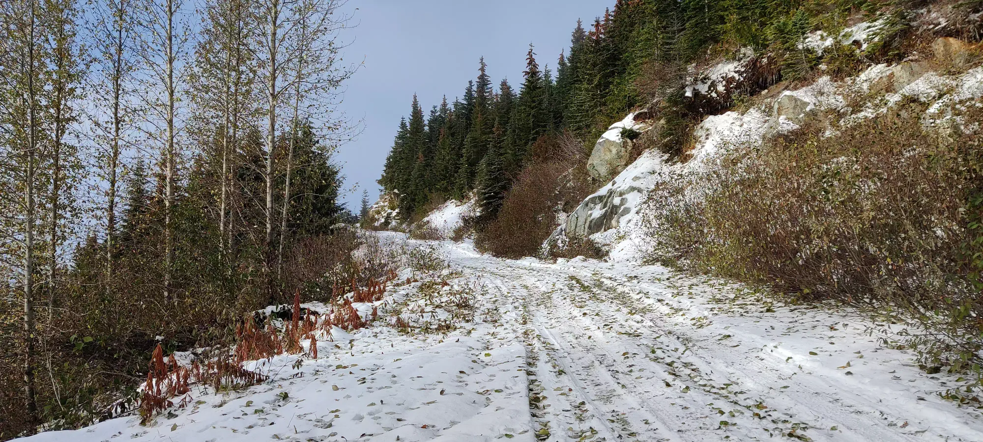
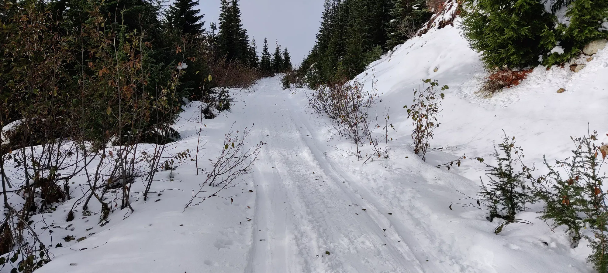
The drive along Brandywine FSR was pretty tame. Of course, it was totally snow-covered, so without real winter tires, you'd have no chance. Both right at the beginning and in a couple spots throughout, we saw people chaining up, but I grew up w/o them, and find them quite tedious (also not entirely positive mine fit properly), so I just went on without them. It isn't steep, and there's no meaningful obstacles, so I'd imagine good tires and medium clearance would be enough for this section.
Once we forked up to the path toward the upper parking lot, shared for Brandywine and Metal Dome's access, things got a bit more interesting. The road gets a bit steeper, rougher, and there's more potholes, deep ruts, and small water bars to contend with. We saw a few clusters of stopped crossovers, but I was determined to keep pushing as long as I could muster. There is a large switchback at 940m that is fairly steep where we caught up to an SUV crawling up, which forced me to slow down, and fail getting all the way up. So, I backed down, waited for them to get well clear, picked a line to minimize the bumps along the road that eat momentum, and sent it. Success! After this, it got easier again, until we got near the next big switchback at about 1110m. There was a LONG line of parked vehicles on the downhill side of the road, and I just barely managed to find a spot at the end of the line before the turn. I probably could've made it up, as the previous turn seemed to be more difficult, but given the traffic, and that we already had cut the day's elevation gain to <1000m, I decided to just park where a spot existed.
After parking, gearing up, etc. we finally got ourselves moving (skins on from the car) at 10am. Since Logan was trying backcountry skiing, and his new skis which are of the rather heavy frame-binding variety, he was not moving with the utmost of speed, but given the tame stats for the day, it wasn't a concern. After we rounded the turn in front of the car, he picked it up a bit. However, I noticed his boot not flexing as much as it should've, so we stopped to try and deal with that. Along with some advice from passing skinners, one of whom being a boot tech, we managed to get it working, and we continued on, although back at the original, slower pace. The first 1.3km brought us to a fork where left would go toward Brandywine Meadows, and right (our path) to the south face of Metal Dome. The road was snow-covered, but with a good amount of leaves, sticks, and rocks pointing out that'd make skiing down a rather harsh endeavour for one's gear.
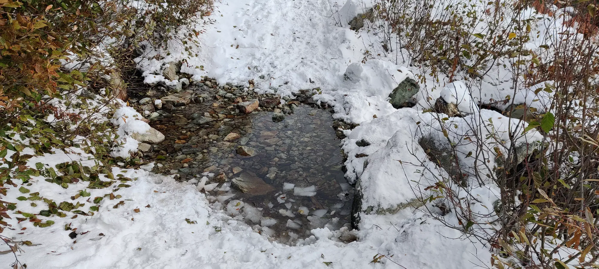
Once we turned up the fork (1290m), we hoped it'd get better, as it steepened a bit as well as narrowing, but instead we were greeted with more rocks poking out, as well as a creek crossing that didn't have a very easy bypass. We actually had to pop out of the skis to cross this one.
After that point, things improved a bit, though, and an hour in, we even got our first views of the day. I'd say one could ski this part of the road, but just slowly to be able to dodge rocks, as those still poked out every so often in clusters. Given the width, I bet you could drive it in the summer too, or even in winter if you had guts, good tires, and a buddy to save you if you messed up.
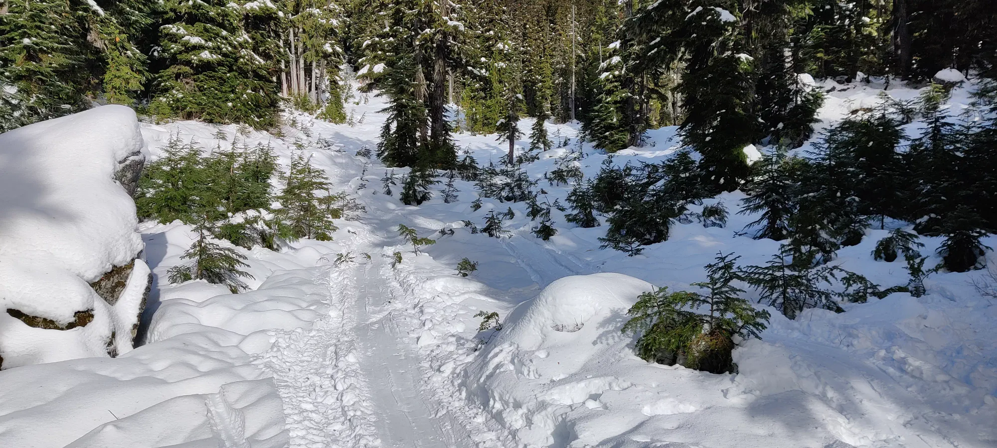
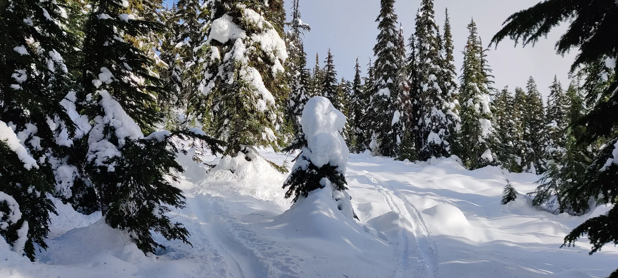
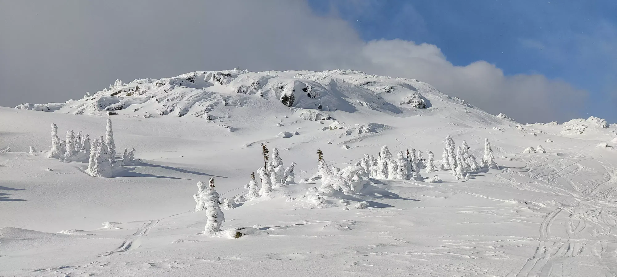
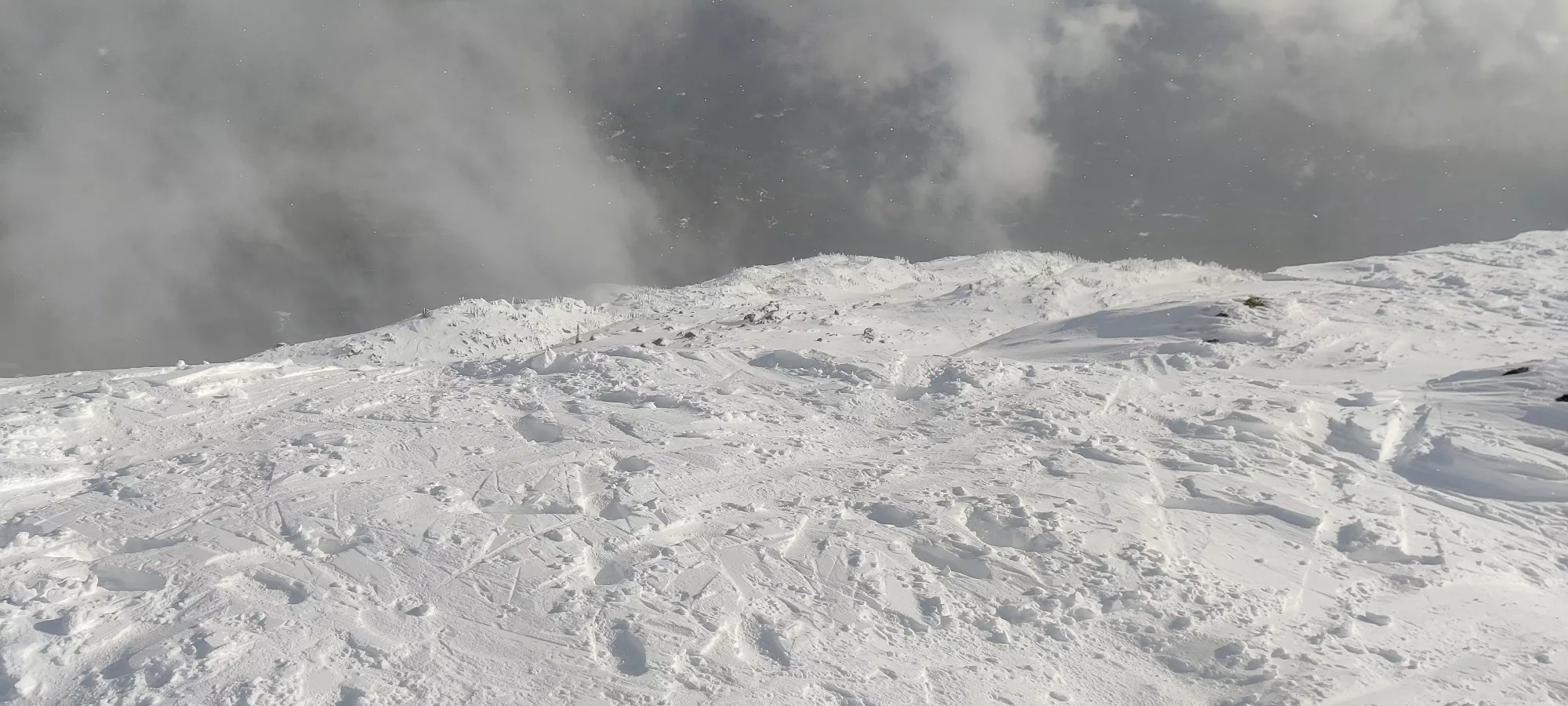
Not too long after, we ran out of road and got into proper forest (though still not super dense) at about 1400m. Sadly, I still couldn't say this was "perfect skiing territory" just yet, as there were still exposed roots in a bunch of spots, and a spot of water or two that'd make it difficult for all but the very best skiers to take with any sort of speed or grace. However, it was easily navigable, not too steep, and a broken trail, so I was pretty happy. We wound our way through this forest, about 1/3 of the way being the point where I stopped seeing roots jutting out until about 11:45 when we broke out above the trees and entered the alpine at about 1600m.
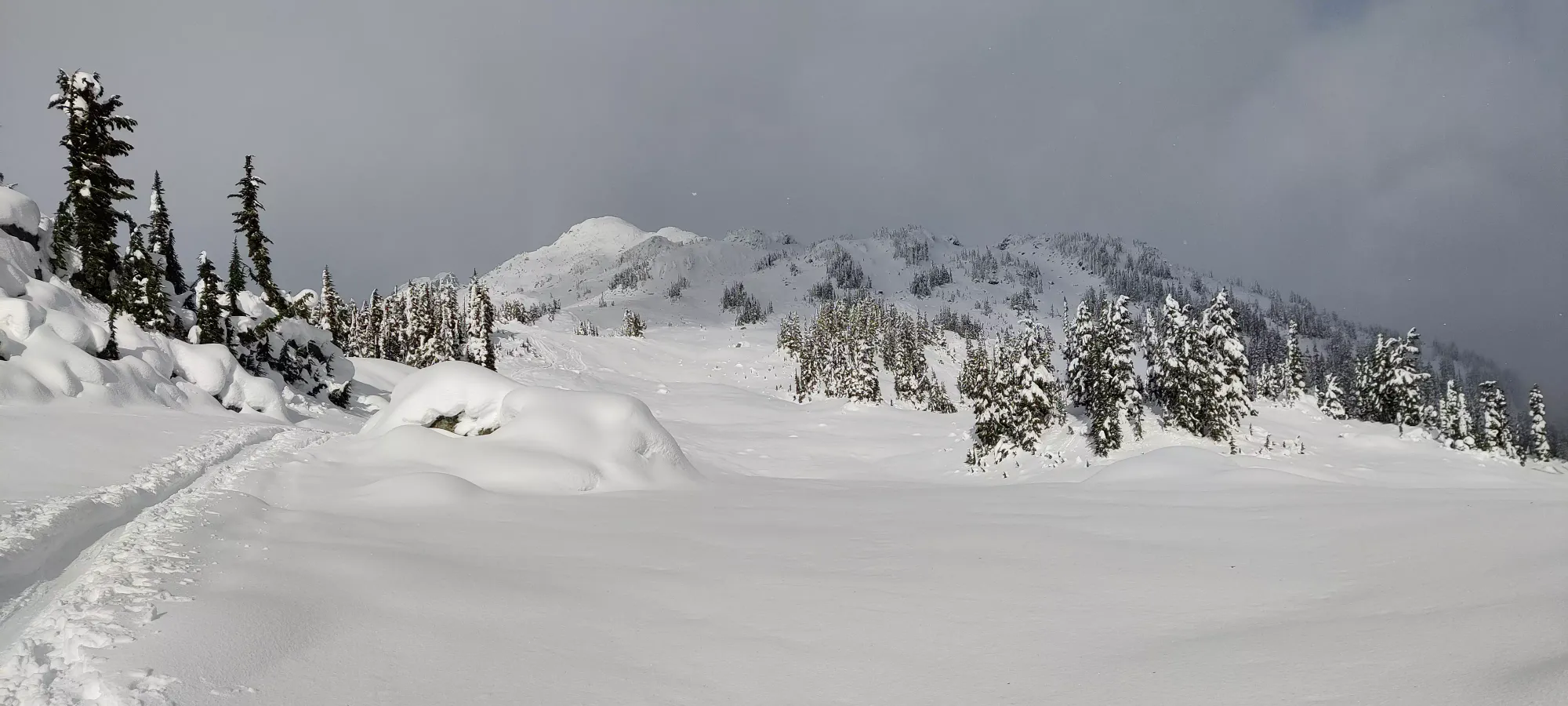
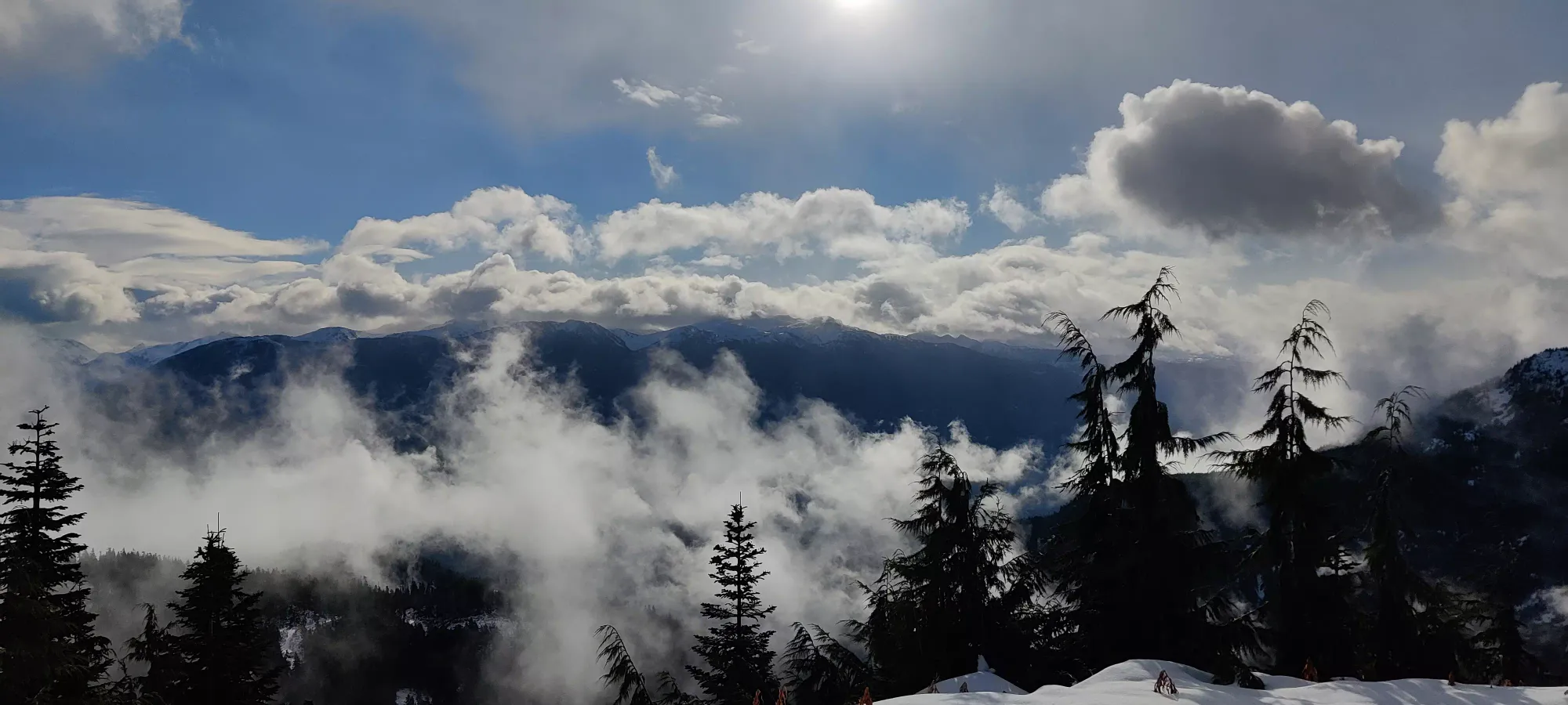
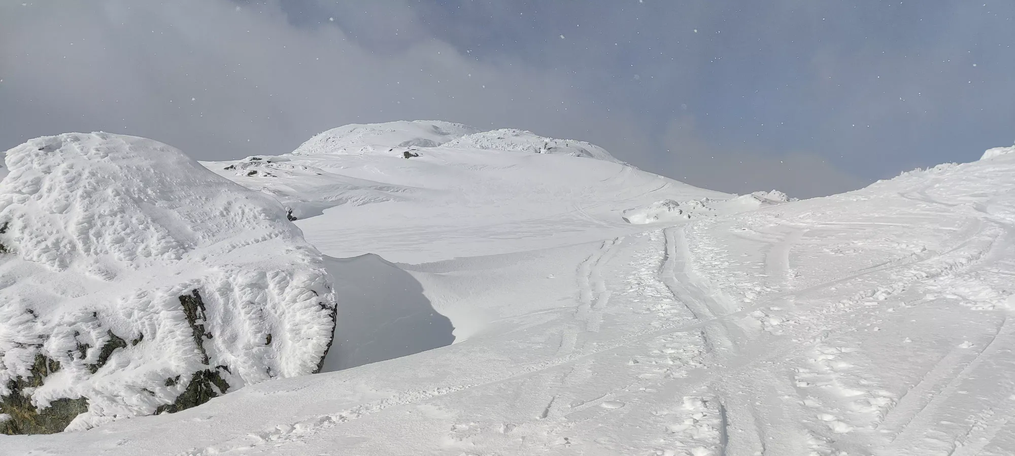
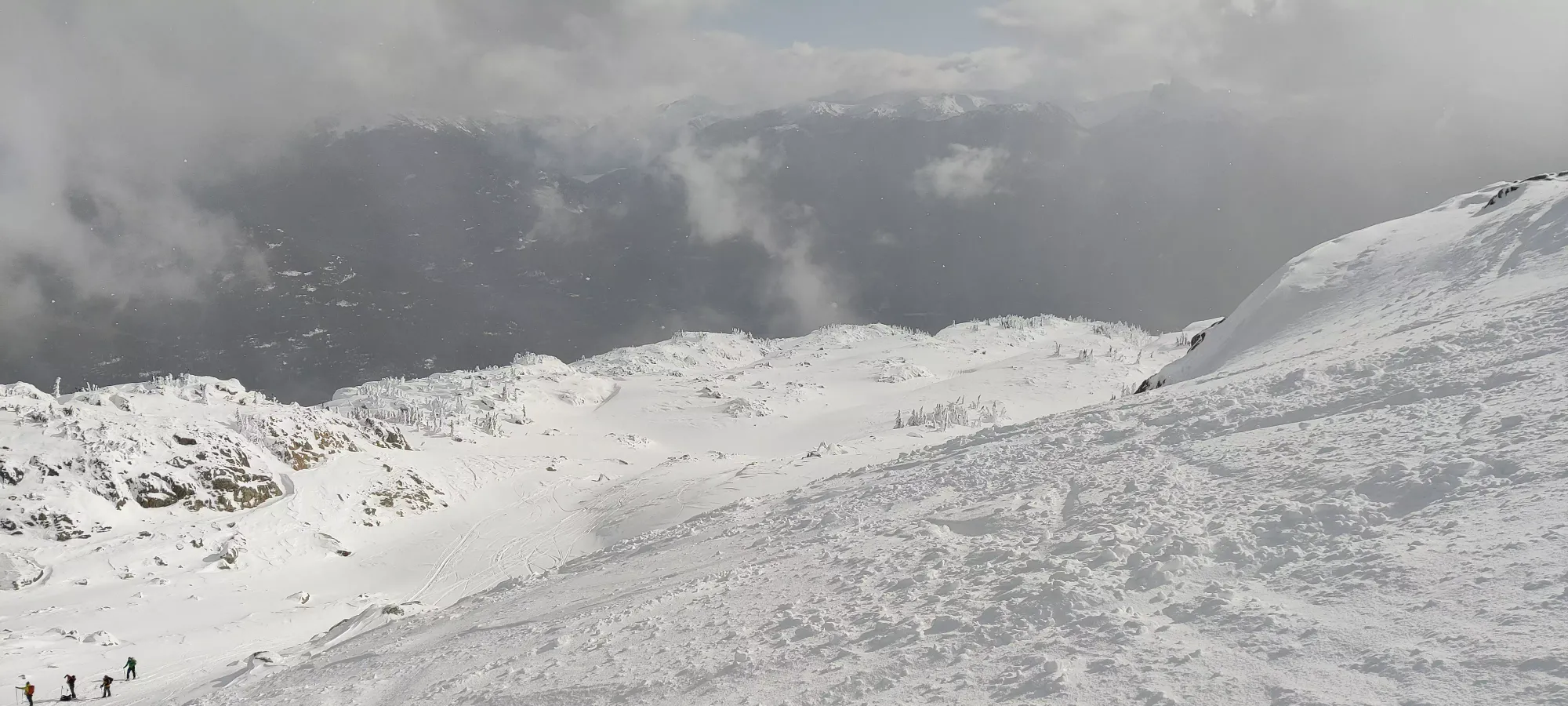
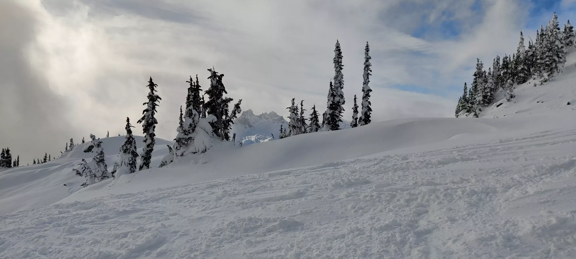
We took a break after entering the alpine, as Logan was feeling the weight of his heavy setup (I understand, my first and last attempt with a similar setup took me about 2x as long as snowshoeing it). After he recouped some willpower, we continued on from 1635m at the 2 hour mark. With more than half the elevation done, I was pretty confident we'd get up and down with sunlight to spare (more of a concern when skiing than just hiking out, unfortunately). As we made the long, straight traverse seen in the cover photo's foreground, it became apparent that Logan was getting tired, as the pace was slow enough that I was no longer able to adjust to match his pace without shortening my strides and "losing glide" in the process. So we started a bit of a cat-and-mouse where I'd try and efficiently skin a dozen metres ahead or so, wait, and repeat. These waits quickly had me feeling a bit cool, so I tossed my midlayer which I'd shirked through the forest on, and put my outer gloves on as well.
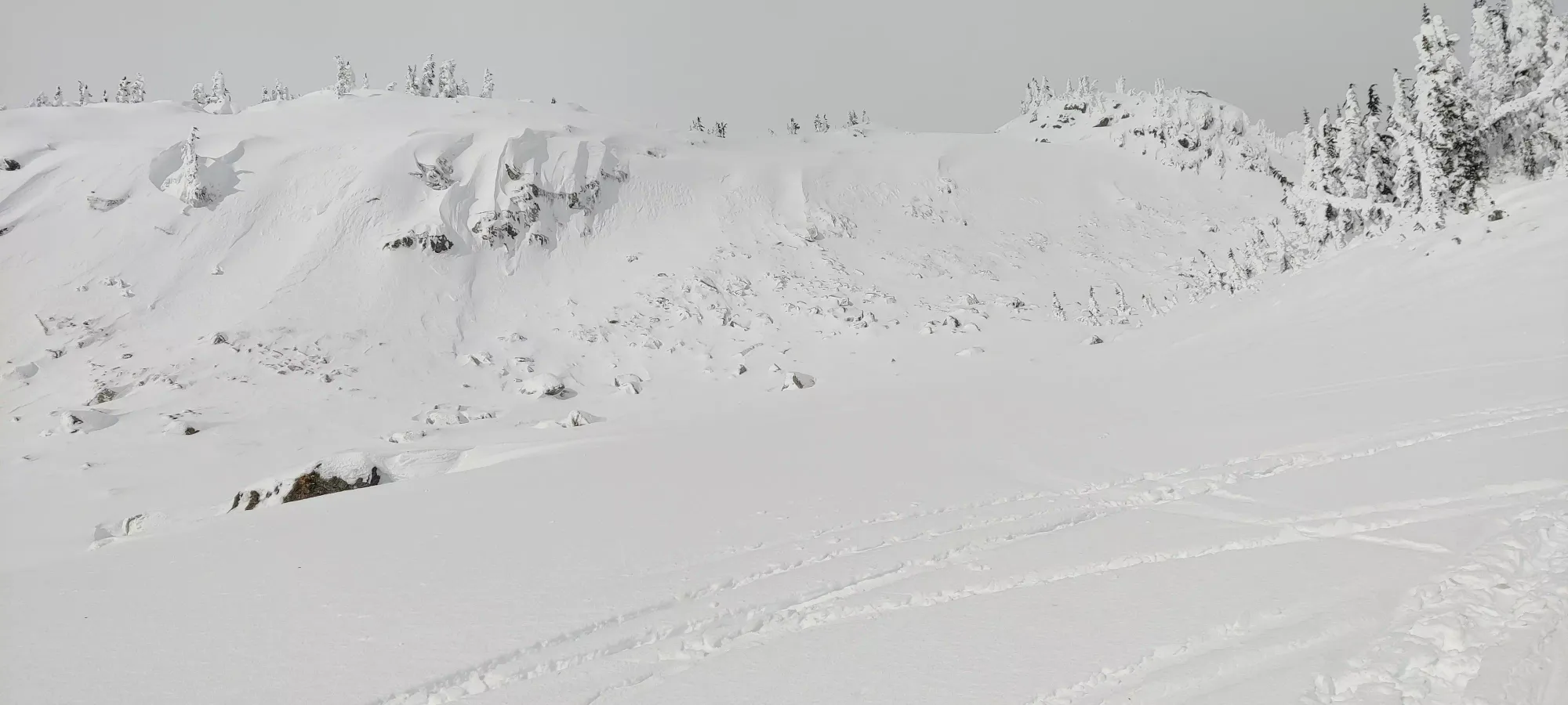
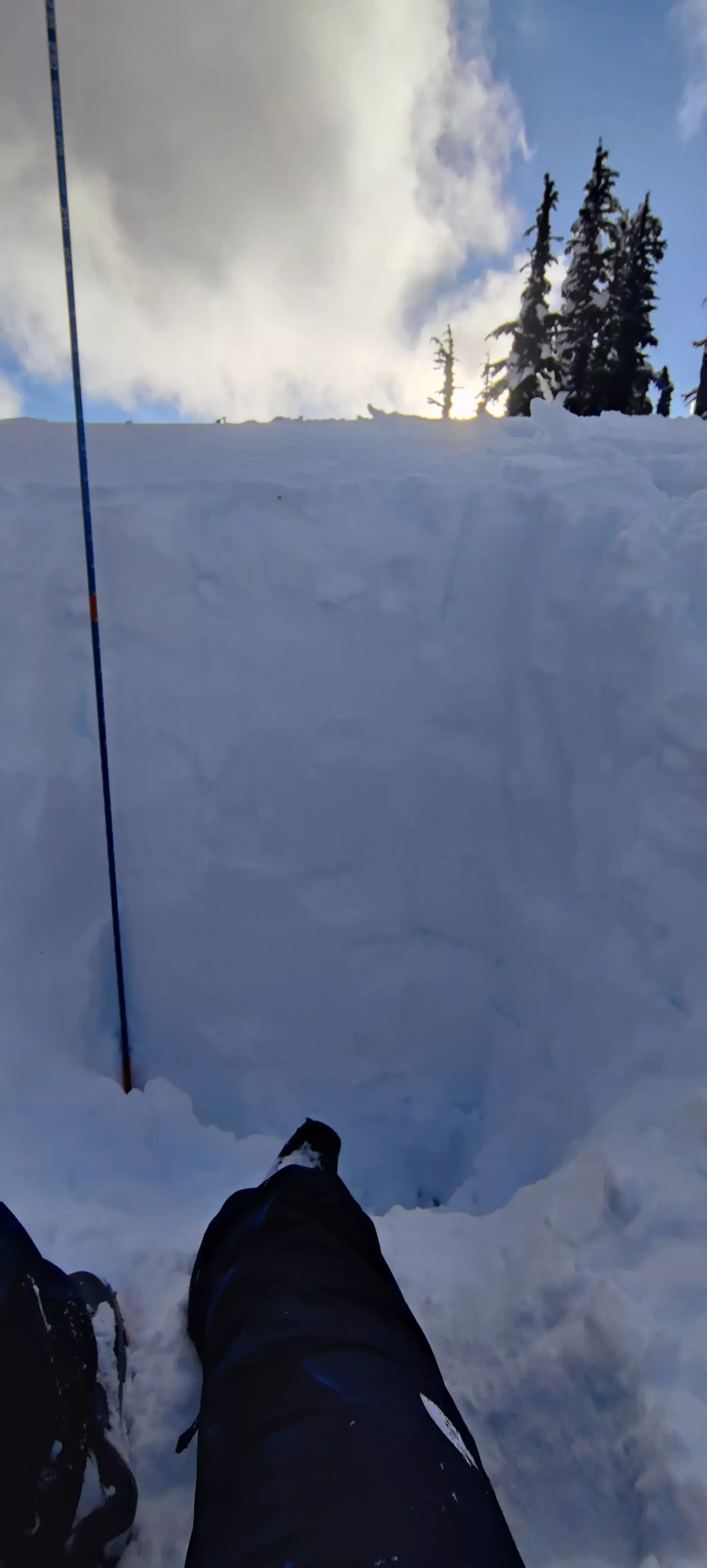
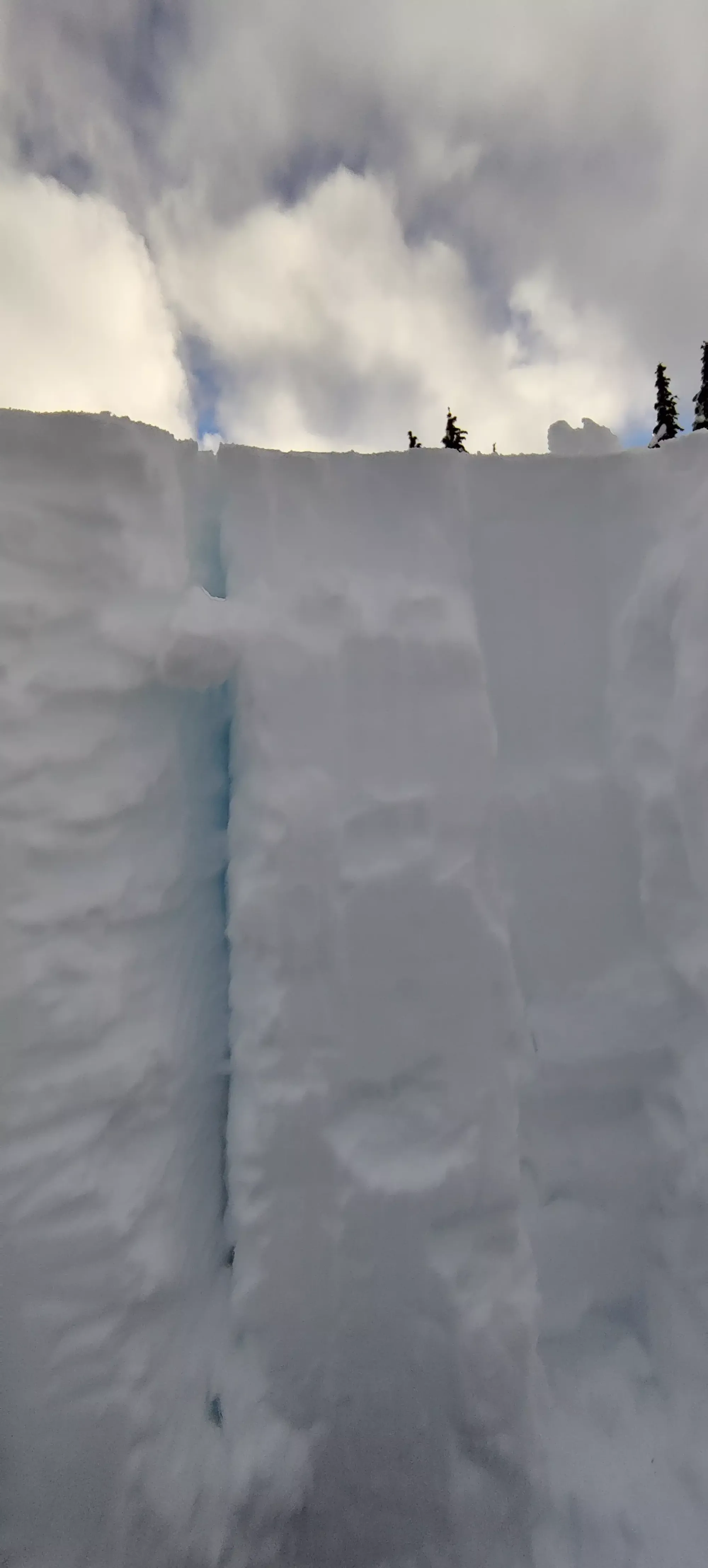
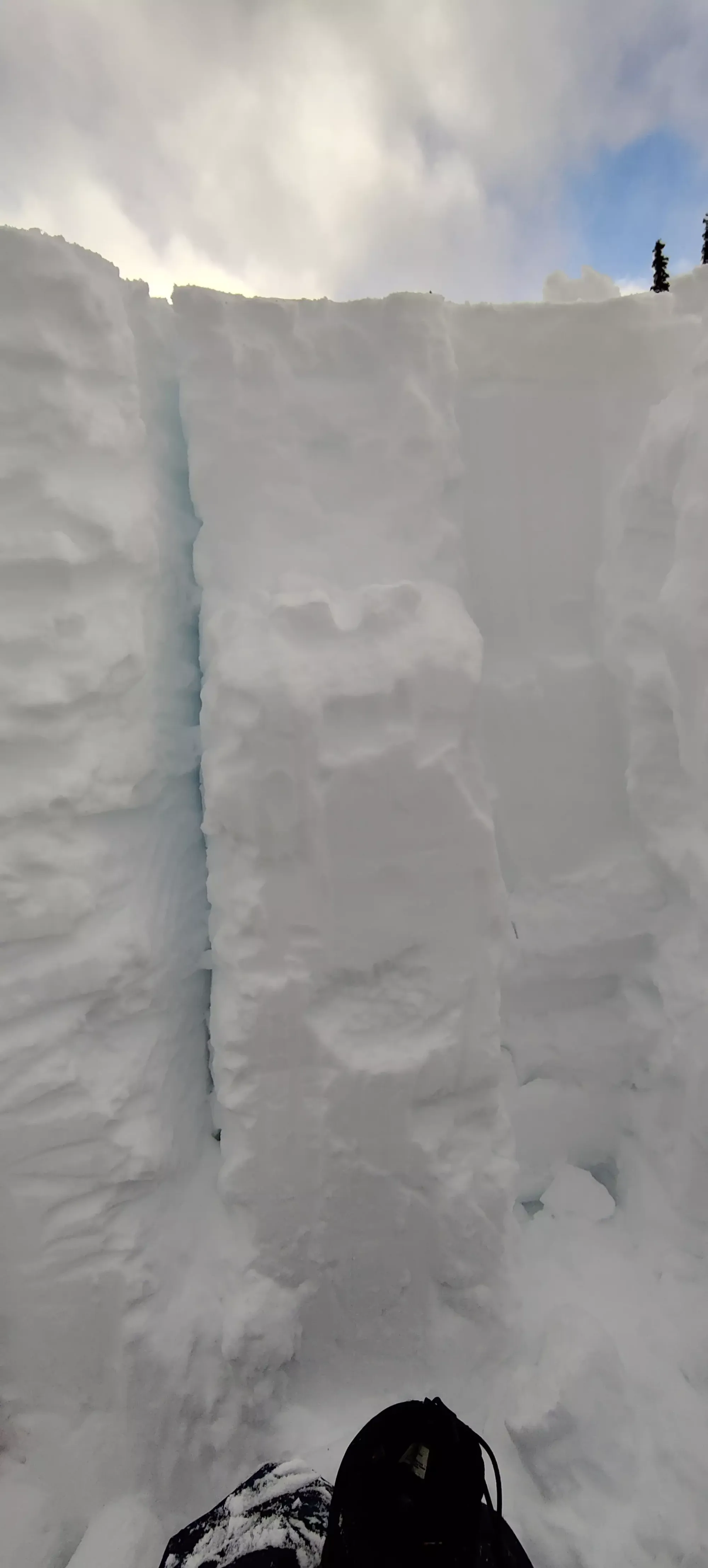
Half an hour later, we made it to 1750m, where I found a cool little "wall" which I bet would have been covered in ski tracks if there was a storm or two more worth of snow than there was. I was tempted to try it on the way down, but like everyone else, could't find a line that made me feel confident enough I'd avoid giving my skis an early grave.
The next half-hour spent getting up to 1900m was pretty uneventful, just a bunch of skinning up easy terrain along the tracks that'd been set much earlier in the day by many parties. Logan was slowing down more and more, but as we were so close, I had high hopes for him to make it, unlike when I was in his situation last spring, where I had to turn back on Mount Price due to running out of time trying to haul resort-weight boots and my own frame binding skis up 1600m of elevation gain.
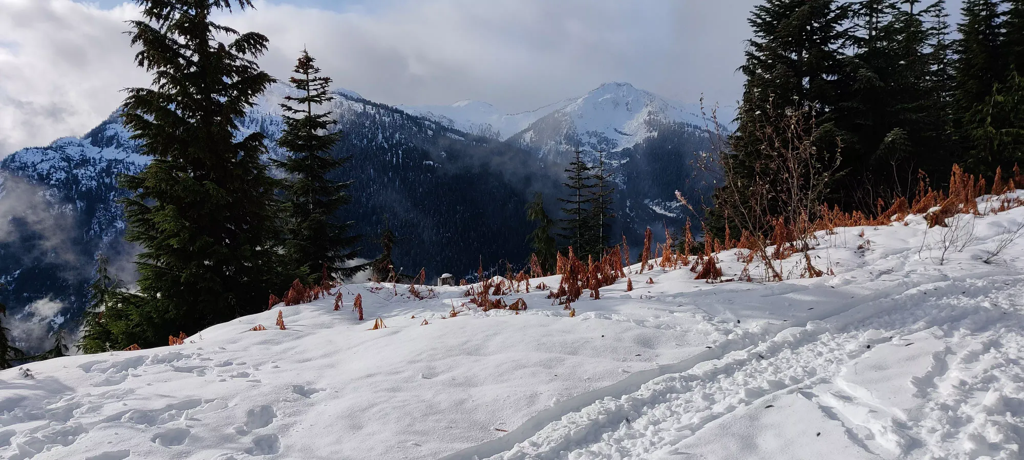
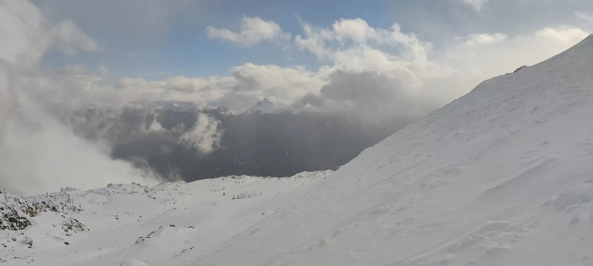
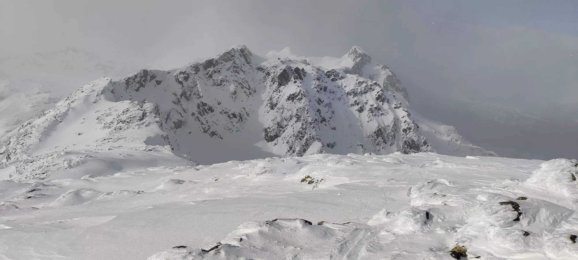
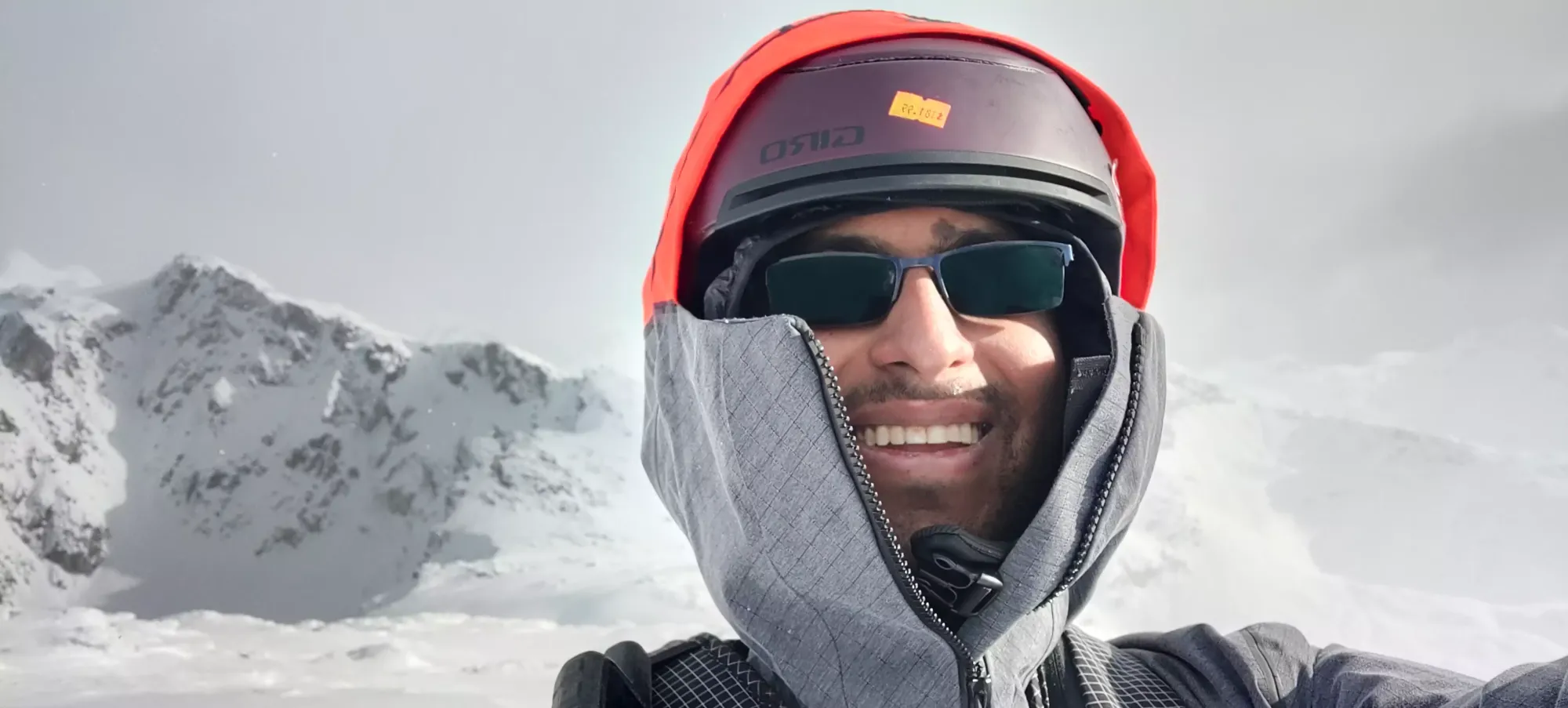
Once at 1900m, there was a big switchback up a steeper hill which involved a bit of sidehilling, so I waited at the apex of the turn for Logan there before the sidehilling, since I figured he might want some more help there. I managed to snag a nice picture of Black Tusk poking through the clouds as he came up, which was a pleasant surprise given the mostly-cloudy nature of the weather thus far.
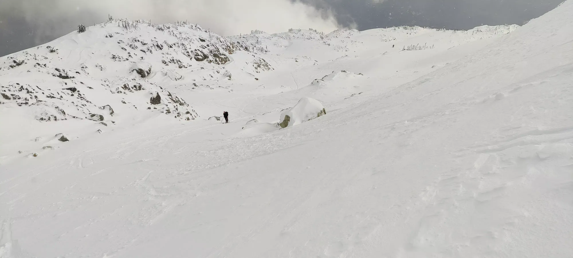
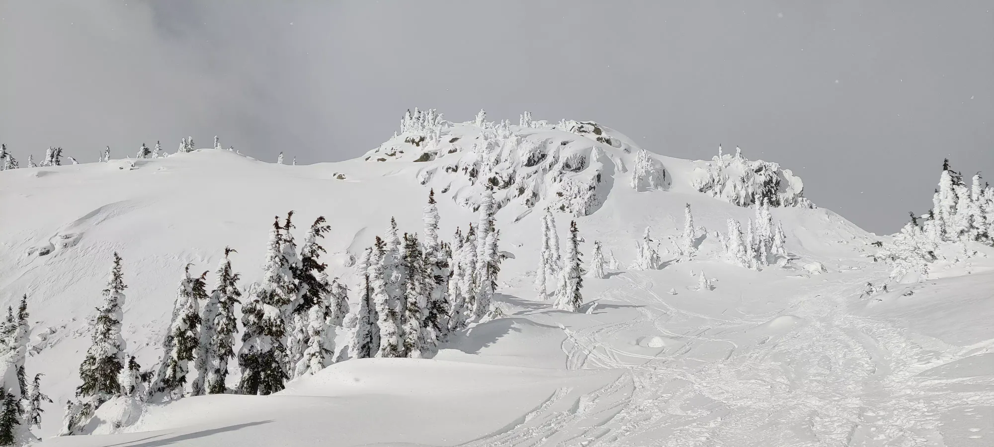
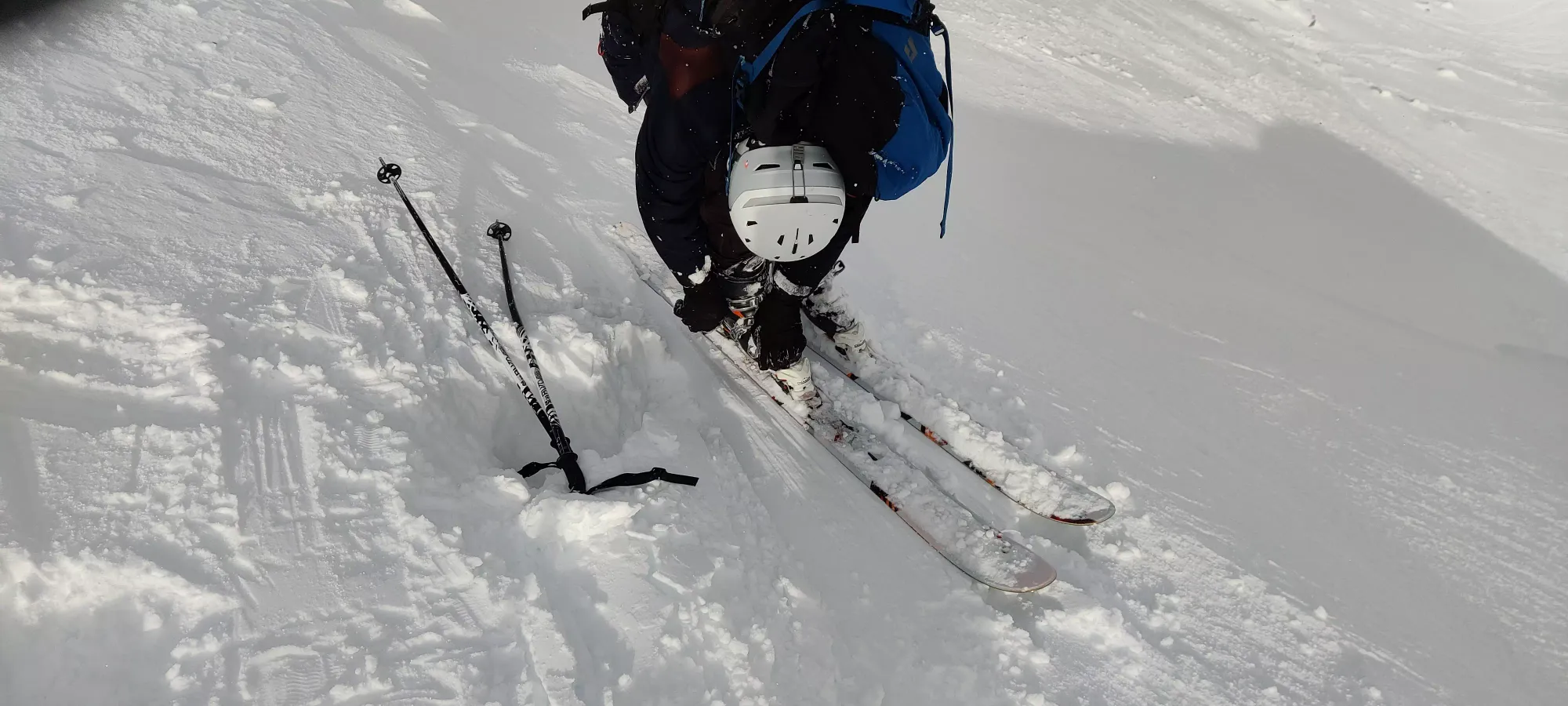
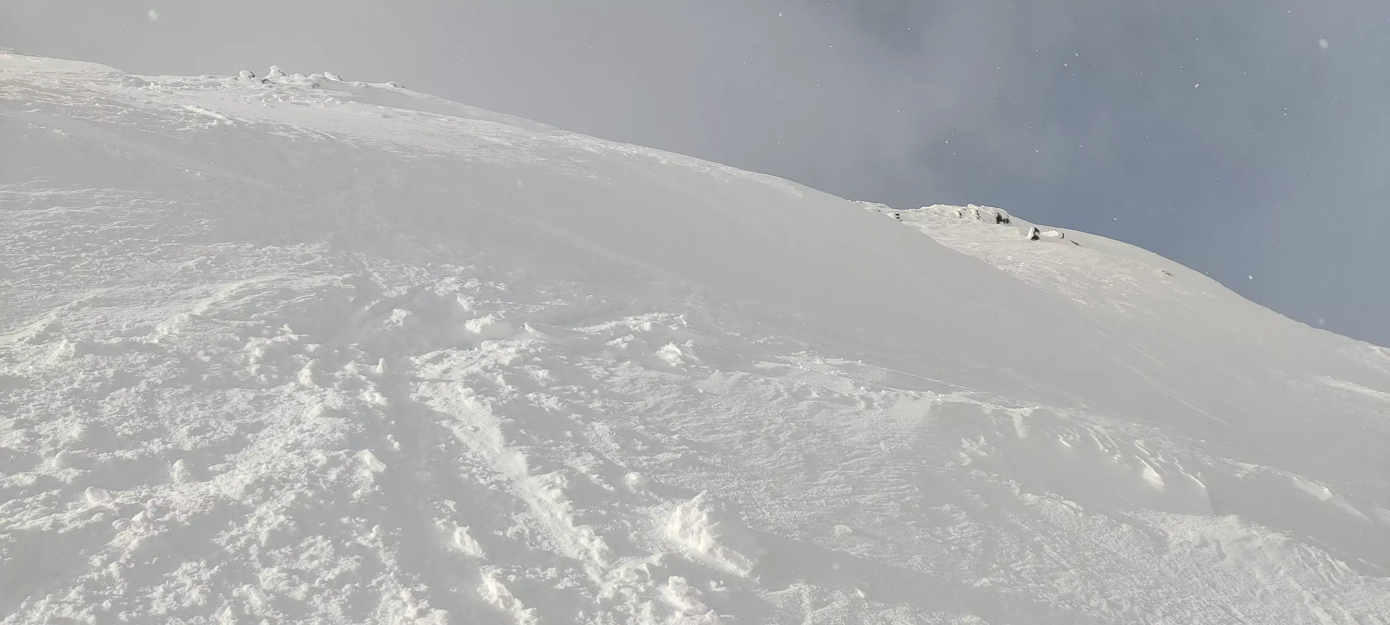
As we crossed the sidehilly part, Logan did alright, but at the end, he slid down and had to recover to an old skin track that thankfully was there for him to get into. However, shortly thereafter as we turned up to "top out" this final bump before the top (about 60m of vertical away), he had some issues getting up, and had to call it. It seemed like his skins weren't gripping anymore, and he was sliding back. I'm not sure exactly what the problem was, but he wasn't making any progress. He tried to bootpack, but it was far too deep and unsupportive, so instead he just waited there for me to tag the top and come back. So, at 1:35 I departed to go crank out the last few metres.
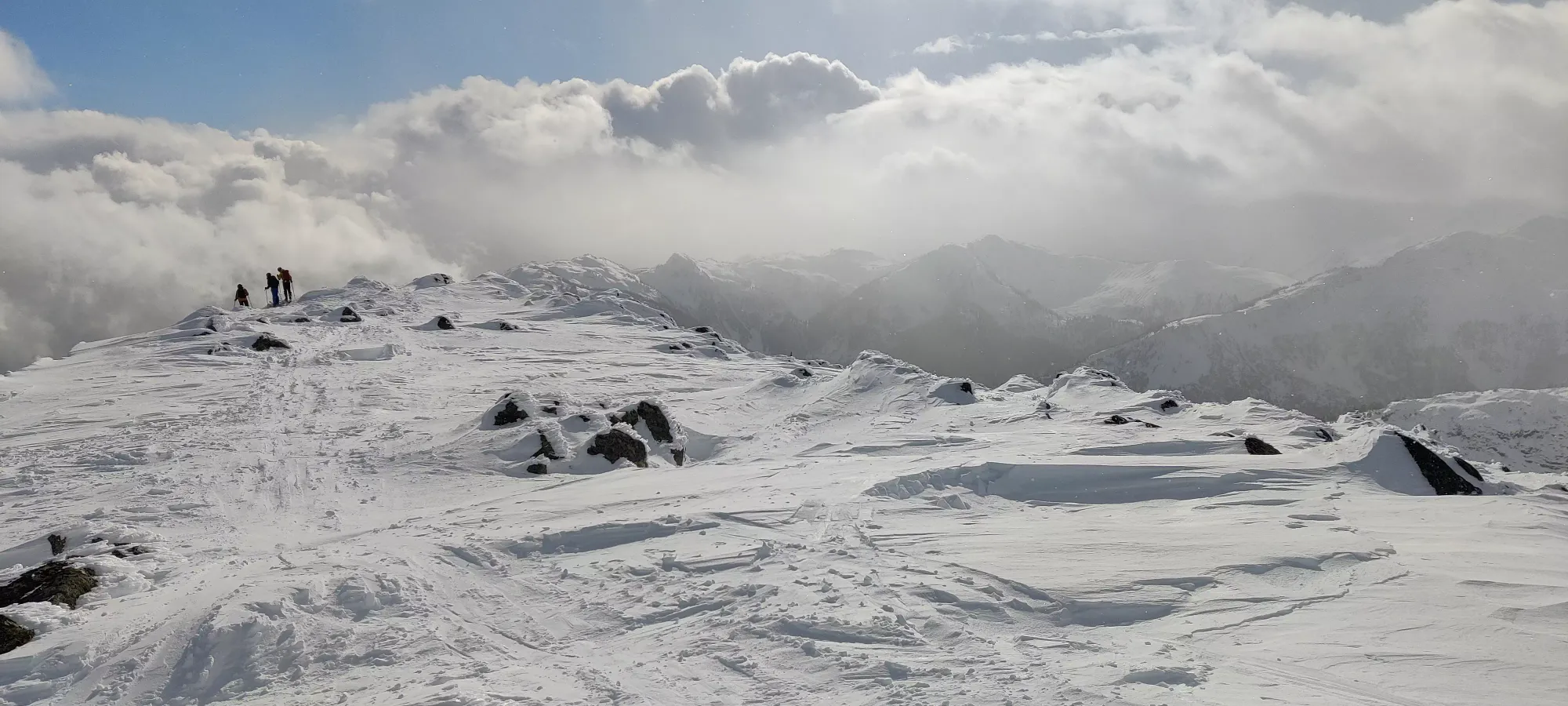
It was under 10 minutes to the top from there, so I got up, said hi to the group at the top, grabbed my pictures, and got ready for the descent. I think the gear change took longer than the actual summiting, to be honest (the wind made trying to get my skins on the skin savers rather difficult).
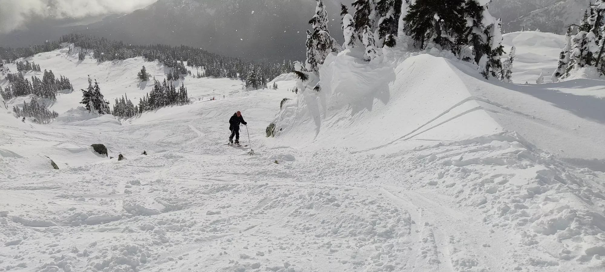
I conveniently started the descent exactly 4 hours after starting, and got a couple fast turns in off the top before meeting back up with Logan. I saw a nice steeper exit to the broader face to skier's right just off the summit, but I'd be below Logan then, so no dice. Even so, despite the ascent taking close to 10 minutes, getting back to him took under 2. How I've missed the joy of fun and expedient ski descents...
We spent about 20 minutes getting his boots, bindings, and everything else sorted, as he was not on a nice, packed, flat spot to change gear, and wasn't enjoying the transition on the side of a hill. We eventually got him all buckled and locked in, though, and we could begin the descent in earnest.
We spent the next 40 minutes getting ourselves down from about 1950m to 1670m. I expected it to be a bit slow, as Logan is still a somewhat new skier, and there were gonna be falls and not much in the way of long, continuous runs. But with the mellow slopes and ample snow, this was good, and he (like I originally did) needed a practical demonstration of how pointless heavy skis are for such endeavours, so we had to make such a trip at some point. Best do it when we have lots of daylight and not an absurd amount of ground to cover. There were definitely some falls, and much struggling to stand up from them when they occured in powder, but that's the nature of the beast. For skiers looking for beta, it's what you'd expect from skiing this (not) steep, but you can largely go down without having to cross-country it across or re-skin up.
Unfortunately, after that 40 minutes of descent, Logan was feeling bad. Not just tired, or frustrated at the tedium of falling/getting up a few times, but "my stomach isn't feeling great" bad. So, we took some time to rest. Unfortunately, a few minutes into said rest, he actually threw up. That left him feeling pretty weak, and shaking despite not feeling consciously cold, so we made the call to get SAR in before things got worse, and it would be too dark for them to come help. Thankfully, I had cell signal, so we could actually call instead of relying on stunted InReach comms, which was nice. After a few calls figuring out logistics, they dispatched a helicopter, and we were to wait for them.
So, while we waited, Logan bundled up in the sun and tried to balance water intake with throwing up more, and I decided to keep warm by digging a snowpit. This was my first time doing so not in a course, and it also wasn't on an avalanche slope, so the compression test results aren't the most meaningful ever, but hopefully the observations are of at least some use.
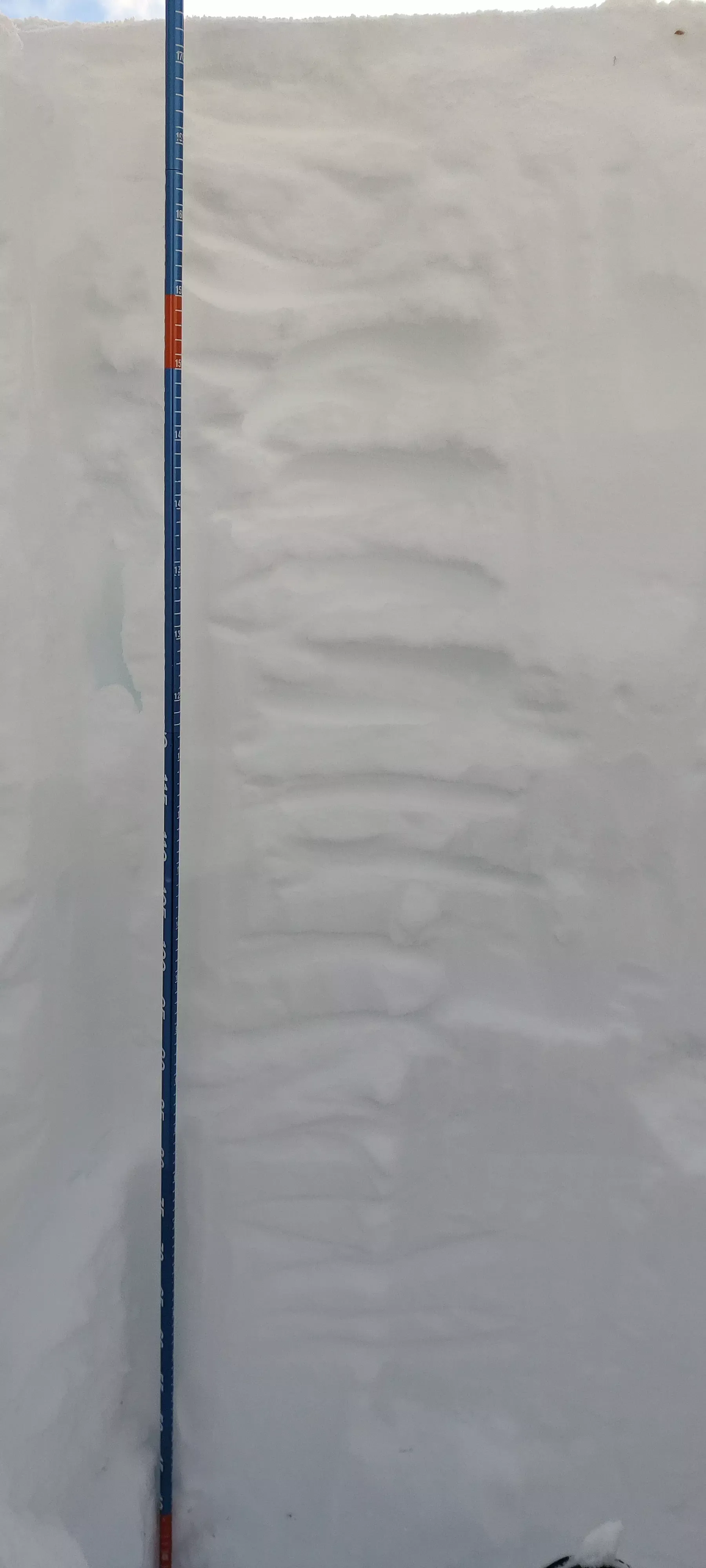
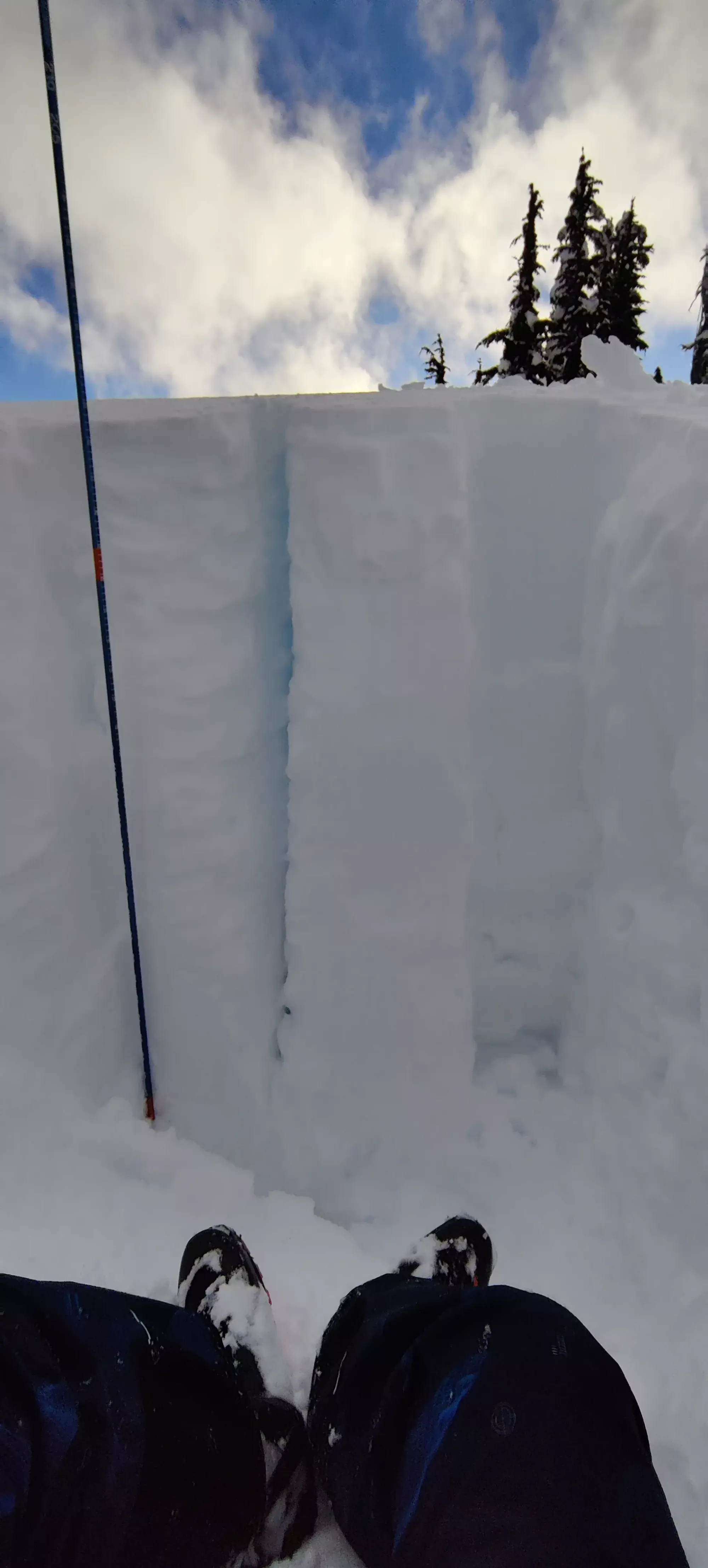
The pit was as tedious to dig as I remember, but I got it down all the way to the ground, at 175cm. This was an east-facing hill on the south face at 1670m. There was a frozen crust in the first couple centimetres, followed by about 3 feet of snow I could penetrate easily with my finger, then below that it was more consolidated and resistant to disruption. My compression test, unsurprisingly, didn't result in anything cracking or sliding (I picked a steeper knoll on the face, but it is still a low-angle slope), but I can report the top 30cm collapsing under a single hit from the elbow, and the next 30cm collapsing under 4 hits from the shoulder. Hopefully this plus the pictures can give those more educated than I some useful information despite the shallow slow this was done on.
Not long after I finished that up, the heli arrived (about 5pm). I wanted to ski myself out, as there was more snow forecast, and I didn't want to leave my car buried kilometres up the FSR, but SAR didn't want to leave a single person alone, especially with no parties above me on the mountain. I didn't want to pick a fight with SAR about that, and they were gracious enough to offer to coordinate a ride for me to retrieve it to avoid that situation, so I loaded up with them for my first helicopter flight in my life, even if not exactly how I'd hoped it'd happen.
They brought us to the Blackcomb Helicopters heliport near Cougar Mountain where they brought Logan to a clinic in Whistler to get checked out, and I got a ride from a very nice police officer back to the car. I got that, and then met up with Logan at the clinic, eventually got him discharged (no apparent serious issues, probably just some bad luck with a cold/flu), grabbed some dinner, and went back to get his car. Thankfully our earlier efforts to set it up for success when we left it paid off, and we drove it out without any issues, and everyone got home safe and sound. Sadly, it was rather late by then, so no Sunday adventures for me as I'm writing this (scoped out the road up to Mount Brew, but didn't drive high enough to do it with how late I woke up, and I couldn't justify driving further solo as the tracks stopped pretty low on the FSR).
So I'd not recommend doing everything we did, but this is a great peak for an easier day, a high-avy-risk day since it is all low-angle slopes (except for avoidable micro-terrain), or just an introductory touring day. The drive can cut it to a pretty easy objective if you have good tires and skills, so highly recommended for such situations. Logan will probably return on such an avy day, and I can just go ski on-resort while he does the hard way while he catches up on the peakbagging.
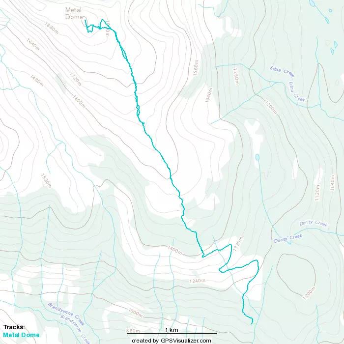
GPX Track + Map