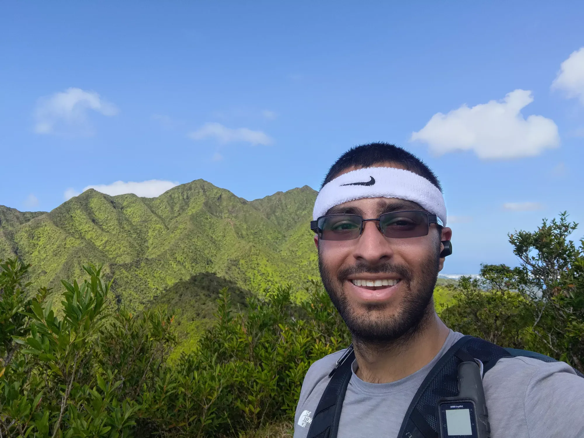
Konahuanui - January 19 2024
A steep and muddy ridge scramble/hike to the high point in the Koolau Range above Honolulu. An excellent example of the more intense/fun ridge hiking that Hawaii has to offer


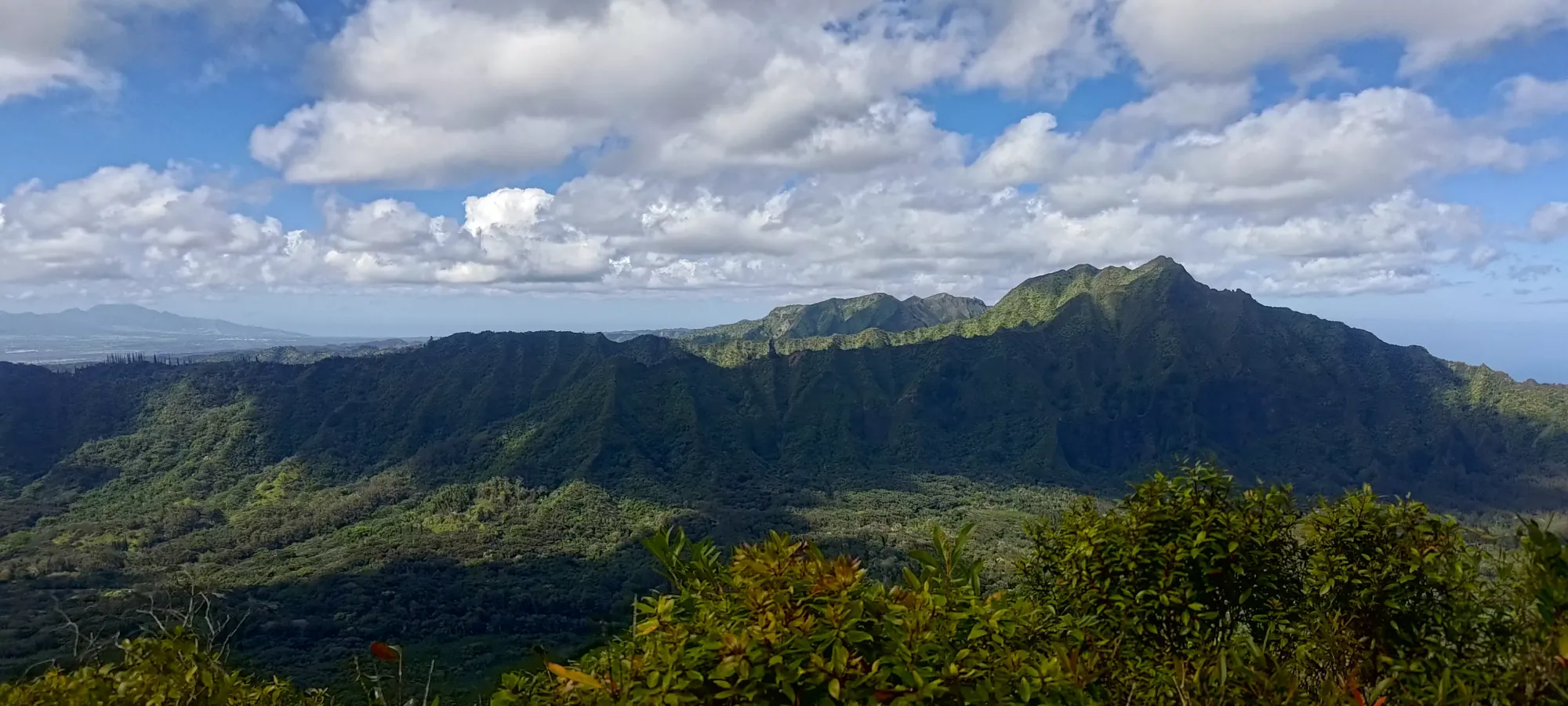
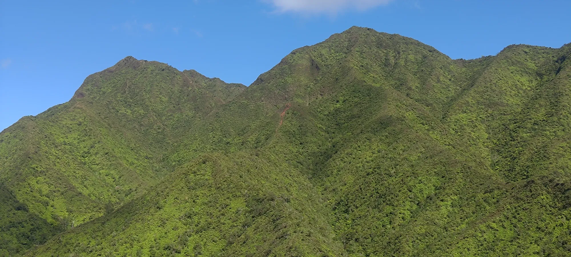
Koolau Range, Oahu, Hawaii
960m
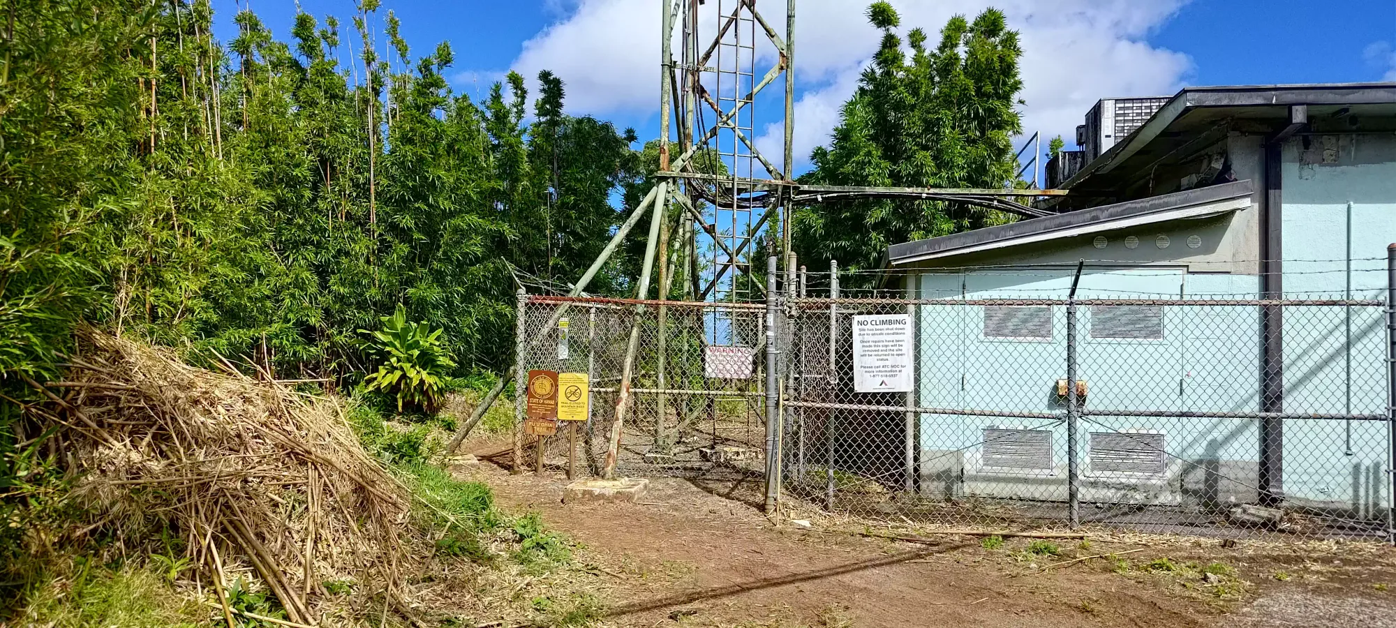
This trip picks up from Mount Tantalus (no, not the one in Squamish), which I ascended as the first peak before making my way towards the much more impressive Konahuanui.
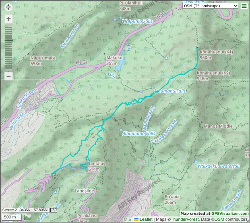
From the summit of Tantalus, I traced my way back down the short trail and onto the road which leads down a little bit, and to a small building where some power lines seem to originate (or at least connect to), where you cut to your left and start hiking on some actual trail.
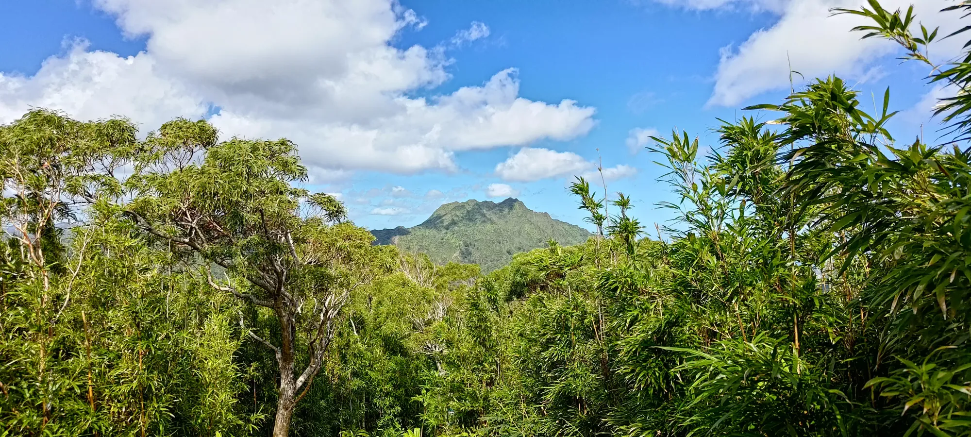
This is all pretty short/fast, so in under 10 minutes from the summit, after following this trail for a brief while, the trail transitioned into the Moana Cliff Trail, and shortly thereafter, forked off into the Pauoa Flats Trail, which is where I headed to try and get back towards the main objective. This took me down to about 475m elevation before it started going back up again, and merged with the Nu'uanu Trail. The trails weren't steep or anything, but the hard-packed mud with a sprinkle of fresh/soft stuff on top made things a bit slippery, so one should take care. Up to this point, though, one could use runners and be fine, as the really slippery stuff was flat enough to just "be careful", and the muddier sections had planks put down to avoid people squelching it up.
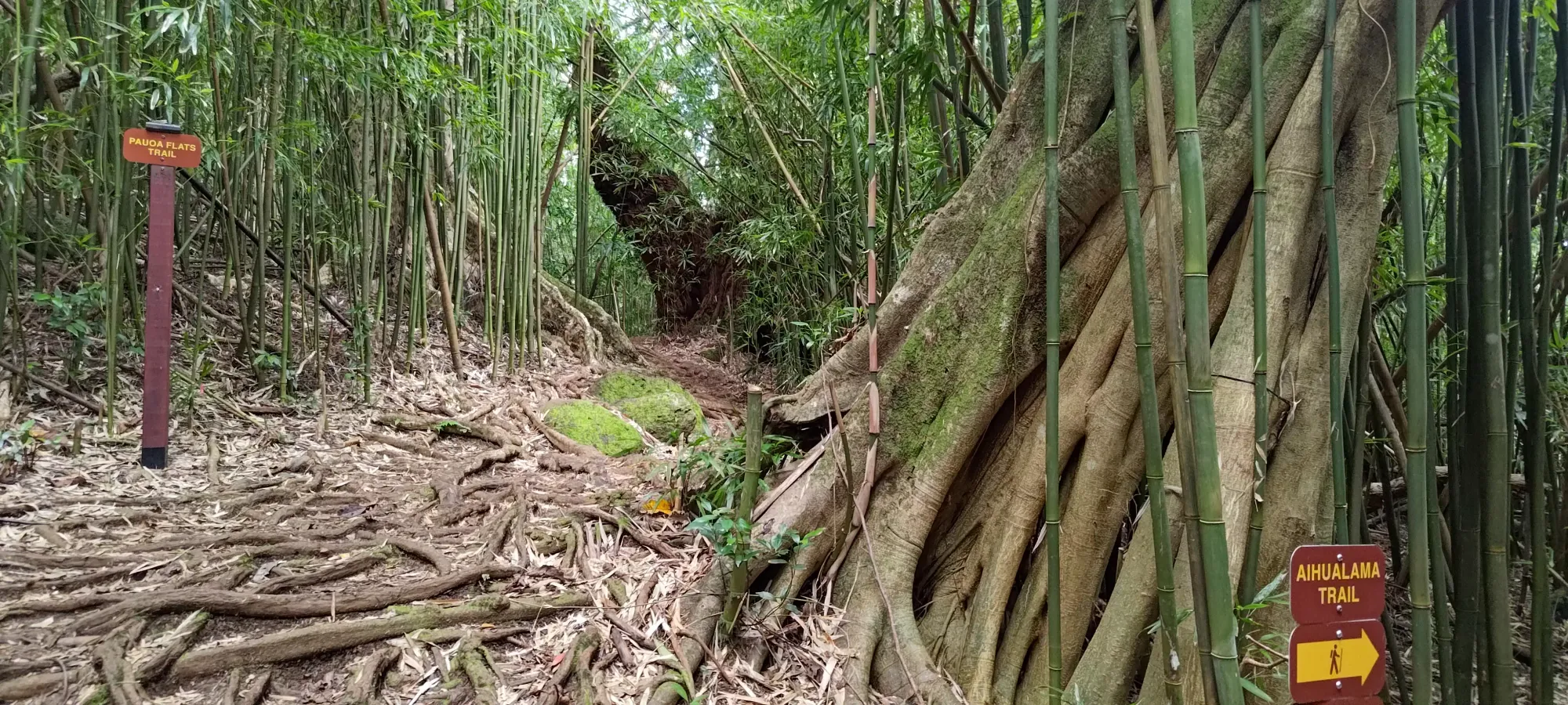
Shortly after merging, there's one more fork where you want to stay to your left, on the Pauoa Flats Trail, instead of the Aihualama Trail. As you can tell, there's a ton of different trails in the area, but this is the most efficient way to get from Tantalus to the ridge climb for Konahuanui.
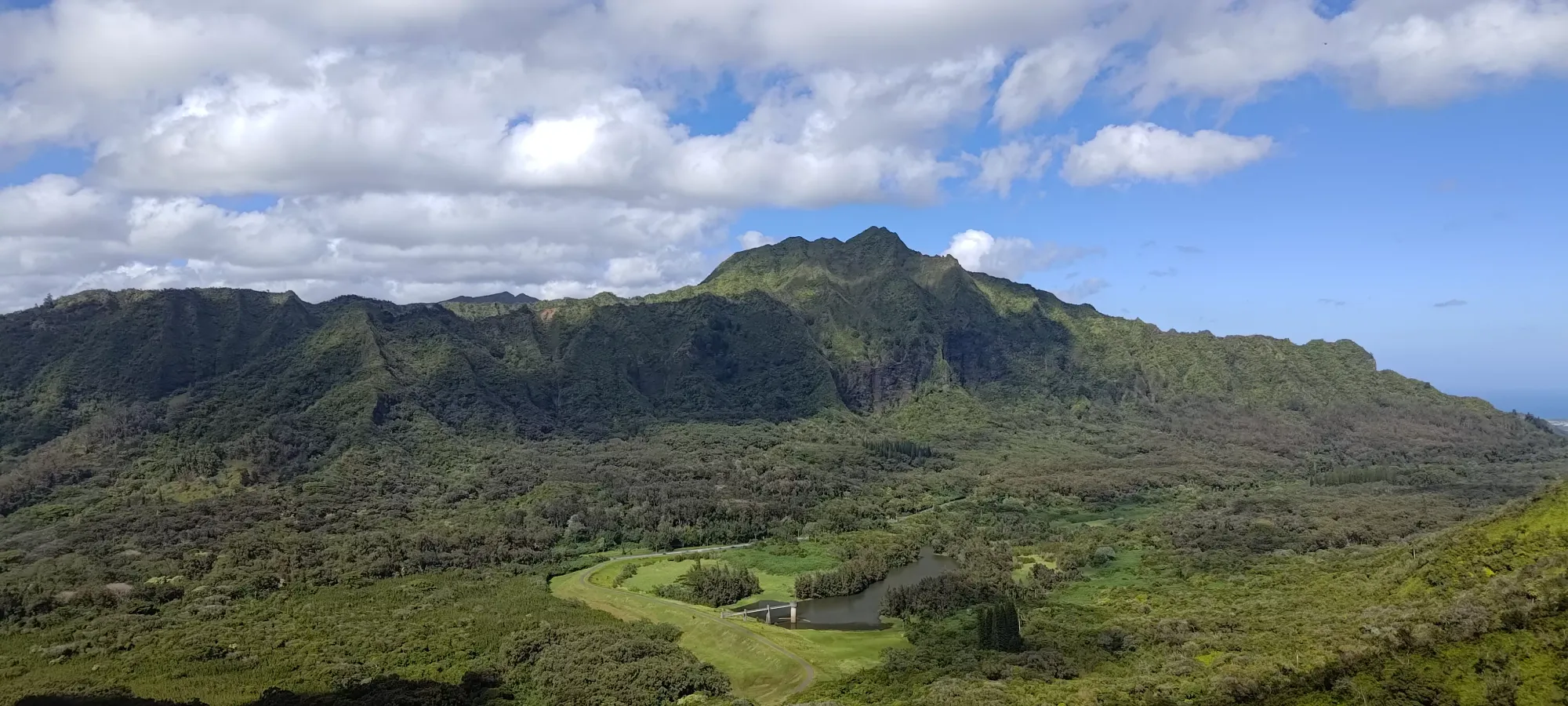
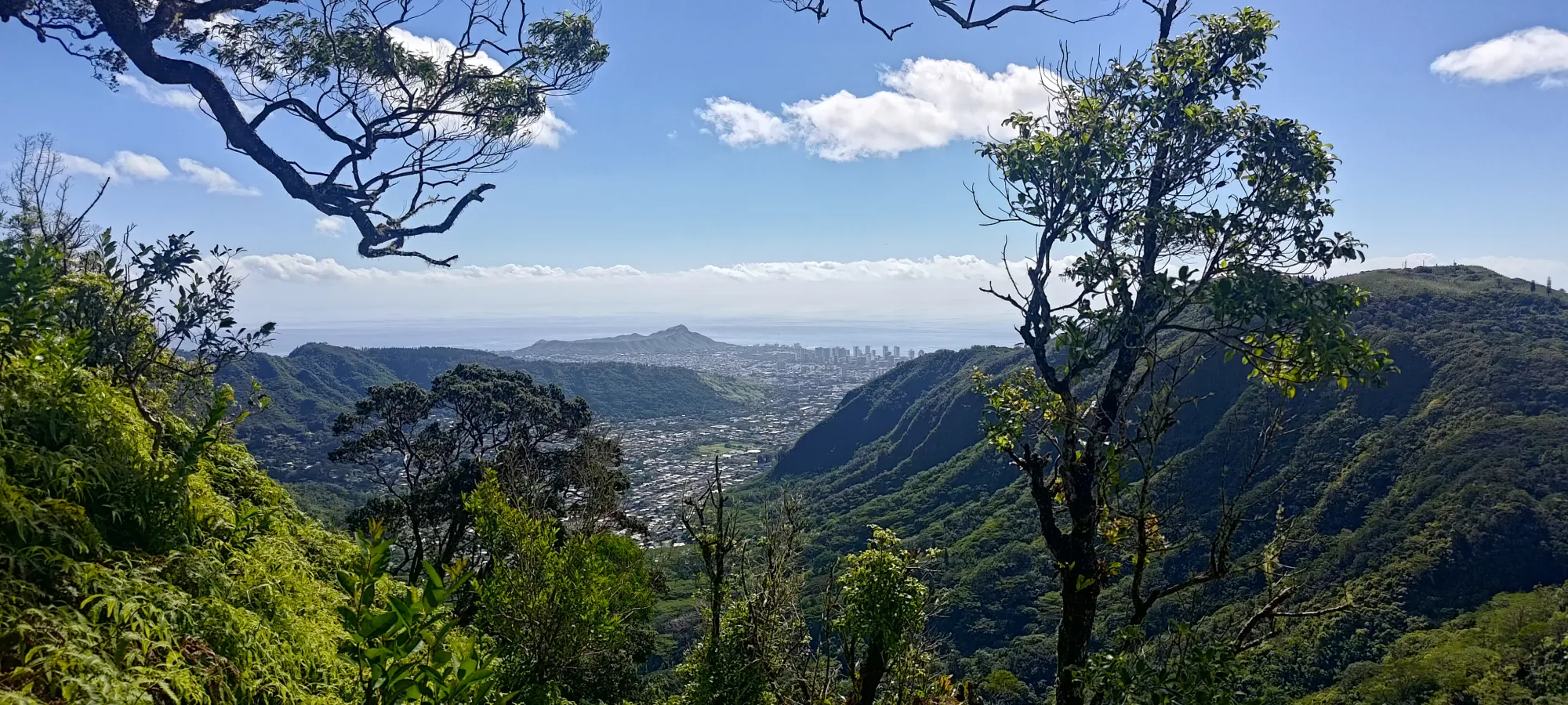
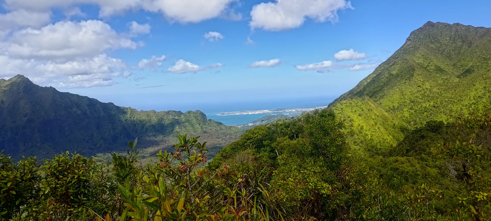
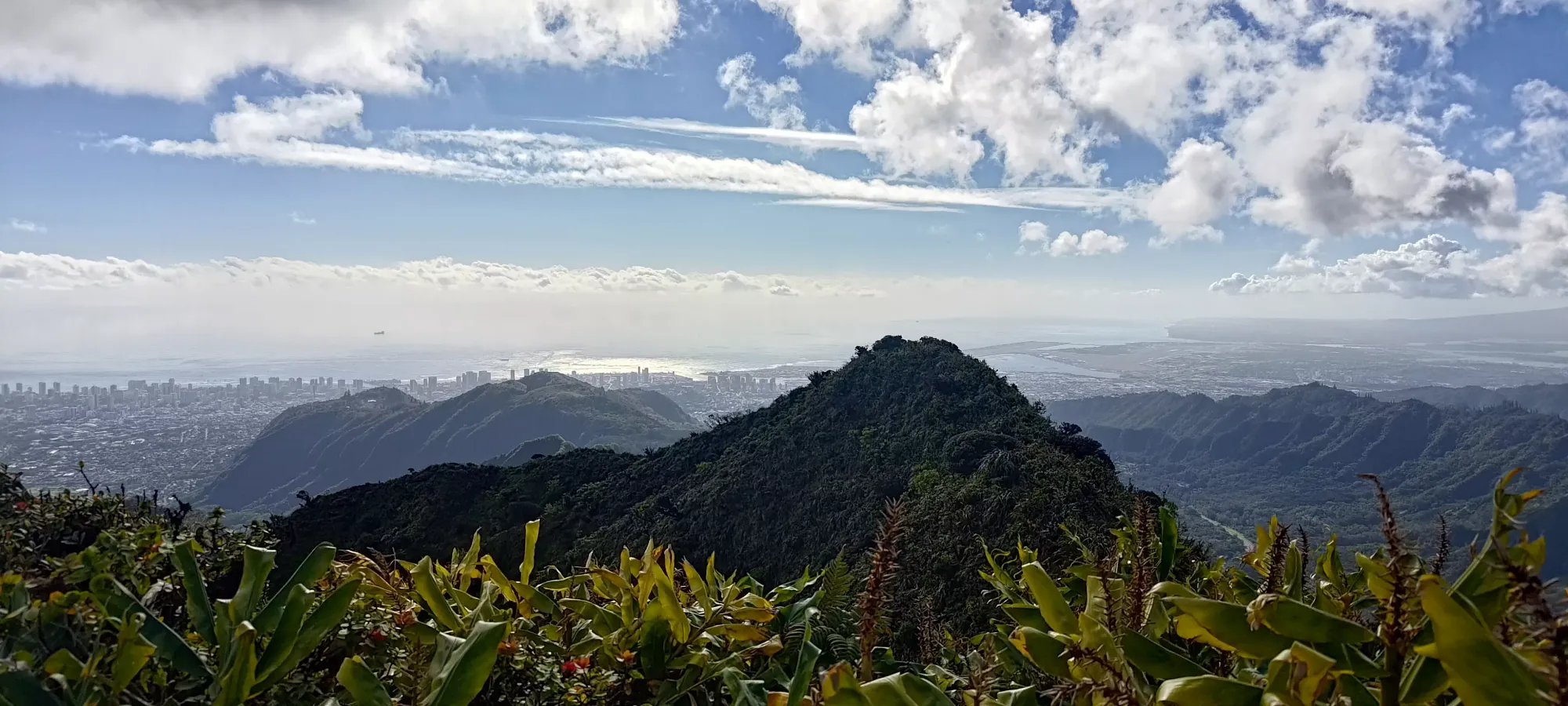
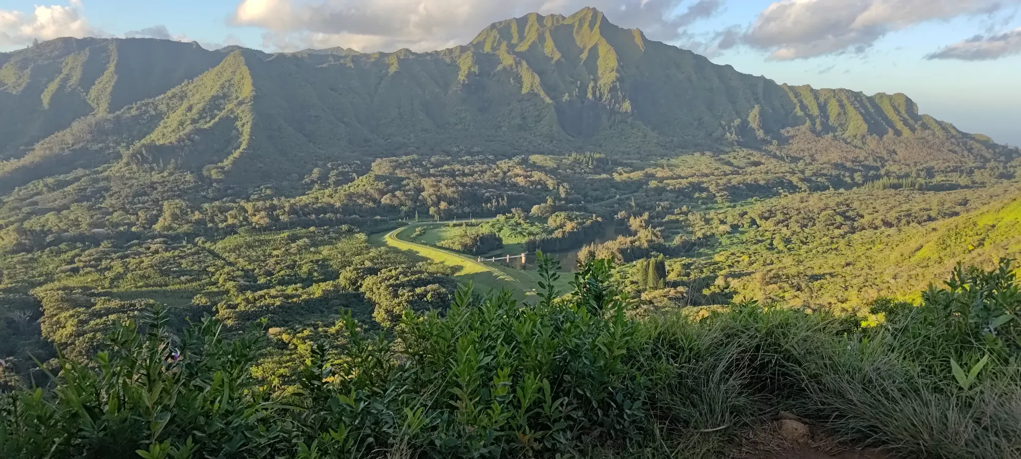
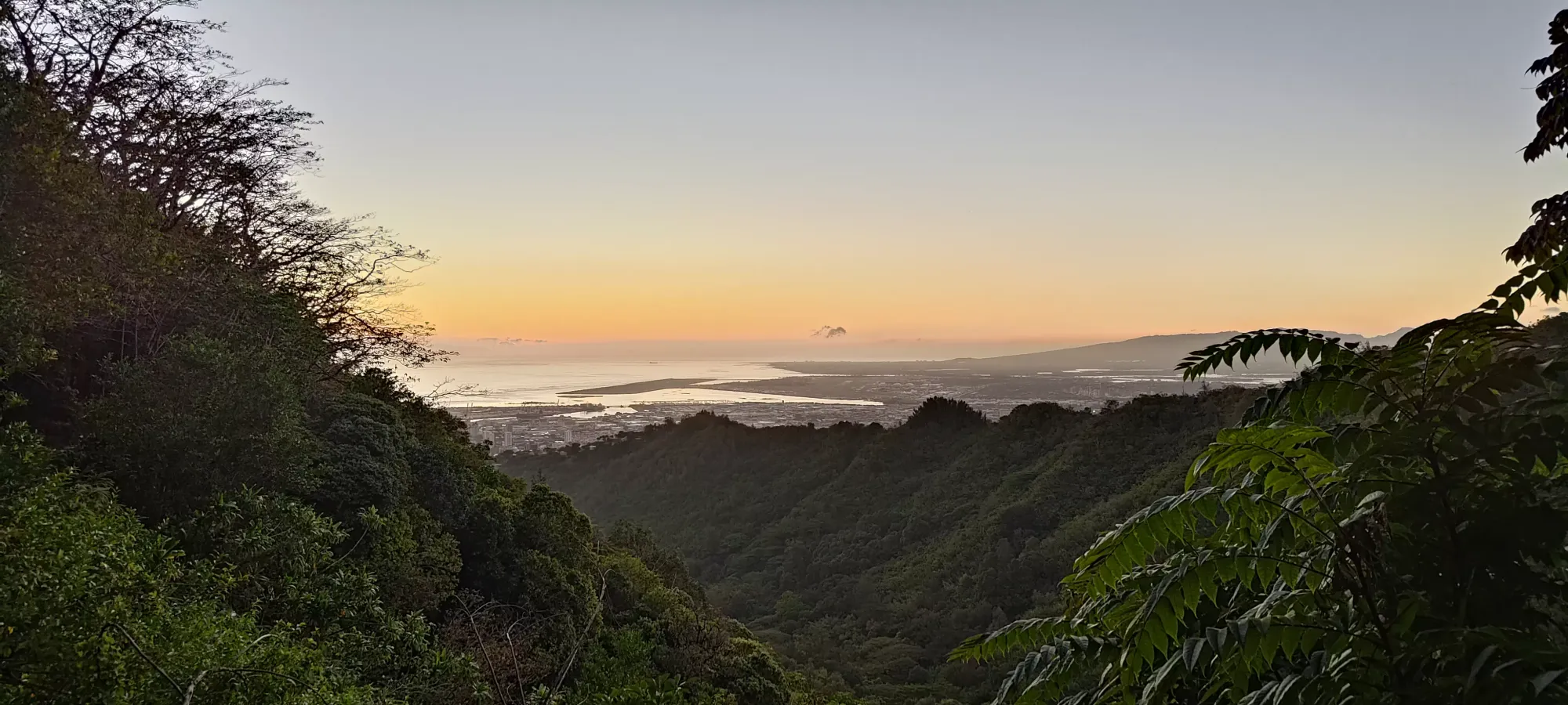
From there, it's about a 5-minute walk to the end of the officially maintained trail network, which has a small bench and a nice viewpoint to look out at the highway, a dam reservoir, and consider if you want to brave the "less official" trail to continue up the mountain.
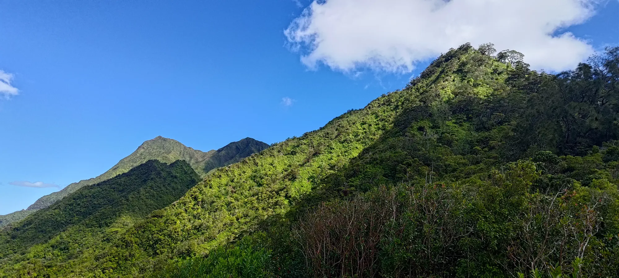
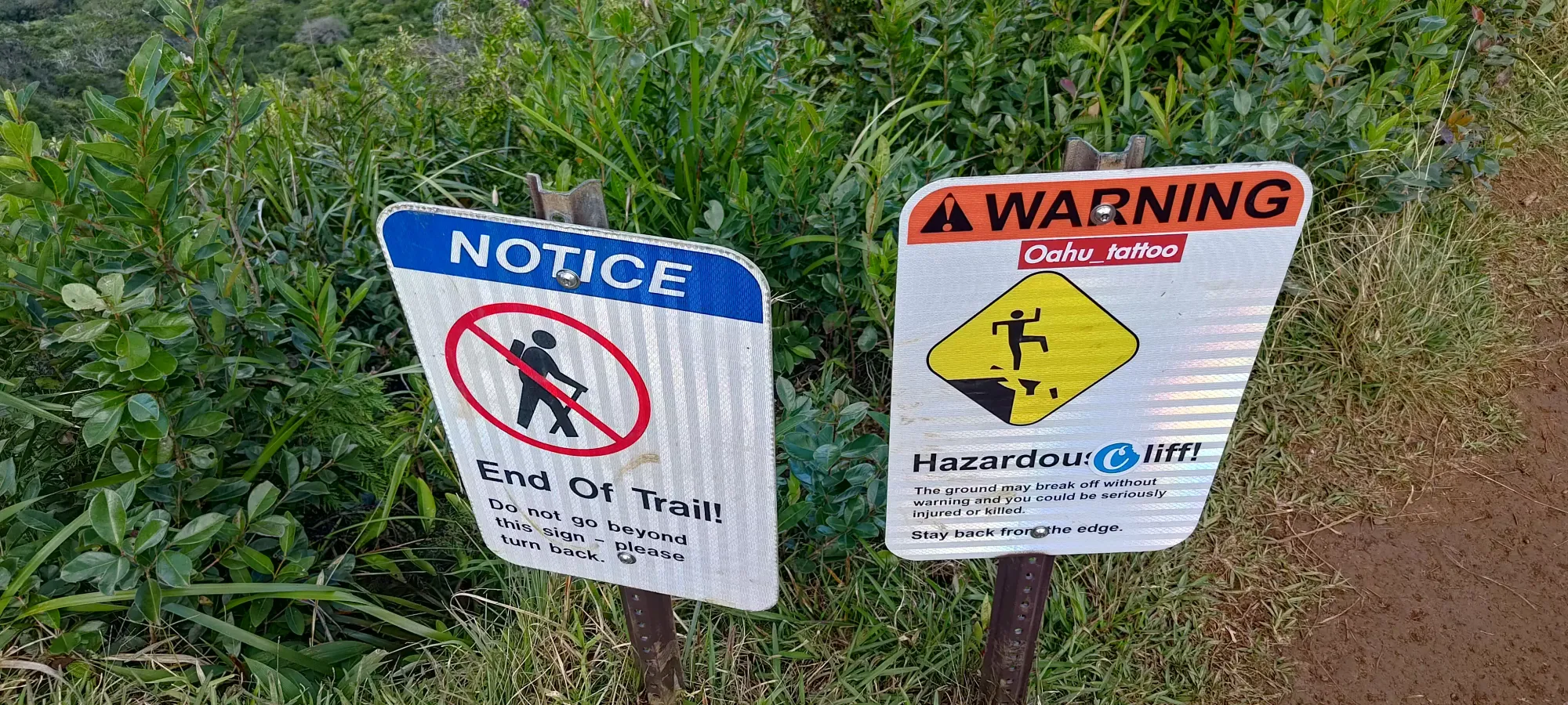
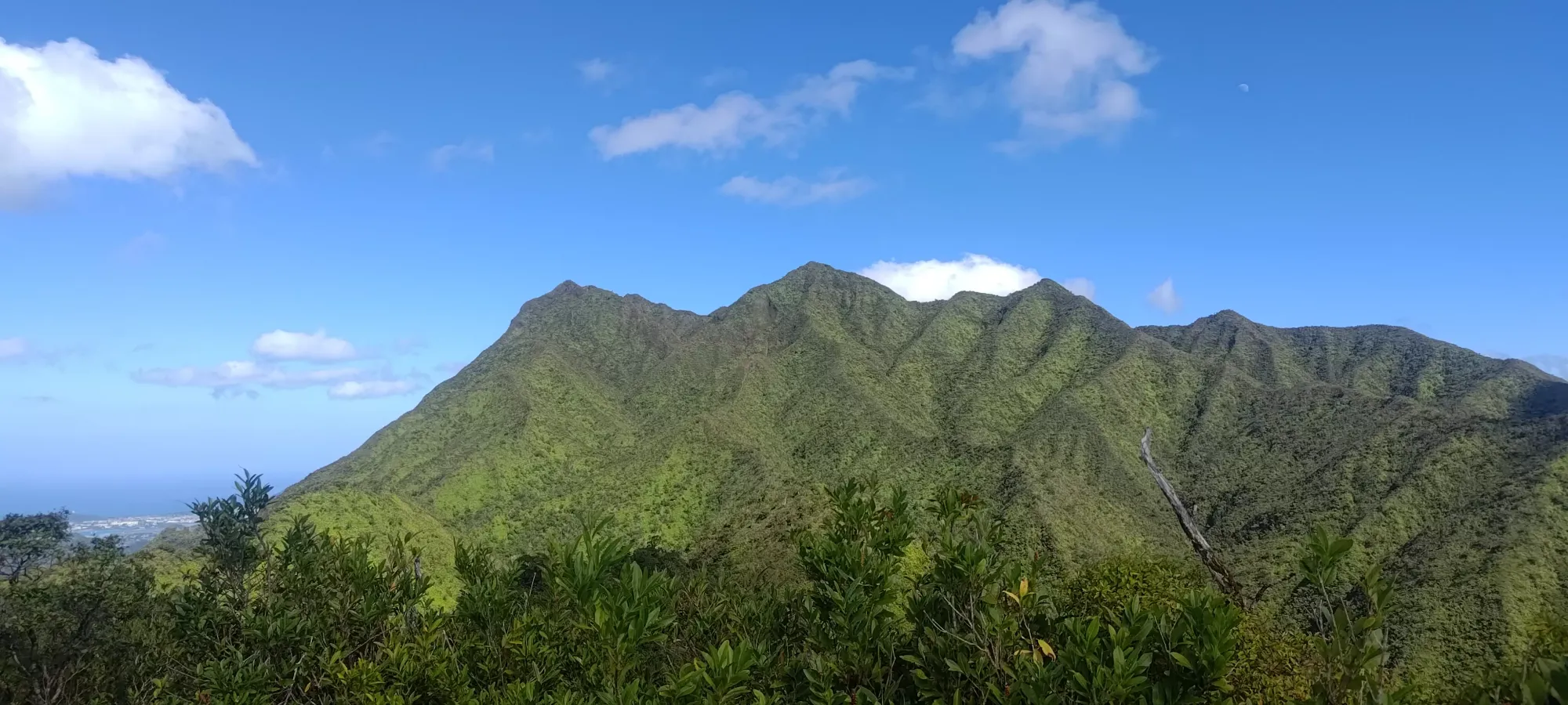
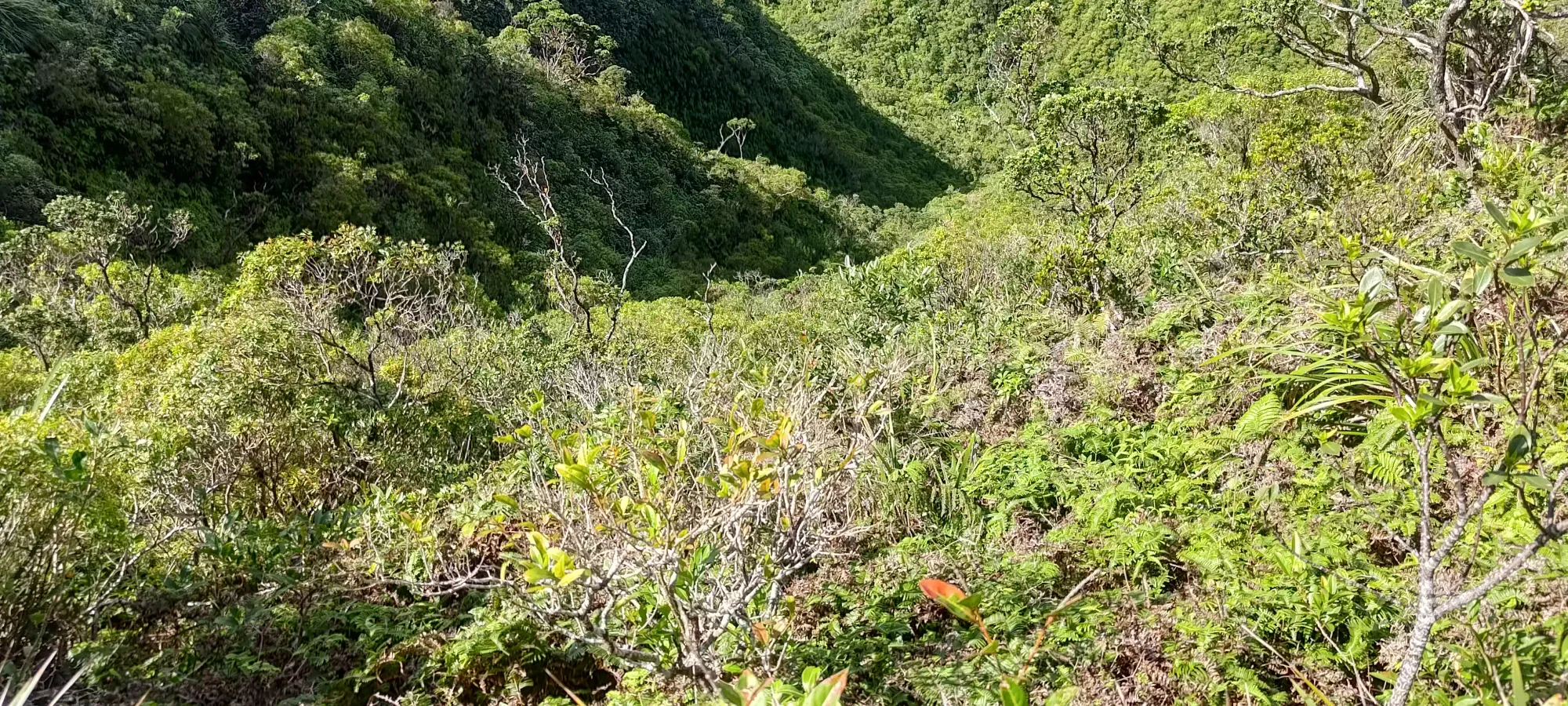
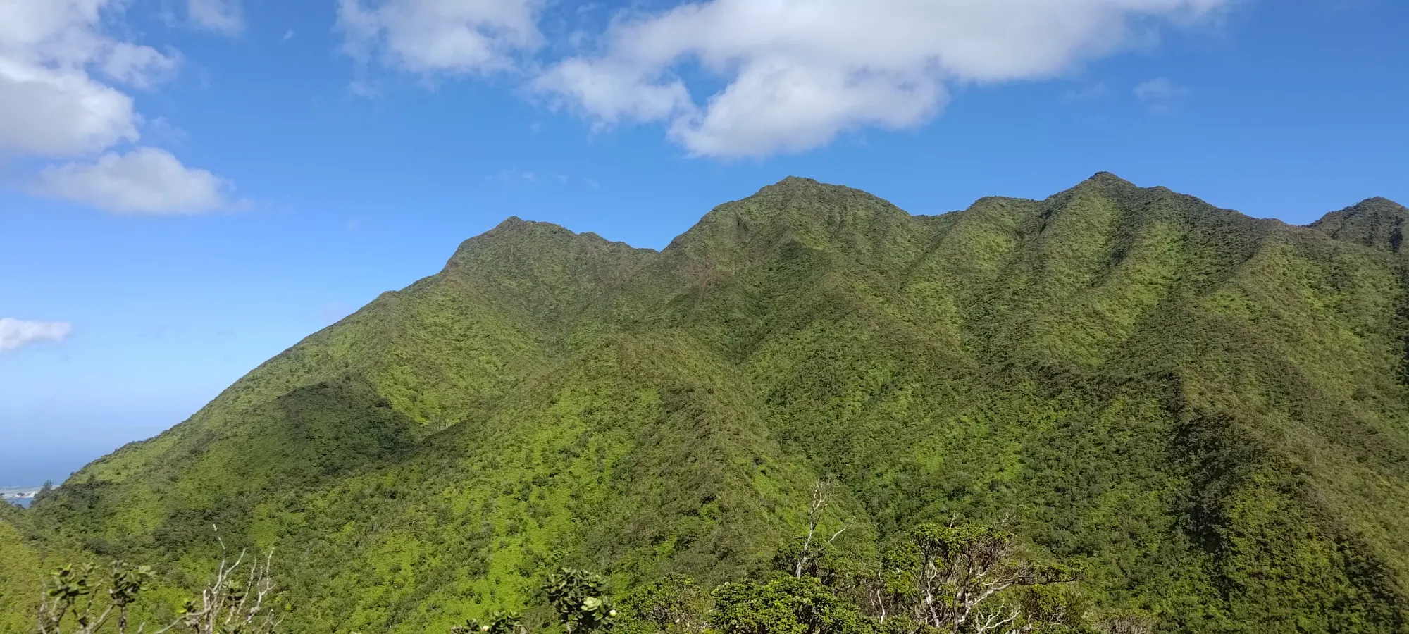
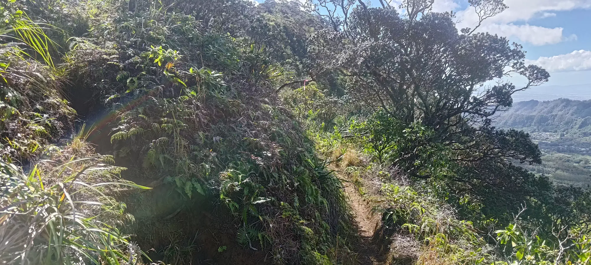
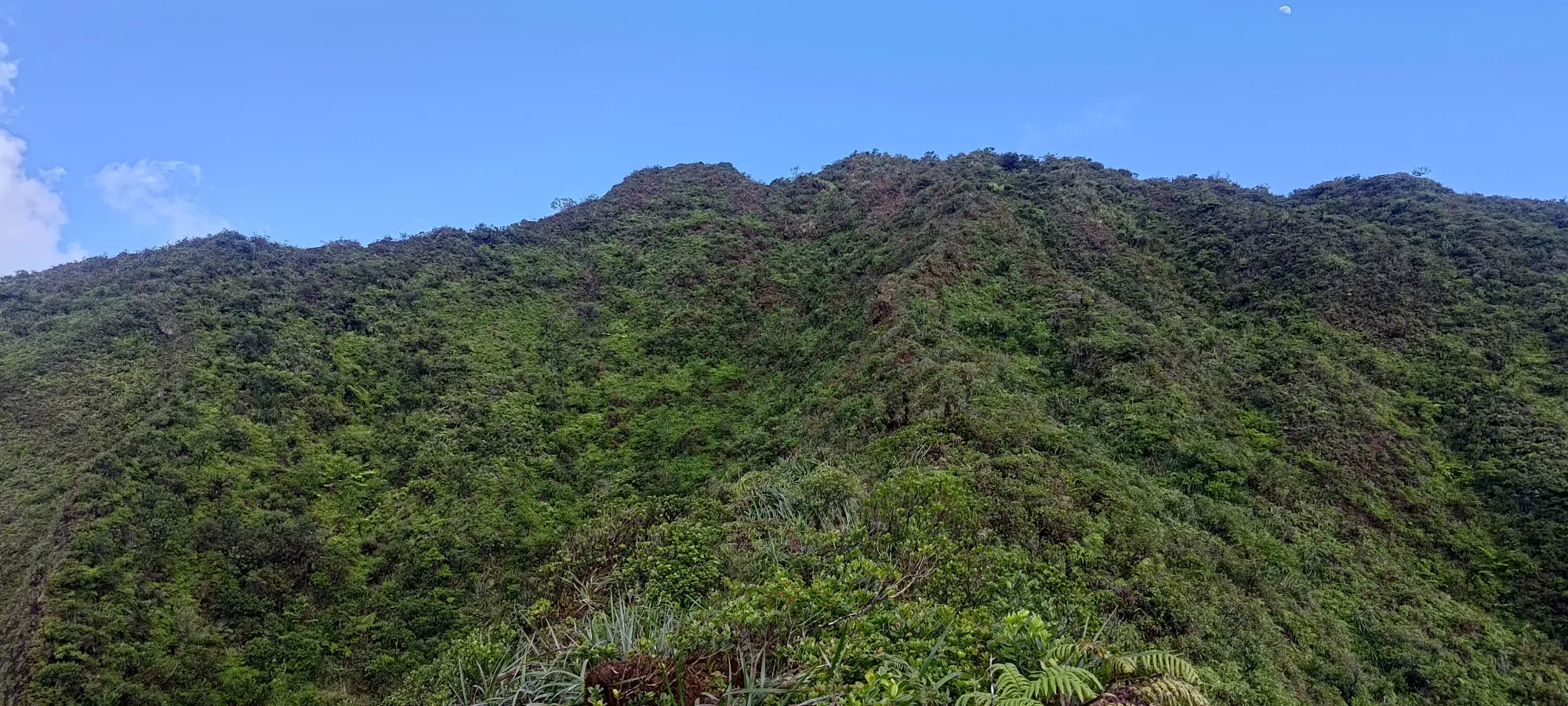
That brought my "approach" time to about 55 minutes, before the "real stuff" started. The first steps on the unmaintained trail are definitely steeper, but not unreasonable, and the trail seems like a decent enough singletrack trail. This, however, changes fairly quickly once the trail forks into two. The fork is for the purpose of going to the summit of an unnamed peak at 676m elevation, which requires you taking the climber's right fork, and going more or less straight up the ridge, whereas the climber's left side trail has more switchbacks, has a bit less undulation, but is a bit more muddy, and "doesn't go to the extra summit". I took the right fork on the way up because "why not get the extra peak".
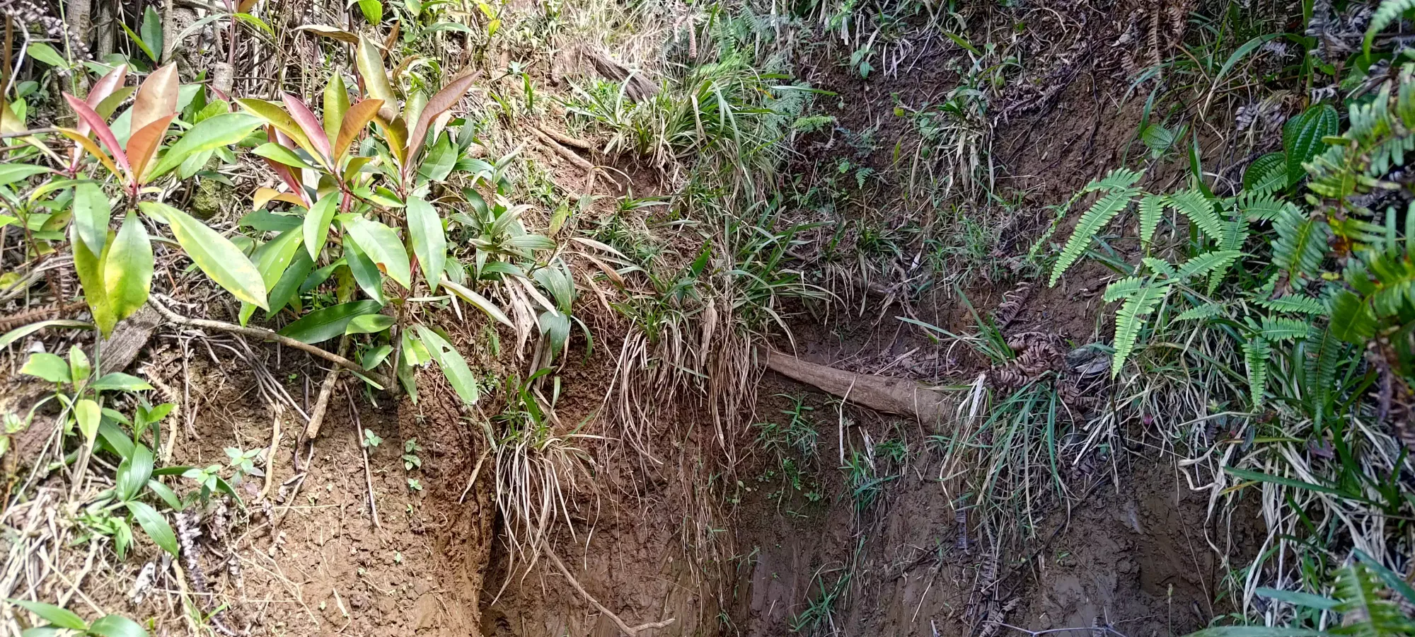
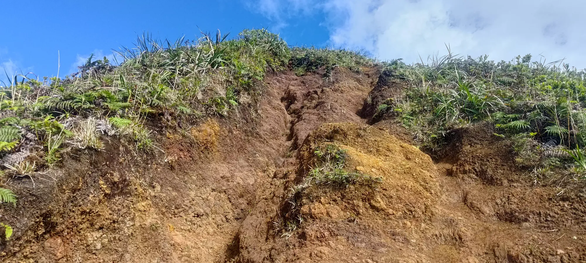
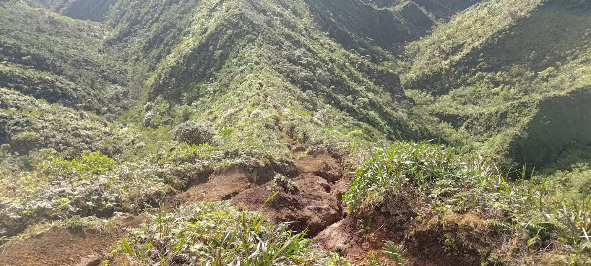
From this fork, there's about 100m to gain to this mini-peak, which took me about 15 minutes to get done. The trail here is quite steep, and is often so narrow it is only wide enough for one foot (not the imperial unit). This places your foot in a sort of trough (which I'm sure water flows down and erodes), so that your step starts with your knee at the level of the surrounding ground, and then you have to actually step up the hill as well. It is very doable, but just be prepared for some stair-like walking. Except for the lack of handrails, the narrowness, the muddy terrain, and the sections so steep/slick/eroded that there are fixed ropes present. I managed to avoid them for the most part, but I believe I used one, which is something I generally avoid like the plague, which belies the intensity of this trail. It did make things pretty fun/interesting, though!
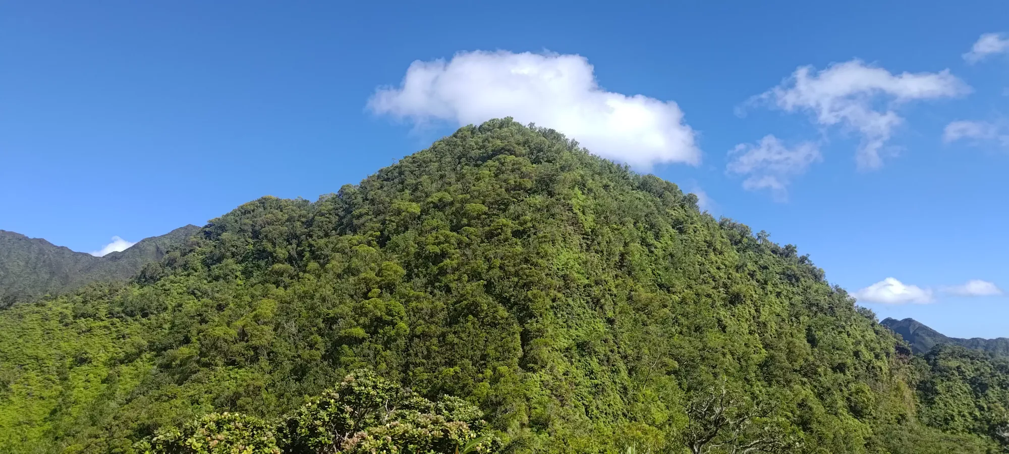
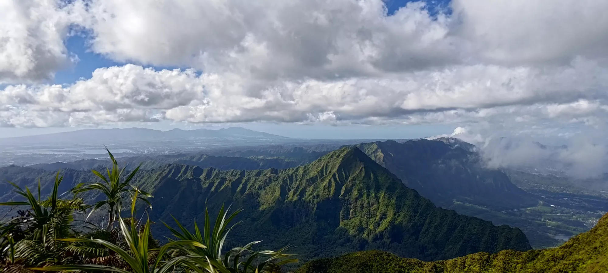
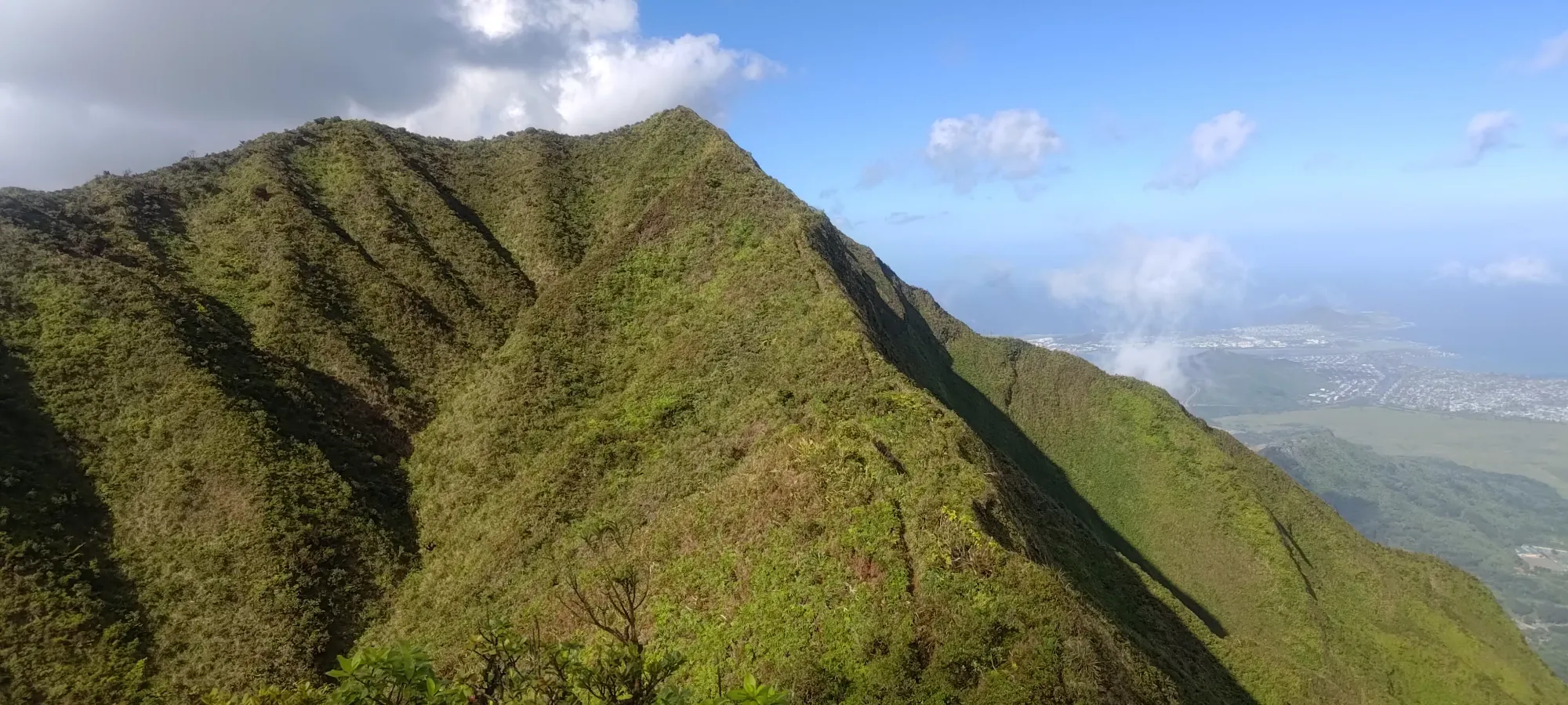
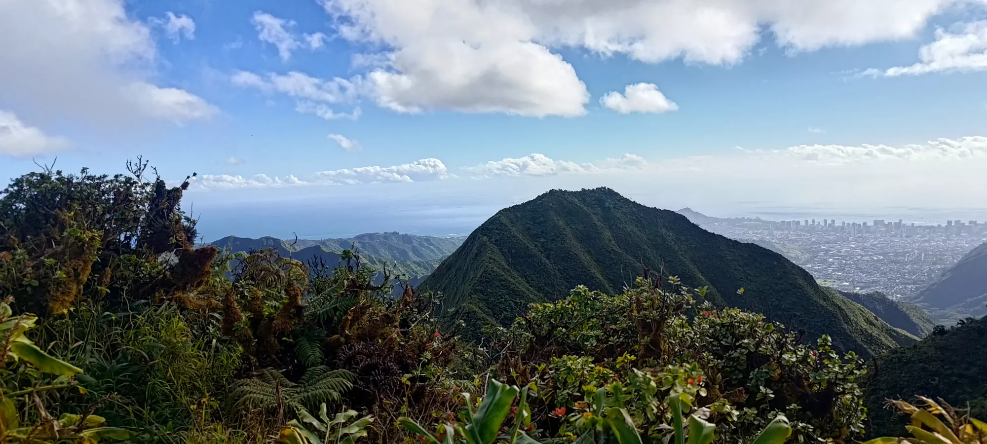
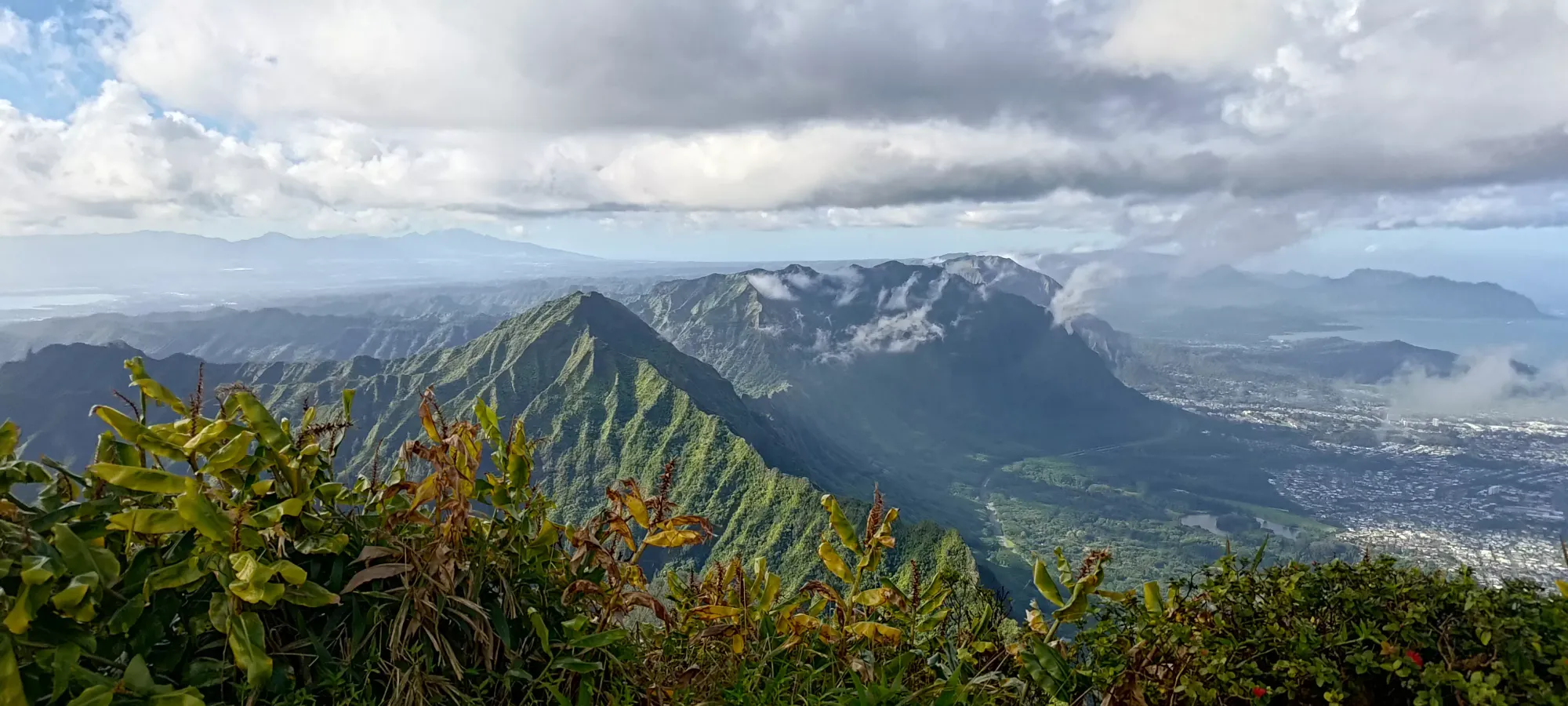
From the top, there's a short but not-too-difficult descent, a couple bumps, then the two forks meet up at the col between this unnamed peak and "K2", the south summit of Konahuanui. Along the way I decided to take a picture (which always flattens stuff out) of the exposure. If you slip in the wrong direction (which is sometimes either direction), it's a tumble to the valley floor.
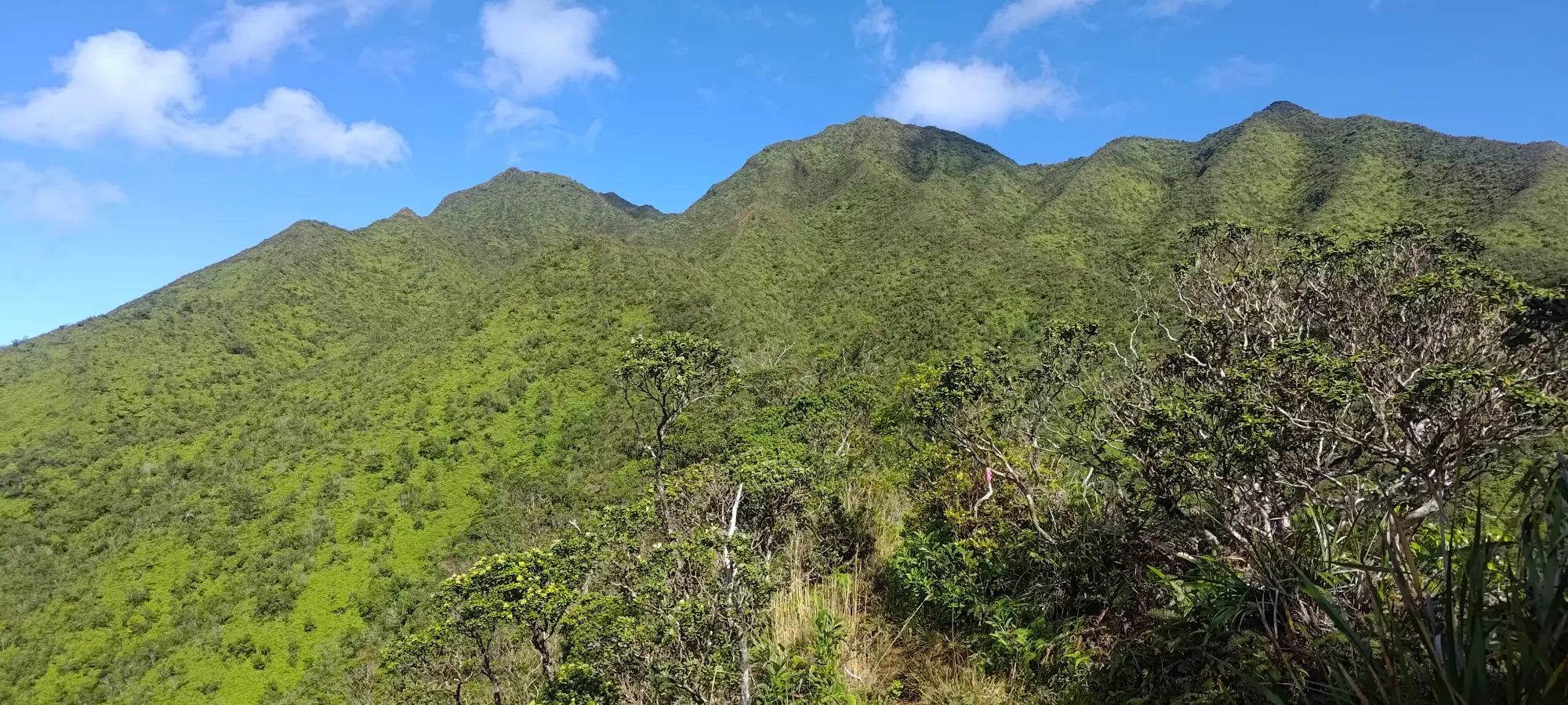
Random flags here where the forks meet
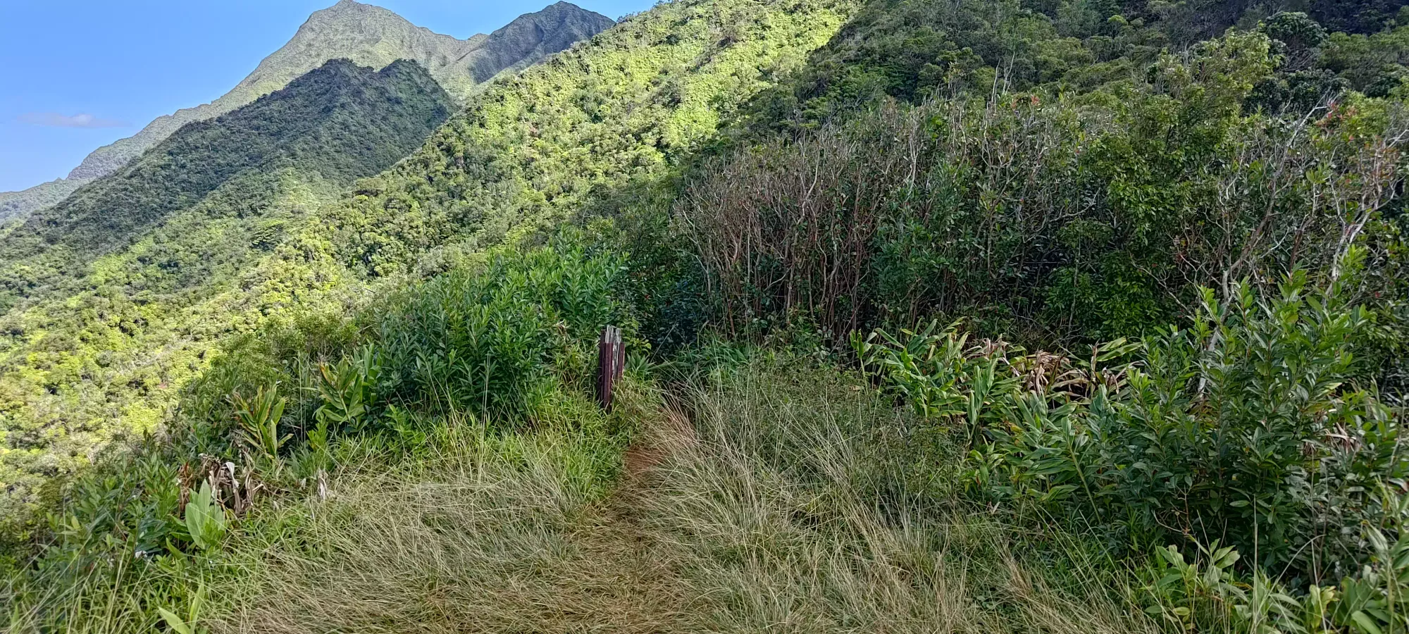
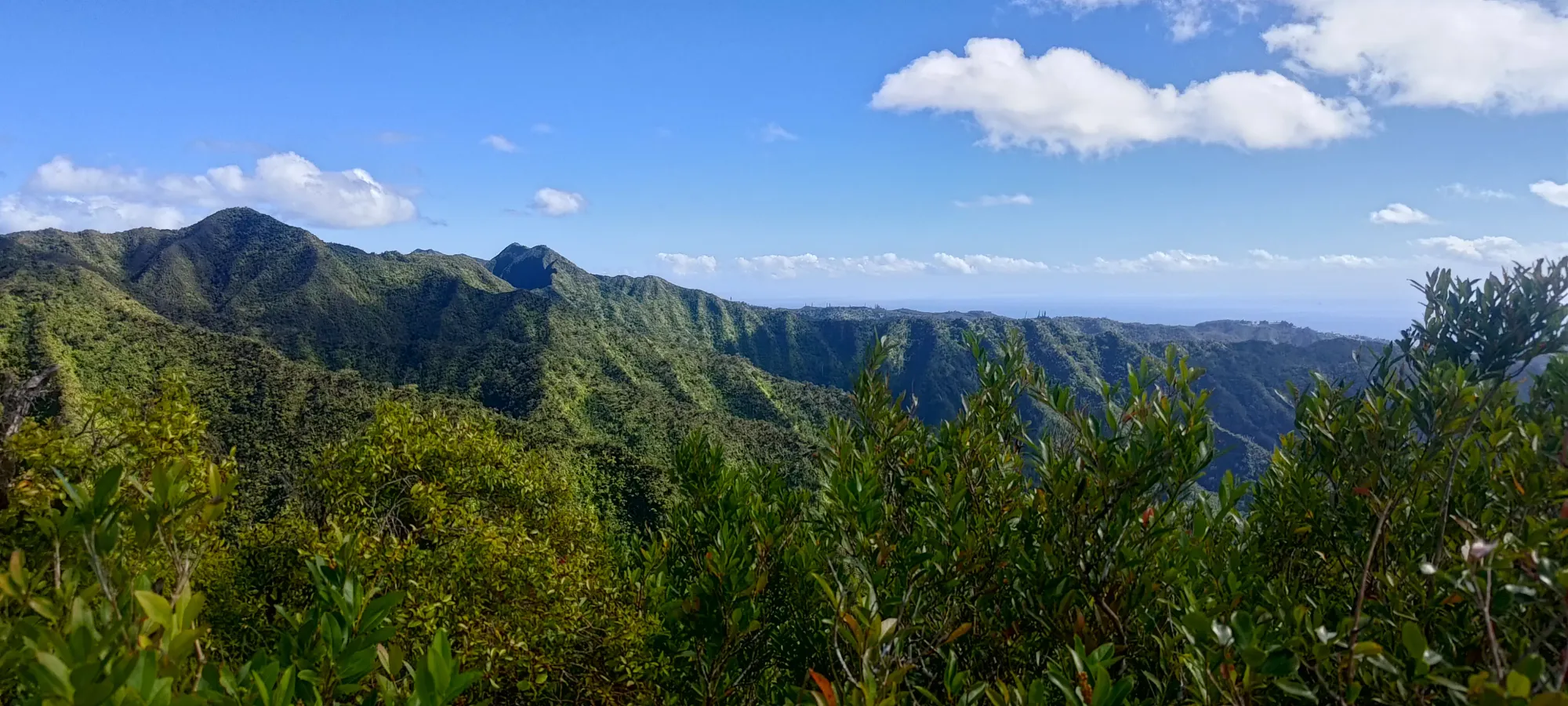
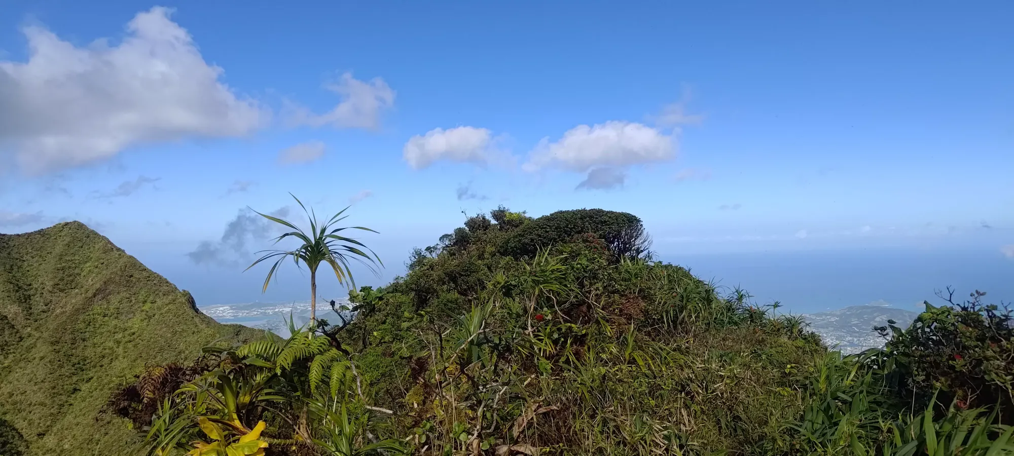
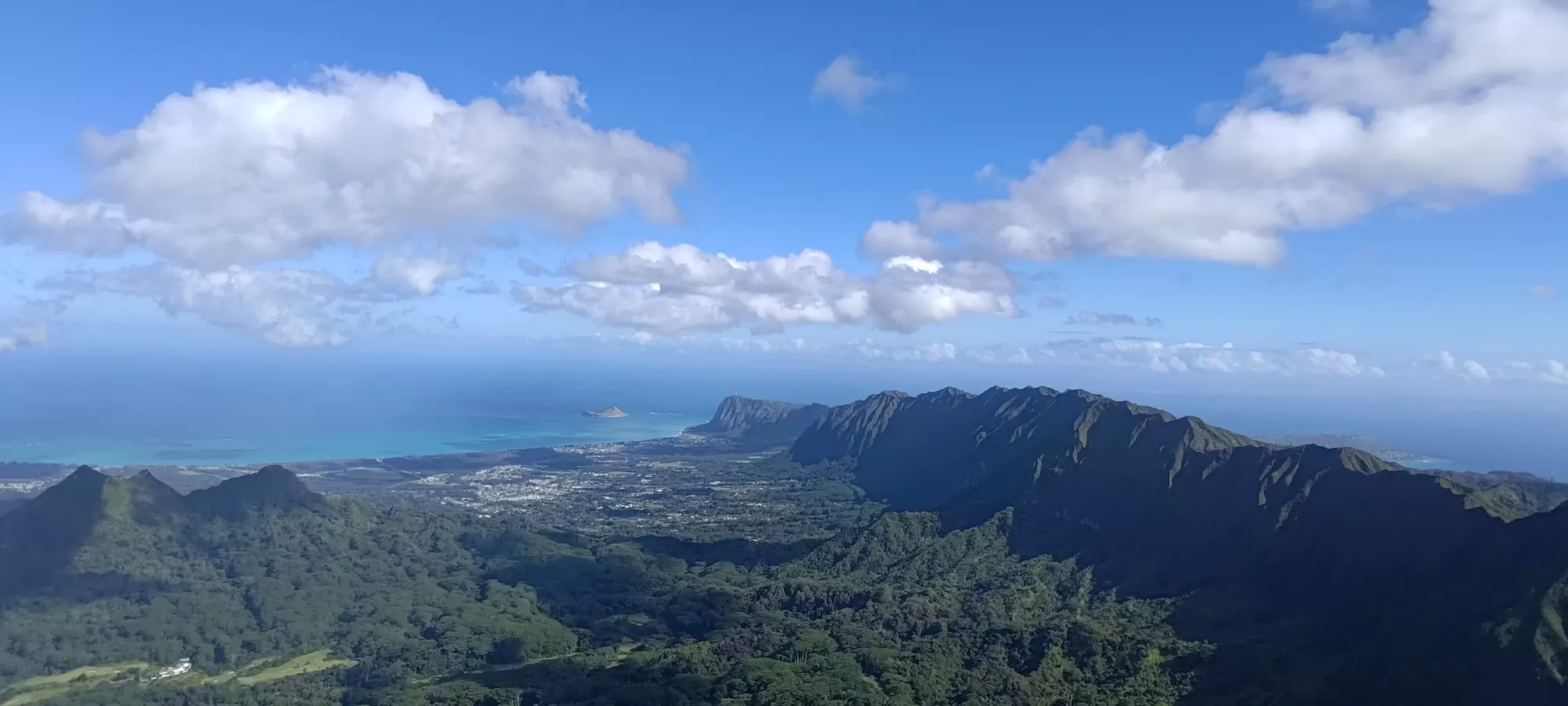
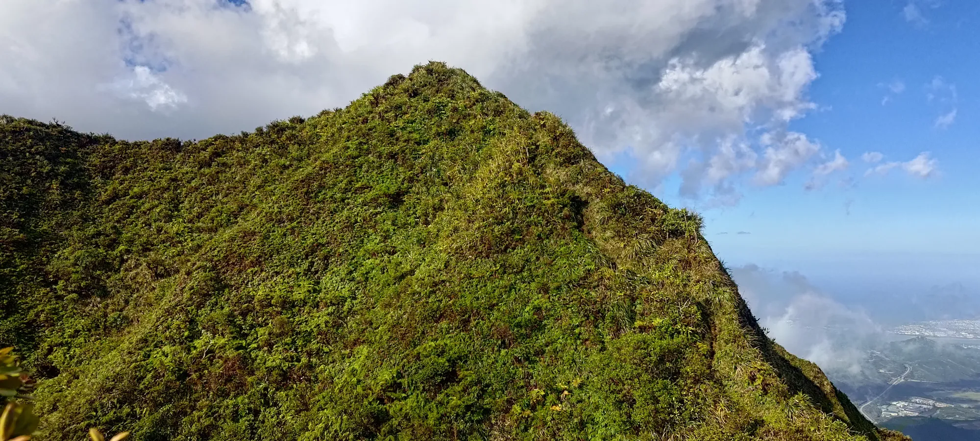
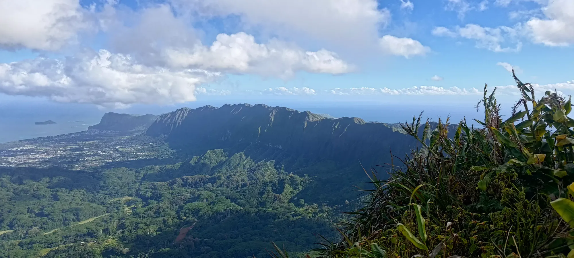
From here, the trail is not-too-steep, and remains fairly chill until a little flat viewpoint at 690m, where I took a quick break for some water.
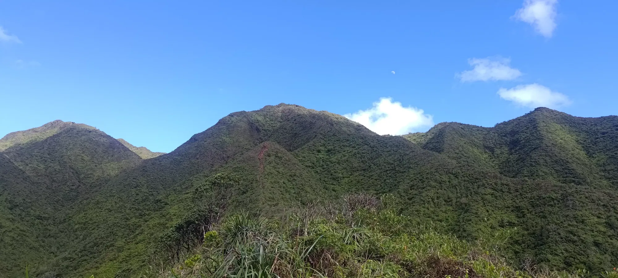
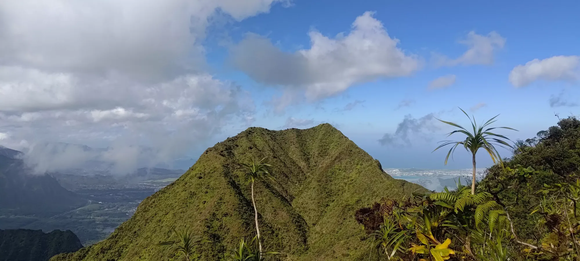
The trail is still somewhat chill for a few minutes past this point, but soon enough, it gets rough again, and the steep packed dirt, exposure, and knee-deep trough for the "original steps" re-appear in full force. This grind more or less does not let up for the next 250m until the south summit, which took me about half an hour to reach just before 3pm, or 2 hours and 20 minutes into the day. This was partially impacted by my getting a call from a neighbour saying my door (back in Squamish) was leaking into the hallway, and having to stop to call/message people trying to get that deal with while I was away. Thankfully there is cell service most of the time on this hike, or that would've been even more annoying than such problems are just "at all". I was able to get my dad, who decided this hike wasn't for him, in contact with the plumbers to try and hand-off the coordination, which was quite helpful, but that probably took another hour from this point. You hopefully will not have that same issue, and can travel a bit more efficiently.
With that done in what felt like a pretty efficient time, all things considered, I was foolish enough to get my hopes up and think I could bang the true summit out in maybe 20 minutes. Sadly, I was quickly shown why what was a stupid thing to think. While the trail up had a few muddy spots, but they were largely avoidable, past the false summit, the trail deteriorated a lot, and I was lucky to have a step without mud.
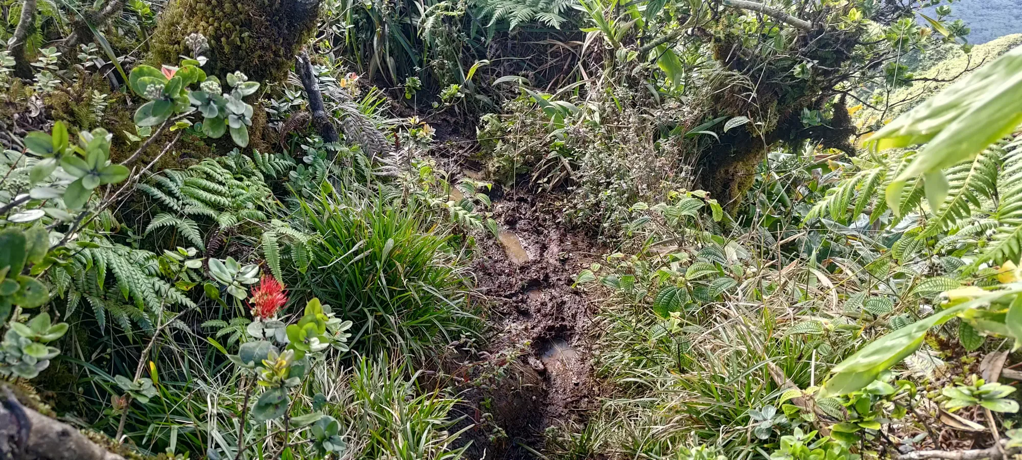
There were definitely steep and sketchy spots on the way up to this point, and a couple where I even bothered to use the fixed ropes. Past the false summit, though, I didn't even bother trying to avoid them, and was grateful for their existence. The mud was often very slick, sloping downward, and combined with the large gap between steps, and exposure on either side, it got pretty sketchy. I used a lot of veggie-belays to get up and down the undulation in one piece. As for the mud, while sometimes there was enough space to step to the side of the main trail, in some spots, the ridge was narrow enough that this was not an option, or the sides were sloped too aggressively to get traction, so you just had to deal with it and trust in the Gore-Tex 😅. Just getting to the low point of the col took 20 minutes, let alone going back up for the true summit.
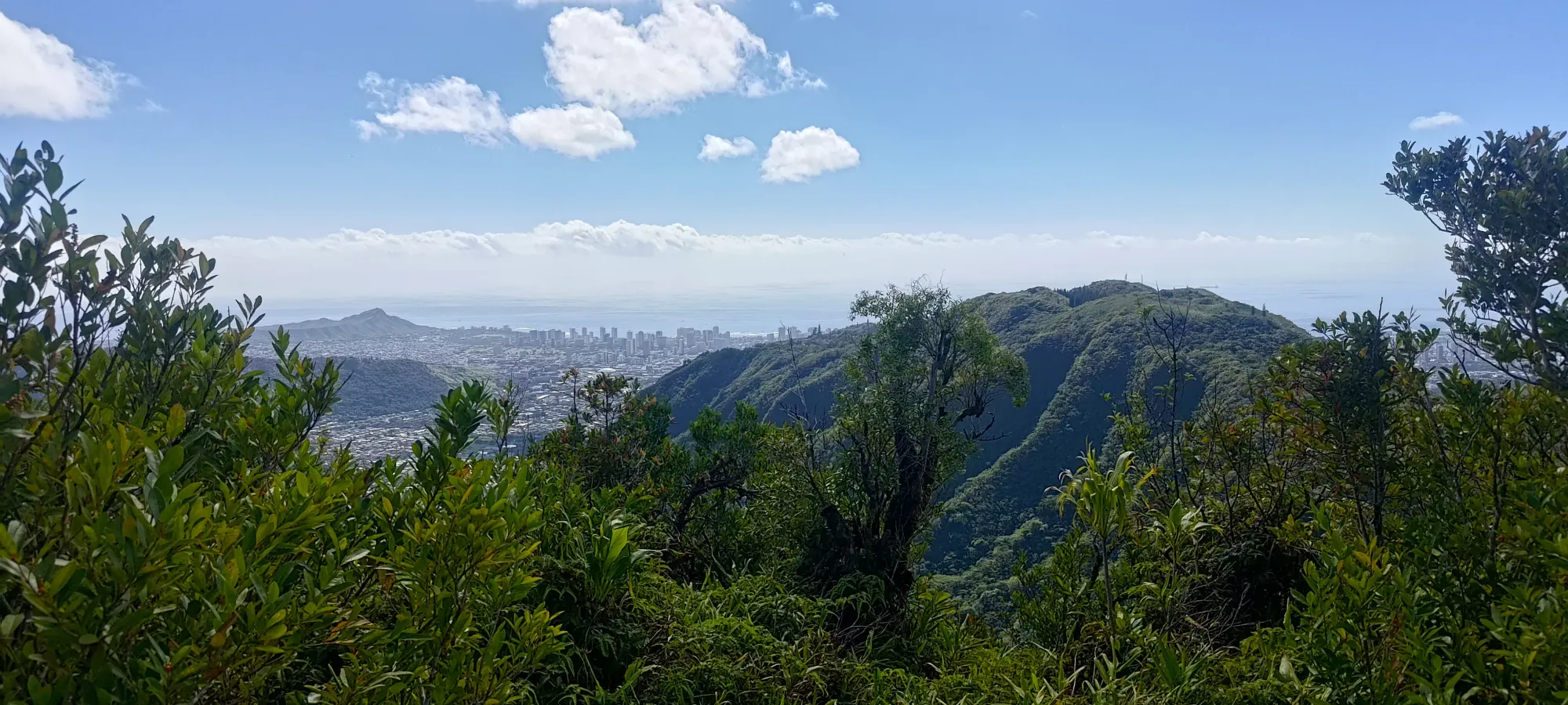
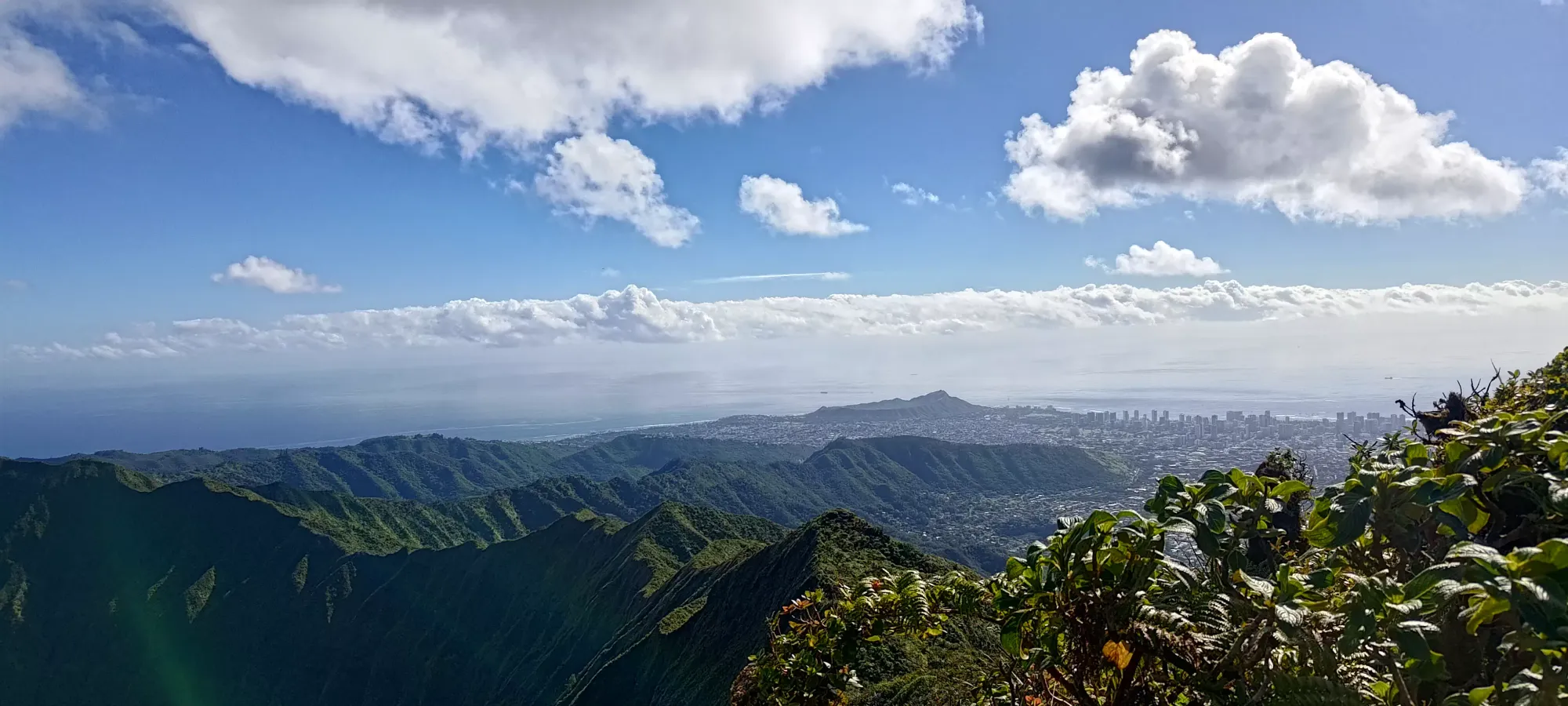
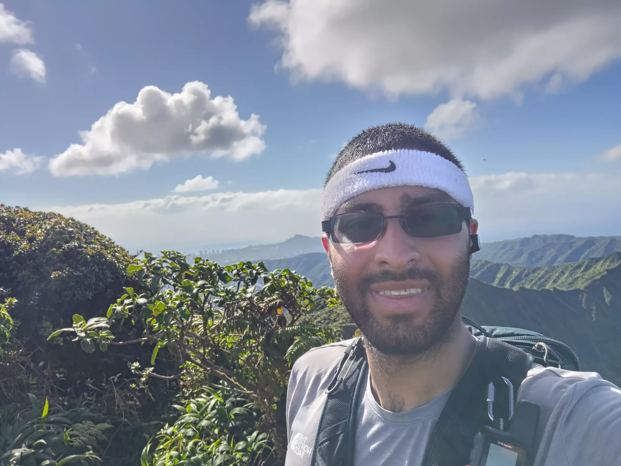
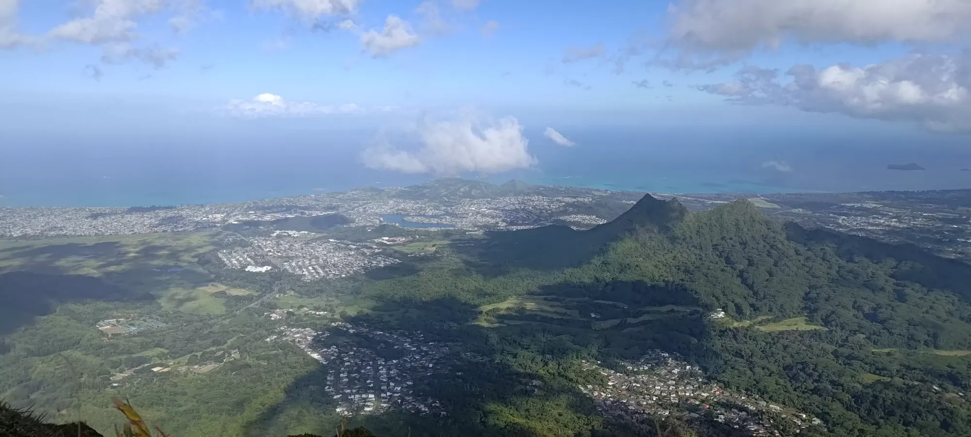
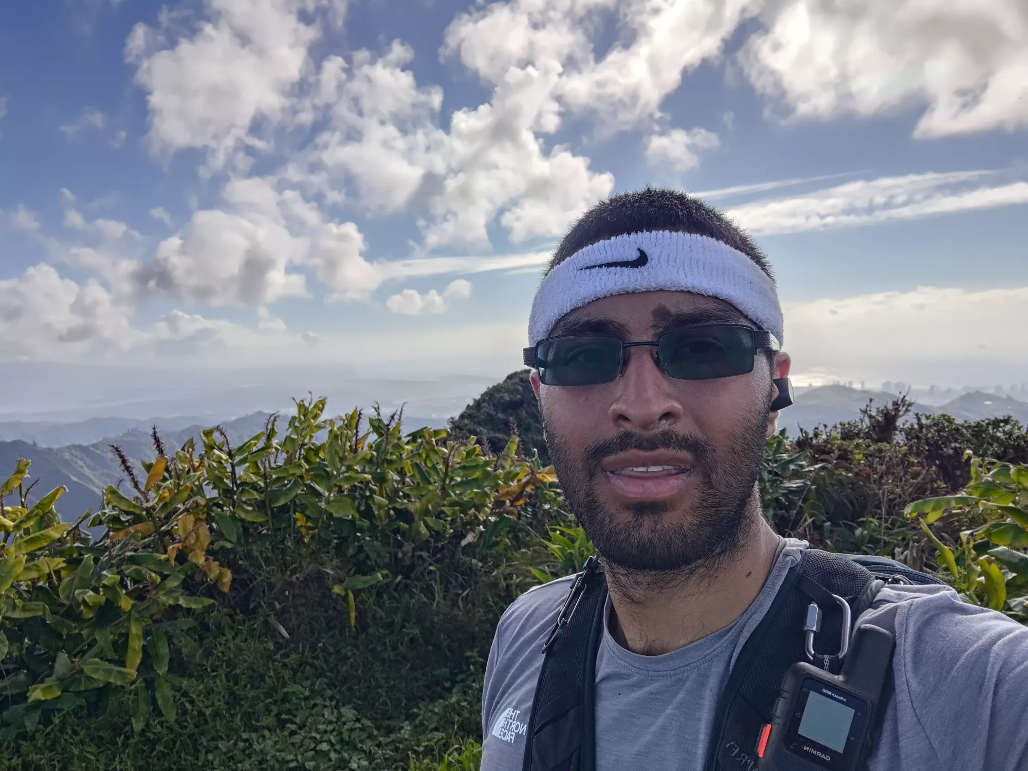
Once I got down, it was actually easier to make the hike back up (traction is generally easier to find uphill than downhill), so it only took 15 minutes to get myself up to the summit, just under 3 hours from when I started (a good omen for my goal of getting down without pulling the headlamp out, and therefore being somewhat "on time" for dinner). I spent a few minutes taking pictures and sending messages about that leak I had going on at home, then steeled myself for a slippery (and muddy) descent.
Fighting back through the mud took about 30 minutes, and naturally a few metres before I got back onto the south summit, I finally slipped hard enough on one patch of slick mud to get a little bit over my ankles and into my right shoe (though thankfully it was small enough to be fairly negligible, mostly just a mental annoyance). The outsides of my shoes, my pants, and my shirt, though, were all thoroughly filthy at this point, as staying stable+upright took all my limbs to achieve.
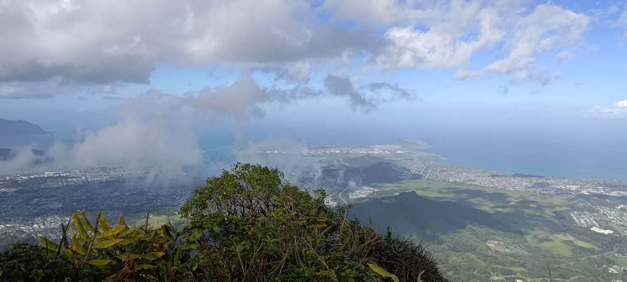
After a little more than 20 minutes of descending, I figured out that while on the way up, stepping into the deep troughs was usually the right call, on the way down, it was a bit more mixed. If the sides of the trail were wide enough, staying on top worked out well. Once it got narrow, though, while it was annoying to have to precisely place my feet within the trough, it did end up being faster. In about 25 minutes off of the false summit, I arrived past a long section of fairly bush-surrounded trail and at the top of a steep, dirt-only section, which had me questioning "how did I get up this again?" at first glance. I was able to walk down without much hassle after I just started moving, though.
As I continued down, I found myself at the fork for the two ways either up or past the unnamed summit at the start of the difficult trail, and decided to take the "other option" for the descent, hoping the switchbacks would mean it was less steep (the way up was one of the harder sections of the day), and it also looked a bit more popular. It worked out well enough, though there was more wet mud than the straight-up-ridge option. I managed to get through the undulations and back at the viewpoint where the official trail ends at basically exactly 5 hours into the day, or about 5:40pm. Now that I was back on easy terrain, I was much more confident that I'd get out with daylight to spare, which was a nice change (winter is brutal, daylight-wise).
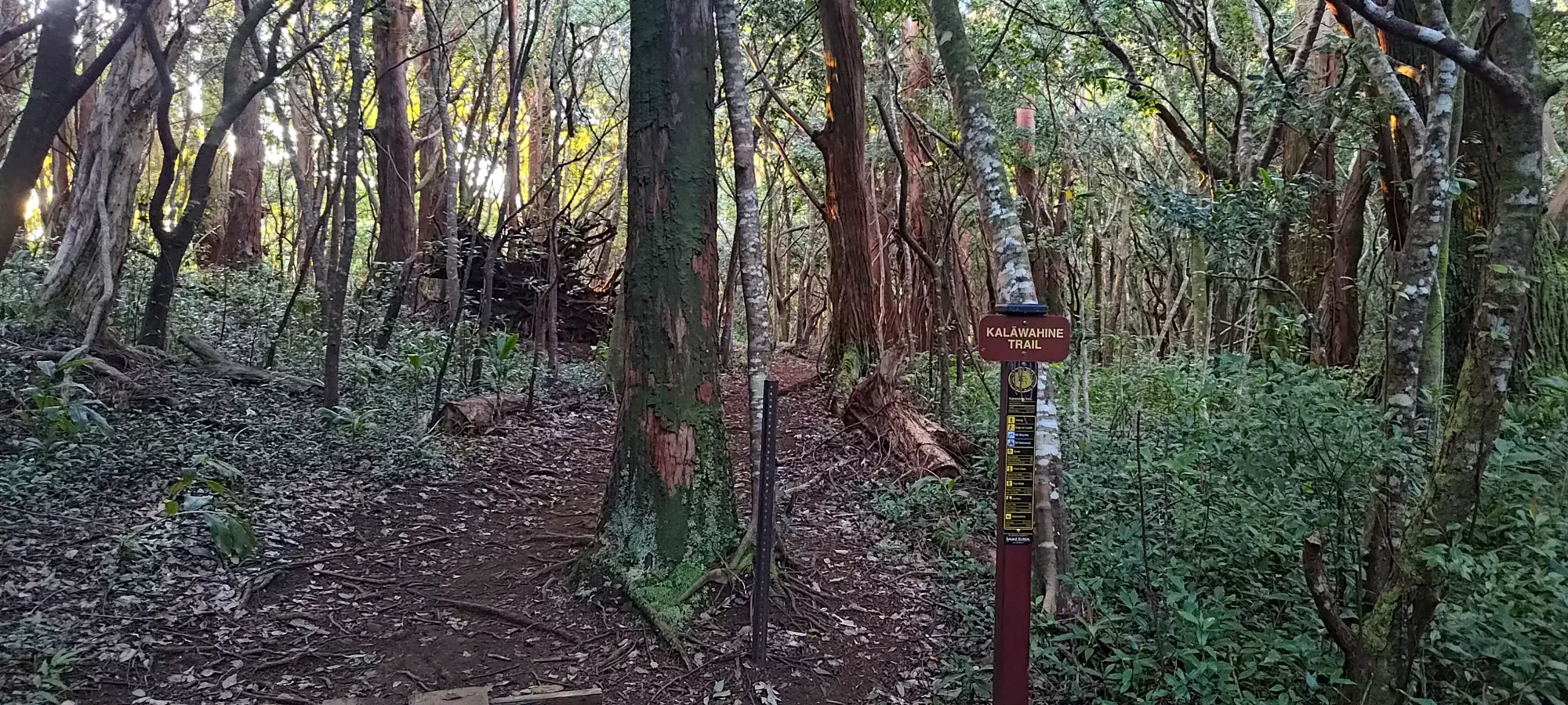
The way out was a simple hike, it took about 40 minutes, and was mostly downhill, with only small undulations en-route. Most people I found seem to do this out and back from the Tantalus trailhead, but I was appreciative of the fact that I was parked at the Kalawahine Trail, which meant I could follow that out instead of winding through the many trails I took on the way up. It took only a few minutes to get to the fork for this from the viewpoint, then it was easy walking on a well-maintained trail all the way out to the road, and a short road walk to the car past the closure area (which was actually re-opened by the time I got back).
Overall, I'd say this is an excellent hike that I absolutely recommend. The stats aren't anything crazy, and the views are amazing. You'll want to be comfortable with exposure, mud, and steep terrain, but if that sounds okay to you, the rewards are well worth it. Plus it's a p600, and 4 peaks in one, all in under 6 hours!
GPX Track + Map