Seven O'Clock Mountain - October 28 2023
An easy double-header along w/ Sun God for a nice outing in any season

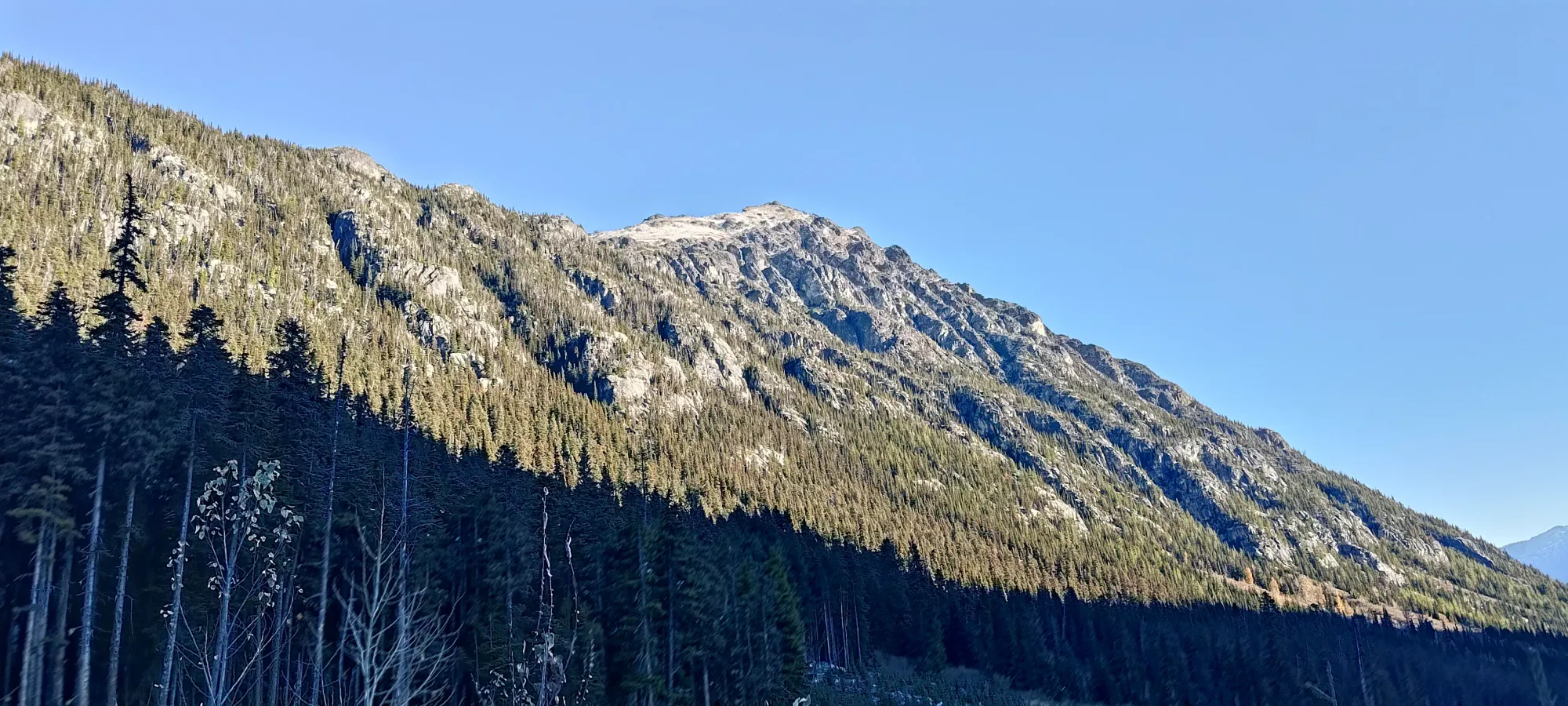
Tenquille Lake Area, Pemberton, British Columbia
2341m
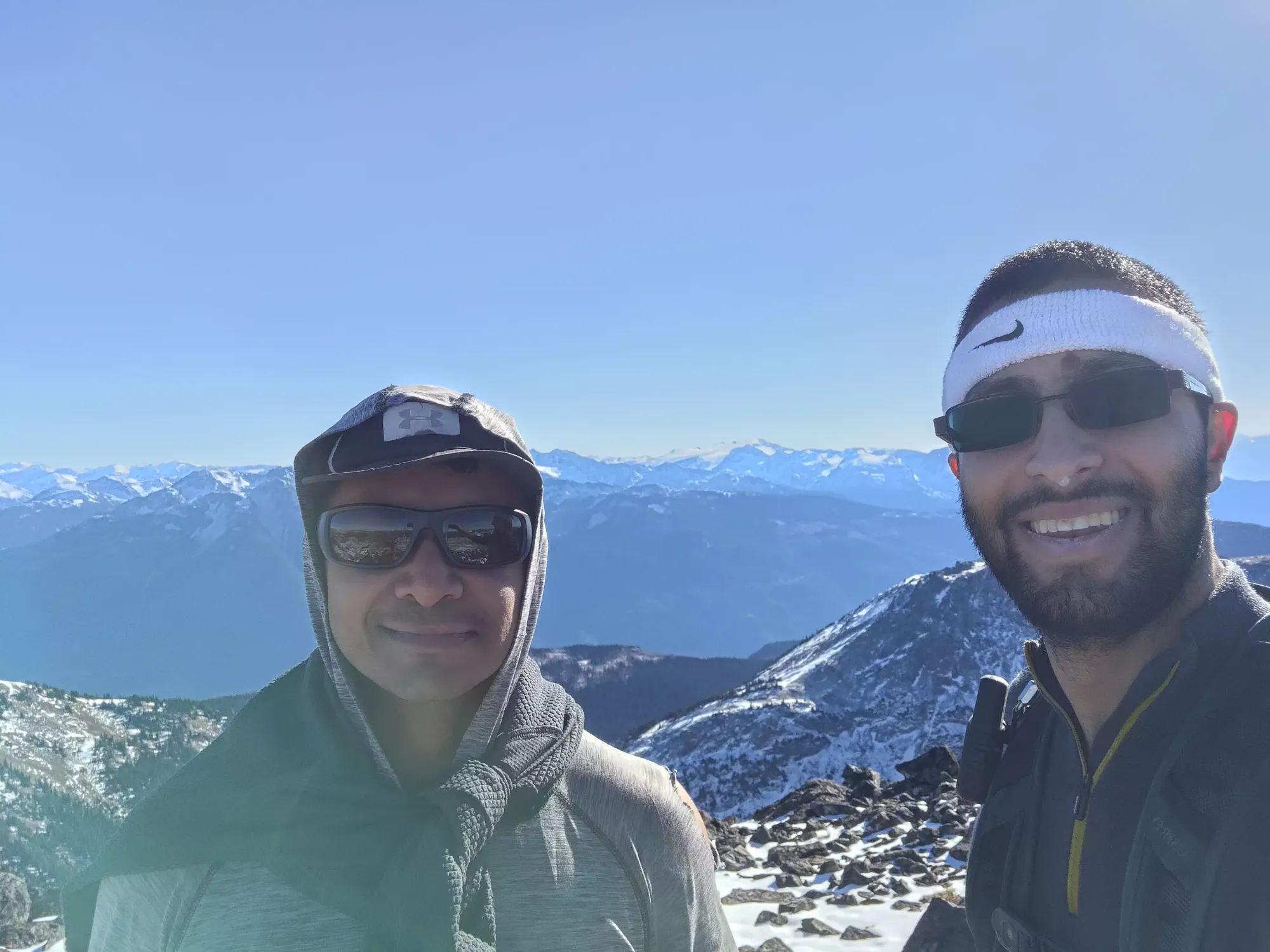
After a mid-week dump of snow that resulted in the first skiing of the season, the weather took a turn for the dry, and the coming weekend seemed to be a pretty relaxed high-pressure system. However, it stayed cold, so most scrambles were going to be out with too much snow, but at the same time, skiing wasn't really a feasible activity yet. I put some feelers out in the local group late Friday after scrounging my maps for something to do where the snow wasn't as intense as the North Shore, and the objectives were more walking than scrambling in case the snow was going to pose an issue (not much beta to go off of). I got a response from someone interested in heading up to the Tenquille Lake area north of Pemberton, so we chose to go for 7:00 mountain and Sun God, a couple of peaks which seemed to be mostly hikes and non-technical scrambling, so perfect for a shoulder season adventure. Tanveer, a peakbagger based out of Washington, but who is fairly active up north as well, met me in Squamish in the morning, and we headed up in my car to the trailhead.
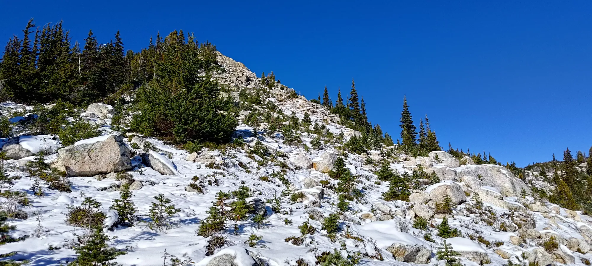
The drive comes out of Pemberton along the Portage Road, until you hit Birkenhead Lake Road, which is a well-graded dirt road. That goes north until you get to Tenas Creek FSR, which is in pretty decent shape, but the cross-ditches will make one want medium-clearance to avoid hitting your bumpers. 2wd would be fine, though. We took this road all the way to a spot just past the trailhead where you can fit a car or two, though more parking is available a bit before the trailhead as well. The road had a small dusting of snow, and a small amount of ice in places, but was very easily driveable. We parked, enjoyed the excellent views from the car alone, then started up the trail at around 9:55am. The entrance into the forest is on the bend of a corner on the road, and takes a bit of inspection to find the boot tracks in the steep dirt, but once you find it, it's easy enough to follow.


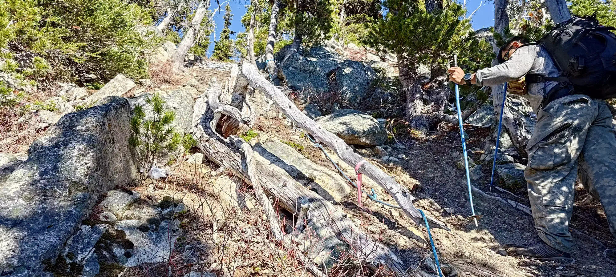
As we started hiking, Tanveer set a very casual pace up the forest, with more mental discipline than I tend to have, keeping us at a very steady and sustainable pace. The forest was pretty steep, there were dustings of snow throughout, and the dirt was hard due to the cold temperatures, but there was still enough traction to make good progress. With the flagging that had been done, it was also pretty easy to follow. I imagine that'd be the case without flags if the snow was gone and you could see the ground, but with that plus the older growth creating wider spacing in the forest, it would be easy to get off-track just following the easiest path. We gained about 450m in the first hour, which brought us up most of the forest, across a couple small boulder fields, and to a short section of fixed rope (ew) in an otherwise unassuming part of the trail.
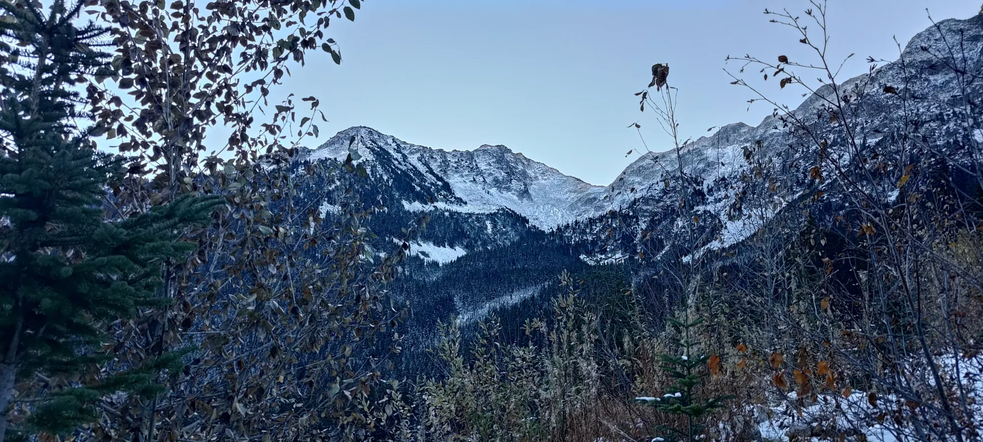
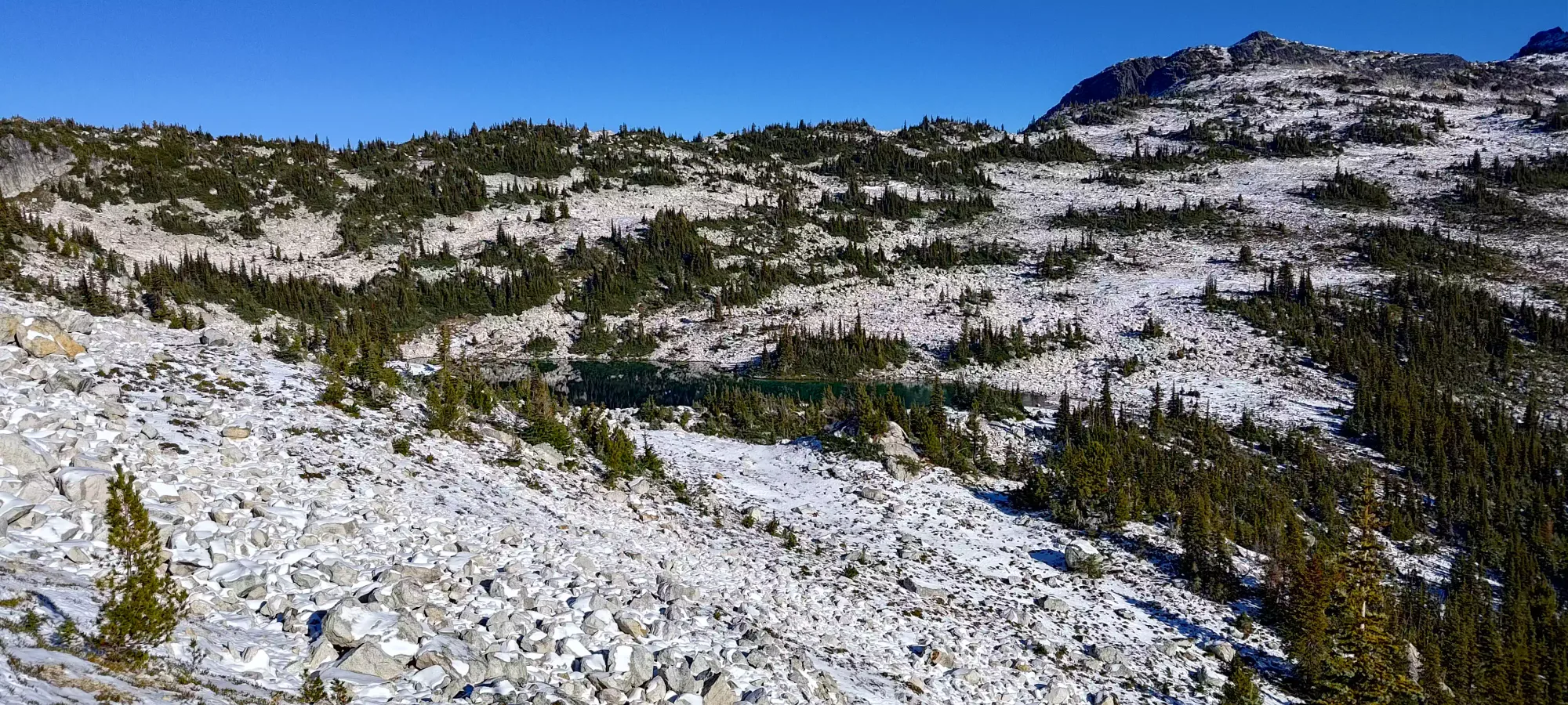
Once we passed this section, it was about 11am, and we officially broke out of the forest, and hit a small section of side-slopes and boulders that led to the small lake separating 7:00 and Sun God mountains.

At around 1930m, the trail got pretty side-hilly, and with the snow, it was a bit sketchy. We could've put spikes on and just walked carefully to get across, but we were feeling fresh so instead decided to just go up the steep slope to climber's left and gain the top of the ridge and walk along it instead, figuring the easier travel would offset the extra gain. This worked well, as the travel was much simpler+safer. In about 15 minutes, we found ourselves above 2000m, looking down towards the lake.

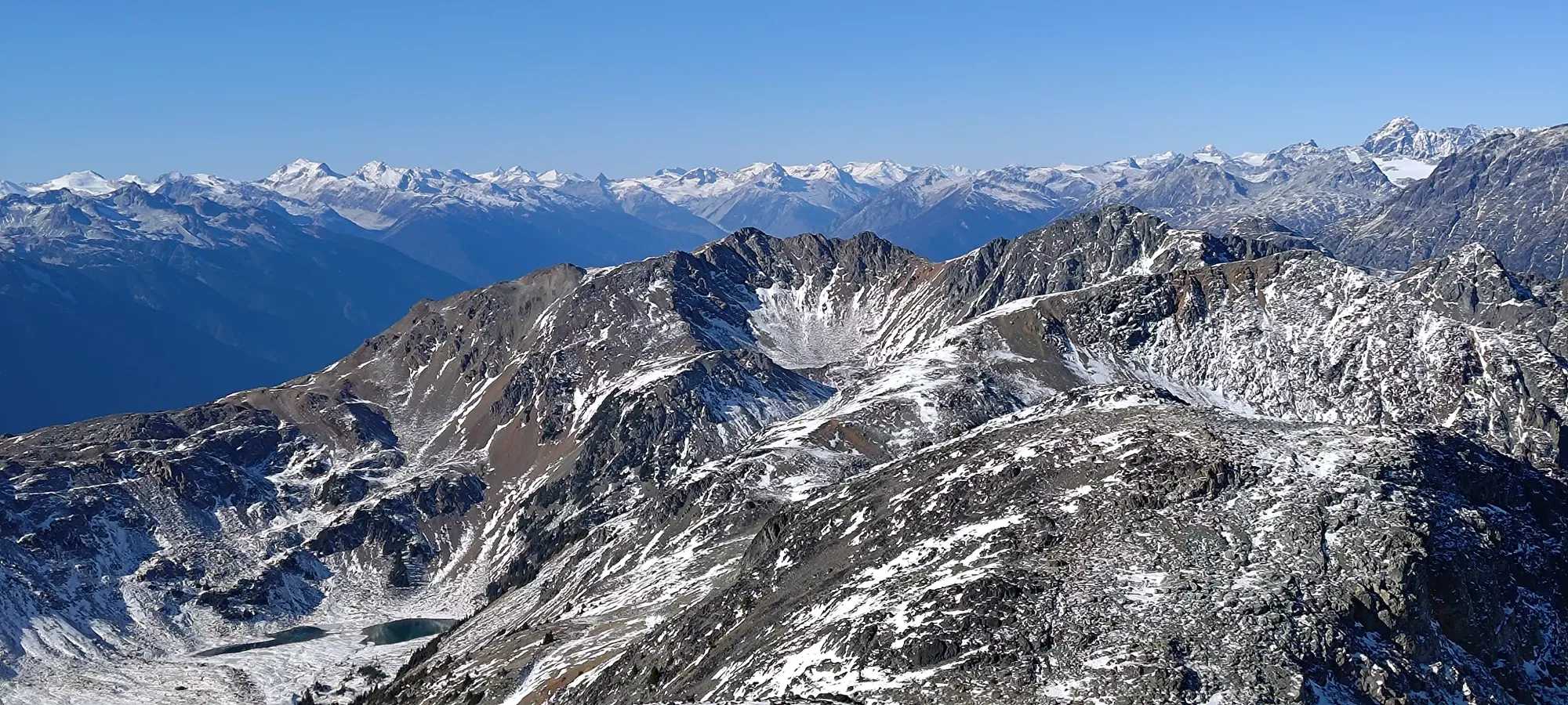
On the way up this little ridge, we realised we were already heading up towards 7:00 mountain anyways, so we may as well just bag that first and then do Sun God second, to avoid going up part of the ridge, down, then back up it later to bag 7:00 second. The original plan was to get Sun God first since it is "more important", being over 600m of prominence and higher than 7:00, but since we had lots of time, it felt like a better choice to pivot at this point. So, we continued up the ridge, which at this point no longer had a discernible trail, and we just followed a combination of "the easiest terrain" and "the general direction of the GPX tracks we had downloaded". Tanveer ditched his pack around this point, as we now were confident we'd definitely be returning to that point.

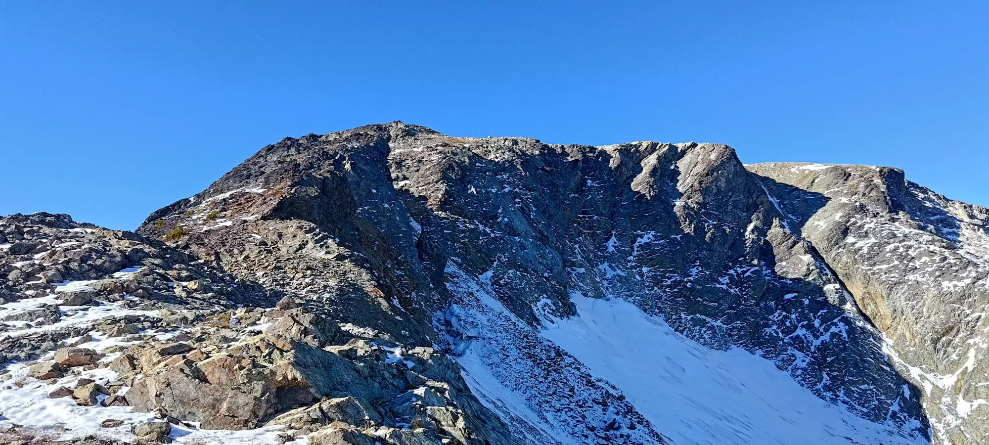
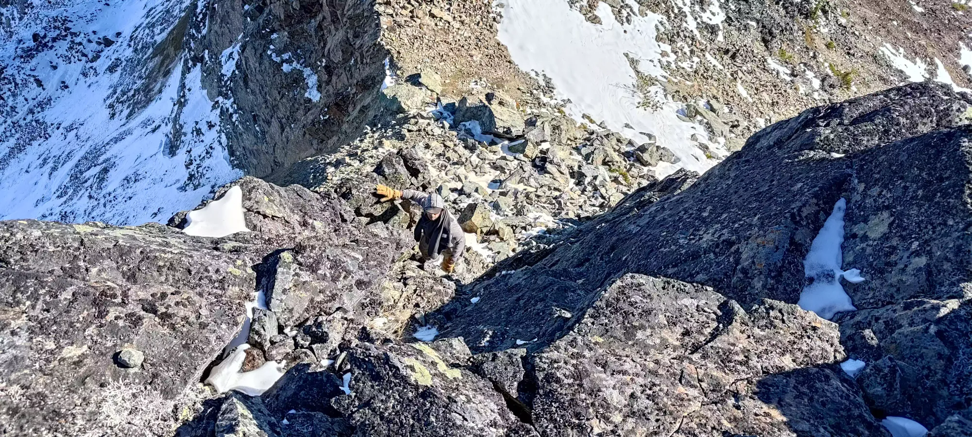
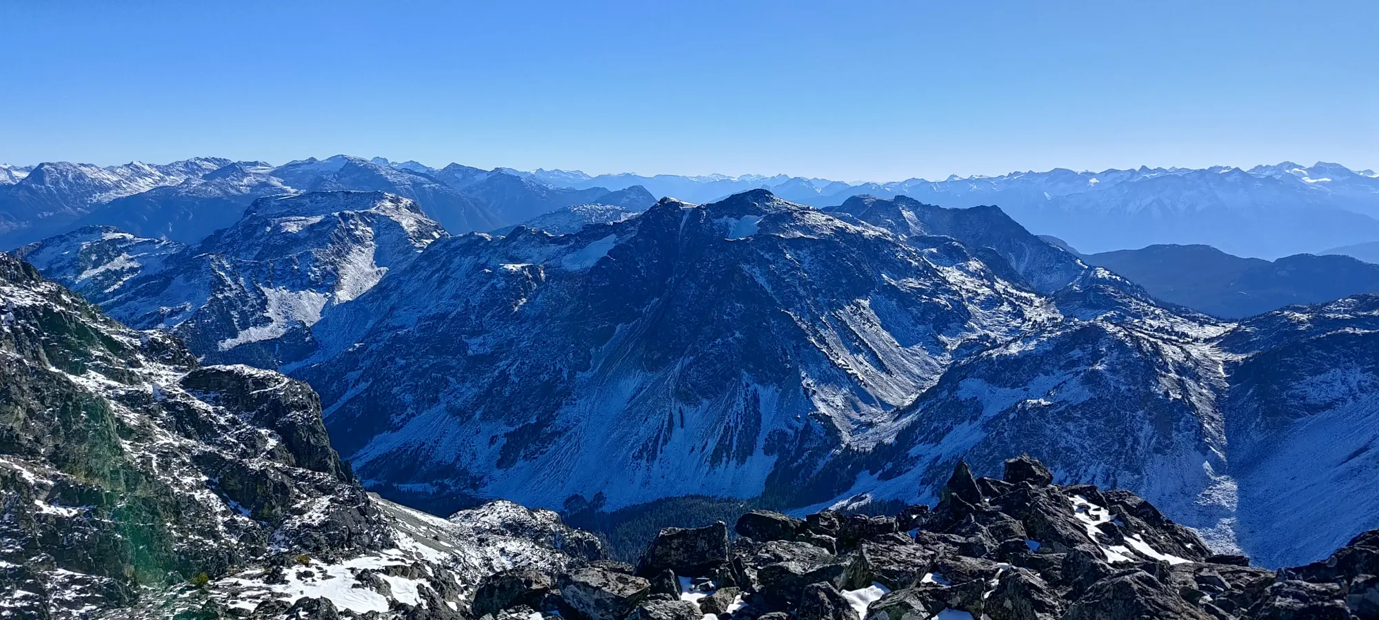
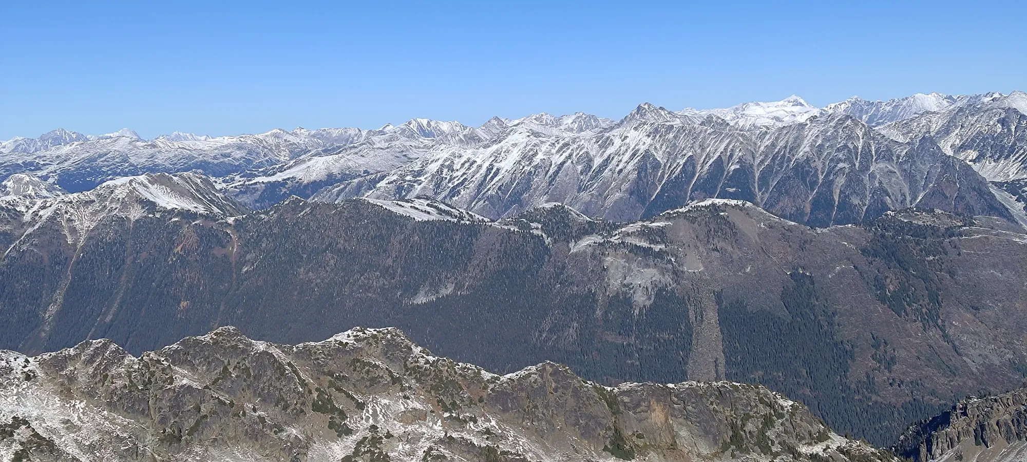
The ridge was pretty uneventful, largely just walking up snow-dusted rock. A couple spots got a bit steep and required heavy use of poles or some light hand-support, but I'd be strained to even call it scrambling, for the most part. There were a lot of small false summits, where you'd crest what seemed like maybe the top, but there would just be another higher point further along. But, since we were around 2 hours into the day, and less than 1000m of gain into it, it wasn't as soul-crushing as if you were on that same ridge and totally exhausted.

At around 2250m we hit the "crux" of the day, a short, maybe ~6m scramble up where you actually had to touch the rock. It was still totally class 2, but enough to be fun.
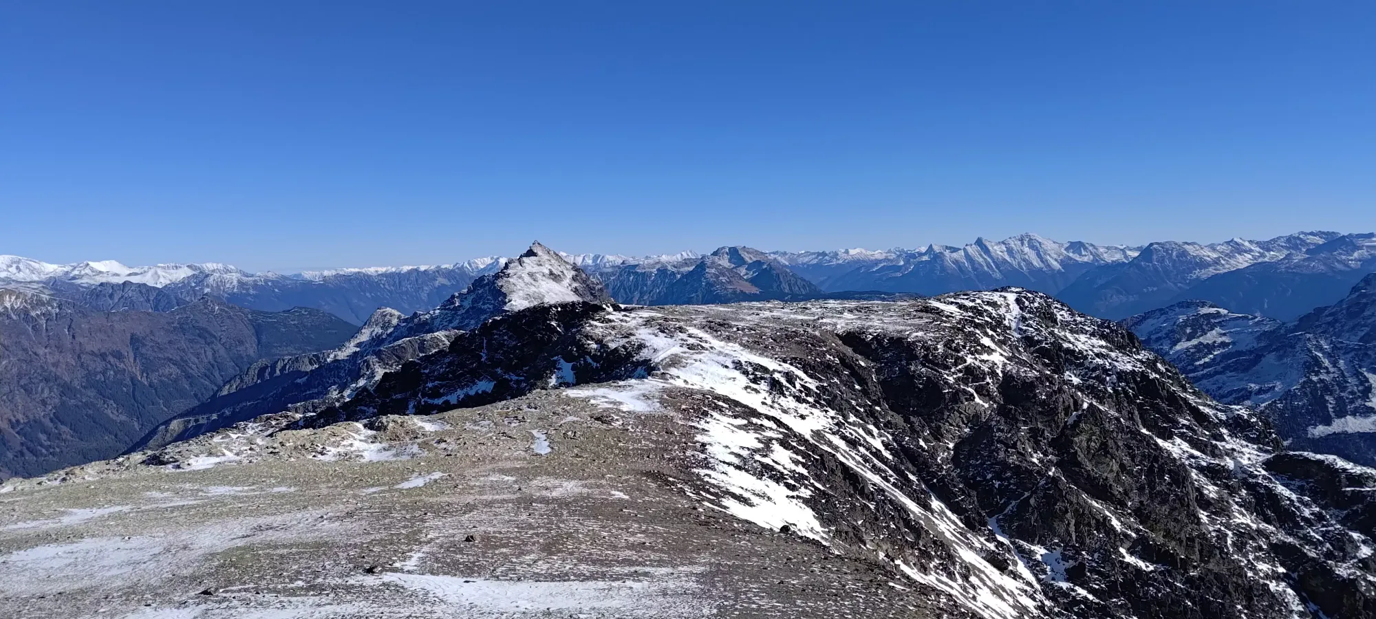
Past that, it was just more walking on the broad ridge, until we hit the last false summit at around 2300m, where the ridge really broadened a ton, and we could finally see the actual high point at the end.

The final walk was just that, a simple walk. We summited at about 12:40pm, with absolutely gorgeous conditions: no wind, clear skies, and temperatures perfect for being comfortable with just a baselayer on. We hung around for about 10 minutes to enjoy the excellent views before starting the walk back.
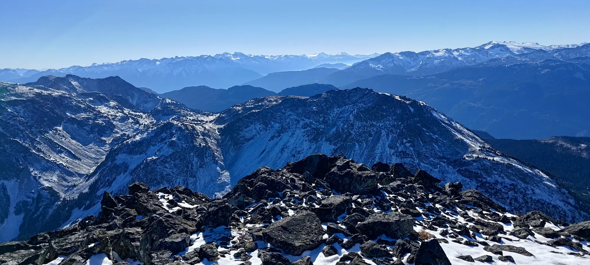

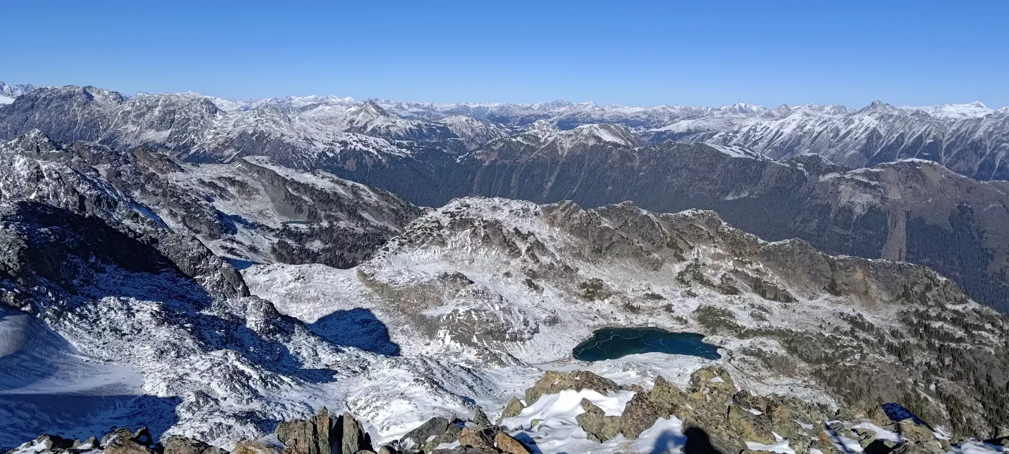
From the summit, it was a pretty basic exercise of just retracing our steps. I did a little extra wandering around and exploring to see if I could find better terrain, and in a few places I found some fun optional scrambling or more efficient ways to avoid small undulations, but largely it was the same. In just over an hour, we were back at Tanveer's pack, and after checking the time (just after 2pm), we confirmed we'd have plenty of time to get back to the forest, if not to the car, by dark, so we split off towards the little lake at the bottom of the col. The rest of the trip can be found in the trip report for Sun God Mountain.

GPX Track + Map
