Mount Weart (Armchair Traverse) - October 16 2022
The second half of the Armchair Traverse, with much scrambling, a forest fire, dark descents, glaciers, and unmapped lakes, even. All sorts of fun on this one 😅

Wedge Group, Whistler, British Columbia
2835m
This is the second (and much more interesting/fun) half of the Armchair Traverse, and picks up from the top of Mount Cook, which we'd ascended to start the aforementioned traverse.
After topping out cook in a bit-longer-than-we-hoped 6.5 hours and faffing about for another forty minutes at the top, we finally got our butts moving at about 1:50pm. With the lateness in the year of this trip, that put us only 4.5 hours from sunset. Given we were traversing a famously hard+long scramble, and down terrain we didn't come up, I definitely wanted to get us going along the ridge with some haste, hoping we could get across in 2 hours and down in another 2, getting us back to known and easy ground before dark. However, as you'll soon find out, that wasn't quite the case...
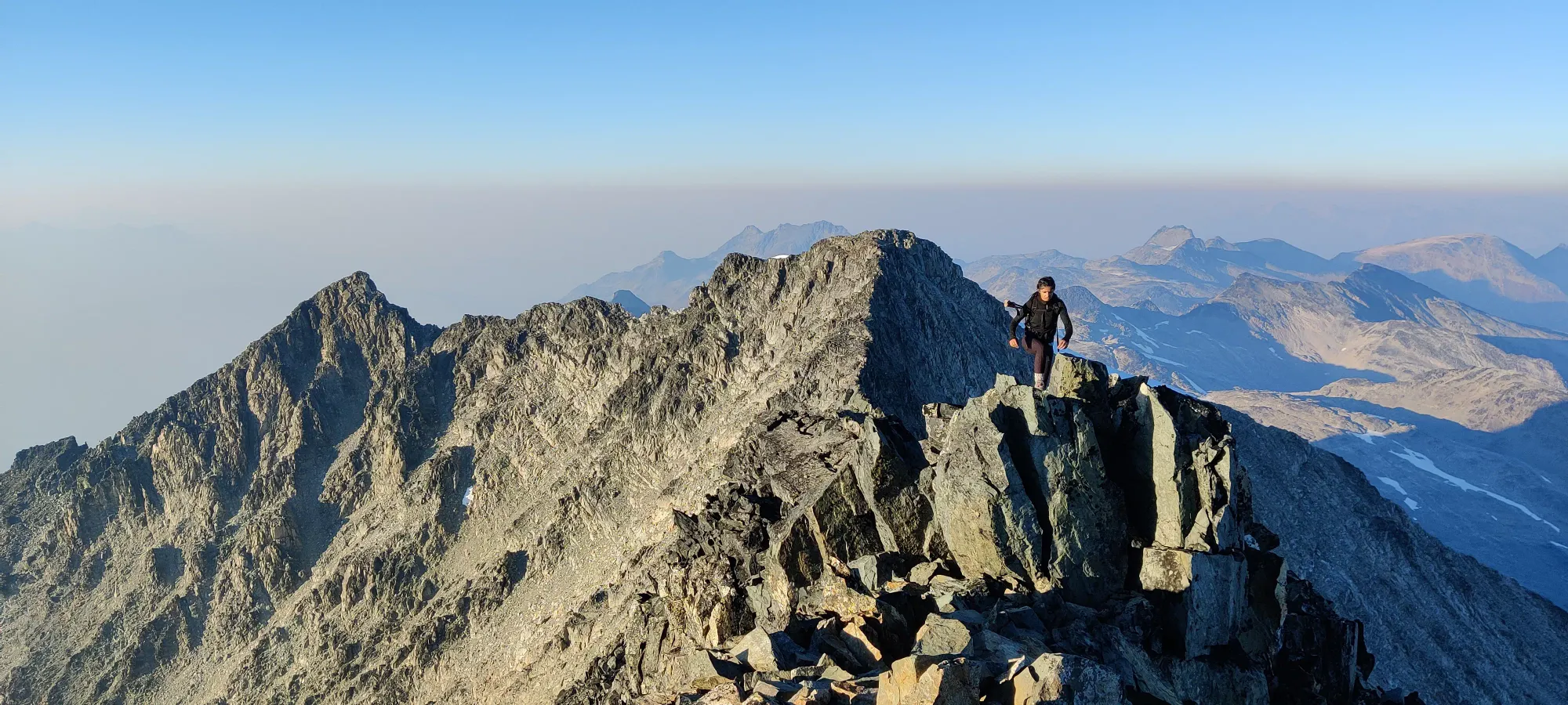
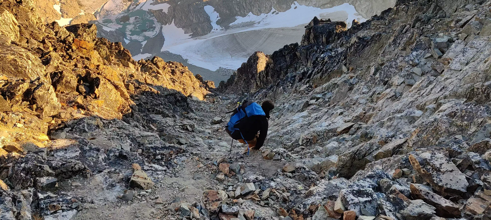
We started off somewhat slow getting down the notch from Cook's peak to start the traverse. It's a short scramble without any difficult moves, followed by a larger 60m descent to bottom-out the col, and then the real scramble begins.


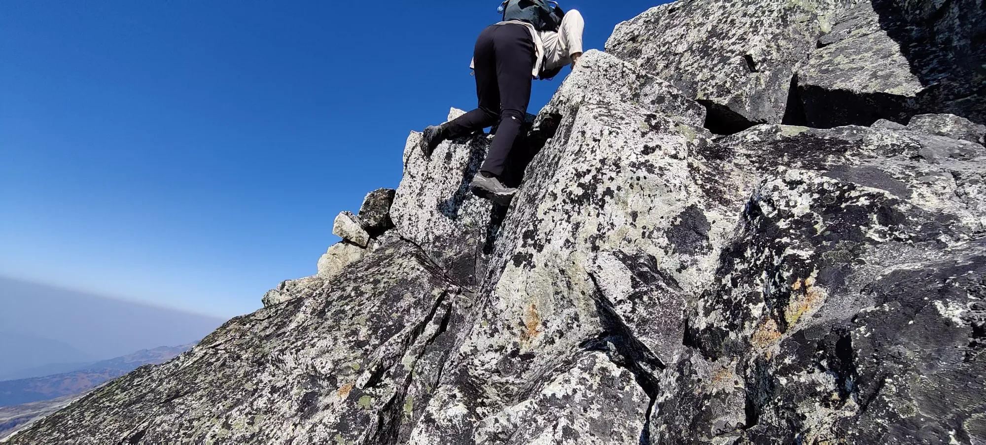
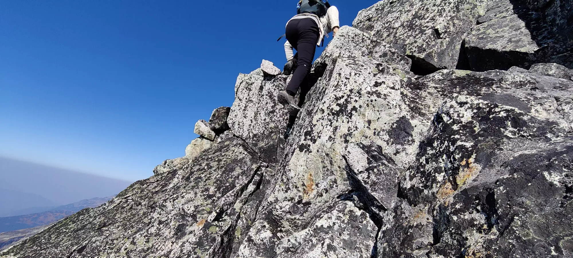
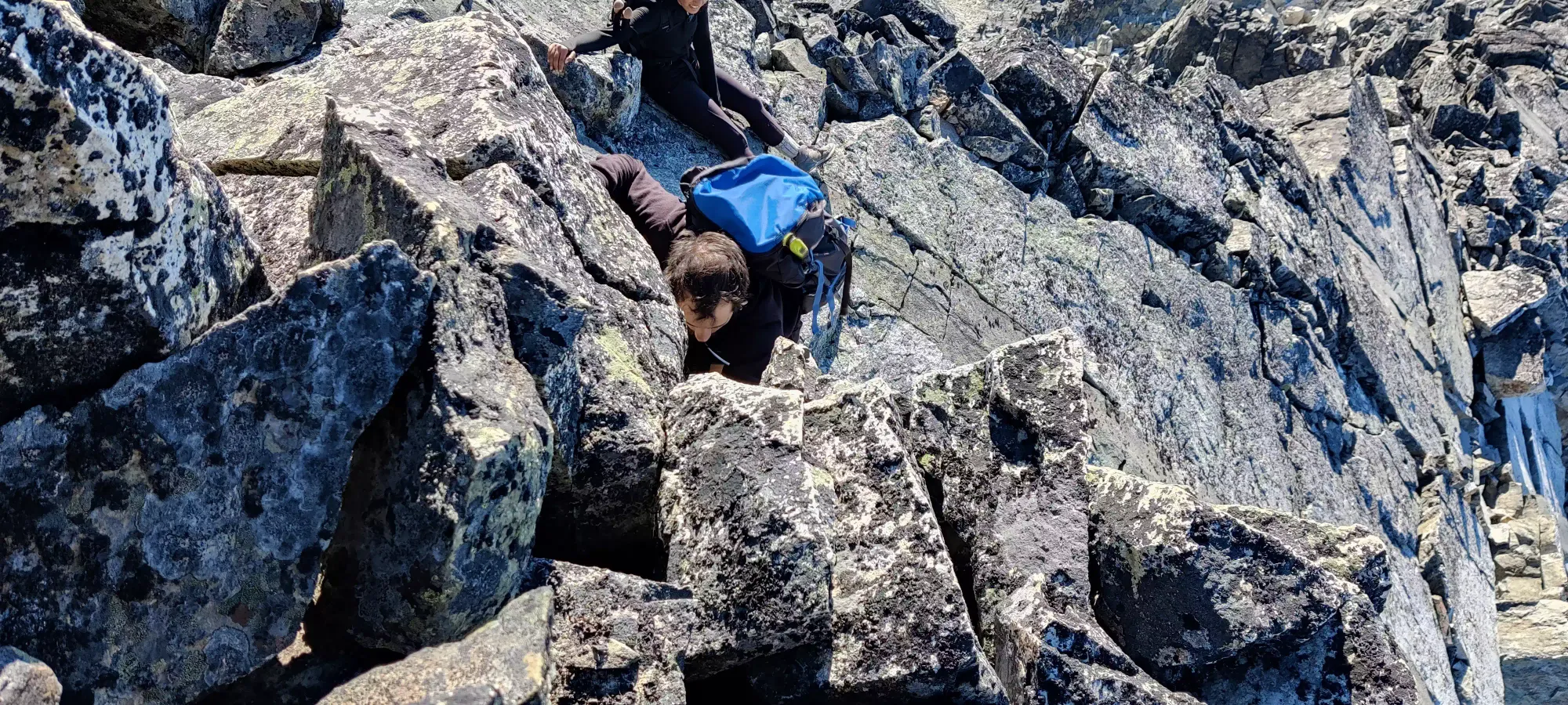
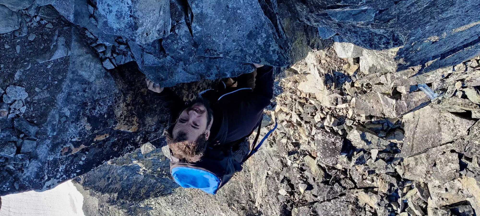
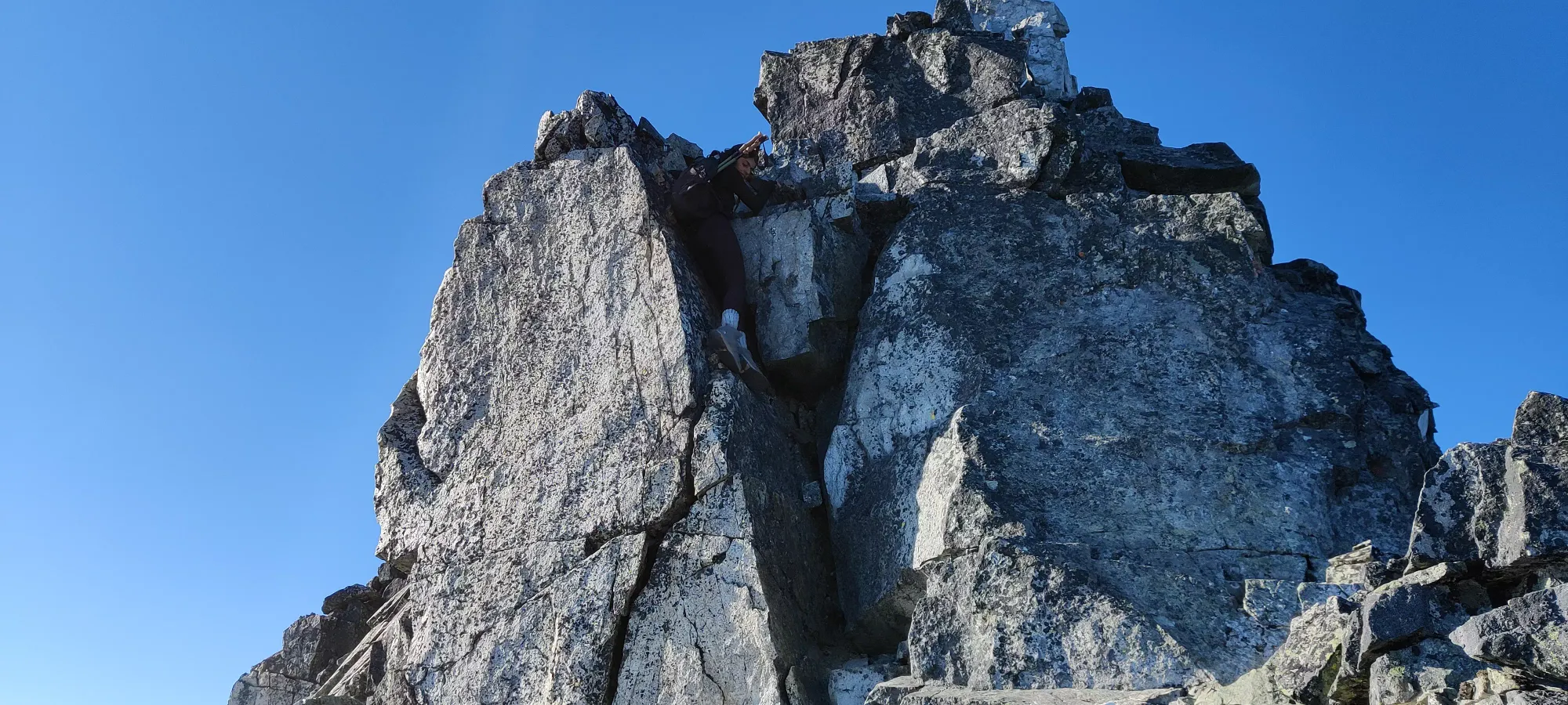
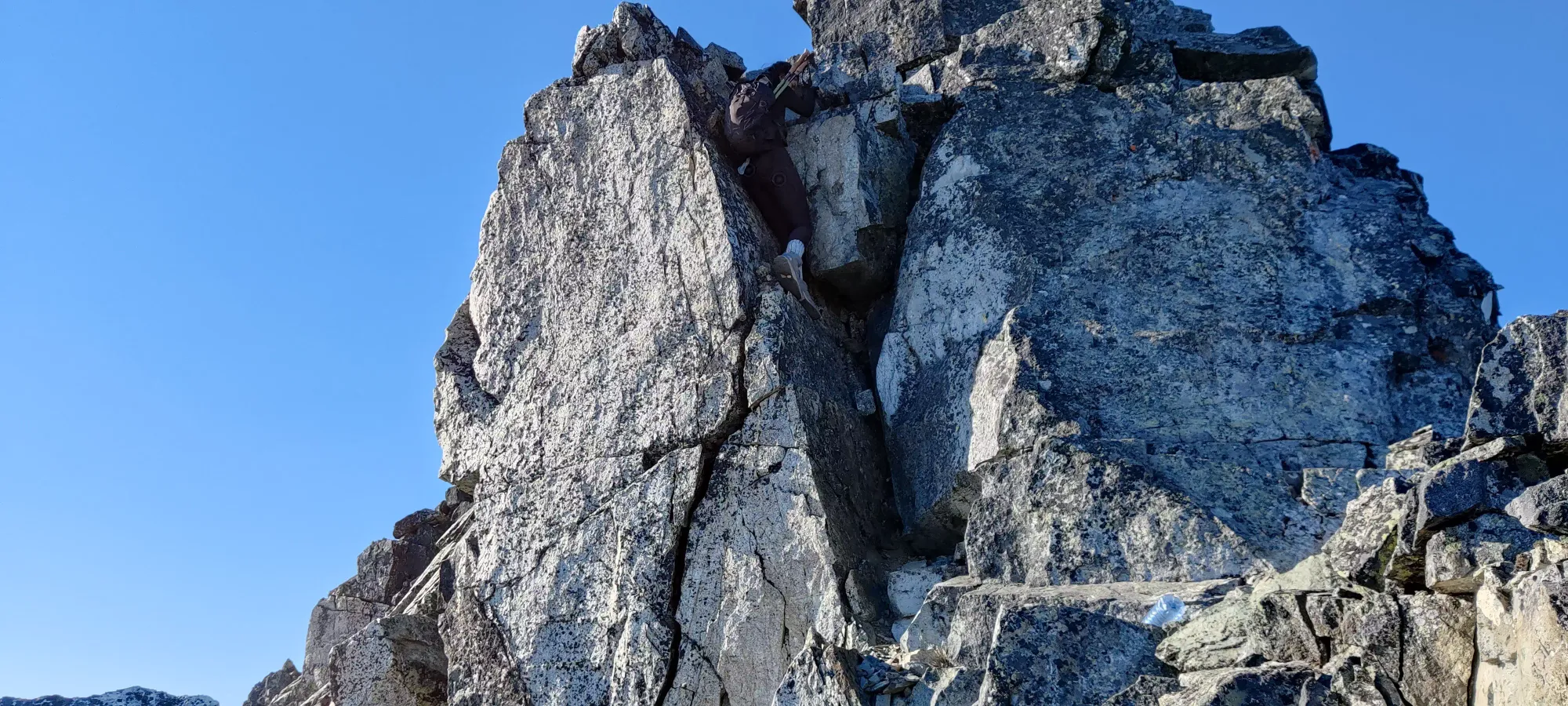
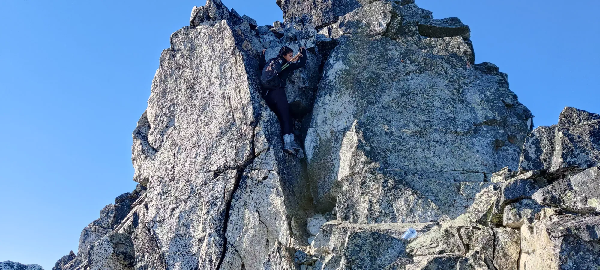
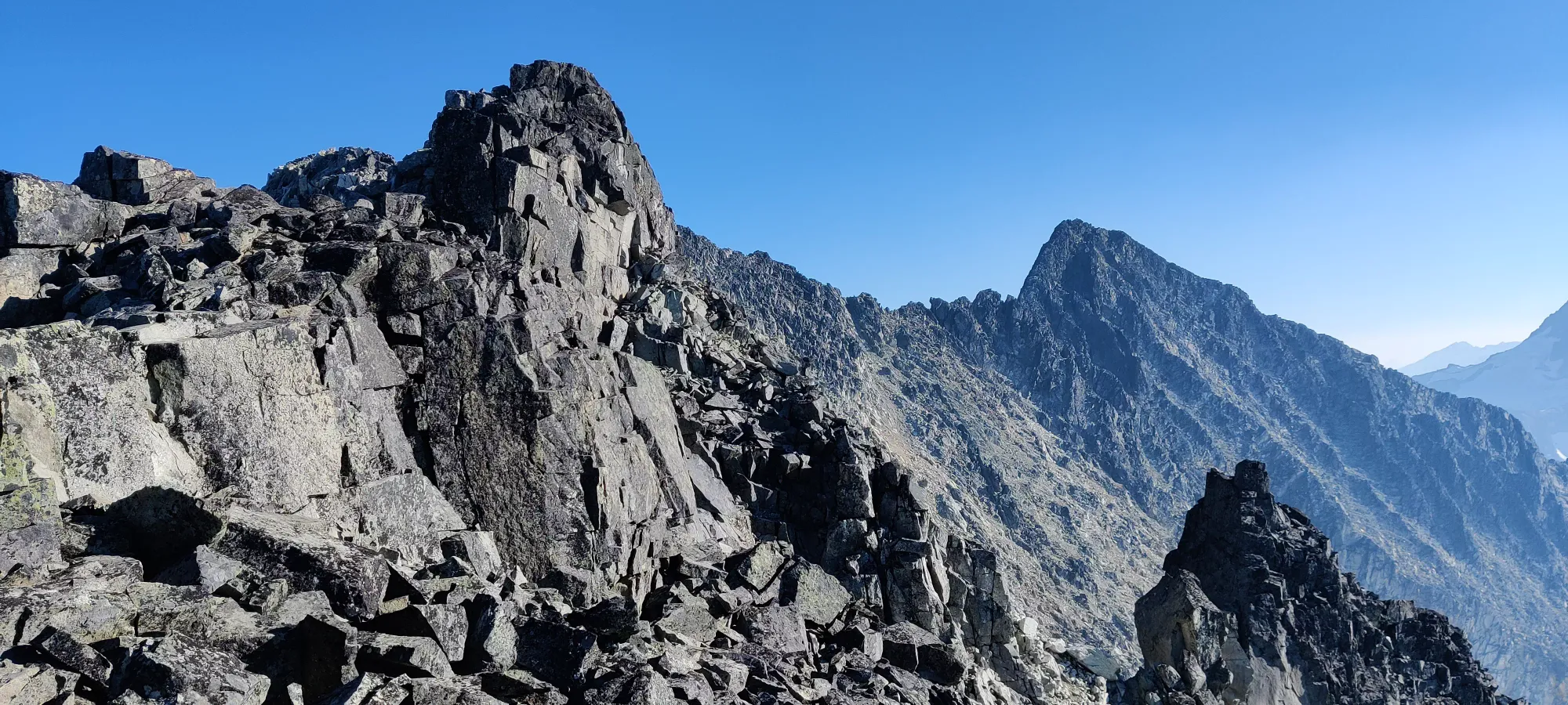
Sadly, once we bottom the col out, things started shaping up to be an, uh, interesting day. I had expected based on our experiences on Robie Reid that Nikita would be slower than me and Logan in the scramble, but things were slower than I had anticipated. There was a small amount of hiking, a good dose of class 2, some class 3, and some class 4+ terrain as well. Of course, me and Logan being who we are, we also chose some routes that ventured into 4+ terrain that weren't strictly necessary for fun, but in retrospect that didn't turn out to be the best as Nikita wanted to have people routefind for her, and wasn't happy taking the routes we pointed out as easier, and getting her through the hard lines took more time. It also didn't help that partway through she revealed she wasn't feeling well, and had an upset stomach. I'm not sure how much this was a factor in the scramble given her speed in the walking sections, but the end result was slow progress, we made it to the first false summit at 2750m in 2 hours, when I was hoping to be at the true summit.
For those who aren't experienced scramblers, frankly, don't try this. It will take forever for you to coax yourself through the many hard moves and involved routefinding choices to get across. For those who are comfortable, I suspect 2 hours is plenty to get across, as long as you don't waste too much time picking hard lines for the sake of it. If you want to do that, I recommend being faster in the hiking sections than we were and/or going earlier in the season to get some more daylight for shenanigans.
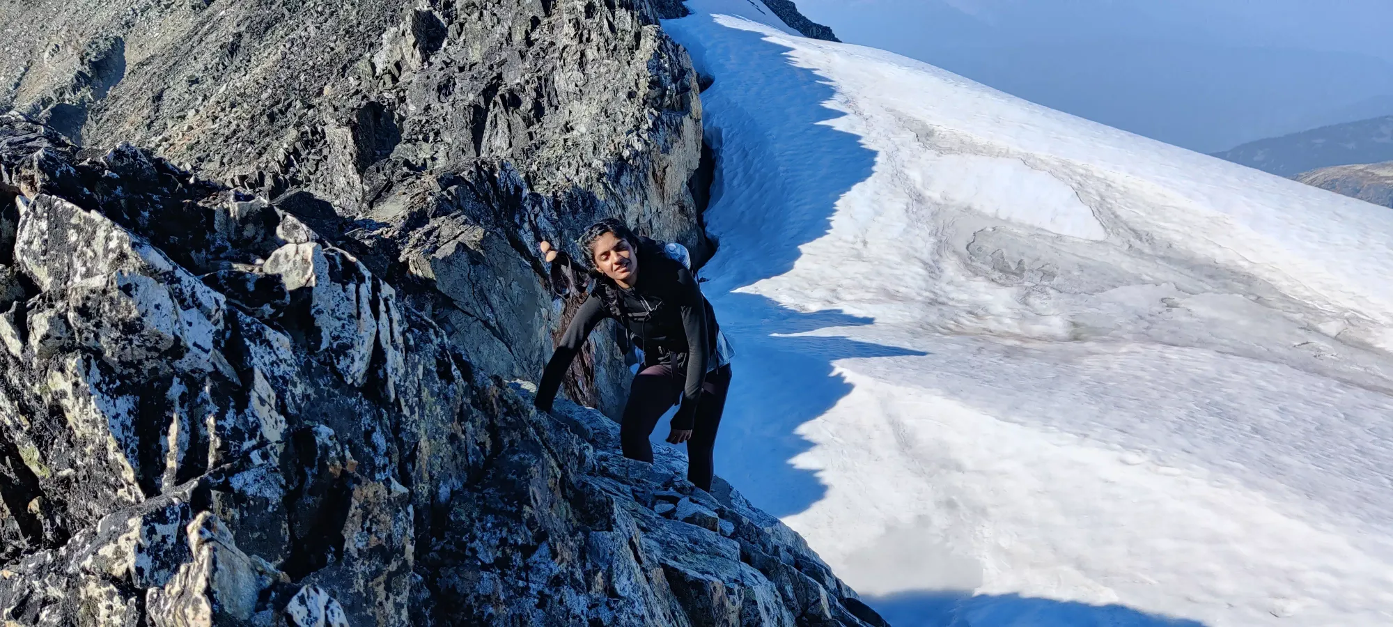
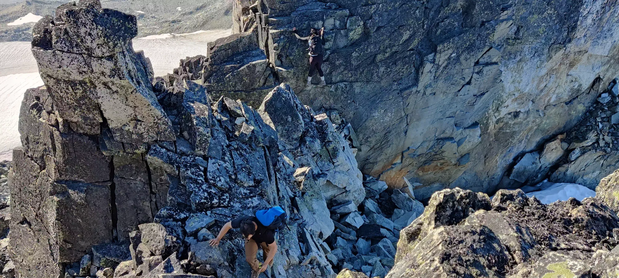


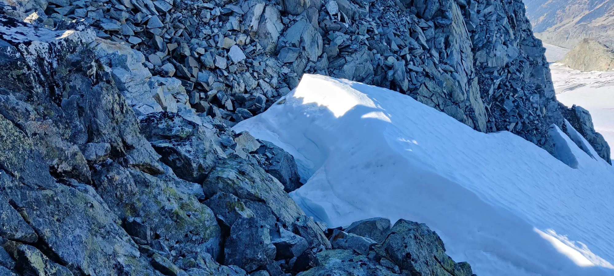
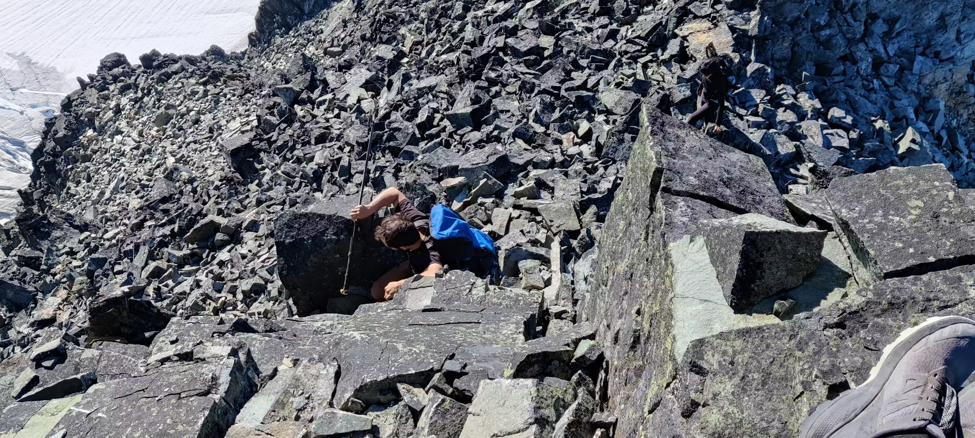

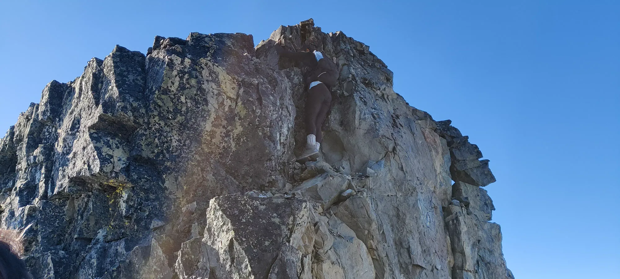
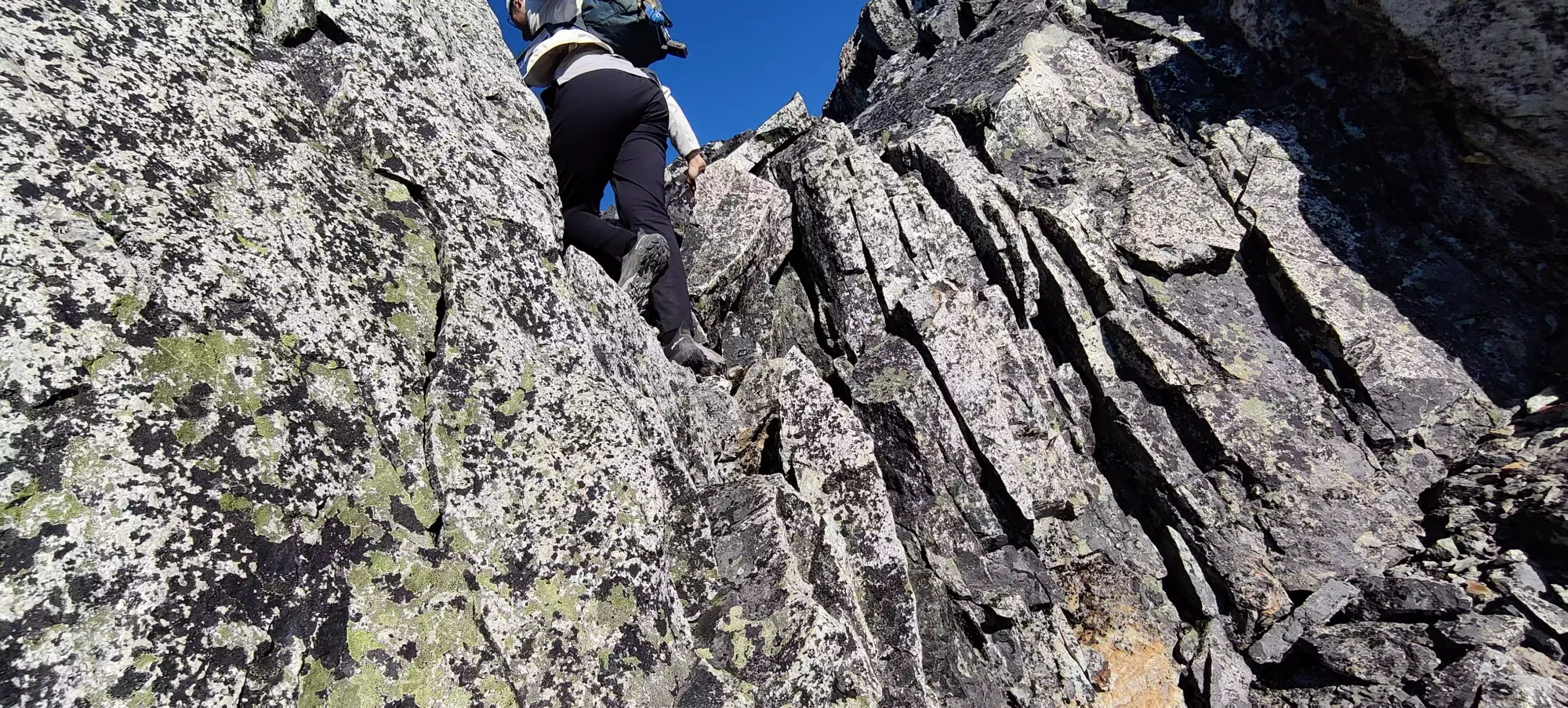

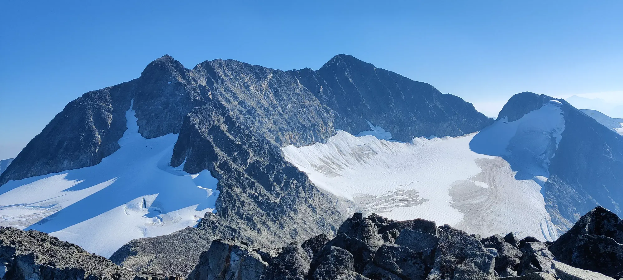
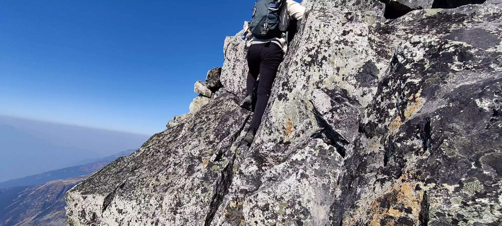
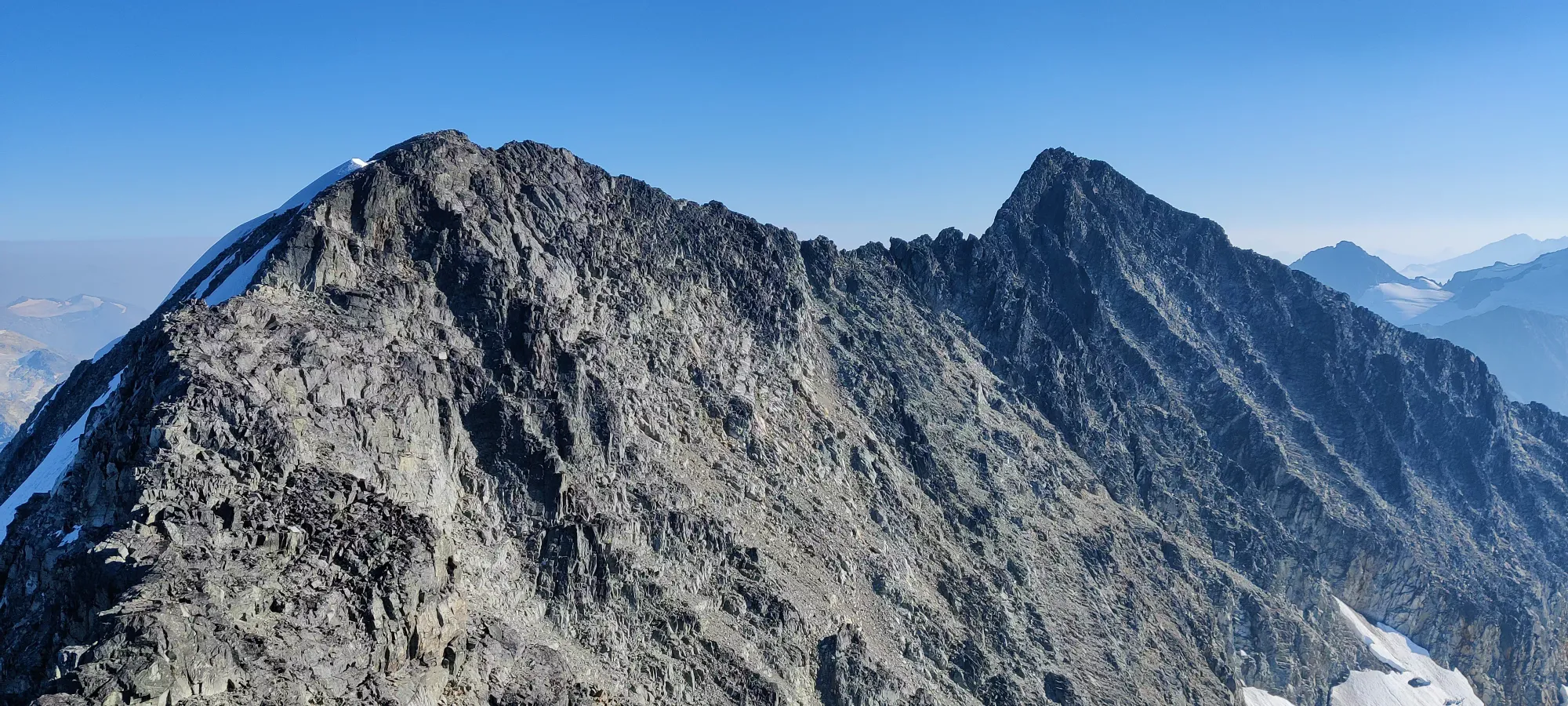
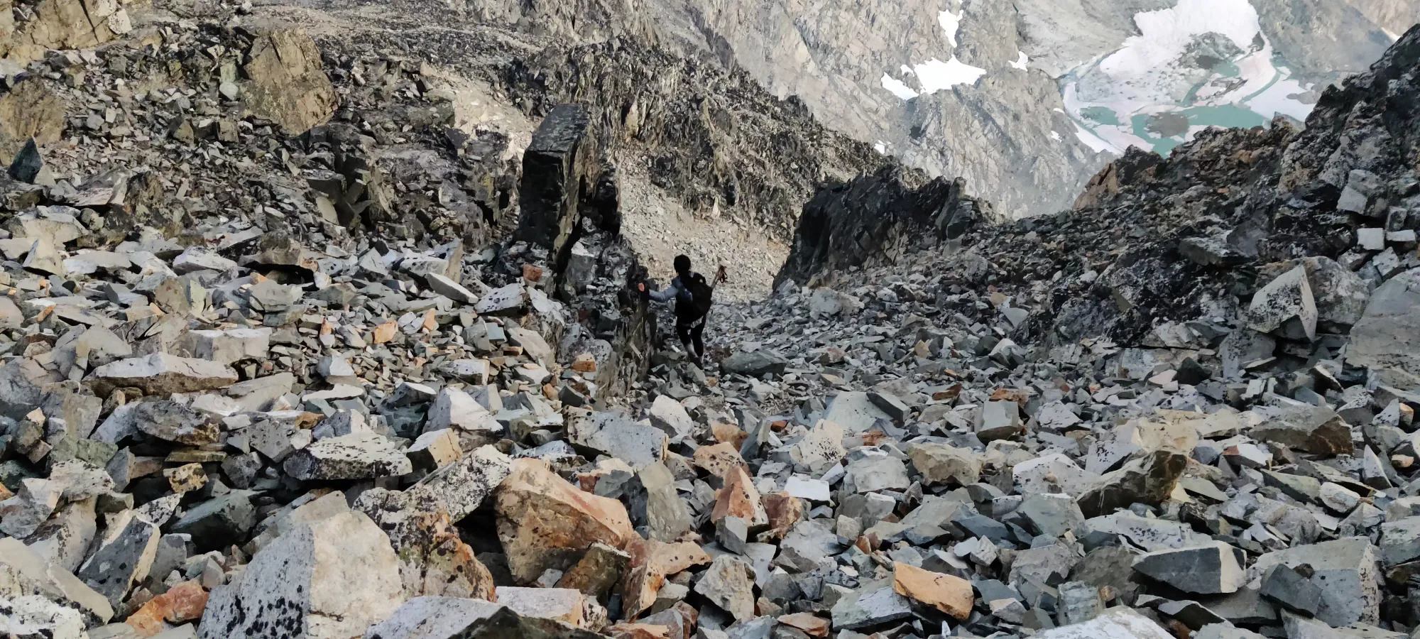
I feel like this wall of pictures needs some text to break it up, so here's some sentences. The terrain on the ridge can probably be called class 2-3 with maybe a couple class 4 sections, but we definitely added in quite a few 4+ sections on our own. If you're wanting to follow our GPX, keep in mind the small turns we make on the ridge are largely fun-dictated more than anything else, so you should make your own decisions based on what terrain you're comfortable with. This isn't a route to try and complete without those skills.


Once we arrived on the false summit, we took a break and considered our situation. Nikita had started to really vocalize her discomfort at this point, and was considering a SAR call. Me and Logan both have a pretty staunch "only if there's no other choice" stance when it comes to calling for ourselves (partially influenced by our agreement to donate $1,000 whenever we have to do so), so we didn't provide any encouragement to do so, but we also tried not to discount it as an option either. It's hard to say what the right thing to do in these situations is, you don't know how the other person is really feeling, what they're used to being able to tolerate, etc. All I can say is we stocked up on snow to melt as she said she felt like she might throw up (which is a pretty dehydrating activity), and tried to give as much support as we could. At this point, we were pretty confident a no-dark descent was out of the picture, and were just hoping to reach the lake by sunset, although even that was seeming less likely.
From there, it was a bit easier terrain down 20m and back up to 2780m, as that took us "only half an hour". There were still a few spots we managed to have fun in, at least. It helped that at this point Nikita had given up on doing all the hard "extracurricular" lines me and Logan were doing, and started taking the easier routes we pointed out, at least when they looked easy enough for her to feel confident without having to follow another's holds. We got to this next false summit at 4:30pm, now only 2 hours from sunset.
Due to our rapidly dwindling time in the daylight, we didn't linger on this bump, and pressed on quickly. The descent, at least, covered some horizontal distance quicker than the rest of the ridge, and we set out on the last big section of scrambling to Weart's summit.
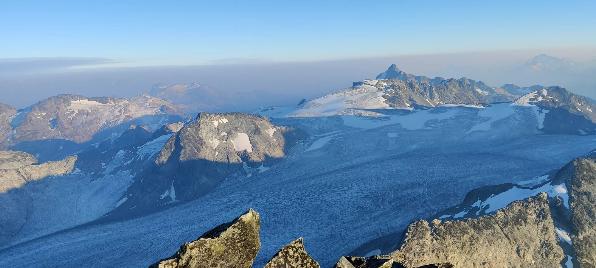
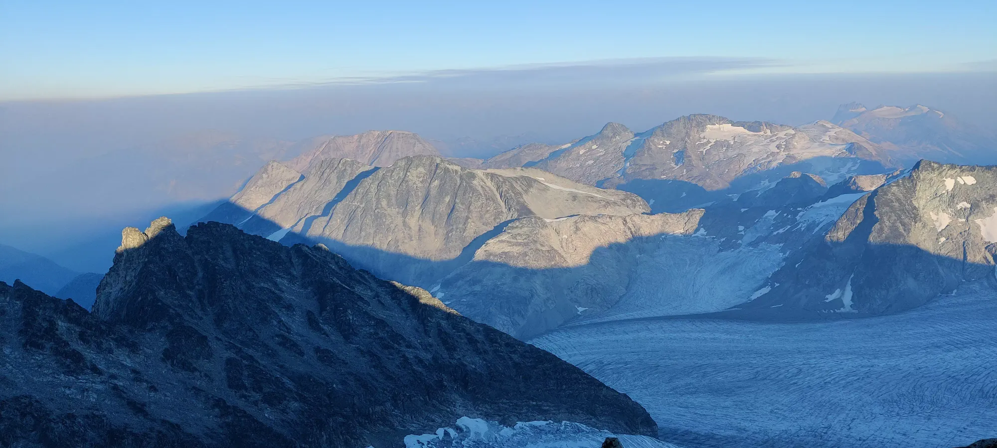
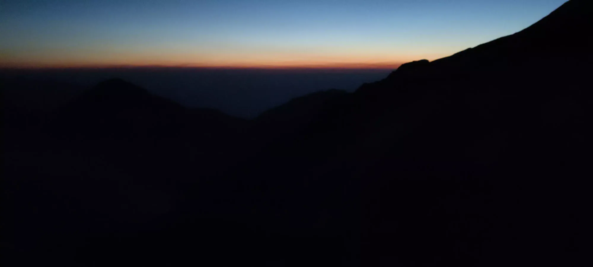
At about 5:00, or 10:15 into the day, we hit the final bump before the true summit. We'd have continued straight on from there, except I saw an interesting thing looking southwest toward Green Lake in Whistler: a bright orange glow on the ground. We quickly realized this was a forest fire, and since I happened to have excellent signal (Telus reception is pretty good on this trail), I called it in. I gave the best details I could, but with the smoke definitely having got worse, it was hard to give exact details. As of the time of writing I don't see it in the BC Fire Dashboard, so hopefully it was extinguished. Remember to call *5555 if you see anything when you're out and about in BC.
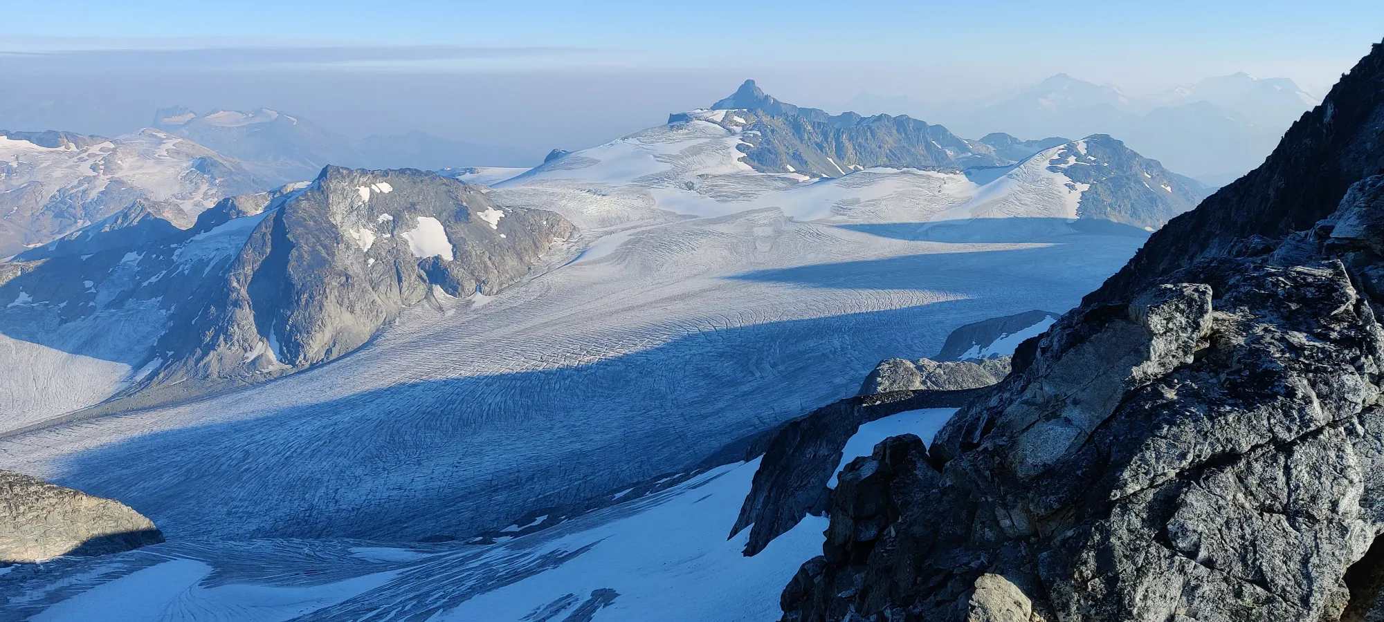
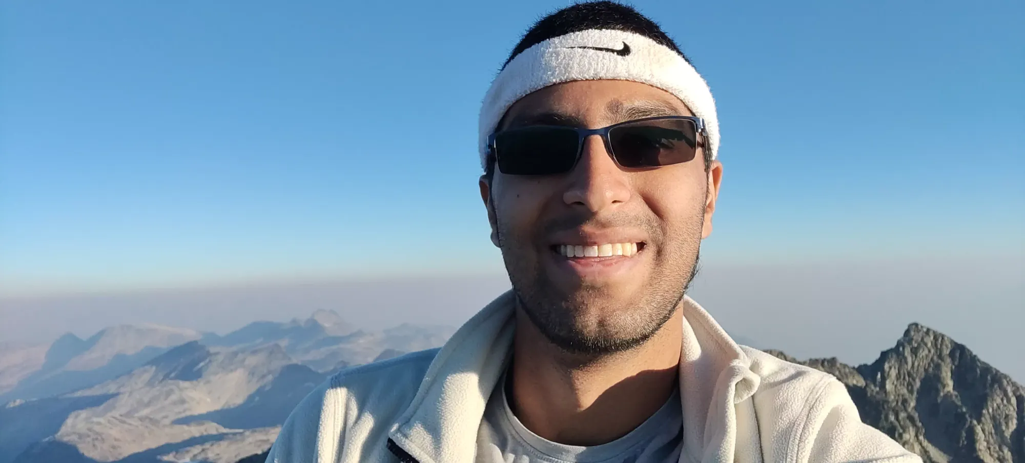
After that call, we spent another 10 minutes topping out, where we took some pictures, had some food, and tried to wrap our heads around what was going to be a very unique descent.

After about a fifteen minute break, we headed out from the summit at 5:40pm. Our goal of "lake by dark" was now "non-technical terrain by dark". We discussed the SAR option for Nikita a few times before this point, but she didn't feel like it was the best choice, and at this point, it was pretty futile as it'd soon be dark and it'd be a much more involved operation to get her out (not to mention the lack of places to land and difficult approach to our position meant no easy extraction options). Unfortunately, the effects of her "unwellness" had now come to include some inability to think as clearly as I'd hope she'd otherwise have, and things like inadvertent rockfall, losing grip on steep/loose terrain, and broadly "poor choices" had started to become greater concerns. The former was compounded by her lack of a helmet, and my admittedly poor decision to forego mine at home with the reason of "well we'll have to go slow anyway since someone doesn't have one". This put me in the back of the group, since letting Logan (who brought his) lead made the most sense, with Nikita in the middle, and me bringing up the rear or at least coming down parallel to avoid the rockfall danger.
Now I'm not entirely sure how this happened, but we took the wrong gully from the top, and it took us quite a while (I think just about an hour) to correct our mistake. This resulted in quite a bit of loose gully descent, with quite a few crossings over between them, hoping the ridge to skier's left we were cutting across would lead us closer to the trail and not just cliff out. The terrain wasn't horrendous, honestly, and if we were all feeling well and thinking straight, it wouldn't have been a significant delay, I imagine. However, getting Nikita to get through the unstable terrain safely in her mental+physical state whilst trying to routefind and get ourselves back onto the trail before dark was not a simple task. At least the gullies had lots of ledges to step down instead of just sliding, and we managed to cross over between gullies with only a few scramble moves of note.

I suspect we got onto the trail around 6:30-6:45, just before things got into headlamp territory. This was just above 2600m, so well above the lake at about 1900m, or the car all the way down at 750m.
Well, I say "trail", but it really was just "a collection of boulders that happened to be where our downloaded GPX wanted us to be", the terrain was indistinguishable from that 10+ metres in any other direction. This continued tediously for about an hour until we got down to 2370m, where we refilled some water, and then hit our next problem: an unexpected lake.
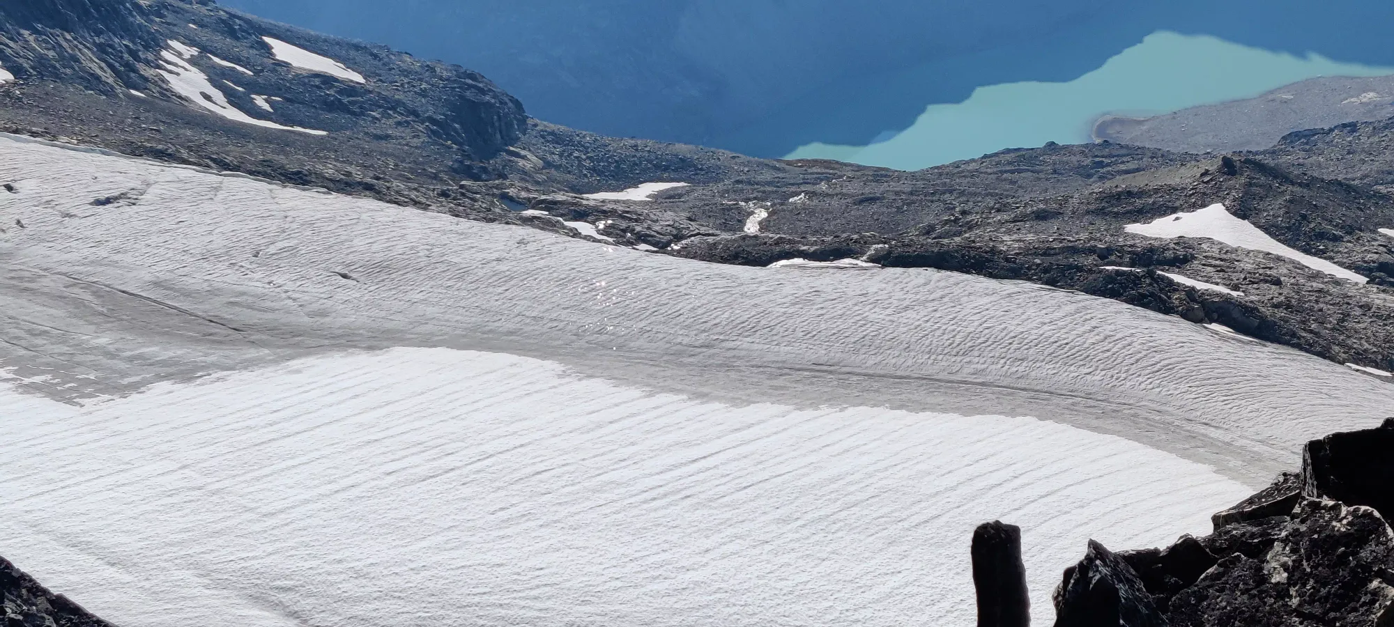
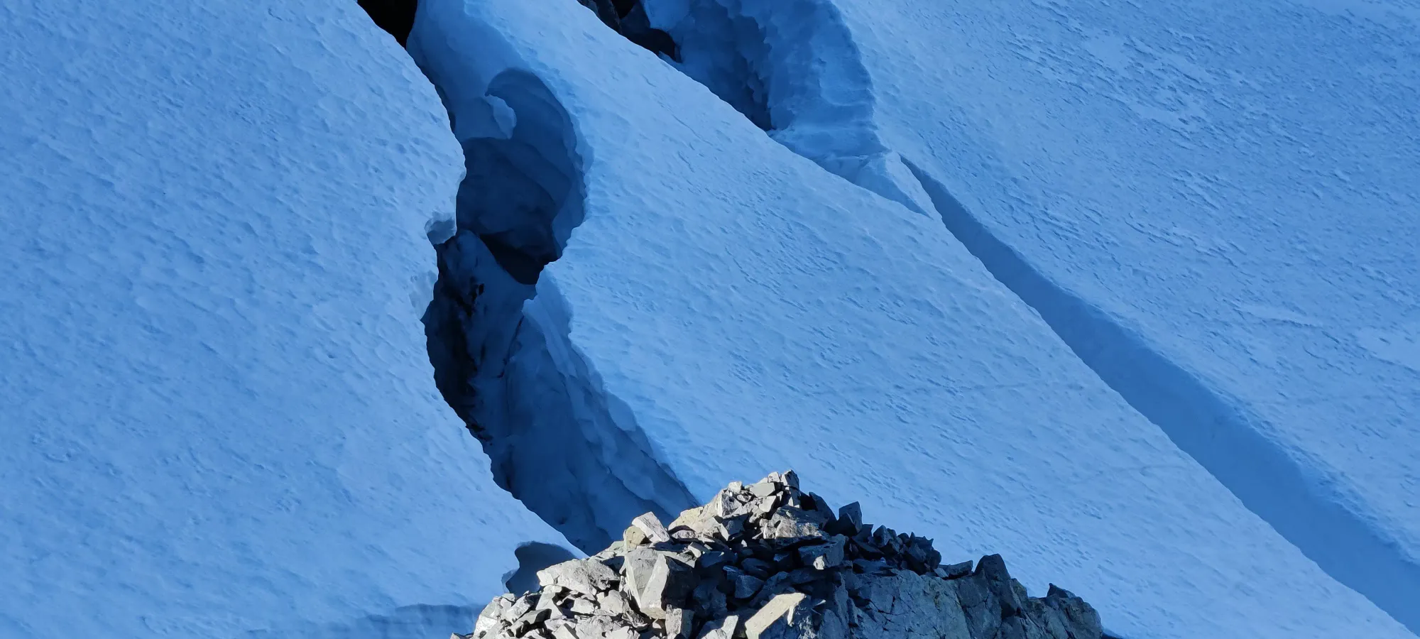
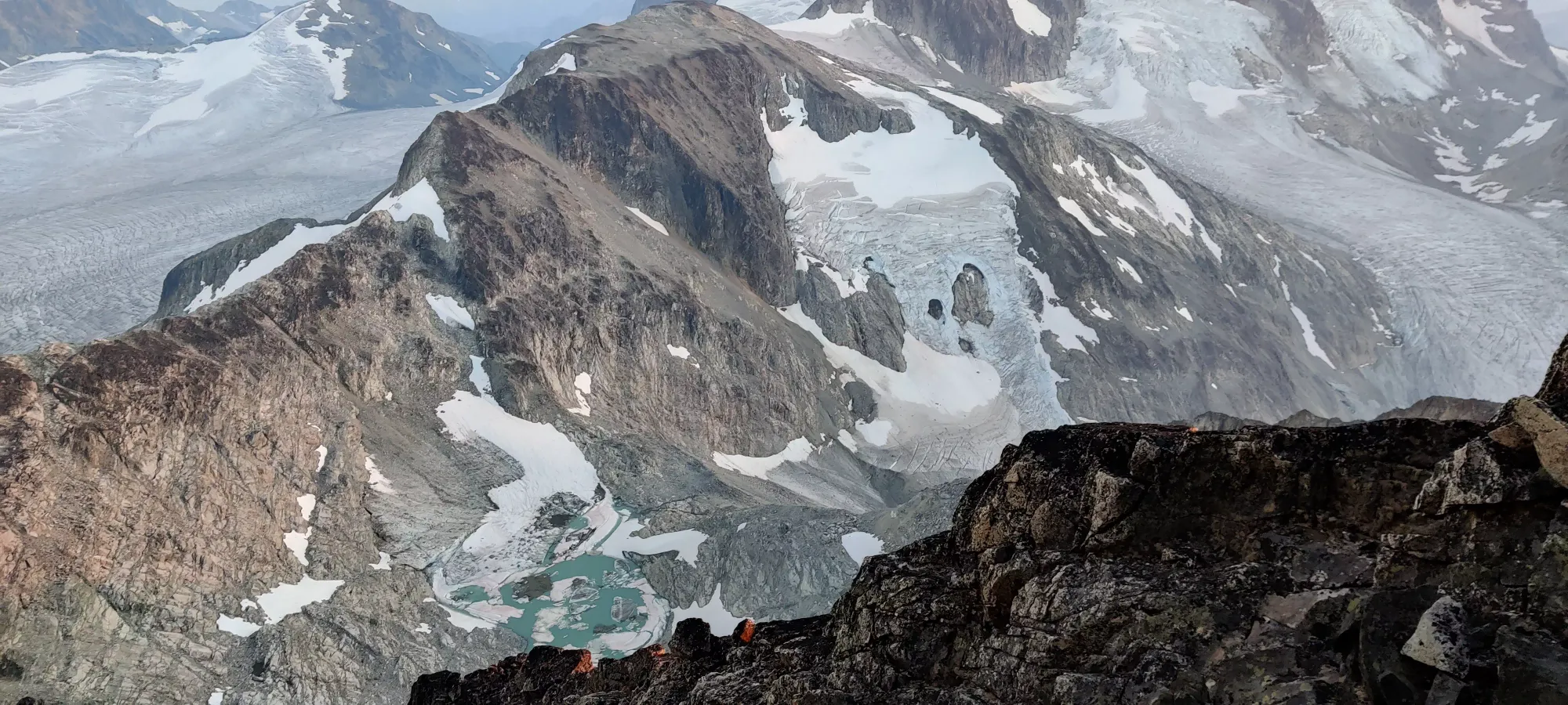
Remember that picture all those words ago where I said "this lake will be important later"? Yeah, that one. See that lake isn't actually on any maps we had access to, or that I've found online. Seems it is a new treat courtesy of global warming. It also happened to be right in the middle of our GPX track. Without light to see everything around us, and with no way around we could see with our headlamps' range, we figured we had to just trust the GPX and head forward onto the semi-frozen lake, and just take care to avoid the myriad holes, thin spots, and "just water" around us.

Our GPX quickly brought us to the "shore" of the ice, wanting us to cross tens of metres of water. That didn't sound very pleasant in the middle of the October night, so we spent some time wandering around, investigating a series of floes that looked like they led across to where the GPS wanted us to go. They did not appear particularly stable, nor did we see them actually exit all the way. The way to our right seemed to be just water, so left was our only option, toward Wedge Mountain. This turned out to be the right call, as we found ice to cross, and that eventually deposited us into moraine I think about half an hour later (no more pictures to cross-reference, so this is based on hazy memory a couple days later).
The next hour was a disgusting time spent descending from 2350m to 2150m through a steep moraine, complete with unstable rock everywhere, frictionless patches of dirt, and a "path" that meant basically nothing. Nikita took a particularly unpleasant-looking slide for about 7 seconds, gaining WAYYY too much speed down one of those dirt patches, which was rather ugly to watch. Thankfully she was free of serious injury, but the fact that she just decided to send it down there despite warnings from both me and Logan to the contrary reinforced our desire to get out of hazardous terrain, not that this desire was in any way actionable.
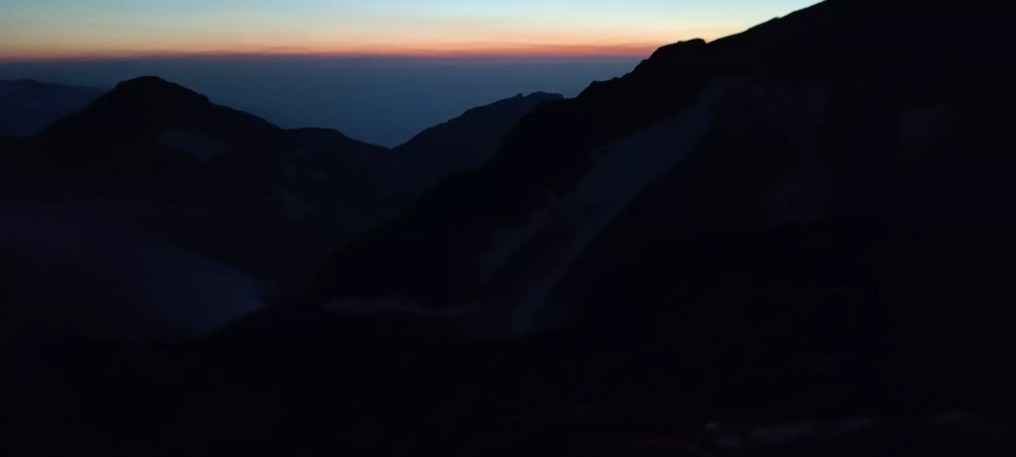
After this, the next hour and fifteen minutes were spent going through slightly less terrible terrain as the slope angle evened off a bit. The rocks got a bit flatter and there were even patches of just dirt/mud/water, and even a short section of large, clean rock cliffs to walk across. A lot of breaks were taken up to, including, and past this point, but there wasn't much getting around that. At least when we took breaks we got to turn off the headlamps and gaze at an absolutely gorgeous night sky my phone is sadly completely incapable of capturing.
The relief we felt when we finally hit the tip of Wedgemount Lake at 10:30 was indescribable. At last, we had even ground, a fairly well-defined trail, and I had hope we could pick the pace up and actually get the hell out of dodge. Fifteen minutes brought us a few metres from camp where a break was called for (incidentally it lasted the same amount of time). After that, we spent a few minutes at the campgrounds checking out the emergency shelter, and got going on the last leg.
We spent about 40 minutes getting through the gully section of the trail before the forest, taking extra time because Nikita (who was headlampless) didn't feel comfortable navigating this section without poles in one hand and the other free to grab rocks, meaning she couldn't use her phone for light, and was still relying on us for lighting the way. It wasn't as bad as when we had to routefind in totally unknown terrain, but still not quite ideal.
After that, though, she was able to light her own way, and we had 2 hours and twenty minutes of forest descent to get back to the car. The grade of the forest trail is steep enough that you don't really get to rest all that much going down, nor can most people really run it (especially in the dark), so a lot of effort is wasted on stopping yourself from destroying your knees and/or falling over. Nikita moved at a pretty decent clip all things considered, and Logan actually started to fall back a bit, as he has never been a fan of descents. He did catch up though as Nikita still needed some breaks to get down, showing signs of tiredness (sleep-wise) along with the uneasiness from before and exhaustion. This continued until about 1250m or so where I think things slowed down enough for Logan to stay right behind us, and we were breaking every 100-150m of elevation lost. Our last break was at 1130m, where I kinda just thought "well the trail is pretty well-defined, so even if they fall back, they'll be fine getting out", and I decided more breaks were just not going to happen, and pushed all the way out. Logan fell back at first, while Nikita kept fairly close, if getting a bit further back as things continued. When I finally got out of the forest and onto the deactivated road, I didn't see anyone, but in a minute or two I saw Nikita catching up, and Logan just behind. Apparently, my decision was good, as it motivated everyone to just push through, and Logan managed to jog back up to us as the terrain became more his style.
We finally got to the car at 2:10am, WAYYYYY later than originally planned, and rather exhausted. I was physically fine given the pace we took, but mentally quite exhausted. Thankfully I managed to drive back to Squamish without incident, and let Logan take himself and Nikita back to the city. I somehow stayed awake long enough to heat up a frozen dinner and scarf it down before passing out on the couch, and needless to say I skipped my morning meetings the following workday.
So... what do I think about the Armchair Traverse? I think it's pretty ironic we half-chose it to make fun of the drama surrounding the trouble others had on it, and then had all sorts of troubles ourselves. I do think it's quite a nice, if physically demanding hike. The scrambling was quite fun, and made everything worth it to me. Plus, Weart is a pretty high peak for SWBC, so that feels pretty good to have bagged. I would recommend not bringing experienced/comfortable scramblers, though, as that can really hamper the pace. Of course, we had illness thrown into the mix as well, which is rather hard to plan for, so that's hard to draw conclusions from. I also recommend ensuring you have enough time to get down to the lake in daylight, at least, since you could probably avoid a lot of the trouble we had getting down with "being able to see your entire surroundings". But hey, I'm glad to have these two bagged, I was quite happy to see a notable improvement in my time to the lake vs last year, and I can't wait to get back and bag the ultra left waiting for me in the form of Wedge.
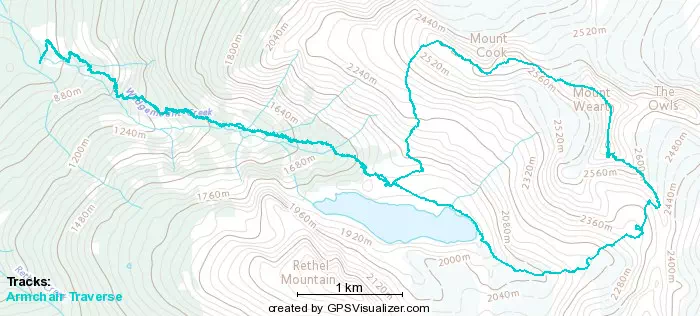
GPX Track + Map