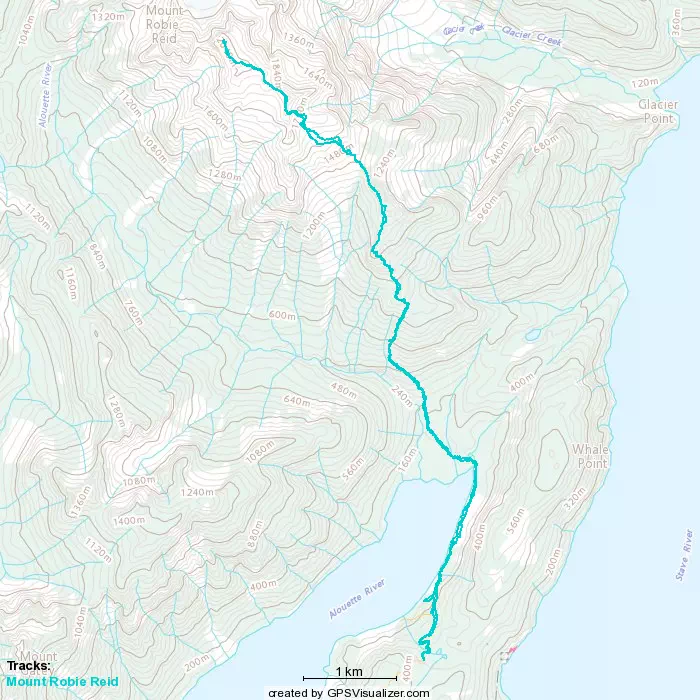
Mount Robie Reid - October 8 2022
A long slog with a ton of elevation gain, but great views and great friends to share them with. Also lots of fun scrambling!

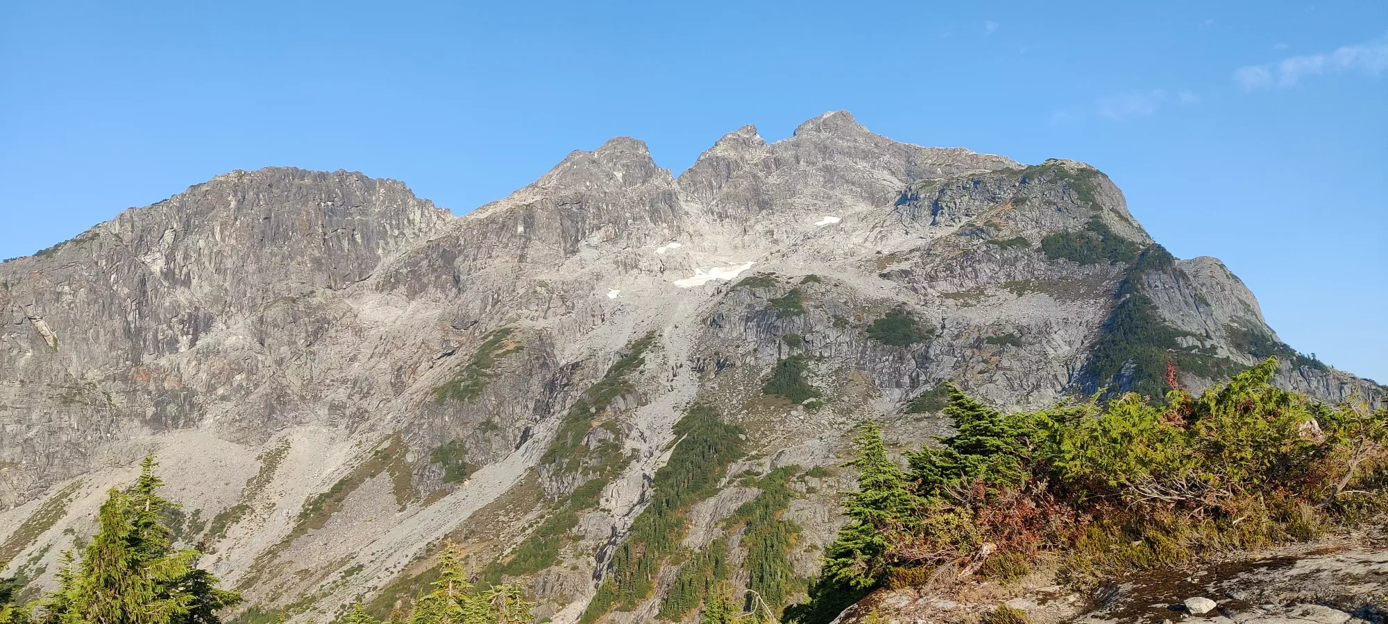
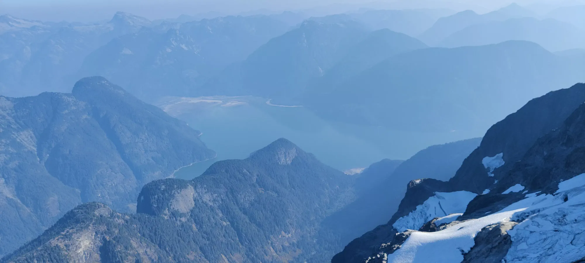
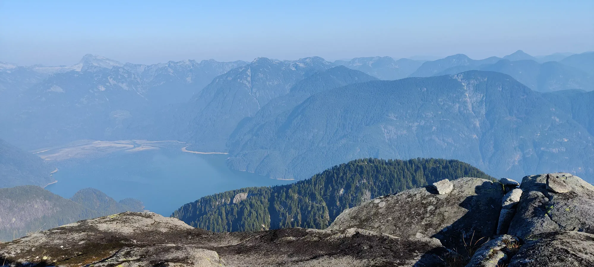
Golden Ears Ranges, Maple Ridge, British Columbia
2095m
As a hallmark peak to add to one's collection in SWBC, Robie Reid was a peak I'd generally be ready to say yes to whenever it was brought up. Midway through the week, exactly that happened, and a plan was borne. In fact, with conditions seeming to line up very nicely with not-too-much smoke and clear skies, interest was high and a group of six was formed, the most I've ever gone with. We did, however, start in 2 separate groups, since the former mostly lived a bit closer and were going to go at a more chill pace since they had a newer hiker coming along, while my group was me and Jass starting about an hour later. I was pretty low on sleep already, so I really wanted that extra hour of rest, as my wake-up was already 1am.
I got up, had some breakfast, and started the long drive to Alouette Lake. There was unsurprisingly no traffic, and the FSR was in great shape, anyone with non-sports-car clearance can get there. I went much faster than google thought I would on the FSR, and got to the trailhead gate at 3:45am (do note if using google to navigate, it brings you to the spur road's start, but doesn't tell you to drive down it. You should). I tried to nap at the trailhead while waiting for Jass to show up (we were supposed to meet a bit later than that), but didn't have any success. He got there maybe 15 minutes later, and after getting our things in order, we started out at about 4:15. The other group was supposed to have started at 3am, so we had a good amount of time to make up if we were to catch them.
I had bought new shoes the day prior at the insistence of Shayan (who was the "ringleader" of this trip), who had become rather annoyed at my inability to have traction the last couple times we'd gone out (understandable). On their first test, jogging down the deactivated (but annoyingly drivable if not for the gate) road to the lake, they performed admirably, and I didn't fall where I previously would have with my nearly-bald old trail runners. Sadly, we got a bit too into the task and missed the turnoff onto the trail, and went almost all the way to the lake, losing about 50m of elevation we'd have to trudge back up. After correcting that mistake, we found the turnoff to the trail, which goes right at a large left turn when going downhill, into the forest instead of continuing on the road.
The trail was fairly well defined, though at a couple points it forks between old and new trails. The old trail on the way "up" is to climber's left, which we took to avoid unnecessary elevation gain/loss. This was a mistake, as it was much less well-defined, requiring a lot more navigating around large roots, deadfall, and using somewhat sloppy logs to cross gaps in the trail. Definitely take the new trail that goes up to climber's right, it isn't much undulation, and is worth the effort.
In the end, it took us about an hour to get around the lake to the top where the boat-accessible campgrounds were. I wish Lee was with us on this one, so we could've just boated across. Sadly, no such luck, so we went on, happy to at least have a better trail at this point. We pushed forward for about another kilometre, this section being notable for being both fairly flat and marked with real trail markers, probably because it is part of the trail system around the campgrounds. This brought us to about 4.5km into the trail and 250m of elevation, leaving us about 6km to gain the next nearly 2000m of elevation, in other words "where the real pain starts".
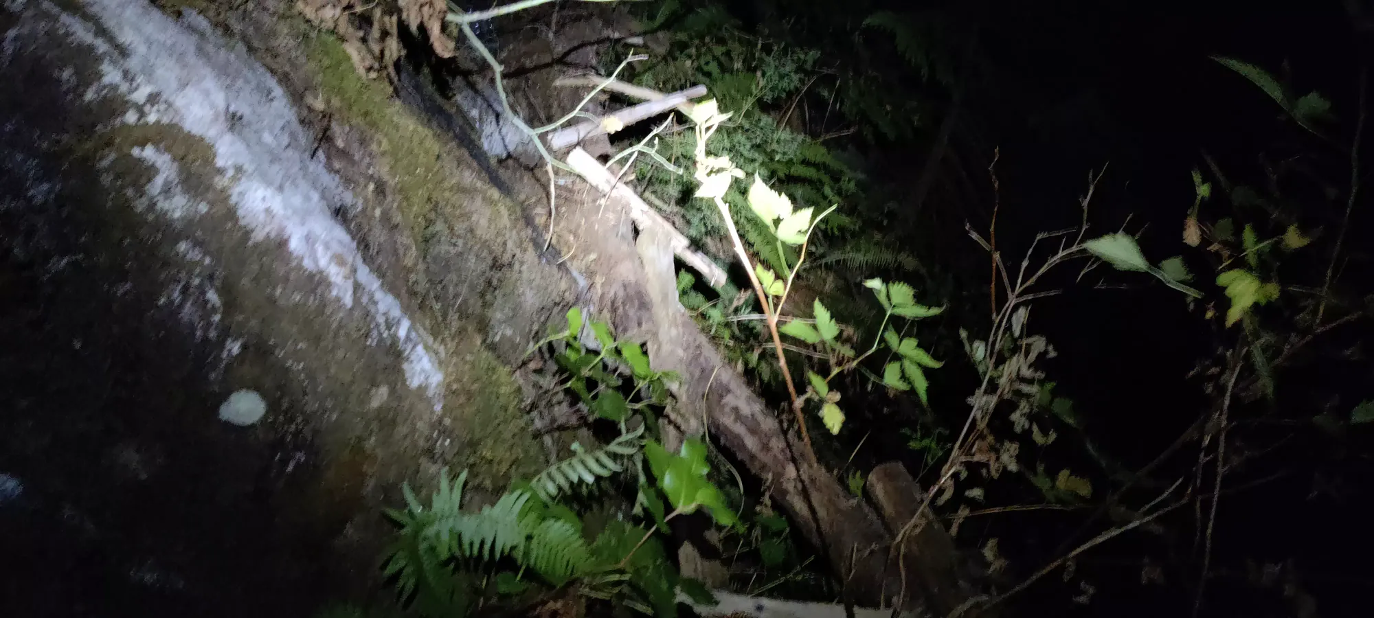
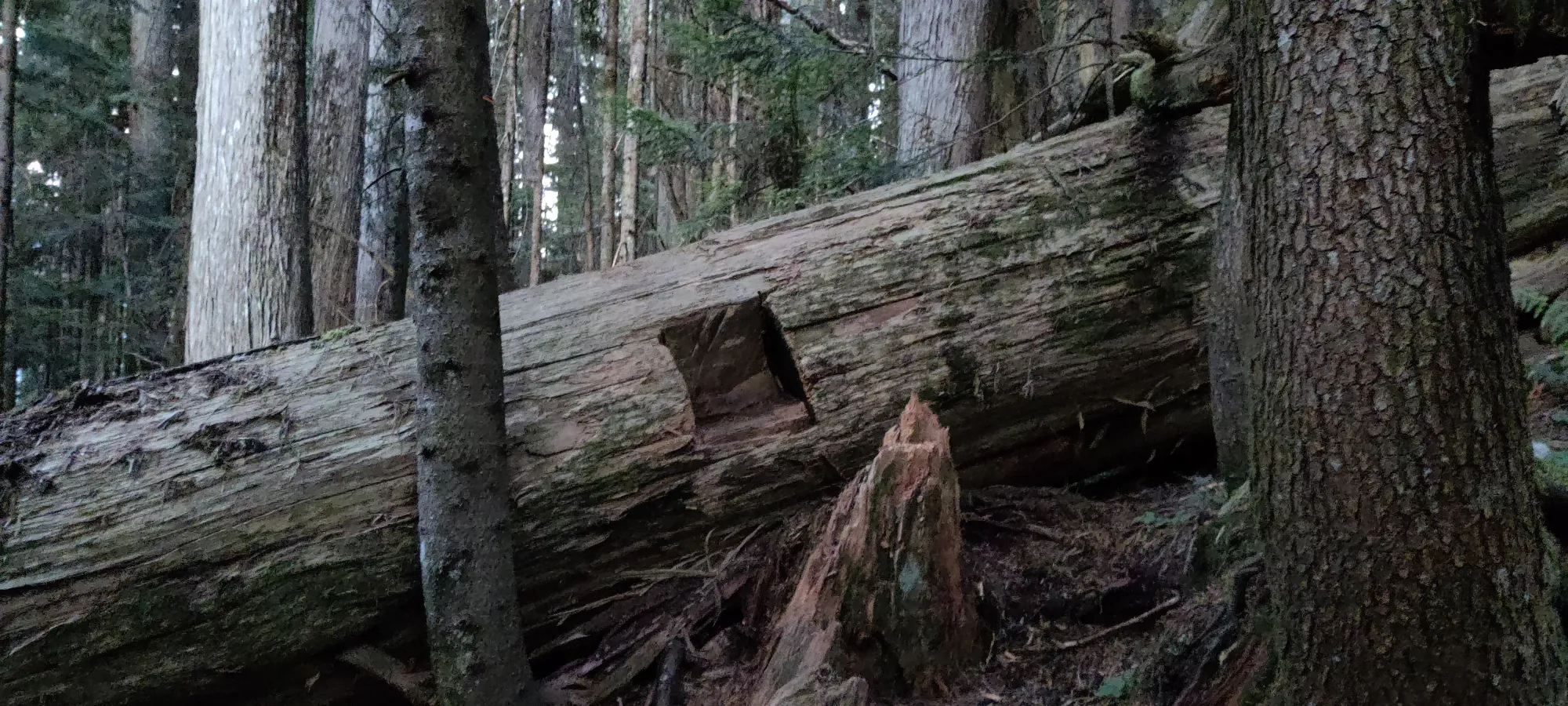
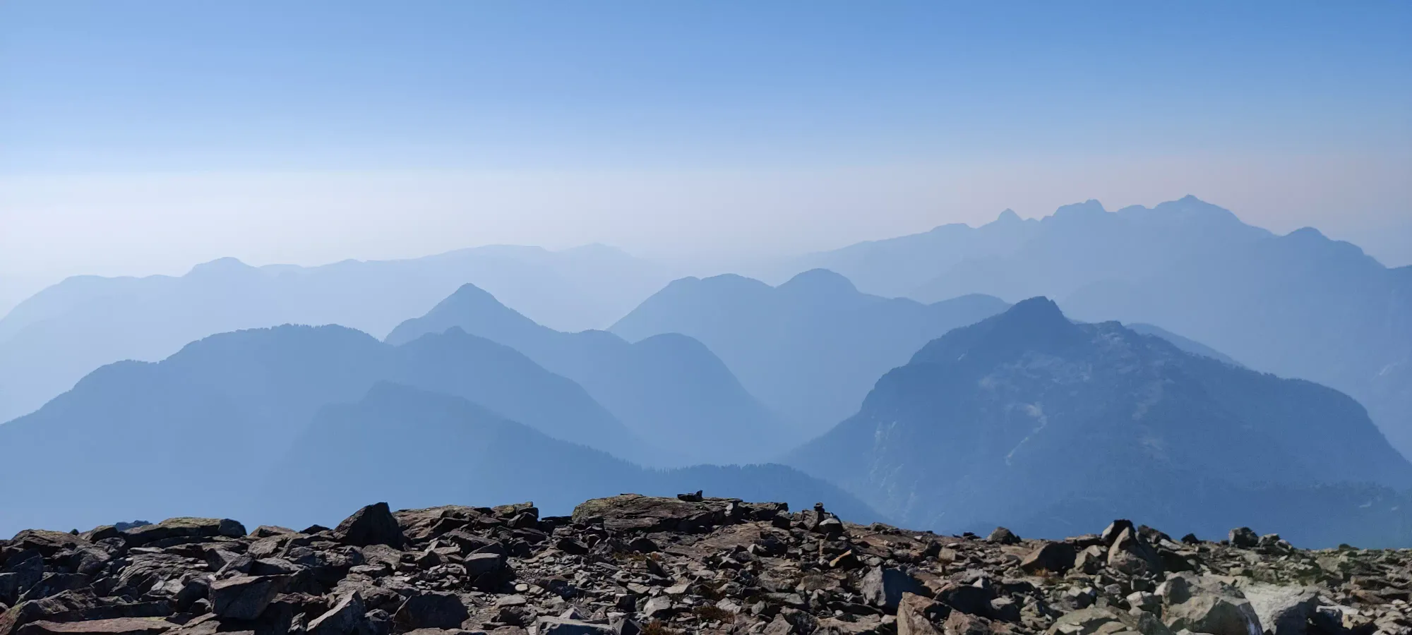
Here, we started the real slog of this mountain. The trail was exceedingly well-flagged, but it was also definitely less maintained than the previous section. There was a lot more detritus on the ground, way more deadfalls, and overall a bit less "definition" to it. The next 3 hours were spent trudging up through the forest, with not a lot of navigational errors, but a good amount of checking the map and looking around for flags to ensure we were on-track, as the forest isn't super dense, and with the less-travelled trail, a lot of the forest in the dark looks just as viable as the "real trail". There were definitely signs of maintenance though, like some steps cut into large deadfall, and of course all the copious flagging.
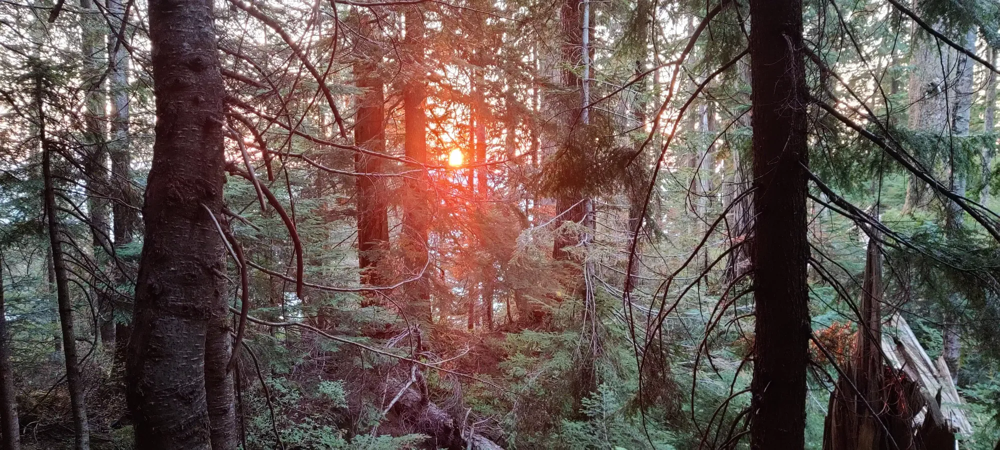
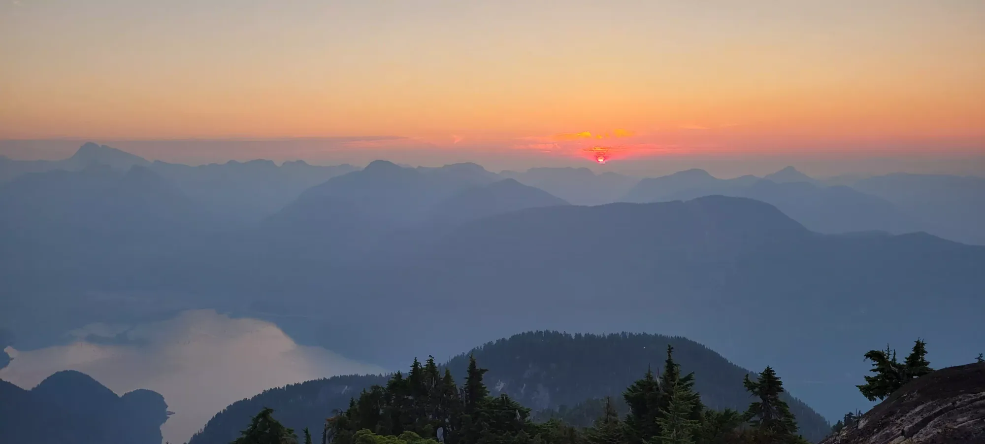
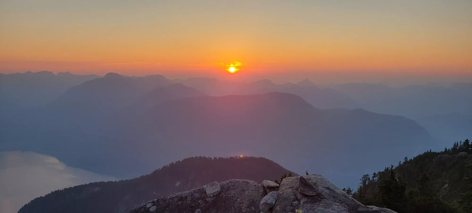
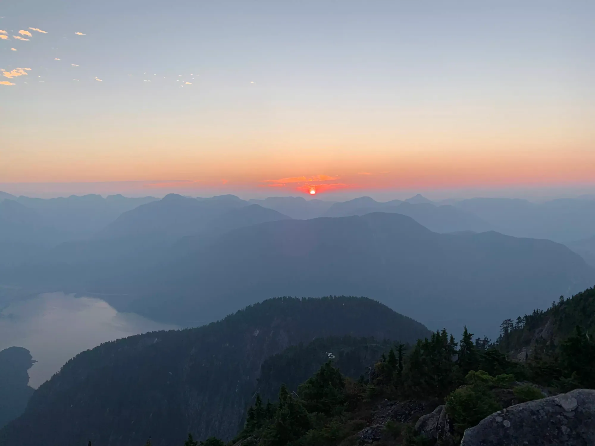
At first, Jass was pushing me, but in about half an hour, the roles swapped and I was pushing ahead a bit faster and having to slow down. Our paces weren't overall that different, though, and I suspect I might've been able to shave half an hour off at most going at my full pace (I am not as fast on steep, uneven terrain as others). we exchanged messages with the forward group a few times along the way, and knew we were 300m below in elevation when they were at 1000m, so we would probably not catch up until the scramble started and things slowed down. We also, unfortunately, didn't get a very nice sunrise view, as it happened entirely within the forest for us.
At 1225m, we finally got a view of some rocks which could've been our objective, and also confirmed that the others were waiting just above "the tarns", at about 1375m. At this point, I think Jass was really feeling the lack of water (he didn't bring a whole lot up with him), and was lamenting the fact that the forest just didn't seem to want to end. I felt similarly, though I at least was well-hydrated as I brought a "Tareef-high" amount of 2L on this trip.

The trail at this point got more even and less deadfall-y, but with a bit more brush to push aside. I'd recommend pants to be able to confidently walk through it with speed. It is also short, though, as we hit the tarns where the forest ended and things opened up in about 15 minutes.


After a couple minutes to enjoy actually being able to see something other than forest, we made the short walk up to the panoramic viewpoint where the others were waiting, an unfortunately slow 4.5 hours into the day. Turns out they were waiting here for a good while, though Nick (the "hiker" of the group) was appreciative of the rest that entailed, as this part of the trail is definitely an unrelenting slog for quite a while. We rested, Jass filled up his water, and the group chatted for about 20 minutes, and we then set out.

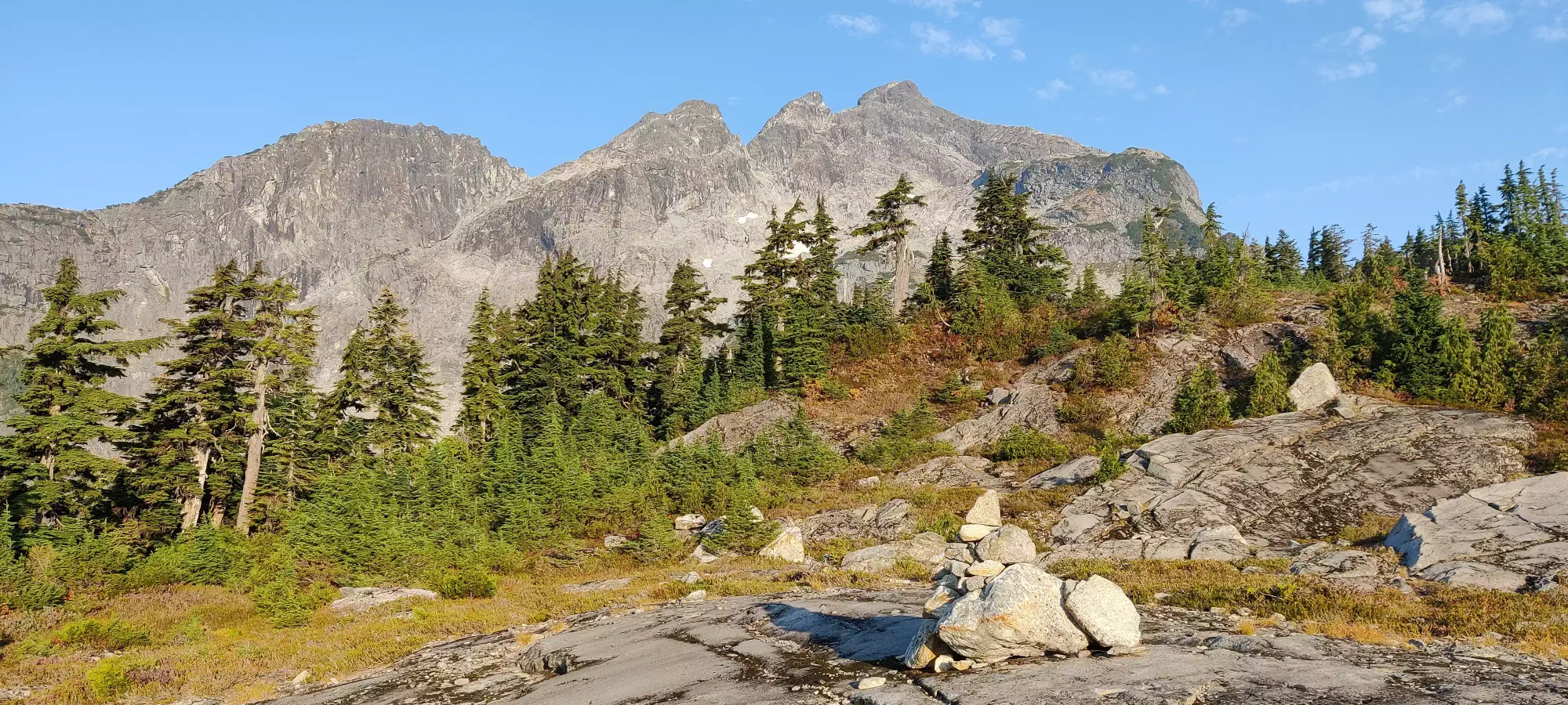
From this viewpoint, there's a short downhill before you regain along a wide ridge toward the three subpeaks seen from the viewpoint. The first bit of this is on large slabs, then a short dirt path through a cluster of trees, after which things open up into the rocky terrain one stays in for the rest of the ascent. Partway up the slabby terrain, Nick called it and turned back, citing not wanting to hold others back and some residual ankle pain. I wasn't with him on the way up so I didn't push the issue, though I suspected the rather fast pace being set was to blame, as we were moving pretty fast and the stop-start dynamic this created tends to feel worse for those in the back. I can say I don't think he'd have summited regardless, though, based on the scrambling that followed, so it wasn't entirely unexpected. He went to go back to the viewpoint and we pushed on.
Once through the last bushes, it's a push up through a somewhat grassy boulder field until the grass fades away, where it becomes a normal boulder field, with a decent amount of large slabs poking out to make the terrain a bit more efficient to travel through than just boulders alone. The sun was also pretty hot at this point, to the point that both me and Shayan felt it wise to shed our shirts for some extra airflow.
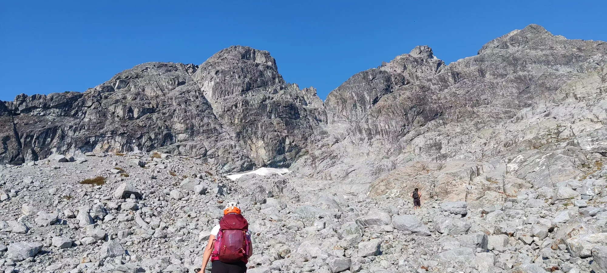
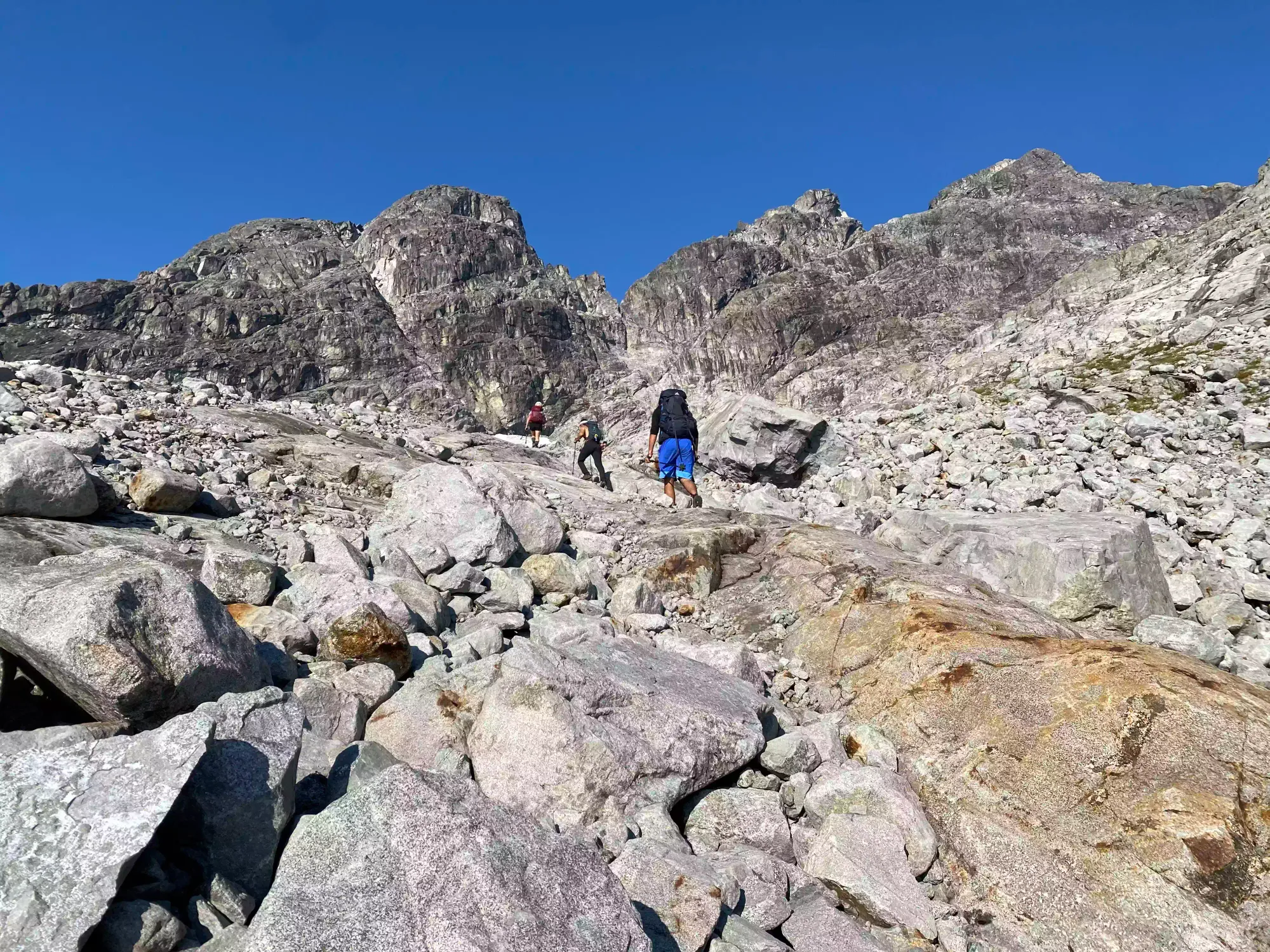
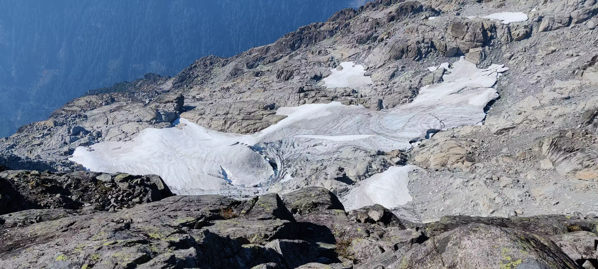
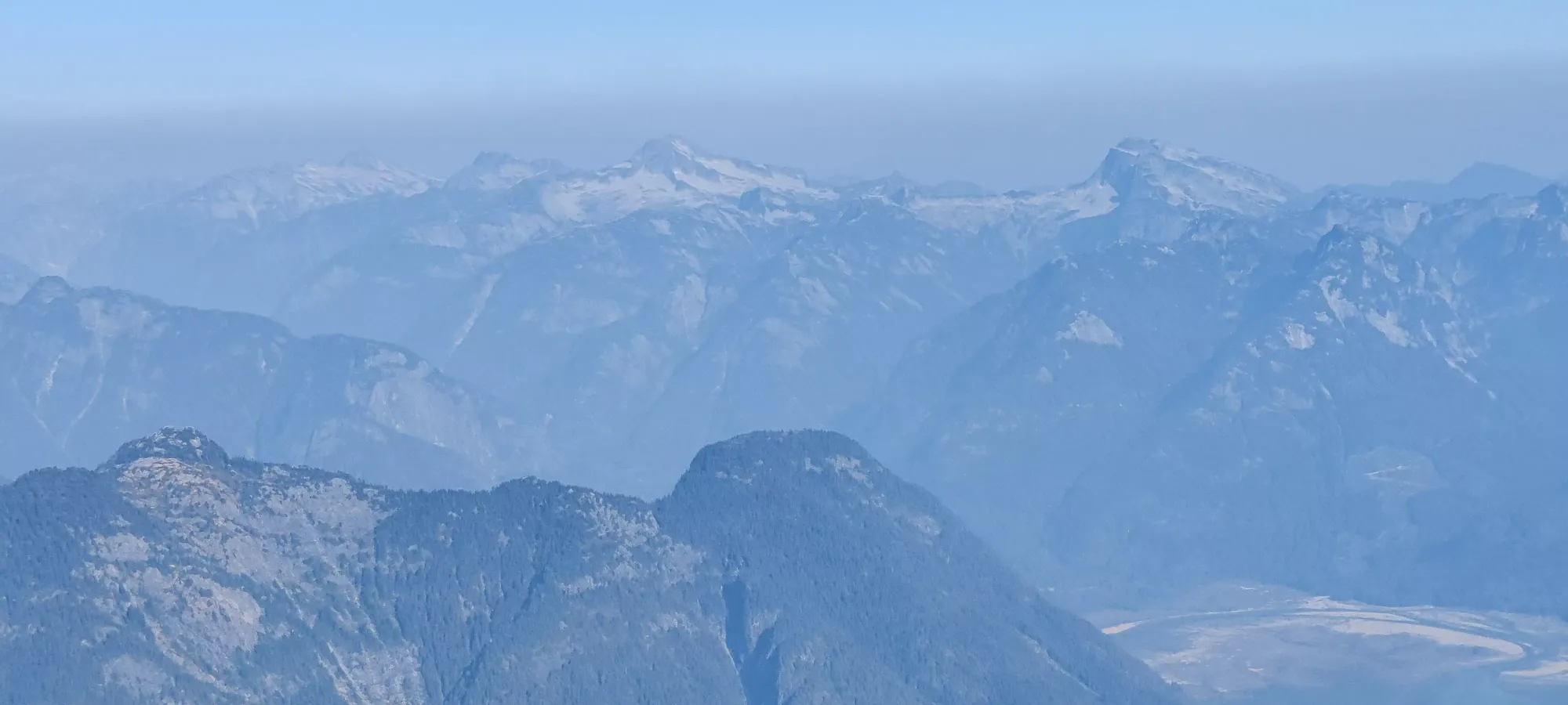
At about 1600m we hit the first snow patches, and shortly thereafter we found a good stream to refill at, and even a small pool below a larger patch of melting snow. So even late into the season, there's a good opportunity for refill up in the rocks. Just after you get past this meltwater pool is where the scrambling starts mixing into things, and the fun begins.

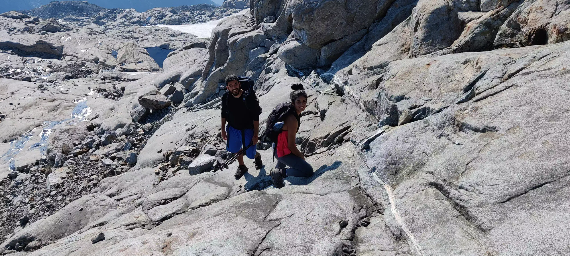
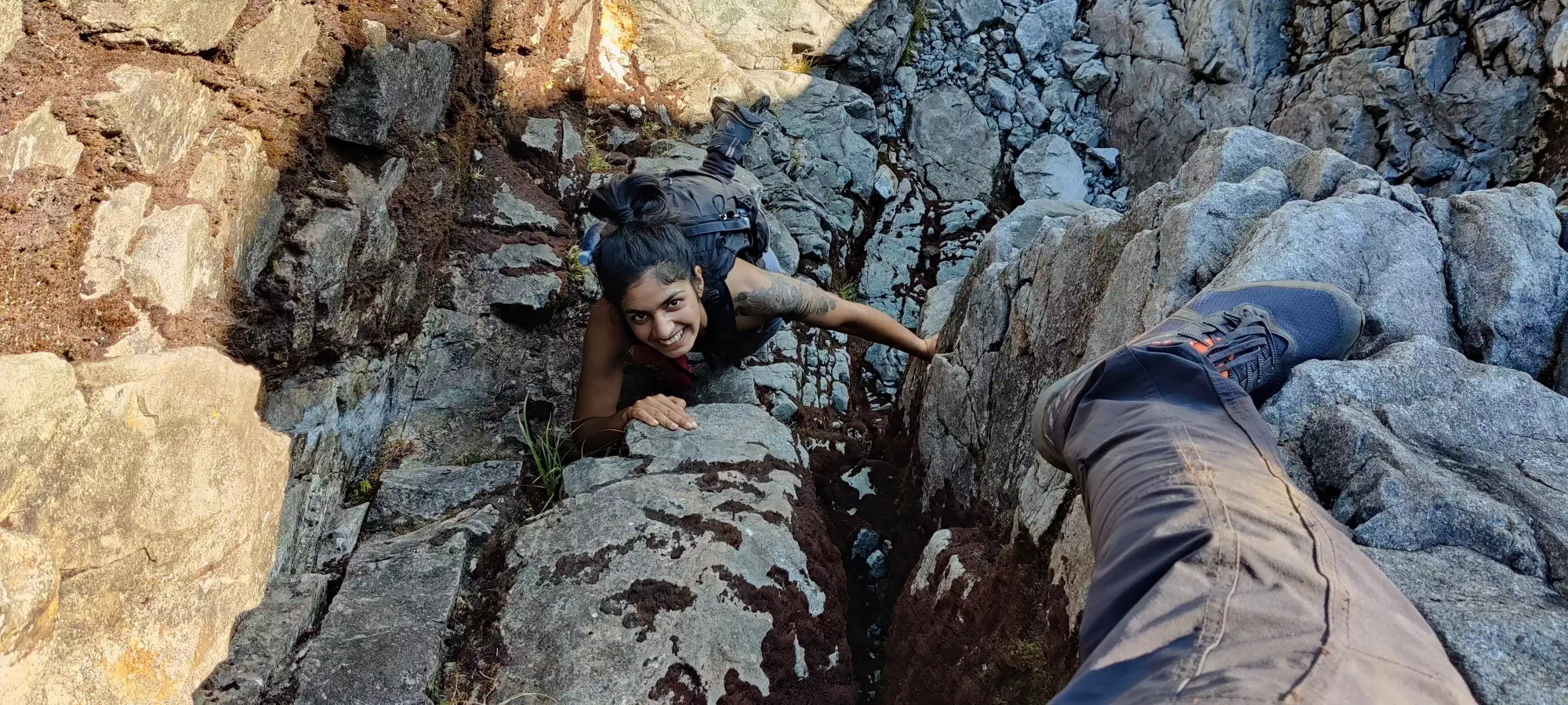
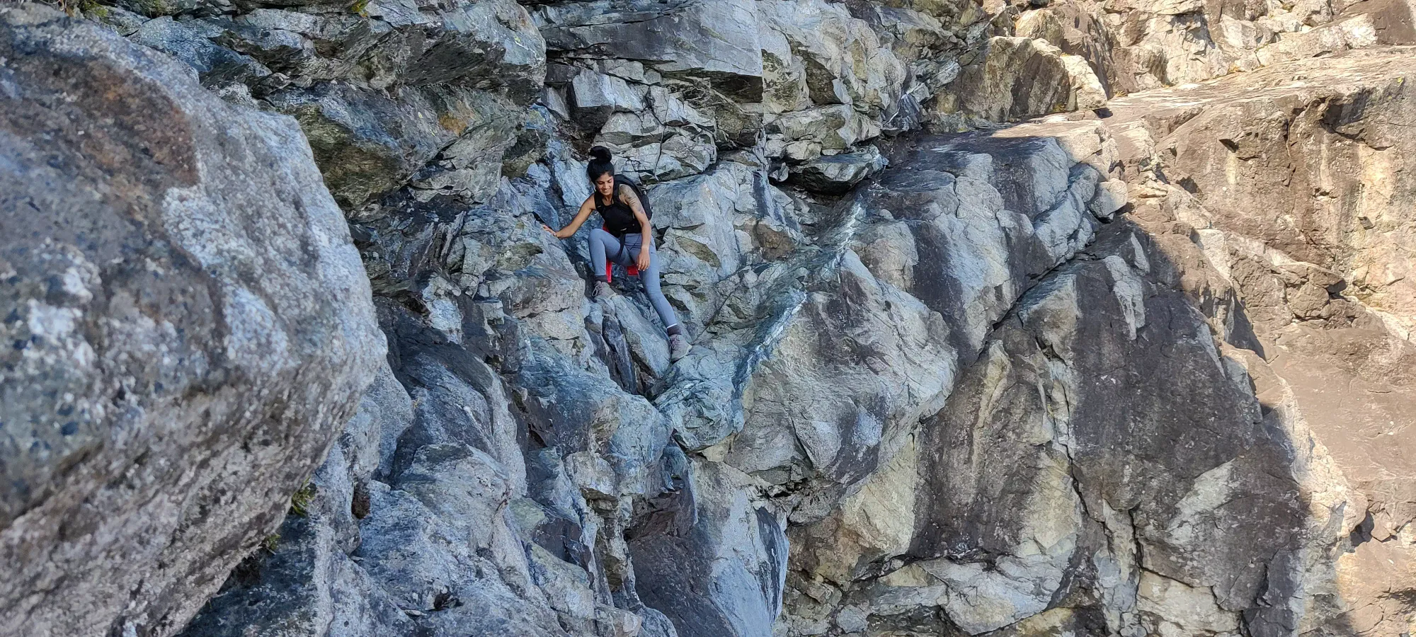
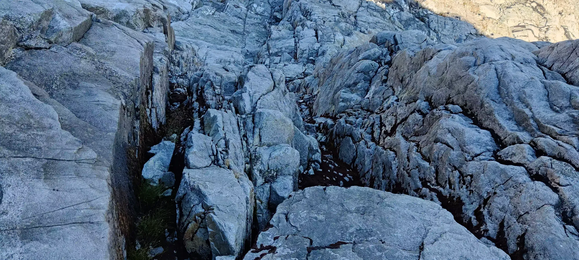
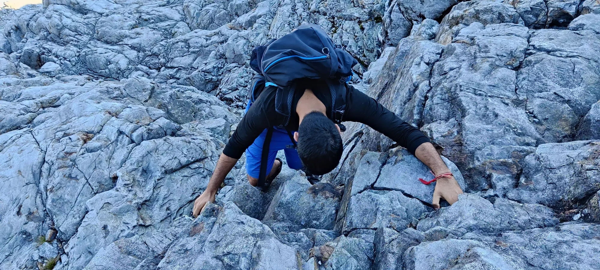
From the point above, one could follow an easier line zig-zagging about the face, mostly doing steep walking up the slabs. However, I thought that was boring, and found a nice scramble route directly up in a couple of wide cracks/chimneys, and decided to go up that way. Miranda had already gone ahead the standard route, but Jass and Nikita had succumbed to my influence and decided to come along for the ride. While this was quite fun, it also was the next source of trip-lengthening, as the others were not quite as used to these sorts of off-trail hard-scramble shenanigans, and they took a while to get up the class 3-5 moves involved in the process. If you are a proficient scrambler who enjoys getting your hands involved, my route makes sense, but the easiest route is definitely not the one taken in this case.


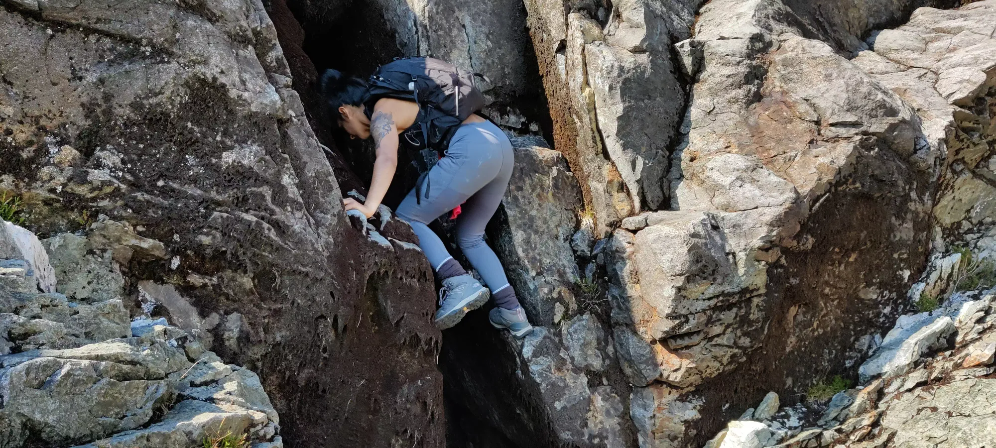
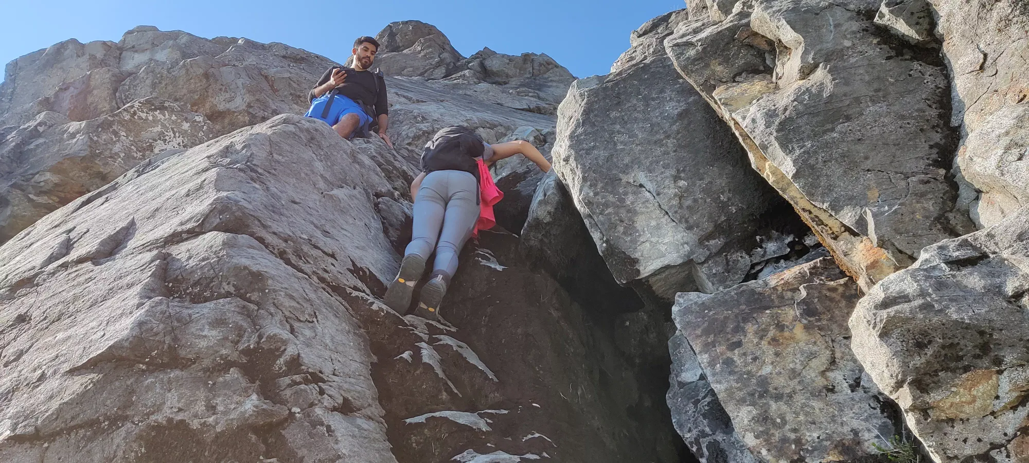

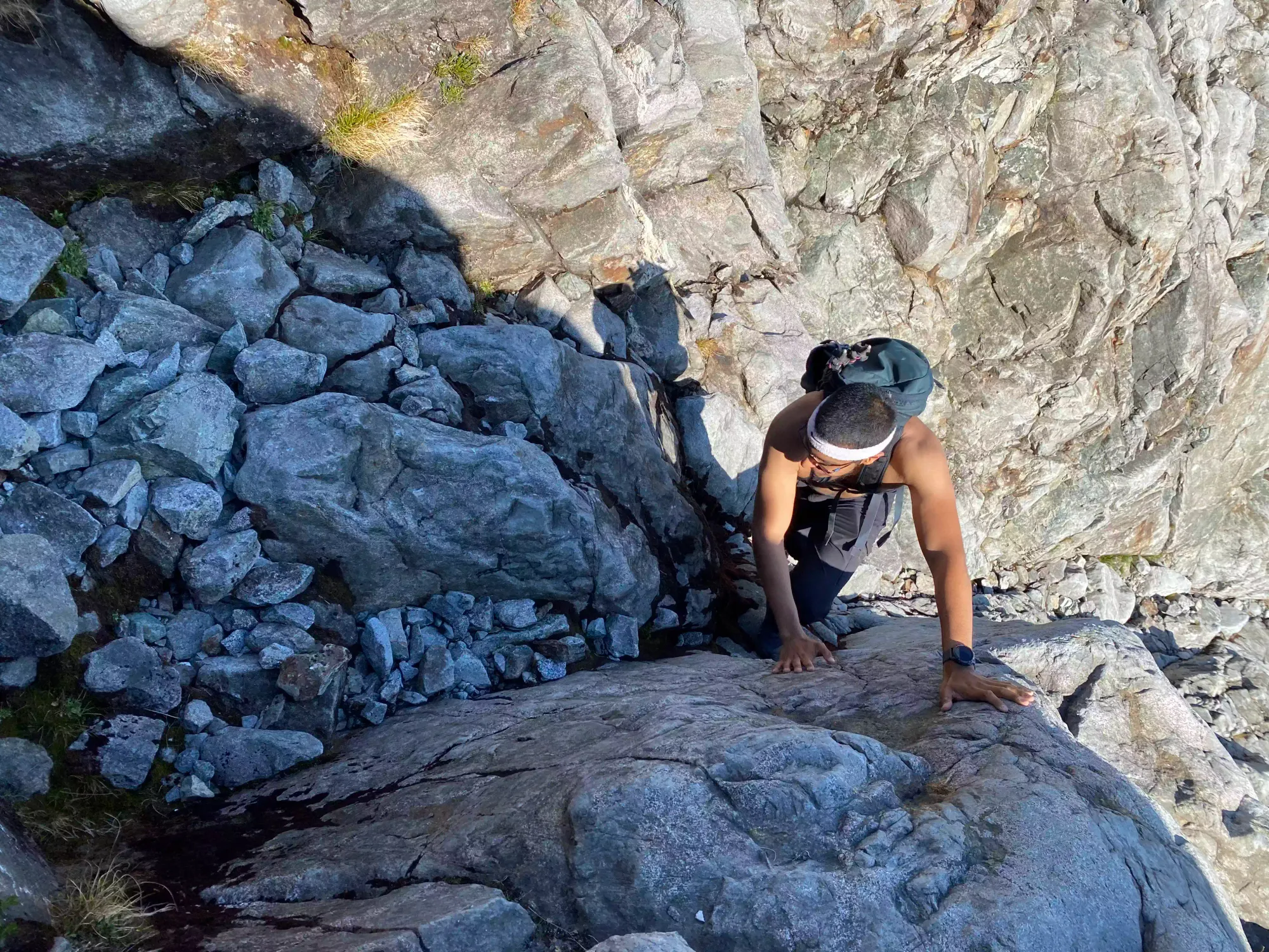

After that first chimney bit which was about a 20 minute endeavour (but one could get up in just a couple), we resumed the easier terrain for a couple minutes before hitting another, tighter chimney to get up (which also probably could've been bypassed, if one wanted to).

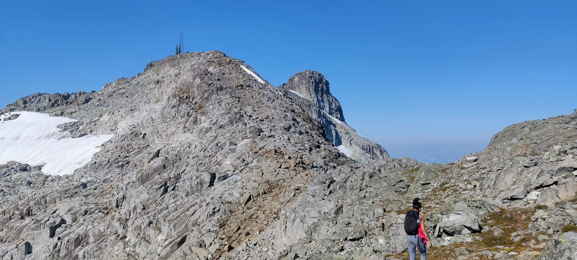
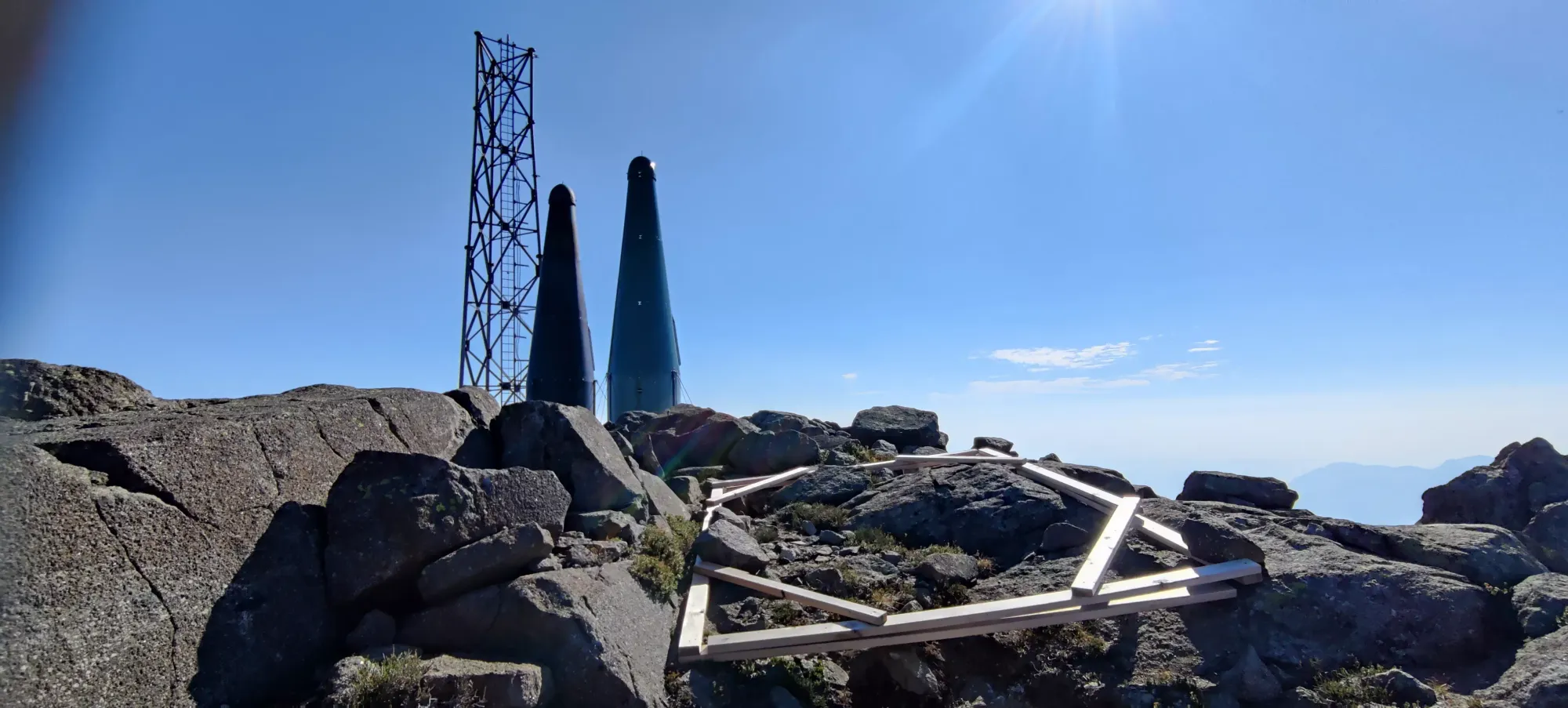
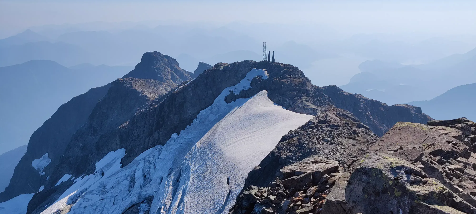
After this it was back to uphill walking, and we hit the base of peak 1997 (aka "Birthday Peak", since that's my birth year) about 7.5 hours in. The terrain up on the ridge there was pretty mild, just walking up to the subpeak, down a notch, and back up to the false summit with the radio towers and heli-pad.

Once we got to the false summit, I dropped a bit further behind to check out the "stuff" and get some rest, as I was pretty tired by this point. Turns out eating one orange between 2am and almost noon isn't great for your energy level, who'd have thought?!
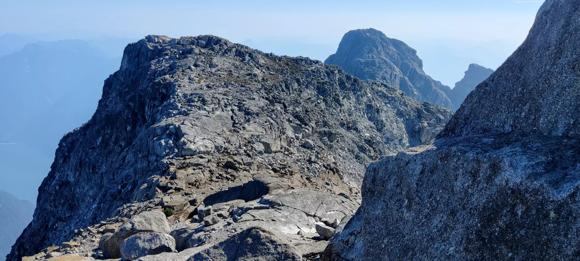
Once past the false summit, it's a short downhill, a short ridgewalk, and then the final summit block. At this point, Shayan and Miranda had already gone most of the way up, Jass was in the middle, and Nikita was a little while behind him, while I traipsed across the ridge.
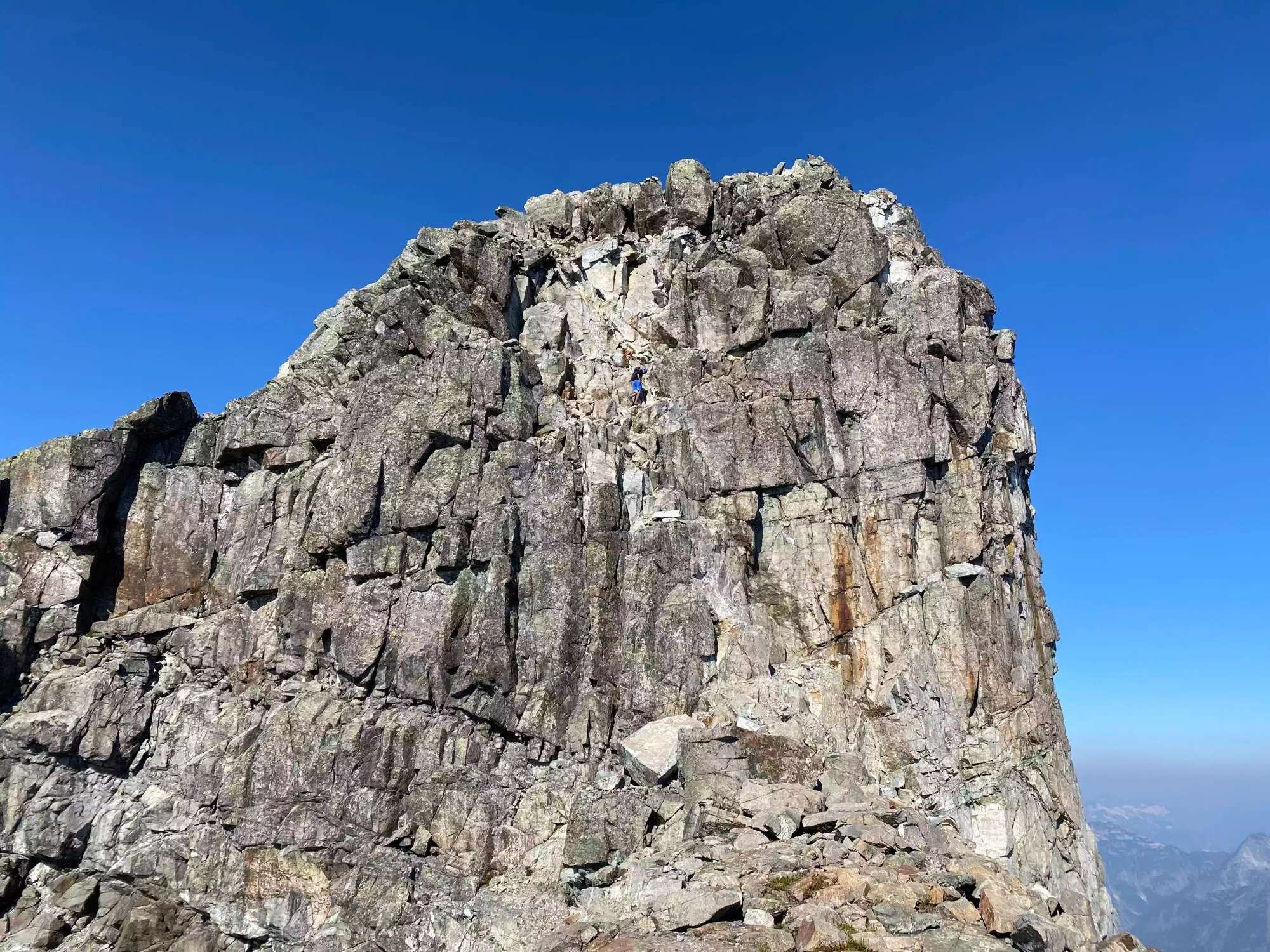
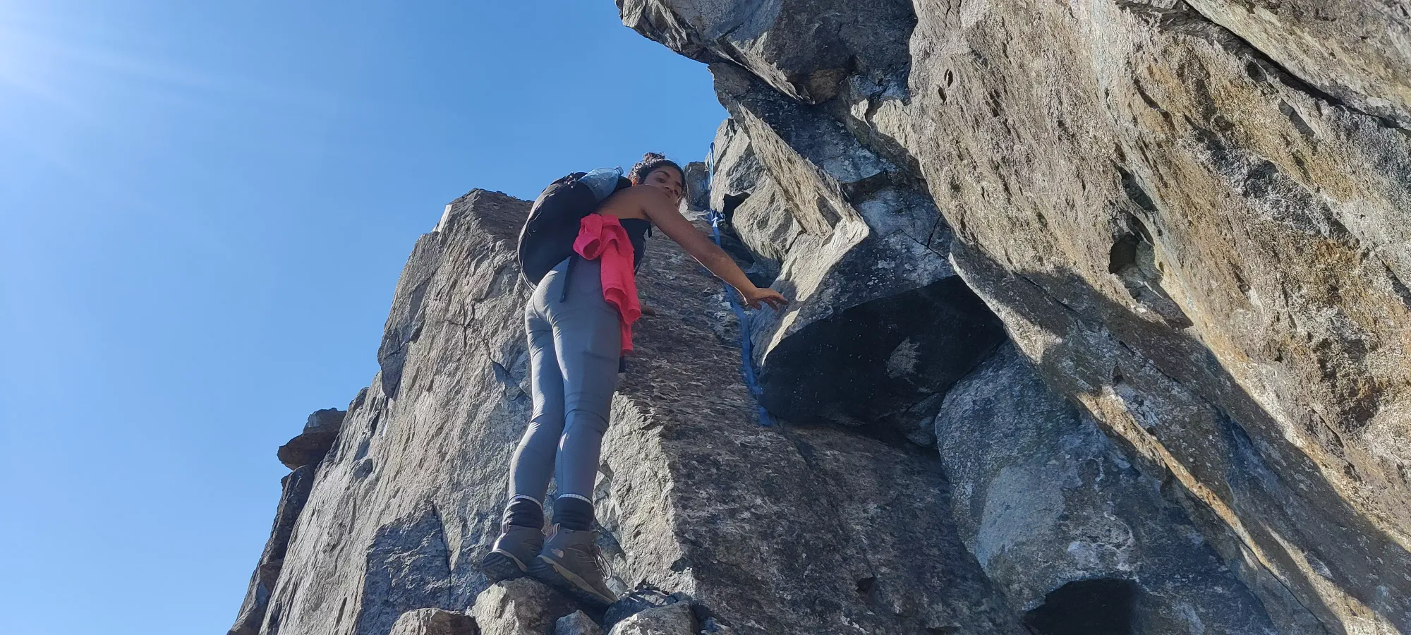
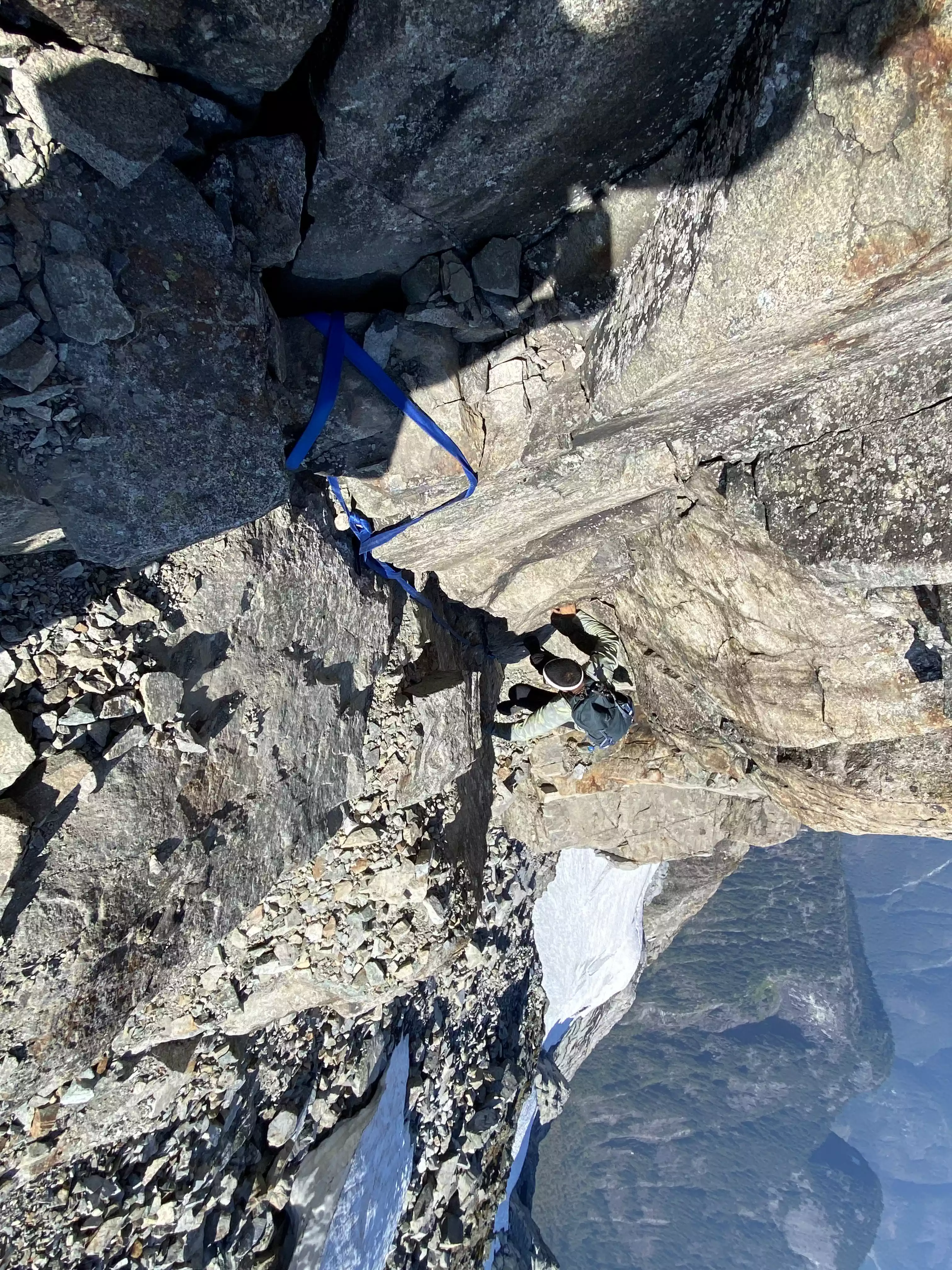
Once I arrived at the summit block scramble, I quickly rejoined the latter two who'd yet to summit. This was also where I (finally) encountered the infamous rope(s) that I was told were littering the slopes, but had yet to encounter (probably as a result of my "creative" routefinding to that point). The local peakbagging community has been "hot" as of late in the discussion of fixed ropes, and if they have a place on the mountains. For my part, I found them very much unnecessary and if anything encouraging suboptimal lines and in the way of my feet.
Relative to the scrambling I led us up before this point, it was very trivial scrambling, and solidly in the class 2-3 realm without death-defying exposure to speak of. After that there's a bit more easy scrambling, and you top the peak out! It took a ridiculous 8.5 hours at our pace, but we got there😅

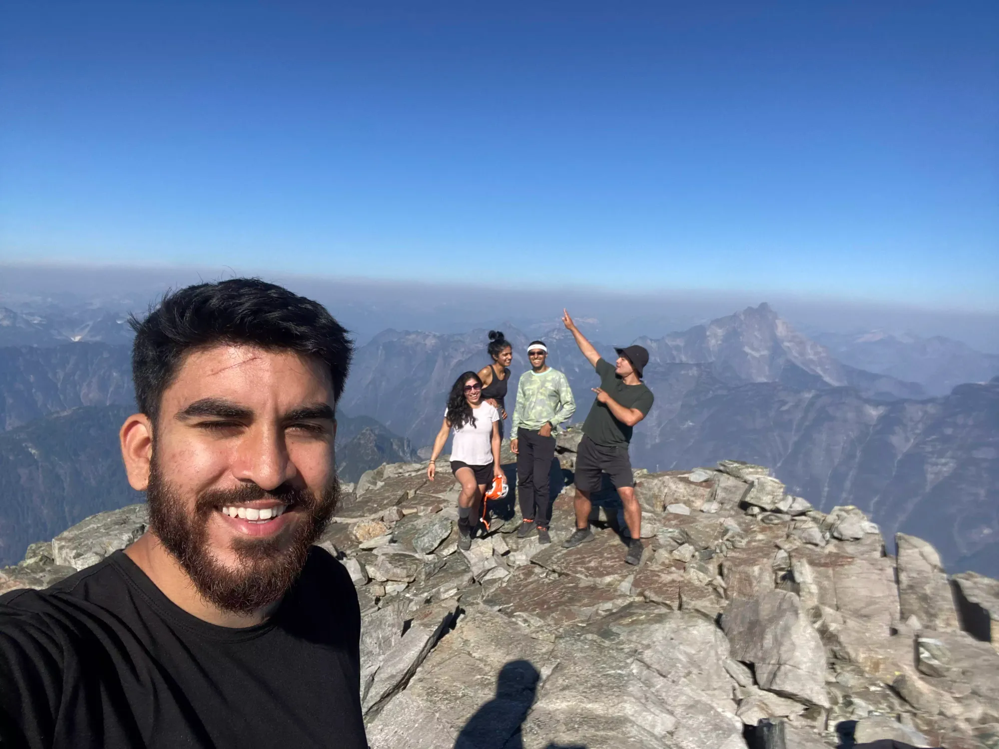
We spent half an hour on the summit, where I discovered I was unable to eat my very old+dry sandwiches, and instead had to survive on the 5 oranges I packed for the day. That was not great, but I wasn't feeling super dead yet, so after a bunch of pictures and that quite bite on my part, we headed back down. The downclimb was pretty uneventful, as this really wasn't a difficult scramble, lots of big, ledgy rocks and minimal exposure.

After getting down from the summit block, I took some time to try and refill my water from some drips coming off the snowfield to the side of the ridge. This was... very slow, and everyone but Nikita went ahead as I attempted to recoup some water. I gave up after a couple hundred mL, but at least it was nice and cold. After that, we got back up to the false summit, and headed back for peak 1997.

Once we got to the false summit, I pulled back a bit, my 5 orange lunch proving insufficient for replenishing my energy (I got some good ideas for hydrating food I'll hopefully be testing soon, not to worry!). While I was definitely the most gassed and made not-so-great time down and up to the sub-peak, a scramble section soon came up, and that brought me back into line with Jass and Nikita as they slowed down there. This time, we went skier's left on the ridge once past 1997, and that brought us to some terrain we didn't take previously.

Once I caught up, I helped Nikita through a set of downsloping ledges with a bit of side-exposure, which then deposited us at the top of the harder scrambling areas we started the fun at so many hours ago.
Then the downclimbing started in earnest, with a couple gullies/cracks to descend. These were again pretty slow for the others to navigate comfortably, but they pushed through, and managed. The official route was definitely elsewhere, as that's what Miranda and Shayan took, and they found some rope there. Honestly, though, a confident scrambler can take the route we did without issue.
After a couple hours we got from the top to the bottom of the scramble bits where we found the other two waiting for us on the slabby rock below. We joined up, and headed down toward the water for some refilling. From there, we had one more fun unnecessary downclimb, and then picked the pace up a bit as we didn't want to leave Nick waiting for an unnecessary amount of time. Shayan lead us down the slabby bits and back into the grassy terrain leading back up to the viewpoint where Nick was pretty quickly, and we got back just after 4pm, about 12 hours into the day. Thankfully Nick seemed in good spirits, so we didn't break for long before heading back into the forest.

Once we were all together, we set a fairly leisurely pace down. Someone cough Shayan cough led us into a bushwhack for a few minutes instead of staying on the now well-defined dirt path, but it wasn't a terribly long detour, just make sure to follow the uptrack below the tarns to stay on-trail in this part. We stayed at that pace for about an hour, and got down to 950m or so. However, there we got passed by a solo hiker coming down at a much faster pace, and Shayan got excited, and wanted to push his pace. I figured it couldn't hurt, as the hour was getting late, so I followed suit. The others didn't quite keep up, but in the next 50 minutes we got down to the tip of the lake, down to 150m, and took a nice rest with our shoes off for about 20 minutes while the others caught up.
Once they did, though, we split up once again. Nick went ahead first, trying to beat the light as he wasn't too hot about dark hikes, Shayan followed to keep him company soon thereafter, then Miranda. Jass and Nikita went a few minutes ahead of me as I struggled to fit into my shoes again (downside of taking them off mid-hike, as nice as it feels). This was the last I saw of them for a while, though. While I am pretty good at yeeting downhill or even flat running on fumes, uphill is another story. And let me tell you, the uphill stats don't seem that bad, but I sure felt them in the last 4km.
The trail undulates quite a bit once you start going parallel to the lake, and it just burned me out completely. I took an hour to walk the 2.75km along the lake back to the spur road, which was pretty abysmal. Jass and Miranda were waiting for me there, and tolerated my slow plodding up the road to gain the last (very annoying) 125m of elevation back to the car, which took another 15 minutes, rounding the trip out at basically 16 hours even.
So quite an adventure. I may have completely tired myself out, necessitating my stealing of an apple from someone Shayan at the cars, stopping in Port Moody for "lunch" at 10pm, and needing to pull over in Brittania Beach just 10 minutes from home to nap on the drive back after that (so close!), but I also made new friends, got a classic peak, and had some fun scrambling, so I'd say it was a good trip. I definitely need to figure out some more food solutions, though, I had no business being that tired.
GPX Track + Map