Mount Baker (Kulshan) - May 12 2024
A classic tour up one of the most famous Cascade Volcanoes, which happens to be highly visible from the Vancouver+Fraser Valley areas. A must-do for any ski mountaineer in the PNW

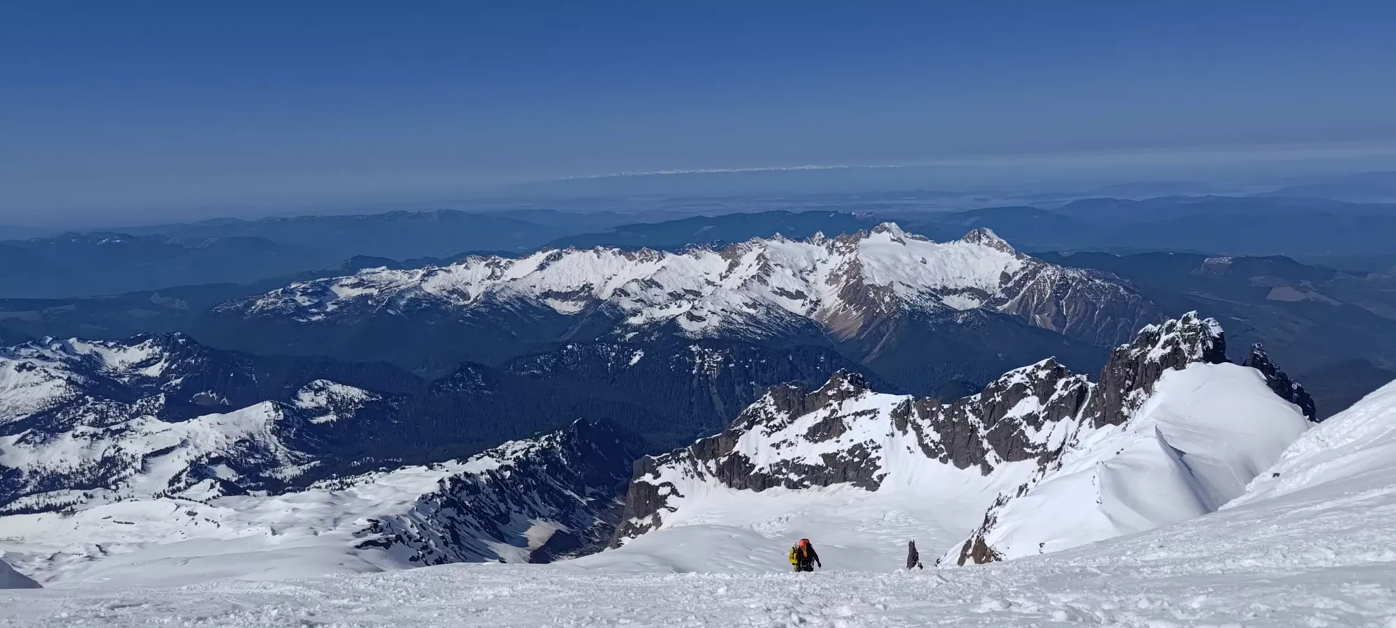
Baker-Shuksan Massif, Mount Baker Wilderness, Washington
3284m
With my last "real peak" having been 3 weeks ago, and that itself being after a week in-hospital from my ongoing battle w/ colitis, I had been itching to get myself back where I belong, in the mountains. However, since that time, I'd been sleeping poorly, eating less, and otherwise suffering the usual symptoms of my condition as I have been working through different medications and trying to get stable once more. While that fight is still ongoing, the last week or so had at least been predictable if not exactly pleasant, so I decided that pain, weakness, and discomfort be damned, I made the decision long ago that I'd live my life without letting my condition stop me from doing so, and I started throwing a plan together for the weekend.
One of my buddies, Kelly, who I last did Abercrombie Mountain with back in March, had asked me about Baker a short while ago. I also saw reports in the last week that the road to the trailhead for the Coleman-Deming route was open, which was my preferred route since as far as I could tell, the glaciers were the "least bad" on that side. Plus being a northwest aspect is generally helpful in the spring. He didn't go for it himself in that time, so I reached out and asked if he was still in for it. We were in for a few days of great spring weather, and he said he'd be down for Sunday, though since it was over 20 degrees at sea level, and we would be doing a single-day push, that we should probably start close to midnight to ensure we wouldn't get into anything sketchy with that massive warming cycle. Going Sunday instead of Saturday (Friday and Saturday were both very warm) also allowed for (hopefully) any big slides that were "ready to go but just needed an extra kick" to go before we got there. Since I was already almost certain to encounter pain and the need to go to the bathroom en-route regardless, the timing wasn't a big problem for me other than "well it's midnight so sleep will suck", but that's not a big deal, and the plan was set!
He met me in Squamish around 10pm, and we set out for the Heliotrope Ridge trailhead henceforth! What I did not expect, though, was the MASSIVE amount of traffic at Porteau Cove. Apparently, the weekend's Aurora Hunting Craze was in full-swing (Friday was the big day, but we were both sleeping in preparation for this day, and didn't see anything, but the storm lasted all weekend, so people were hunting for views on Saturday night as well), and that seemingly translates to "people will park cars along the right lane of the unlit highway and start walking down that lane in the middle of the night hoping nobody hits them". Definitely not MY choice for a good time, but more power to them? If the Squamish RCMP is reading this (for some reason), maybe send an officer down there for crowd control or something. At least have some lighting and cones blocking the area off officially so nobody gets run over.
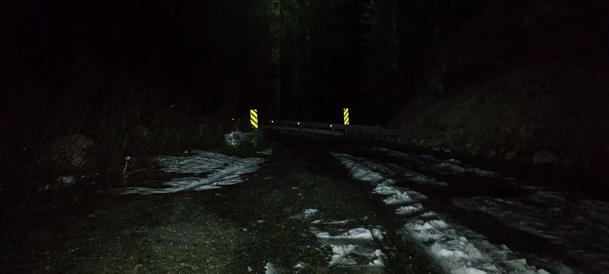
Aside from that, the drive was pretty smooth, with a few seconds of border security confusion when he asked "where are you sleeping tonight" and our answer was "we are not" 😅. The road to the trailhead is paved, but the potholes are so bad it may as well not be. You can probably drive it in a low-clearance vehicle, but you gotta pay attention and avoid the big potholes, or you will hit something. Most crossovers can do whatever as long as you slow down to not destroy your suspension. It is one-lane anyways, so you should be going fairly slow to begin with. As we got under 1km from the parking, we noticed a TON of cars on the side of the road, not long after which we started seeing patchy snow as well. We were expecting maybe a dozen cars, but there must've been over 50!! Not exactly normal for a mountain trailhead at midnight. The aurora craze really is something...
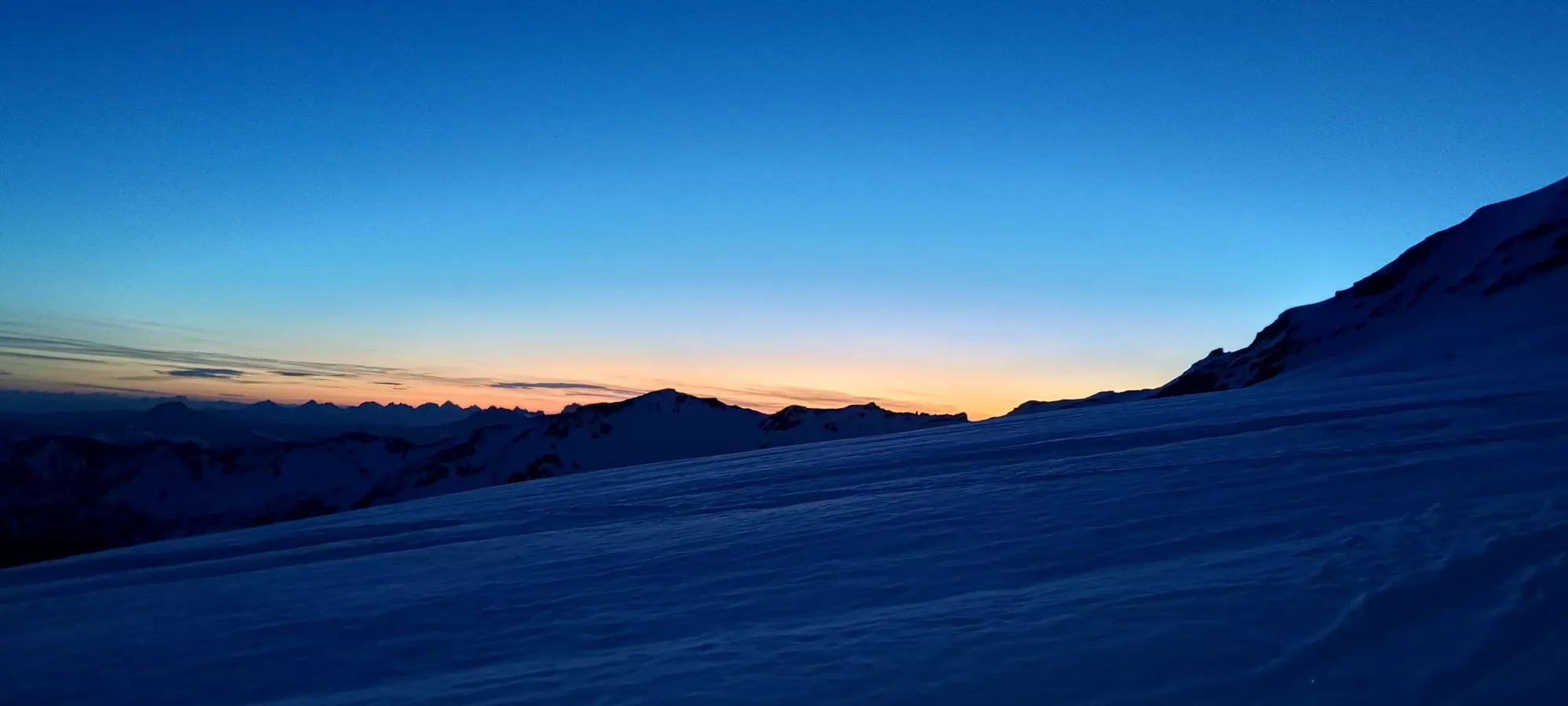
We parked maybe a couple hundred metres from the trailhead, just before a bridge after which the snow looked continuous, deeper than a couple inches, and probably driveable at midnight, but less so in the afternoon when we expected to need to get out. We saw faint ruts but no others who tempted fate, so that was probably the right call. After tossing some layers on (turns out even at only 1100m, near-midnight is still cold), we got ourselves geared up and started walking, skis-in-hand at 12:50am.
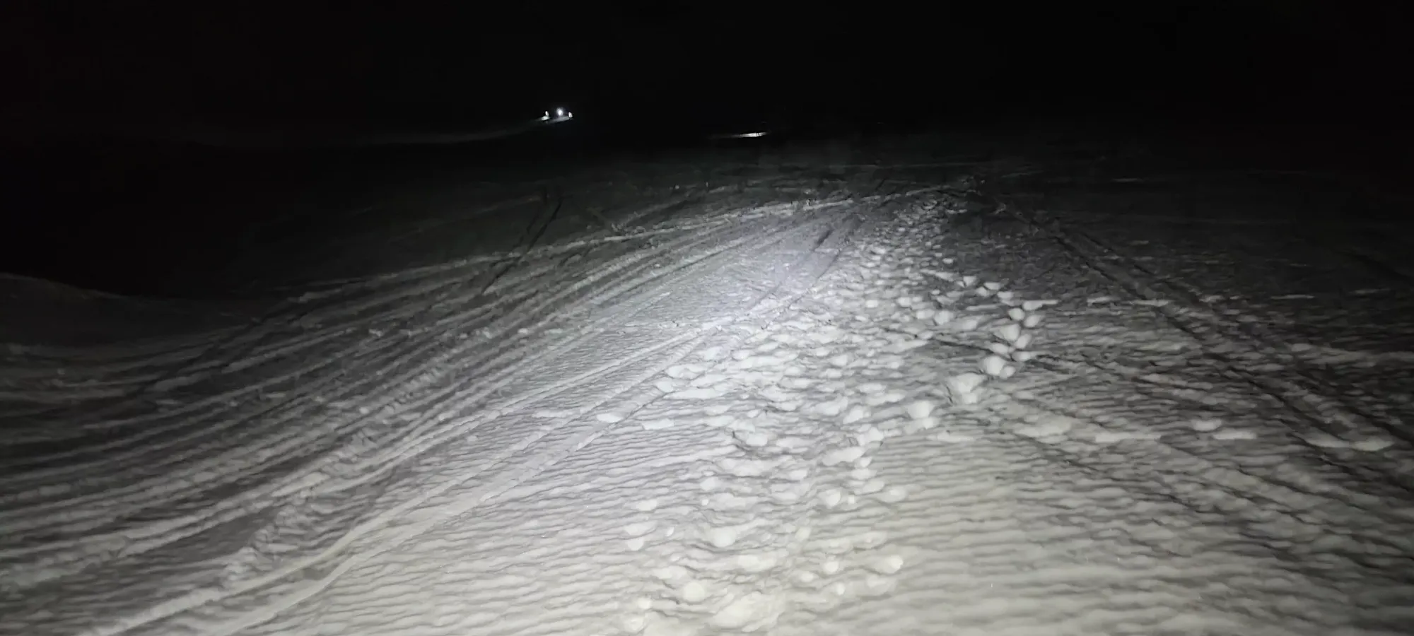
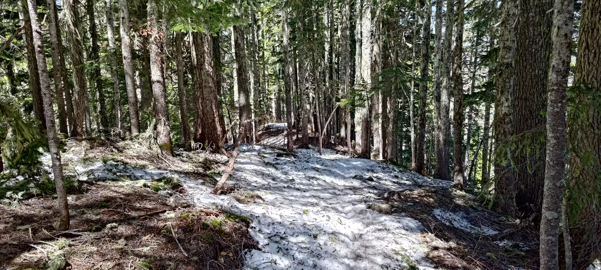
The road to the trailhead was not continuous snow, so don't expect to ski to your car anymore. Once we dipped onto the trail, it was actually totally bare at first, but got patchy quickly. Because of that, we continued just carrying our skis in-hand, figuring the patchiness would turn into continuous snow fairly quickly. After about 10-15 minutes, we stripped our layers (I was down to a t-shirt, which I'd worn in anticipation of the warmth of the coming afternoon), and continued on. After maybe half an hour or perhaps even longer, we realised that we had no idea when the snow would get continuous, let alone skiable, and finally a-framed the skis.
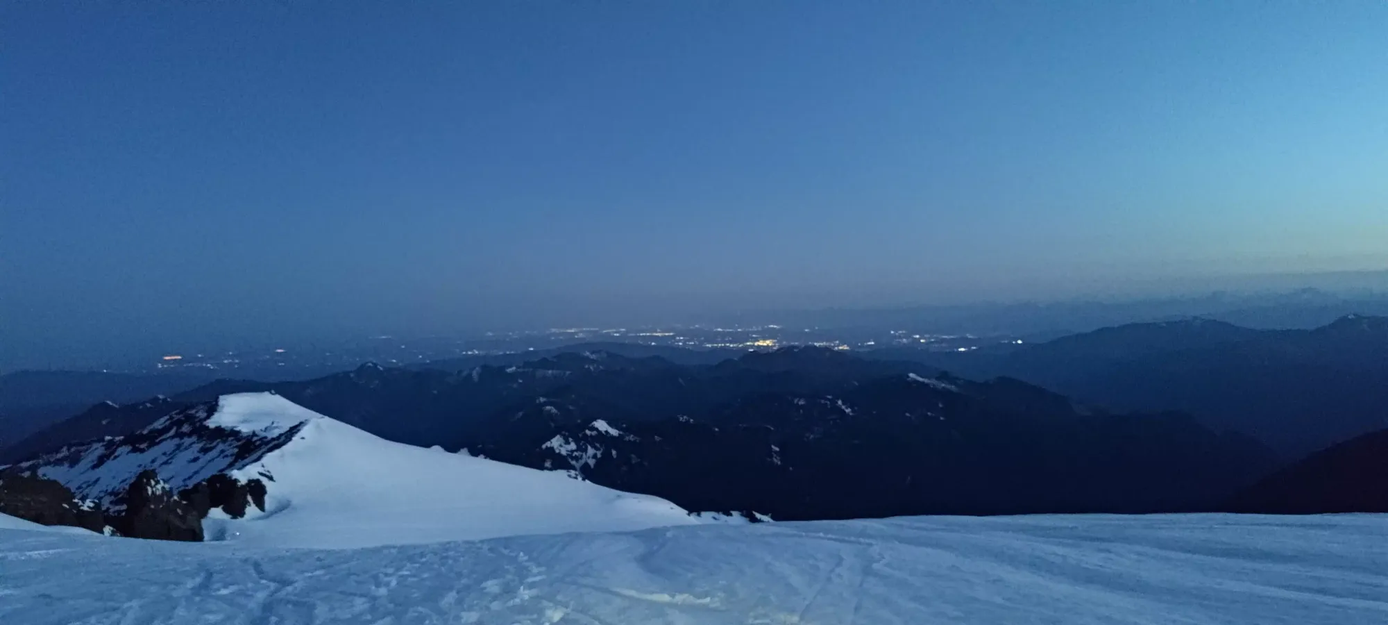
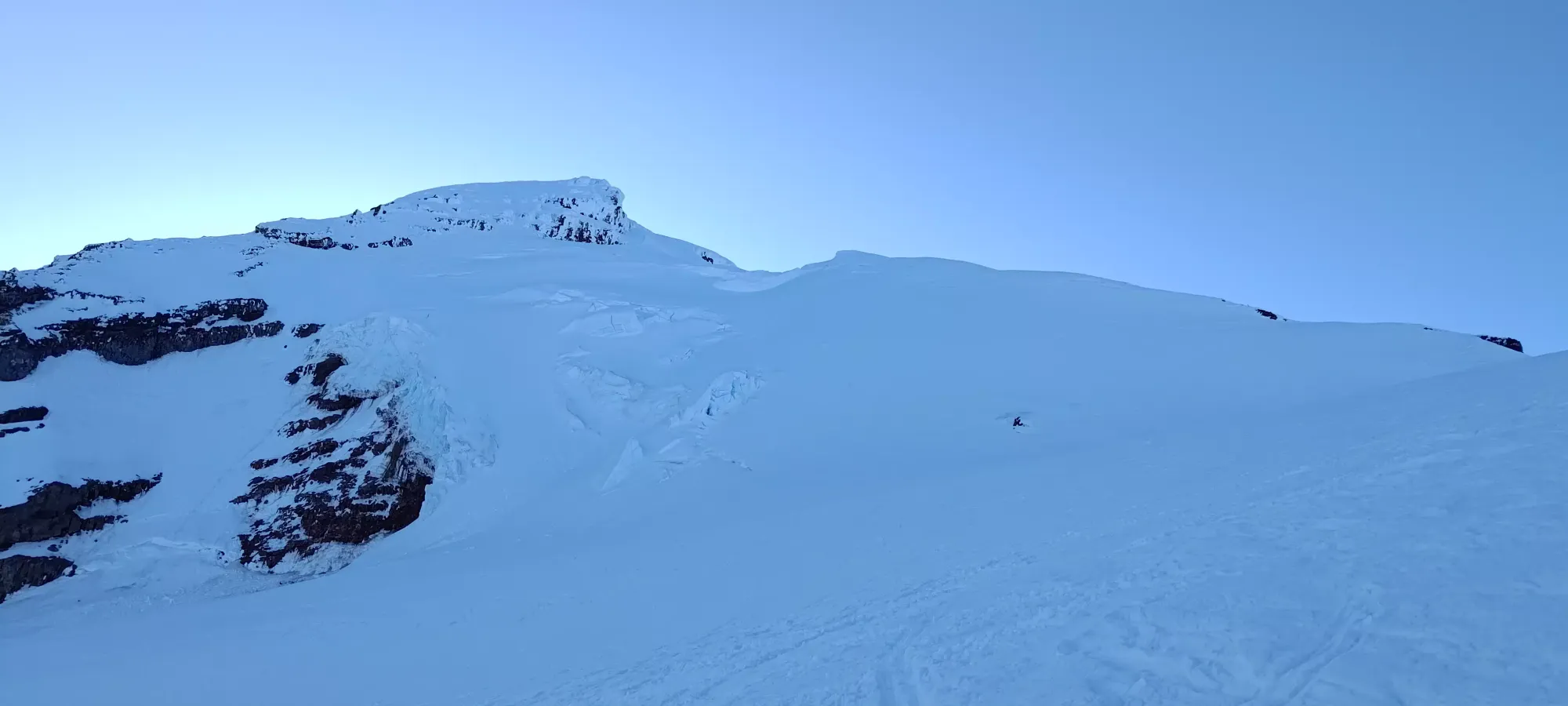
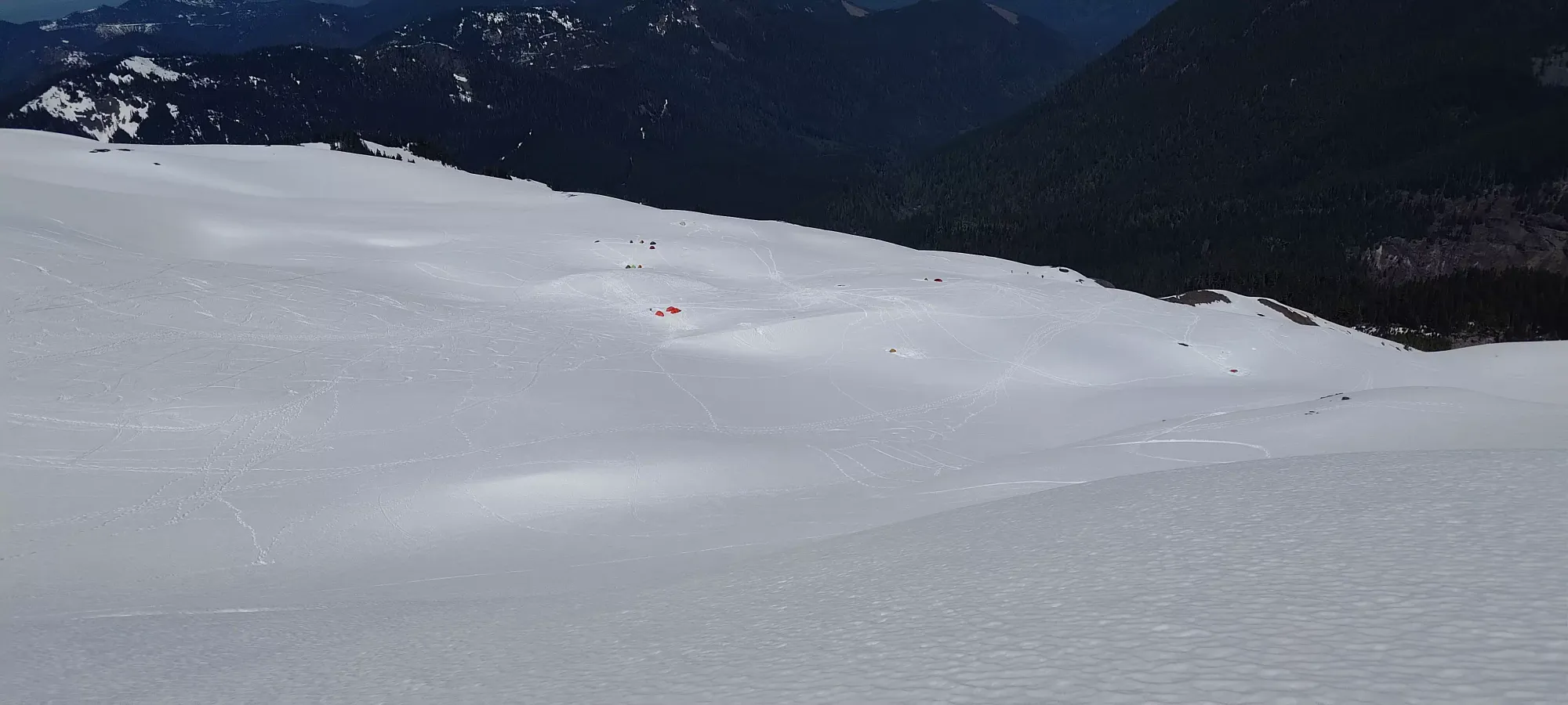
That turned out to be the right call, as we were booting for multiple hours, all the way to Hogsback Camp at 1800m. The snow was continuous a while before that, but it was so frozen, well-booted-on, and generally "not great for skinning" that we just kept on going on our boots until we got to the camp area. There, we found that the snow was still very firm, but there was no obviously amazing boot-path to follow, so skins would be more pleasant than having all that weight on our backs for the entire day, so we transitioned. Getting to this point took about 2:20. The camp itself was quite busy, with probably over a dozen, tents, one party coming down, and a few heading up as well. Lots of people on the mountain this night. Hopefully they were out for the summit and not the Aurora, as it was after 3am and we had yet to see anything all night!
The first bit of skinning was pretty smooth (at least with ski crampons, something Kelly was very happy I recommended he acquire for this trip), though not long after we started, I started to notice the impacts of my month of being "less than healthy". My legs were starting to get tired, which is not something that usually happens to me. I get tired, of course, but that's usually "overall, generic, largely cardiovascular tiredness", but this was "my leg muscles are actually feeling the exertion". I was also feeling cardiovascular tiredness, though 😄. Seems being basically sedentary for a month without good sleep or eating fully will make you lose some strength, go figure. I also started to get some annoying cramps (aside from my digestive cramps which were persistent throughout the morning) in my right quad/knee that were quite annoying, but if I avoided skinning too steeply and massaged it out when they came, were able to be mitigated.
Kelly is thankfully a very patient and understanding partner, and didn't show any of what I'm sure what plenty of justified frustration/annoyance, and we slowly picked our way up the Coleman Glacier. We decided not to bring ropes due to recent beta we'd got on the route, and our risk/reward calculus favouring the massive savings in that department over the very low perceived risk of falling in, and the higher but still low risk of seeing conditions we didn't like and having to turn back because we'd not be comfortable continuing on without. Follow this decision-making at your own discretion+risk. For what it's worth, despite my poor state, we managed to pass at least one party, so that felt good, even though I knew I was performing worse than usual.
As we continued up, I got slower and slower, needing more frequent breaks to deal with increasing cramps of both varieties and my tiredness. After the sun started coming up a little, we took a break and I had a sandwich to try and get the energy levels up somewhat, but that didn't really feel super effective. A bit before 5am (I think, my GPS was tracking quite poorly on the way up) I finally had to take my first bathroom break, which wasted probably nearly half an hour, and gave Kelly quite the head start on me (nobody wants to sit around beside their friend taking a dump on the mountain, so he kept moving). On the plus side, the sun was starting to rise, and we didn't need headlamps anymore?

That "break" wasn't much of a break, sadly, since squatting on the side of a mountain isn't exactly the most restful of experiences, but it did help with the cramping a bit, at least. Kelly waited in a few spots as I tried to catch up over the next while, and we walked together again for a bit before I had a second round of needing to go. That was, at least, the final time for the day, but again took quite a lot of time and energy to get done with. I had an orange and some water before I packed myself up again and got moving. This was largely within my expectations of how things would go (digestively, at least) given my patterns over the last week, so I was a bit hopeful that the cramps would disappear for a while, and I could focus on skinning again with renewed energy with the extra snack.
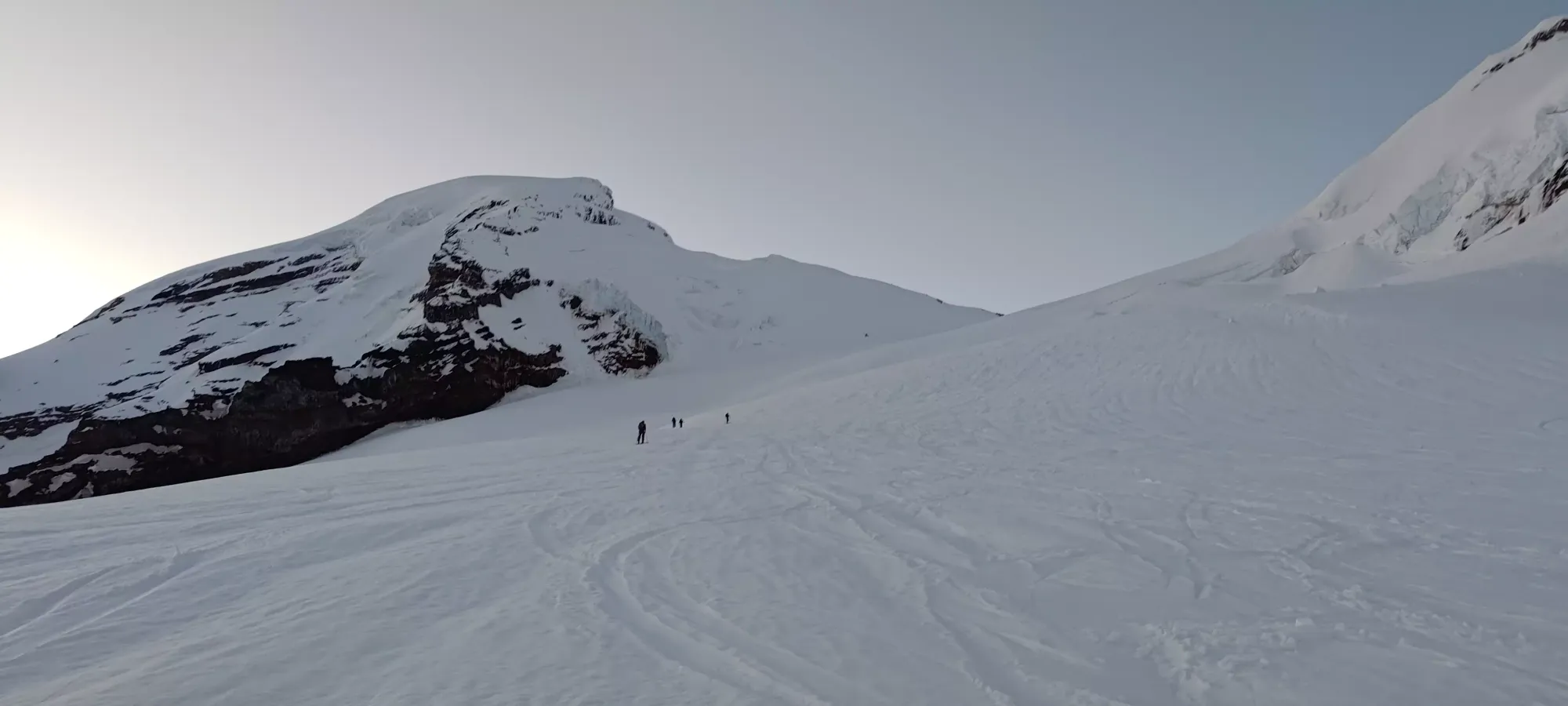
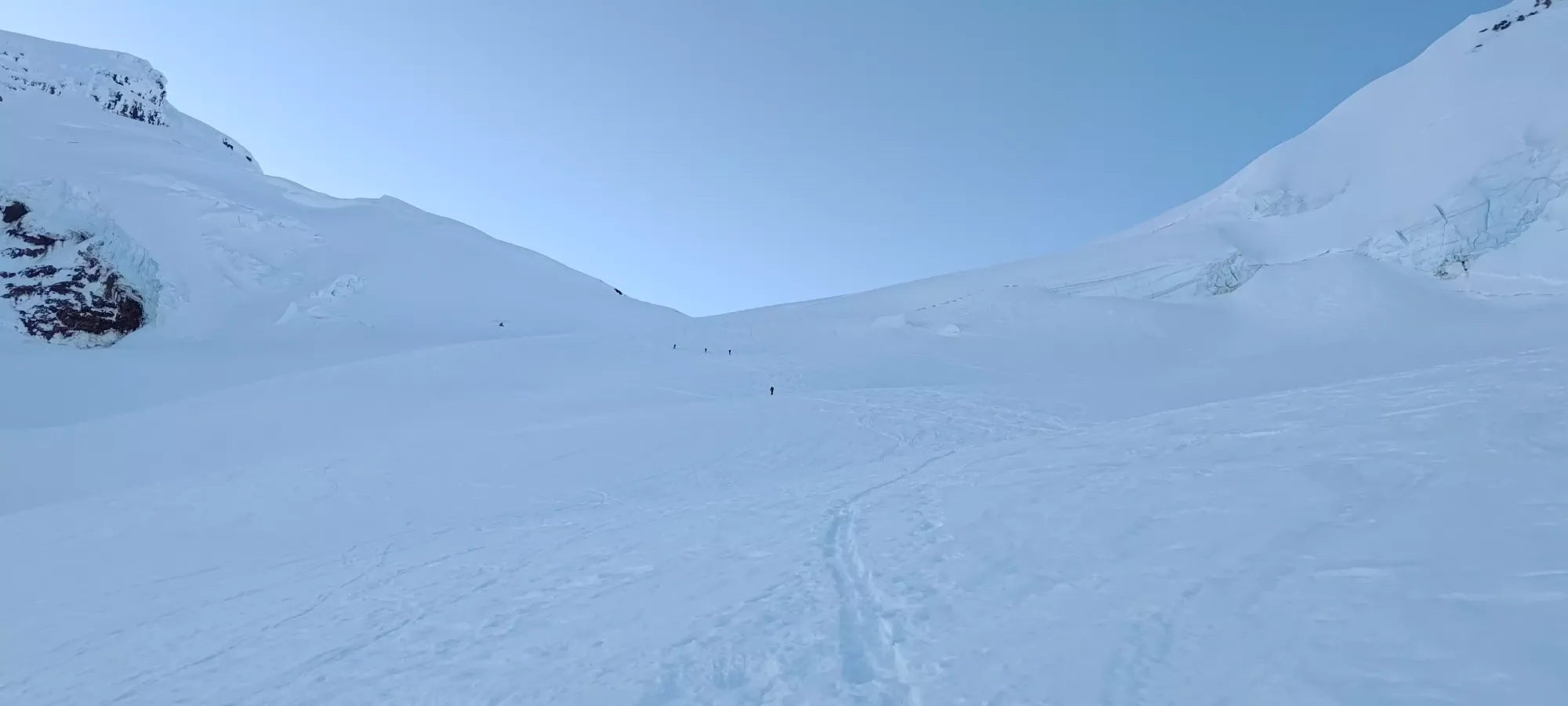
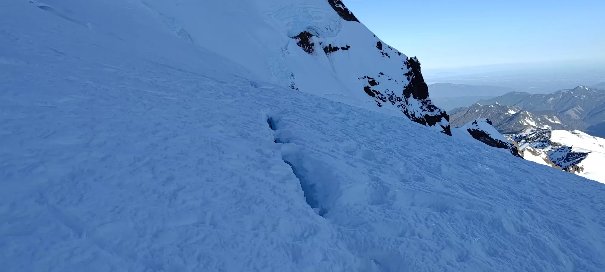
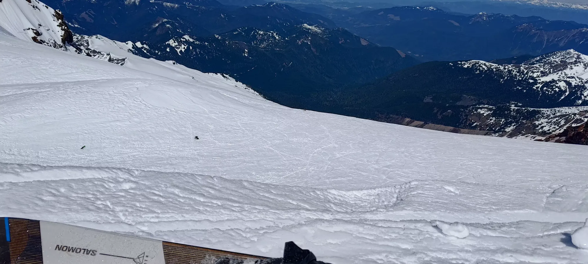
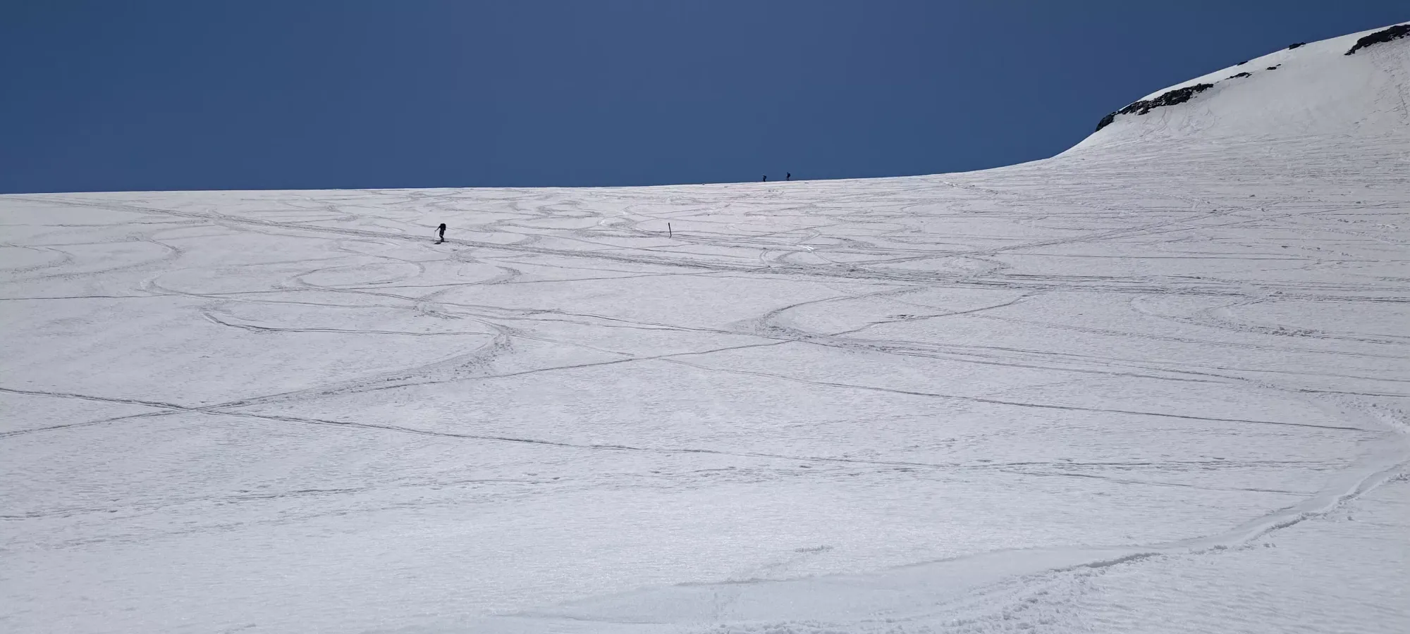
Despite that hope, reality had other plans, and my pace was what it would remain for the rest of the day almost immediately: 15-50 paces (at least there was a range, which favoured the high end at the start), rest, repeat. This took me all the way up to the col between Baker and Colfax, with the only other notable event being seeing the lone open crevasse of the day a bit below the col. It was easily stepped over on skis, which I did since the bridge where I was standing looked quite thin. Apparently whoever went up next after me, as I was told later, didn't make the same assessment, and punched through the bridge (on foot). I think they were roped-up though (which I would too without skis), and it was a fairly narrow slot, so no harm done, thankfully.
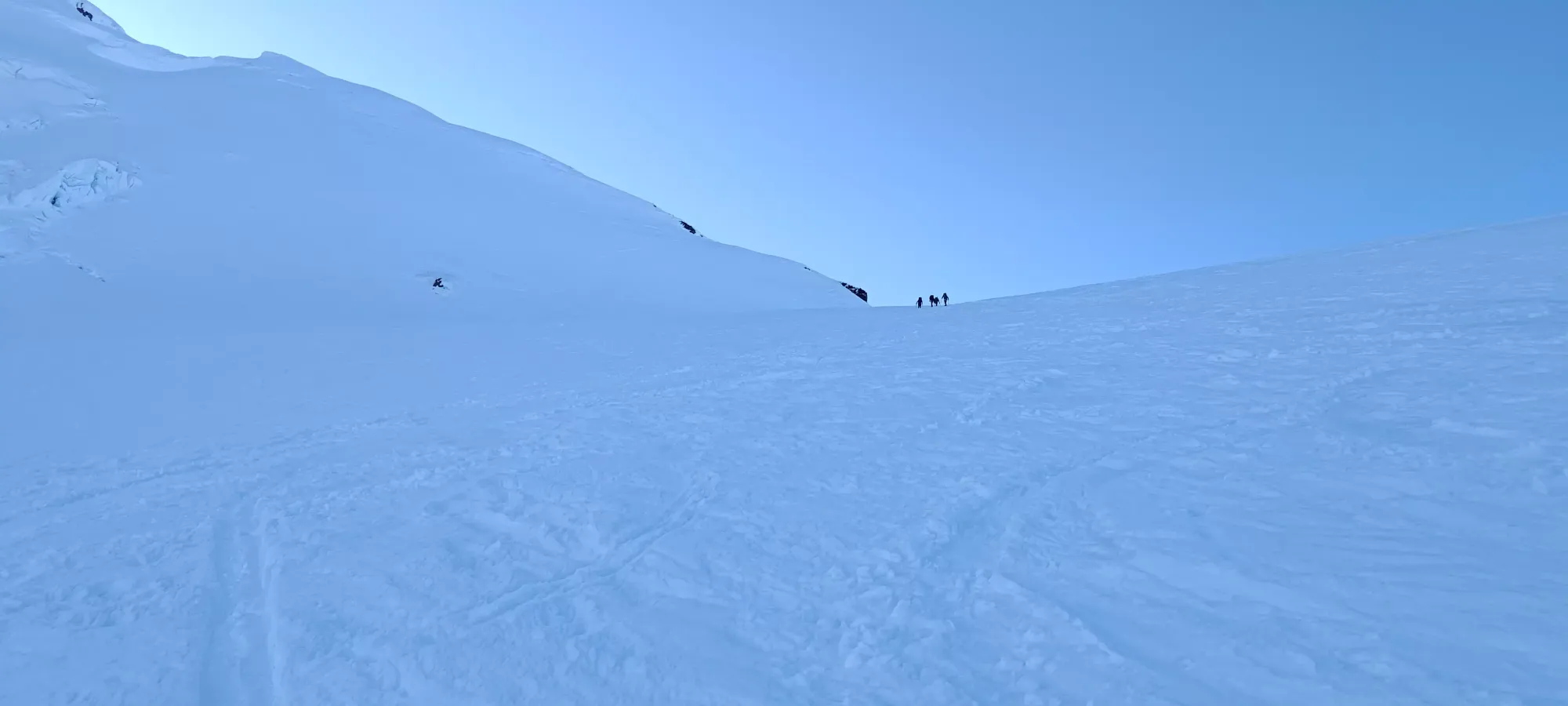
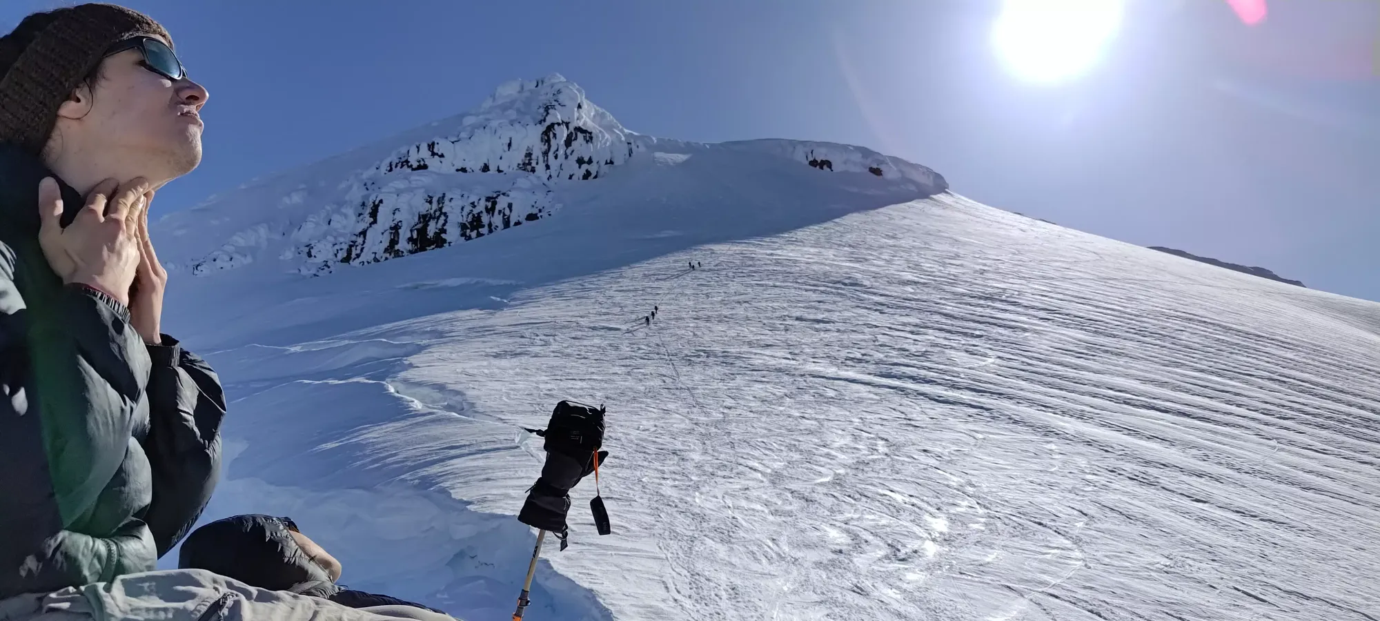
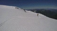
I got to the ridge not too long after 7am. There (or rather, just below it), I took a decent break while chatting with another skier who had caught up to me, and then to transition to put my skis on my back and get crampons on, as the ridge might technically be skinnable in sections, but everyone was booting, and with a broken trail (or even just firm snow), it is the superior choice. I got moving at around 7:40am, conveniently positioned behind a party of 3 being led by a guide who was keeping a pace slow enough for me to follow without breaks, which was probably more efficient than what I was doing naturally.
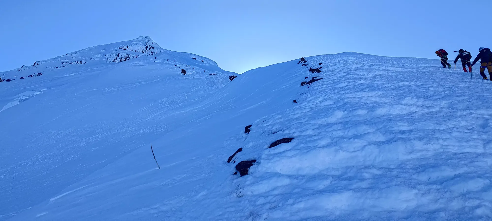
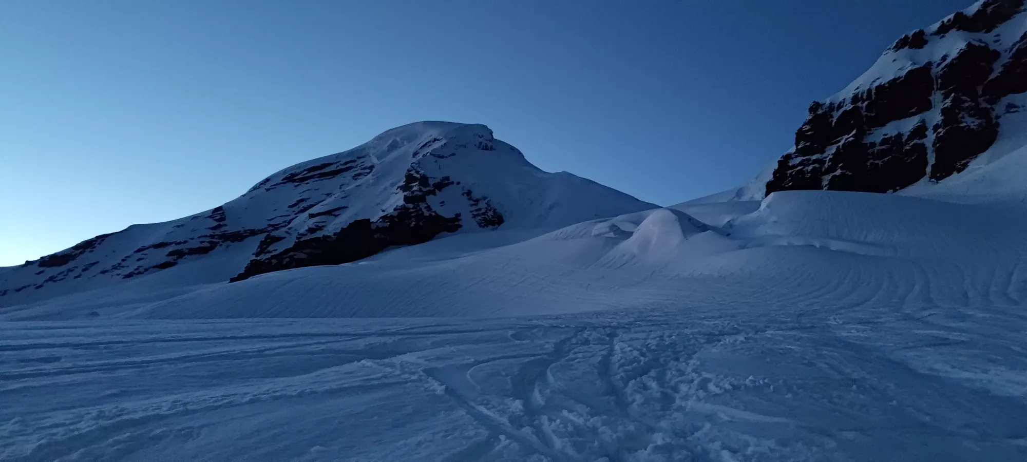
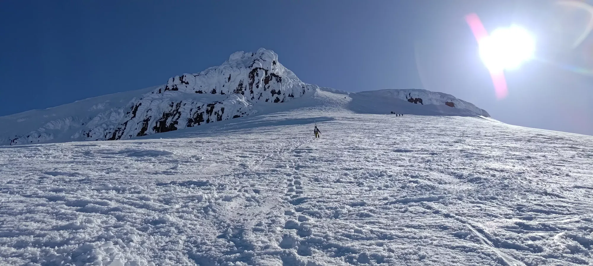
I followed this group up, who were actually moving slower than I could've mustered, until they eventually stopped as one of their members was even more exhausted than me, apparently, and needed to take some rest. I took advantage of the opportunity to ask one of them to get my rain pants out from under my helmet (which was much faster than me taking my pack off to get at them) and put them on, as the wind on the ridge was a bit uncomfortable in my fairly breathable hiking pants. This section seemed to go pretty well, actually, as I got up to near 300m in about an hour, which is actually still an acceptable pace! I did take a decent break there, though, as that was a nice sunny spot that wasn't windy, and after was the big, steep Roman Wall, which I knew would take me some time.
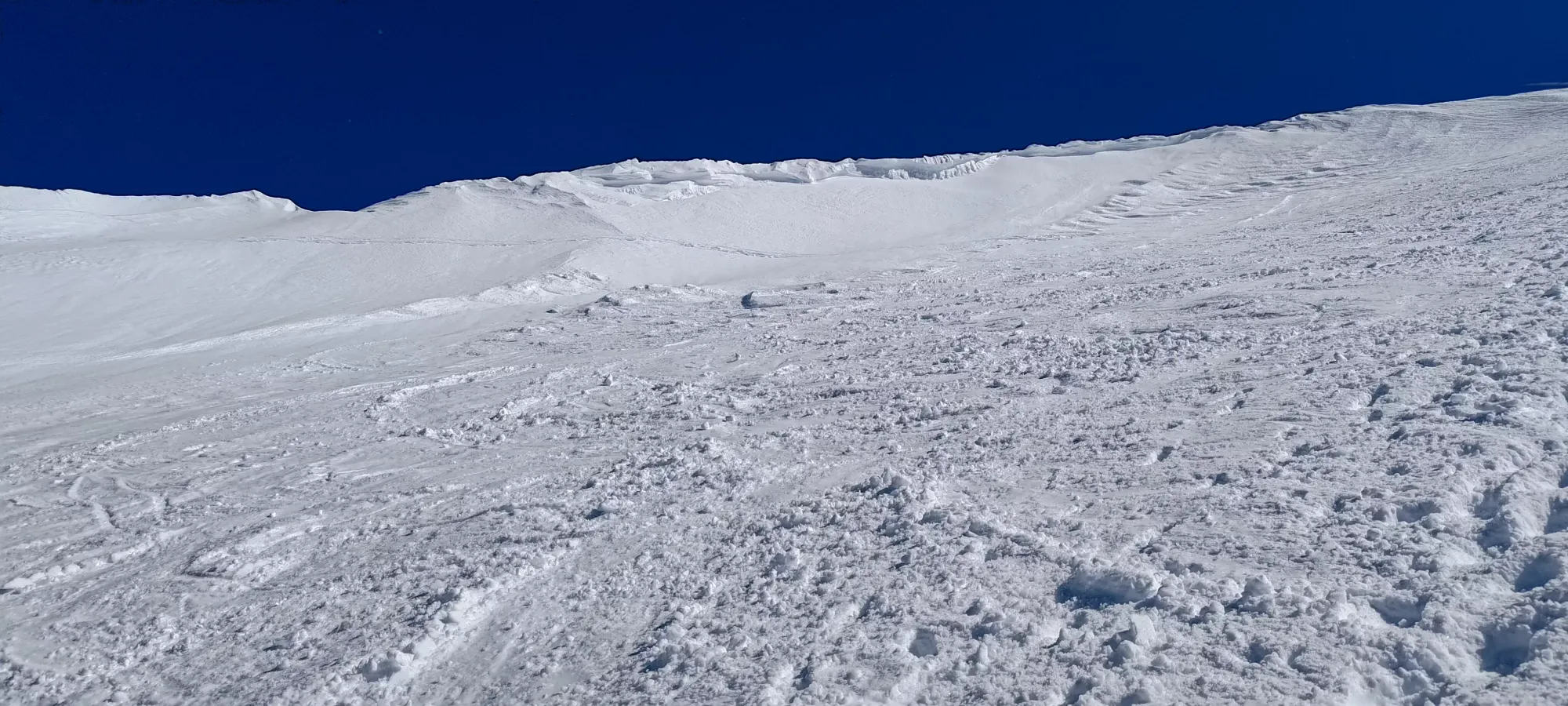
I started moving some time around 9:00, following the well-broken trail up towards the main "meat" of the Roman Wall. In a bit under half an hour or so, I'd say, it got steep enough that I might bother calling it a wall. Though, to be honest, it's really not that steep, I didn't feel the need to take my axe out, despite the snow not being soft enough to get my poles into it even upside-down. It was just tiring, more than anything.
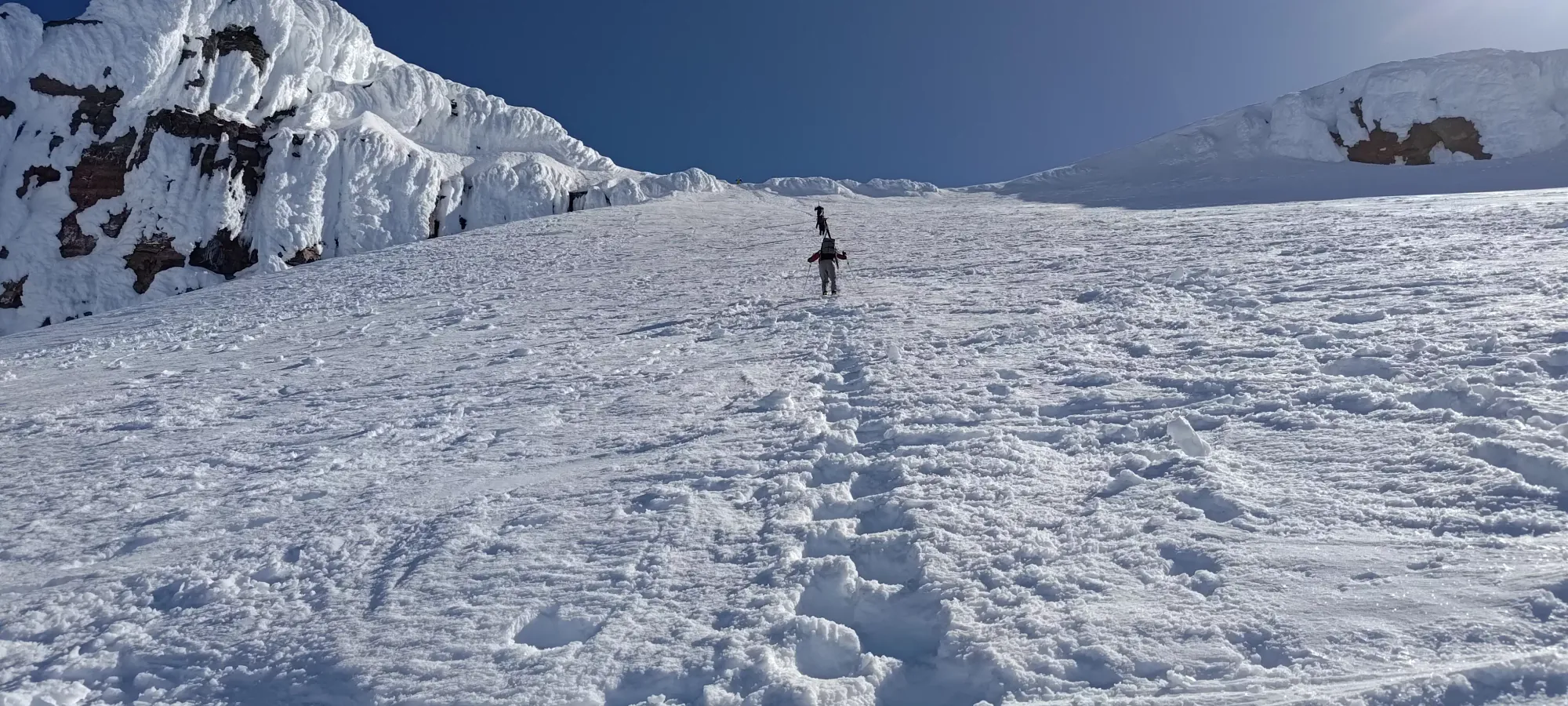
It took about 40-45 minutes from leaving my rest spot to the top of the wall, which tops out around 3220m. I needed a lot of breaks on the way up, taking as few as a dozen steps at a time by the end of it. I was really gassed, but I knew my reserves would get me down, so as long as Kelly had enough saintly patience to wait for me to trudge my way up. I had some water and took my pack off for a few minutes before continuing my walk up. At some point during the wall climb, too, my watch finally decided it should start tracking properly, and I had no more teleportations on my GPX track past that point 😅
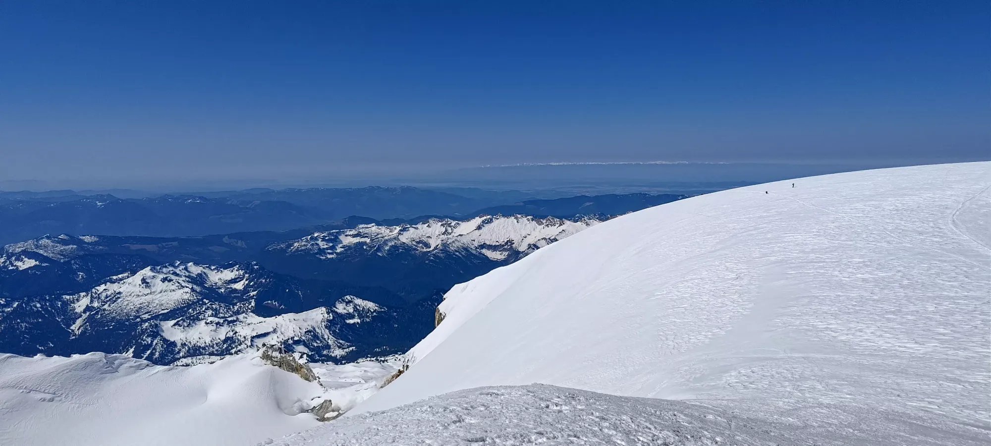
After the wall, things mellow out a bit, so it got a bit easier to get moving once again. I actually linked up with Kelly just below the false summit, who had apparently heard from a party ahead I'd turned back, so he was starting to head down and find me. Thankfully we crossed paths very close to the false summit, so not much elevation was lost, and we agreed that I'd just go tag the summit and meet back with him for the descent. Sadly, this is where I was informed the top of what you can see once you top the wall out is not the true summit, and I had a short descent and regain to do after that. Mercifully, though, while the true summit looks a bit far when you first see it, it isn't actually that far, and once you're done the small descent, it is basically as long as the bootpack up the top of the Showcase T-Bar to Blackcomb Glacier.
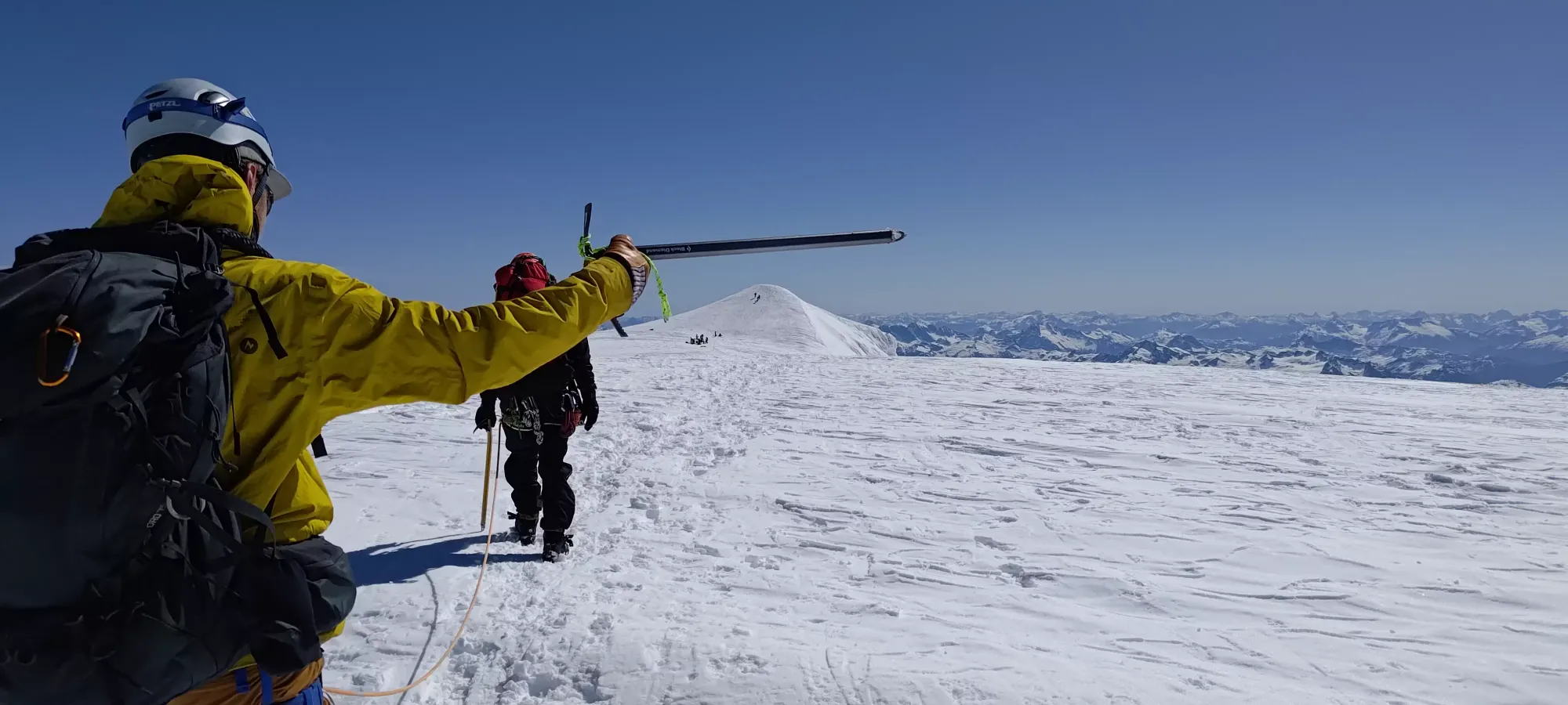
I linked up with the same slower party from the ridge that I'd passed, who were down their most tired member and were now just 2 who were able to catch up to me. I'm terrible with names, but I'm pretty sure the one pointing his axe's name starts with C. With a gun to my head... Cameron??? We chatted on the walk over, and for a bit just below the final ascent while he and his guide de-roped and had some snacks, and I took a bit of rest since I could use all I could get. Eventually, though, I needed to prioritize getting back to Kelly, so I thanked them for the company, and booted up to the summit, a casual almost 10 hours into the day 🙃.
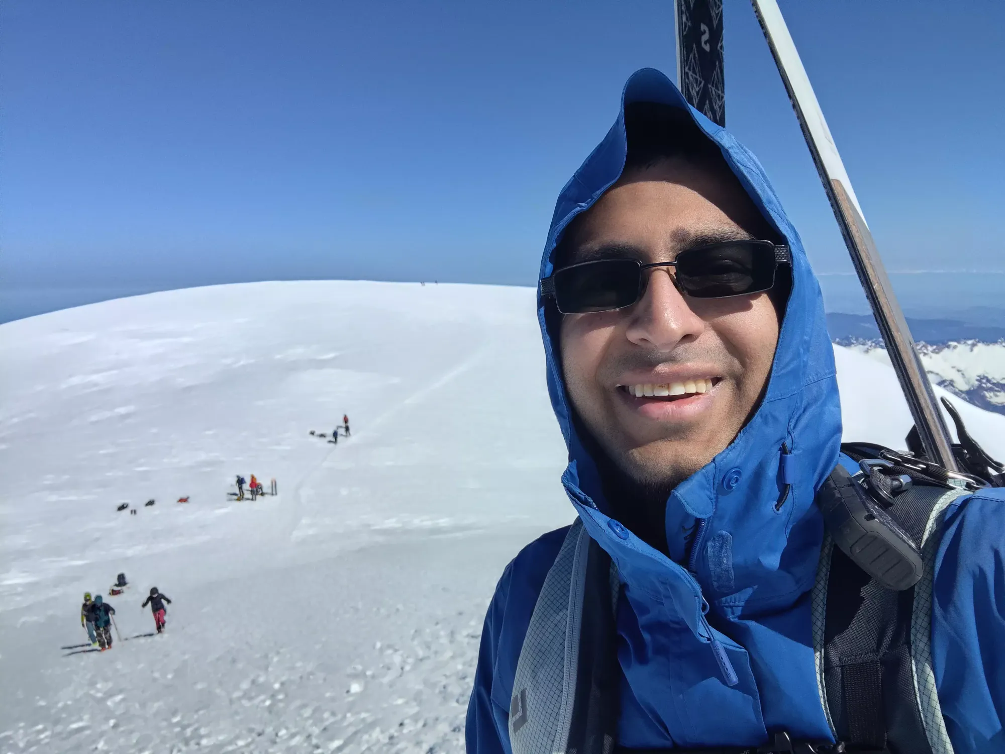
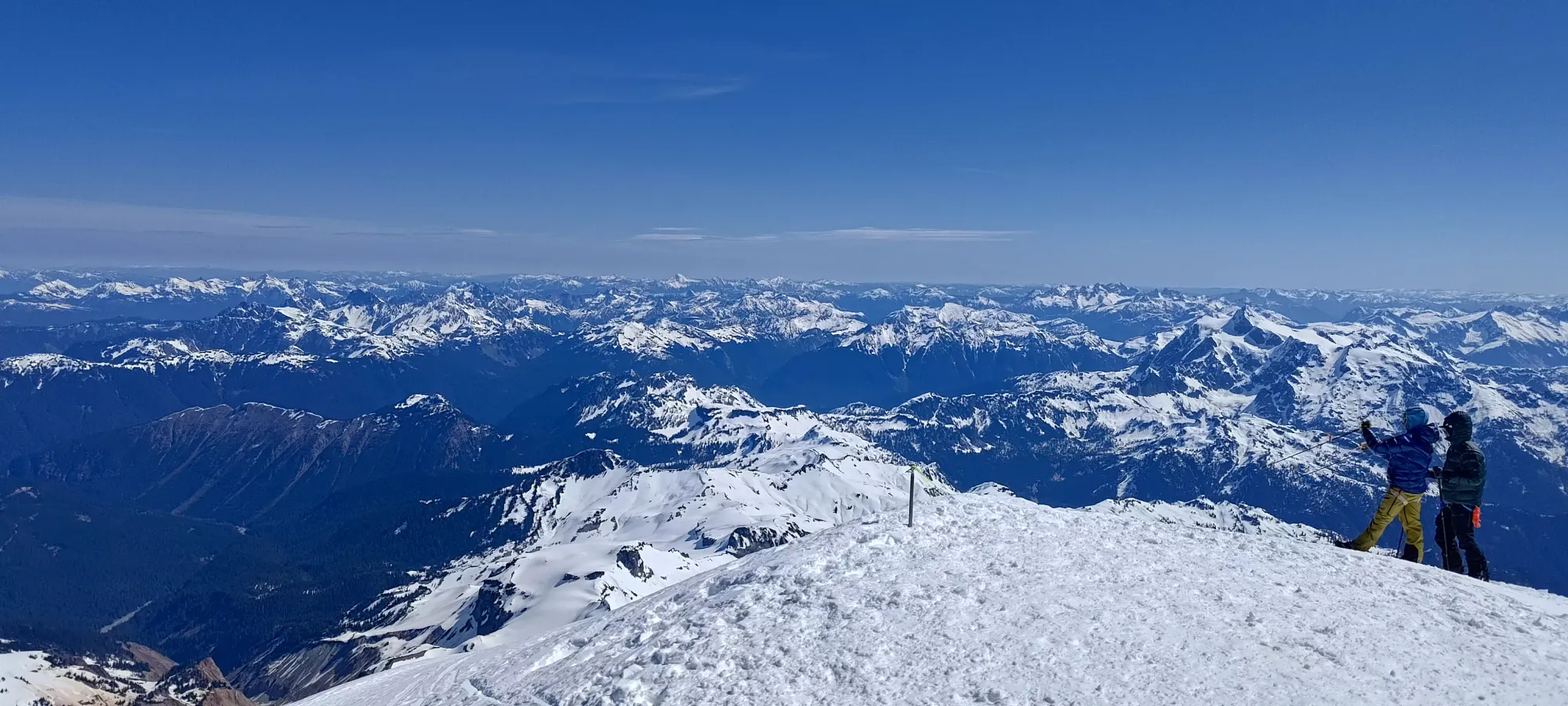
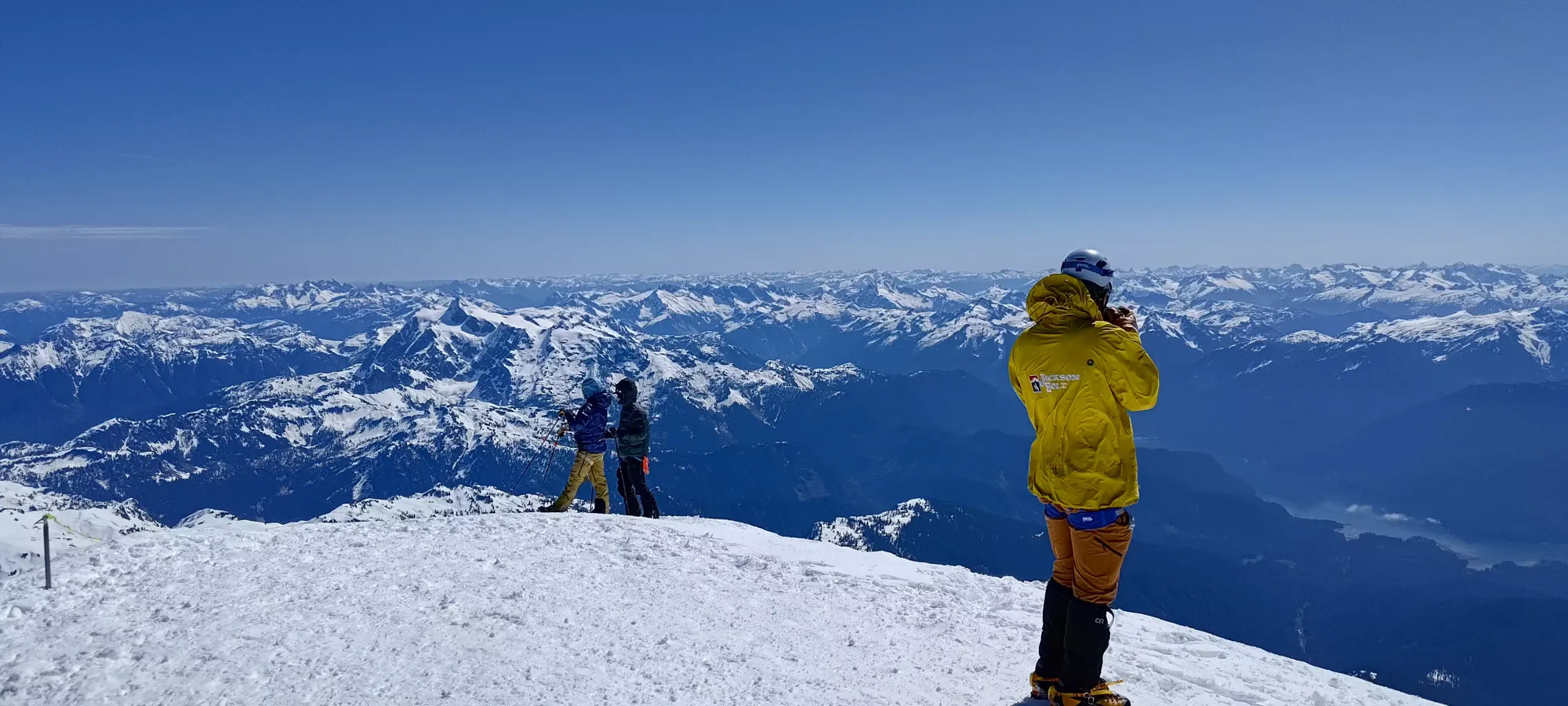
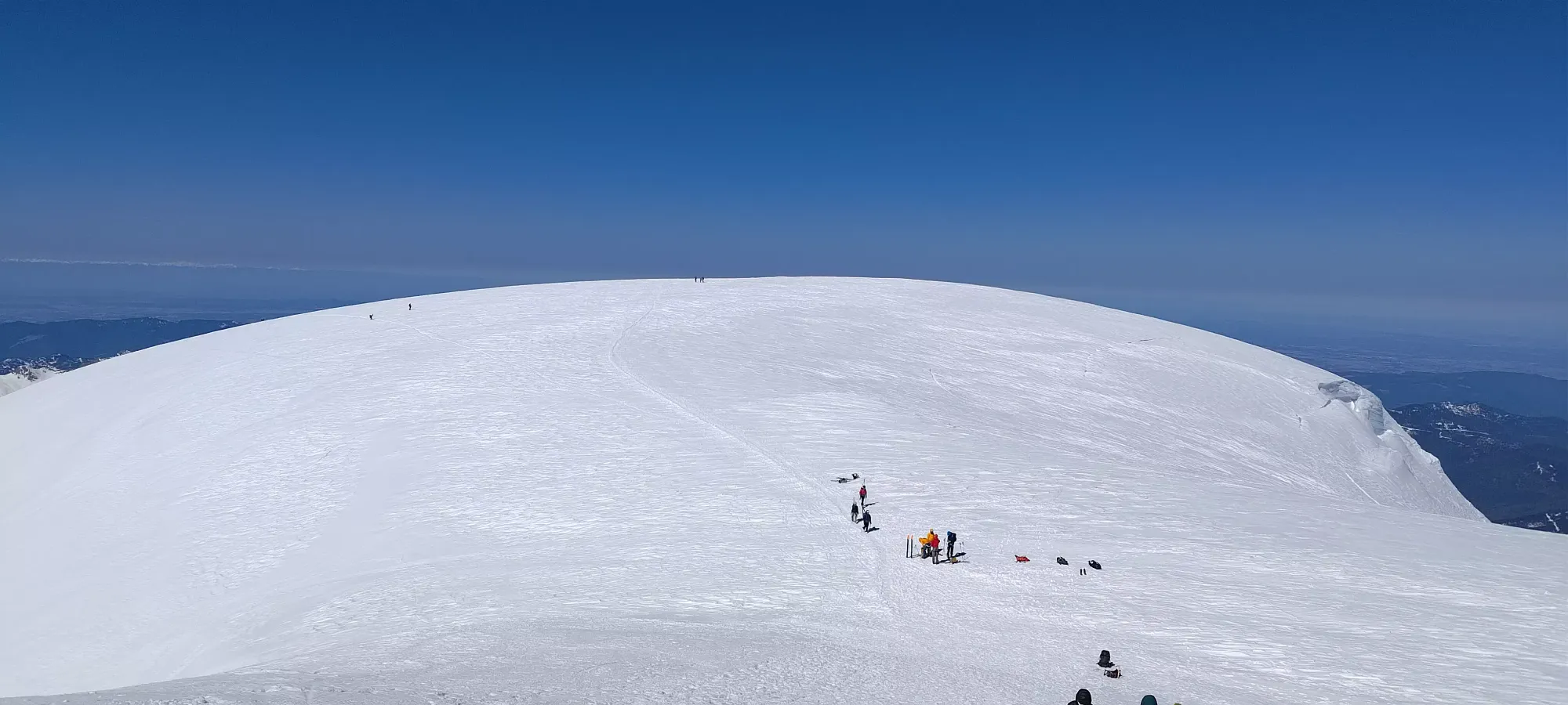
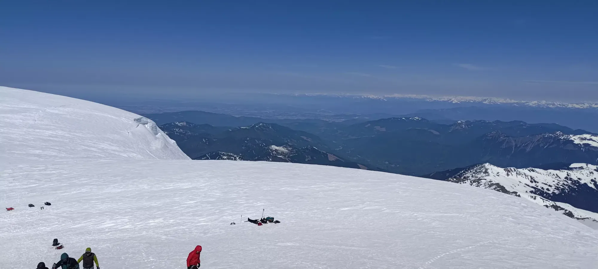
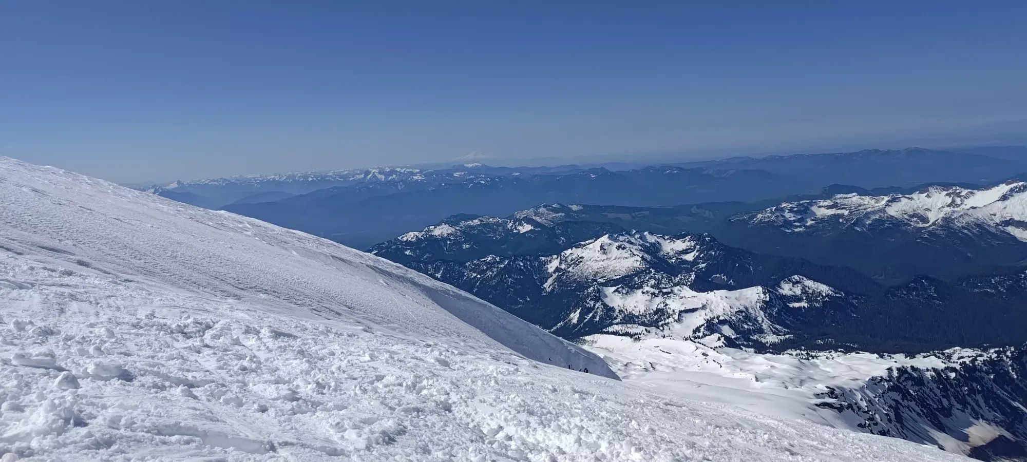
The summit was pretty windy, enough to move my body when the skis caught it, so a few pictures were hasty+sideways, and I didn't linger up there longer than necessary. I took the flatter return path that goes a bit more to skier's left off the false summit to avoid elevation gain on the way back, but that backfired and got me too low, to the point Kelly couldn't see me from where we split up, so I ended up having to boot back up most of the false summit anyways before we could group up 🙃. Once we did, I transitioned, and in my haste to get out of the wind, I tried a somewhat sketchy way to pack my crampons+skins into my helmet holder, since my pack was kinda full and difficult to pack without taking the time to take things out and neatly pack them. This would become important later 😅. We did, at least, agree I should ski first so Kelly could watch said items in case that proved to be ineffective, so it wasn't totally stupid. We got moving down just before 11:15am. The snow was still quite icy and unpleasant at the top, but we figured since the lower slopes had been baking for a while that waiting too much longer would compromise the snow down low too much, and it might start making the steeper parts in danger of cornice falls and other things nastier than just sticky snow or small wet slides you can out-ski.
This was also the first time I have ever had an action camera with me, in this case an old GoPro my aunt gave me when I visited L.A. and skied Mount San Antonio. I did not, however, take any time to adjust the angle at which it was recording, and I think it was pointing a bit too far forwards, but hey, it's better than nothing 🤷. Sadly, the snow was so crappy that there was nothing worth filming. It was bumpy from all the walking and skiing and wind over the past weeks, and super hard all the way down to the Colfax col. My body was already battered to hell, and my Ankle doesn't enjoy skiing on surfaces like that which require it to absorb shock forces repeatedly, so I was in quite a bit of pain, and my ankle needed many breaks to get down safely, as if I tried to ski it in one shot, I wouldn't have had the strength to turn/stop whenever I needed to.
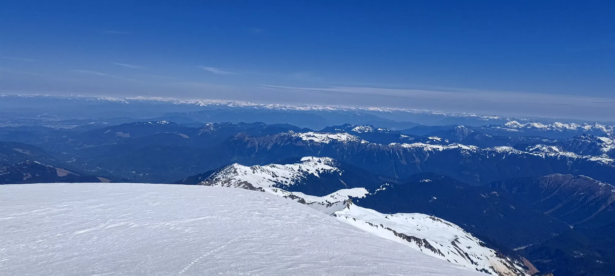
Aside from that, the terrain is quite easily skiable, even the Roman Wall is no harder than your typical black run inbounds, and it doesn't even have moguls, so really it's probably easier than that. It was just unpleasant for Kelly, and actively painful for me. After about 20 minutes of that suffering, though, I was down nearly 600m from the peak, so still way faster than walking, and most notably, I was back at the Coleman Glacier, which got sun earlier, and promised better conditions than we had previously.
My first few turns down to 2600m were getting better, though I apparently started moving a bit too fast for my jenky skin+crampon storage method, and my skins fell out after an "actually decent turn". So, I had to stop and boot up 20m to retrieve them, which was super not fun after finally getting to go downhill and enjoy myself. 15 minutes and a "proper repack" to avoid repeating that fun later, and I got to start actually enjoying myself, with the snow now in perfect corn condition.
We got some good progress after that, skiing down from 2600m down to 1600m in under 20 minutes. The snow remained good corn down to about 2000-1900m, just above the Hogsback Camp. On that final stretch, we somehow found a whole-ass ski that someone had lost, just sitting on the ground. Nobody nearby was there to claim it, so apparently someone actually, like, dropped it and didn't notice 🤷. We stood it up to make it more visible and hoped someone was coming down for it, hopefully that was the right call.
After that, we started hitting occasional spots where the snow was sticky and would lurch you over your toes a bit, but nothing so bad it wiped either of us out. As we got below the camp, the snow quickly got slushy, to the point that it would make sloshing sounds and get kicked up over your boots and onto your pants (hopefully the waterproof kind). It was still fairly fun, though. We descended to skier's left of the camp, avoiding the ridge we booted up in the morning, and instead keeping to the less-tracked face to the side, which we were able to navigate despite it being somewhat blind (just had to check at each roll to make sure it still went, and it always did, if occasionally with some adjustment). We started seeing some wet loose activity at this point, though it was all small terrain, and the snow moved much slower than an average skier, so nothing to really get worried about, I skied through one of Kelly's slides without issue.
We spent another few minutes getting down as far as the snow was continuous, about 1400m. There, another pair of skiers went to follow Kulshan Creek, which rejoins the trail about 75m further down, but we decided to take the W for the day and just walk it out, since it was quite warm, and we knew how patchy the trail was, and didn't want to risk falling into a hole into a very wet and miserable creek. From there, we packed our stuff up and hiked out. Kelly was eager to get off his feet at all costs so he left fairly quickly. I knew I was gonna be slow and tired anyways, so I took my shells off, got my skis packed up nicely, and turned on the music to crank out the last 3-ish kilometres.
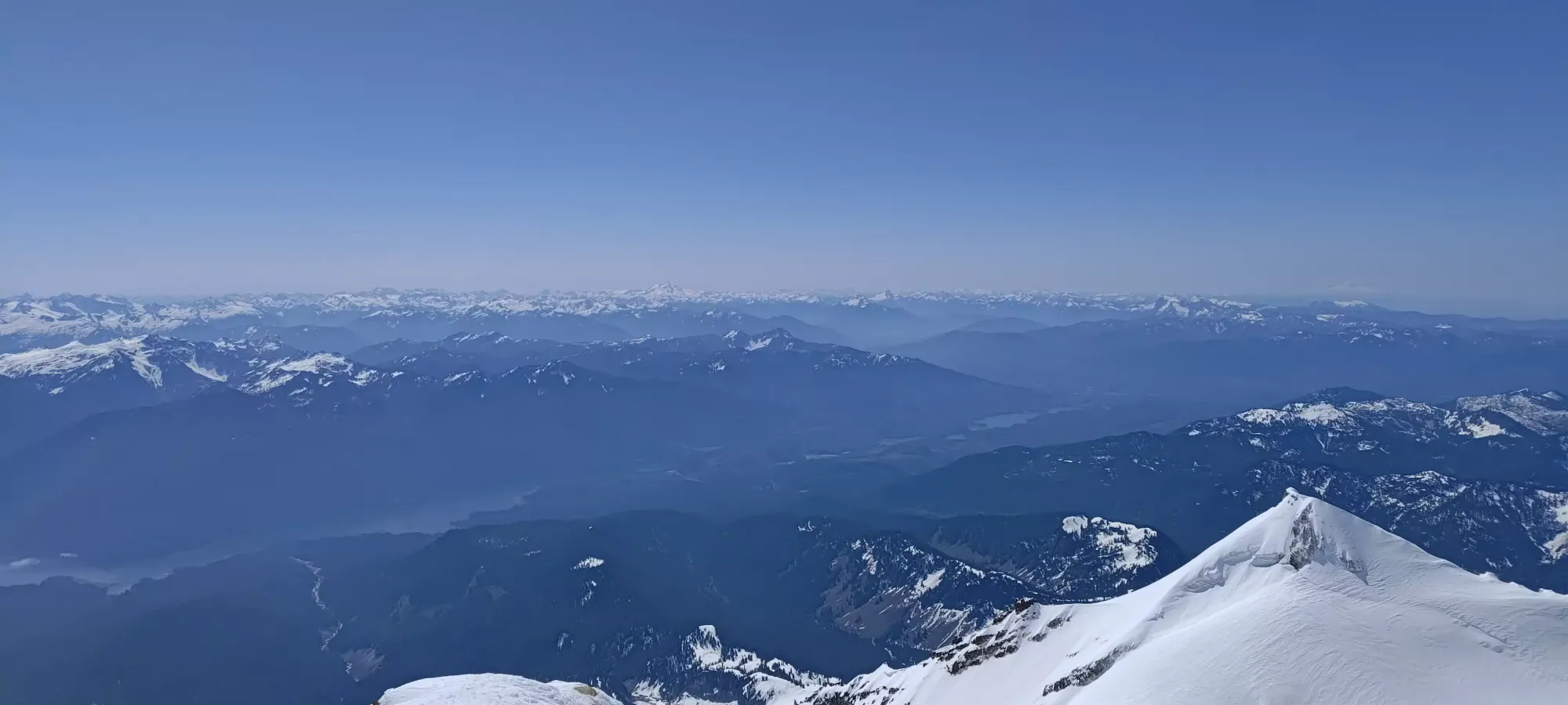
Overall I took about 1:10 to walk the just-over-three clicks back to the car, which is pretty sad for a downhill pace. When I got back to the car (finally), about 13 hours had elapsed since we left, and the feeling of sitting down on the backseat and taking my boots off was truly a gleeful experience. This was a pretty brutal trip, and by most people's standards, I probably bit off more than I could chew for my first "real mountain" in about a month, but Kelly insists he was still happy to come along, and I know my body enough to know when I can keep grinding vs when I actually need to get out, so I would call this a win. Baker is an epic mountain, visible from all sorts of places, and of course, an ultra 🙂. 10/10 would recommend, and would also recommend going on skis, and in no shallower snow than we had, otherwise the crevasses do become quite the pain in the rear. In the spring, with all that elevation differential, it's basically impossible to have good snow the whole way down, so I'd try timing it similarly to avoid slides in more dangerous spots, and still get as much corn as possible. Winter is, of course, an option for those able to find a weather+stability window for the sake of glorious powder for a couple thousand metres or more, but I'd probably want a sled to make that happen (which I do not have).
At least until my colitis takes a turn for the worse, or anything else untoward, I think I can say "I'm back" once again 🙂
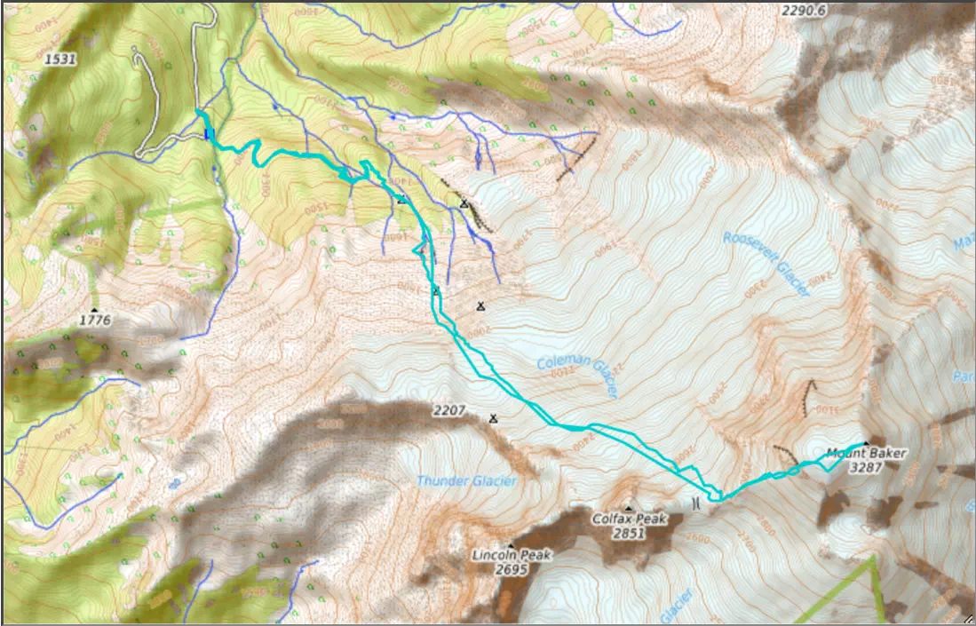
GPX Track + Map