Abercrombie Mountain - March 17 2024
A long, gentle slog for a peak that's quite easy and popular in the summer, but rarely ascended in winter due to the long, sloggy nature. It's an ultra, though, and in better snow would actually be good skiing!

Abercrombie Area Selkirks, Colville, Washington
2227m
With avalanche hazards very high in the area near home for the week and weekend following a massive dumping of snow with a weak layer below, and rapid warming, I was in a bit of a bind. I'd already spent the previous weekend enjoying that dumping of snow inbounds, so I wanted to redeem my lack of peaks with something substantial. However, substantial mountains tend to come with avalanche danger, so that wasn't going to quite work very neatly. Some others I know in the peakbagging communities had some very optimistic hopes of some Cascade Volanoes or Duffey-area peaks, but with the conditions being what they were, that wasn't going to happen. This was, after all, the 1-year anniversary of my near-fatal accident on Wedge Mountain, and my mother was going to kill me if I did something stupid on that exact day 😅.
So, with much map scouring and research, I came up with an idea: drive out to Colville, WA, and try to ski Abercrombie Mountain. This peak is fairly mellow, especially on the southern side. It also has approach roads going up to around 1500m, and multi-use trails above that, so the terrain should be open and holding snow decently, and make for easy terrain to travel. I couldn't find much in the way of records of winter ascents, especially with skis, but I did find one video of a couple dudes snowboarding it, and the open glades looked pretty fun. I managed to sucker in Kelly, a new friend I'd just made skiing together on the weekend prior to join in for the sufferfest. The plan was to leave town early Saturday afternoon, then drive down to Colville and crash at a motel for the night, and get a start somewhat early Sunday, and have a late-night drive to get home for work Monday.
We left a bit late due to some off-road congestion on my last-minute peak beforehand, but were on the road by about 3pm. I got us to Abbotsford before I had to pull off and use the bathroom (my colitis is still not great at the time of writing, due to a less-than-effective attempt to try new medication. Hopefully that will be resolved soon, though). Sadly, there was a wait to use it longer than I had the capacity to deal with, but thankfully I had brought an extra change of clothes and my new friend was kind enough to ignore the awkwardness and brought me them from the car along with some very helpful wet-wipes to get that situation resolved 😅. A bit unpleasant to start things off, but that's sometimes the reality of doing stuff like this when you've got conditions like mine.
After dealing with all that, it was already after 5pm as we left Abbotsford, so not exactly the timing we were hoping for. At least with me feeling better after that stop, I drove us to Osoyoos by about 8pm, where we grabbed some dinner before figuring out our plan for the night. The original plan was to use the border crossing at Christina Lake, but sadly when we arrived, we figured out that while it is open til midnight, that's only to come BACK to Canada, to enter the states, you have to be there sooner 😞. That was quite the annoying wrench in our plans. For some reason, Google also didn't feel like showing us that there IS a 24-hour crossing south of Rossland either, so instead, we headed to Castlegar for the night, arriving at 11:15pm and sleeping not too long thereafter.
Since we were unaware of the Rossland crossing, we thought our options were an 8am crossing at Christina Lake, or 9am at Boundary, WA (very creative town name, I know). Since the driving time was around an hour different in each, we chose Boundary so we could drive more the night before and wake up later instead. So, we got up at quarter to 7, had some breakfast, and set out to get to the border closer to 8:30am, just in case they opened early.
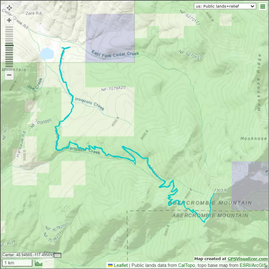
They did not, but we did at least get to be first in line to cross. Once that was over with, we had to find our way to the trailhead. There is no signal here to speak of, so make sure to download your maps ahead of time. We did so, and followed Google's directions to take Cedar Creek Road towards the trailhead, as it was "what Google said to do", was visually the most direct way to the western trailhead we were looking to use, and also appeared to cut off the most distance at the lowest elevations before it got towards the trailhead (the area is a mess of many roads), which we figured would be good to increase our chances of driving farther up.
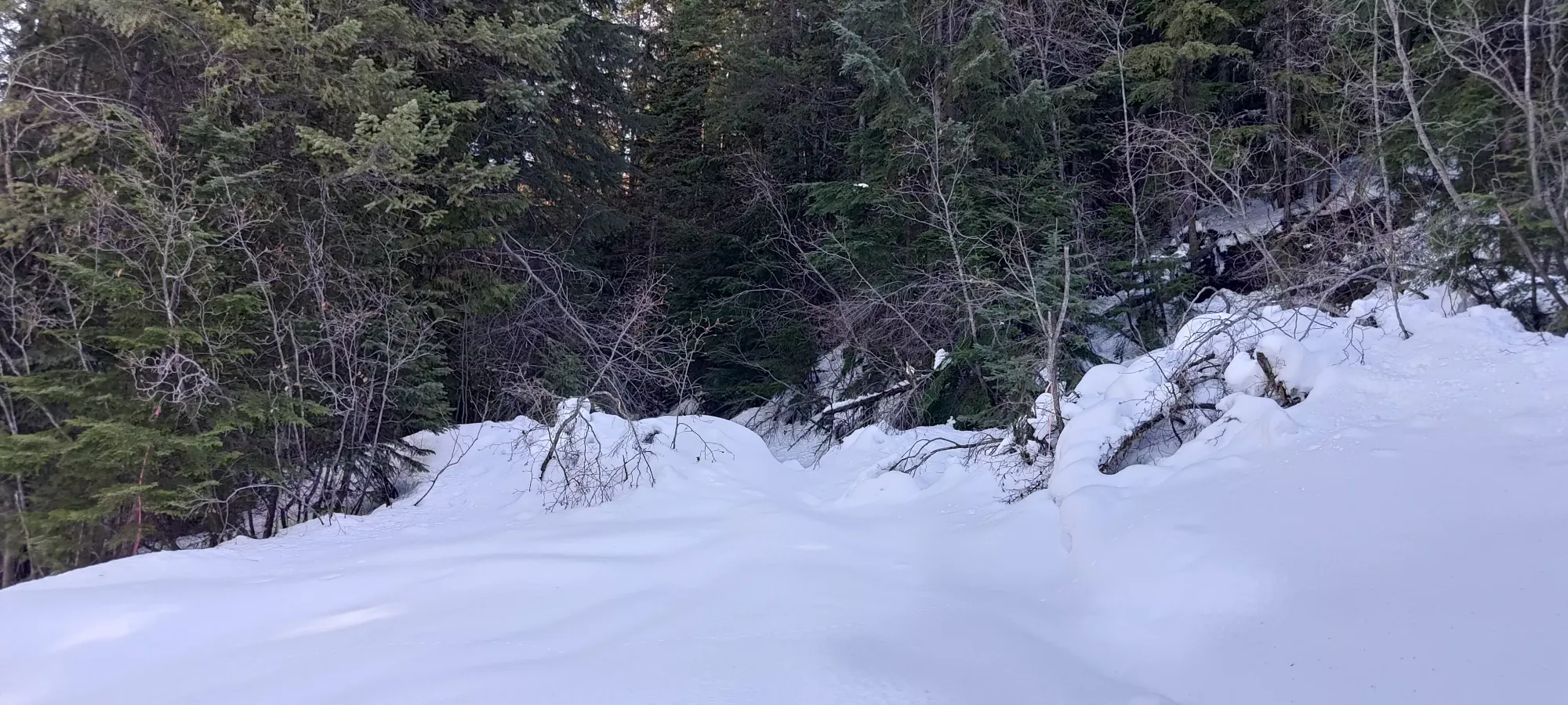
Sadly, right after the road turned south, there was a clear snowbank from where plowing stopped, and a small deadfall blocking the way. We tested the snow and found it to still be firm+cold, and not too deep, so we moved the deadfall and I drove us up a couple hundred metres before failing to make further uphill progress at about 825m elevation. I might've been able to keep going if I aired down and chained up, but since I was only one vehicle, we didn't want to push things and get stuck in softer snow on the way down, so we decided to just embrace the suffer and accept it would be a long day.
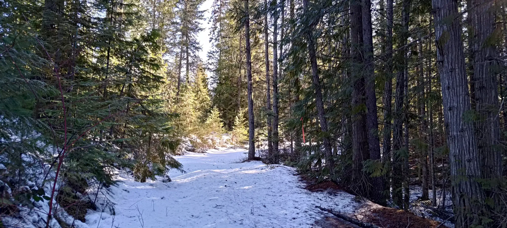
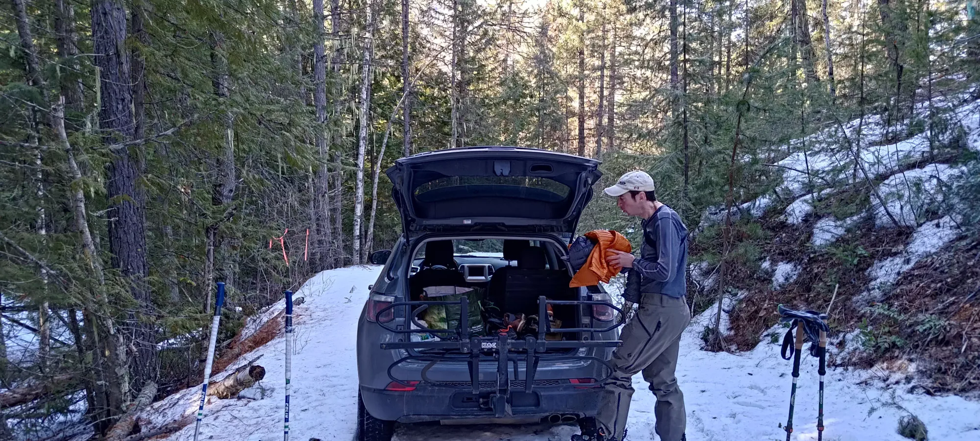
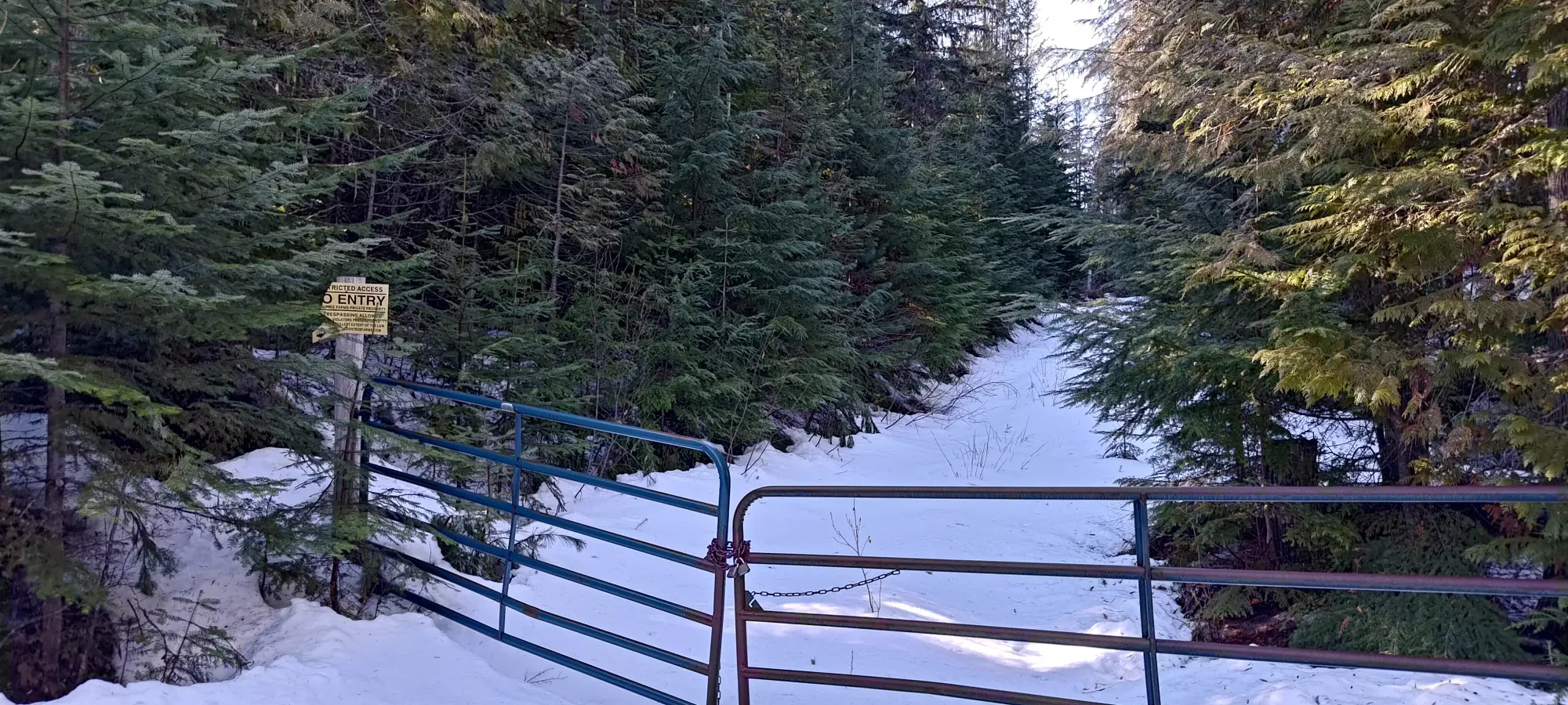
We got our gear together and started skinning at 9:40am, quickly discovering just how much of a mess of roads the area was, and following an incorrect branch east for a couple minutes before realising our error and heading back. We got back to the correct road, noted as #7078 by some maps, and found a gate blocking motorized access just past the car! This made us feel better about not bothering to try to drive further, if nothing else. We removed our skis to get across, then continued skinning, ignoring the no trespassing sign at our own discretion.
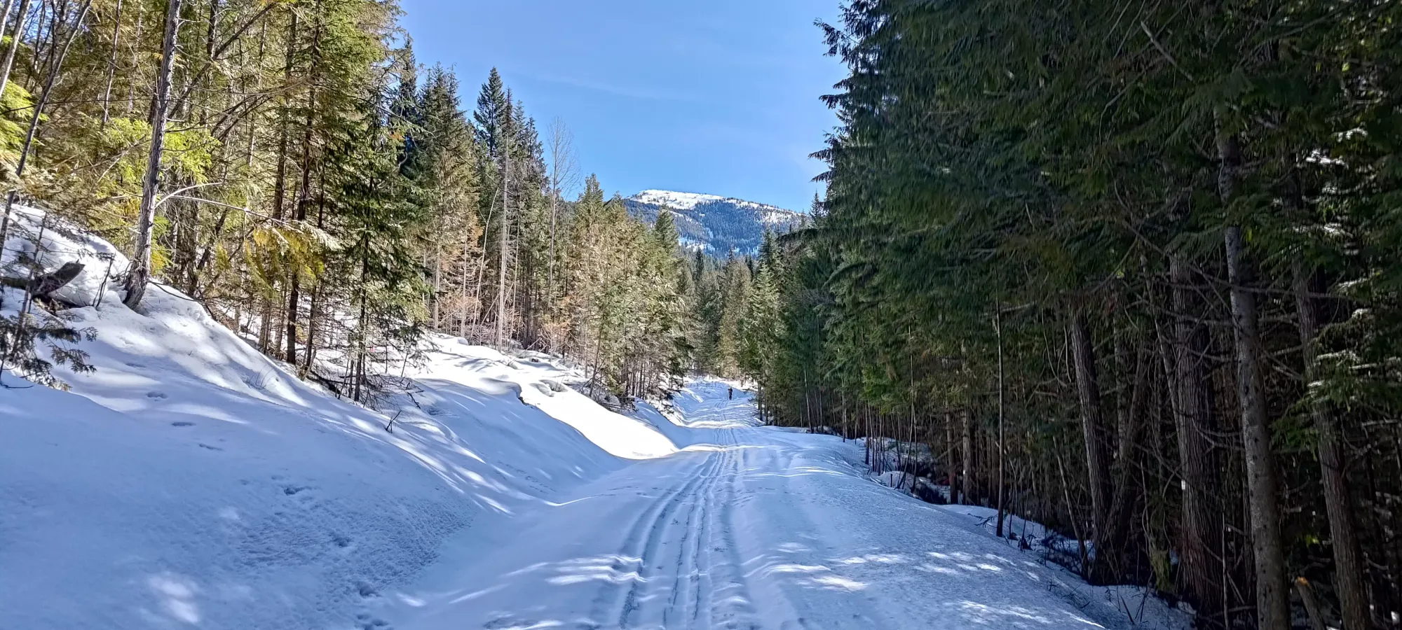
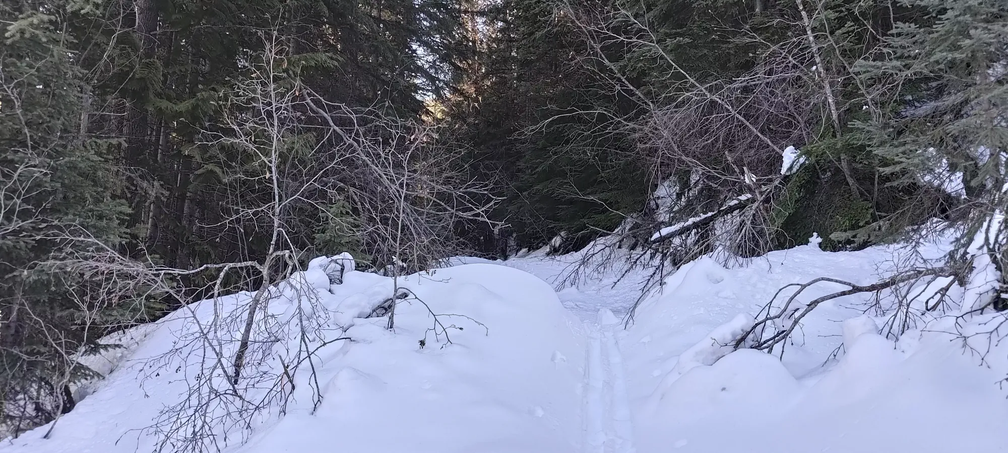
Sadly, within a minute or so of bypassing the gate, we found the road totally bare, and had to take our skis off and start booting it. We walked for a while just carrying our skis before we accepted that this might be a long walk (the road goes south while gaining elevation rather gradually before turning east and starting to go up the mountain a bit more directly), and stopped to strap skis onto our packs.
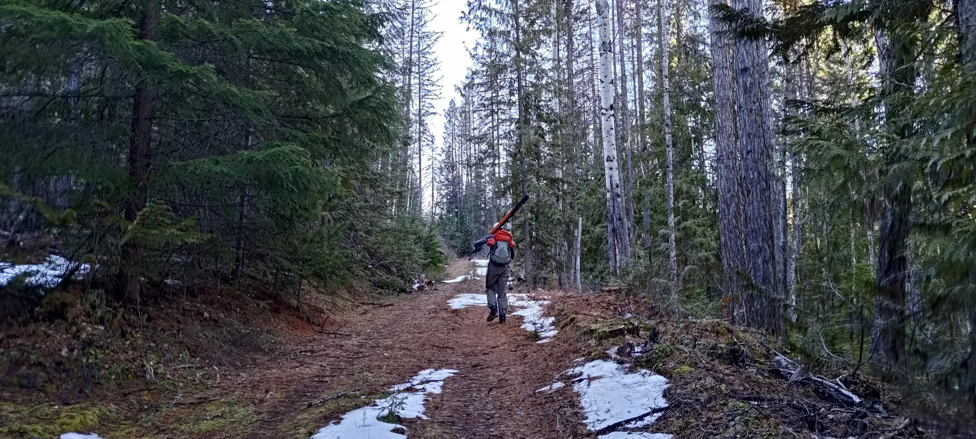
We booted it for around 45 minutes, much of which was dry or patchy road, with only the last hundred or two metres actually being in snow deep enough to potentially get into one's boots. At around 1000m elevation, or around 3km in, we finally gained enough confidence in the snow's consistency to put our skis back on and resume skinning.
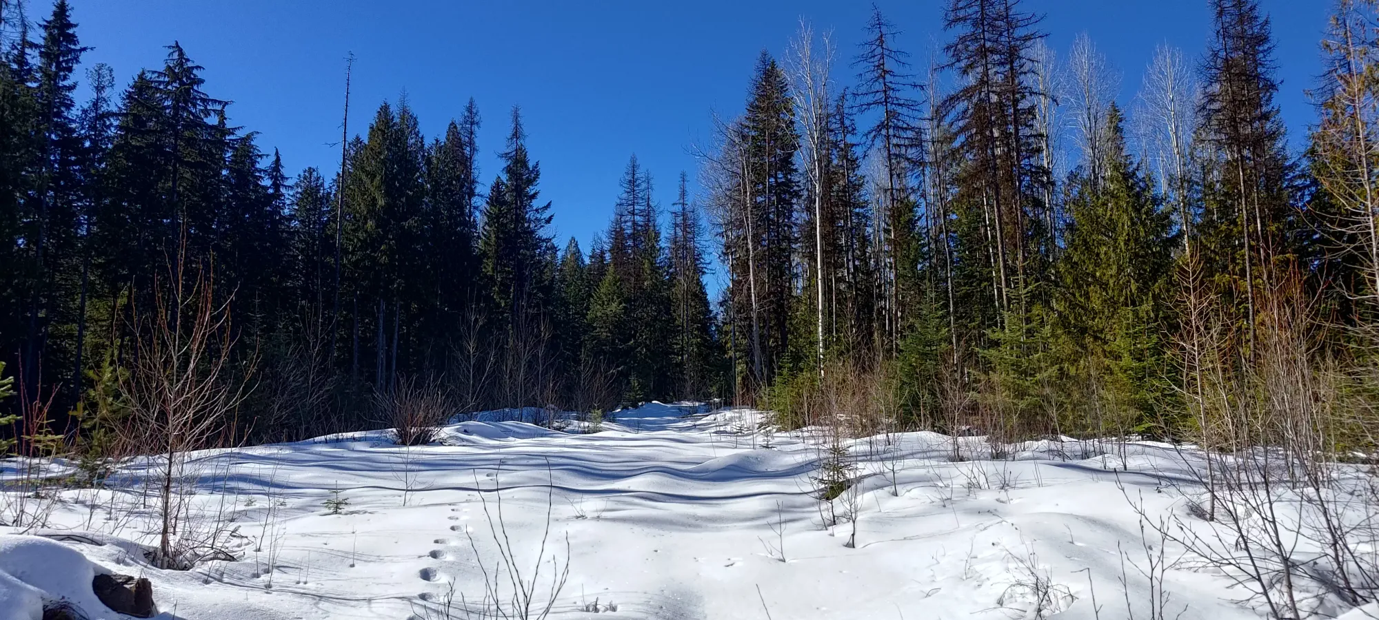
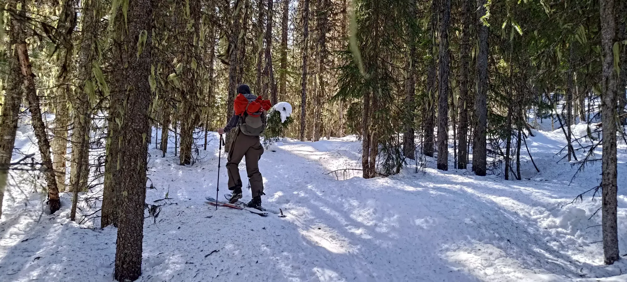
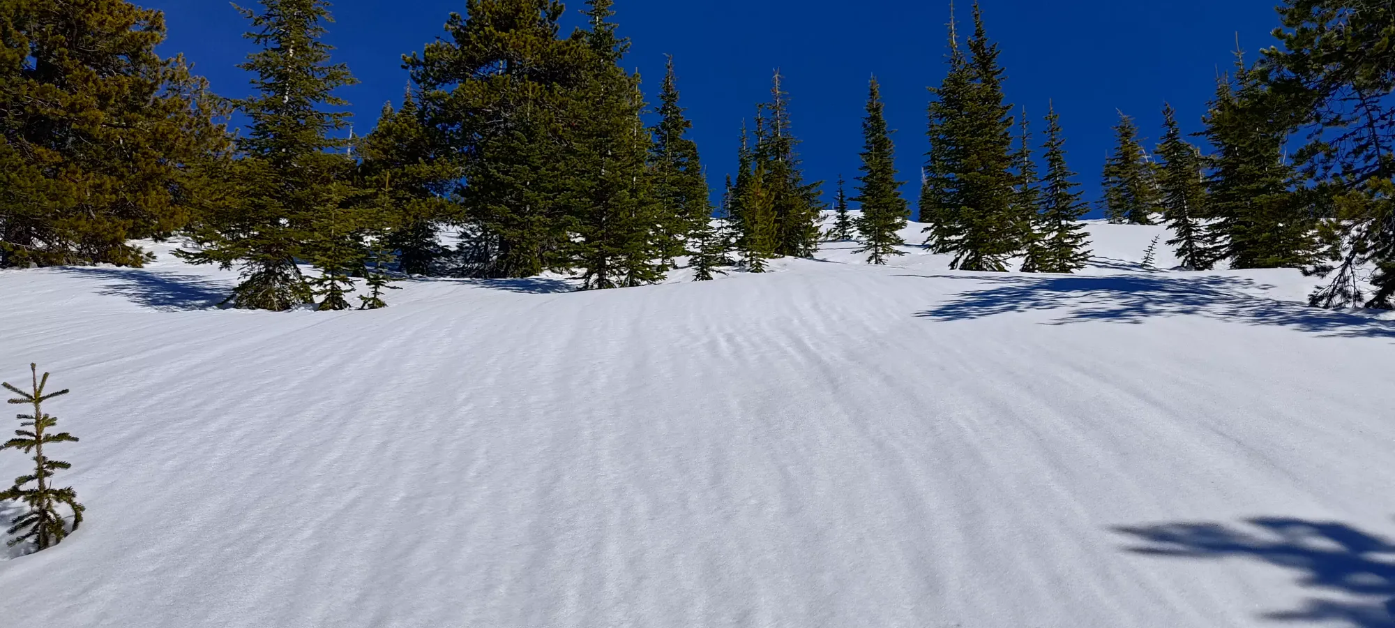
From this point, the next couple hours were pretty simple/boring. We slowly plodded up the road til we got to the trailhead, with not a ton of note happening until that point. The snow was thin at the bottom, and there was one bare patch a few metres long which required the removal of our skis, but otherwise was fine. There were a ton of cut-blocks once we got past this point, some of which would make good shortcuts/skiing in higher-snowpack conditions, but we did not get to enjoy that luxury. The angle was always very gentle, so we didn't need to do anything other than keep walking up.
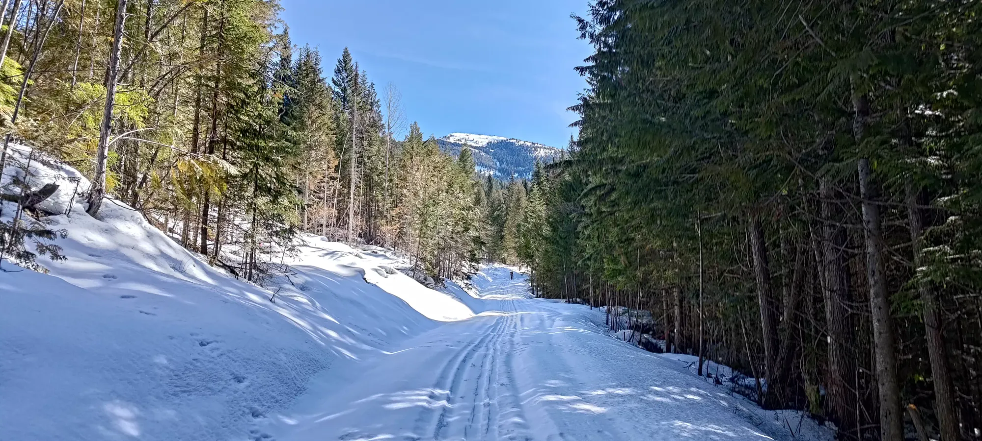
At about 6km/1100m elevation, we hit a fork where the #7078 road turned back south, and we instead took the #300 branch up towards the trailhead. Here, we picked up some old sled tracks which came from that southern direction. Maybe that would've been better, but we didn't have time to explore, and if we started at the same starting elevation, it would've been longer, so I'm happy enough with our choice of approach.
Just before the 3 hour mark, we had walked about 11.5km and gained about 700m, and finally found ourselves at the trailhead. I was curious to see if the sledders followed the rules and turned back at the non-motorized boundary, and was pleasantly surprised to see they did (although once we got eyes on the trail beyond this point, it was clear trying to go further would've been difficult anyways). After dealing with that "just a bit too shallow to feel efficient" road for so long, we took a break for a few minutes (though I was still on the nothing-in, nothing-out program so I just had a couple sips of water). We also had to clean our skis off, as the ridiculous warmth (we were both on single-layers only) combined with the shady area by the trailhead, and the less-packed snow there meant we both had some serious glopping going on.
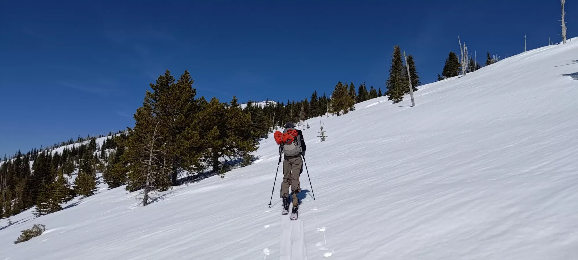
As we started up the hiking/multi-use trail (basically anything that's not engine-powered is kosher), we were greeted with a still-quite-gentle, but slightly more appealing grade for travel (we did not feel the need to do anything but walk right up the trail still). The bottom switchback or two had quite a few deadfall, trees that were stuck in the snow on both sides, and roots/branches ripe for tripping the inattentive skier, but largely the trail was smooth skinning. We had some glopping issues on the way, especially on switchbacks where sun conditions changed a lot, but for the most part, a couple stomps every few minutes kept things under control.
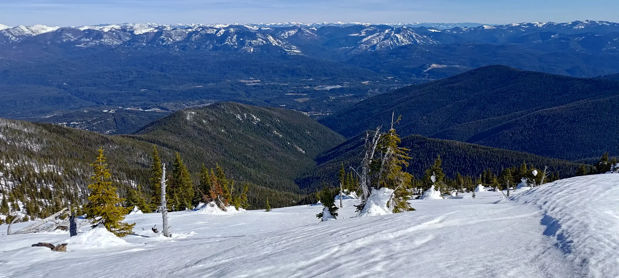
2.5km brought us to 1775m, where an alternative southern approach trail joins up with the one we were using (seems it starts at the end of Silver Creek Road). This is also the point where I might be willing to call the forest skiable with better snow. It is still quite dense, but the spacing is enough to make turns if your snow isn't super-wet cement (which it was for us, sadly). From this point, there's about 500m to skin on flat ground until a short drop (a few metres of elevation, but enough to require a transition on the way back) across a mini-valley at about 1800m, where the ascent trail continues continuously uphill to the top.
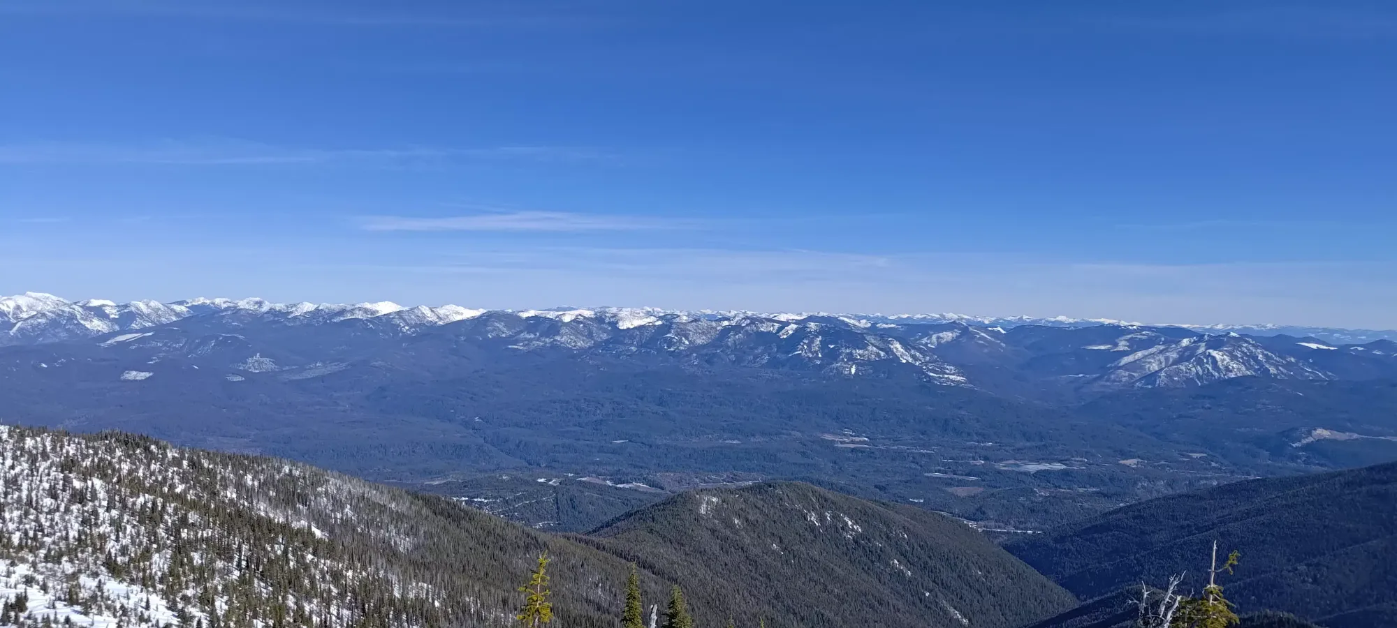
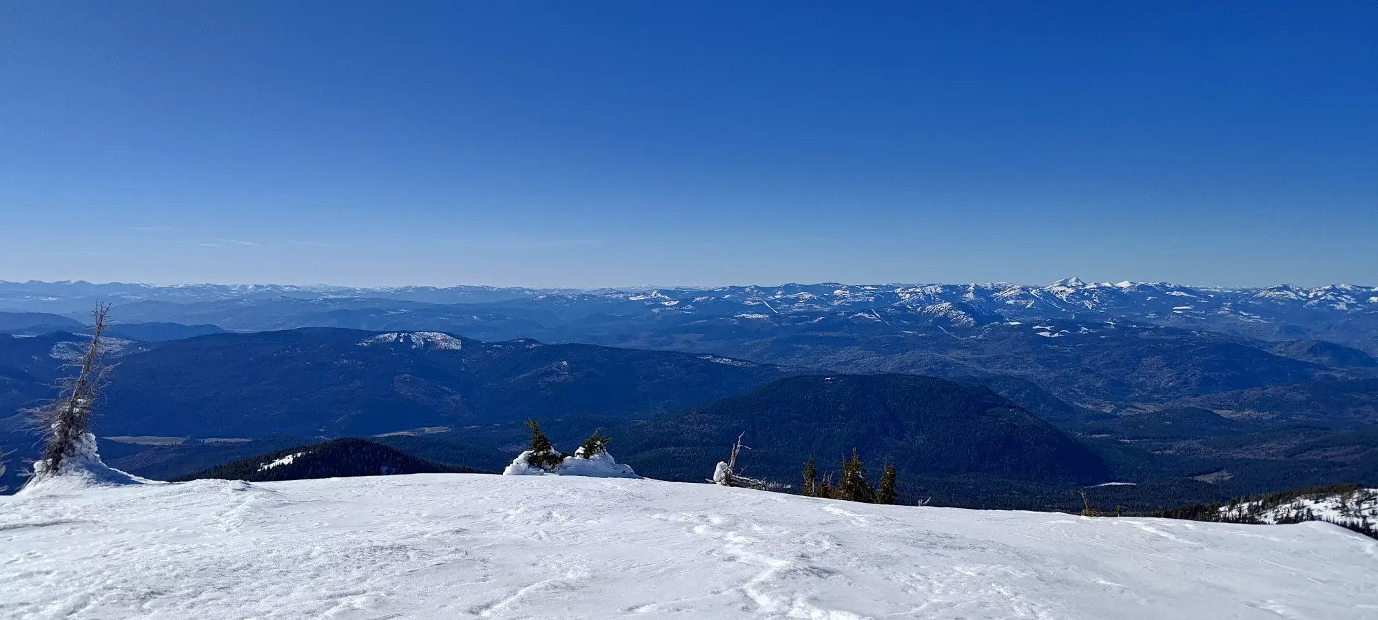
By 1850m elevation, we were done being in that denser forest with more debris on the ground, and broke out into treeline, and finally got some views! The big peaks of the Cascades aren't really visible, which are the only ones I really know in Washington, but it was still pretty, and beat endless road/forest views, for sure.

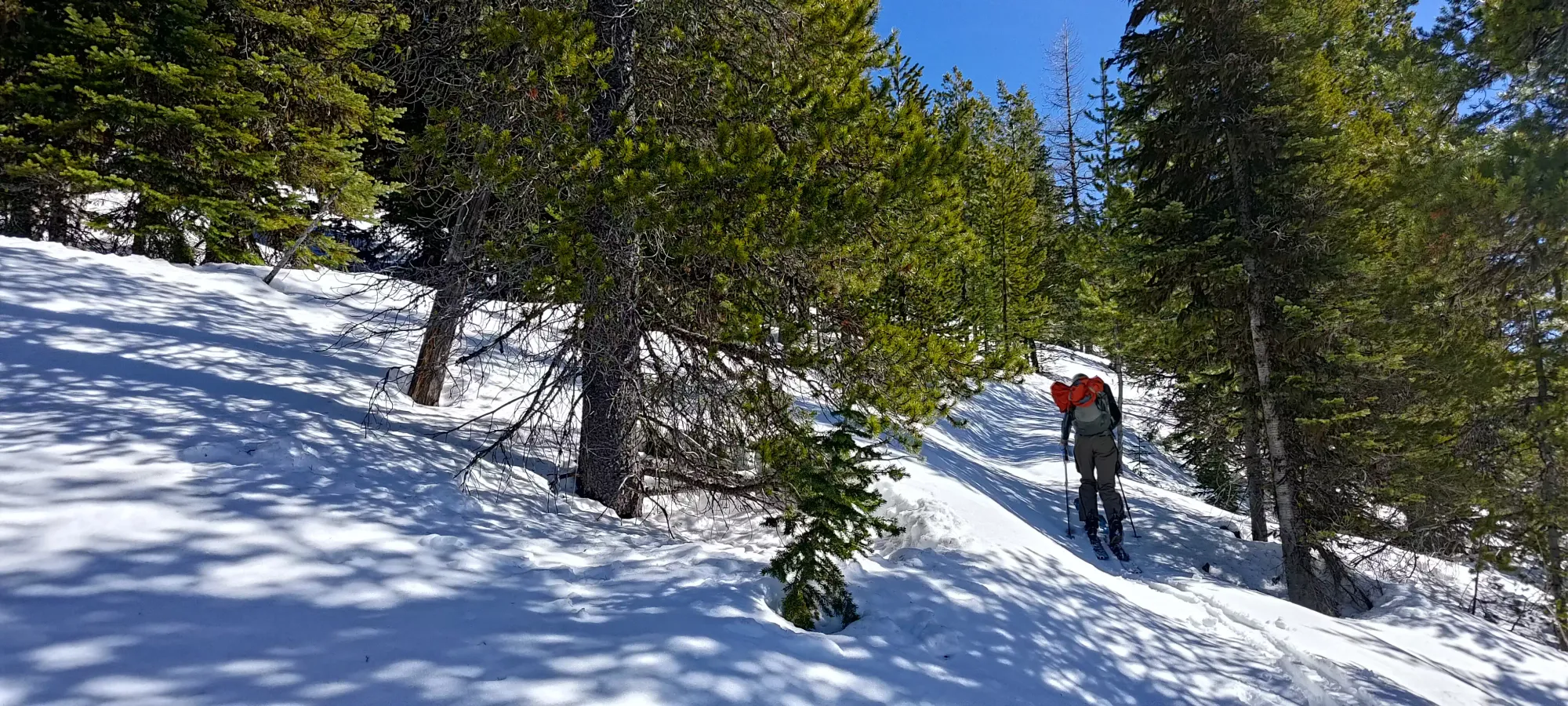
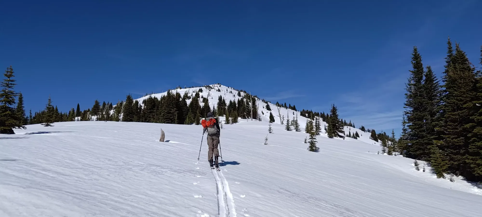
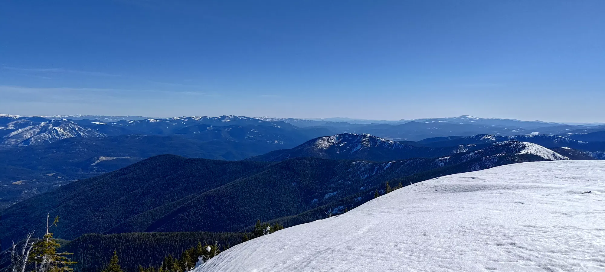
From this point, our stoke levels were growing as the forest was looking not just skiable, but actively enjoyable. We had to resist the desire to get the tedious walking over with and just cut up the steeper slope to our left immediately, and keep following the trail to the south ridge, which was our designated "safest route without any avy risk". It didn't take too long, though, and we got to the south ridge in just half an hour after we got into this open terrain, with a pretty direct view up towards the peak from there to greet us.
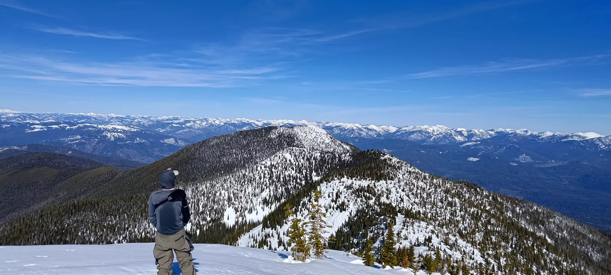
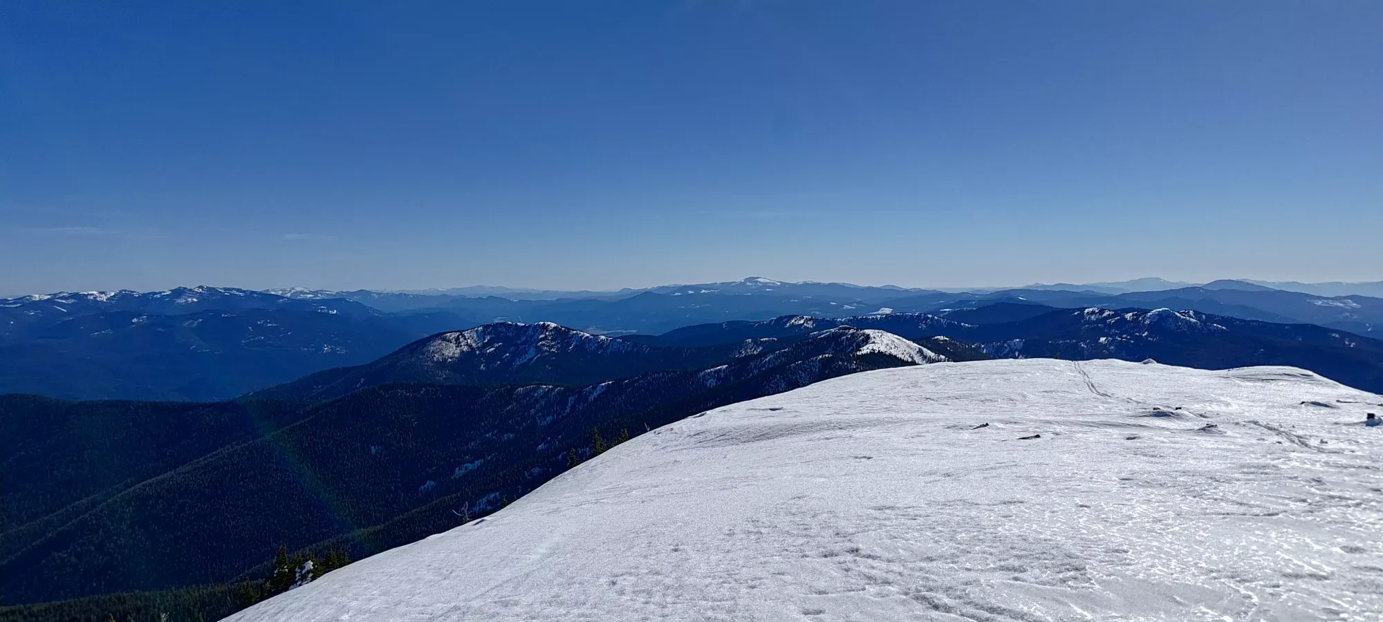
We finally deviated from the official trail a little bit on the final climb to get onto the ridge, where we made a couple switchbacks at an angle steep enough to justify risers, which was a refreshing change. One last break was had as we swapped onto the eastern side of the ridge, and made our way to the top at a leisurely pace, as we were in one of our more conversational arcs of the journey😄. We topped out at basically exactly 5.5 hours into the day.
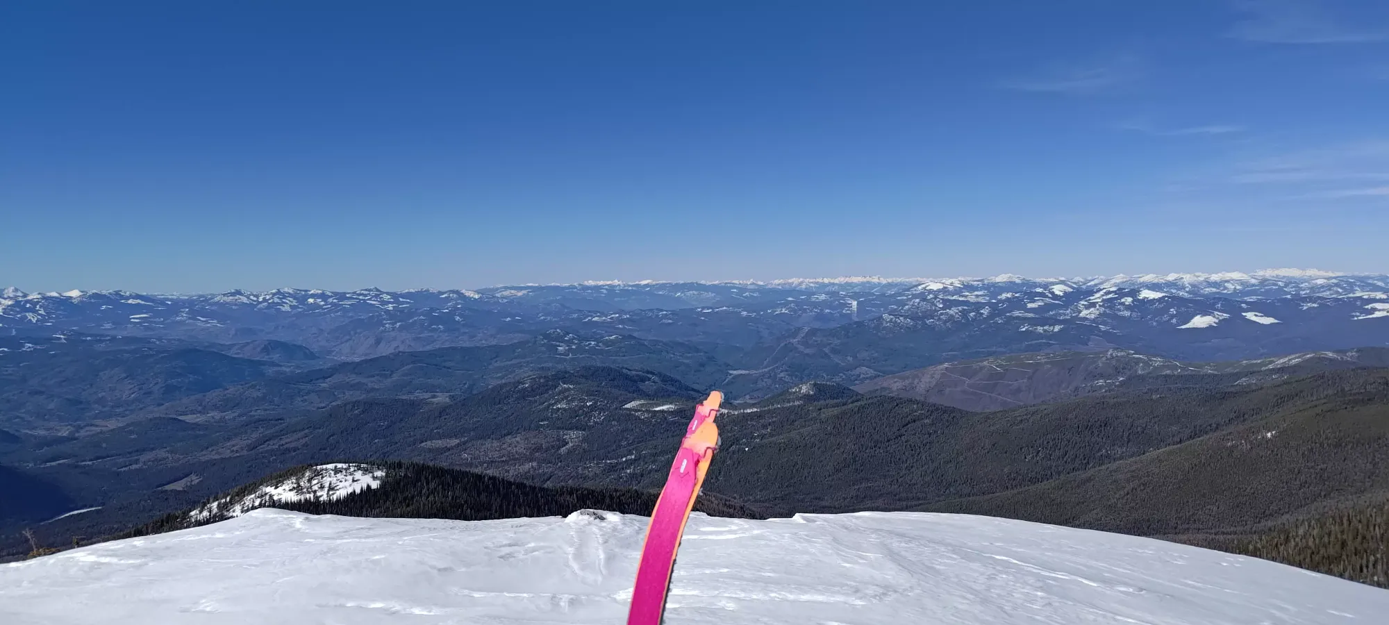
We took a nice, long summit break at the top, totalling about 25 minutes. We took lots of pictures, mused about how snow-quality aside, the weather was excellent for an ultra summit day on skis (no wind, comfortable in our base layers, and clear skies), Kelly had some food, and we generally enjoyed ourselves up top before getting ready to finally do some skiing.
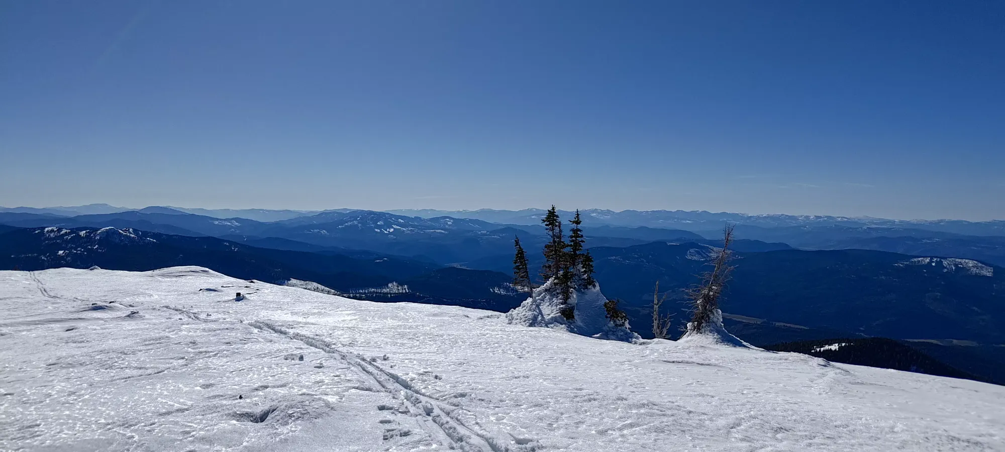
With all that out of the way, it was finally time to ski! We stashed our rather-wet skins in our packs and started making our way down. I didn't even bring snowpants since it was so warm, and even with rain pants and a summer soft-shell jacket, I was STILL heating up almost immediately.
The skiing itself was about what we expected, if not what we had hoped for. The snow was ridiculously wet and sticky, so it was basically all we could do to avoid wiping out, without much in the way of style or sick turns. We skied down mostly just on or near the skin track to just below 1900m, where we started just following the skin track directly. This took about 10 minutes. Another 5 of just sliding along the skin track got us down to 1800m where we hit that little undulation before the flat walk to the fork in the trail, where we slapped our skins back on.
The rest of the trail was never quite steep and sustained enough to justify ripping skins, so we just slid along (at least mostly sliding vs walking past the fork) until the trailhead, which we reached in about half an hour.
I had hoped that we would speed up and rip skins after this, but my sense of steepness on tedious road skins is apparently not as calibrated as Kelly's, as he was more pessimistic but also more correct, and expected to be skinning down the entire rest of the road. This ended up being exactly what we did. Maybe with cold snow and a nice skin track you could ski more of it, but it felt pretty damn flat. Once we got past the first big switchback, the idea of being able to shortcut down the forest might have been a good one with an extra metre or two of snow, but as things stood for us, we just kept on walking down. If any Nordic skiers are reading this shortly after the fact, there's probably an amazing trip here for you!
We got to the fork where roads #300 and #7078 diverged in about an hour, and took about another 40 to get to 1000m where we strapped our skis back onto our packs and started the final walk down to the gate. From there, it was another 20 minutes of just walking back to the car, though we did put our skis on from the gate half for kicks (though it would save a minor amount of postholing).
The human-powered portion of this trip was overall just about exactly 9 hours, which given the distance and lack of meaningful downhill skiing actually feels pretty alright, though much longer in both distance and time than most summer trips here, unfortunately. But it was a unique way to experience this mountain, a safe way to ski (ski quality aside) on an otherwise spicy weekend, and we managed to not hate each other by the end, so I consider that a win.
As for actually getting home from the trailhead, we drove for around an hour from the trail back to Canada. Google had originally had us going through our intended border crossing in Laurier, WA (I think), but Kelly really wanted to get back into Canada, so we took the unknown-to-us (until we saw signs) 24-hour crossing that leads into Rossland. We got there for 8pm and had a nice (if lengthy) dinner, then had the casual nearly 700km drive back to Squamish starting at 9:15pm. Somehow, I managed to stay alert for it, and we got back at a "still early enough to be considered a late night instead of an early morning" 3:30am on Monday. Technically in time for work, though admittedly I think we both took it easy 😅.
10/10 would sufferfest again.
GPX Track + Map