Helm Peak - September 2 2023
A short but fun scramble in Garibaldi Park, which is linkable to some extra peaks as well

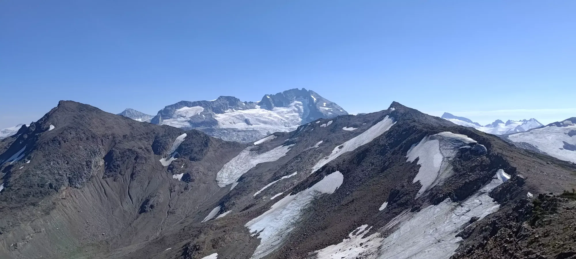
Garibaldi Névé, Whistler, British Columbia
2163m
On Friday night before the Labour Day weekend, me+Logan were talking to a couple friends to try and throw some plans together, but ended up needing to come up with a last-minute objective as things fell through. We had talked about Helm for a while, and now that we both have bikes and ways to transport them, we figured we could sneak in without day passes by parking on the road and biking in, since the passes are for vehicles only. So, we met up in Squamish, transferred his bike to my car, and headed on up.
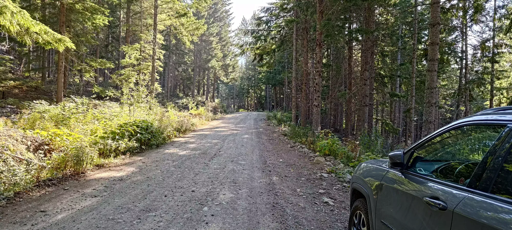
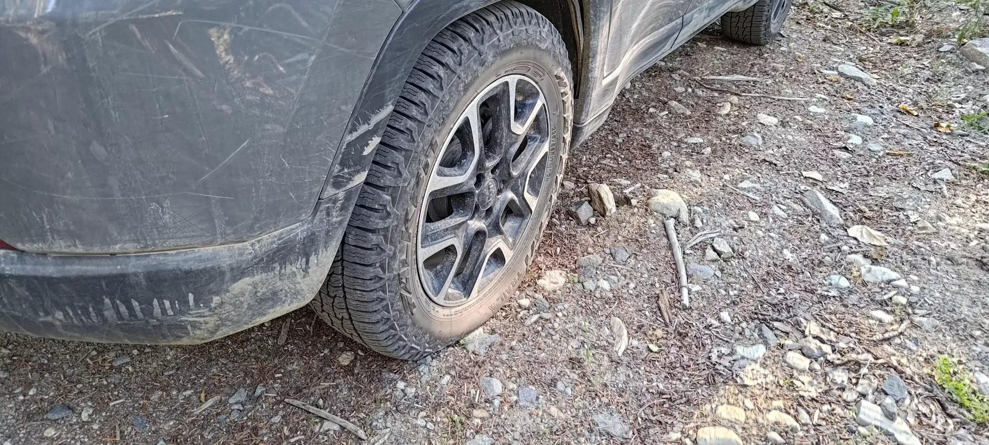
The drive felt a little off, which was something I'd also felt on the highway the last weekend, and I chalked it up to "I guess a full bike rack really hits your driving dynamics". However, upon parking, I discovered that this was not the case, but instead, I had a tire down at 12 PSI. We left it to deal with at the end of the day, since it's actually not a terrible thing on the FSR. On the plus side, we were able to get within a few hundred metres of the parking lot and found a pull-off before there was anyone checking passes, so we didn't even bother taking our bikes, and just geared up to hike the whole thing (even though you can bike to the bridge over the Cheakamus River). So, with a slightly annoyance waiting for us at the car, we set off at 9:30am.
The first part of this peak is just the approach past the Helm Creek Campground, and to the fork between the Helm Creek Trail that leads to the Tusk/Panorama col, and the trail we were aiming for that leads towards the Helm Glacier and Castle Towers (a future objective). I consider this 10.8km (for those who park where we did) to be basically just "one big same-y thing" since it's all such easy terrain. For us, it was a brief FSR walk to the parking, a wide and easy trail (green for mountain biking) to the bridge over the river, a short and steep set of switchbacks with some rocks littering the trail on the other side, then a more mellow and winding trail up to the campgrounds, and just a straight dirt trail to the aforementioned fork past there. This is all super-easy terrain, highly runnable and efficient, if uninteresting. We ground through this in 2 hours and 20 minutes, gaining about 850m in the process. A fitter party, or one who only has a single objective could do even better (I did it in under 2 hours last year for Cinder Cone, and I'm far from fast).


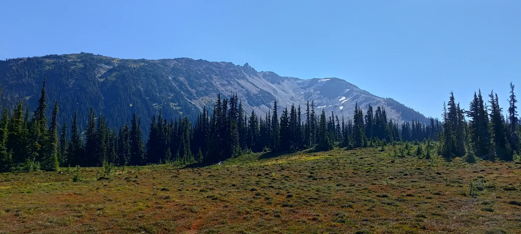
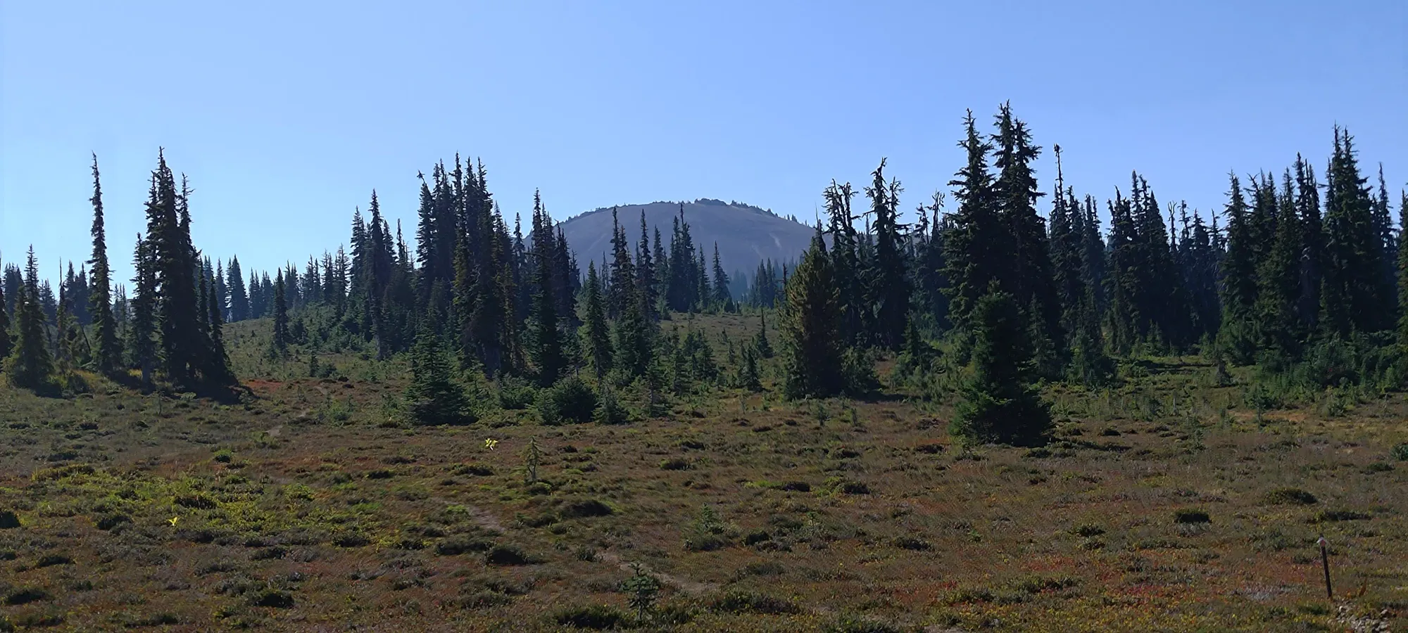
We took about 25 minutes to relax, have some food, and enjoy the views before heading out. After that, it's an easy walk along the trail to the Helm Glacier. We cut off at about 1690m, although that's just our suggestion, and there's a million valid choices here. The Glacier trail is very visibly obvious and easy to walk on, though it isn't the same pristine, carved-out dirt of the officially-maintained Helm Creek trail. Where we cut off, it was just to climber's right of the scree slope up Helm Peak, and at the edge of the forest on that side. You can grind up the scree if you find that enjoyable, or maybe bushwhack further to the right if you're a masochist, but I think our approach made sense. The meadows to get there were easy walking, then it was just a steep slog at the edge of the forest, which gave us more solid footing than scree, and a bit of shade without needing to bushwhack for it.
At around 1800m, we broke up above the end of the forest, and merged onto a dirt path that seemed to extend for a while below, at the edge of the scree bowl. We found a nice spot to sit a little bit higher, and had a 5-minute break there before continuing on up.
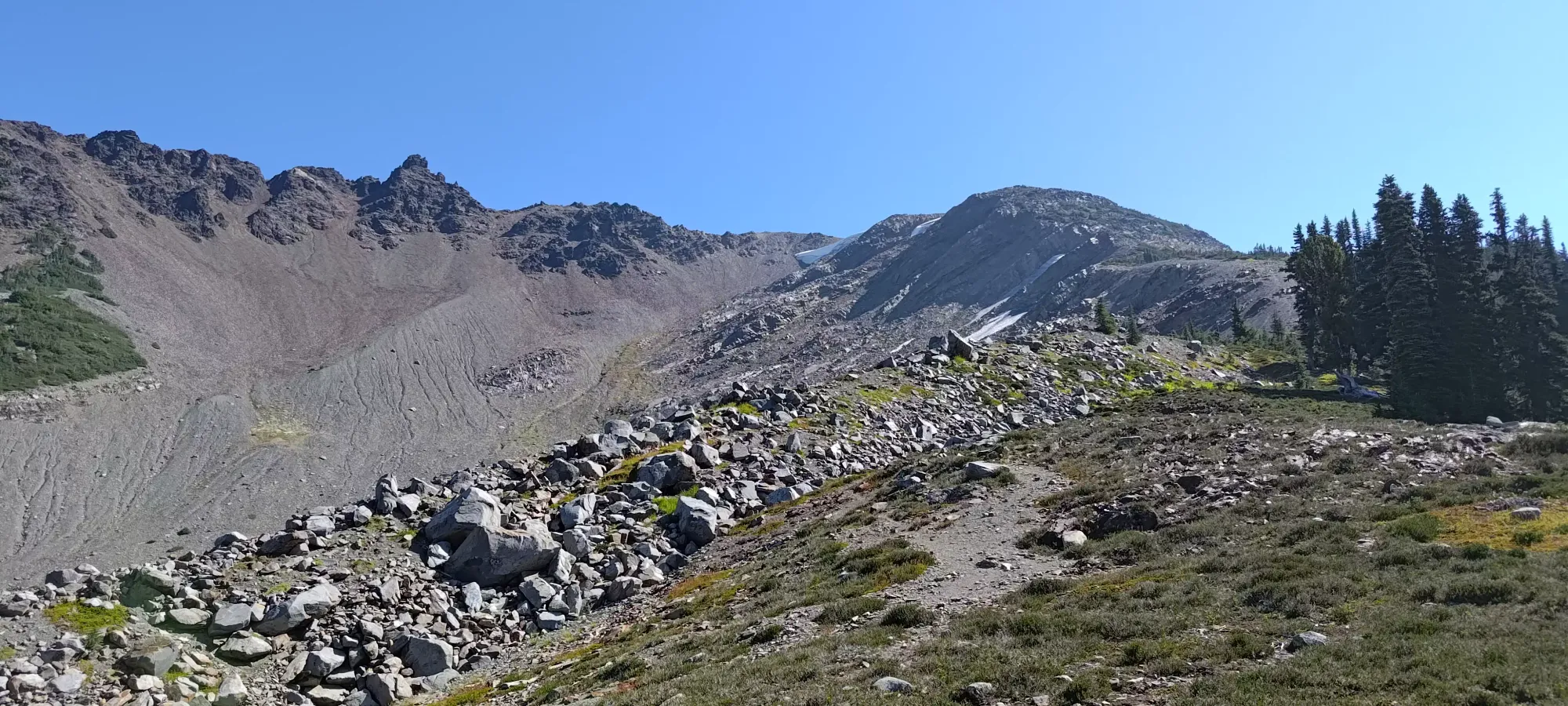

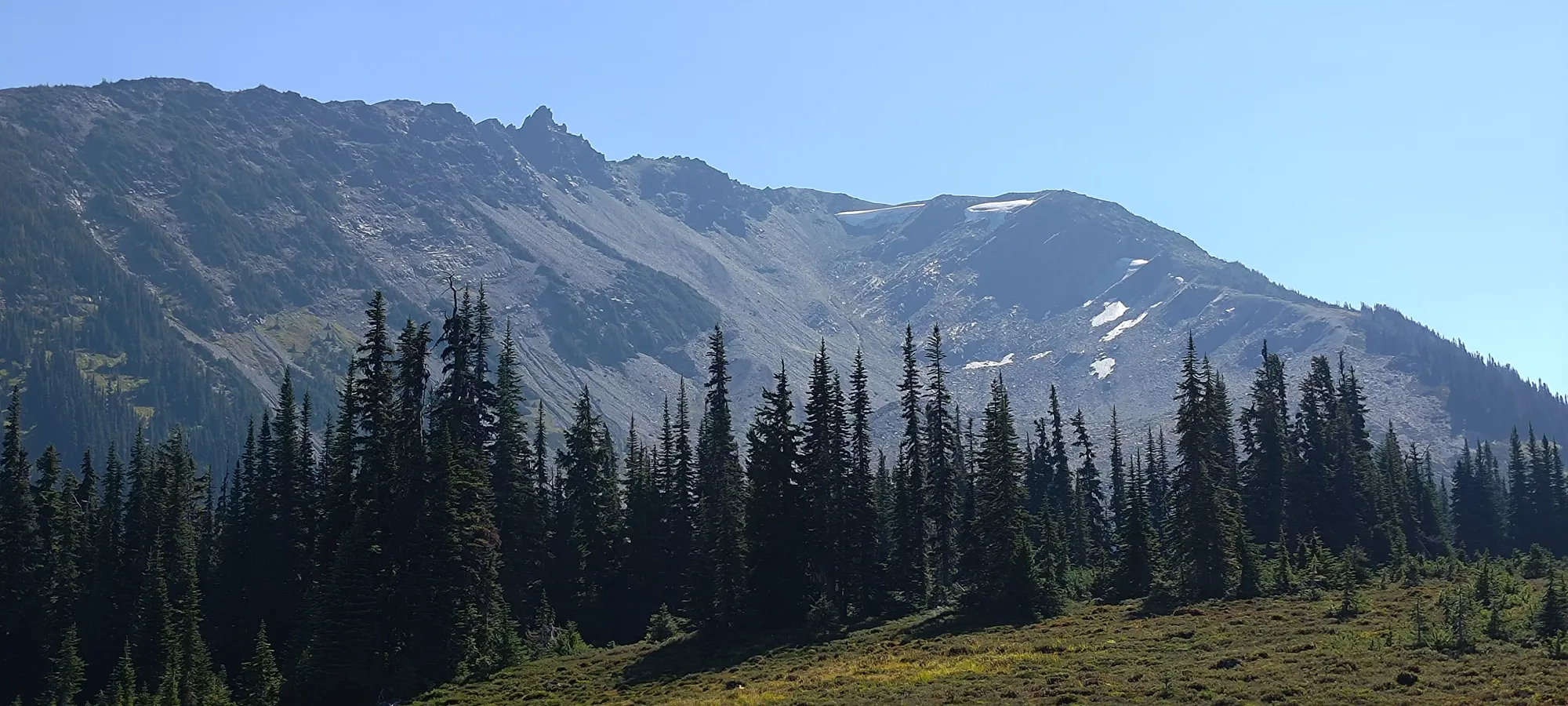
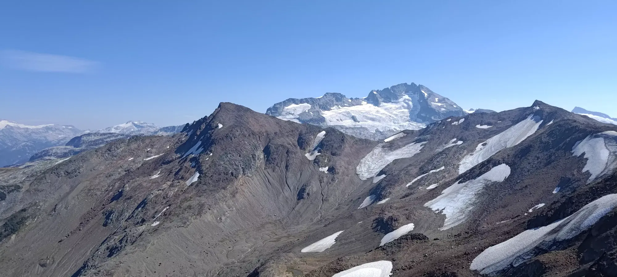
The grind continued up the steep slopes to the top of Gentian Ridge, with a couple class 2 scramble moves in places, but largely just steep walking to get to the top. We hit the little rock pile at the top of the ridge at 4 hours and 10 minutes from our departure, reaching (according to my watch). As we took our rest up top, we met a trail runner who came up behind us who was curious about the summit scramble, and decided to watch us go up and see if he wanted to try it once we were done. We were happy to oblige, and headed out after about 10 minutes of rest.

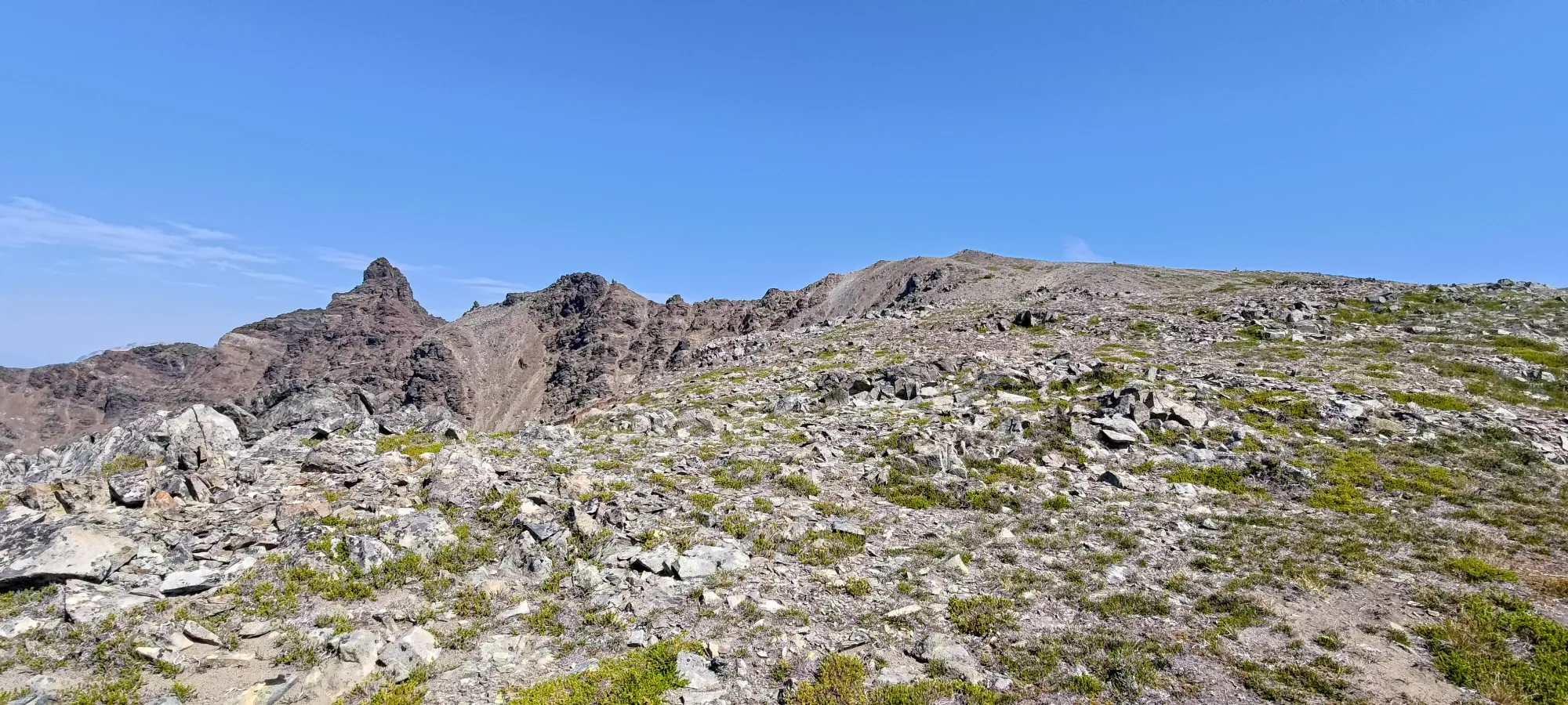


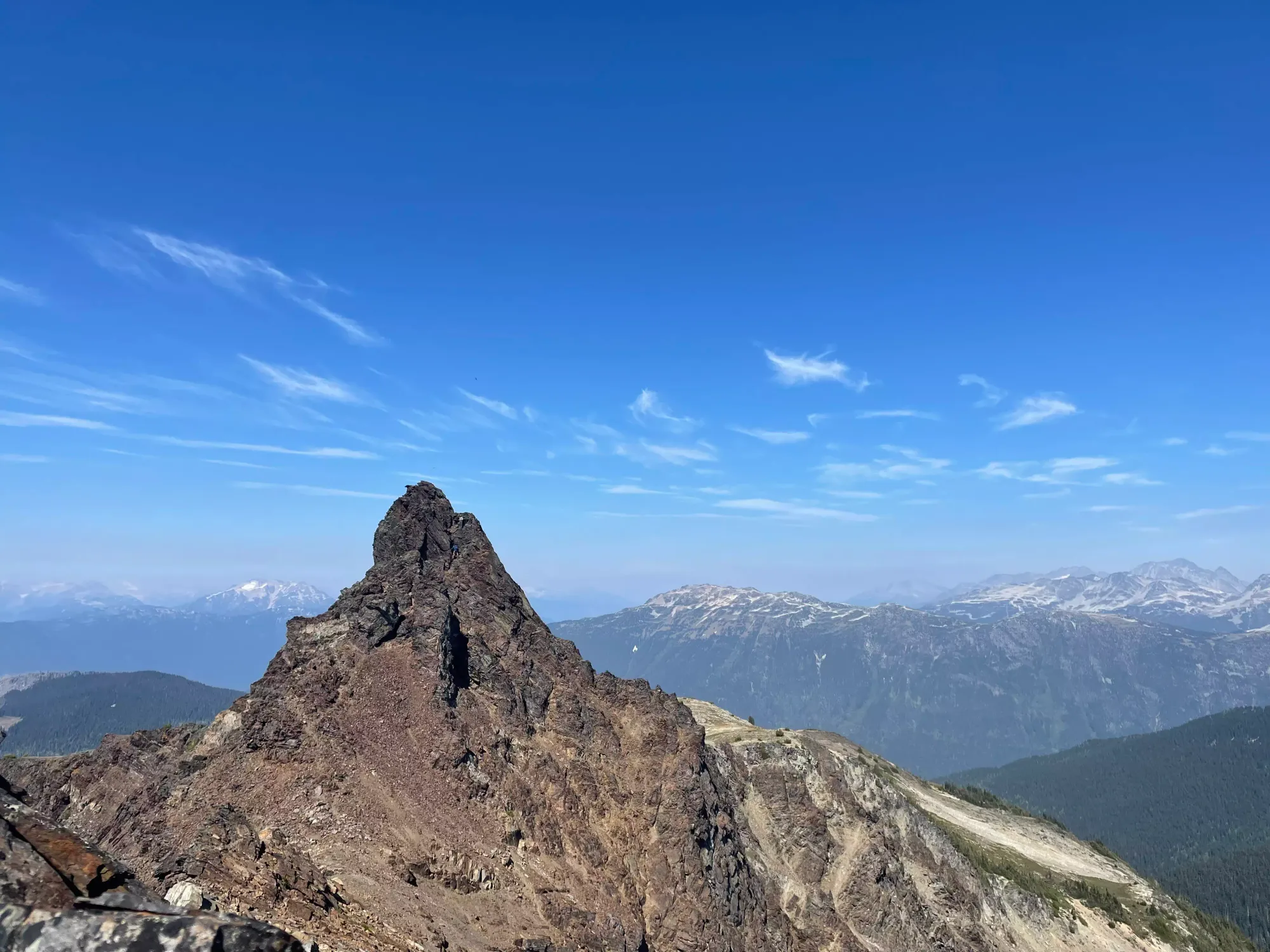
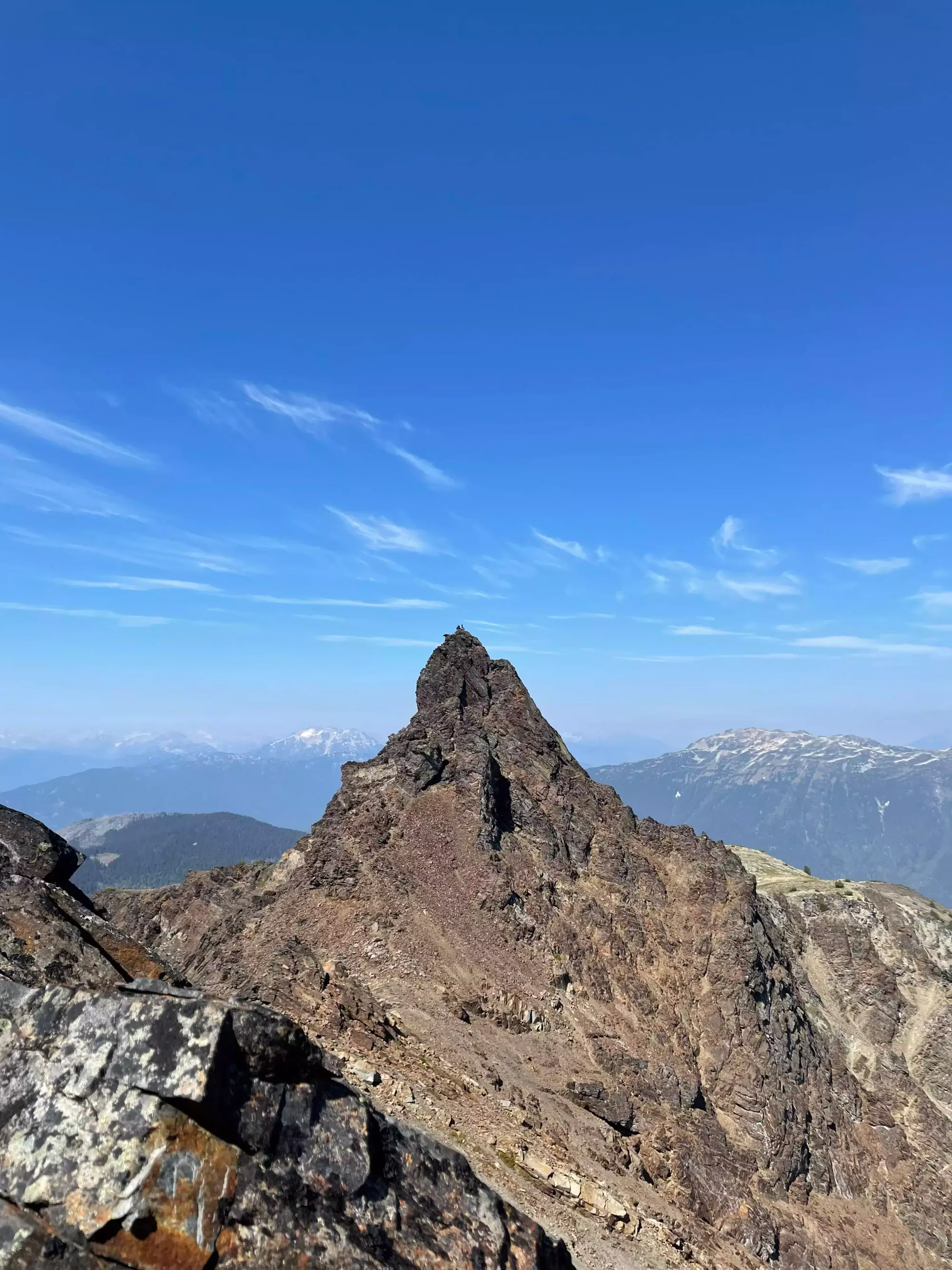
The ridge can look intimidating up-close, but it's barely more than walking, only requiring some stabilizing hands a couple times to manoeuvre around outcroppings in the middle, but you don't have to mantle anything to get to the base of the summit pinnacle. We got to the base of the climb fairly quickly, and I stashed my poles before we started heading up.
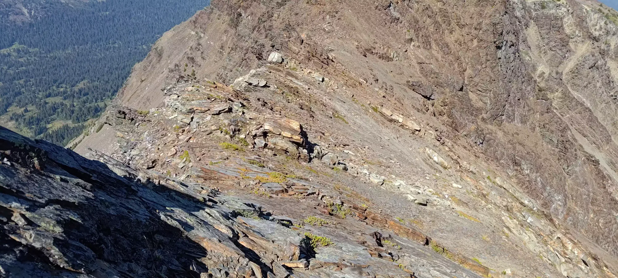
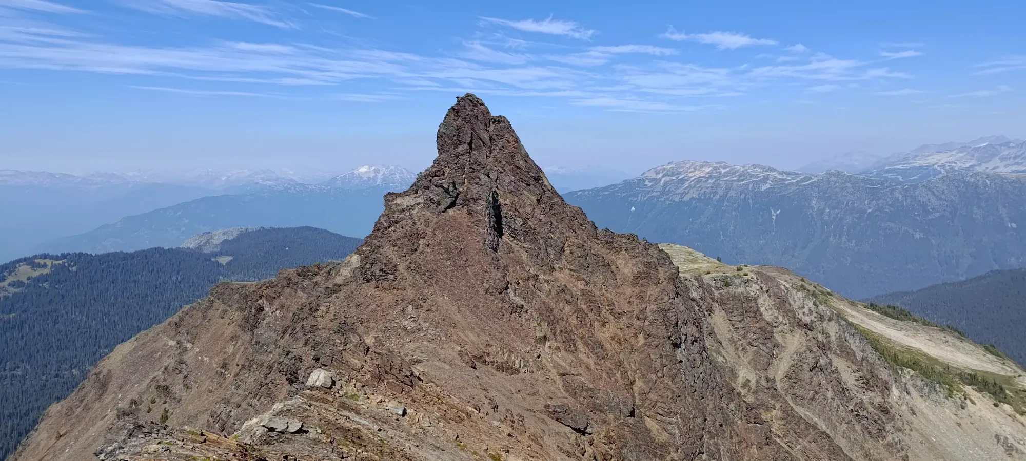
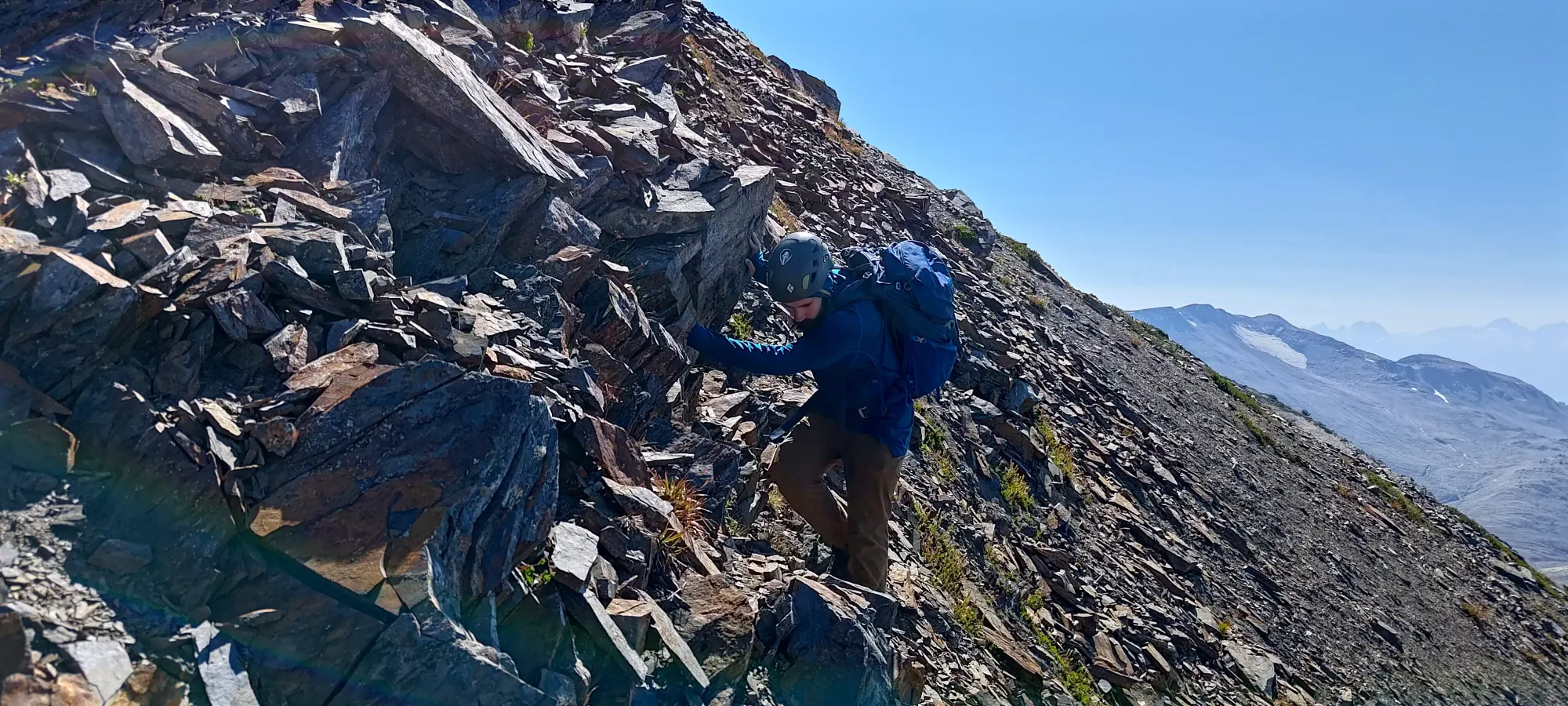

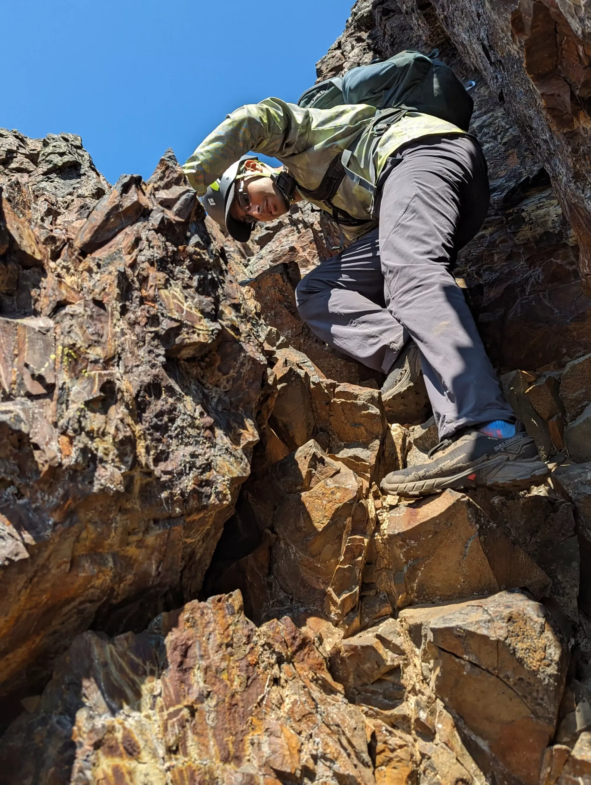
The scramble itself is actually quite short, comprising largely of sections, one chimney at the beginning, and a steep face that curves climber's left and tops out shortly thereafter. I got up the first section pretty easily; there was one move requiring me to "max-out" the flexion in my bad knee, but otherwise, I'd say it was class 3, with no moves swinging your weight over the abyss or requiring seriously difficult technique. Many people have disparaged this summit for the rock quality, but I think that's just a relative comparison to the rest of the area. Compared to the Rockies, I found the quality to be pretty good. There are rocks that would be bad, of course, but I never struggled to find a hold, and all the holds I selected for use were sturdy.
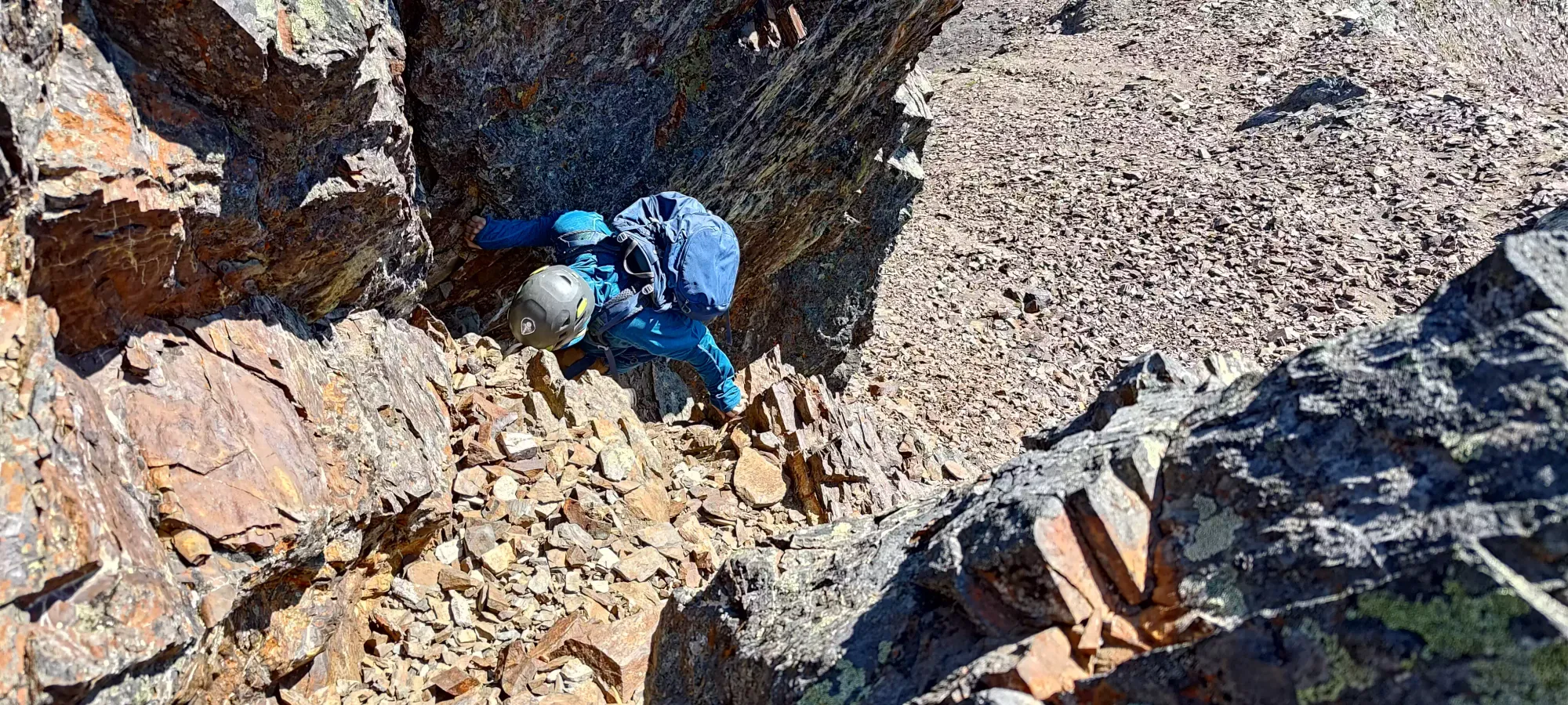


Partway through the first section, there's a nice spot you can wedge yourself in to wait for the next person to come up (rockfall management is fairly important here), which is where I got my photo of Logan from. After that, there's a couple more moves before a short walk over to the second scramble section. I was so surprised at how close the summit looked, and how little scrambling we did that I shouted back to our friend waiting on the ridge to ask if we were actually right below the summit, but he confirmed we were.
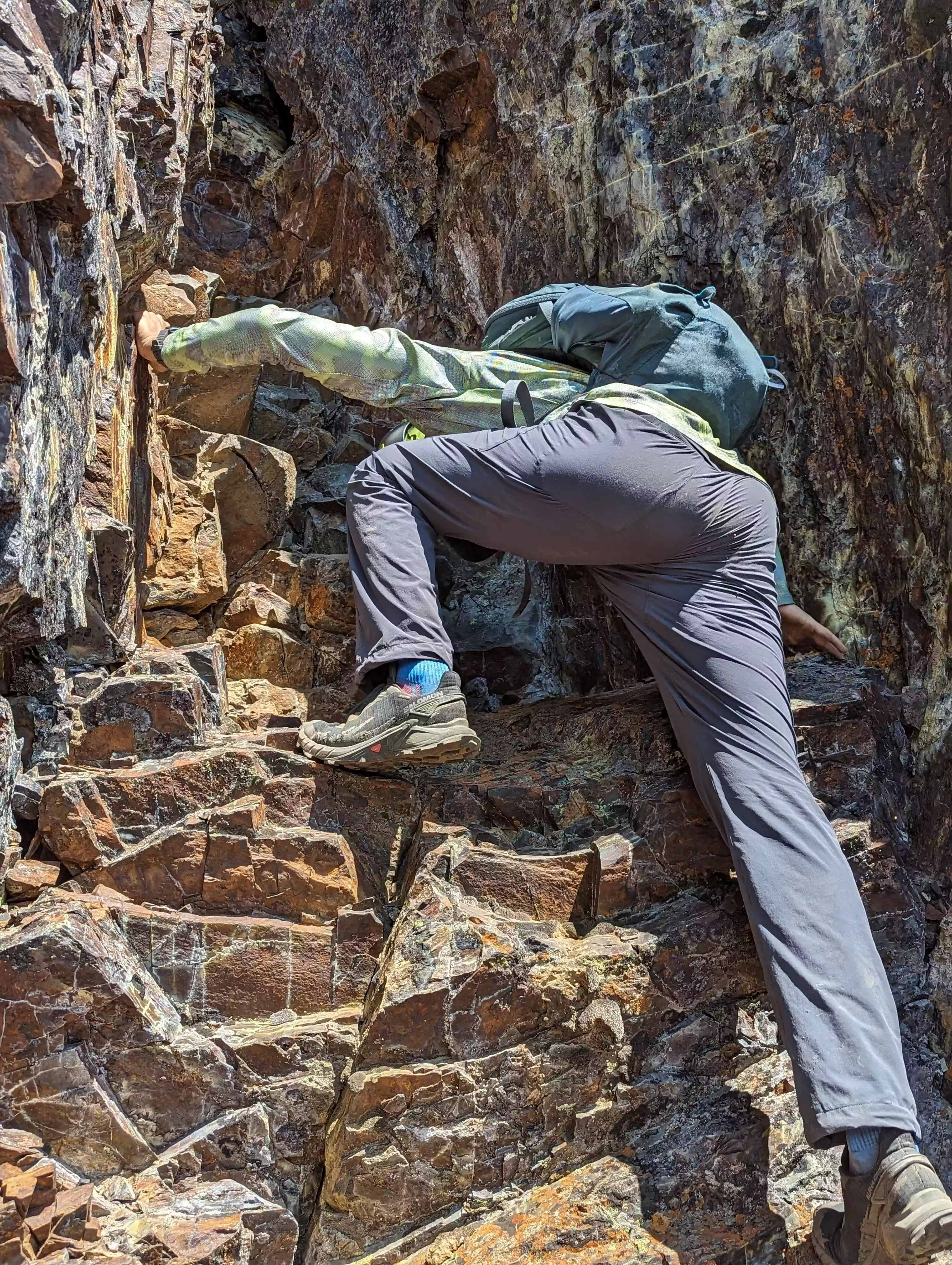
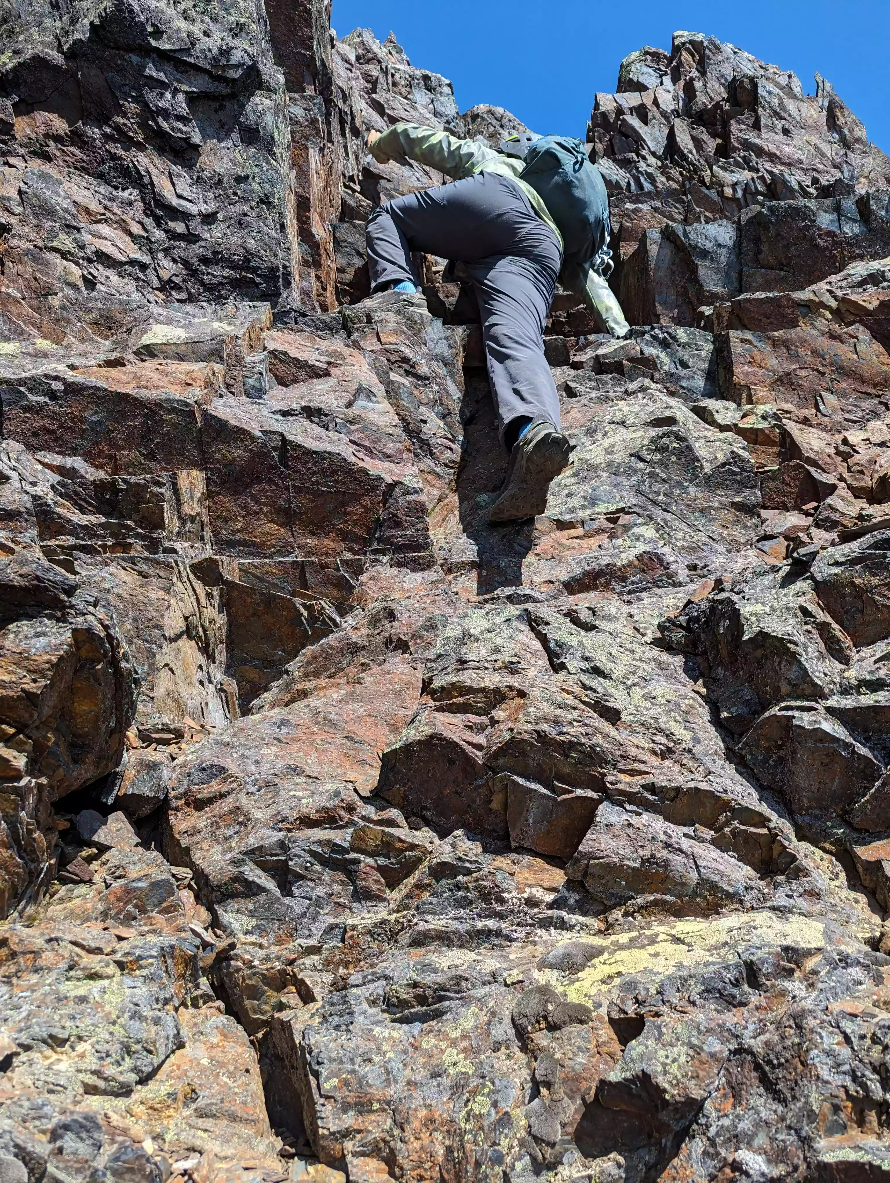
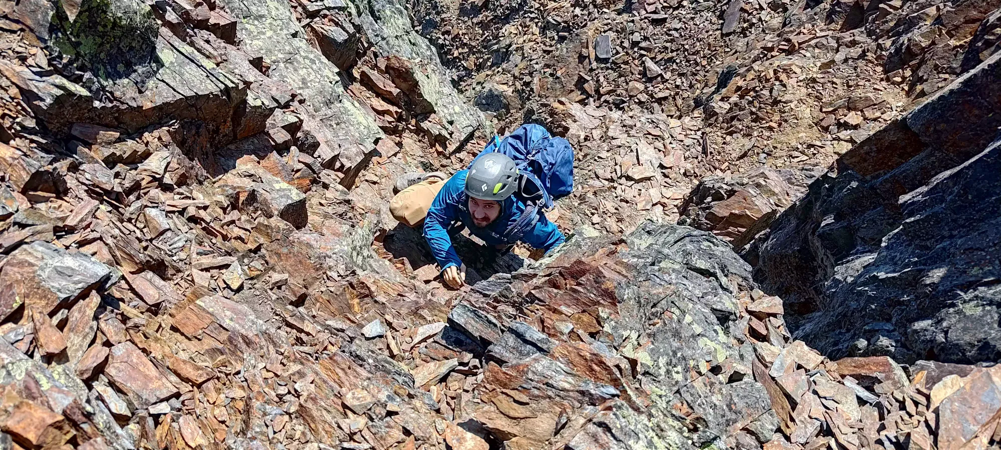
The second section of climbing itself was pretty simple, just a few face climbing moves; I'd say this again goes at class 3. I scampered up to the part where it curves up to climber's left, and let Logan catch up, then we scampered up to the top, which involves simple moves until you mantle up to the final ridge, and make an easy-but-exposed move around a rock to get onto the summit plateau, which was big enough for a couple people.
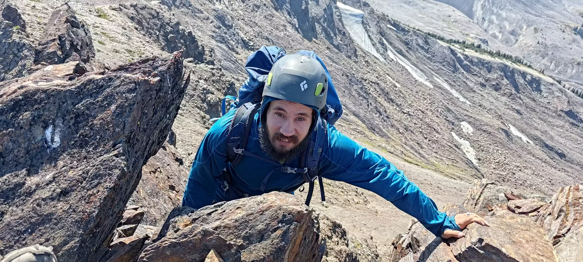
The summit itself has nice views, but to be honest, so does the ridge, without being as cramped. More notably than that, though, was the annoying presence of flying red ants living right on the top for some stupid reason. Due to their presence, we didn't spend too long on the summit, we just took some photos, and then ducked out of there. Apparently our friend on the ridge heard my complaints, since he mentioned them to us once we met on the way down. I wouldn't plan to spend much time on the summit for that reason. At least they weren't wasps, which seem to be pervasive this summer.


The downclimb was pretty uneventful, not posing much difficulty compared to the way up. One move that was annoying was near the end of the second (higher) section, where I had to trust my less-than-amazing-on-slabs new trail runners to hold me on a downsloping rock ledge while I had to crouch down and get hands low to move down. It wasn't a big deal, though, just "was more than mindless", which is how the rest felt. I'll reaffirm my view of this as a class 3 scramble, to that end. Once we got to the bottom of the scramble, we chatted with the trail runner for a bit, and we told him how the scramble went. We exchanged e-mails, and he graciously provided the below pictures of us as we scrambled. Thanks!
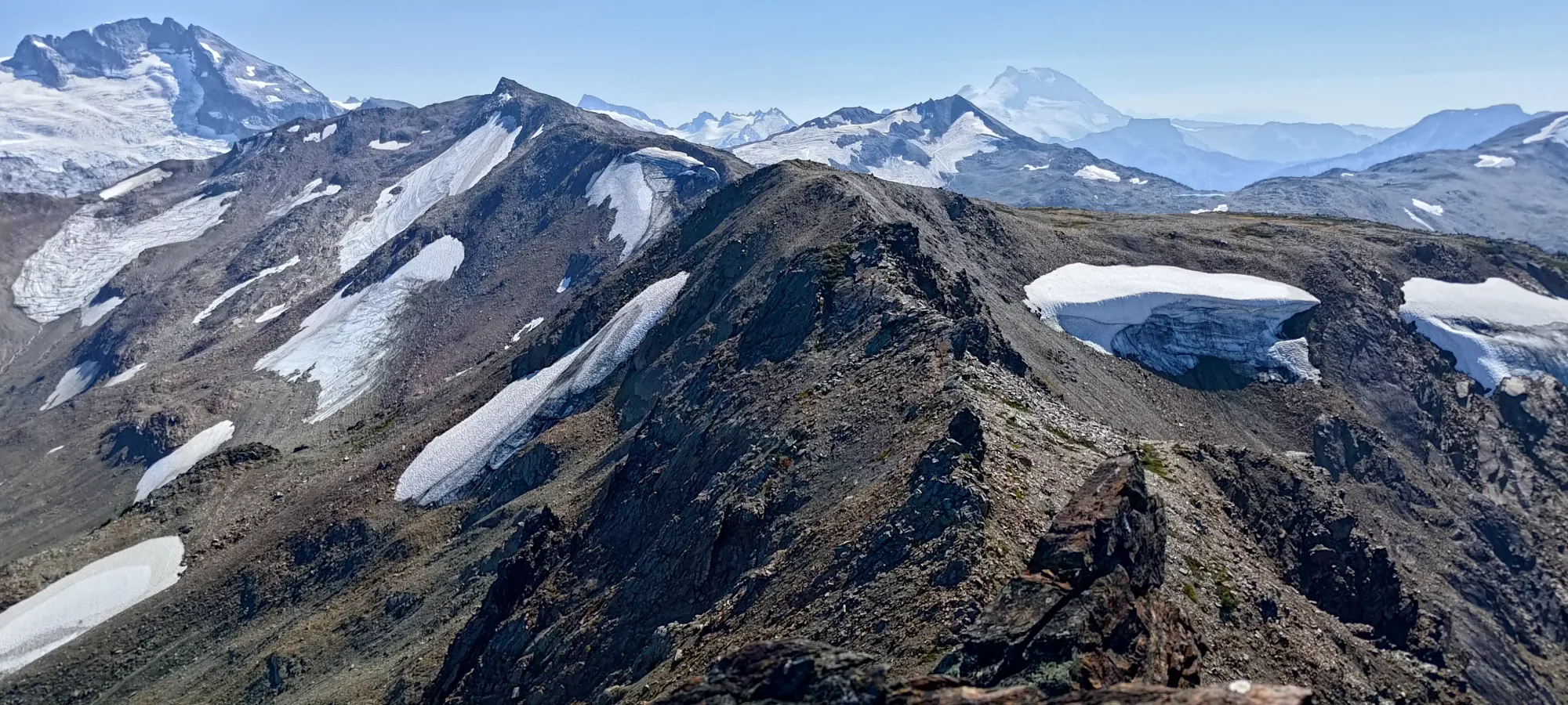
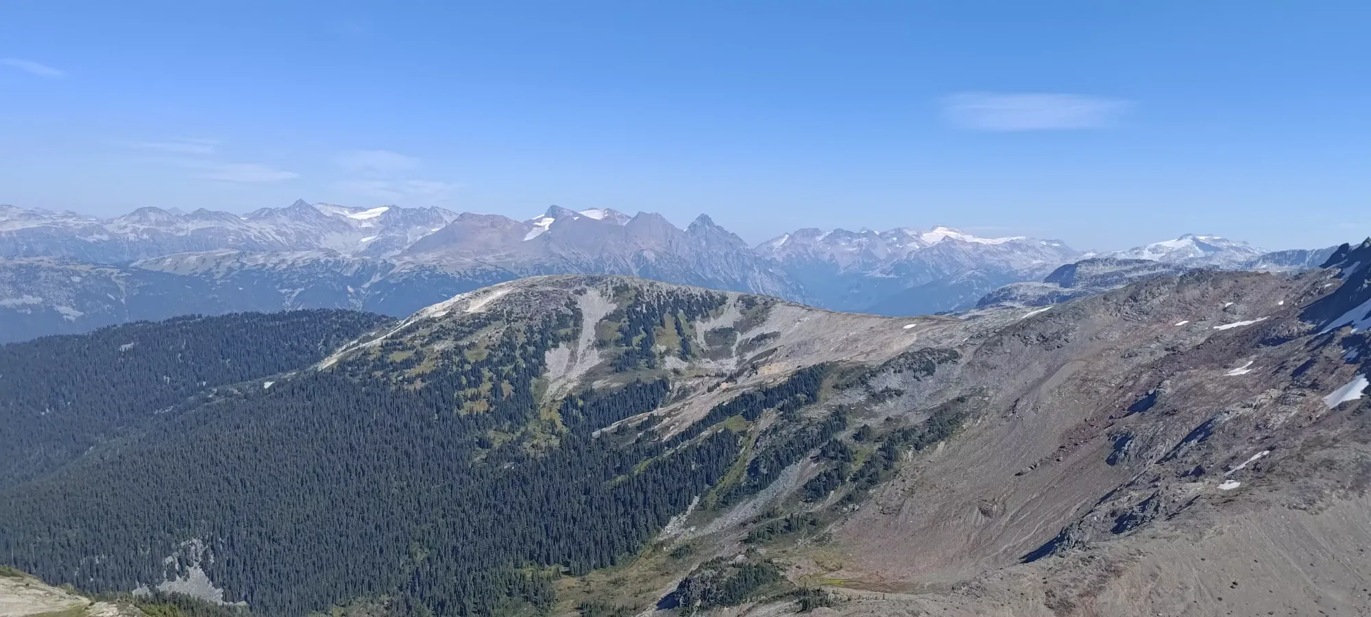
We got back onto the non-scrambly ridge a bit before 3pm (though you can blast through the scramble in half an hour without much issue if you go solo and don't take your time with photos and rockfall mitigation). With a good amount of energy and daylight left, we took a short break, then headed along the ridge towards Fuscian Peak to tack on some extra value to the day.
As for Helm itself, I'd say it's a bit overblown in terms of the difficulty and rock quality, but it was still fun, and the long approach is efficient and goes fast, at least. I'd recommend linking it with other objectives on Corrie Ridge for a day trip, or doing it while camping at Helm Creek to maximize value. It's not a bad place to practice recognizing good vs bad rock before heading to the Rockies where this kind of thin, layered, weak rock is commonplace.
GPX Track + Map