Vantage Peak - December 17 2023
A fun ski with a little bit of extra spicy climbing at the end to make it a mini-mountaineering objective (at least in the winter)

Joffre Group, Pemberton, British Columbia
2235m
After the previous weekend, I unfortunately had some of my colitis symptoms return with somewhat of a vengeance, so I was taking it easy all week to try and get those settled. I was only moderately successful, so I wanted some medium-difficulty peaks for the weekend, which wouldn't force me to wake up too unreasonably early to avoid making that worse. Freezing levels were spiking for the weekend in most of SWBC as well, so I made a choice from the limited supply of peaks in the Duffey (the only region claiming to stay at least near 0 or colder) I thought might be skiable, and after giving a few options to my potential partners, Vantage won out. Since the heading below kinda gives it away, I didn't summit the first day, so this trip report is split over 2 days and 2 attempts, the first of which was with Alex, a splitboarder and creator who reached out to me a few weeks ago, and who I got to ski with the previous weekend at Whistler.
Saturday
With snow levels at the highway (according to the AvCan station there) being about 50cm or so, we figured we could probably make skiing work, so after a late start due to the aforementioned colitis issues, I got my skis loaded, picked Alex up in Whistler en-route (thankfully no traffic, seems it's still not snowy enough for just "a weekend" to generate congestion yet), and we got to the Cerise Creek pull-off on the highway at around 9:15. After getting geared up (skis in-hand, as there's a short walk and bridge crossing before you typically start skinning), we started at 9:26am with partially cloudy skies, and one other truck in the parking lot, which we were excited to see, since it meant some of the trail would likely be broken, at least.

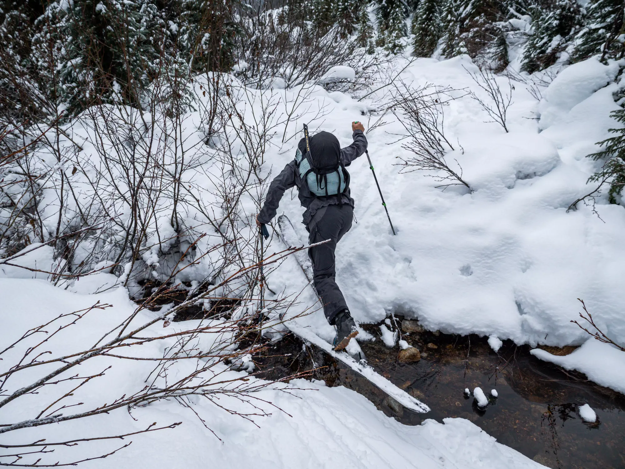
After the couple minutes spent walking down to and across Cayoosh Creek at 1200m, we slapped our skins on, and started skinning the "just barely covered enough" trail through the forest. It winds out beside Cerise Creek after a couple more minutes, where it seemed like the people who'd arrived before us went. This is the "winter route", which I'd previously taken on my trip up Mount Matier, where I noted that it was more trouble that it's worth, so in much earlier/wetter season, we made the call to dive back into the forest and stay on the summer trail.

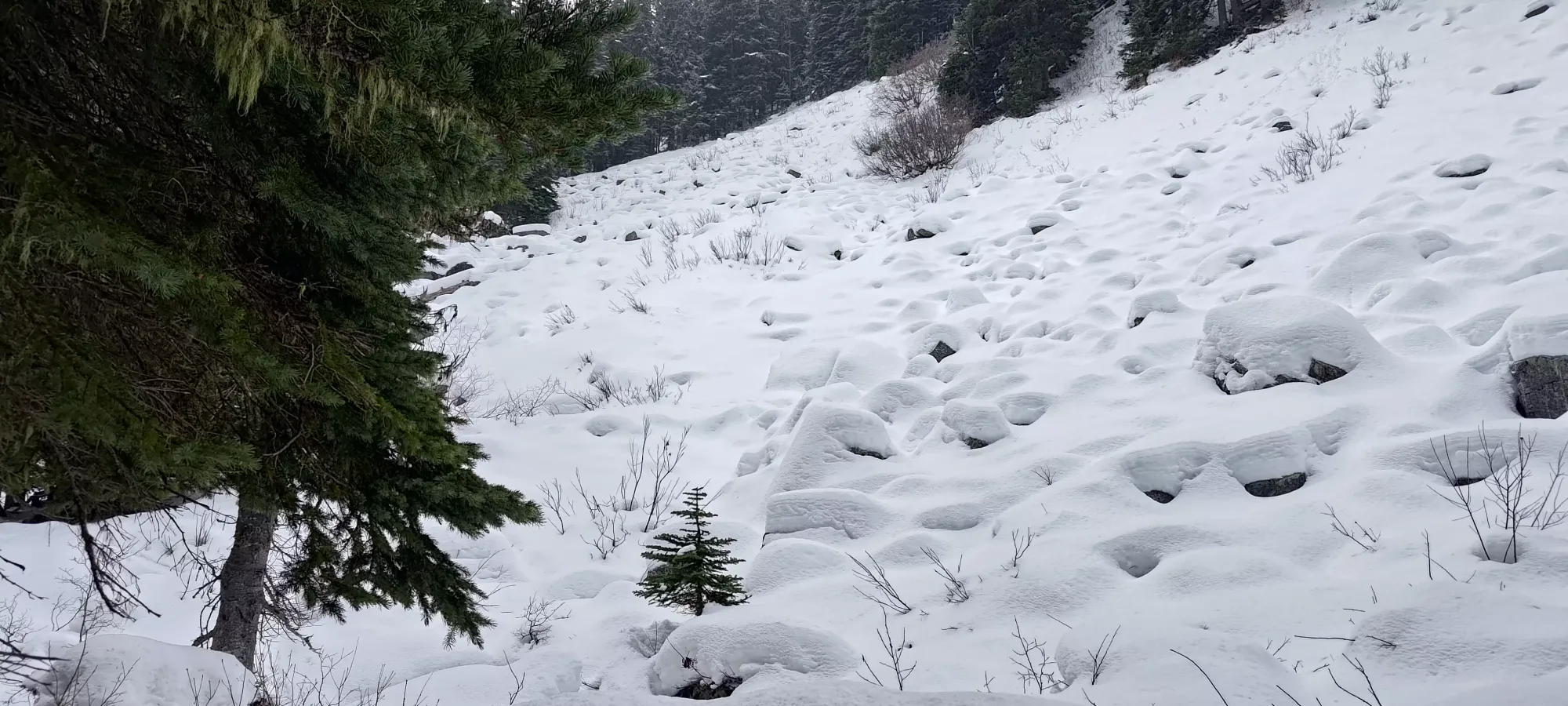
The forested part of the trail took us about half an hour with a few bare spots to carefully skin over, meaning we'd sadly have to bootpack down. The coverage was at least so thin the trail-breaking wasn't a big deal, and we'd not have to worry about postholing or anything on the way down either. Once done, we were deposited onto the old road, having gained a bit over 100m, which would last another kilometre itself.

My recollection of the road section from Matier was a fairly short, easy skin which ate up distance pretty quickly. This time, however, with the snowpack in a "barely skiable" state, it was quite a pain in the rear. There were new growth trees slapping us much of the way (especially in the latter half), and around half a dozen fairly deep creek crossings which required quite a bit of skin acrobatics to get through without wetting our skins (or giving up and taking our skis off, which is simply unacceptable). As a result, this kilometre took about half an hour as well, with less than 50m of elevation gain to show for it.
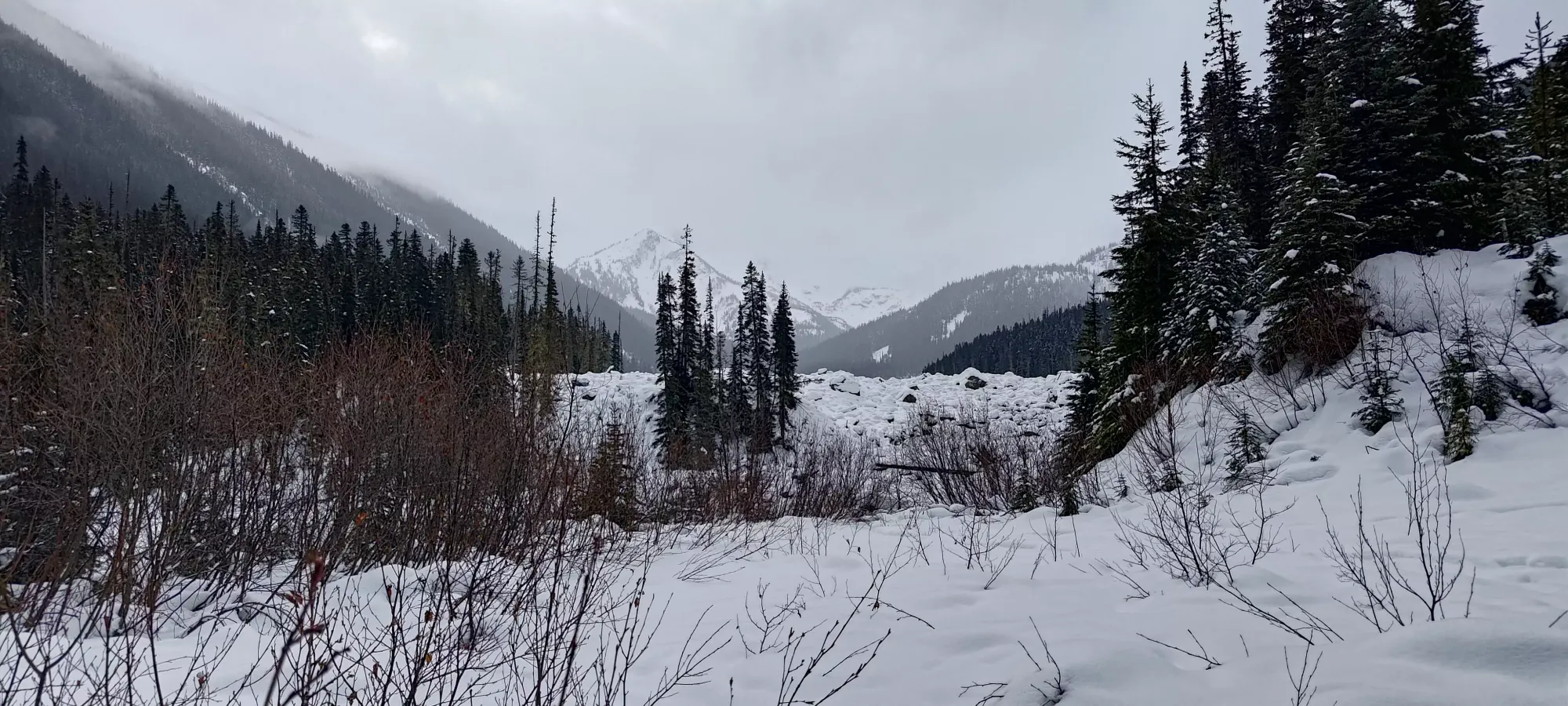

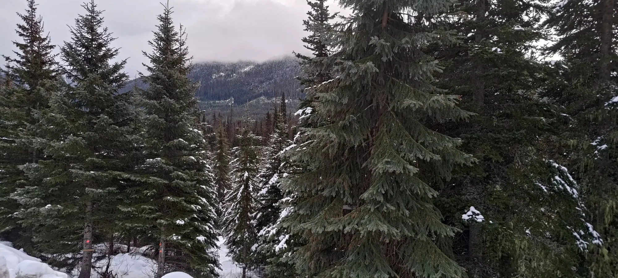
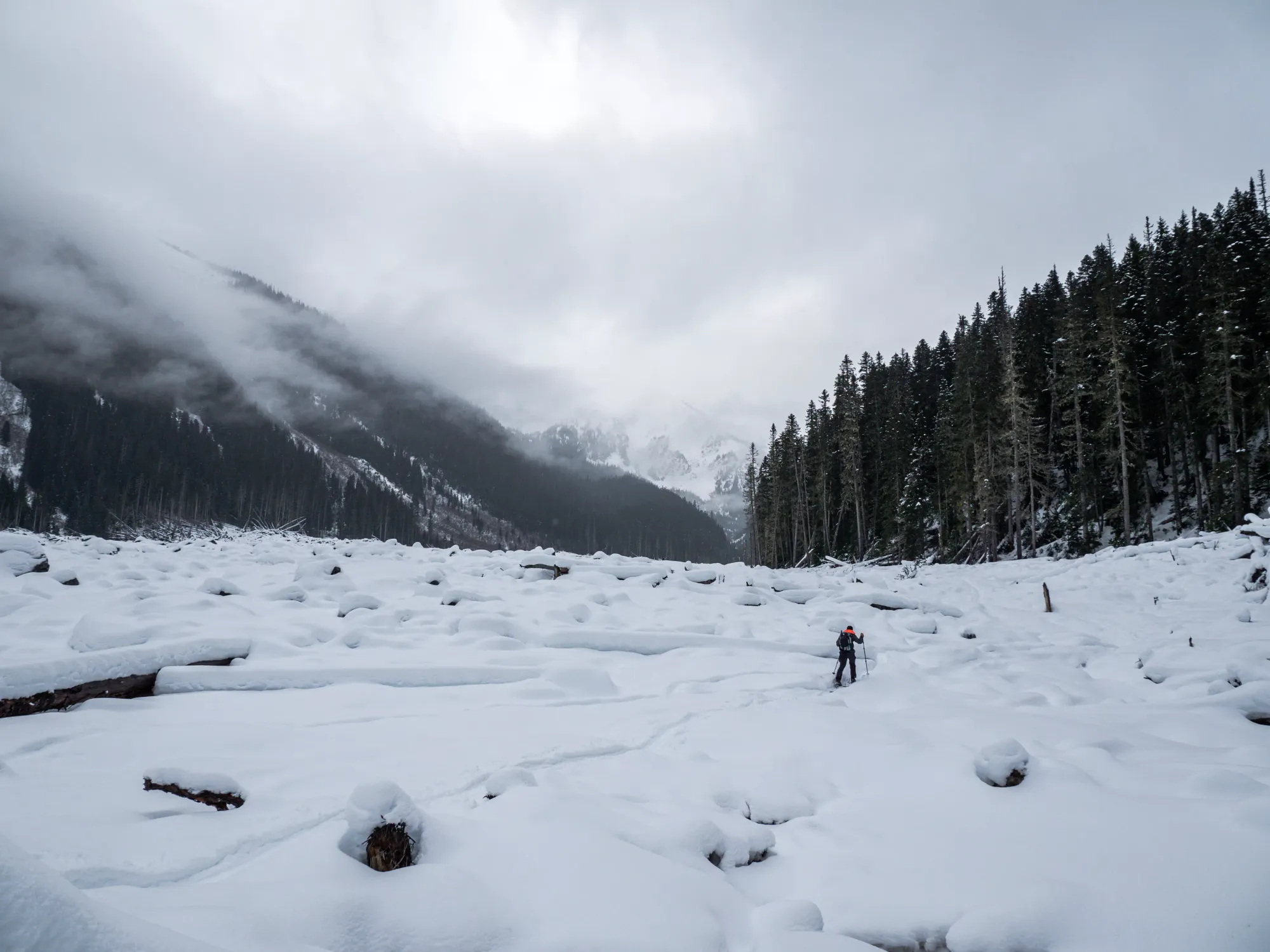
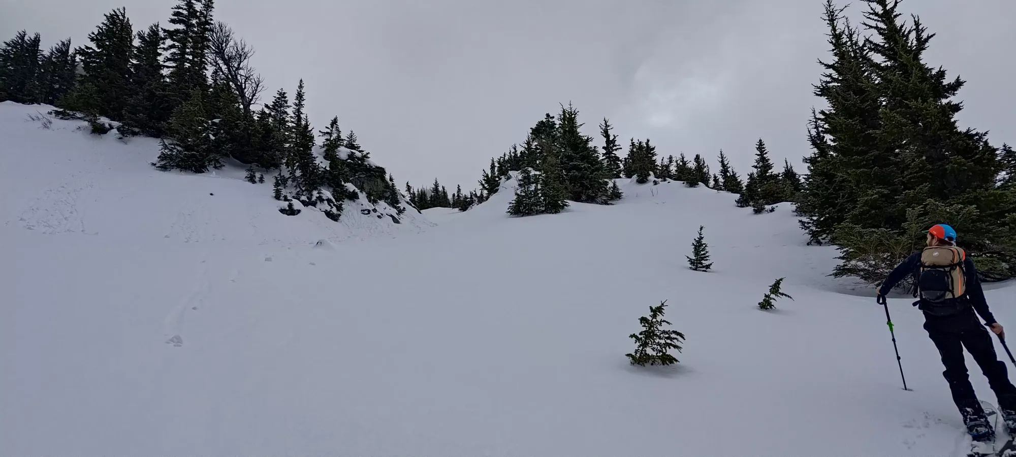
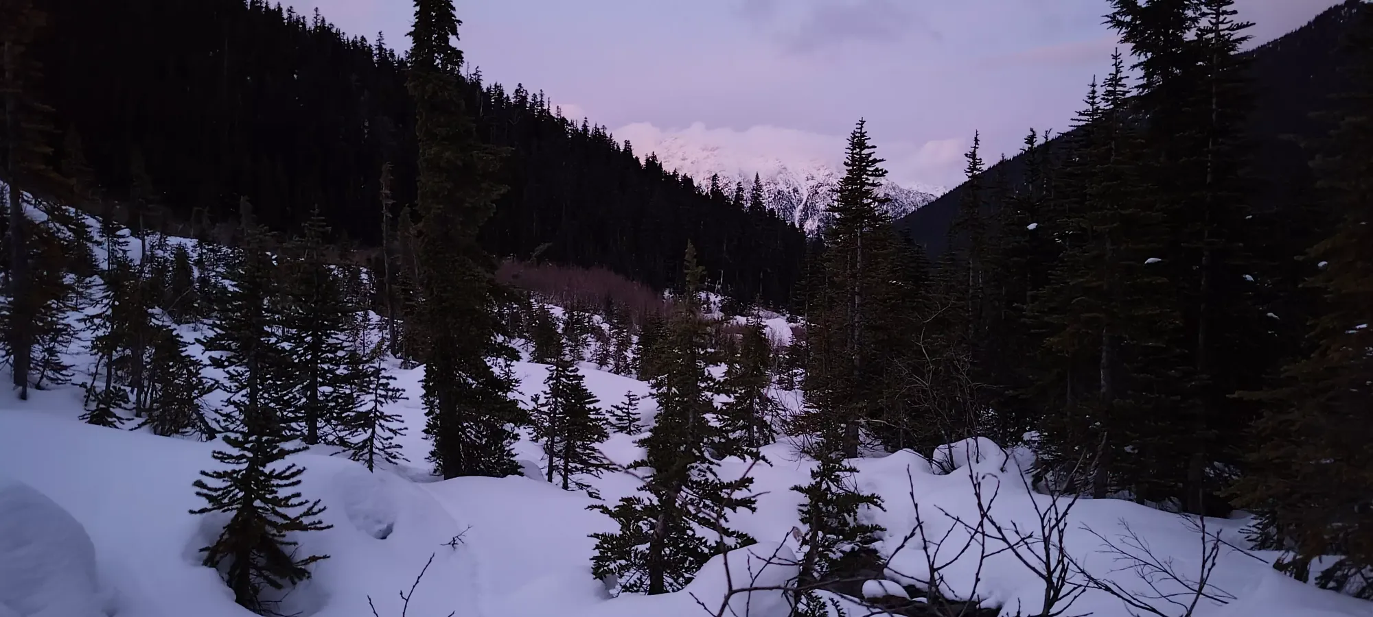
The next 50-ish minutes were spent weaving through the huge debris field left over from the Joffre Peak Landslide(s) back in 2019. There was a skin track here that let us avoid discovering any holes in the snow, at least, but it was a rather windy process, with a couple more creek crossings, one of which also necessitated ski removal. After moving almost 2 more kilometres, around 4 for the day, we found ourselves just over 1400m of elevation, where the trail finally picks up again in the trees, and winds its way up towards Keith's Hut.
This upper section of forest trail, despite being a couple hundred metres above the first one from the parking lot, was in the same shape as the first, with skinnable but not skiable coverage. It does, at least, gain elevation fairly effectively, and in the next half hour we'd gained up another 100+m, until the trail exited the trees and started skirting between the wall of the Anniversary Glacier moraine and the forest. Since we knew the hut was above where we'd need to traverse over to our route up Vantage (normally one could follow the "winter route" up the creek, and avoid any shenanigans, but that was not the case for us), we decided to cut across the moraine here to try and reduce the elevation loss+time wasted by going all the way up to the hut.
The traverse across this slope was pretty slow, unfortunately. Not due to trail-breaking, while that was something I had to do, the penetration was quite low, so it wasn't much effort there. Rather, once we got past the initial shallower slope, traversing across the slope was rather sketchy due to the thin slab on top of a very firm+slick crust, making it necessary to kick hard steps with lots of edge pressure to keep one's skis stable. The runout wasn't dangerous, it was just open slopes with a flat basin at the bottom, but it would be rather annoying and time-wasting, so we had to cut a careful path across for about 20 minutes in our attempts to get across towards the creek (where we would approximately rejoin the planned route up) without losing a bunch of elevation.


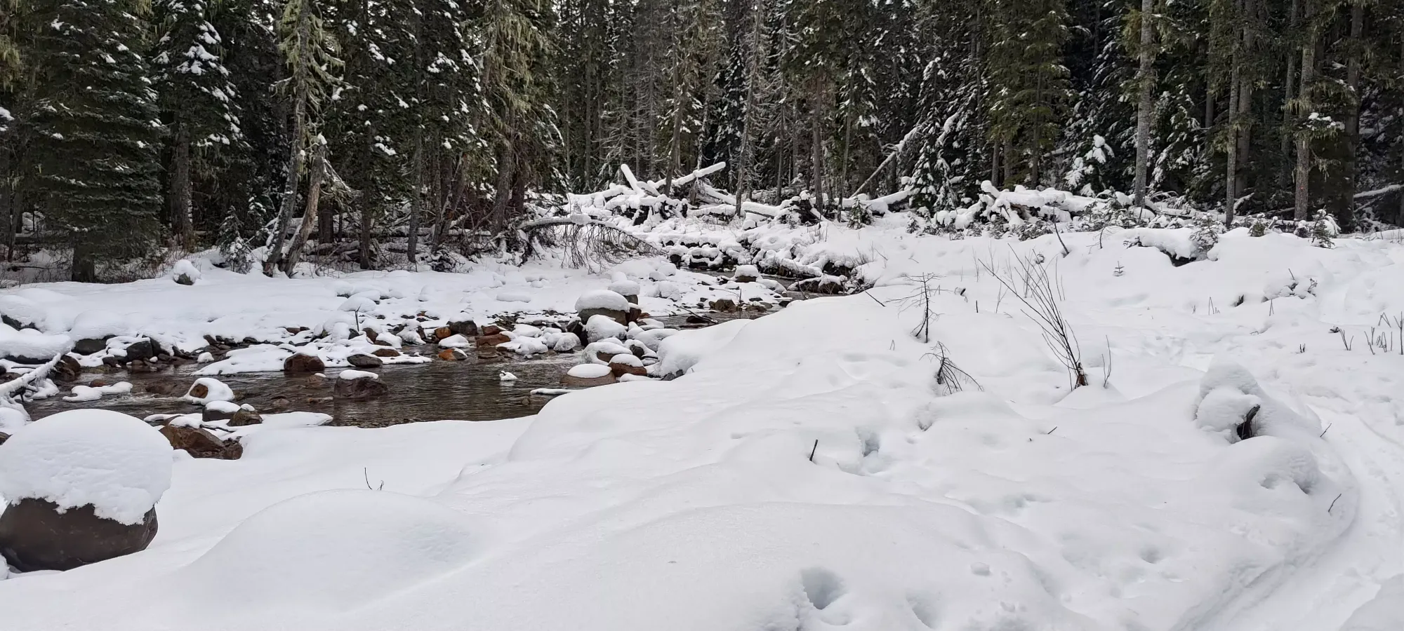
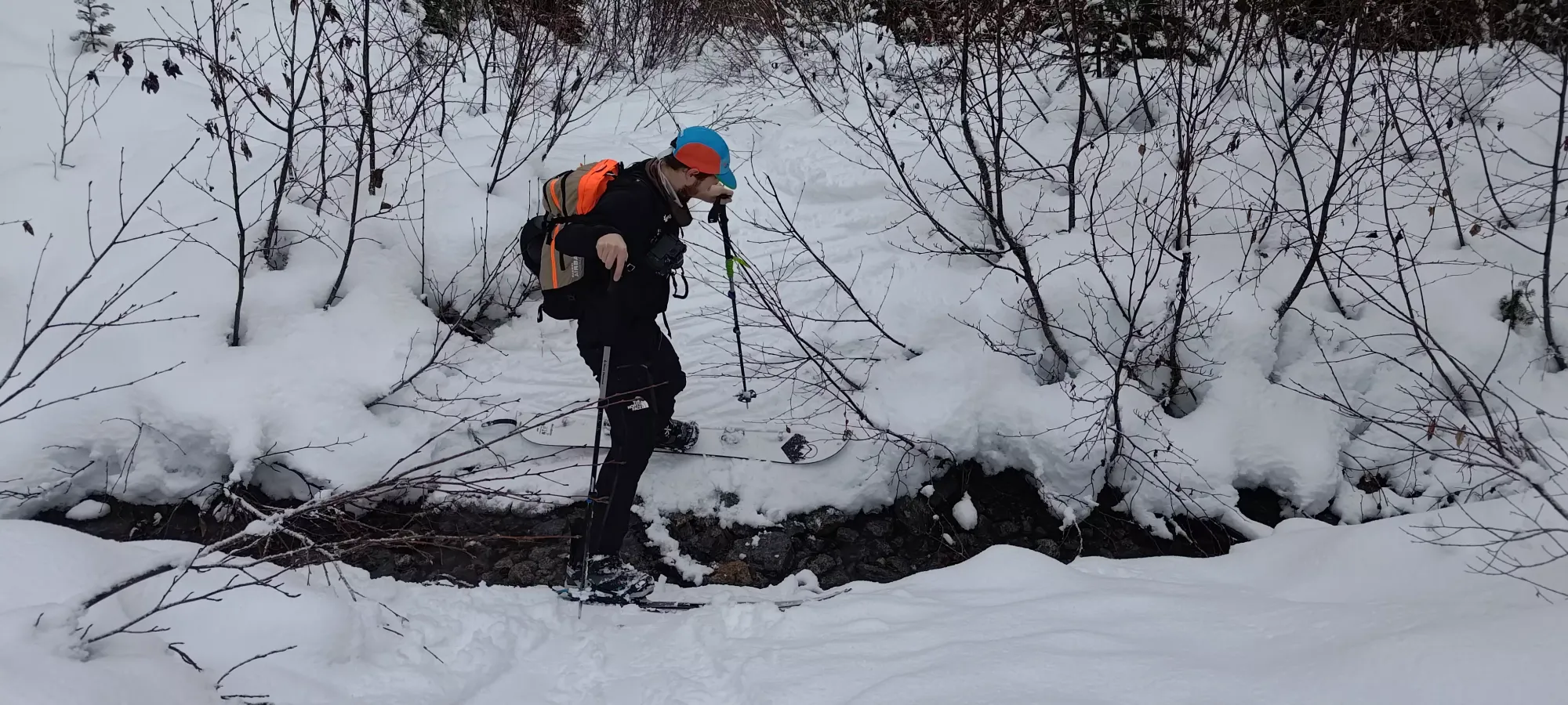
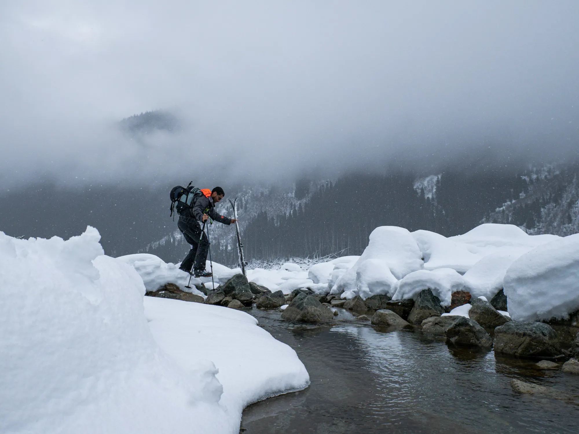
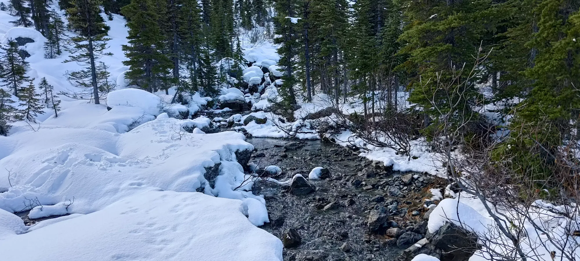
After dealing with this annoying terrain for a while, we got far enough to be past the thicker bands of trees below, and decided to just descend to the flatter terrain closer to the creek, and walk across to our crossing-point where the walking would be easier. I got to show Alex my patent-pending technique of "how to descend a steep slope with your skins on" as I scuttled down to the bottom without transitioning, while he did the normal thing and actually rode down like a sane person. I broke a trail down to the creek while he transitioned and we reconvened to do our final creek crossing of the ascent (finally!).

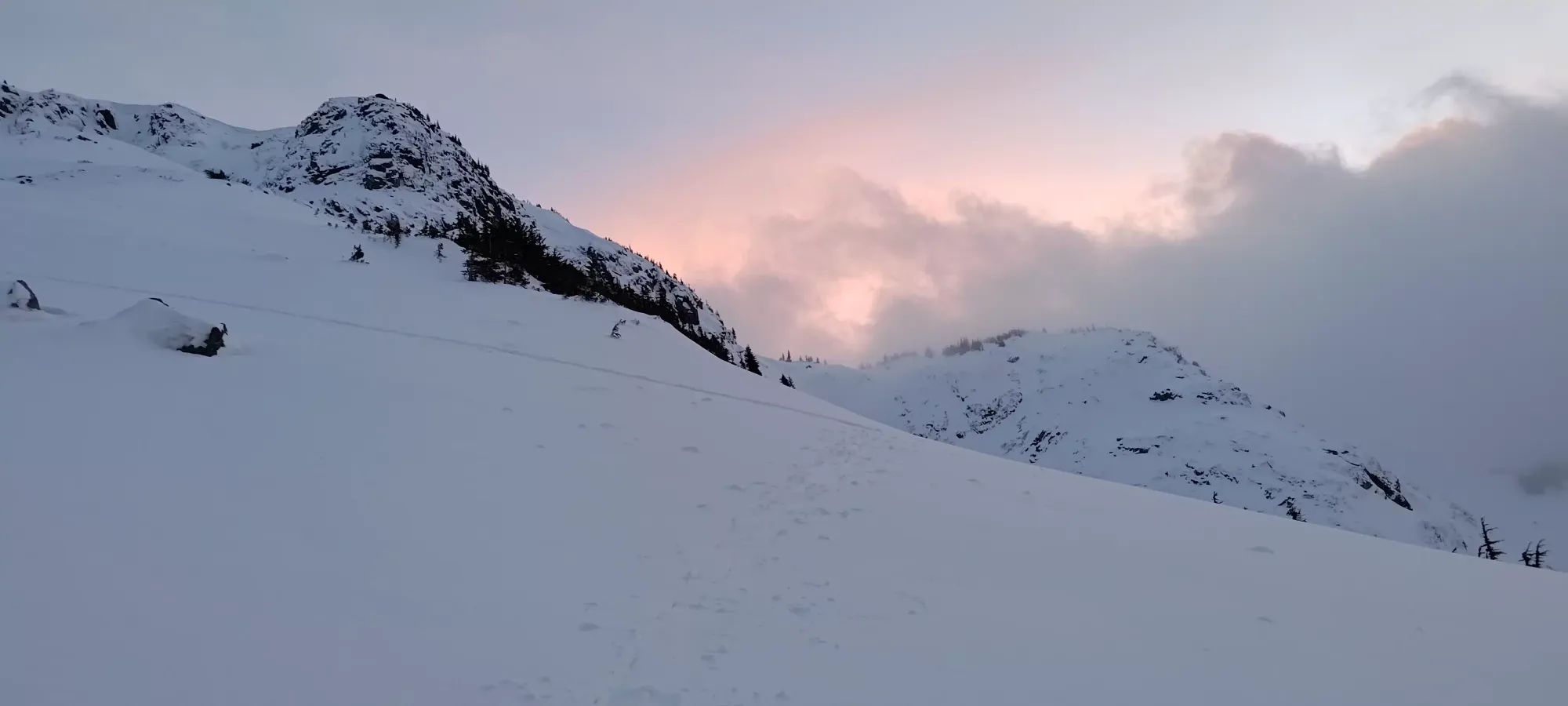
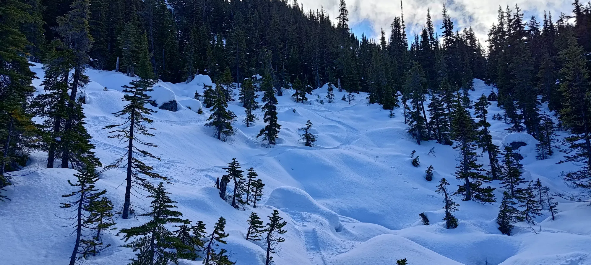
It felt really good to finally be somewhat on-track after 3 hours of having to deal with long, flat terrain, poor snow conditions, and random routefinding to account for those conditions. Despite starting at about 1250m elevation, and walking for 3 hours, we'd only gained up to about 1550m at the point we crossed the creek, which is definitely below my general "300m/hour" threshold for acceptably efficient elevation gain. At last, we'd get to just make vertical progress all the way to the top. The next 20 minutes were spent in some sparse trees winding our way up towards treeline. We gained 100m in that time, and we didn't even have to lose it right after!

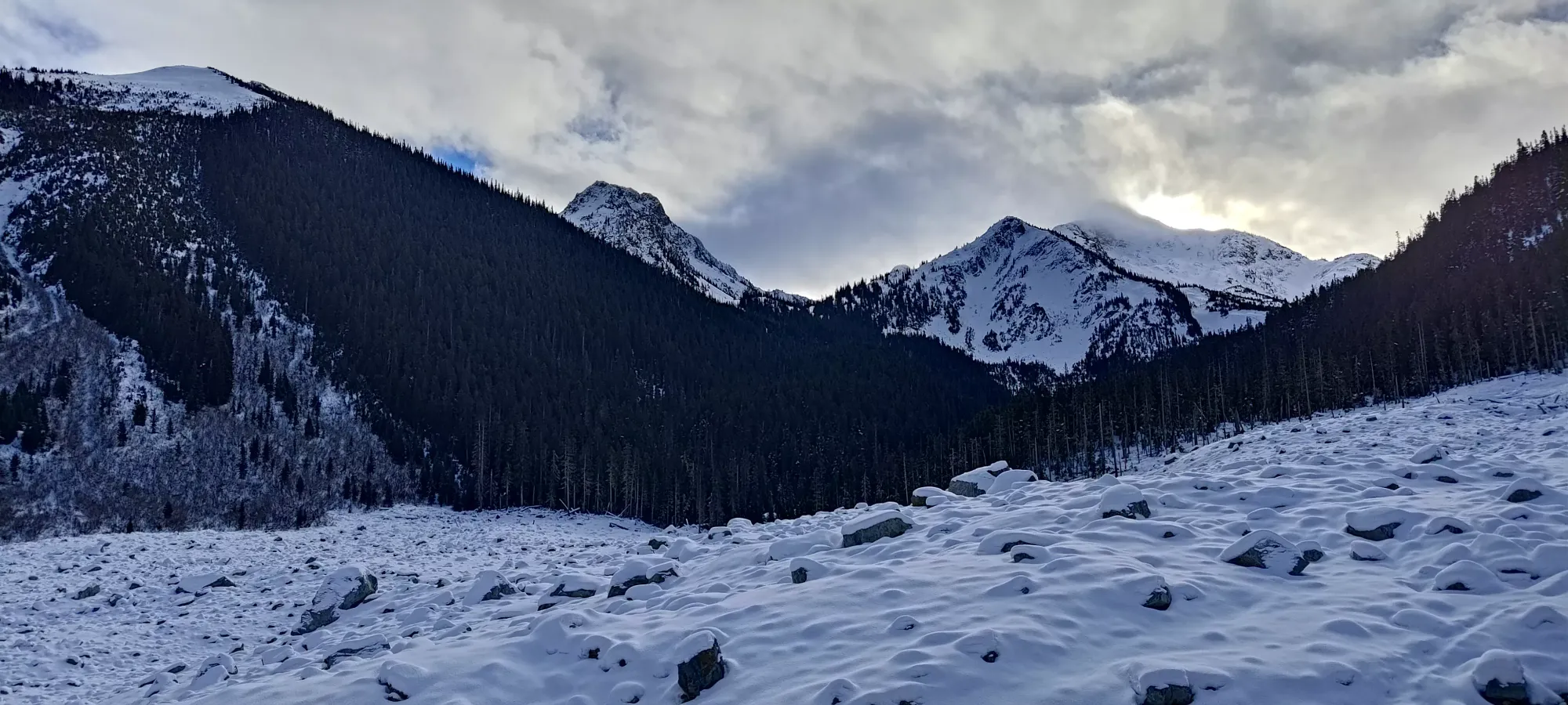
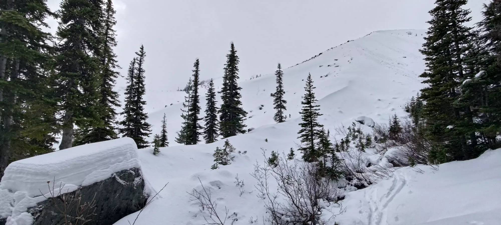
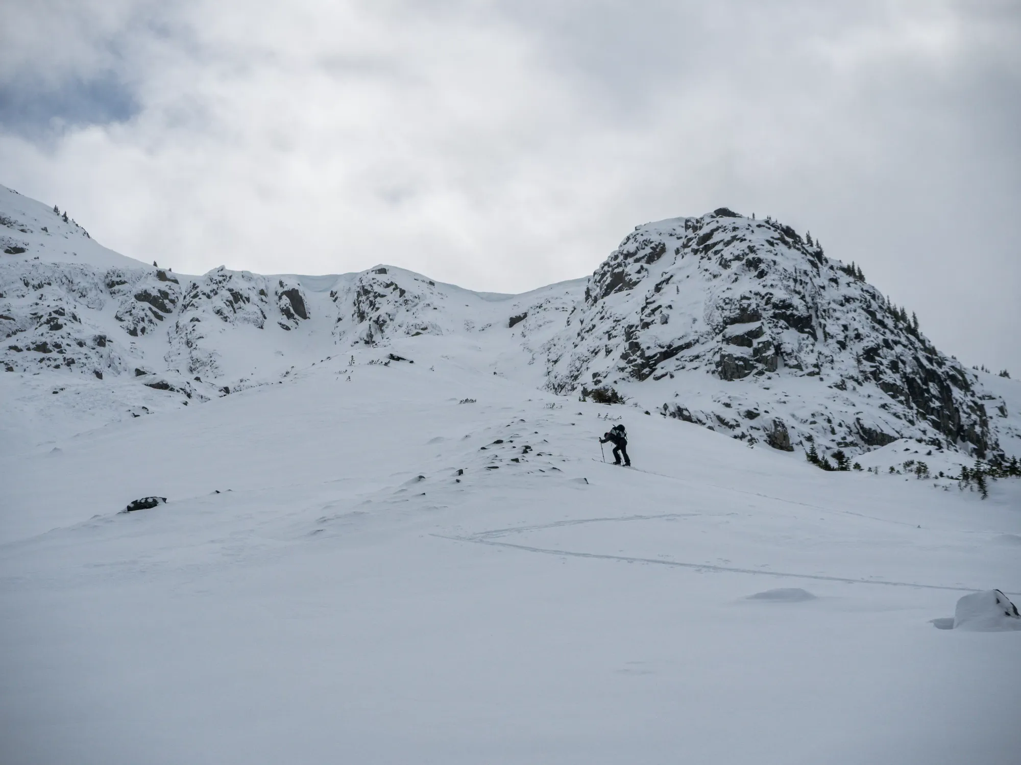
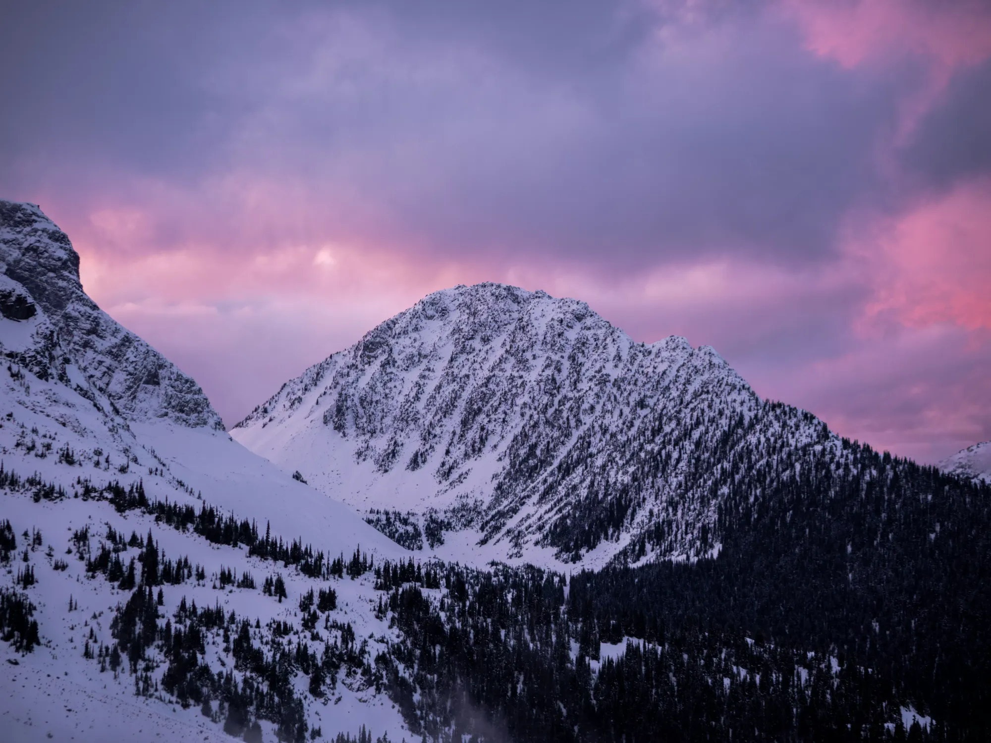
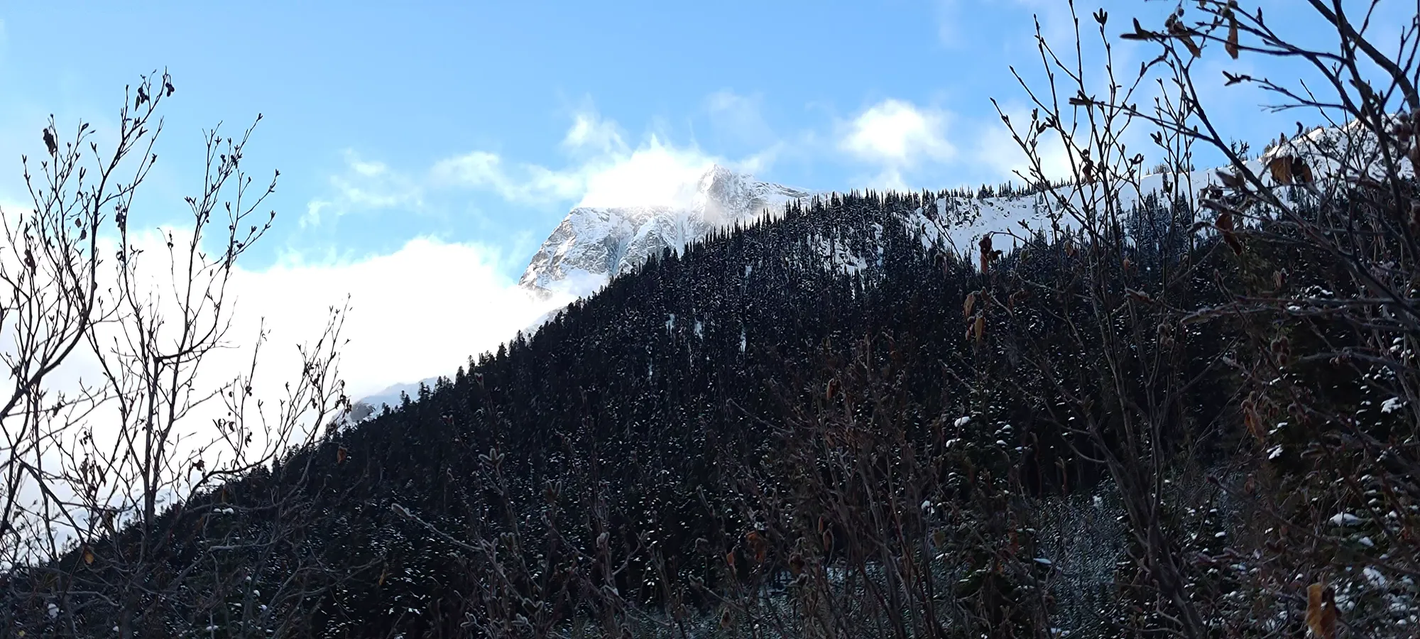
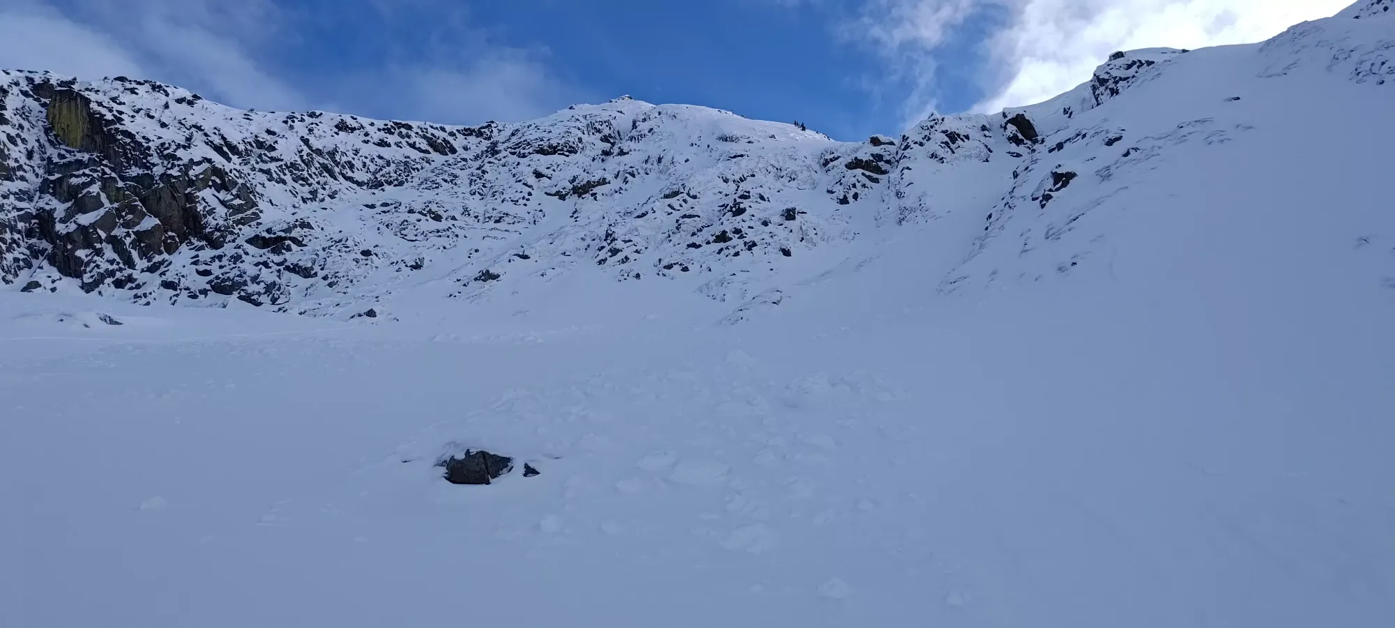
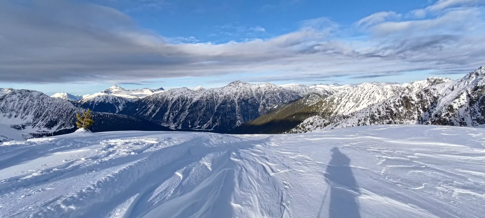
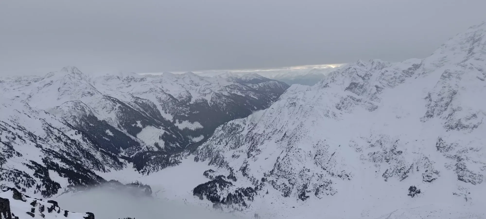
The terrain continued as above for the next half hour, following a fairly wide+open drainage up to 1800m, where we crested above a ridge and got our first eyes on the summit in quite some time. It was nice to have good terrain for a change, as we got to gain efficiently, and even had fun terrain we could follow down without having to worry about routefinding in, which given the rather variable conditions thus far, was a great relief.


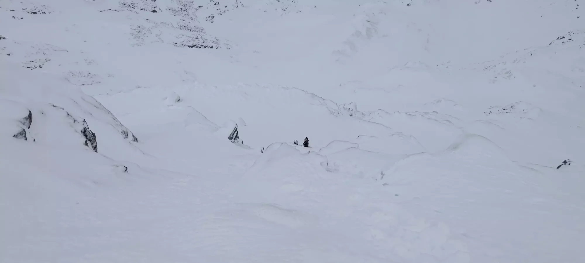
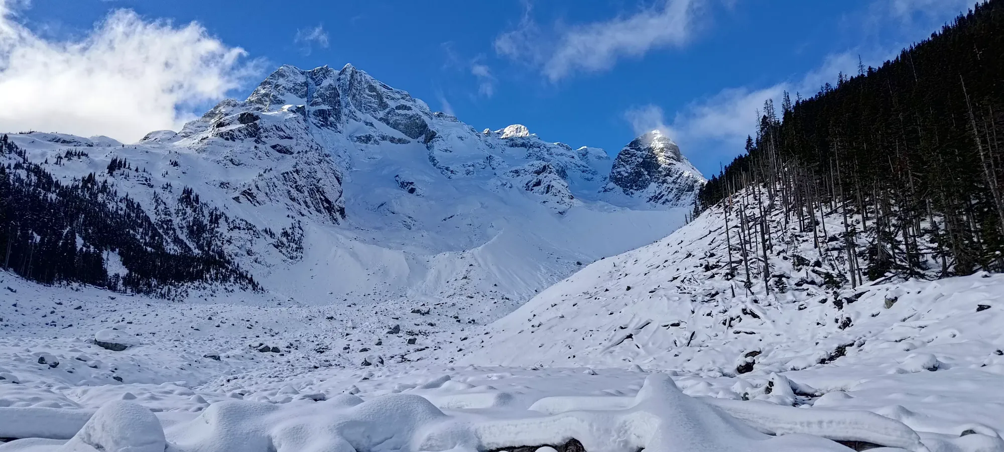
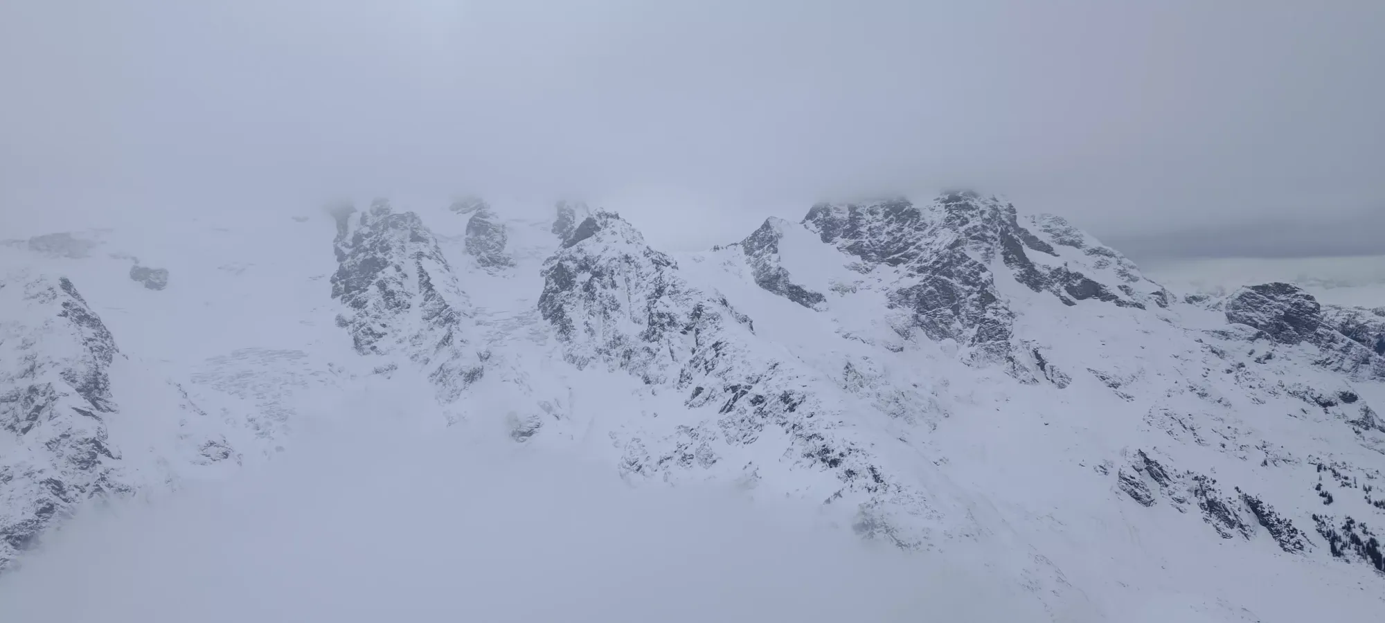
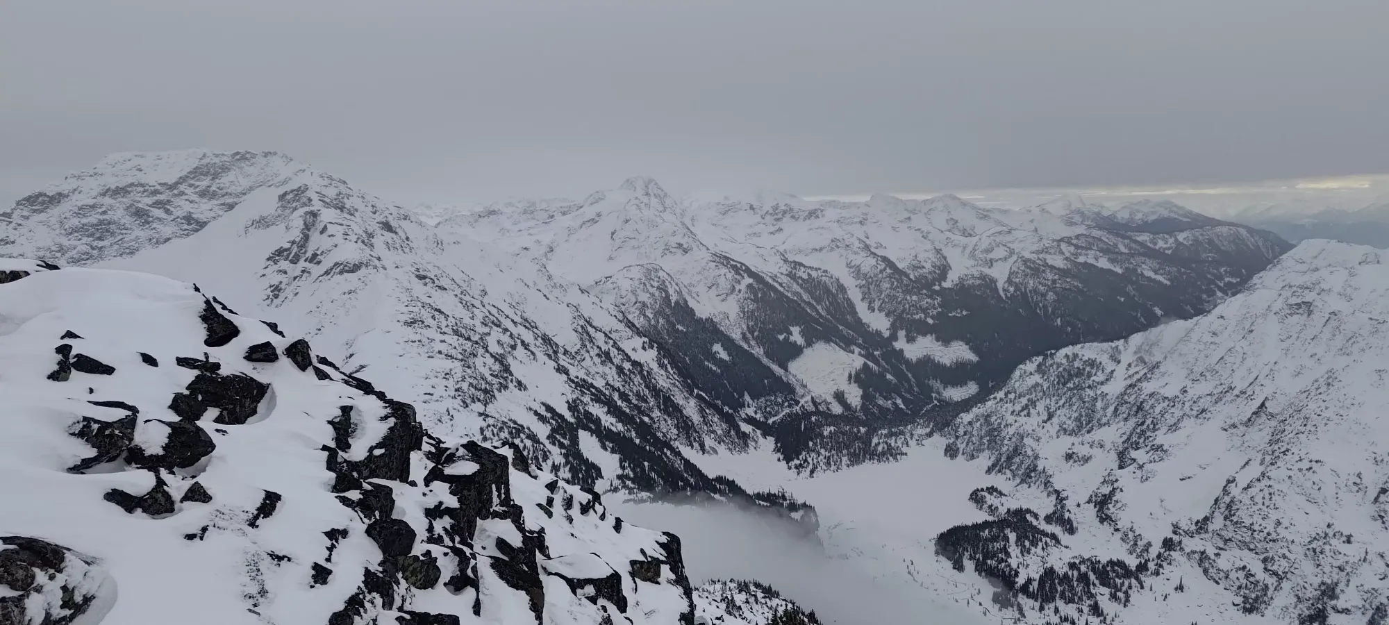
Once we got to this point, we were relieved to find that the conditions were actually looking fairly conducive to an ascent, as the cornices were small and set back from the runout slopes below, the overall snowpack was generally just below threshold for slides on the slopes that would've otherwise been of concern, but the base was solid+pervasive enough to be skiable, and we could roughly see a couple routes to get up to the West Ridge, which is the typical summit route. So, after a short snack break, we started making our way up the fairly flat plateau that kept us east of the Matier-Vantage col (another common route up is ascending one drainage over directly to this col and along the entire ridge).
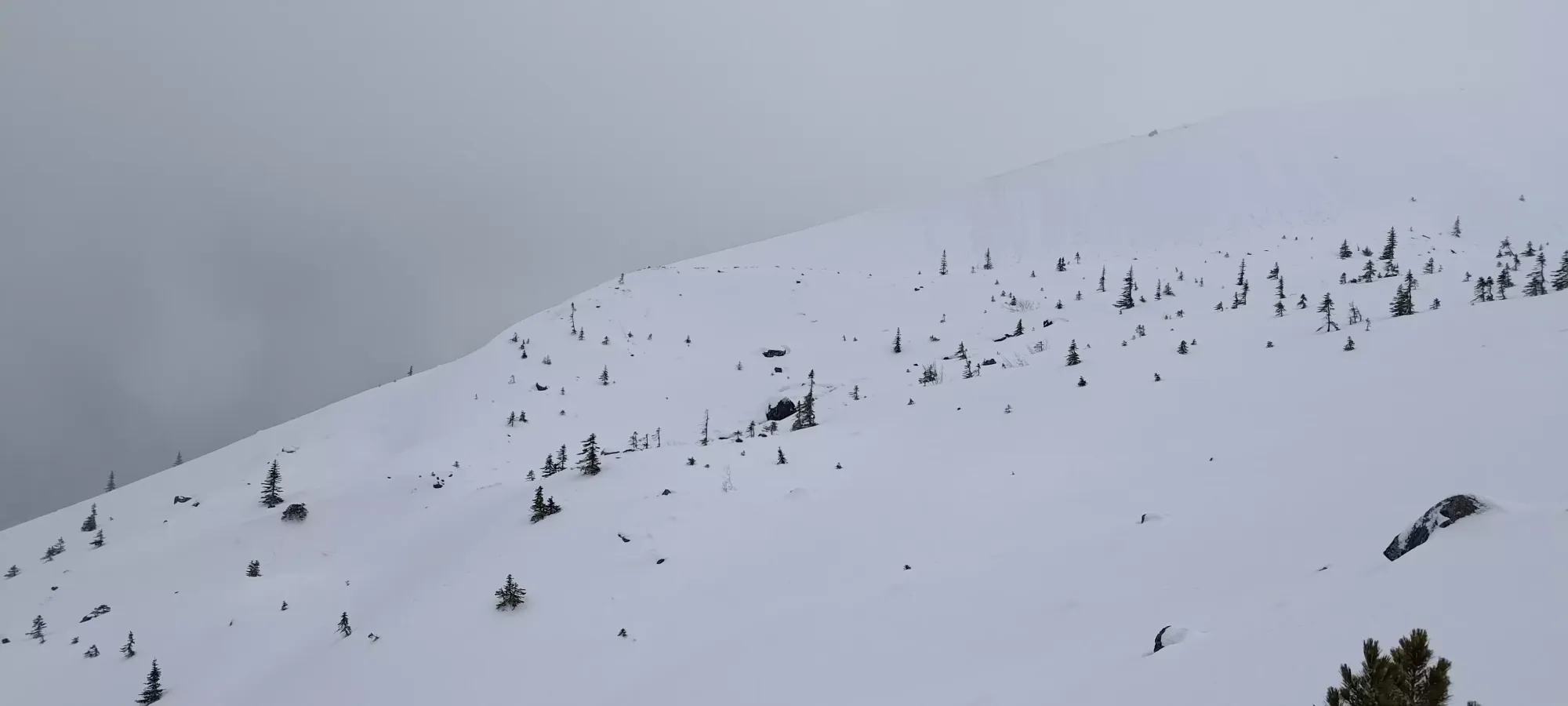
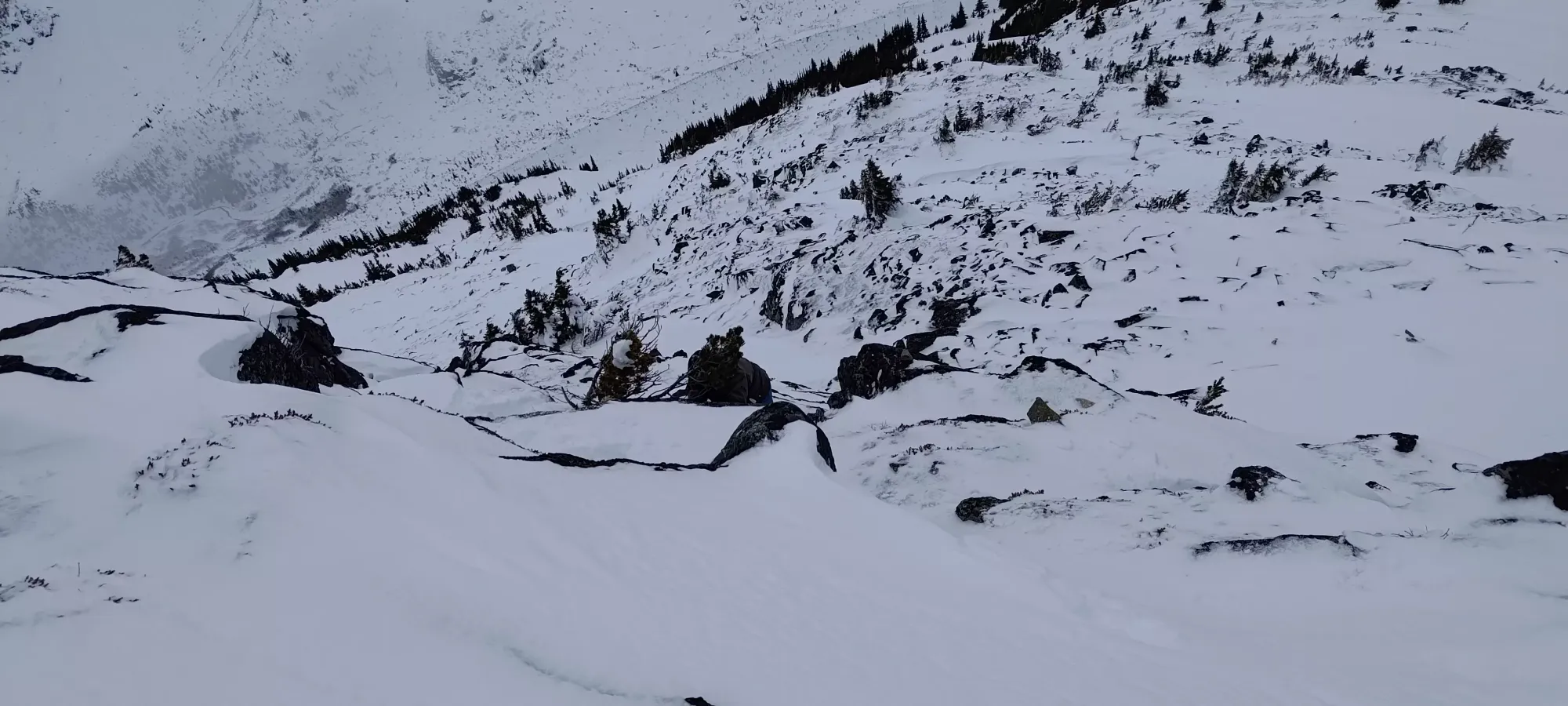
Sadly, our stoke levels did not stay high for too long, as we started seeing the effects of the wind and melt/freeze on the alpine snowpack. As the terrain got steeper, we started to run into some bad conditions. More of the previous slick, thin slab on hard crust, sometimes the thin slab was scoured away and it was just the icy crust and nothing else, and sometimes there was enough wind-deposited snow to be grippy. We ended up having to boot up a short section of this ridge where it was rockier+icier before we turned climber's left into the bowl where the terrain was more sheltered, and retained better snow.
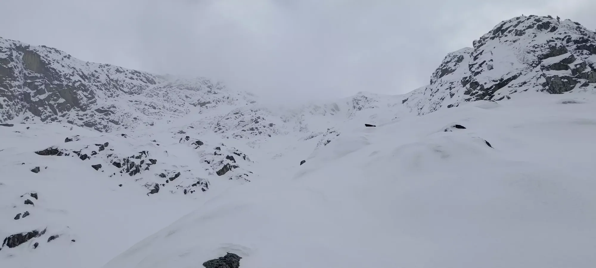
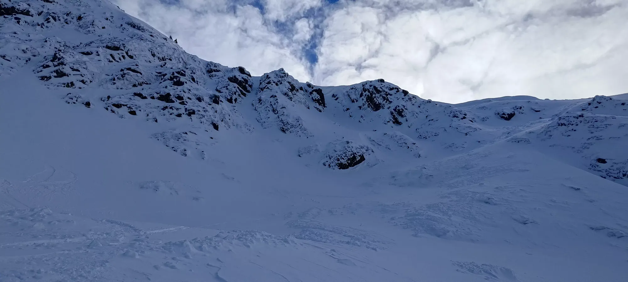
Once we got through that annoying section, we decided to cut across the bowl to climber's left, and ascend a ramp going back up to climber's right to join the ridge above some corniced sections and a couple couloirs (which I otherwise might've climbed with more time on my hands, or skied if the snowpack was less icy). I don't hear people talking much about this peak ski-wise, but there are lots of fun lines in this zone!


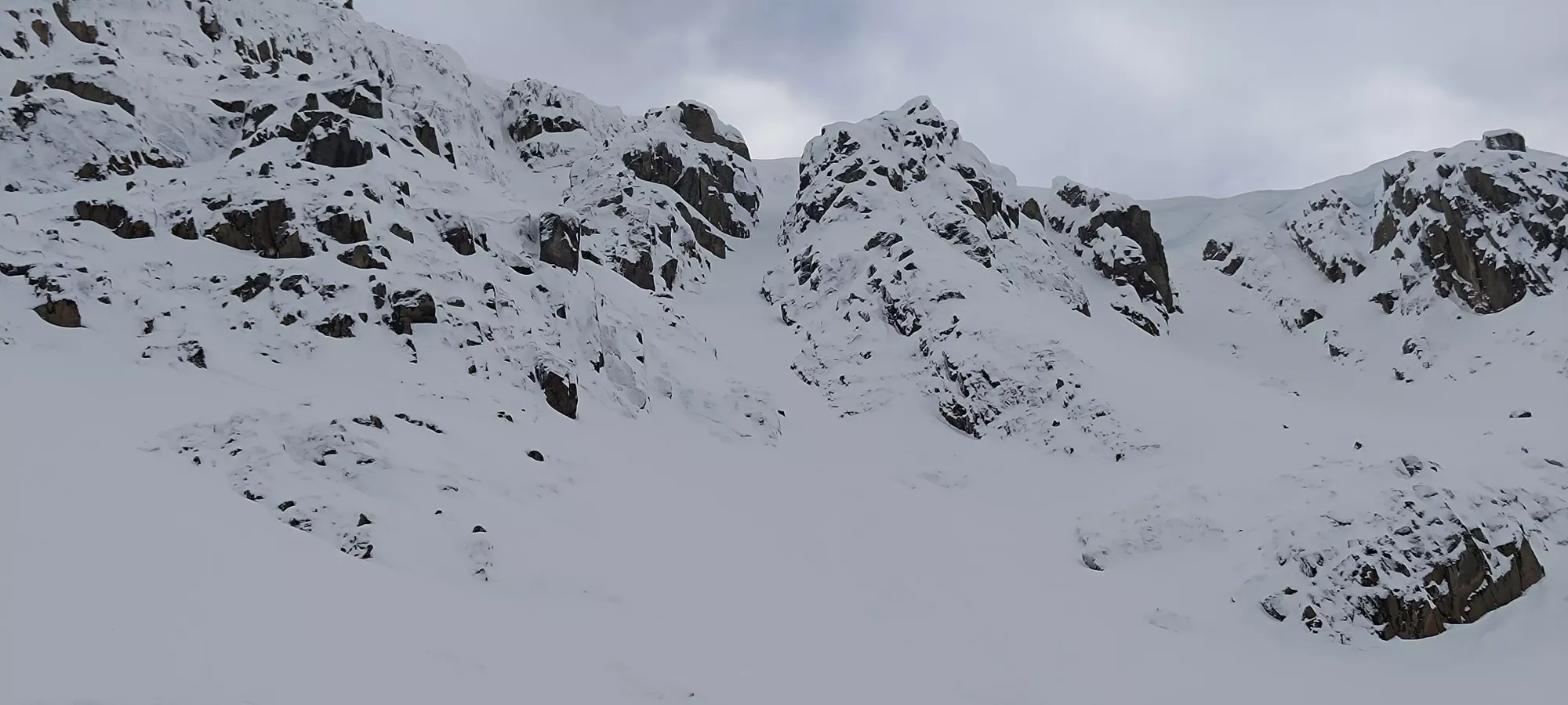
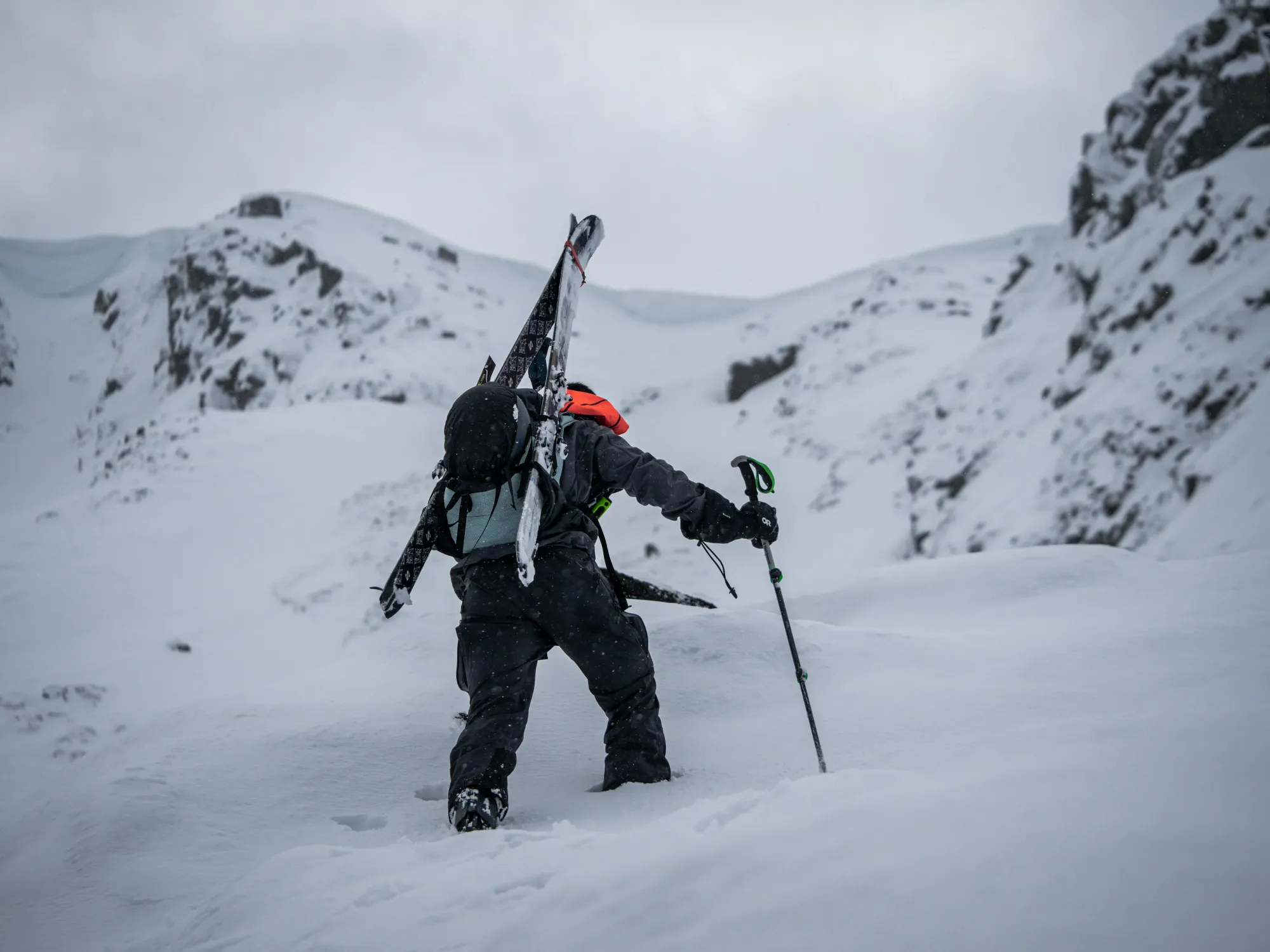
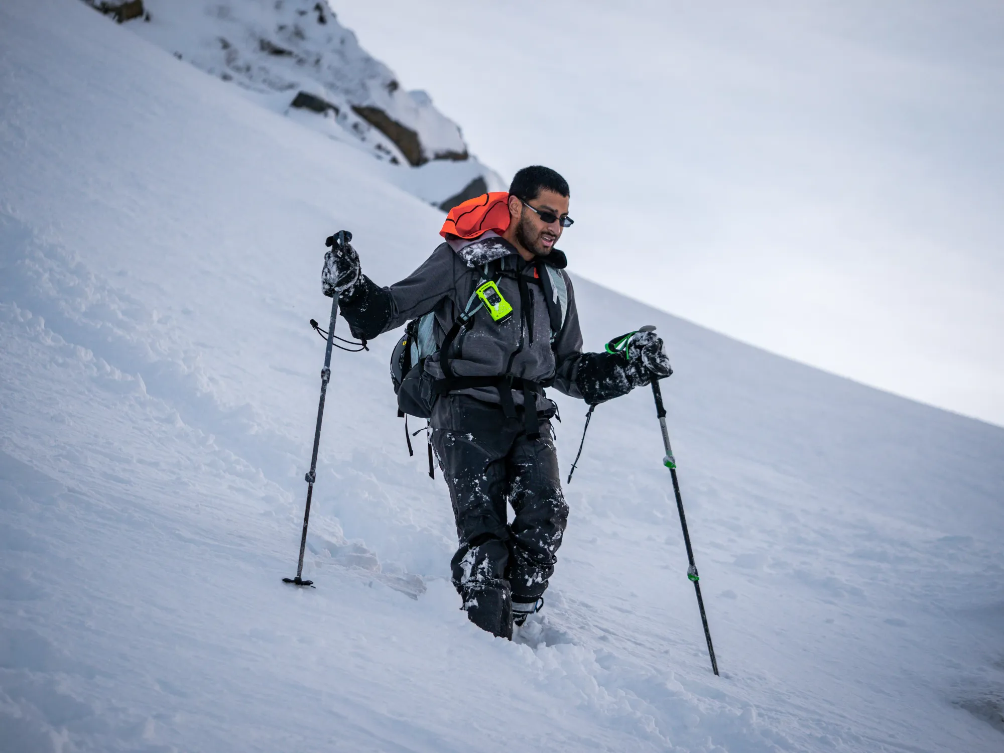
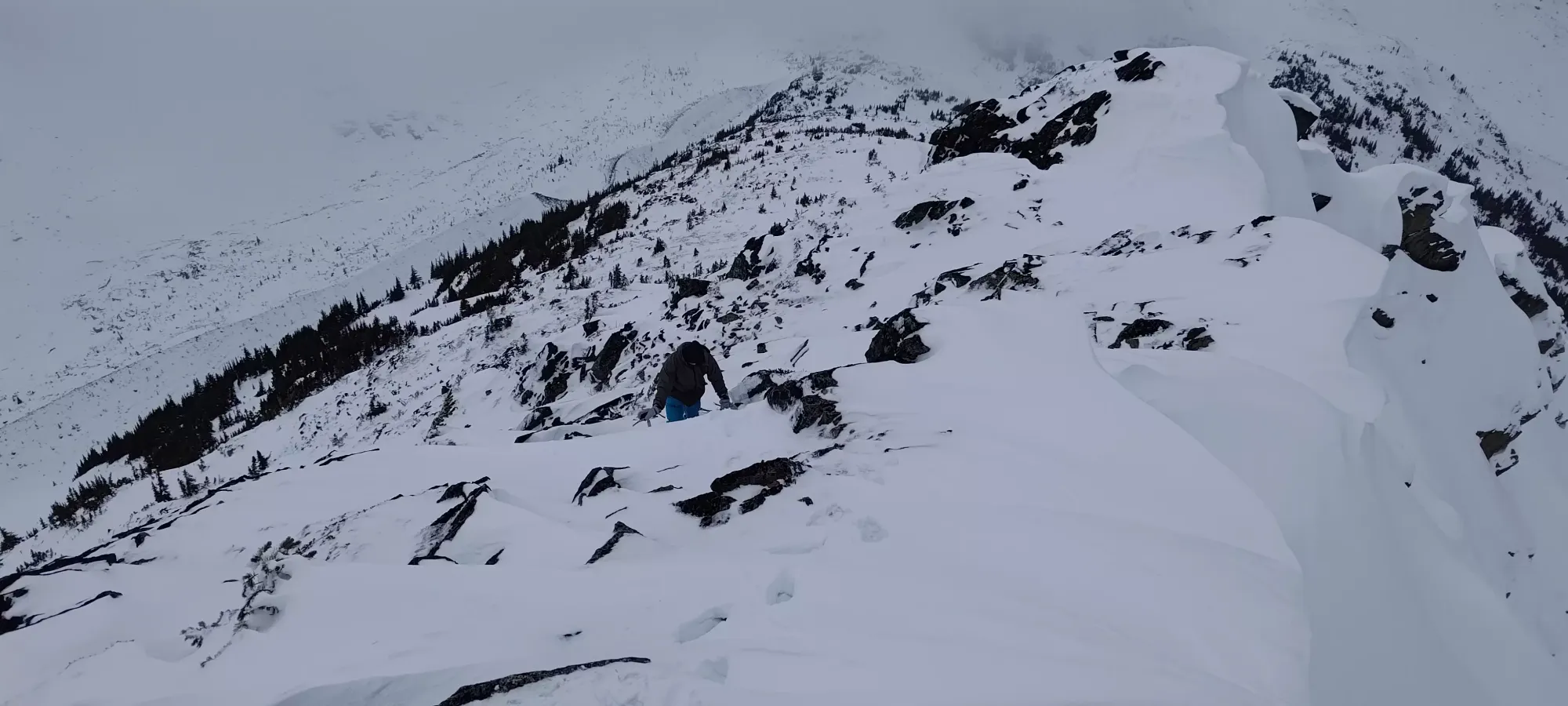
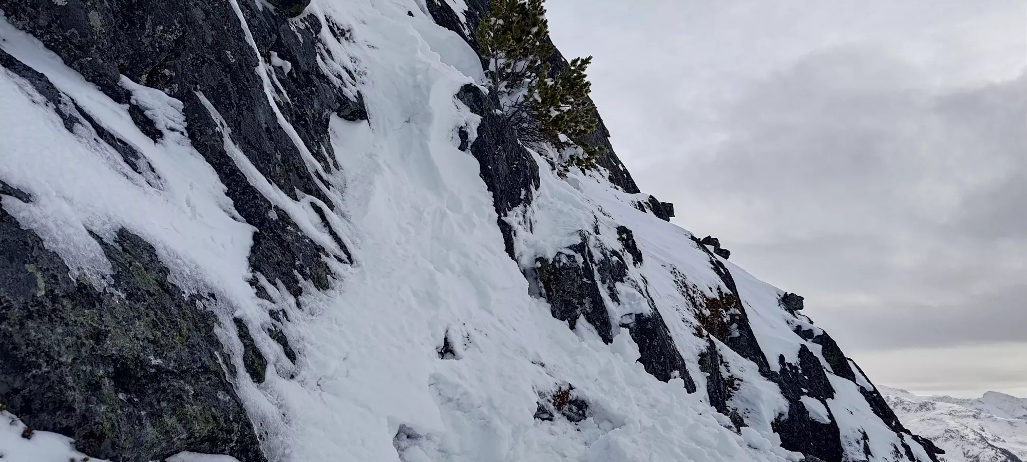
After we got onto our final ramp up to the ridge (around 2050m), it started getting steeper and icier, with a little exposure below us, and we made the call to pack the skis away and start booting up (this was a bit over 5 hours in, or around 2:30pm). Alex went ahead to get some nice shots of me coming up, but stopped after about 10 minutes as it was getting icier, steeper, and at the limits of his axe-less, crampon-less setup.
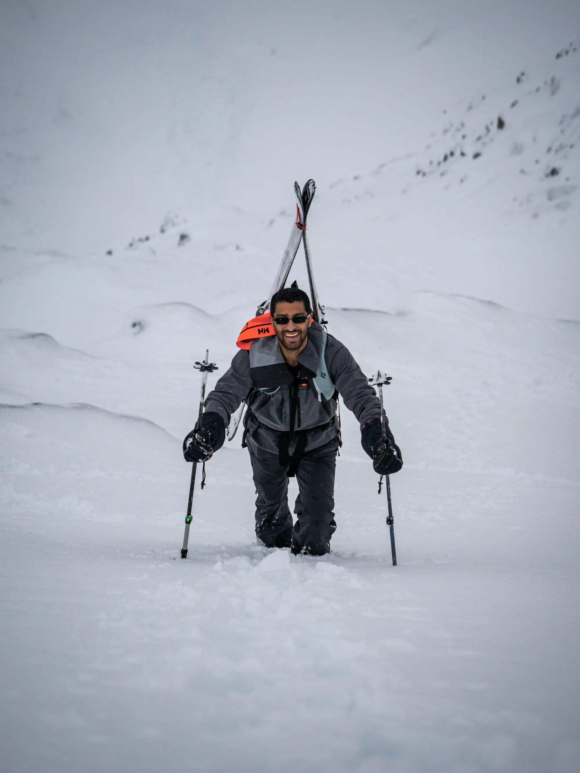
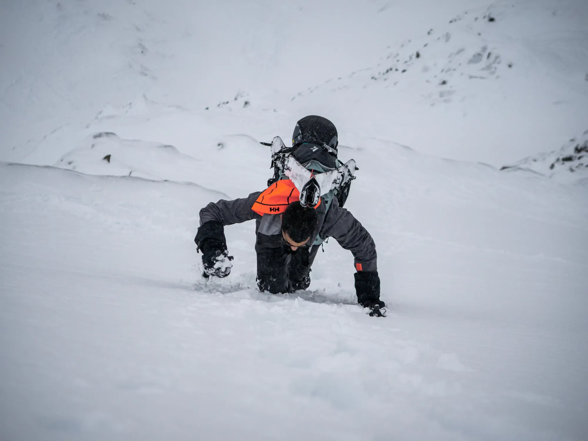
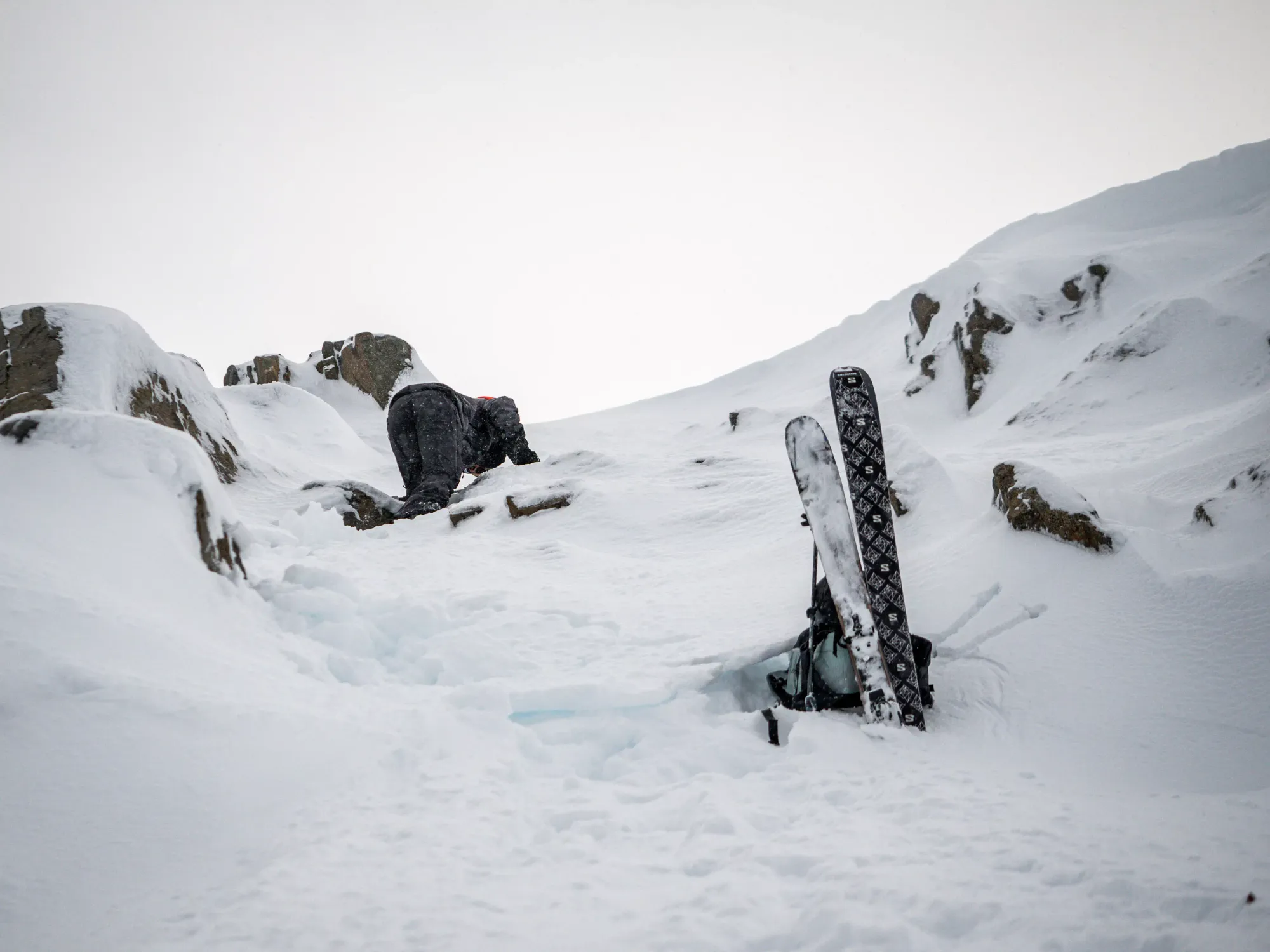
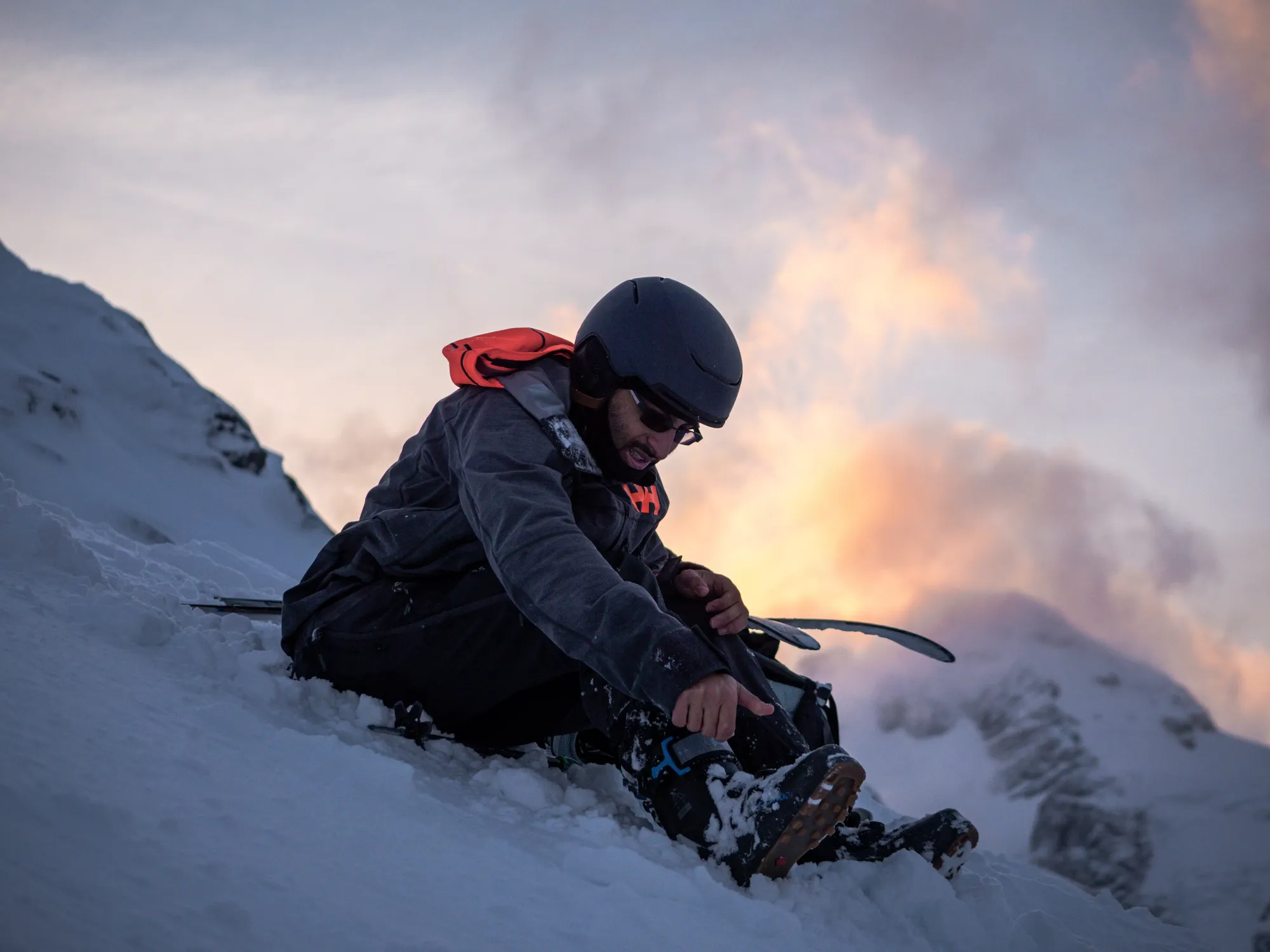
I went a bit higher after where Alex stopped, but soon the slope was getting even steeper, and the thick crust at the top of the snowpack was making progress quite difficult, as I couldn't get poles through the crust reliably, and stepping up required releasing my weight from the slope to get my legs up and over, or a lot of knee-bashing to try and break the crust to move my legs up in a safer manner. So, I stashed my pack+skis, took my axe out, foolishly decided against taking my crampons out, and continued on up.
As I continued up, things only got worse. The crust was more and more impenetrable, in some places I was unable to get through with my boots at all (should've put the crampons on after all, but our turnaround time was approaching rapidly, so I decided if I needed that much time/effort, I wasn't going to make it anyways). The snow underneath was also pretty soft, so many steps ended up being useless. Topping it off, the rocks underneath were often downwards-sloping and useless, so I spent like 20 minutes making very little progress before calling it at around 2120m of elevation, just a few metres below the ridge. It felt kinda bad to turn around so close, but it was getting sketchy, I was hoping to be out of the main skiing terrain before nightfall, and I didn't want to leave Alex alone as the wind was starting to pick up, so it was the right thing to do.

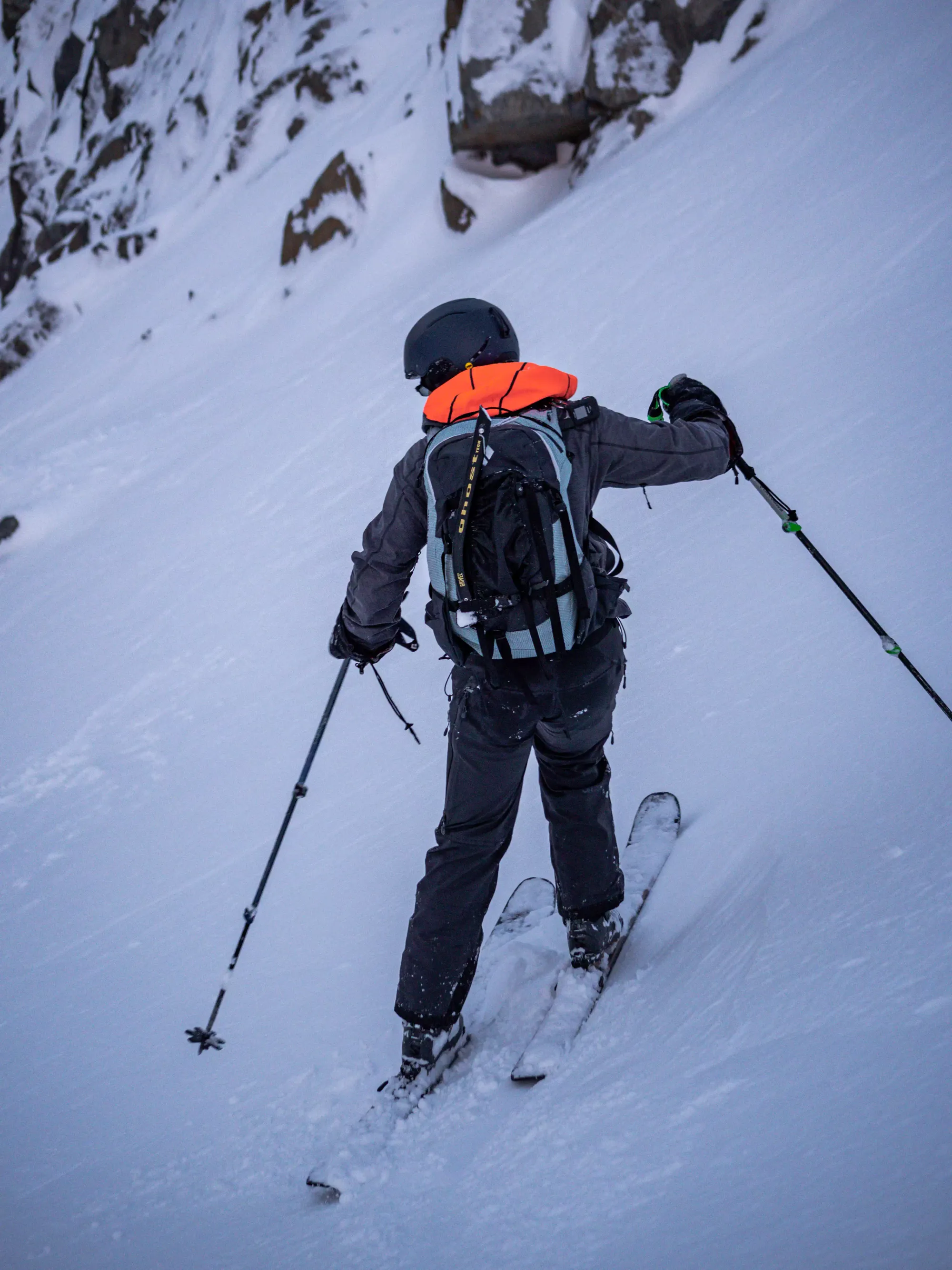
The descent was just as fun as the way up; naturally I did it in my trademark facing-forwards style to make it just that little bit spicier. The main trick was keeping a solid footing, since the ice was hard enough to make kicking new steps in impossible, but my track was also quite soft/loose below the crust, so I had to take care to avoid slipping when the snow gave, or revealed downsloping rocks. With judicious application of tactical sliding and patience, I made it back to my skis, threw my pack back on, and made my way down to Alex, who managed to take some nice pictures in-between getting showered in chunks of crust that I shot down in his direction 😅.

Once we got back to the flatter spot where we started booting, we slapped the skis on and got skiing! The alpine was pretty alright, but not stellar. The thin slabby stuff was a bit moist from the warm air all day, so it was kinda sticky. Protected wind deposits skied well, though, and the crust was "fine". The small amounts of debris sucked, but were largely avoidable. We skied down to the beginning of the treeline drainage area in about 15 minutes, mostly slowing down for routefinding decisions to ensure we were going the best way we could. This meant we did succeed in avoiding the bony ridge we had to bootpack partway up, though, so I consider that a worthwhile tradeoff.


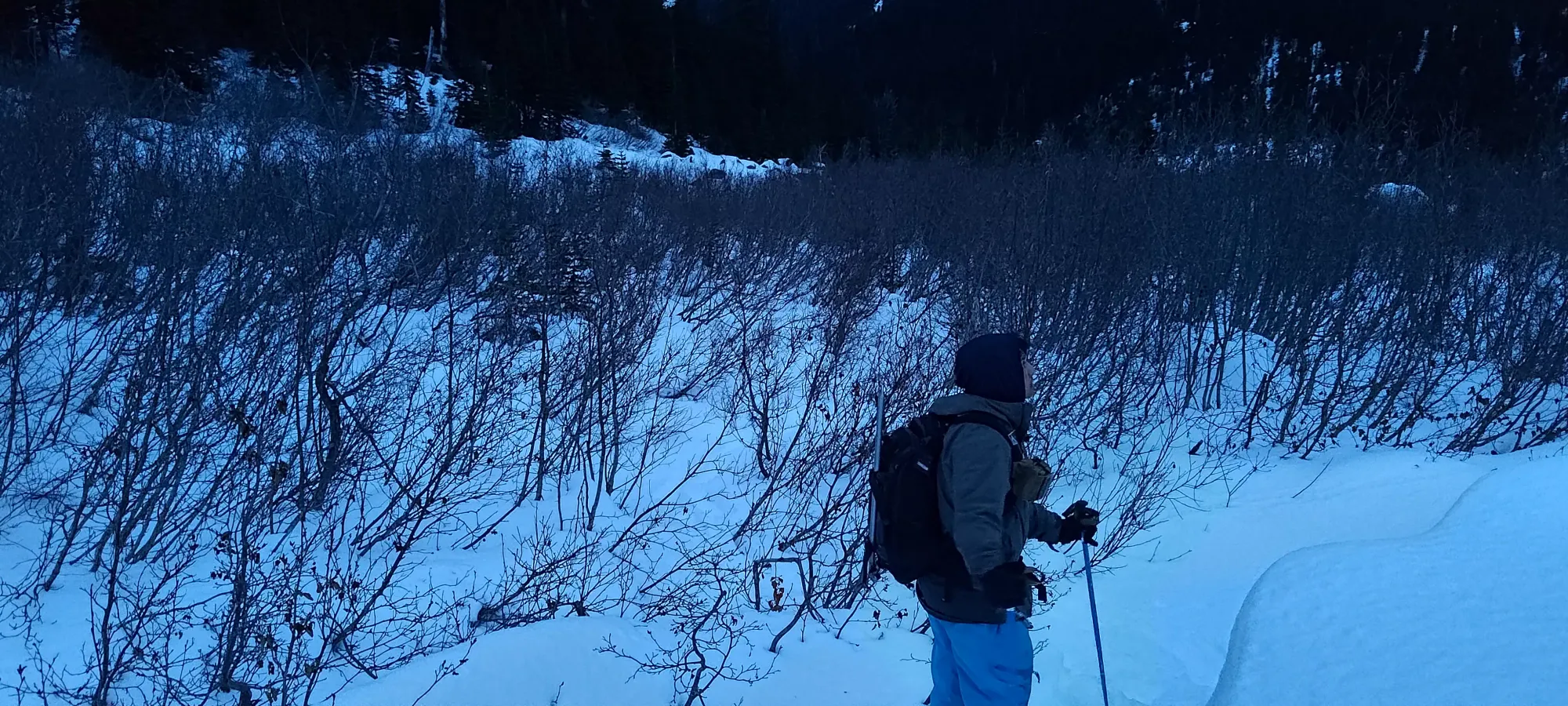
The ski down to the creek was about 15 more minutes of meh skiing in very sticky snow, but it was still better than walking at least. We managed to accomplish our goal of getting back across the creek before dark, and slapped our skins on in the short bushes in the valley, then started trying to find our way back towards the trail in the most direct/least bushwhacky way we could, in that order.
We took a 20-minute break to eat some rather-late lunch, put skins on, and get headlamps on ahead-of-time before we set out from the creek. The first few minutes brought us most of the way there, but then we had a thick bushwhack to contend with as a result of our unwillingness to follow our morning track up the moraine and around the new growth bushes. The new growth stuff wasn't too bad, but we then also had to cut through the more mature forest, which was quite thick, and made us pack up our skis and crawl in a few places to get back. The overall process of regaining the trail took about half an hour, so I'd recommend following the return path detailed later in this trip report if you want to replicate our strategy at all.
Once we were on the trail, it was a simple bootpack down to the landslide debris, then a skin through that and the overgrown road, and a final boot down the forested trail to the car, which all together took just under 2 hours to complete. If we had more snow, like I did on Matier, that could've been halved, but oh well, it was at least very simple/easy terrain (other than the annoying creek crossings on the old road, those were fairly tiresome).
While all that was a fun day, it was not a summit, and it was "only Saturday", so after dropping Alex off in Whistler in the evening, I called my buddy Tanveer, who I was going to be going out with on Sunday to report that I had beta and a broken trail for Vantage that I figured we could just re-use to get ourselves a fairly guaranteed objective, which he agreed with. So, onto Sunday!
Sunday
With a pretty much known route+conditions, me and Tanveer (who splitboards when the snow allows) had a pretty solid plan to not ski, and instead bring snowshoes+axes+crampons as our tools of the trade, and try to knock Vantage out before the conditions changed again. Since my night was pretty late and my colitis was still not doing super hot, we started somewhat late, right around 9:30am. For the first time in ages, I actually didn't drive, since he has a Prius, and the trailhead is right off the highway. That felt weird.
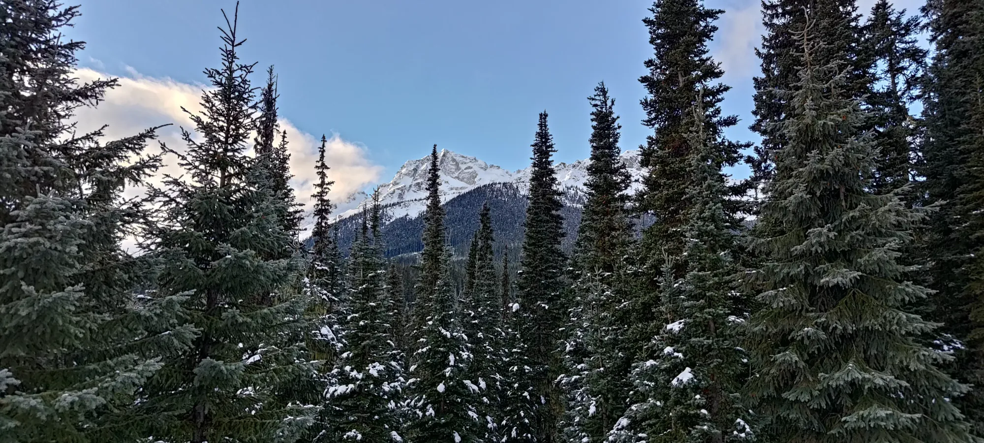
The weather was clearer and a degree or two warmer, with views right from the trailhead! Aside from that, my pack was definitely a big lighter without skis strapped to it, which was a welcome change for the long bootpacking sections of the trail.
The forest was actually quite icy compared to the previous day, extra traffic plus the melt-freeze that probably happened overnight were not kind to the trail. We went through just on boots, but wished we had spikes, and we both resolved to put some traction on for the descent. The walk up the trail was uneventful, and even once we hit the old road, we didn't feel the need to put snowshoes on, and we breezed through at Tanveer's legendary measured pacing (he is definitely slower at the trailhead, but keeps pace consistent for basically the entire day, which I do not have the willpower to do, I go fast and burn out if left to my own devices) to the first fork into the debris field at ten past 10:00.

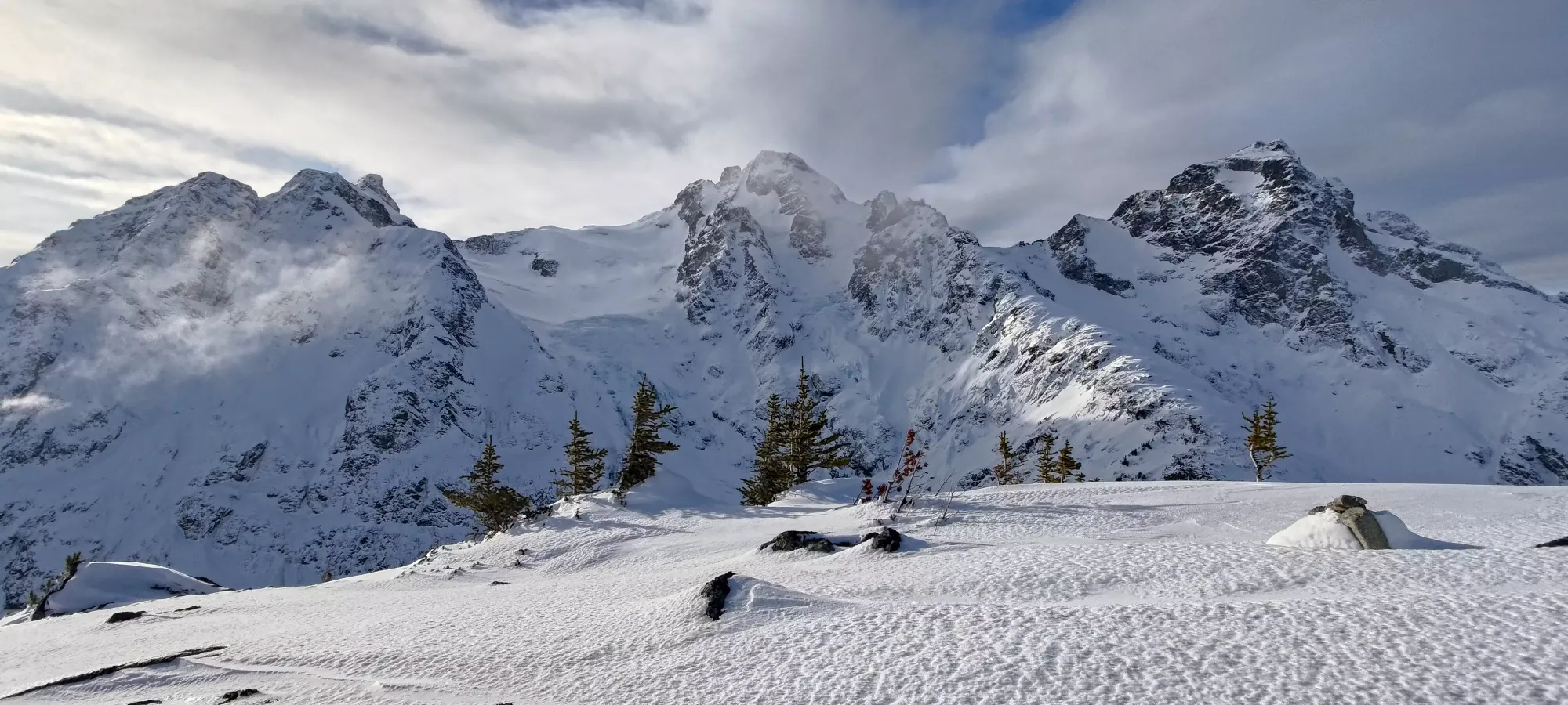
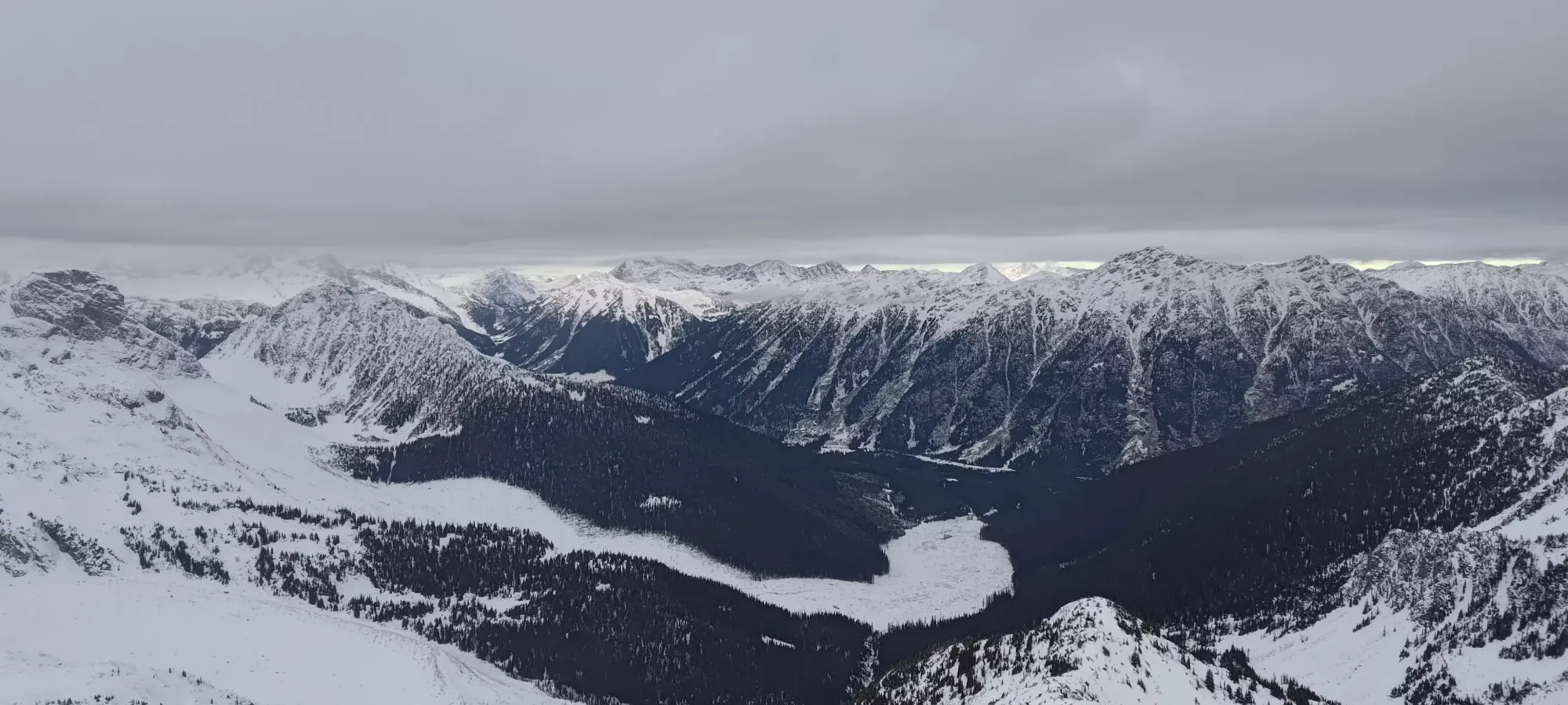
Travel with light packs and a more packed trail was definitely helping us out, and this time we got through the debris field only about 90 minutes after leaving the car, so things were looking quite positive for a successful ascent this time around. Plus, the views were even better, so we had lots of time to stare at Joffre and the surrounding peaks and imagine ski lines.


Once we dipped back into the forest, it was about 20–25 minutes until we got to a spot where we could see a fairly open and short descent into the creekbed area, a bit earlier than the 2 spots I'd deviated on Saturday. Since those ended up being too high or too bushy, this seemed like a good spot, so we donned our snowshoes after about 5km of just booting it, and I led us down through a short section of mature forest into the creekbed/debris area.


After getting down the mature forest, we had a couple minutes of open boulders before a short section of bushwhacking in the "infantile growth" down at the bottom of the valley. This was short, probably only around 5 minutes, but it took some creative routefinding to cross the creek at an acceptable location. Once we did, though, it was easy enough to follow the creek in open terrain to where I'd crossed the previous day, and pick up the tracks to start getting us up the mountain in earnest.

It was around noon, putting us about half an hour ahead of the previous day's schedule, at this point. Tanveer took over lead duties here, and started guiding us up with the old skin track (which we could destroy guilt-free given it was my parts the previous day that made it) towards the alpine. I managed to convert him to the "heel riser enthusiast" camp in the process (for some reason a lot of people are hesitant to use these), perhaps too well, because he started breaking new trail straight up the mountain instead of following switchbacks! (There is actually a good reason for this, snowshoes suck at sidehilling, and the hard crust meant doing so was a pretty ankle-intensive measure, so just going up made sense). This made for some efficient travel, though, and we found ourselves at the base of the alpine area in about 45 minutes, gaining 250m in that time.


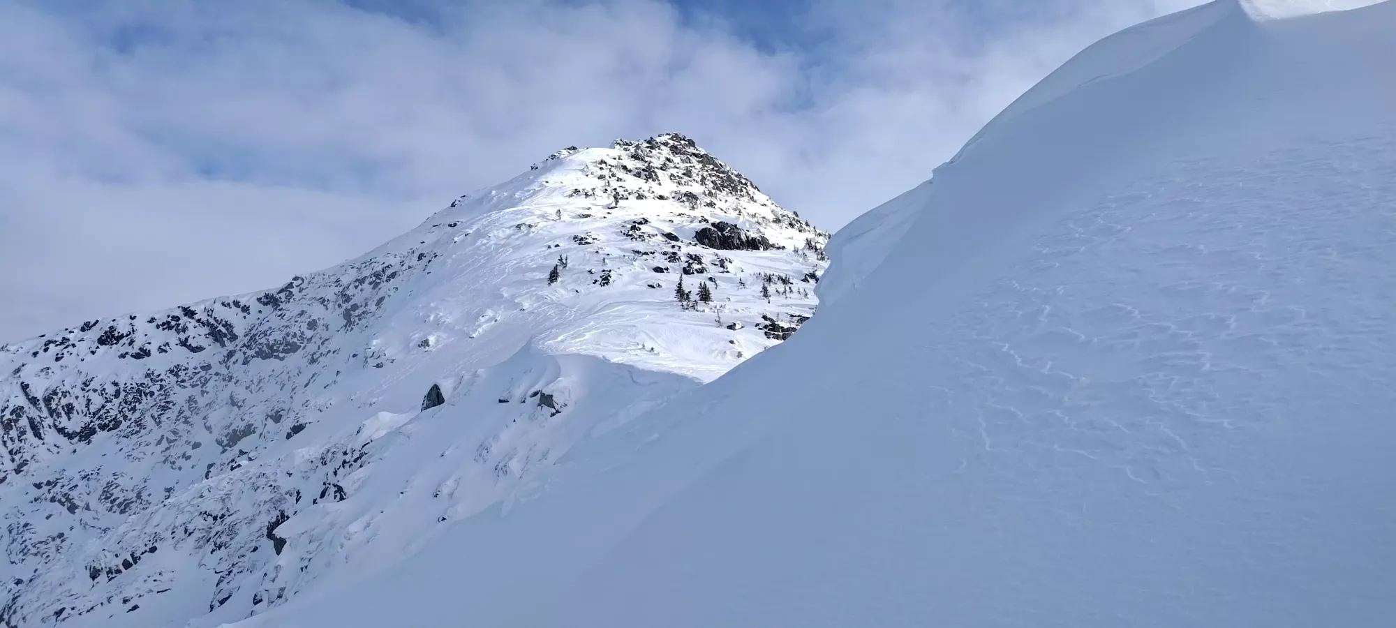
Once we got into the alpine, we were super appreciative of our crampons+rails on the bottom of our snowshoes, as ascending the initial rocky ridge to get into the bowl was much easier than on skis, where I had quite the fun time skinning, and Alex just gave up and booted. Once we got past there, we snaked left across half the bowl, but instead of aiming for the high ramp I went for the previous day, we took an earlier ramp below the cornices (which were set back enough to not be a hazard) to join the ridge sooner, which ended up being much easier, and doable entirely with snowshoes.
Once we gained the ridge, we took a lunch break. Or rather, Tanveer did. I was feeling pretty iffy all day, digestively-speaking, so I was on a classic "colitis challenge" diet, adopting the "nothing in, nothing out" philosophy. Of course, I HAD food+water if I needed them, but to avoid needing to go to the bathroom in the middle of the winter wilderness, I wasn't going to partake unless absolutely necessary. We ended up getting moving some time around 1:40 or so (my tracking got a little wonky on the summit ridge).

Now that we were on top of the ridge, we swapped leads again, and I led us on a winding route up the various rolls, rocks, and features towards the top. From afar, the ascent looked easy, but there was actually quite a bit of stuff that slowed us down. The crusty snow made all the rolls you could normally sidehill straight through tricky, steep climbs, and Tanveer's lightning ascents seemed to struggle with it, and some of them took quite a few minutes to clear (take that, MSR fanboys). After we dealt with a few of these sorts of obstacles, we made it to about 2150m or so (near where I'd stopped the previous day), and we started getting into some rockier stuff.

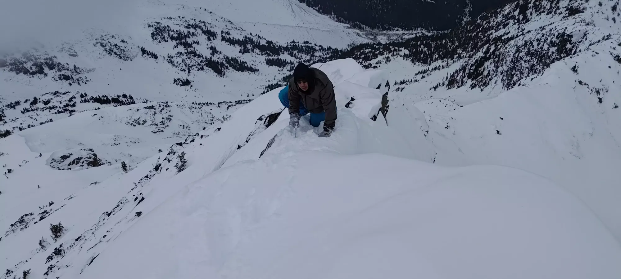
The next few sections required some careful routefinding to find snowshoe-able terrain, and that lasted us until the imposing-looking summit block we hit at 2:15pm, where we finally had to stash the snowshoes and bust out the axe+crampons. While it wasn't necessary, I did bring an ice tool to complement my regular axe, and it was nice to be able to finally justify doing so. We geared up for about 10 minutes (I got to feel superior here having brought automatic crampons, which are much easier/faster to transition with), and started picking our way up.

The climbing wasn't too technical, solidly in the realm of "class 3", if you extend that system to include axes+crampons. There was never really a need to throw your weight over the air or anything, and I felt pretty secure the whole time. In less than 10 minutes, we'd topped out what seemed like it was the summit, although it turned out to be a false summit, and instead was a pretty narrow ridge towards the true summit.
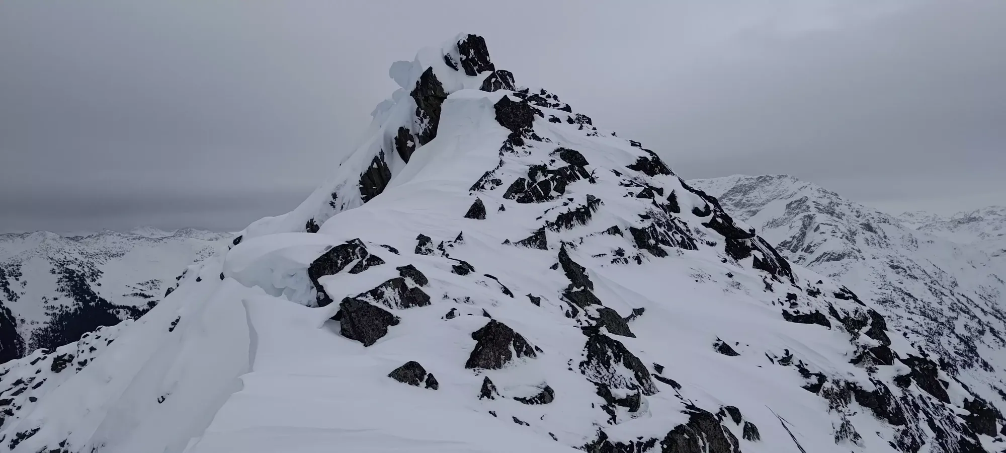
After taking some careful steps to stay on supported snow on that little ridge traverse, it was pretty easy walking over to the true summit, which looked like the pointy rock above, but was actually a small plateau just beyond it. We took a few pictures up here, but headed down fairly quickly, since we did want to get down as much of the off-trail terrain as we could before dark set in to minimize routefinding troubles and give ourselves the option of taking shortcuts/optimisations as they presented themselves.


Descending was actually pretty easy, and we got to our packs in just about 10 minutes, where we decided to just keep crampons on until the postholing got tedious, preferring the security and delaying a transition.
This worked pretty well, and in 20 minutes we were back at the point where we originally hit the ridge. We did do some postholing, but Tanveer was leading as the main proponent of keeping the crampons on, so as long as he was happy breaking the occasional bit of crust, I was happy to follow along.

From there, it was a pretty uneventful descent. We glissed down a few sections where it was steep enough, where I got to show off my patented "running while sitting down technique" that allows you to slide down moderate slopes without taking your crampons off or needing an axe to control your speed (replicate at your own risk). Once we hit treeline, we swapped to snowshoes, and continued the alternating gliss+walk down to the creek, which we arrived at, still in the daylight, in about an hour from the ridge. From there, we just retraced our steps back to the forested trail, which seemed to be the best approach, even looking from above.
Fifteen minutes later, we were back on the trail, where I managed to convince Tanveer to keep the snowshoes on, figuring they'd be "fine" for the short forest, helpful in the open debris+road where the sun would've softened things up, and good traction for the icy trail to the car. This worked out well, and we dragged ourselves back to the car in 1:45 from that point. There was a brief spit of rain near the end, but thankfully it ended before we got to the car, so we could pack ourselves up in peace. I even managed to make it home (still sans-food and water) without needing to go to the bathroom, which was the true crux of the day.
So, despite it taking two days to accomplish, I'd say this was a pretty nice peak, and I'd definitely recommend coming up in winter. There's some small but fun features in the alpine, with deeper snow, the approach is actually not too bad, and it can also be done as part of a Keith's Hut trip to make that approach less impactful. Plus, it turned out to actually have some fun climbing, which made it a bit more fun than I was expecting!
GPX Track + Map
