Sky Pilot - July 16 2023
A fun scramble to the "top of Squamish", something I probably should've done long ago

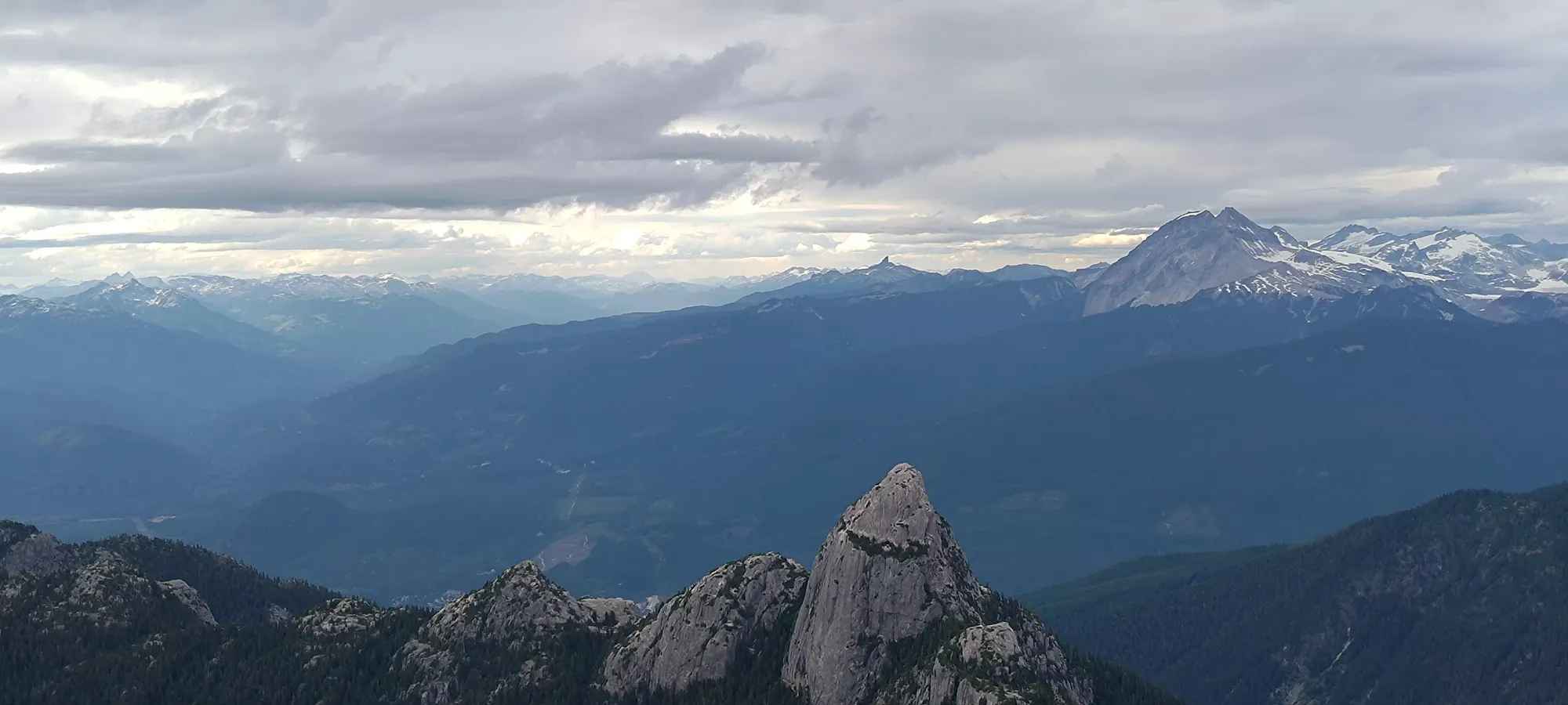
Sky Pilot Group, Squamish, BC
2031m
After a late night getting home from Mount Bishop the day prior, I basically left Sunday's plans up to Jass and Logan, who both had really wanted to get Sky Pilot for a while. I was still debating if it should be done in winter or summer, as I've seen some awesome ice climbing ascent videos and I know the skiing is supposed to be super fun, but their enthusiasm convinced me. I can still go to Ledge, etc. in winter, and this way, I got to sleep in a bit since they had to drive up to me vs me driving out east for a change, which would help.
After waking up, I finally got to shower, which was quite essential. I normally have to go to the bathroom for a while in the A.M. thanks to my colitis, but that didn't seem to be happening. Since I knew I was low on calories, I went to a local breakfast place for a heartier-than-average egg breakfast (I ran out at the least convenient time, of course). Logan and Jass met me there mostly through my meal, and Logan decided to eat up as well before we went back to my place. There, we geared up, as we were bringing rope in case the cruxes were hard enough for me in my injured state to want to rap or be belayed. I didn't think we'd need to, since I've been told by a few people this is similarly overhyped to Black Tusk, but better safe than sorry, especially when Logan gets to carry the weight 😃. I decided to bring just 1 water bottle since there's supposedly lots of water on trail, but only brought a small amount of food since I didn't want to aggravate my stomach given how my morning was unfolding so far. I figured if I got to the gondola and was feeling good, I could grab something there, and my buddies had tons of stuff if I got desperate and needed calories.
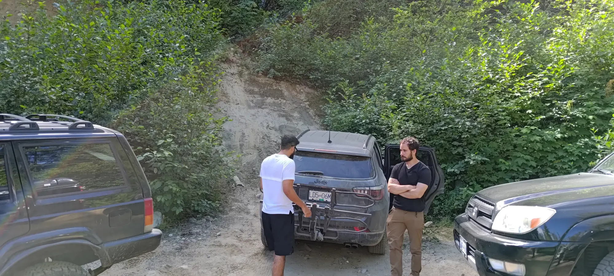
Once we finally got on the road at about 10:20am, it was a pretty easy drive up to the parking area near the gondola. You can, of course, take the gondola up, but that costs money and that's not fun, so we drove up Indian River Road/Shannon Creek Road behind the gondola instead. It's a pretty simple forest road, though the washboarding on Shannon Creek Road is a bit rough in places. A motivated 2WD can still get up though, I'd bet. One to thing to be weary of is parking, though. The parking has space for at most a dozen vehicles, and was "basically full" when we arrived. I had to invent a spot by getting in between 2 vehicles and yeeting up a hill to rest on. If I didn't, it'd have been a good many minutes downhill to another suitable pull-off to park safely.
The parking is around 775m elevation, and the gondola is about 880m. We got up to that at a moderate pace, me not wanting to go too fast and upset my stomach before I got there, so about 20 minutes. I then tried to go to the bathroom for 40 minutes to no avail, which was the final nail in the coffin preventing me from not being starving the whole day, as with that result, I wasn't going to continue to scarf food down. I did consider buying something, but the line was super long, so I decided to make do with my scant snacks and some thievery from Logan+Jass if needed. We left the gondola basically right at noon, and started the long plod to the actual trail.
Unfortunately, when I called in the morning, the gondola confirmed my suspicion that bikes aren't permitted in their trail network, even though the trails we wanted to bring them on are just forest roads. So including the section from the car all the way to the spot where the Habrich Spur ends and forks into the Habrich and Sky Pilot Trails, we had to hike 6.4km and 275m of elevation to get to the actual hiking trail. It'd be really great if they revised their rules to allow for biking on these roads, at least. Thankfully it didn't take too long, at least, as we got there in just over an hour from the gondola.
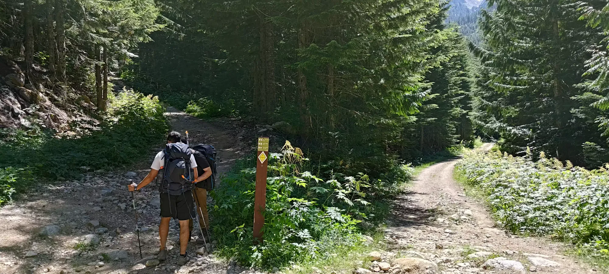
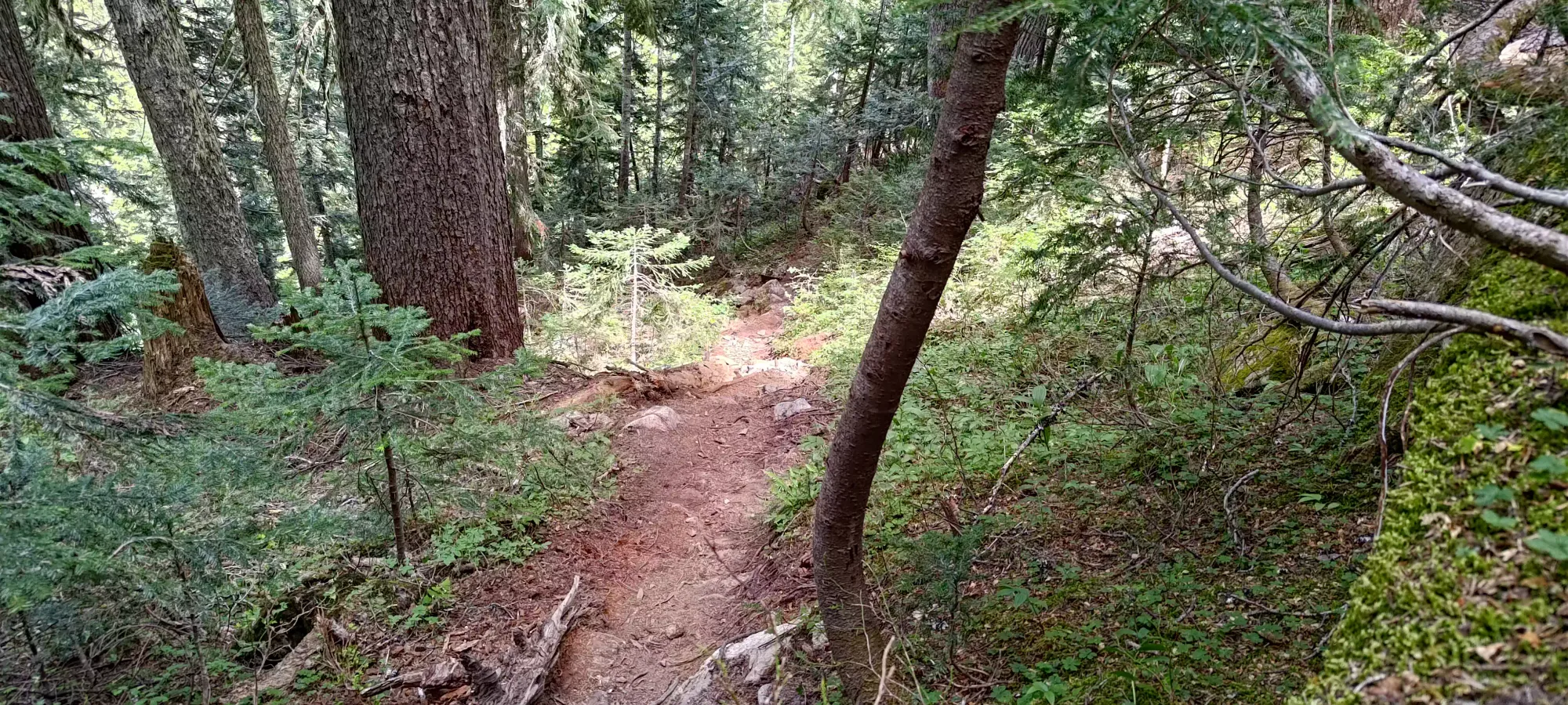
Once you start on the trail, it's unfortunately a good while of creekbed-walking, though while I can't remember exactly how long, it lasted for less than an hour uphill, so it's not the worst thing ever. Due to traffic, I imagine, there aren't a ton of loose rocks, at least, so while uneven, you can find solid footing without too much difficulty vs some other areas. The first hour on the "real trail" brought us from 1050m to about 1300m. We had a break right after that in a forested section of the trail full of switchbacks, where I went through the last of my baby food (about 90 whole calories), staving off what had become ravenous hunger back down to peckishness. After 15 minutes of snacking and rest we picked ourselves back up and headed on forwards.


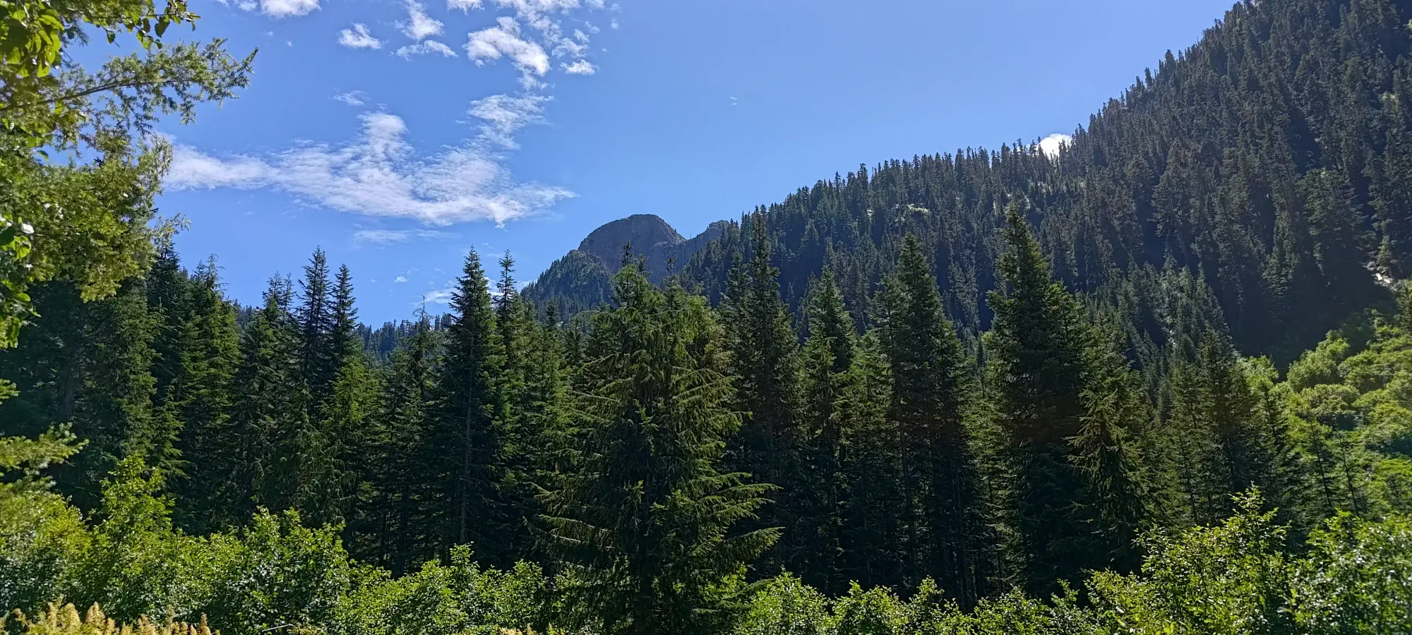
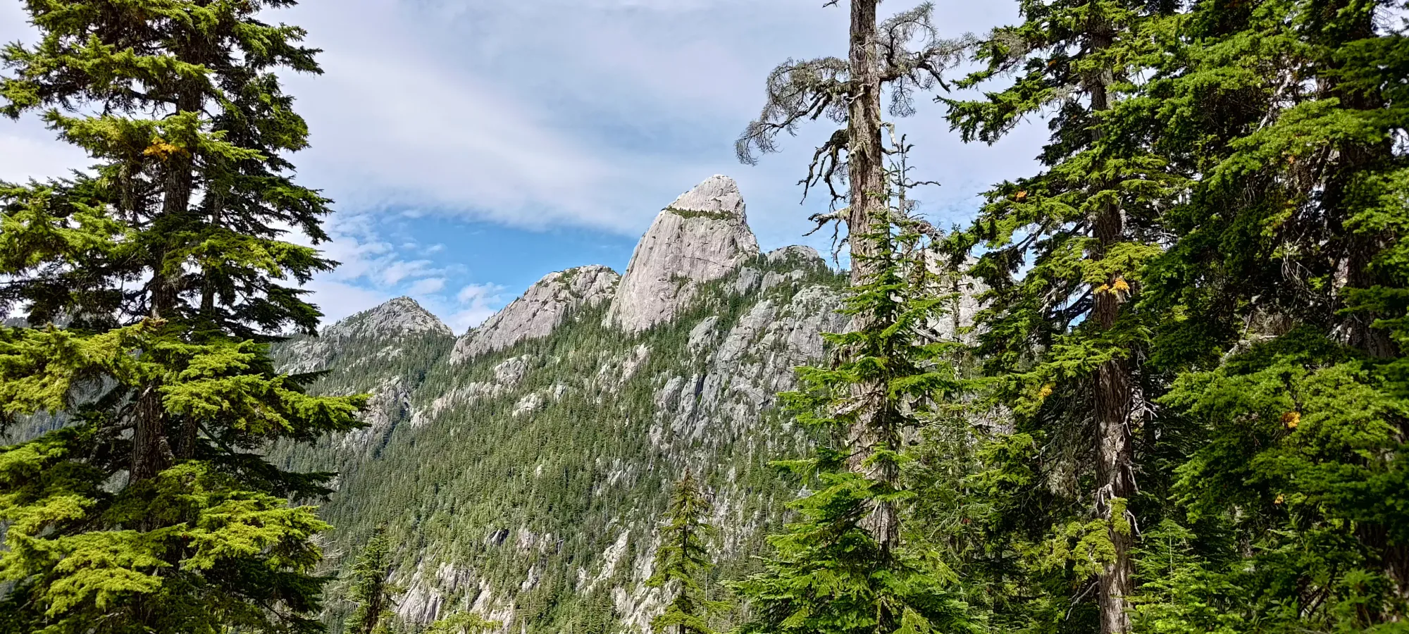
From there, it was only another 20ish minutes for us to arrive in the valley formed by the ridges running around from Sky Pilot beyond Copilot and Habrich. We stopped for a quick look at Habrich from a nice viewpoint just before the valley, then again in the valley for a refill from the fresh snowmelt.


Looking at the right and left streams that merge down to form Shannon Creek
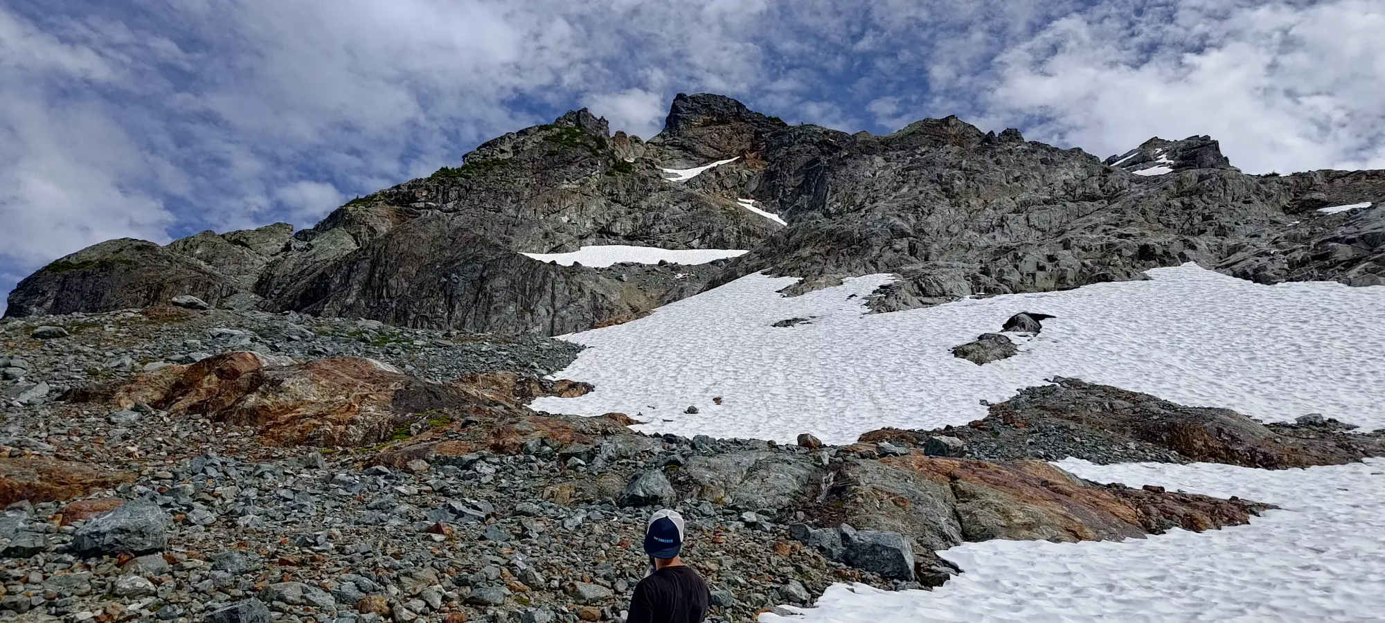
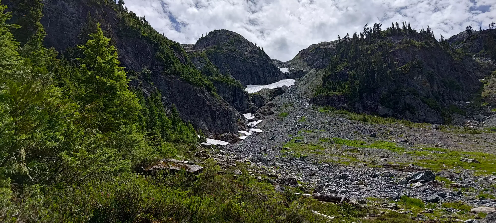
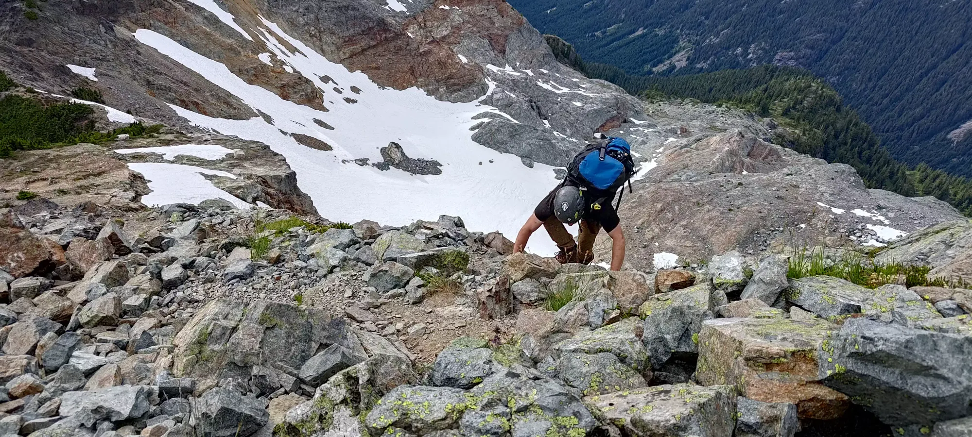
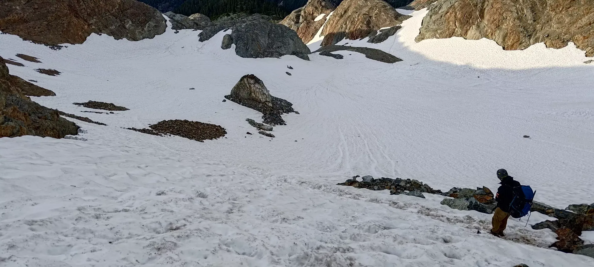
The next 40 minutes netted us another 200 metres gained, a slow but still reasonable pace. This was just getting up the somewhat steep and loose rock/dirt in the valley below, where I'm sure the Stadium Glacier once extended. There is enough traffic for a few footpaths to be cleared into mostly dirt, so the uphill travel is actually not too bad. Once we got up to about 1600m we hit a long snow patch and decided it'd be easier to just put our traction on and walk up the snow instead of walking up loose choss, so we did exactly that.
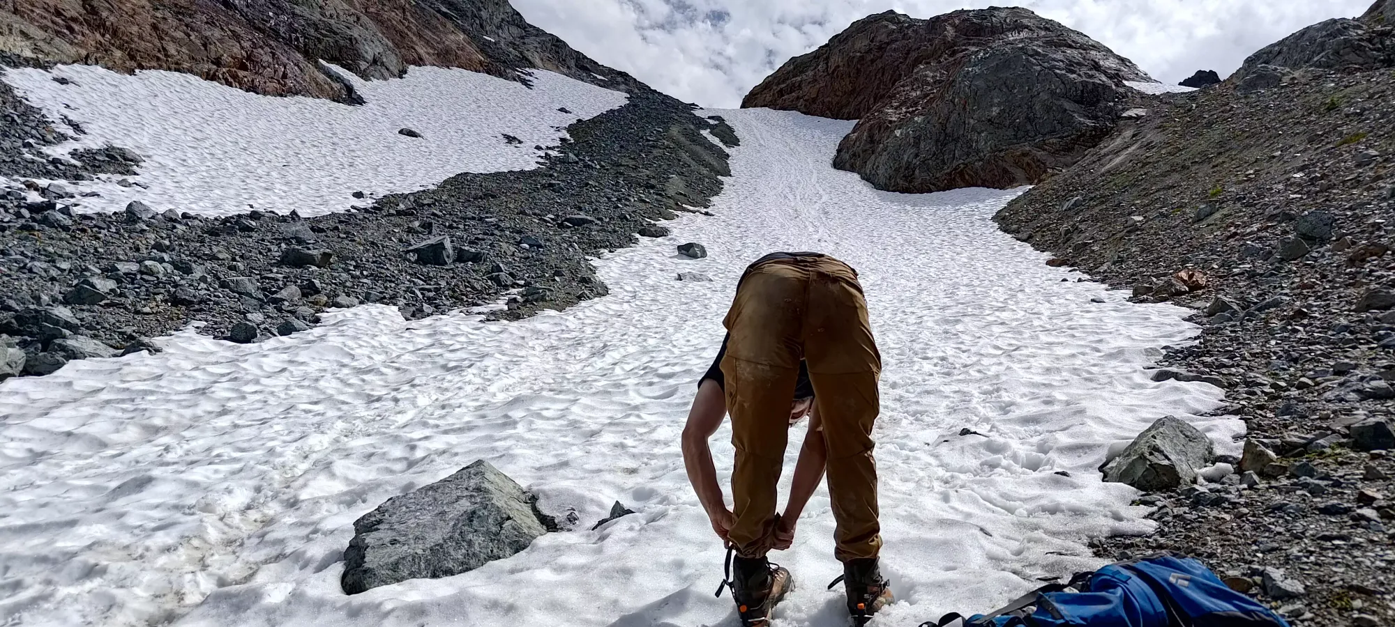
That section went pretty fast. We saw someone descending up to climber's left about halfway up and considered trying to follow a rough route up from that side since it looked feasible from afar and would be efficient (plus it skips the glacier). But we decided such attempts should be saved for a party who didn't start a noon, and cared more about a fun route than the peak, and pushed on. Once we topped the above hill, we had to cross a short rocky section (though Logan went left, sidehilling on the snow instead to avoid walking on the rocks w/ his crampons), and we were at the bottom of the glacier.

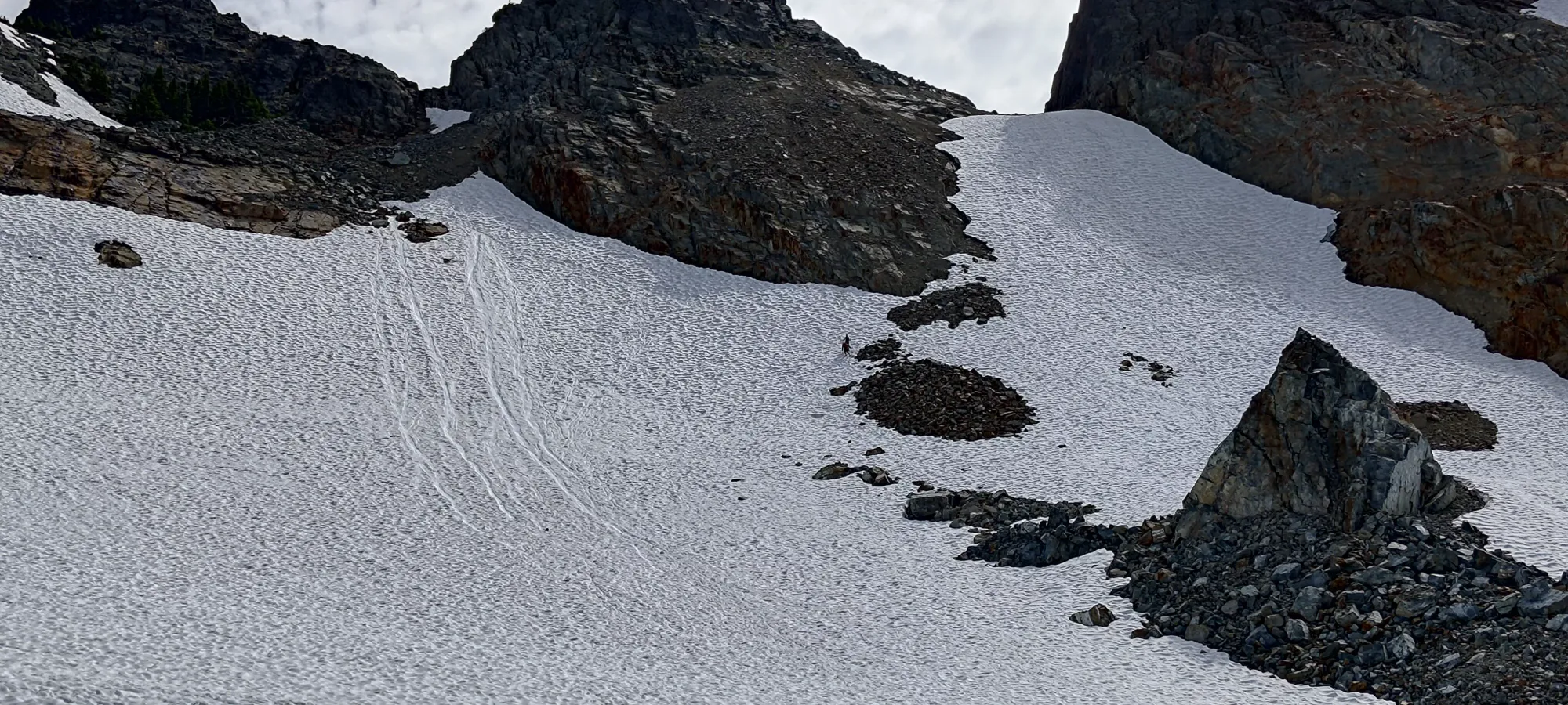
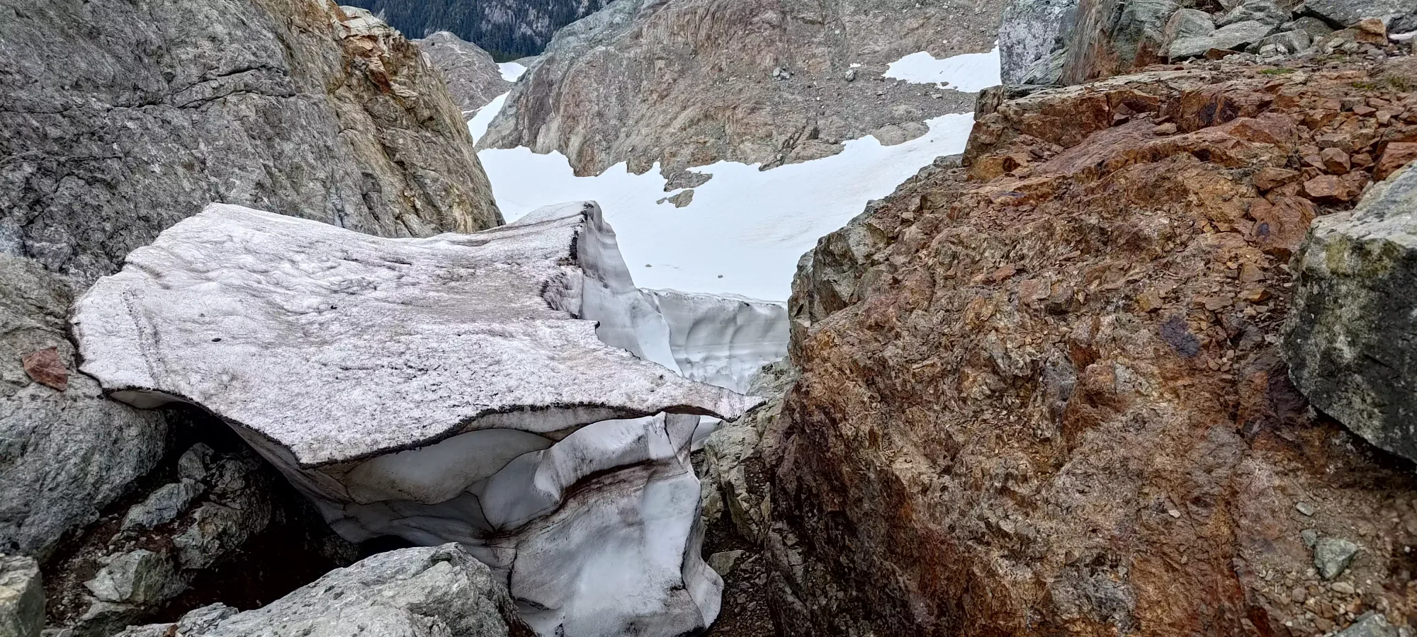
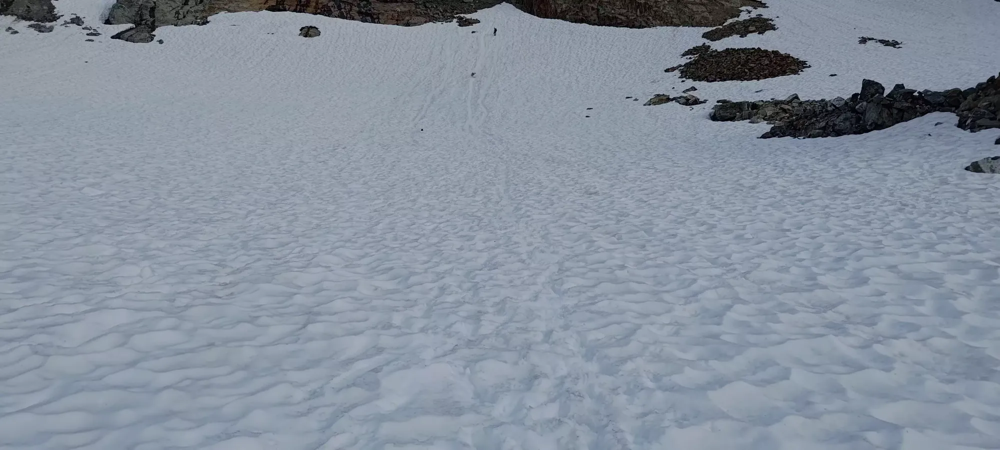
On the glacier, honestly, the first instinct I had was "damn I wish we had crampons and axes to go around, we could just go straight up the middle and it'd be fun". However, there was a more gently-graded path worn by previous users across the heavily sun-cupped snow and up to the top which was easy enough to walk on. Breaking that trail in the hard snow would've been possible, but annoying, so we were glad not to need to kick steps in, as that'd take quite a bit of time. The state of the glacier was barely above snowfield, though we did see some depressions that indicated there's still some crevasses and/or holes in there, so follow at your own risk. With the heavy traffic, oodles of beta, and very firm snow, we were happy with the gear we used. I will recommend at least "some metal on your feet", as that firm snow is unforgiving if you lose footing, and while it's unlikely you'll fall through a bridge into a crevasse, you could easily tumble into a rock. Helmets on isn't a terrible plan either, which you should have for later regardless.

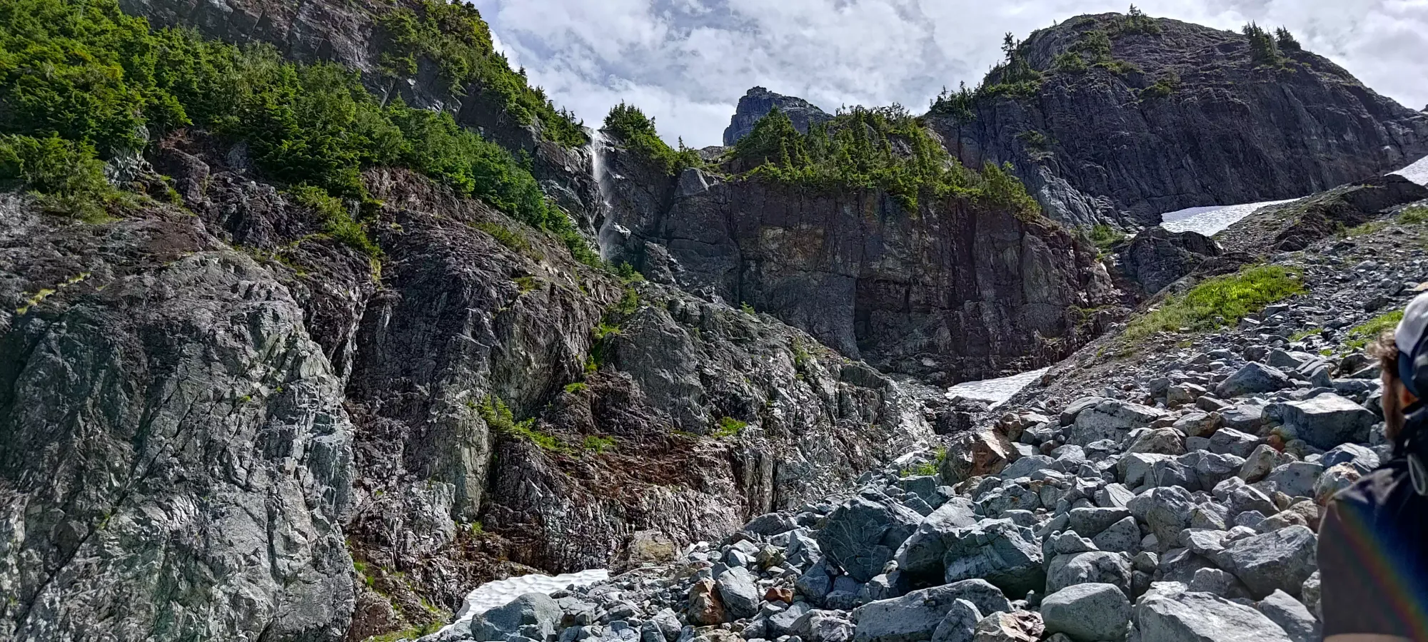
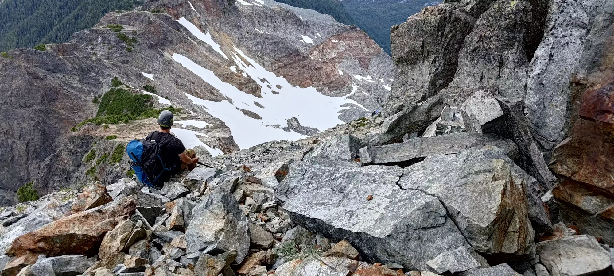
We took about half an hour to get up the glacier, which ended unceremoniously (no 'schrund) at about 1750m. After packing our traction, it was a short trudge up some very loose choss before hitting the Pilot-Copilot col and starting to traverse that, which was much nicer terrain.

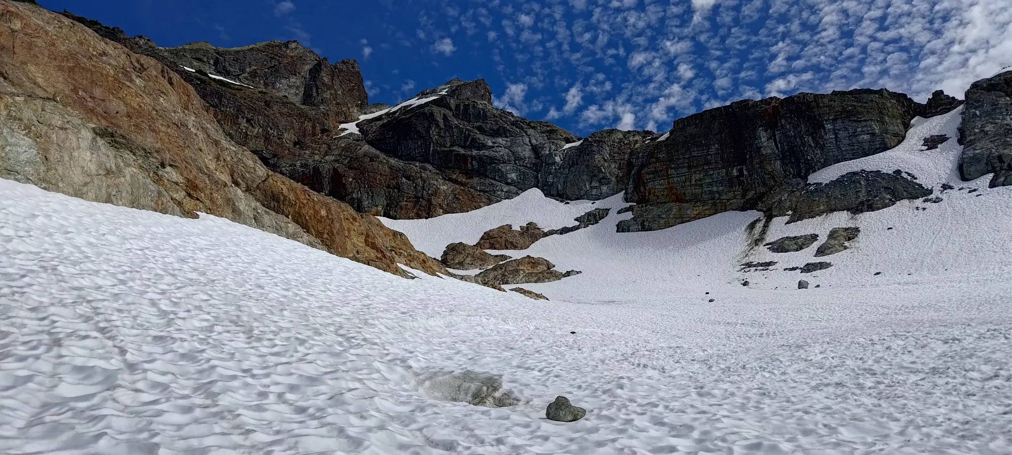
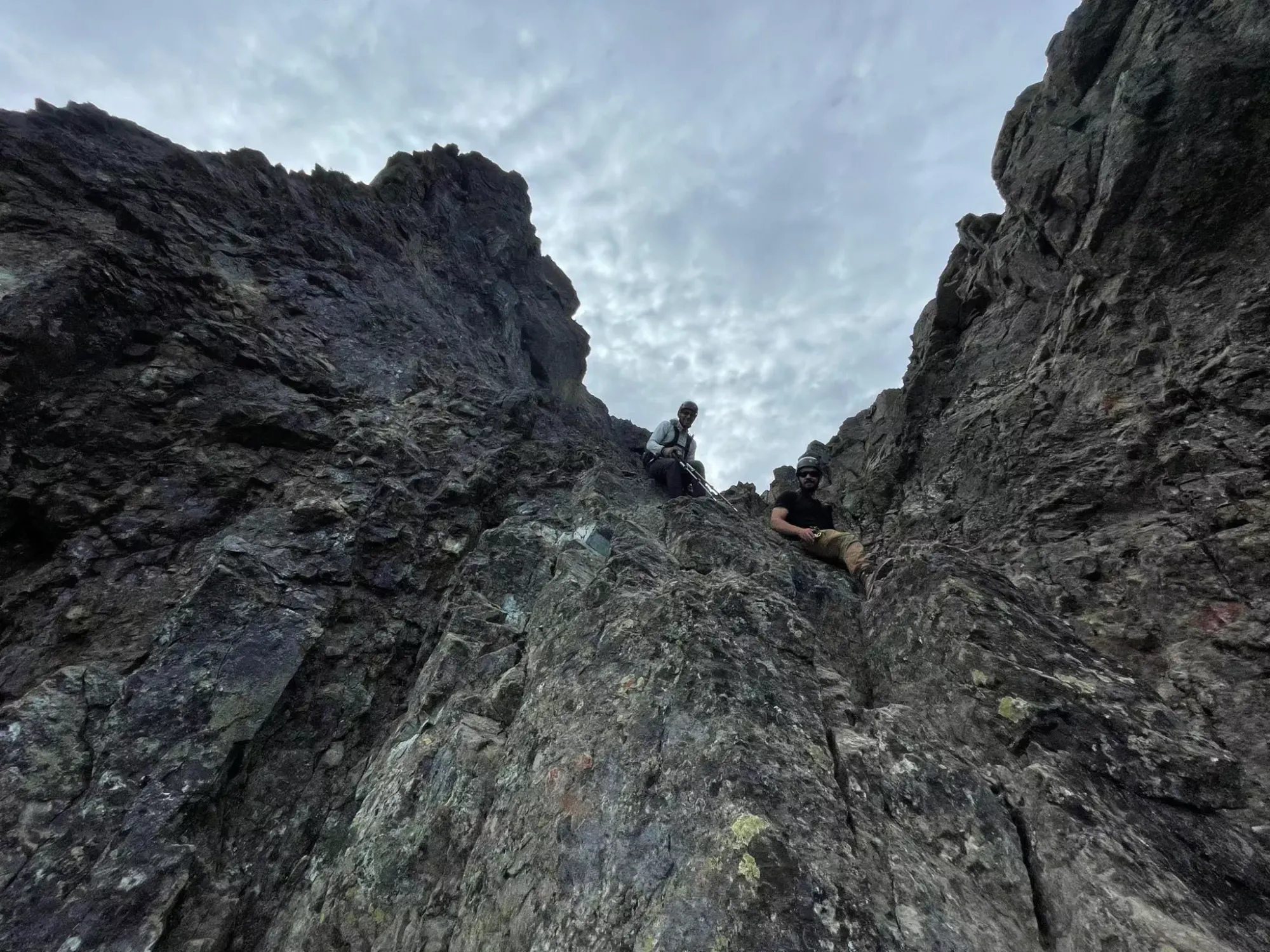
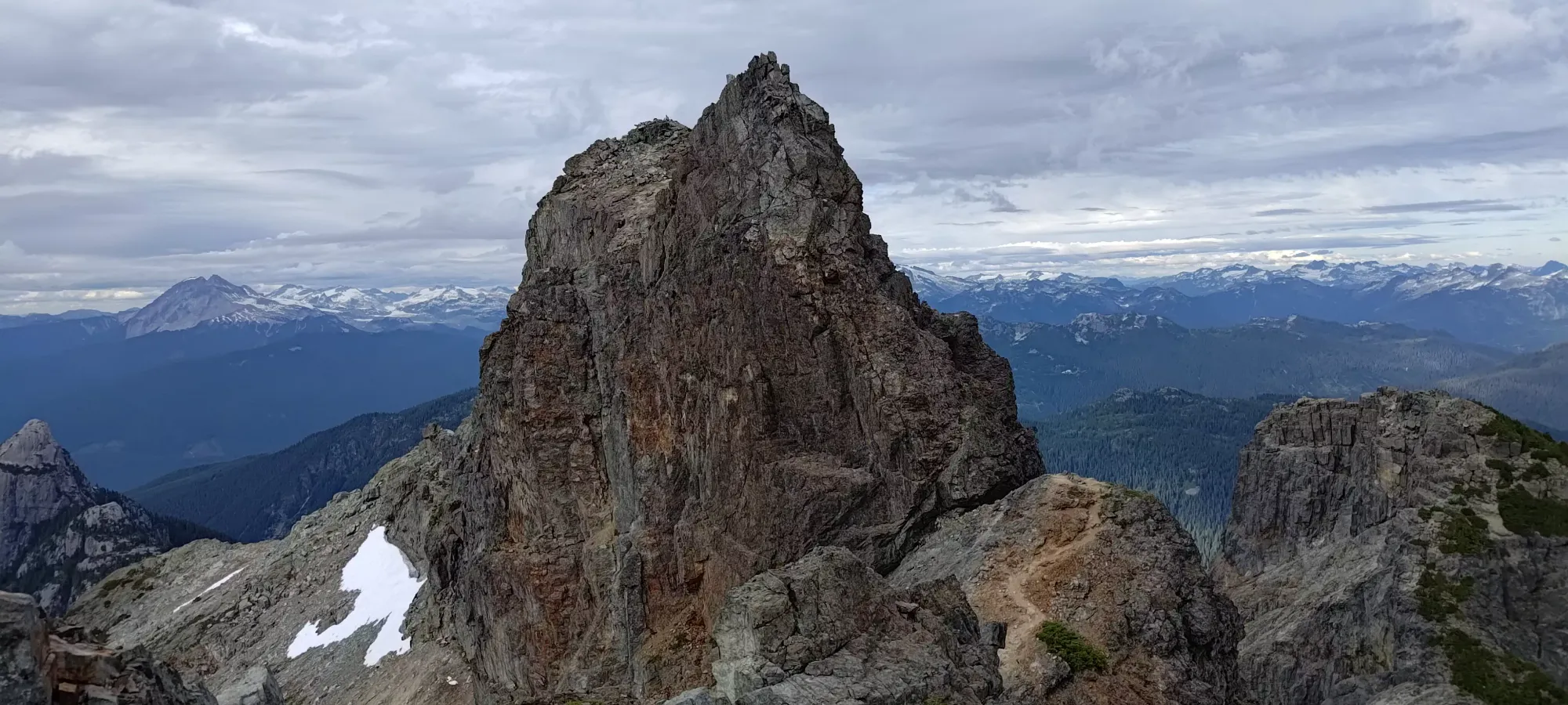
About half an hour of walking up the ridge brought us to the famous "pink slab". It was honestly hard for us to recognise, except that another descending party pointed it out for us. It's not as vertical as we expected, not very pink, and didn't feel as 4th-5th class as described. Jass went up first, and me+Logan followed simultaneous on different lines. There's lots of choice, we chose harder lines coming up than down, since we felt safe enough to do so. We did find rap rings in seemingly good condition (only visually inspected, don't rely on this) at the top, and wondered if we'd need them, but nobody really expected to.

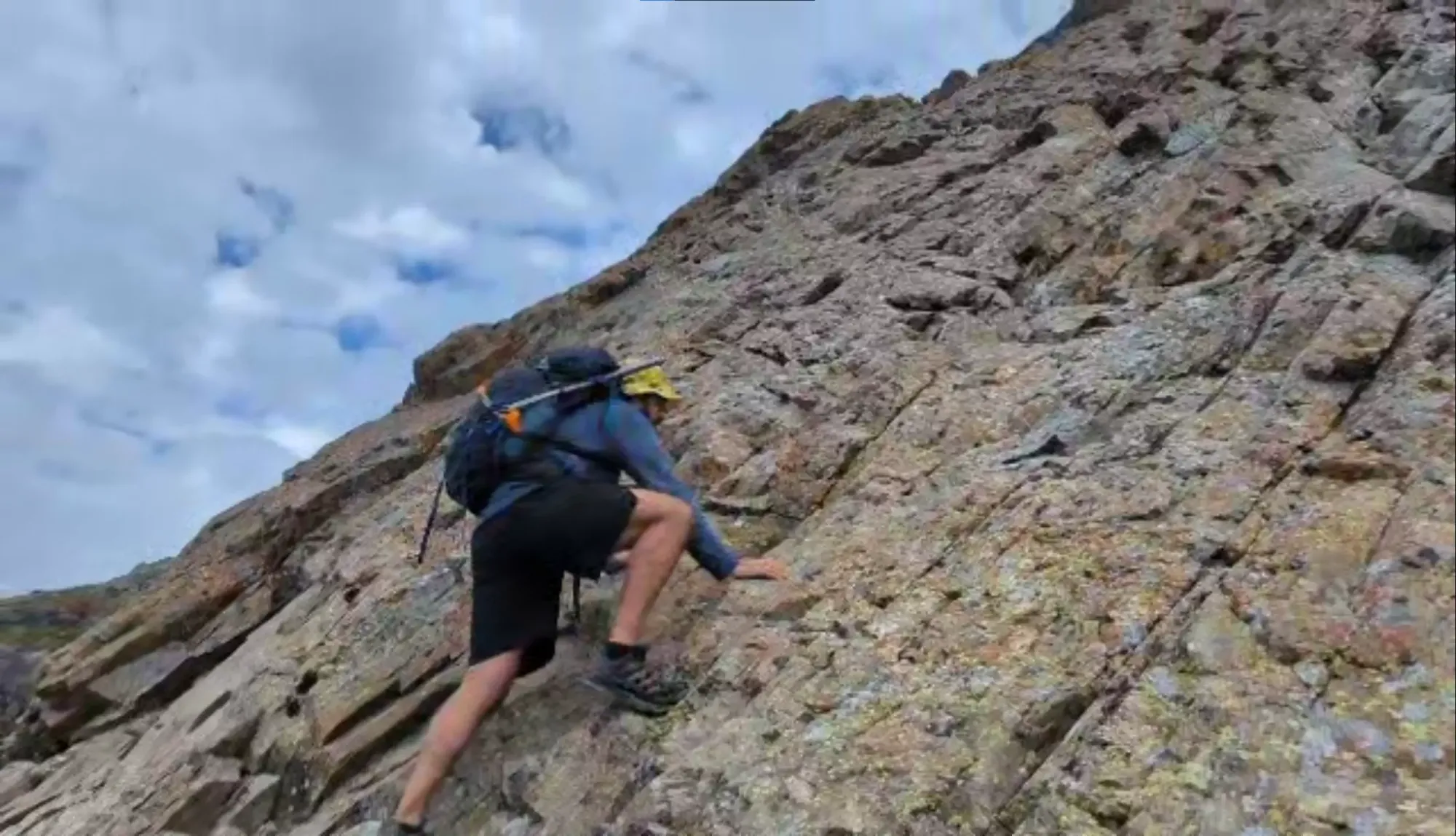
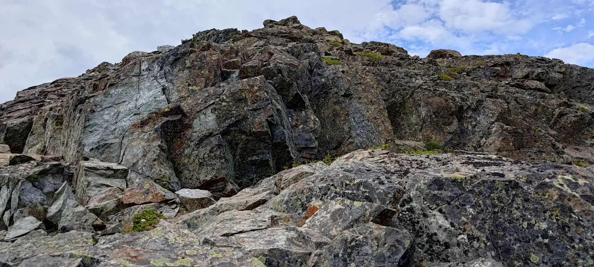
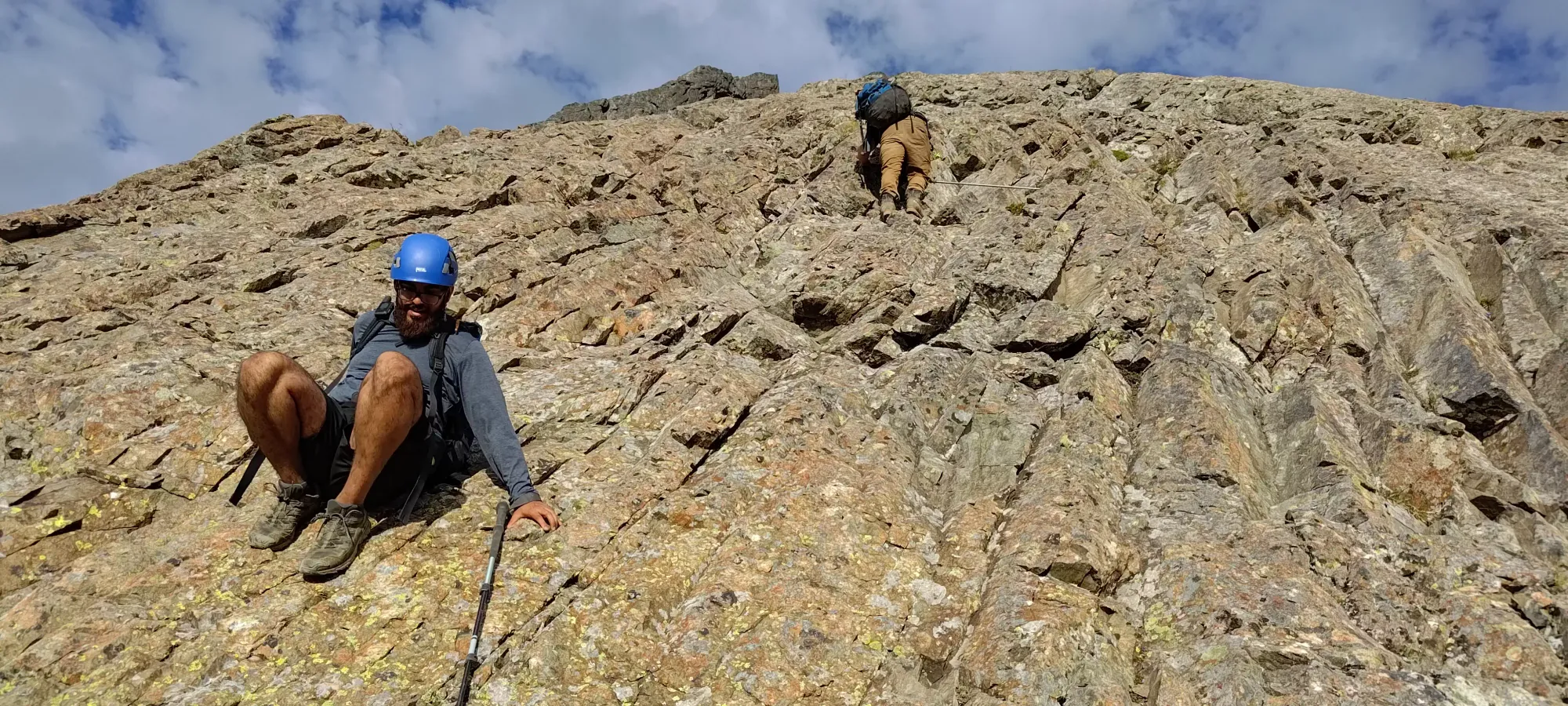
After the slab, it was more walking with some occasional easy scrambling moves up to the headwall of the summit block. We initially went up too high to early, and saw only "definitely class 5" ways up, so we had to descend a few metres and traverse climber's right around the wall to find the correct terrain. This was at around 1950m elevation.
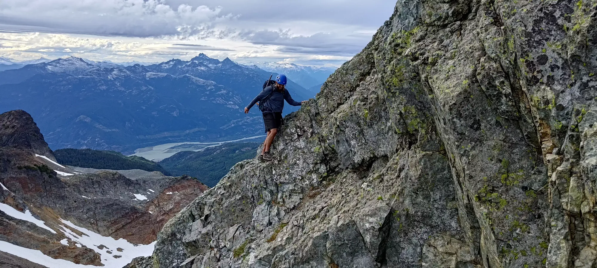
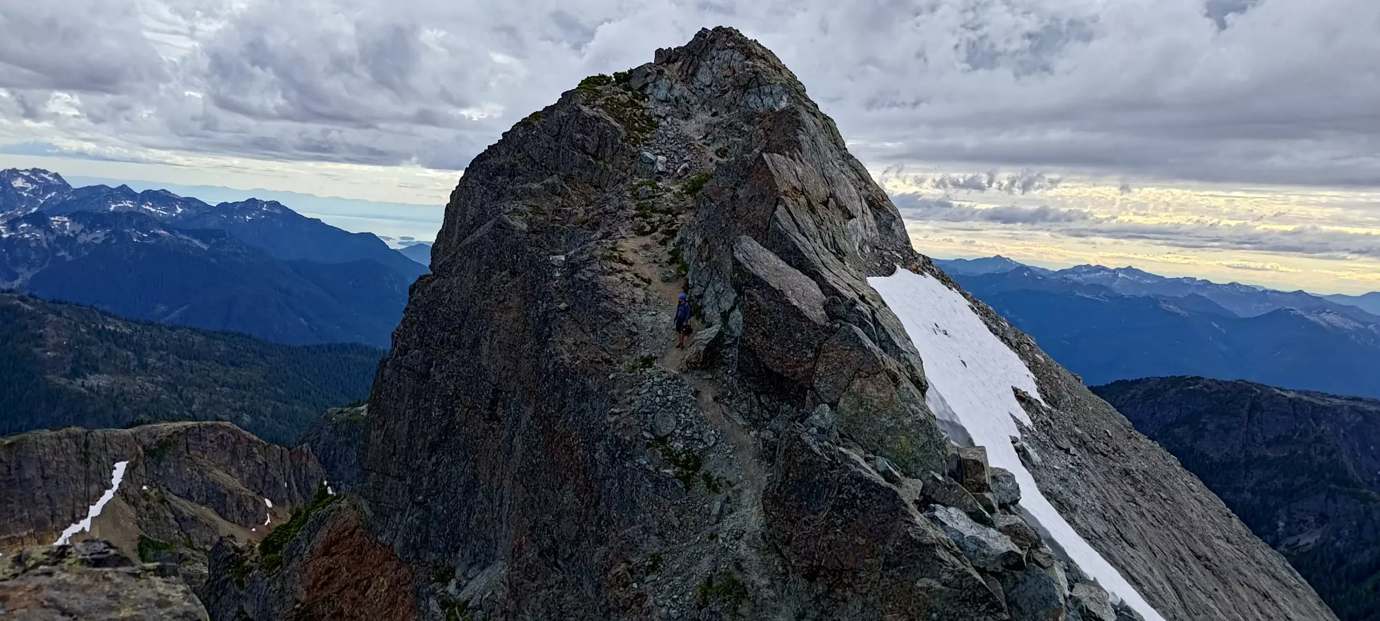
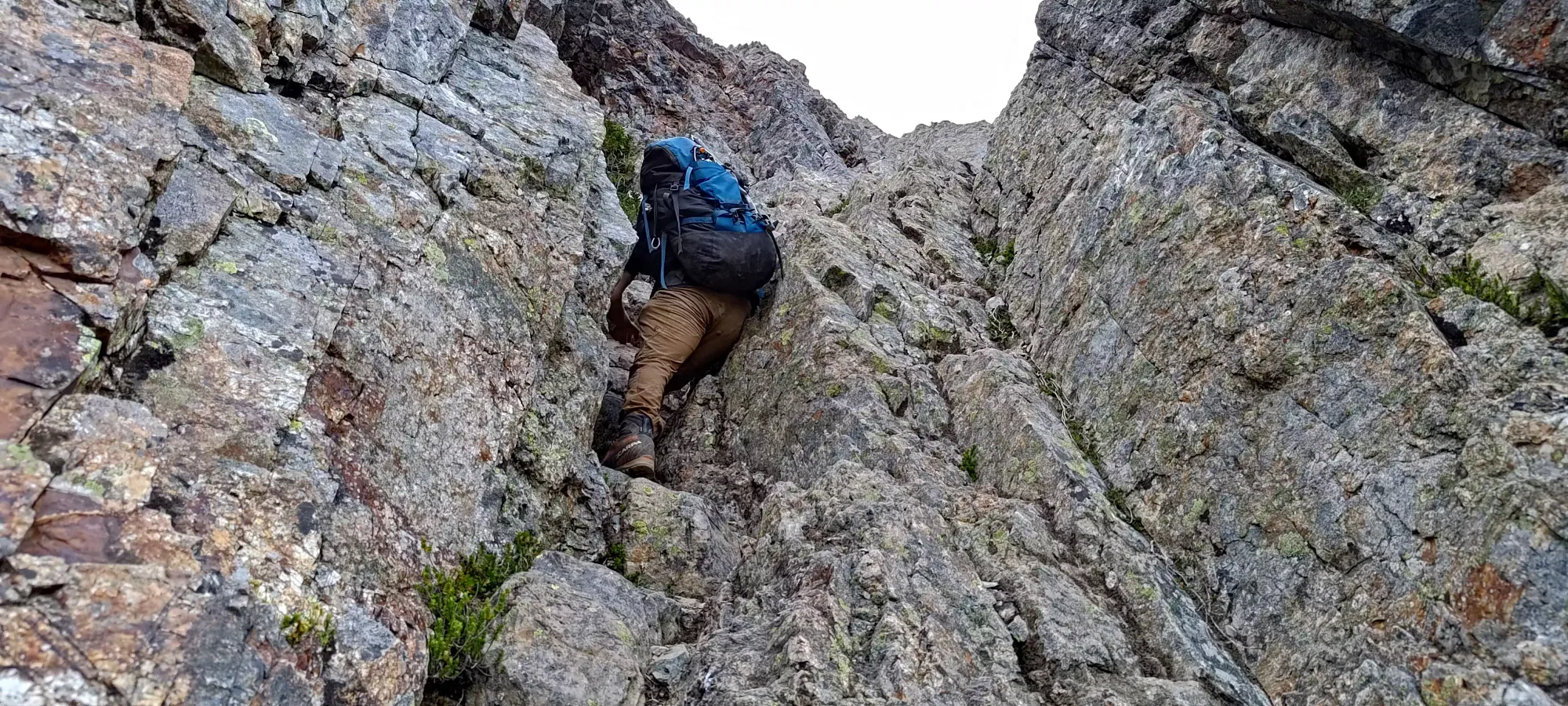
Once we got around that corner, there was some class 2 scrambling up ledgy+juggy rock for a while, until around 1980m if my GPS is accurate (hard to say surrounded by so many high rock walls, GPSes don't tend to like that). For most parties, this statement is false, the terrain more or less continues the same here. However, we found a short bench, which when walked across, revealed a fun looking chimney/crack feature to get up a short wall, which was far more fun-looking than the walk-up feature that was "the trail". So, we decided to have some fun. I climbed up first, and Logan+Jass followed. It was excellent rock and nice holds, if a bit airy, so right up my alley in terms of fun scrambling.
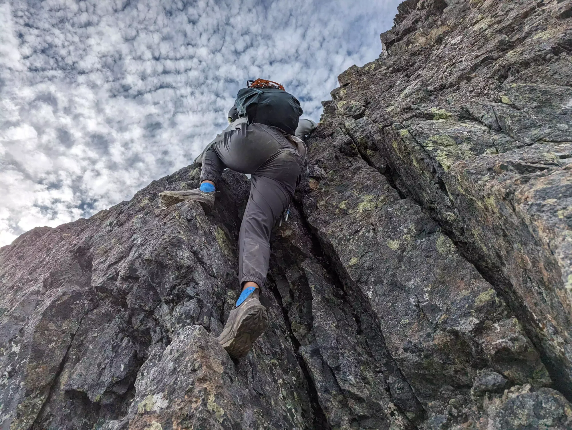
After this, there was some more class 2 scrambling (nothing hard or really exposed, and lots of steep stepping interspersed) for a few minutes until we hit the final ridge with a couple of false summits and the true one.
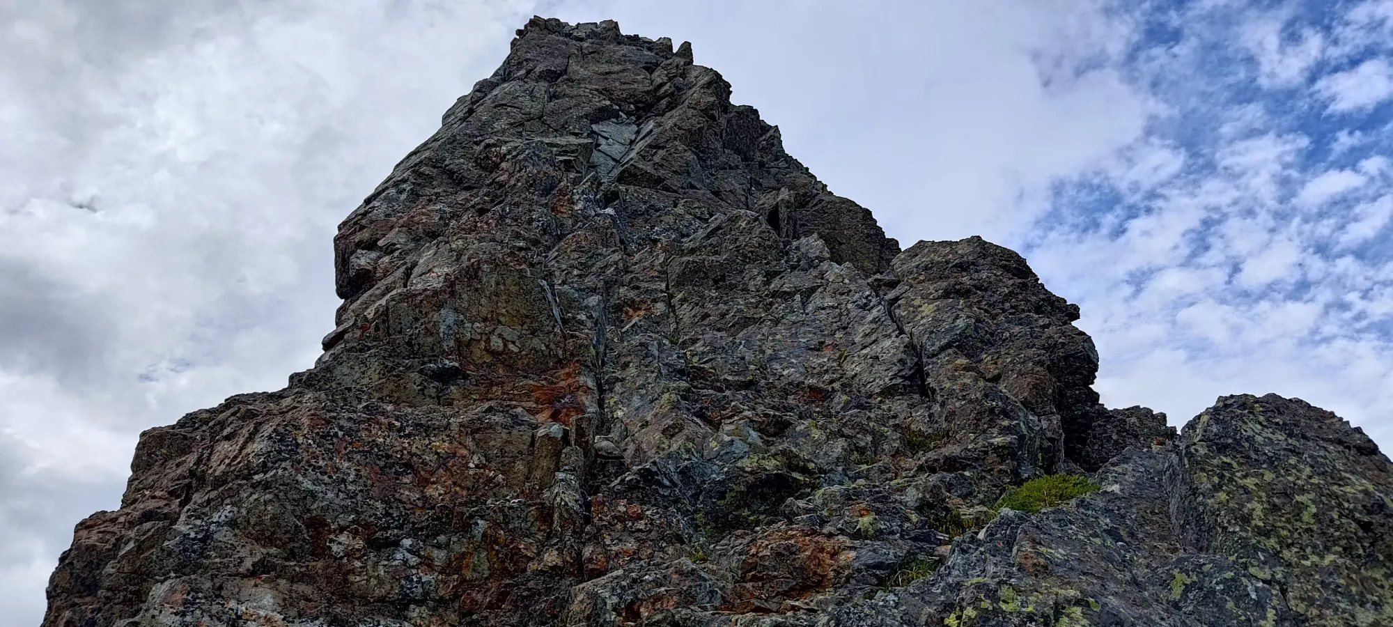
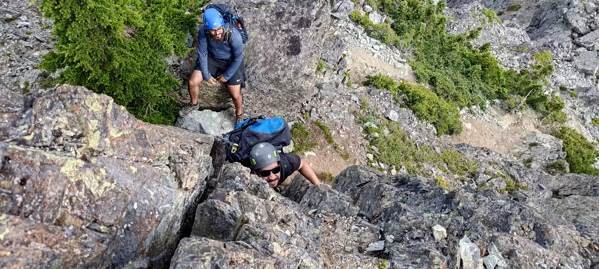
Getting from the bump to the bottom of the final scramble involved squeezing through a tight tree against the rock face (apparently someone dislocated something here, so be careful I guess. Was no issue with my day pack on, at least). After that, there's more class 2-3 scrambling to get up to the summit, but nothing really disconcerting. The whole way up, Jass was saying there's supposed to be a pair of chimneys with rap rings, but nothing felt hard enough to justify those, nor did we see any.
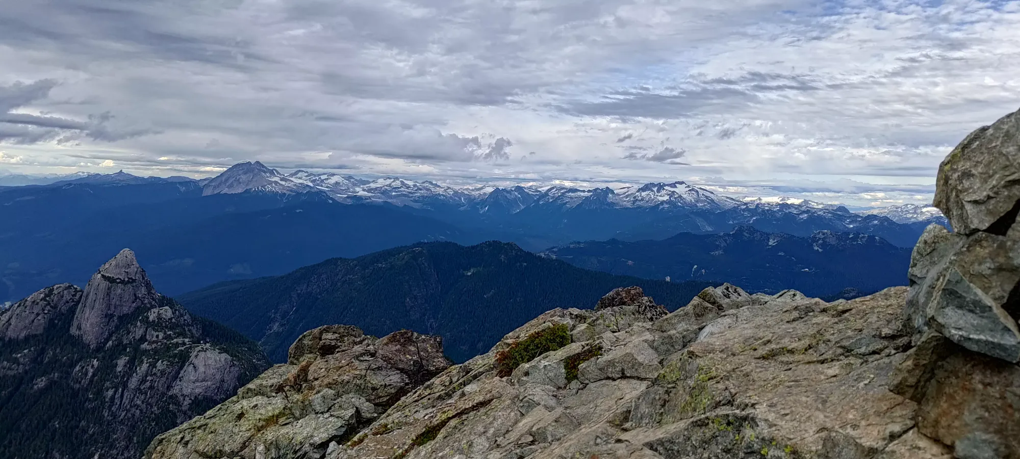
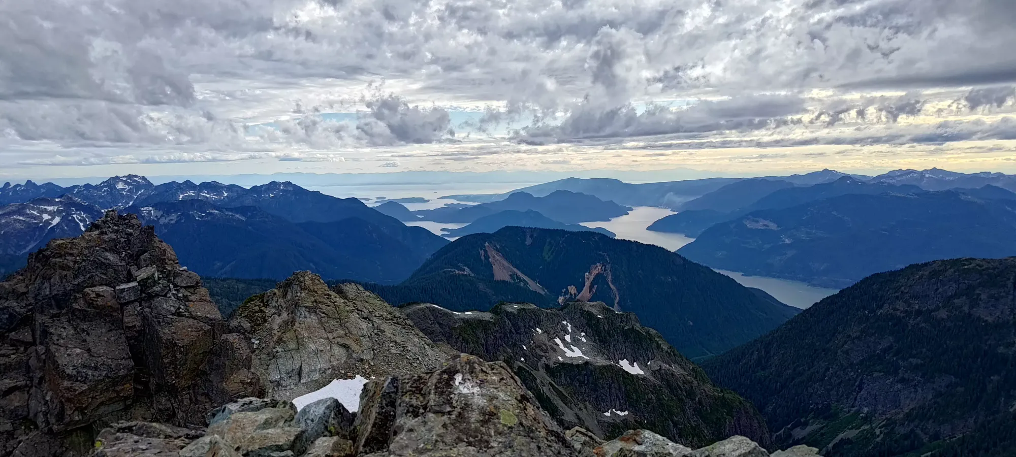
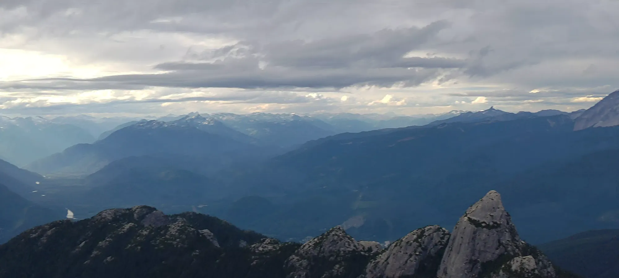
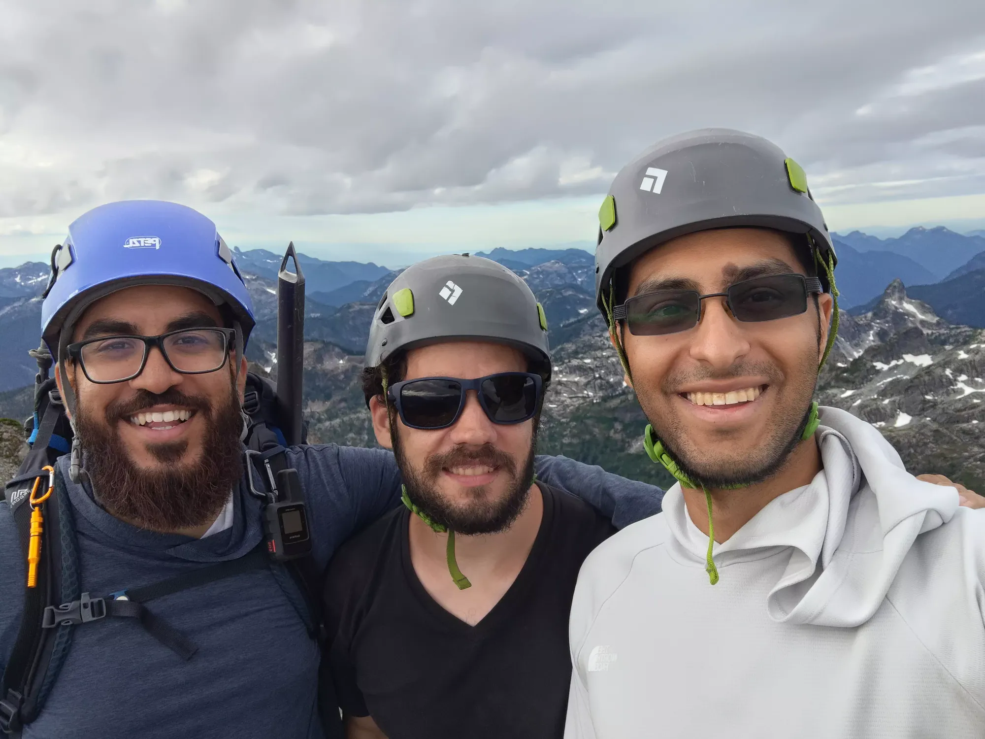
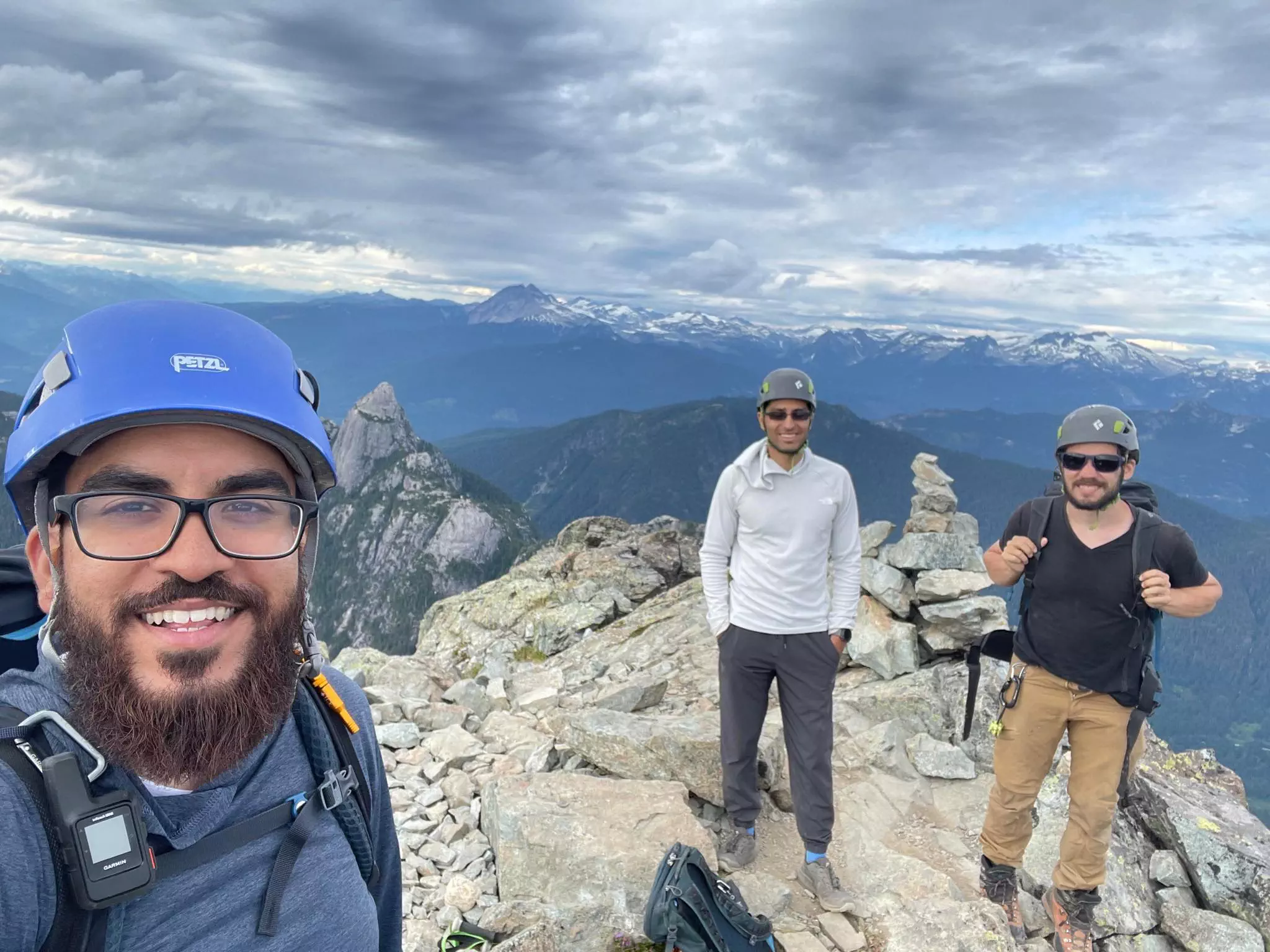
The final few metres to the top were mostly walking, with a couple of ways up, mine involved a small amount of slab-walking and one vault move to get on top of them. We summited around 6:30, a bit later than we wanted, but we were confident we'd get down the glacier by dark in the worst case, and further in the best case, and the terrain beyond that we were perfectly fine handling in the dark, so we weren't too worried. We took a good few pictures on the top before we headed down, though we limited ourselves to only 10 minutes to ensure we got out of the harder terrain with daylight to spare.


After all the photos were taken, it was time to head down. The downclimb was pretty uneventful, to be honest. The terrain was really pretty easy, very doable with my injuries and in my trademark "always-facing-forwards" position. We got down to the pink slab in about 35 minutes (no beta on rap rings above that since, well, we never found them, even looking on the way down). Once we got to the slab, we were on skier's left of the rap rings, but the way down looked pretty simple, so we decided to just go for it. We saw a horn that could be used in the latter half if anyone got sketched out, so we were pretty happy with our positioning.

We ended up taking all different lines and descending simultaneously, with Jass being the furthest right, and me taking a line that Logan seemed to like cause he largely copied it like a thief 😃. I won the unofficial race we never spoke about to the bottom though so I get one internet point. Having gone both up and down the slab while recovering from injury, I can say it's very overblown, and a confident scrambler should have no problems as long as it's dry.
We took about another 20 minutes to hit the headwall of the glacier. Here, we all debated the merits of glissing down vs walking. I decided to try walking first, but after slipping a bit and having to arrest(snow was very firm and spikes only go so far on steeper slopes), I decided to embrace the yeet. Logan came down to graciously lend me his axe, as mine was lost on Wedge and I've had a bear of a time finding a replacement for it. I was then able to slide down quite easily. While uninjured I'd probably have been fine not having an axe in this section, as rocks were sparse and easily avoided, I just didn't want to chance getting twisted up by accident or anything else weird, so it was axe or tedious, careful walking. After I went, the 2 guys followed down. We even managed to give Logan an impromptu lesson in gliss technique (he has struggled with keeping speed up, which we narrowed down to him not committing to keeping his butt on the ground, which we managed to sort out).
After we slid down the glacier, we walked back to the large snow patch, and considered glissing again, but dismissed the idea due to it being steeper, thinner, and having less of a flat runout zone to cut speed. Instead, we packed up the snow gear and just started the long descent down the steep dirt+rocks. That took us about half an hour, and we got down to 1400m (the base of the valley) at about 9pm, still with plenty of light. This was a "stretch goal" of the descent pre-darkness, so that was a pretty great result. We refilled for the last time, and headed out in a few minutes. Unfortunately while faffing about near the water, I stumbled and fell on a pole, bending one section irreversibly. That ticked me off for a few minutes, but thankfully it held for the rest of the day. I'll have to navigate the hell of Black Diamond support queues to get a replacement for that...


I actually left a couple minutes ahead of the others, as I filled my water first, and I knew they'd catch up, so I just decided to send it and get as far as I could in the daylight. Much to my surprise, in the next 50 minutes I managed to descent down to 1050m (the start of the road where the trail intersects with the Habrich trail), including through the creekbed. The pace I was moving at was what felt like nearly normal, at least past the couple boulder fields and creek crossings higher up. That felt pretty great. We actually got out to the fork in the light, without needing headlamps.

At the start of the road, we waited for a couple minutes for Logan (he caught up long ago, but fell back to adjust his gear a bit), and were going to head out when we heard some voices coming down Habrich. We waited for them to come down, and after chatting, it turns out they were a couple climbers who came up to climb there, but apparently did not take the gondola or park where we did, but instead about 4-5km up Indian River Road (which is also about 400m elevation gain AFTER you descend Shannon Creek Road). There were 2 of them, and 2 spaces in our car, so I offered to give them a ride, which seemed to make their night.
From that point, it was just a 5-6km plod back to the car on the forest roads, which took us basically exactly 1 hour to complete. After that, we drove em down, back up Indian River Road to their vehicle, they even e-transferred me some cash to thank me (thanks guys!), and then we headed down into town. We stopped at McDonald's as basically everything was closed and everyone needed calories, de-geared, and I ate+crashed.
This was definitely a most excellent trip. A bit harder than it needed to be due to timing+dietary things, but oh well, not too much to do about that (at least the latter). The scrambling was fun, it was good to get back onto a "hard" scramble and not feel the need to pull out the rope, and the speed at which I tackled the downhill creekbed was really encouraging. Plus, I got to get the "top of Squamish" checked off, which has been a long time coming given how long I've been here now. This is an excellent peak and scramble to it, and I'd recommend it in both summer and winter conditions. Even better with friends, both old and new.
GPX Track + Map
