Mount Bishop - July 15 2023
A steep trail to the top of Mount Seymour Provincial Park

Fannin Range, North Vancouver, BC
1509m
While doing some random errands the Friday of this weekend, I was trying to figure out what I wanted to do on the upcoming Saturday, as my usual hiking buddies were busy, and I was left to my own devices. While I was tossing up various options in my head, though, Hêdy, a fellow member of the local bagging community, sent out a call for partners. I responded, and he said he was willing to put up with the slowness of a recovering bagger, and he floated out Mount Bishop as a place to go. That wasn't too far of a drive for me (which I sadly classify as under 2 hours these days 🙃), and while steep, seemed to be near the higher end of the elevation I've done since injury but still reasonable, so I was happy to do it. Plus, it's a p600m peak and the top of Seymour Park, so that's some extra motivation.
Once we figured out that the approach would be Seymour Mainline, which is about 13km of non-motorized road, I discovered Hêdy didn't have a bike! Thankfully, I recently got an extra one from my Dad when he moved out this way and brought an old one from back home, so I was able to bring that along with my e-bike. We made a rough plan to tag Bishop, traverse north to 2 extra peaks on a ridge if we had time, and maybe get 1 more near Vicar Lake on the way down if everything was super smooth, though we didn't have expectations of all that working out. We met a bit late, since I was out late the night before experiencing the pain of terminating Ethernet cables for my dad (those wires are so annoying to get straight!), and after locating each others' parking spots, getting the bikes unloaded, etc. we set out at 10:20am.
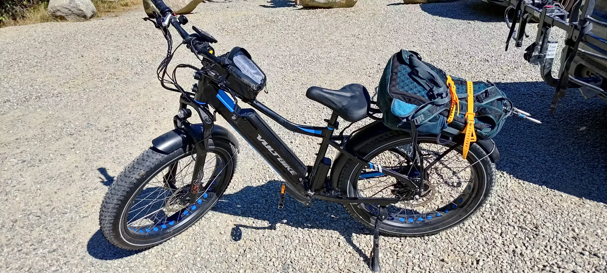
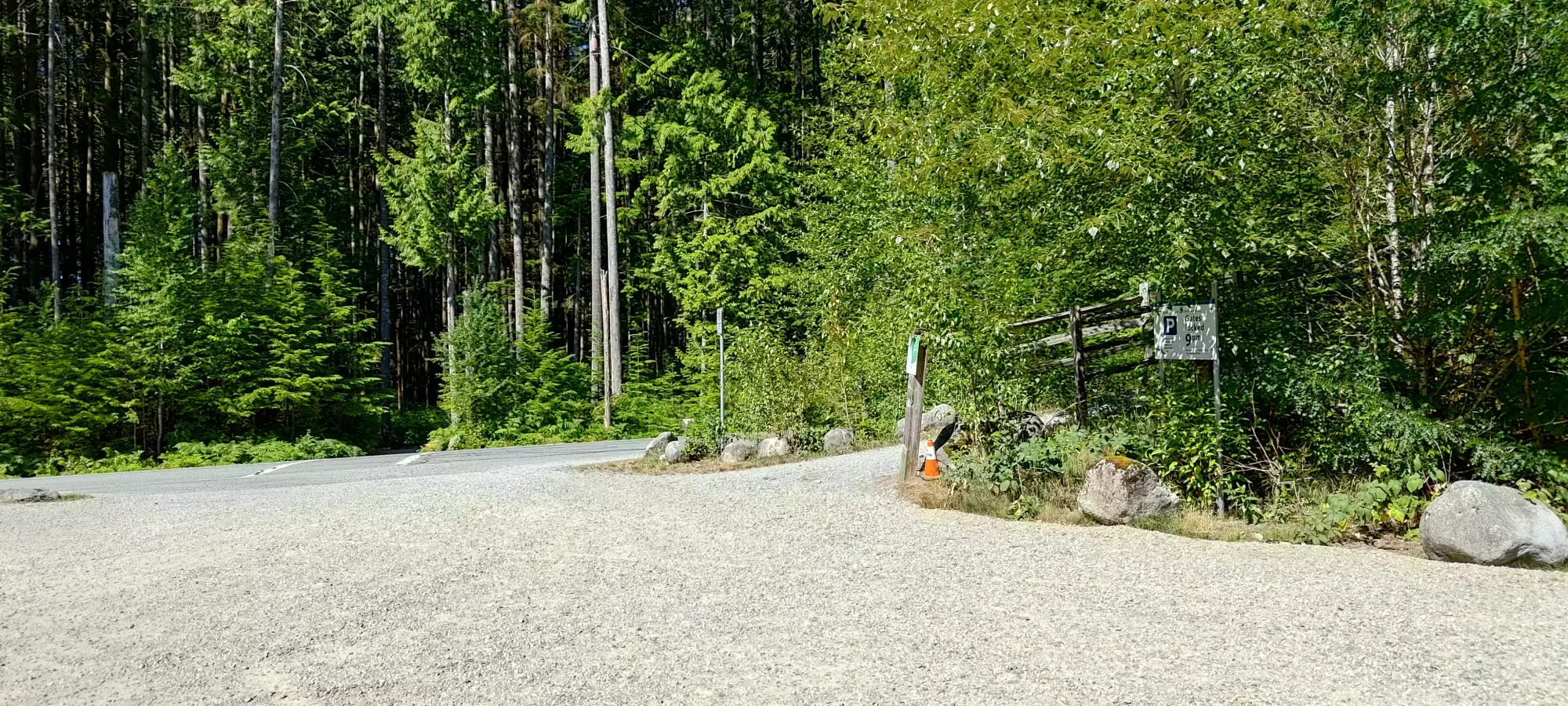
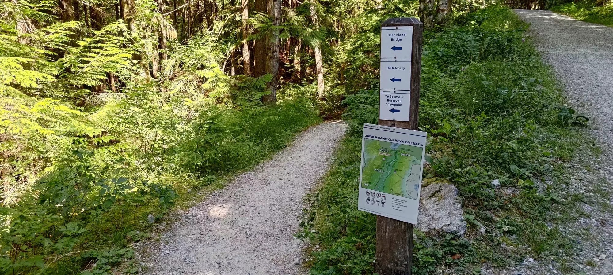
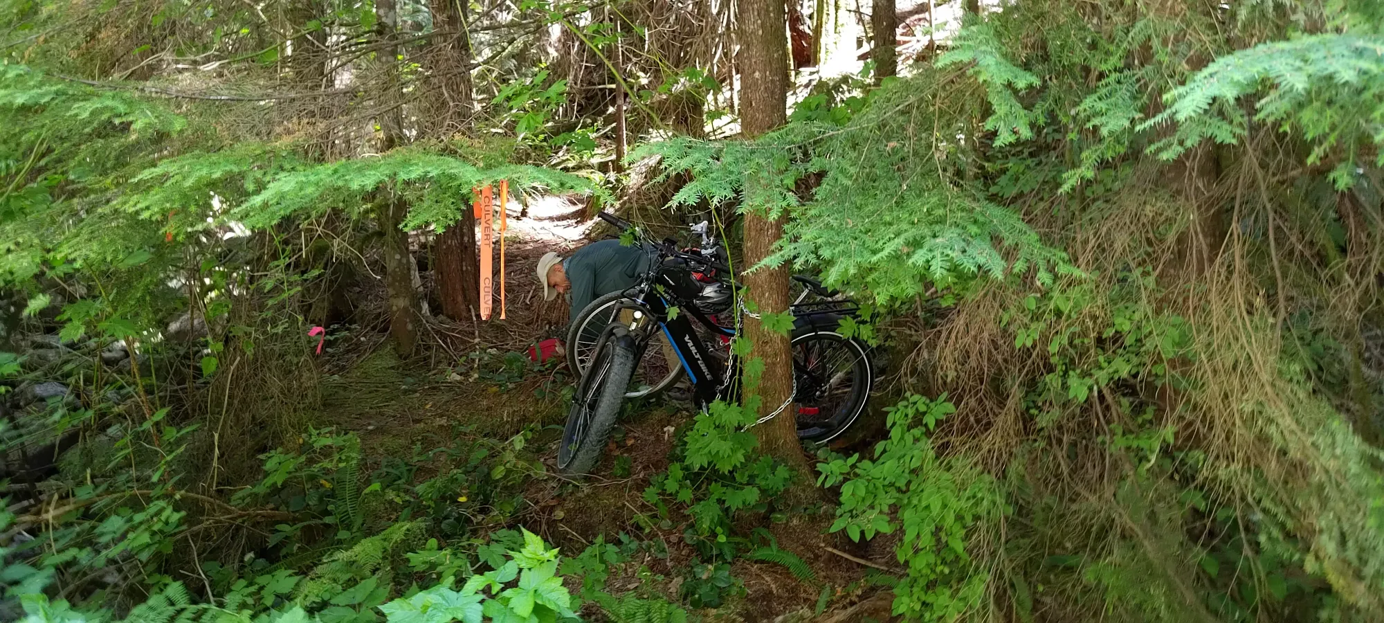
We spent a few minutes faffing about near the start of the bike, trying to find our way onto the road, which was gated and monitored, reserved for industrial or similar traffic only. However, within 10 minutes, we managed to determine that the bike path down is actually itself paved (our beta was a bit vague on this) and goes all the way to Seymour Lake, so we hopped on that, and the bike began. While my ebike is definitely not perfect, it was great at this section, letting my cruise on the path without really having to try, while Hêdy had to actually work on the uphills. We got to and crossed Seymour River in about 55 minutes, taking the paved path all the way until the crossing itself. Once we crossed, the path got narrow, softer, and steep. Hêdy tried biking up, but was unsuccessful, so he walked his bike up. I was unable to cold-start on the hill, the weight of my bike being too great, but I tried getting a "running start" on the flat bridge, and that worked, getting me all the way to the final hairpin turn at the top where the trail joins the "Spur 4" gravel road on the east side of the river. I didn't have the stones/skill to try that turn with enough speed to stay moving, so I walked the bike from there. Once on the spur, we biked down for a minute or so, and after some wandering found a place to stash the bikes and get hiking. The trail is hard to see from the direction we came from, but is marked.
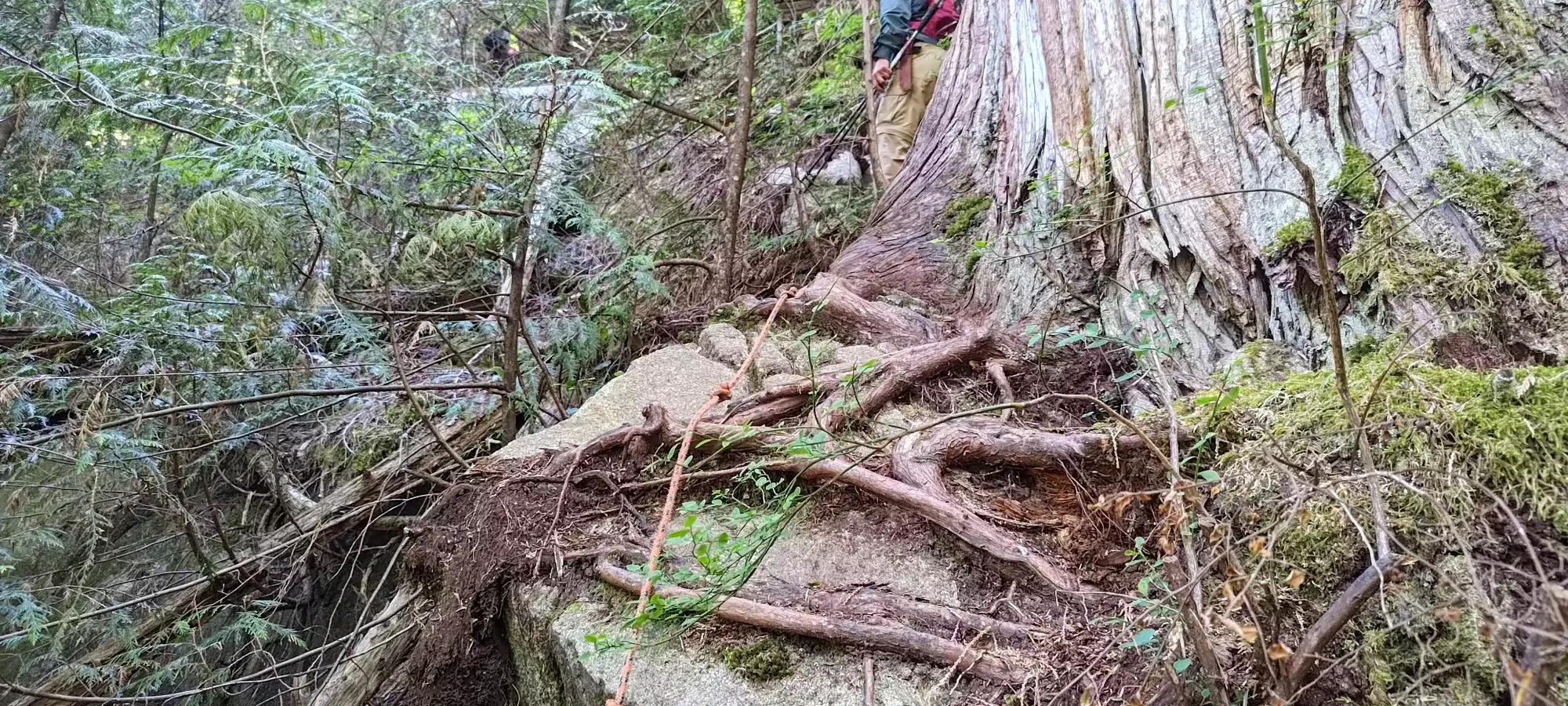
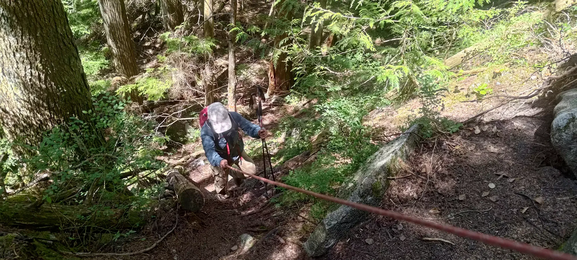
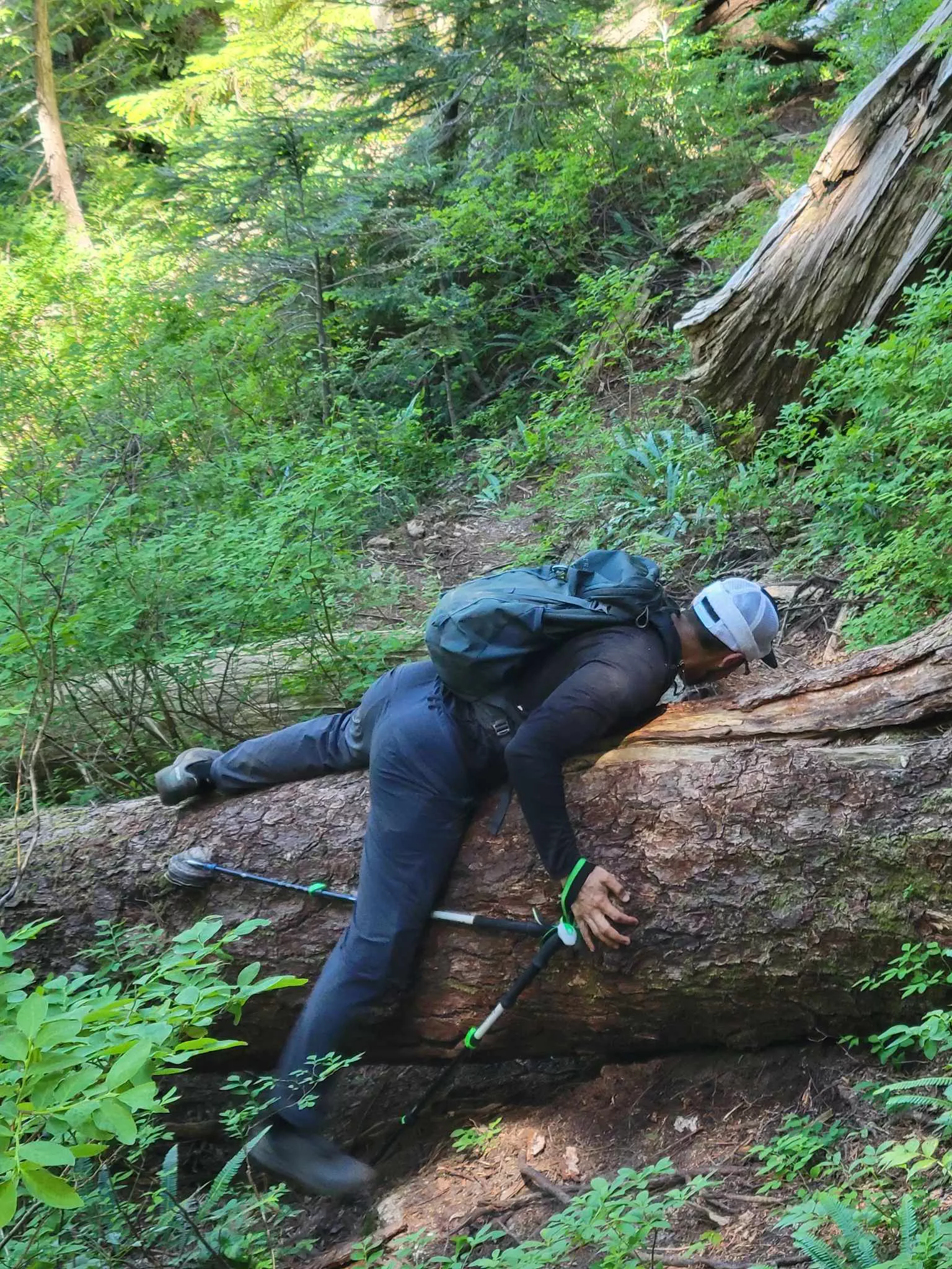
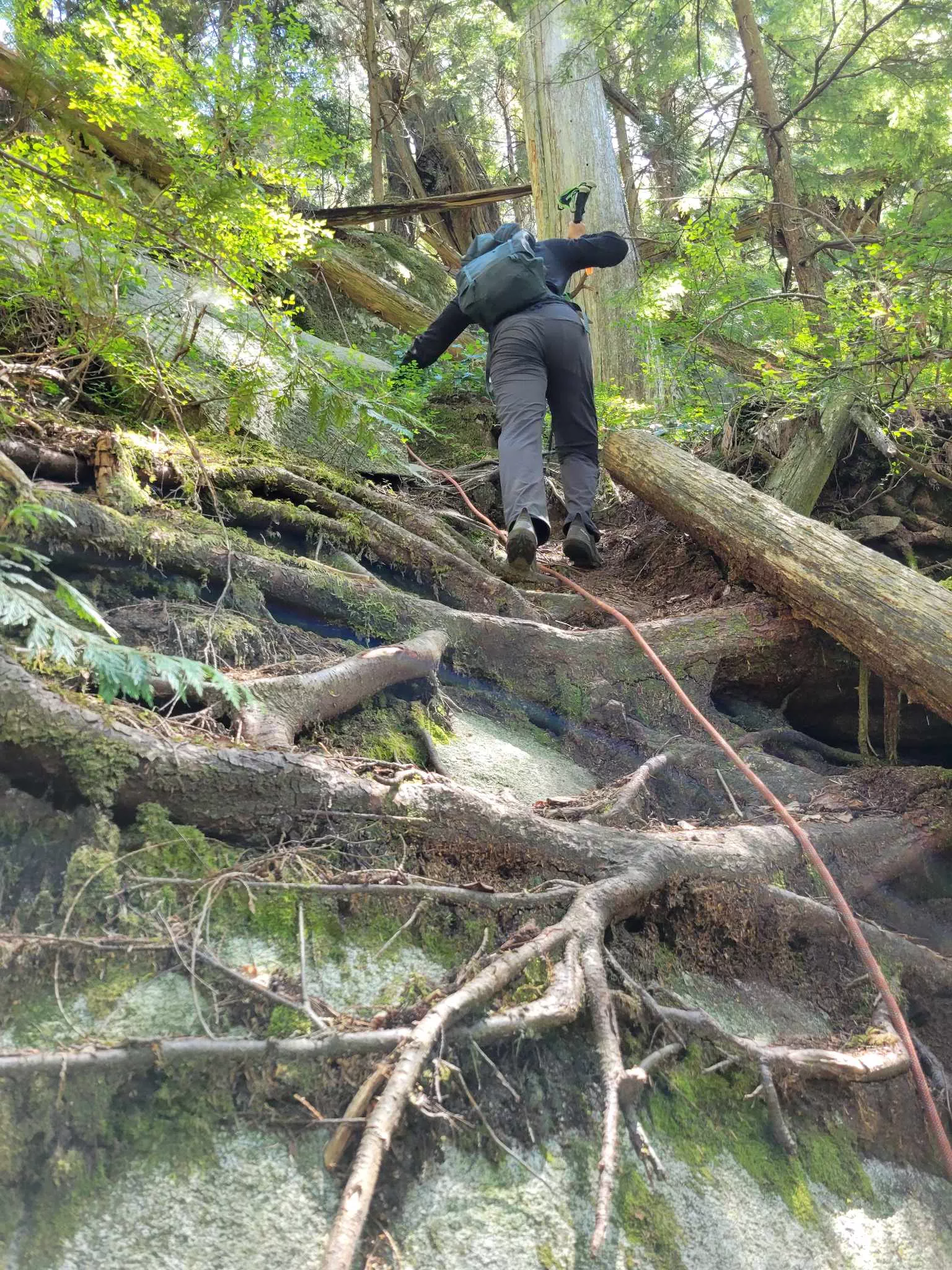
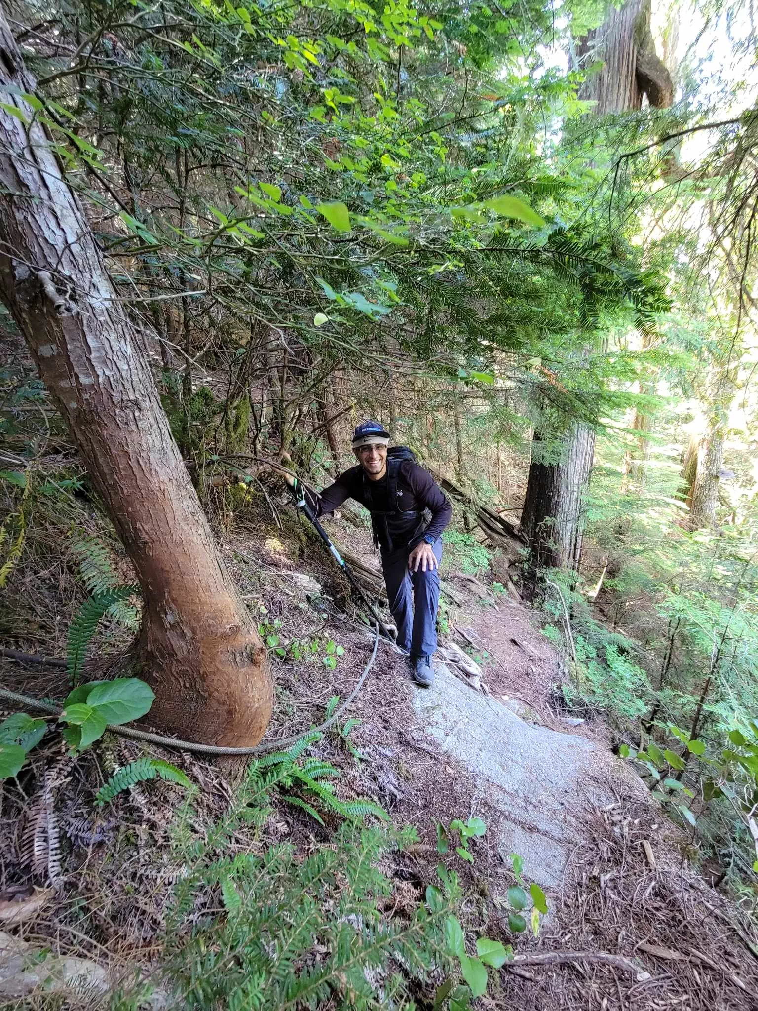
The trail starts off steep and doesn't let off the gas. AllTrails lists it at 7.6km, 1268m elevation gain, making it definitely one of the steeper trails that I've done. The first ten or twenty minutes of the trail is just "fairly steep forest", though it's at least rooty enough to get solid, flat footing vs just being angled dirt, which would not be fun at this grade. There's not much of note on the trail until about 420m elevation, where we encountered our first fixed rope. This is notable not just because I'm the kind of masochist who refuses to use fixed ropes and thus got to get some forested scrambling in, but because this was a sign of a veritable onslaught of fixed ropes that would make Alan Blair cry. I took pictures of the first couple, but gave up soon after because there were literally dozens of them.
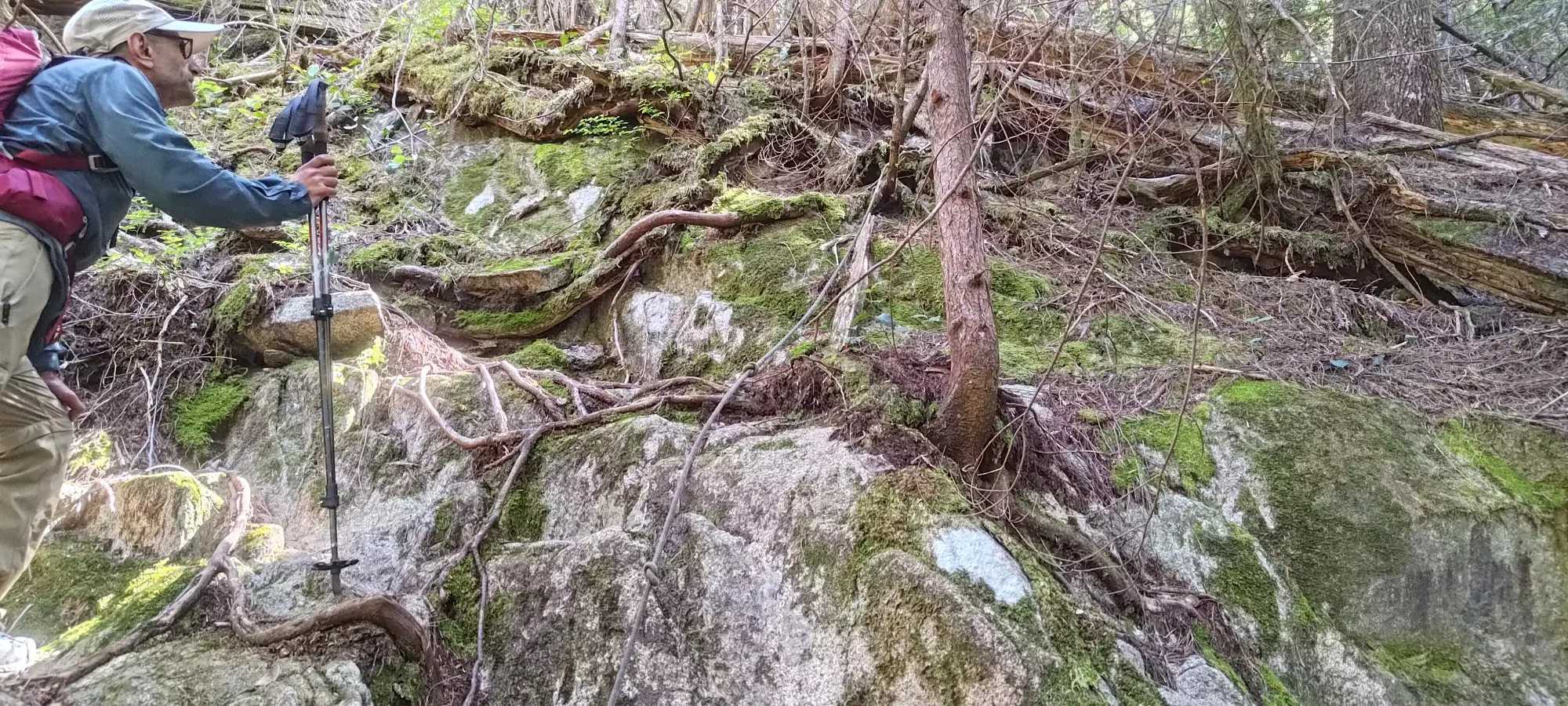
Normally I treat fixed ropes as a fun meme-y challenge to avoid, but in this case, I found them to actually be annoying in quantity, more so on the downhill as they can get in the way of one's footing, just making things take longer to move them out of the way if necessary. We did at least still have fun meming it up as we root-scrambled up the trail, though, for whatever that's worth. There are at least some placements where I can understand why someone would appreciate it being there, but then there are others that just made no sense to me, like below, where the roots provide such excellent holds already.
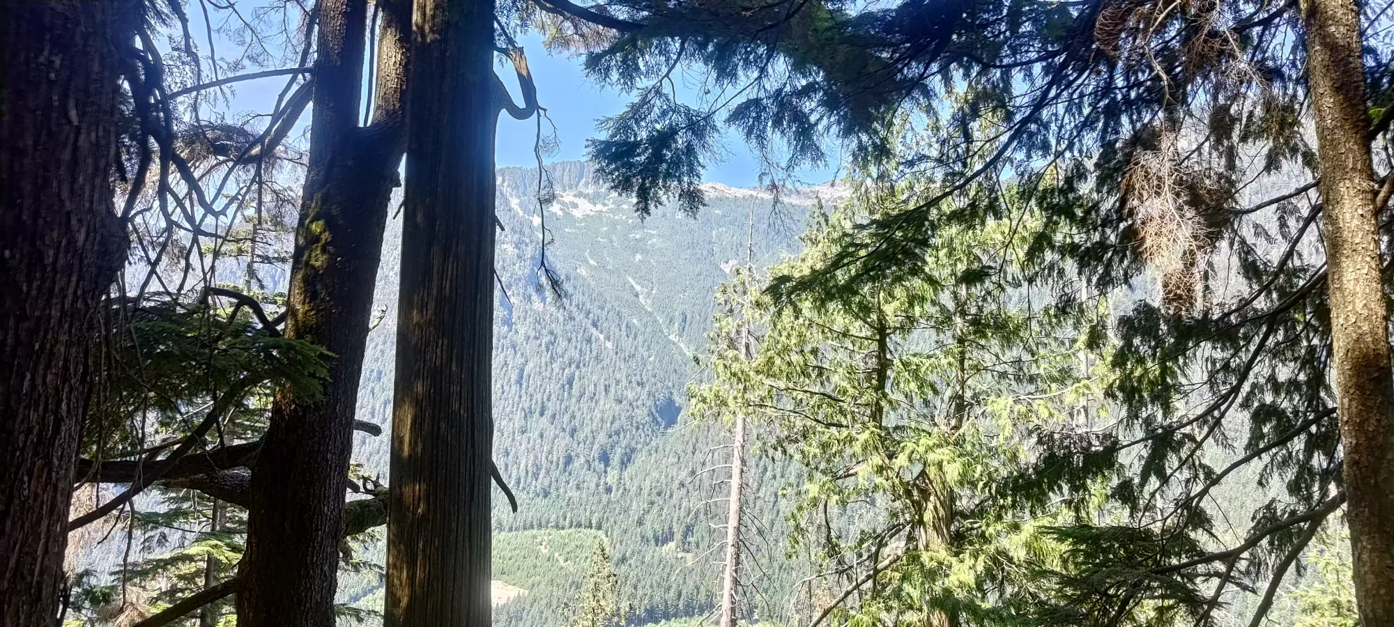
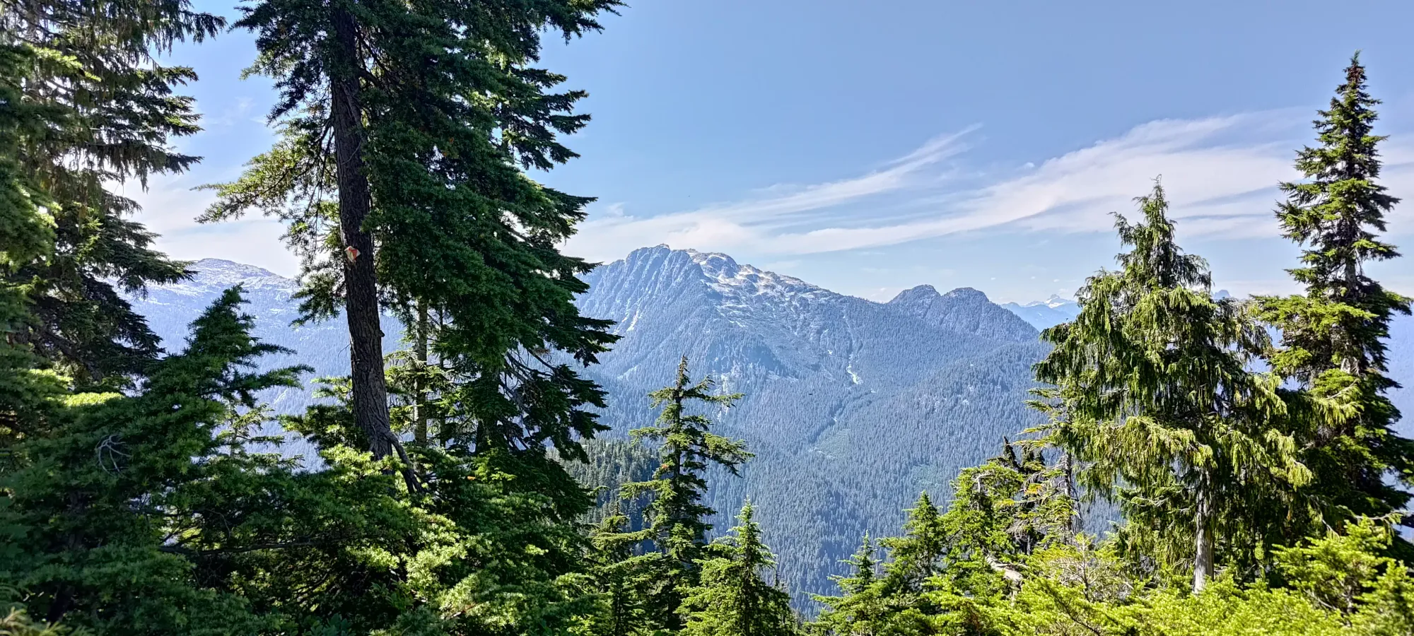
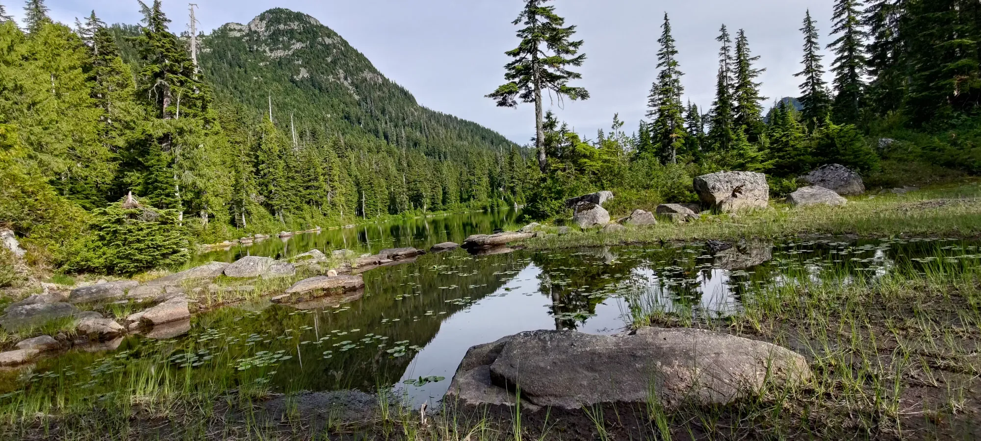
The steep trail, interspersed with such scramble sections, seemingly randomly with our without a fixed line, continues basically all the way up to 1000m where you hit Vicar Lakes. We got up to the lake in about 2 hours, with not much other than a few glimpses back with a view through the trees. There's also no water sources along the way, so pack accordingly.
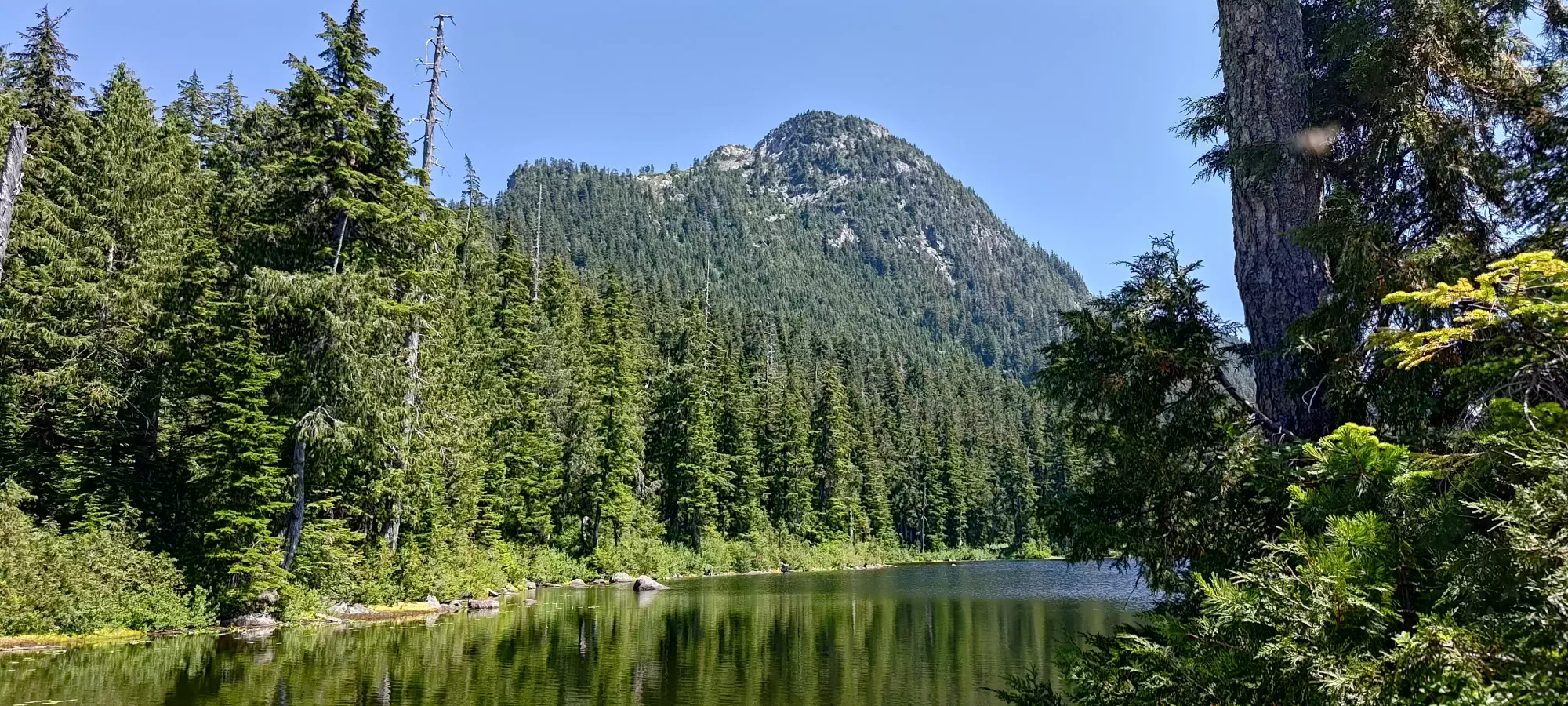
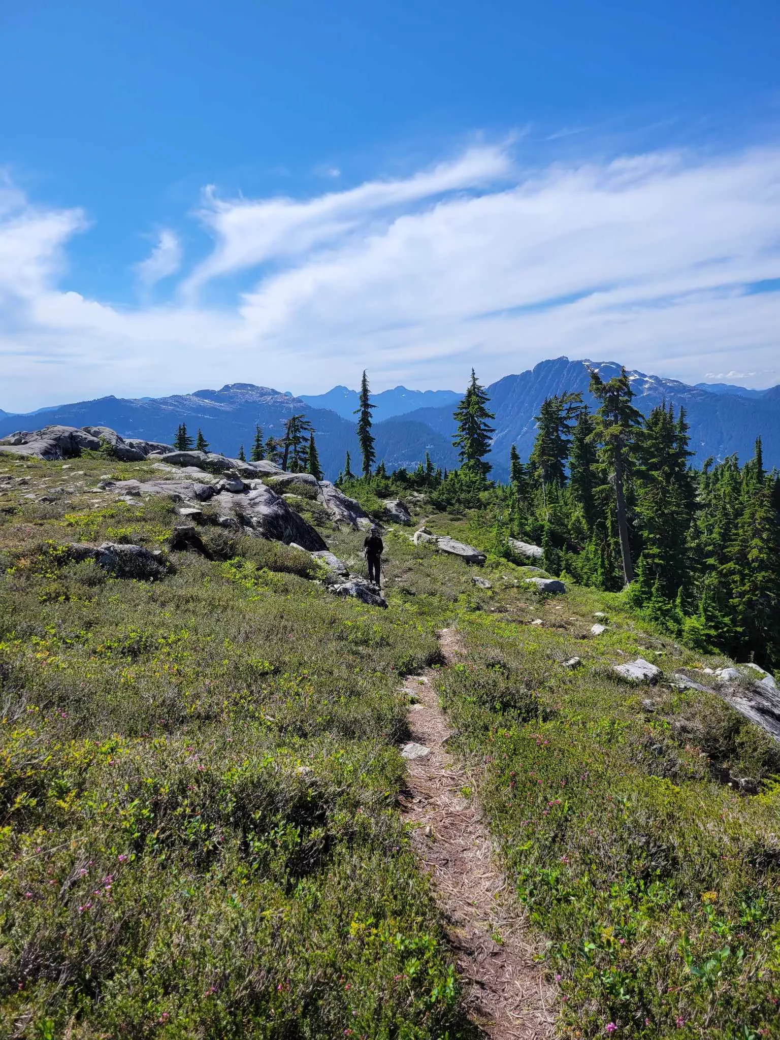
As you near 1000m, the trees break open, and there's a couple minutes of meadow-walking as you get to the water. The first of Vicar Lakes is more like "Vicar Pond" in the summer, with a small amount of still water and not much else. However, a few extra minutes of hiking will get you to the "real" lake, which while seemingly not very large or deep, was quite pretty nonetheless. We met a hiker descending who claimed there was a creek flowing full of "glacial water" (not sure what glacier he thinks exists in Seymour Park), which definitely does NOT exist here. Aside from the absence of any glacier here, the lake was also low enough not to be flowing, so pack a good filtration system if you want to fill up at this point.
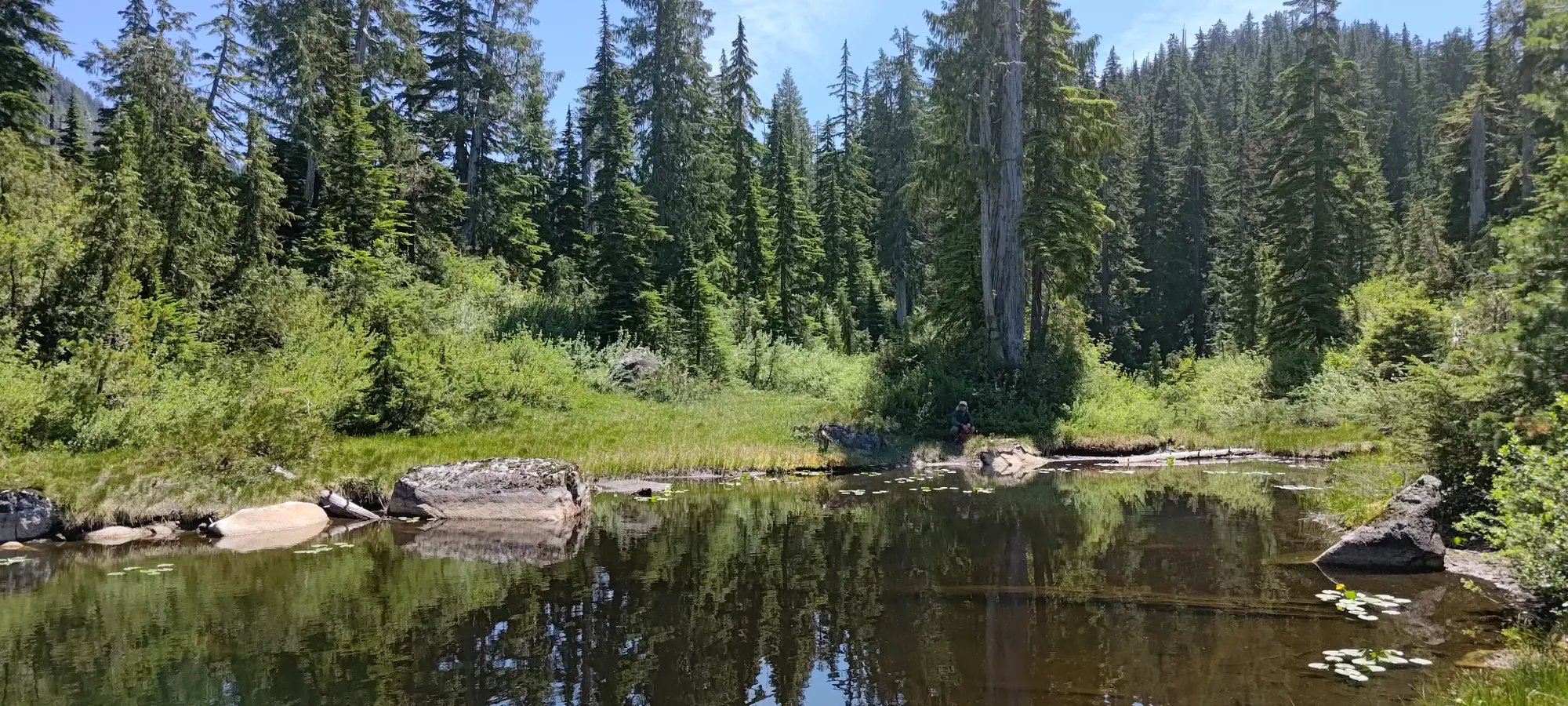

We spent about 35 minutes at the lake having lunch and hunting for flowing water, to no avail. Since I had my filter, I refilled anyway, not trusting that there'd be much in the way of water getting higher on those dry-looking and steep slopes ahead. Once we got moving, I was pleasantly surprised with the easiest section of the hike so far. Usually the hike to the lake is the easy part, and the way to the summit is where things get hard, but this area is the opposite! The first couple hundred metres of elevation are actually shaded again, and an easier grade+terrain than the trail to the lake. There are a couple fixed-rope sections, but only a couple, and it is still quite easy to avoid using them. We knocked out about 100m of elevation per 20 minutes and hit 1300m a bit before 3:30pm.
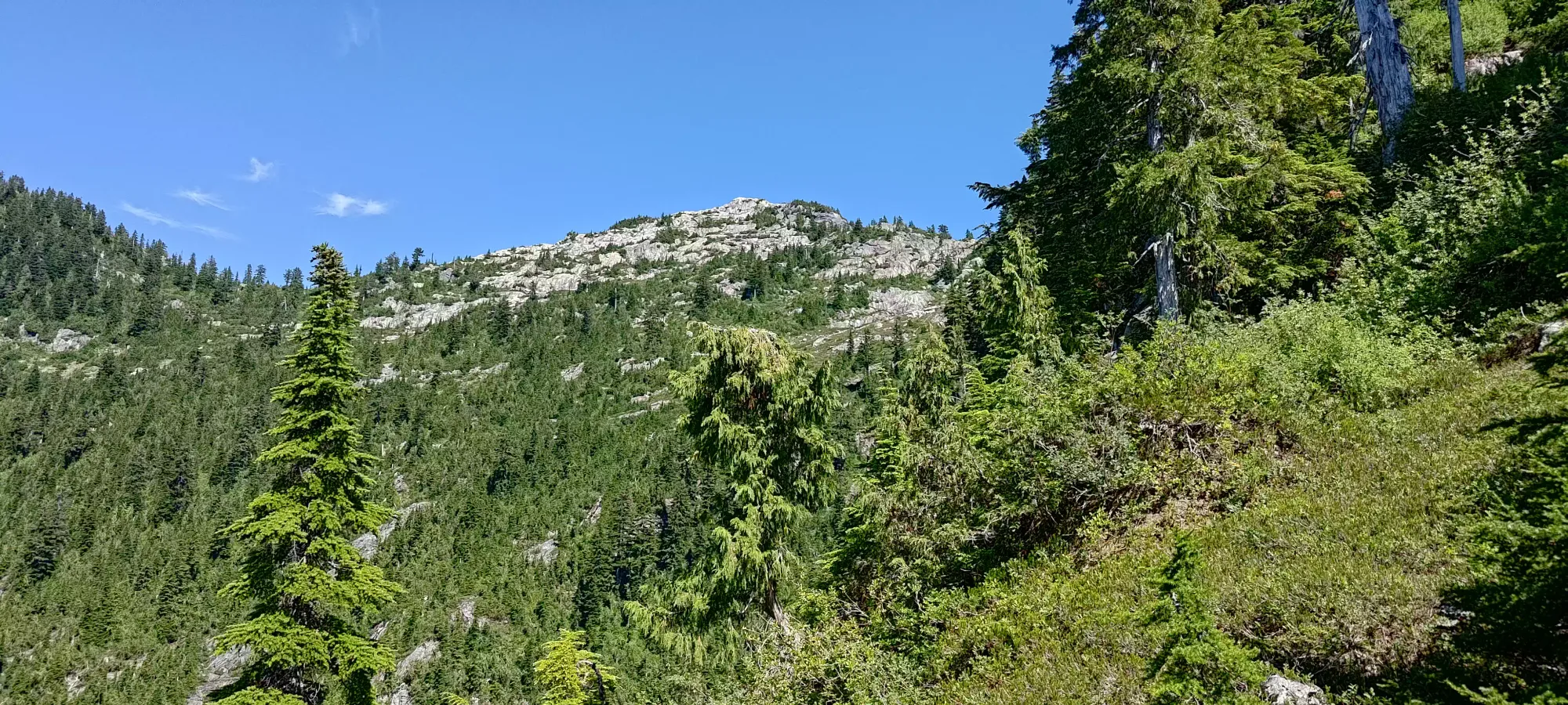

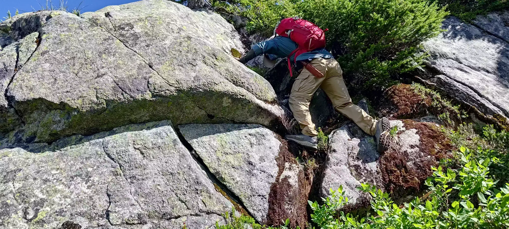
As we approached 1400m, we broke out of the bushy ridge and into a small alpine/treeline area where we could see some flowing water (finally), and a little bit of a summit scramble, this time on rocks instead of roots! We refilled at the much cooler, more refreshing, and safer snowmelt here (though this is unlikely to last much longer given the heat and its total volume, so don't rely on this in late season). We saw a couple coming down who followed the mapped trail across the snowpatch and around the gentler side of the summit, but we decided the snow was annoying and the scrambling would be more fun just going up climber's left, so that's where we went.

We were pretty happy with that choice, as the rock quality was quite good, and I wouldn't say anything was class 4, it was generally shallow enough that I wouldn't call the exposure deadly. There were a couple hard moves, but those weren't in the most exposed places, and we both felt happy with the terrain, even me in my condition. The last 100m of elevation took us about 25 minutes to scramble up, which could definitely be shorter if you take an easier route than we did, but we felt it was worth the enjoyment factor.
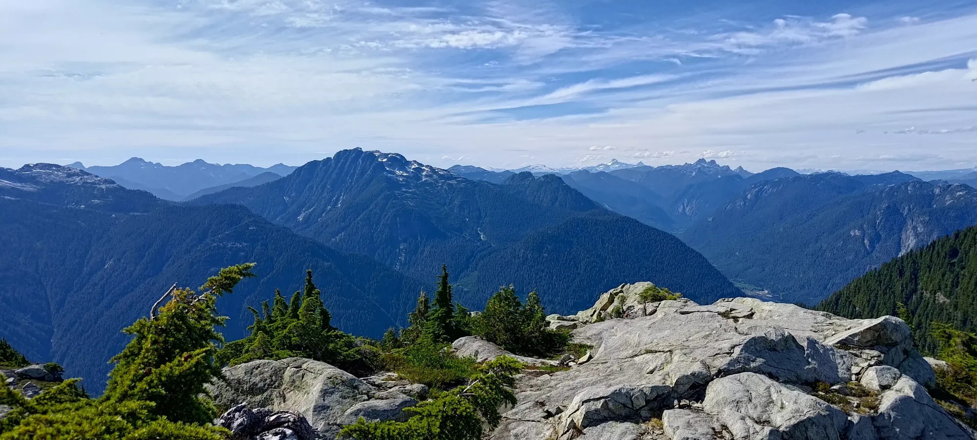
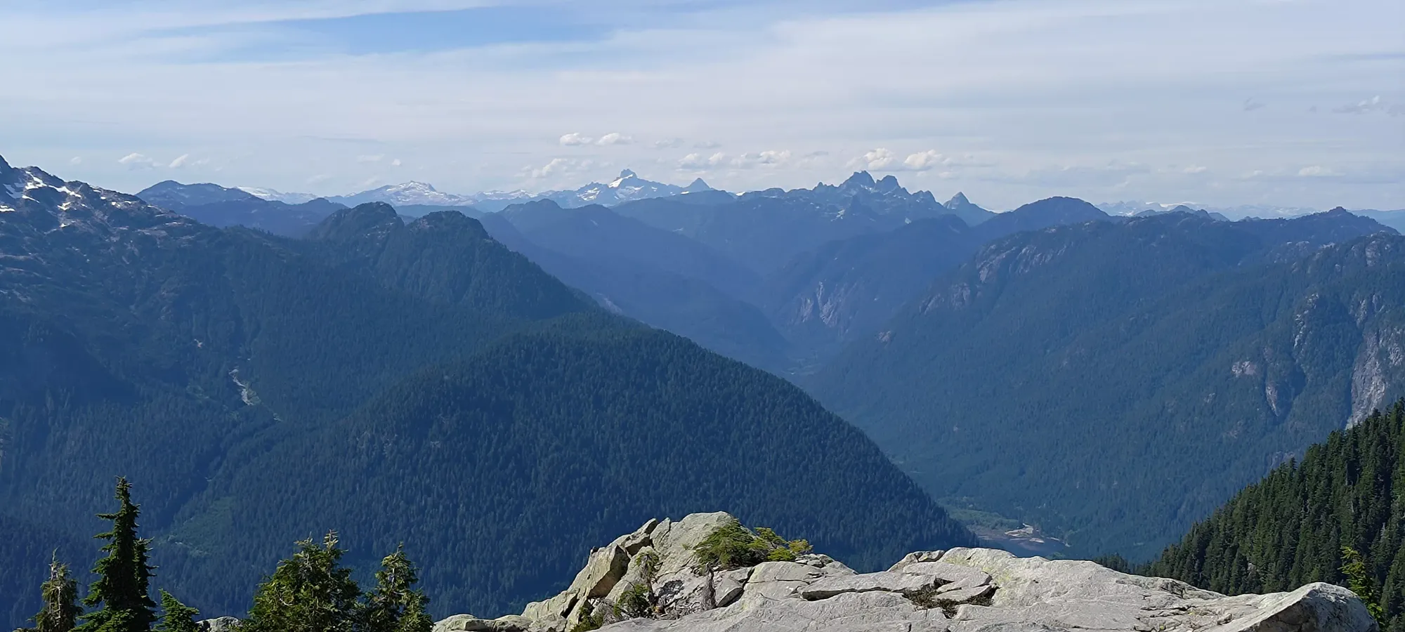
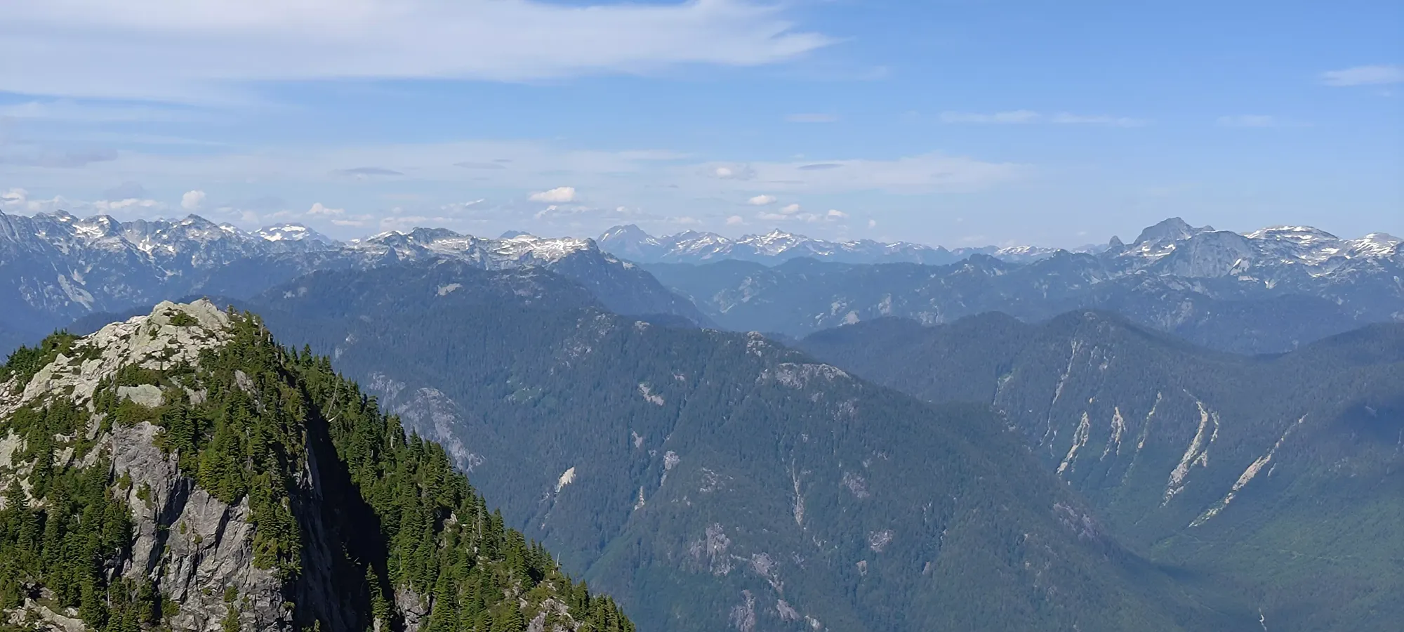
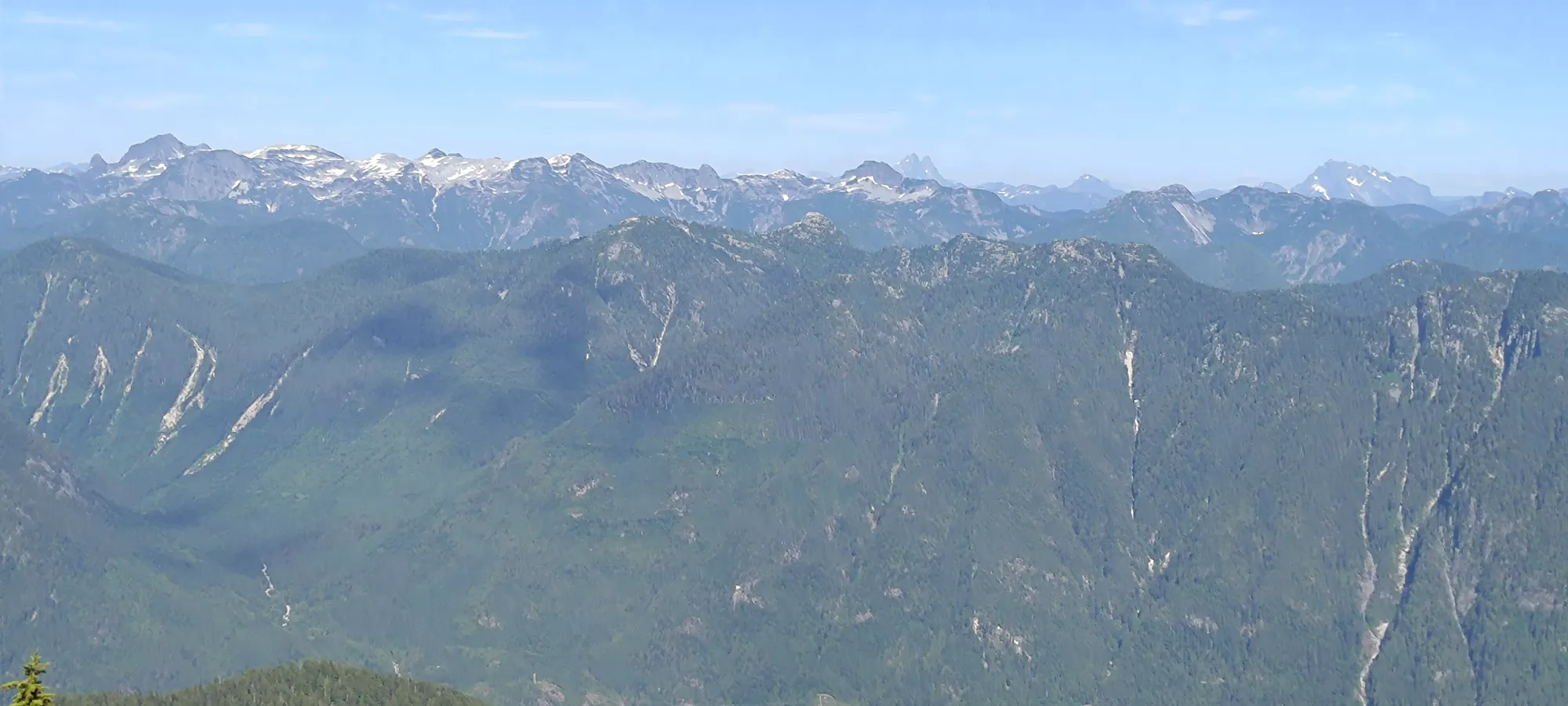
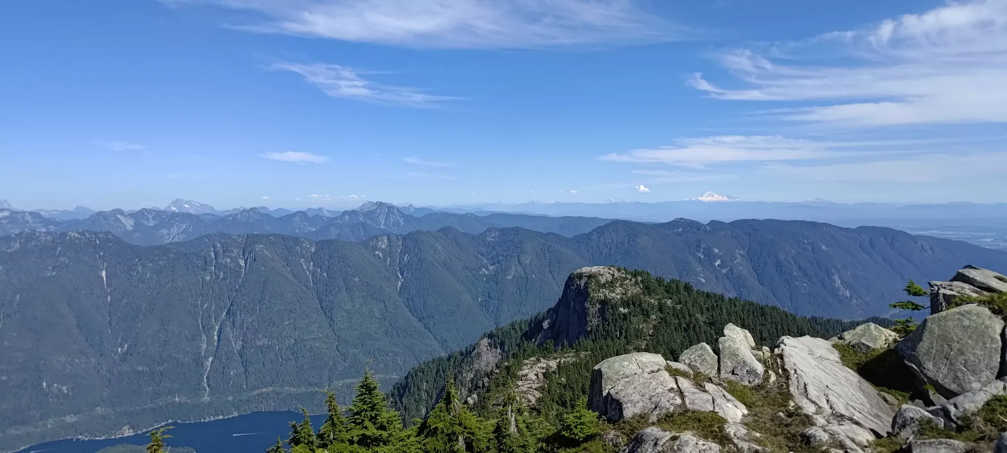
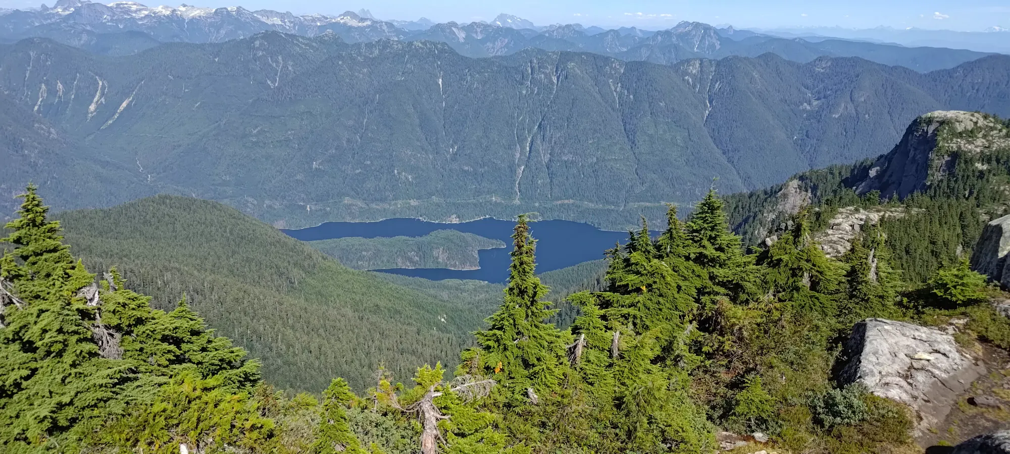
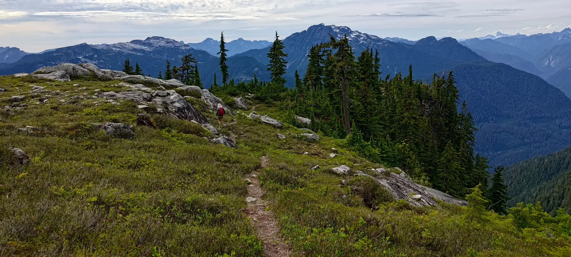
The summit views were amazing, unsurprisingly being a 600+ metre prominent peak surrounded by other mountain ranges makes for great views. We took a ton of photos as a result. We were up there for 15-20 minutes taking pictures and having snacks before heading down, since the day was still getting fairly late (definitely no extra credit peaks for this trip, unfortunately).
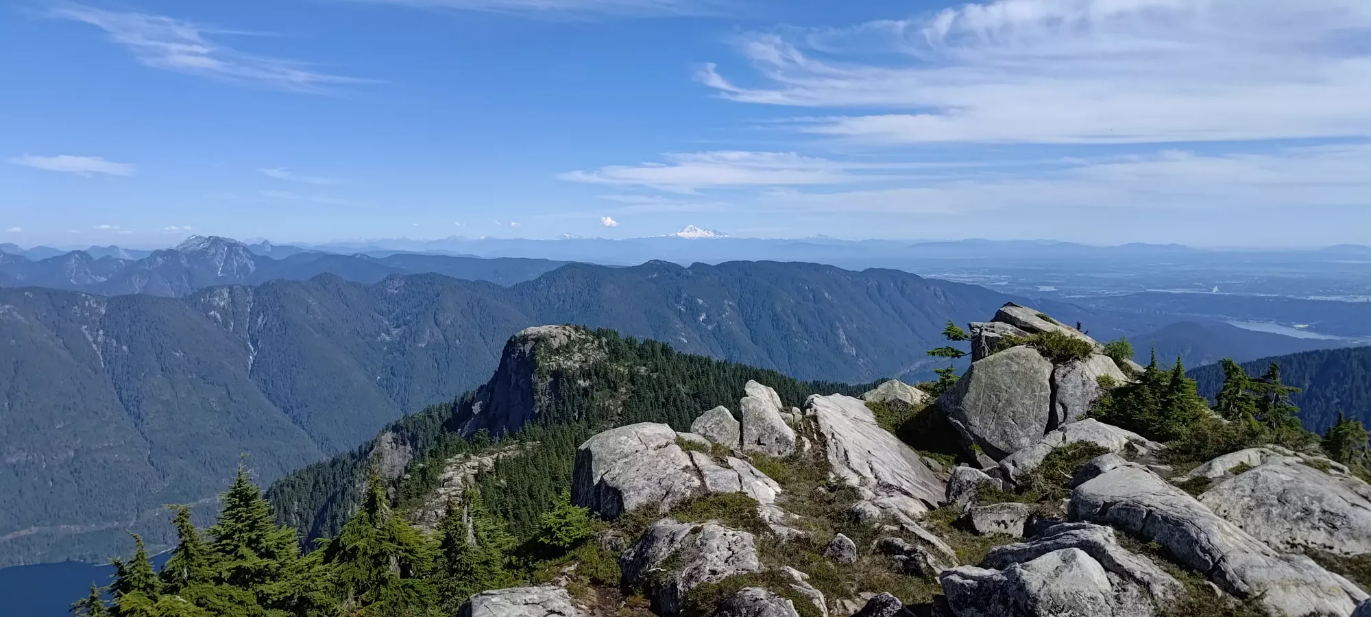
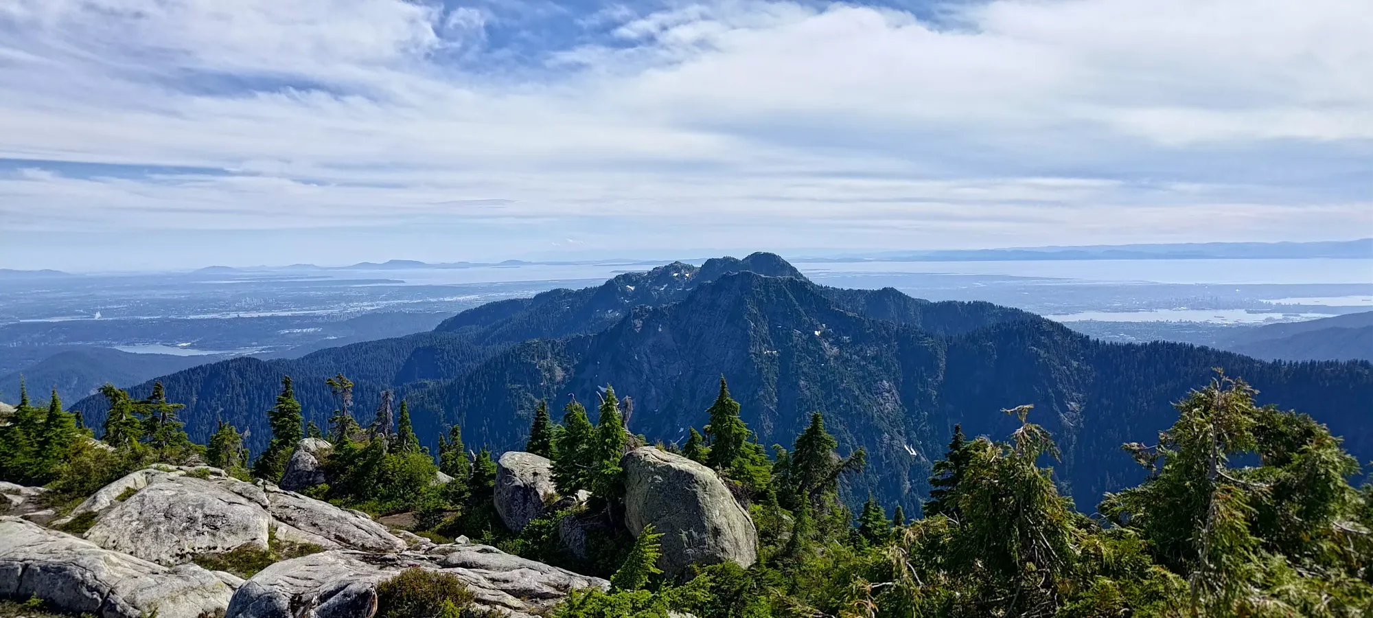


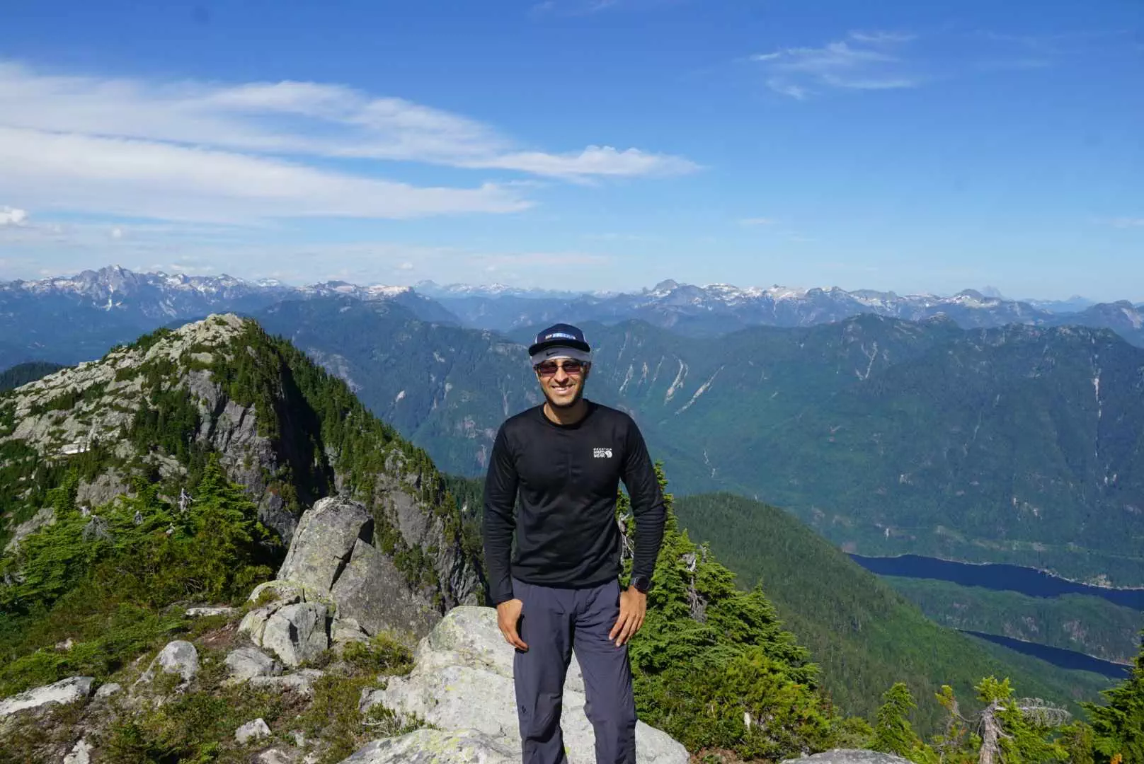
Aside from the extensive panorama shots, I did still manage to look down once and get a view of the Indian Arm, and Hêdy got me my "summit evidence" shot as well 😀
After we finished our summit break, we decided to head down the easier way for a faster descent. We originally went a little too far along the summit ridge, but were able to get down without much fuss to the top of the upper bowl. The terrain was a small amount of slab-walking and a lot of stepping and hopping down ledges. Once we got to the snow patch, Hêdy decided to gliss down, while I was dissuaded by my lack of axe and more notably the wetness of the snow in the hot sun, so I instead strapped my spikes on and stepped down carefully using the sun cups to provide flatter footing than the hill would natively support. After that, it was a simple descent down to the lakes, with just a couple of rest breaks to catch my breath en-route.
We got back to the lakes at about 6pm, and rested for about 15 minutes there before heading down again. I was pretty tired at this point, but we still had some hope of getting down in time for the 9pm park closure time (of course, just listed as "dawn to dusk" on the park site, for the usual nebulously useless "public safety reasons").
However, the descent took us about 2.5 hours, mostly just due to tiredness, and a little bit just because we didn't feel motivated to rush and instead enjoyed our breaks and chatted longer than we perhaps needed to. Hêdy was confident we'd not be locked in regardless, and we were happy to take it casual as a result (I'm always happy to indirectly protest the existence of gates, and of course was prepared to just bike out or camp if his beta was wrong). The terrain being so steep/rugged also played a part, for sure. If this was Garibaldi Lake Trail, we'd have been down much faster.
Once we got out of the forest, it took about 15 minutes to untangle the bikes from the forest, take a couple minutes of rest, and get our plan together. Hêdy went ahead by a good few minutes since he was going to be slower due to the lack of electric motors, and I spent some time fiddling with my bike, strapping my pack down with my straps that were not exactly the ideal length and took a lot of yanking to close, and taking a bit of extra rest. I compounded this by failing to maintain my composure on the loose hairpin turn on the descent to the river and crashing, forcing me to fix my chain for a few minutes before continuing (was not unexpected, my speed reflected the likelihood of falling, and it was totally fine, just annoying). As a result, we met up just around where the bike path diverges from the service road. This was a good thing, since Hêdy was heading down the road instead of the bike path, so I was able to correct that just in the nick of time.
Once on the road, I zoomed ahead, but after a kilometre or two, I realised that we might be getting into the dark by the end, and Hêdy didn't have a headlamp, so I stopped to get mine out and give it to him, since he'd be getting out a bit later, and my bike had a built-in light anyways. After doing that tradeoff, I managed around a 30km/h pace to the car, where I was able to gear down, get my bike loaded up, and drive up to the trailhead to meet Hêdy. It seems our timing was "just perfectly wrong" as a parks worker said that he was at his car, so I went there, but just before that, he sent Hêdy down to my car instead, so we ended up missing each other and took an extra few minutes to get ourselves sorted 🙃.
It wasn't a big deal, though. We got out with minimal fuss, and I even managed to get home by 11pm, so just enough time to scarf down a middling "meal" and pass out before the next day's adventure.
Overall, I'd recommend this hike for peakbaggers only, really. The views are pretty great, but so are other places with easier access and a less intense trail. Ideally you'd park below the gate (no spaces when we arrived), bring ebikes or just "be fit enough not to care", and be able to get the whole ridge north of Bishop and the fourth peak near the lake (Gibbens) to avoid needing to repeat the trip in the future. Guess I'll have to come back at least once more, myself. Great to get out, get a p600m, a park high point, and make a new friend, though!
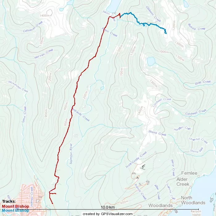
GPX Track + Map