Pinnacle Peak - October 14 2023
A somewhat remote ultra with pretty low stats near Cherryville, BC


Thompson Plateau, Cherryville, BC
2573m
After a few no-hike-needed peaks and a concert the night before, we had a bit of a late start to the day, but Logan and I were all the way out in Penticton, so there was no way we were just going to waste the opportunity to get some peaks further from home. We were hoping to do this longer objective on the Sunday instead of the Saturday, giving us some time to rest and get an earlier start, but the promise of heavier rains and wetter rock overnight on Saturday/Sunday forced our hand, so Saturday it was. That and we actually found out that a bridge on the way in would be getting closed on the Sunday for the following month, so that made deciding pretty simple. After getting up, grabbing breakfast, driving, needing a bathroom break, and driving some more, we ended up at the start of the Monashee Creek Road (which turns into the South Fork FSR, if you're reading trip reports and seeing mentions of that) close to noon. The road was pleasantly in excellent condition, doable in "anything but the lowest of sports cars", though we did encounter some industrial traffic (one large truck) and spotted a sign for active hauling on weekdays, so be aware of that if you're coming, there's probably heavy weekday traffic, and still some on the weekends as well.
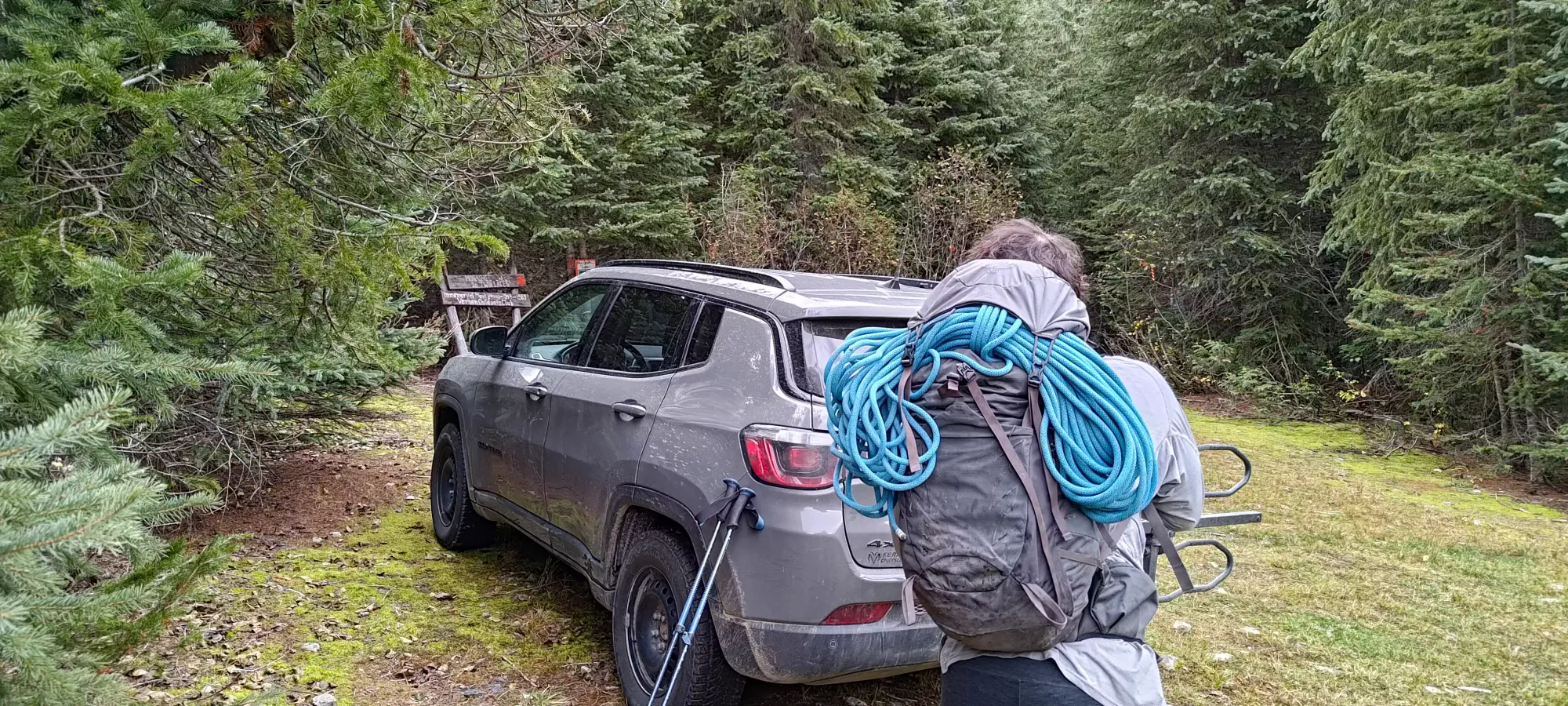
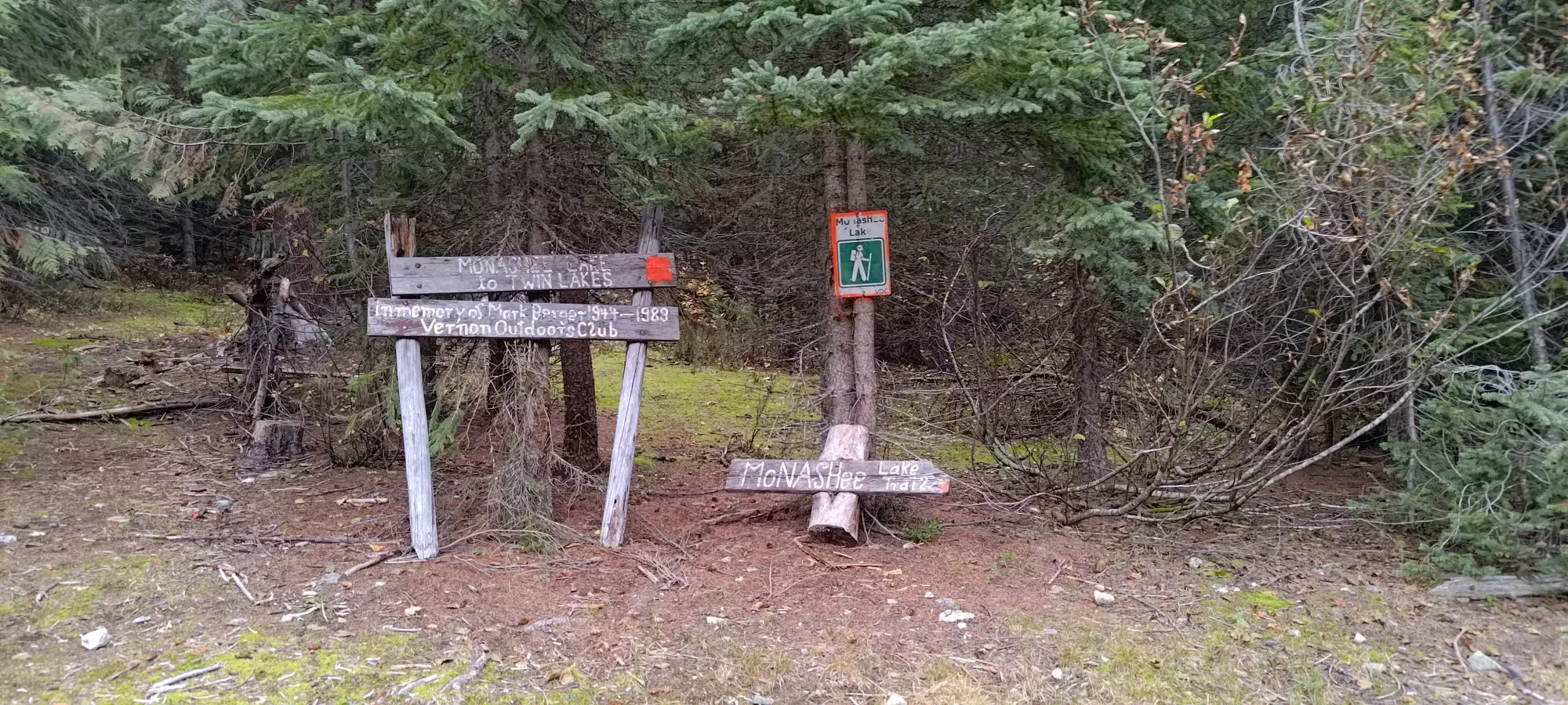
We drove all the way to the trailhead without issue, where there's a large expanse of area to park in. There was one vehicle already there, but otherwise no signs of others around. Not surprising for a remote area with some rain in the forecast. The trailhead was indicated with lots of signs, so we were hoping for a nice trail. We set off at 12:37pm, which seems late, but the stats were about 15km and 1250m gain round-trip by our maps' estimation, so that seemed enough to summit and get onto easy terrain by dark, if nothing else.
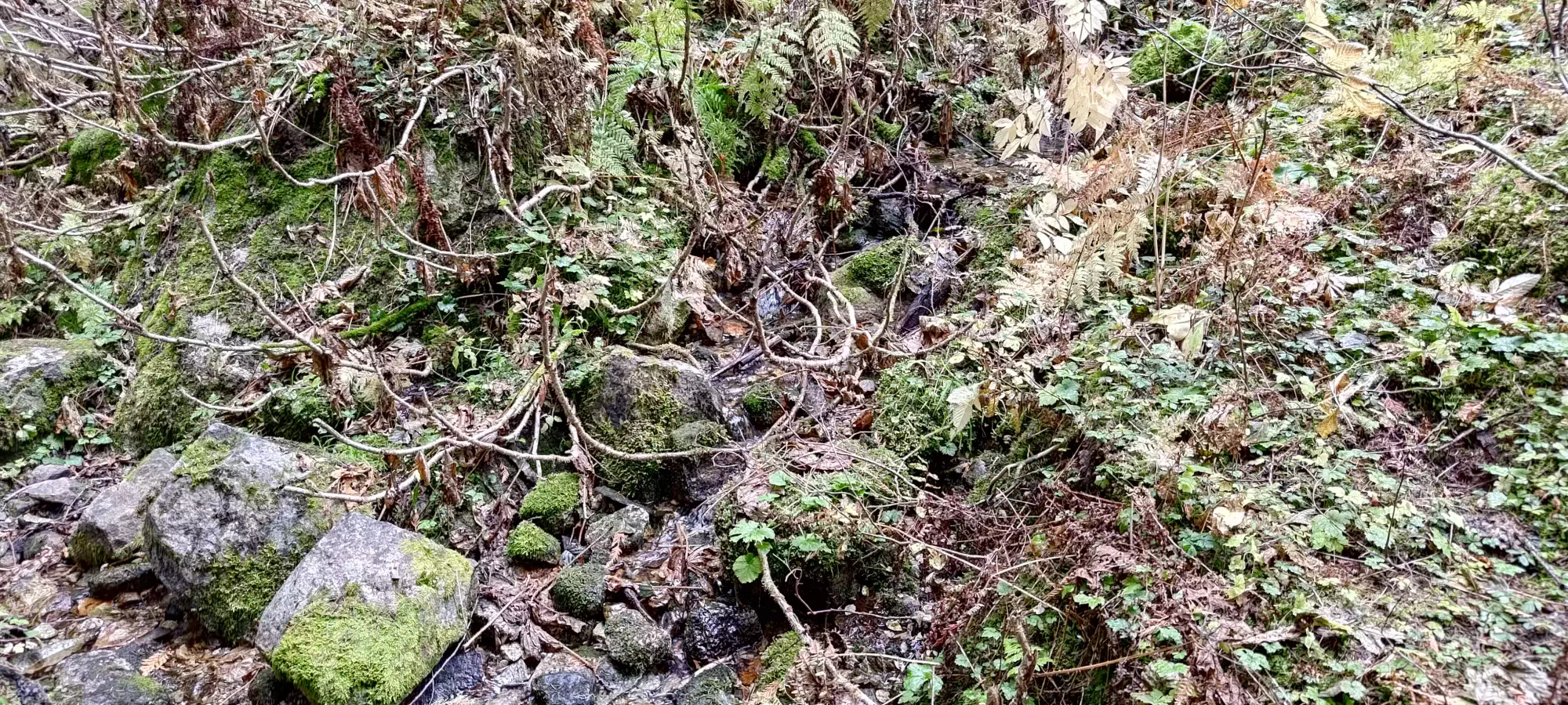
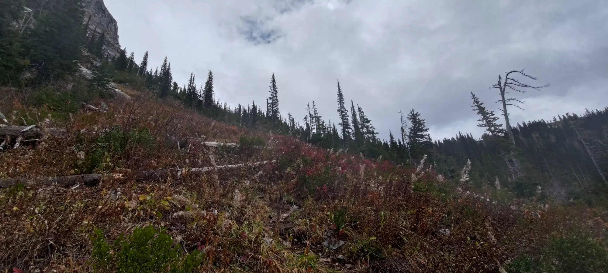
The beginning of the trail starts off on the remnants of the forest road that presumably went further up the valley, but only takes a few minutes to narrow to a single-track hiking trail. We took our time on this mainly due to my using of some brand-new trail runners as my old ones (only bought this August!) had started to wear out, and even when they were new, they didn't do so hot on rock, and we were expecting to scramble. It took me a few tries to find a way to tie em that made me happy, so the first 1.5km/100m of gain as I played with my laces a few times to get them in a comfortable setup. It was here we saw the first of a couple mini-creeks draining through the trail, letting us know water was plentiful for our journey, which I appreciated given I packed only 1L (though I didn't expect to need more, as I usually don't, especially in cooler conditions).
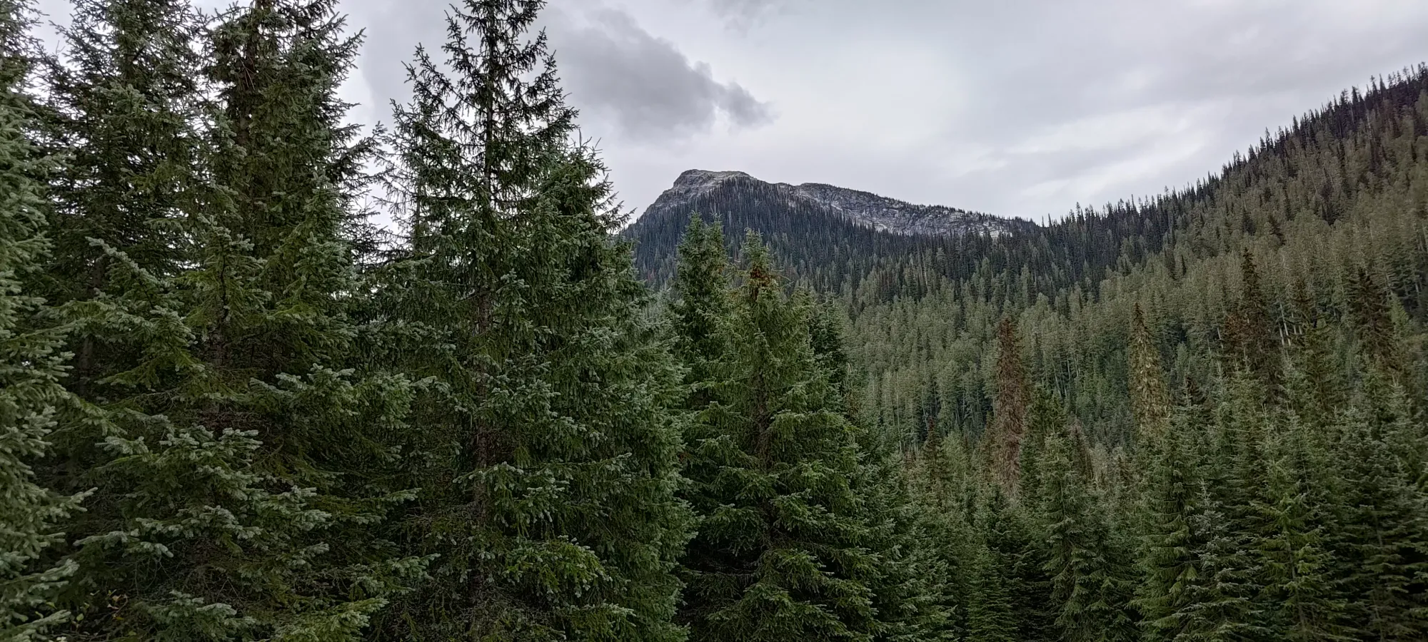
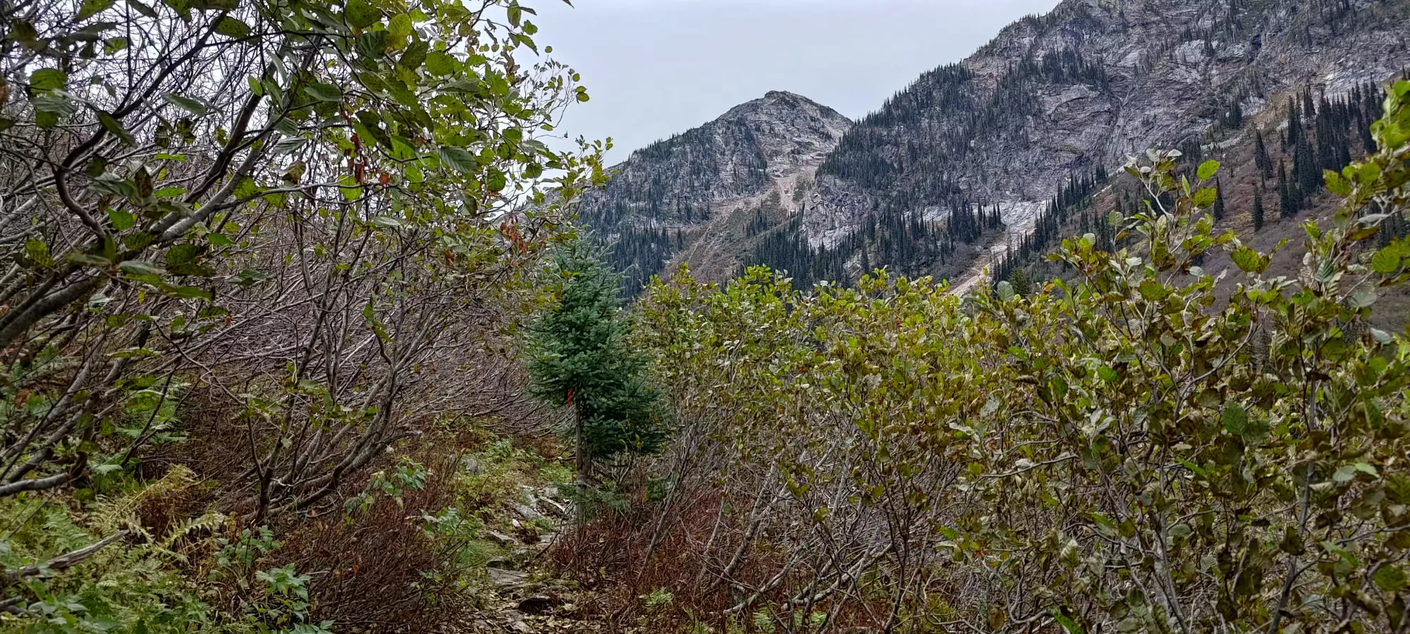
About 10 minutes later, or 2.5km into the trail, we broke out of the old forest and into the open valley, in a section of small, stout trees with a trail that had (thankfully) been cut nicely through the thick bush. Here, we saw a few peaks towering over the valley, but they weren't "our peak", which was obscured by the smaller sub-peaks near Pinnacle Lake.
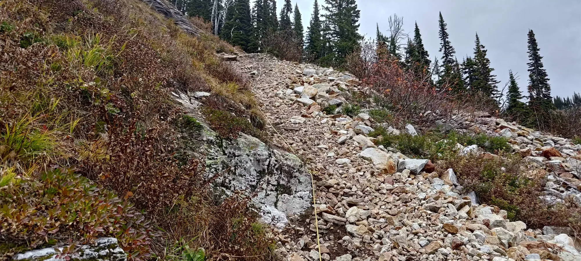
We continued along this gently undulating trail for another 20 minutes, gaining up to 1630m, until we hit the base of a steep rock gully on climber's left, heading in the direction of Mount Severide. Here, we turned up the gully, and started to make some more serious elevation progress.
We had our first break not too long after starting in the gully, though it wasn't too long, as we still had lots of progress to make. The main rocky section didn't actually last too long, probably not more than 100m of elevation.
After that, the trail curved to climber's right and wound through some low brush and a few trees, before depositing us in a similar-looking gully just a bit further over. This section was shorter, though, and after a bit of a loose climb by a few rather unnecessary fixed ropes (the slope wasn't particularly steep, just a little loose), we found ourselves back on a dirt trail heading up and to the right.
Past the ropes, it was about another 20 minutes of hiking up a somewhat steep dirt trail, until we were deposited at the lower (unnamed) lake at just over 2000m elevation. Here, we got our first peek at the Pinnacles (or at least a subset of them and their surrounding sub-summits), and also found the people who were in the other car we saw at the trailhead. Unfortunately, those people had a dog who seemed to be a bit aggressive and unleashed that ran up at us a couple times, but thankfully didn't go further than chasing and aggressive barking+stomping. Leash up your dogs around other people, ffs!
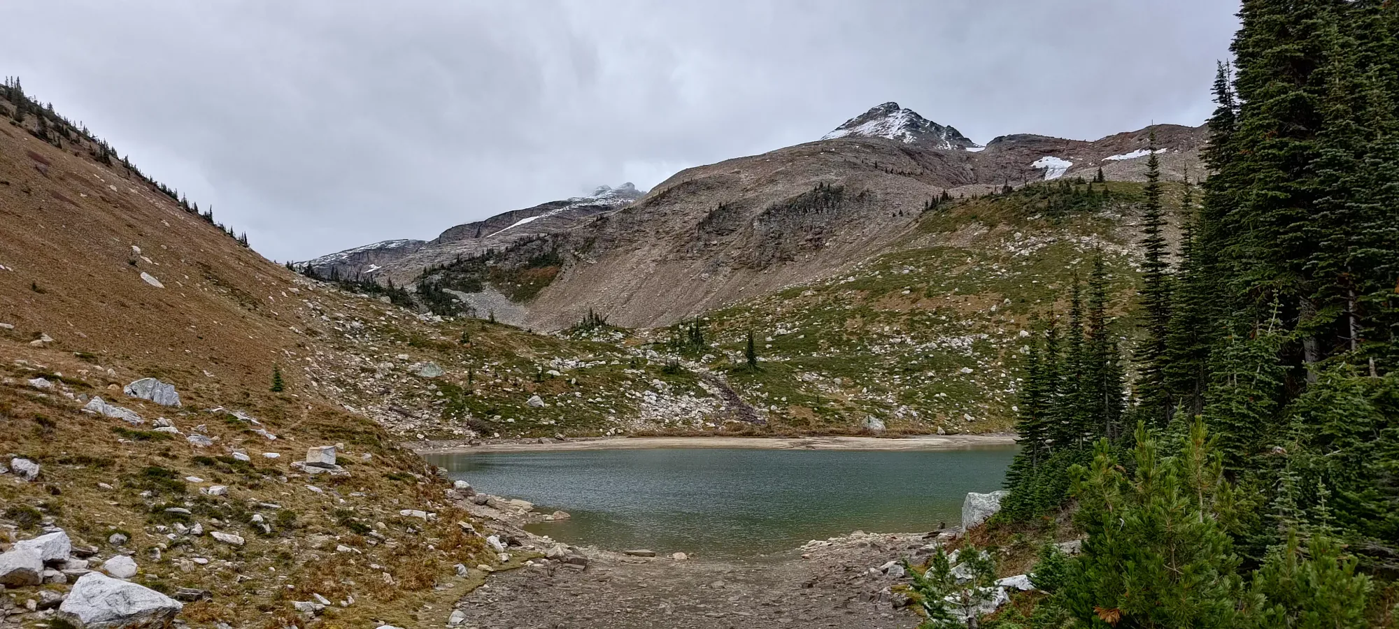
At the lake, we decided to don our shells, since the wind was picking up a bit, and the temperature was of course also lower being ~700m higher than the trailhead. From there, the trail seemed to die quite a bit, and we had to rely on our maps a bit more. We sidehilled along the NE shores of the lake, and gained about 100m in open terrain to the next lake. Just before we topped the ridge before the lake, we decided to eat our lunch, since the wind was basically non-existent, and we figured it wasn't going to last in the alpine. After a 15-minute break, we topped the ridge out, and arrived at the lake at the base of the "scramble".


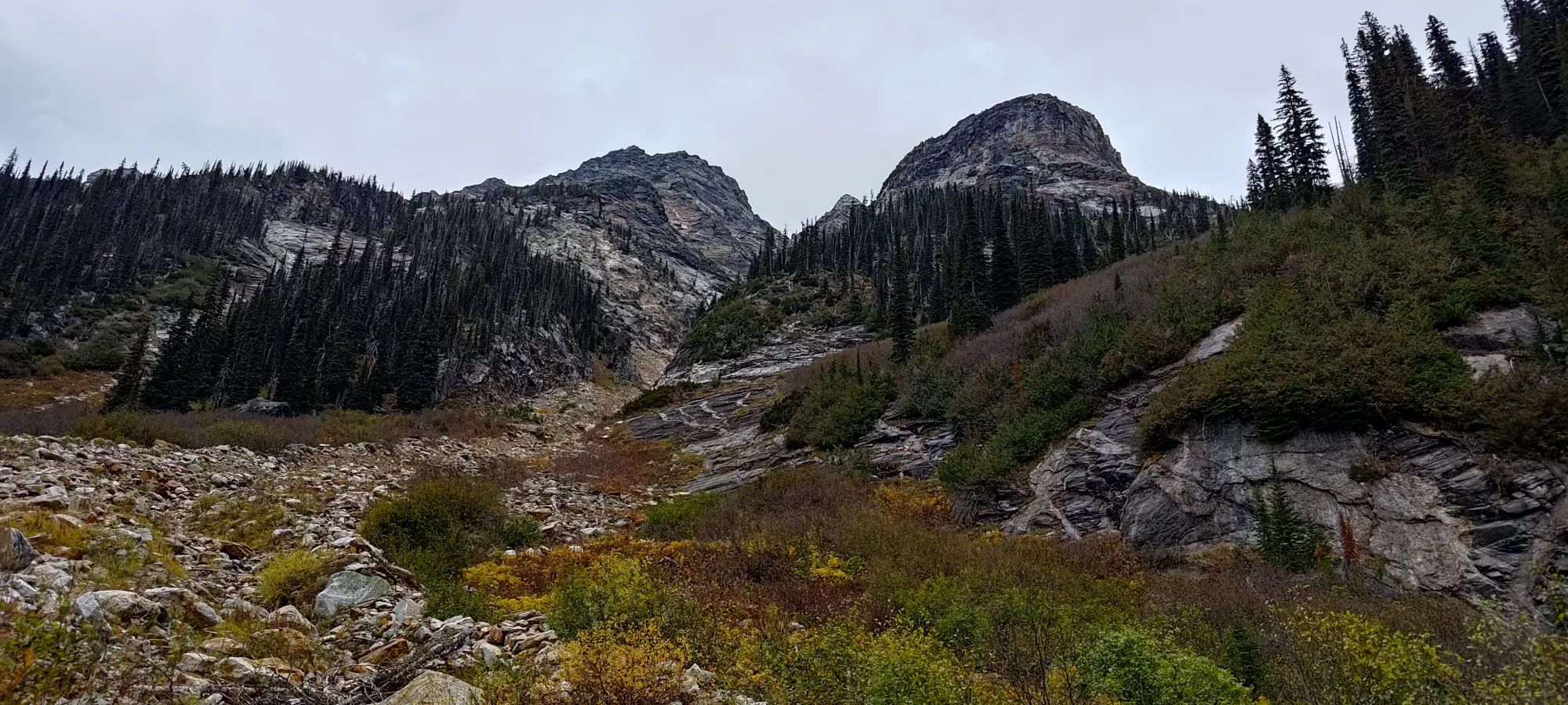
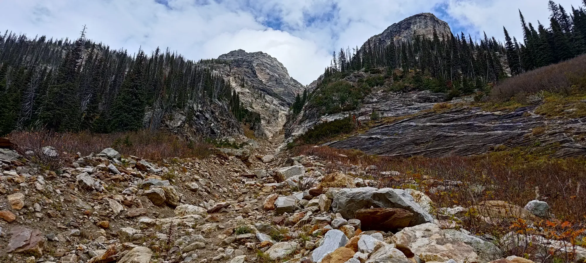
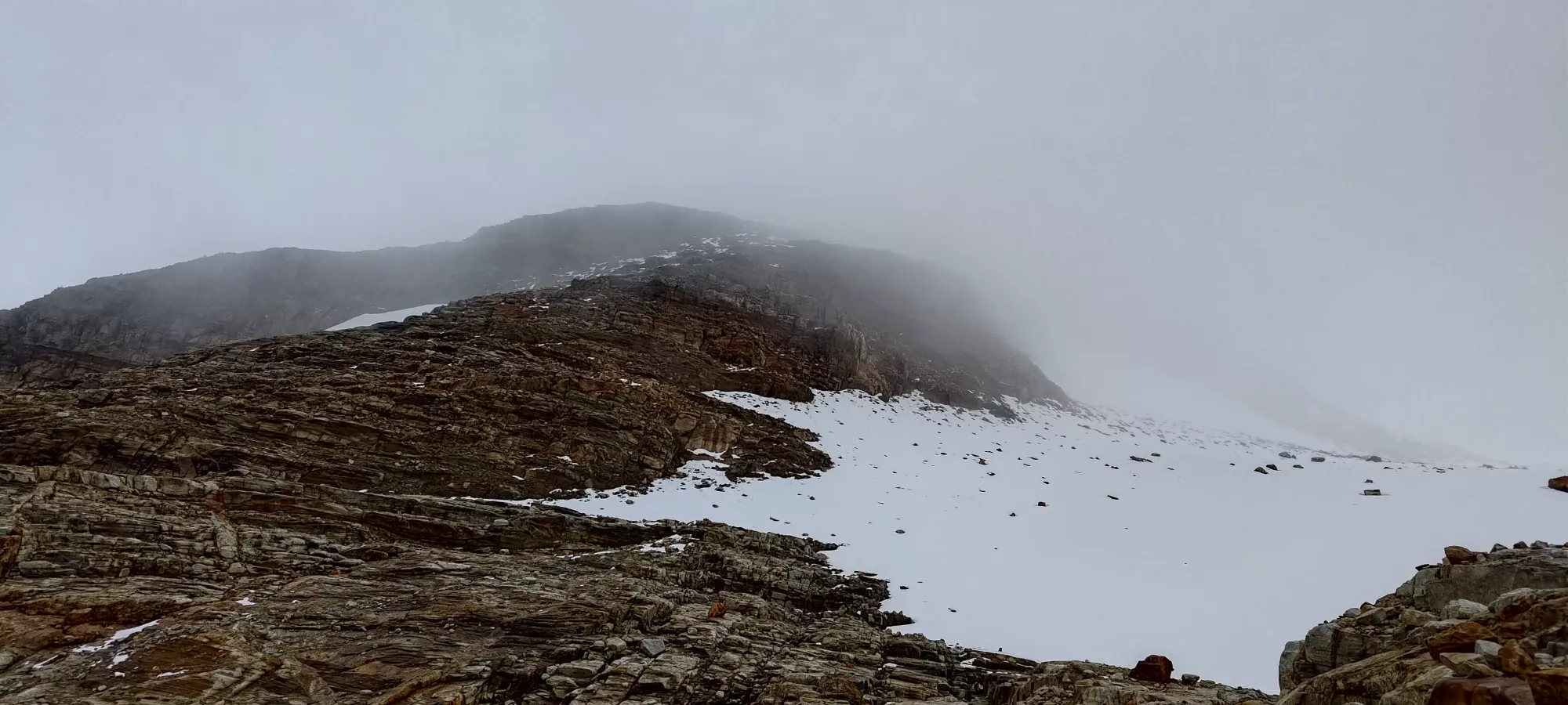
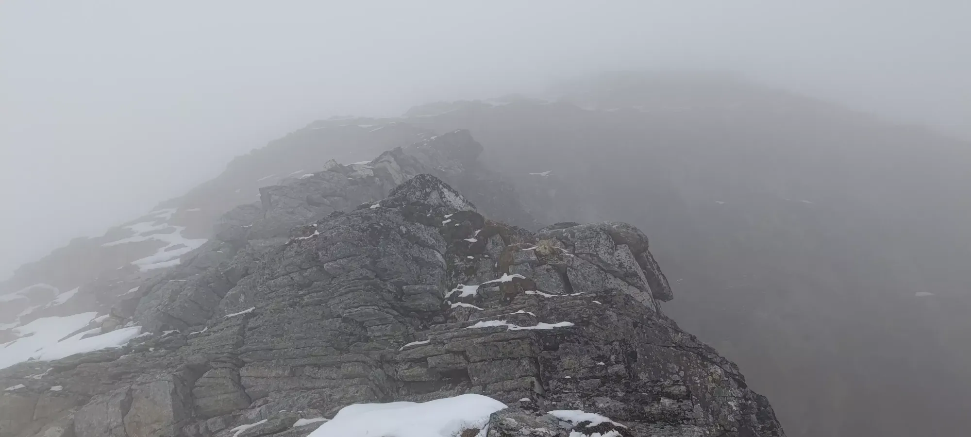
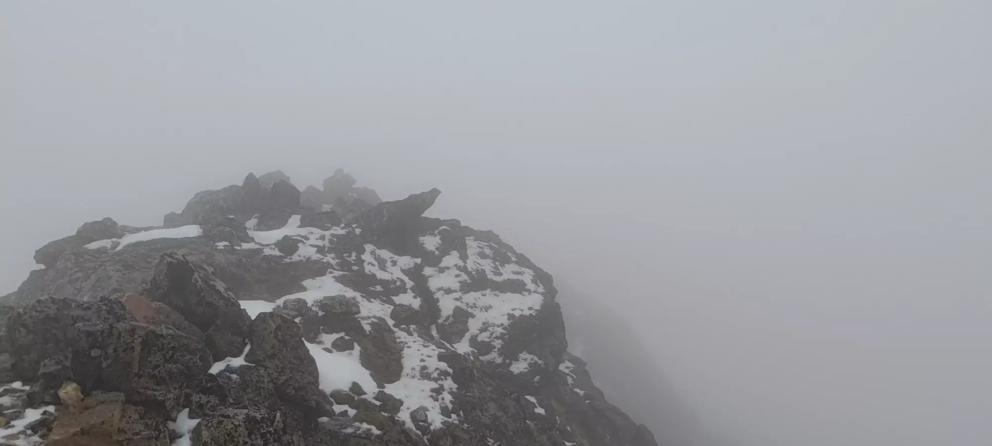
From the lakes, the terrain turned very much alpine, and we saw the last of the trees for quite some time. The first couple hundred metres of elevation were honestly barely a scramble, and were largely just "walking up ledges". The lighter rock was pretty grippy, but some of the darker slabs were somewhat slippery, even when dry. We didn't encounter those too often, though, so it was pretty easy sailing up past the first ridge below the clouds in the above picture.
After topping that out, we had more easy, ledgy terrain beside a small glacier (or at least "piece of ice with snow on top", we couldn't confirm any flow or cracks to show it is a true glacier. This was about 3 hours in, or at about 2275m elevation. Here, we turned to climber's left to gain onto the most prominent part of the ridge, as it would allow for both more gentle slopes and the highest chance of avoiding snow, since it would be the least shaded area. This proved largely successful, and we made good progress for a while longer before we started hitting unavoidable snow.
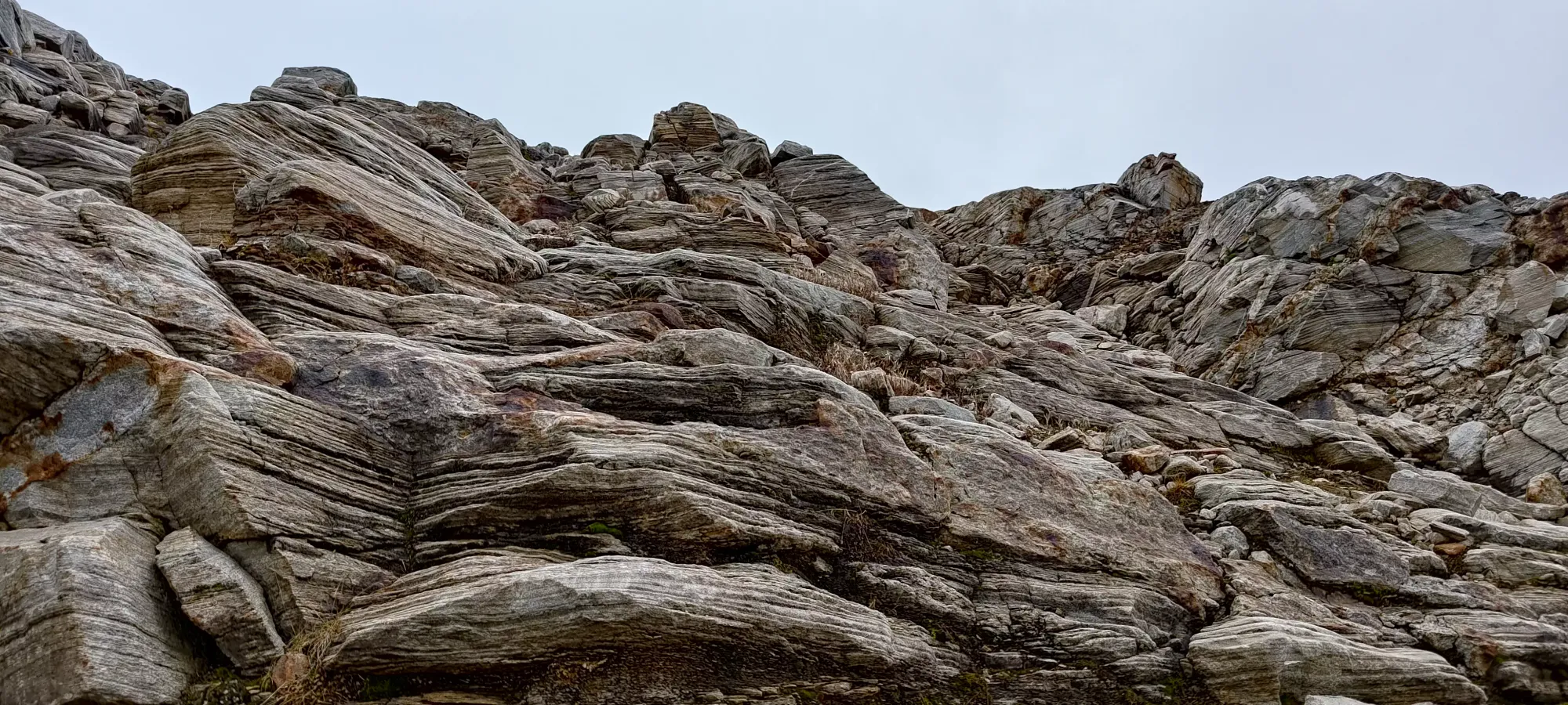
We went up more nice ledges on this ridge until about 2370m, where we started hitting snow patches that were either unavoidable, or "better to just walk on than to avoid". However, they weren't really large obstacles to movement, more so just a nuisance since their thin nature meant one had to step carefully to avoid punching through at an inopportune moment. This section was not too long, though, and quickly turned up to climber's left and became more of a jagged summit ridge instead of the ledgy slopes we'd been on to that point.
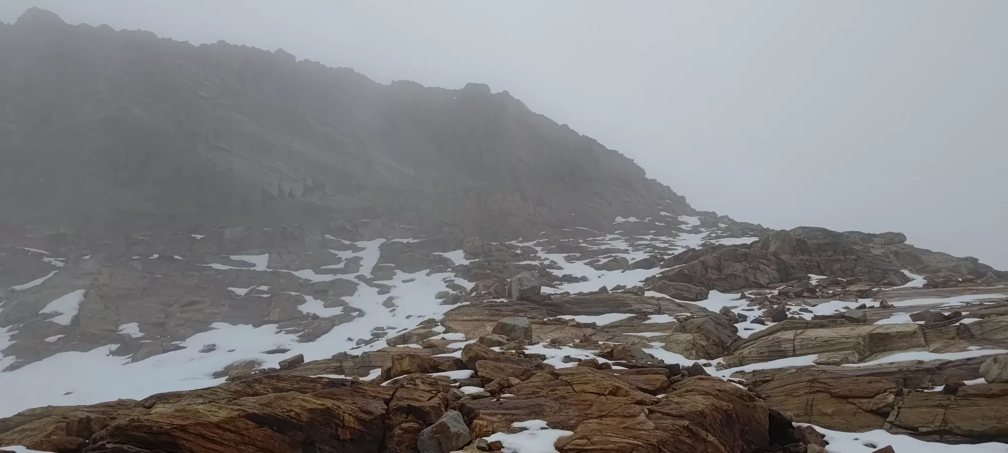
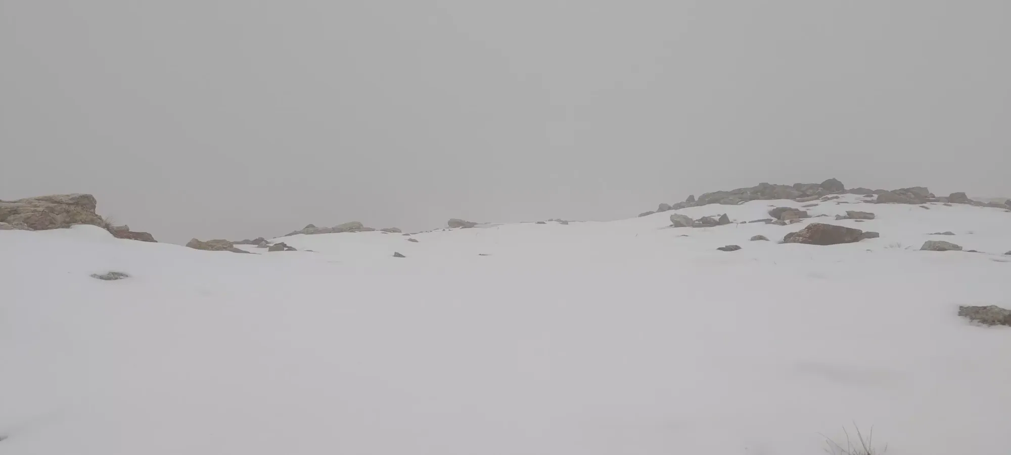
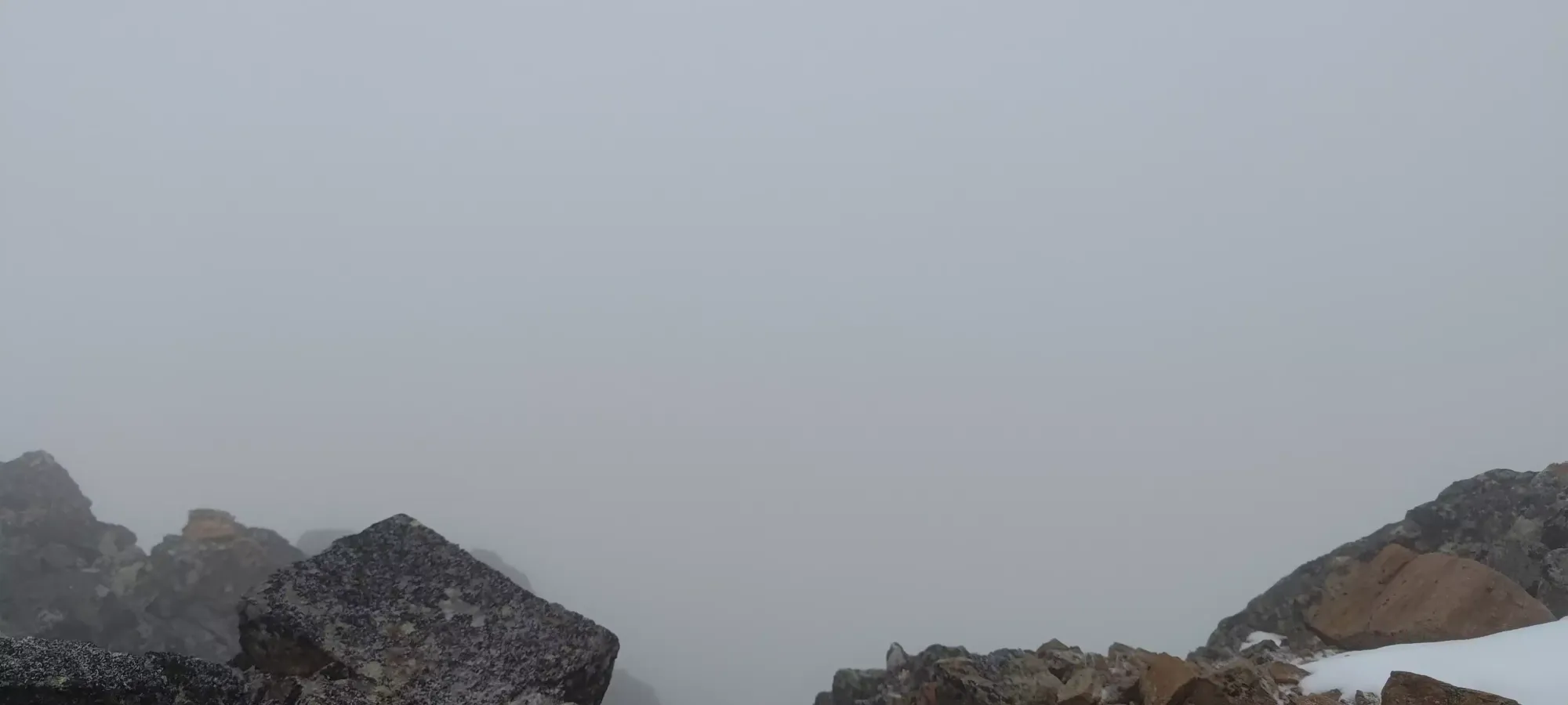
Above this point, the terrain alternated between more ledges, steep but walkable snow, and some class 2/3 scrambling. The visibility on the ridge was piss-poor, 3-10m depending on "the shape of the rocks around you". We started slowing down around this point due to that visibility. At 4:15pm (about 3h 40m into the day) we hit the first false summit, which was small rocky protrusion above a flatter, snowy plateau. We spent a few minutes here looking around for the way to go, as the visibility did not allow us to see anything around us, but after looking over the edge of the abyss on the false summit, we discerned that the path must be to climber's left, which sure enough it was, and we continued on.
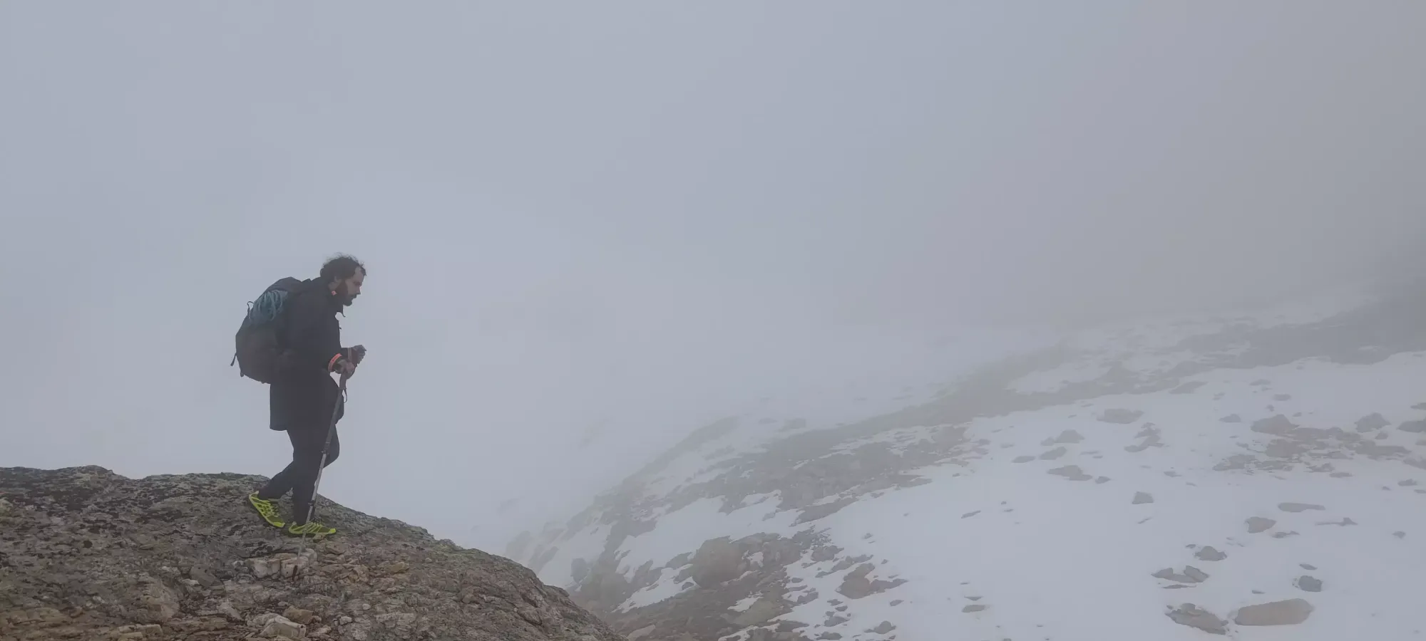
After that, we turned a little too far to climber's left, and corrected course back onto the ridge, then walked a wide col to the next part of the scramble, a much sharper ridge with more exposed rock that looked more class 3-4 than the easy terrain before.
That ridge was pretty fun, and brought us up to another false summit, which we again had to spend a couple minutes fumbling around to find the way forward at. The direct connection to the col was not good here, but rather a fairly steep drop, so we instead had to curve down+around on some steep and narrow ledges to make our way across. This was the first "properly exposed" section of the day.
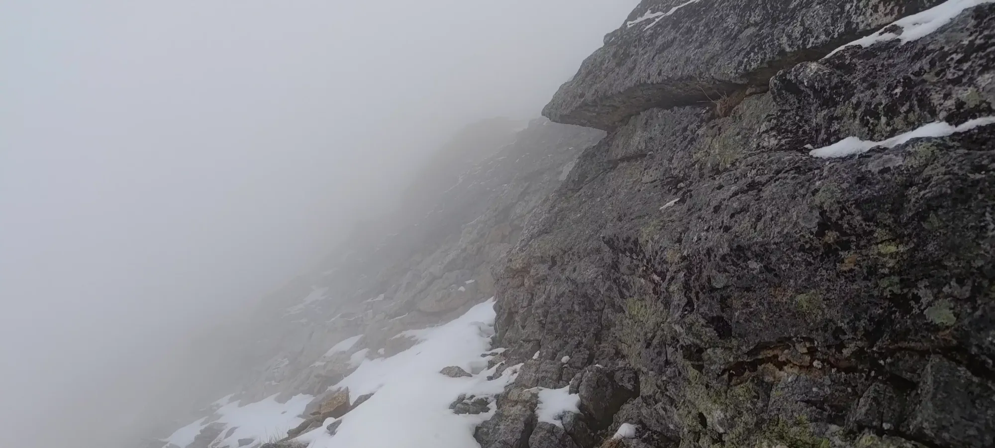
Past this false summit, the scrambling got harder once again. Aside from the steep, thin traverse, we had a short slabby section where the holds were more difficult, and falling would likely mean a long tumble, a short section where we got fully on-top of the ridge and had to turn climber's left past a gully going down the far side that Logan got stymied by for a few minutes (but I found to be "just normal, difficult scrambling"), and even one momentum-y move past that which I actually failed and fell back trying (though it wasn't an exposed one, which is why I tried it). Even just the regular ledges, with snow, became more challenging, and made this feel like a miniature version of Assiniboine (Logan even mentioned earlier that the view of the lower summits from the lakes somewhat reminded him of it). We got very close to our hard turnaround time, and just about right on it at 5:20pm we got to the summit.
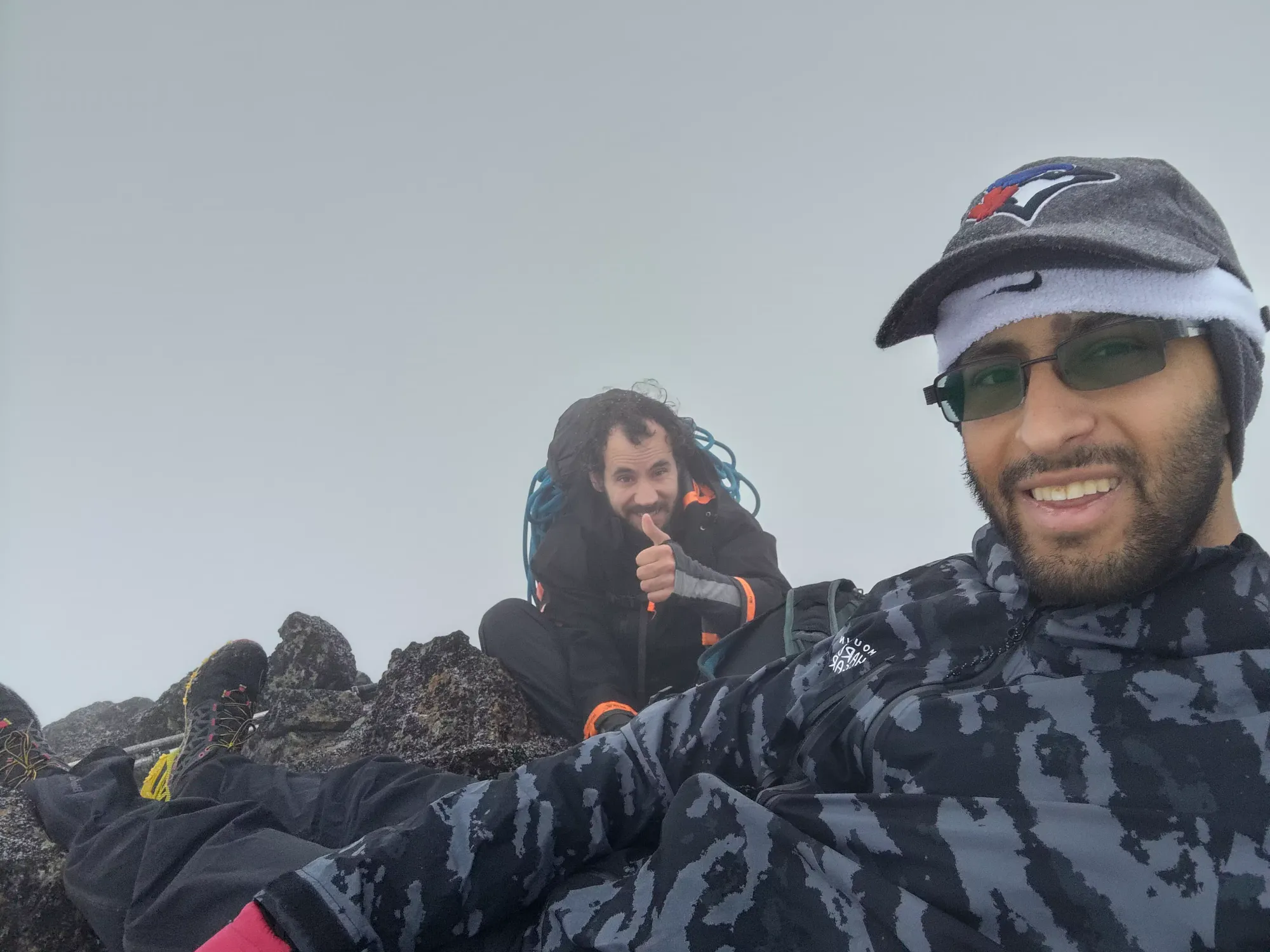

After a short photo session, it was time to head down, as we had to push relatively hard to get down safely, but also be below the hard ridge terrain before dark. Given the cloud cover and ensuing darkness, I didn't take any more photos, so I hope you like big walls of text!
For some reason, if I had to guess, it was the late-night post-concert pizza that I had right before bed (not much open that late in Penticton, and we got screwed by Google Maps chasing restaurants that weren't actually open, so the remaining options for not-fast-food were too full with concert traffic by the time we got to them), I started feeling pretty "not great" shortly after we started descending. This was quite annoying, and slowed us down by maybe 10 minutes (which were very precious minutes at this point) as I had to take a few rest breaks to calm my stomach down. We started explicitly managing water and the like in case things developed further, but thankfully after the ridge I magically felt better again 🤷.
The ridge itself was actually not too bad of a downclimb (aside from the above). We decided to put our spikes on at the summit, and they definitely helped, enough to switch our strategy to actually aim for snow rather than avoid it. We got past all the hard obstacles either with bypasses or just "effective downclimbing", and never needed the rope we brought in case the downclimb got spicy with the snow. It took a bit less than an hour to make our way to the end of the scrambly ridge and get into the easier ledgy terrain. Shortly after we started making our way down that terrain, we put our headlamps on to get a better view of the terrain, as it was getting harder to discern fine details and figure out the slope angle of snow patches.
Near the end of the ridge, it had also started to snow on us, and that turned into rain soon after we got onto the ledgy stuff. Thankfully, we were prepared (I even had rain pants with me) for that, and it also wasn't very powerful rain, so the effect was just "rocks were a bit more slippery", and nothing terrible. We continued down past the point where we turned onto the main ridge on the way up (my watch started tracking poorly on the way down, and we didn't notice in the poor visibility that we'd gone past the original point where we turned skier's left onto the face proper), and so had to regain some elevation along some minor cliff bands, but still managed to do so largely with just walking and a couple class 2 moves.
From there, we continued further to skier's left to the old glacier we saw on the way up, and made the decision to descend it for a bit, since the snow travel was so efficient. We saw faint old tracks, and given we could see the overall depth was only a few metres, decided even IF there were crevasses (which we doubted) the risk was minimal, and that worked out quite nicely, even if it was a bit shorter than we'd hoped for.
The rest of the descent was pretty uneventful, with mostly just ledge walking and a few small looser gullies (the lack of light, and more so the still-dense fog made retracing our steps exactly a bit of a lost cause) on the way down towards the lake. Once we got onto gentler terrain, we took our spikes off (they actually were quite nice for providing extra grip on the wet slabby rocks), and made it to the lake at about 8:20pm.
From there, it was a bit of slow routefinding as we cross-referenced my watch (which we'd lost faith in at this point, I think when you're in dense clouds with lots of rocks the low-power antenna can't reliably get signal, at least without some power mode tweaking I seemingly need to do), my phone (which WAS tracking accurately), and Logan's GPS to figure out where we were going in the very same-y moraine terrain between the two lakes. This was probably the most inefficient section with respect to elevation per minute, as it took about 50 to drop the 100m or so between the lakes.
Thankfully, after this point, there was a trail again, and things picked up quite a bit. It took about 1.5 hours to get from the lower lake back to the car. The upper dirt path was a bit slippery, and actually caused us both to slip and fall a couple times (somehow tearing my rain pants in the process. When I said it was like Assiniboine, that was NOT a parallel I was hoping to draw!!!), but it was safe terrain and wasn't really impactful. The gully was surprisingly easy to descend, as I was expecting it to be more slippery than it turned out to be, with the rocks+dirt managing to hold together enough to provide grip instead of just slipping under your feet.
Once we got into the valley, it was less steep, and the walk back through the new and old growth sections went quite easily, although I swear we took different trails than on the way in, as we had to slap a few more bushes than I remembered from the way in.
We ended up at the car at nearly 11pm, which was later than we'd anticipated (we expected the dark, but not quite that late), as the foggy routefinding slowed us down somewhat, but overall we were quite satisfied to have got out before it was super late, and we managed to find somewhere in Kelowna to grab some food before getting back to our motel in Penticton, showering, and promptly crashing to get some sleep before the long drive back to the coast on Sunday.
Overall, this was actually quite a fun objective, and I'd recommend it. You can camp at the lakes pretty comfortably and explore the other peaks in the area, or just wait for long summer days and day-trip them too, or I guess like us just go up in marginal conditions in shoulder season and slog through it with brute force 😅. Just make sure to wait until at least the 15th of November for whatever you're doing, as the bridge is going to be out until then. Honestly, for an ultra, this is pretty easy going, so go get it if you're nearby!
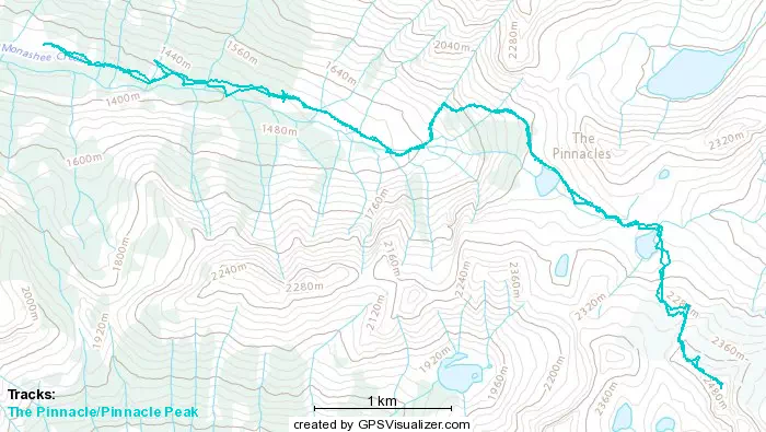
GPX Track + Map