Mount Assiniboine - September 11 2023
The "Matterhorn of the Rockies", an excellent alpine climb/scramble (depends on your abilities/comfort), though with tricky access+conditions.

Assiniboine Group, Mount Assiniboine Provincial Park, British Columbia
3618m
With our Rockies trip winding down, Logan and I were looking for a bigger objective to really "make the trip". We had originally hoped to get Edith Cavell to fill this role, but snow scared us off of that (we got this trip booked a bit too last-minute and close to the end of the season). That was actually going to be during-the-week, though, and the whole time we had been eyeing Assiniboine as the capstone. I had separately had the intent to meet up with Charles, who I hadn't climbed with since Wedge, and he was also interested in Assiniboine, so a plan was born. Logan and I would stay up as late as possible into Sunday, sleep during the day, and we'd all meet up after Charles was done work that evening, and get a start super early Monday morning, and try to do Assiniboine in one big push.
This was definitely an ambitious goal, for a variety of reasons. First was it was rather late in the season, and conditions were unknown at the time we left, we knew it had snowed a bit in the last week or two, but that it was also sunny and warm since then, and there may have been some melt. Aside from that, most people make a multi-day out of the trip, leveraging the Hind Hut, but we were planning to day-trip it, albeit with a very early start. We also were planning to take the most technical and most sketchy access from the south along Assiniboine Creek, which while popular amongst climbers, is not nearly as technically simple as the (longer) approaches from Alberta or Mitchell River, and also involves driving on an FSR used by an active mine, and a deactivated spur with unmaintained bridges. Last but not least, on a personal level, this was my most elevation gain, longest distance, most peaks in a row (the Thursday and Friday before I'd done a peak each), and most technical peak since I got injured, so it was gonna be a big event from the get-go. Aside from all that, the North Ridge route we were planning goes at a 5.5 grade, and although we expected to solo it given beta from other climbers whose scrambling abilities we could compare ourselves against, that is still "a real climb".
After a lot of anime binging through Saturday night/Sunday morning, a fairly-successful sleep during the day, and a small mix-up with time zones when planning our meet-up, Charles met up with us in Golden, and we set out to the trailhead at around 11pm. The drive from there was pretty chill down Highway 95, with the exception of one seemingly drunk or otherwise terrible driver we had to pass, and just as chill on Highway 93 once we got to Radium. After that, it was around 40km of driving down the wide, mainline FSRs that are Settler's Road, the Cross River FSR, and the Mitchell River FSR. Finally, we exited that onto the final spur, going over a tight drainage ditch to get onto it from the mainline, then along a fairly easy road with one small washout (most crossovers should be okay, probably not sedans though). We had a couple bridges to cross, but thankfully they looked decent enough, and we had a much larger van ahead that didn't fall through to give us some reassurances.
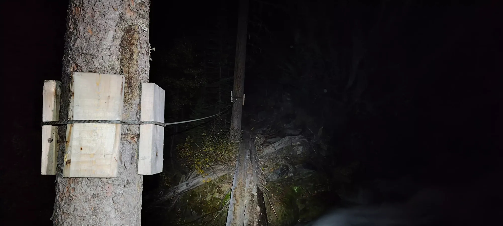
After parking, we geared up, unpacked our chicken wire and did up some porcupine protection for our brake+fuel lines (apparently a concern here), talked to some people who were coming down from the mountain who said there was a good amount of snow, but the climb still went without axes/crampons (a bad but then good omen), and eventually got moving at 1:55am, unfortunately a good deal later than we'd hoped (we were aiming for 12:30, but had enough leeway in the plan for this to be acceptable).
The first 10 minutes were pretty chill, although I realised that my attempt to do the entire approach in mountaineering boots was not going to fly, so I stopped to change into my approach shoes, only to discover that somehow I managed to explicitly remove them from their shelf and comment on them, but not actually insert them into my pack. That'd have been annoying to discover in the scramble 10+km later, but thankfully I had time to dash back to the car and slap my trail runners on, so I did that, and we were back on track in 15 minutes. Disaster averted 😅.
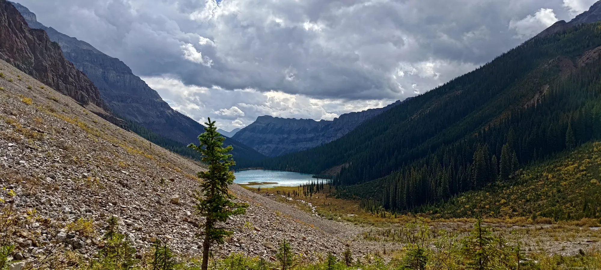
From the trailhead to Assiniboine Lake, the trail was actually very nicely maintained; we were surprised just how well it was kept up for a climber's access trail. Eventually, we realised/accepted that it must be kept up for hikers to access the lakes, as there's just no way a climber's route was this nice, especially given how it deteriorates after the lakes. It took us (netting out the time wasted by me at the beginning) about 2 hours to hit the lakes, and that was going at a very slow, measured pace to conserve energy. If you're camping, a similar or better pace can be achieved since you don't need energy for the climb. This took us up about 400m of elevation, and about 7.5km, so not much elevation, but a ton of the distance. We were noticing this the whole way, and kept hoping it would get steeper, knowing we'd just have to pay the price later.
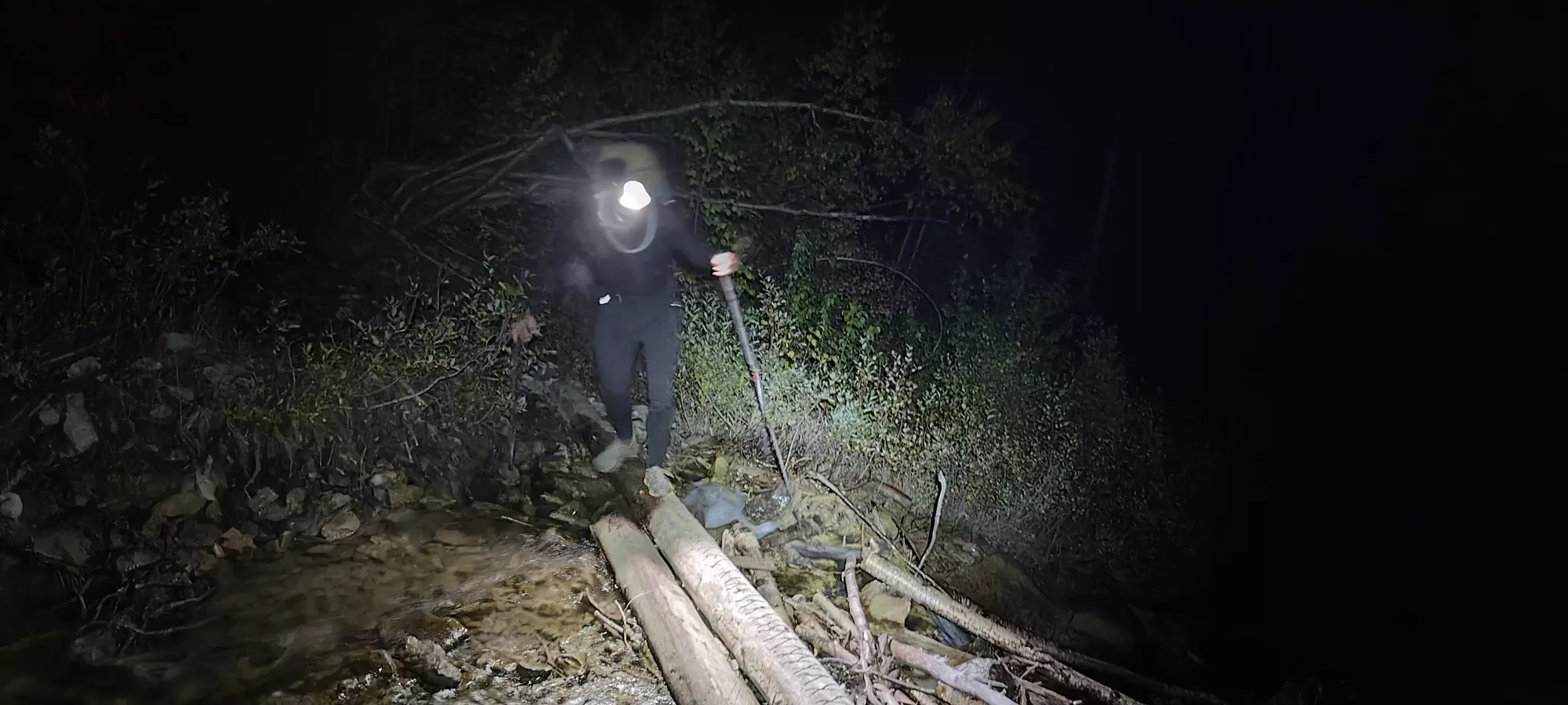
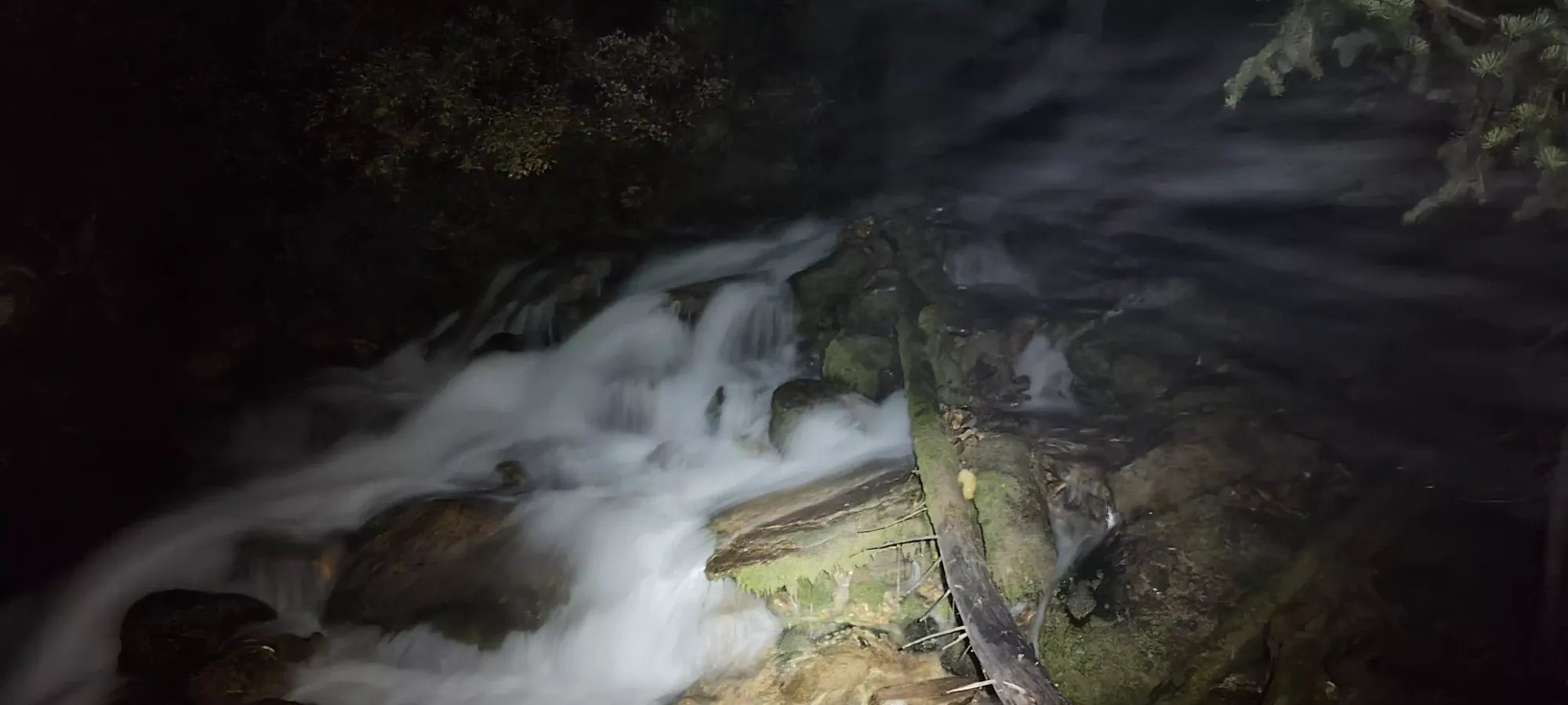
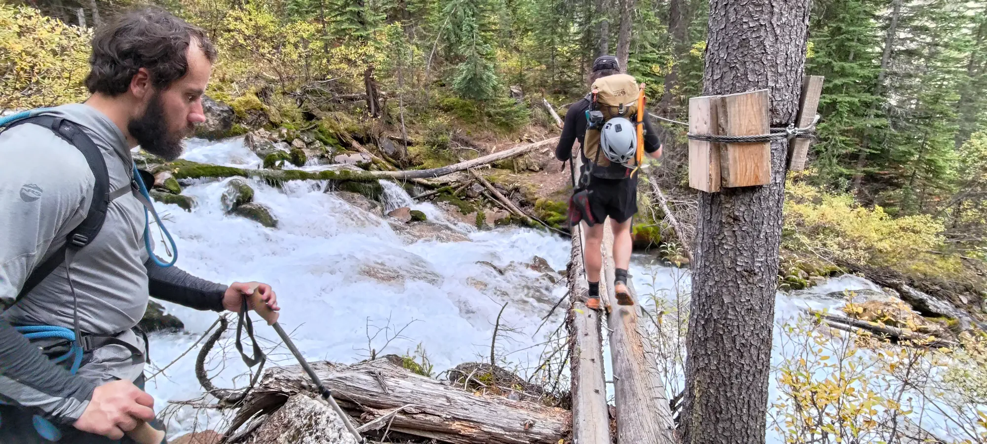
There were nearly a dozen logs to cross, although only a few over active water flow, and the longest had a hand-cable to provide safety. There were also a few muddy spots, but nothing you couldn't avoid whilst still wearing shoes. Otherwise, it was smooth sailing to the bottom of the lake.

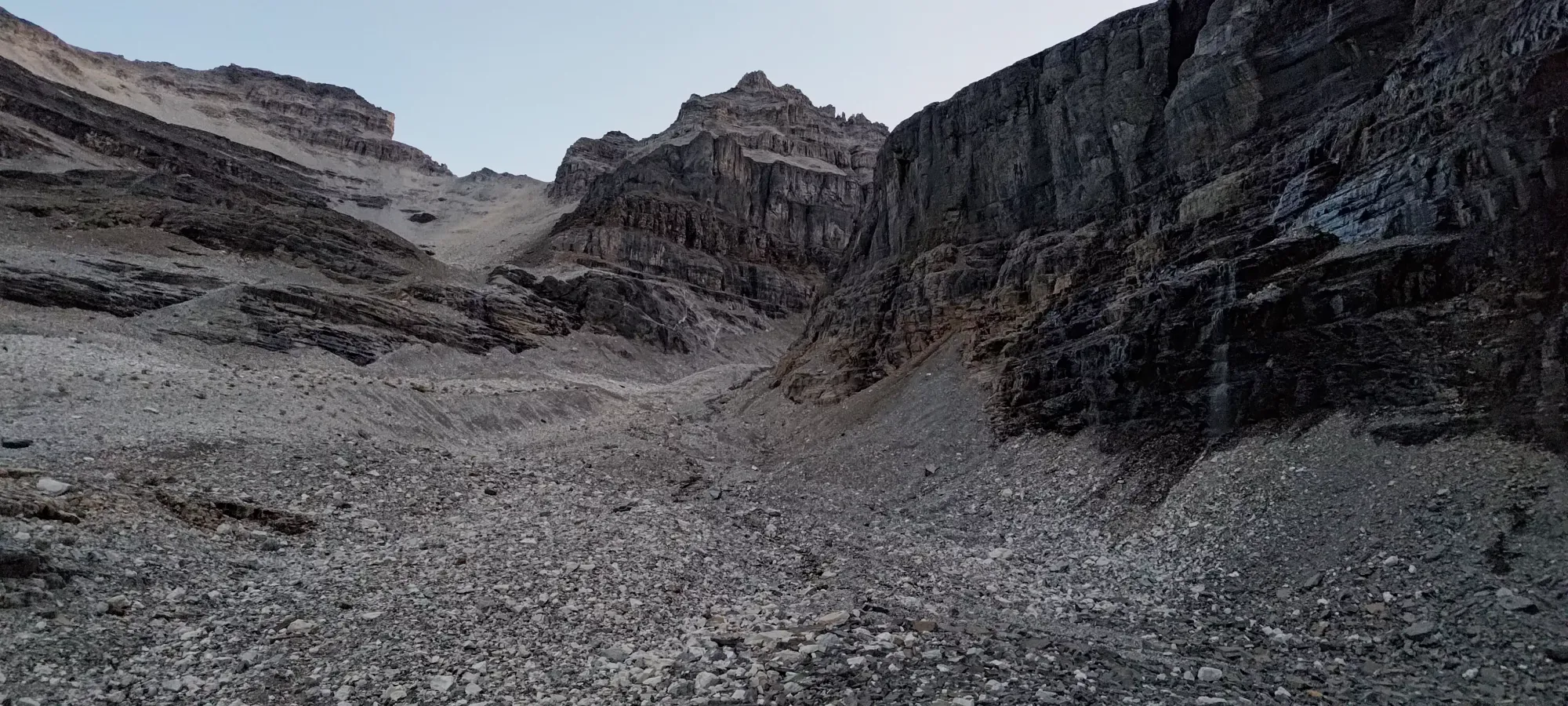
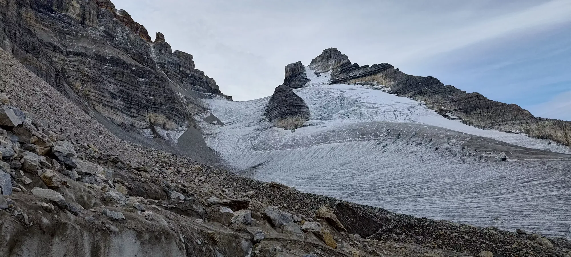
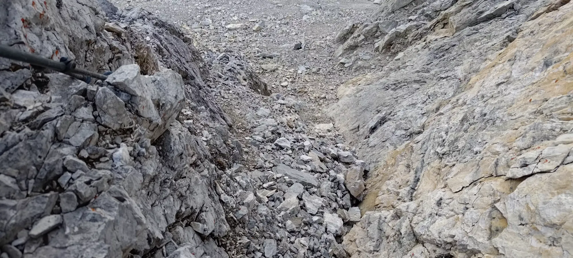
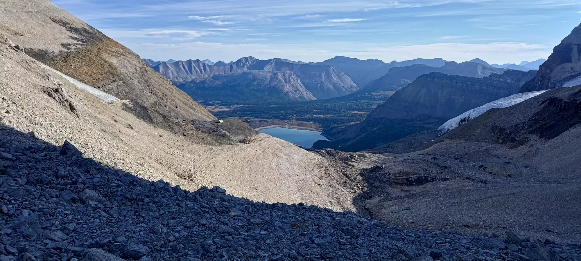
Once you arrive at the lake, the trail kinda deteriorates a bit. Not quite as much as we thought at this point in the dark, but it does deteriorate. Most of the lake was spent walking on "kinda trail" in a talus field, with thankful reprieves where the rocks turned super thin and flat, making walking much smoother and stable. After this, though, the dark was definitely a detriment to our ability to navigate efficiently. We followed too-high to climber's right, I think, and sidehilled on moraine longer than we should have just above the lake, when instead there's a less rocky plain from higher water-flow times that extends for a bit longer. After that point, it's a long, unending grind up the rocky moraine. There IS a decent trail put into the rocks, but we had issues staying on it, and instead mostly oscillated between a couple ribs in the slope, trying to find the most stable rocks to grunt up. This was a 3-hour process involving some sketchy traverses and re-alignments, culminating in us hitting the toe of the glacier after sunrise, which was nice for navigation, but less nice for "giving us lots of time", given the people we saw on the way up said their hut->summit->hut time was 13 hours the day before.

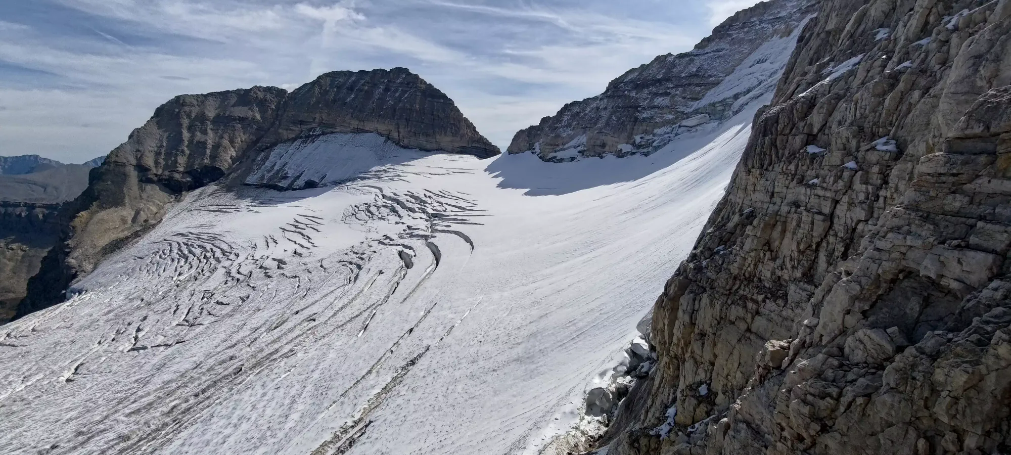
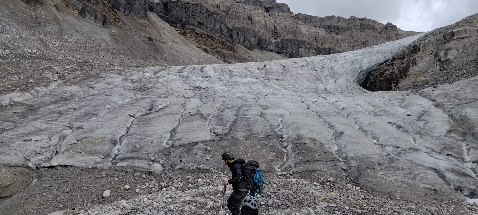
At the glacier, we saw pretty bare but still soft glacier conditions, and a good track to follow from previous climbers, along with a "not that steep" grade, so we decided to get our gear on, but leave ourselves unroped, as fall risk was minimal, and since it was daylight, our visibility wasn't compromised. We were planning to rope up in the dark, but accidentally avoided that hassle. We met another party on the glacier who confirmed the "snowy but still goes" status of the N Ridge, which was reassuring.
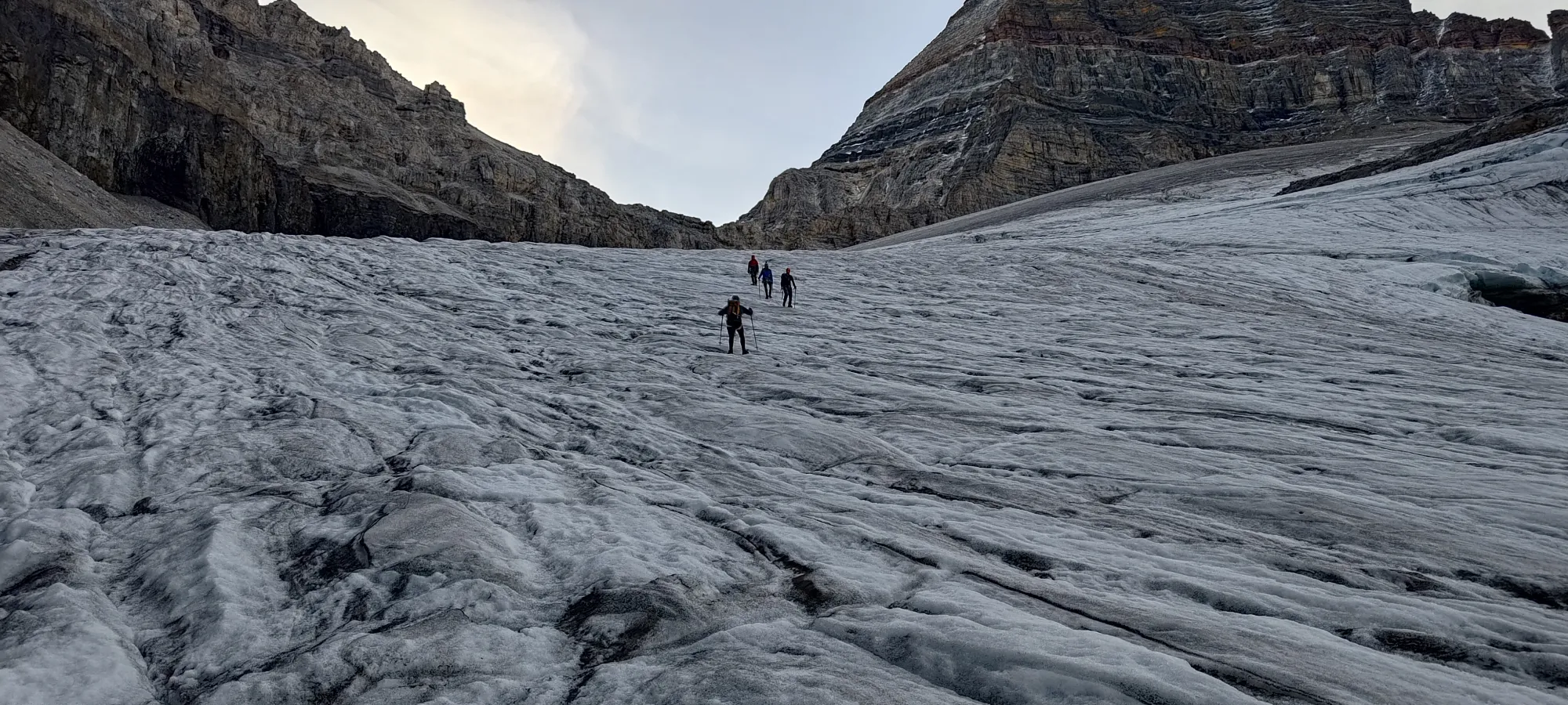
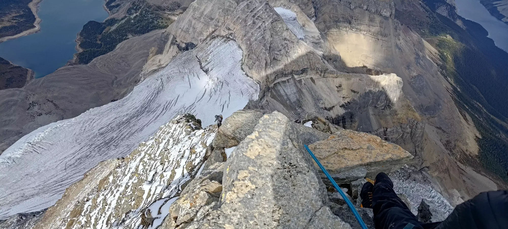
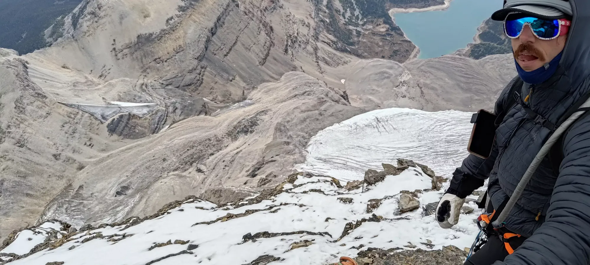
The last 50m of elevation or so on the glacier were the spicier section. Once you crest the small ridge on the ice you can see above, there are more large crevasses, though we were able to navigate around them without needing to rappel or use sketchy bridges. We got off the glacier at about 2870m, where we stashed our glacier gear, boots, and crampons+axes, since we had no more glaciers to cross, and our beta was that the route up went without snow climbing gear.
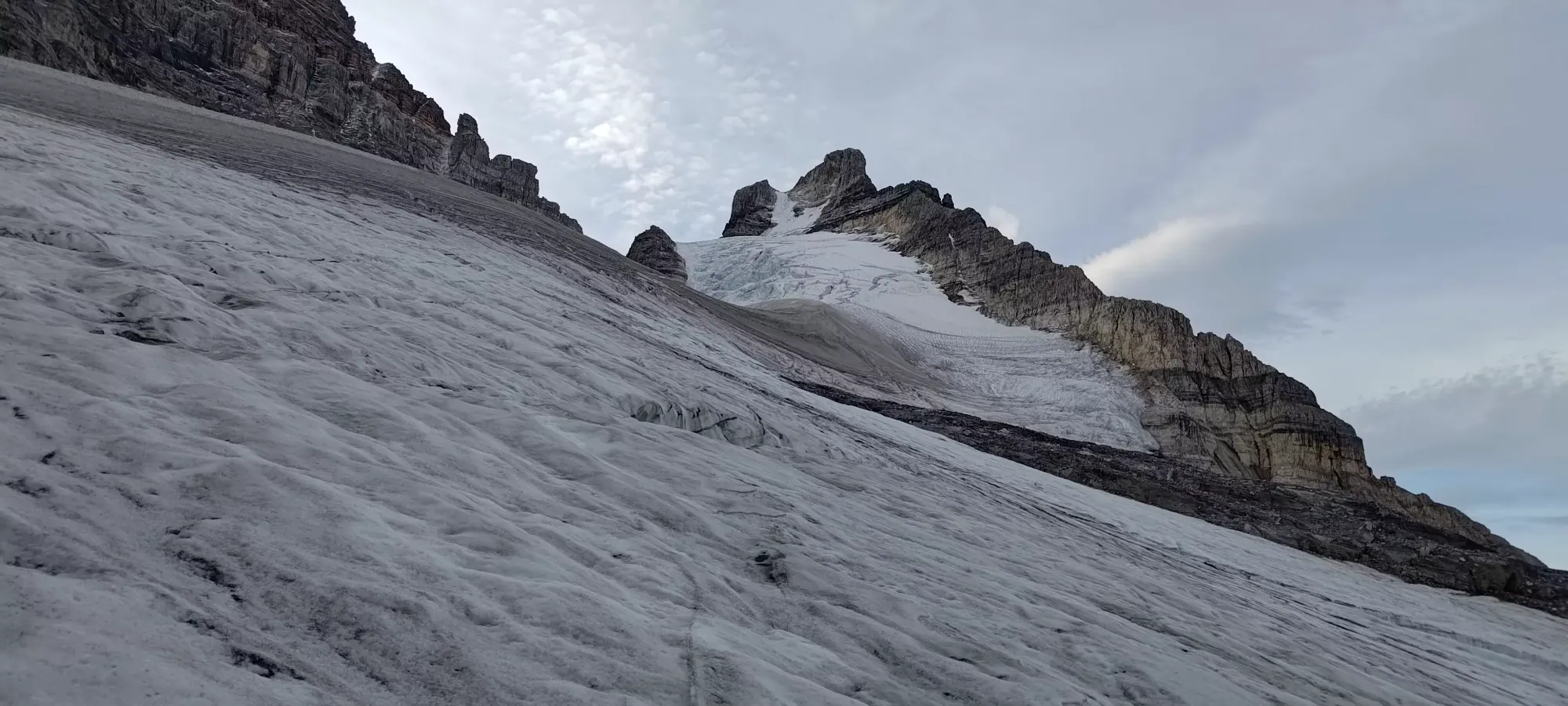


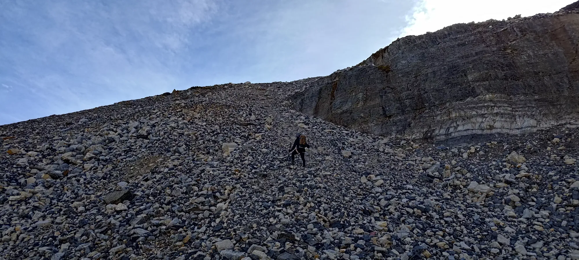
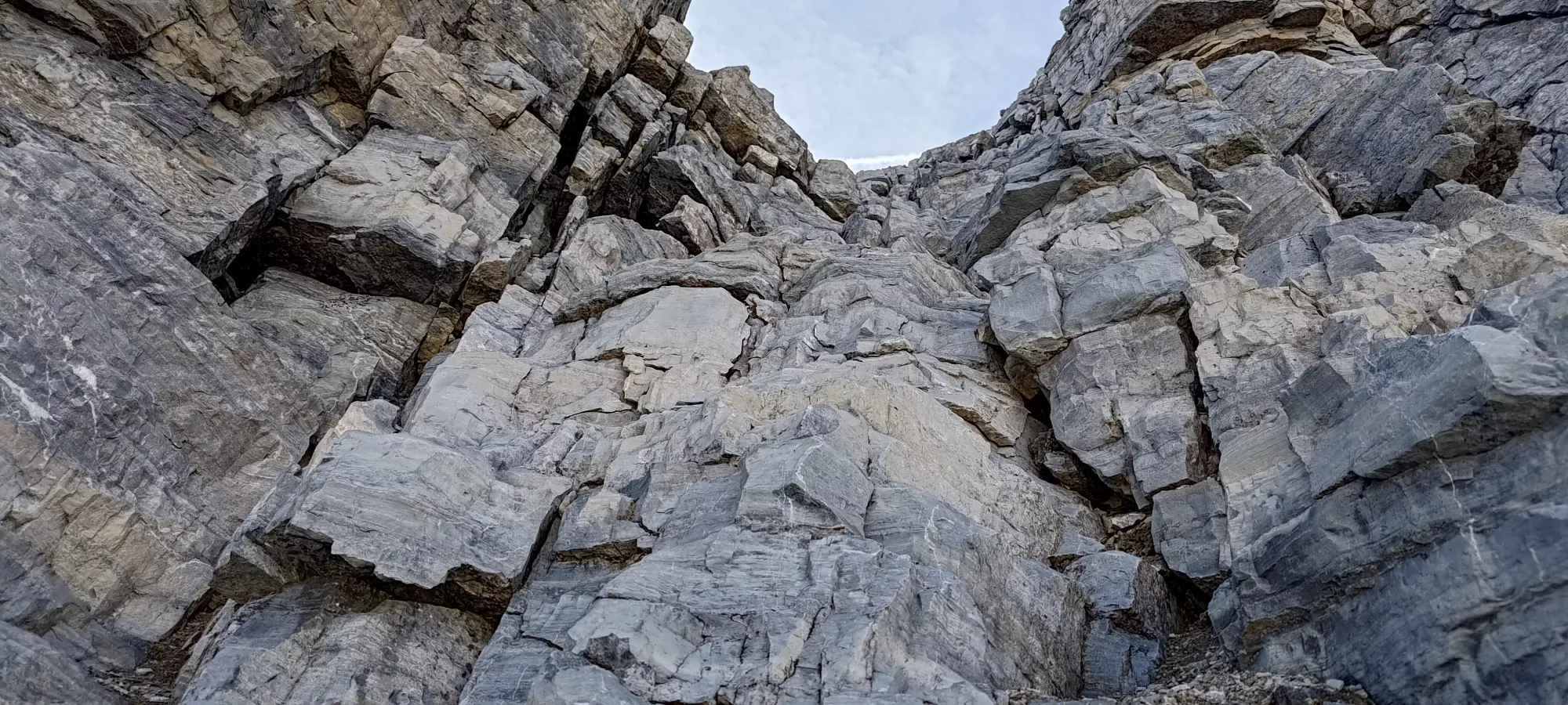
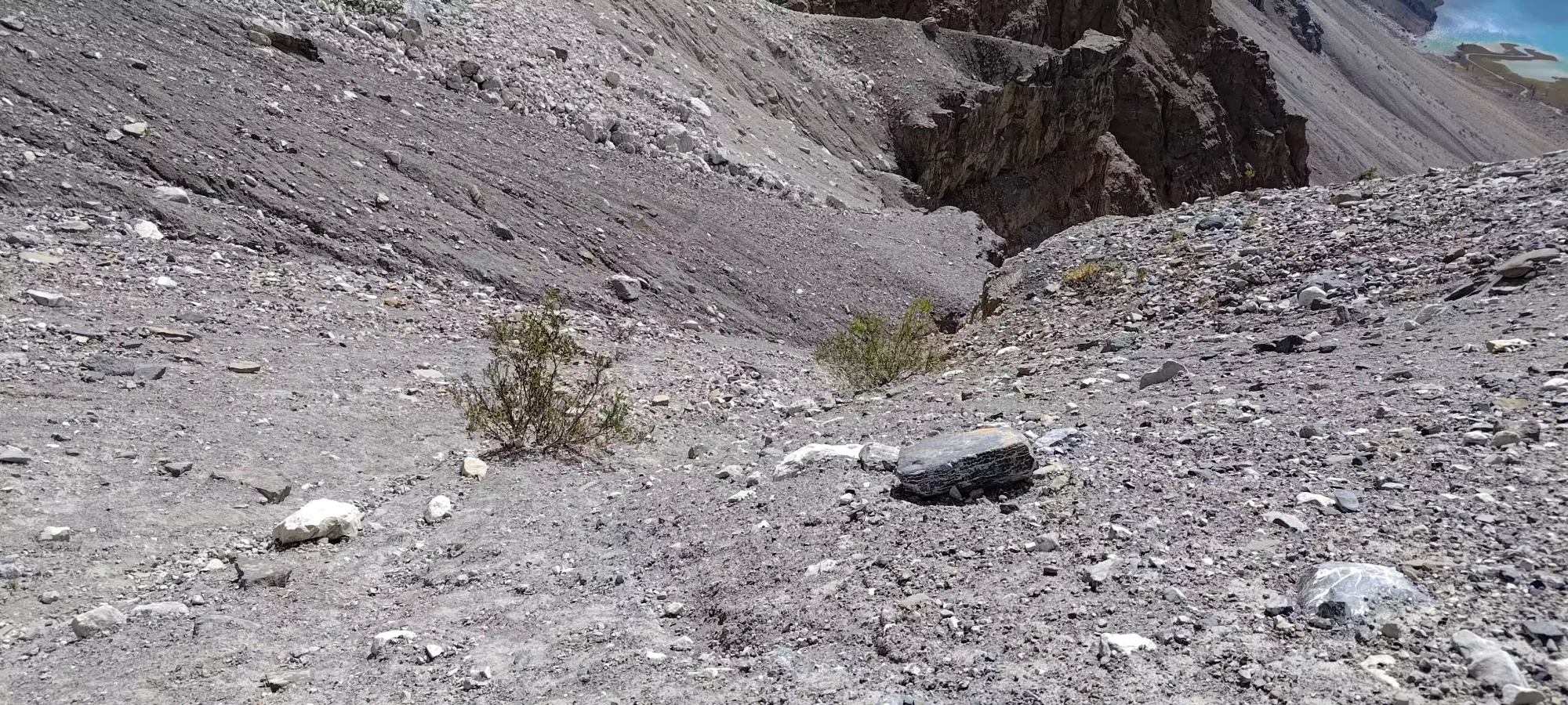
The grind up to the top of the col was not very fun. The rocks were super loose, making spacing necessary and pace slow, it created a lot of treadmill situations that slowed us down, and generally was just inefficient. We did get pretty far to climber's left into a fun bit of scrambling, though. Logan and Charles did a chimney they thought was pretty fun, though I scrambled around while they were in it for expediency's sake. After this short scramble section (described as low 5th moves, whereas my route was 3rd), we had more loose crap to go, and finally hit the col nearly 7 and a half hours into the day. Definitely not the <6 we were hoping for. Better nighttime routefinding in the moraine would allow you to do this faster, or just waiting for daylight.


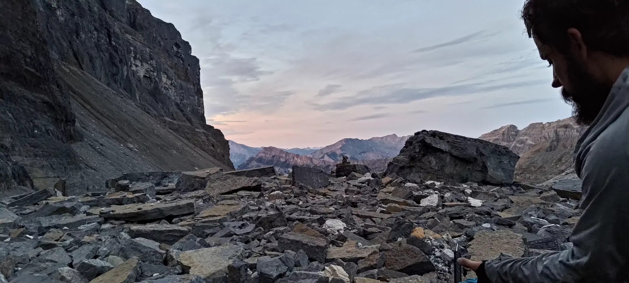
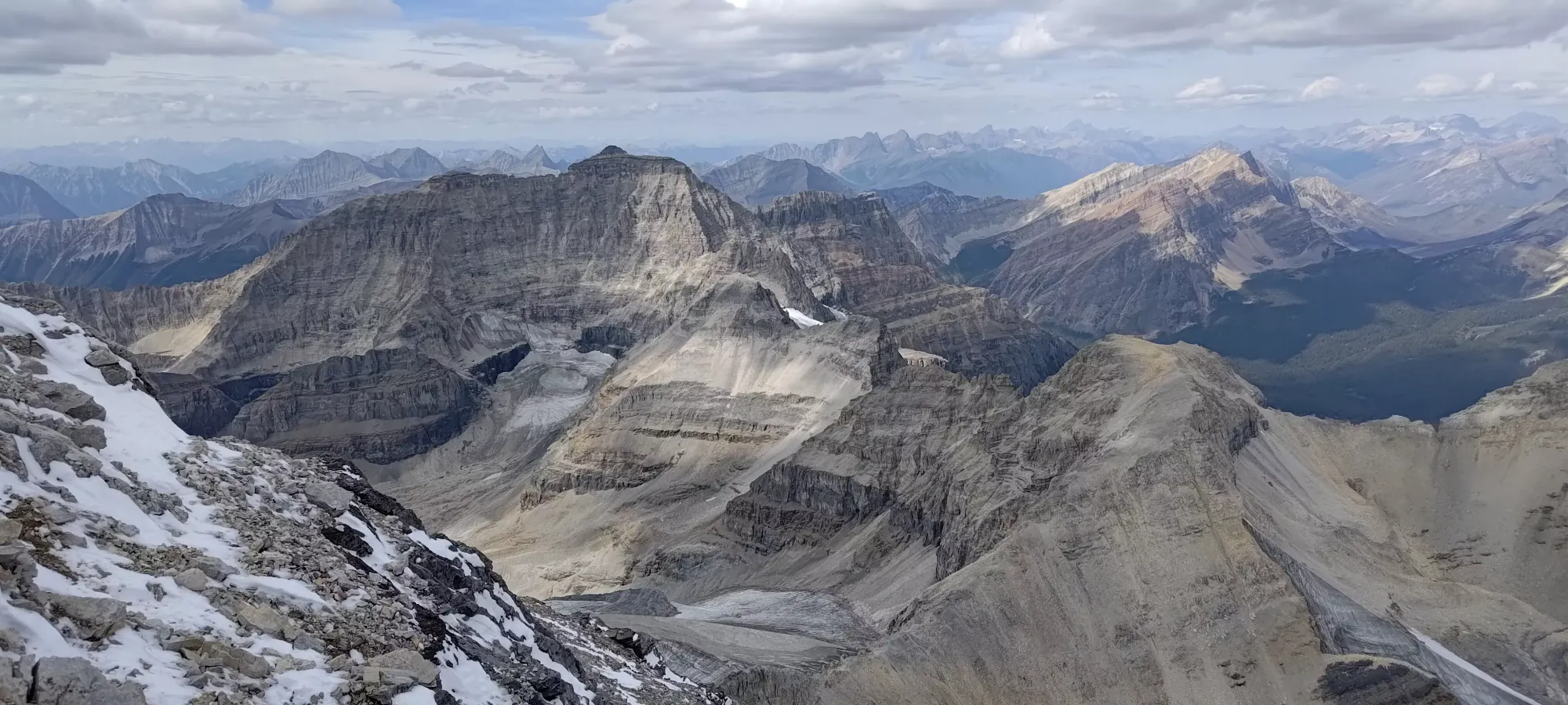
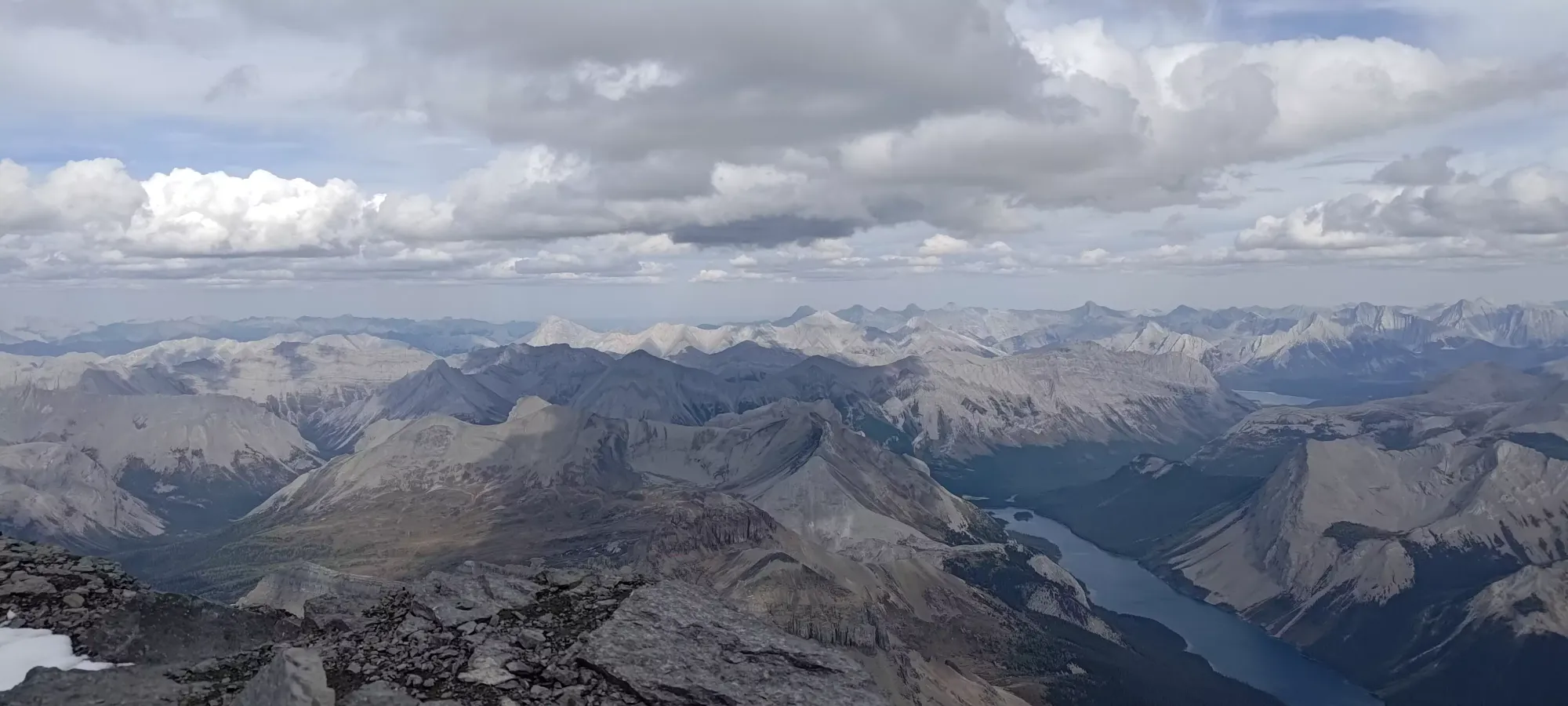
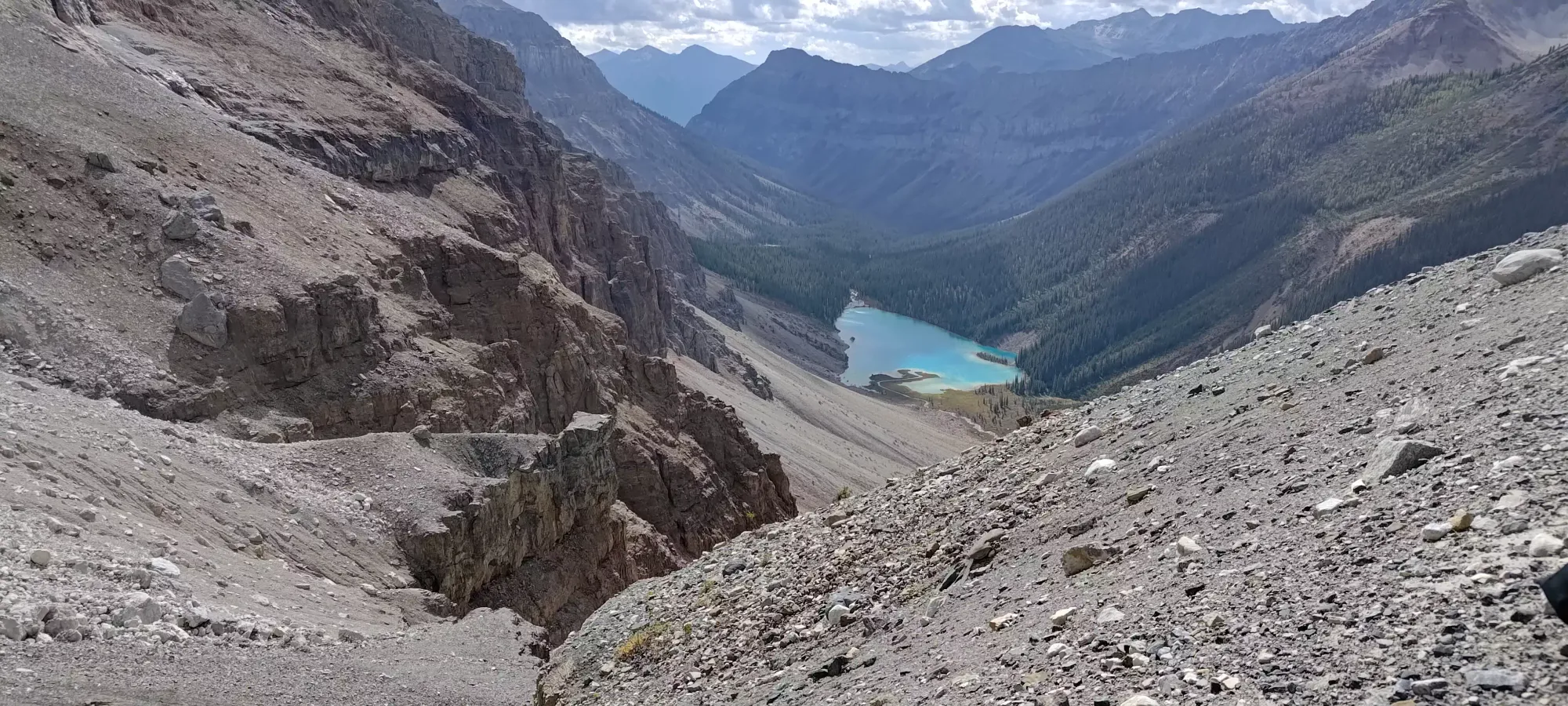
Getting to the hut from there is only about 800m as the crow flies, and loses less than 100m vertical metres, but is on possibly the loosest, least stable boulder field I've experienced, so it took us about half an hour. First is a steep descent off the side of the col to a "glacial remnant", which you can walk across to save some boulders until it gets too steep and turns downhill, and then it's just loose, unstable crap until you get to the hut. Once we got there, we briefly dipped in to just take a look and chat with those present, who confirmed we were the only summit-going party of the day, and then headed out to a nice improvised bench made out of rocks that looked over Magog Lake to enjoy some breakfast for a bit.


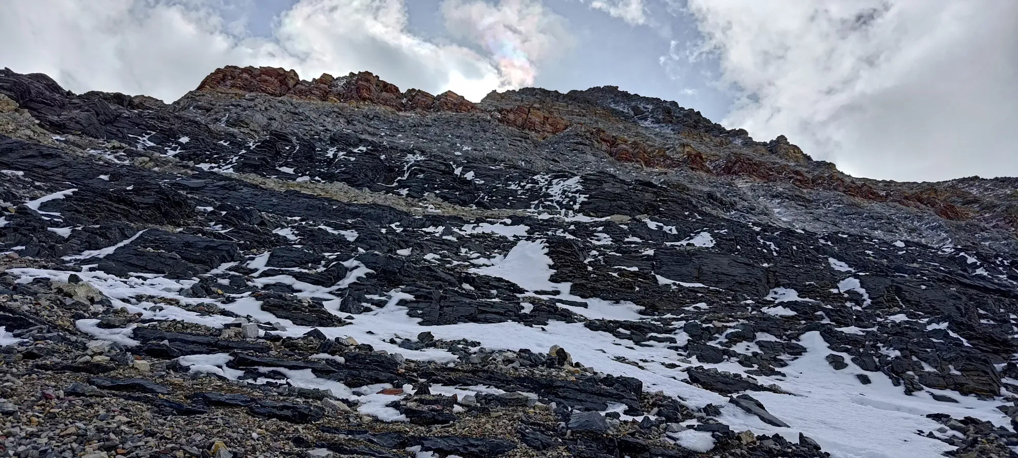
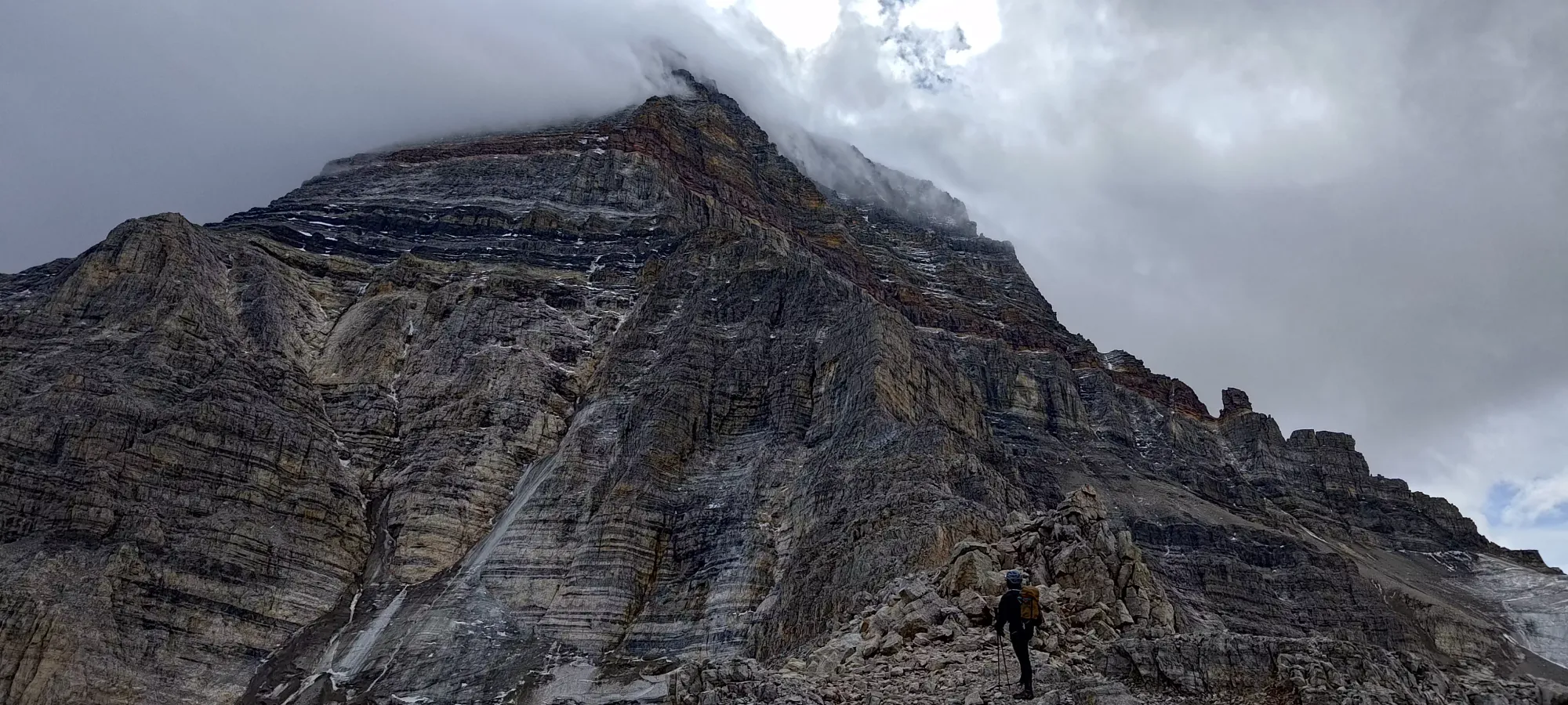
After a little over half an hour breaking at the hut, we got on our way to the ridge. This involves a descent down a couple of rolls, then a steep grunt up more loose crap onto the ridge, then a hike up the ridge a bit longer on more loose crap until one eventually hits the actual base of the scramble at around 3000m (my tracking got a little off as we got higher and steeper, so this is a rough estimate). It was a great relief when we finally saw some scrambling terrain and were able to say goodbye to that awful moraine. We stashed our poles here, and Logan+Charles swapped into rock shoes.
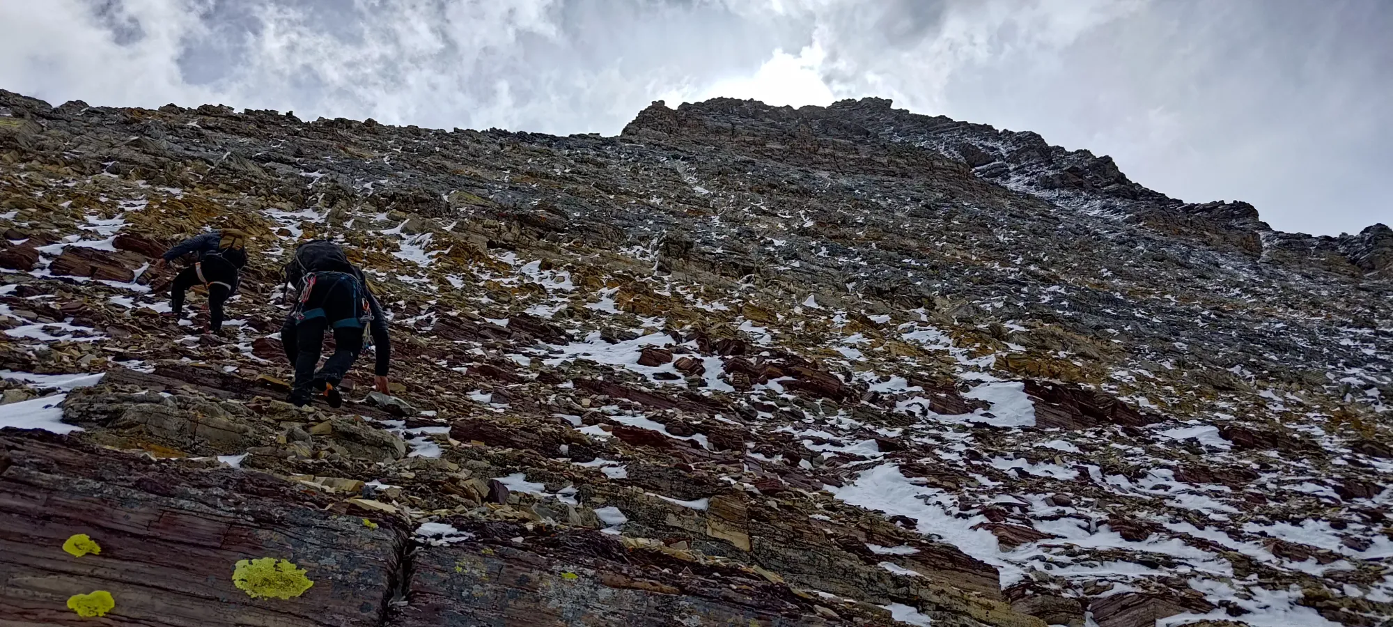
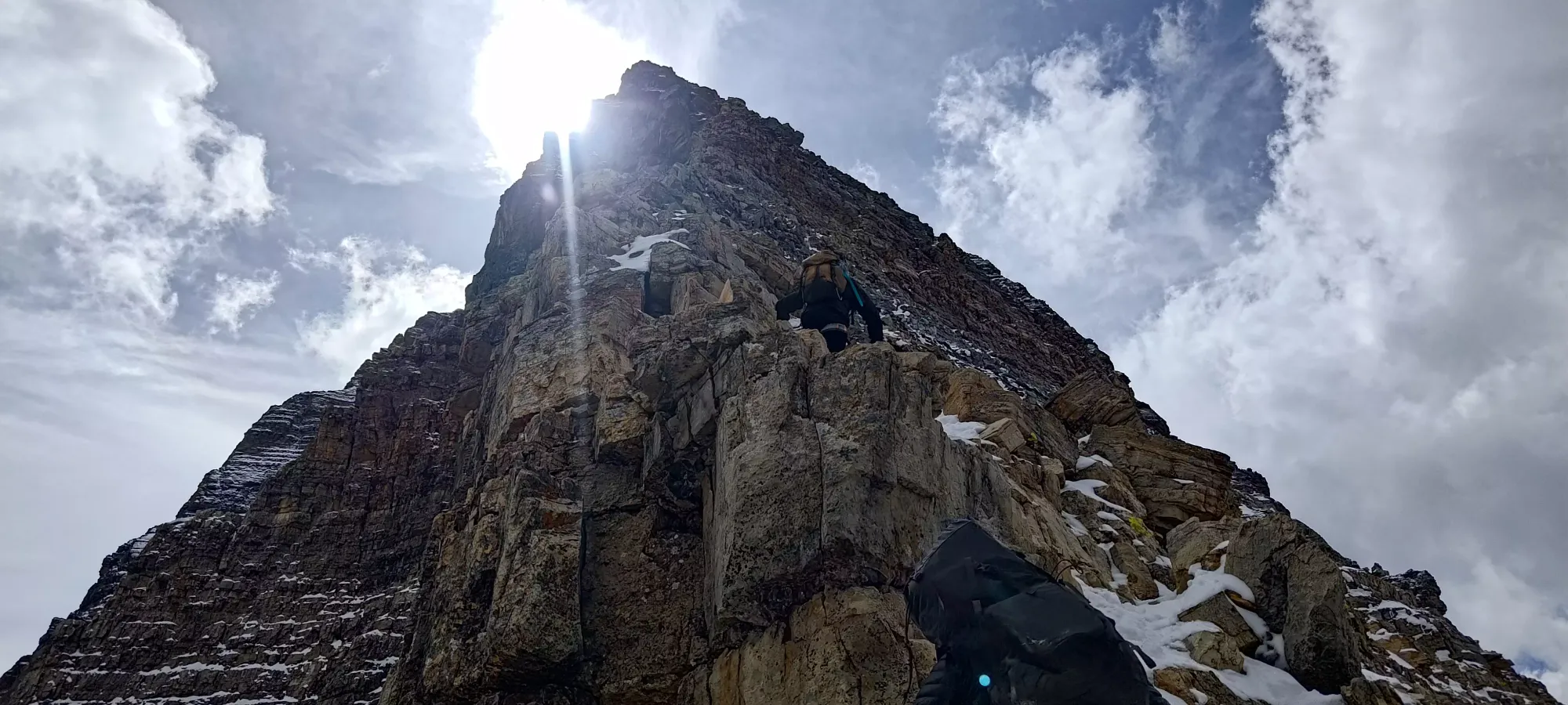
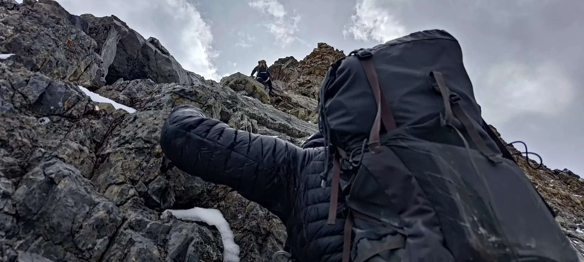
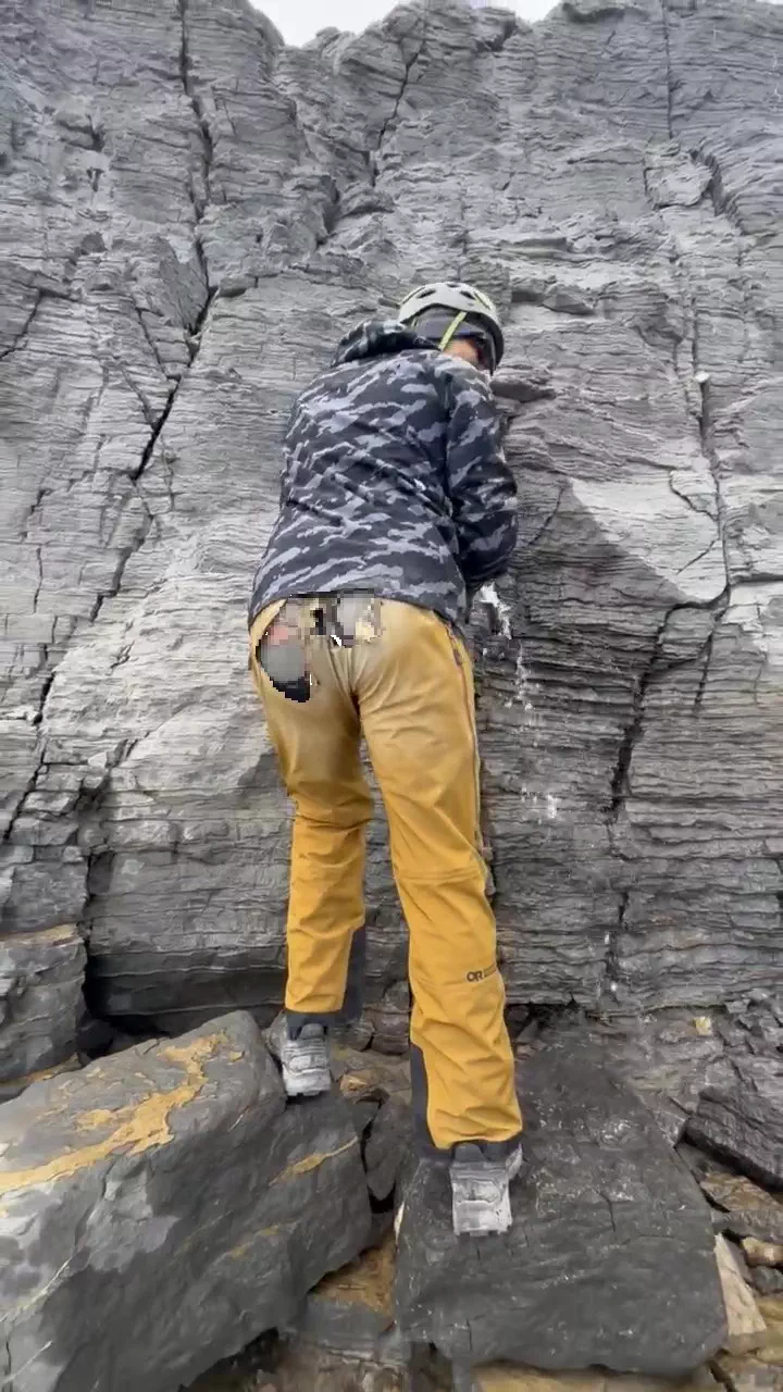
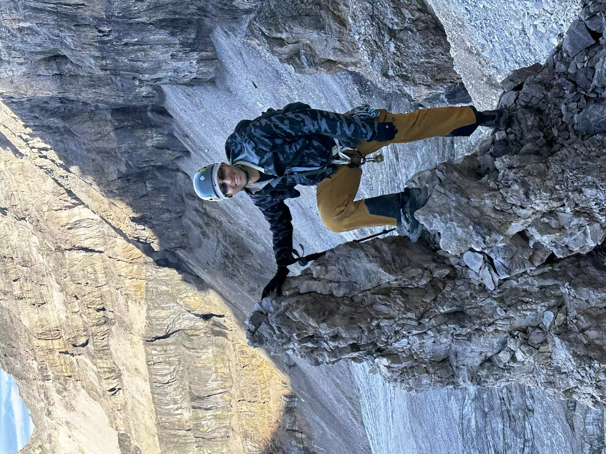
The first couple sections of scrambling were easy and dry, I'd say they go at class 3. There isn't just one way up, and we spread out over the wide face for quite a while before we consolidated higher up. The climbing is actually fairly sustained, with not too much walking, unlike many scrambles that are a few moves then a bunch of steep stepping. The rock is actually pretty in-shape too, with few rocks to clean and few loose holds to speak of, most things you grab actually go, which is great.
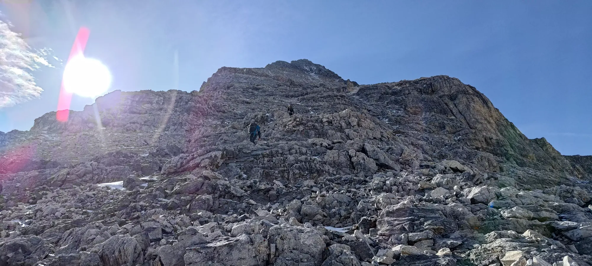
As we got past the first hundred metres, the snow patches started to increase in frequency and size, though this largely just meant "the large variety of route choices was diminished slightly", not "you were boned and had to snow climb now".
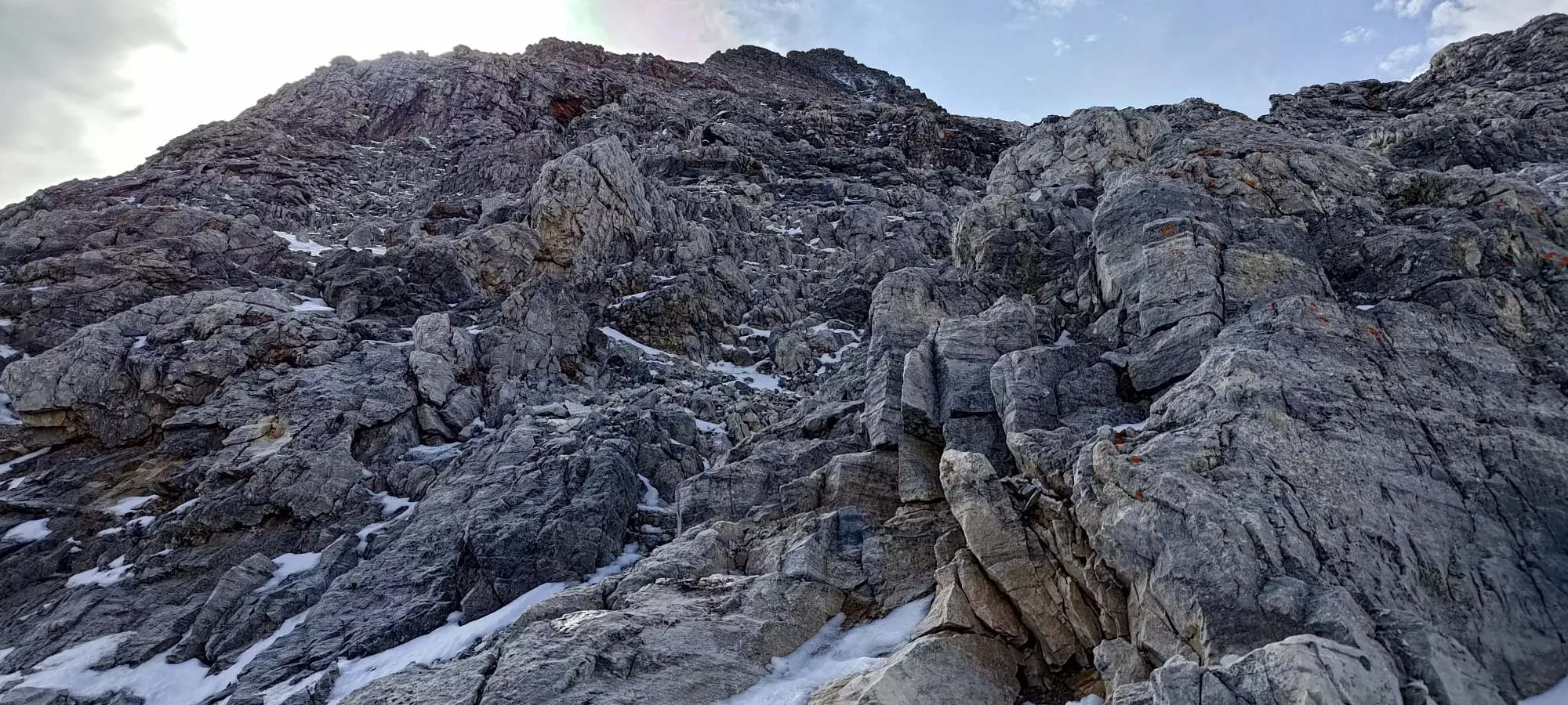
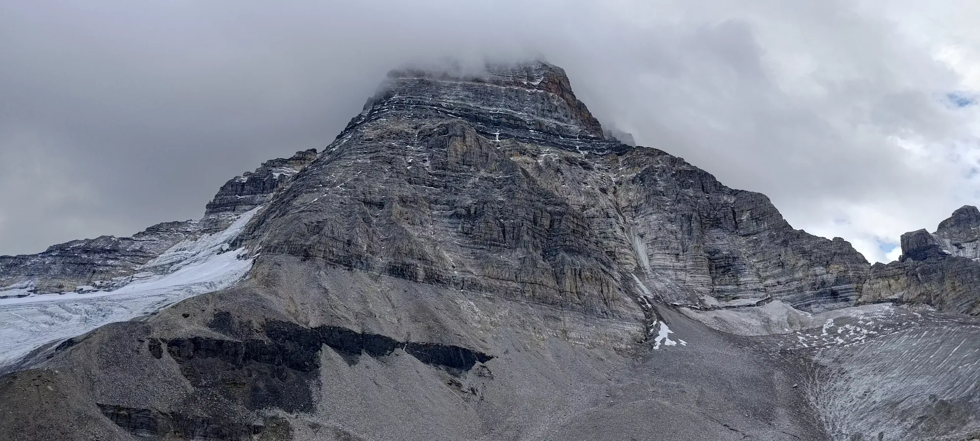
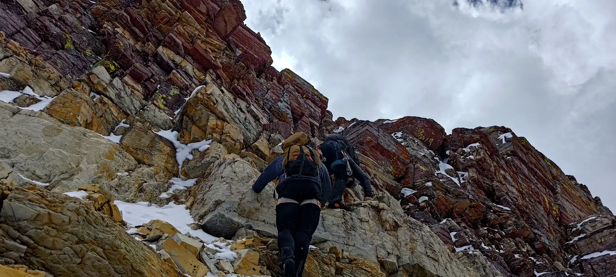
By 11 hours into the day (close to 1pm), we were at 3200m (according to my watch, at least), and approaching the red band, the first of 2 apparent cruxes according to prevalent beta. At this point, snow patches were consistent enough that we often had to deal with wet or white holds, and follow tracks in the snow between sections of scrambling. Here, Logan and Charles started regretting their choice of footwear, or at least having stashed their shoes instead of packing them, as the steeper snow sections proved a bit difficult for them with flat-bottomed shoes, though they kept managing. For what it's worth, despite me having my trail runners instead of approach shoes, I was actually kind of glad, as they proved to be quite grippy in the snow, and I often took snowier routes than them, as they felt very secure. Normally trail runners would be okay in lower fifth routes like this for me, but this particular pair falls short on slabs specifically a bit, so I was a bit concerned bringing them. Now having been there, this route is almost entirely just face climbing, that was never an issue, and I was glad for the higher comfort, water-resistance, and snow grip.

The red band wasn't really anything too hard to be honest, the steepness and a couple harder moves might make it fourth class, but we never even considered it to be fifth class, or hard enough to take the rope out. The rock is super blocky and there are jugs aplenty to grab, so we just moseyed up like the rest of the terrain, more limited by our tiredness than anything else.
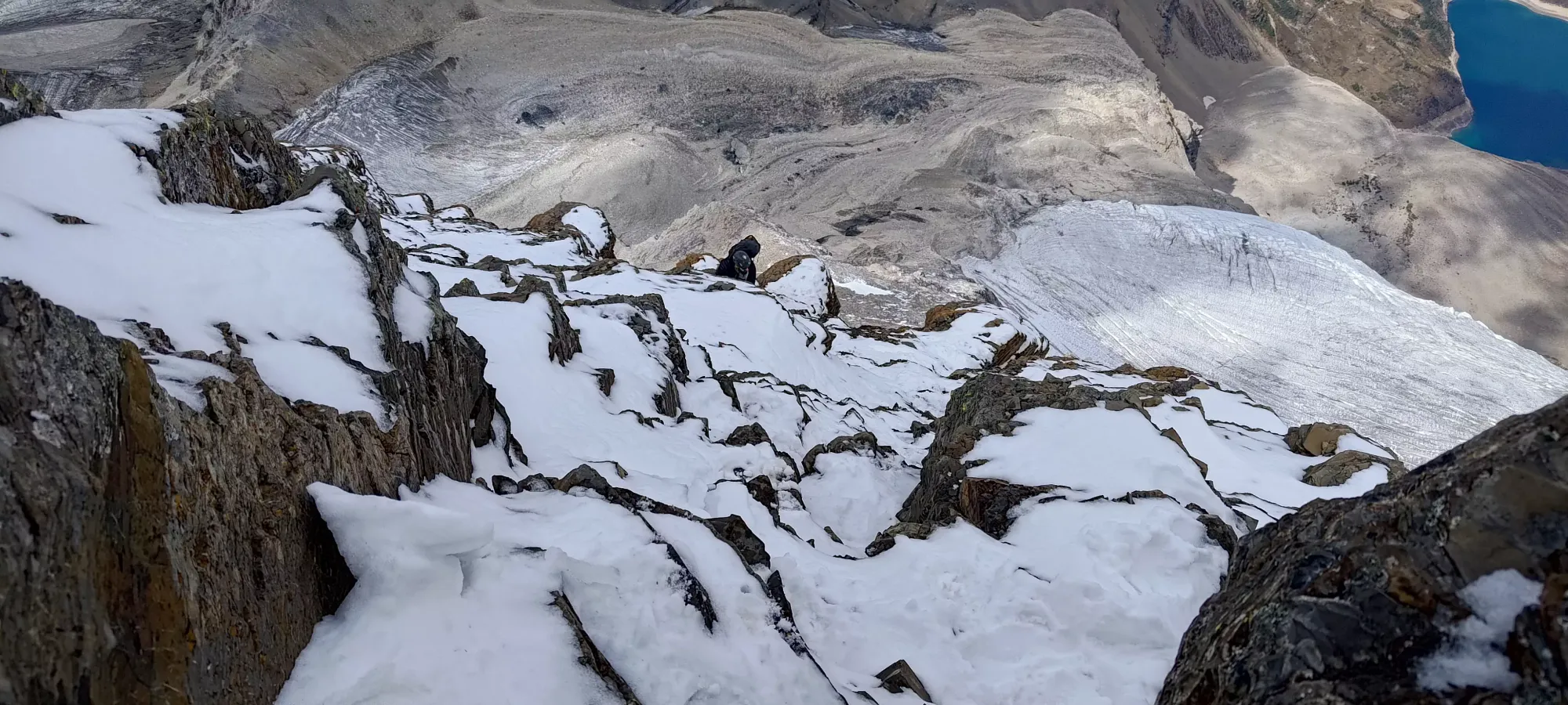
After the red band, we followed paths in the snow, and obvious weaknesses over to climber's left, and within a couple dozen metres of elevation, we found ourselves on the ridge proper, where we stayed for the remainder of the climb to the top. Here, the real exposure starts, as falling would mean going down the entire face to the glacier to climber's left, or tumbling down to the moraine to climber's right. At this point, even this scrambling sandbagger would say this is certainly fourth class terrain. At this point, we kinda deteriorated from "Tareef is a slow cripple but we're doing decently with respect to pace" to "Charles staying up all night has let him reach enlightenment somehow, but Tareef is struggling to keep up, and Logan is lagging back a bit more", and we spaced out quite a bit.
As we got closer to 3400m (around 3pm, we were burning daylight now), this spacing had kinda established itself, and it was mostly a game of Charles leading up, me trying my best to keep up, and us occasionally waiting for Logan to ensure we didn't totally lose sight of everyone (this was sporadic, and later revealed to be related to him not having cemented a great rope-carrying system, and busting out the cams for some ghetto aid climbing in spicier spots a few times). Here the snow became quite consistent, and finding holds required more digging about or simply gripping into the snow. There was one section here that both me and Charles did and kinda looked at each other and said "that was the limit" on what we'd be willing to solo. It was a lot of toe-holds into snow, and pretty vertical, but the handholds (after the first move or two) were good enough to make it okay, though on-the-edge. We did realise our mistake in getting up before Logan had a chance to get there, though, as he was the one with the rope, and neither of us fancied trying to downclimb that section. After that, we corrected our mistake, and ensured that any edge-of-soloing terrain would have eyes-on from the rope-man before we went up. A retrospective look had us all agree that the rope should be in front, period. That was an oversight I'm glad didn't result in a lengthy attempt to have anyone need to aid-climb up to let us rap down, or downclimb fifth-class with snow, which while I'm confident we could have managed, would not have been particularly fun, safe, or "sling-preserving", as we'd likely have had to improvise some aid-downclimbing to get down happily.
Basically right as we got onto the ridge above the red band, we'd started to notice rap stations, some bolted, some slung around rocks, and while we didn't waypoint them (stupid), we noted that they were, at least, within reach with our 60m rope from each other, and would allow us to bypass a lot of difficult downclimbing, which was our biggest concern. Most of the moves on the ridge are juggy and/or mantling onto large ledges, but like the section mentioned above, there were occasional hard sections that made us very glad to have the option to rappel. One could probably downclimb if it was dry, and you were motivated enough, but I'd definitely not recommend it, at least when on the harder ridge terrain above the red band.

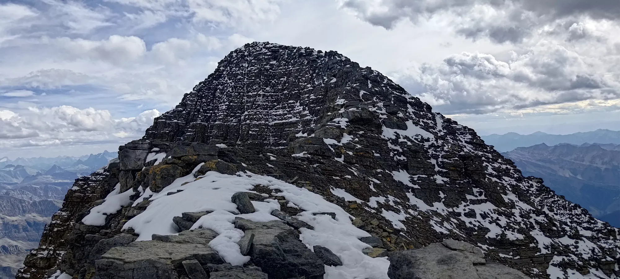
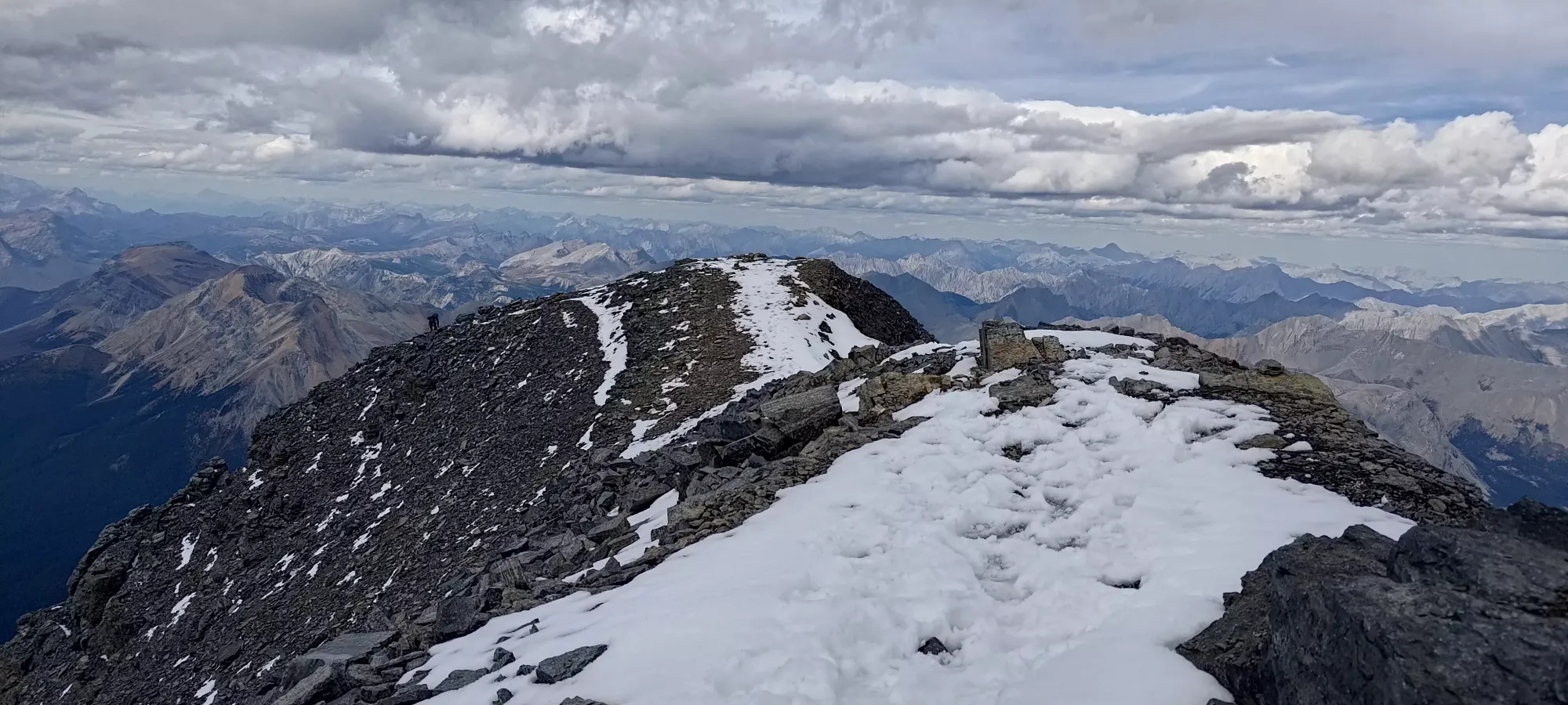
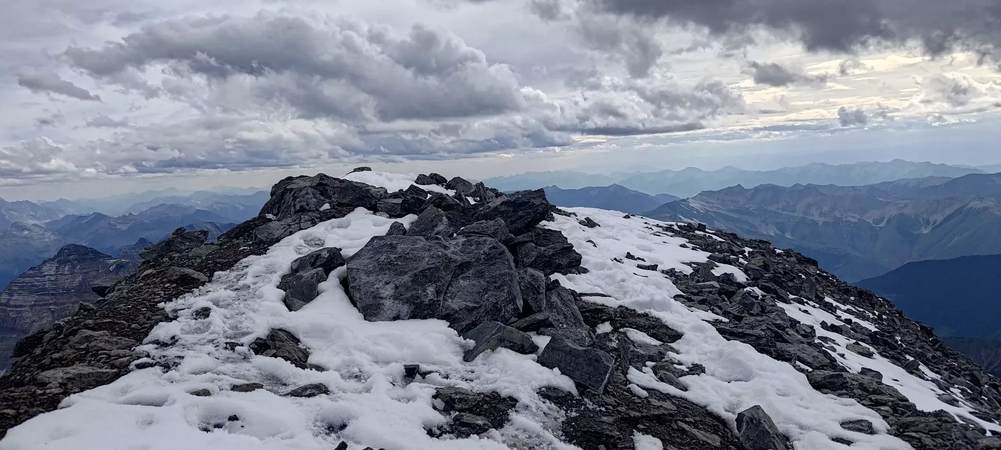
Somewhere between 3450 and 3500m (hard to trust my GPS at this point) we finished with the harder scrambling, and hit a small plateau with a good view of the top. Here, Charles took off to go and tag the summit and take some videos, and I just plodded along nice and slow. I was really feeling my lack of calories at this point, but was determined to wait for the top to start snacking (probably not the right call in retrospect, but I wasn't the last on top, so it wasn't a big deal in this case). I took about 20 minutes to trudge up this last bit of easier terrain to the false summit, then along a short ridge to finally hit the top, just before 4pm, which was when we'd decided was "just about the limit of when it's okay to not be heading down", as we wanted to be out of the hard stuff before dark. We were okay dealing with the moraine, or even the easier scrambling in the dark, but didn't particularly fancy being in the class 4 stuff in the dark.


We spent a bit over half an hour on the top, where we rested, tried to get some calories in, and started hashing out our plan of attack for the descent. We agreed to rap past all the parts we didn't want to downclimb, but once we got into terrain that didn't feel sketchy, it was probably just faster to downclimb. We also agreed that we didn't want to bivy on the ridge, given the darker clouds moving in overnight, and the general unpleasantness that would bring with only emergency sleeping gear, and the question would be "do we crash in the hut or push all the way down in the dark"? I was leaning towards the hut, but was still open to the idea of pushing down if we felt alright and conditions were nice on the ice we could see, as the glacier might become hard and slippery without snow cover overnight. For now, the goal was "get out of hard terrain before dark". We layered up with whatever we had, I got my big-ass mittens on, and we started down.
Walking down past the false summit was easy enough, and we did a little downclimbing to reach the first rap station, where we started to get that going. Charles needed some guidance getting himself sorted, as he had infrequent rappelling experience, but that didn't take too long, we just took turns helping him tie-in to ensure that was done right, and the mechanics themselves were pretty smooth. Sadly, the overall system for the group was less smooth. The rope was pretty tangled from the start, and took a while to get in-order. Since the ridge isn't just a vertical face, but a series of ledges and rocks with slippery snow thrown into the mix, you can't just yeet straight down, so the first rappeller has to put some legwork in to bring the rope down (again made worse by more tangling). In this case, that was Logan, then I helped Charles follow, and I finally went down myself. This first one was also not a great rappel for me, as the rope ended up on the wrong side of a rock. Without a good hold in a particular section, I took a rather unpleasant whipper as I swung out from the ridge where I had to be heading to where the rope wanted me to go, which happened to be "into a wall of rock". That stung me for about 30 seconds, and my elbow and lower back seemed to be mad at me for a while afterwards, but nothing serious (much better than falling due to a lack of rope). I got back across and down after that, but it definitely made me a bit more cautious, perhaps overly so for the rest of the way down.
The next few rappels were the biggest issue of the day, as rope tangling/management continued to slow things down tremendously. This motivated Logan+Charles to rap without prussiks to go even faster, although this was a risk I wasn't willing to bear myself, as the easier control afforded by the backup made me feel surer that I could protect my existing injuries from any impacts, which did seem to work, at least (and it added maybe 30s-1 min at most to each rappel). We lost a ton of time just dealing with the rope, though, and by 6:40pm, we were still in snowy and hard terrain, and we were really in mental overdrive trying to speed things up everywhere we could.
This tedious process went on until we were running quite low on light. At around 8pm, Charles (who was now comfortable enough to rappel first, with Logan in the middle, and me coming down last) found himself in terrain he was willing to downclimb, so he just went down, as he had the least gear to survive the night, and had an intense desire to make the hut ASAP. It had also started to flurry at this point, which was not a great sign for sticking around. Logan wanted to keep rappelling, so I decided to stick with him, since I didn't want to split up completely, and as a result, the "price" of the rappels would already have to be paid. We did 1 or 2 more until we were both happy with the terrain we were in, and we packed the rope away to head down. By the time we did so, though, it was fully nighttime, and the snow had picked up to the point that we could see it accumulate on our gloves if we set them down to mess with our packs, so our urgency was definitely at 11.

Unfortunately, after this point, I don't have any pictures, as my goal was just "get the heck down" and not "take a bunch of photos". The next 2.5 hours were spent primarily butt-sliding down ledges and scree slopes with interspersed downclimbing and traversing, with us just picking the best visible line in front of us while not getting too far off the GPX to be in totally different terrain. This was actually pretty efficient, and after having to traverse a gully or two near the bottom to get ourselves pointed to the moraine instead of the glacier to the east, we somehow ended up at our poles and shoes at the base of the scramble, which was quite the relief. I was very happy to have my poles again, which I regretted stashing more than anything else (I normally keep them with me, but I naively decided to go with the flow and not just do what made sense for me). Logan was happy to have "not rock shoes", though sadly he only found one of them. We knew Charles was down for some time, as we could see his light well ahead of us for a while, though we weren't sure if he had passed through this section, as we found 1 extra pole among our gear, which I packed up to take with us.
The first part of the moraine was easy to navigate, but unfortunately, my watch started acting up and couldn't navigate to the hut once we got into "just random boulders" (it said it was 11km away despite it definitely being under 1km away), and my phone was totally useless (it has a bug where it sometimes just doesn't get a GPS signal at all, even in the best of conditions). Logan's GPS is apparently great at being an InReach, but less great at navigating, so he didn't try using it for quite a while, and we wasted like an hour in the howling winds of the moraine chasing after hut-shaped boulders. Eventually, through a mix of just using directional navigation only (ignoring trying to use "routing" features, something we should've done sooner) and cross-referencing multiple devices, we eventually found the hut, which really should get some reflective panels or something to make it easier to locate in the dark. Once we got in, we dropped gear as quietly as we could, and just collapsed. I didn't even bother getting my emergency bivy out, as it was loud+crinkly, and I figured I was tired enough to just fall asleep.
Unfortunately, I discovered here that my aggressive butt-sliding technique (partially motivated by my lack of poles and therefore stable footing in the steep terrain) had a price, and that price was ripping through my hardshell pants, baselayer, AND underwear, which wasn't great. I hastily fashioned "pants" out of my hoodie, and went to bed as best I could. Partway through the night Logan did his best to share the bivy he did bother unpacking, which helped a bit, and later on in the early morning, some kind campers even tossed some extra layers on us, which brought things from "sufficient" to "actually comfortable". Thanks guys!
In the morning Logan was the first to get up, followed by me, and then Charles (although I stayed lying down til I saw him get up, I had no need to prove anything by actually standing up 😁). Here, we got acquainted with a couple of saintly gentlemen from the Fraser Valley who made the trek up, but upon hearing the conditions we and other reported, decided not to make a summit bid, and therefore had a bunch of extra food to pack out, and they were generous enough to share it with us. I was not particularly looking forward to the doable but not enjoyable descent on 75% of a peanut butter sandwich and a couple snacks, but we were soon treated to a quite fancy breakfast of lamb chops and chicken noodle soup! That turned our day quite bright, and we had a great time chatting and eating with our benefactors for the morning.
I was slightly dreading the bathroom-related fallout of that luxurious breakfast, being me, but I have to say, the hut toilet was actually the best I've used. Quite clean, not smelly, and well-sheltered from the elements. I got my business done, and we were ready to head out at around quarter to 11, with our bellies full, bowels empty (at least mine), and water bottles refilled.


Getting back up to the Strom-Sturdee col took us about half an hour, once again having to deal with the tedium of the loose boulders, and the steep headwall up the col (we had to space out quite a bit for rockfall mitigation here). Once we did, though, we were at least able to say we were basically done with elevation gain for the day, which was a very nice thing to be able to say. We decided here not to retrace our hard scramble route up, but instead take the steep and loose way down, which seemed like an easier descent, even if we didn't prefer it for the way up.
It took us another 20-25 minutes of careful stepping and occasional scree-skiing to get back down to the head of the glacier, this time a bit further to skier's left, so we had to traverse a little bit at the top to get to our gear. Thankfully, despite the rain/snow overnight, it was still dry, so we all got our glacier gear strapped on, and started the walk down. Once again, we felt safer disconnected, so we just kept to the tracks we had, and carefully walked down. On the steepest parts, I was able to use my 66cm axe to provide some extra stability, but it's largely mellow enough that you'd have to be hunched over to have axe->ice contact. We weaved down for about half an hour until we got to the bottom, where we had to wade through some annoying muck created by the glacial melt, which totally muddied up our crampons just before it was time to stash em, but oh well. We hung about for 20-30 minutes to rest, snack (at least the other guys snacked, I was good with breakfast as-is), and drink while we took our glacier gear off. I decided to try and keep the boots on for a bit longer in the moraine, since my memories of the way up were unstable, steep, and generally annoying, and while I've always been a trail runner guy, I've heard many sing the praises of boots in such terrain, so I thought I'd give it a shot.
Here, my estimates of time and distance get pretty out-of-whack, as I went into my power-saving mode to ensure my watch recorded the whole activity, and the tracking takes a nosedive when you do that. I definitely need to get a new single-night battery pack, the one I brought was not working at all. The walk along the flatter, upper section was pretty easy, and we got to the top of the steeper part of the moraine relatively quickly.

The way down was a long slog, though we were indeed correct, and there WAS a decent enough trail in the debris, we just couldn't find it in the dark on the way up. This made travel a lot more efficient, and we got down to the lake from the toe of the glacier in about an hour and a half. We stayed close-ish, until I gave up on my boots about 60% of the way down and took those off, stashed some layers (the sun was coming out and quite warm), and took my helmet off as well. The others did that a bit closer to the lake, so I caught up where they were doing the same. I can at least say I've tried to boot approach to life now, and am still firmly in shoe camp.
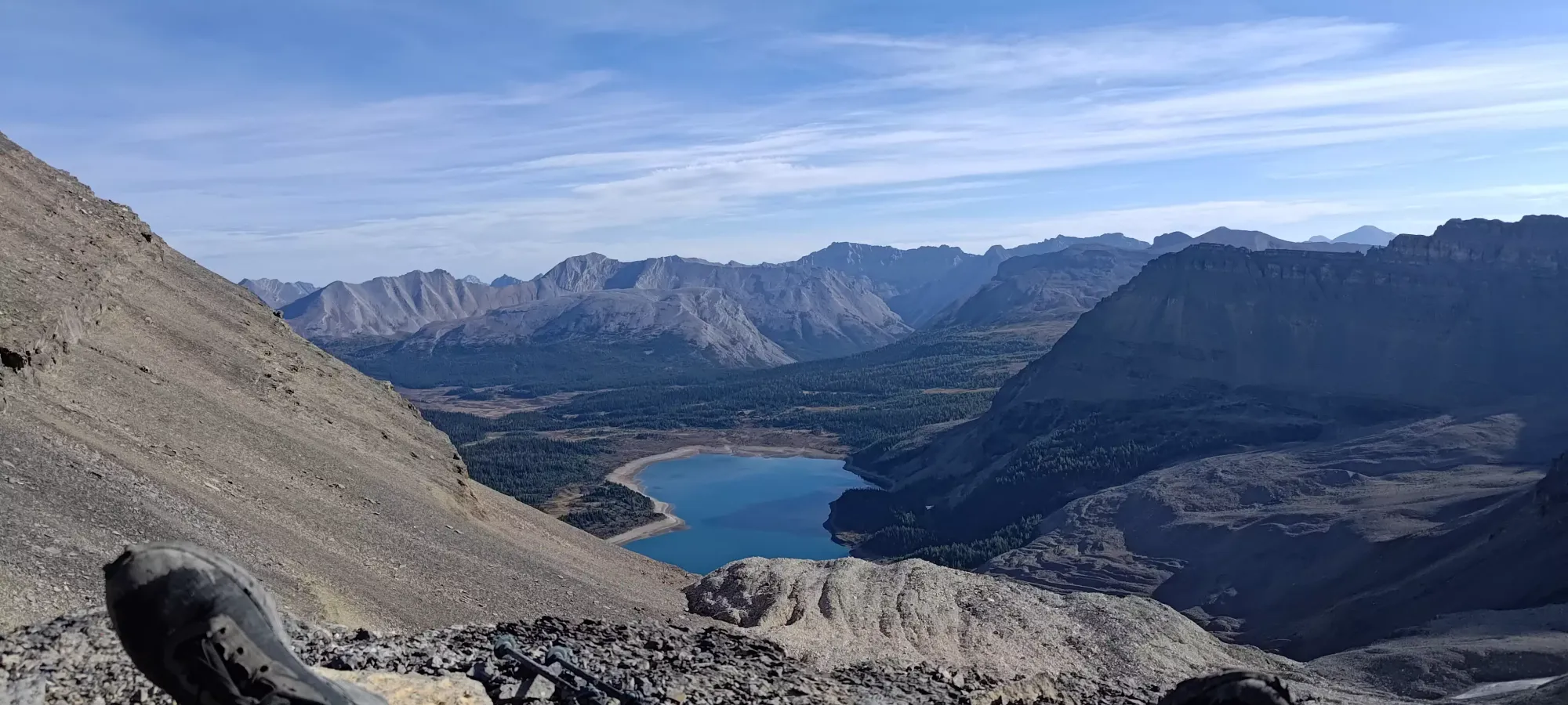
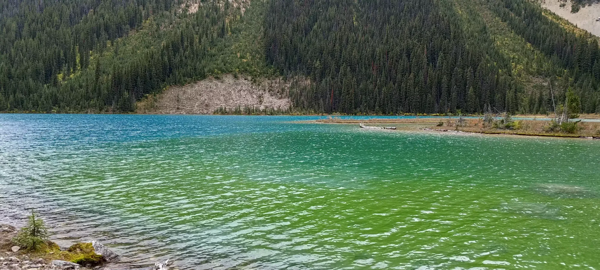
Once we got to the lake, we took a path closer to the water, avoiding more rocks and sidehilling, though we had to pay the small price of some rock-hopping to get onto trail once we ran out of land (well worth it, I'd say). The water was gorgeous, and we spent a few minutes enjoying the view (as well as cleaning off our crampons a bit so we could stash em in our packs). Once we did that, it was just a couple hour long walk back to the car, or about 7km.

Once we got onto the dirt, for some reason my left calf started hurting, so I couldn't quite keep up the pace I'd otherwise wanted to, but we still made decent, consistent progress. I did quickly notice that the trail was a bit muddy on the way up because later in the day and/or after some precipitation, parts of it are, in fact, "just creek". Like the way up, though, it was always bypassable whilst staying dry. We met a couple people who'd come up just to see the lakes at the fork for Lunette Lake, but otherwise largely just charged down, stopping once or twice to refill water or take a couple minutes of rest.

We got back to the car somewhere between 4 and 5pm, where we celebrated with the tedious chore of de-chicken-wiring the car (thankfully no porcupines made it their home or their snack). After that, it was the usual de-gearing (although I had to improvise a seat for my somewhat bare arse, which was made more complex by me forgetting where my emergency clothing stash was in my car, it turns out it was buried deeper in my glovebox than I thought, so I just had to sit on a jacket instead), a few snacks, and we were on the road. The drive out was pretty chill, no mining trucks barrelling into us, and we decided to go all the way to Golden for dinner, where (after acquiring some intact pants) we gorged ourselves on $2.50 tacos at the Riverhouse Tavern, which definitely had "local watering hole" vibes.
All in all, this was definitely an awesome trip. There were some learnings to pick up, namely:
- You should always do a gear check before a big peak
- Take the effort to set waypoints for rap stations and gear drops
- Trust your instincts if you think it might be worth carrying something up instead of stashing it
- Make sure the guy with the rope is the guy in the front
- Make sure the rope is managed better to avoid tangles and speed up rappels
- Bring battery banks that aren't sketchy "work swag" from 10 years ago
and more things that I haven't felt like repeating here. It was still a success, though, and we're all pretty stoked to have the "Matterhorn of the Rockies" ticked off. It also gives me some confidence for the easier Rockies routes like Sir Donald and Edith Cavell, although I'll probably book a little earlier in the season than this trip for when I return for those 😅. It was super awesome to get to climb with Charles again, and I hope we'll get to do it again this winter as long as I find myself able to ski well enough still. For those looking for beta, the key points to note are:
- Our approach to the hut isn't the best to follow since it was in the dark, and the way down was glitchy, but there's lots of good tracks out there for that, and in the daylight, it's pretty obvious.
- From the hut, it's hard to say how accurate our track was due to the steep rock, but there's definitely a soloable route for confident scramblers. I'd say it was similar in difficulty to the harder scrambles that I've done like Edge Peak in Golden Ears, or East Lion.
- I'd plan to rappel, downclimbing would be "spicy" to put it mildly
- Most crossovers should make the trailhead drive, but beware of the bridges (assess for yourself), and bring some chicken wire, there wasn't enough for us if we hadn't brought our own.
- Water is abundant before the lakes, and at the hut. Between those spots, and above the hut, bring everything you'll need.
- Snow makes the scramble a lot spicier, and especially my buddies who were in climbing shoes only regretted their choice. I'd not write it off entirely if snow is present, but I'd bring "at least some shoes with good traction in snow", if not spikes, an axe, or just crampons if you like scrambling in boots, depending on how much there is.
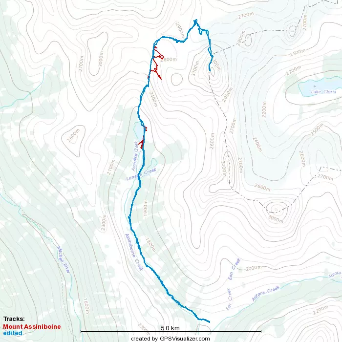
Given the above, I have provided both my original GPX, and a slightly edited one that removes the worst of the glitches in the track if you want to try and refer to that, though I'll reiterate that one needs strong routefinding to do this, especially on the actual north ridge part of the route, so a GPX can only roughly tell you if you're in the right area or not.
GPX Track + Map