Mount Windsor - October 22 2023
A pleasant, local hike with excellent views, and a bit of optional scrambling


North Vancouver Area, Porteau Cove, BC
1689m
After spending the previous day this weekend doing unproductive things like sleeping in a bit, chores, and spending time with friends (my health had been acting up and I wasn't feeling up to leaving town), I was determined that colitis be damned, I wasn't going to waste one of the last no-snow weekends doing nothing. I did, however, still have to contend with my poorer health, so I was only feeling up to doing something close to noon. Thankfully (for me), Logan had some plans fall through and was needing something to do, so we met up, and decided with the time we had a local summit would be a good plan. We decided that the Deeks Lake area would be good since we'd not been there before, we hadn't heard about wasps there in a while, and there were lots of peaks nearby. I was originally hoping to get at least some checked off as part of the Howe Sound Crest Trail, but upon further inspection, they are largely quite a deviation from it, so I figured getting some by themselves would make an eventual traverse a bit easier. So we drove to the trailhead, and set off at 11:48am on a fairly pleasant October Sunday.

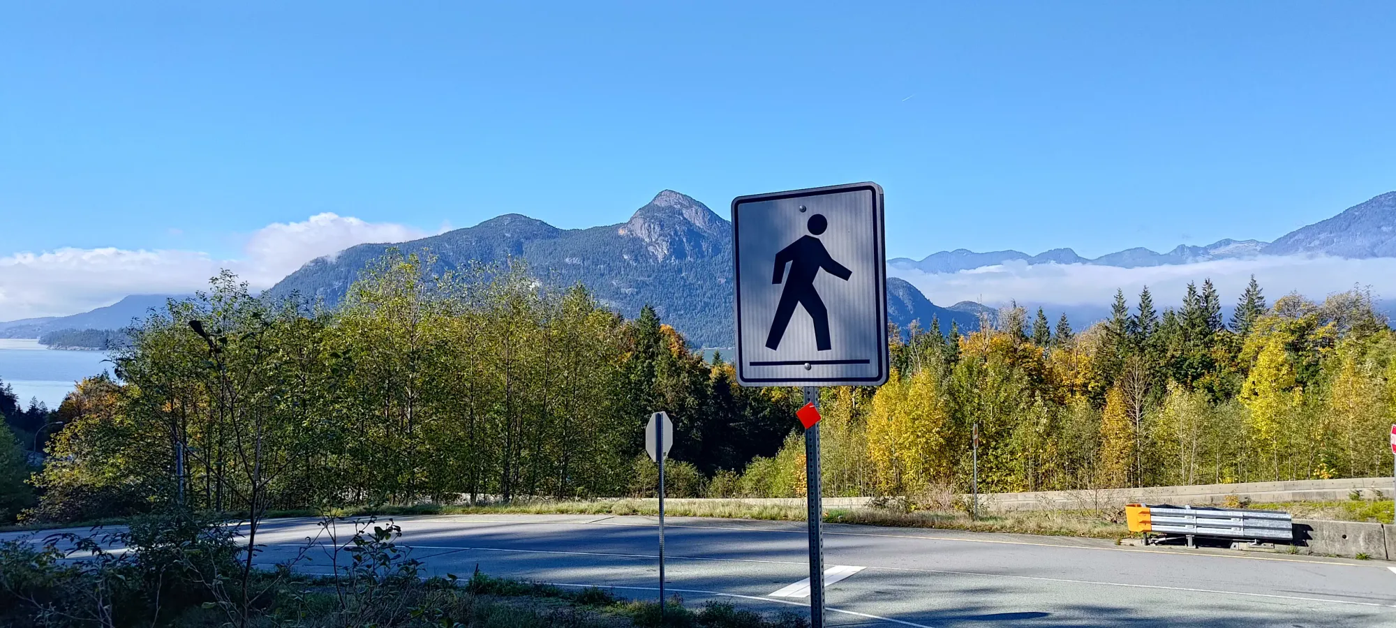
We walked along the road for a bit over 5 minutes, dipping down to about 50m of elevation to truly "start" the hike. This is the common egress point for the Howe Sound Crest Trail, since most people prefer to start at 1000m of elevation at Cypress Resort instead of basically sea level in Porteau Cove (an understandable choice). The first twenty minutes were spent on a fairly damp (the previous week was a deluge of rain and not much respite) trail that joins up with the road which started at the parking lot (but was gated by the mine). From there, it took us about another 25 to hit the fork for Deeks Bluff. The trail to this point is mostly just "walking on an old road", with the notable "fun" point of it being an active creek in sections, with some areas eroded by over 2 feet in the middle of the trail where water has reclaimed it. I hope the engineers designing it weren't aiming for long-term integrity, because that definitely did not happen.

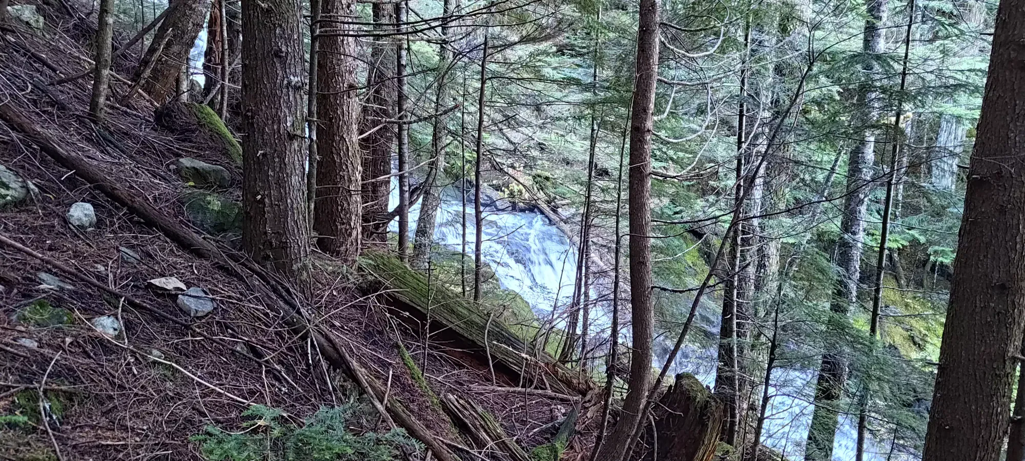
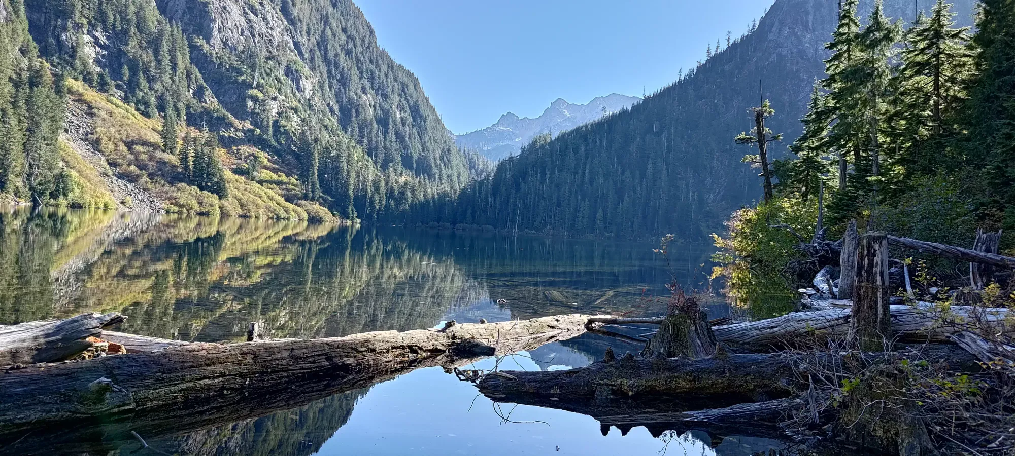
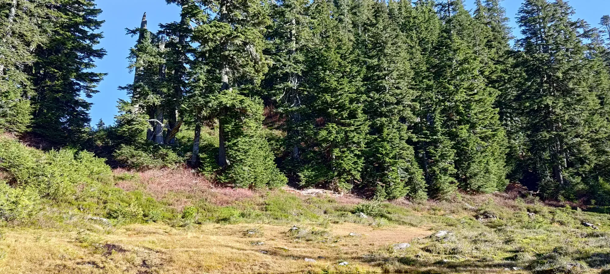
Once we got past that fork (which we did not take, figuring we could decide to take on that side-quest if we felt up to it on the way down), it was just a long grind up to the lake. This section is about 600m of elevation gain, with a little more road-like terrain before it turns into fairly old-growth forest with a wide and obvious trail, though it has a couple offshoots higher up, and also gets rockier and especially rootier as it climbs and approaches Deeks Lake. We were pleasantly surprised to see that Deeks Creek was actually "pretty cool" and had some nice rushing water along with a pretty intense waterfall. Those added some interest to the otherwise bland (if efficient) plod up, which we did in about 75 minutes, at an "it's exercise, but we're not tiring ourselves out" kind of pace. This was to the main fork between the HSCT and the Deeks/Windsor trail, we walked a bit further along the lake to find a place to sit with a view before we actually sat down for a small break.

We sat down at the lake for about 15 minutes and relaxed. Since my digestive system was still a dumpster fire, I avoided eating anything, and just had a couple sips of water to ensure I didn't keel over. Thankfully, despite gaining 1000m+, we were feeling pretty good due to the excellent and efficient trail, so I wasn't really running low on energy or anything. Plus, the creek (and tributaries) left us with oodles of water to fill up and binge if the need ever arose.
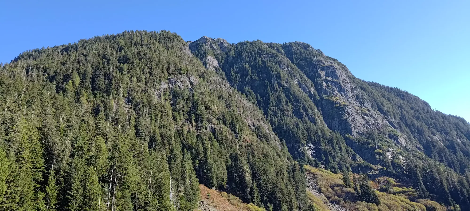
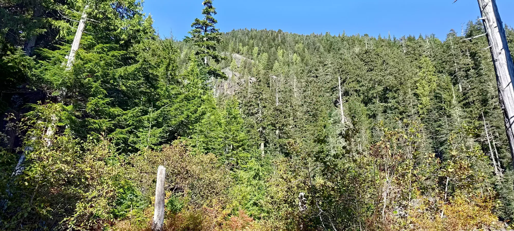
After that, it was about a 400m grunt up to the next checkpoint, the Deeks-Windsor col. At this point, we hadn't yet decided what we were actually going to do: Deeks, Deeks and the "Whiskey Peaks" to the north, or Windsor. The plan was to see how we felt about energy/health/time at the col, and go from there. After a short section of boulders on the far side of the lake, we got into a more basic, but still nice old-growth trail up in the forest. This area seemed like pretty nice skiing terrain to me: sparse enough to be fun, not too bluffy, and high enough to hold good snow. As for hiking, it was easy enough, though with a few small creeks that cut the trail off and required small+careful steps to get across, along with the mud patches that were present throughout the day due to the rain previously. We took about 45 minutes at our same "measured pace" to get to this point, a couple small puddles in an open grassy area between Deeks and Windsor.
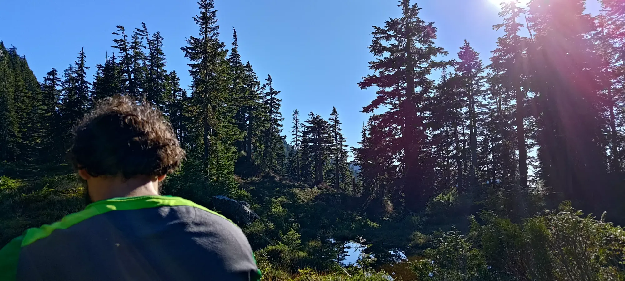
We rested here for 10–15 minutes once again, this time figuring out where we should go. It was about 3:15pm, so we figured we probably didn't have time to get Deeks and traverse out to and back from all 3 of the "bonus peaks" past Deeks, and since you had to go up nearly half the way from the col to Deeks to get those, they seemed better suited for a day just for those 4, and it'd be better to just get the single, higher, and more prominent Windsor today, so off we set. After a tricky mud-crossing (Logan got a little "familiar" with the local ecology here), we set up to the formal high-point of the col, where we got a sneak-peak of the views to come before dipping onto the Windsor trail (it seems like some people might continue northeast from here into the Capilano River Valley, but probably not many based on the lack of obvious tracks).

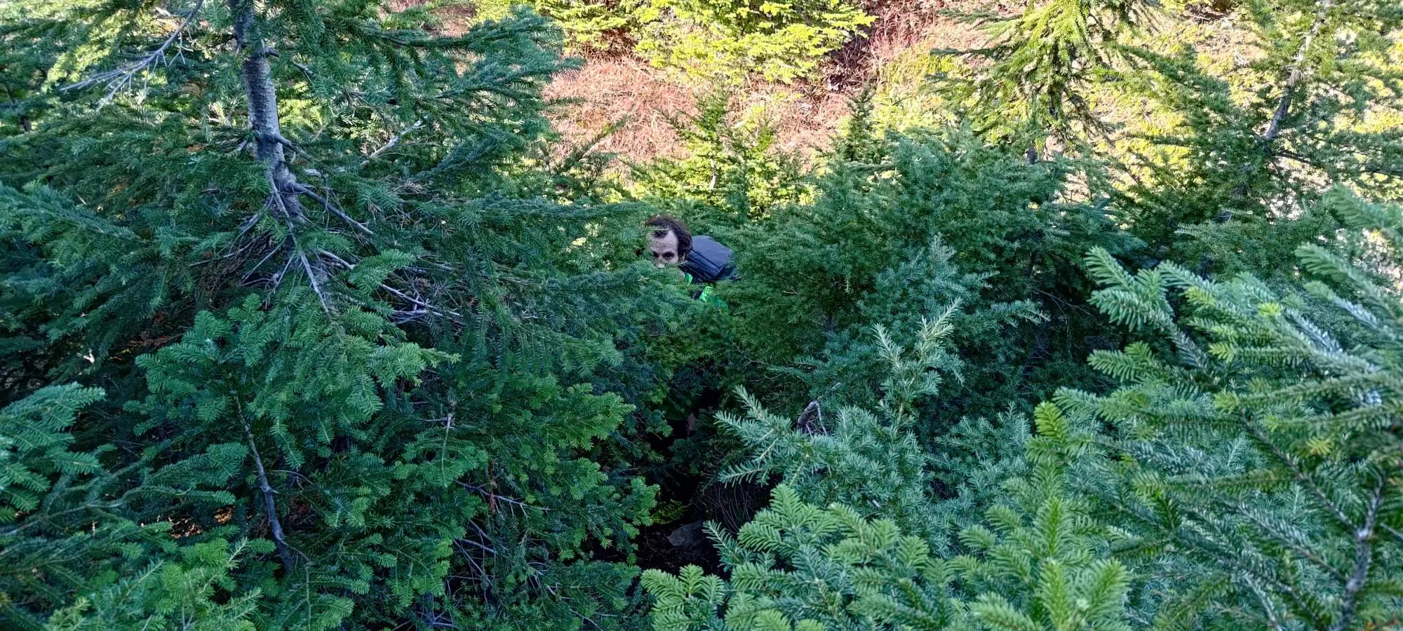
For whatever reason, the trail to Windsor kinda dies for about 8 metres here, with some rather thick brush covering the trail. Right after that it clears up again, but right at this spot after you turn onto the ridge, it is randomly quite dense. If you're here, don't fret, it is the way, and clears up quickly.
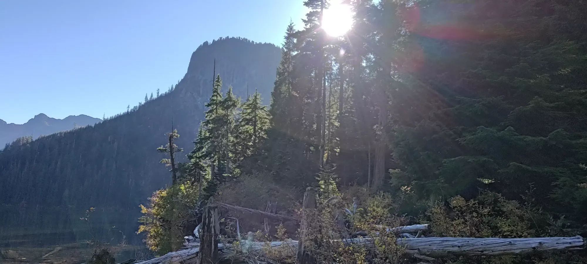
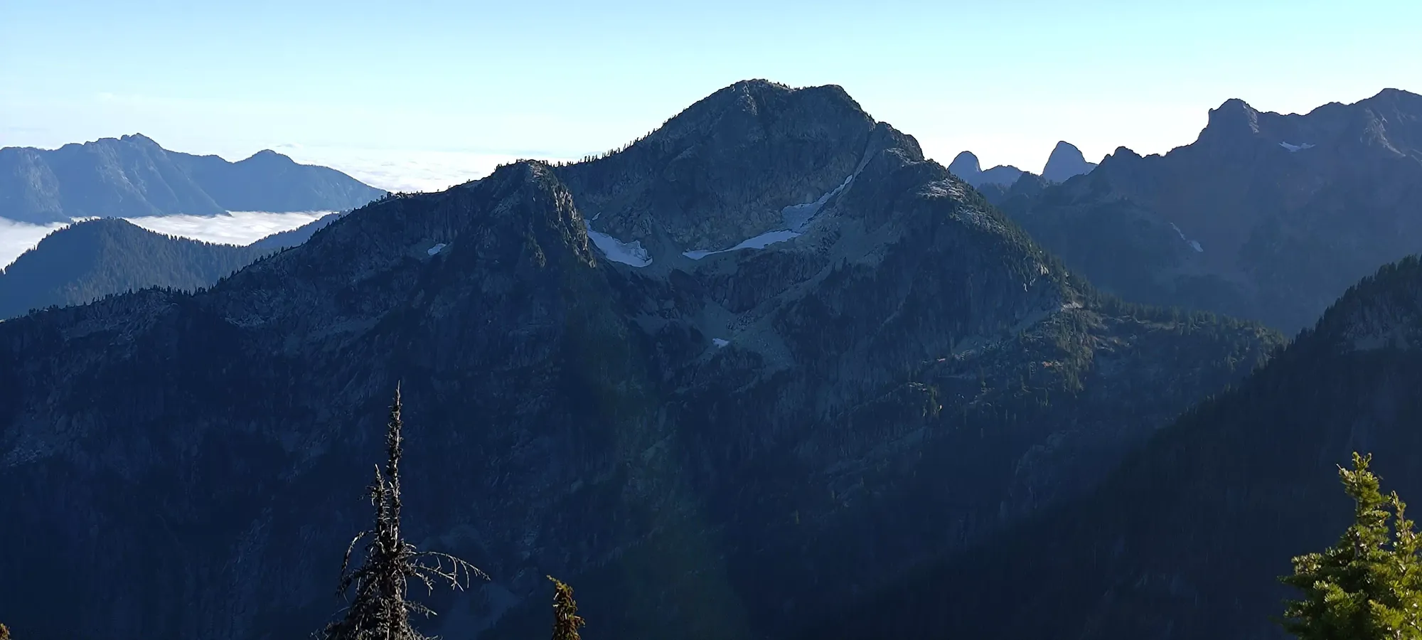
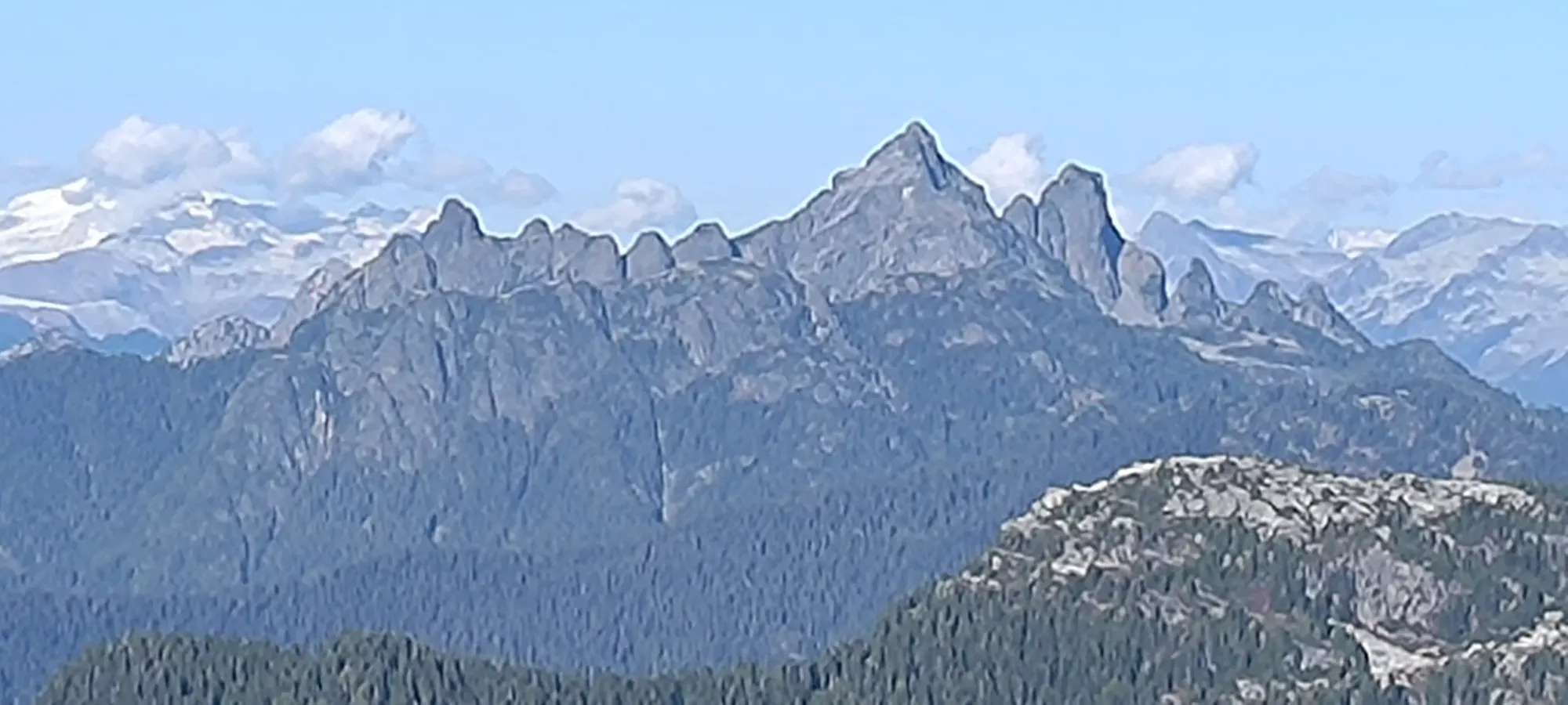
Past that small aberration, the trail is a regular "low use but nicely broken" kind of summit trail, with at most some bush-brushing, but otherwise easy to follow and walk on. Within a few minutes, we got a glimpse of our goal.
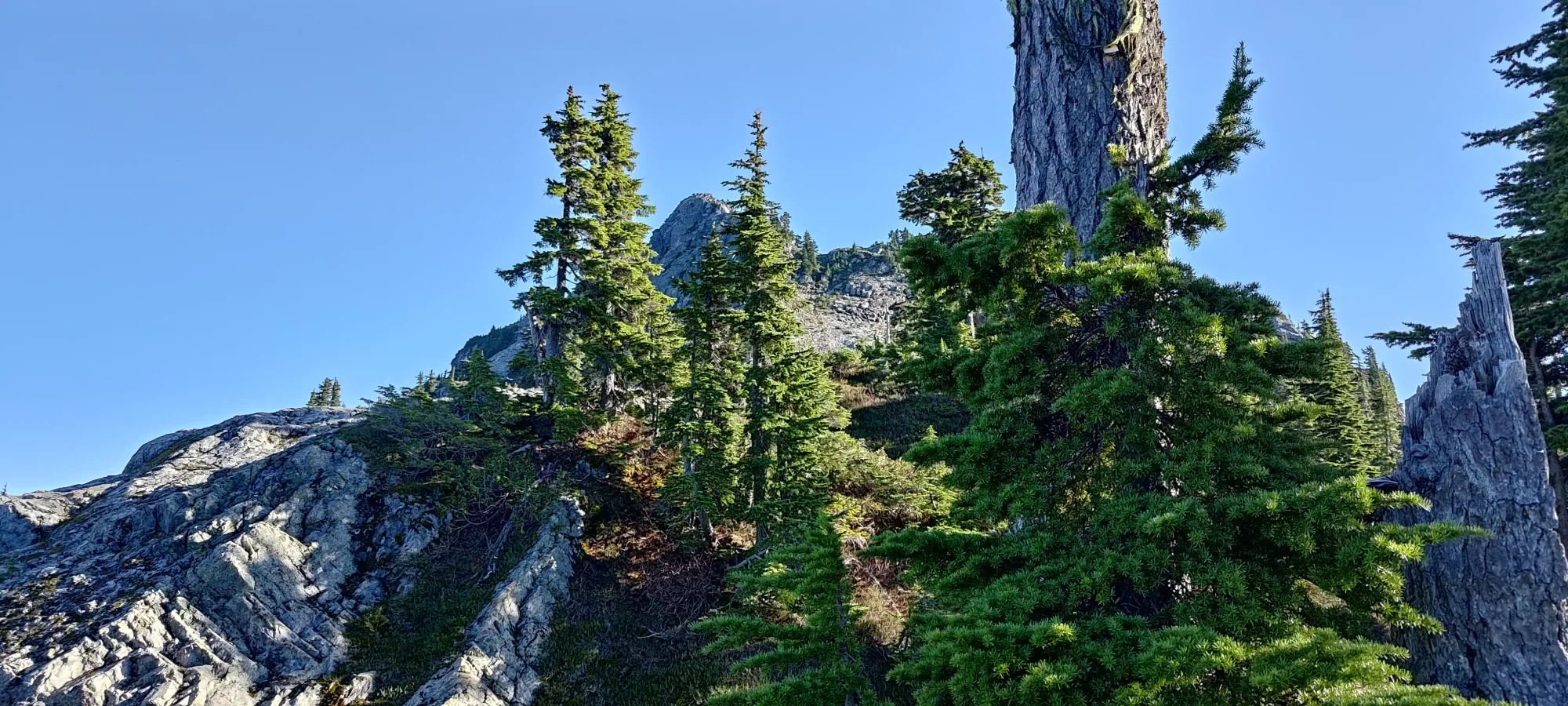
About 15 minutes after starting up the ridge, things opened into an open slope scattered with rocks, at about 1580m. The terrain here is pretty "everything goes", so we just aimed for "the fewest potentially unstable rocks", before curving up to climber's left, hoping to find an interesting summit scramble. The actual trail is hiking-only, and a bit further to climber's right, but that's boring, so we ignored that fact.
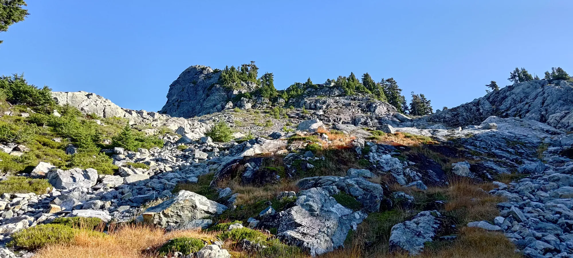
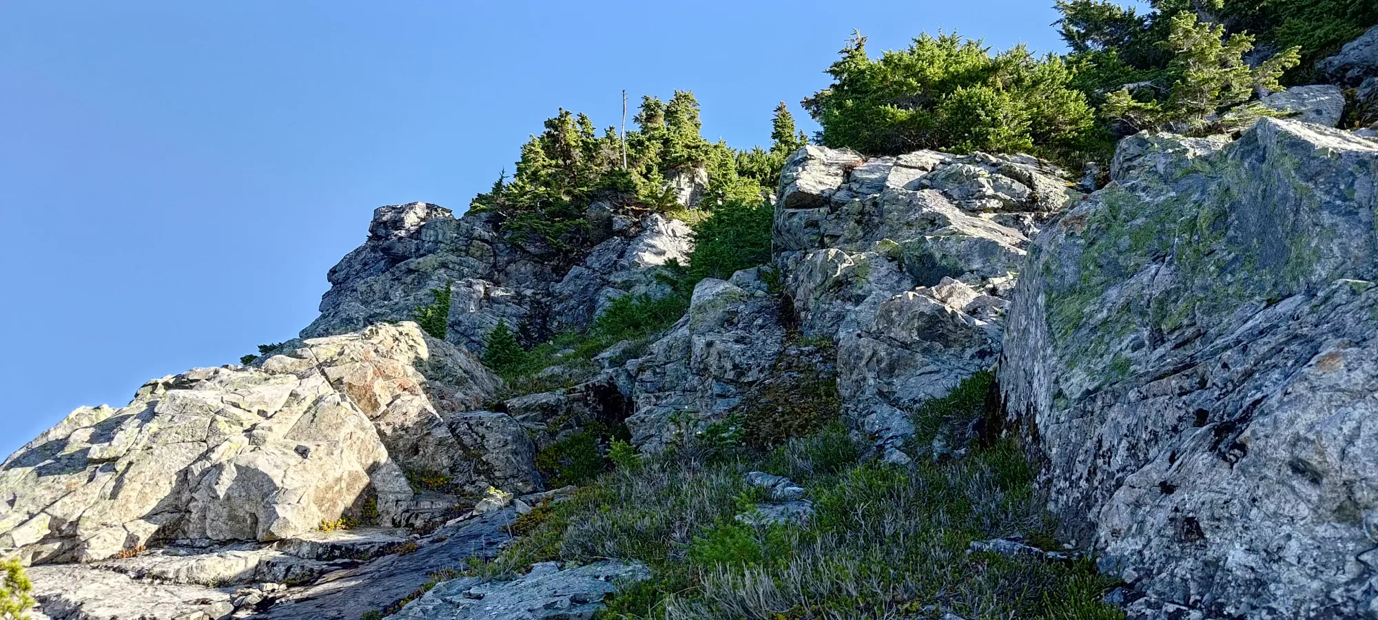
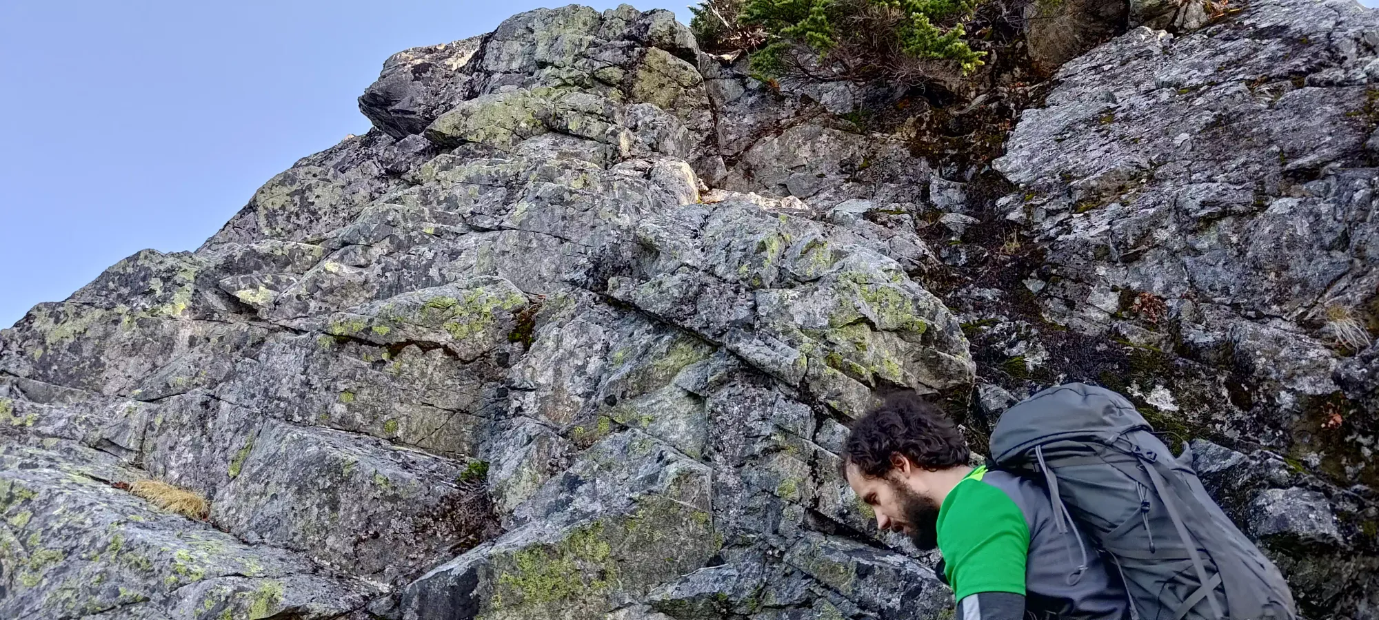
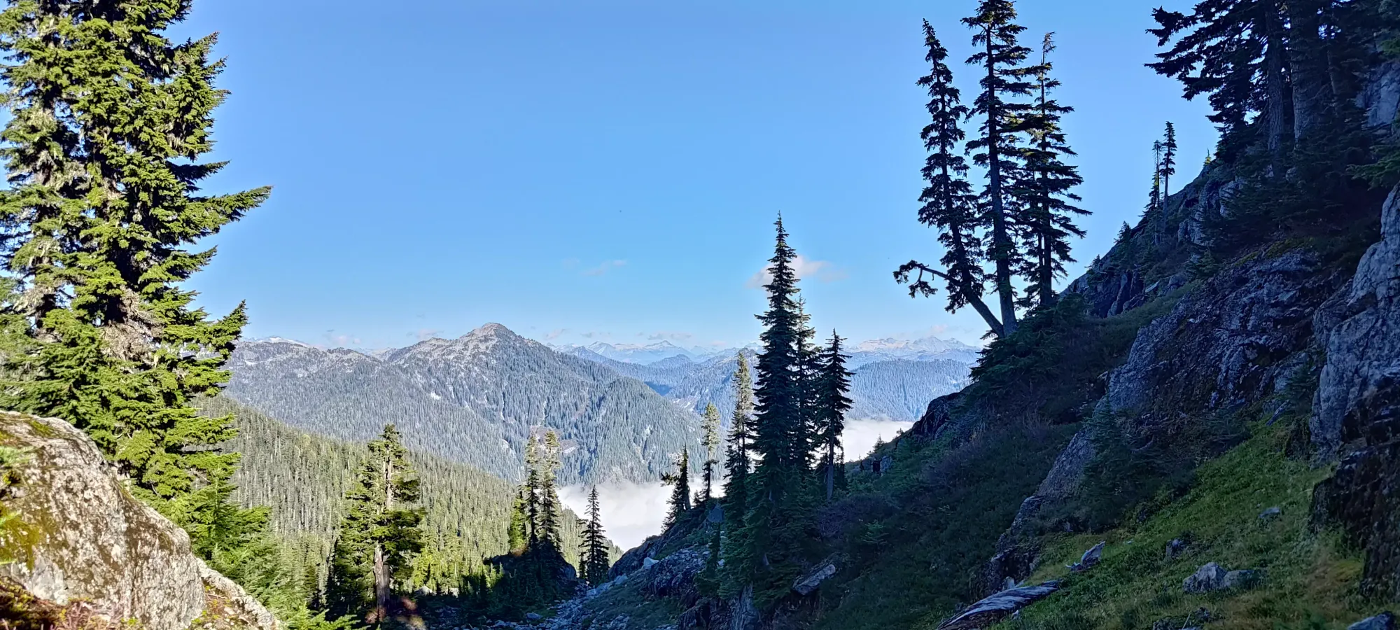
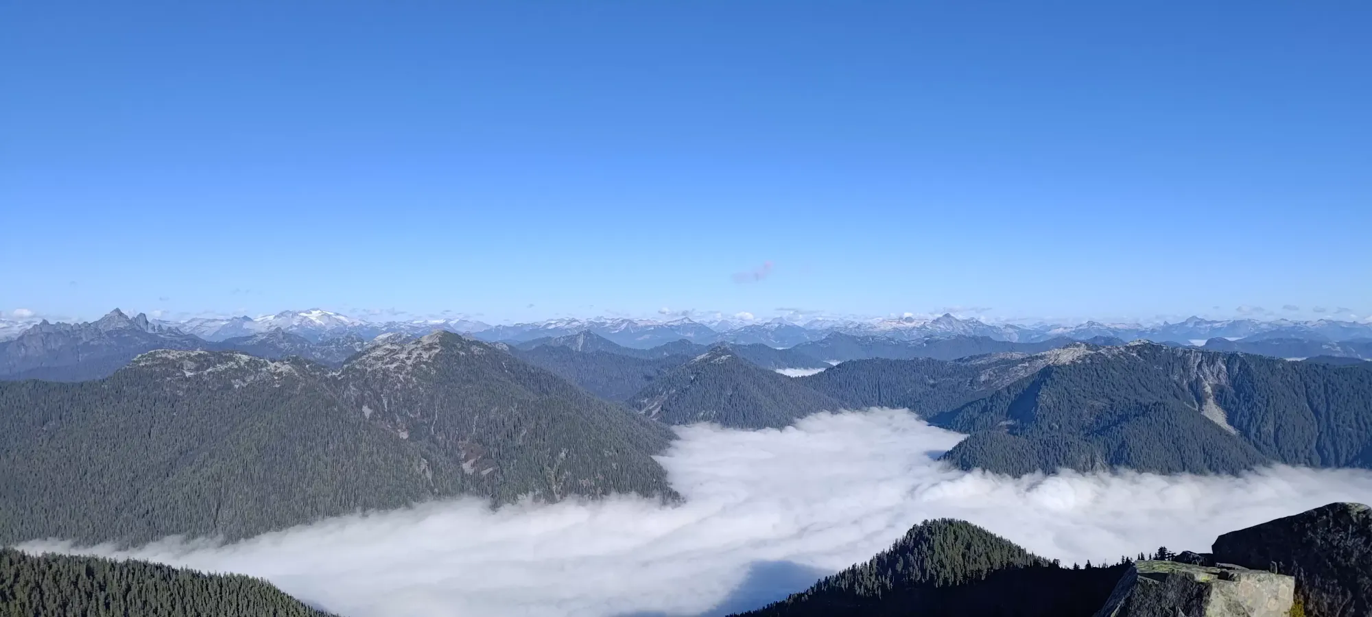
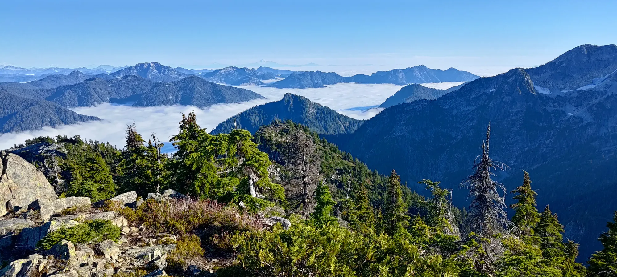
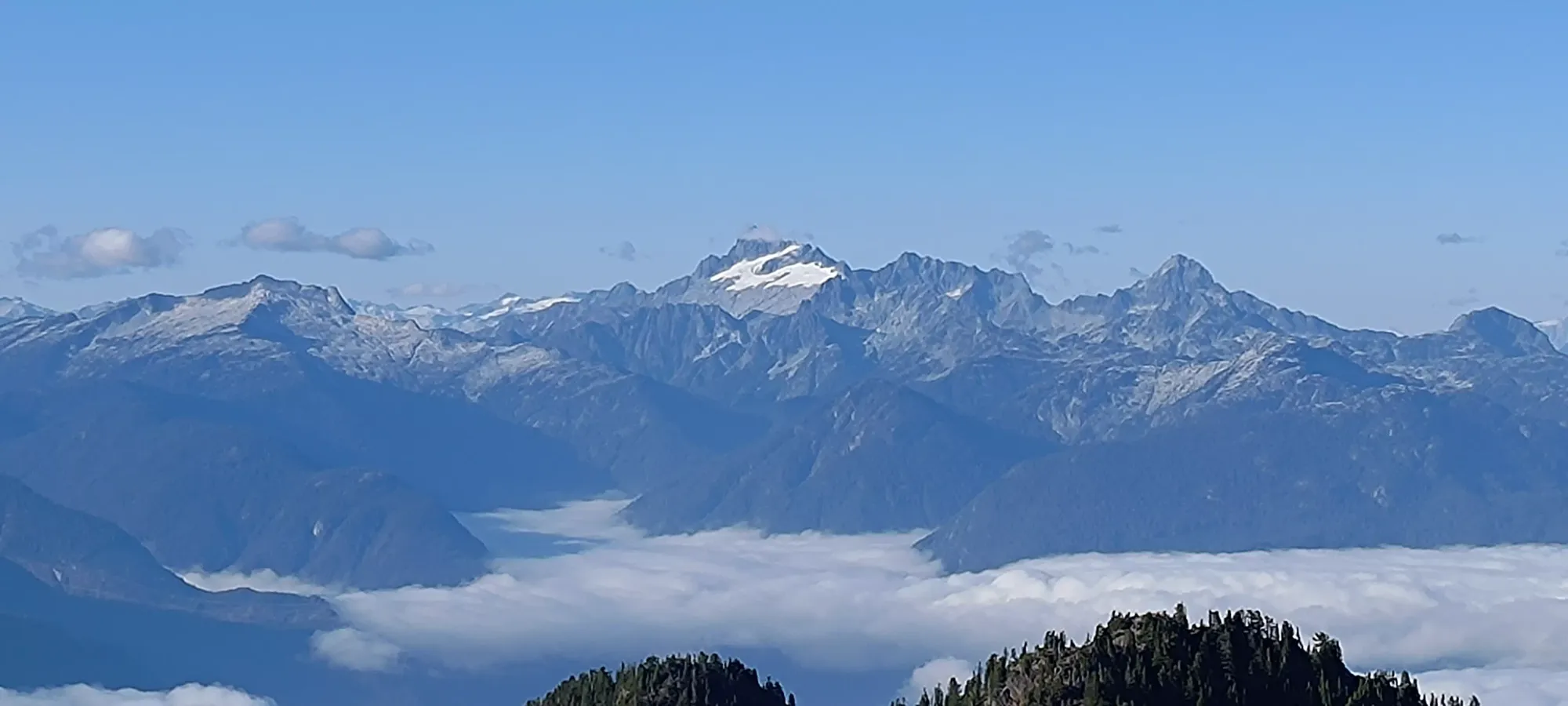
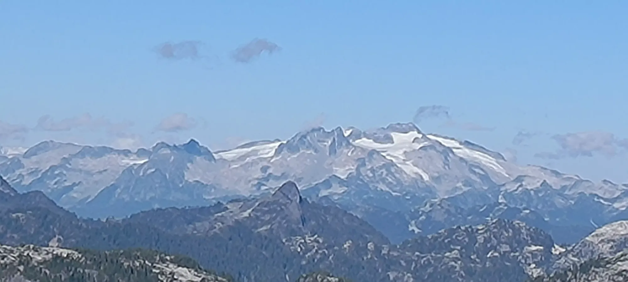
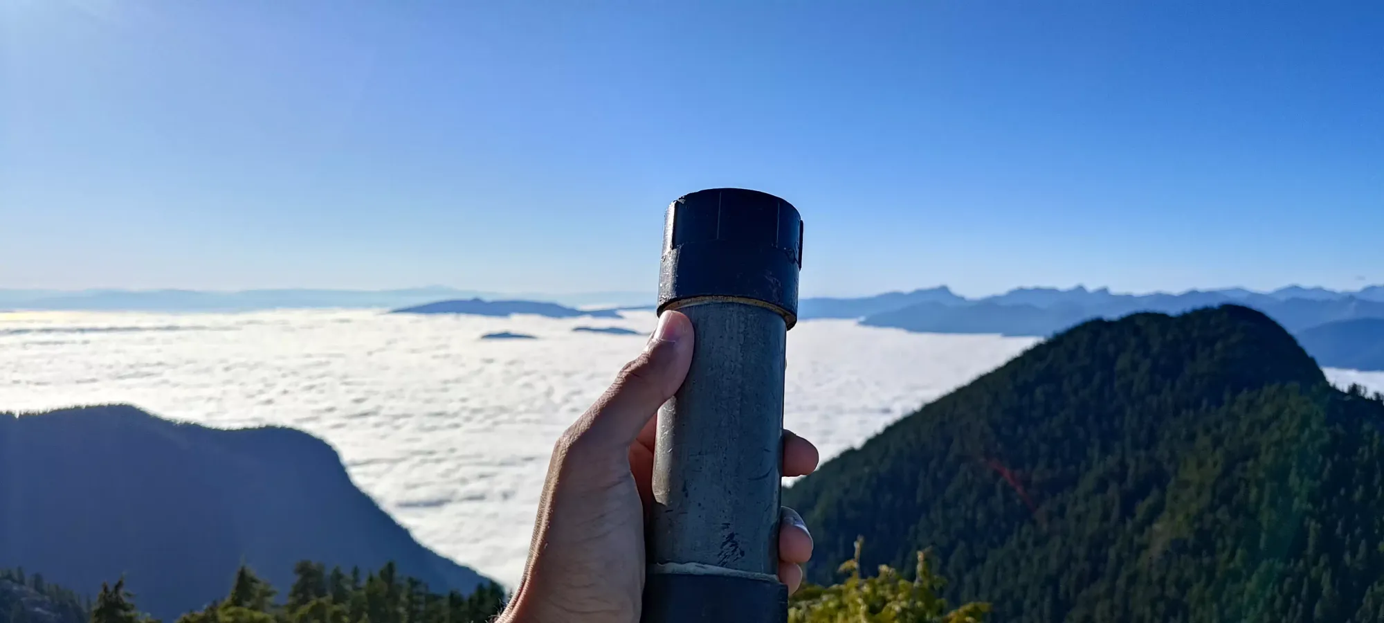
We figured that we'd been moving fast enough to "deserve" some fun scrambling, and so we chose to stay to climber's left in the rocks. The first couple routes, with the wetness of the week lingering, ended up being a bit too sketch for us, at least with our "not rock climbing" footwear. But we managed to at least find some terrain that was more interesting than just "walking up a trail", so I'd say it was a success. The dark bit behind Logan above with the dirt in it would be the most fun route, I'd say, if it was dry. We scrambled for a bit over 10 minutes before we eventually crested onto the summit a bit before 4pm. At the top, we discovered a summit register with hard-to-reach paper and no writing utensil, and a gorgeous cloud inversion blanketing the surrounding valleys, as well as Howe Sound. A surprise to be sure, but a welcome one.


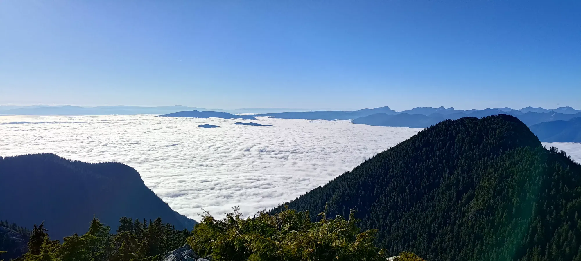
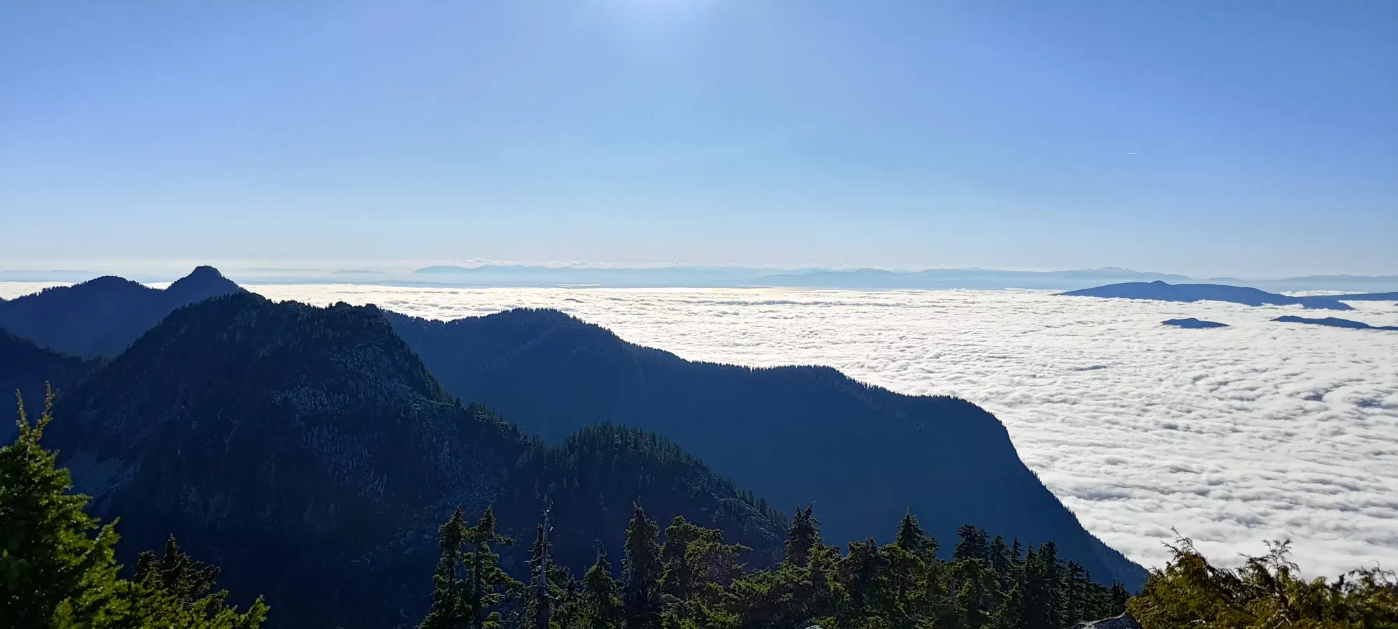
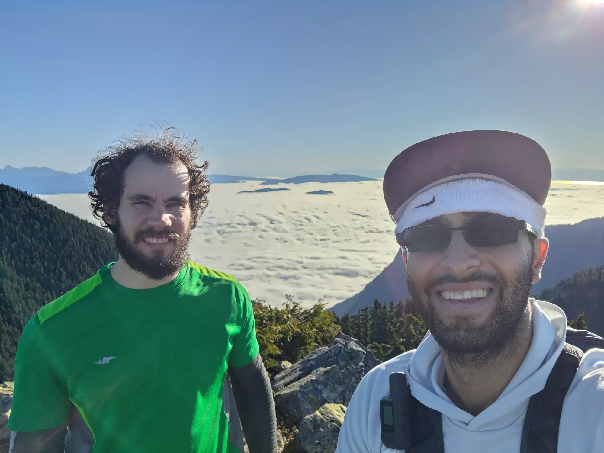
With the conditions so nice, we spent like 20 minutes chilling up top and enjoying the views. My mom happened to send me a picture of a mountain at the top (she's on vacation right now), so I responded with a picture of my own view. She of course said it "doesn't count" because she was looking at her view "right now", so of course I had to reply by video calling her as I was literally on the summit right then 😃. Nice timing, mom, that was probably the least opportune moment to say that to me. After that fun interaction and a few more pictures, we started our way down, as while the trail would be trivial to walk in the dark, we still didn't feel like being out that late (hence the single-summit objective).
With our Instagrammer-amounts of pictures taken, we finally started moving. At first, Logan led us a bit too far off the east side of the peak, but after realising it was going too far over a steep ridge we had to cut back to skier's right and over, we turned back, and took a little shortcut over to the trail a few metres below the summit, and started the journey down (we didn't feel the need to go down the wet, downsloping rocks we climbed up). After we picked our way through that open terrain, we found a folded-up sign nestled in some rocks. Out of curiosity, we unfurled it to discover a warning not to enter the Capilano Watershed! I'm not sure if it was supposed to be here or not, but we decided to leave it a bit more exposed than how we found it, letting people at least make an informed decision.

Once we got past this point, we got back on more beaten trail, and things got easier. Even at the muddy spot Logan got a little too familiar with on the way up, we found a couple hidden rocks to avoid repeating that, and managed to get through the steeper upper trail past the lake in about 35 minutes, making it back to the northern shores of Deeks Lake at about 5:15pm.
Beyond the lake, we more or less went into "mission mode", just trying to burn through as much trail as we could before dark, at least with my limiters of "my ankle can't take hard impacts or run, and I was trying to avoid turbulent movement to avoid angering my digestive system still". Getting down to the Deeks Bluff fork took us just about an hour from the lake, which we were pretty happy with, especially given the dense fog (probably from the inversion) that started a few hundred metres below the lake. This made it feel like the sun was already set, even though it was still bright enough to not need headlamps. At about 6:30, we made the call to go and tag Deeks Bluff too, since it is somewhat out-of-the-way, and we had the time+energy, so "may as well get it over with". We stashed our packs at this fork and headed out with just our headlamps (which we turned on here), and for me, poles.

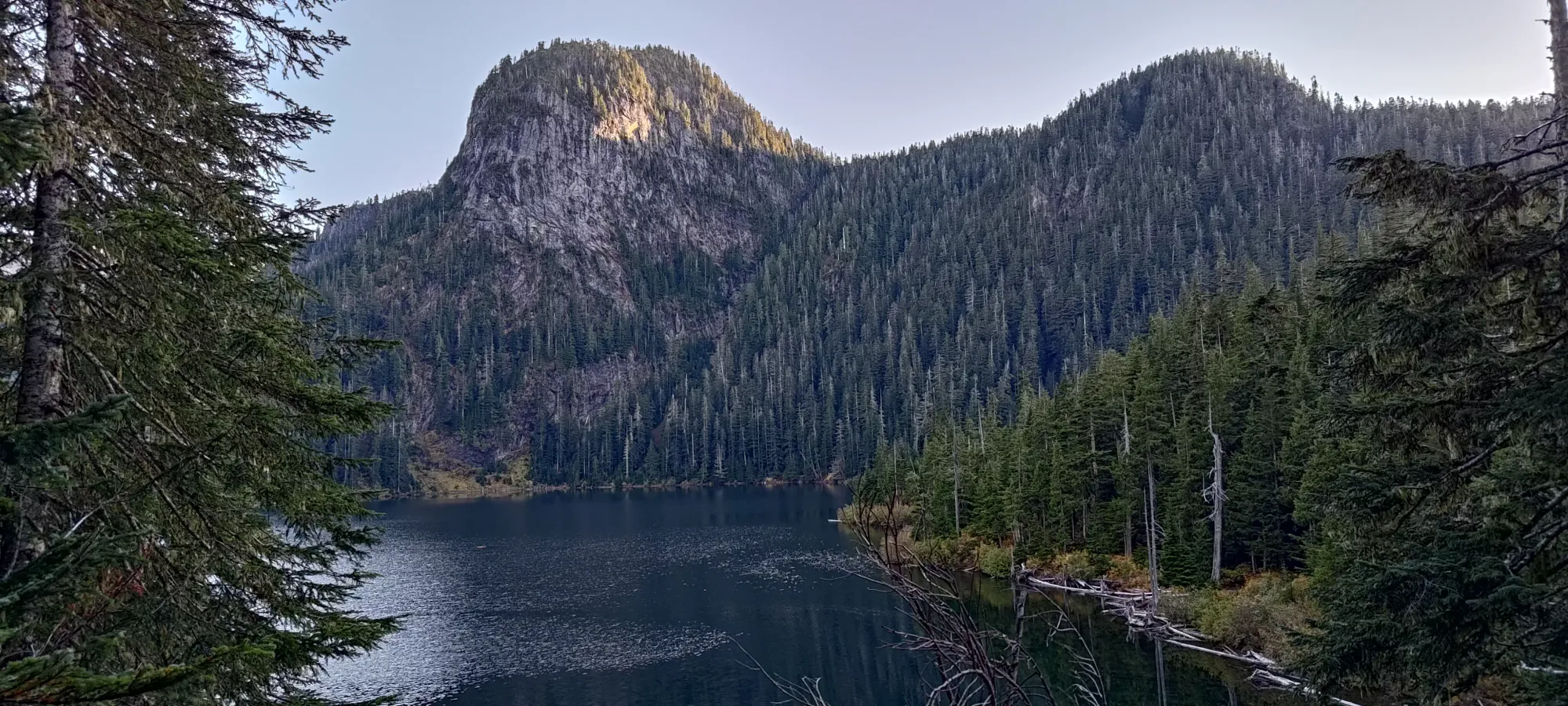
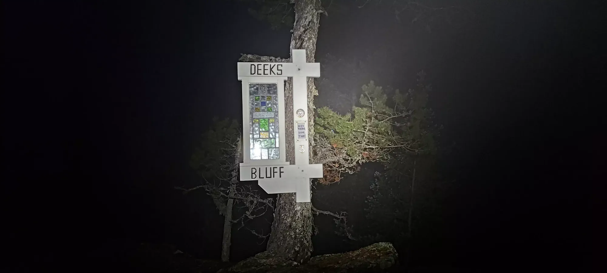
The detour was only about 15 minutes each way, with a short break at the top for pictures and a bio break. I finally got to see one of the somewhat-controversial stained-glass signs someone had put up on some north shore peaks. A few were mad at a religious symbol (the cross) being put up on the mountains, but to be honest, if nobody had told me about that, I'd not have thought there was one there, so I'm not particularly bothered, especially at such a "mainstream" viewpoint that was never going to be left alone anyways (there was paint on the rocks, and a bench as well). The best thing I can say about Deeks Bluff is "it was surprisingly more prominent than the 0 metres I expected".
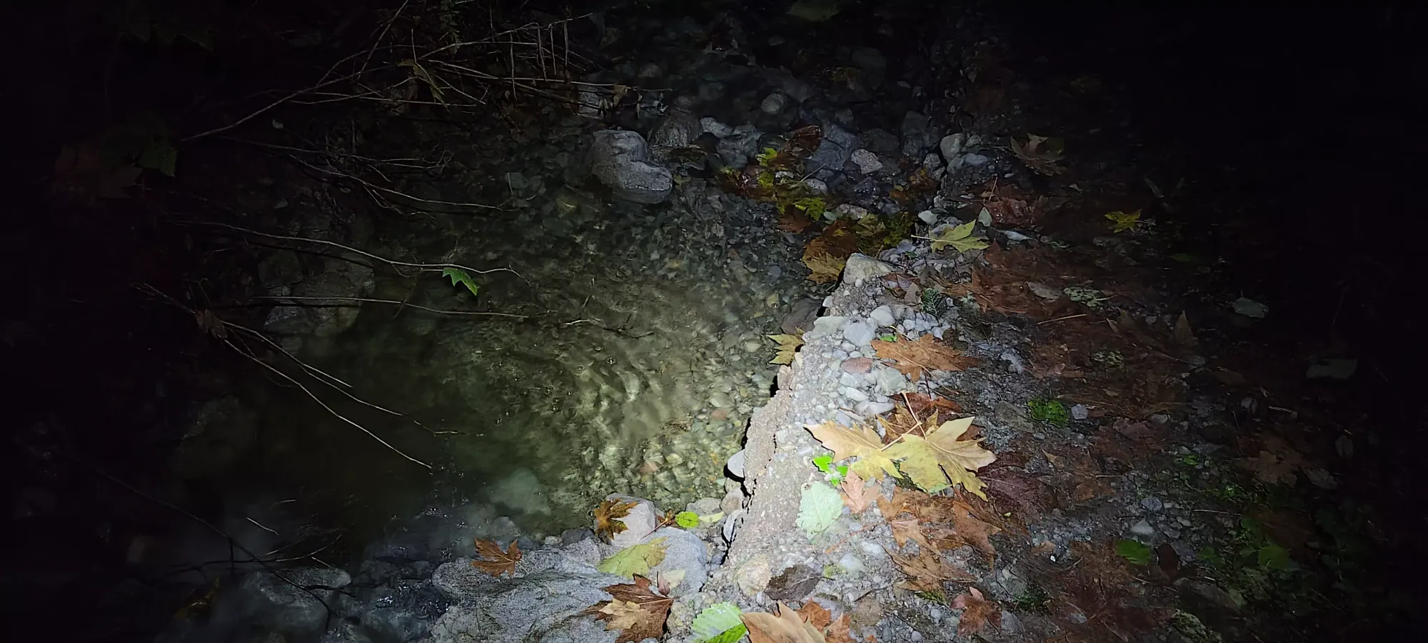
After making our way back to the main trail, it was 7:15pm, and Logan had to meet someone to pick up some skis before the snow season kicks off, so we were back in "get down mode". The trail from here is mostly a "somewhat rocky" old road, and I did at least remember to take a picture of a larger point of erosion where the creek really "takes over" the trail. That section only lasts a few minutes, at least, and for the most part, we just walked down uninterrupted.
Once we got to the fork, we "happened to miss the turnoff and unfortunately had to descend the more direct road out to the parking which doesn't lose an extra fifty metres", which was so unfortunate. Since it was technically possible, though unlikely, that there was active traffic, we ducked into the forest once when we head some loud engine noises, but it turned out we were just close to the highway, and there was actually nothing there 😅. Then, pretty close to the end, we saw some lights approaching and ducked away again, only to discover it was not angry mine operators, but some trail runners. We joked about the situation, then headed down together. They happened to know that there was a camera at the bottom, and offered to lead us down with beta on where to go lights-out to avoid any issues, which was cool. We got to the cars without issue (turns out they were actually parked right beside us!). As we de-geared, amusingly enough, it turns out they even knew who I was (because of my injury on Wedge). We had a fun conversation about that, and they headed to Vancouver as we went back up to Squamish for a ski purchase and some dinner before going our separate ways.
Overall I would say this is definitely a nice peak+area to check out. The trail up all the way to the Deeks+Windsor col, honestly, is super efficient, and you even get some nice waterfall, creek, and lake views along the way. Once you're there, you have a couple peaks with good views to check out, which would be hard to add onto a HSCT trip anyways, so why not enjoy yourself and take 'em in by themselves. It was also nice to edge closer to 2000m gain than 1000m, as it had been a few weeks, and I was getting scared I might be getting weak 😅, which thankfully seems to be okay for now.
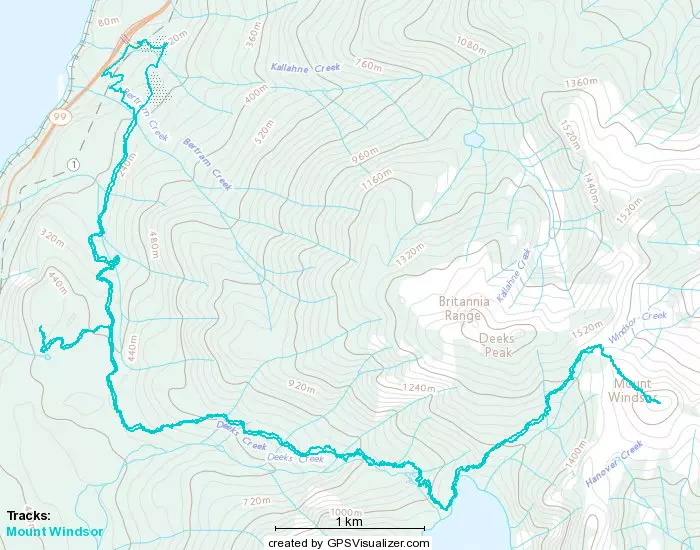
GPX Track + Map