McCrae Peak - June 9 2024
A fun ski peak with some spicy scrambling (at least in shoulder season) to top out. p600 for those who are into that. Plus, the road goes up super high so you can skin to/from the car even in June!


Central Duncan Ranges, Revelstoke, British Columbia
2504m
After spending my Friday driving and my Saturday on a failed attempt on Mount Victoria's north summit (trip was so short it wasn't really worth writing about, basically I went out with some new partners, someone who wasn't equipped for the mission was added discreetly, we started far too late, and had to turn around well below the summit due to warming conditions), and having the plans to go up to the Columbia Icefields canned after a long planning session in the afternoon that followed, I was kinda frustrated and tired. I'd driven for an entire day, camped for the brief night (which is never easy for me with my digestive issues), then had a peak attempt failed for largely avoidable reasons, then had my afternoon spent waiting for people who said they were committed to a plan slowly back themselves out (while keeping me in Lake Louise, trapped by the need to retain cell service for this process). So, at some point in the evening, I just said "screw it", gave up on the idea, and started driving west, figuring I couldn't do a high, glaciated peak solo (the original idea of the trip was going for some 11000ers), so I should at least get somewhat closer to home, and go for lower peaks in that direction I could handle myself.
Before I committed to the misery train, though, I reached out to Charles, who I met and did a couple peaks with in Squamish (including Wedge, where I sustained my large, lasting lower-body injuries), and then got to meet up with for Assiniboine to mark my "pretty much recovery" 6 months later. Since then, though, as he moved to Revelstoke, we'd been unable to meet up. I figured since I was going to pass through on the way home anyways, if he was free, we could do something, and I sent a text asking him to "save me from my write-off of a weekend" 😅. After some back-forth about conditions and potential objectives, we found McCrae Peak, a peak where one could skip the tedious approach due to a road going above 1700m elevation, there was reportedly good skiing to be had, and even some scrambling to reach the peak. That made us both happy, so I crashed on his couch that night, we took a casual start for the day (we both needed sleep badly), and we set out in the early afternoon.
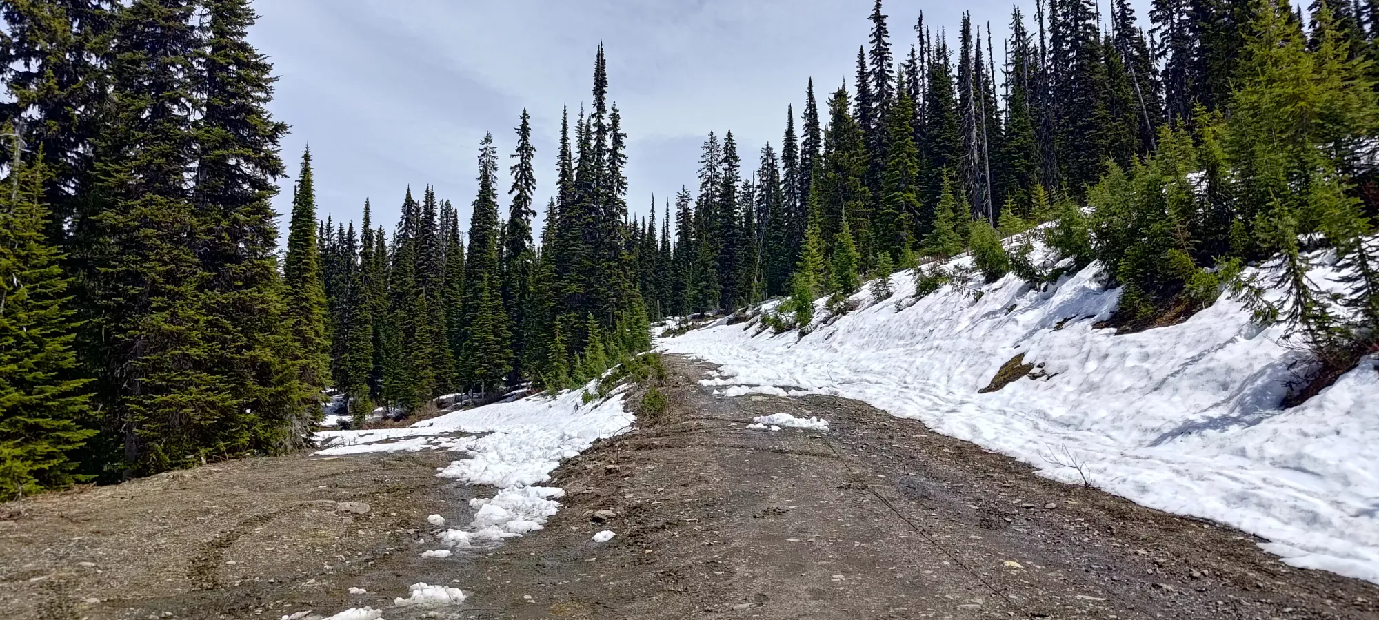
The drive up is pretty simple, and AllTrails has a good description of the route, so I recommend reading that (as Google will not lead you down a driveable path, as it wants you to take a route blocked by concrete blocks). Charles said he'd not take his personal sedan there, but I think a 2wd sedan could get up just fine. We stopped at the fork at 1700m where snow appeared very suddenly and consistently, and were the only people present (there was a party camping on the road, but we never saw them on the mountain). It appears you can drive another 1.8km to 1770m, but we were forced to accept a little road skinning still, even in June. Definitely better than road-bootpacking, though!
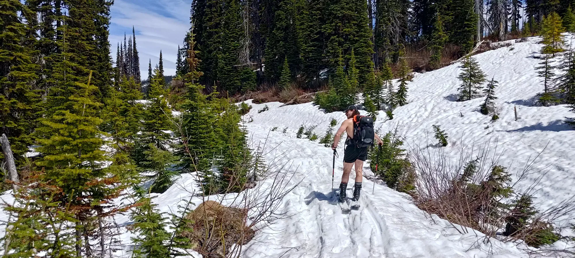
After gearing up (and a bit of gearing down, it was so warm Charles went shorts and no shirt, and I left my shell pants in the car, going with the thinnest baselayer I had (I was packed for the Columbia Icefields, not a sunny day topping out at 2500m) and a t-shirt), we started the glorious process of skinning from the car in June at 1:20pm. Not the time I'd recommend for good skiing, as everything was already slushy and wet as heck by that time, but it was a compromise we were willing to make for actually having sleep and just "having a good day out", which was most of what we were looking for.
The road skinning was pretty boring, so all I really have to say about it is "there's an annoying downhill right before the road ends which forces you to lose about 30m, meaning you'll need to gain that on the way out". Oh yeah, that and "we saw some sled tracks here, and they unsurprisingly did not end at the sign which said vehicles were not permitted beyond". For us, at least, they provided a somewhat-compacted snow base to skin on, since we'd be sinking a bit otherwise given the late hour and soft snow brought on by that.
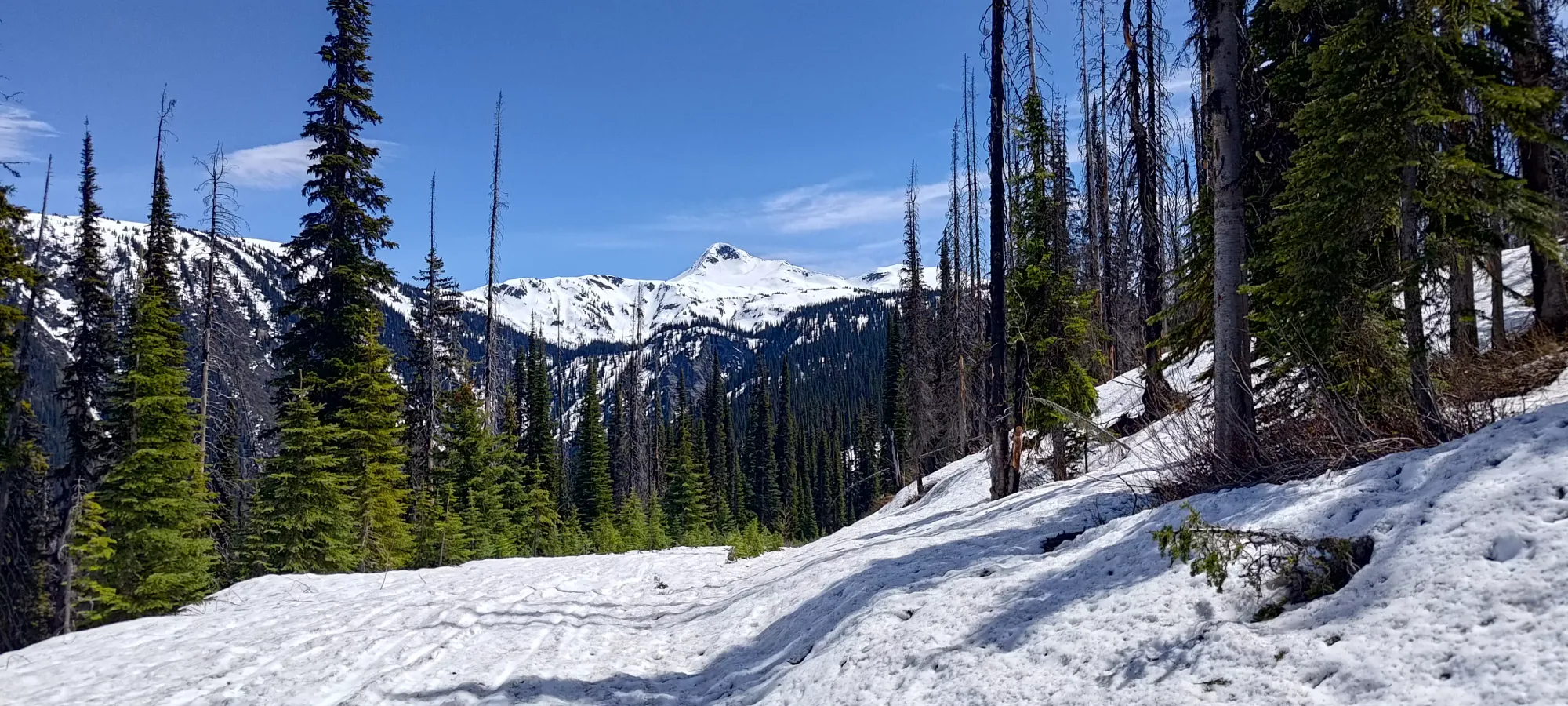
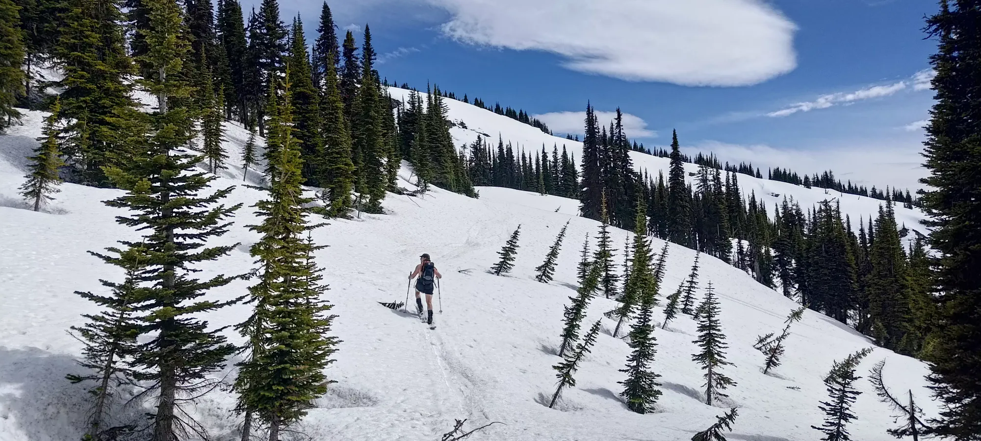
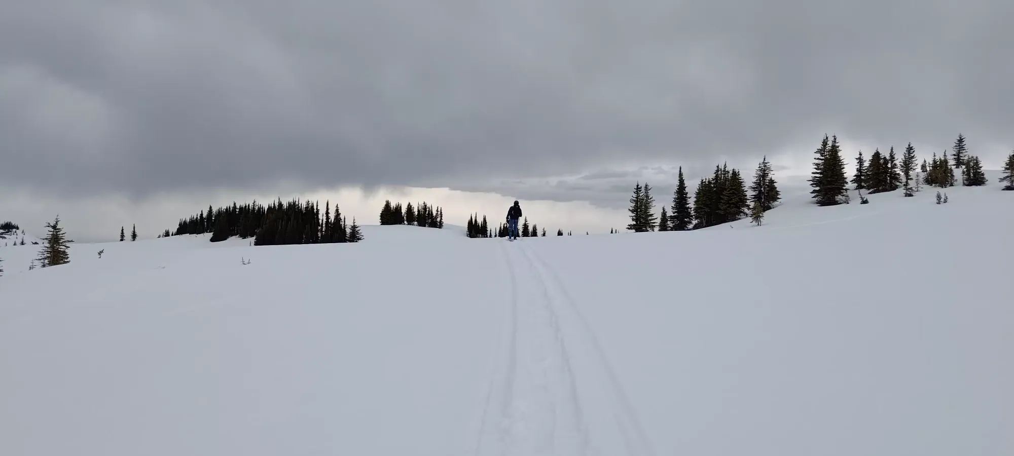
Once the trail starts, it turns up through a cutblock until the trail gets back above 1800m, and then it enters a well-spaced, mature forest. We DIY-ed our way into the cutblock by following close to, but not exactly beside the trail markers to avoid some dry spots, but quickly picked up skin+sled tracks again, and followed them for a good while thereafter.
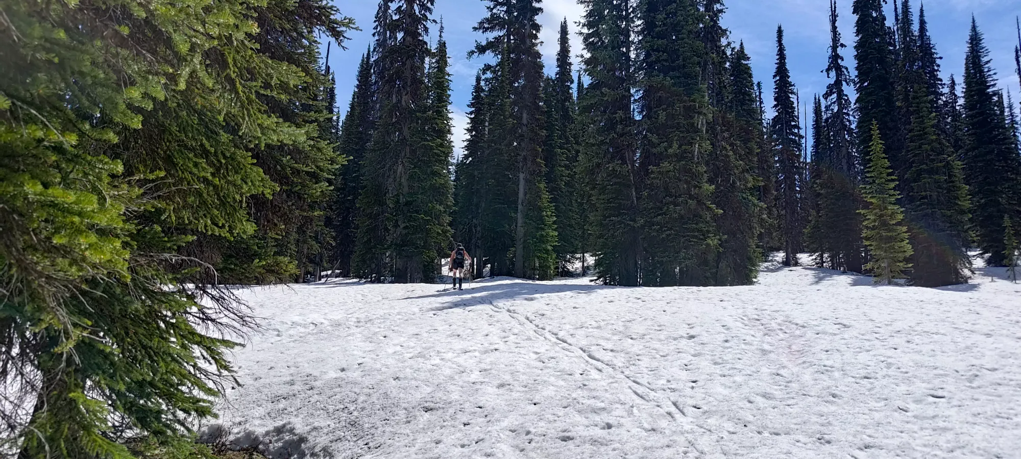
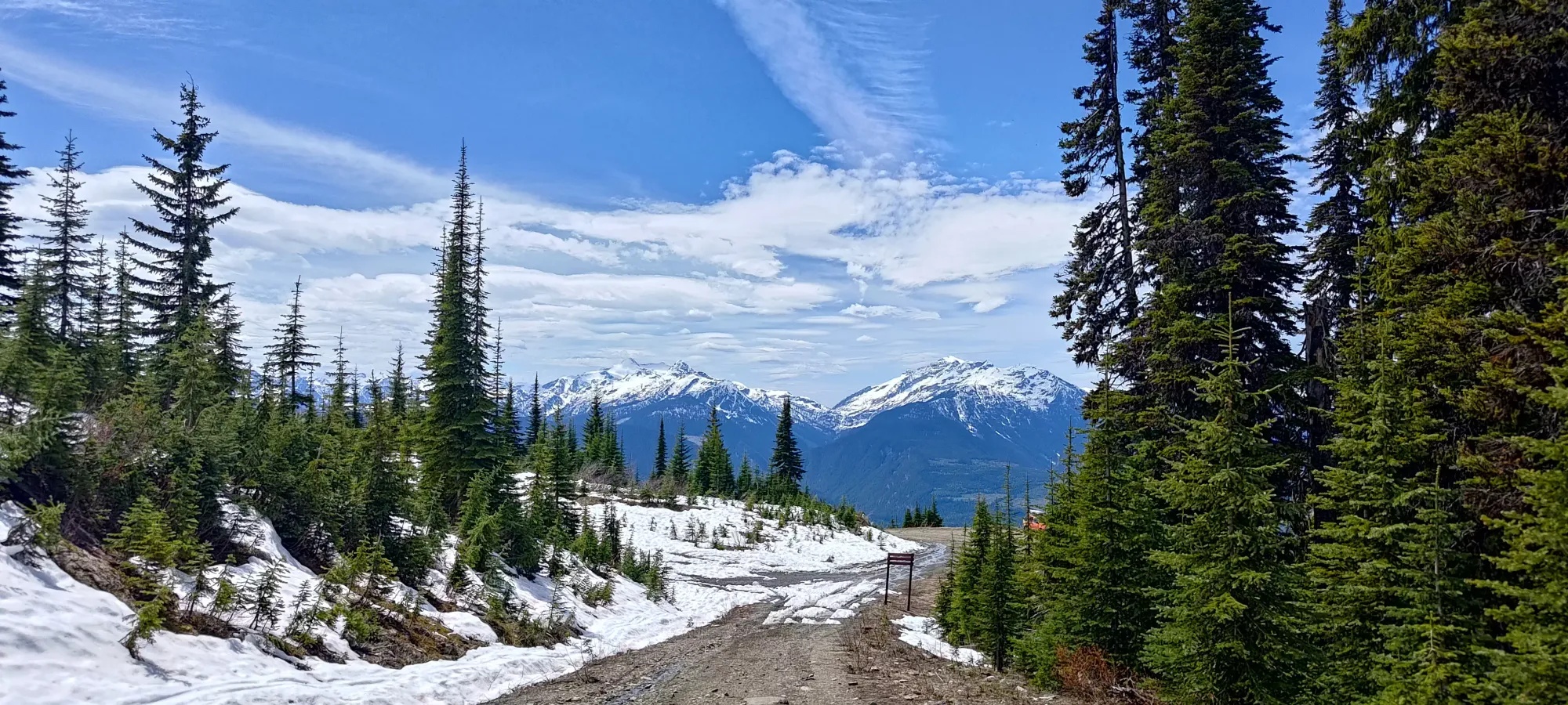
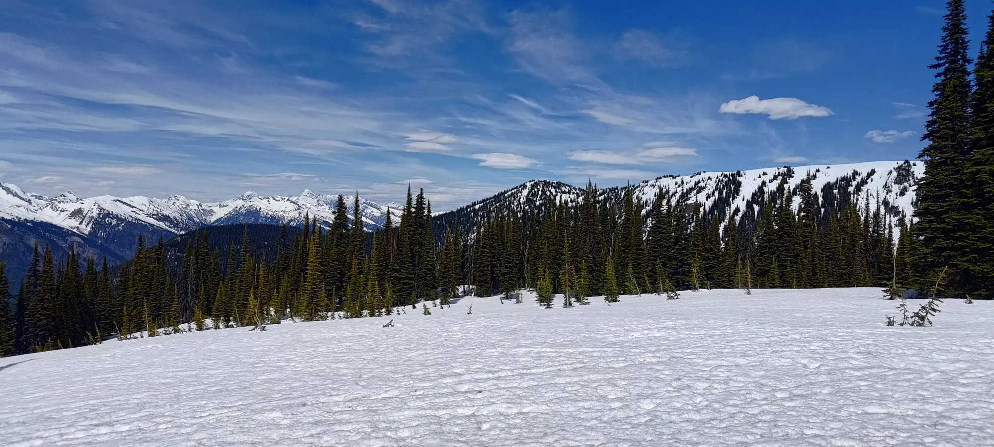
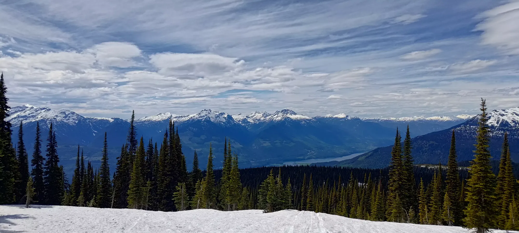
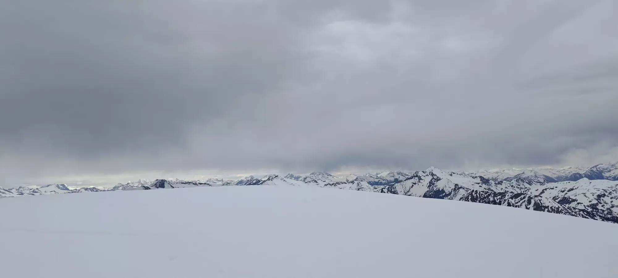
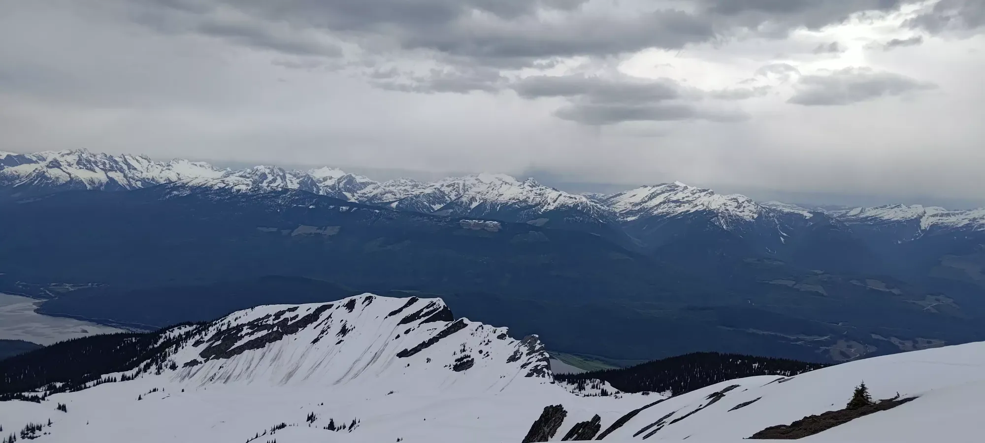
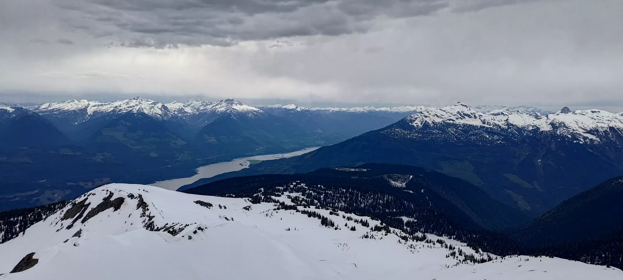
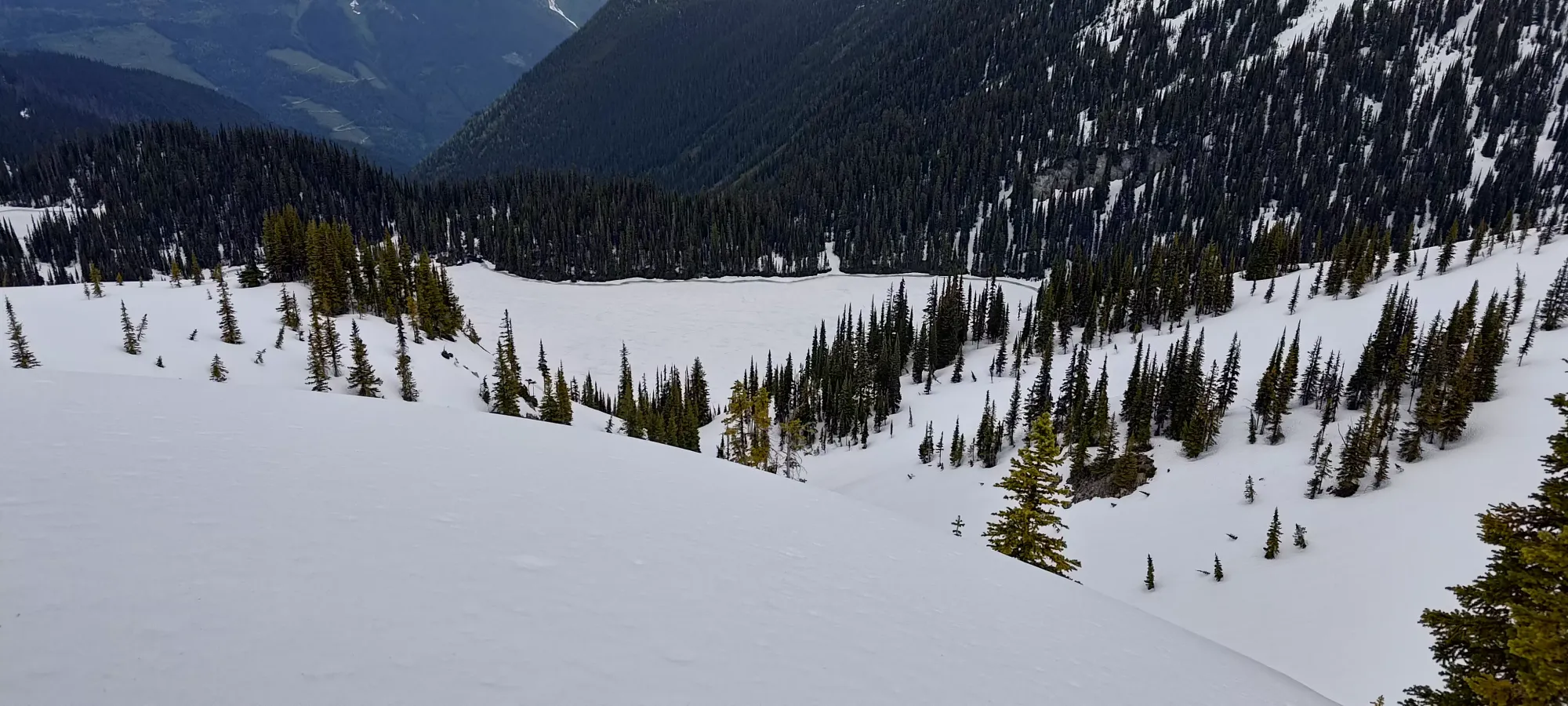
We did diverge from the tracks (largely, there were so many we often would run into them even when off the beaten path) above the flats near 1900m, where we went further to climber's right, and climbed up the west side of the first bump along the west ridge. Here I was reminded of Charles' love of steep climbs, as we cut a fairly straight-up track to this bump. I kept up better than I expected to that point, but started really feeling it as we gained up to ~2070m and got our first good open views at this viewpoint before continuing on. This was about 80 minutes in, and about 4km with our extra road skinning factored in.
Past this point, there was a small descent to make (under 20m), then we contoured around to find a mini-valley that bypassed a couple potential bumps (which would lead to elevation loss, and were also potentially steep enough to slide (even if with minor consequences), and wound our way up towards the ridge on the climber's right side.
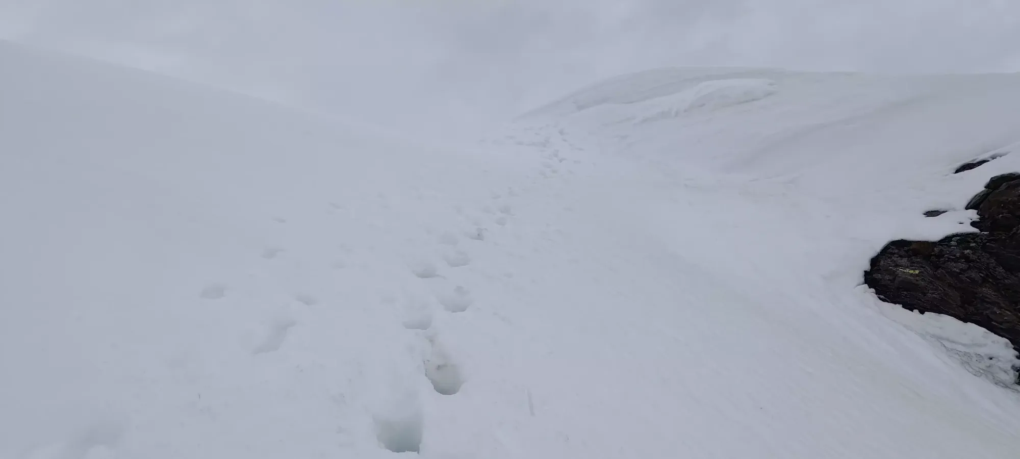
We did finally have to get on a steeper slope at about 2150m, but with fairly low consequences, as the slope was rather small, had some trees to break up potential slabs (not that we were worried about breaking off slabs with the conditions we had, just taking your downhill partner out with some wet loose if you're not careful), and a safe runout. After a switchback or two, we were mostly on the ridge, though we had a couple long stretches between turns thereafter before we truly were "on top" of the ridge instead of on the broad sides of it.
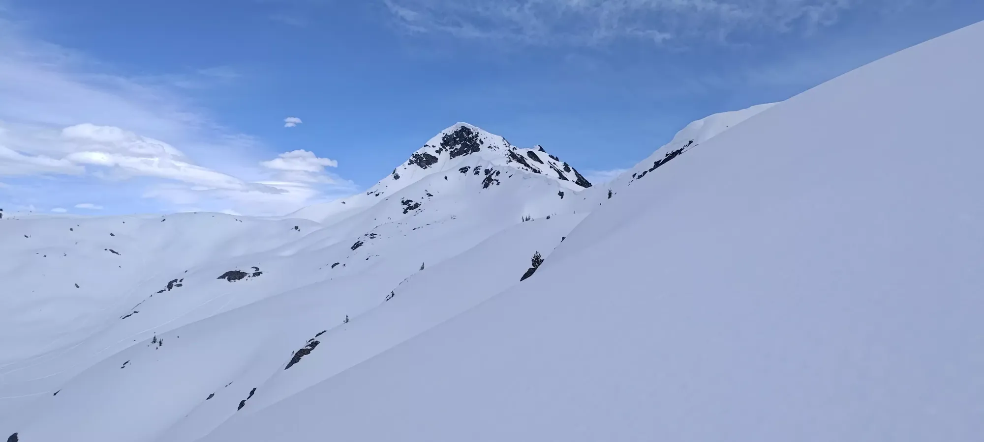
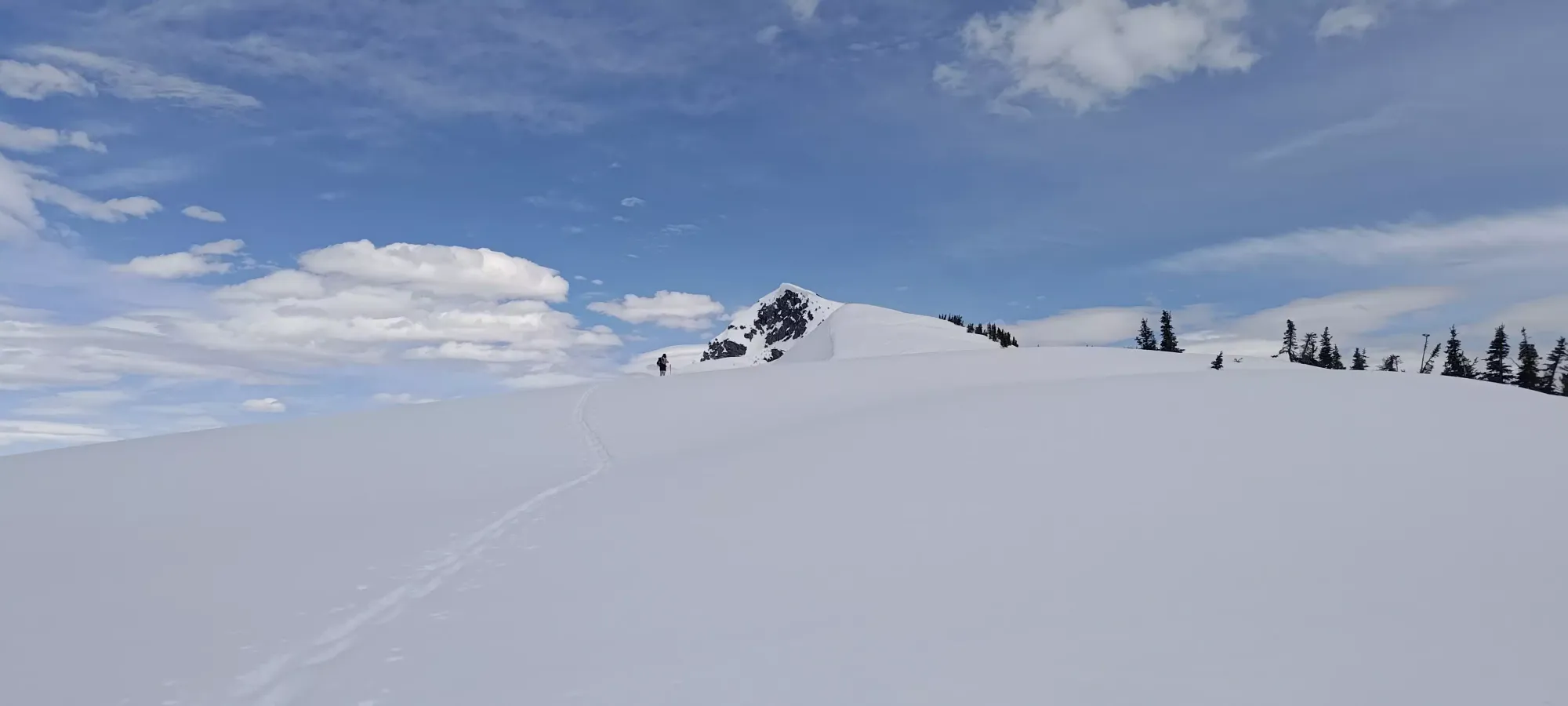
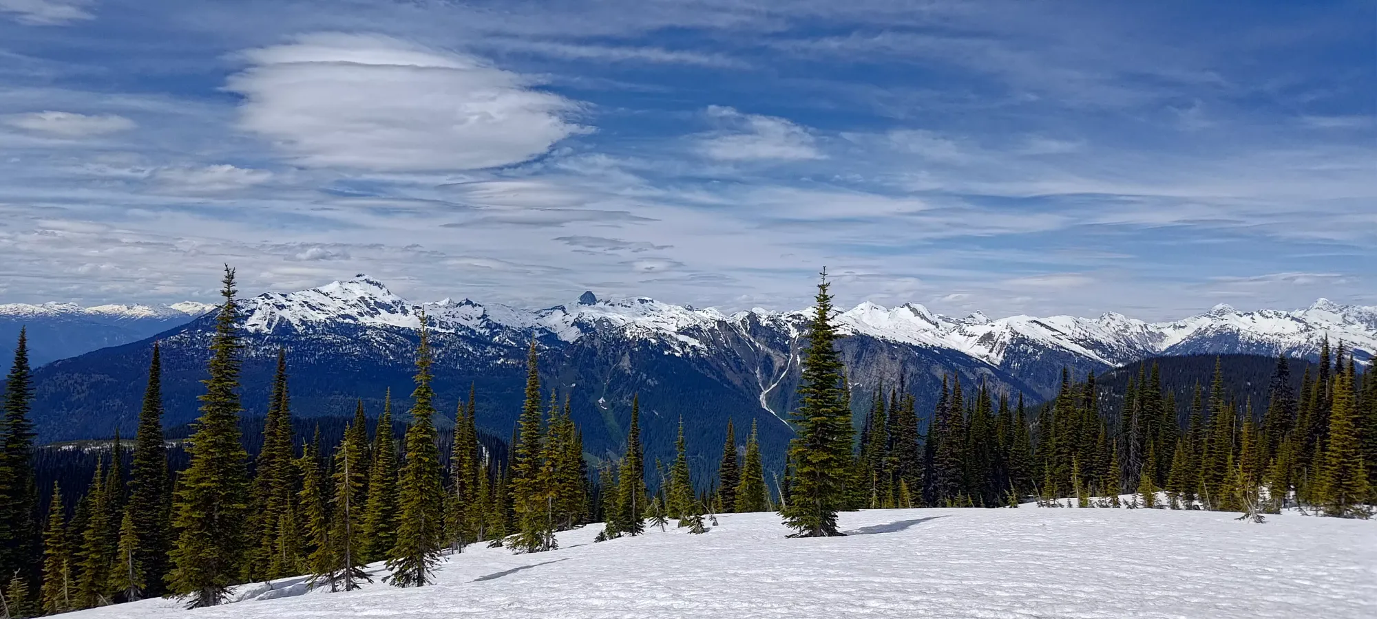
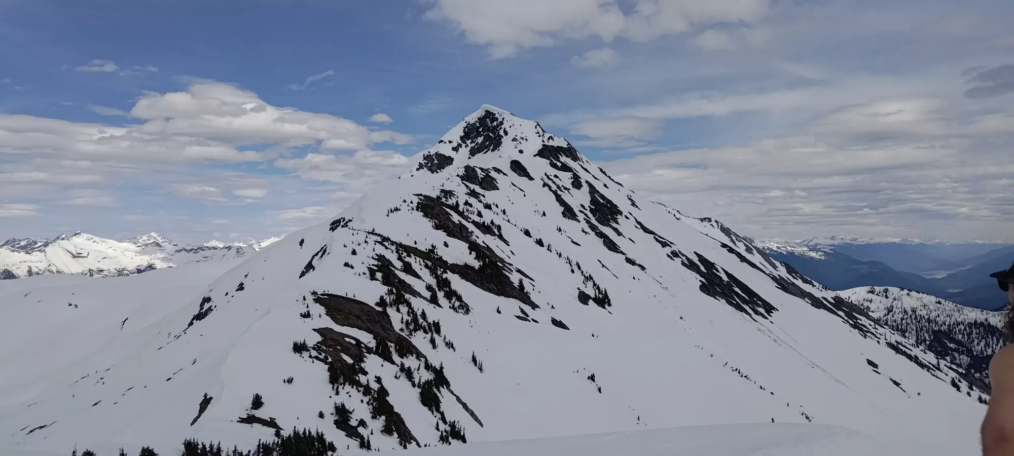
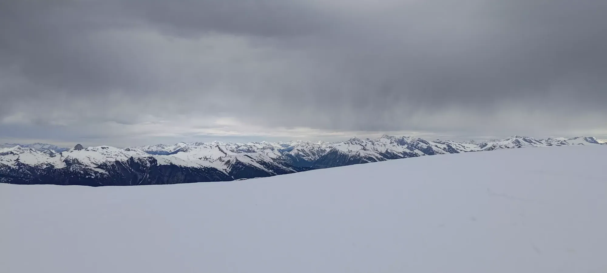
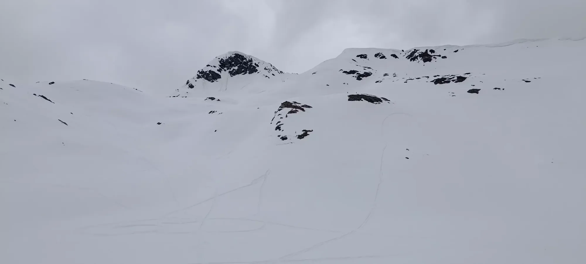
Once on the ridge, we skinned for about 10 minutes to hit the 2324m subpeak, where there were some poles marking it as "something". This gave us a good view of the side ahead, which looked largely snow-covered, but also had a section of what looked like either very steep snow to climb (which had already slid), or some bare rock that would have to be contended with. We considered bringing trail runners for the scramble, but decided against it, so at least I was hoping the rock would be easy enough for ski boots, or avoidable upon closer inspection.
We decided to skin-ski down to the bottom of this col (about 50m of descent), which would've been less scary if we didn't have very warm cornices the whole way limiting our ability to turn and slow down 😅. Once we got down, we had our designated break before the summit push, and I suggested we layer up while we had a flat, dry (some exposed+dried out grass at the col) ground to work in, as we both had to take our boots off to put some pants on. This turned out to be a great idea, as the sun was starting to disappear in some thicker clouds, and wouldn't return for the rest of the day. That plus the increased winds on the ridge made us both glad for having done this when we did. We had a nice half-hour to do all that, and got moving at about 4:10pm.
We skinned for a bit past our rest point, but near 2300m we found a set bootpack up a slope that was too steep to skin, and there was no good place to try and drop into the bowl and skin up to another point, as the ridge was corniced heavily basically the whole way, so we strapped our skis onto our backs, I brought my crampons out (arguably not the best choice, as I probably wore them out and made my contact with rocks less stable a lot more often than I got grip on snow I otherwise wouldn't have), and we started the real suffering 😆.
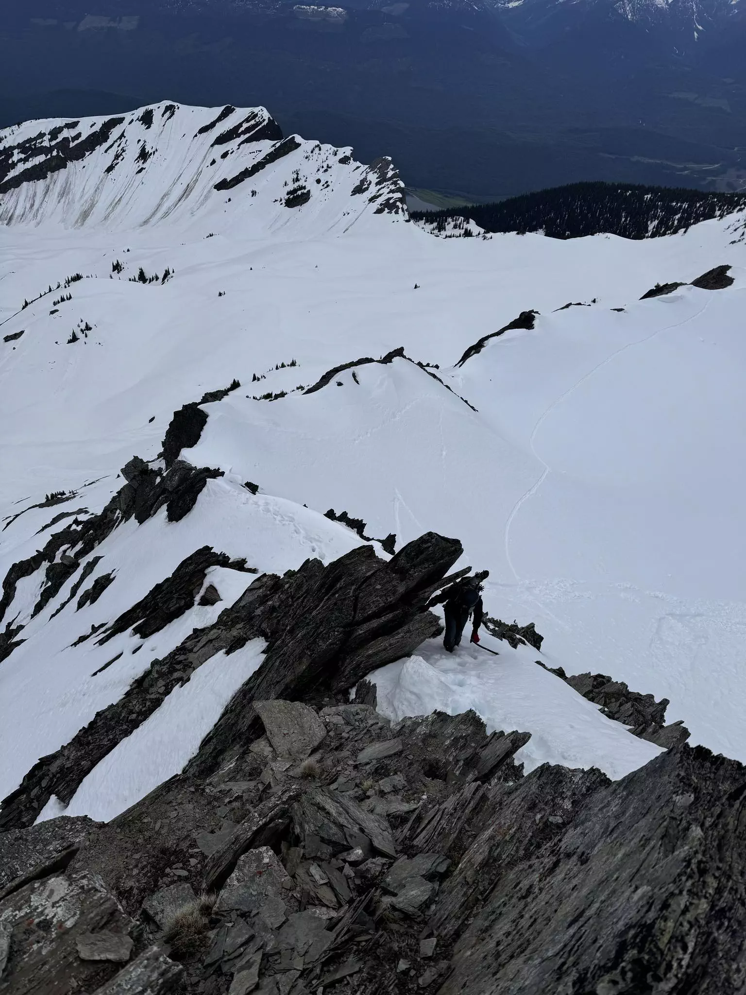
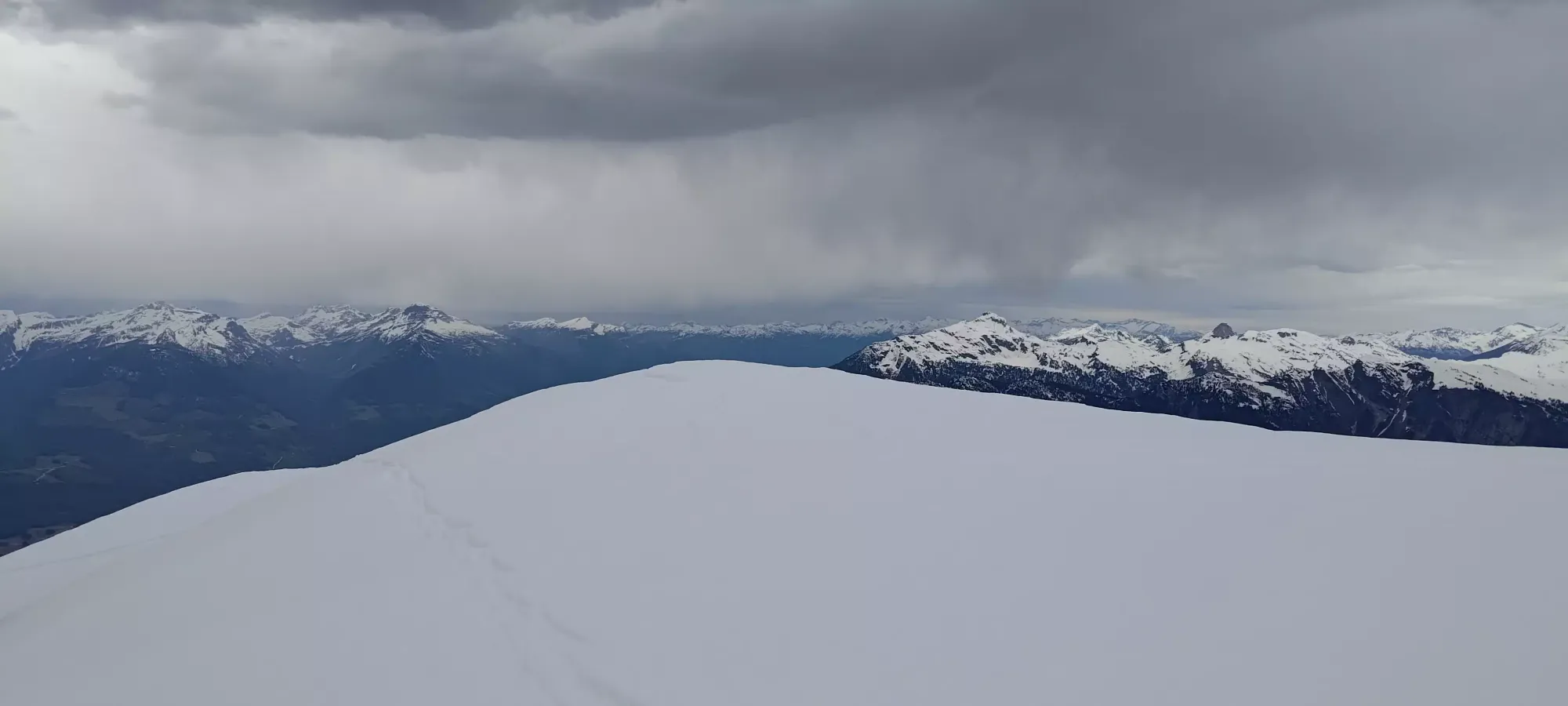
After this slope, it was a pretty on-and-off mix of snow walking and walking over rocks, with an occasional class 2 bit of scrambling to get along the ridge. I think we lost the footprints at some point in the process, so Charles graciously broke trail from that point, and we stepped through the up-to-calf-deep snow and slightly downsloping rock (sticking to the climber's right side for cornice-related reasons) until just below 2400m, where we spotted a clean+safe entry into the bowl where we could skin to just below the crux section. That would allow us to bypass a good amount of tedious walking on the ridge, so I packed my crampons away, and we took our skis back out for the walk to the base of the crux.
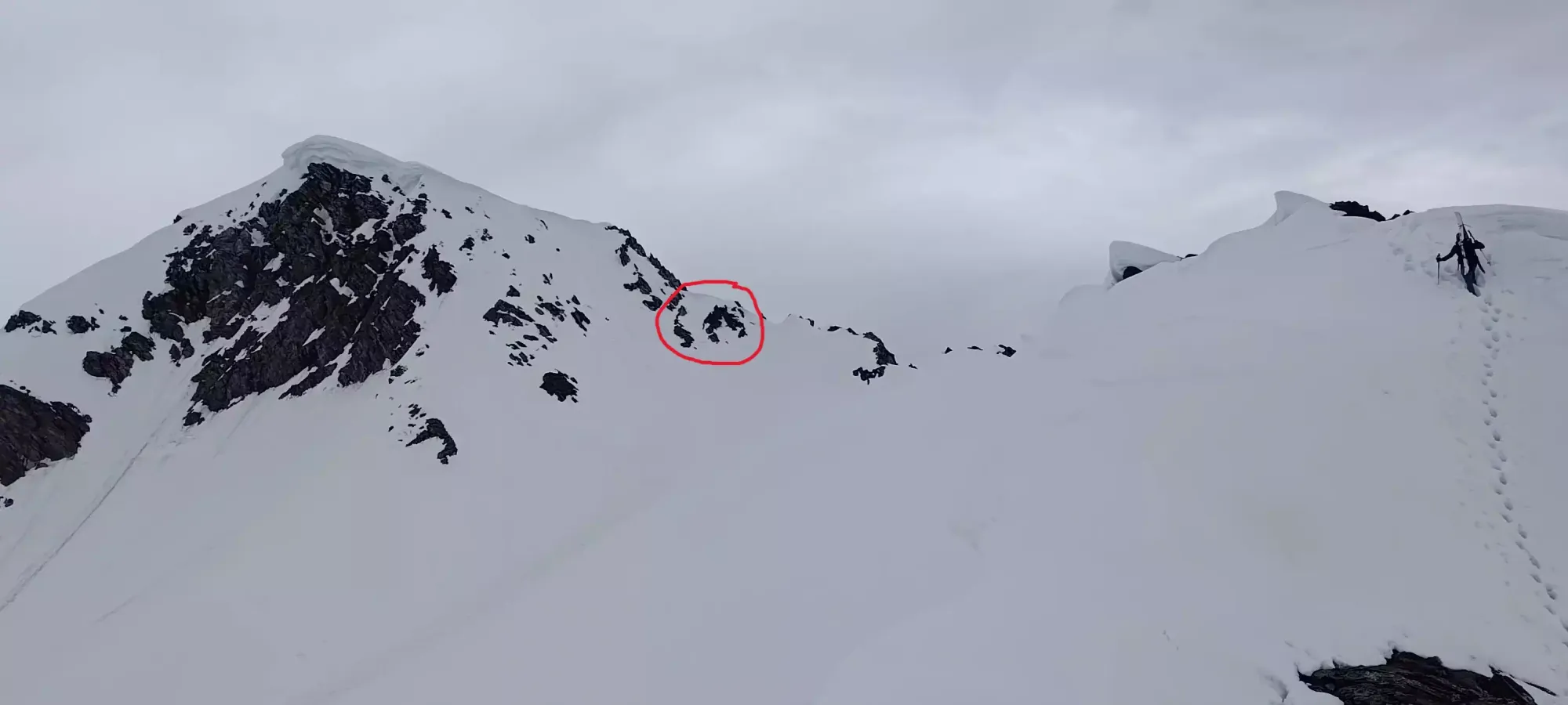
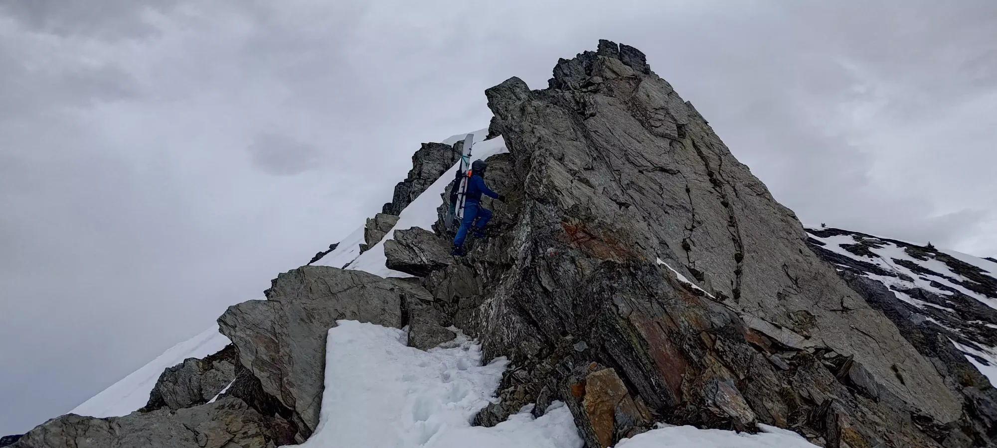
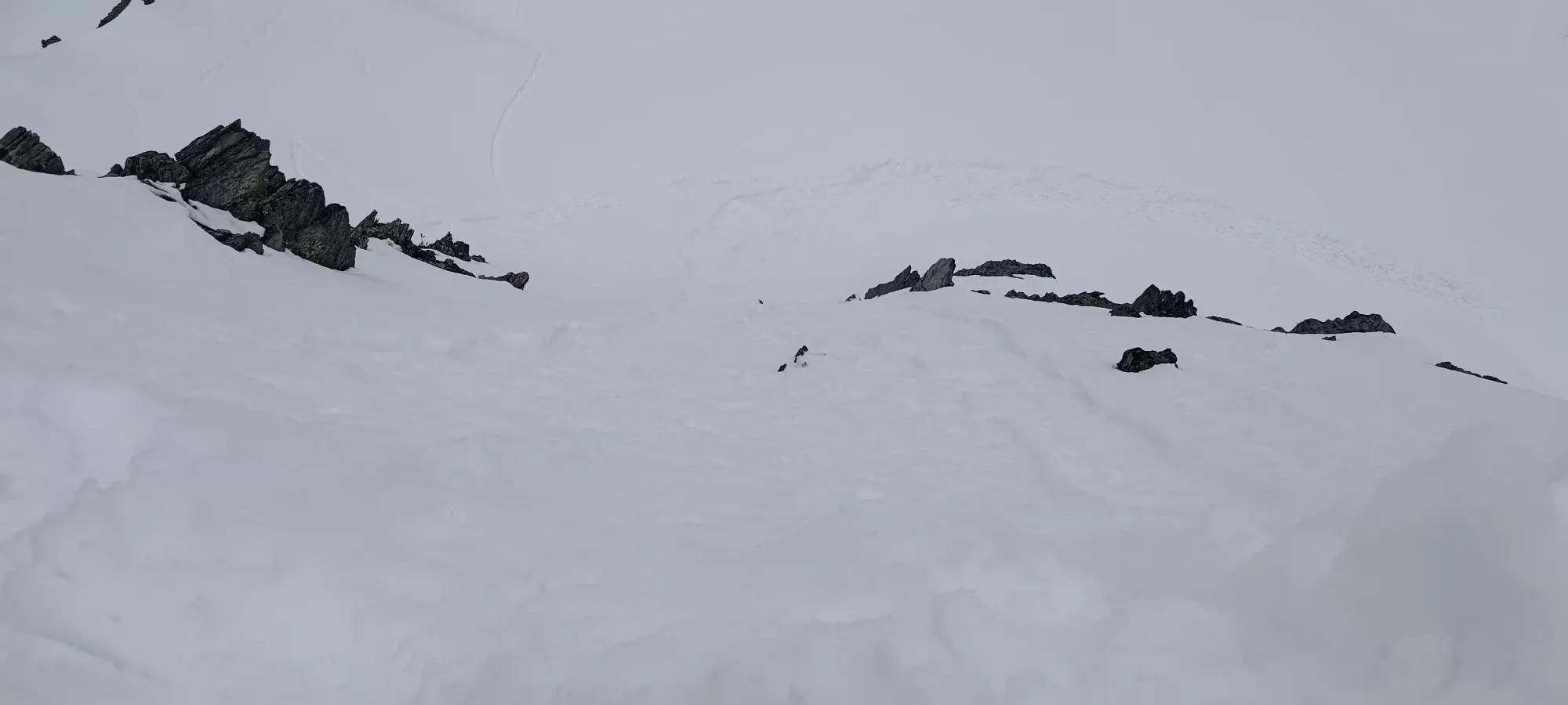
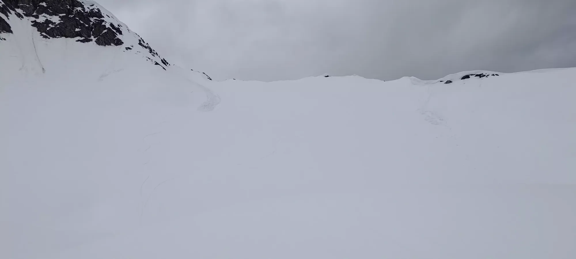
From far away, we figured the rocks would be scrambleable with jugs due to how upward they were pointing, and that was confirmed when we got closer. Our original thought was that we'd have to take the ridge the whole way, but thankfully this spot also was cornice-free, so we skinned up to the rocks (circled above), and scrambled up them to gain the ridge just below the crux scramble. This was class 2/3, with easy moves only made somewhat annoying by ski boots on our feet and skis on our backs. I pulled my axe out here, but it was totally useless, as the snow climbing was too soft for it to be useful, and the rocks were shaped such that hands were more useful than axes or tools.
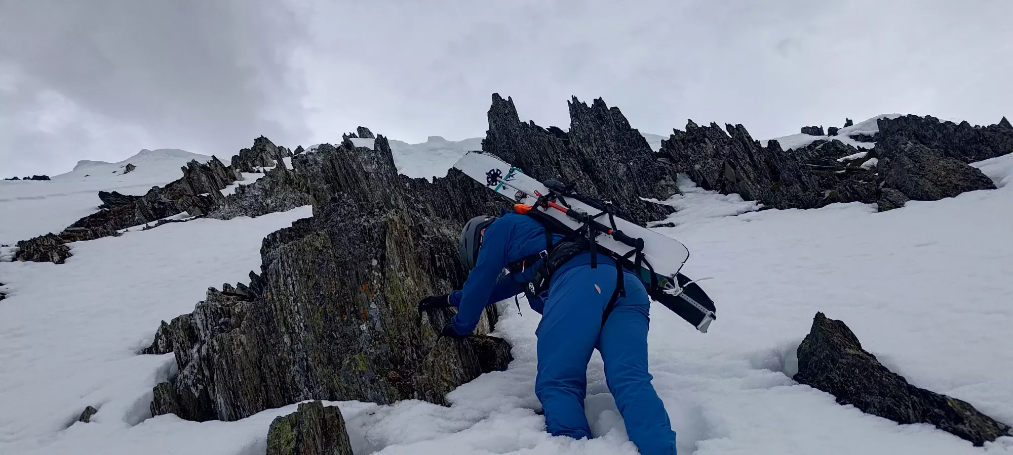
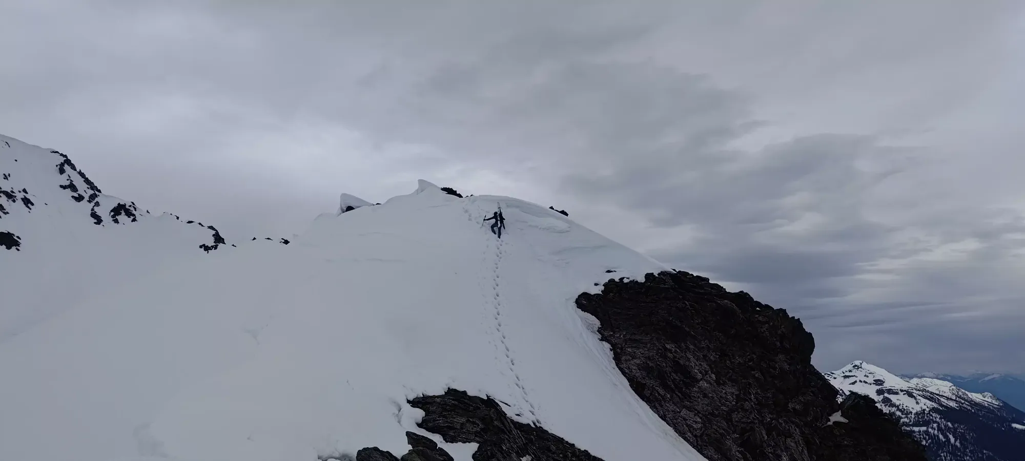
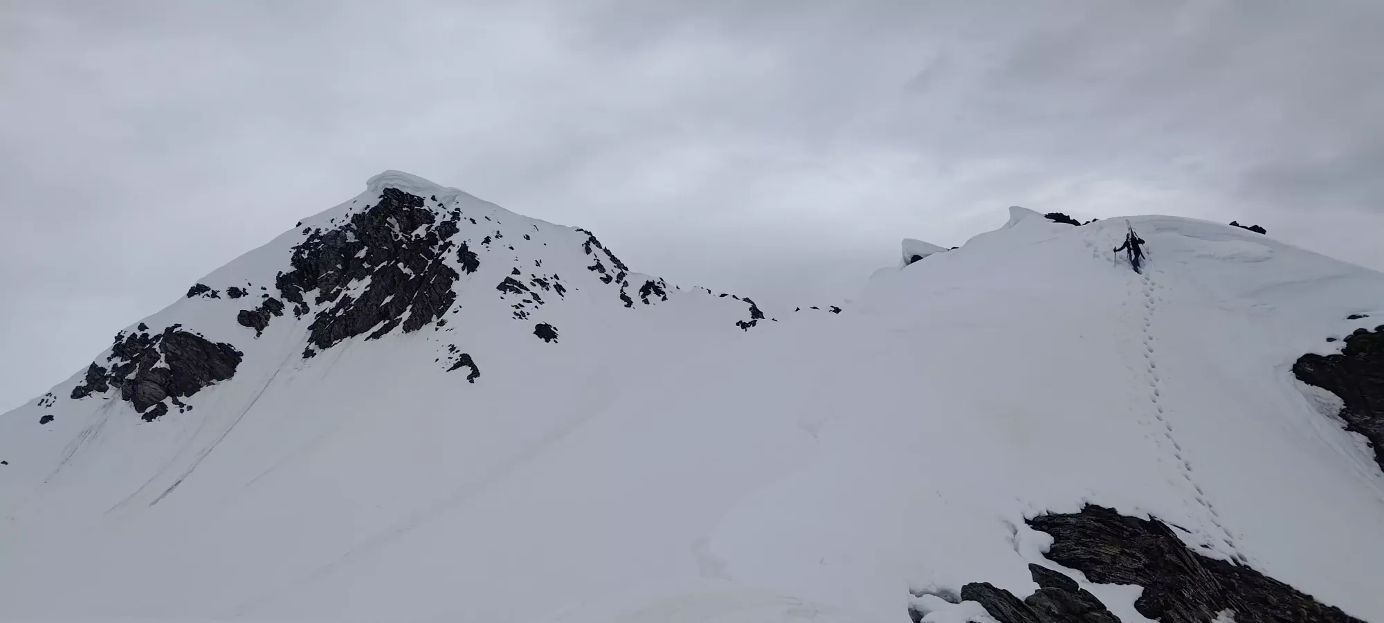
The scramble was pretty fun, and again, without ski boots would be quite simple. With them, it was a bit challenging in spots where you had to trust the toe you couldn't feel whatsoever, but the holds were indeed quite jugular, so that kept things safe and under control. We spent a few minutes getting through this section, and once we were out (around 2430m), it was back to walking through the snow where the cornices allowed, and on the oft-downsloping rocks to the climber's right when they didn't.
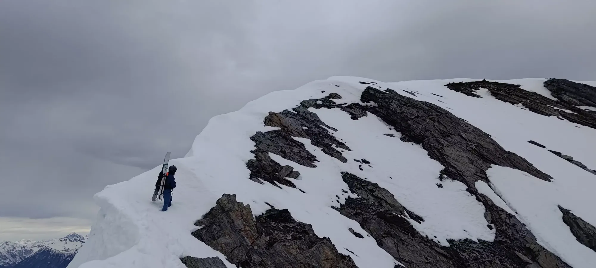
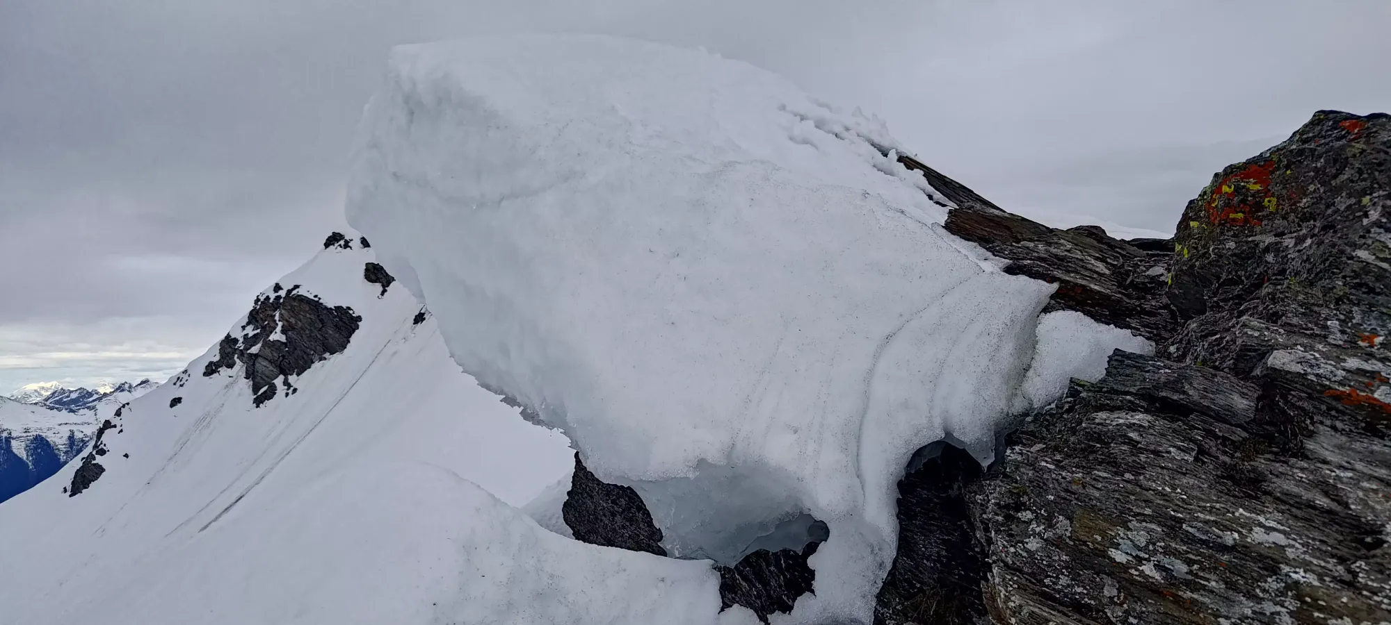
From there, we walked most of the way on foot, but with a couple dozen metres left, we transitioned back to skinning to get to the top, since it was all snow for the last section, and we just felt better not plunging our feet all the way down through the snow when we were about to get familiar with a gigantic, warm cornice. From exiting the cornice to the top was just about 15 minutes total, transition included.
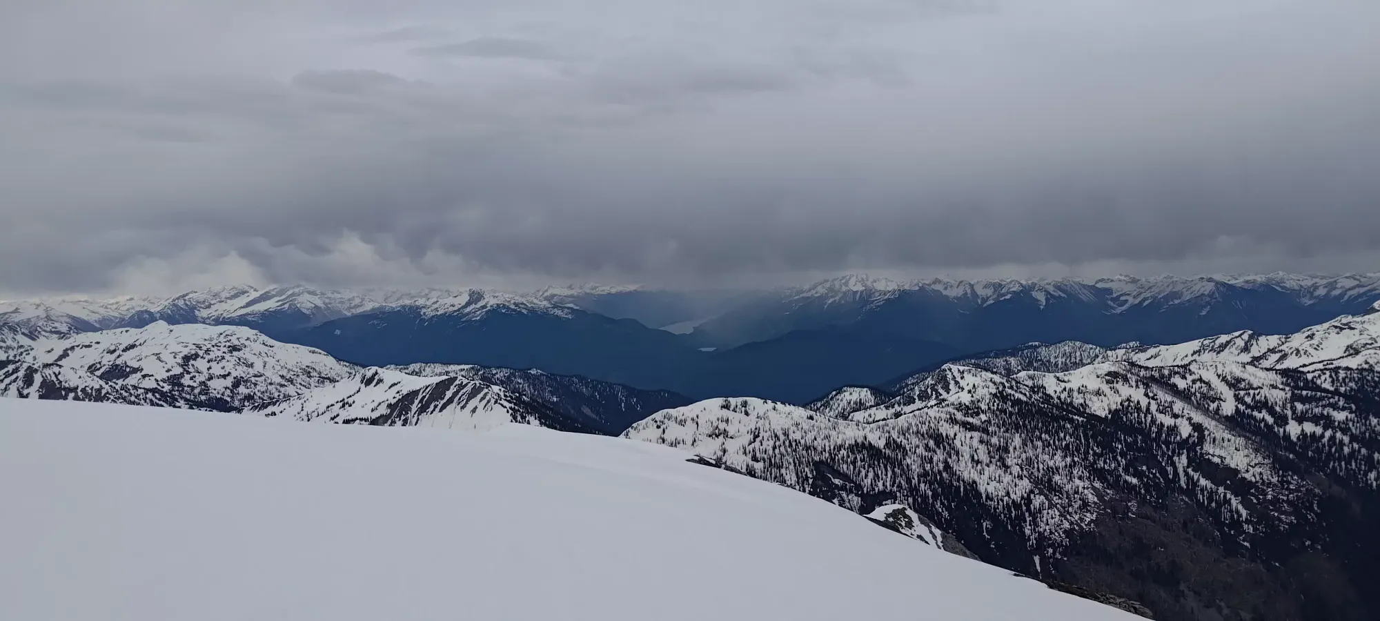
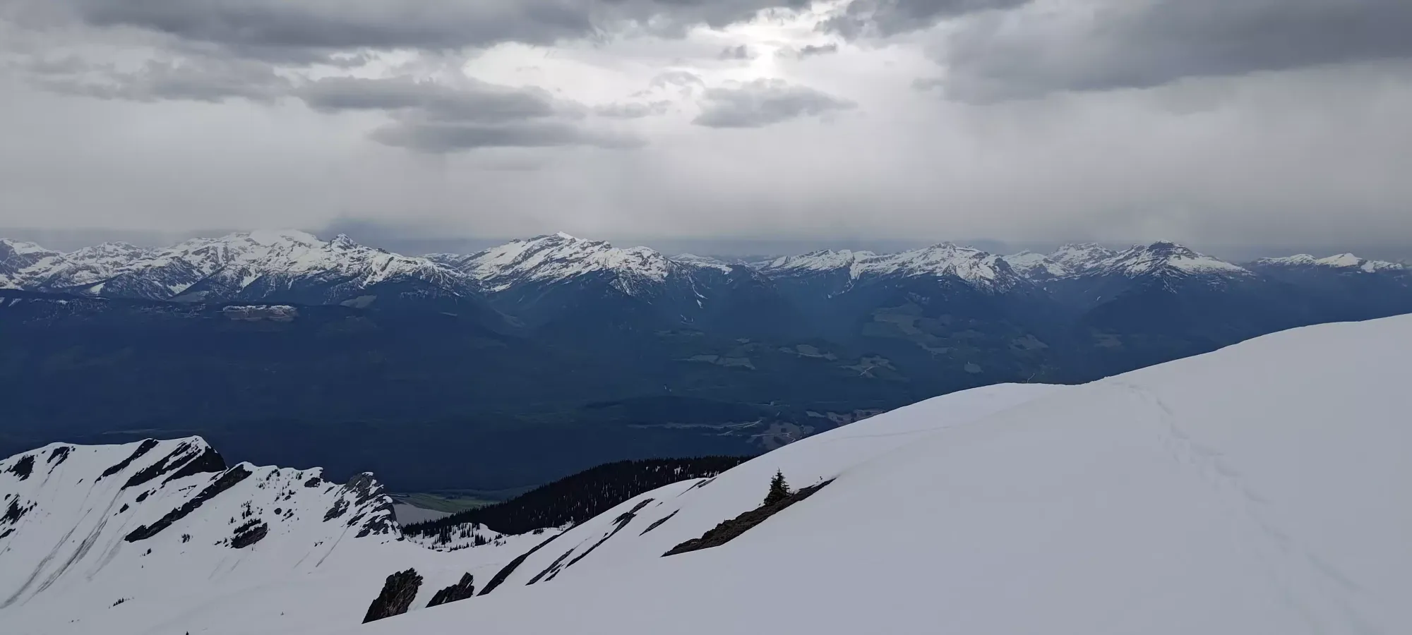
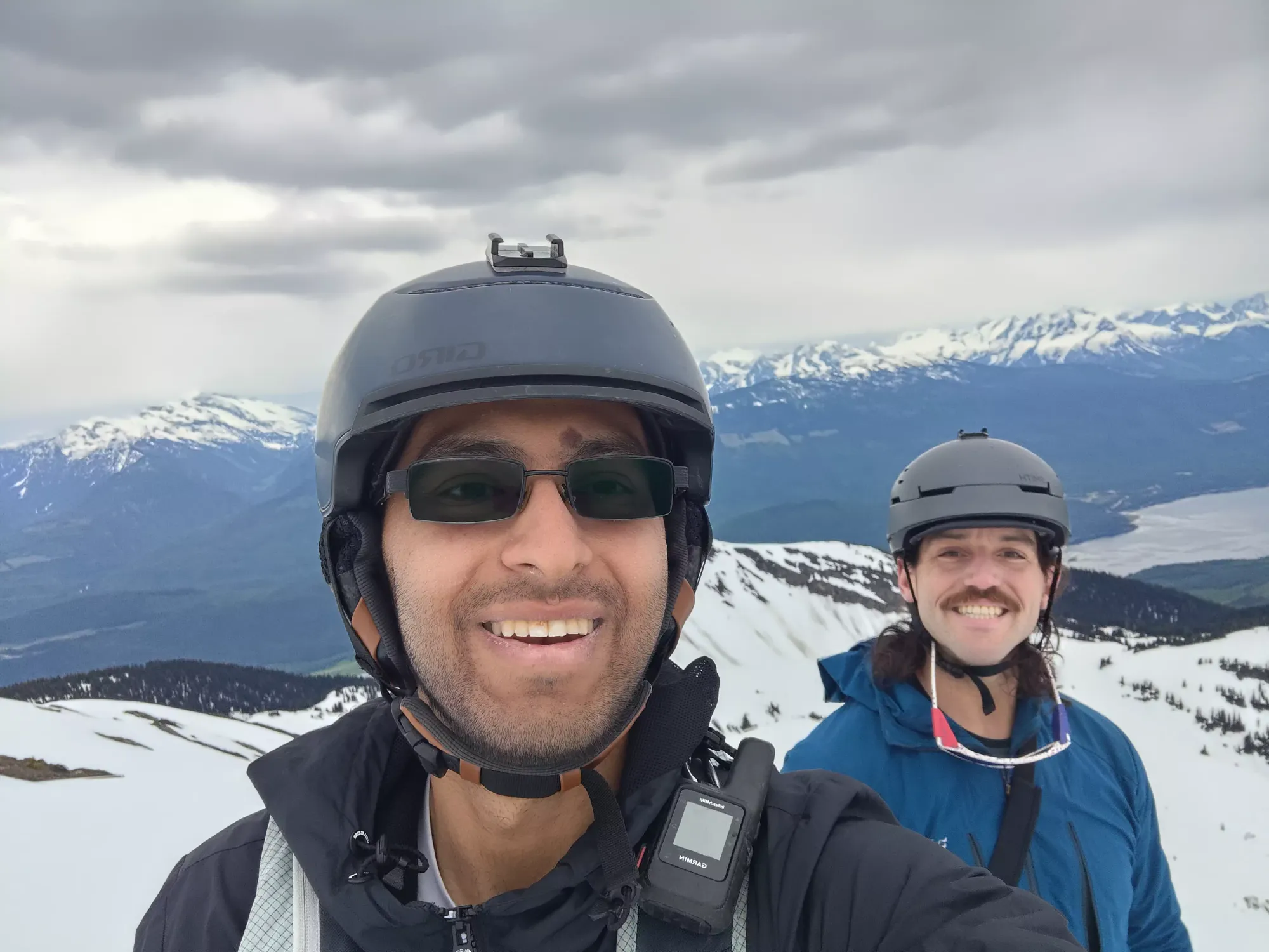
On the summit plateau, we hung out as far as we comfortably probed, knowing how big the cornice was. This thankfully paid off in us not tumbling to our deaths 🙂. Some photos were taken, then it was time to figure out how we'd get down.
As for our way down, we considered continuing the ridge due east then north to find where the tracks we saw in the morning started, but discarded that after seeing how far that would be, and that there would definitely be difficult, steep sections to contend with potentially even harder than what we came up. We could have downclimbed what we came up, but were both hoping to get in more skiing and simultaneously avoid having to downclimb the crux in ski boots with skis on our backs. So, we decided to simply walk down the ridge until we found a safe spot to cut the cornice and drop in before that.
After descending about 50m, we got to the end of the ridge above the crux, where we previously saw the start of a couple slides. Standing in that spot, we noticed that the cornice wasn't overhanging here at all (so arguably was just a snowy ridge and not a cornice, I guess). We also had some rock to stand on while we "worked" on the snow, and the slope was not exposed to fall hazard, with just one rock in it and snow below, so we decided to transition and ski from there.
After sending some chunks down and seeing that despite the large debris flow we saw on the wider slope below, the snow was reacting only locally, and quite slowly, we agreed to ski the line, and Charles got ready to drop while I waited from a small, rocky spot a bit further back from the flat spot we could put our skis/boards on at. I didn't have any batteries charged for my GoPro so no crappy footage this time, but "the skiing was steep and fun". We didn't send it super hard since the snow was quite reactive, even if in small quantities, but hey, steep skiing in June is a treat by itself. Once we both met in a safe spot to skier's left of the bottom of the steep run, we watched all our sluff trickle down in the large, curving tongue of debris, then got ready to try and find our way out.
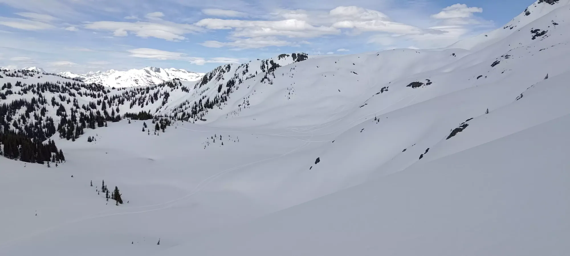
The next bit of skiing was an exercise in trying to find the best way to stay downhill in flat light with some undulating terrain, which I would like to think was fairly successful. The snow was super wet and pretty heavy, but at least for me wasn't sticky, so with a little effort, I could still turn and enjoy myself. We got into a mini-bowl a hundred metres or so below the ridge, which we had to straightline across and walk/shuffle for a minute or two in order to crest the opposite side, from which we could ski a long run to the edge of the alpine, where a bunch of sled tracks gathered in the flats at around 2150m.
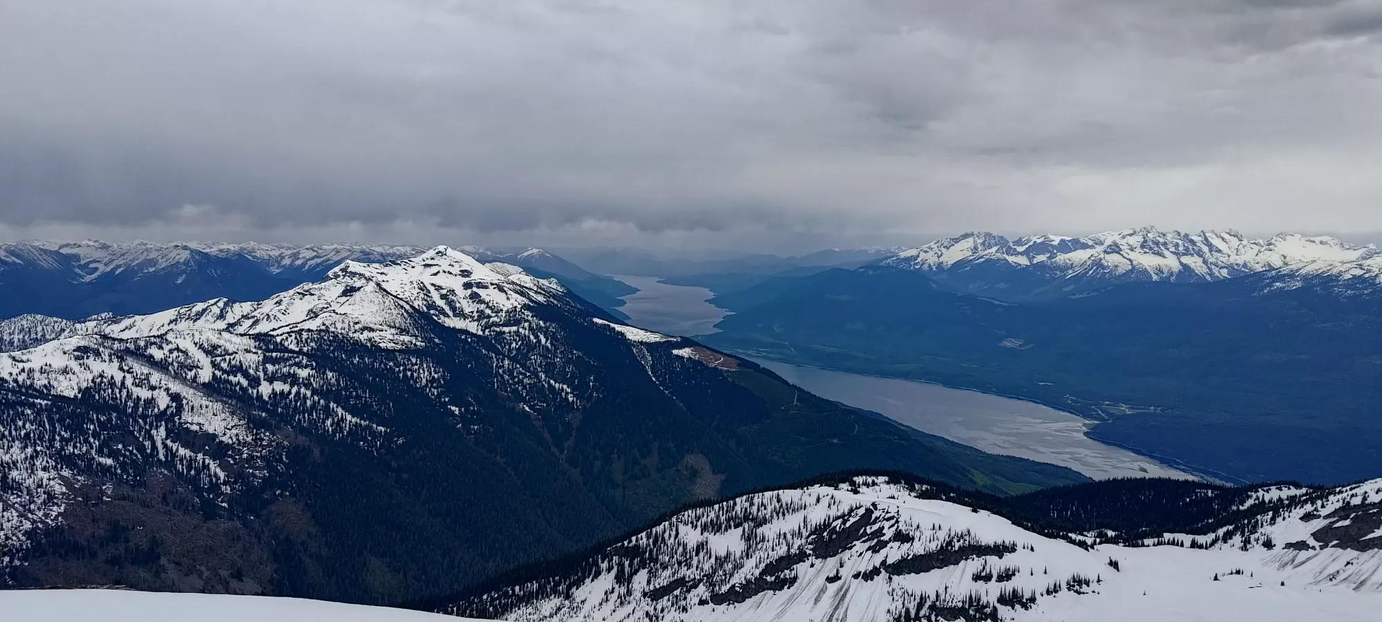
From that spot, we put our very wet skins (thankfully they still stuck) back on, and wandered up to a high point to figure out our next move. We didn't really want to sidehill back to our uptrack, so we originally considered skiing down to the lake. Closer inspection revealed possibly cliffy terrain near the bottom, and we could see blue at the edges of the lake, so that probably wasn't the best plan. Instead, we figured we could skin a bit further to another mini-hill a bit more to the west, and ski a creek drainage from there to meet up with the lake's hiking trail a bit above the lake, and get back that way.
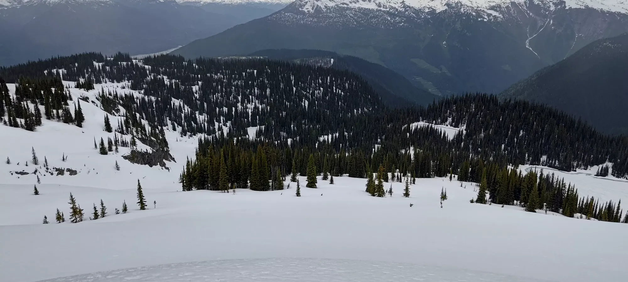
From there, we skied down a couple hundred metres to just below 2000m, where our creek hit the trail, and we put our skins on once more to gain a bit of elevation and get back on track to get out. We only had to gain about 30-40m until we hit the high point of the lake's hiking trail, at which point we ripped skins once more, and started a long, traversing ski run to try and hit our uptrack before the forest road. We took it a bit slow with lots of map-checking to ensure we didn't have too much fun skiing fall line in the forest (the snow was crustier and kinda better for it), but that paid off, and 15 minutes later, we found ourselves back at the forest road!
From there, our soaking skins (I could run my hand down them on my skis and squeeze water out) had 1 last stand for their glue to stick (which thankfully did manage to adhere), and we skinned up the last 30m of elevation gain to turn the corner on the road. I was planning to skin downhill as I remembered the road being gentle and having a flat spot or two, but Charles convinced me to rip skins, and he was definitely right. With our morning skin track, it was just slick enough for us to be able to ski out (Charles was very excited to have "graduated" to being a pro skier at this point as he didn't reassemble his board), and we knocked out the last kilometre and change in a bit over 5 minutes.
Overall, the round-trip time was just over 6.5 hours. Given the stats, that's a bit long, but with all the transitions and routefinding we did in the suboptimal conditions, I'm happy enough. I was happy just to get out with a friend and bag a peak given how my plans were looking 24 hours prior 😅. With that, we happily drove back down to town, grabbed some food, and I got myself ready for a long drive back home late at night...
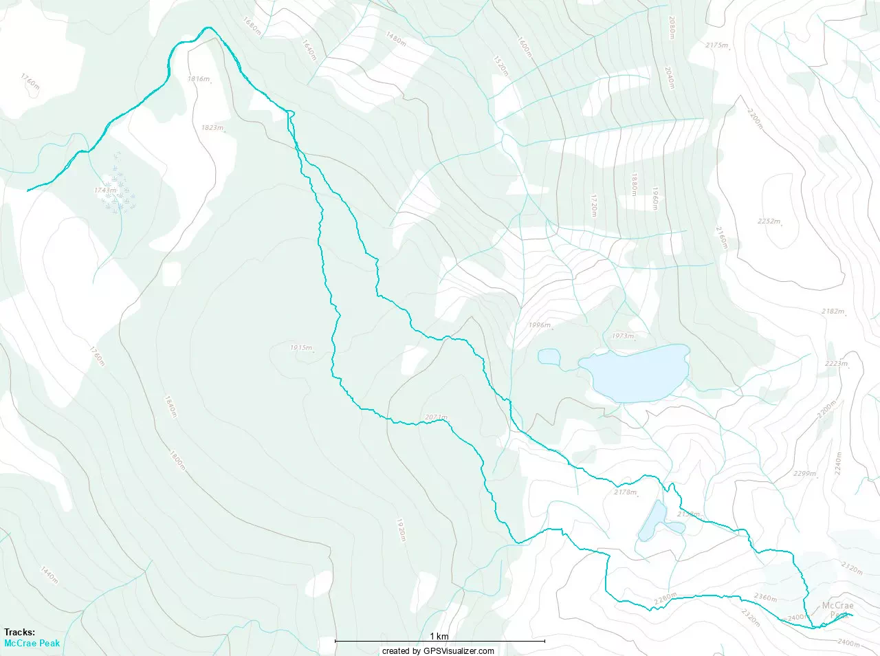
GPX Track + Map