Crown Mountain - July 13 2024
The high point of the Grouse Mountain group of mountains, Crown is deceptively difficult due to the ups/downs required to get there (especially if you don't take the gondola up). The standard route is fairly non-technical, but harder routes are also available

North Vancouver Area, North Vancouver, British Columbia
1504m
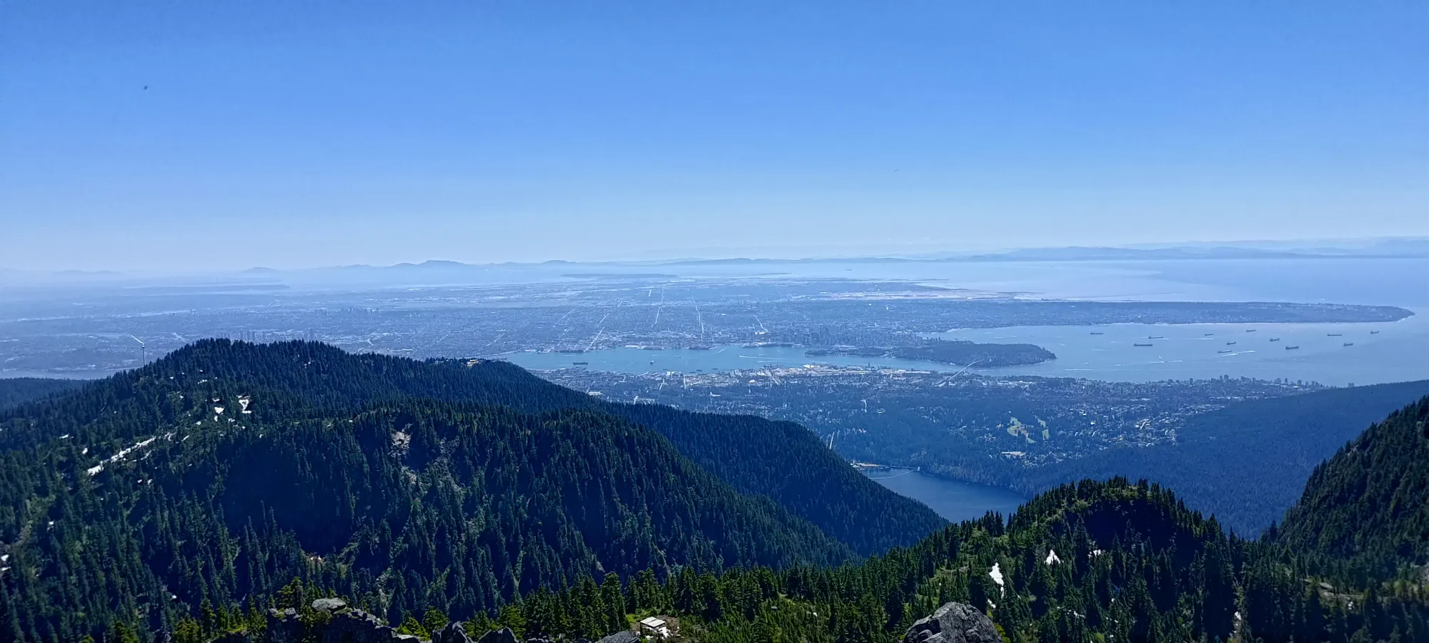
This weekend was one of my less-than-favourite on-call weekends, meaning that I had to remain within the range of Telus' cell service in order to remain in my employer's good graces. Given that my activity of choice is "go climb mountains", which tend to be located in less-than-urban locations, that can be a bit tricky 😅. So, after scouring some cell coverage maps (which are surprisingly detailed/specific), I decided I would finally knock Crown Mountain off my list. This is the highest peak in the Grouse Mountain area in North Vancouver, and as such sees a lot of traffic, since it is somewhat notable, and still fairly accessible (you can take transit right to the base of the mountain). I had avoided it until this point because it's good to save for weeks such as this one, and also because it has some nice climbing routes nearby, and I was considering doing those. However, with my options limited, and snowpacks still a bit too high for me wanting to chance the overhead-hazard exposed climbing routes, I just decided to bite the bullet and do it the standard way.
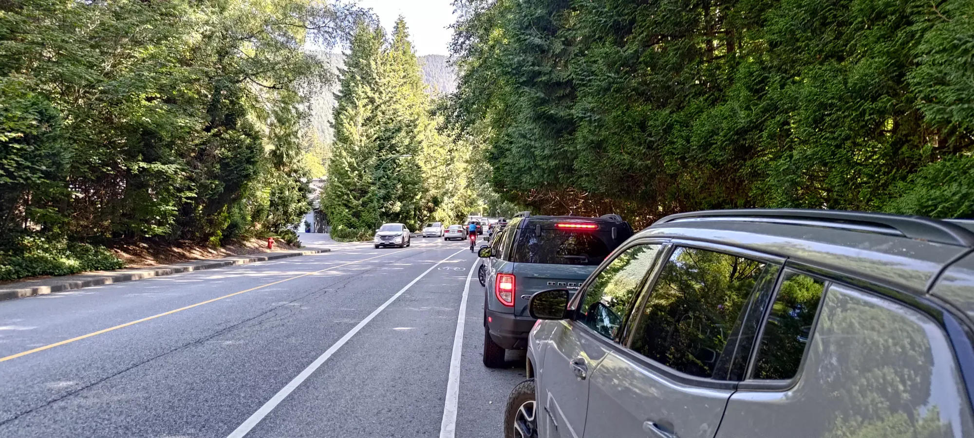
Since I'm a cheap bastard (and my e-bike was stolen, meaning the Grouse Mountain Highway approach was not practical), I refused to park at or take the Gondola up. That meant I parked about 600m/65m (distance/elevation) below the actual trailhead to use the free street parking on Nancy Greene Way, and also planned to take the Grouse Grind trail up to the resort's base at 1100m instead of shelling out for the ride up the gondola. If you have more confidence in your ability to get a better parking spot, you can get a bit closer, but I didn't at about 10am, so I just parked once the density of cars got fairly high. There apparently was also a race going on in the area, which made things even more busy than a normal summer weekend with sunny weather, which itself would attract quite a crowd. So, happy enough to have parked for free at all, I set out from the car at 10:08am.
Walking up to the trailhead took about 7.5 minutes out of my life, which I think was a fair trade for saving 10 bucks. From there, the trail more or less immediately turns into nature stairs, and my heart rate commensurately rose to the ~190 it would stay at until I finished the grind 😅
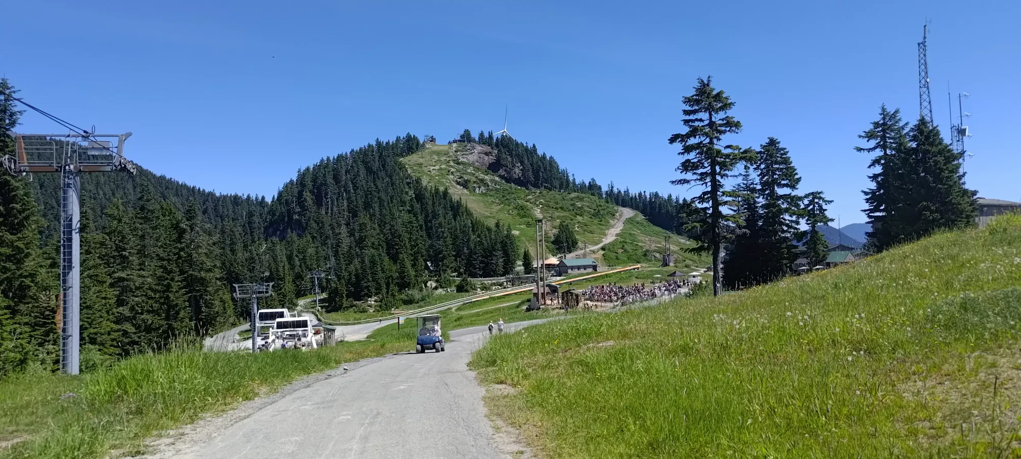
The Grouse Grind is a very well-documented trail, so rather than stop and take photos of "a walk up stairs through a forest that everyone and their mother has been on", I instead let my competitive spirit take over and tried to get myself up in a slightly respectable time. At the onset, I told myself to take it easy since I had ~2000m of gain planned for the entire day. I even thought most people doing the grind just stop at the top and take the gondola down, they can afford to go without a pack and exhaust themselves, so you don't need to keep pace with them. Of course, this did not stop me from being unwilling to let people pass, so I did my best to push up in the ongoing heat wave. Admittedly, a couple trail runners did pass me, and I stopped at the halfway point for some water (I'm still too lazy to actually use a CamelBak), but I managed to get up in just over an hour, which I'd consider pretty decent for 800m of gain with the gear and retained energy to "not just stop there". Conveniently, just outside the entrance to the lodge, there was a table with free water to refill yourself, which I gladly took advantage of while I rested for a few minutes before starting the "more hiking-y" part of the day.
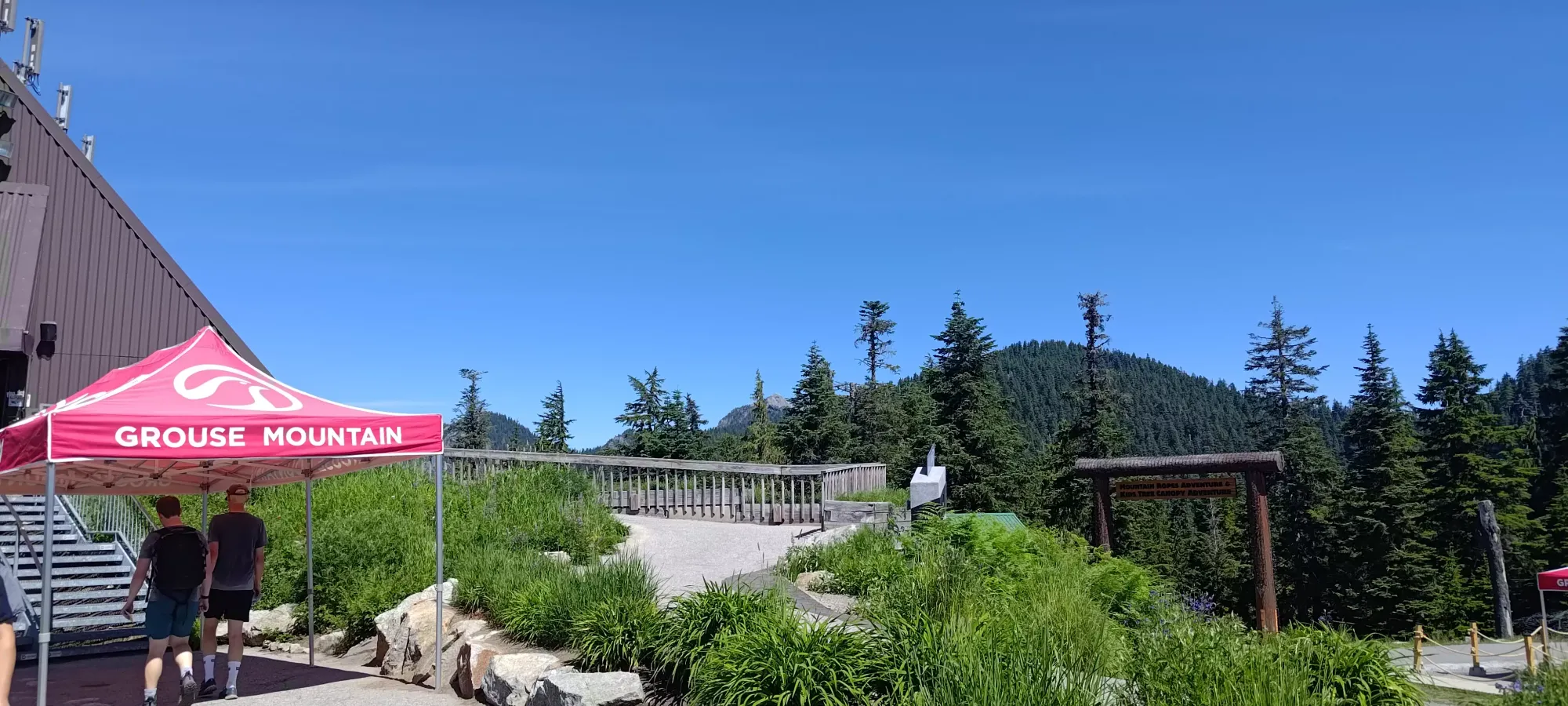
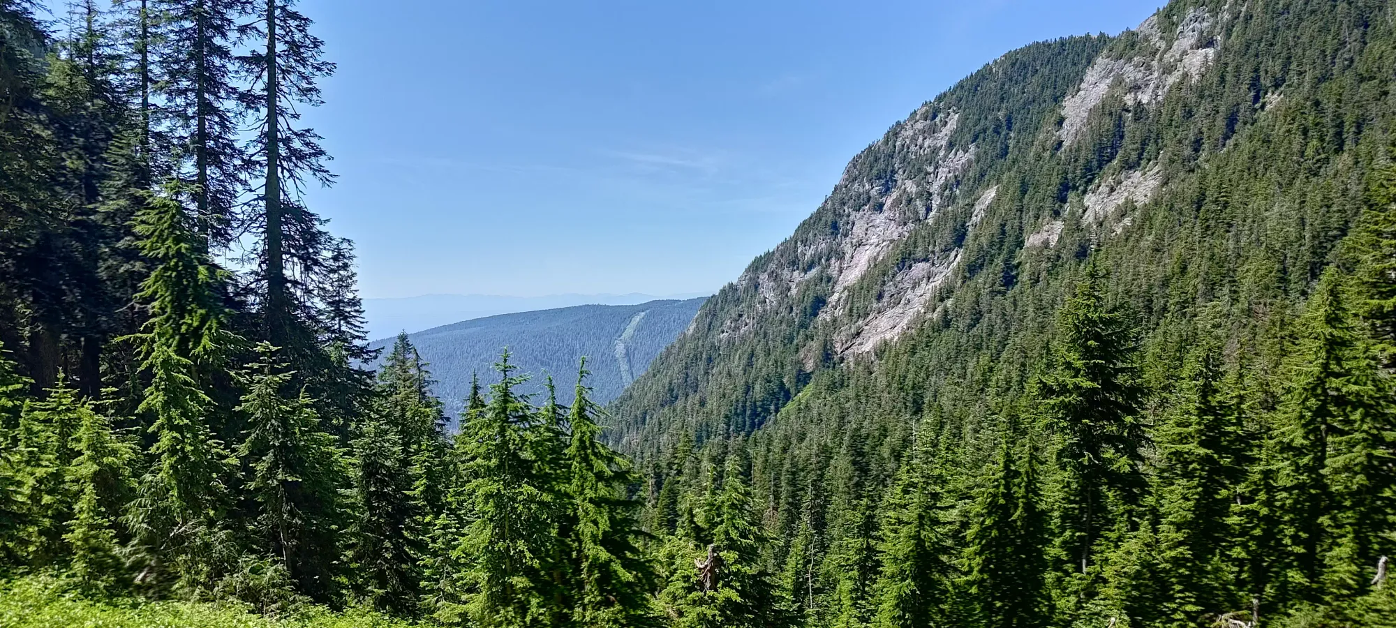
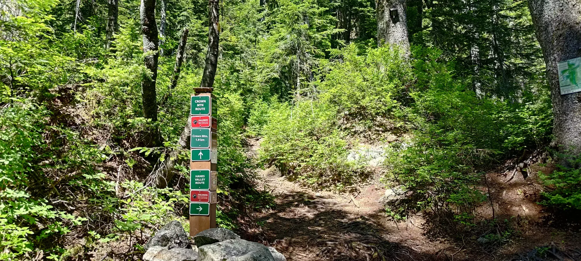
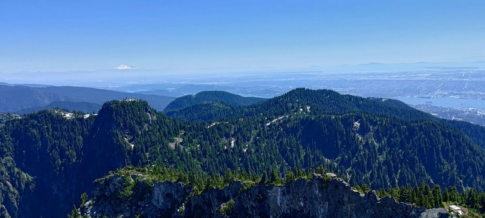
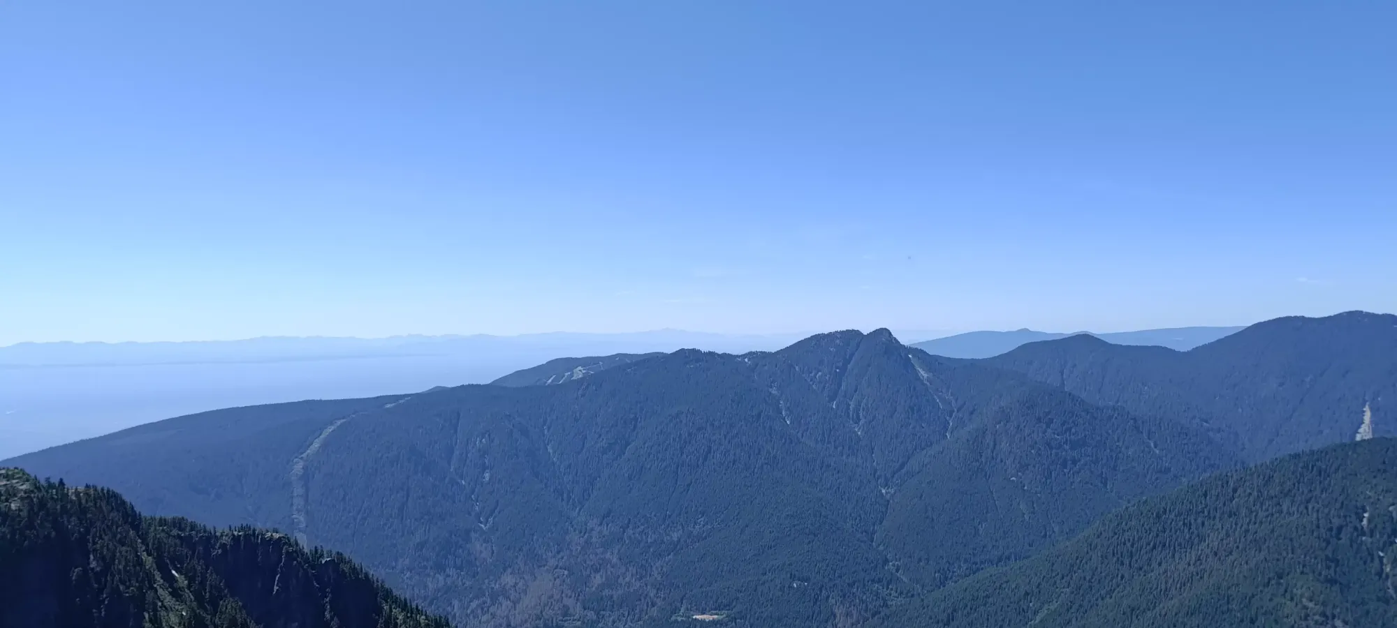
After that was over, I started walking over to the Alpine Trail, which is one of the two trails that go from the Grouse Mountain Lodge to Crown Mountain. The other is the Ridge Trail, which I think might actually be a nicer trail, but it gains/loses more elevation, since it summits Dam and Little Goat Mountains. I already had bagged those long ago, though, so I felt no need to endure the extra gain. There were tons of people around the resort area, but once I got onto the trails beyond the paved roads leading to official attractions, things calmed down quite a bit.
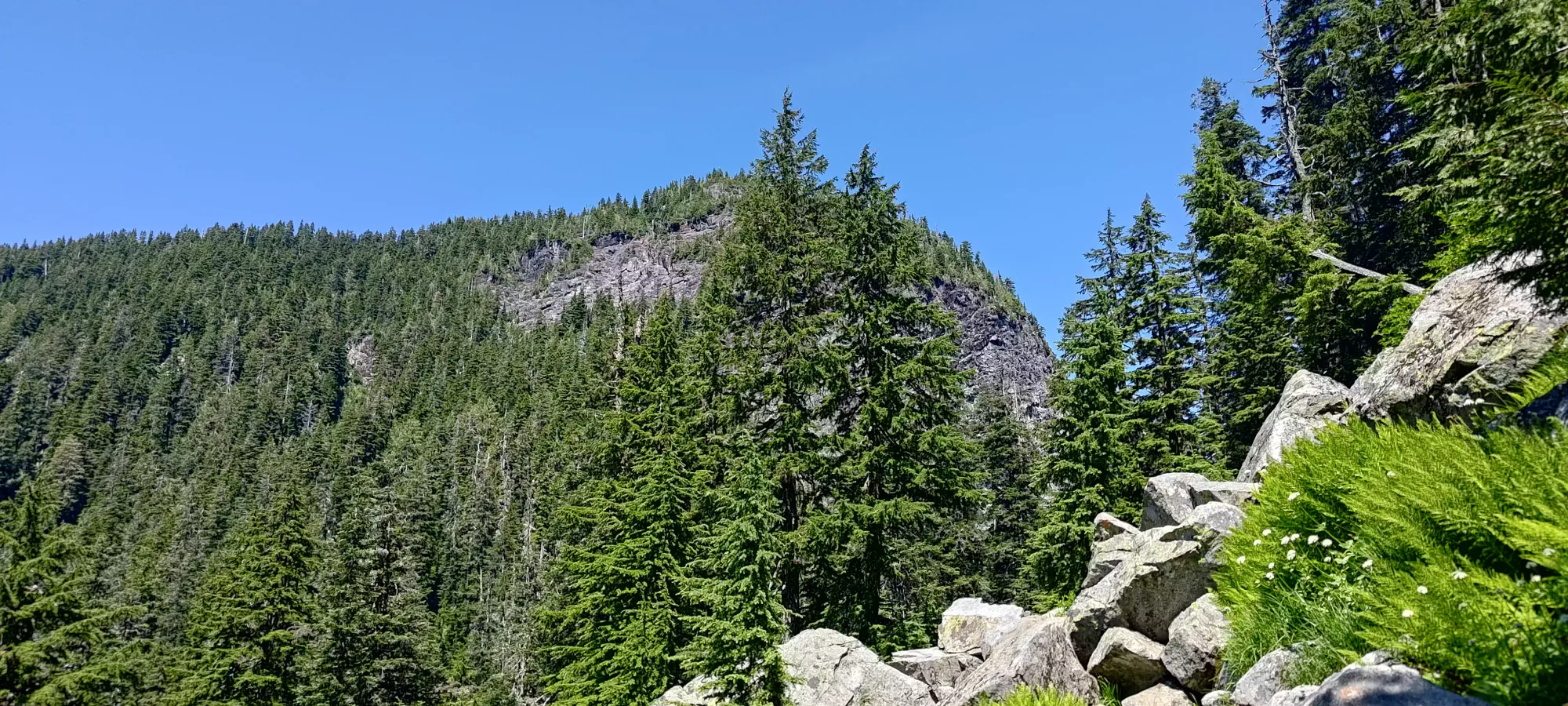
Things were hot and dry for most of the way, but at around 1250m I saw a couple small snow patches and there was some mud to step around (but nothing really troublesome). This was on the way up beside Dam Mountain. The trail was still largely devoid of snow, or even moisture as a whole, and I reached the junction just past Little Goat in a bit under an hour. This is the point where the trail splits to the right for Goat Mountain, or left to Crown Pass (and Crown Mountain, naturally). For whatever reason, there were a couple larger snow patches right in this spot, but all on easy terrain with a well-set footpath beaten in, so my (now deemed useless) microspikes stayed in the bag.
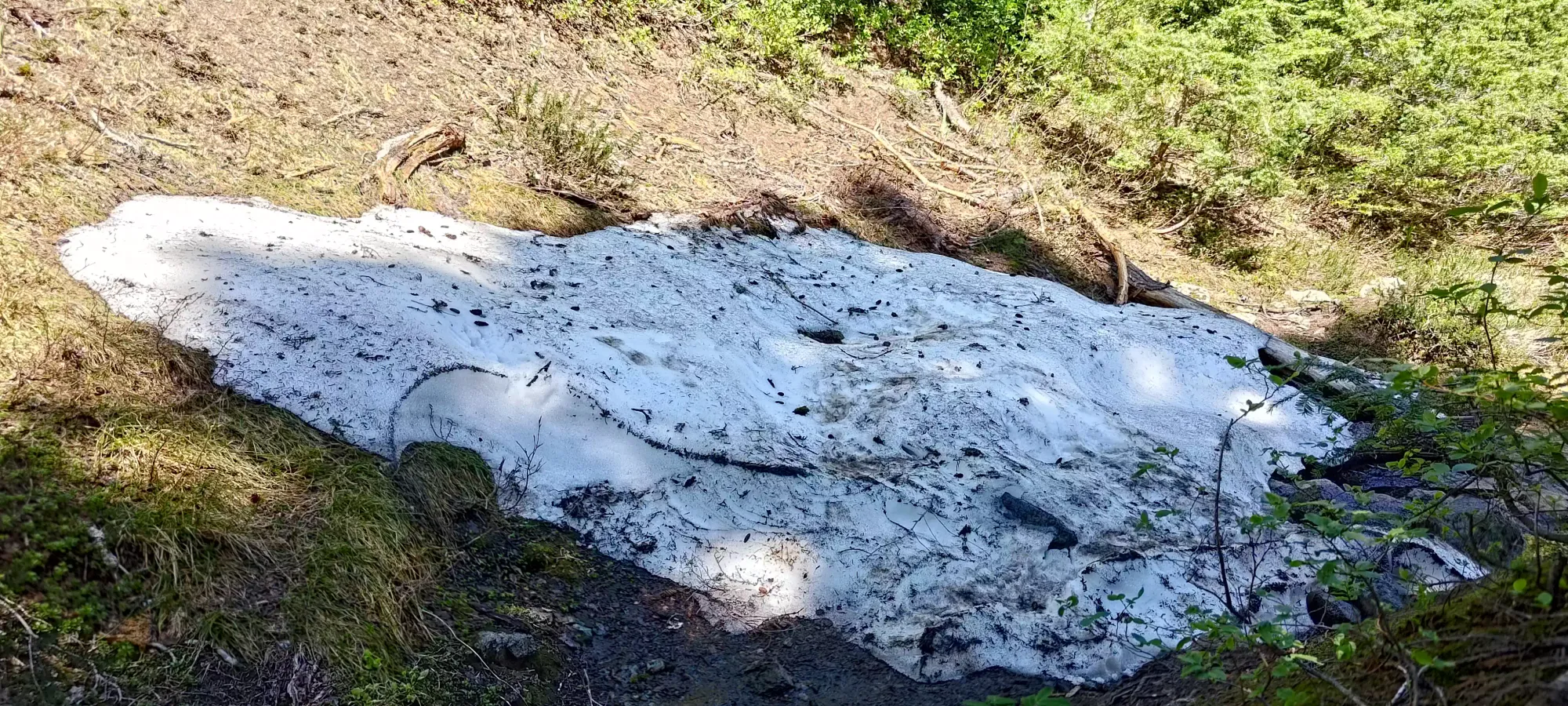
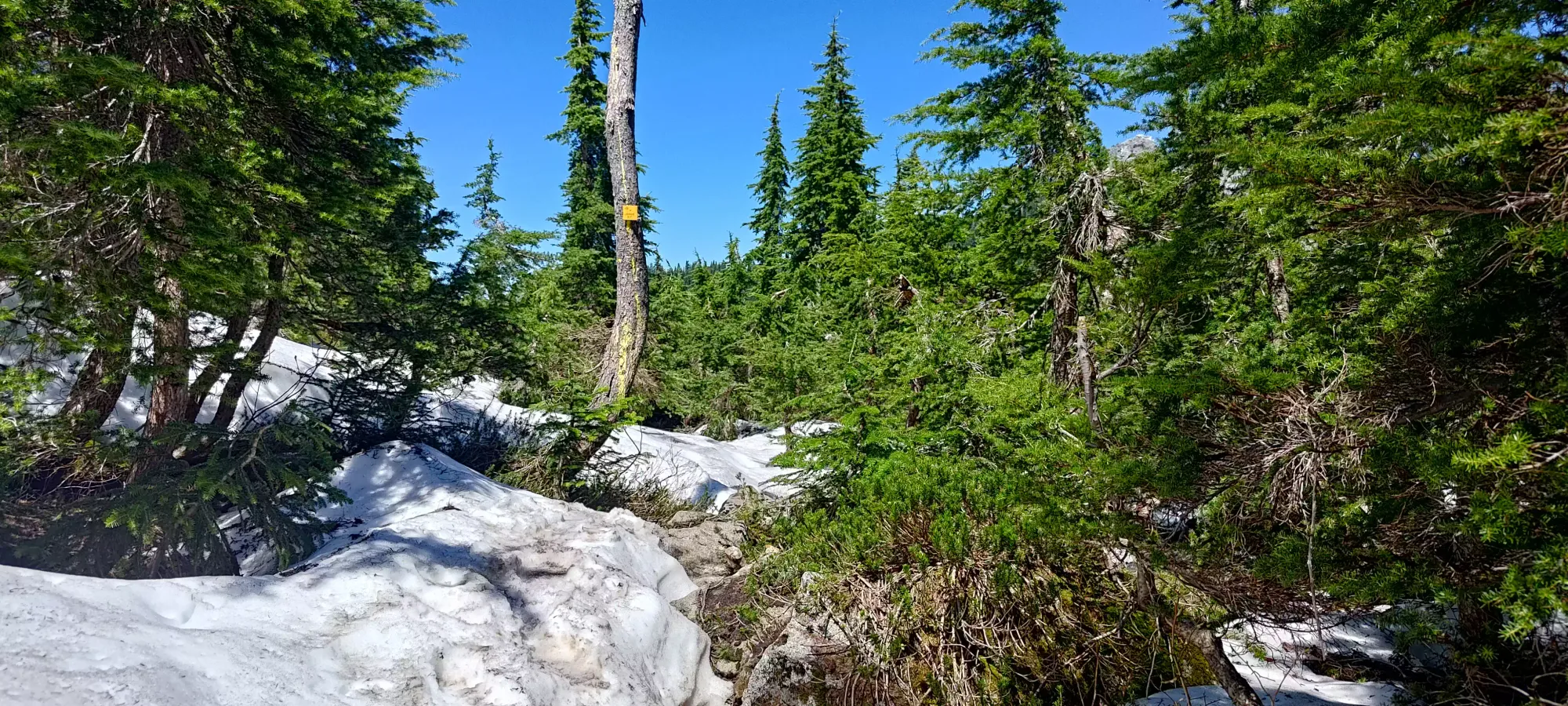
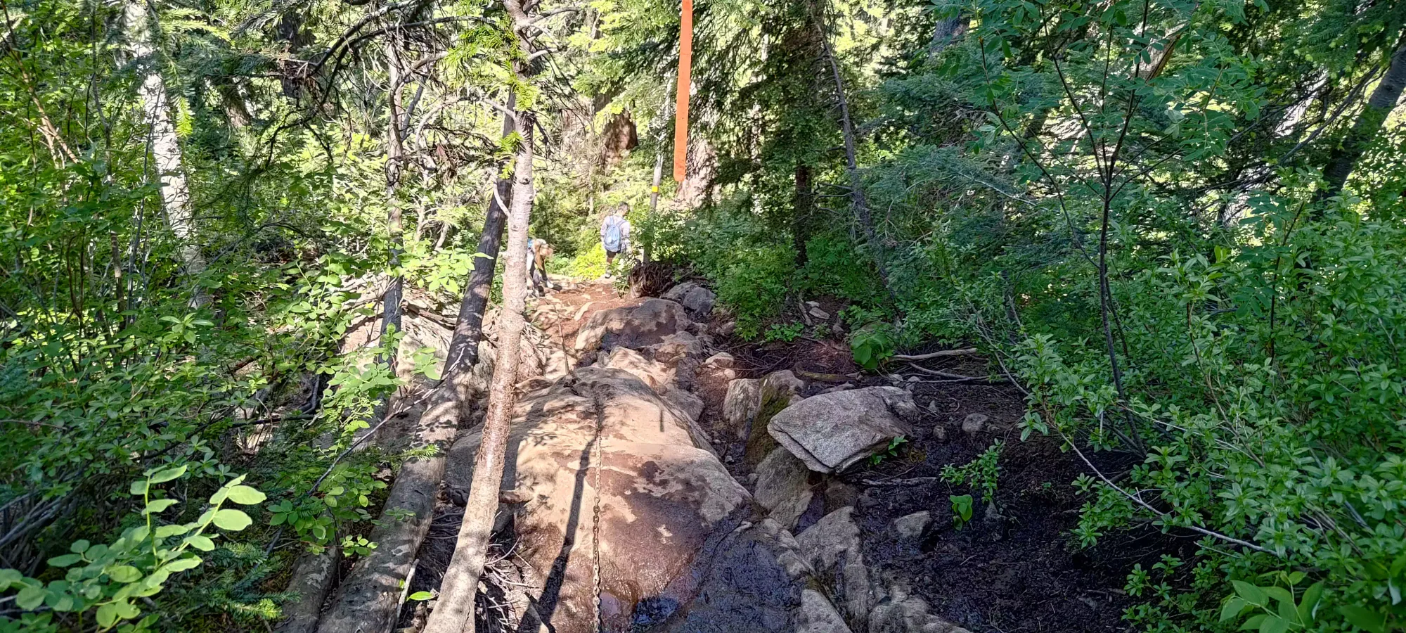
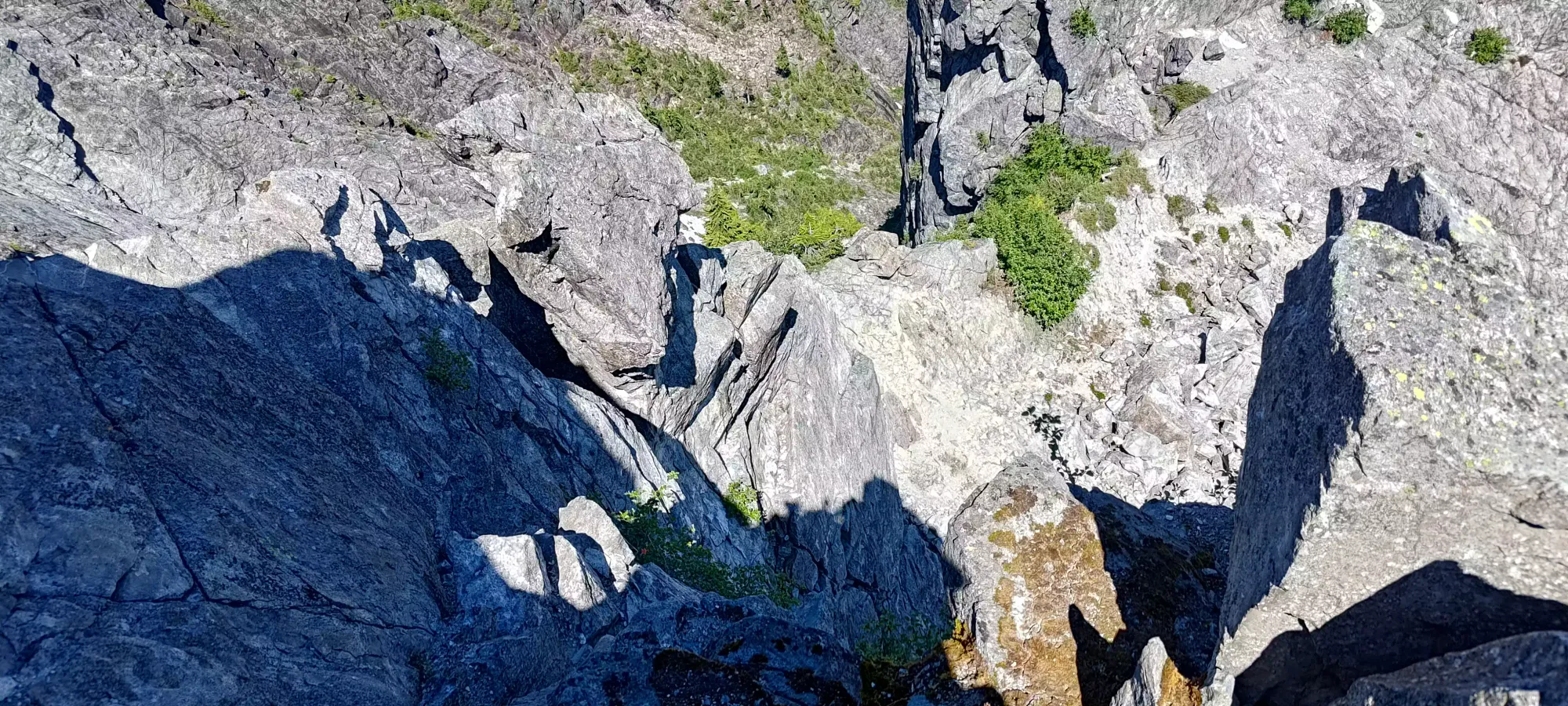
After the junction, there was a short snow patch of a few dozen steps that might've been slippery if not for the fully-broken-in steps that high foot traffic had created, and then a somewhat steep descent down to the pass (an unfortunate loss of over 200m that would need to be regained on the way out). Below the snow, sadly, became a bit of a slippery mess, with some mud and wet rocks making for tricky footing in places. I did manage to get by without using the fixed chains, at least (or I'd never hear the end of it 🤣). After getting most of the way down, there is a short boulder field traverse one must pay attention in to stay on-route, but it is short, and once you're done with it, the bottom of the pass, and the junction with the Hanes Valley Trail is right there. This section took me about half an hour.
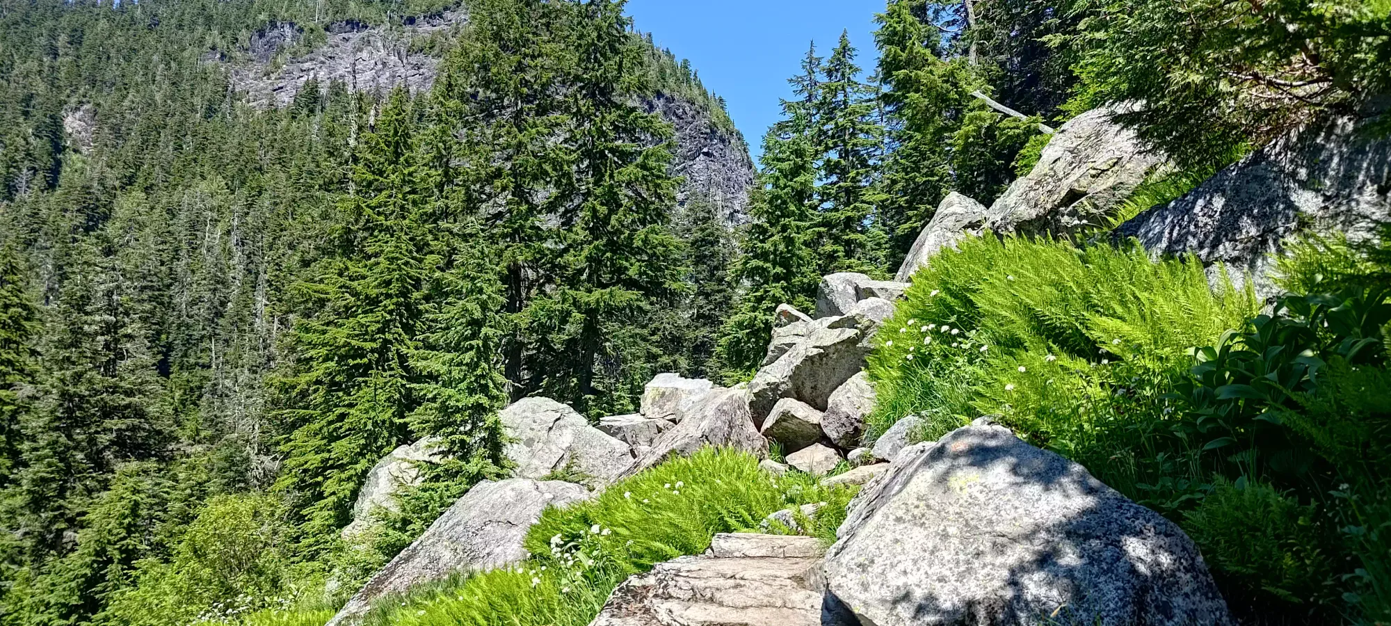
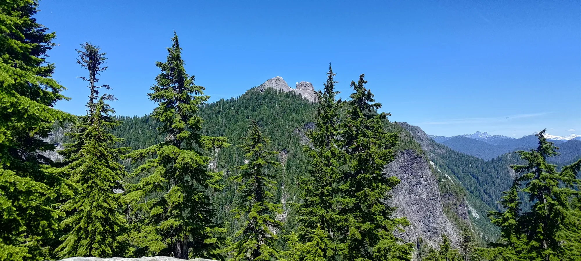
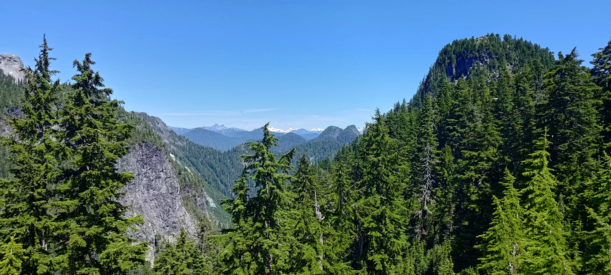
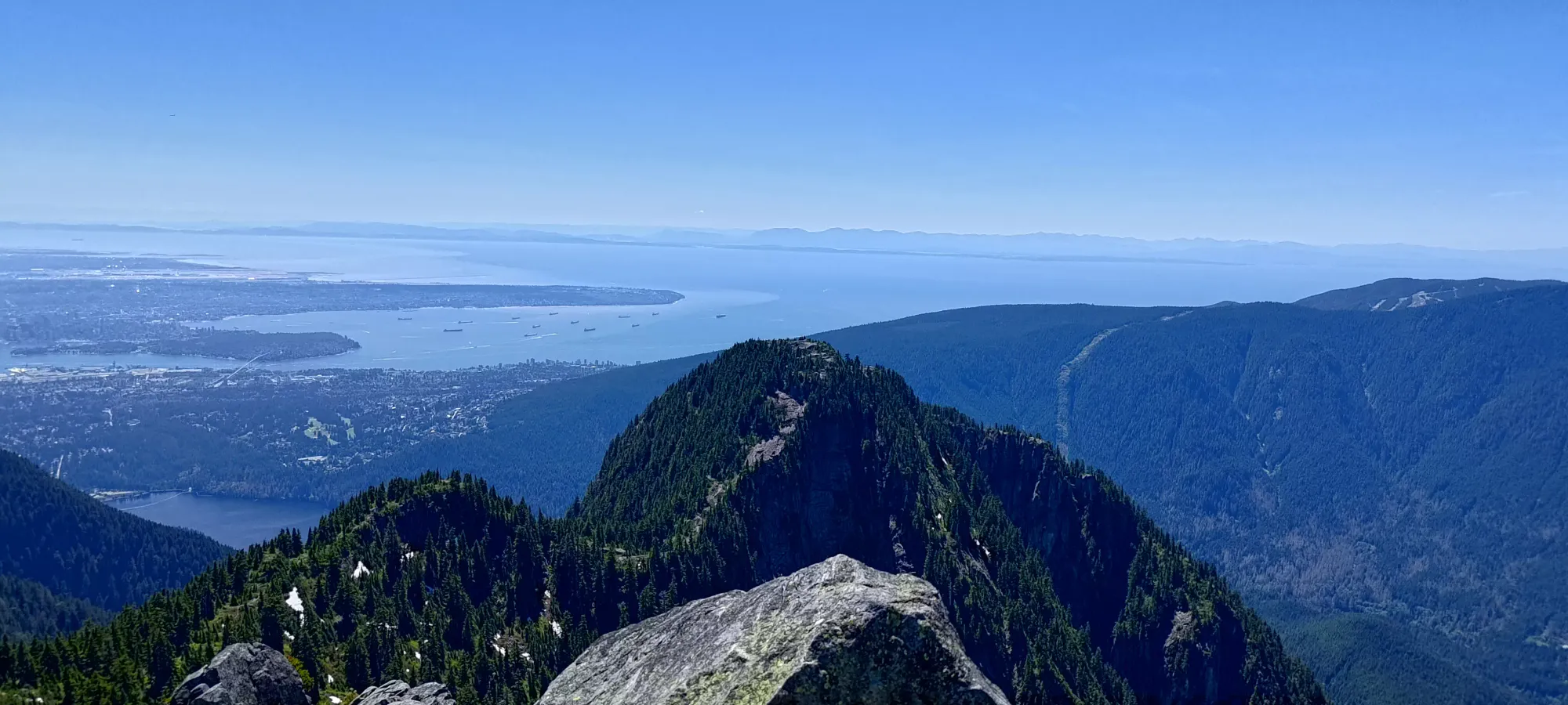
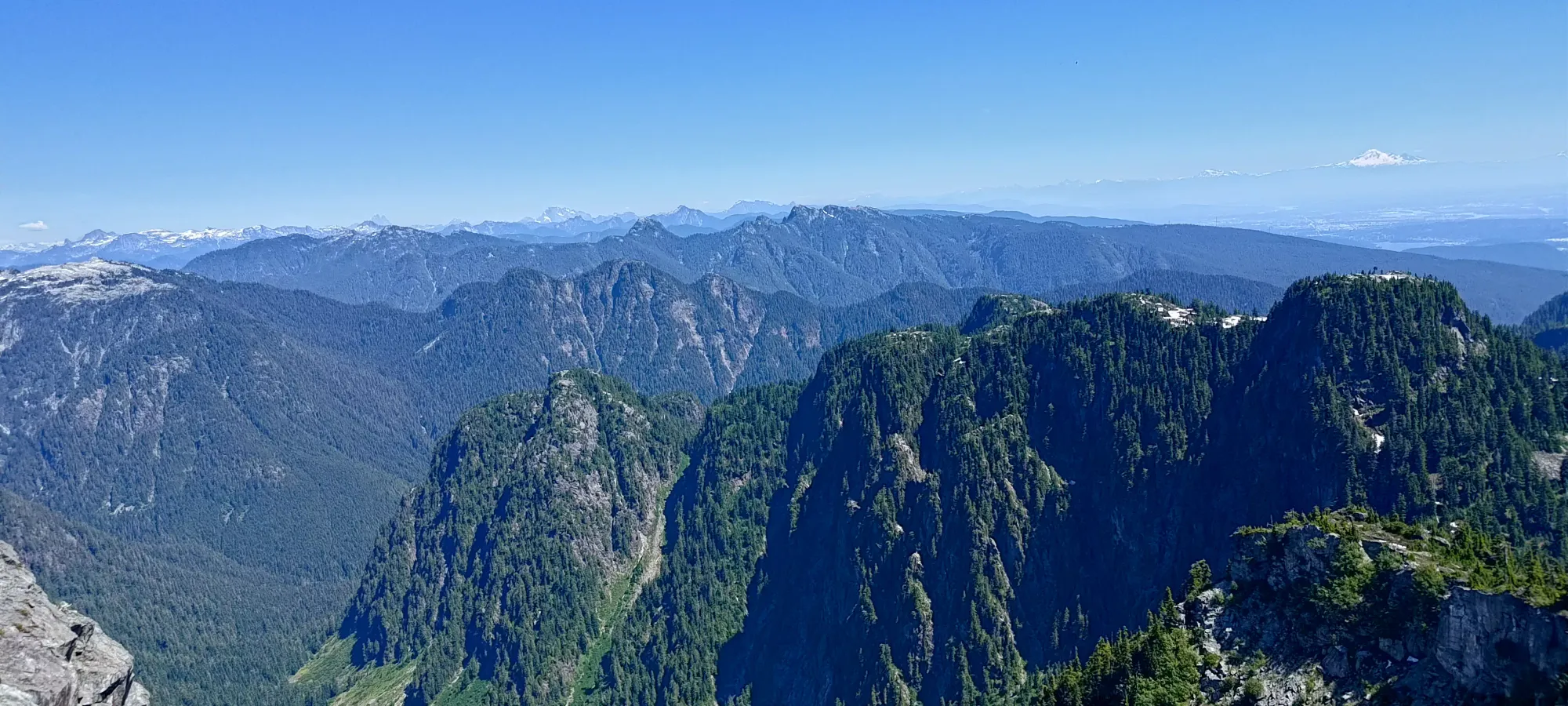
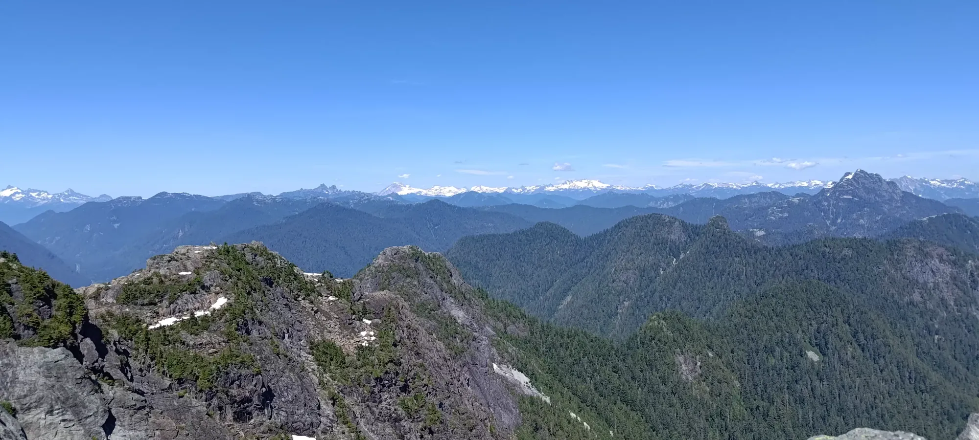
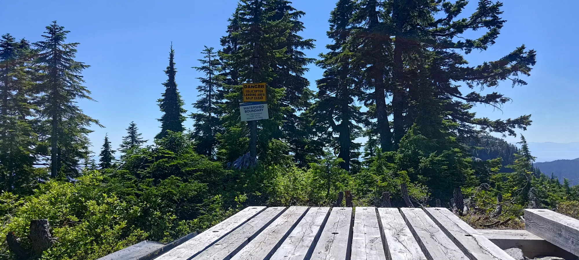
After the junction, it's basically up without any more meaningful undulation right to the summit, so about 420m elevation more to go 😅 It's simply steep forest until around 1250m, where you do a short traverse across easy rock (hiking/class 2 scrambling) to more forest, which carries you up to 1400m. Here, there is a clearing to climber's left where a helipad is located, and the trail opens up into treeline terrain, where you get eyes on some views once again, as well as the summit-area rock. I was more tired on this section, and spent nearly an hour getting up to this point. I intermittently picked up trail friends en-route, but lost them when either they continued on ahead, or fell behind.
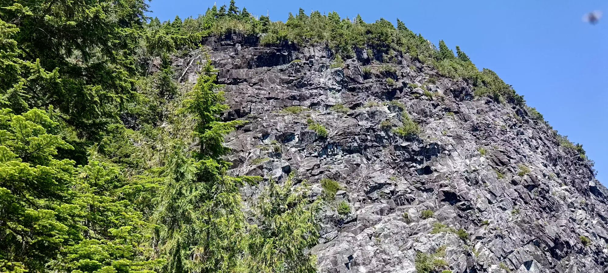
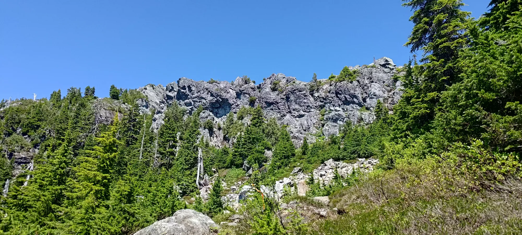
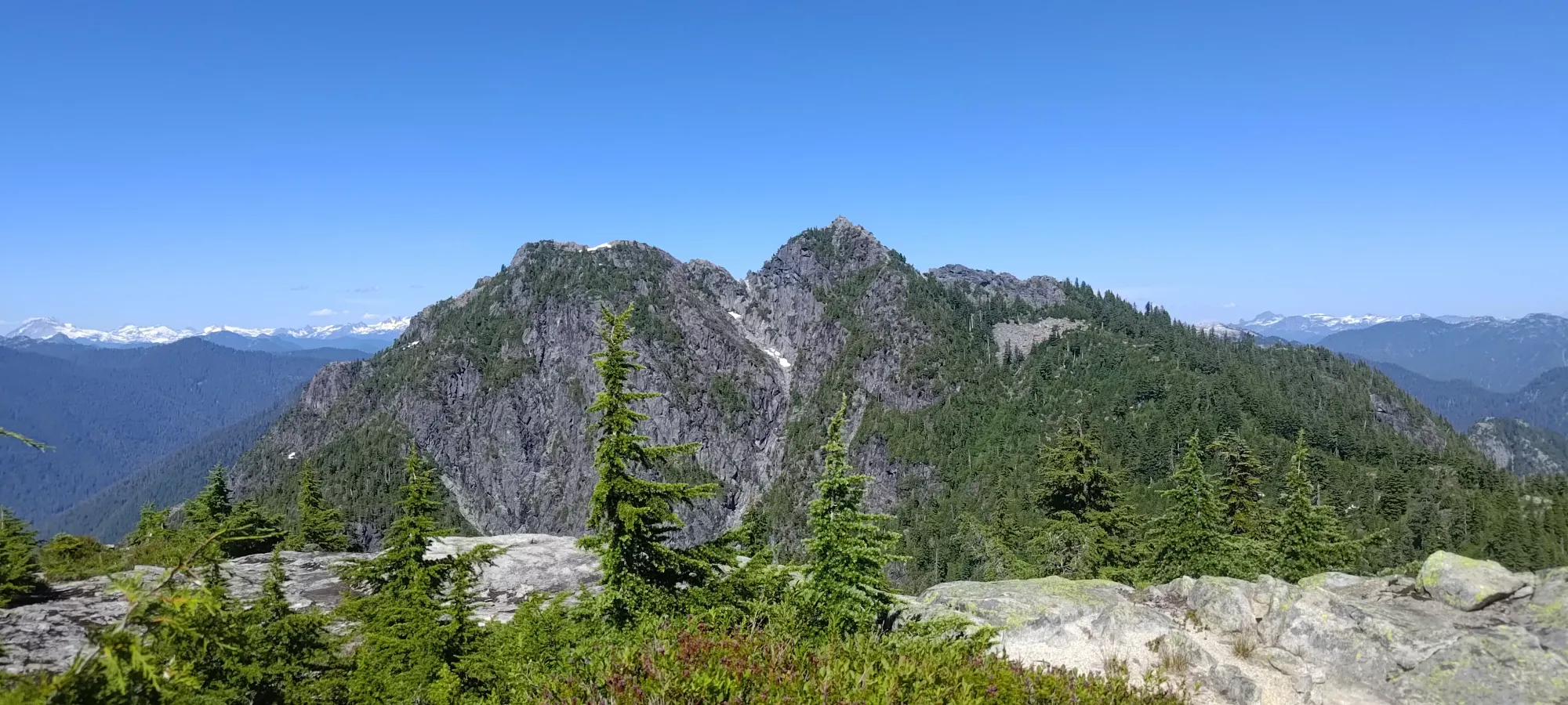
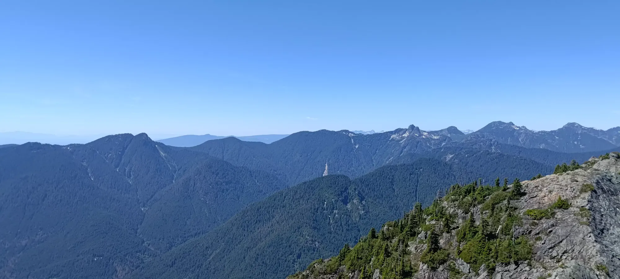
After this plateau with the helipad, there was another short boulder field. This one was partially snow-covered, though not enough to be of any help, unfortunately. On the plus side, the boulders were quite stable and large, so it wasn't that annoying to get through. Once on the other side, it was just a regular trail up through the increasingly sparse (that sounds weird to say) trees. After about 10 minutes, I hit the top of the Crown/Crater couloir. This is a generally "more fun" route up the mountain, with good scrambling for a few hundred metres of elevation instead of just a few like the standard route. However, I was feeling a bit lazy and unmotivated, and the snow I saw as low as 1200m spooked me out of it. I felt a bit vindicated once I got to the top here, as I saw 3 large snow patches in the climber's right side of the couloir, which were reminiscent of the ones that nearly beaned my party in the head last year on Edge Peak. They didn't look as steep or unstable, but still, it's a risk, and that would likely make part of the route wet and unpleasant. In a week or two, given the intense weather going on, I imagine the routes here will be in great shape (and I can feel justified in my unwillingness to add a few hundred extra metres of gain onto my day 😆).
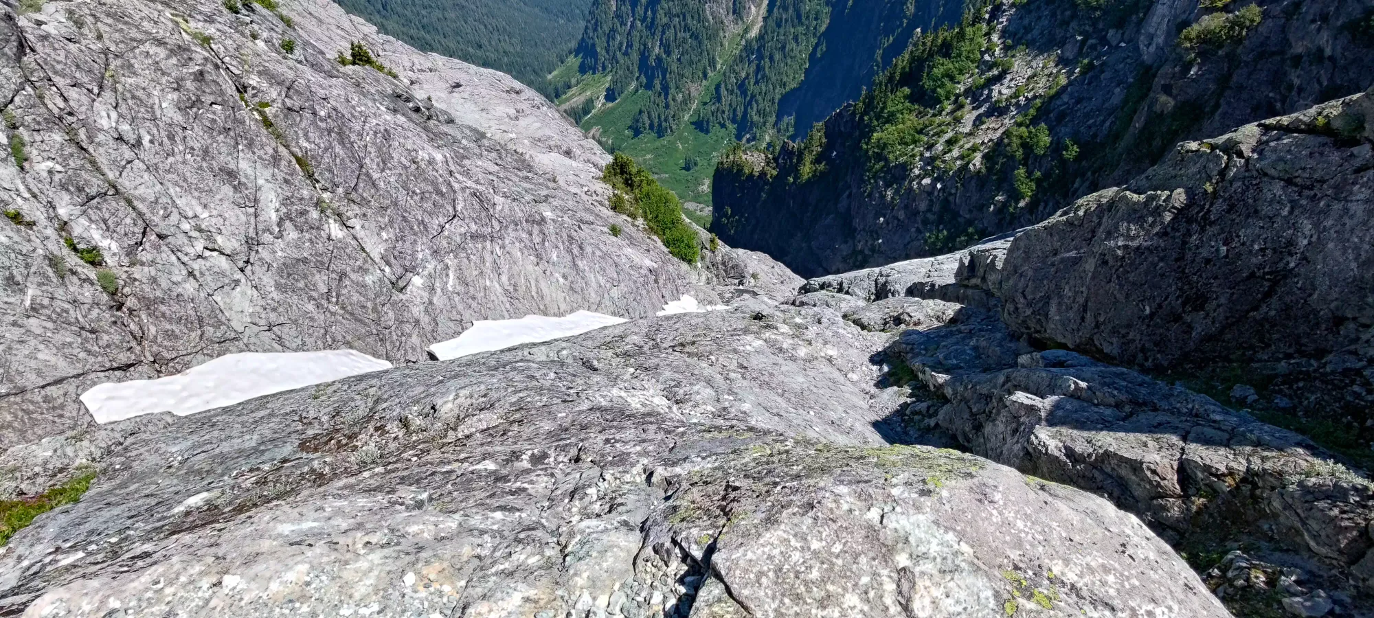
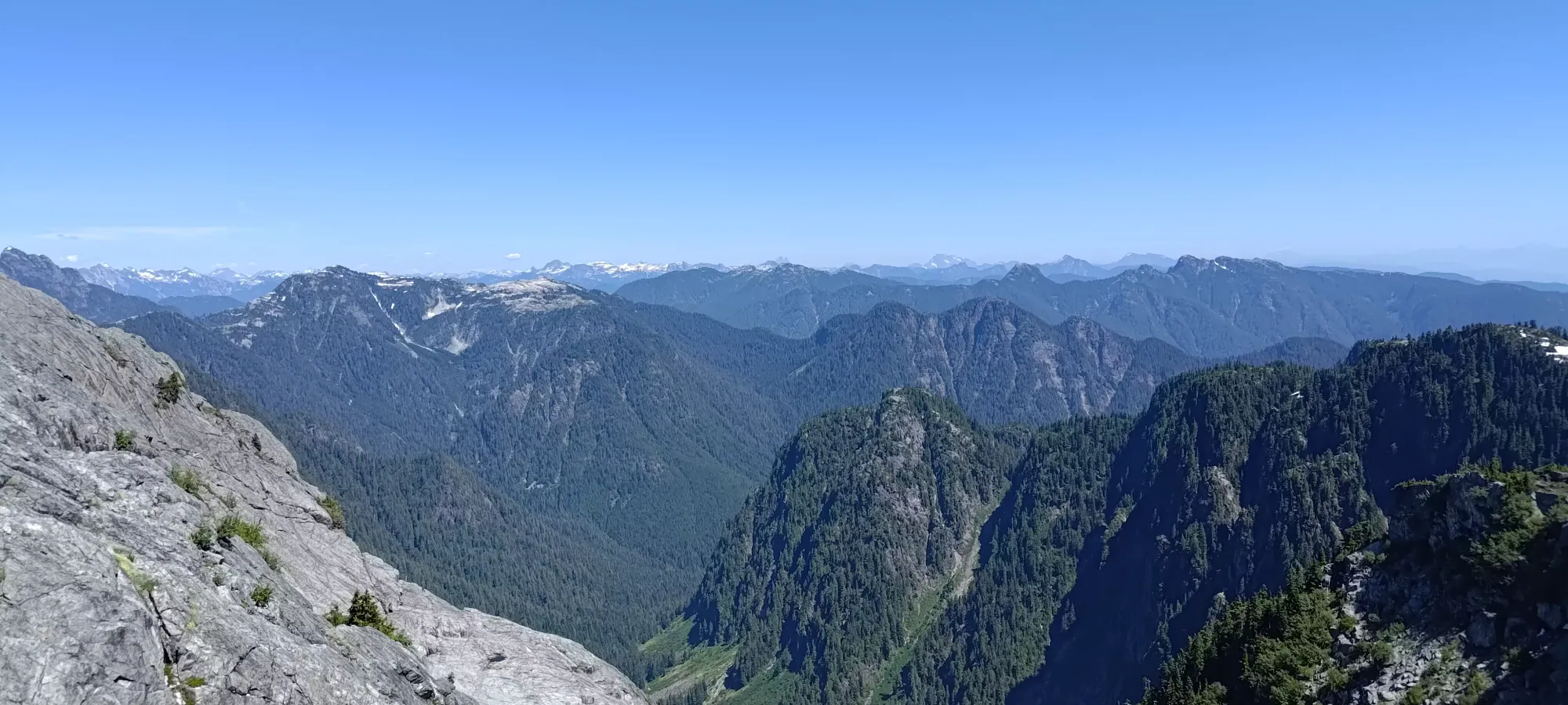
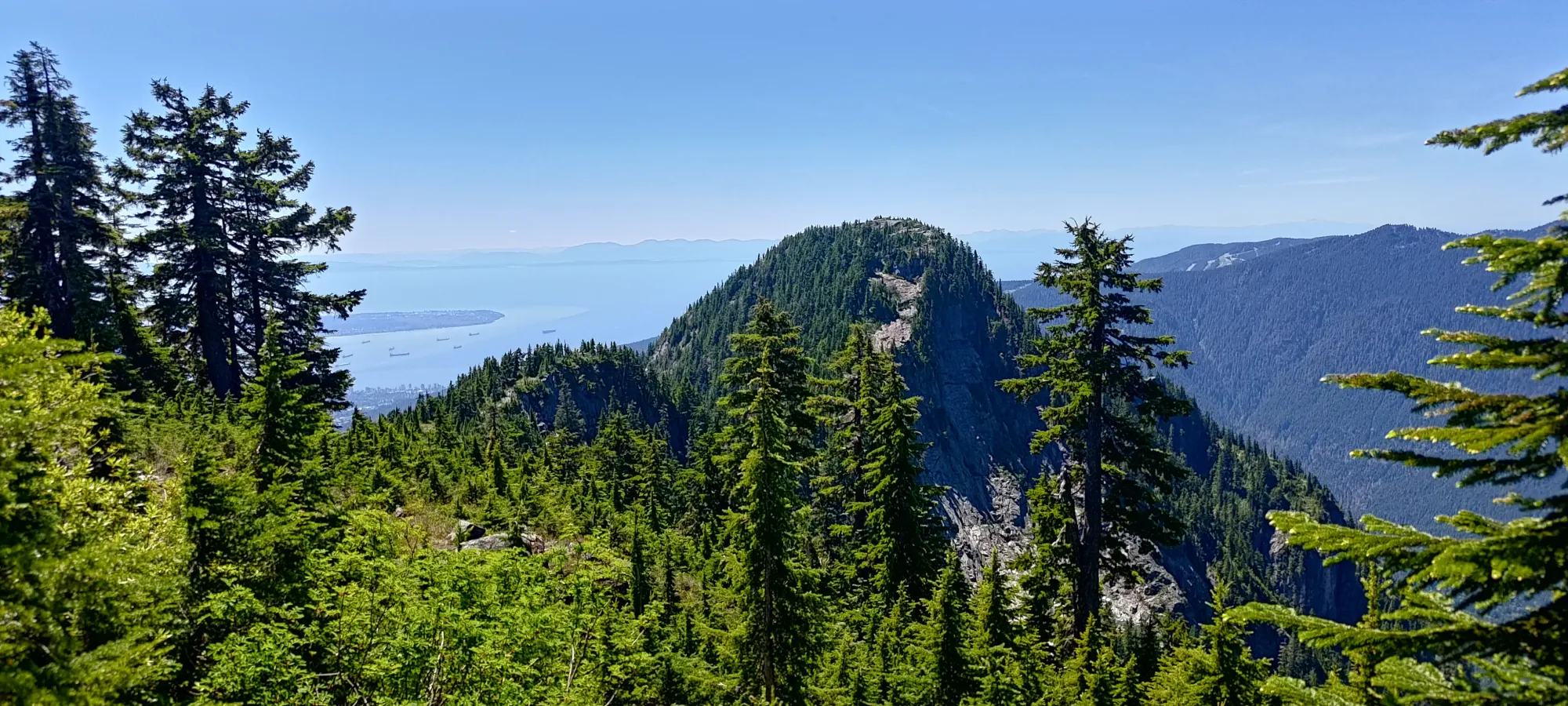
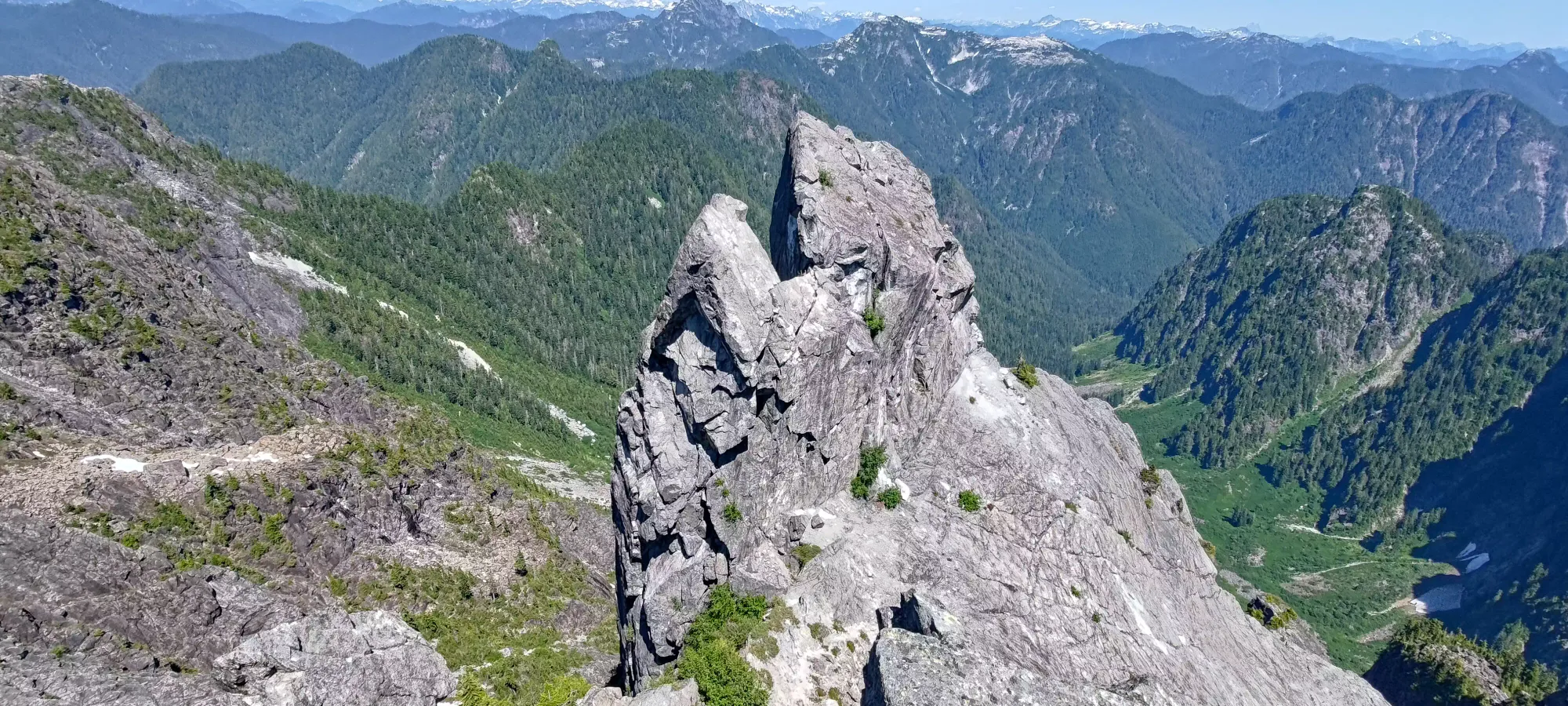
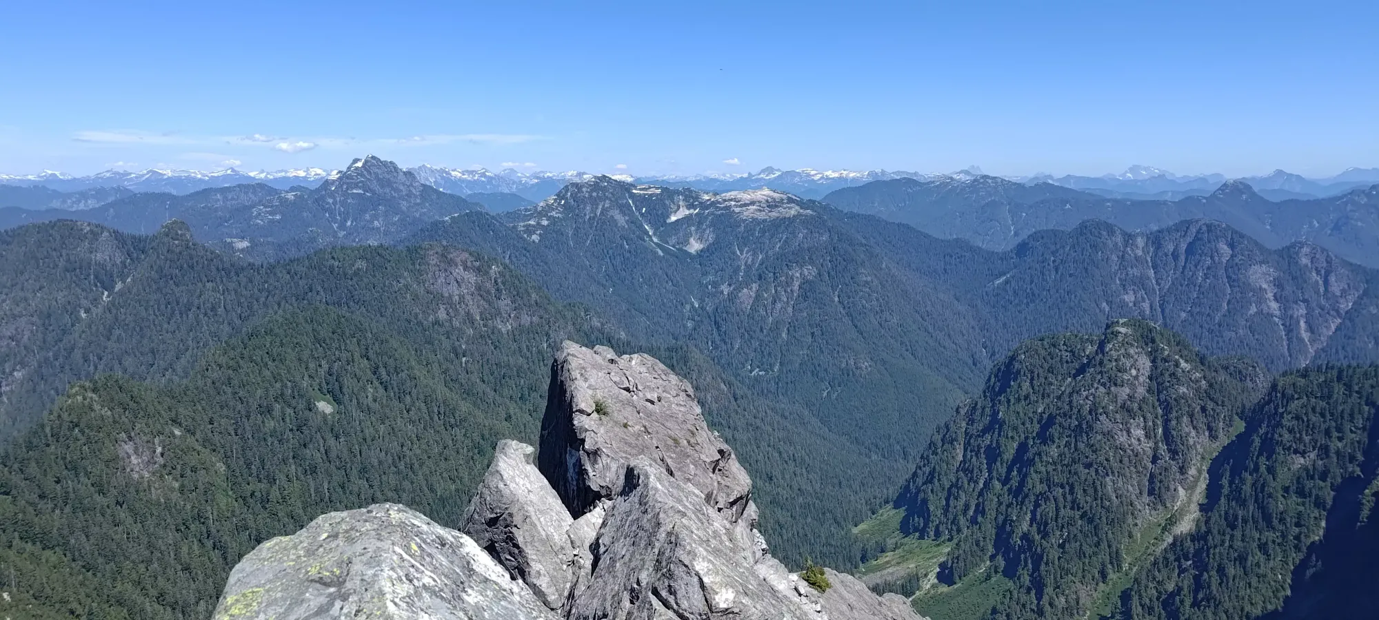
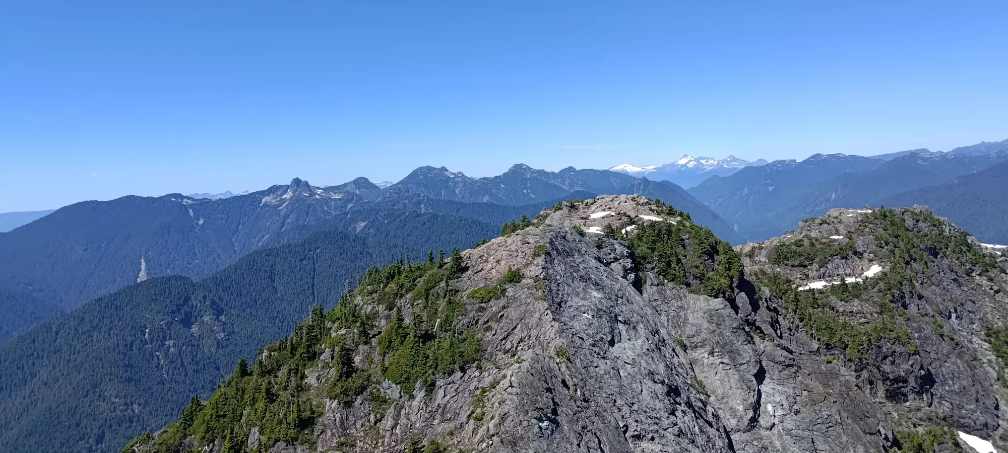
From that point, it was less than 10 minutes of walking and easy scrambling up to the top. I managed to find a couple unnecessary moves to make it more interesting, namely one wide crack with poor holds on the sides that took some mantling skills to pull off, but you can more or less walk up if you want to. Nobody else there (a couple parties, plus a couple more as I rested on top) seemed to want to get to the true summit, but I, of course, did. I did some more unnecessary scrambling to climber's left around the large rock blocking access from where most people stop, but you could also just walk around it to the right, and be on a ledge right below the top, which you could then do one easy move to summit.
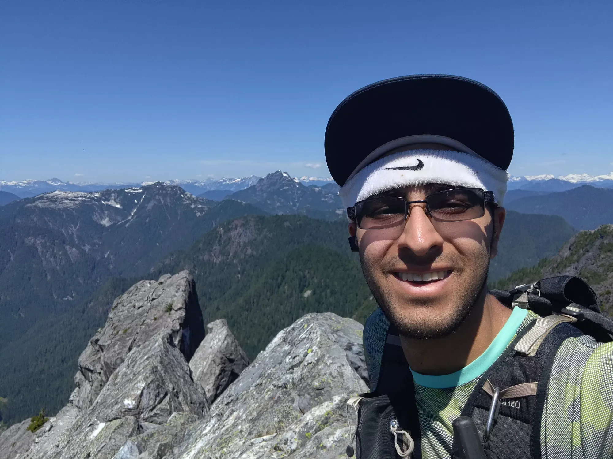
Getting to the summit from my cheap-ass parking spot on the road took basically 4 hours on the dot, which I was fairly happy with. I briefly considered trying to traverse to The Camel, but the downclimb looked very committing, and I knew the easier way is to come up from the couloir, so I decided "it isn't a p100, so I don't need to care". More realistically, if my climbing friends can ever convince me to return for the harder routes up, I'll do it then, but I'm in no rush. There was a bolted rap station, though, if you brought a rope up and wanted to traverse from Crown.
So, instead, I just lounged around at the top and chatted with a couple guys I'd met on the way up who fell behind when refilling their water past Crown Pass. After half an hour of pictures, intense sunshine, and relaxation, I decided to make my way down, and started reversing my course.
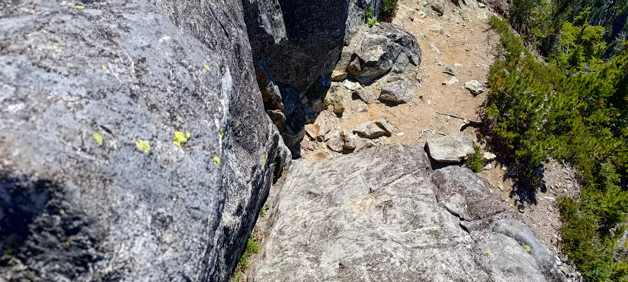
Retracing my steps took a bit more than 10 minutes, at which point I developed some temporary dyslexia at the helipad, then dipped into the forest to tag Beauty Peak while I was around before heading back south.
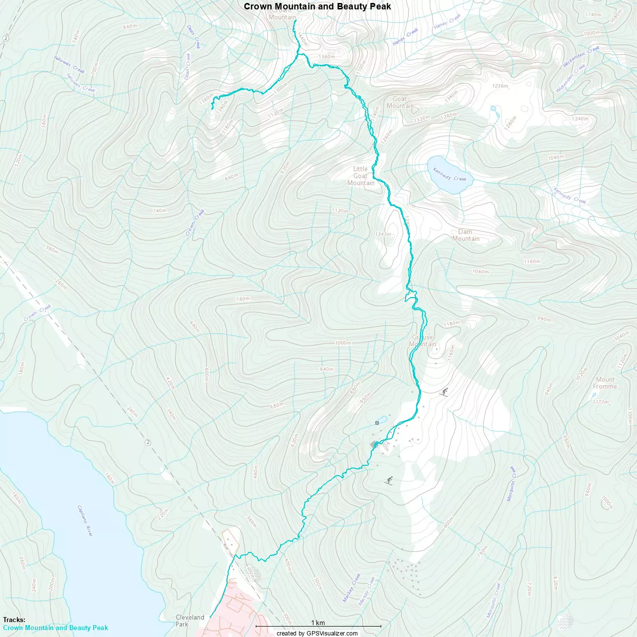
GPX Track + Map