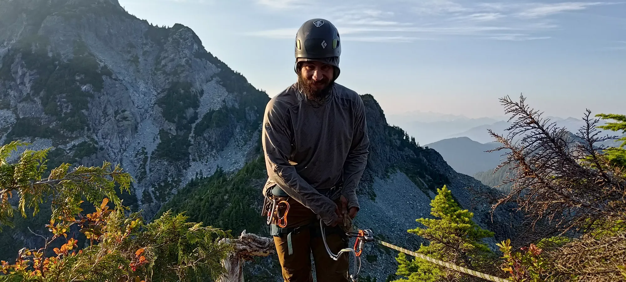
Edge Peak - August 26 2023
A very fun scramble, slightly marred by a very severe lack of sleep. But a 10/10 destination for any scrambler in the area

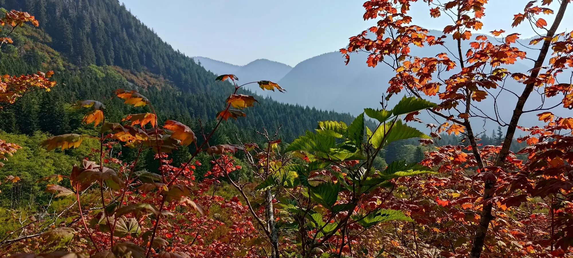
Golden Ears Ranges, Maple Ridge, British Columbia
1680m
Alright, grab some popcorn, get comfy, and relax, because this is gonna be a long one (if you just stumbled here looking for beta, the GPX is at the bottom, and you can skim through for route details, but my trip reports ain't free, you gotta suffer through my rambling to get the beta!). After wasting my last weekend 0n-call, and having a really rough last week and a half being woken up by alerts, working super long hours, etc. I was ready to move past that crappiness and get back to some fun peakbagging instead. I slept in a bit on Thursday night, and even went as far as packing 2 days of stuff, and sleeping in West Van Friday night to be closer for our early start on Saturday.
Logan and Jass had wanted Edge for a while, and their friend Michael (who I'd talked to about some trips before, but never got out with) was in on this as well. I like getting to the tops of mountains, generally, so I was perfectly happy to do Edge too, and excited, even, once I was informed that the planned White Dyke route was excellent scrambling on high-quality rock. So, we agreed to meet at a Maple Ridge Park at 6:30 to carpool in Michael's truck, and then get to the park soon after the 7:00 gate time to give us lots of time to get in/out before crowds, darkness, or gate closures would be a problem. I was kinda annoyed at having to wake up at 4, but I didn't feel too bad the day of, and managed to get there on time, though we didn't end up getting moving from the trailhead til about 7:40.

We decided to bike East Canyon instead of just hiking the West Canyon trail (how I previously have done things for Golden Ears), as it is supposed to be a nicer trail, and bike friendly. It was harder than expected, with a few rocky sections that made us get off and push, but we still cleared 3km in 26 minutes, which is slightly faster than hiking 😃. The real benefit would be the way down, and for me+Michael, at least, not being as tired (since we had ebikes). We stashed our bikes on the side of the trail, I finally got the heavy-ass chain out of my bag (though it was finally helpful to be as long as it is, as we locked up all 4 bikes with it), and we continued on foot.
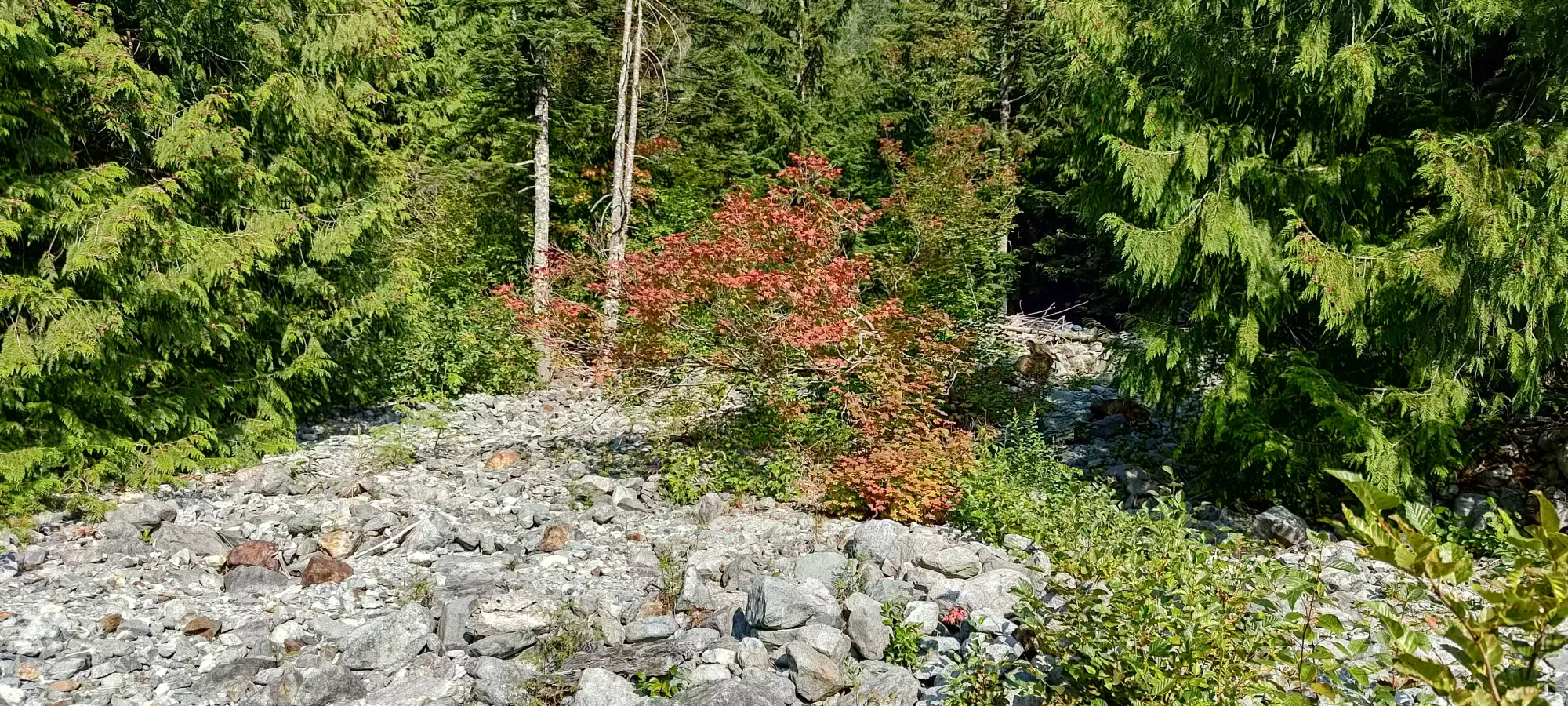
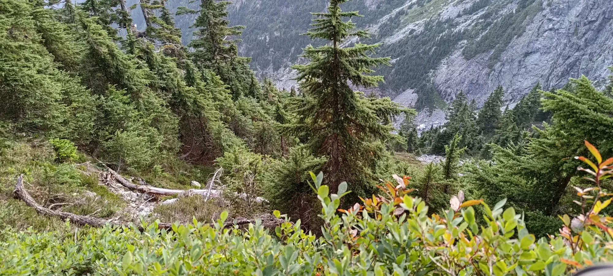
The trail to Alder Flats is pretty boring/simple, so I really don't have much to say about it, other than "there were a few water sources along the way, which we didn't need since the day was just starting". We got there in 50 minutes, and the off-trail navigation began. I had prepared a GPX the day prior, splicing together a few from reports I found online, and had generally gleaned that there was a short bushwhack to a creekbed, followed by a long walk up it, possibly some snow, and then the scramble. The others, I assumed, knew the route better, though they didn't have a route downloaded onto their wrists, so I took the lead in the beginning. Getting out of the campground and across the first creek was pretty simple, and there was a faint trail to follow. Past that, though, it was just bush with little to discern in the terrain, so we just followed the weaknesses in the terrain. We ended up parallel to the GPX track, but in open boulders covered in dirt/grass, so we followed that for a bit. In that boulder field, the lead ended up changing, and we followed the weaknesses in the boulders until it started getting bushy. I noticed we were getting a bit too far climber's left of the track I had for my liking, but the others seemed confident, so I followed along, going through some rather thick bushes until about 40 minutes had elapsed, and we had gained a whole 20 metres of elevation from Alder Flats.
At 150-200m off to the side of the trail, with the bush getting thicker, I decided to deviate a bit from the group, and went up a knoll to my right to get a better vantage, and get myself a bit closer to the track I was expecting to lead us to a creekbed instead of just a bushy valley. Once I was on top of it, I saw that the bushes continued basically until the start of the scramble, and decided "screw that, I'm getting over to the trail now". I informed the others I was doing so (they were well ahead, so it was shouting territory, but still within earshot enough to communicate that intent), and started traversing.
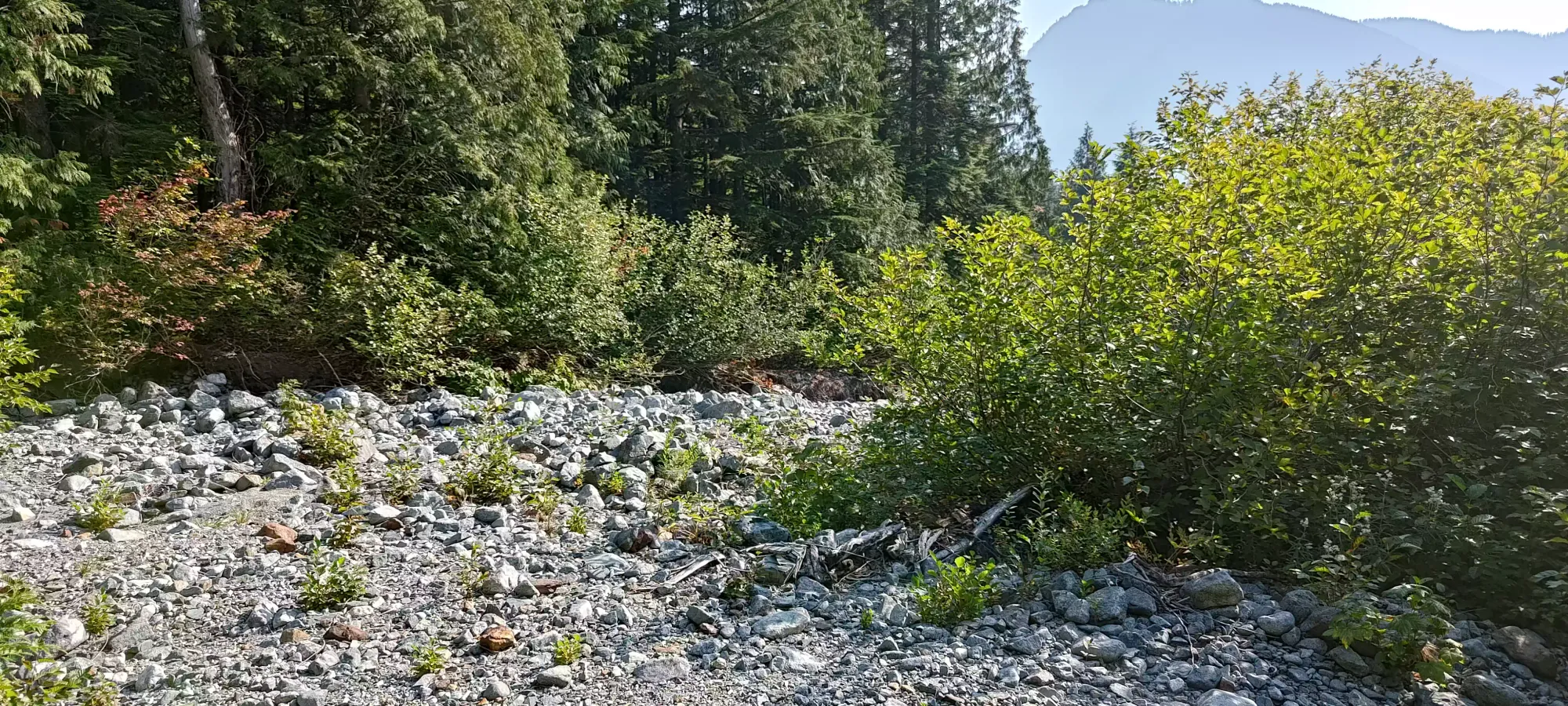
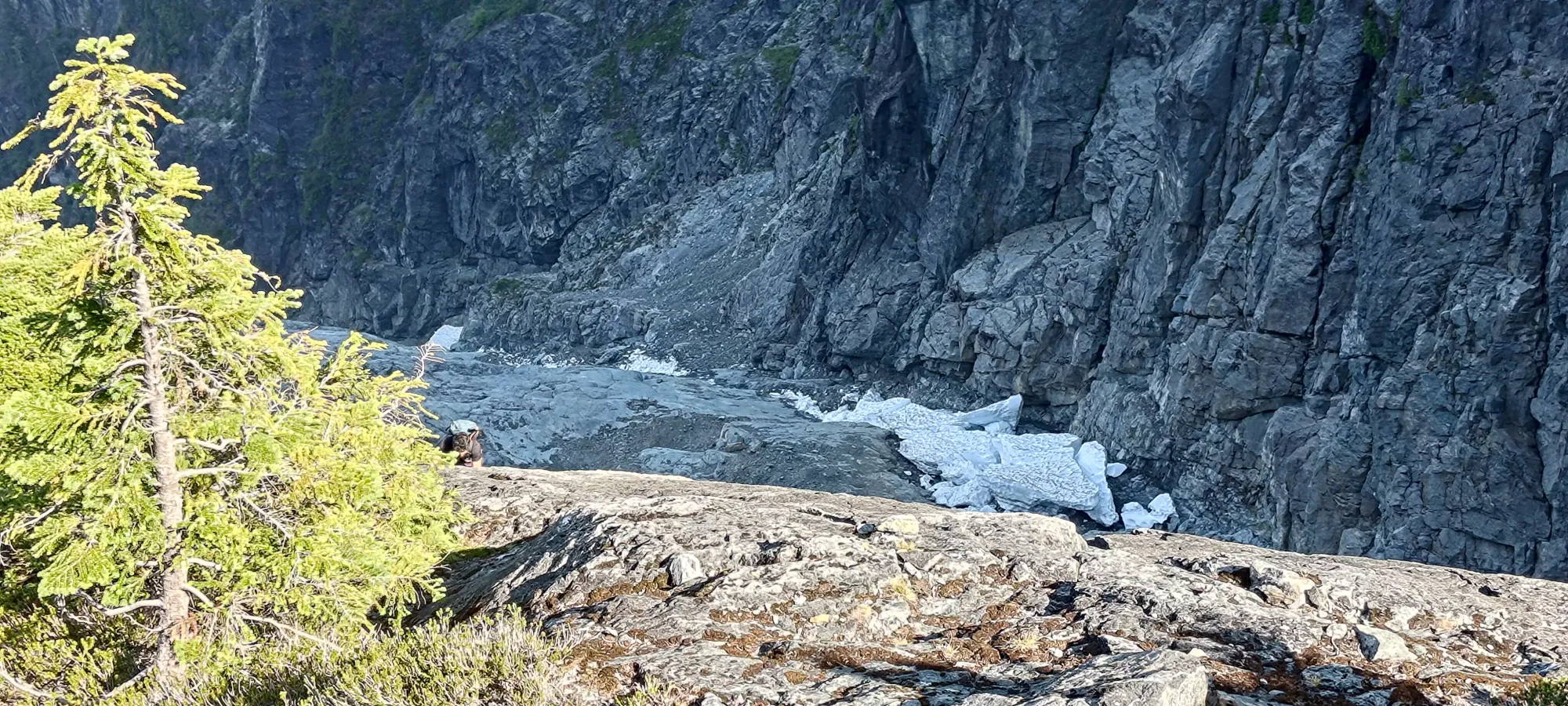
The traverse was rather horrid, as I was forced to get up and over a hill, then sidehill-bushwhack on another, through very dense bush, with Devil's Club abound. After nearly half an hour of cursing and bushwhacking, I finally got myself on-track, and sure enough, I was in a totally open creekbed! I emptied my shoes out (they'd been untied by the bush anyways), had some water, and started the much more pleasant walk up (I don't think I've ever been so happy to be walking in a creekbed 😅).
A few minutes later, after basically losing comms with the others (we'd got too separated to hear each other), I heard the sounds of someone in the forest. I was surprised to hear someone so low down, but after a few minutes of shouting back-and-forth and lots of rustling trees, out popped Michael! Apparently, after I started cutting back to the trail, they quickly became concerned about our inability to communicate, so he decided to try and follow my trajectory. After we regrouped, we started plodding up the creekbed, and every so often would find a little high point to shout and look around. A couple times we thought we heard or saw them, and at one point we waited for quite a while, but it took until around 700m elevation or so before we actually met up. Logan and Jass apparently bushwhacked all the way up to the end of the meadows directly, which they described as "an adventure", so hey, more power to them I guess? My only regret is not putting my foot down sooner, I definitely did not enjoy the bushy section, and it was entirely avoidable.

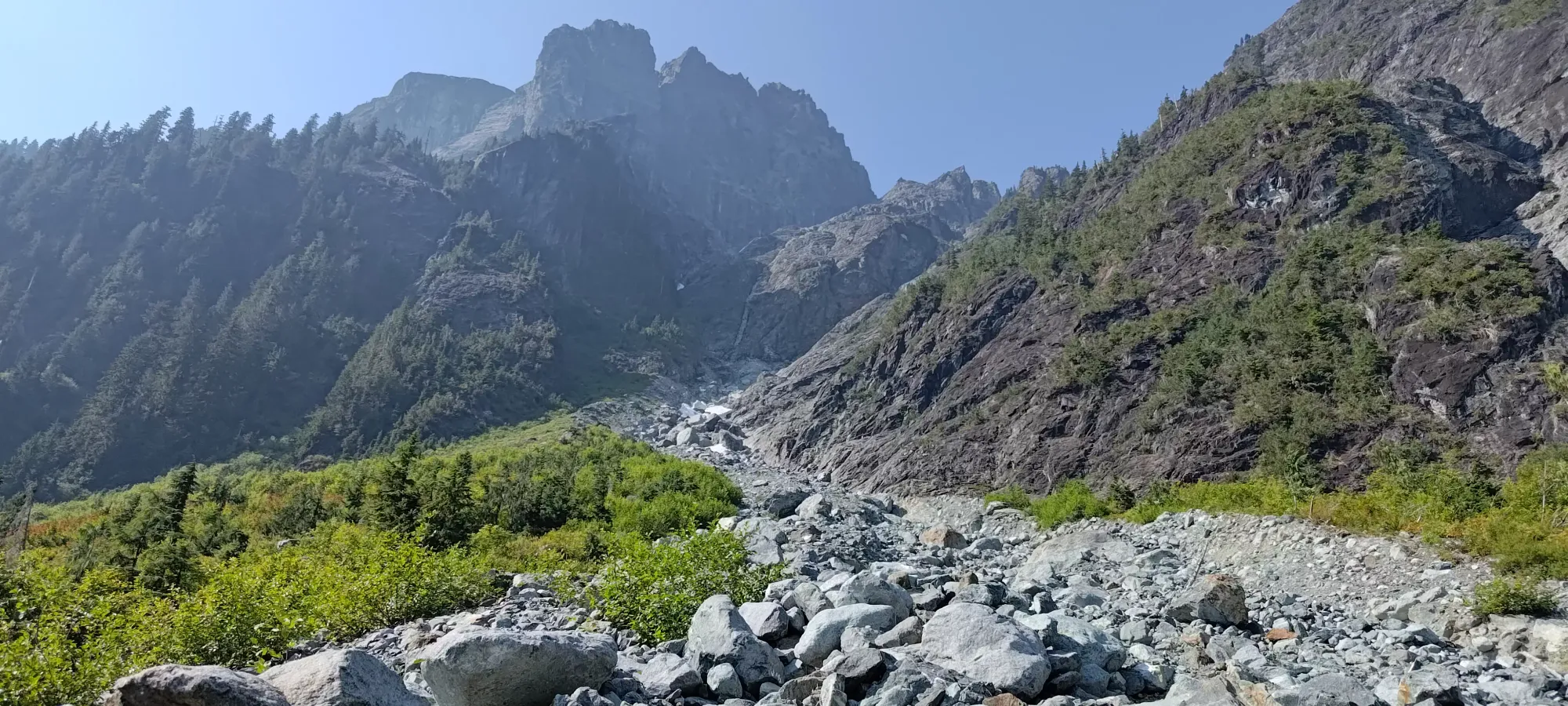
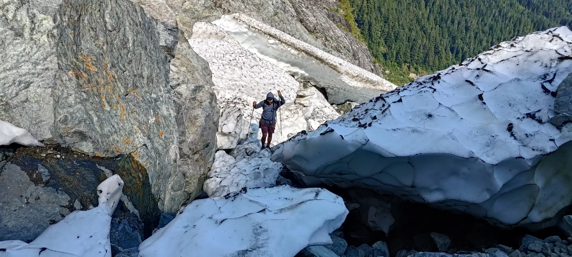
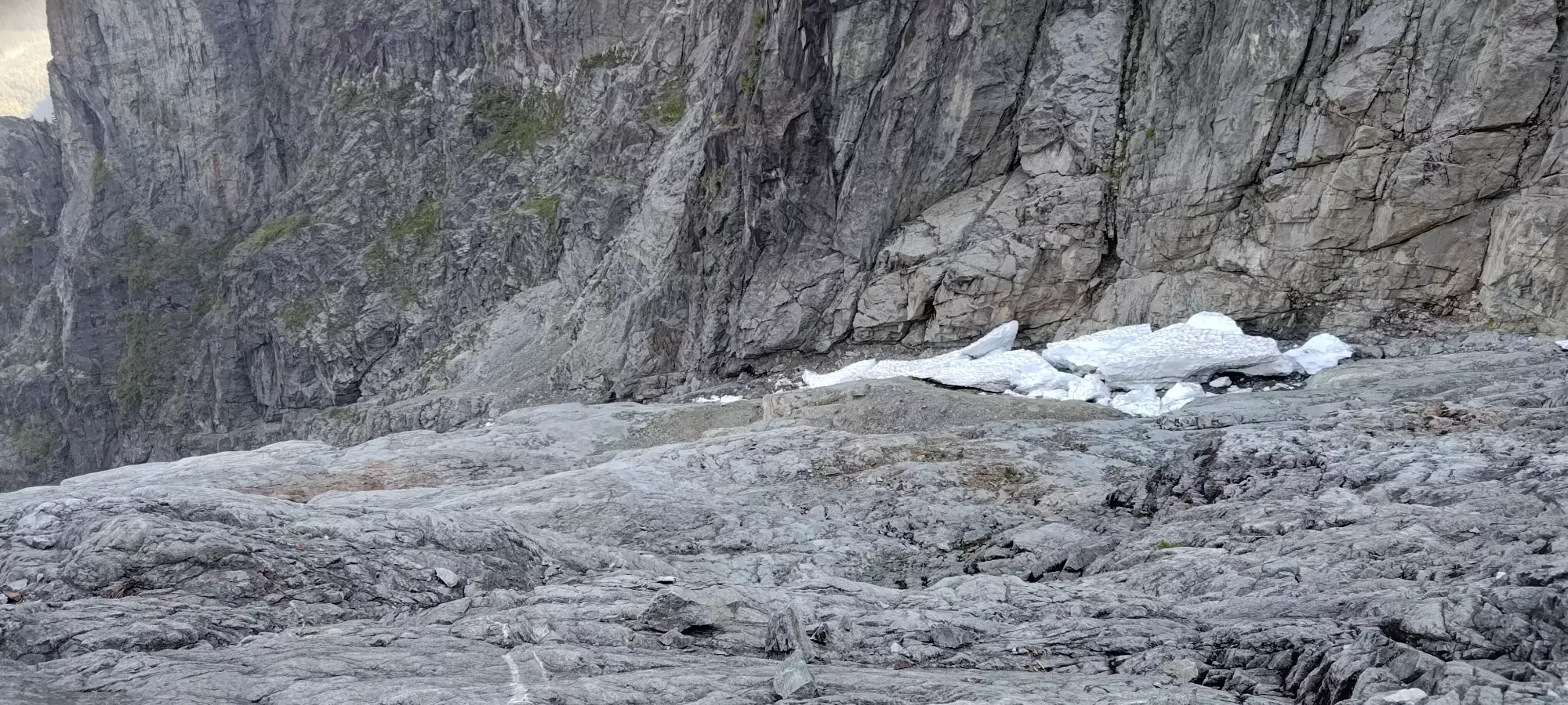
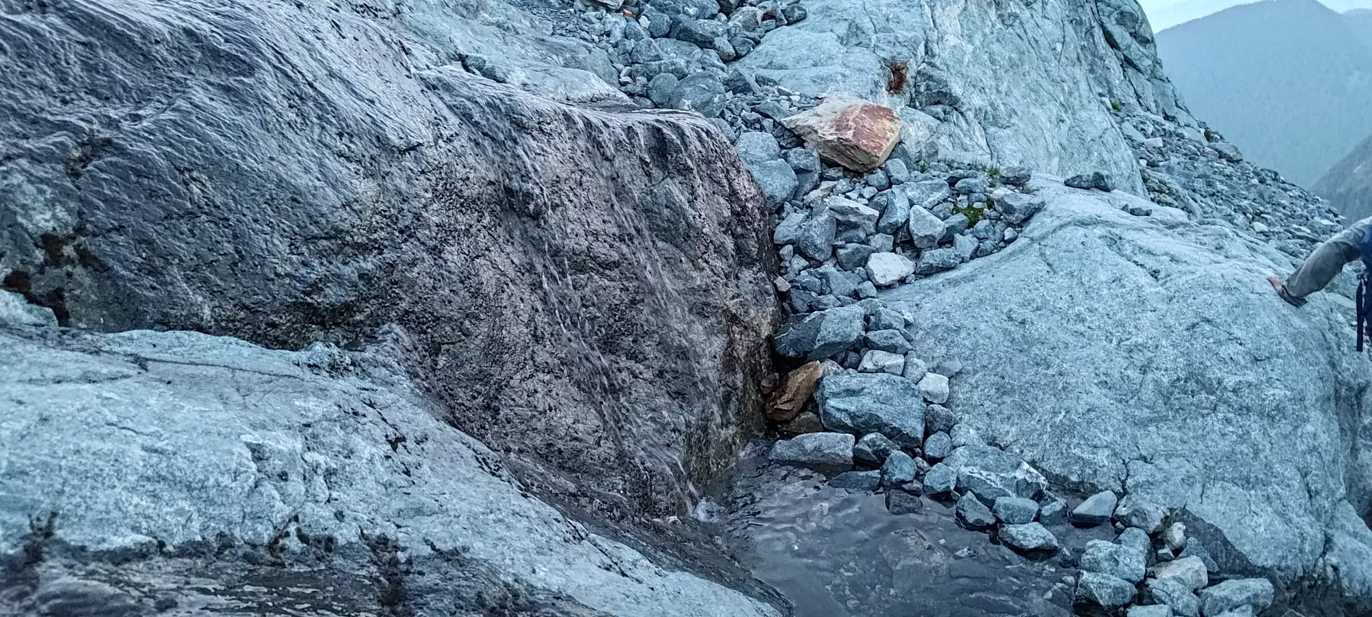
Once we were together, we hiked up for about 20 minutes before deciding it was a good time for lunch, and took a break on the climber's right side of the creekbed (which was turning into more of a gully due to the steepness and increasing height of the walls of rock on the sides, especially on the right), as that's where the water was flowing. We rested for about 20 minutes, then continued on. As we gained up the rocky terrain, we encountered more large rock formations that were "just part of the mountain" instead of just boulders in a creek, but also more loose dirt as the steeper terrain couldn't hold onto rocks as well. Before long, we got into a surprising amount of snow given the snowpack reports in surrounding areas, hitting snow below even 900m, and in pretty thick formations.
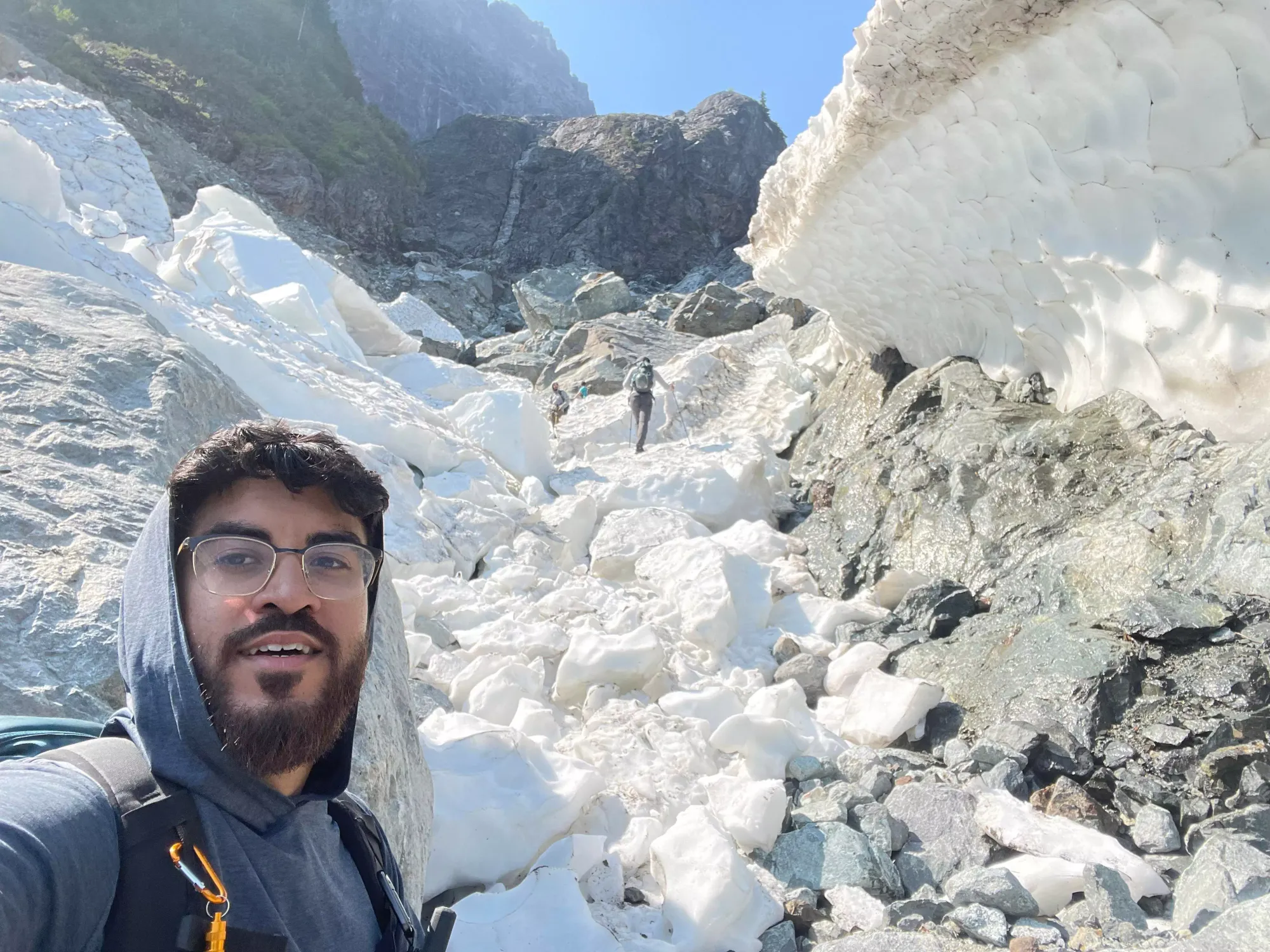
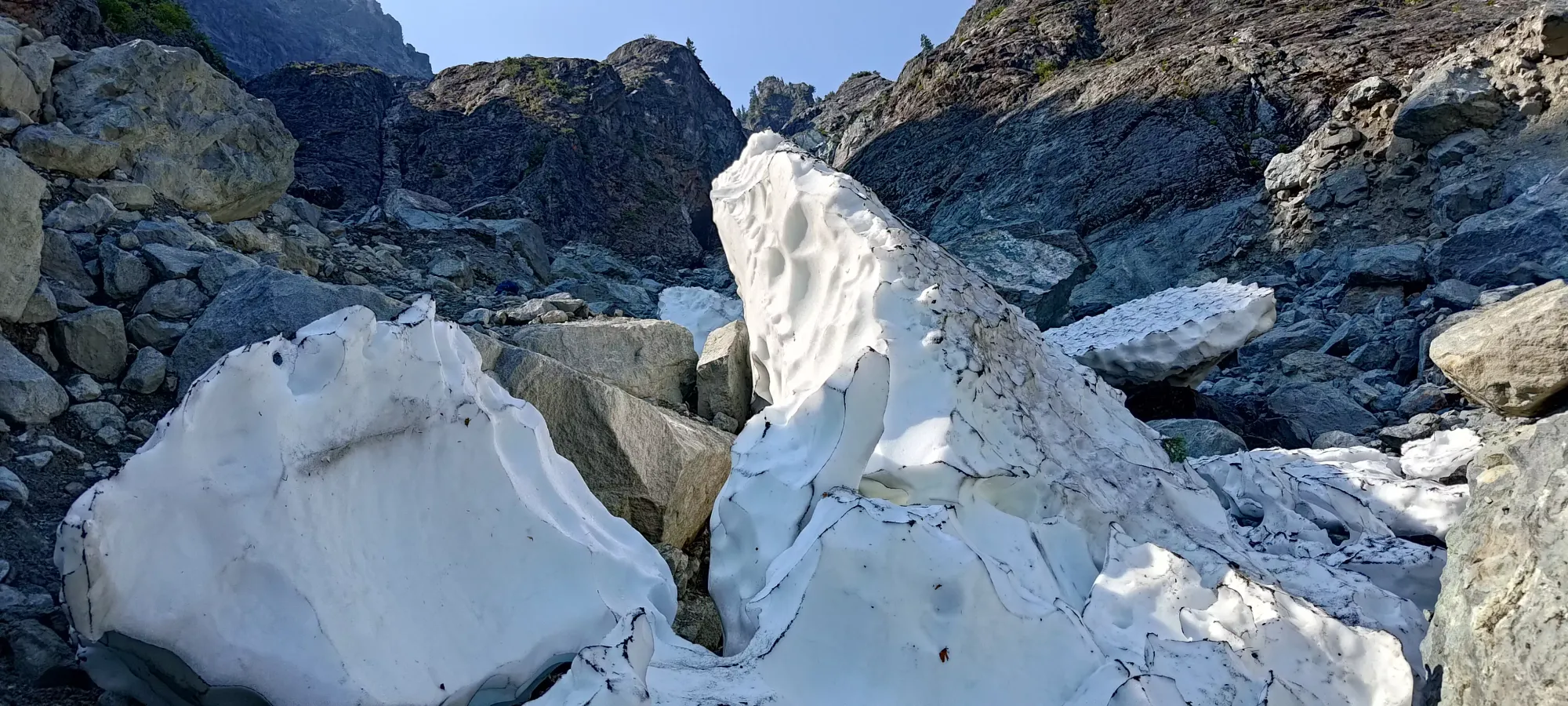
Thankfully, the snow was (unsurprisingly) very well-packed, and difficult to make collapse. On the other hand, it made some steeper parts difficult to get traction on, as we didn't bring spikes/crampons. Logan+Michael took the adventurous route a couple times and snuck under some caves, whereas me+Jass went over the obstacles instead. Jass was even kind enough to give me a little boost from behind on one particular step I wasn't too keen on making unsupported as it was relatively steep, and falling would've been rather cold and unpleasant (thanks bro!). This wasn't too long, though, and we made it to the base of the Dyke at around 12:40pm (as you can see, the day was starting to stretch itself out).
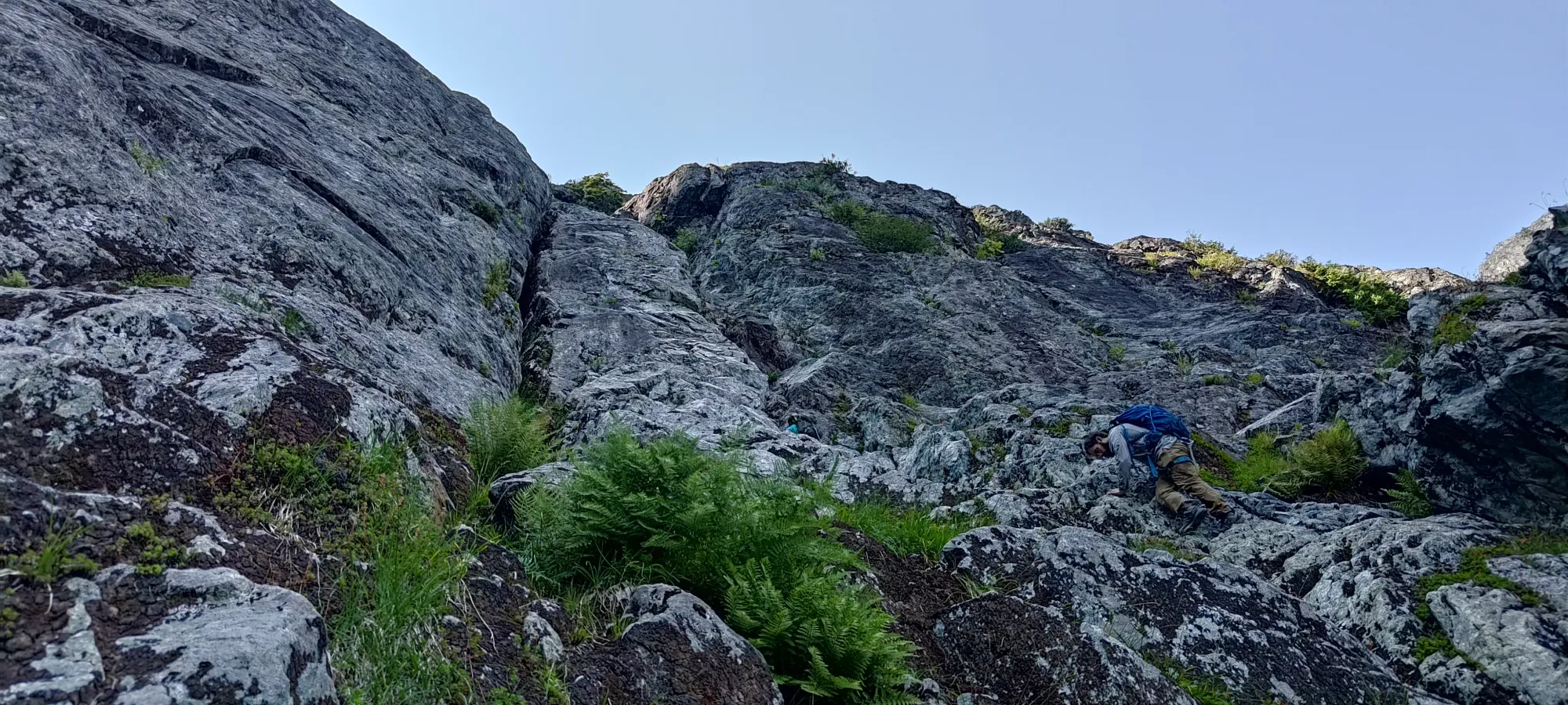
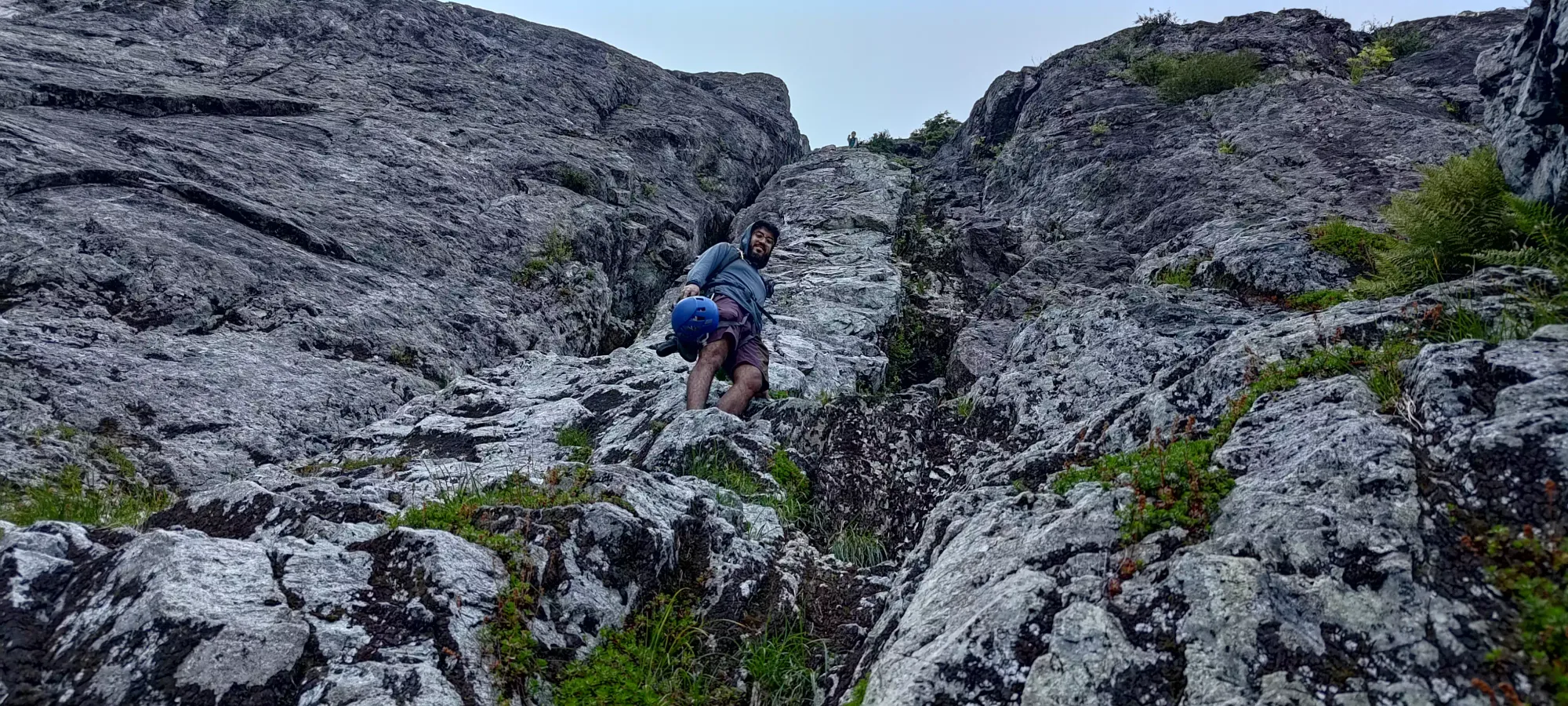
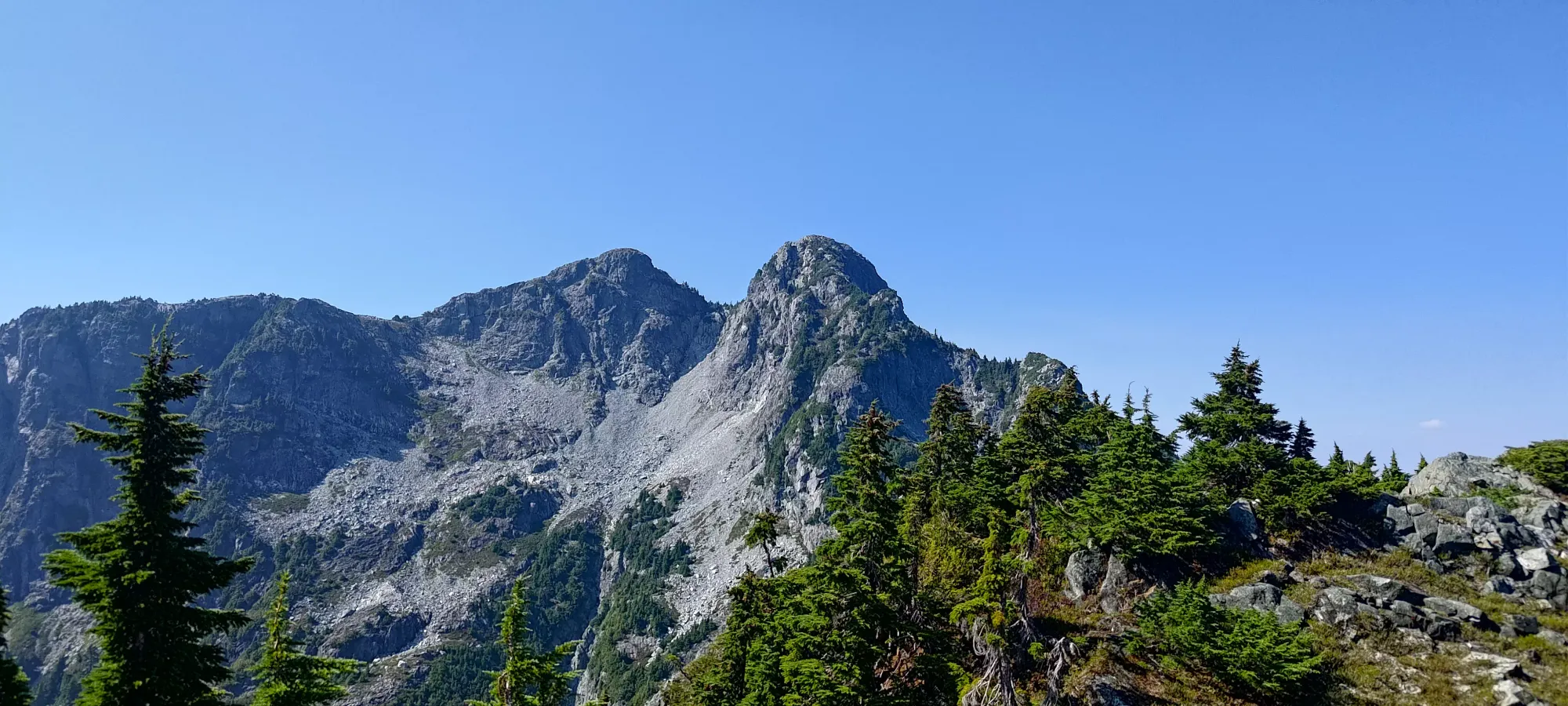
The scrambling here was really fun. The rock was bomber, super solid. There's a good choice of routes, including the chimneys/cracks on either side, or even the face in-between. At this part, you wouldn't bail to the sides, but higher up, that's often an option as well. It is, however, quite exposed, as a fall would tumble you down to the base, and there are definitely some crimpier moves, friction-y moves, and ones that put your weight over the air for some time, so you should be a comfortable scrambler before committing to this route. For those who meet that bar, though, a great time awaits.
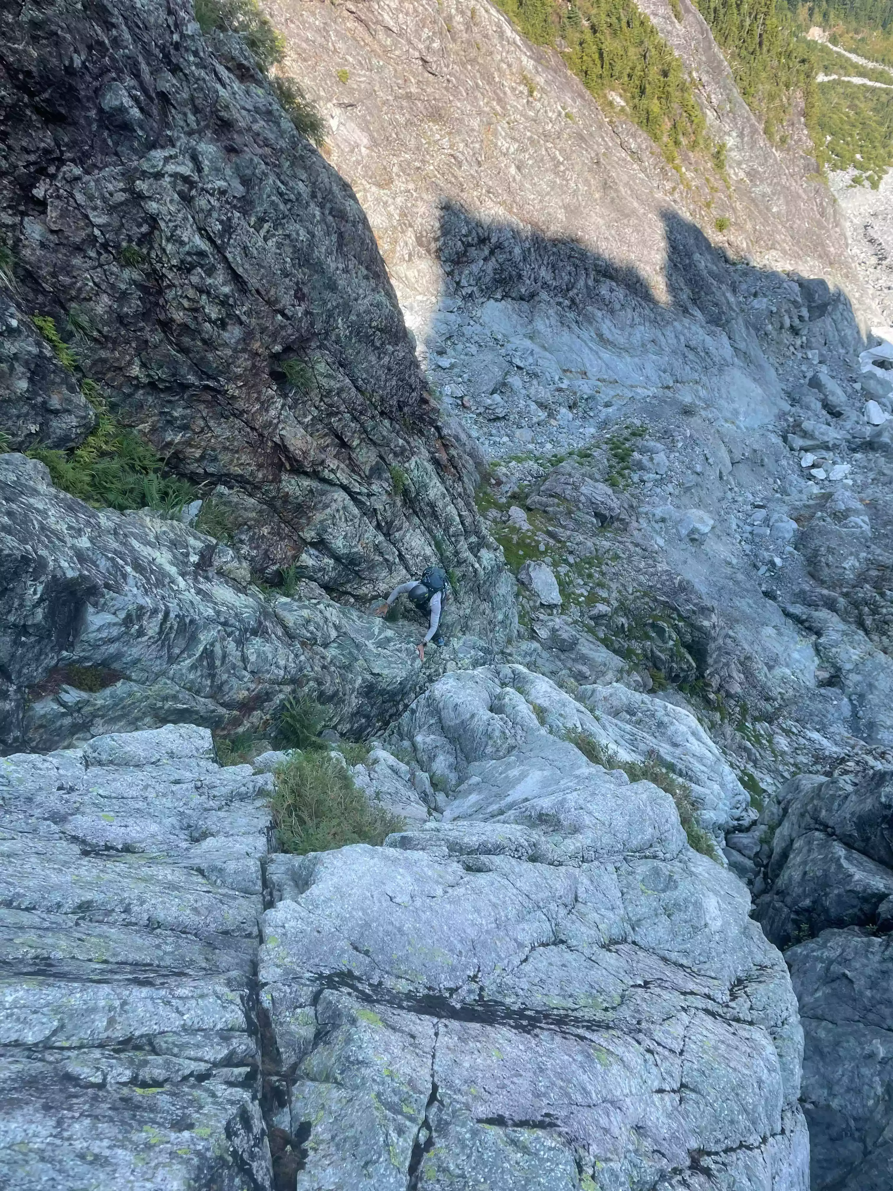

After the first 20-30m or so, things started to mellow out a little bit, and we entered a long section of class 2-3 scrambling, which probably goes until about 1200m or so. The beginning is the harder part, with more sustained hands-on, steeper terrain, and harder moves with less choice. We saw a couple of spots with tat, although there'd still be a ton of difficult downclimbing if you descended this route.
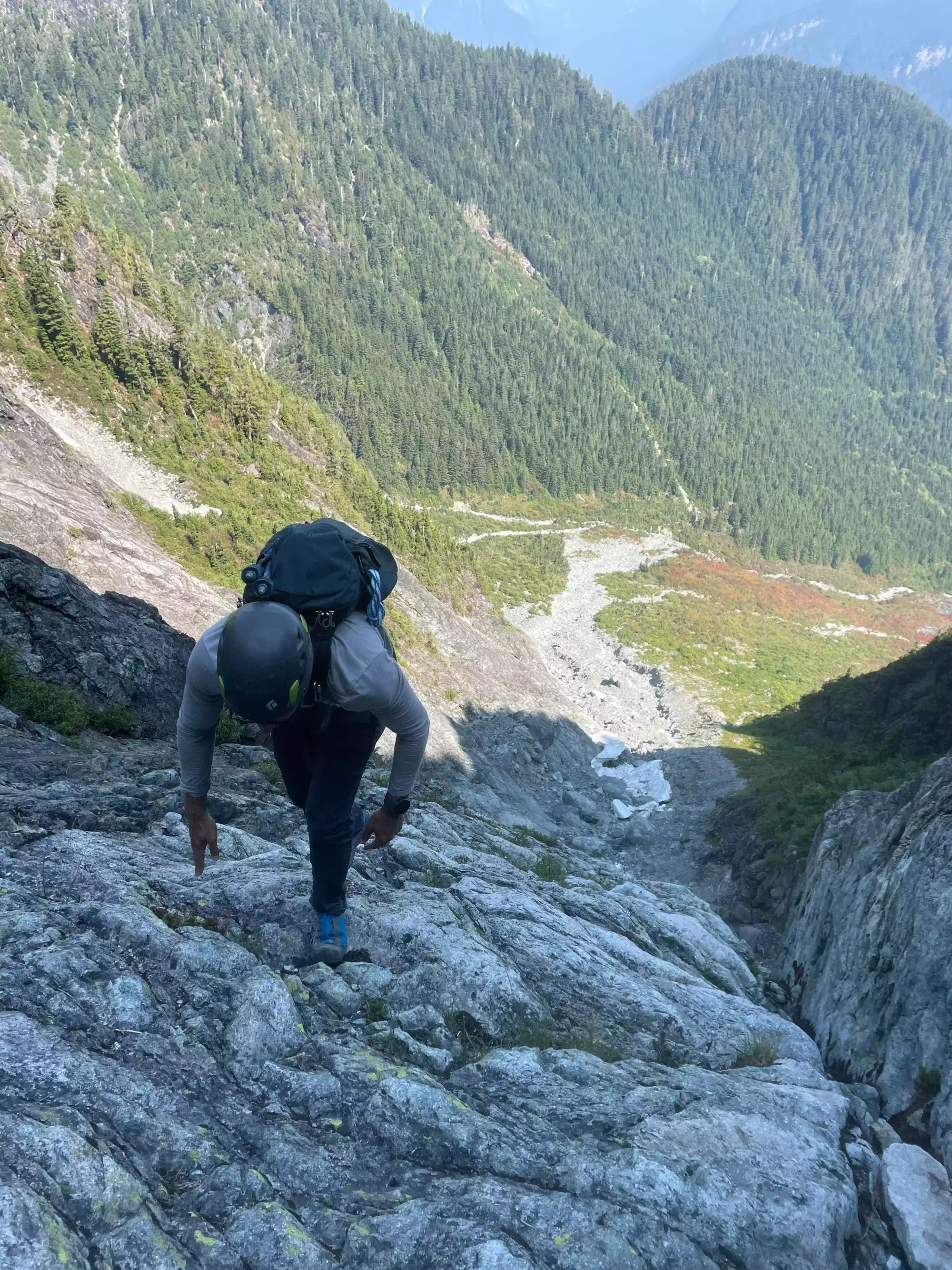
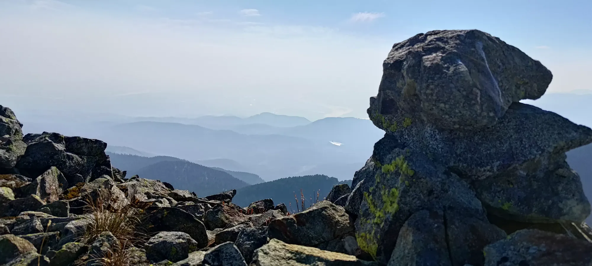
As we ascended, we encountered more spots where one could actually walk vs scramble, and the terrain got more like "slabby ledges". There wasn't too much of note terrain-wise up to the ridge top at around 1500m, but there were some notable events just in the little world of our trip. First was that I was definitely getting slow as the day continued. I wasn't sure why at first, guessing "random luck" and being impacted by the heat, before settling on the most likely theory of "one day of normal sleep wasn't enough to counteract a week and a half of very poor sleep, especially with an alpine wake-up the day of". But, that was all I was feeling, just slow, so we made sure that we would have time to get out of technical terrain in the daylight, but paid it not too much mind for a while.
The next and scariest thing happened around 2pm, somewhere high up in the gully above the creekbed to climber's left of the scramble route. We heard a sound like bomb going off, followed by exorbitantly loud sounds of tumbling debris. We initially thought there was a rockfall on the other side of the mountain, seemingly large enough to be considered as meaningful as Snowpatch Spire or Grand Teton. However, after getting up a little higher, Michael soon discovered that it was, in fact, not on the other side of the mountain, but instead that some massive snow patches had calved and fallen down the gully, breaking apart and shoving rock down for 10+ seconds in a very-scary example of the raw power of the sun. We were glad to have got out of the gully closer to noon, as it was quite possible that this would've cascaded debris all the way down to that point. It's a great reminder to not take summer for granted, and remember that overhead hazards aren't just a winter problem. If you're planning this scramble, I recommend planning to be out of the gully (on the scramble, ideally above the crux to the point that there's a raised fin or valley wall between you and the main chute) by noon or better.

The last thing was somewhere between 1300-1350m, I think. Michael+Logan reported encountering a wasp nest (thankfully no stings), and advised us to venture climber's right, so we headed a bit further that way for a while until the top. This ended up resulting in some spicier climbing near the top, with some more class 3+4 moves than one probably needs to, but we'd take that over getting stung any way (we'd probably take it even without the wasps forcing us to, time permitting).
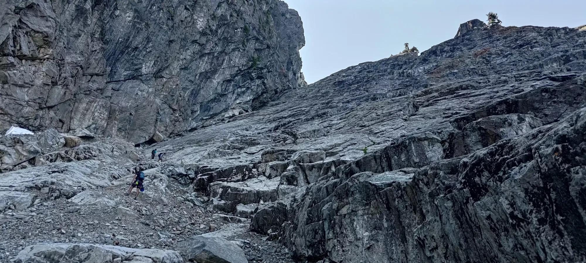
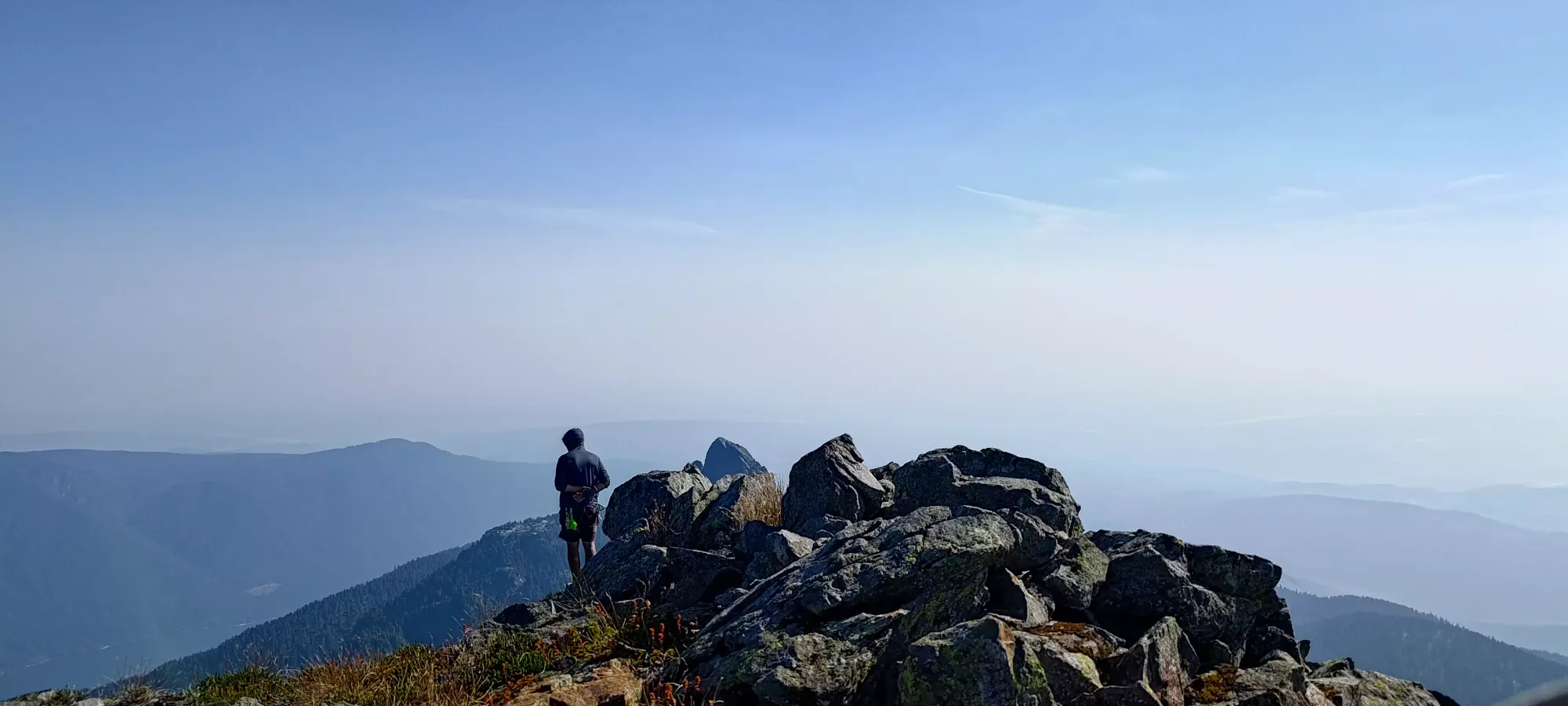
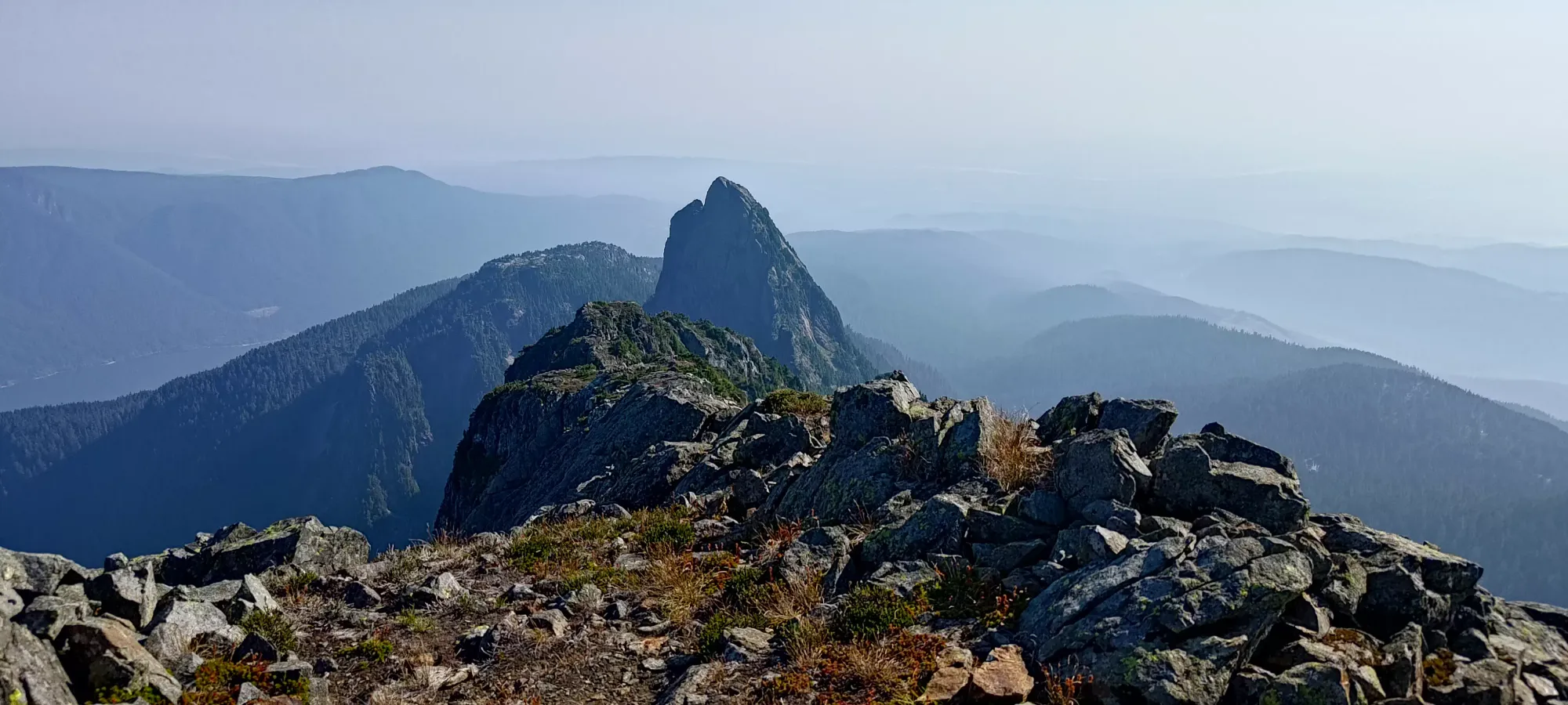
After a short break at the spot above, we eventually all reconvened at the ridge, at around 3:15pm. Here, we planned our attack for the summit. The approach curls slightly around the direct route from the col, and is just a steep, faint trail for the first little bit. However, it soon leads to a so-called chimney with some class 3-4 scrambling to get up to the next section of the summit block. This area was looser, so we were forced to go one-at-a-time.


The "chimney" didn't feel super chimney-like to me (I kinda think of chimneys as narrow enough to stem), but it was still fun. This is the first and hardest section, and above it, there's a small rest area to climber's right, and another, easier section going up to climber's left, which then opens up to a little more hiking before the final ridge.
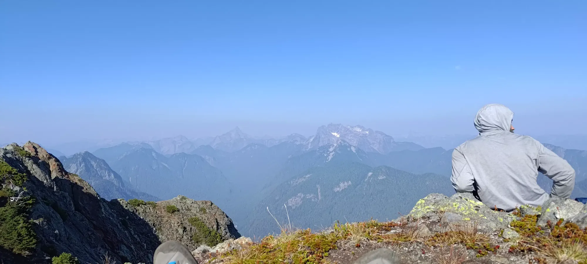
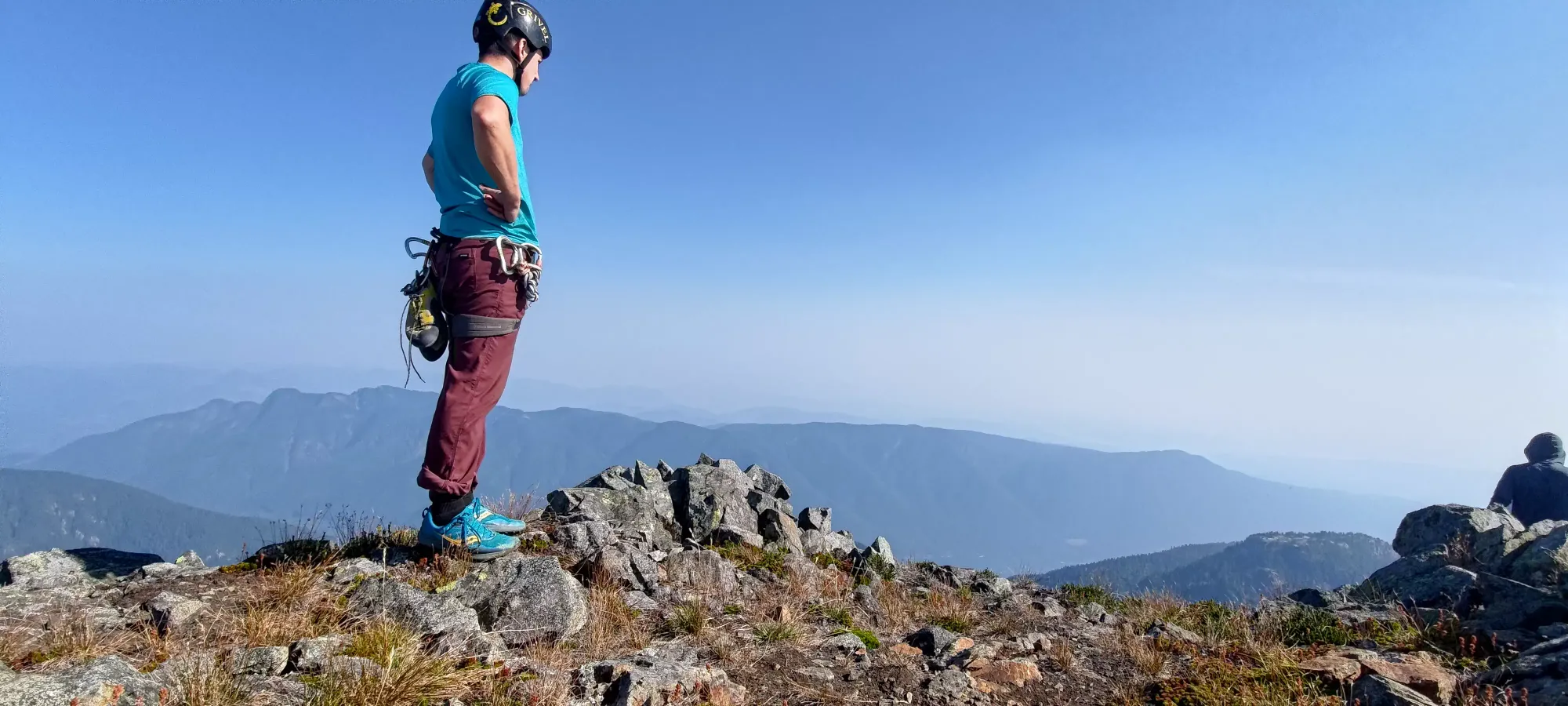
Once we got through that part, I was thoroughly tired, and going quite slow. The summit ridge was interesting, as there were 2 cairn-ed summits, though the further one seems to be higher. Getting there requires a little exposure on the narrow ridge, but the climbing is easy. While slow, I was still feeling fine until literally the last 5 steps, when I suddenly got hit by a wave of nausea. Instead of a hyped-up summit shout, I just lay down on the summit and hoped it would pass. I took my summit pictures sitting down, and we hung out for 15ish minutes before starting the plod down. I had some more food here, hoping that would help, though I was now pretty sure about the sleep theory, which was less easy to solve.


With that, the tedious descent began. I was very slow at first, trying to avoid getting nauseated by moving slow, and trying not to change how much I was bent over or taking hard steps suddenly. After getting off the ridge and getting into a rhythm on the steep grass/dirt, though, I started getting a bit better. At the top of the chimneys, Jass went down first all the way, and I followed, but stopped at the halfway point, figuring it'd be faster to get everyone down in 2 stages than to have everyone go through the full length one-at-a-time (since rockfall from the top pitch would easily cascade the whole way down). While we waited for Jass to get totally down, we noticed there was a rap station in good condition. We decided that Logan+Michael should rap down to save time, and while they set it up, I could downclimb to get down as efficiently as possible (plus while chatting before I made a confident prediction I could downclimb in my typical forward-facing style, and I couldn't let myself face the shame of giving up before I even started now, could I?).
I actually found the downclimb fairly simple, with one move requiring a "quite extended" leg to get a good position, but as long as one did that, it felt nice and secure. Since I downclimbed before the others were done setting the rap up, me and Jass finished hiking down to the col before they could get there, and I got some free rest, which was nice. I was feeling a lot better at this point, though, so things were trending up.
A few minutes later, Logan+Michael showed up, and we made our way to the first rap station to get down to the Golden Ears->Edge Col. We decided to go this way since the downclimb on Edge would be length, we didn't want more snow to give way and destroy our souls, and we knew the Golden Ears trail was quite easy, and were all familiar with it. There was a short, slightly bushy ridge-walk to the rap station, but when we got there, we found a very nice anchor with a rap ring ready to go. Logan managed to get the rope a bit tangled between the first rap in the summit gully and here, so naturally I had to take a picture of that to poke some fun (though I at least spared the shame of making it the headline picture, you're welcome 😜).
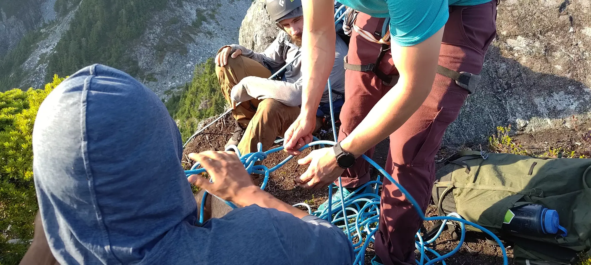
Logan went down first, and I followed, thankful to have got a good half-dozen raps in during the last week's rock climbing, as I don't do it very often, and it's easy to forget systems left unpracticed. It was pretty smooth, and definitely more efficient than trying to downclimb a very steep face.
At the next station, we miraculously stumbled upon not just a nice anchor, but a whole-ass rope just lying there, fixed into place. We pulled it up, inspected it, and tossed it down to see if it would go the whole length, and sure enough it did! That was handy, for sure. This time, we single-strand rapped down, and I actually borrowed Jass' Reverso since my Alpine ATC was too skinny for the rope we found 😅. I did save a few grams though, so totally worth it (if it was a problem, we could've just used our rope, which I knew was compatible with the smaller ATC). Thanks to Jass for the loaner, as I haven't rapped off a Munter before, but he was comfortable doing so. Saved us having to break out our rope or exchange devices by pulling the rope up again.
Once down from the second rappel (a bit bushier than the first), you need to do a short scramble to skier's right (facing Golden Ears) around the boulder in front of you, then down the ridge toward the bottom of the col. There's a small ledge (maybe 2m) that seems to have no nice way down, just fighting through the trees growing off of it to control your descent and get down onto solid ground. Once you're through that, though, it's pretty simple. Follow the ridge, go left if forward doesn't make sense. This, plus the faint trail that was already present, got us all the way down and back up to Golden Ears' trail in about half an hour.
Once we got on the Golden Ears trail, it was a short walk down the slabby, occasionally bouldery Panorama Ridge to get to some water, where we all partook in some well-deserved nourishment. At this point (8:20pm or so), we knew we weren't making the gate time, but previous experience led us to believe they'd be there to open it, and in the worst case, Michael and I both had ebikes, so we could get to the cars in town and get us out anyways, so we weren't too worried about that.
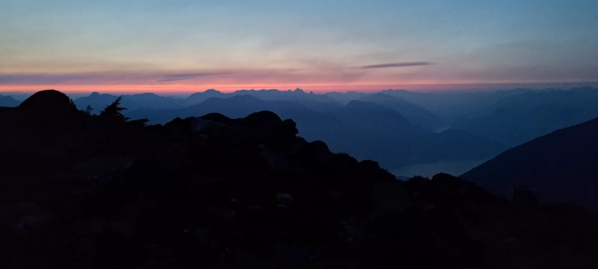
From there, we made pretty decent time along the ridge and into the short forest before the final viewpoint above the steep forest section. I got a nice photo of the sunset's glow before we dipped into the forest.
Unfortunately, the forest was where my nausea crept back in, and slowed things down to a crawl. It took over an hour to get through the forest down to the creekbed, with a lot of breaks to let nausea pass. At the top of the creekbed, I was feeling really pooped, but I also still felt I might be able to push through and get out the night of, which would be vastly preferable to the alternative, so I just continued on plodding at my snail's pace. This continued on until about midnight, where I was just no longer able to keep up with the pace the group had decided was acceptable to move at, so I called it and said I needed to bivy.
We talked about it, and the others had a strong desire to get out that night, and I was able enough to get out myself, so they left me enough food+water to get some energy in the unlikely (but possible) case I slept until the morning and had to recover a full night's worth of calories to get myself going again, I crawled into my emergency bivy on the side of the trail, and attempted to sleep. If I knew how fast my condition would worsen, it'd have been way nicer to sleep at the real bivy spot at the top of the creekbed section of the trail, but no dice, so instead I just dealt with my uneven, not-very-flat spot and shut my eyes.
The bivy was surprisingly warm, to the point that I actually had to leave my head out to not get stuffy. I didn't exactly get restful REM sleep, but by 3:20am or so I checked my watch and figured "that is probably enough to get me out". So, I scarfed down a granola bar, half a bottle of water, and packed up.
From this point, things actually went quite nicely. I got down to Alder Flats in about 20 minutes, Gold Creek in another 40, and to the bike in just over 10 from there (and that part had elevation gain too!). A couple hours of shut-eye go a long way. After spending 10-ish minutes gearing up for the bike ride, it was a pretty pleasant 20 minutes down to the trailhead. Unlike the way up, I think I only had to get off the bike twice, and when I did, it required minimal pushing to get past the really gnarly sections. The light on my bike was super bright too, which was very handy for spotting rocks (once I figured out it was pointing straight down and adjusted it, at least).
From there, I started the long bike out to the park gate. It was easy enough on an ebike (though I was a bit too conservative with my battery, I could've gone faster if I had more faith I'd make it all the way to my car). The worst part was the cold, I forgot how much moving fast in "not hot" air cools you down. But I already strapped my bag down so nicely, and didn't have enough Fs to give to retrieve my shell, so I just dealt with it (it wasn't so bad it'd totally mess me up). A little over half an hour later, I made it to the gate (at this point, the sun was starting to rise, and my lights became unnecessary). I talked to the gate attendant to confirm my friends got out, and that they knew I was now out too in case they were informed of my existence. Then, I popped my earphones in and biked the final 5-10 minutes to my car. From there, it was a tired but tolerable drive home, where I somehow scrounged up the willpower to unpack my gear, clean my hands, and wash my face before passing out at the ripe hour of 8am on Sunday morning 😃.
So... "how do I feel about this trip"? A lot of ways. I think the scramble was freaking excellent. I have upgraded my "will to speak up about route choice" again, as despite being more forthcoming than on Wedge, I still waited too long, and could've avoided an annoying bushwhack if I just trusted myself more. I definitely got a scary reminder about the year-round dangers snow can present. I was pretty happy putting some rope skills to use off the crag, that was pretty awesome. As for the whole "slow, tired, and emergency bivy" situation, that is a bit harder to digest. I guess the question of "is one night of decent sleep enough to offset a week+ of bad sleep" is now answered with a resounding "no". It's hard to say if I could've known how the symptoms would develop sooner or not, as there are plenty of times when people are "just slow" and otherwise feel fine. So I'm happy enough with the decisions/progress made. I do think if I just napped for an hour at the top of the creekbed, it would've been more restful, and enough to get me out, but oh well, worse things have happened than being a few hours later. I am glad that I do bring enough gear to get through a night if I have to, at least, it was definitely nice to have that.
Would I recommend someone follow a trip like this? Partially. I'd say "stick to the creek" when you leave Alder Flats, avoid overhead hazard in the afternoon in the gully, even in late summer, "don't be super sleep-deprived", etc. But it is an awesome scramble, far more enjoyable than, say, Golden Ears itself. My GPX is glitchier than usual, so I'd recommend only using it as a rough guideline, and applying some logic to filter out the inefficient parts I mentioned above.
This was a long one, so if you read this far (or just skipped to the end 😢), congrats on making it! It's been a bit too long since we had a proper misadventure, so I guess here's your quarterly dose of shenanigans.
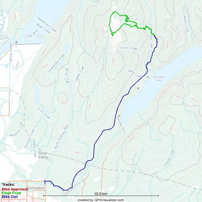
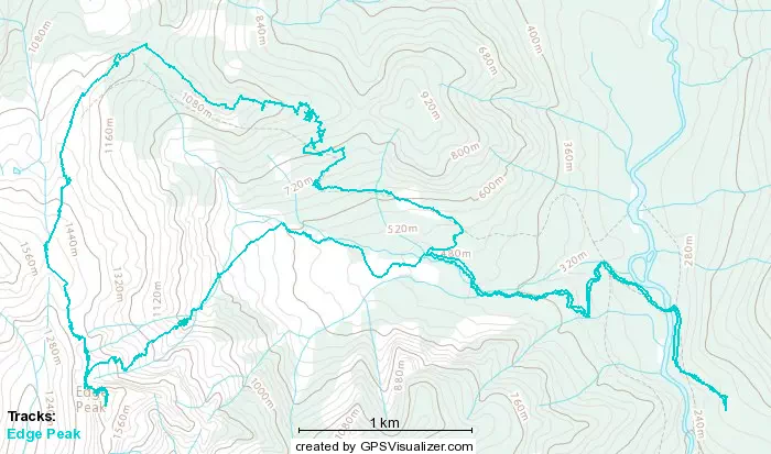
GPX Track + Map(s)