Cloudburst Mountain - November 24 2023
A fun, slightly-early solo ski trip close to Squamish with some nice prominence

Squamish-Cheakamus Divide, Squamish, BC
1871m
After exploring the roads a couple weeks ago as a backup once I got turned away from the gate to Olympic Park hoping to try my hand at Rainbow Mountain, I found myself blocked there as well trying to approach Cloudburst from Chance Creek FSR, where the tracks I wanted to follow just... went through a thick group of trees with no path whatsoever. I figure either that route is super old, weirdly a very intense bushwhack, or needs a couple extra metres of snow. So, with recent snowfall hopefully making the Squamish-Whistler corridor "somewhat skiable", but keeping roads driveable fairly high, I figured it was time to give it another go.
The goal was to get out early, and still be able to work most of the day, so I left home in the dark at quarter to six, and made my way up the Squamish Valley. The road was pretty uneventful until Branch 200. Branch 200 was in rougher shape than last year for the first kilometre, but still doable with AWD medium clearance (however, this is not true if one continues to the trailheads for Tricouni or Cloudburst, so keep this in mind). The next couple kilometres were actually better, though, it seems some people have cleared up the few large boulders that made this spur "not-full-size-truck-friendly". This level of difficulty (or easier) was sustained until shortly after the fork off from Branch 200 towards Cloudburst, where there was a large cross-ditch (which I was aware existed, thanks to some beta from other peakbaggers).
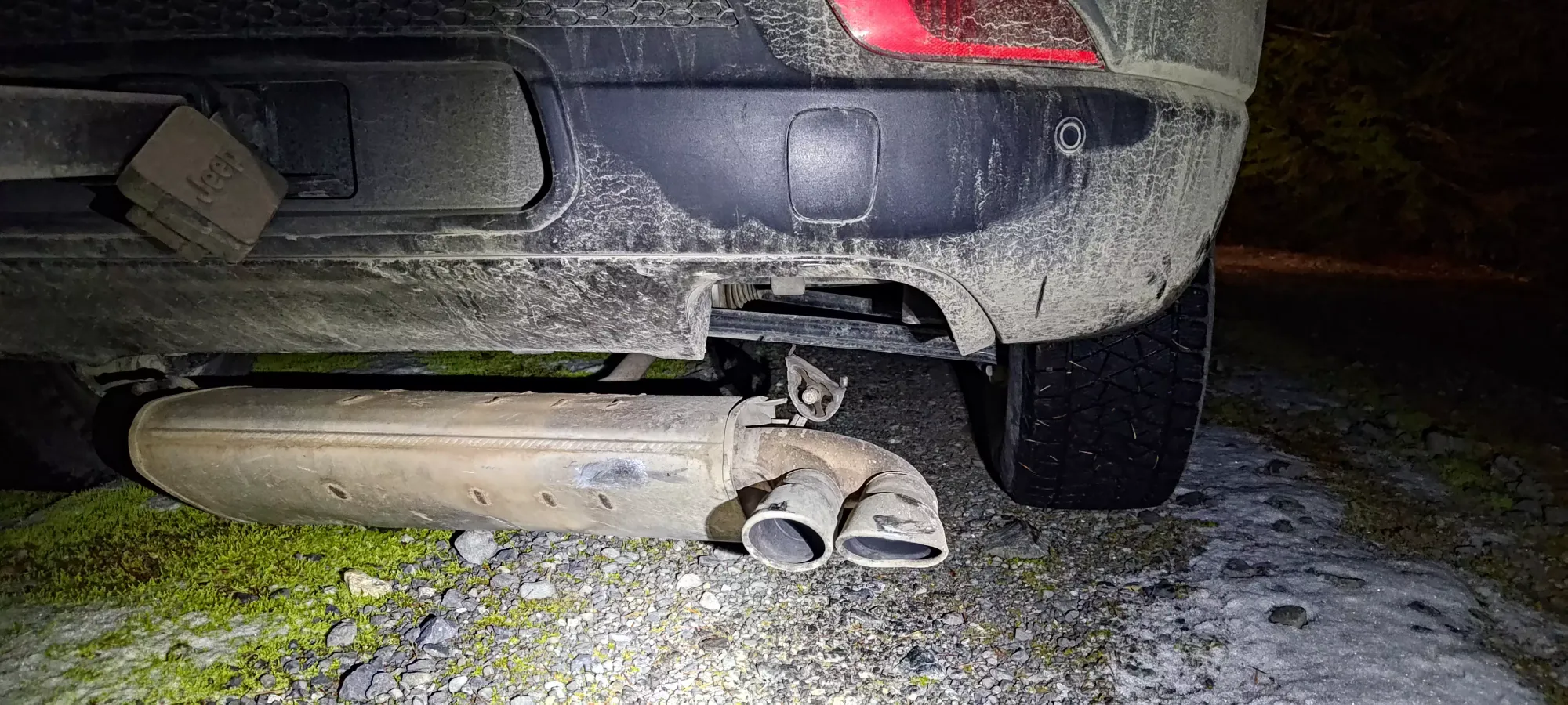
This ditch is AWD or 4WD required, with high clearance. It's not super deep, but fairly narrow, a bit loose, and short, so you need good angles to not hit. Thankfully, that describes my vehicle fairly well, so I went through without a problem. Sadly, that didn't last, as a few minutes later, I started hearing a concerning noise. After driving up far enough to get "close enough" to the peak (a bit of a choice), I parked at 840m elevation, and got out to see a rather unwelcome sight: my muffler had decided life was too hard, and yeeted itself right out of its mounts and onto the ground, the source of the dragging sound I'd heard before. It was too hot to touch+do anything about, so I sent a message out to the 4WDABC group for some advice on the best way to secure it, packed myself up for a hike (was hoping to skin from the car, but oh well), and got hiking, since I figured I'd either just have to tie it up somehow myself, or wait for someone to come with materials and let the metal cool down, and "the summit was still there, waiting to be stood upon". So, I left the car at 7:15 after a-framing my skis and putting some trail runners on.

The road was a mix of snow and bare for the first few minutes, but quickly became fully covered, if thin. The snow was super crusty and supportive, so I just kept walking as long as my shoes weren't slipping or postholing, which ended up being "the entire length of the road". I took it slow to allow for my phone to attempt to acquire signal and send/receive information for car stuff, and by the top, signal was good, and I got my pictures out, got some good ideas, and got Logan to agree (thanks man!) to pick some stuff out that was more heat-resistant than my in-vehicle options, and meet me at the car to help fix it once I got down the mountain. That, plus putting my skis+boots on at the end of the road, took about an hour, and brought me to ~1130m elevation.
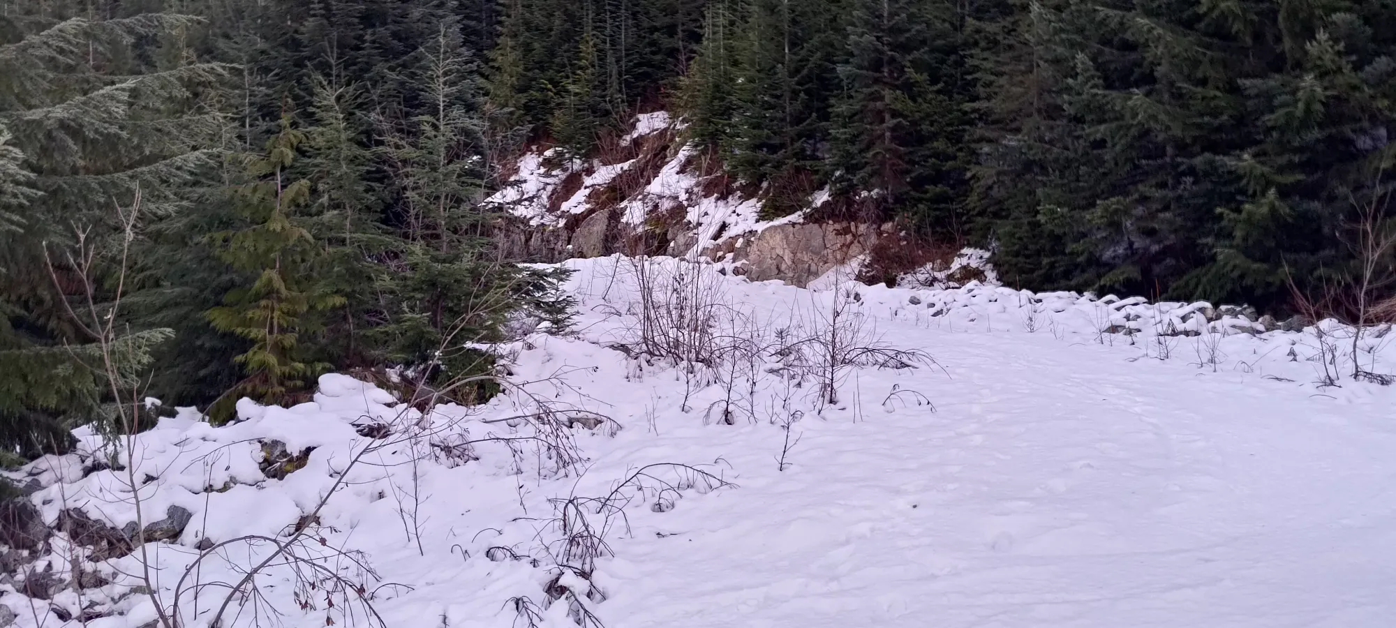


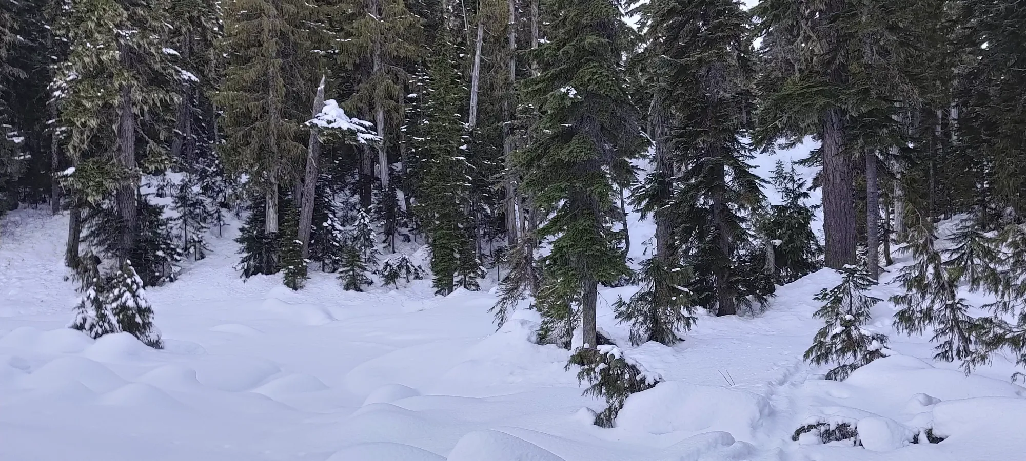
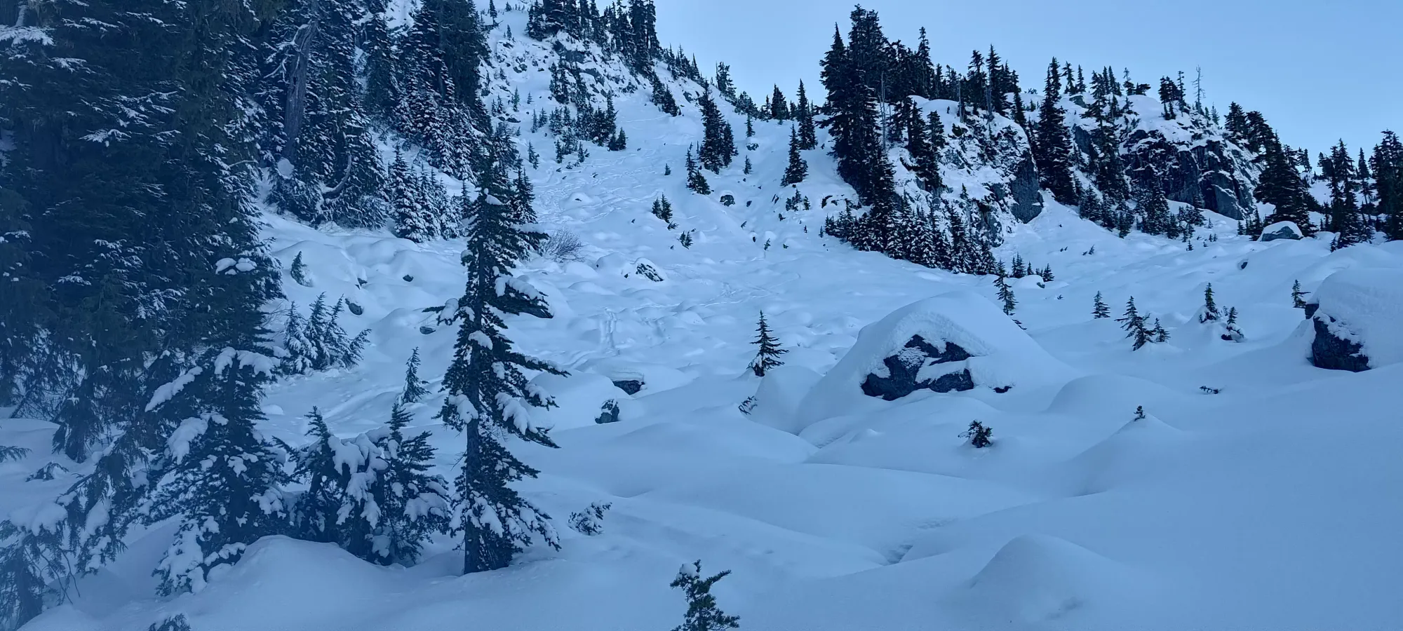
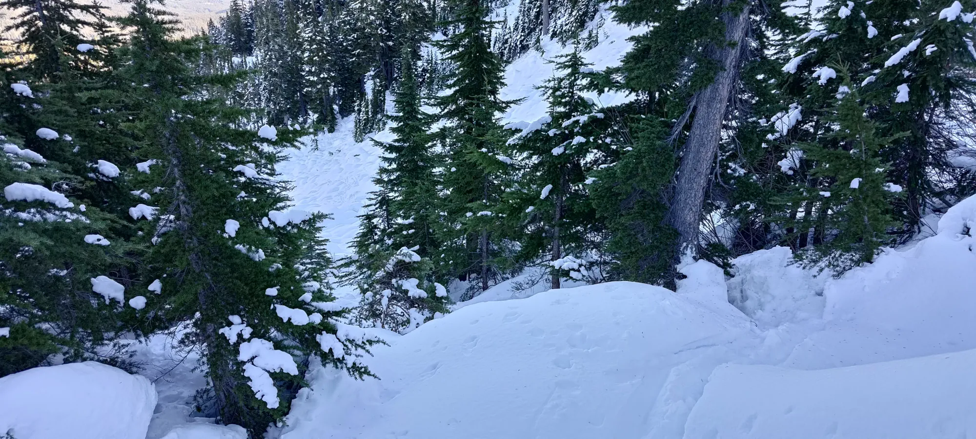
There was a convenient old skin track visible, so I followed that from the road for convenience. Well, at least I thought it would be convenient. That first section visible above, as well as probably half a dozen to a dozen more spots through the forest were fairly steep, which when combined with the bullet-hard and icy crust on top of the snow, made for very difficult skinning. If I was making my own skin track, I'd probably have reworked it a bit, and in some spots that just what I had to do, but overall it worked well enough (though that first spot I actually had to boot up). Sadly I've not acquired ski crampons for these skis yet, so I didn't have a great solution other than just booting when the going got tough.
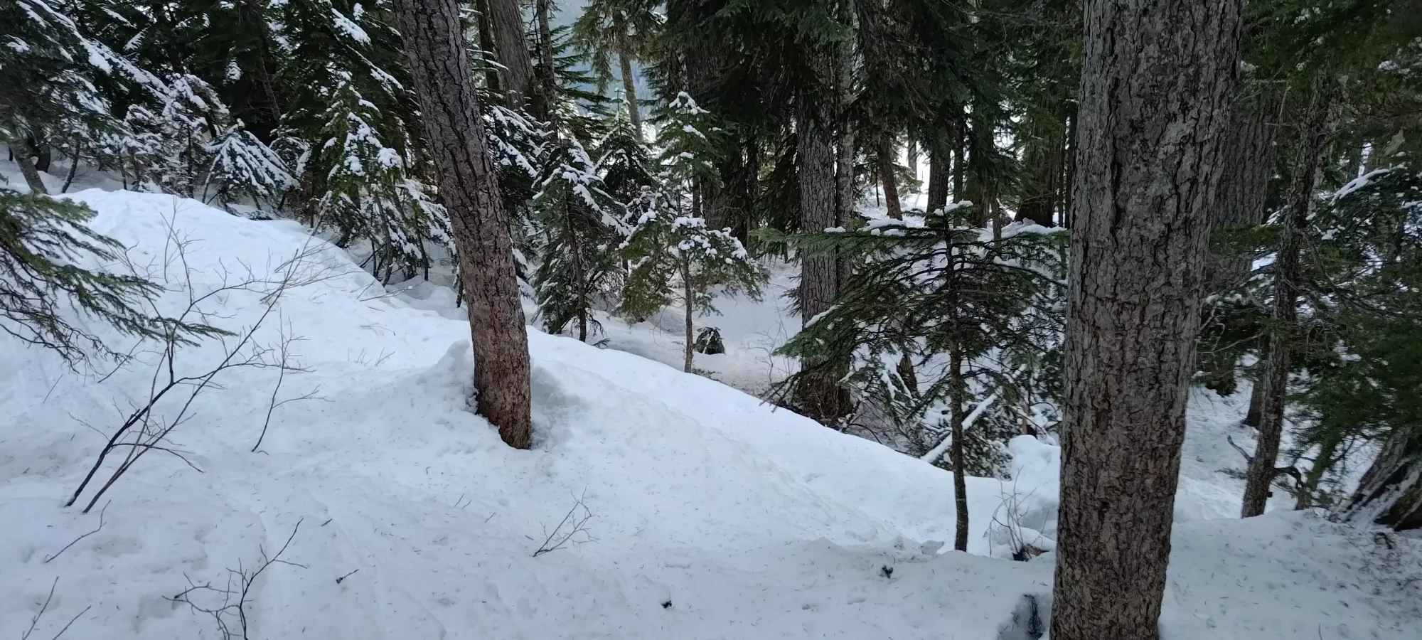
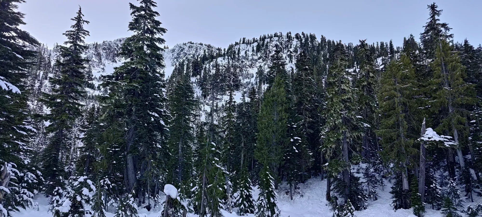
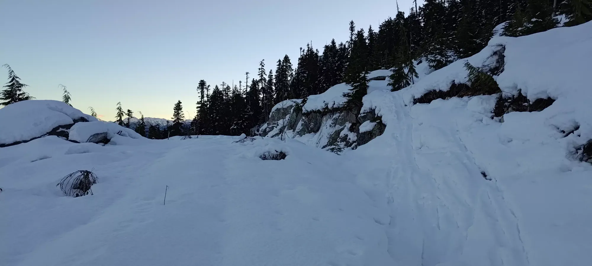
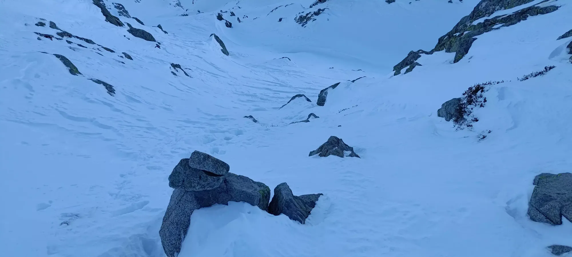
Thankfully, by around 1270m, the forest ended, and things got a bit better. The trail opened into a wide, pillowy drainage which looked quite fun if one could have confidence that landing the jumps would result in powder and not faceplanting into rocks. Sadly, that wasn't quite the case for me, but I was still going up, so I didn't have to worry about that just yet.
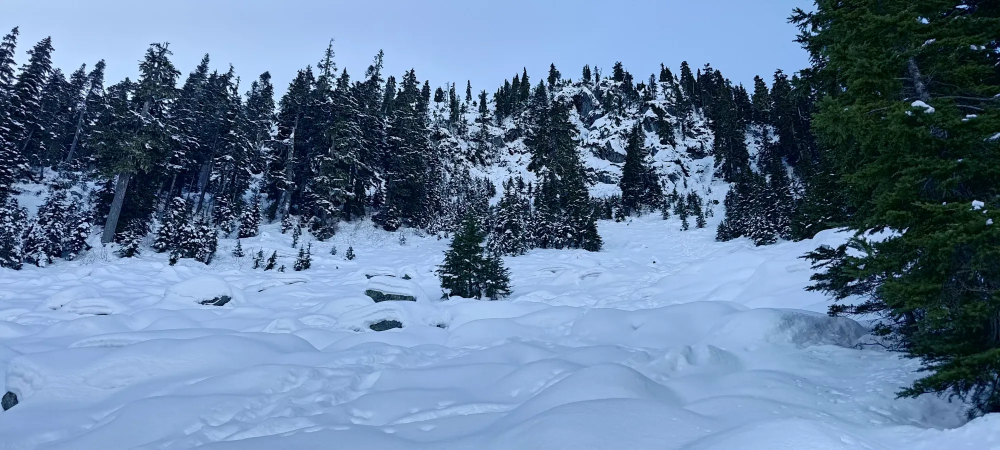
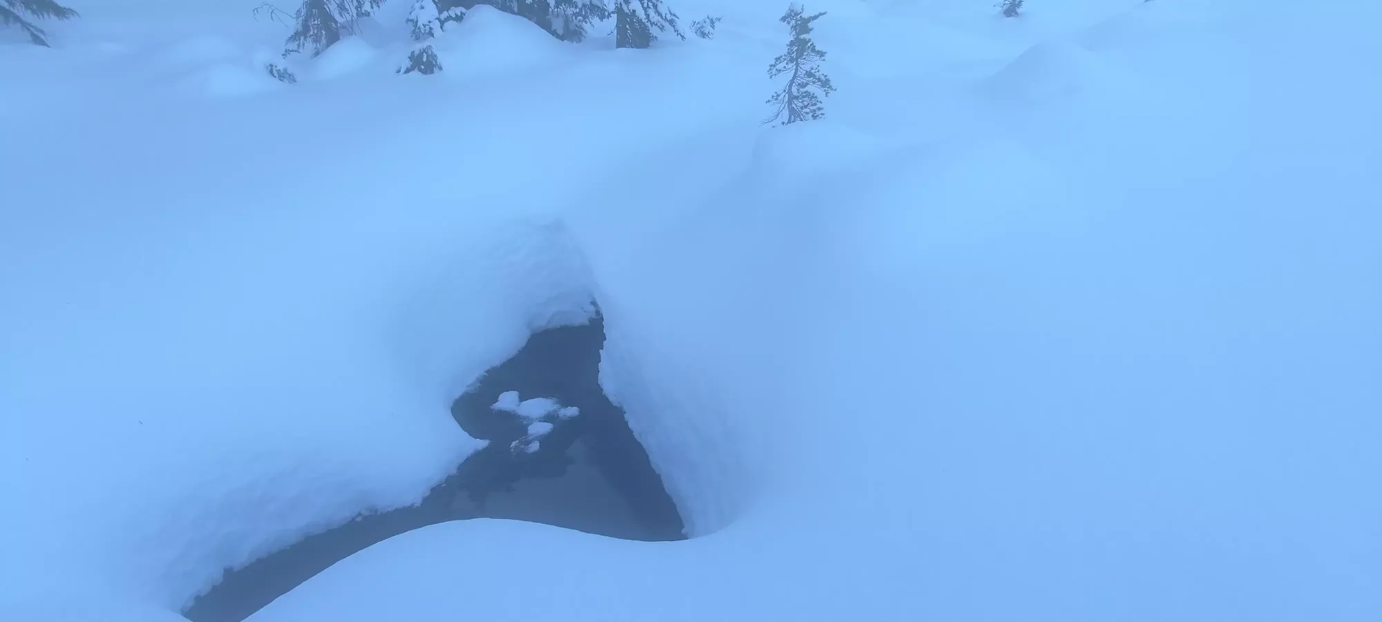
After about 20 minutes I gained another 100m, and found myself in another more different open pillowy area, but with slightly better snow, so that was cool. As I meandered through the bumps, I noticed just how much the snow had settled, since in the creek gaps you could see right down to the bottom, and it wasn't far.
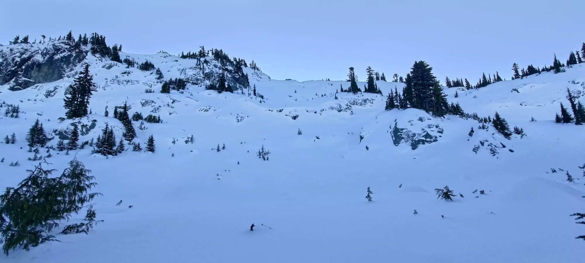
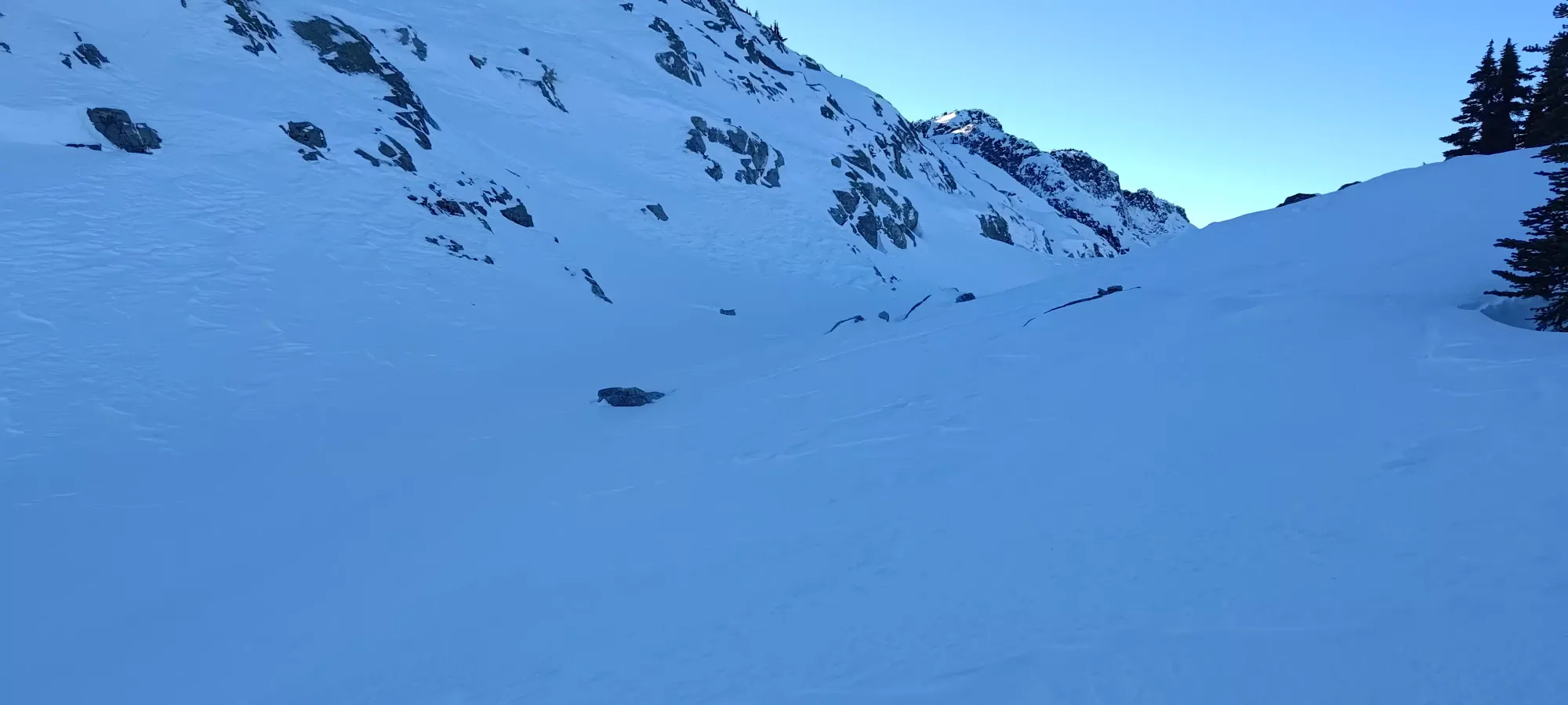
15 more minutes in there brought me up and over the shoulder and about 100m higher, along a fairly nice and well-graded section I could skin straight up, and into some slightly bigger terrain. This is also where I lost the skin track, and had to start fully breaking my own trail. I'm not sure if these people turned back or just went somewhere else, but this was the first spot I looked at the terrain and thought "I want to ski that", so hopefully just the latter.

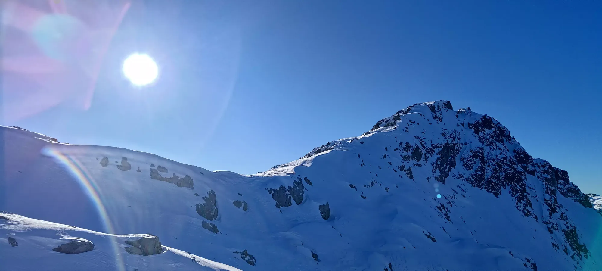
This headwall brought me up to 1600m, and brought a mix of new experiences for the trail. Instead of just hard forest crust or dust on crust beforehand, here we had our first signs of sastrugi from the wind, some thin breakable crusts on slopes steep enough to slide (but too thin to bury you, just force you to break them when cutting the skin track to avoid slipping), and some slopes that were steep and open enough to genuinely get me excited to ski! I spent 25 minutes on this pitch, as that extra-hard trail-breaking was a bit more tiring than "regular skinning".
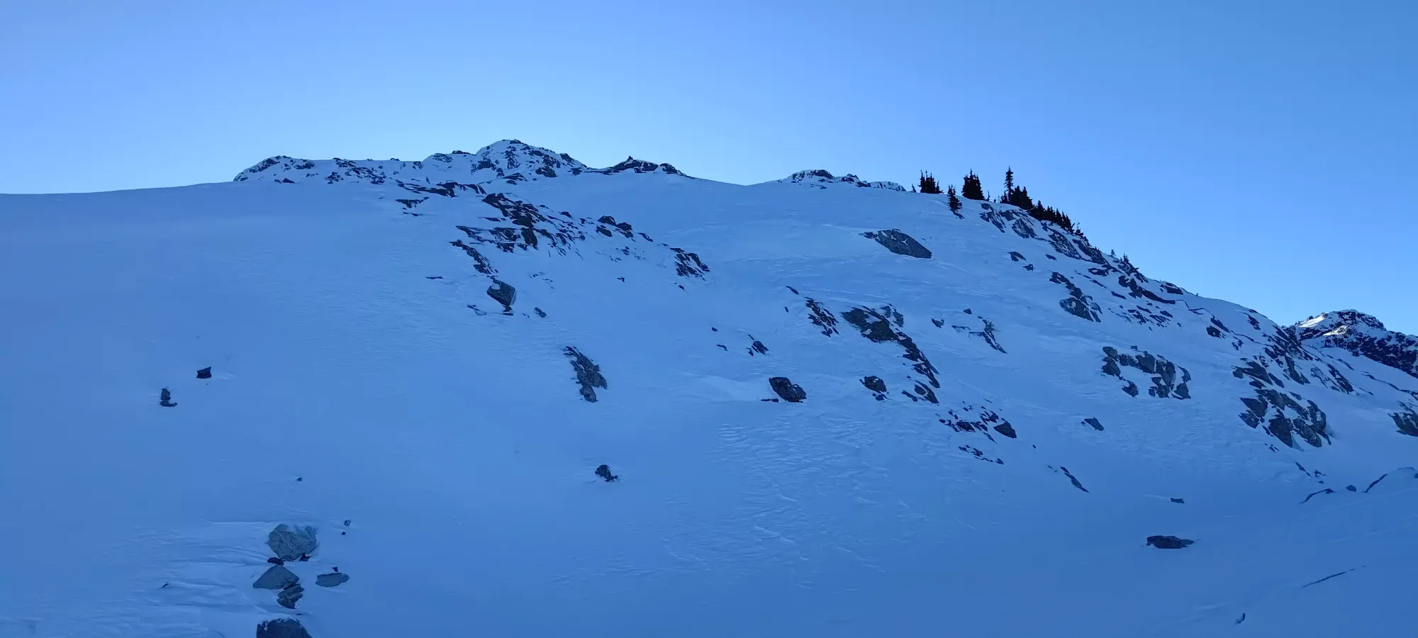

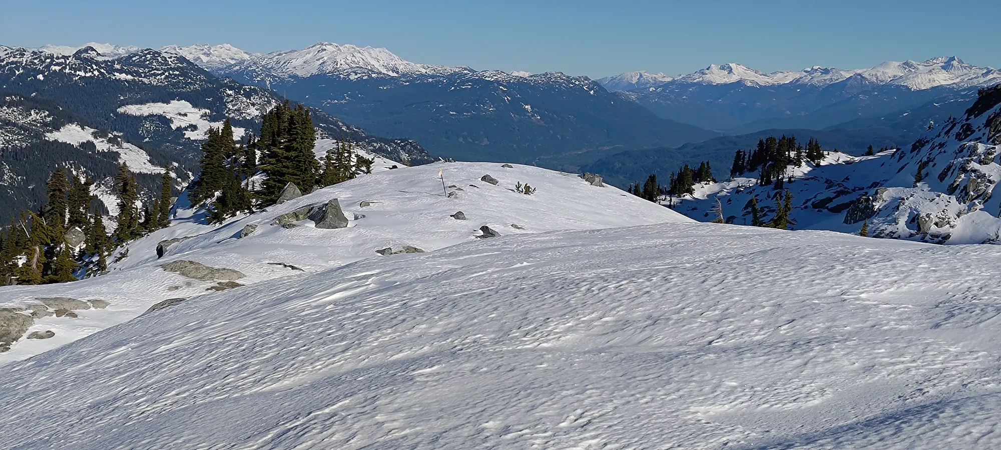
From here, another 15 minutes of skinning through the snow patches between the rocks took me up to 1700m, to a remarkably similar point to that at 1600m, but just "a bit closer". Here, the snow was more wind-affected, and quite firm. There were also a few spots that were also wind-deposited instead of just wind-scoured, so that made for some more grippy skinning, and created some hope for the way down as well.
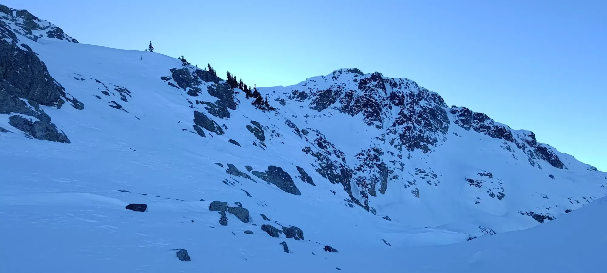
From here, I had a steep pitch to gain the ridge proper before I had the more chill summit push. The first bit was skinned easily, but after a few minutes making tight switchbacks in a narrow patch of snow, I decided "screw it, this is tedious, the snow is firm, I can just bootpack". So, I strapped the skis back on my pack, and walked for... about 2 minutes. But I felt more secure and less annoyed than skinning in that tight space so hey, all's well that ends well. More snow, more intact knees, or more patience would allow for skinning the whole way.
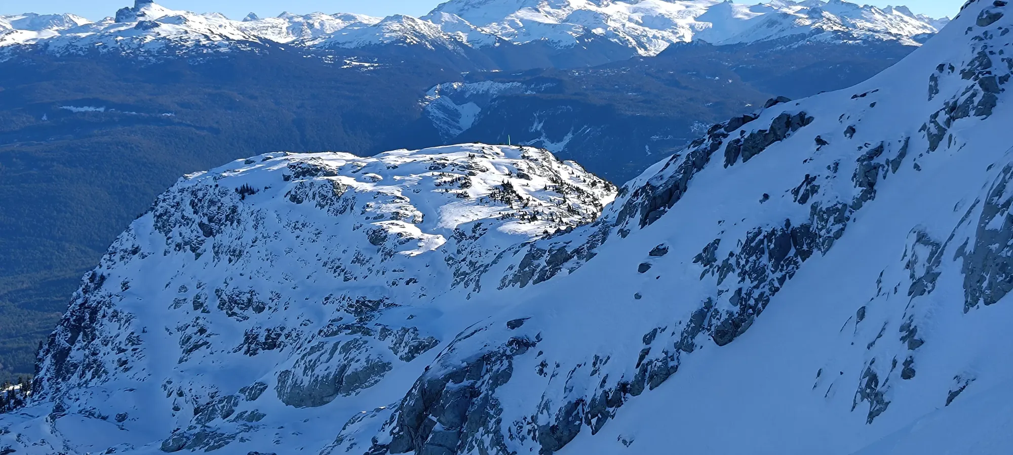
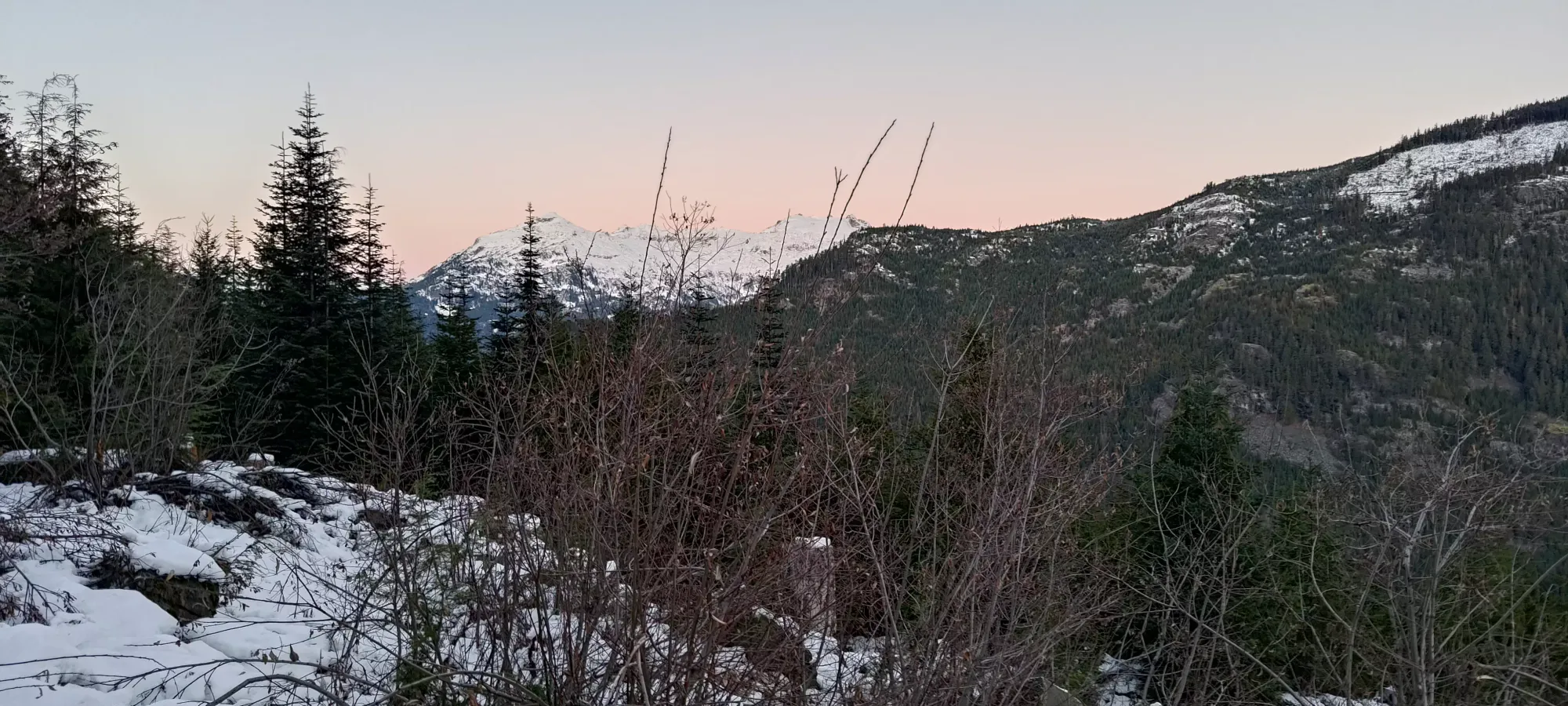
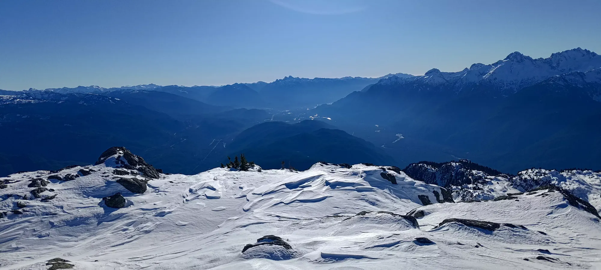
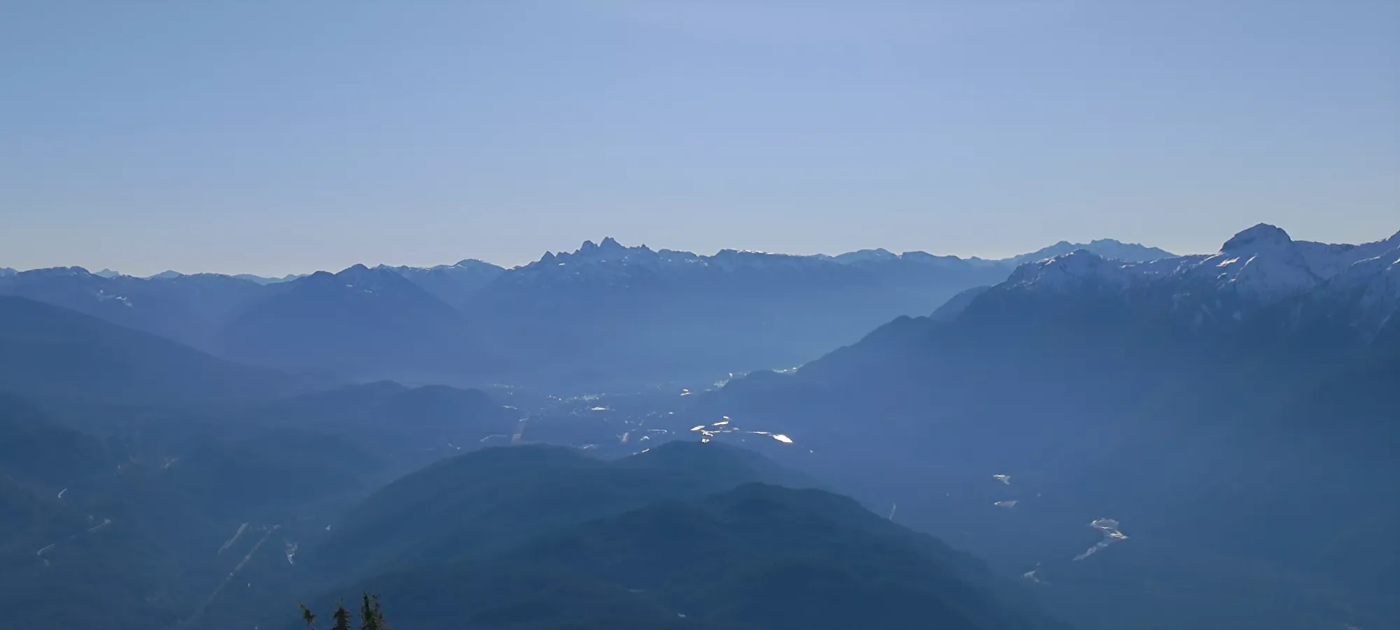
After that short booting, it was back to the regularly scheduled "skinning through the rocks", which was not particularly eventful. At 10:45 (3.5 hours in), I finally got my first view of sunlight, since the western aspect I was on was nice and shady in the morning. It was nice and refreshing, and helped keep me warm as I slowed down to appreciate the views, and ofc when I got to the summit.

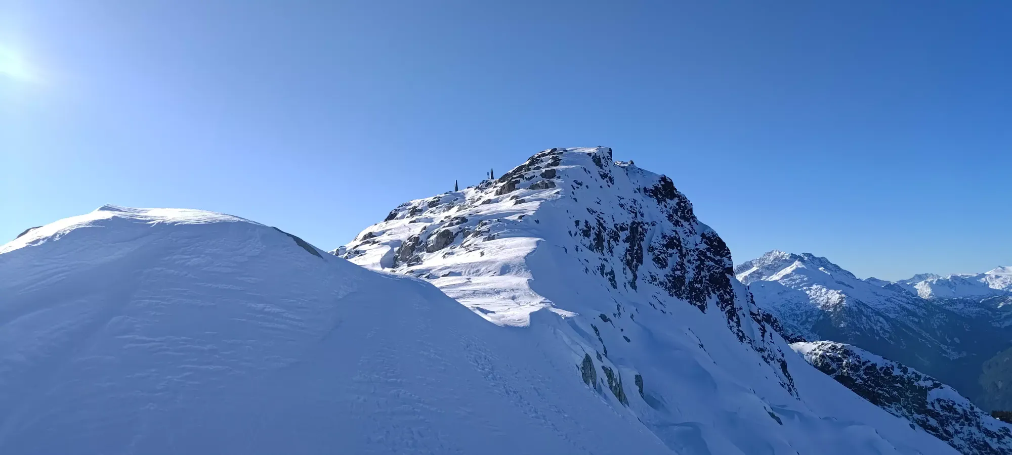
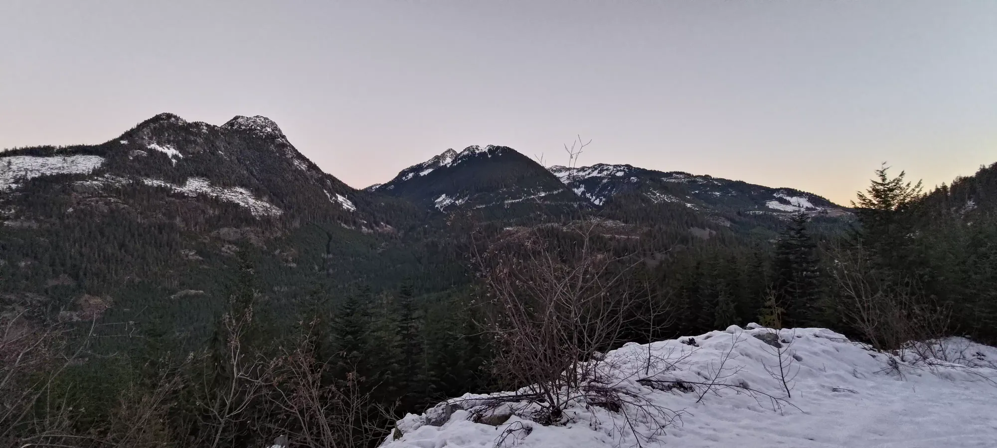
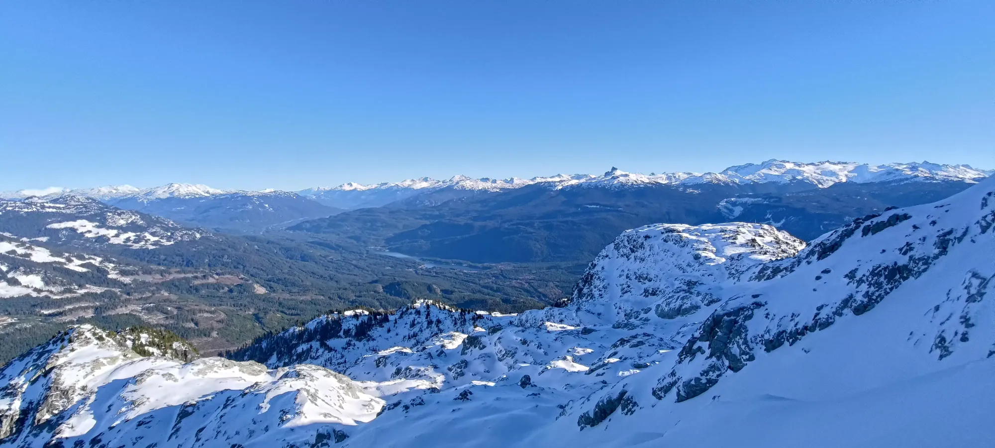
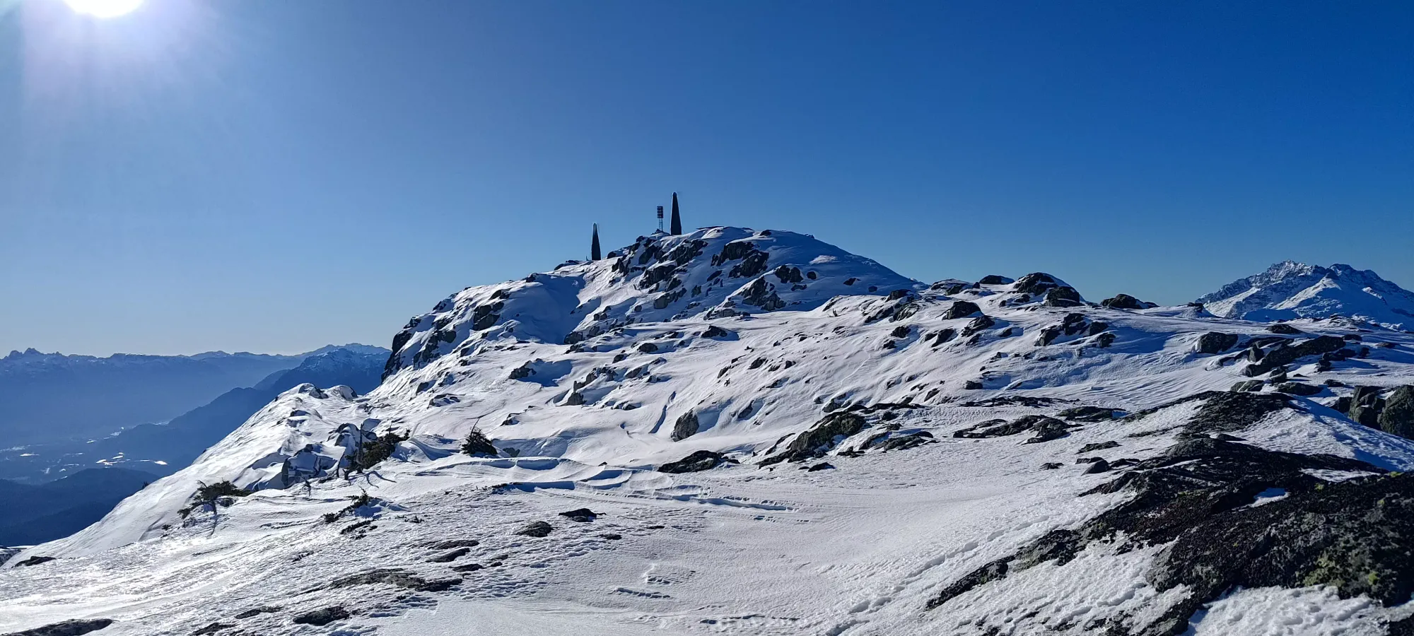
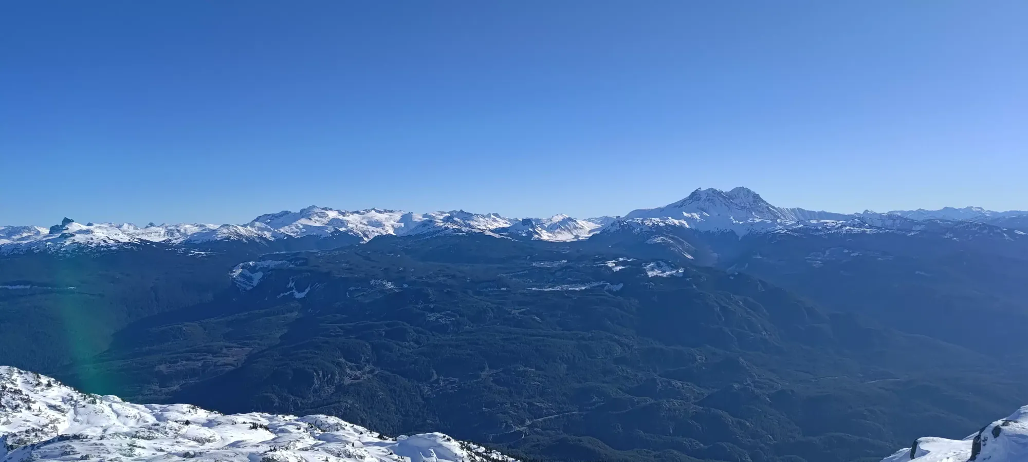
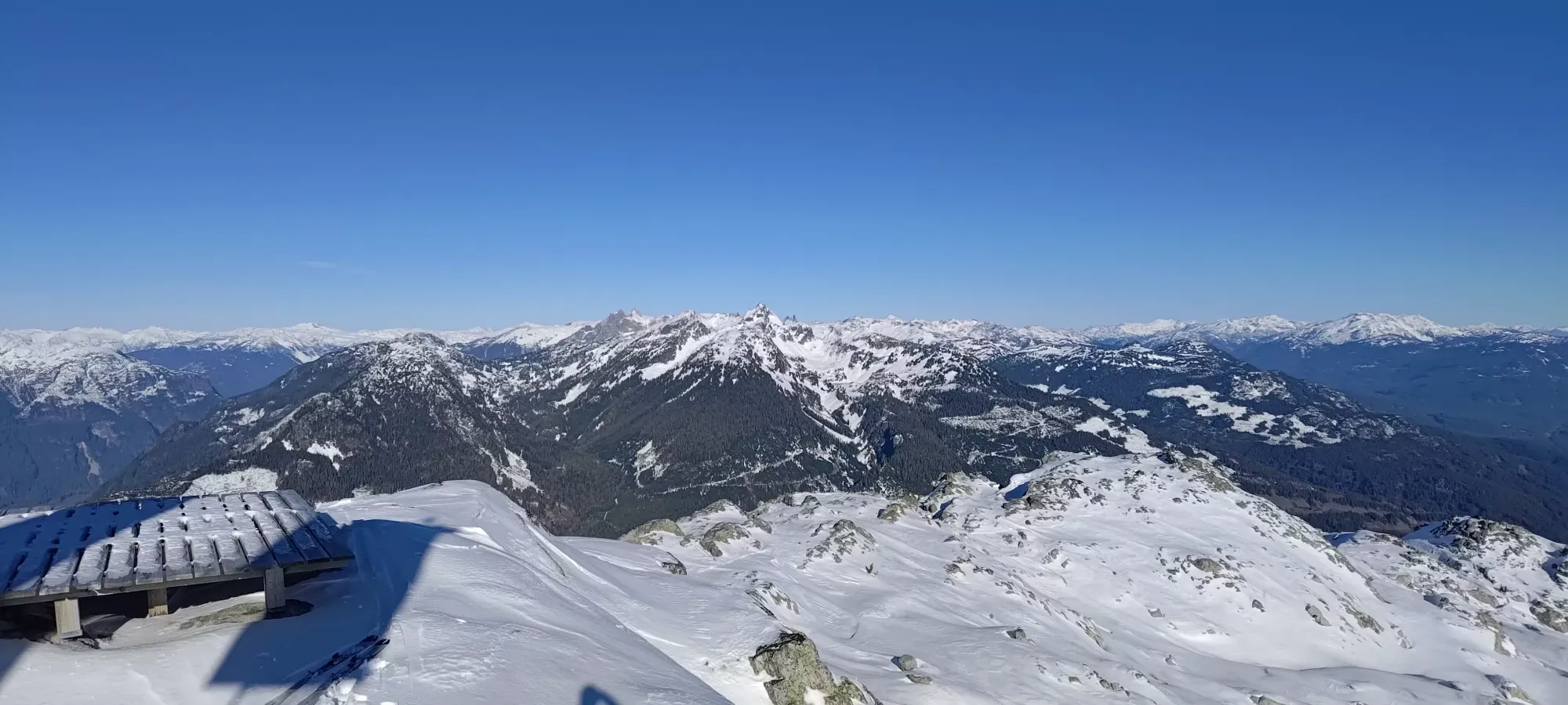
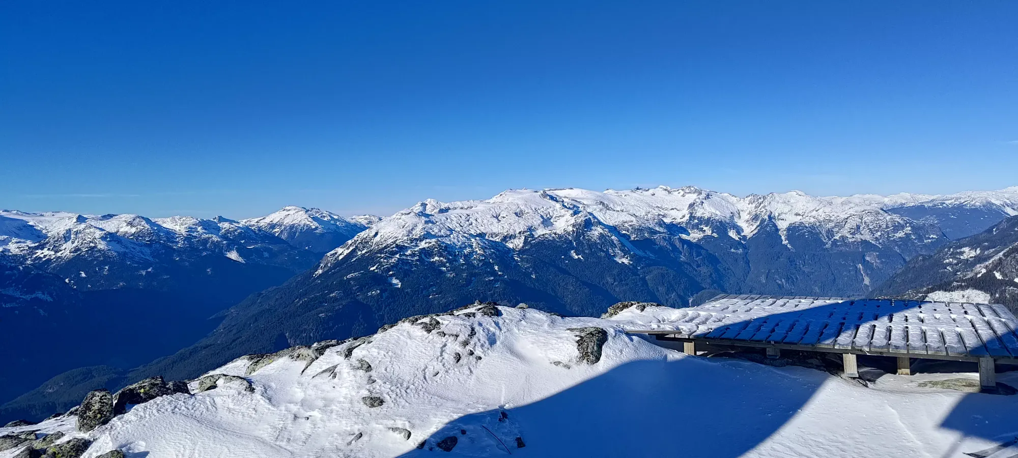
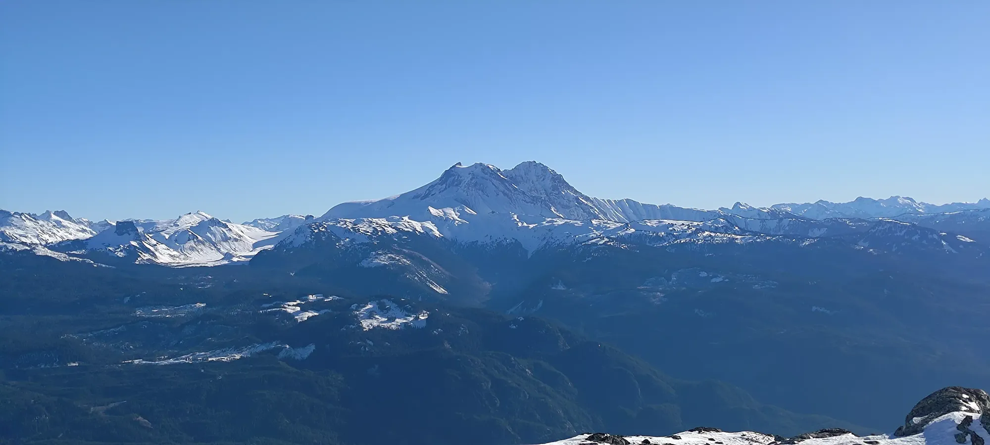
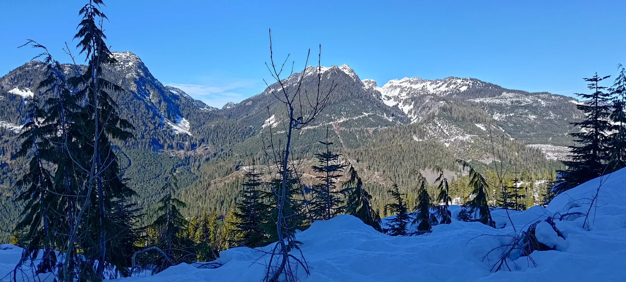
The ridge was a little undulating, in deeper snow I might not rip skins until I got back to the point above (unless you just skied off the ridge earlier, which I wasn't willing to do solo with minimal research into alternative routes). As I got closer to the summit, I had to spend some time doing some "creative skinning" around the rocks and small ledges/wind lips, which made the short-looking distance take a surprising amount of time. This push took almost 20 minutes, which still let me summit in under 4 hours, which was nice (if honestly kinda slow for only around 1000m gain). The views were awesome, which was a rare treat for me. 1000m of prominence and bluebird skies go a long way!
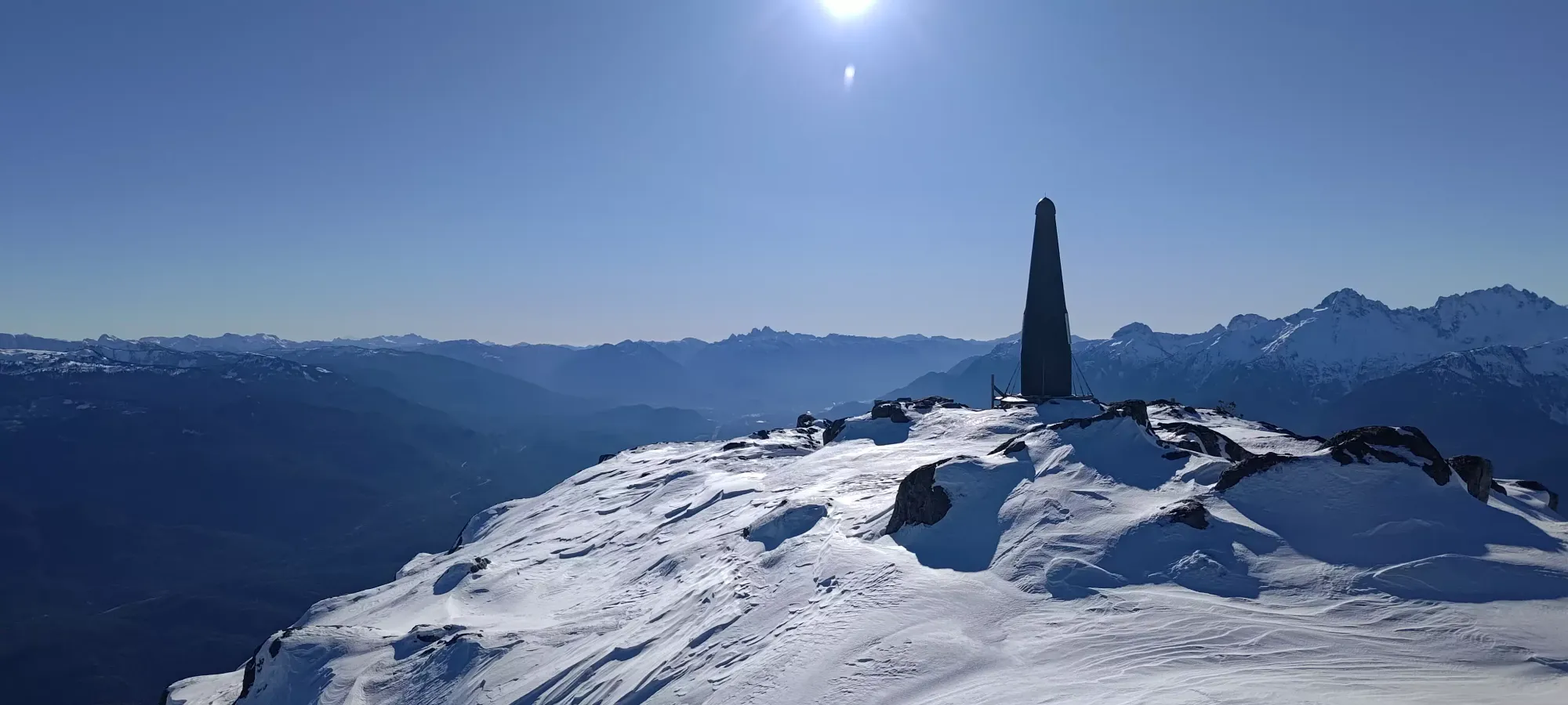


My summit time was just over 20 minutes, between pictures, texting, deleting 5000 Black Friday emails, and transitioning my skis. The next 15 minutes were spent with careful skiing to "not fall off the ridge", avoid scratching, and involved a couple small boots to get through the undulation to hit the spot I gained the ridge on the way up.


Getting back to 1600m from the ridge was mostly just an exercise in careful skiing to avoid rocks and cliffs, which thankfully was a success on both counts! One could definitely "ski hard" here if they researched enough, had friends around, and weren't recovering from injury, but since I was none of those things, I mostly just followed my skin track back. For me, ski touring is a bonus on top of winter peakbagging, so "being able to not walk but ski at all" is enough to make me happy 🙂.
That being said, this was the big face I got all excited about on the way up, so I wasn't going to just waste it. This was the first (and only) place I could really open it up and link some turns together for real. I didn't go full send since I was solo, my injuries are not fully healed, and the variable snow wasn't perfect, but I definitely still had some fun! I got to actually enjoy the skiing down to the pillowy boulder and/or shrub fields, where I had to calm back down, as the pillows were not actually pillows, but lootboxes in a dangerous game of "is it powder, crust, tree, rock, or creek". There was also a spot between the 2 main pillow sections where I had to do some tight skinning through the trees on the way up, and wasn't confident just yeeting randomly around, so I had to take the skis off for a minute.
About 15 minutes of playing the pillow game and only losing once (thankfully avoiding a full wipeout when I did), I arrived back at the forest, where I wasted no time in taking my skis off, as I had 0 intent of trying to ski that crusty-ass forest.

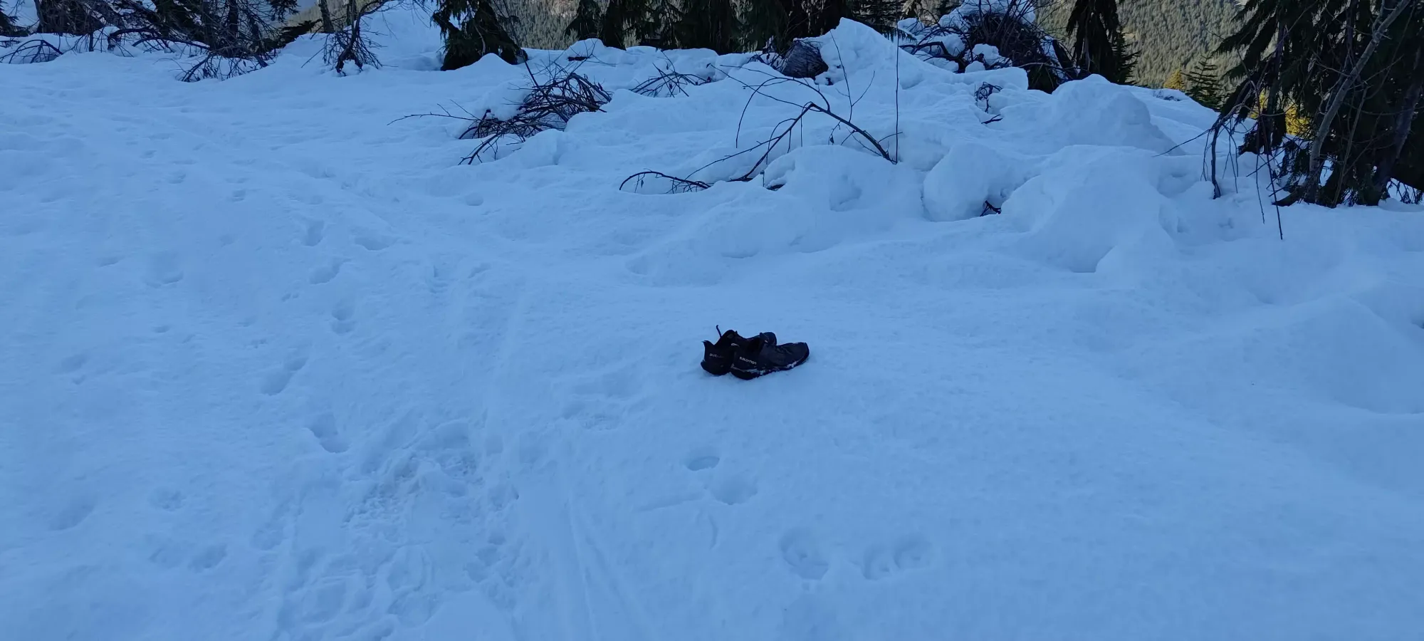
The forest took about 25 minutes to slog through with skis on my back, as it was quite slippery, and even walking in the skin track, I not only didn't penetrate, but actually slid on my boots quite often. I was very happy to see my shoes upon exiting, where I also got a text from Logan saying he'd just arrived, so not bad timing either, just a bit under 300m of forest road to descent (in elevation).
I did try and ski from the 1100m point on the road down to about 1050m, but the annoying amount of overgrowth that left one with a lot of opportunities to be tripped, and the lack of coverage in the deactivated section got to me, and I ended up going to shoes at that point, even though just below was more open, easier-to-ski road. That meant I spent another 20 minutes descending to the car, but oh well, at least I didn't get tripped by a root and re-injure my leg, so I'm not going to fret too long over it.

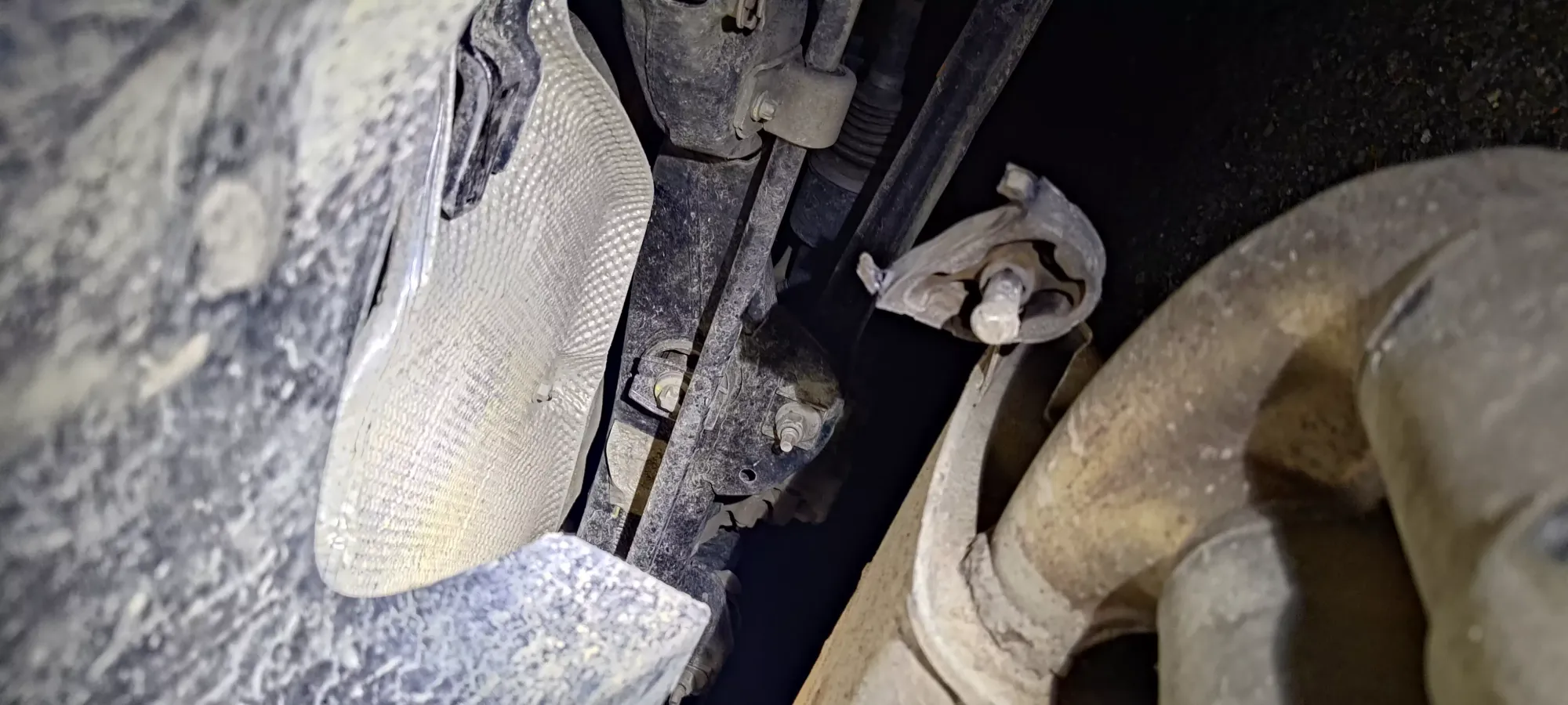
Once at the car, I was very happy to see Logan, who came with a few things, the most important of which were a second pair of hands, some metal zip-ties, and some cardboard to lie down on while we worked. I managed to get the muffler relatively in-place, and we got a rock to hold it there, and get it zip-tied into the mounting brackets on either side enough to get it out. The drive was slow and careful, but I managed to get through without it falling down or even scraping (despite it hanging a bit lower than stock now), so I'd say it was a great success! The real annoying part will be the bill for a permanent fix...
So, as long as your car doesn't decide to disintegrate on you and turn a short, fun outing into "a whole thing", I can say Cloudburst is a great peak, especially if you take this route. Fun skiing, would work as a snowshoe too, great views, only a couple spots where one would have to be worried about avalanche risk (today there was not enough unstable snow to be a concern for me), and not too much effort either, at least if you can drive as high (or further than) I did. Plus it's p1000 peak, and who doesn't like that!
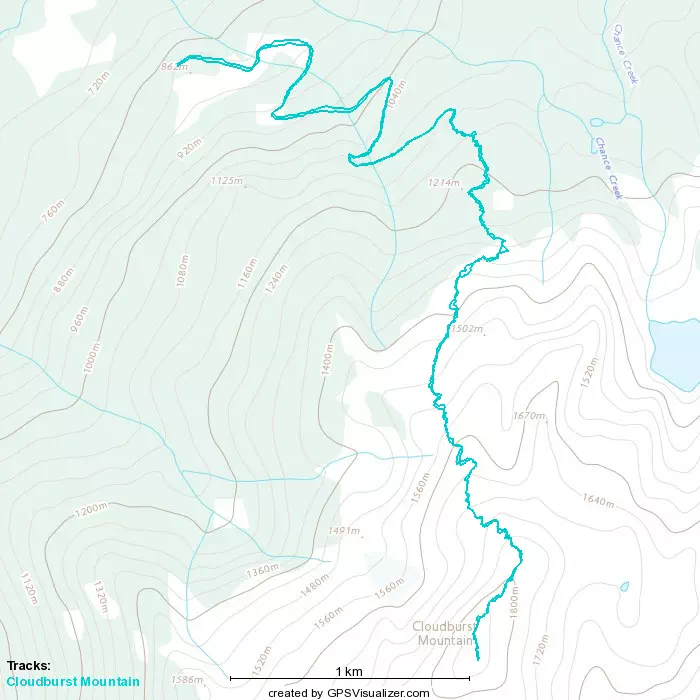
GPX Track + Map