Birkenhead Peak - October 2 2022
An ultra, some new friends, 3 peaks, a fantastic road taking us up to 1900m... what's not to like?

Tenquille Lake Area, Birken, British Columbia
2506m
Given the long weekend, there's no way I could settle for only 1 peak, so after planning Coquihalla Mountain on Friday, I got a message from Shayan asking if I had any plans. We tossed a couple ideas around before coming to the conclusion that we both had an interest in bagging ultras (peaks with over 1500m of prominence), and a plan for Birkenhead was formed. There's 2 smaller peaks en-route as well, which was nice, and we got a couple more people to join as well, so it was shaping up to be quite a fun day; I was even actually socializing!
The original plan was to meet in Squamish at 7:00 to carpool up, but we ended up being a bit lax with the knowledge that the road went up to 1900m, so we actually left around 7:45, made it up to the parking for a 10:45am start. The road was in good shape, with only a few cross ditches and ruts that'd necessitate high-clearance, but not much in the way of traction issues. If anything, transmission overheating would be the biggest challenge. There was some active work going on though, so make sure to communicate with the staff onsite to avoid any collisions. My Jeep Compass made it up without issue; I did let it cool off a couple times, but that was more just "because I could" than "it was in the danger zone".
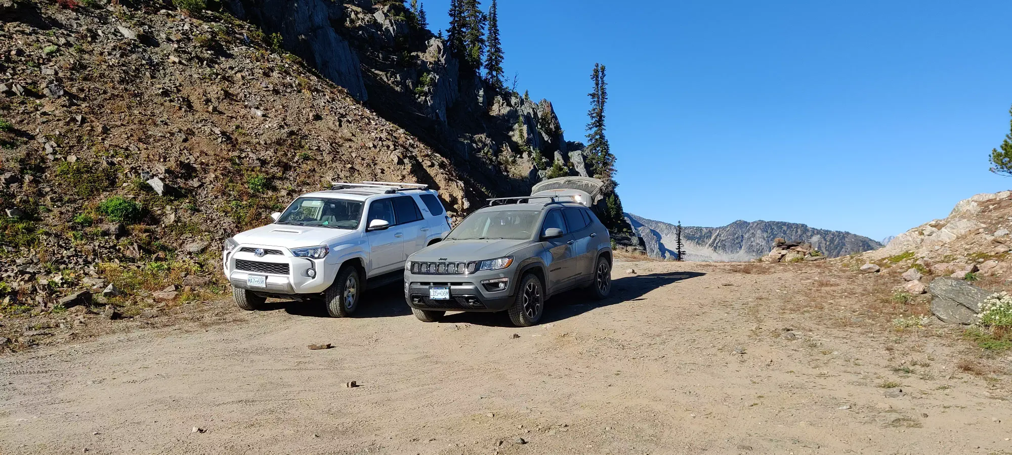
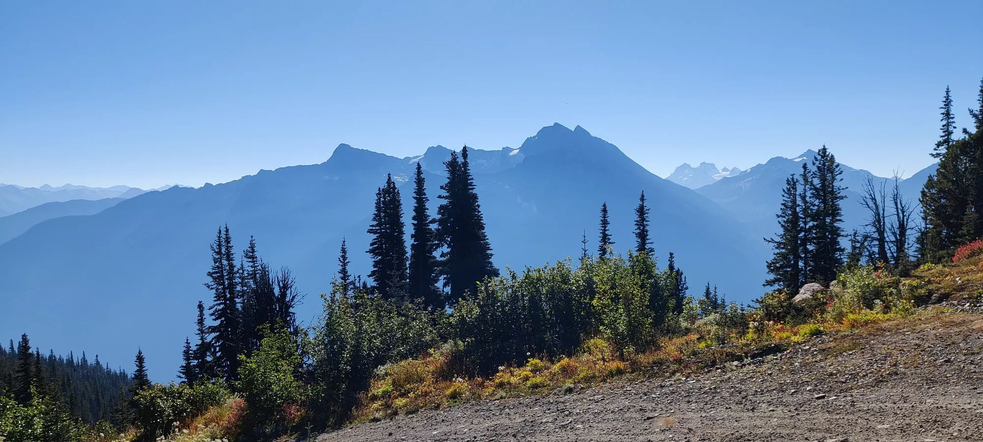
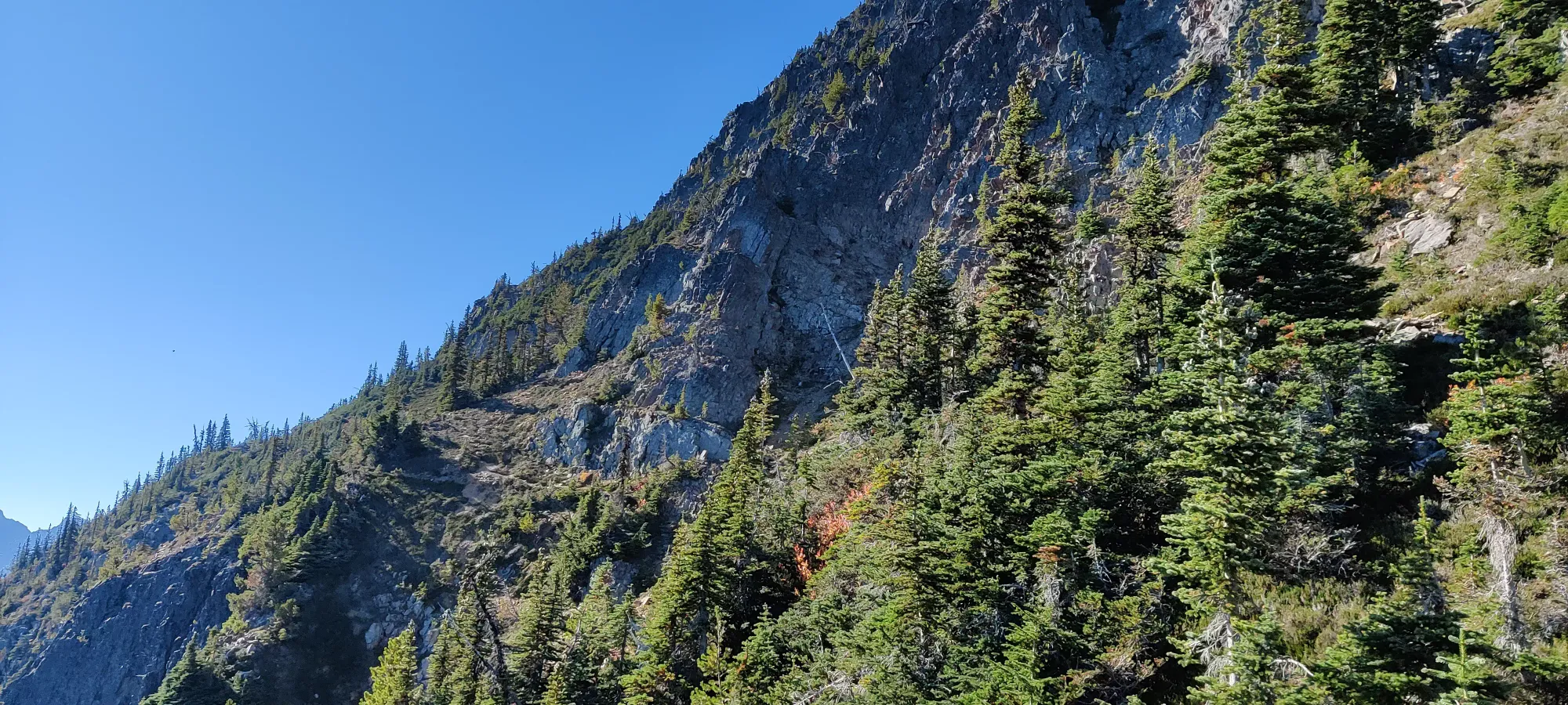
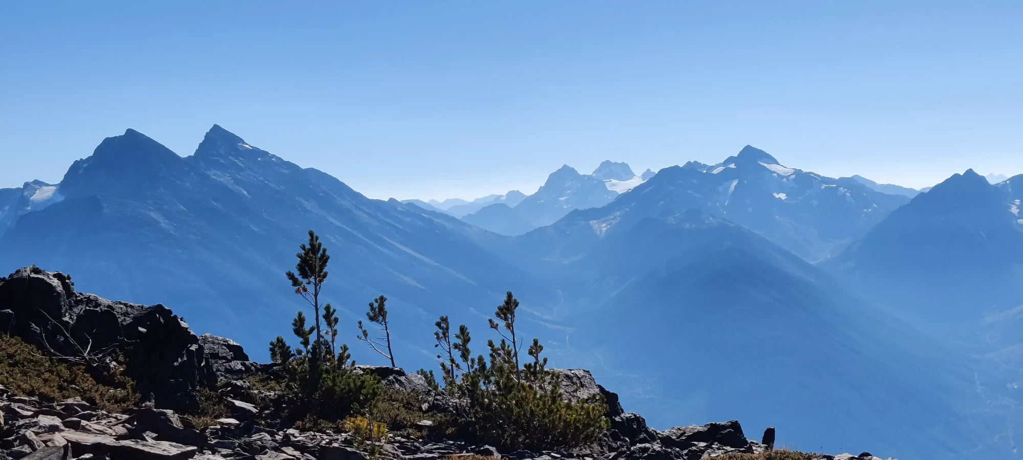
The views were already amazing just from the parking near the microwave towers, but we had loftier goals in mind, so off we went. After coming up that short last bit of "road", the trail goes through a fairly flat area, gaining only about 100m in the first couple kilometres, until the trail takes a hard right turn uphill towards Kafir Peak. Despite being fairly flat, though, this part of the trail has a lot of sidehilling on steep slopes, mostly on dirt, so don't bring too-worn out shoes or you'll not enjoy that.
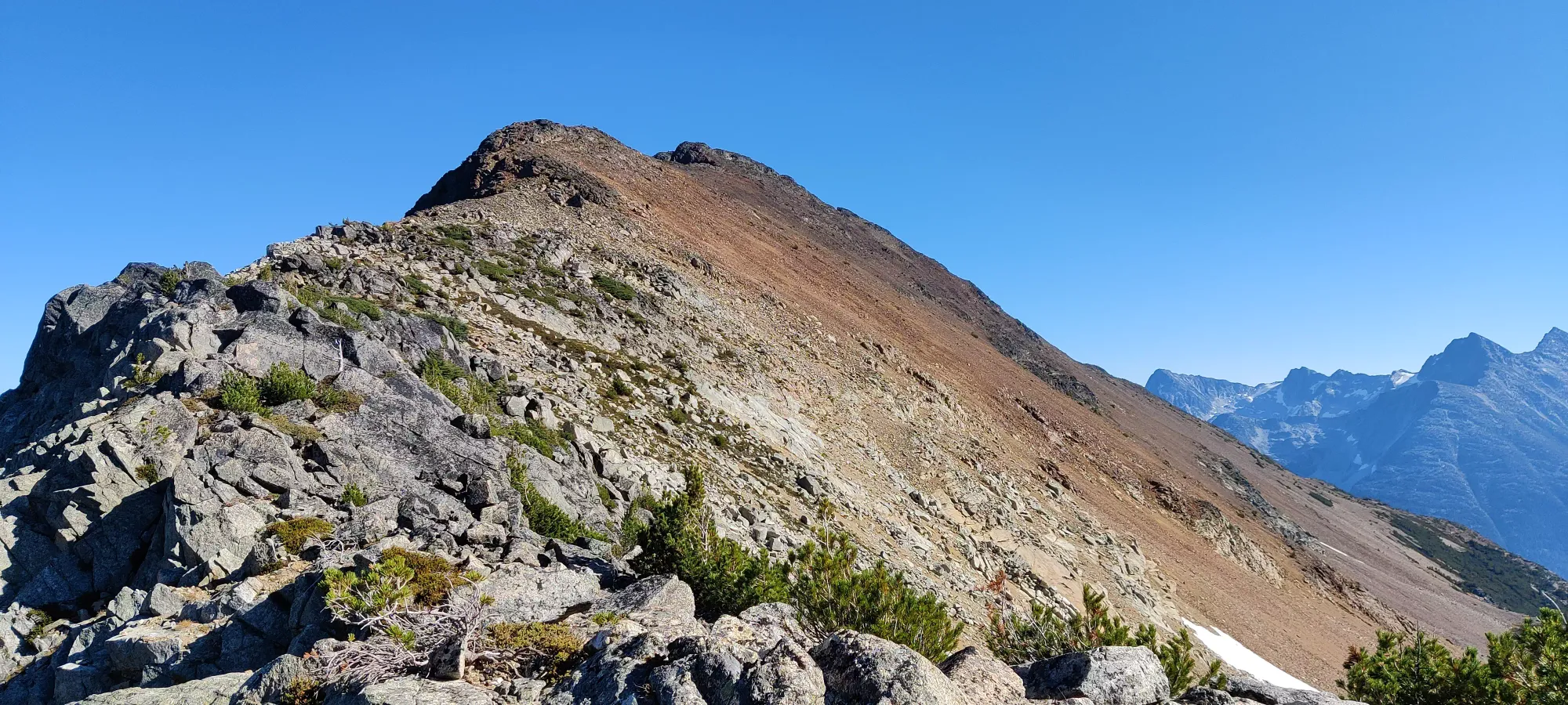
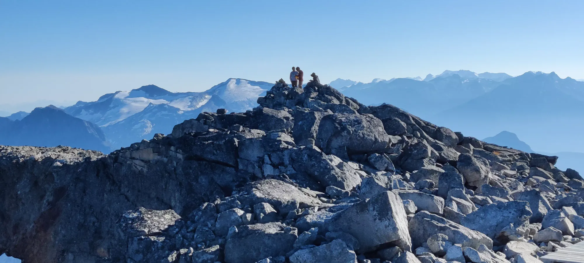
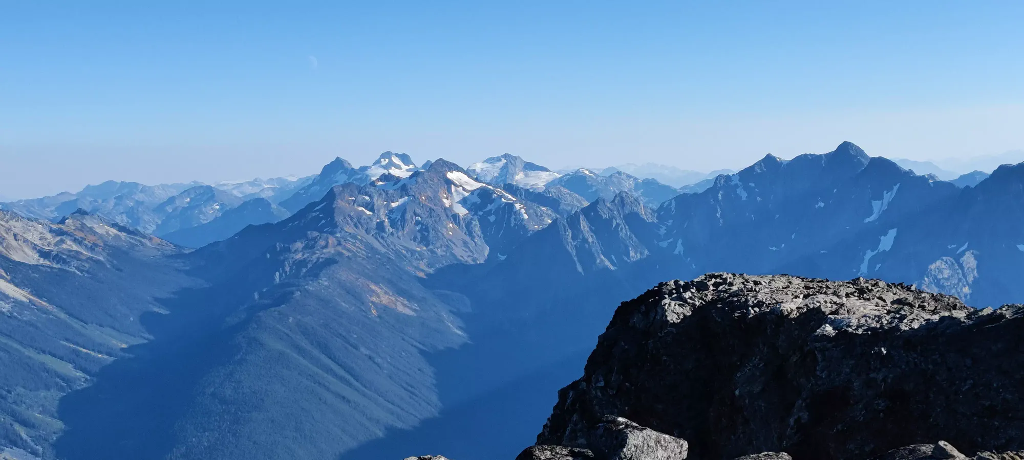
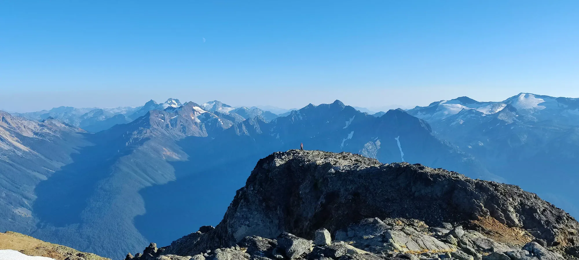
Once at this big turn, the elevation gain starts in earnest. One first is positioned at the base of a steep, loose gully, which you can struggle up, or take a bypass to climber's left through a more treed route with more steps and solid ground, which I highly recommend (and we used). After that, it's mostly just "walk up steep scree for a while". We took a break partway through, and weren't by any means pushing a fast pace, so we got up to beginning of the Kafir Peak summit ridge in about 2 hours. It is difficult to say which point along the ridge is the high point, but the trail goes along the entirety of the ridge anyway, so one ends up getting the summit even if they don't know at what point in time. We took some pictures on either end for good measure.


We spent about half an hour traversing across the ridge, going up and down until the last "summit candidate". It is mostly quite flat, except for an unfortunate dip and re-ascent for the last bump. After that, it's a somewhat steep descent down to the fork between Birkenhead and Birkhorn. Partway down this part the trail changes from more scree to boulders.

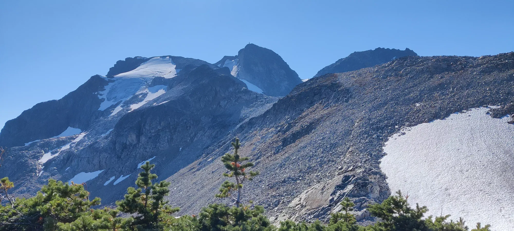
We got to the fork for Birkhorn Peak about 3 hours in, a bit slower than we were anticipating. Nick, one of our party members who was more of a climber than a peakbagger, was feeling a bit tired, so we split up into two groups. Shayan and Nick would head straight up toward the peak, and I would head up to Birkhorn with Bhaskar and catch up with them as we could, since Nick wasn't as dedicated to getting the sub-peaks as the rest of us, this would allow us to move a bit faster.
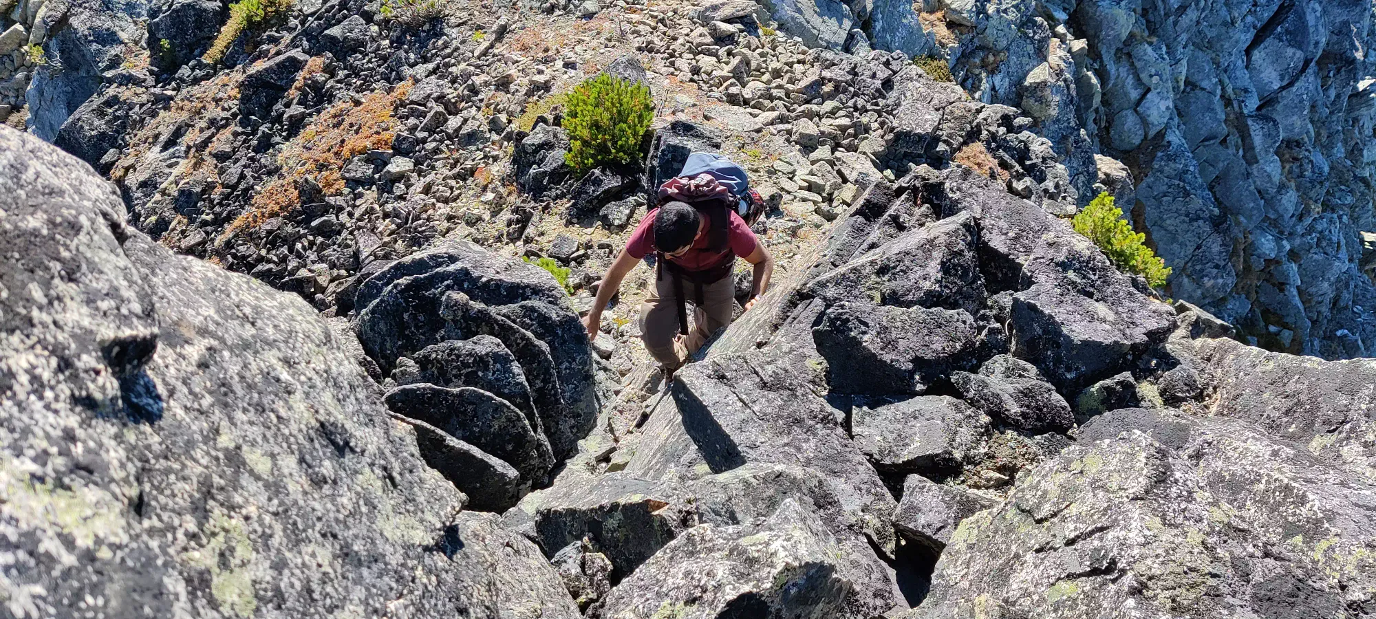
The way up to Birkhorn was 80% boulder-hopping up soot/ash covered boulders, which unfortunately made them a bit more slippery than ideal, but wasn't much of a challenge. There was a bit of class 2 (maybe 3, I've been told I sandbag my ratings a bit) which was fun, but it was only about 15 minutes to get up.
We spent about 20 minutes on the top, as Bhaskar apparently missed the details of the plan a bit and had a bite to eat, but I didn't mind the break since I was still pretty optimistic about timing given the overall low-gain nature of the day.

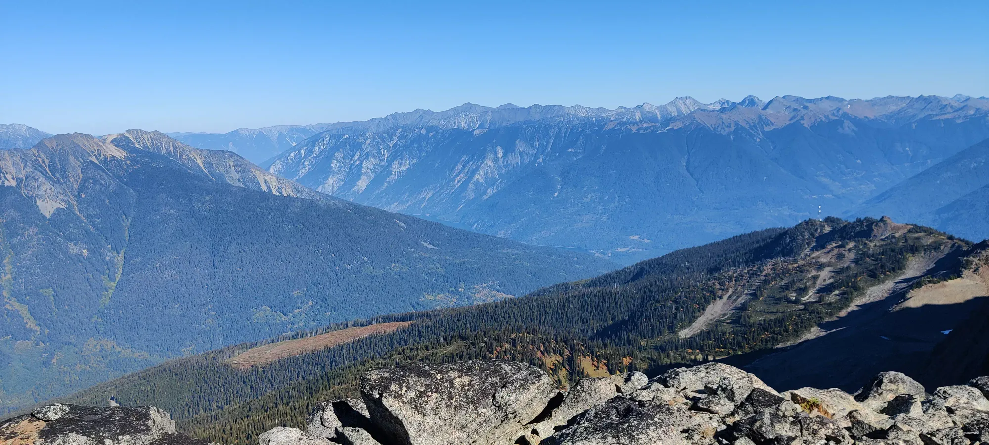

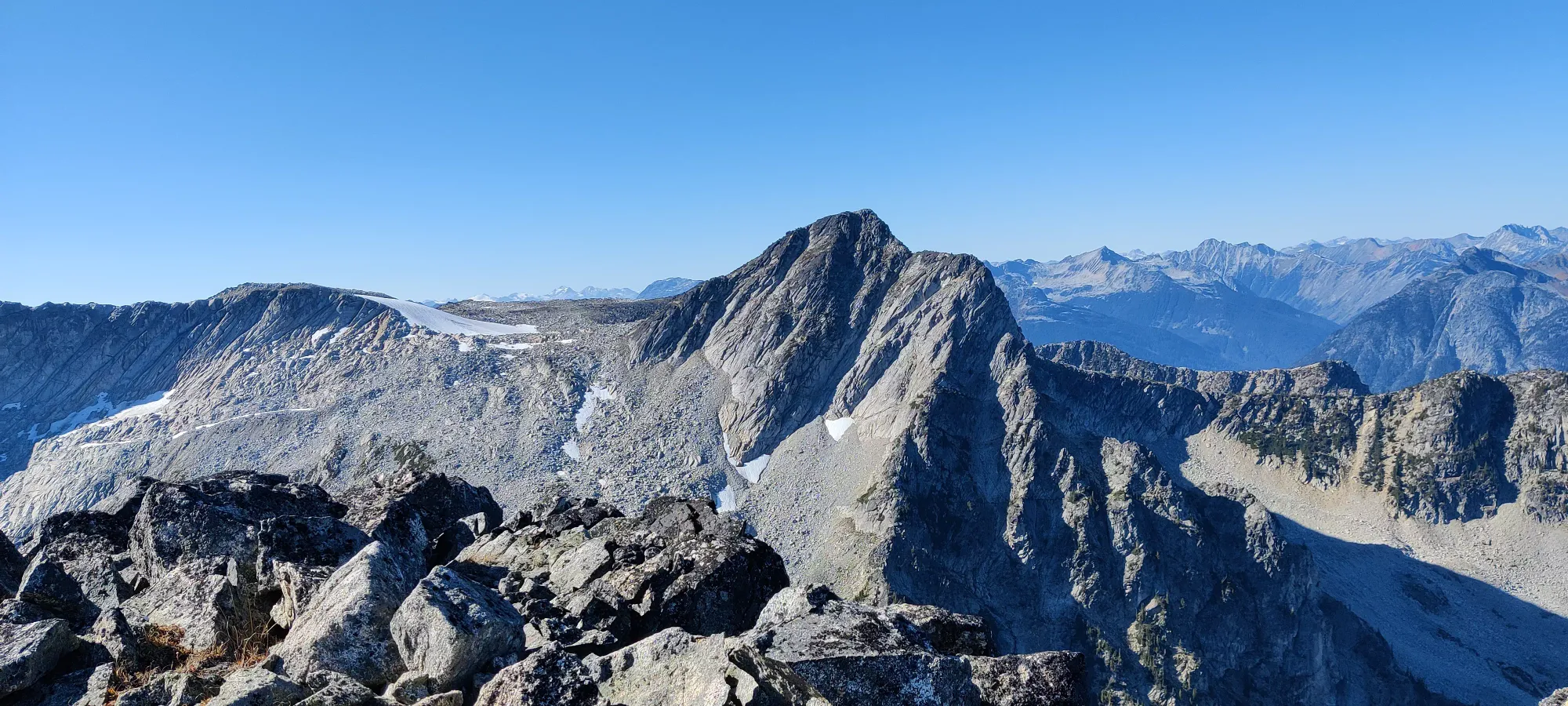

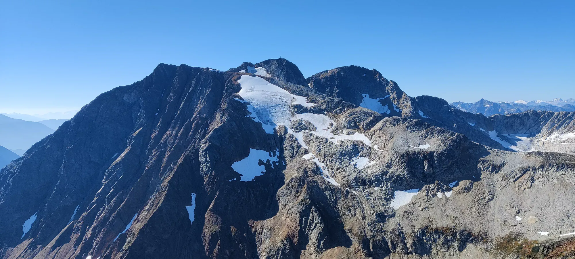
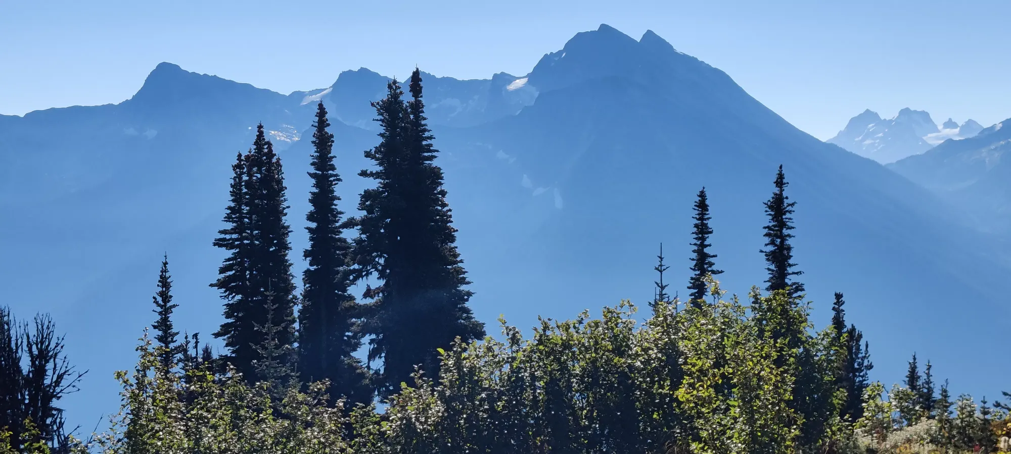
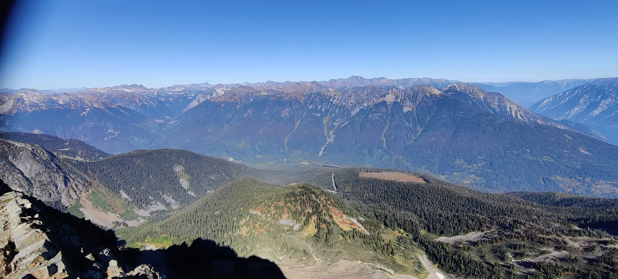
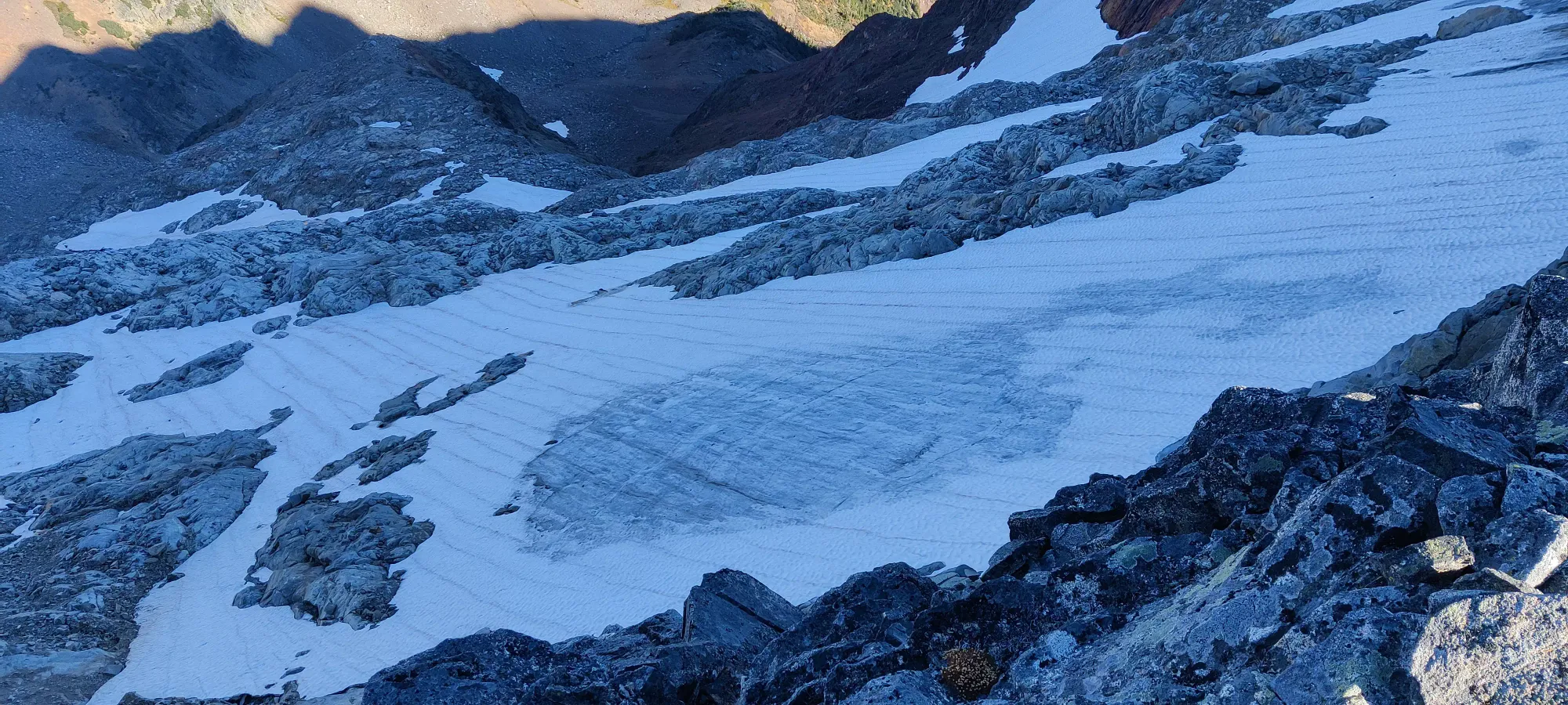
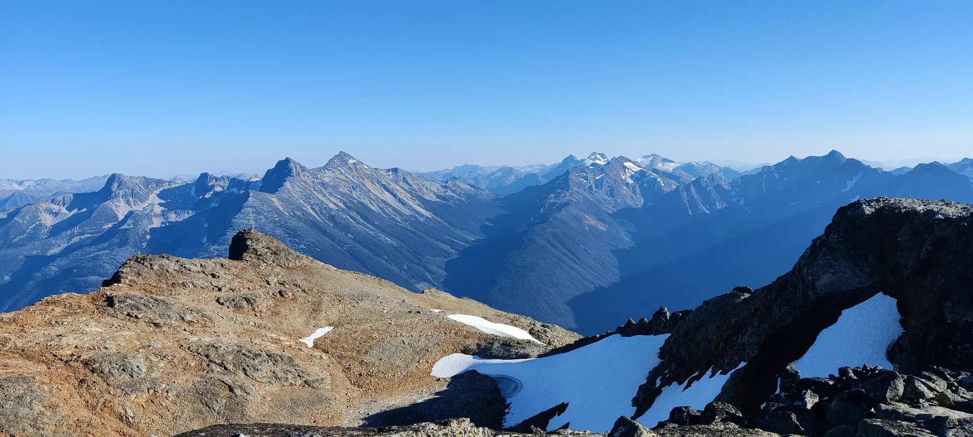
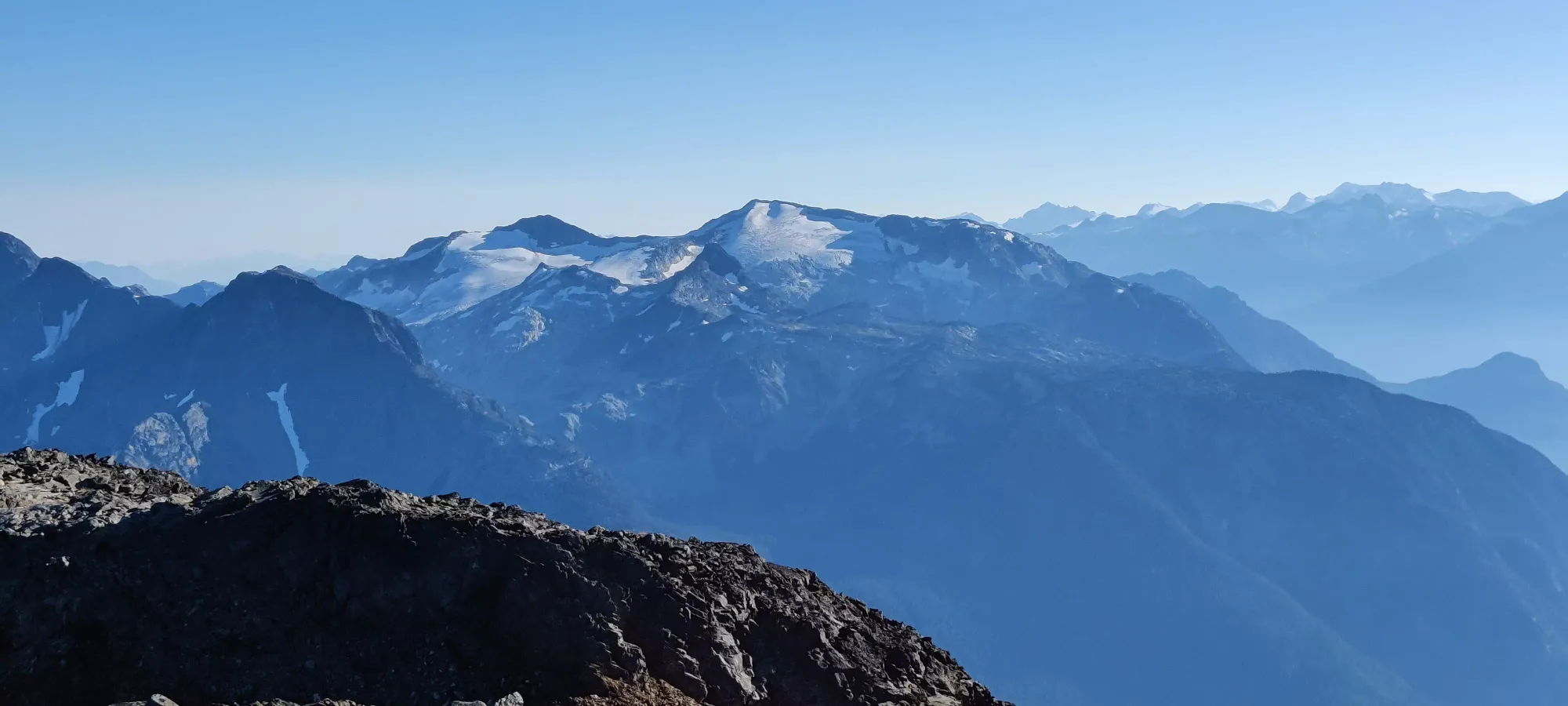
Once we started heading down from Birkhorn, it was a short descent to the low-point of the col, and a long stretch of boulder-hopping up the ridge. In an hour, we covered about 1.5km and 200m of elevation. Not a great pace, but the terrain was rather annoying, full of boulders, loose rocks, and a rather sketchy ledge traverse I decided would be fun to try to avoid a particular section of undulation (which the ridge has many of). From there, up at 2350m, we could see quite a bit of the surrounding glaciers, which were heavily crevassed, though not super deep, so I imagine winter/spring skiing would be decent, at least in the top half of the mountain.


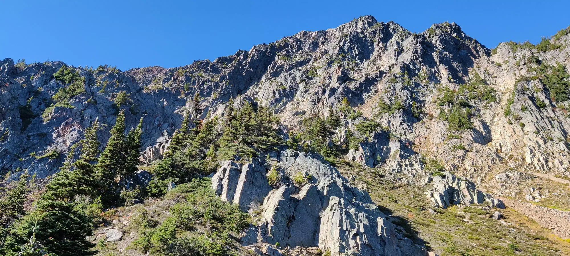
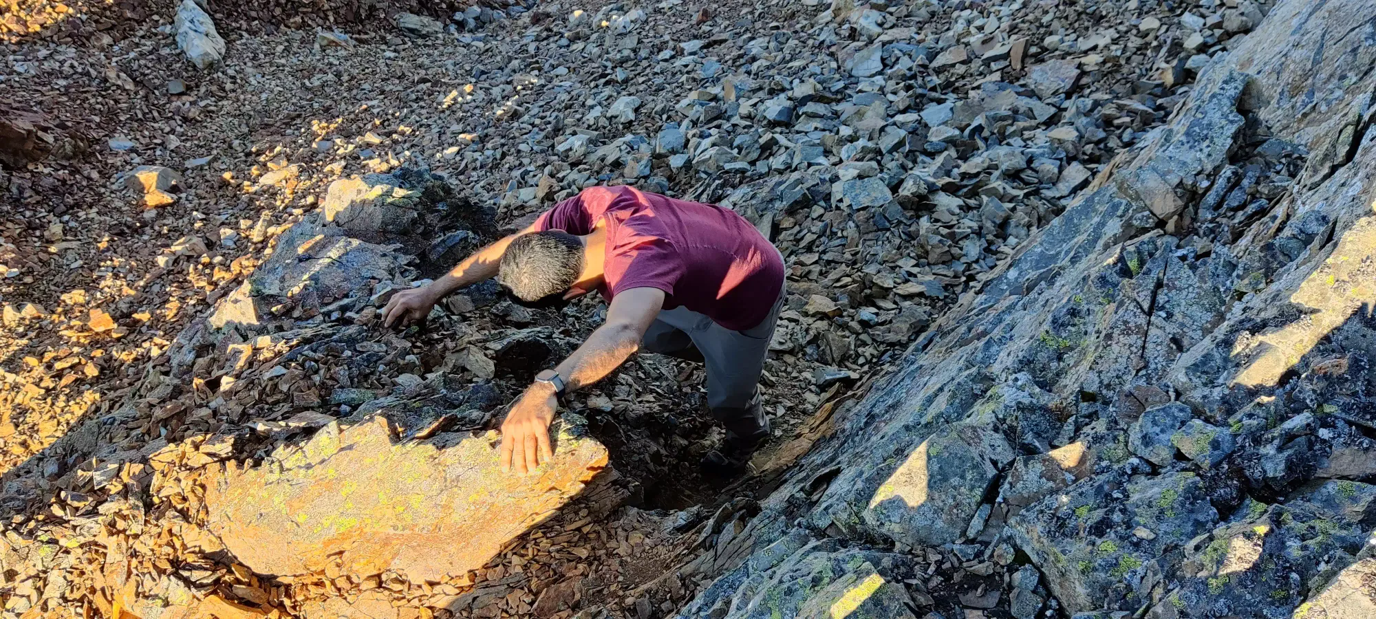
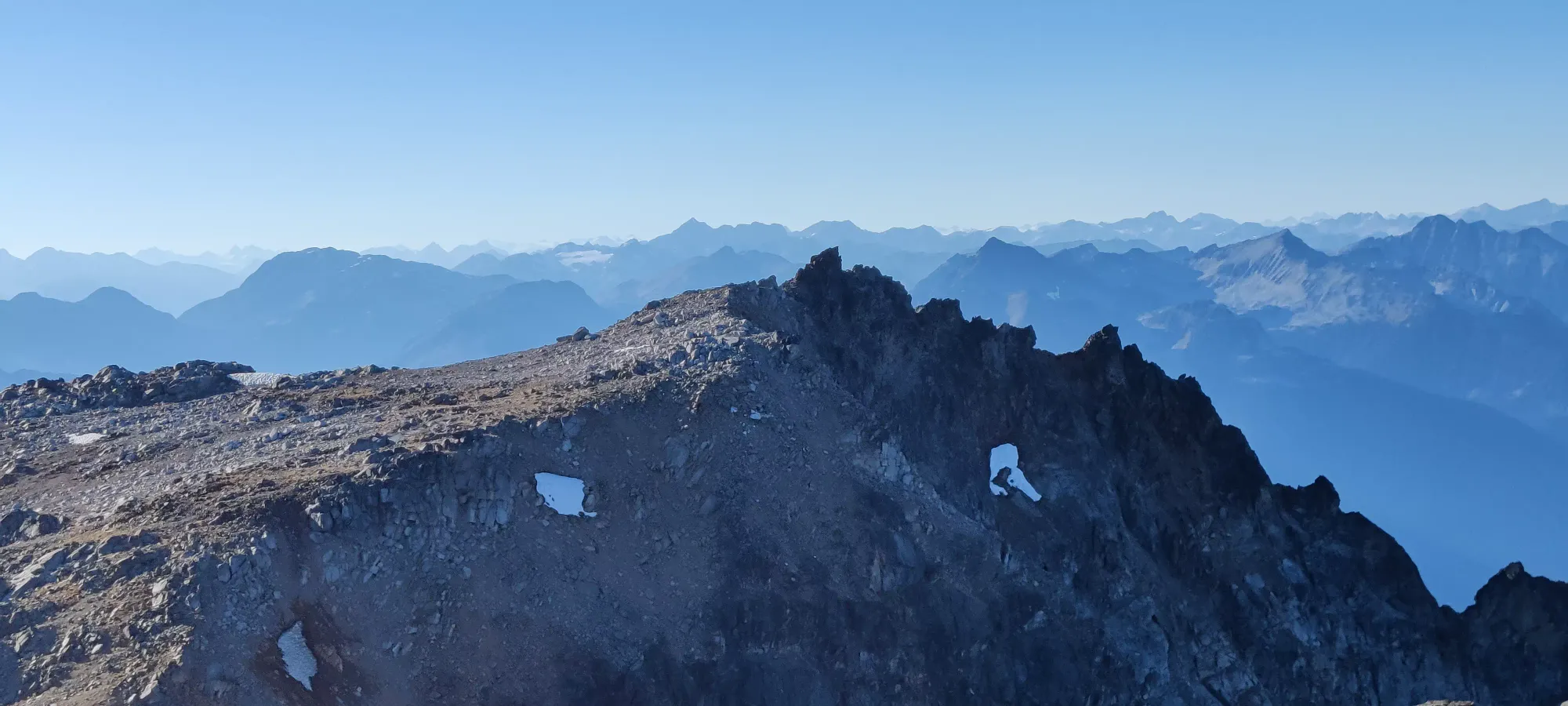
Once you hit about 2400m, the ridge turns around the top of the glacier, and then turns into the summit scramble heading northwest to the peak. There was a snow patch Bhaskar tried to get some water out of, but the flow was too low and he ended up just melting a token amount of snow in his bottle instead. The water sources are scarce, so make sure to pack enough. Getting to the bottom of the scramble is just tediously walking along the rubble around the lip of the bowl. You can stay on top of the ridge or cut below, we did a bit of both, and ended up below the scramble about 5 hours into the day, at about 3:45. This was a bit worrying, but at least the others were on the peak by the time we started the scramble, so we both knew where they were, and didn't have to worry about the ascent being any slower than we'd make it.

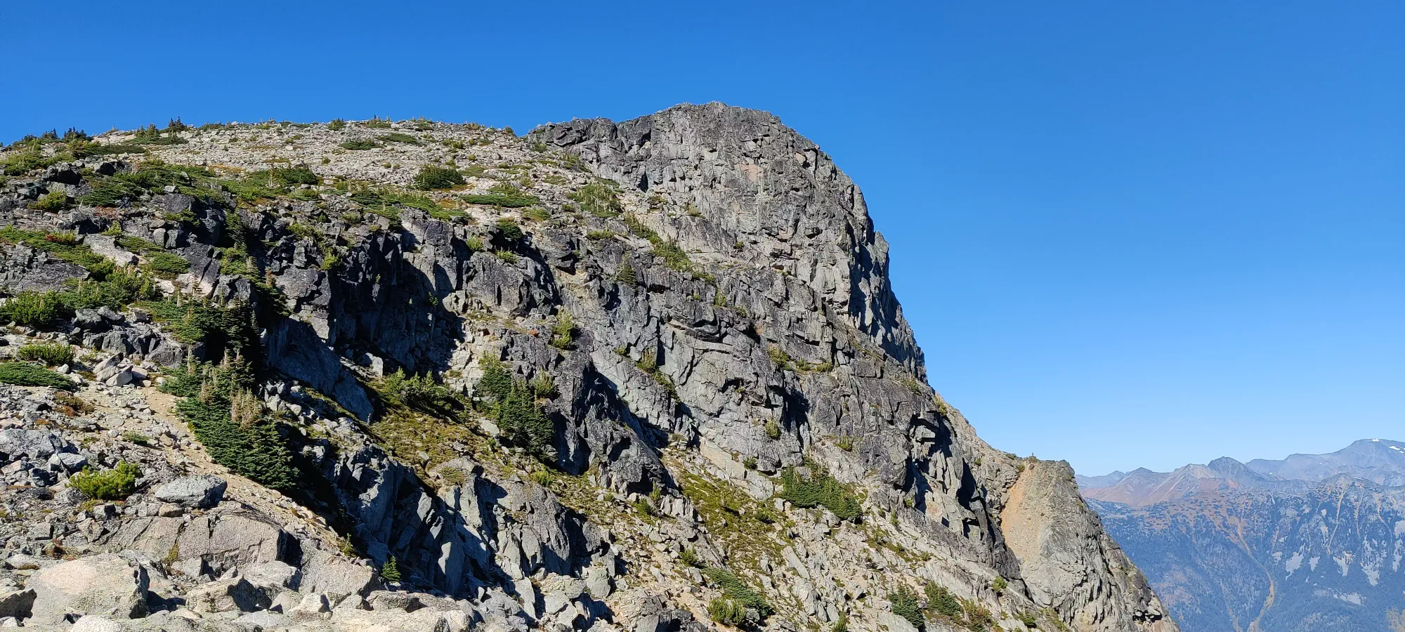
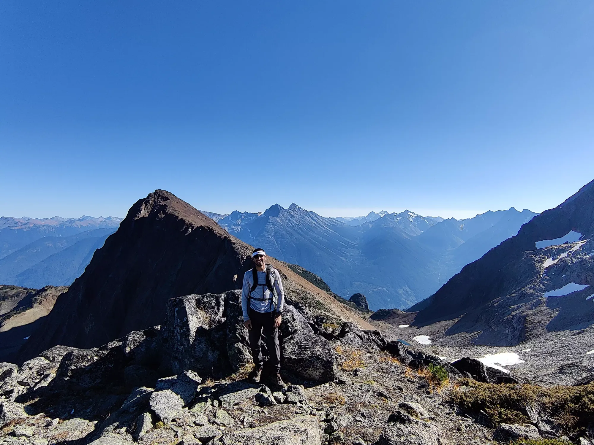
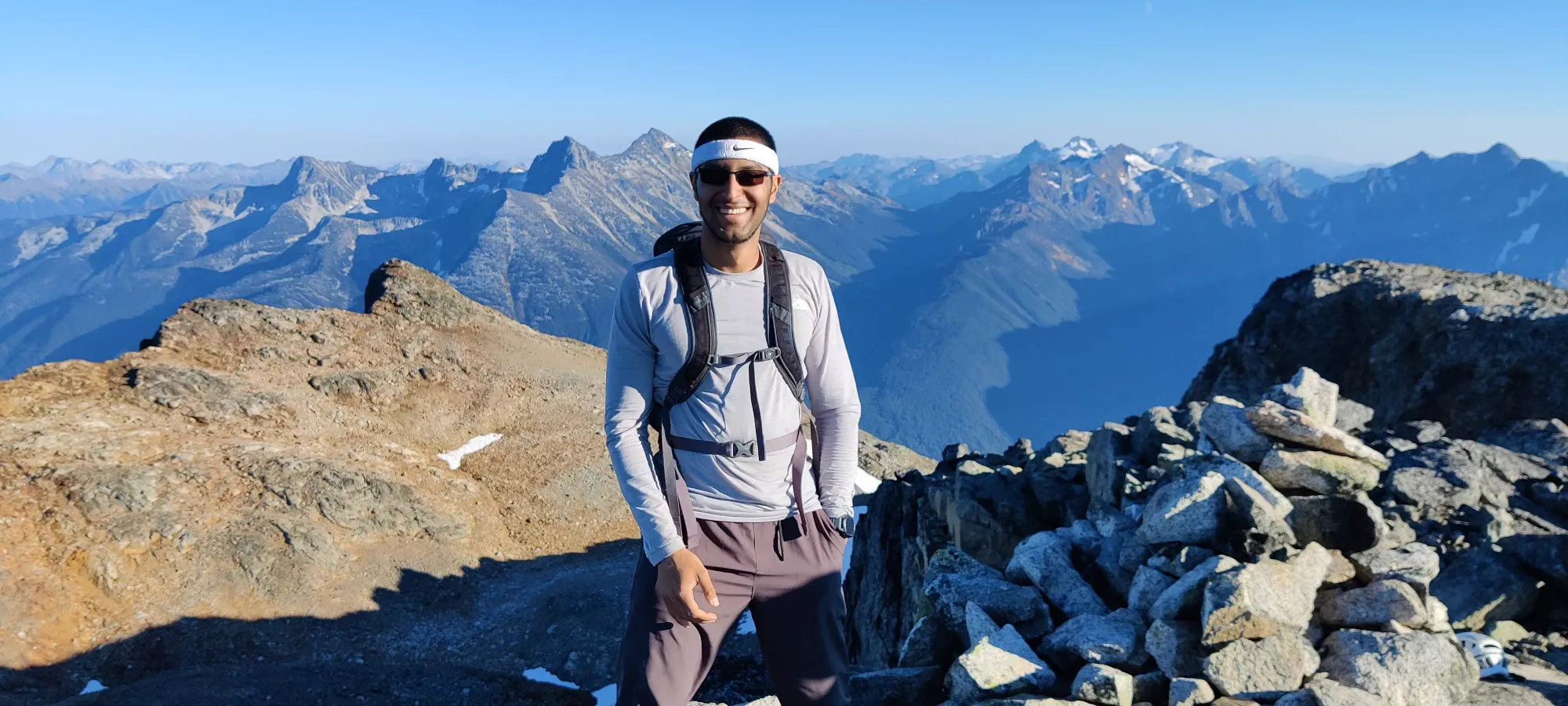
Bhaskar stashed his pack at the bottom of the scramble where the others had left their poles, while I kept mine so I could have some water and a snack at the top, and we headed out after a few minutes of Bhaskar unpacking his summit necessities. The scramble was mostly solid rock of class 2-3 interspersed with some dirty ledges (loose rocks on em) and walking on rubble. Nothing too challenging, and a few spots to take harder lines to make things interesting. 20 minutes of scrambling later, and we made the summit, which is actually highest before the official marking on the map (that's the location of the tower and heli-pad). The register is in the cairn at the high point.

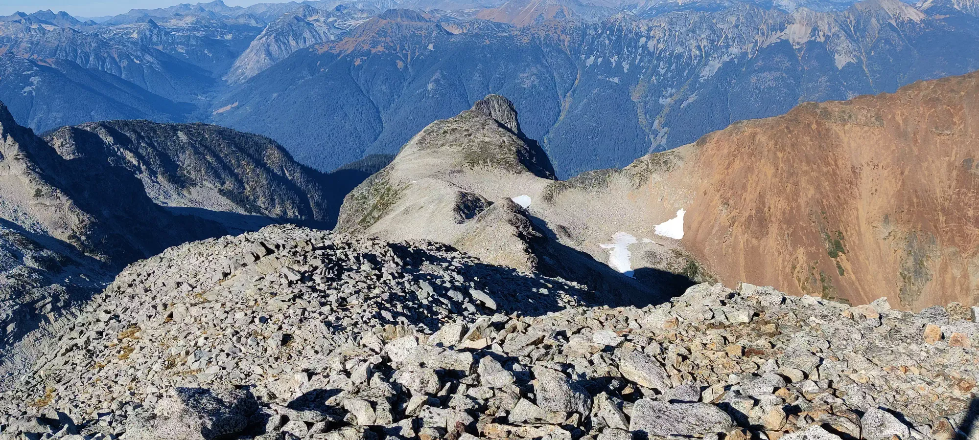
Once we got to the top, we confirmed that the admittedly cooler-looking sub-peak further along to the west was not higher, grabbed some pics, I shared some of my water with the others who were running low, had my sandwich, tagged the mapped peak just in case, and we headed out in about 40 minutes, probably a bit long given the time, in all honesty. 5pm from the top was a bit late, though I still had hopes we could make the car in the daylight, since heading downhill is usually easier.


Since Nick wasn't feeling super happy about the down-scramble, he went ahead while the rest of us finished out summit pics, since we'd all catch up fairly quickly. We went down the scramble pretty slow, as while Nick is definitely a better climber than the rest of us, he's much happier on solid rocks with rocks and anchors than loose scrambling on a ridge. We picked our way down in about half an hour, where we sent Shayan on ahead to go bag Birkhorn since he bypassed it with Nick on the way up, while me and Bhaskar went down with Nick through the boulders. He was a bit happier here without much in the way of exposure to worry about, but still not quite full speed. We got down to the Birkhorn fork in another 75 minutes, with the shadow of Birkenhead rapidly rising on Kafir as the sun lowered. Here, we met back up with Shayan, and also discovered that the group was rather low on water. Since this was mostly a peakbagger group (I didn't know Nick was more of a climber and occasional hiker at the time), I didn't bring a lot of water, and actually intentionally packed light to move fast anticipating being the slow one, so I only had about 500mL to share (used that much on the way up, more than I'd have liked to wash down lunch, and wanted to keep at least 300 for the descent, and I only packed 1.5L). But we shared some sips around, and got to work on what we knew would be the worst part: regaining the couple hundred metres of elevation from the bottom of the col to the top of Kafir. This was at about 7pm, for reference.

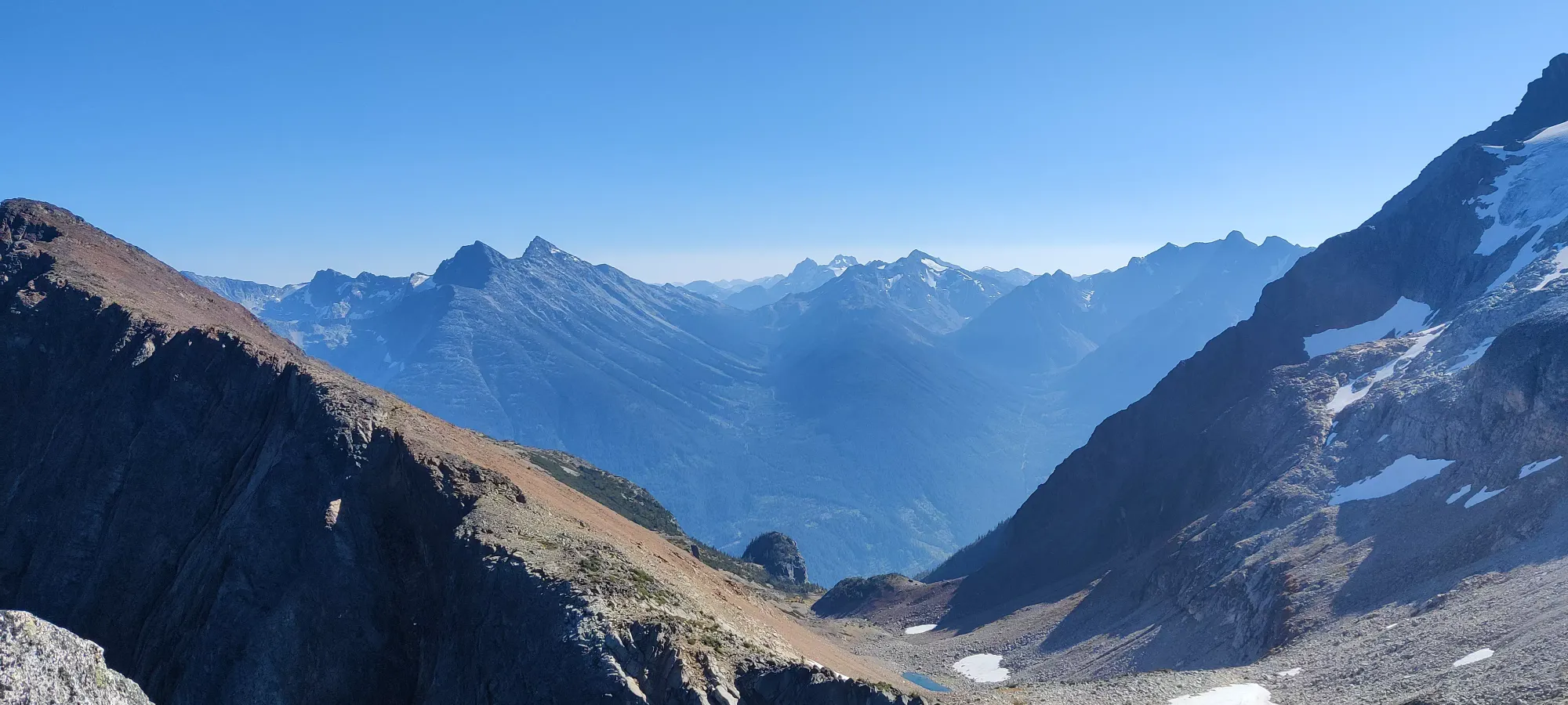
We made a pretty good pace up the scree slopes, all things considered. With Nick's discomfort and tiredness, everyone's thirst, and the dwindling light, I was impressed with our time of 35 minutes to the top, avoiding needing headlamps for the ascent, if nothing else. At that point, though, we did strap them on (though only me and Bhaskar had them, the others made do with phones, and I stayed behind with Nick to provide additional light with my headlamp as best as I could). The next hour and a half walking the ridge and descending Kafir's south slopes were pretty rough. Everyone was thirsty, Shayan was leading without a map, and Nick was having his patience tested by darkness and a slope full of loose talus. We accidentally descended too far to skier's right at the end of the talus slopes and had to make a painful regain back up for a few minutes, but we eventually made it to a spot just above the first big gully we encountered on the uptrack, by the big turn at the edge of the south face.
This point was notable because this is where Bhaskar lost a water bottle on the way up, or so he thought. We spent a few minutes looking around since, well, we REALLY wanted that water. We didn't find it though, and I switched to the lead and continued down, but with my eyes peeled. This turned out to be a good idea, since not 3 minutes later, I found it just to the left of the trail, half-full of the tastiest water we'd probably had. We passed that around, reinvigorated our souls, and made a slightly better pace down the last of the scree to the top of the gully. This time, instead of taking the bypass, for some reason we decided to take the loose gully instead, which was not an efficient decision. The dirt was steep, loose, and there wasn't a ton of rock to slow you down once you started sliding down. We spent probably 25 minutes getting down that stupid thing, pushing us all the way to 9:15pm.
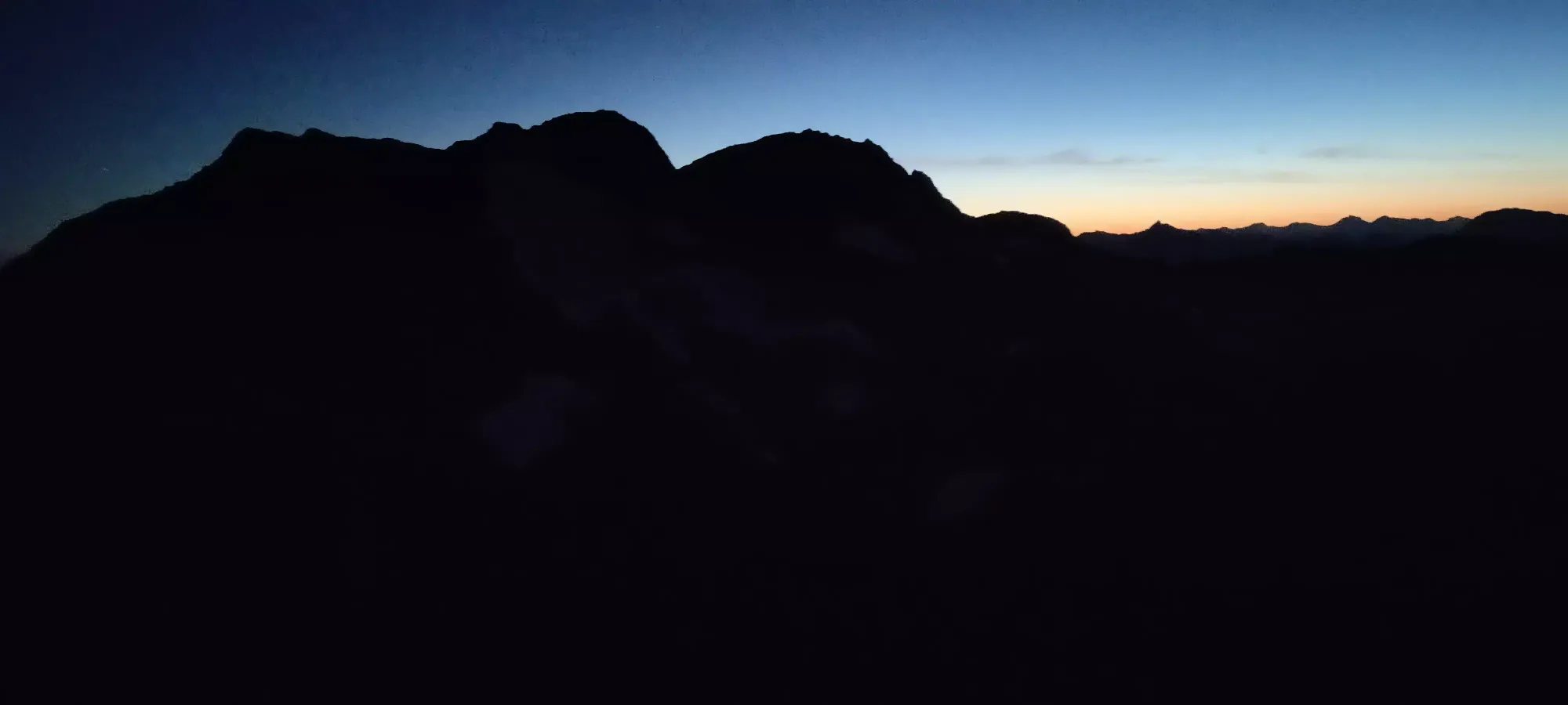
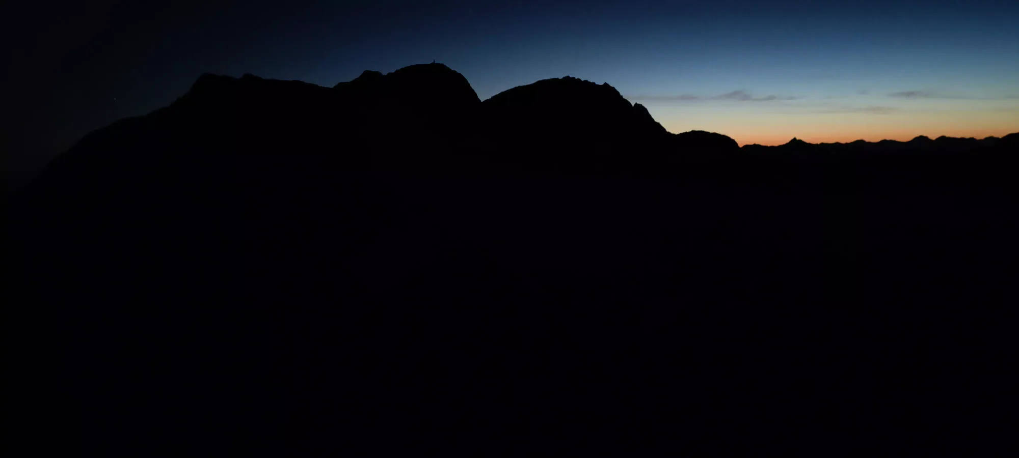
Once out, though, it was a much simpler walk back across the side-hilly slopes, with a couple water breaks interspersed. A less tired party could blast through this quickly, but that was not the state of our party, so instead we trudged across for another hour, getting back just before 10:30pm. The only real happy point of this part was when me and Bhaskar turned off our headlamps after a water break and sat there for an extra 30 seconds while we realized how beautiful the night sky looked (I tried to capture it, but my phone was not up to the task). That was pretty gorgeous, almost as good as when I went to Kenya as a kid good. When we did eventually get back to the car, before driving off, we made a point of taking a minute to enjoy that view once more.
So it was a bit more of an "adventure" than was originally anticipated, but hey, we got all the peaks, I was once again validated in my decision to get my Compass (which got all the way up, and unlike the Gladiator I used on the last trip didn't cost me a kidney in gas), and I made some new friends! Plus, of course, crossing off another ultra. I definitely recommend this peak, the drive cuts off a ton of elevation, so as long as you are comfortable with the described terrain, you can knock it off pretty fast, and get some fantastic views along the way.
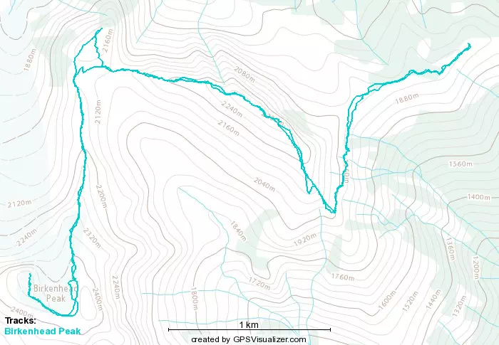
GPX Track + Map