Vedder Mountain (Vedder Peak) - December 20 2023
A quick hike doable before work, with some fun offroading and biking nearby

Border Ranges, Chilliwack, British Columbia
925m
With the holidays rolling around, I had some family in town, who were nice enough to offer me some nice home-cooked food if I made the drive out to the North Shore Tuesday evening. Naturally, I wouldn't want to waste the gas+time to make the trek down from Squamish, so I looked around to see what I could do out east. I had Wednesday morning blocked off, which in winter normally means I go skiing, but with a historically powerful El Niño in 2023, the snow was barely present, and terribly wet, so I decided I could sacrifice a crappy ski day for a short peak instead. Things closer to Vancouver were still kinda rainy, but Chilliwack was dry, and it seemed like roads were too up to around 1000m, so I decided it would be a good time to check off Vedder Mountain, since it's largely driveable, a p600, and I could save myself 45 minutes each way by staying with family instead of having to start in Squamish to do it. Michal decided to join last minute, and so we had a plan!
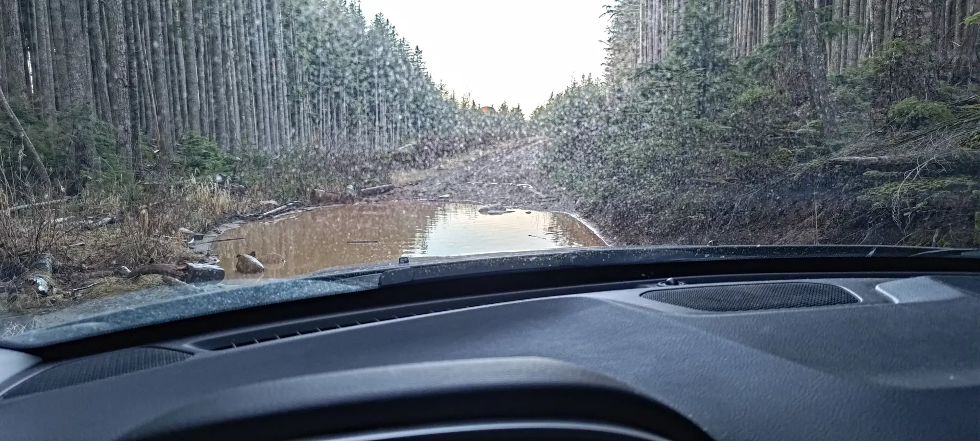
The drive was pretty smooth, with minimal traffic starting before 7am. After a quick Tim's run, we got to the base of the mountain at around 8:15-8:30, and started our way up the main FSR. This is in great shape, basically doable in "not a Lambo". This goes up to 570m, where we forked off on Tower Road, which I would say is 2WD high-clearance, as there's a large cross-ditch right at the beginning which would cause lower vehicles to hit, but otherwise is fairly even and doesn't require anything fancy to get up. This road goes up to about 670m of elevation, where the main "Vedder Mountain Ridge Trail" starts. However, if you continue on Tower Road past there, you can curl around and onto the ridge, and drive all the way up to 800m of elevation, and cut off some distance as well. This requires AWD and high clearance, as the road past this point has some larger obstacles, ruts, and holes which will put your vehicle to a decent test. We stopped where the road seemed to be at its highest, and also had a large puddle whose depth was difficult to gauge.
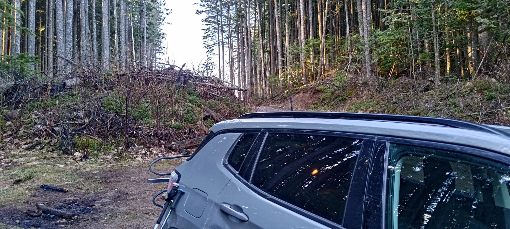
So, after getting parked and getting some trail runners on, we got moving at 8:41am, giving us just under 2 hours to get done and get back for our hopeful ETA of 12:00 to get Michal to school 😀. The walk through the sparse forest to the trail took a whole minute or so, no real bushwhacking, just walking over deadfall to get onto an exceptionally well-maintained trail.

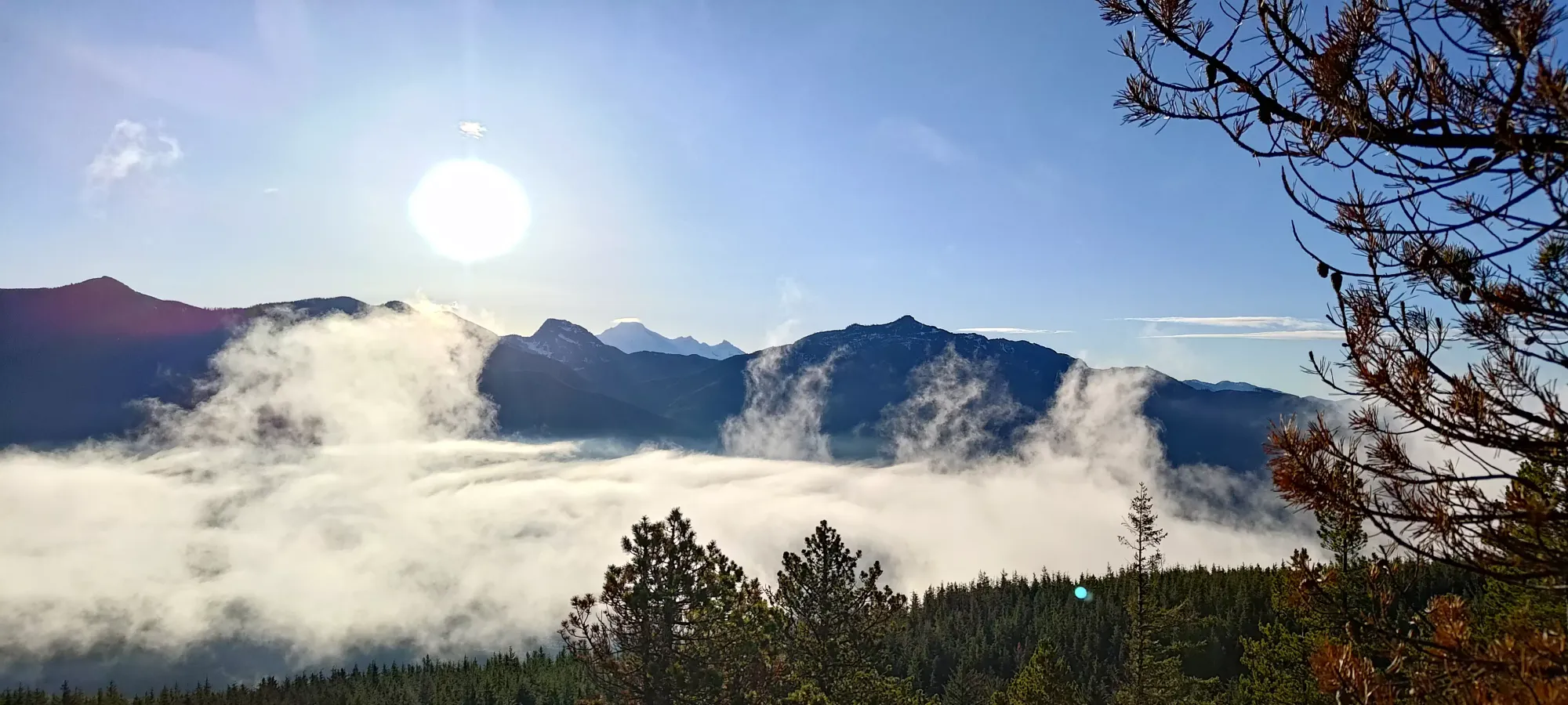
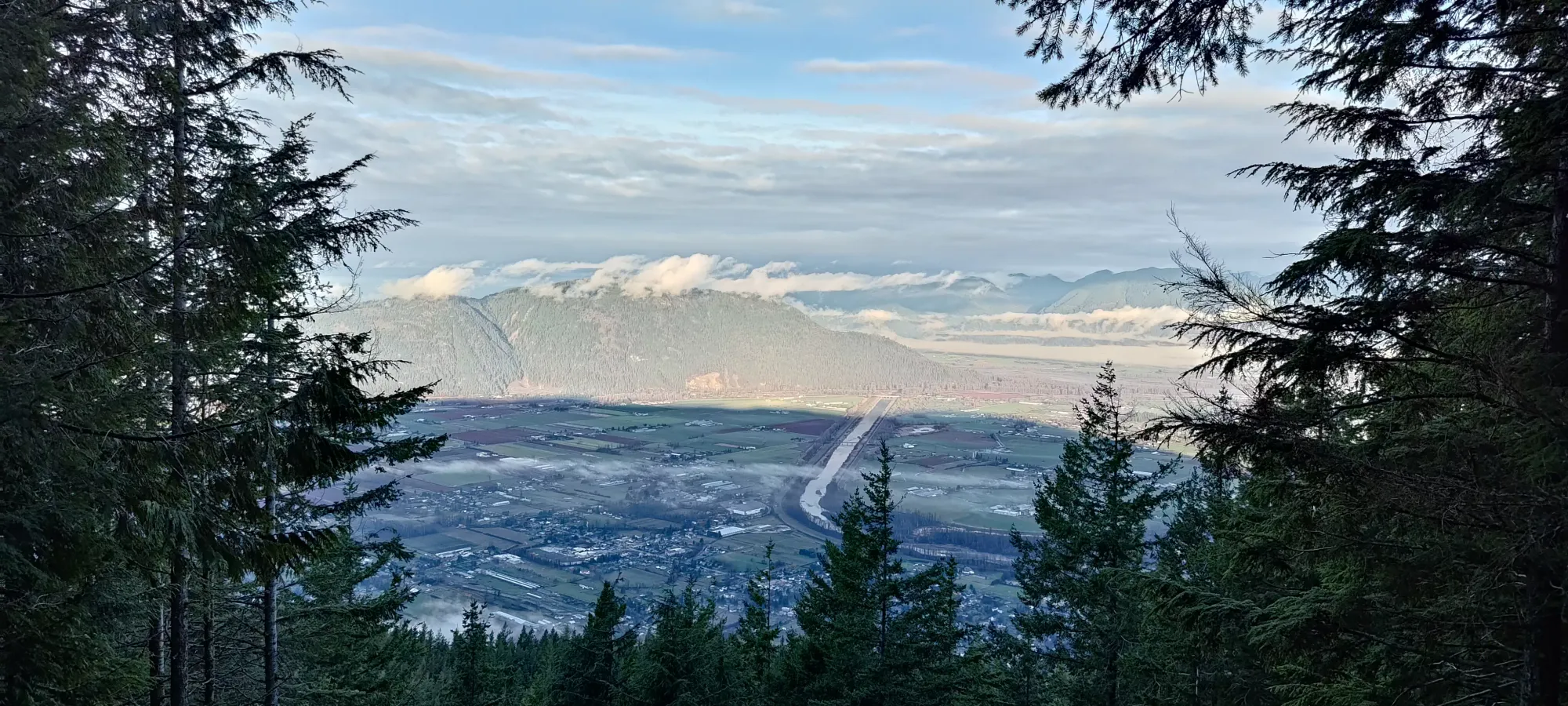
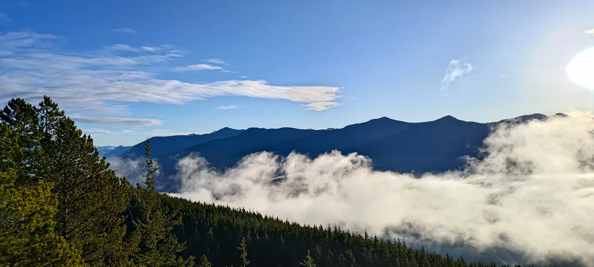
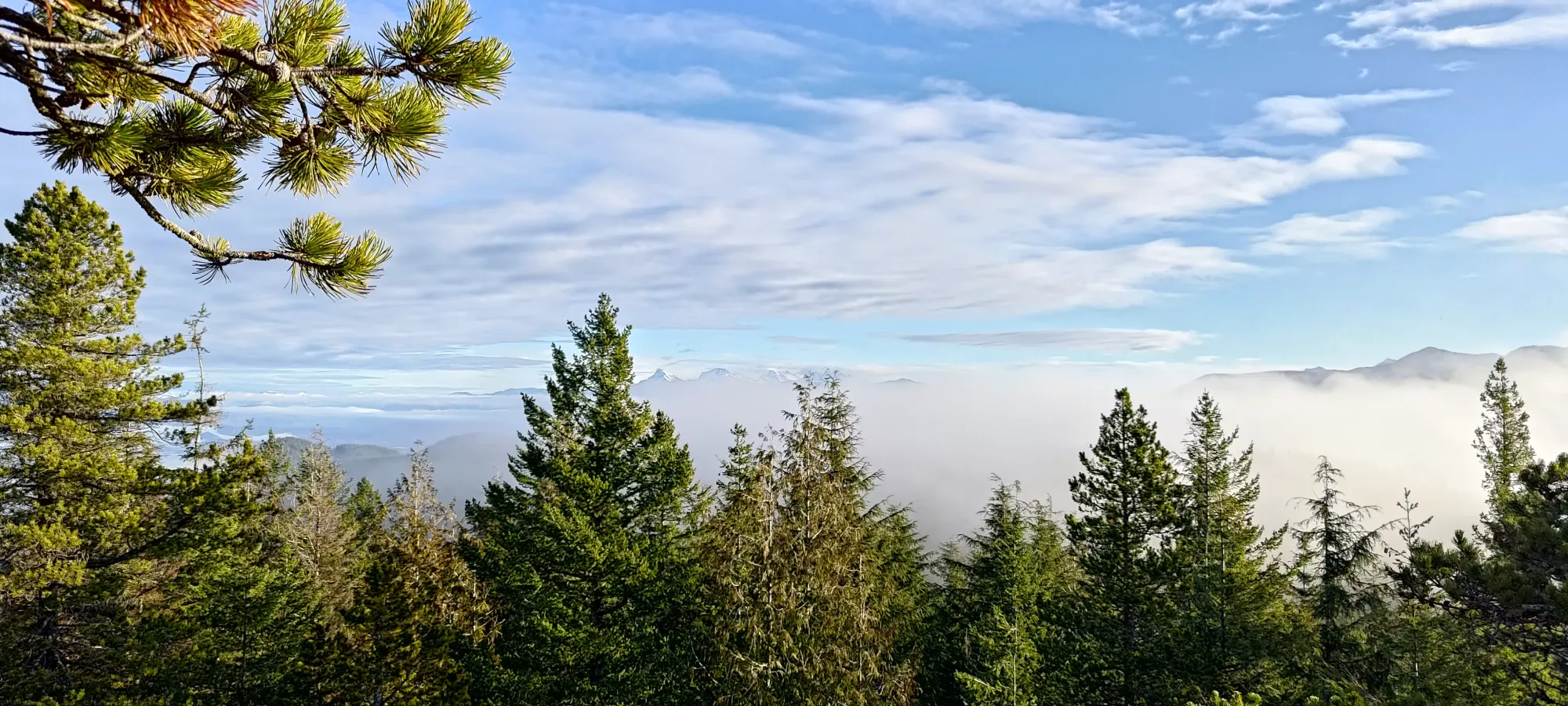
The hike is pretty uneventful, just "walk along the undulating ridge on a super-nice trail", so there's not too much to say about it. We got to a little viewpoint about 15 minutes in, where we stopped to appreciate some views to the NW, though sadly the big peaks in Golden Ears were hiding in the clouds we avoided by coming to Chilliwack.
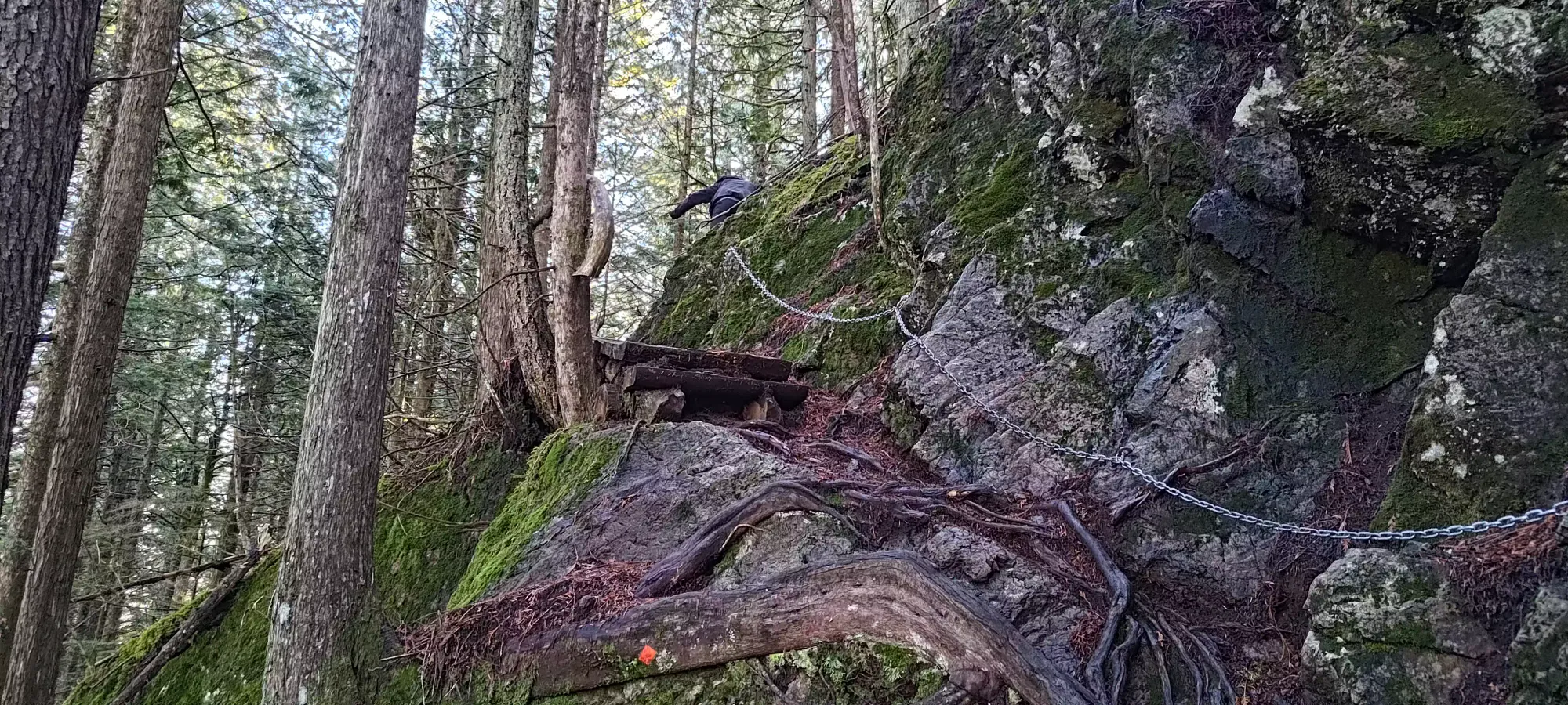
Other than that, we just kept on walking for about 3km until we hit a couple switchbacks to drop down beside a small pond with a slippery wood bridge, then go back up on the other side past a few fixed rope/chain sections (which we avoided using, of course), and then we hit the summit in just over 40 minutes, well ahead of schedule!


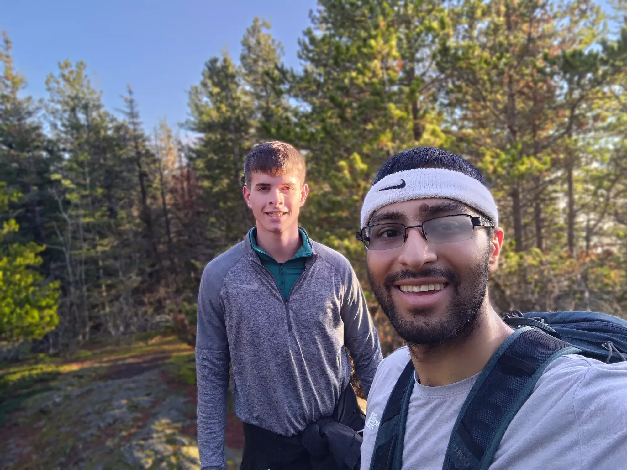
After some photos, we walked back a few metres to the viewpoint on the north side of the ridge to get some more photos on that side, then headed down after about 10 minutes.

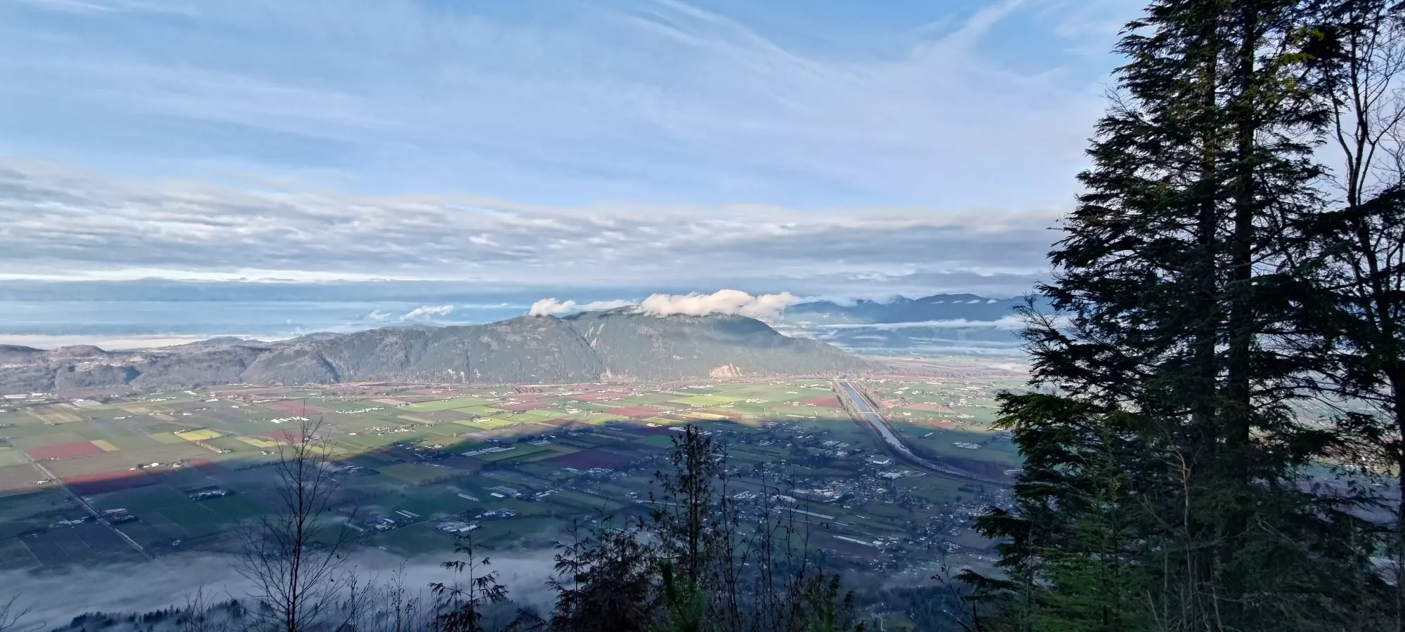


We went back at a more casual pace, at first due to the slippery rocks on top, then due to the challenge of going down sans-fixed-rope, then just "because neither of us felt like getting too sweaty and we had the time". We stopped once more for some views of the Cheam Range as it poked out of the clouds, then it was just the same, simple walk back to the car.

We got back to the car with a round-trip time of 90 minutes almost on the dot, and we didn't even rush. Definitely recommend doing this as a pre/post work hike if you're in Vancouver or further east, it's got nice views, relatively easy access (especially if you have a decent vehicle), and gets you a p600 with less than 2 hours of effort. What's not to love?!?!
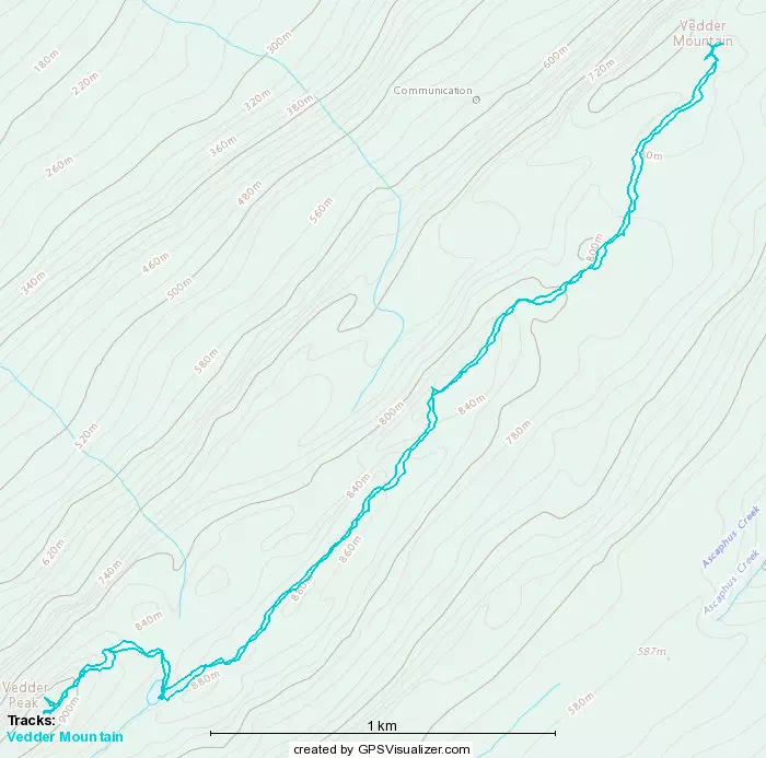
GPX Track + Map