Three Sisters (Fernie) - July 16 2022

Harrison Ranges, Fernie, British Columbia
2788m
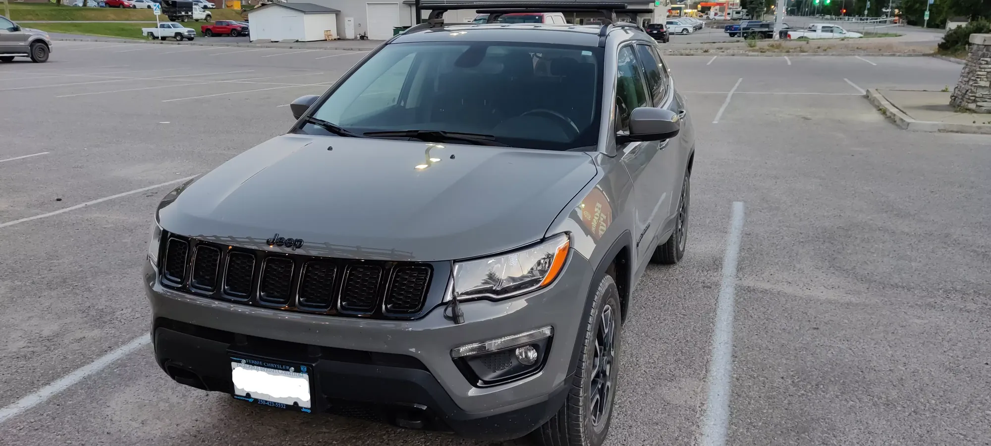
This outing was quite the confluence of plans/events. Many months ago, me and a couple friends made plans to rent a place in Canmore for a month to be able to bag some peaks out there for a month (though the current snowpack may make that challenging). Beyond that, I had also been looking for another vehicle for a couple months, as despite how much I love my trusty Mitsubishi Lancer, it's not exactly an FSR-conquering beast. I managed to find a suitable replacement in Fernie, so I arranged to pick it up on way up to Canmore, and the timing worked out such that I'd have the day after the transaction was dealt with to hike before I headed to get my friends in Calgary.
So, when I got to town, I took a look around, saw what looked like the coolest-looking peak in the area, and said "hey, let's go there!"
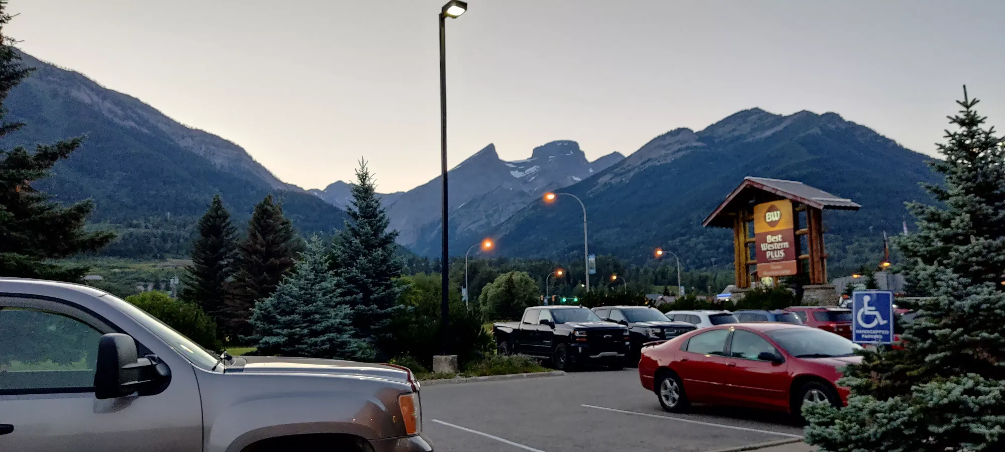
So, after driving across the province on Friday, I crashed, got to the dealership at 9:00 sharp, and tried to get the car stuff all done as fast as I could to ensure I still had enough daylight left for the mountain. Thankfully, after getting the car swap done, getting all my crap transferred over, insurance, a quick snack, etc. done, it was "only" 12:30, so given the front desk attendant at the hotel said it's often done in 2 days, I felt confident I'd be able to make it 😃
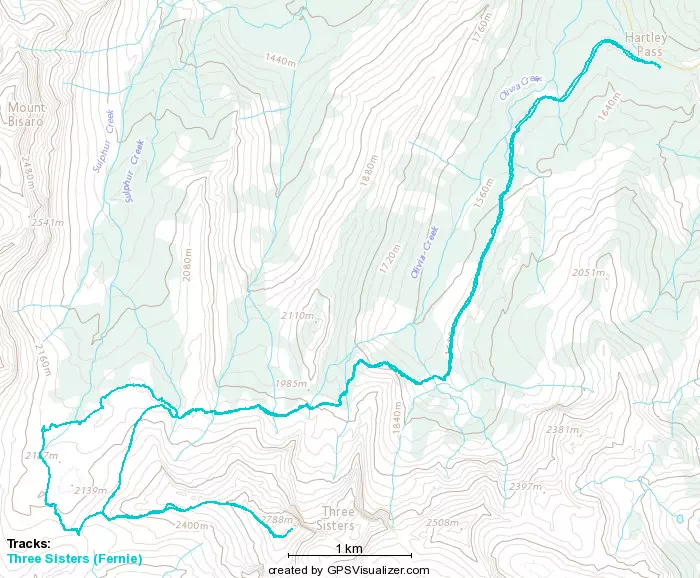
I took the Hartley Lake approach, instead of the one that skirts behind Mt Fernie. This was mainly to reduce kms, as my time was limited, though I'd heard the latter was a much "prettier" hike with lakes and caves. If you have time, that's probably the way to go. Incidentally, not an hour after I got my new vehicle (Jeep Compass Upland), I got to put it to use. A regular sedan won't make it more than a kilometre or two up the road, but I managed to get all the way to the trailhead. Sadly, the shiny new car is now dirty/dusty as hell, but that's also what it is for, so I'm not too broken up about it. You definitely want good clearance and approach angles for this drive. 4WD probably isn't necessary if you somehow for the former two, though. There's a lot a couple kms before the trailhead that I was recommended to stop at for about 5 cars, but it was full, and I had faith, so I pushed it the whole way. There's a combination of cross-ditches, giant potholes, and ruts so it was definitely getting close to the limits, but I made it!
I finally got onto the trail at 1:15pm (1600m starting elevation), and began the slog. There's not much of note here, the first 3.3km are barely uphill, and clearly a common ATV/dirtbike course (if you have one, you can save rather boring walking). About 25 minutes in, or 2.4km, there's a fork I bothered to take a picture of, but I'm 99% sure it doesn't matter at all, and there's just a few places to choose-your-own-adventure for this section.
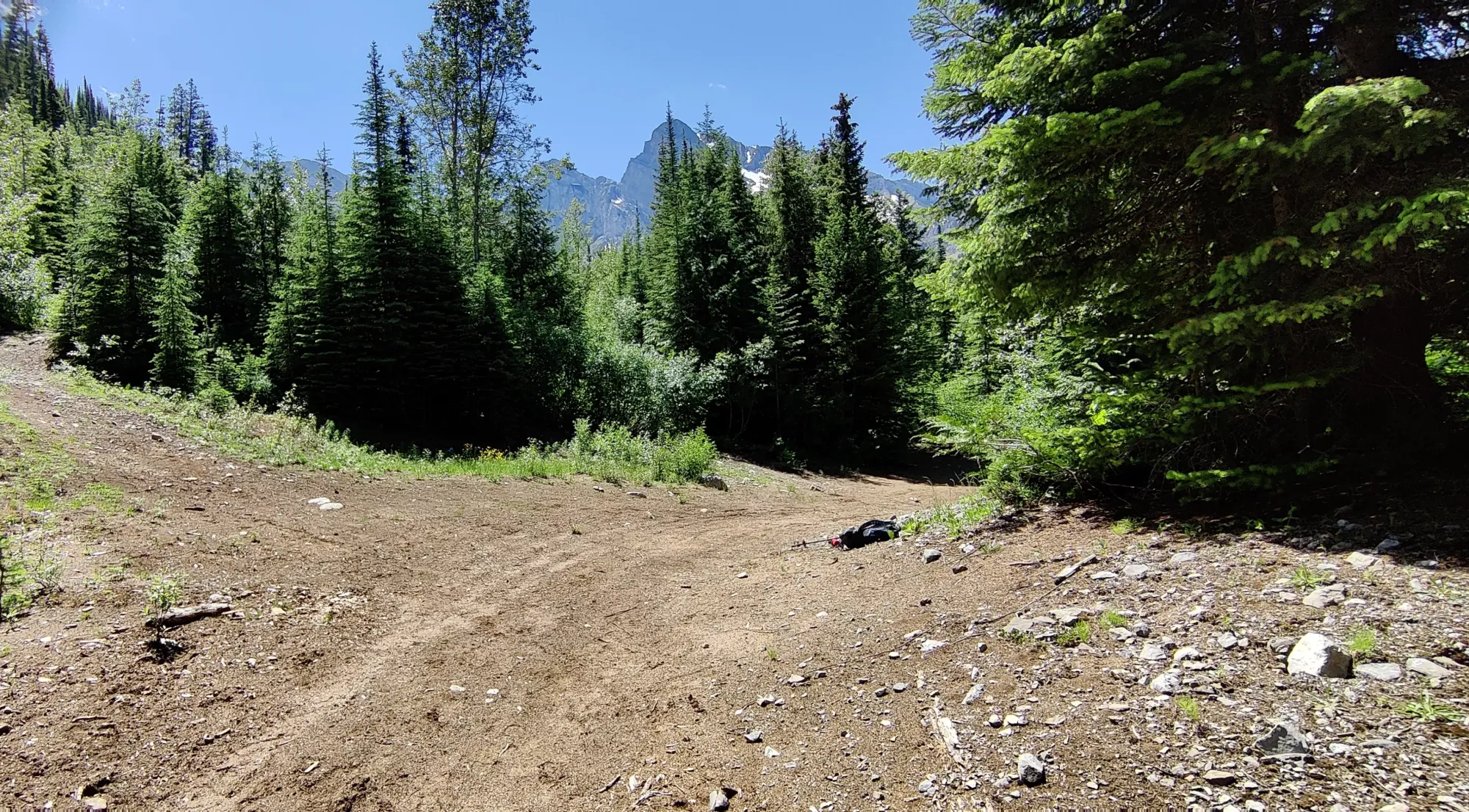
Another 20 minutes of walking brought me to the 3.3km mark where you'd have to ditch your ATV if you brought one, and the trail narrowed substantially, with fairly frequent ankle-slapping by the undergrowth, then the 4.5km mark where you open up into the valley below the surrounding peaks, at about 1830m. It was also this point where I made a disappointing realization: what I thought was abrasion from a rock in my shoe on the way to Brohm Peak last week was actually just crappy shoes, and now BOTH my heels were torn up from these shoes, and I still had most of the hike left to go. This was... not great. No more Sunday hike for me, and probably another week off to heal, plus another set of hiking shoes to buy (hopefully without a freaking seam in the middle of the heel, what were you thinking Salomon?!?!)
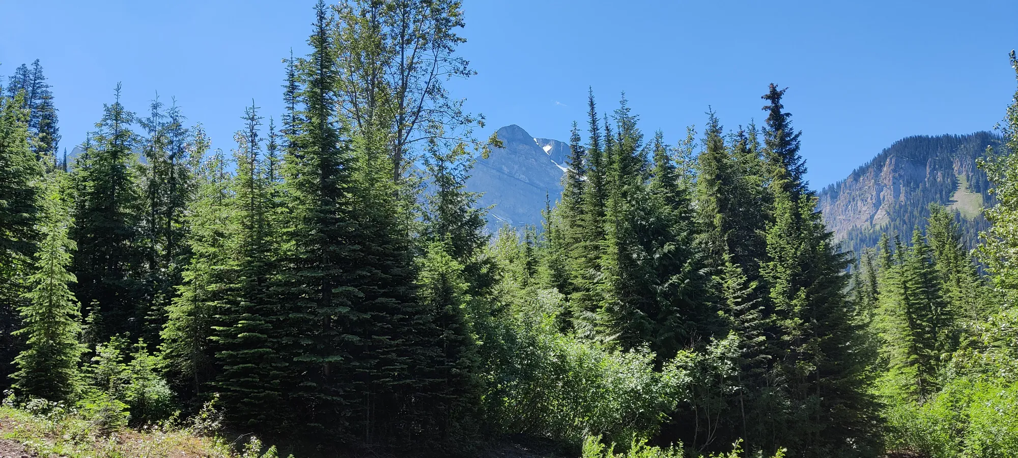
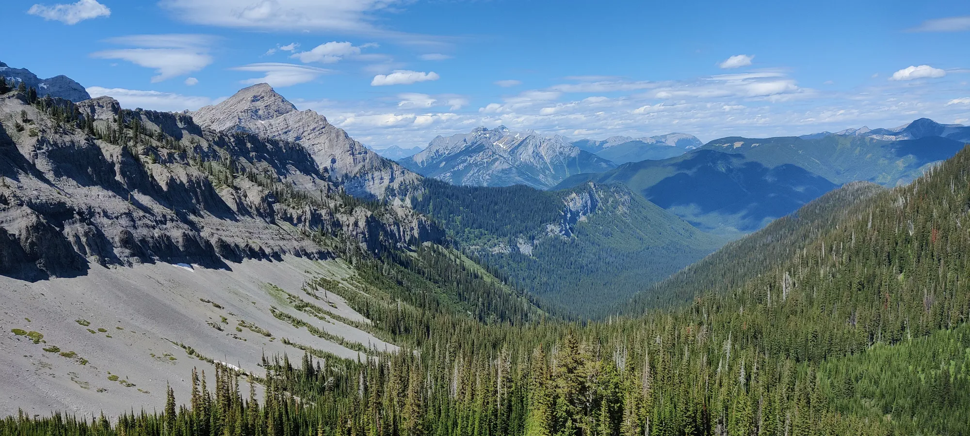
Another half hour and 1km getting through the valley brought me up to just over 2000m, where I got a less obstructed peak view, and looking down finally started to have some visual impact. Things aren't super steep yet, so I was still feeling alright, making decent time.
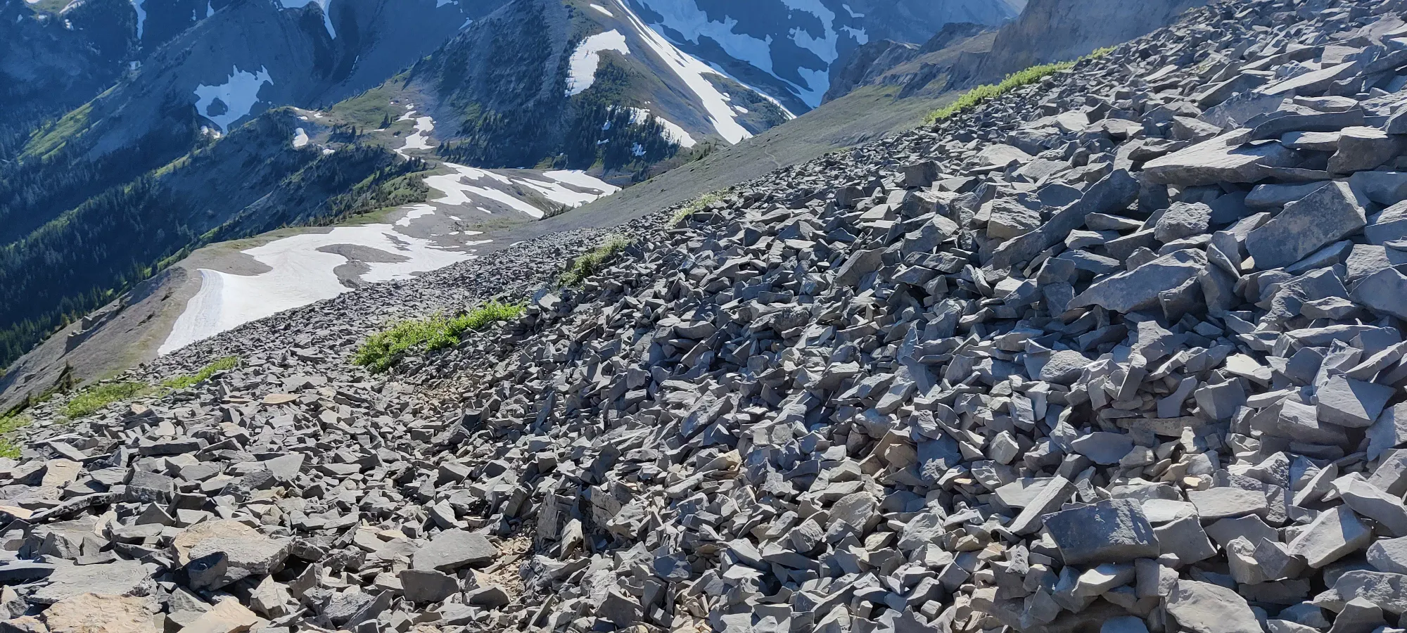
Despite getting basically half the distance up done in about an hour and a half, sadly, I was not halfway up to the summit yet time or elevation-wise, as things were about to get steeper, and the terrain much less easy to walk up. The next 15 minutes were about 25% steep trail and 75% steep scree claiming to be the trail, but there was enough solid rock poking out that you could find purchase without much difficulty, and at the end of it I was rewarded with 125m of elevation gained. However, what came next slowed me to a crawl.
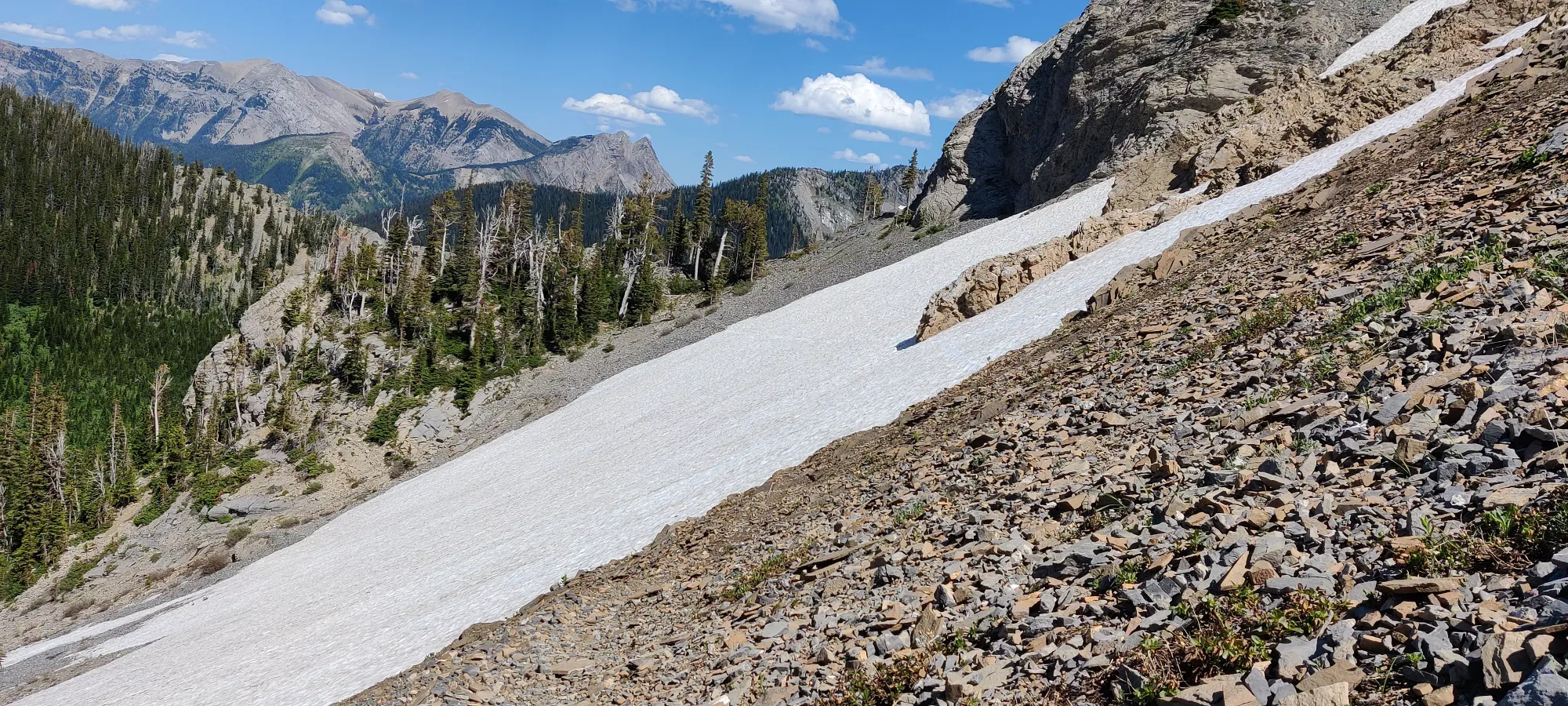
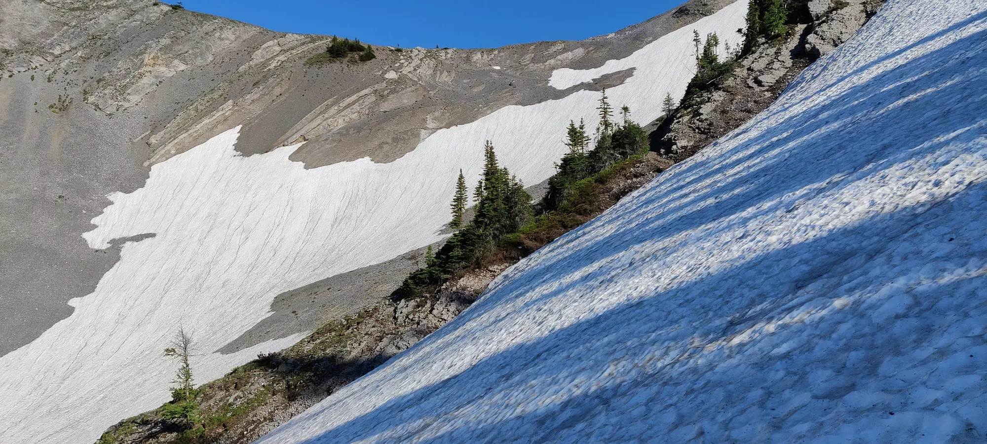
The next section took me just about half an hour to cross, despite gaining 0 elevation, and it only being about 100m long. Why, do you ask? Well, that's because it is basically a giant, steep scree slope one must cut across, except it was covered by snow, with no broken trail. I also did not have boots and crampons to confidently just smash across, or even an axe to make myself less concerned about sliding down, as a misstep would assuredly sweep you quite a ways down, and ignoring how much it'd suck to get back up, it's steep enough however you do stop at the end, it'd be violent and almost assuredly break something. So, cursing myself the entire way across, I slowly kicked some steps in and traversed across. After a depressing half hour of painfully slow kickstepping and praying, I made it across and out of the snow. This is the only section you'd need em, but I'd recommend spikes and an axe for this alone. Or go soon enough after someone else that the tracks are there, or just wait for the melt.
With that out of the way, now a much longer than expected 2 hours and fifteen minutes in, I continued on relieved to "only" be side-hilling on slightly-flattened scree on the slopes. Fifteen minutes brought me 7km in, where there's a fork to take "the long way" around, or you can turn left to head more directly up the mountain and avoid a long 270-degree loop. I decided to go with the former, as the AllTrails GPX I downloaded said to go straight, and it had kinda been off the trail the whole day. About 15 minutes into that (2:45 into the hike), I was at 2260m elevation, looking up the steep, mostly-scree face, but with a usable path through so you didn't slip all that much.
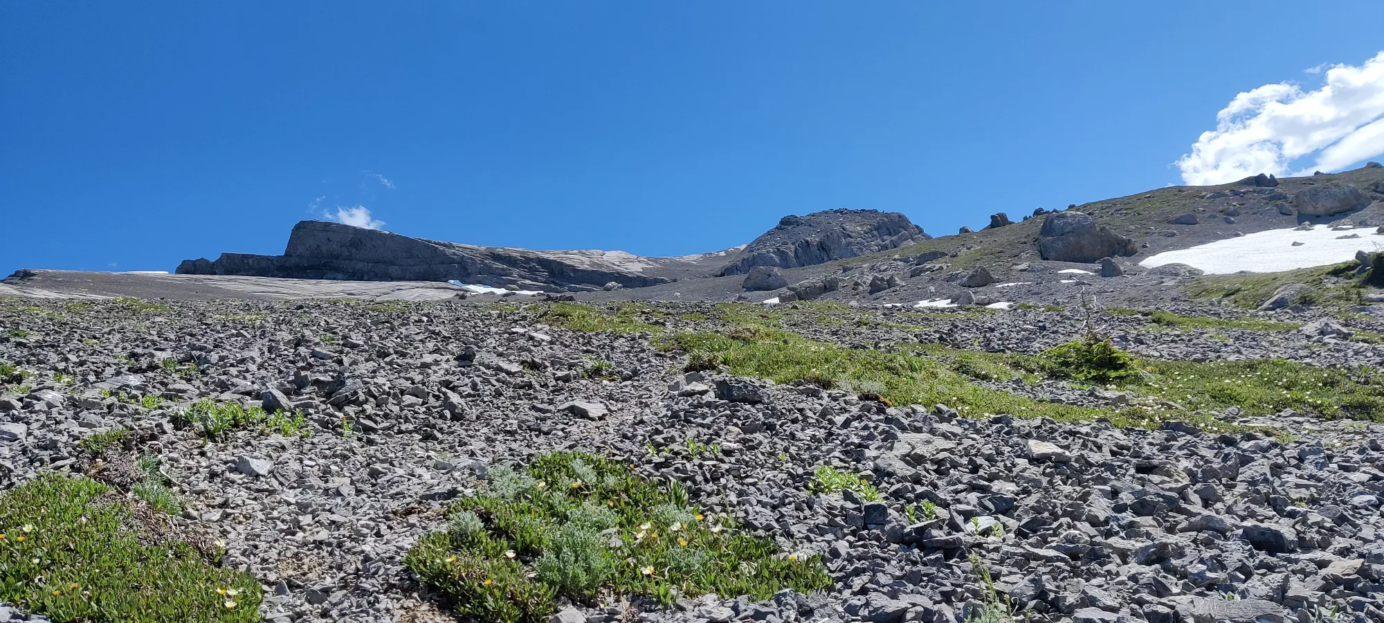
The steep slope continues until about 2380m, where it meets back up with the trail that loops around. For reference, this section was about 1.38km for me, but would've taken 3.24 the long way around, so it's less than half the distance going the steep way, in my opinion worth it as long as you can handle the steep slopes well. It took me about 40 minutes to take the shortcut, and once it meets up with the loop trail, it mellows out a bit. From here, you're just side-hilling on scree until the summit, basically. I took another break 3.5 hours in at 2520m, with the summit looking kinda far still, but definitely in reach.
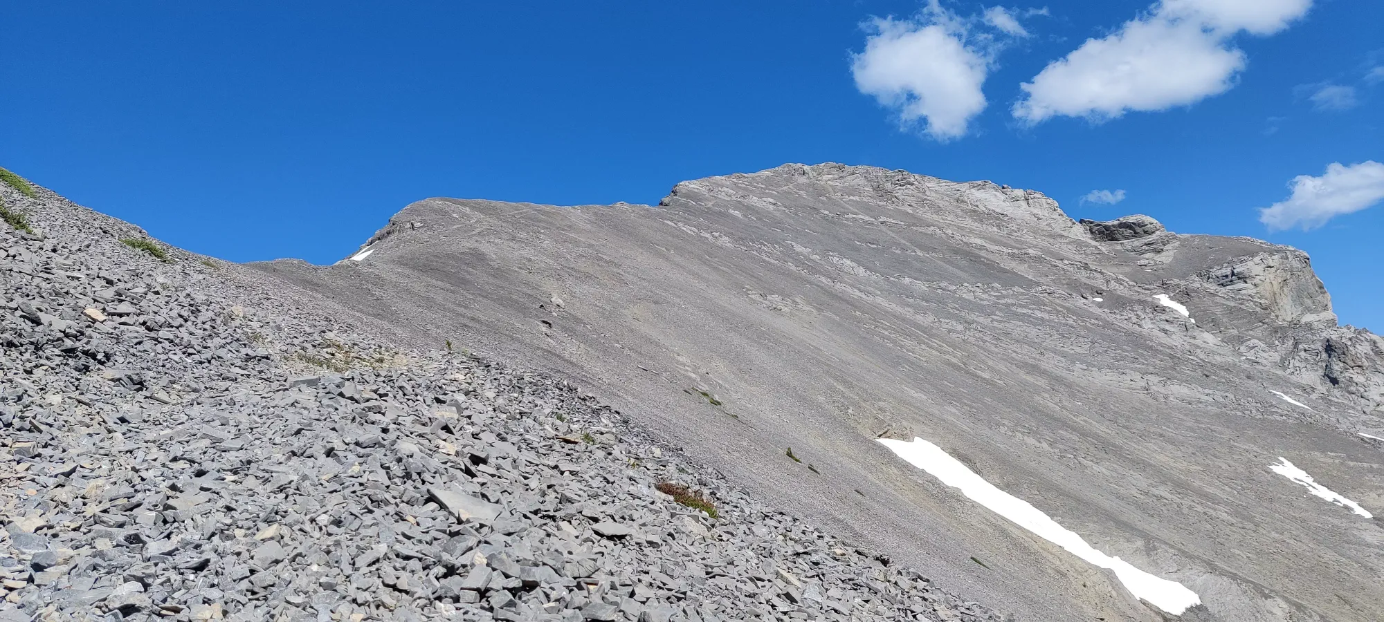
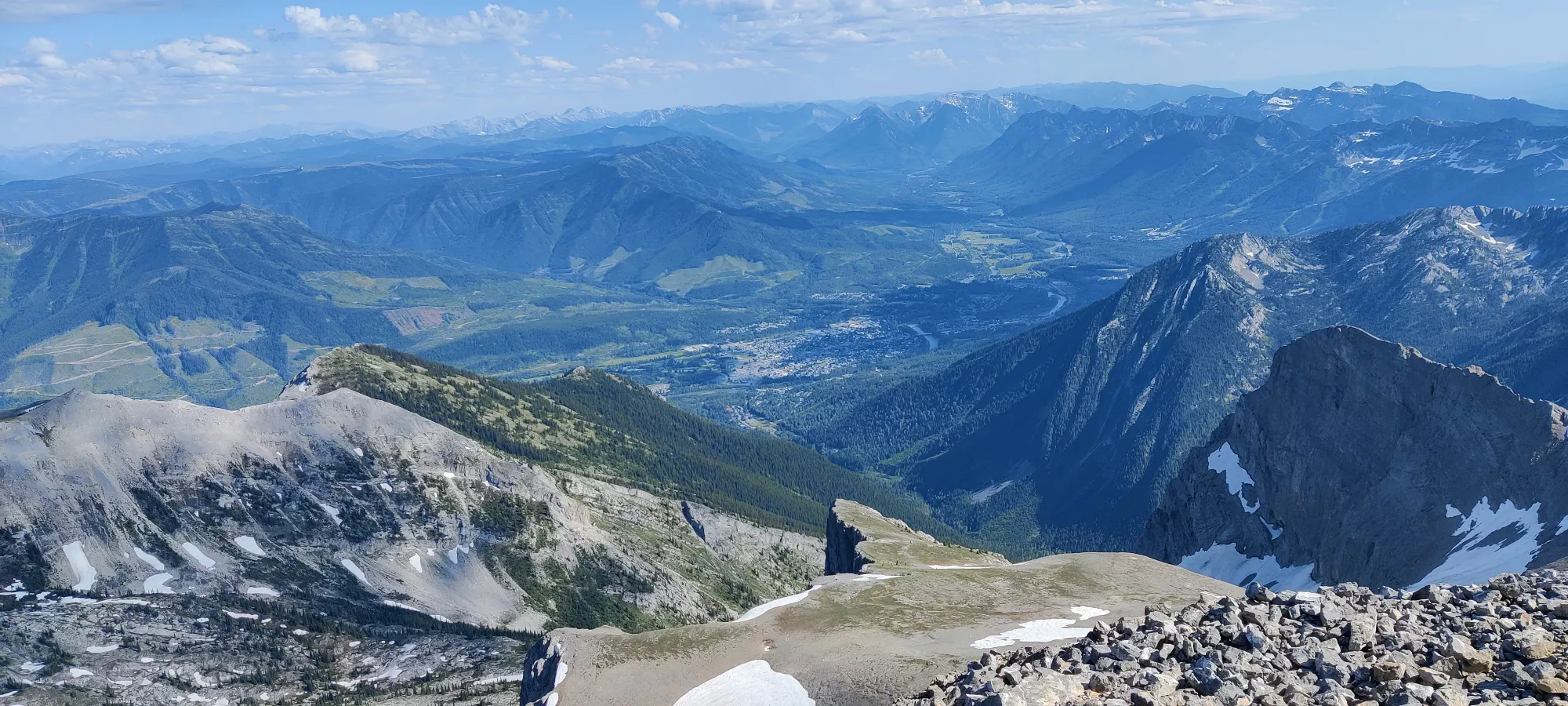
At this point, I was feeling kinda gassed. The day before was 11 hours of driving, and I'd also eaten breakfast at about 8:00 and only had a muffin since, so I was feeling that a bit. It took 45 minutes for me to get all the way up. I'd like to blame the insane winds for some of that, but they were mostly sideways, so I don't think that was a huge factor. Definitely check the forecast for the peak here, though, they were so bad I actually put my pole straps on (which I basically never do) because they'd 100% fly away if I let go. Thankfully it was still hot enough that it wasn't cold despite my shorts-and-t-shirt getup. The summit push is almost entirely just side-hilling on slightly-steep scree, and a couple minutes of mild scrambling to get on top of the summit ridge at the end.
What is your reward for this, you might ask? A large, green phallus, of course!
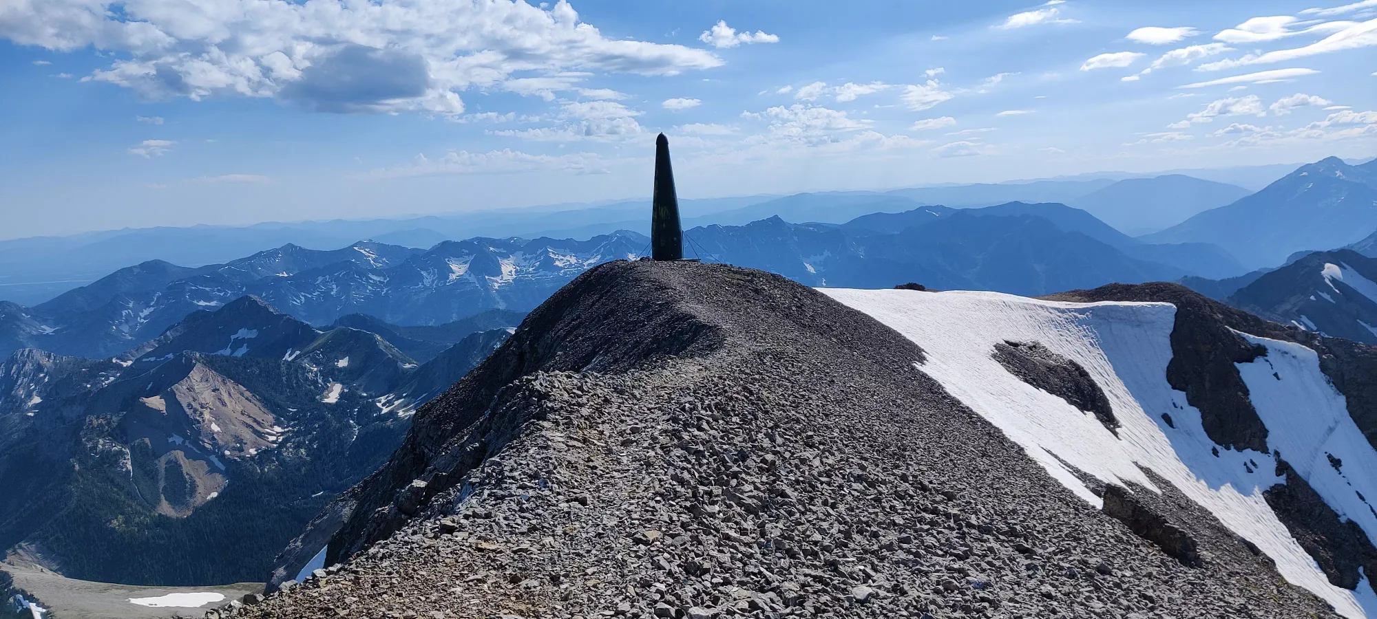
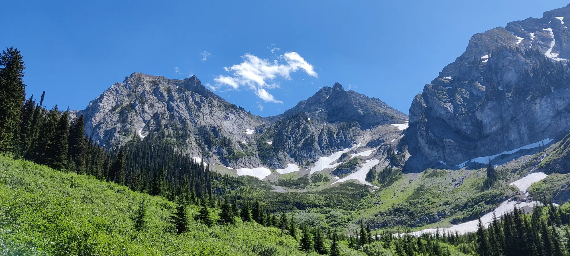
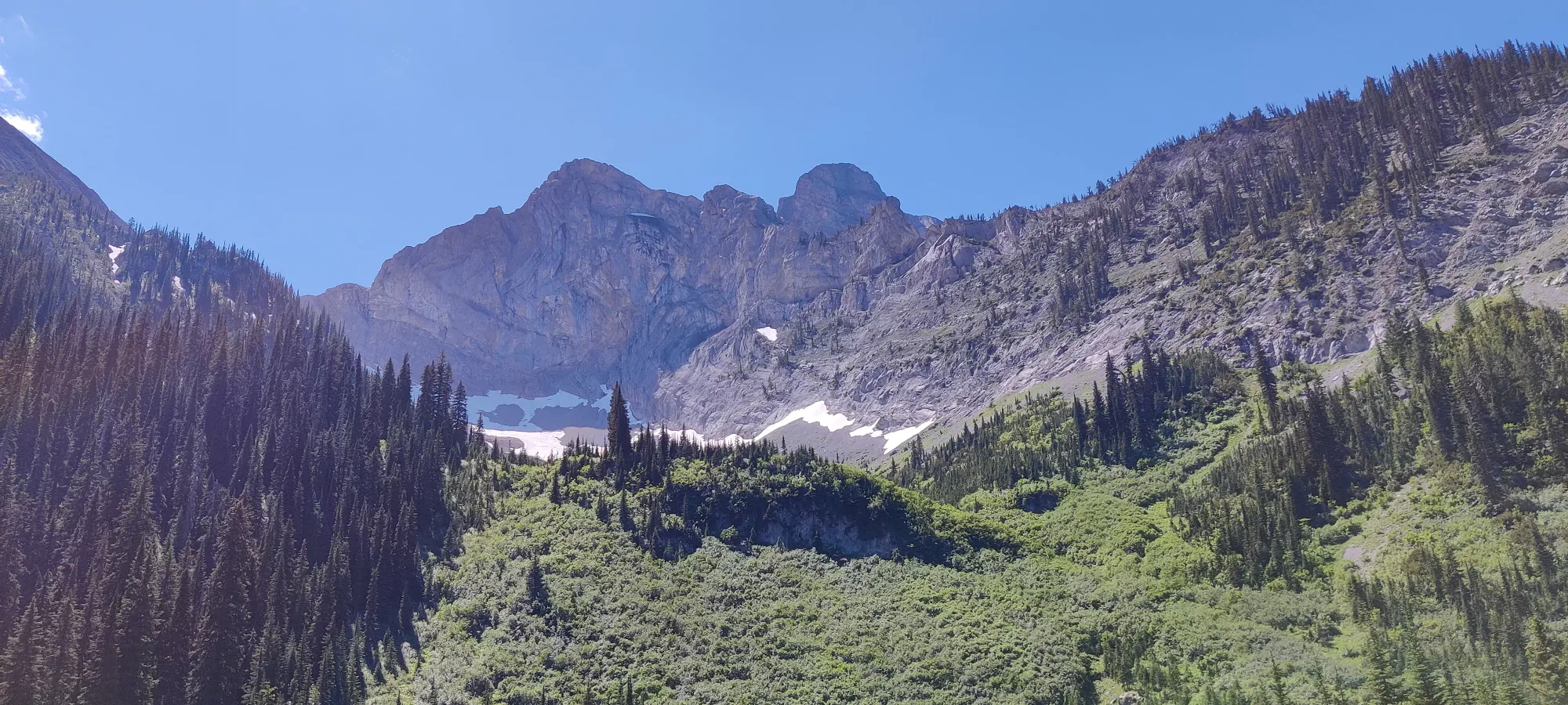
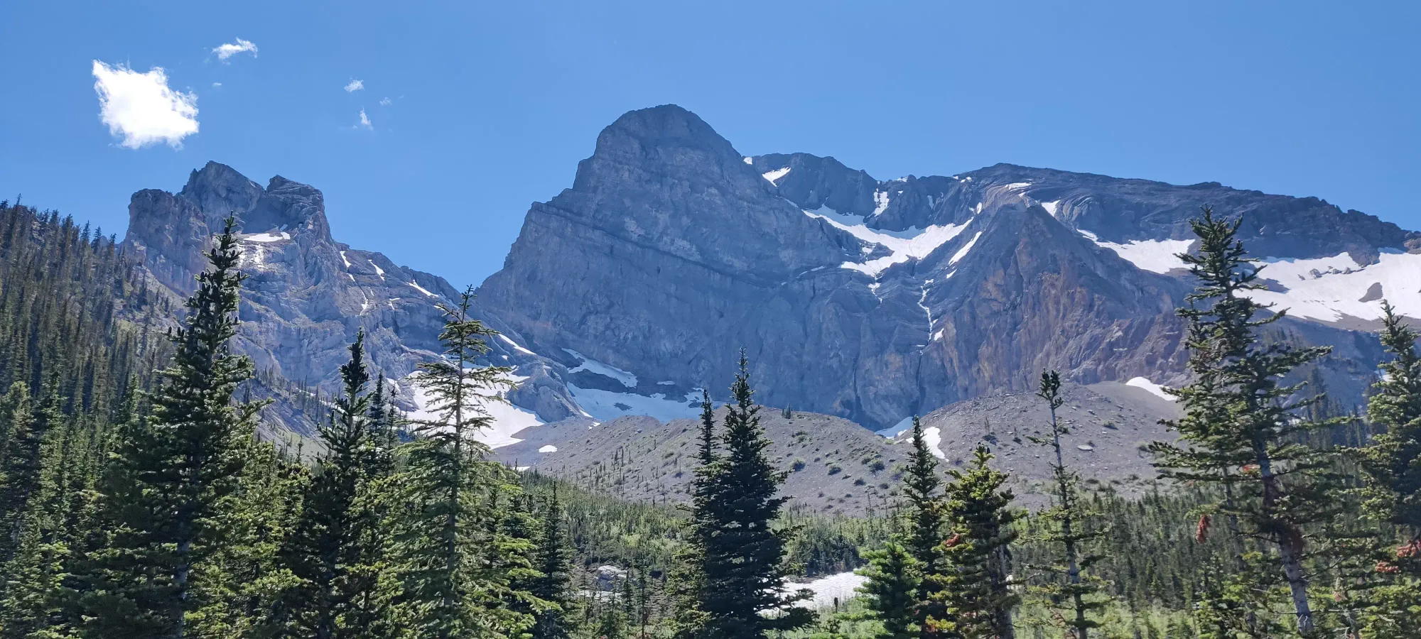
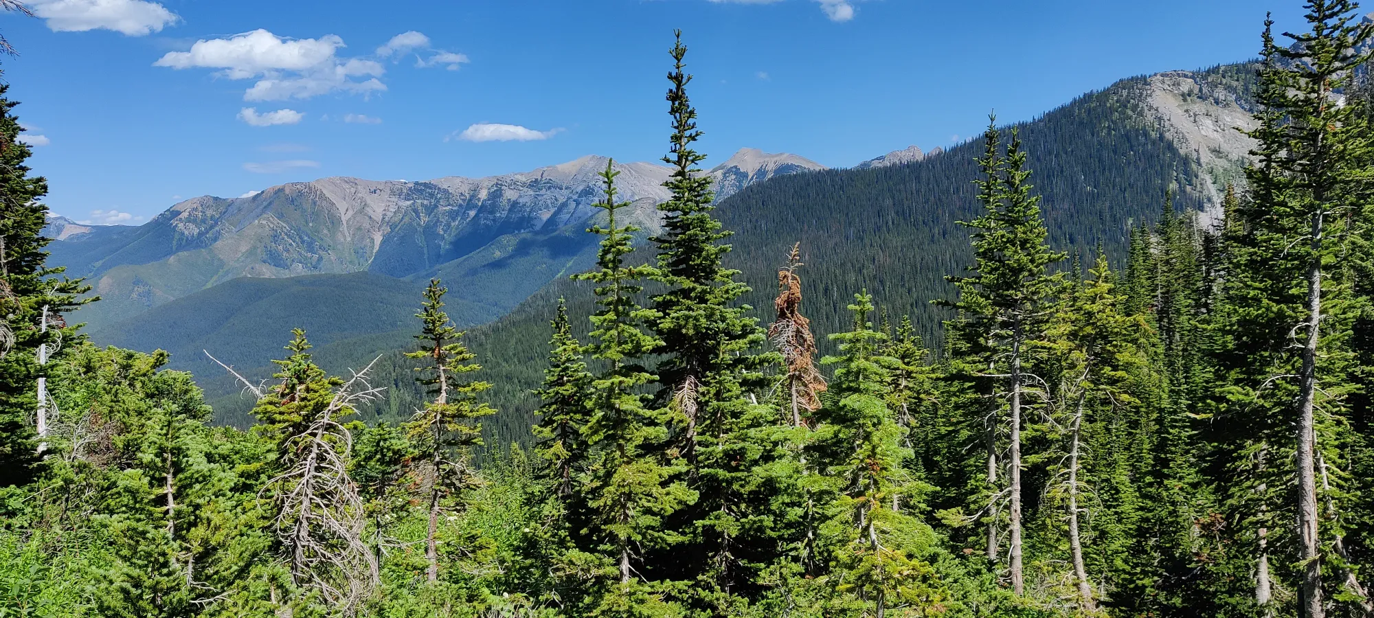
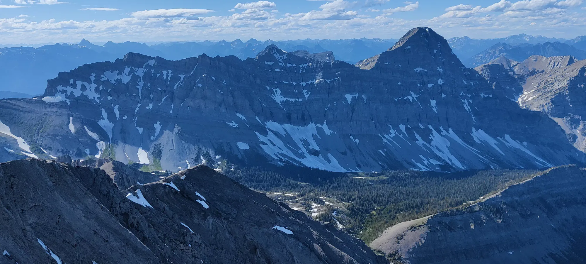
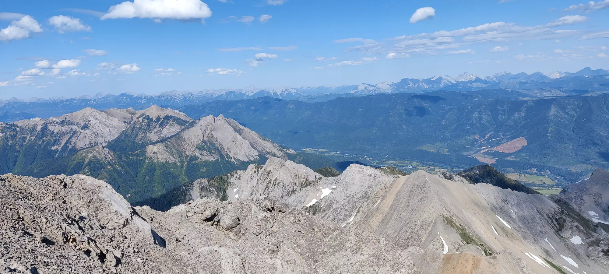
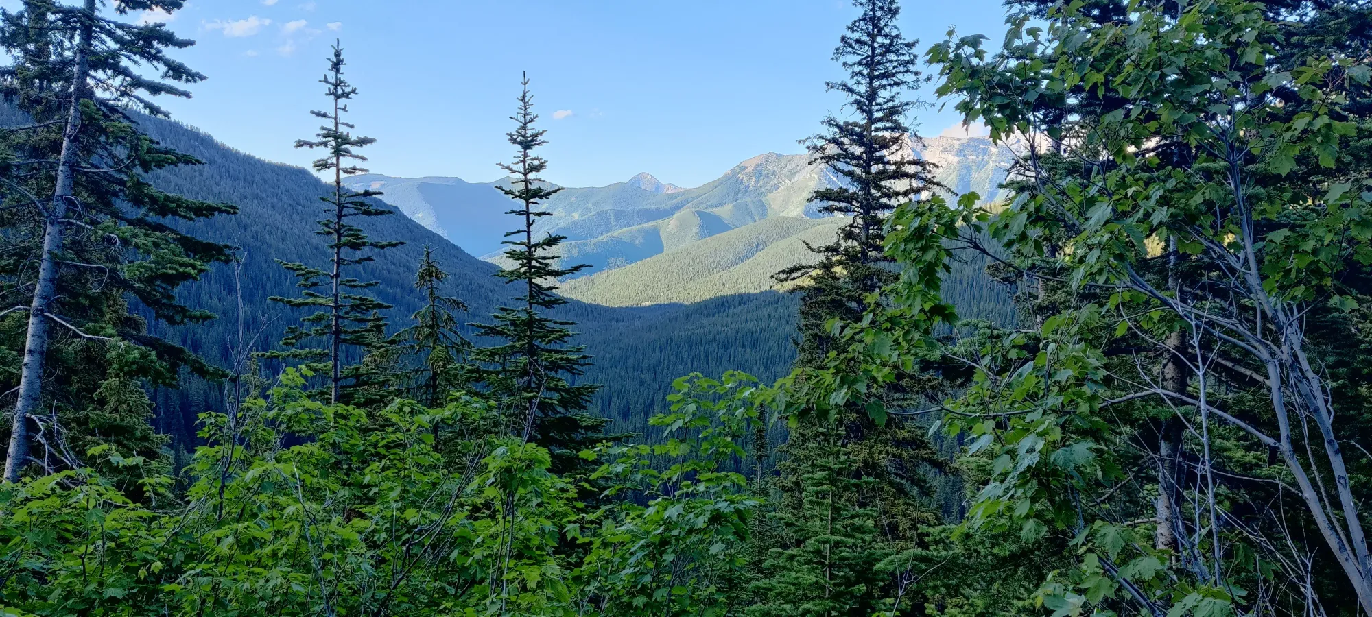
Aside from that, though, you get some pretty sweet views of the surrounding topography, as this is one of the tallest peaks around (though Mount Bisaro beats it out by a couple dozen metres). Sadly I do not know much about the mountains in this area, so I won't be able to provide much meaningful commentary about the surroundings.
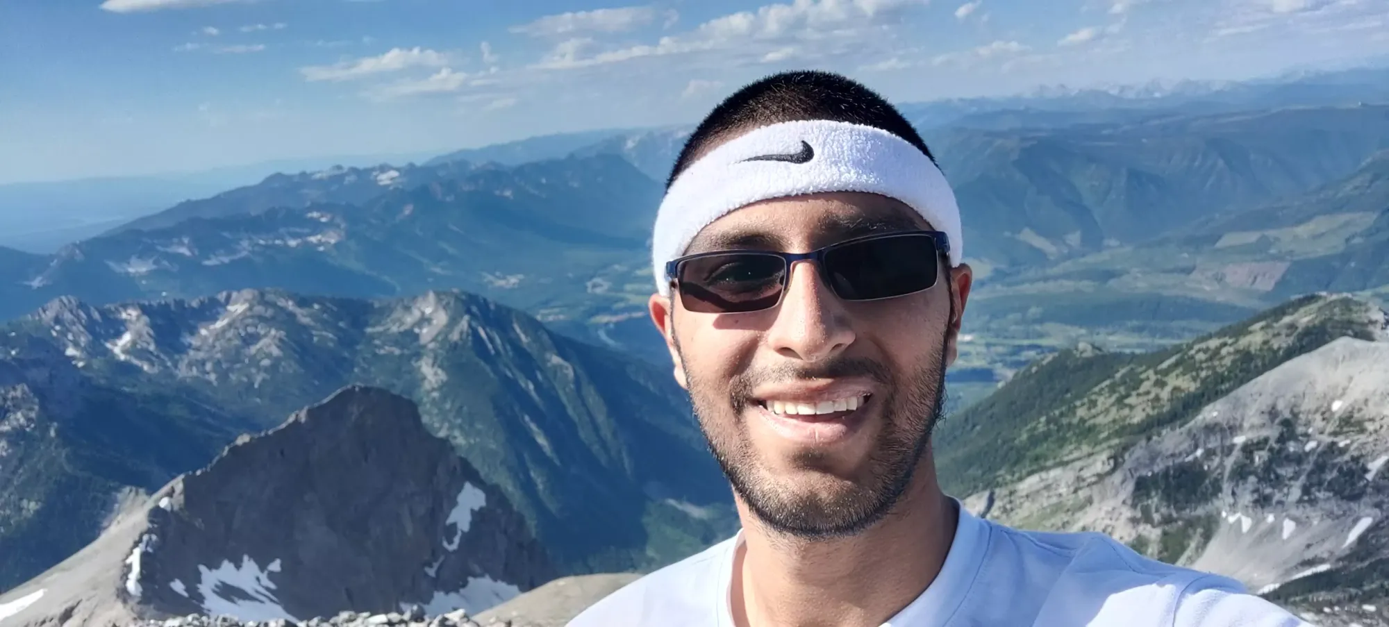
I lingered on the summit for about 15 minutes; took some pictures, had a snack, and started my way down. I'd have liked some more digestion and relaxation time, but it was now 4 and a half hours in, or 5:45, so I was racing against the sun. I had a headlamp, but I didn't really want to use it, especially since the drive down wasn't an easy one, and I REALLY didn't want to injure my car on the first day I got it.
The descent was not really much easier (though less tiring) until I got to the shortcut fork, as the scree was loose and steep enough to make it a bit challenging to confidently bash down. Half an hour was on-pace to get to the car by 9, which was my goal, so I was still happy.
Here, now 5 hours in at 6:15, I made the bold choice of trusting AllTrails, and trying the other way down. I didn't fancy the steep scree descent the shortcut would offer, and I was hoping it might let me circumvent the super-steep snow slope that slowed me down on the way up. Plus, just past the fork was a clear trail, and even a sign plus picnic table, it must be the right way to go!
What a fool I was! The first couple kilometres were pretty nice, actually. Gentle slopes easy to walk down, more snowy patches but they were shallow and no trouble to cross, and in 10 minutes I'd managed to descend almost 100m! However, that was very much a short-lived burst of excitement, as about 1.5km into this section, the trail forks. If you go straight, you end up on the Mountain Lakes Trail. This might actually be a good trail to take, it's a bit further up the road, but the trail looked pretty good from what I could see. Sadly, that was not my path, I had to fork right, which basically looked like a whole bunch of nothing.
From here until you rejoin the path at the shortcut fork, it was a painful process of check the GPS, cry about the fact that it leads right into a group of trees, through a creek, or up a random hill, take a guess about where to go, and repeat. Some highlights include some fairly intense bushwhacking, crossing a muddy swamp where a creek opened up to a flat clearing, and way too much undulation. I wasted about half an hour doing this until I managed to regain the trail I took up at almost exactly 6 hours into the hike, at 2200m. Which, by the way, is only about 20m below where the "not a trail-trail" section begins, so it didn't even get me down any meaningful part of the mountain. A total letdown, recommend either just going back the shortcut, or taking the Mountain Lakes trail if the vehicle access is still good, and the part of the trail I couldn't see is also good.
After regaining, I was a bit tired from a decent uphill climb I took to regain the trail, but also relieved to be somewhere I could actually follow a path I knew led somewhere, so I pressed on with minimal delay. It was now 7:15, and the sun was getting close to being hidden by the ridge of Mount Bisaro to the west. Thankfully with the trail actually existing again, I could make better time, and with my steps already in the steep snow section, crossing that wasn't much of an issue, so I made it back to the top of the meadows in about 45 minutes.
I had to contend with 1 last steep scree-ish descent (but since this section also has some exposed, firmly-seated rocks it's much easier than up in the alpine), and some steeper dirt, but once I got down that and across the meadows, I knew I was in the fairly mild home stretch. It took 15 minutes to get across the meadows, and then 45 minutes to walk the last 4 fairly flat kilometres back to the car. The bugs whilst I packed up and put slightly less disgusting clothes on weren't the best, but I didn't want to just totally cake the new car in dirt, so I figured I had to at least try. Thankfully I had plenty of light to drive down, so I got back to town, pigged out on some dinner, showered, and crashed.
Overall, it was a pretty good hike. Hopefully this beta will make it to someone and prevent them from making the poor decisions I did. The views were great, as is being able to say I bagged the best-looking peak in town. Plus I got to put the new car to use immediately, so that feels good. Wish those hiking shoes didn't tear my heels up though, that'll delay the Canmore peak-bagging a bit... C'mon Salomon, do better!
GPX Track + Map