Snowshoe Peak - September 28 2024
A somewhat out-of-the-way peak in NW Montana that makes for a great scramble. Being an ultra means it has excellent views, and the remote location makes for a more rugged ascent than many other American ultras


Cabinet Mountains, Libby, Montana
2663m
With the long weekend for the National Day for Truth and Reconciliation coming up, and my having been in a bit of a slow spell since my Rockies trip at the start of the month, I wanted to make up for it a bit. So, I decided that I'd leave work a bit early on Friday, and do a nice little road trip down to Montana/Idaho and go for a couple ultras that would otherwise be, if nothing else, difficult to arrange as a weekend trip, and certainly too much driving for a day trip.
Unfortunately, despite leaving at a good time, I was (and still am at the time of writing) suffering from some nasty side effects of a recent medication change, and as a result was already tired at the time of. That meant by the time I drove through Sandpoint, Idaho in the late evening, I was ready to call it, so I stopped there for the night. In the morning, I woke up with a tight quad, again courtesy of those side effects, but I shrugged that off, and started the couple-hour journey towards Libby, Montana, and the trailhead. Sadly, I had to make a couple bathroom stops en-route, so by the time I actually arrived at the trailhead (which required some easy offroad driving, most anything should be able to make it with care to avoid potholes), it was already almost 1pm 😅
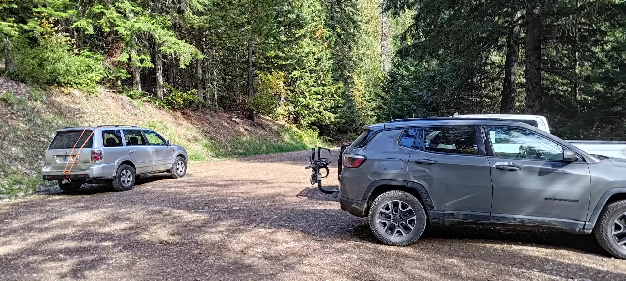
Thankfully, the stats weren't too bad (under 15km, 1500m of elevation), so I still had some hope I could get things done reasonably (I decided not to worry about the 7-hour drive I had to get from there to the next objective for the time being). So, after getting geared up, I left the car at 12:52pm.
Almost immediately, I knew this was going to be a day, as I had some difficulty shaking my muscle tightness off, and was getting tired right off the bat, even though I was just starting the hike, and was on a good trail. I just decided to take things as they came, and go until it didn't make sense, accepting that I might have to do a bit of headlamp hiking to get things done.
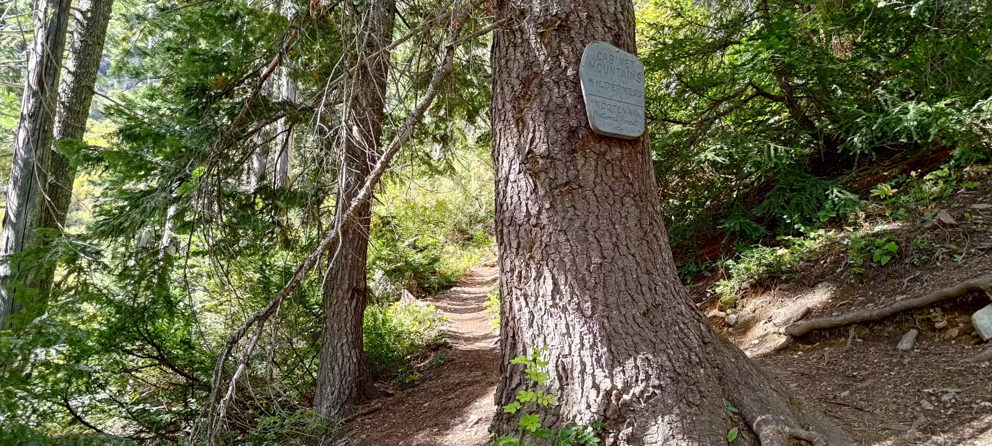
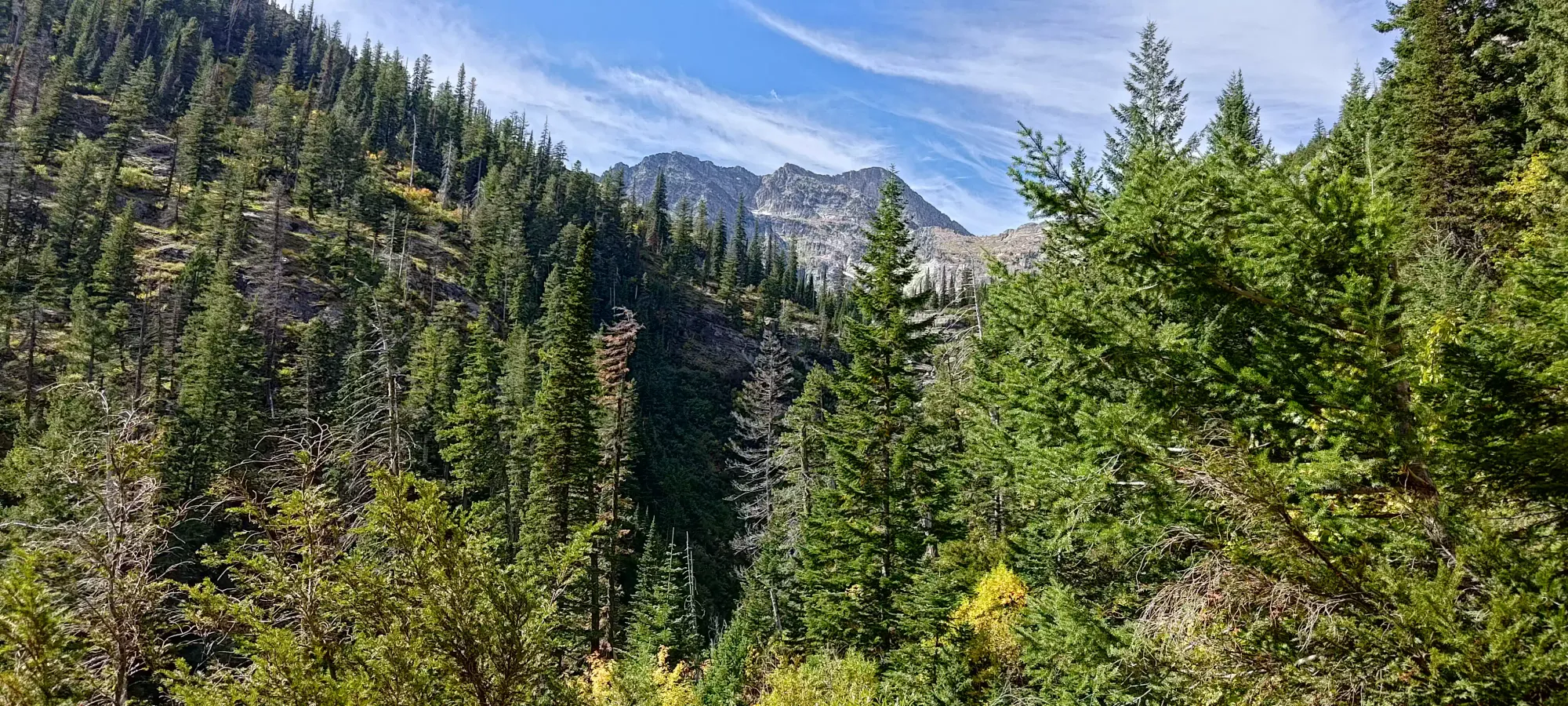
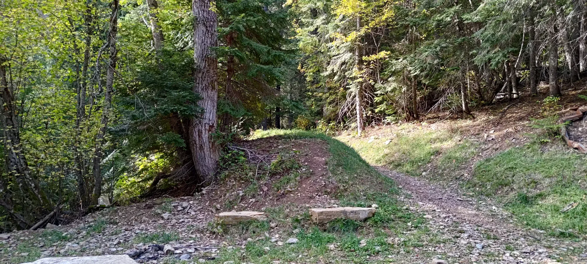
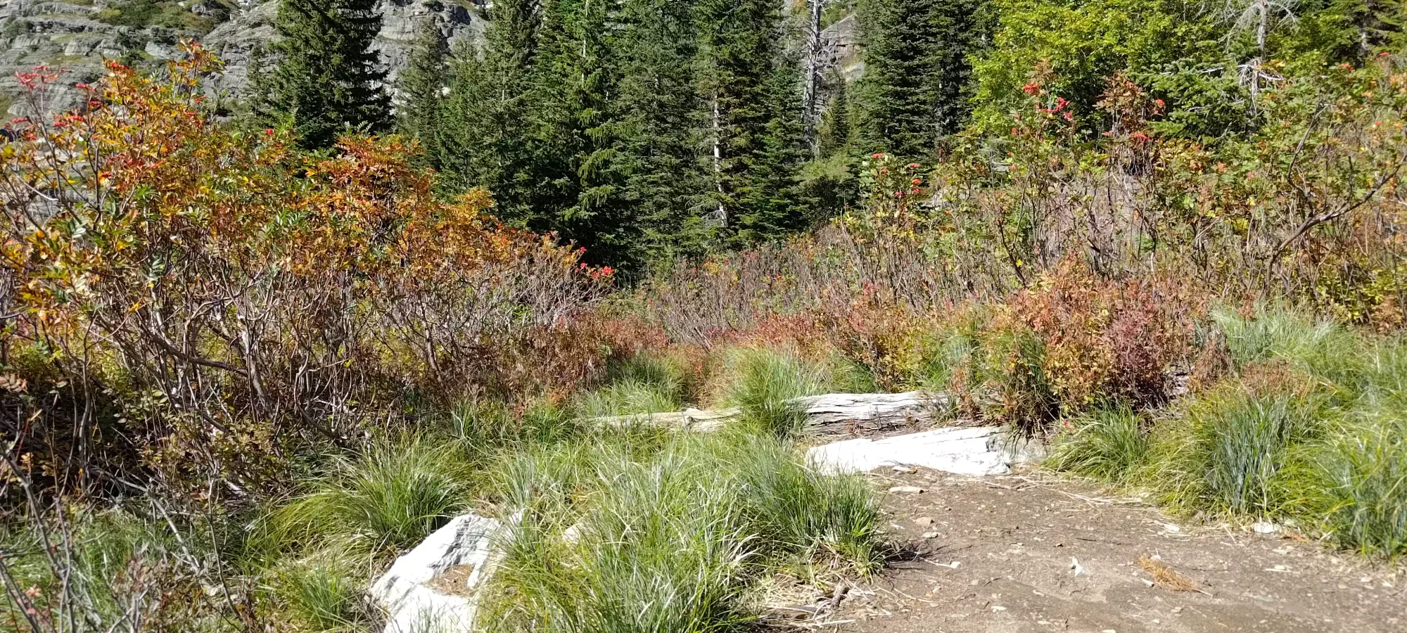
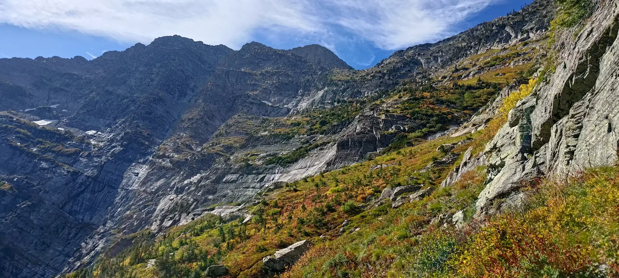
The Leigh Lake trail is in decent shape, and spends a short time in the forest before peeking out into the treeline, hugging the bottom of a cliff band below Bockman Peak before arriving at Leigh Lake. As I was walking along the bottom of the cliffs, I wondered if there were any crags in that area, as those cliffs looked both fairly accessible and like they'd offer fun routes.

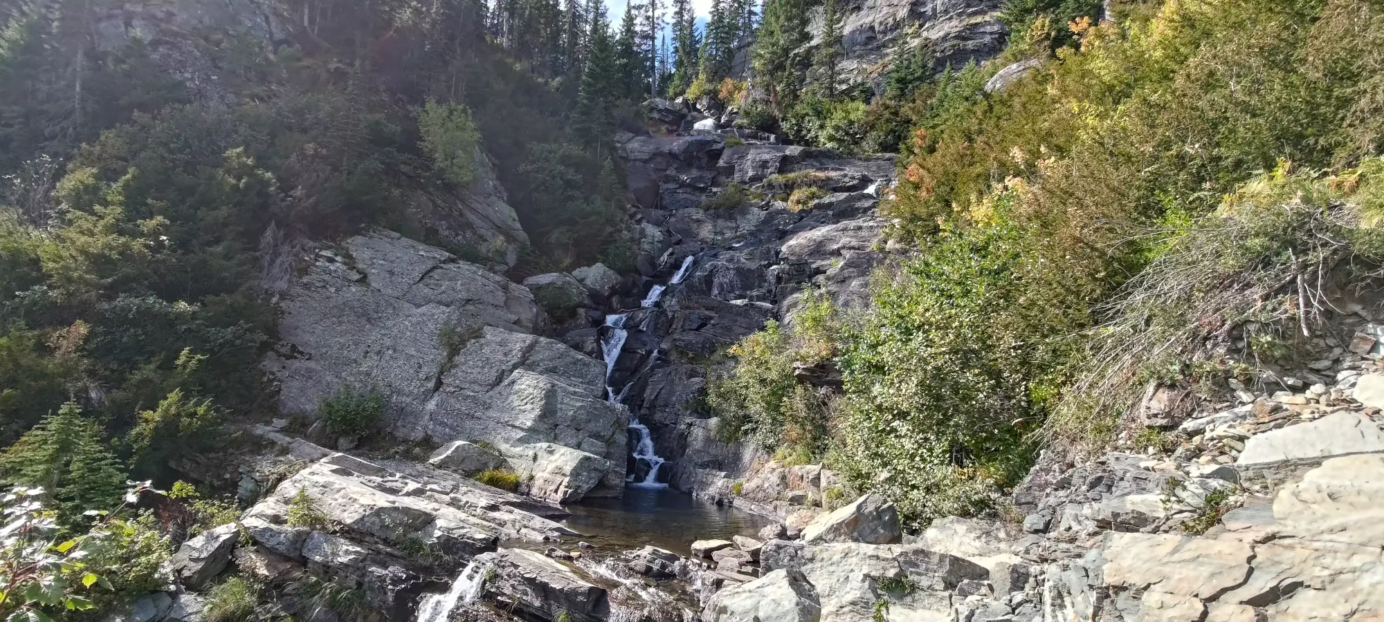
In a bit over half an hour, I reached the bottom of a pretty waterfall, which had a confusing sign in front of it, indicating that there was somehow a trail that either went up the waterfall, or crossed the creek and just went up the random cliffy terrain to... somewhere? After remarking that the pool below would make for a great swimming spot for those less pressed for time (and warmer), I continued on up to the lake.

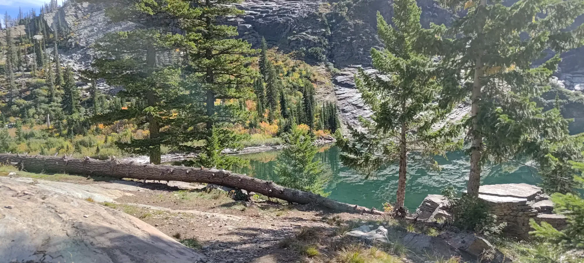
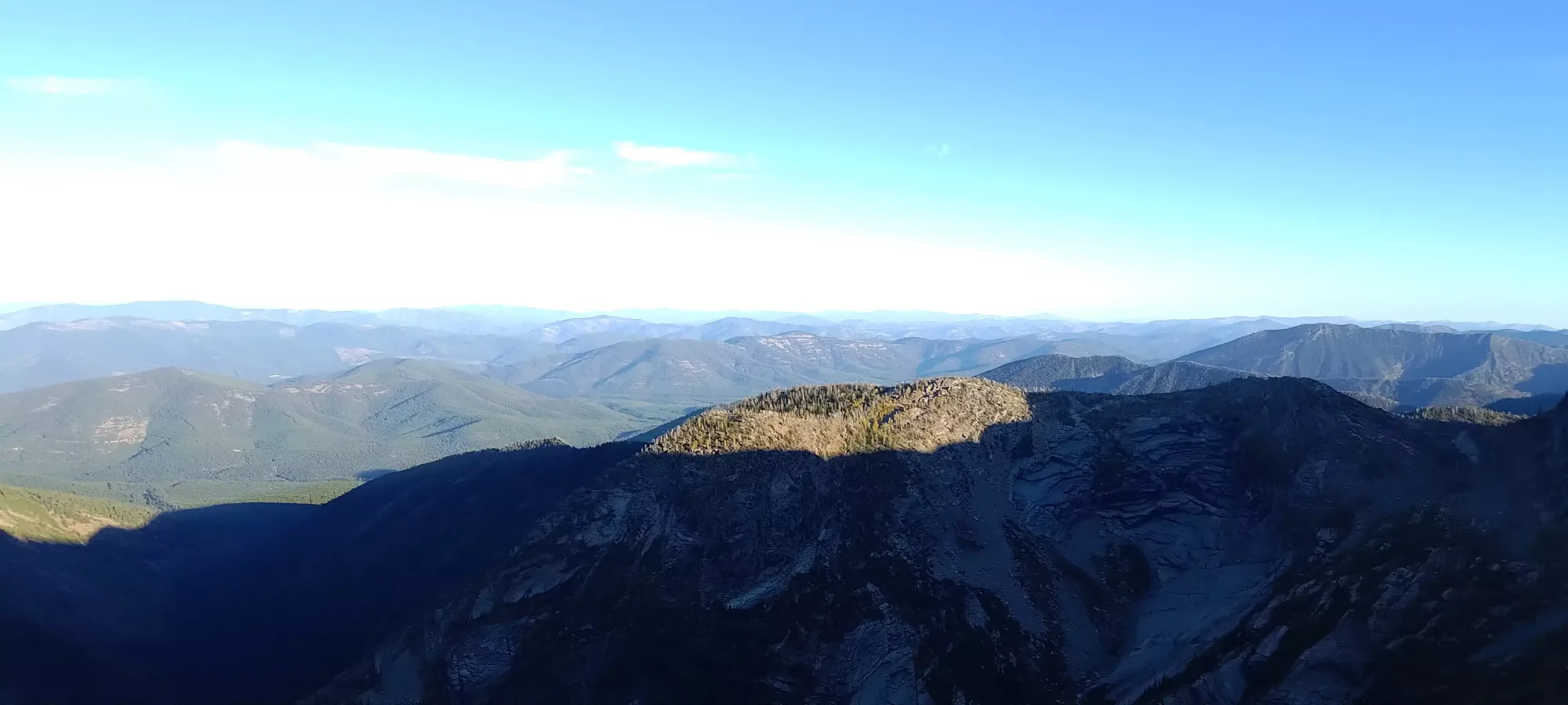
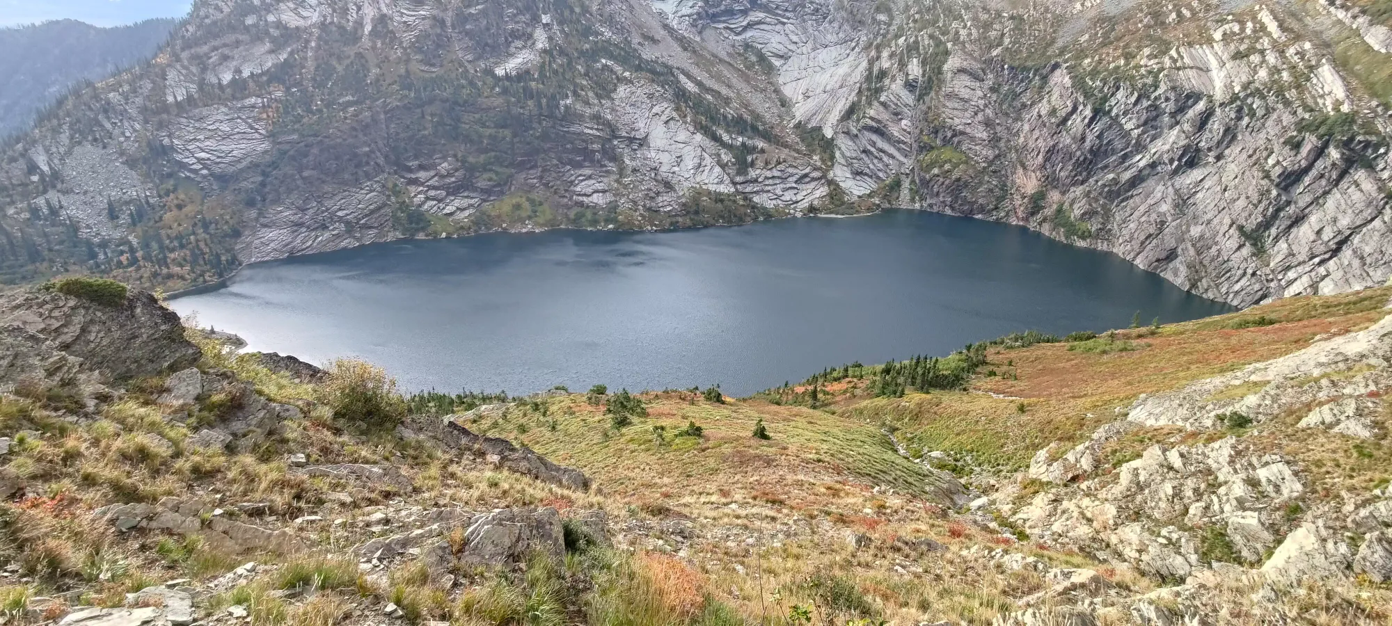
With about 15 more minutes of hiking, I found myself at a local high point, where I could finally look over the super-reflective Leigh Lake, and see the surrounding peaks. It's definitely a pretty area, and one could justify coming out just for the lake if the summit is a bit out-of-reach.
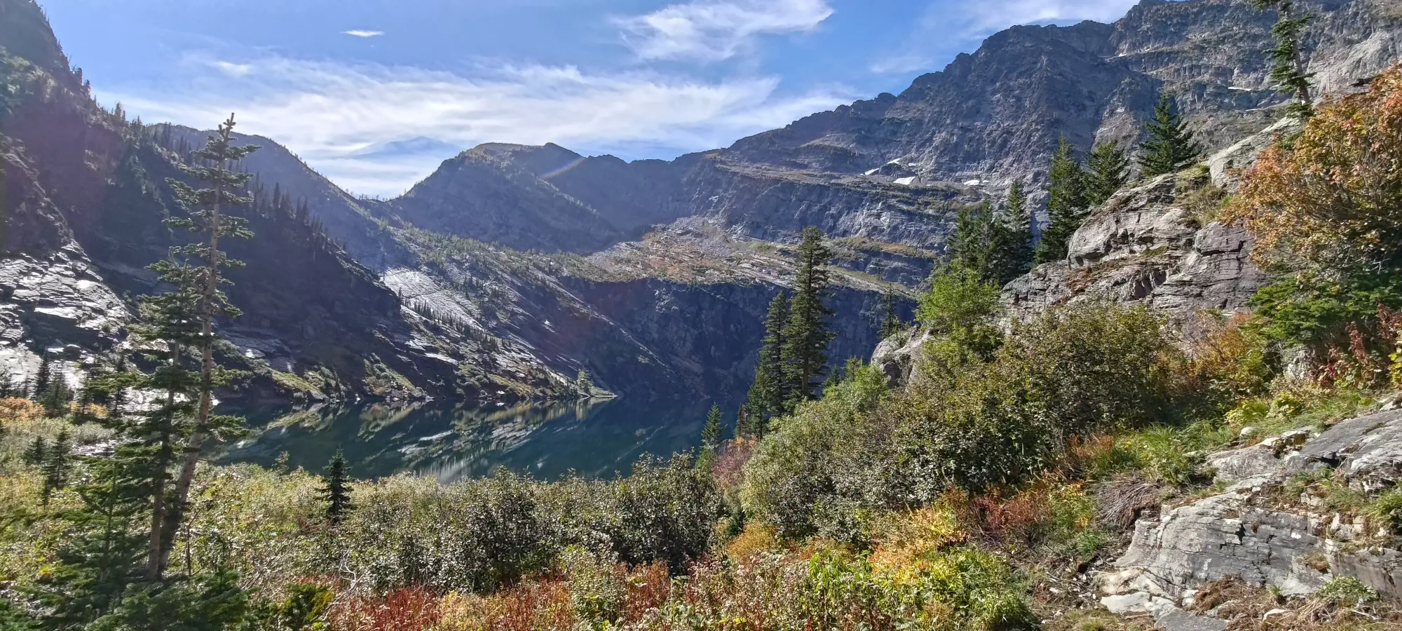
A few short minutes after that, I found myself at the end of the official trail, just above the lakeshore. There, I rested for a couple minutes, and hunted around for some unofficial trails which I'd read existed, and would bring me around the lake towards the meat of the ascent.

I soon set off on the first trail I found, which looked like it led down to the lakeshore, which aligned with my expectations based on previous trips I'd read up on. I didn't end up picking all the "best" forks, and had to do some mild bushwhacking to get myself to the right spot, but after 5-10 minutes I found myself a better looking trail, and started to make my way northwest and uphill, towards the Bockman-Snowshoe col.
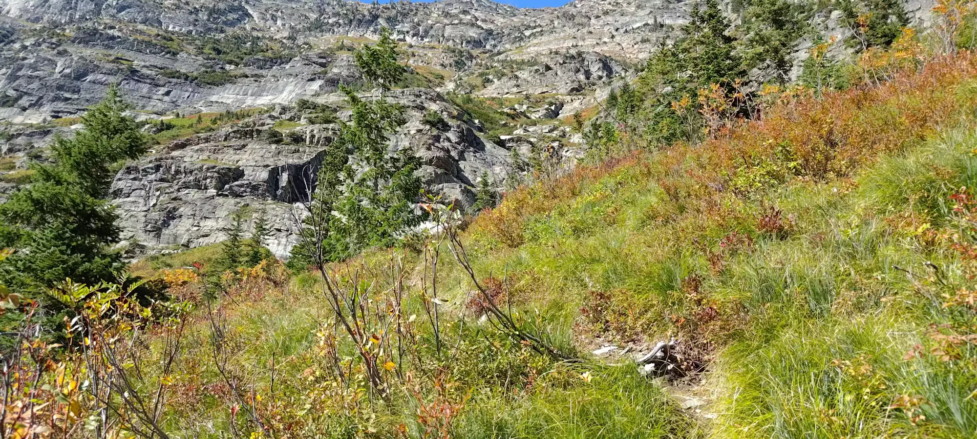
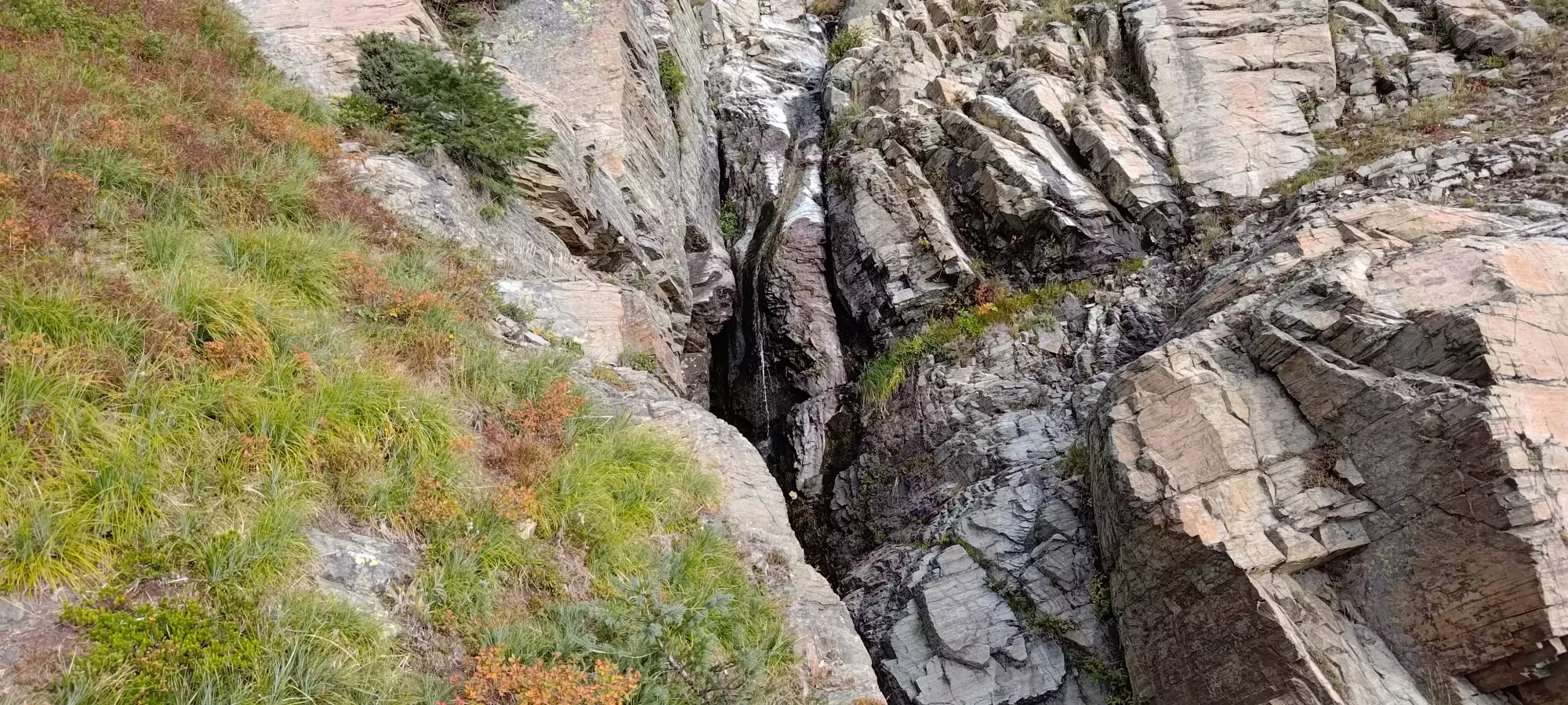
The "trail" quickly turned from pretty well-defined to yeah that's less grassy than the other spots to well, I guess that'll work. There were hints of drainage paths, game trails, and sometimes human-carved trails in the terrain above the lake, but they appeared and disappeared very often, and generally were hard to discern from each other, so at some point, I just gave up on following them, and just "went up the terrain that made sense", along with some guidance from GPX tracks to stay roughly on course. The biggest challenge was making sure to cross the large chasms where drainage collected and ran down the mountainside, as there were many spots where they were basically unnavigable, so finding the correct spots to get across was a key factor to one's success.
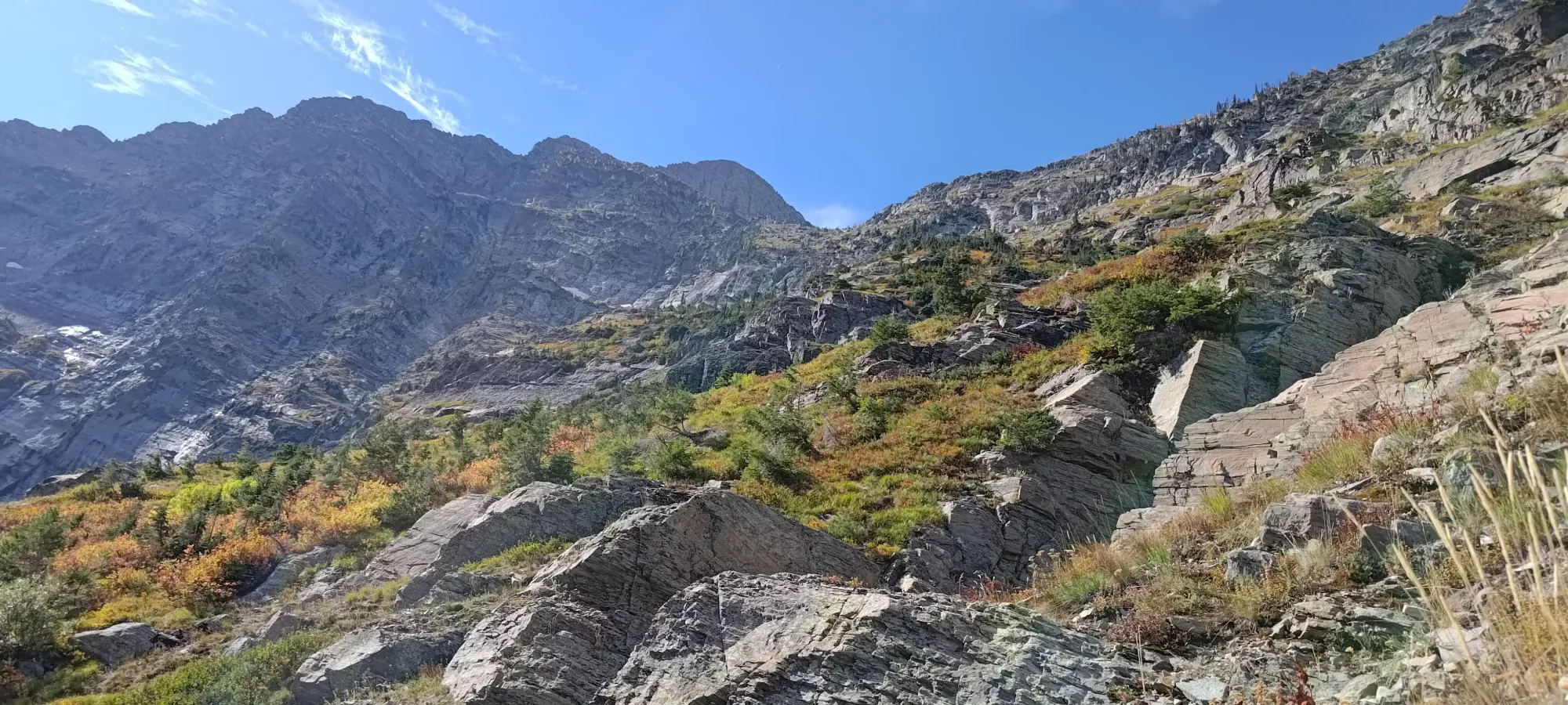
Soon after I started making my way up, I realised that the col I was originally looking at was way too far around the lake, and the actual way up was the Bockman-Snowshoe col, and I had to recalibrate my orientation a bit. I actually overcorrected a bit, though, and ended up taking a more directly "up" route than most others I'd seen online, probably just out of a desire to avoid sidehilling on the steep and slippery grass on the NW side of Leigh Lake.
Over the next couple hours, I slowly made my way up the grassy slopes between the drainage paths, trying to head more to climber's left, so I could at least end up at, if not beyond, the low point of the col, as most people seemed to join up with it a bit more to the west (left) side. I was pretty sleepy, though, and actually shut my eyes a few times when I found some shaded spots in the grass. By 4:40pm, I'd only made it to a bit above 2000m, so I knew this was going to be a bit of an epic. Given how much it took to just get to this place, and the fact that it was soon going to get snowed in, I continued on, accepting a bit of suffering for the ultra 😅
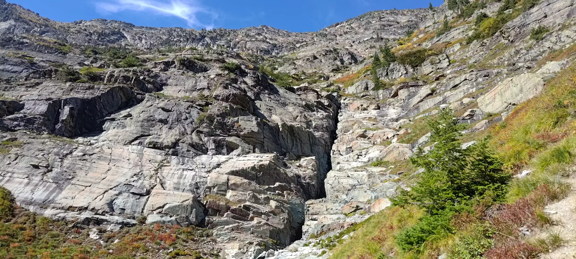
At around the same time, the route was looking steeper and more annoying to keep sidehilling, and I was pretty close to being below the low point of the col, so I decided to start scrambling up the rocky face above me, and traversing if/when I got to easier ground, hoping that would make for a more efficient and simple route than trying to find my way across the slippery grass as the route got steeper.
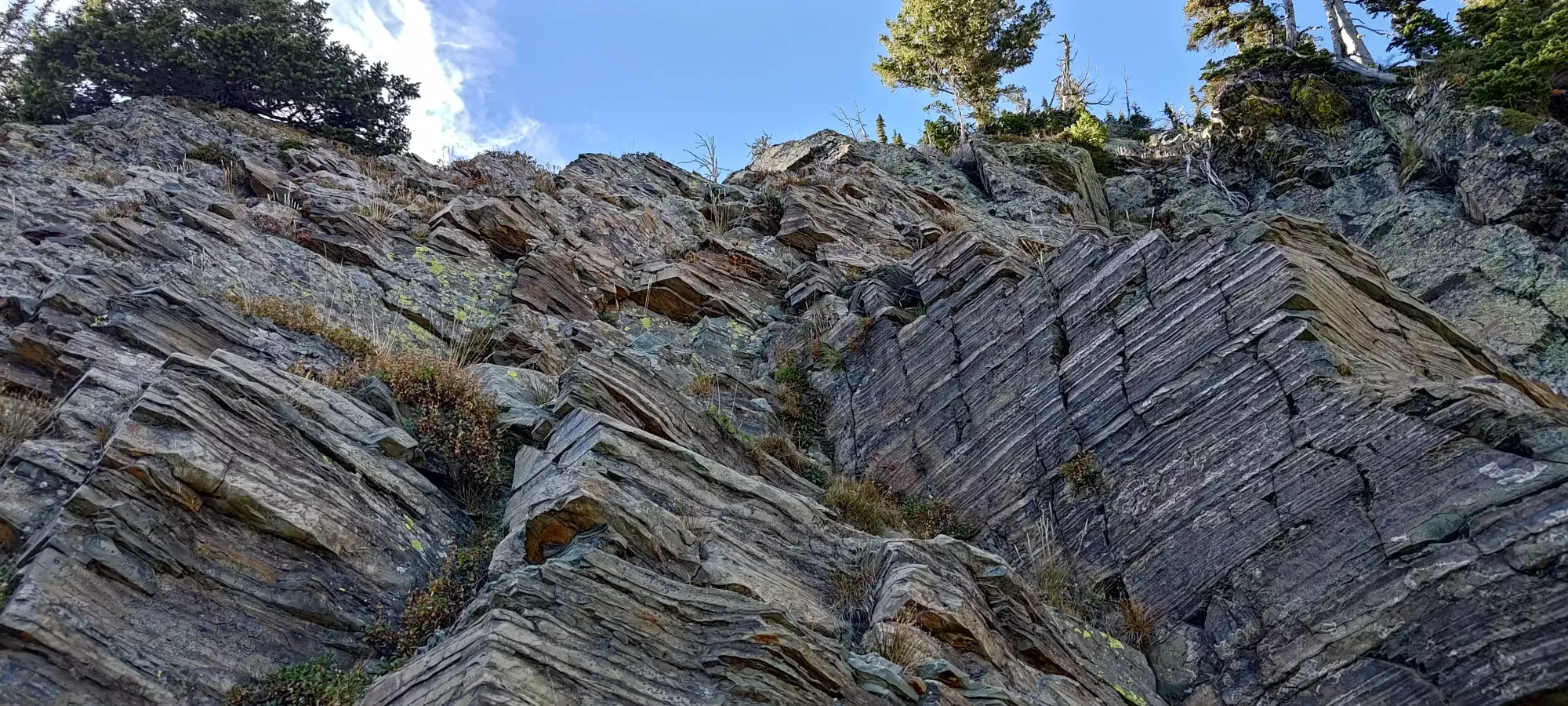
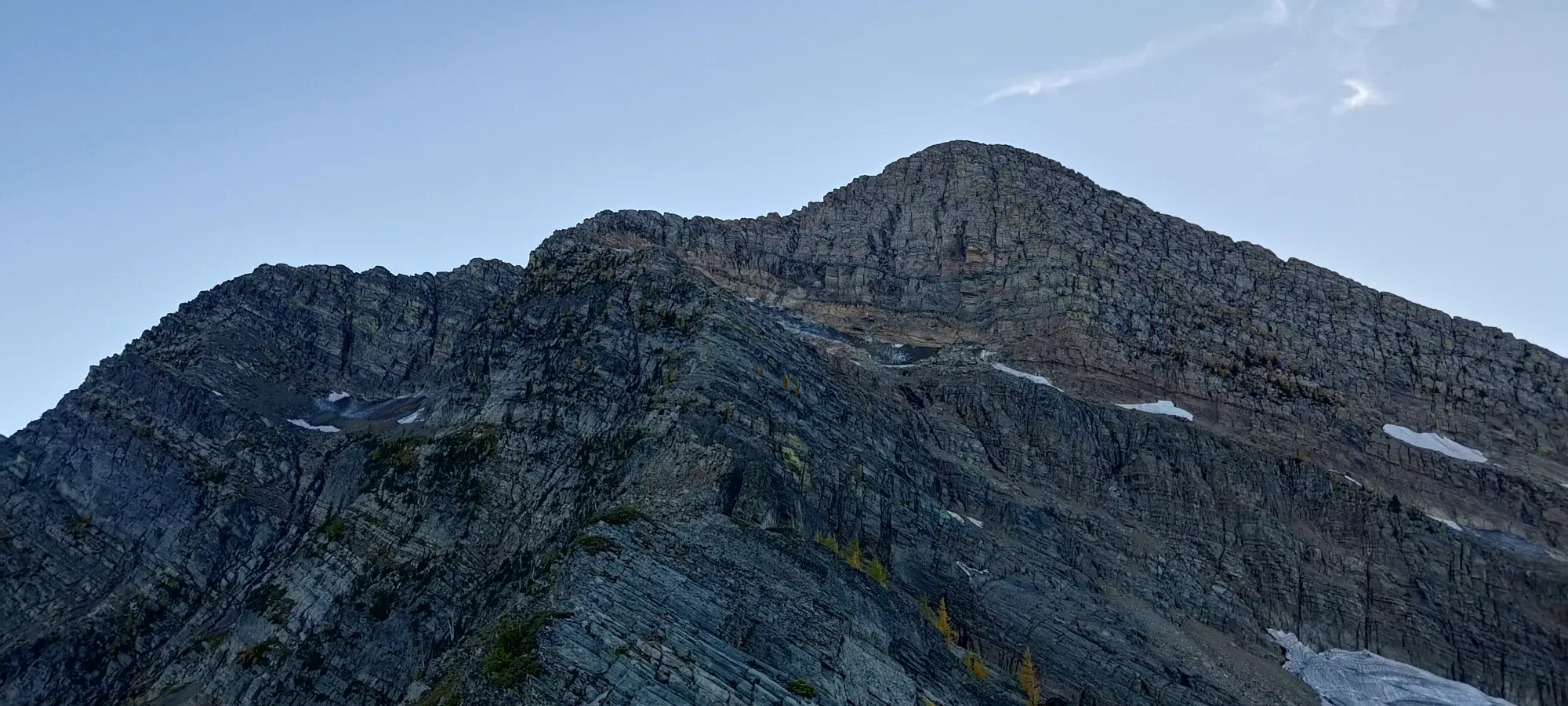
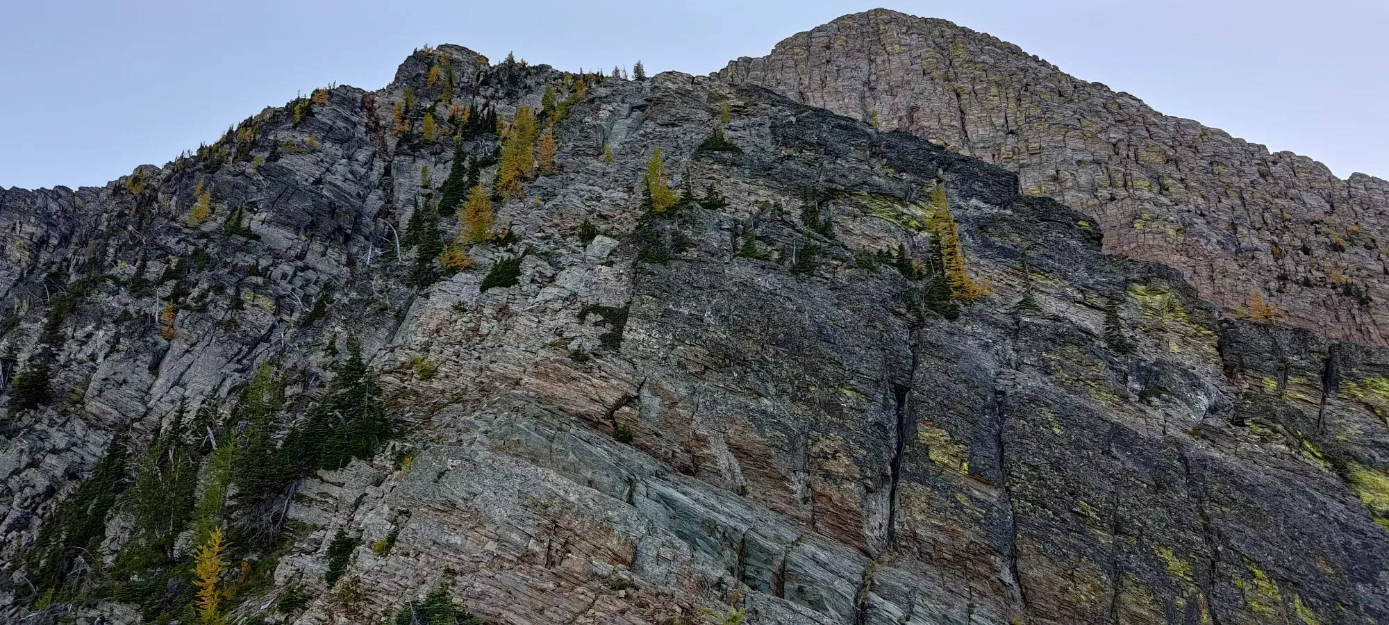
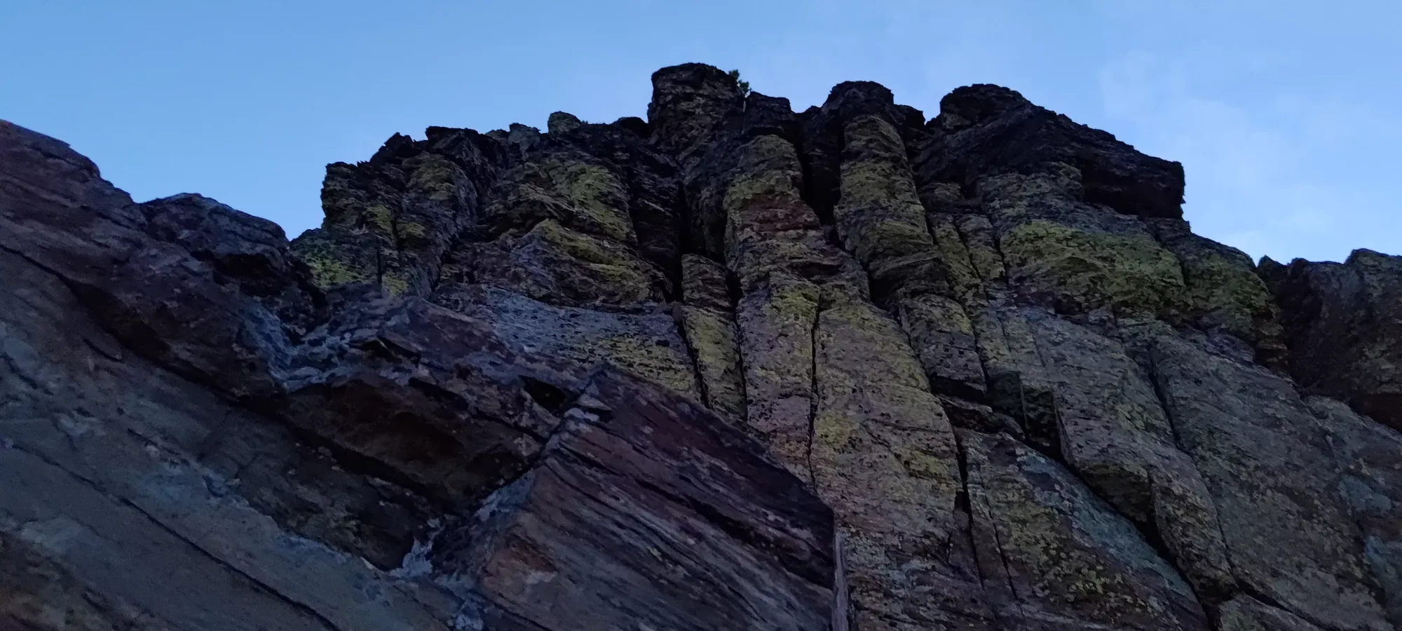
The scrambling here was actually pretty fun, with fairly solid rock, and a good amount of class 3/4, and even some low 5th moves tossed in for fun. It was absolutely not necessary, traversing more while still lower down would result in a much more hiking-focused route, but given I enjoy a hard scramble, and with the fall coming in earnest over the next weeks, I figured this might be one of the last opportunities I'd have to enjoy some scrambling. So, I just kept going up, and traversing when the terrain flattened enough for it to make sense.
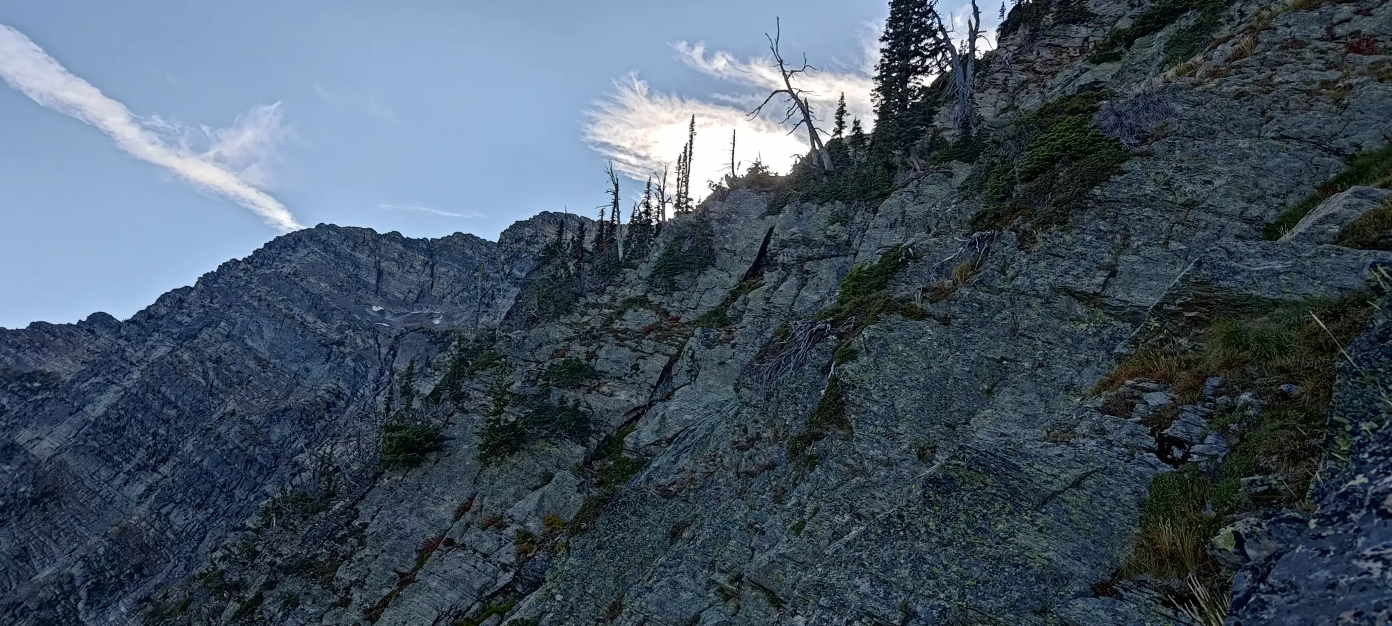
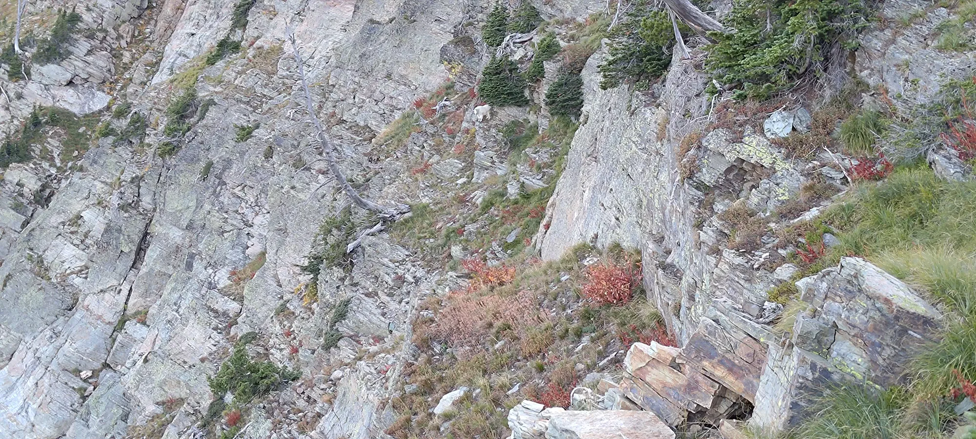
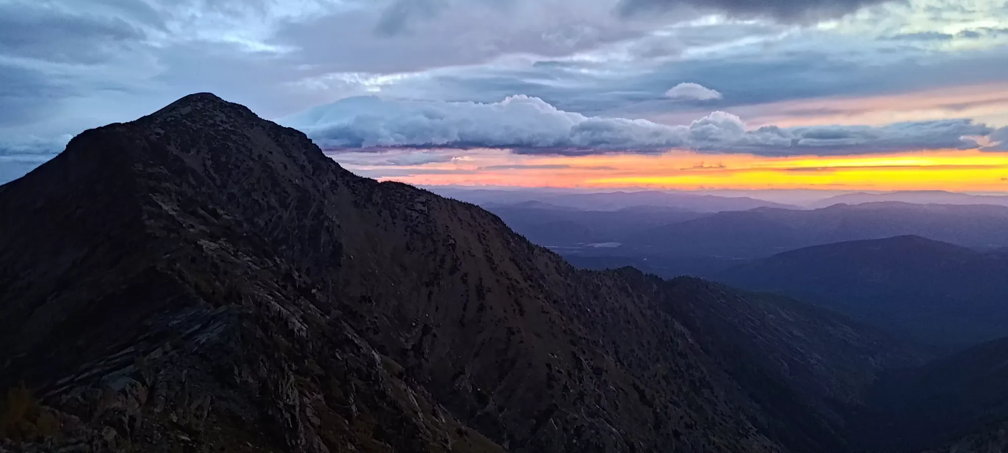
As I kept getting higher, though, the scrambling wasn't getting easier, and traversing was looking more and more gnarly. By 5:30pm, I was getting worried that I'd have a long, rocky ridge traverse to get down and back up the other side of the col on the ridge itself, as most of what I was looking at to get across was just sheer rock face. It still kept going if I went up, though, so I was not out of options, at least. I did find a mountain goat in the same terrain, so I knew something was able to navigate it, at least (the agility of mountain goats being far above that of humans notwithstanding).

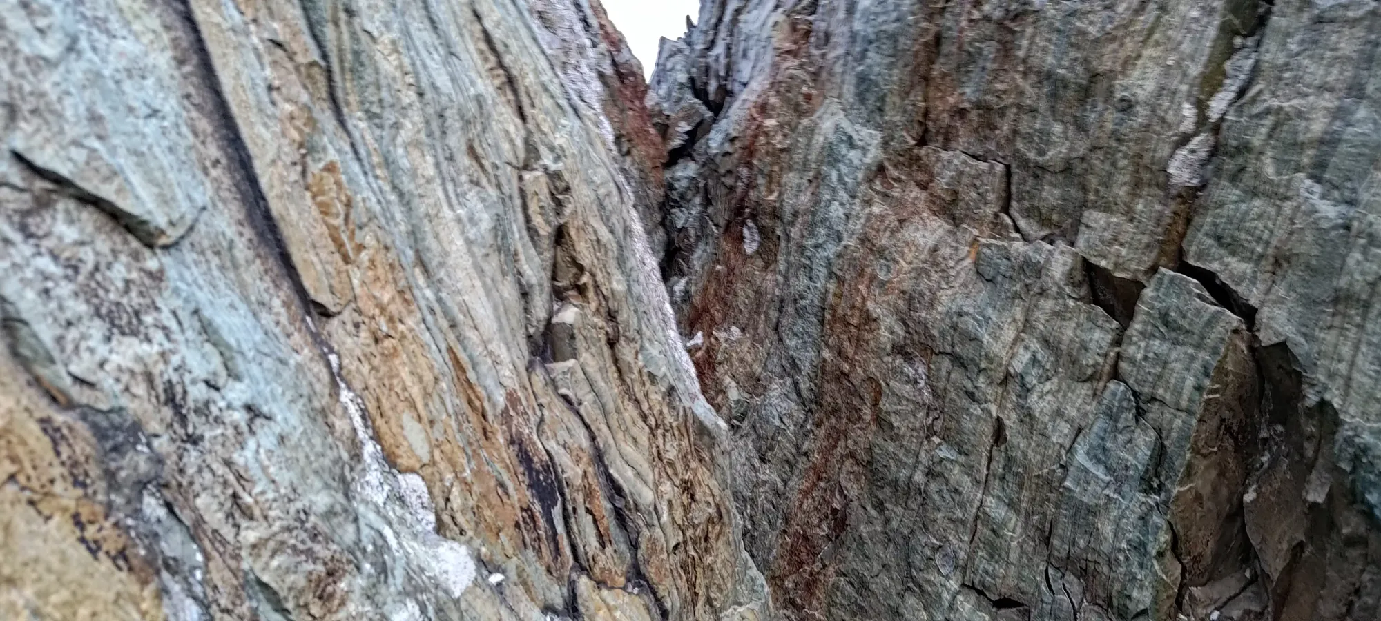
Of course, it is always when you give up a bit that you find more options, and not 3 minutes after taking the photo above, I found a decent ledge that let me travel a good bit sideways and closer to the middle of the col. Once it ended, I did have to go up a bit more, but was soon enough rewarded with another ledge I used to make substantial progress.

After those key traverses, I finally made my way onto the ridge at the low point of the col, right around 6pm. Only ~450m to gain and 2 hours until headlamp time! On the plus side, while my route up was fairly involved, and would make for a rather difficult downclimb in the dark, I could easily make out the easier route to take back down, so I wasn't worried about having to return to the lake after sunset. And so, with some amount of enthusiasm restored, I continued on up the NW ridge.
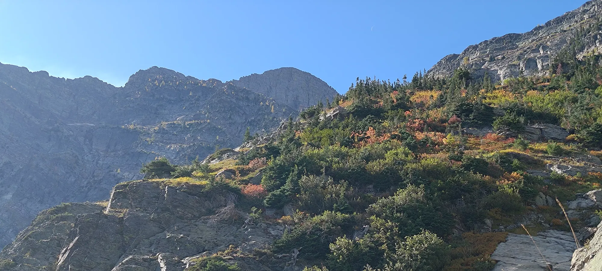
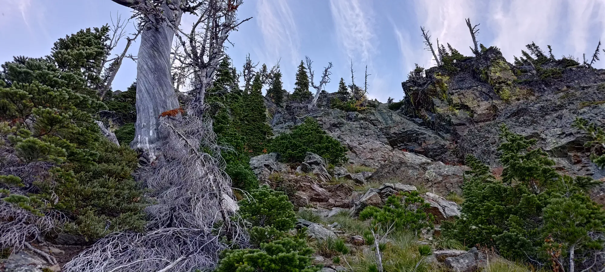
As I started making my way along the ridge, travel got easier than it had been previously, with a higher hike:scramble ratio than the last couple hours getting up to it had presented. In about 15 minutes, I made it to 2300m, where I first started noting potential bivy sites in case the terrain got too gnarly to continue in the night, and I needed to find a sheltered spot to hunker down (the night was forecast to bring very strong and cold winds, persisting into the next day, so I knew I couldn't just stop wherever). I wasn't explicitly planning on using one, but knowing that I was wanting to nap in the early afternoon, I figured it was a real possibility.
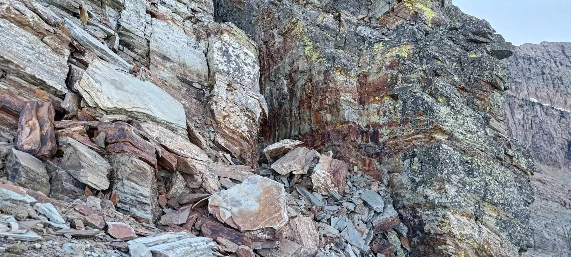
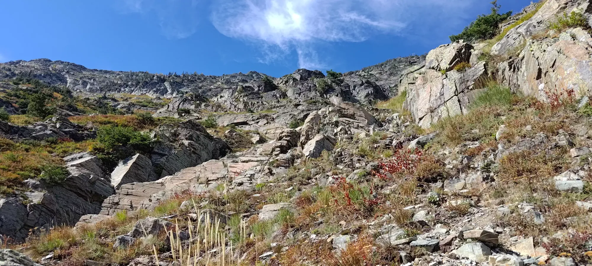
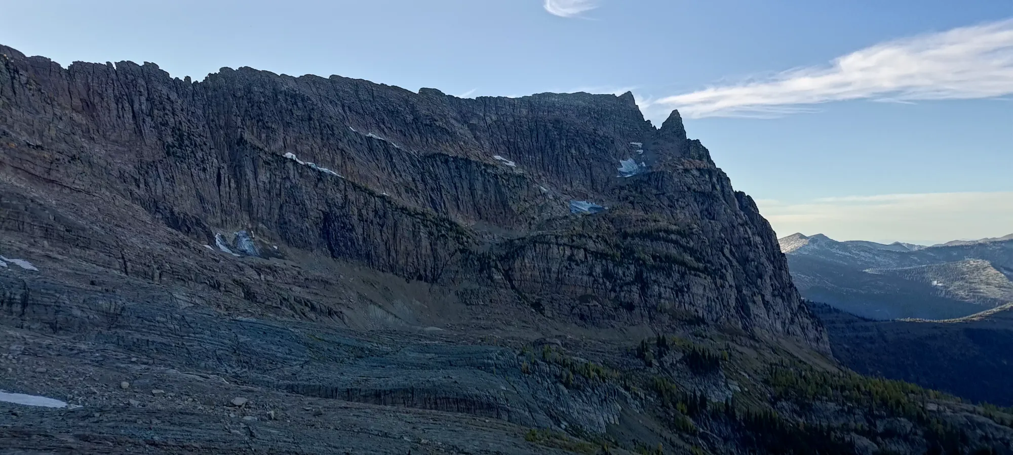
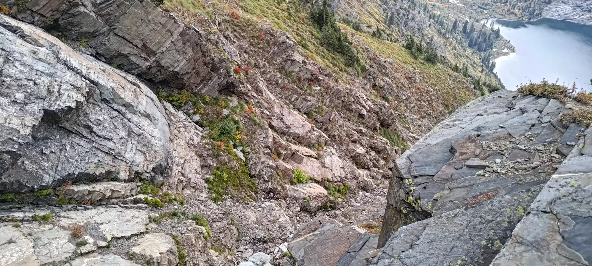
I continued making my way up, generally staying on the climber's left (east) side of the ridge, alternating between hiking and short scrambling sections to get higher up when necessary. The scrambling here was largely class 2 with hints of class 3 or 4 moves, but I suspect most of those were optional, and routefinding that prioritized ease of scrambling vs staying hiking for more of the time could avoid those harder moves. I reached the so-called "crux" that I'd heard many people rappel just before 7pm, and took only the highest-resolution photo for people who wish to evaluate it for themselves 😅
Since the photo I managed to take wasn't exactly a Jimmy Chin calibre one, I'll do my best to describe the crux. It is basically a tight chimney (though more of a corner than something with 2 parallel walls). I didn't struggle to get up, as there are decent ledges on either side to get you up, with solid, juggy holds. The exposure is not severe either, with a decent flat area below it. Once I got above, I found a sling wrapped around a large boulder above it (which let me know it was the crux people had previously mentioned), then resumed my ascent, as it was getting closer and closer to sundown, and I was still heading up!
Above that point, things got consistently rockier, though the terrain still managed to stay solidly hike-y with not too much scrambling. This remained true until about quarter-to-eight, when I arrived at the base of a large headwall, which I did not see a scrambly way up, and which forced me to move to climber's right, onto the top of the glacier, to get around it.


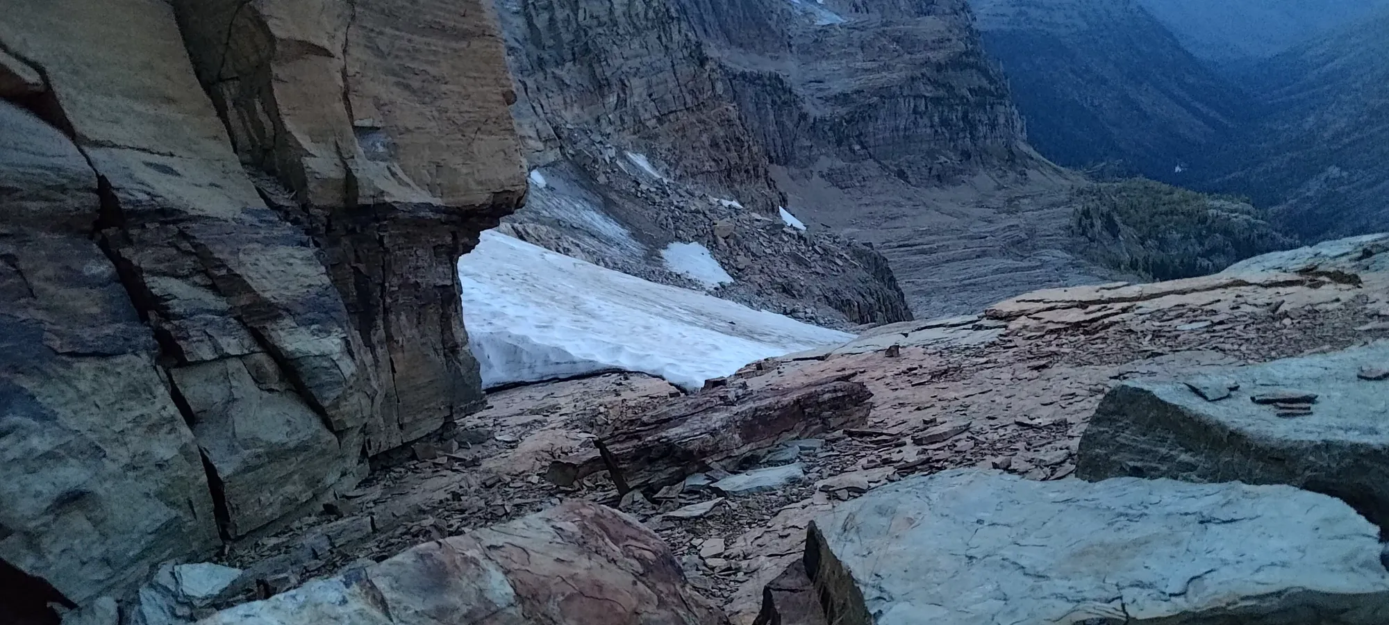
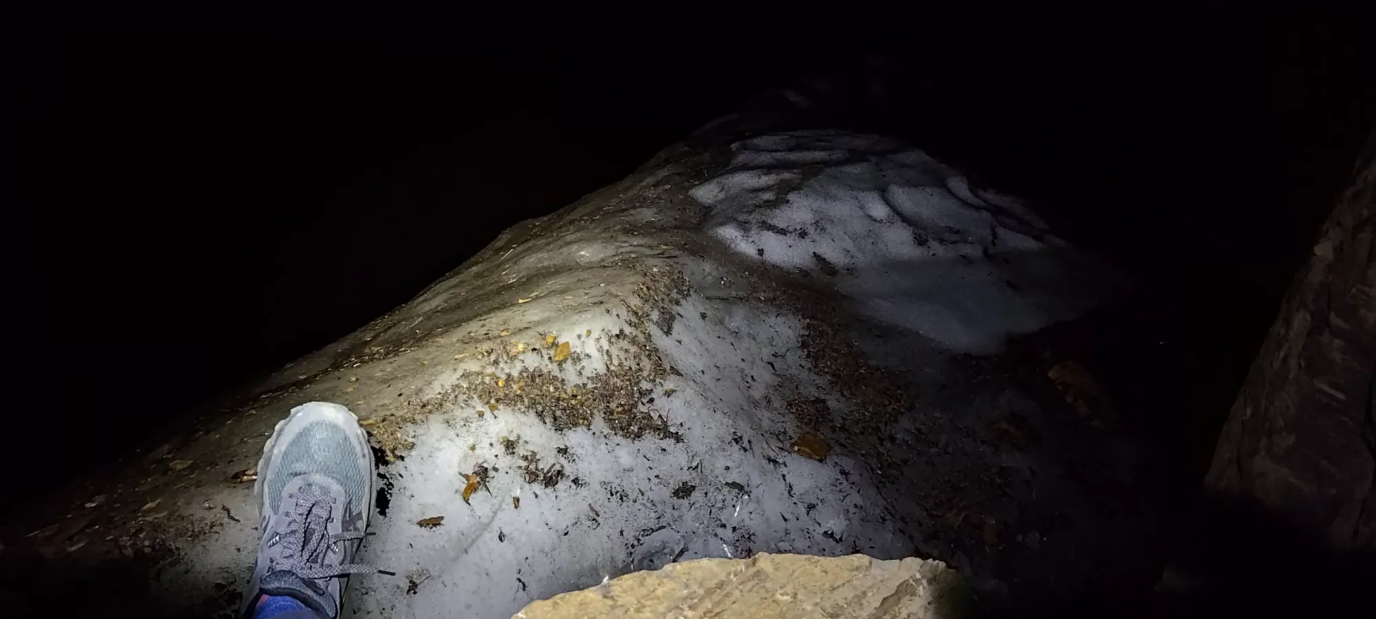
The glacier was a fun experience... While I only had to walk a couple dozen steps across the top of the glacier's head, it was a lot more involved than I was really hoping for. The snow slope below was steep enough that stopping a slide on it would be challenging without snow gear (which I'd left in the car after reading trip reports indicating that snow travel was unnecessary at the end of the season 🙃), so I resigned myself to walking the narrow flat spot right where the snowpack drops off towards the headwall. Unfortunately, while it looked quite white and snowy, it was actually incredibly slick ice, and I was swiftly taken to my butt after a couple steps. So, after sliding down to the rock wall where the ice/snow ended to retrieve the poles I'd let go of, I had to awkwardly shuffle with my feet having basically no grip, while having one hand against the rock and the other against the ice, until I got far enough that there was sufficient rockfall debris on the ice to step on for traction, and I could get myself off.
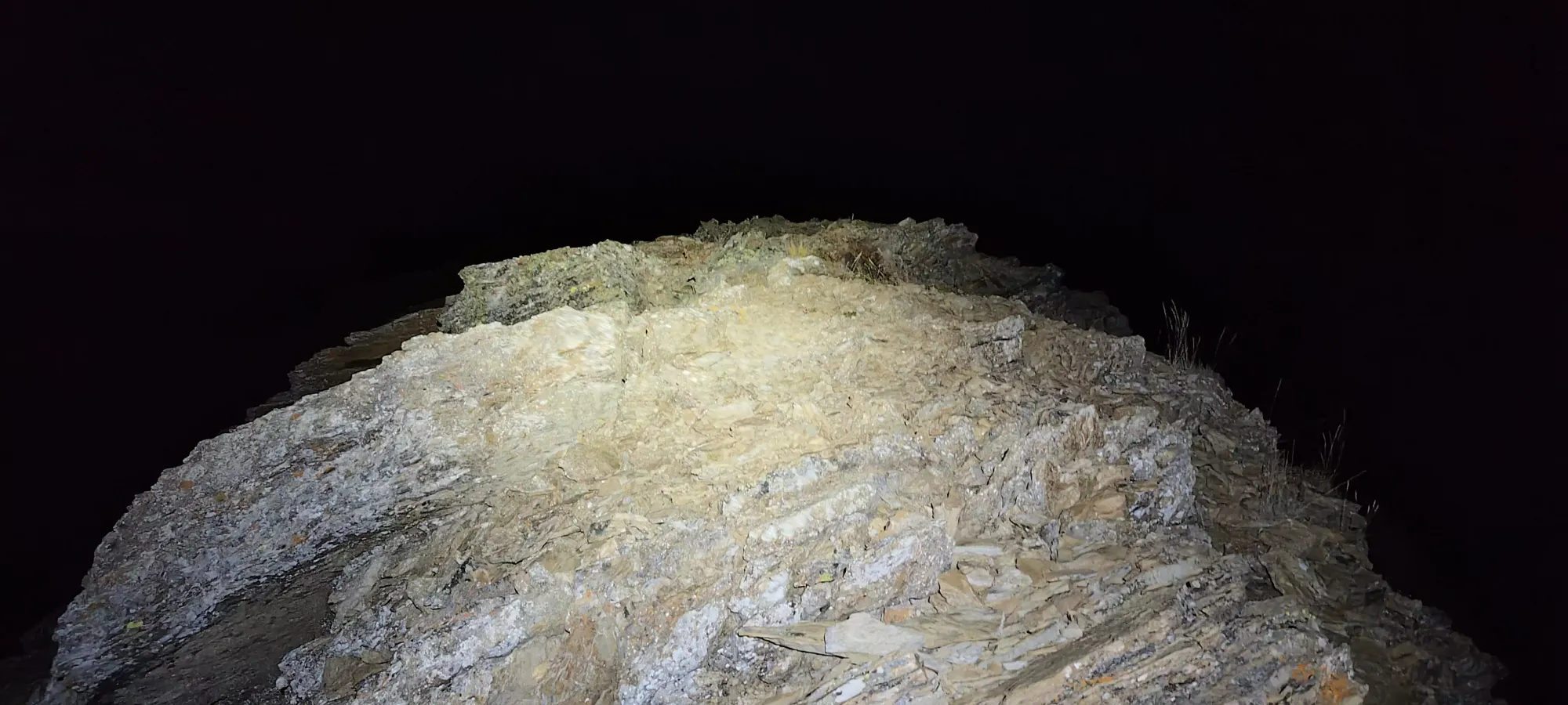
After that was over with, and I was thoroughly wet (thankfully not yet cold, though), there were a few steps in softer moraine-y soil before I got back onto solid rock. At that point, it got pretty dark, so I think I wasn't able to see easier routes, and instead did some pretty involved scrambling directly on top of the ridge to finish the NW section of the ascent, with lots of reach-y moves on large blocks to get to the spot where I finally turned onto the SE ridge. At some point in this stretch, I finally gave up and put the headlamp on.

From there, I had to make my way up about another 60m of elevation and about 500m of distance to the summit. Without sunlight, I had to mostly guess what terrain was going to work out the best. The ridgetop quickly showed itself to be fairly cumbersome to stay on, with more large blocks that required exposed and dangerous moves to sustain my position. So, I dipped down to climber's left (the west side of the ridge), and started mostly sidehilling, as every time I looked up, the terrain seemed to turn into more difficult-to-traverse stuff on top.
While it wasn't just a sheer, angled slab by any means, the terrain still wasn't totally flat/even, and there was a good amount of class 2 scrambling to get up and down various ledges to keep making progress. At times, I had to go up/down scree-filled ramps to try and get around impasses and more difficult obstacles. At one point, I even found a hole to crawl through to continue forwards on the path I'd found for myself. The dark definitely made this less efficient and more tedious, but the overall lack of exposure, and terrain that mostly "could be navigated if you wished" meant I had general confidence that I could get up and back without too much hassle, even if I wasn't following any sort of official route. With about half an hour of travel in such terrain, I finally found myself close to the summit marker on my GPS, and made my way up towards the ridge for the final time.
The summit itself probably offers great views during the day, being an ultra and all, but in the dark, I made out a fairly wide ridge that flattened out enough to sit down by the register and chill for a few minutes. There were a couple bumps on the ridge, and I don't think the register was even necessarily on the highest one, but once you are up there, everything is just walking, so it's easy to tag the highest spot and be done with it. My summit time was right around 8 hours in, or just before 9pm.


After a couple minutes on top, I started making my way back, as the winds had already started to pick up a bit, and I knew they were only going to get stronger/colder as the night went on. Plus, well, there wasn't much to look at in the pitch-black 😅
The way back down the SE ridge was about as slow as the way up, taking me roughly 40 minutes to get back to the spot where I turned back onto the NW ridge. However, I'd say it was slightly easier, without any crawling sections, and more notably, the spot where I turned onto the NW ridge was much easier than the difficult scrambling I did above the glacier on the way up. It was just a broad spot on the ridge where the rock connected, and I could just... hike down. I basically hiked all the way to the glacier from that point without having to scramble more than a couple easy moves, so I'd definitely stay more to climber's left on the way up!
Armed with the knowledge of the slipperiness of the glacier's head from the way up, I put my shoulder season gloves on pre-emptively, and did my best to retrace my steps from the way up. The one modification I made was following the headwall all the way to the end of the ice (which wasn't precisely where I entered it on the ascent), which allowed me to use the wall for support, and exit without taking a spill into the wet/dirty ice below.
After that, navigating the ridge back down was not too bad. I found very occasional cairns with my headlamp's light, but often had to just follow my instinct, generally trying my best to stay on top vs not, just for the sake of keeping my options open and hopefully being able to spot cairns, should they exist. In about an hour, I got from the glacier at above 2550m down to about 2350m, the approximate location of the so-called crux (even though the scrambling I did between the glacier and the SW ridge was definitely more difficult).
I was able to downclimb it with minimal difficulty. Once I got to the hardest move, I did remove my backpack and lower it to the ledge below with a pole, and that allowed me to confidently manoeuvre my way down in my trademark facing-forwards posture 🙂
From there, I resumed the hiking+easy scrambling descent to around 2300m, where I found a pretty decently sheltered and fairly flat spot along the ridge. It was around 11:30pm, and I was pretty sleepy, so I figured given how low I was, even if I waited for the morning, the wind+cold shouldn't be too bad. I could've kept going, realistically, but I kinda didn't want to, and the idea of navigating in the daylight for the way down (which was not the same route I used to get up, mind you) was appealing enough that I said screw it, and decided to bivy up on the ridge until sunrise.
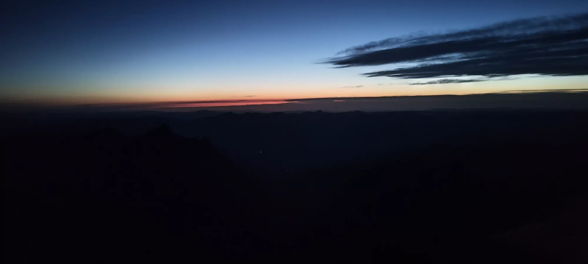
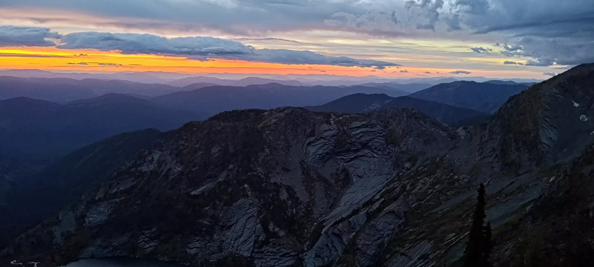
Of course, with no sleeping bag, tent, or even much in the way of extra clothes, I didn't exactly have a 5-star sleeping area, so I spent the next 7 hours tossing, turning, moving rocks around, and doing basically anything other than actually sleeping, keeping a totally-restful ~100bpm heart rate for the night 🙃 With my midlayer, shell, hat, and gloves on, I managed to keep a state that was solidly not hypothermic, if not precisely warm, so... that's something? Once I saw some red on the horizon, though, I was ready to pack it up and get off that damn mountain!
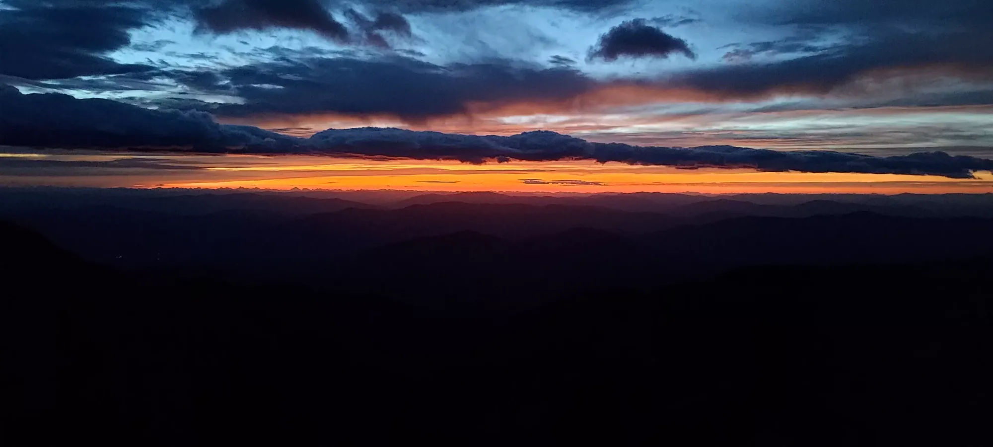
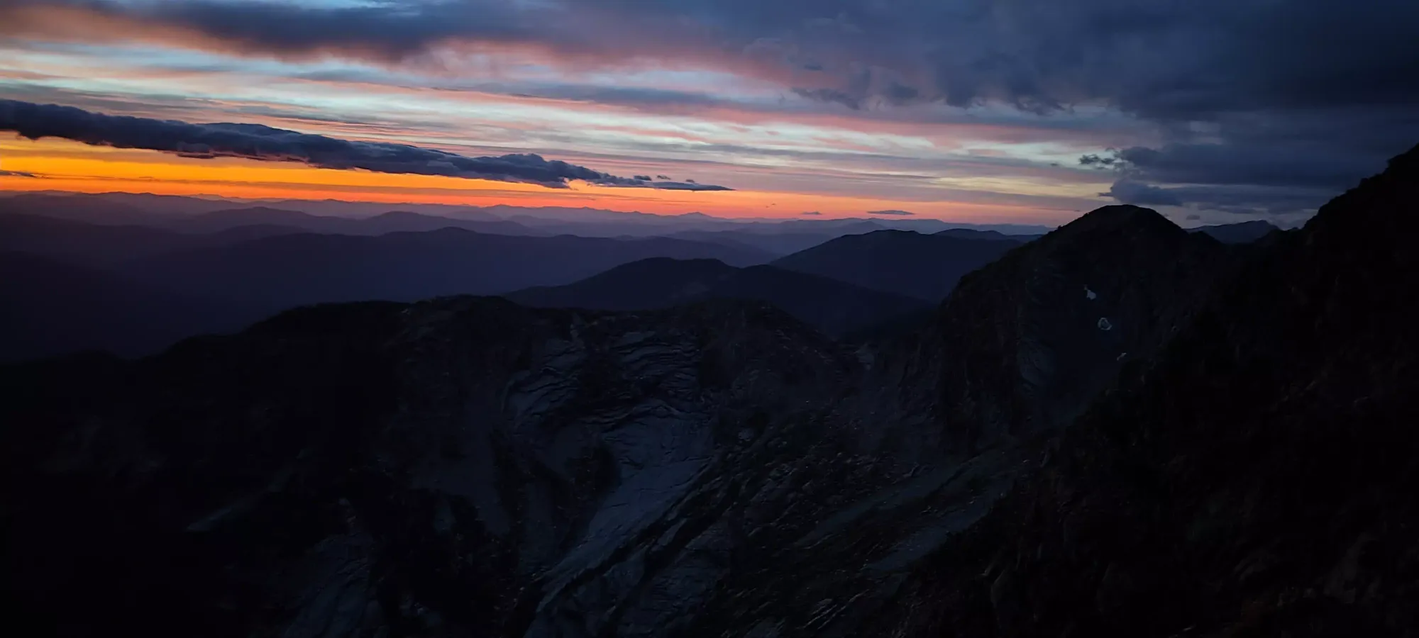
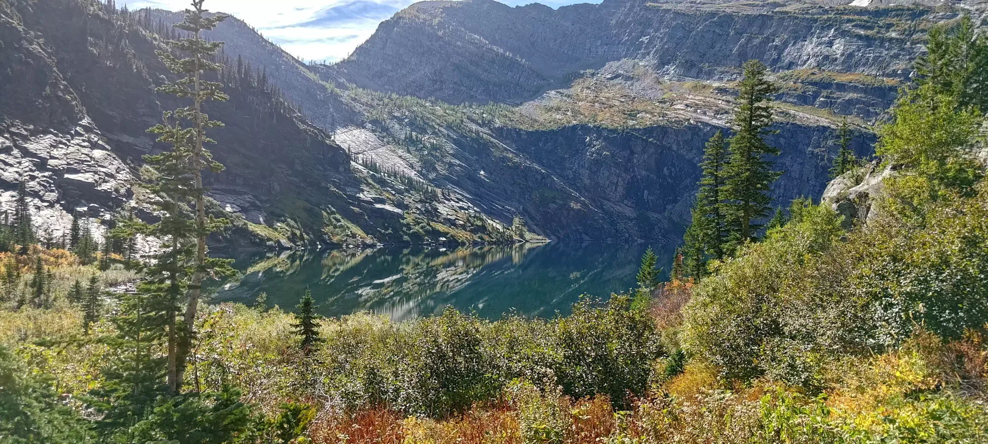
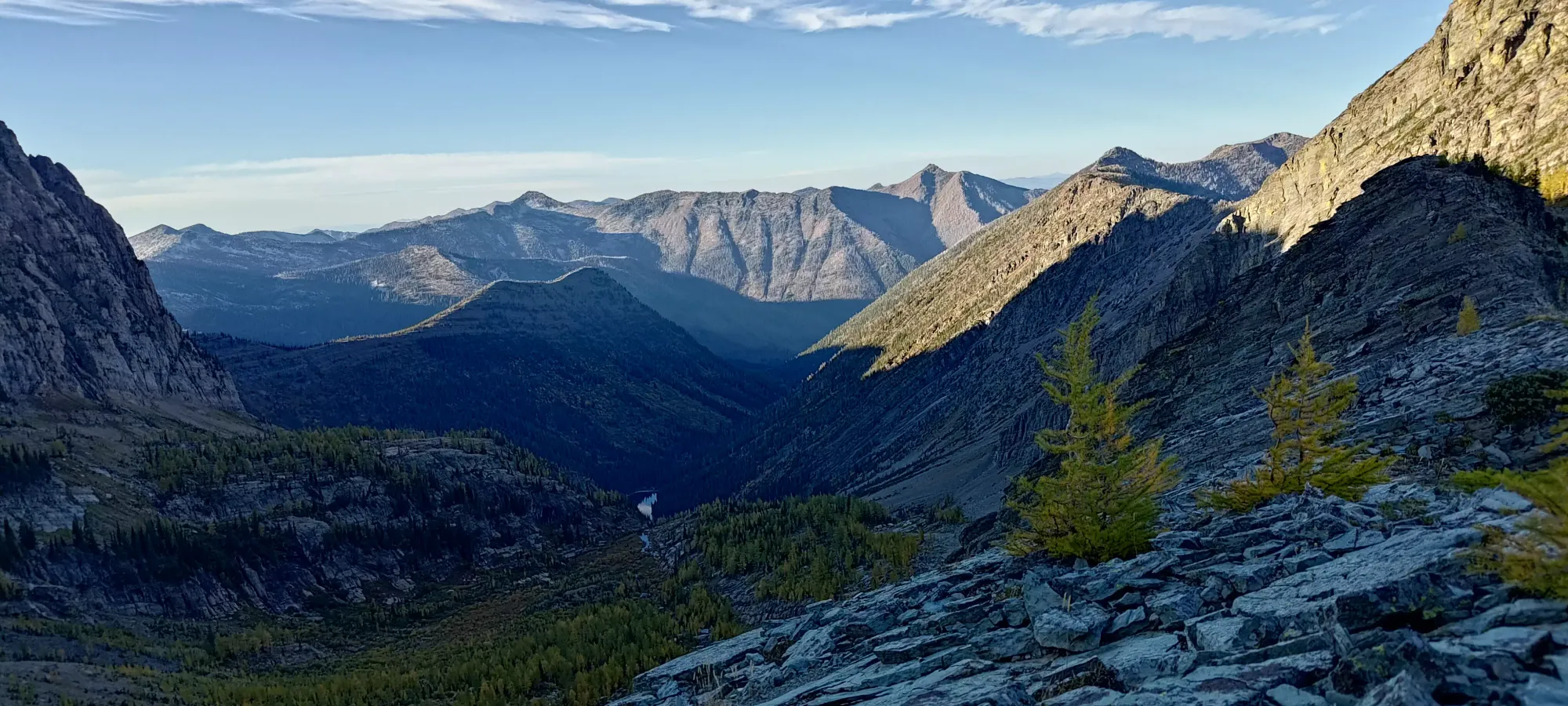
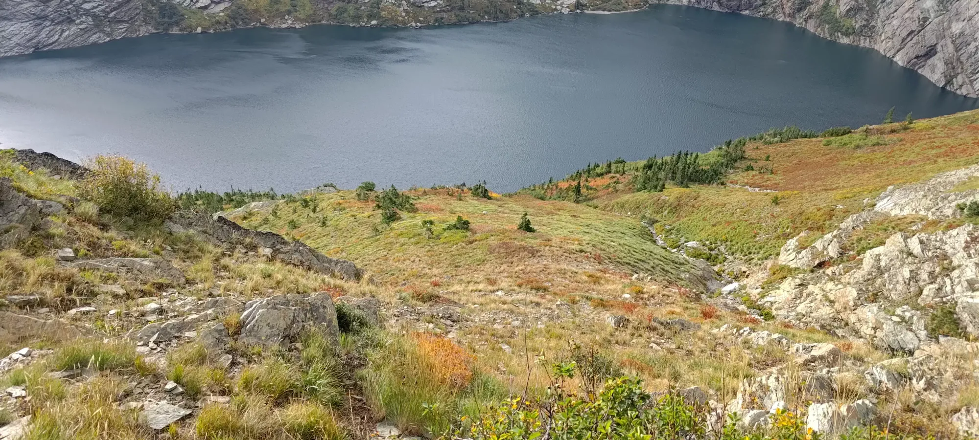
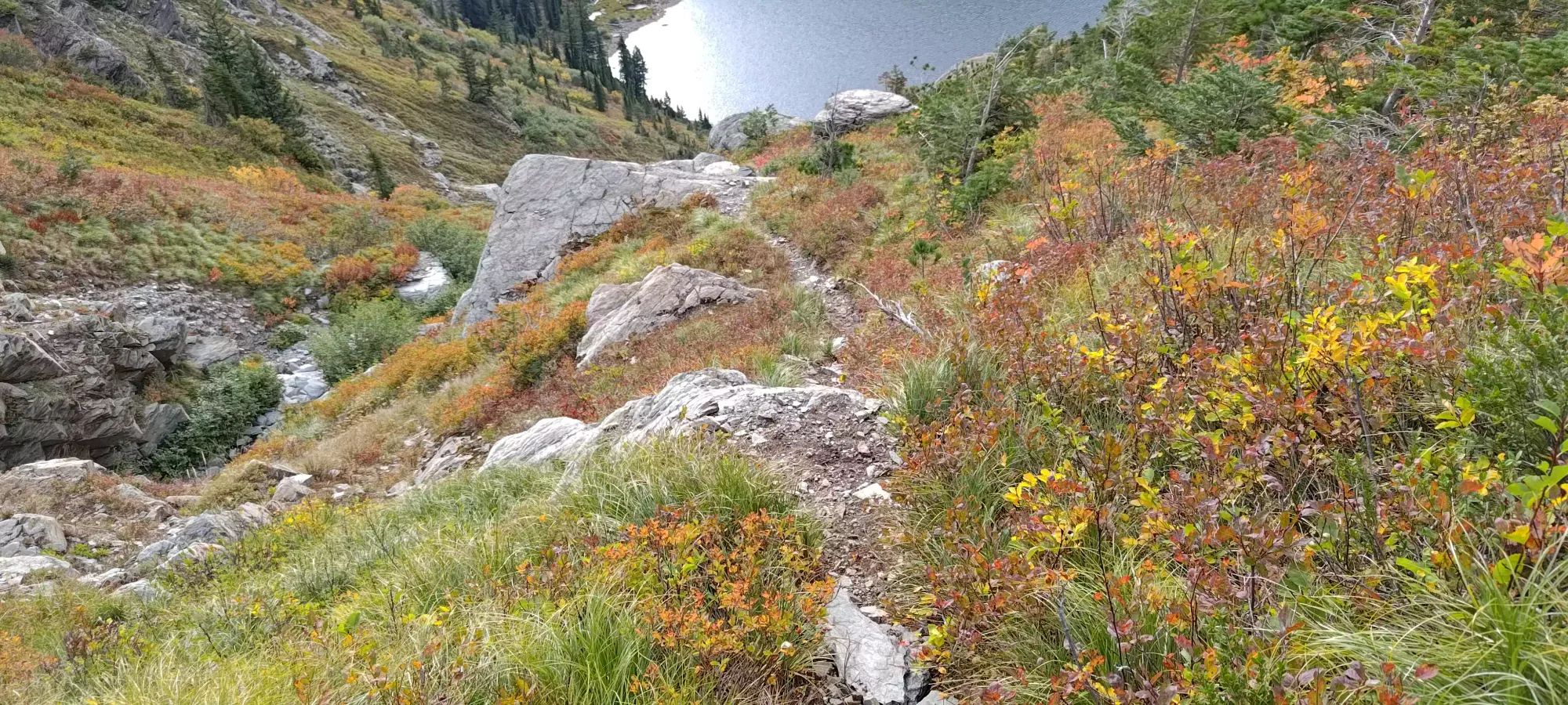
After getting myself packed up and ready to move again, I got the legs churning again at about 7:15am. In a short few minutes, I was rewarded with a nice view of Leigh Lake in the morning, and a fairly tame-looking route down to it!

From the ~2300m spot I departed the ridge, I mostly hiked down the grassy/ledgy terrain between me and the lake, with short stints of class 2 scrambling down the taller ledges to get myself towards Leigh Lake's comforting shores. Indeed, with daylight, the travel was much easier, and I could easily route my way down without getting stuck in hard terrain I was happy to avoid 19 hours after I'd set off from my car 😅


By about 9am, I made it far across enough the slope that I could start heading down in earnest, with the only traversing left to cross the large drainages where the opportunity arose. The first of those was quite steep/large, but thankfully had enough ledges to make it actually doable, despite the imposing look from above.
In about half an hour, I'd dropped from nearly 2000m to below 1800m, a marked improvement in downhill performance. The grassy slopes in this section made for swift travel, and aside from the occasional chasm-crossing, I continued to make good progress.
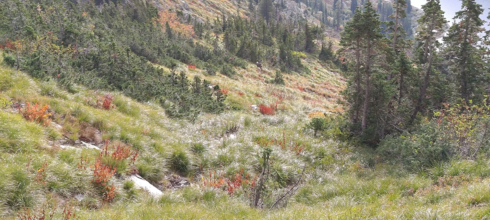
In those grassy slopes, I actually managed to find a Mule Deer, the second large animal of the trip (and thankfully, not a Grizzly). After some more time winding my way down the grassy terrain, I encountered the final big drainage path to cross, where I got to refill my water, which was quite nice (I thought I'd brought 1.5L, but it turns out I actually only packed 1L 🙃).
By 9:45, I'd made my way far down enough to actually hit some trail, which was quite exciting! Once I got onto that, it was only about 35 minutes until I found myself at the northern shores of Leigh Lake, quietly resting beside the tent of some fellow adventurers, excited to be back in officially maintained country!
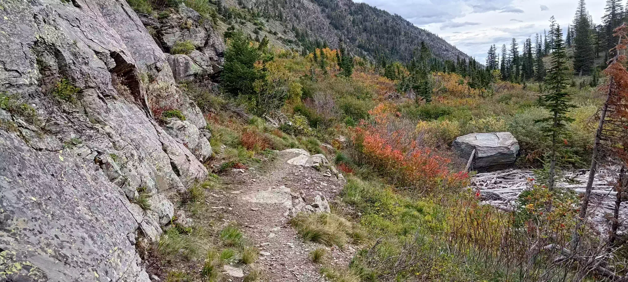
Once I was back on the maintained trail, it only took about 50 minutes to hike out, which included a couple "being tired" breaks, a photo break at the waterfall (which, sadly, I did not swim below, given it was below 10 degrees and I was too tired to endure that coldness), and a short chat with some hikers coming up who wanted some beta.

It felt great being back at the car, even if it was over 22 hours after I'd left it 🙃 While the trip wasn't exactly how I'd planned it to go, nothing happened outside of my control, and I was happy enough that I decided to tough it out. I'm still not sure if bivying was the right call, or if I should've just toughed it out, but I don't think there's really a definitive right answer on that one.
After that, I somehow managed to drive 7+ hours down to Riggins, Idaho, where I slept the night hoping to go for She Devil on Monday morning before heading home, but it turns out the side effects of my new medication had other plans for me, and I instead spent 3 hours learning that the rock-hard knot of pain my left leg had turned into during the drive and subsequent night of sleep was not something that would loosen up by hiking it off, and I turned back before a loooong drive home in defeat 😅
So perhaps not the epitome of typical success, but at least I got one of the ultras I was aiming for on the long weekend, and had a good story to tell for it. For anyone aiming for Snowshoe Peak, I'd recommend sticking roughly to my descent track, and making sure you're comfortable routefinding in unmarked terrain, and handling difficult scrambling if you take anything off the ideal, least-difficult route. Oh, and maybe bring some spikes for that glacier 🤣
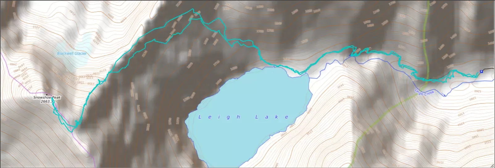
GPX Track + Map