Sawchuk Peak - June 21 2024
A first internet ascent for me, otherwise a short (if you can drive all the way) and steep bushwhack+scramble with some pretty decent views

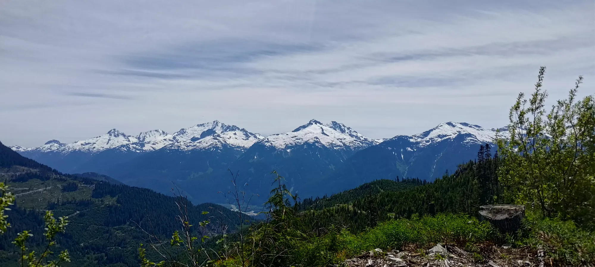
Squamish-Cheakamus Divide, Squamish, British Columbia
1849m
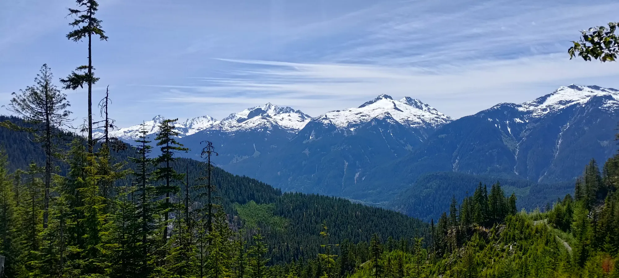
This peak is one I've been wondering about for a while. As far as I could tell, there were no recorded ascents anywhere online. The closest I could find was someone having been further north on the ridge near Hynes Peak, but nothing on the summit of Sawchuk itself. Since it is pretty close to home, has a forest road going up to 1300m, and the terrain didn't seem crazy steep on maps, I figured it should be doable. I am somewhat lacking in first ascents (be it "for real" or the more realistic in 2024 first internet ascents), so I was fairly motivated to make this happen. I'd considered it for a snowy winter ascent before, but that just never materialised. However, after running into some "peak shoulder season conditions" the day before when trying to hit the alpine, but also noticing that southern aspects seemed a lot drier, I checked satellite imagery, and sure enough, Sawchuck seemed largely dry, and I figured a Friday when nobody else was around and I had limited options was a good time, so I decided to go for it!
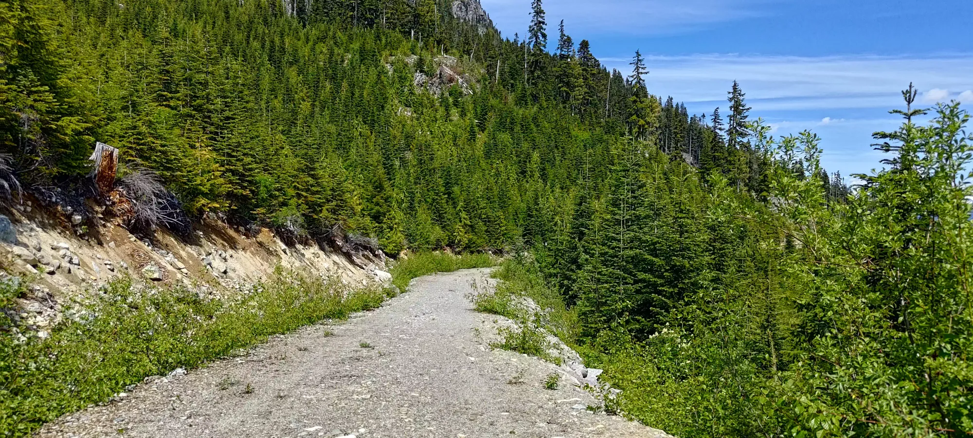
I set out rather late, around noon. Getting to the Squamish River FSR was, as usual, a pleasant drive up Squamish Valley Road. Once I got there, I actually bothered airing down, since I recalled Branch 200 being a fairly rocky road, and even though I'd driven it before with full pressure, that didn't mean I couldn't get a puncture this time. Plus, I would be going onto spur roads for which I had no beta, so being more prepared was better than not. The mainline (Squamish River FSR) is in excellent shape, as usual. Once I got to branch 200, I took it for about 5.5km until it forks at "TFL 240". Getting to this point is doable with AWD and medium clearance (most crossovers), but is rocky, and has a couple water bars, so one should drive carefully, and consider airing down if you're rocking street tires.
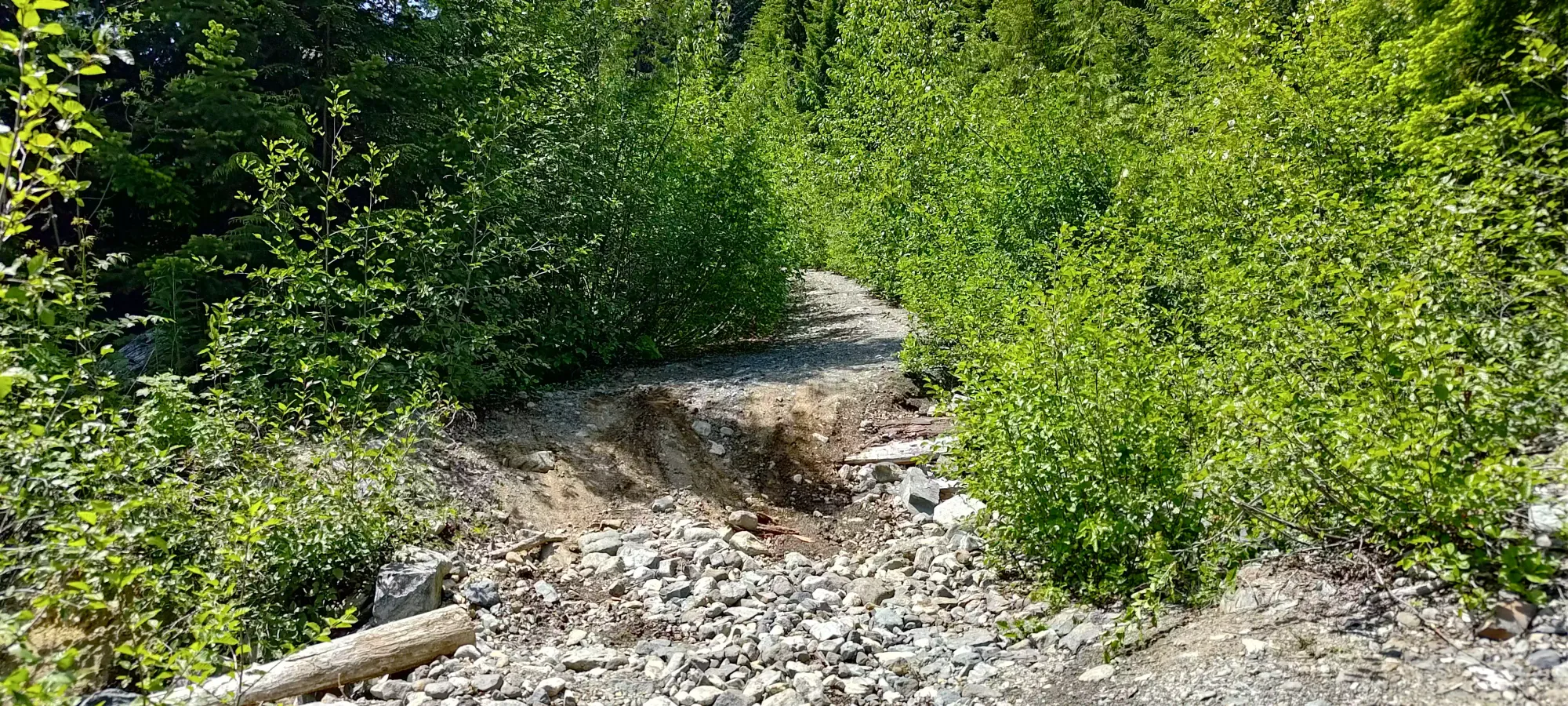
Once I forked off, the road got narrower, and there was mild pinstriping from trees encroaching on the sides of the road. There were a couple somewhat deeper ditches, but nothing my Jeep Compass couldn't handle. I drove up about 1.65km of the road before encountering a large washout. I tried a few lines and nearly got across, but wasn't able to coax my vehicle across. I suspect if my brakes were in better shape, I could've made it (since my traction largely comes from brake vectoring), but that was not the case. Perhaps a few more minutes of trying would've got me across, but I didn't want to push things solo, so I turned around, got out of the way as best I could (there's barely space to do so here, and you have to be comfortable touching some tree to do this), and parked.
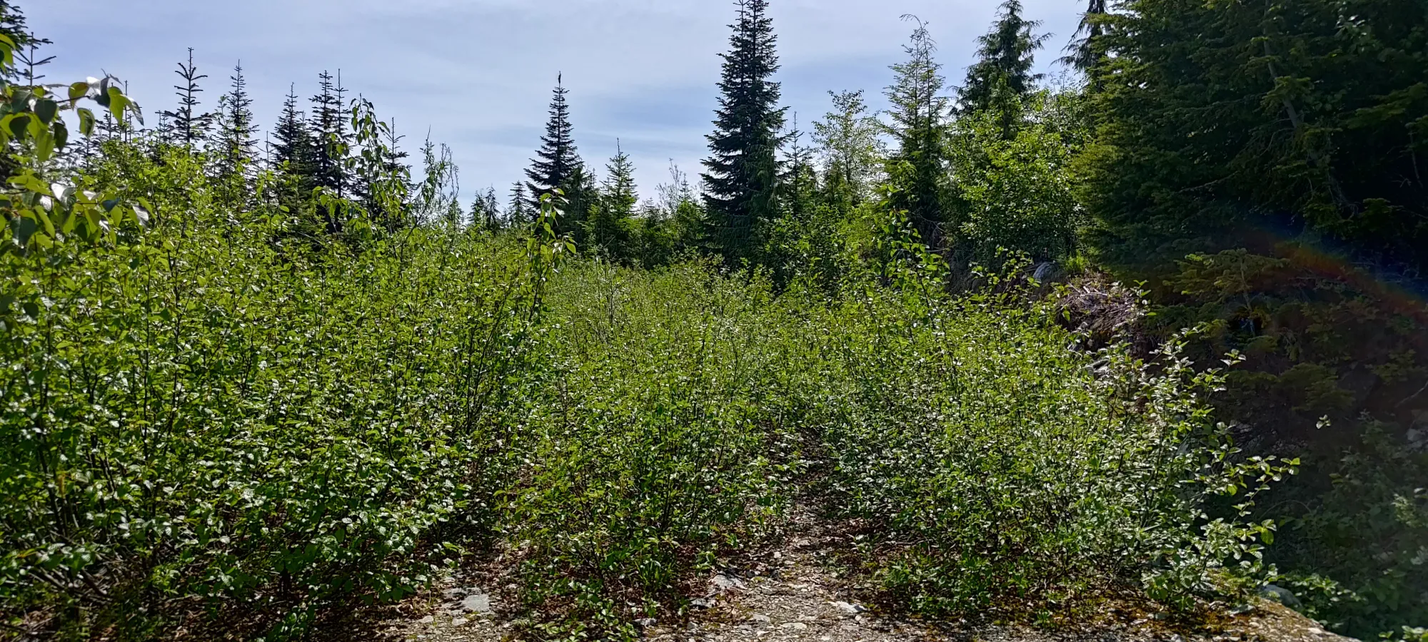
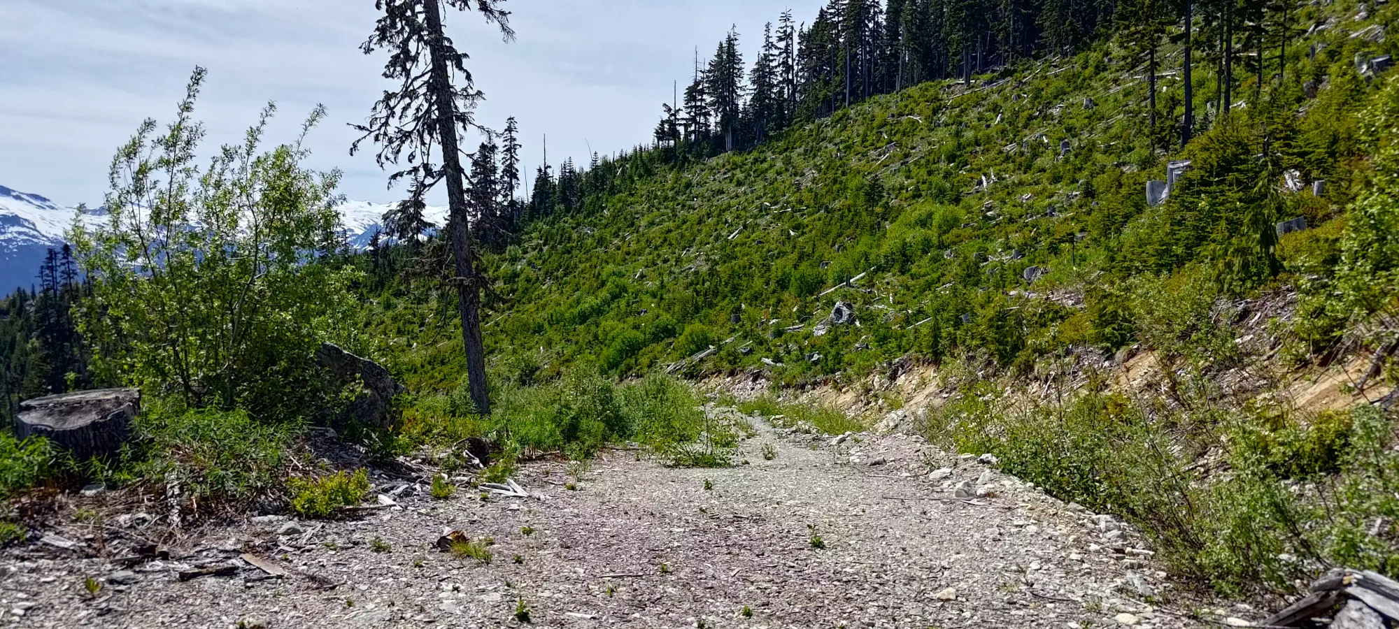
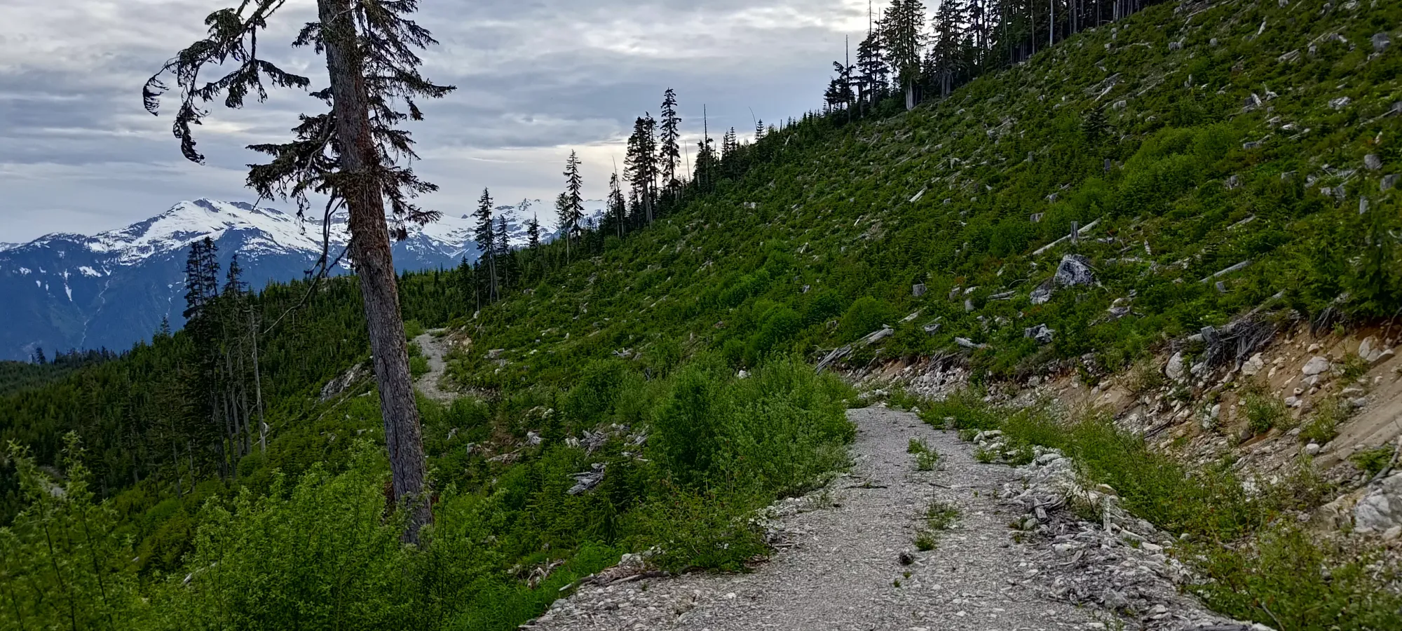
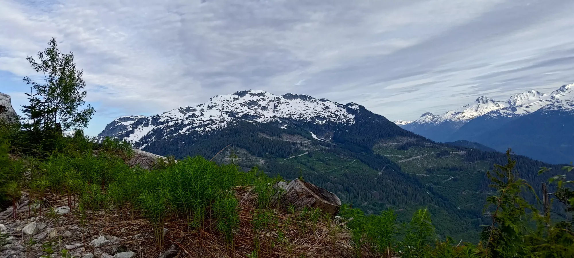
This meant instead of parking near 1300m like I'd hoped, I was down below 850m instead, with a long road walk up to my "trailhead". Oh well, it was already past 1:30pm, so there wasn't much time to waste fretting, so I just got myself geared up and started hiking. The first hour was just tedious/boring grinding up the road, and got me to 1250m over about 4km. I guess the views were alright though, if nothing else. As for the road, according to maps, it didn't end there, but it appeared to just disappear into the bush. After consulting the satellite maps more closely, I noticed that the road I forked at this point, and the obvious road I was on ended a couple metres after the fork, but the "real" road went to climber's right, and seemed to just have a random overgrown section for some reason.
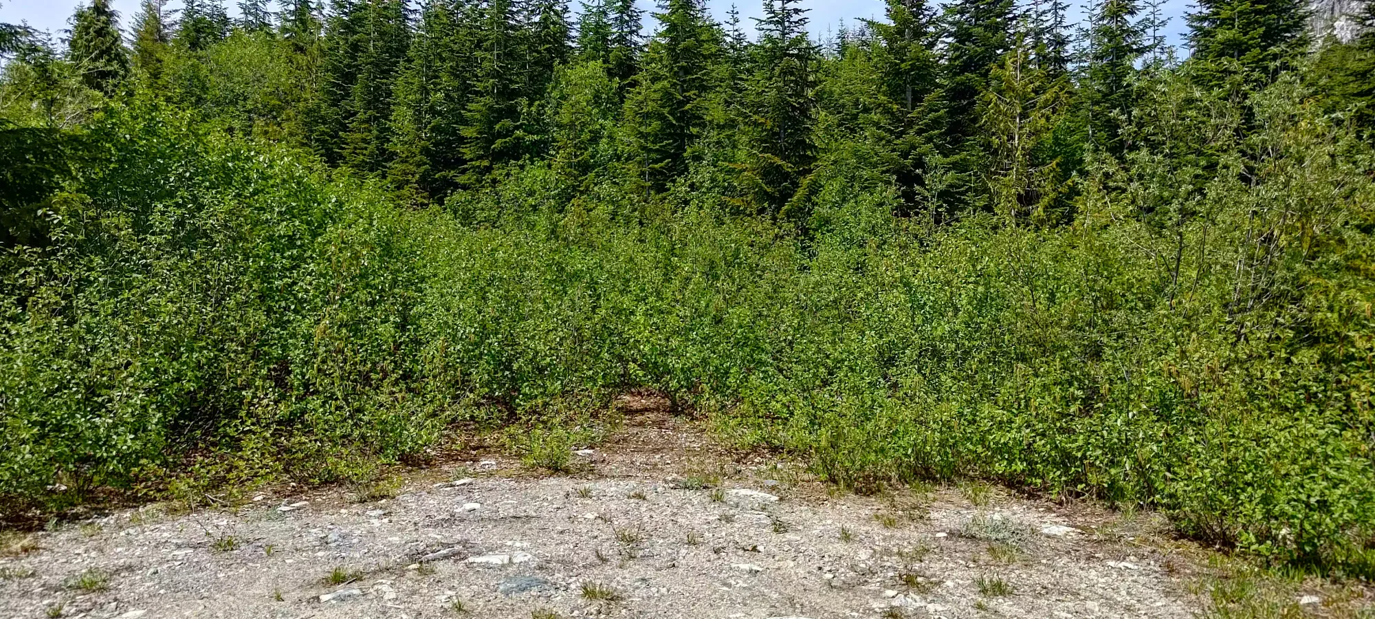
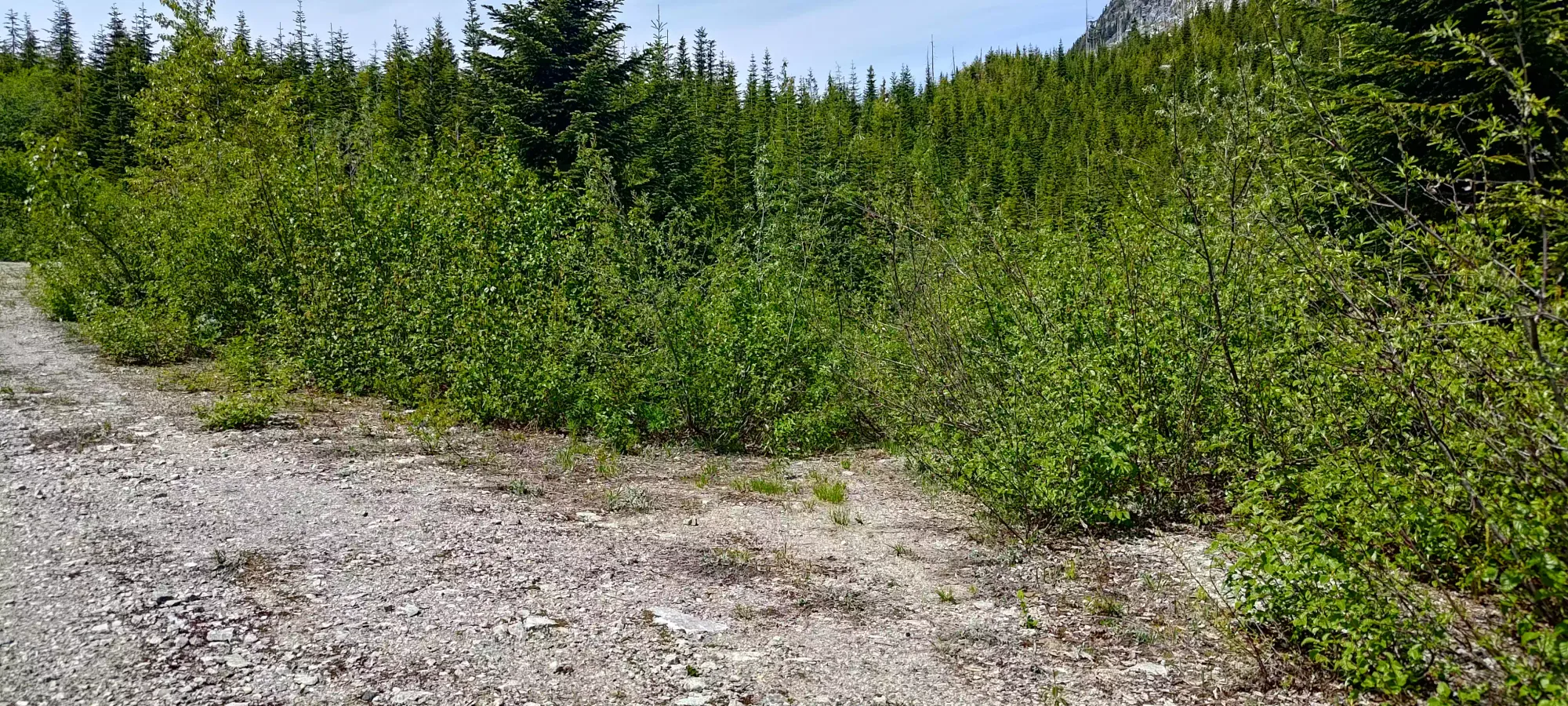
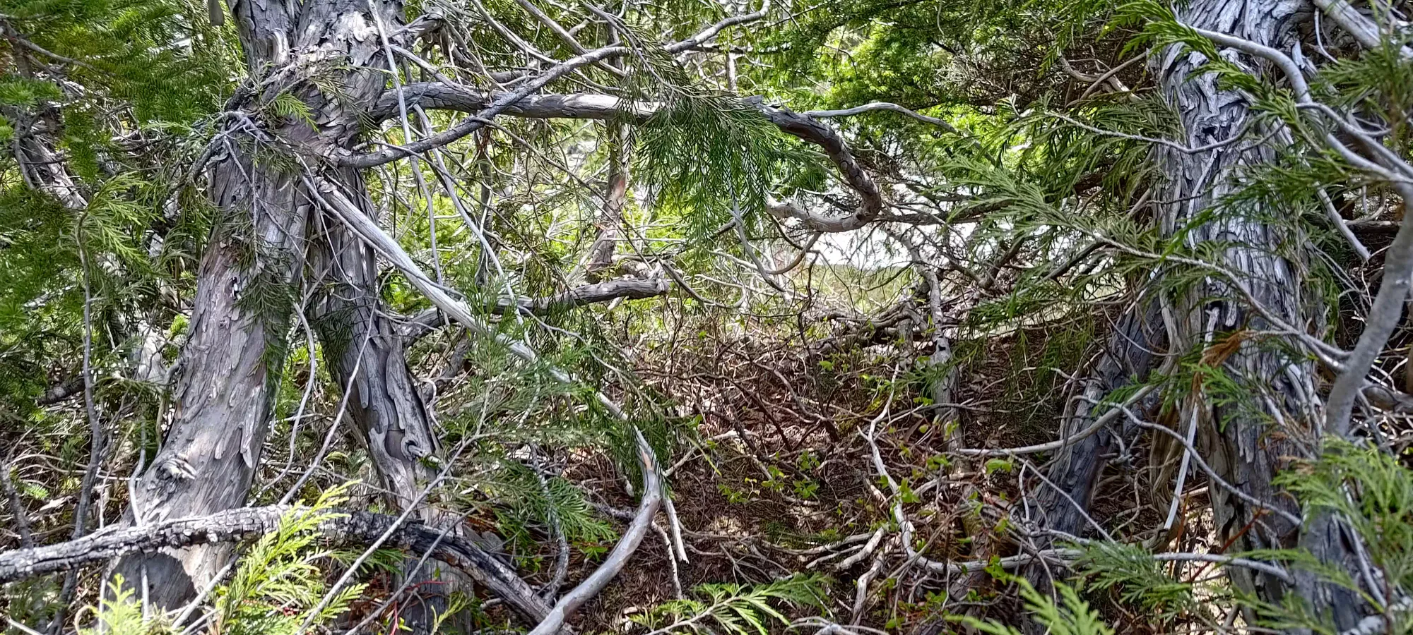
I bushwhacked through the random overgrown road for a minute or two. Thankfully, it wasn't devil's club or anything else painful, and you could keep your eyes down and make out the slightly-less-grown-over tire tracks. Then, you just pop out on the other side, and the excellent road continues like nothing ever happened! That meant while I couldn't have driven all the way to the end of the road (I'd not drive through that without a more powerful vehicle), I still tacked on over 4km and 400m of elevation because of that washout, as it was definitely the crux of the road. Oh well...
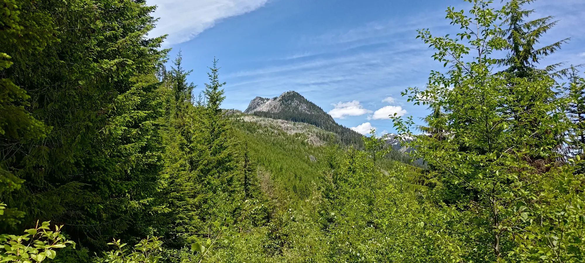
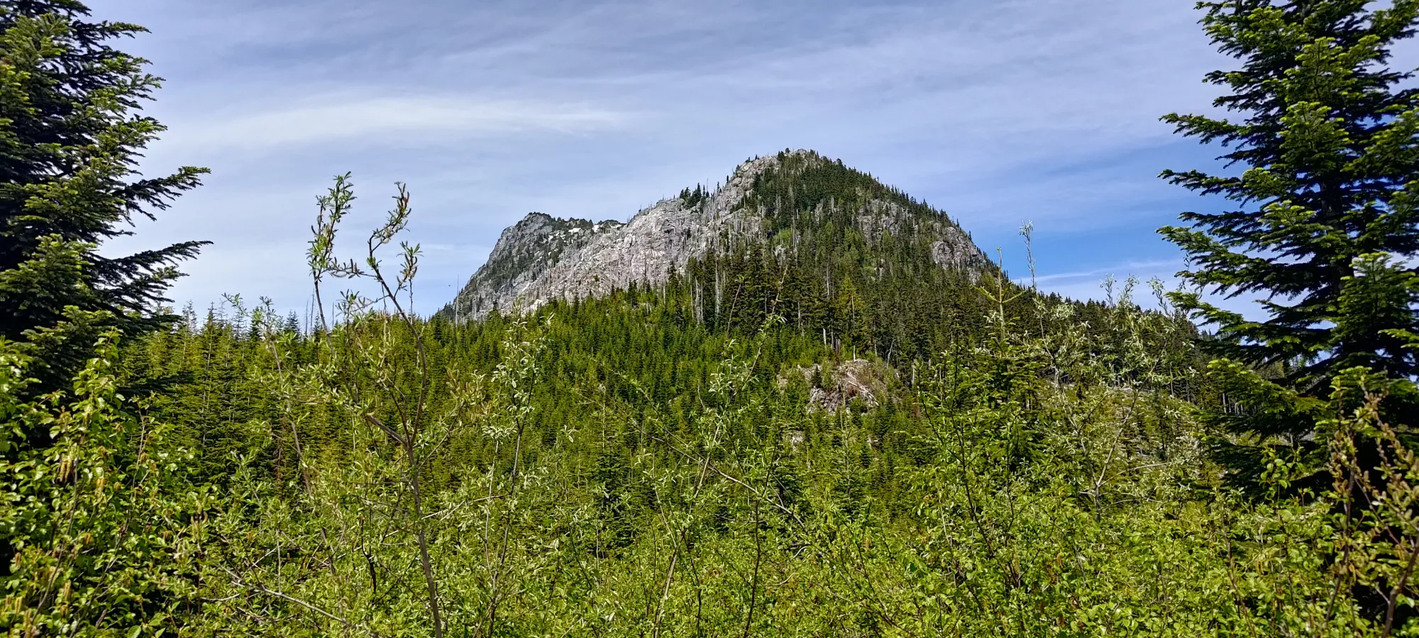
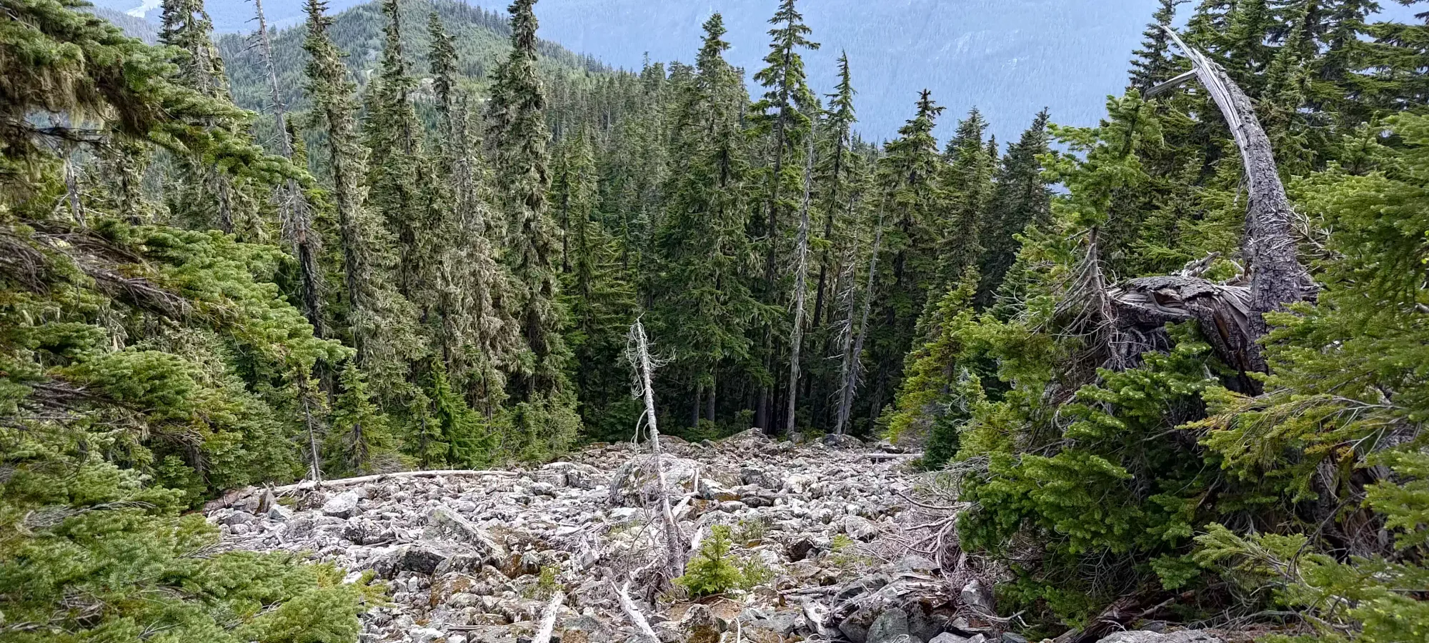
The road continued for another ~500m or so, and gained up to just shy of 1300m, at which point I was sitting at the bottom of a cutblock, forced to decide to walk through it or enter the forest. Getting to this point took me 70 minutes, covering about 4.5km and gaining about 500m with undulation to get there. I took a swig of water and re-consulted my maps before heading on. I had devised a plan from satellite images beforehand, which largely had me staying on the left side of the ridge for the sake of more open terrain, but that was based on satellite imagery alone. On the ground, I could see the forest looked decently old-growth, and might offer relatively easy travel. On the other hand, the cutblock seemed to be fairly "clean", without a ton of branches or debris on the ground that would obstruct travel either. So, I decided to just go up the cutblock, then stay on the ridge as much as possible. Maps showed a potentially sharp ridge that would force you to commit to one side or the other, which was my primary concern, so I determined to stay left if I was ever made to decide, but otherwise kept my options open.
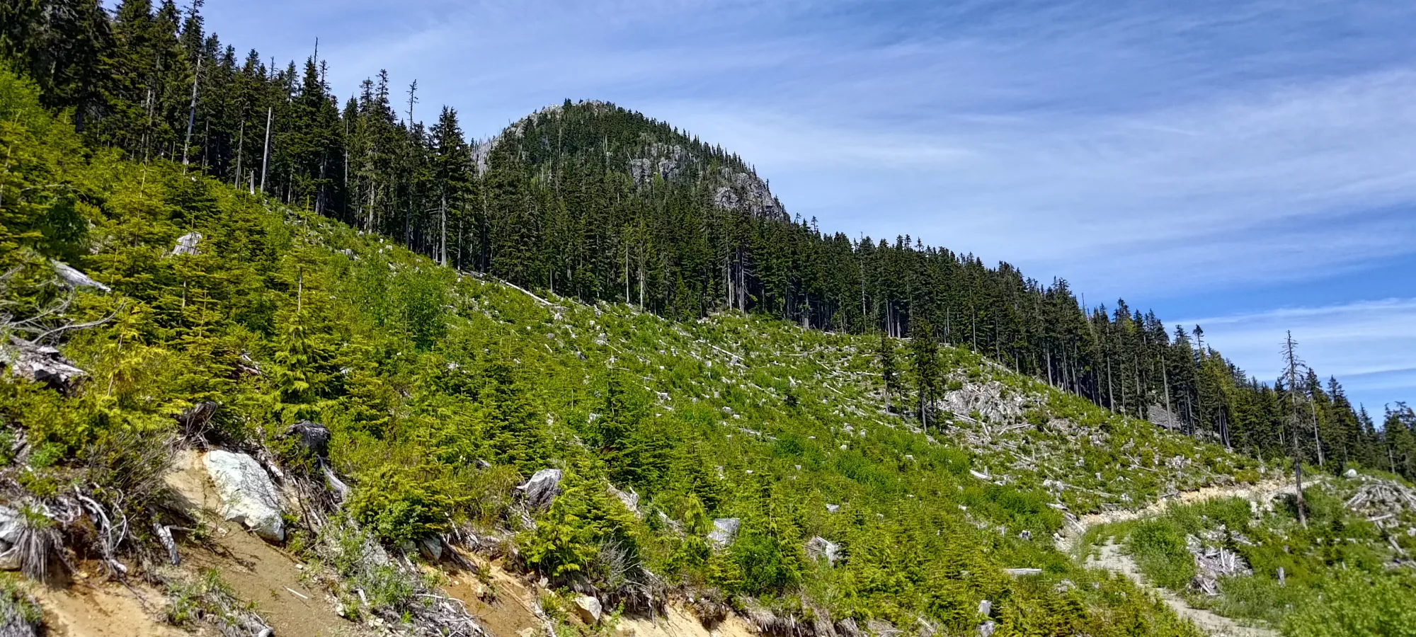
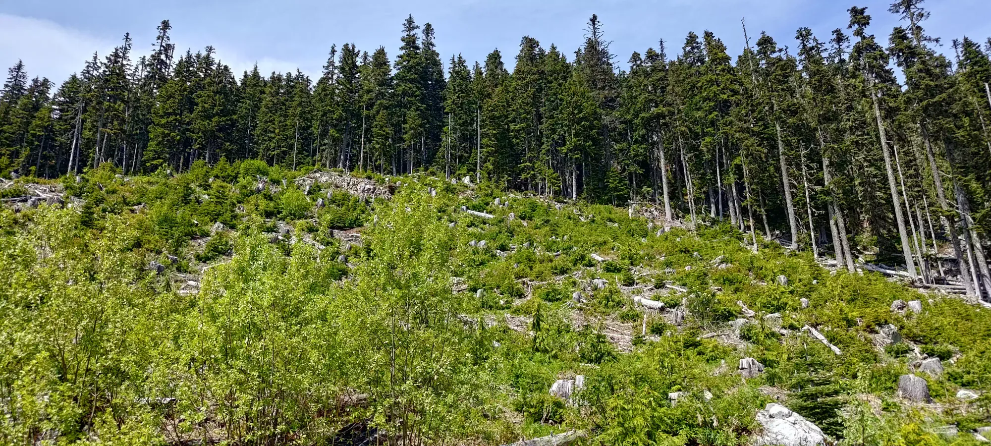
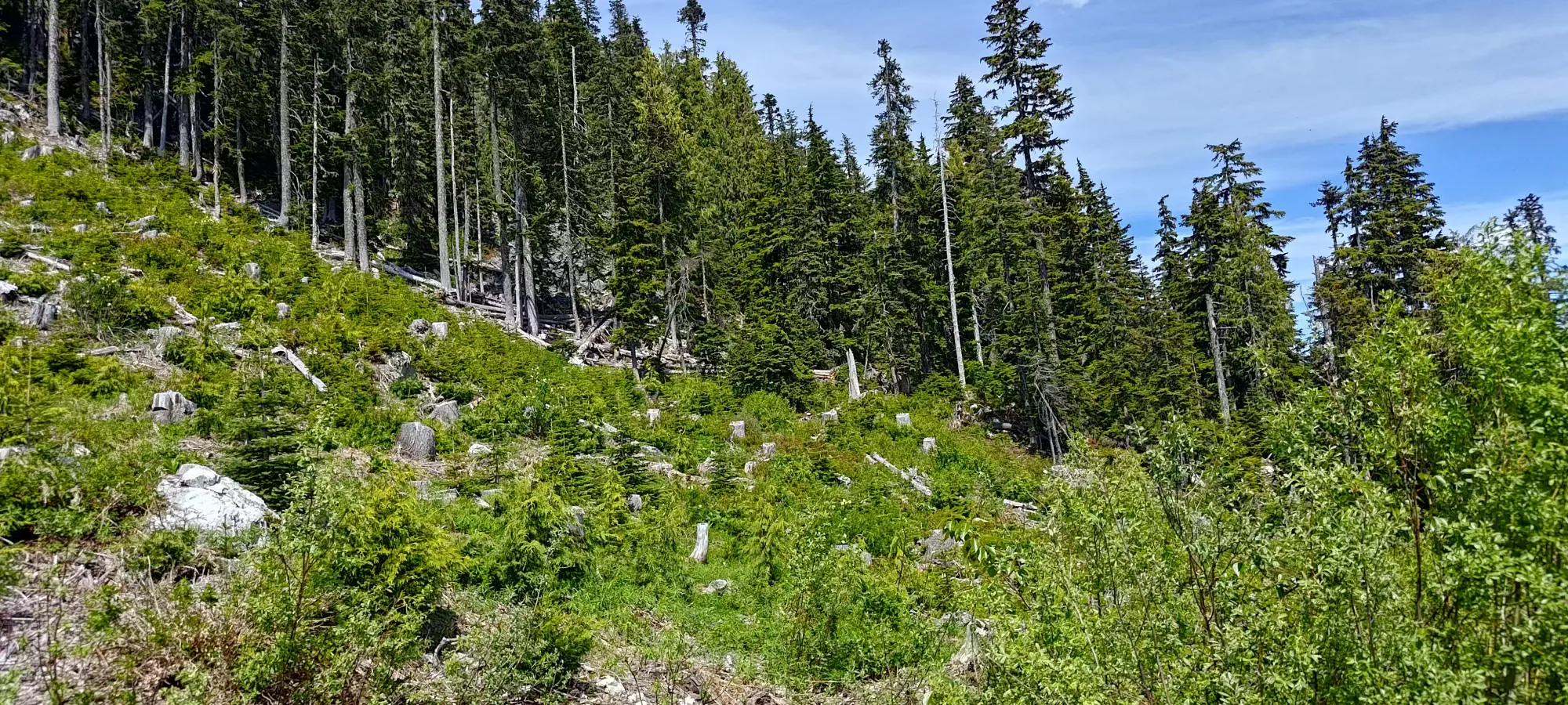
Getting through the cutblock was indeed quite easy, and was an easy 50m of gain to get above the road. Once I got to the forest, I was pleased to see not quite an old-growth forest, but still a mature forest which had plenty of space in which to manoeuvre.
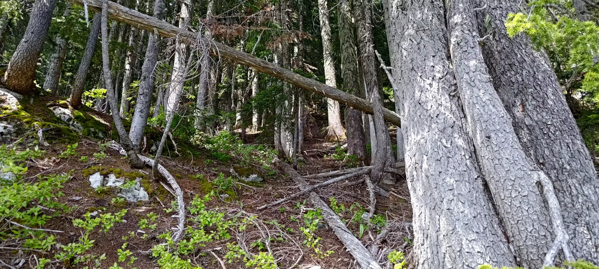
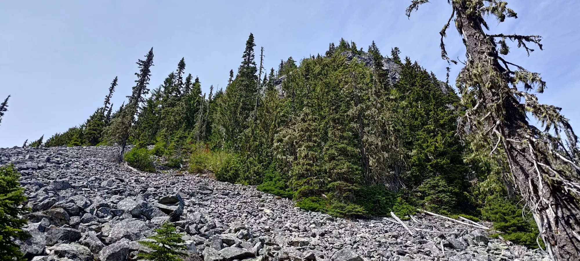
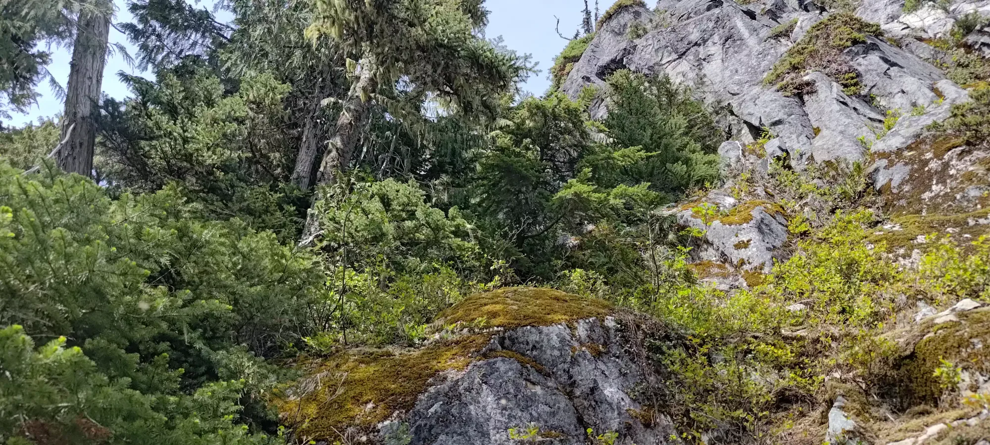
Travel continued with relative ease in the forest for the next few minutes until I reached a boulder field at around 1400m. Here, I considered going straight up the boulders, but decided to stay to climber's left at the forest's edge until it got a bit too deadfall-y, then cut into the open boulders. This was largely to avoid unstable ground and being in the full sun, but the former wasn't much of a problem, as they were actually fairly stable, as boulder fields go. Sadly, around this time, I started to get harassed by bugs. At first it wasn't bad (and before this point they'd not bothered me at all), but before long, there were dozens around me at all times, and it was quite unpleasant. I really should've brought a bug net, and maybe some climbing gloves or something for my hands 😅
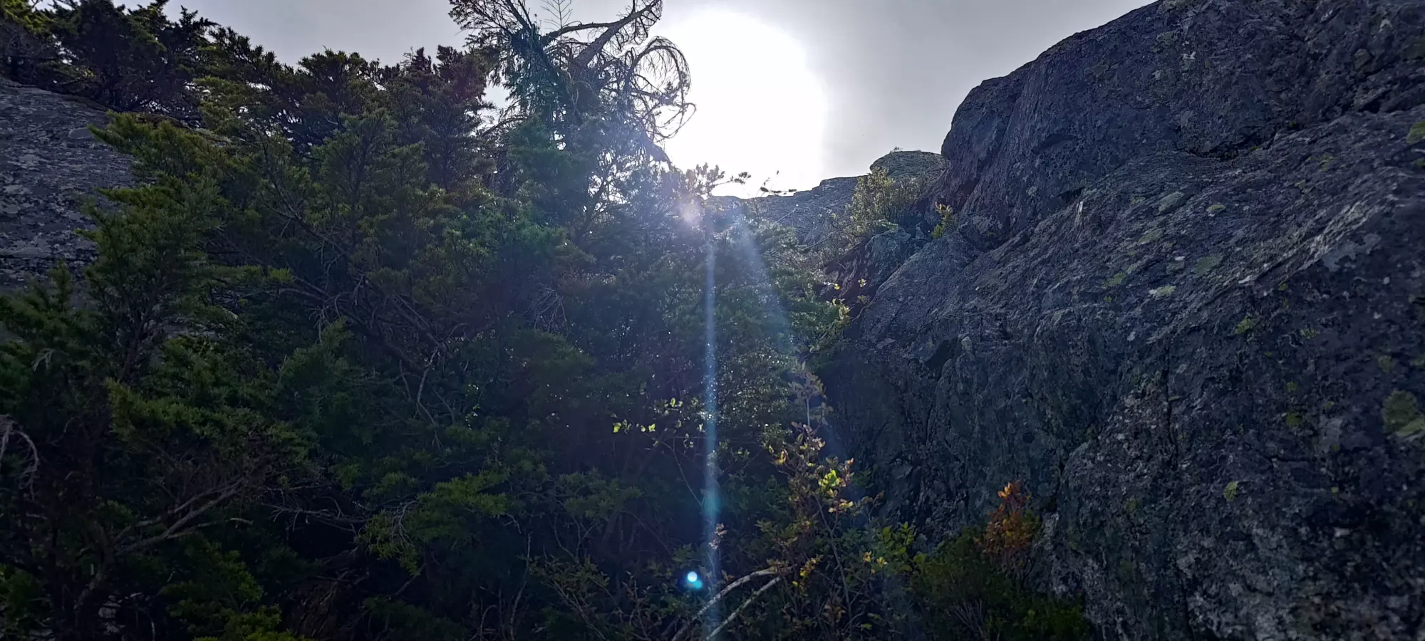
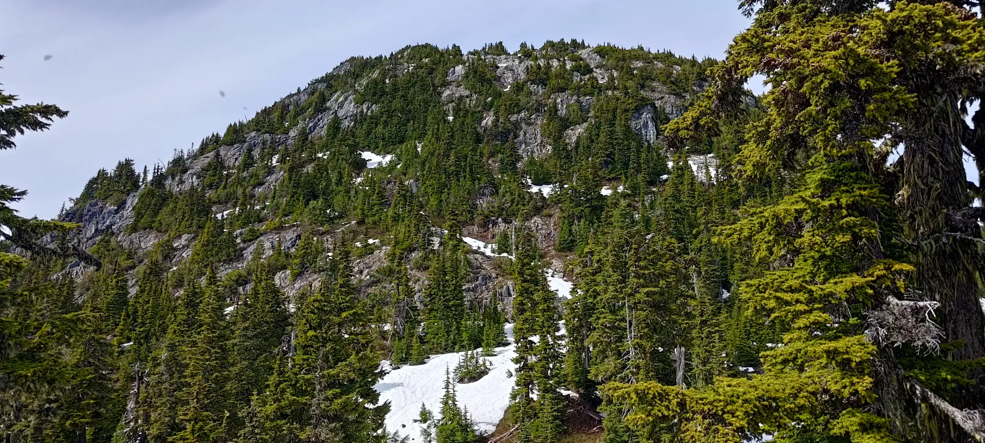
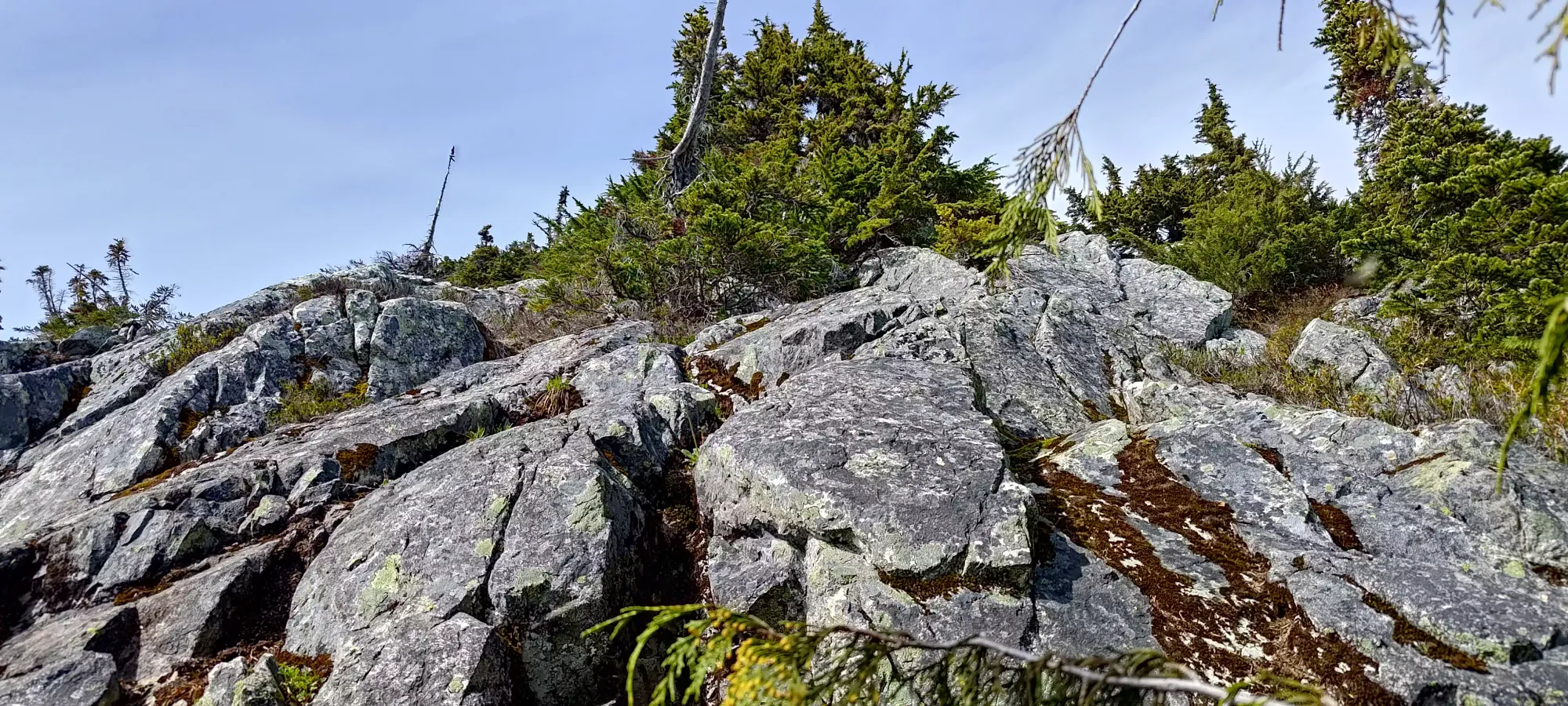
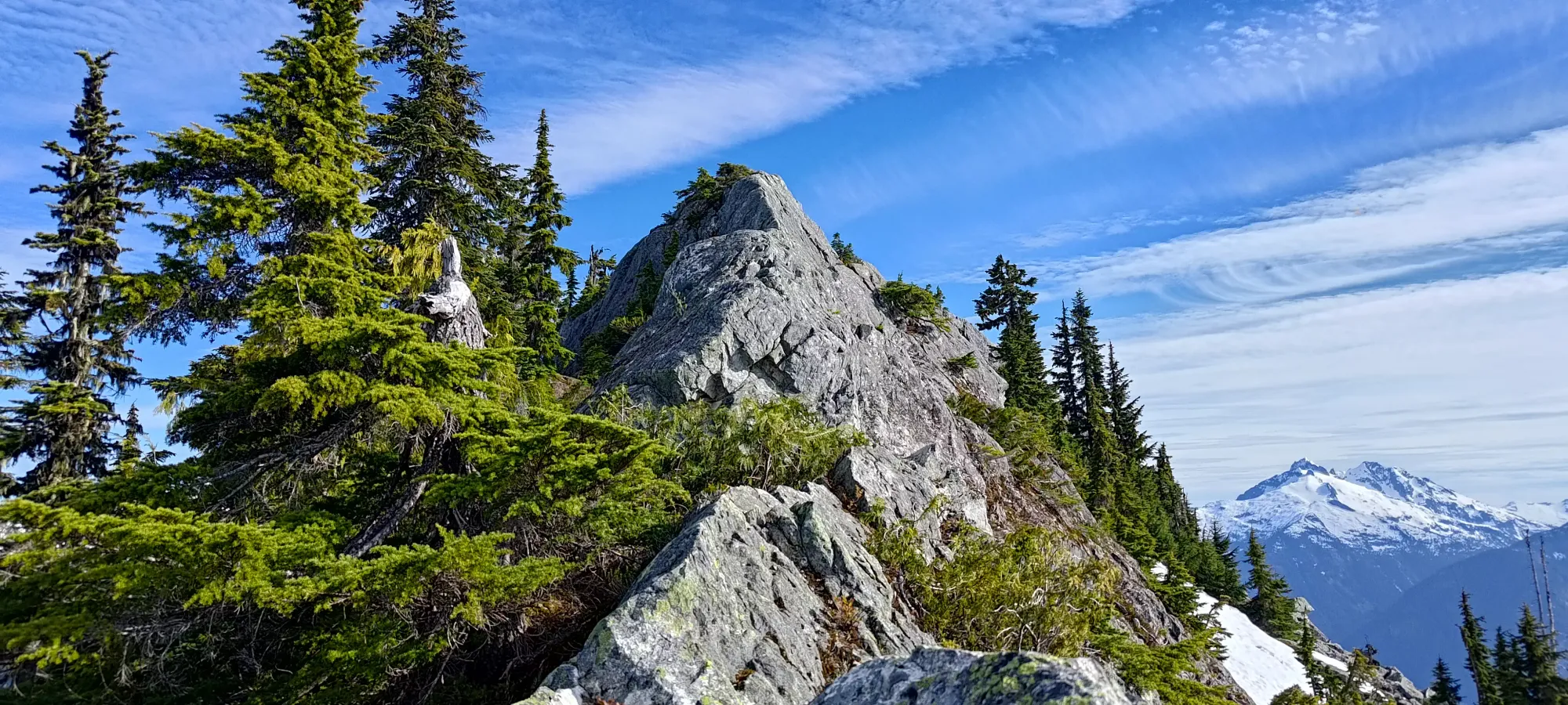
The next 20-30 minutes were a mix of steep dirt slopes, general bushwhacking, and navigating bluffs. There were a few sheer faces which might've been climbable, but I didn't particularly want to find out solo. Instead, I generally trended to climber's left until about 1550m or so, when I started cutting back to climber's right, as the terrain was getting less tree-dense and more rocky, and I figured "if I was scrambling anyways, I may as well stay close to the ridge itself", since the plan was to be on top of it as much as possible. There were a few difficult moves, and I'd definitely say it was class 3 in places, but there's no death-defying exposure to this point.
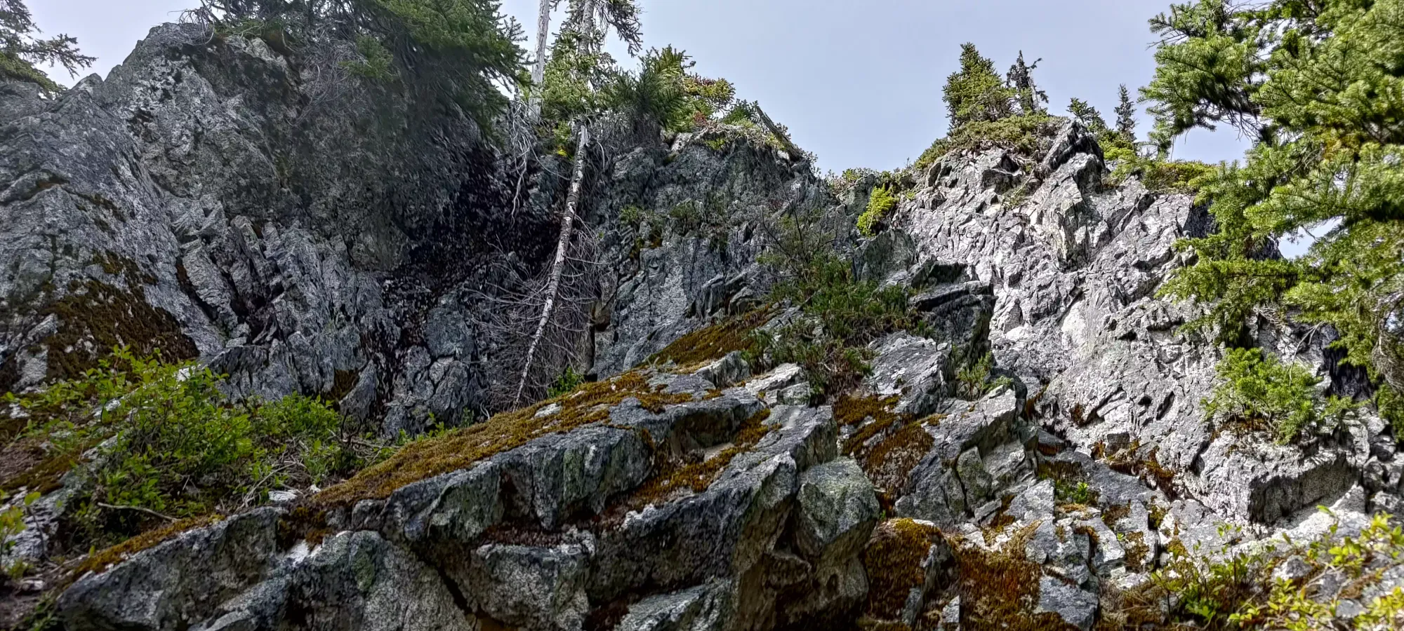
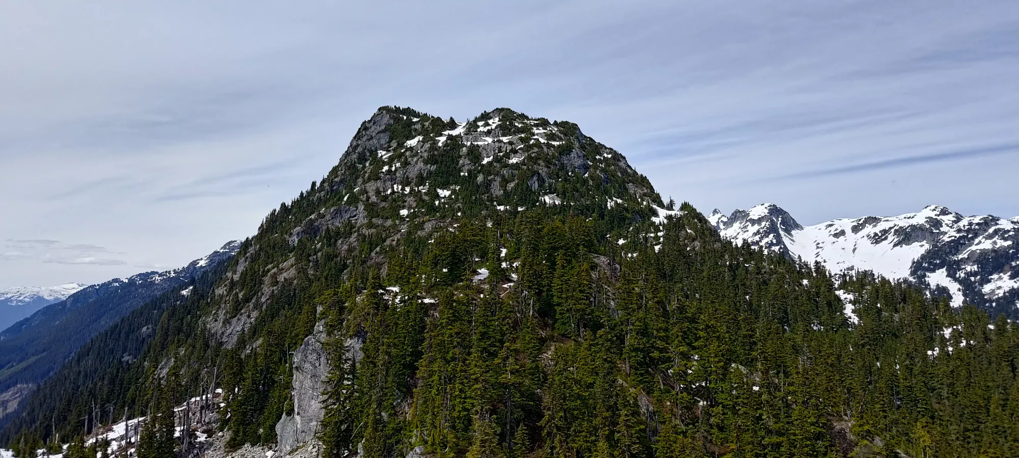
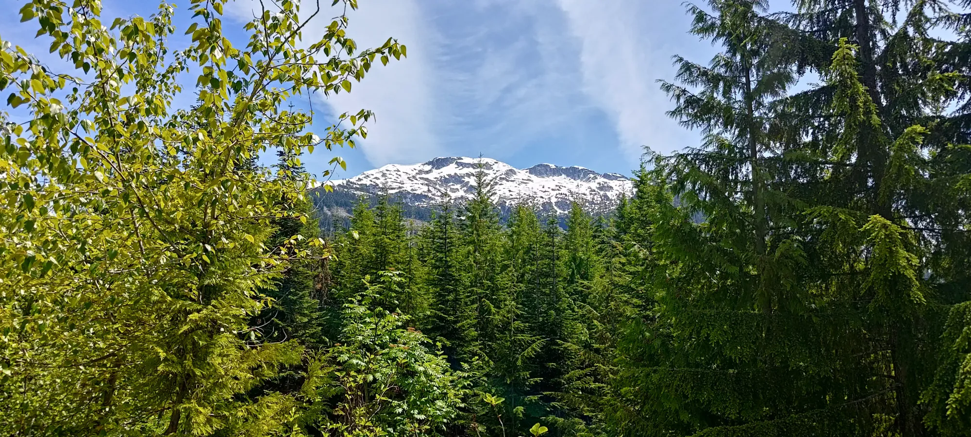
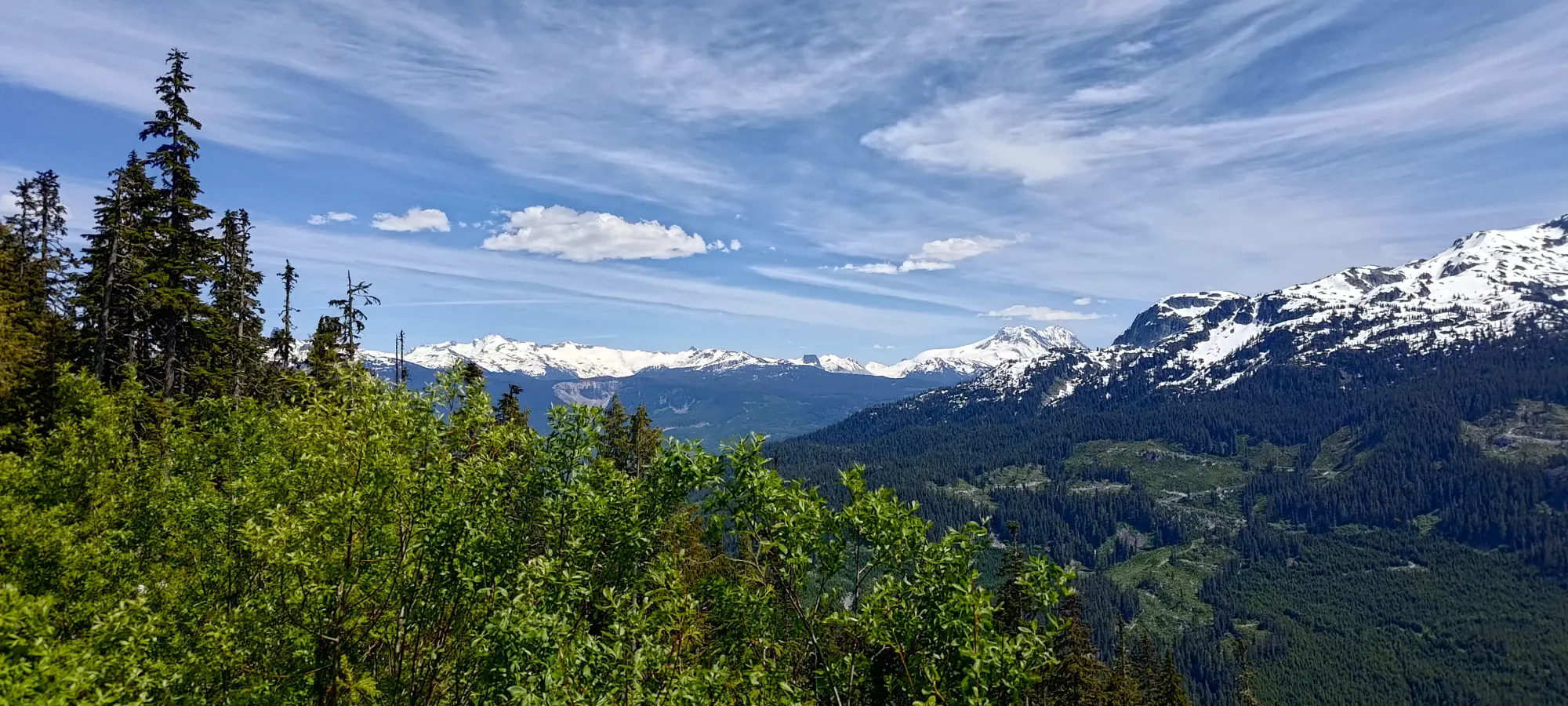
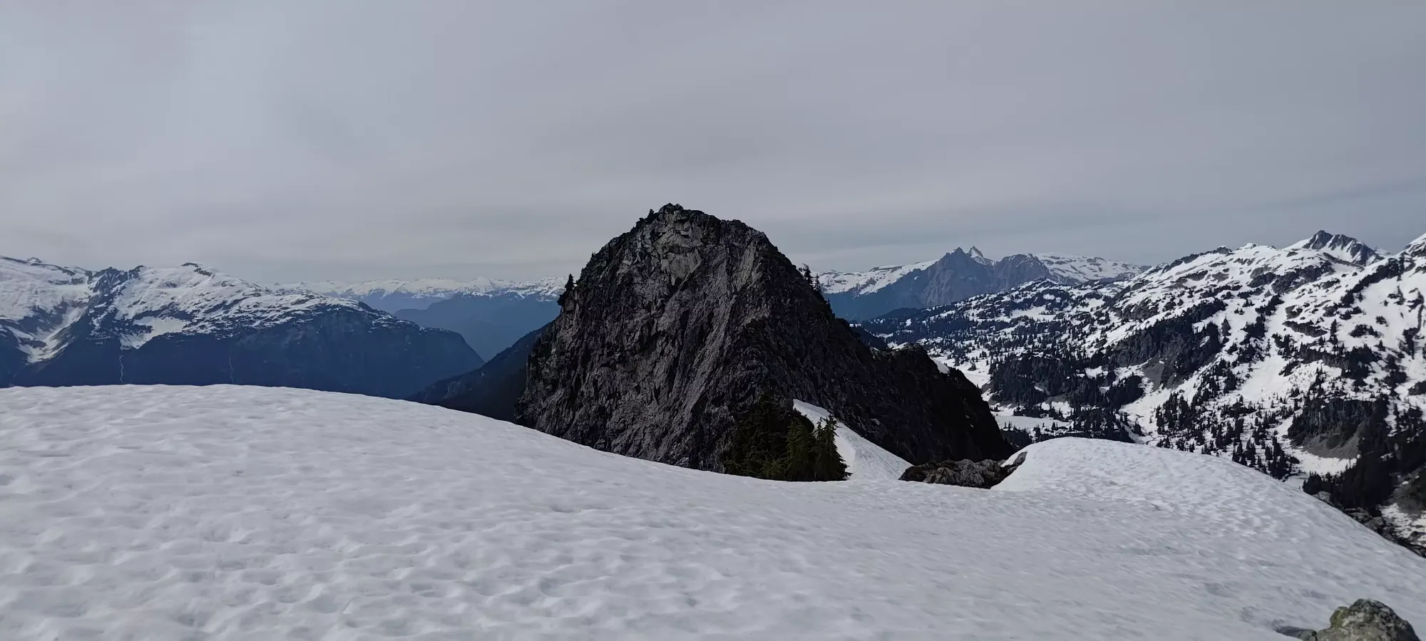
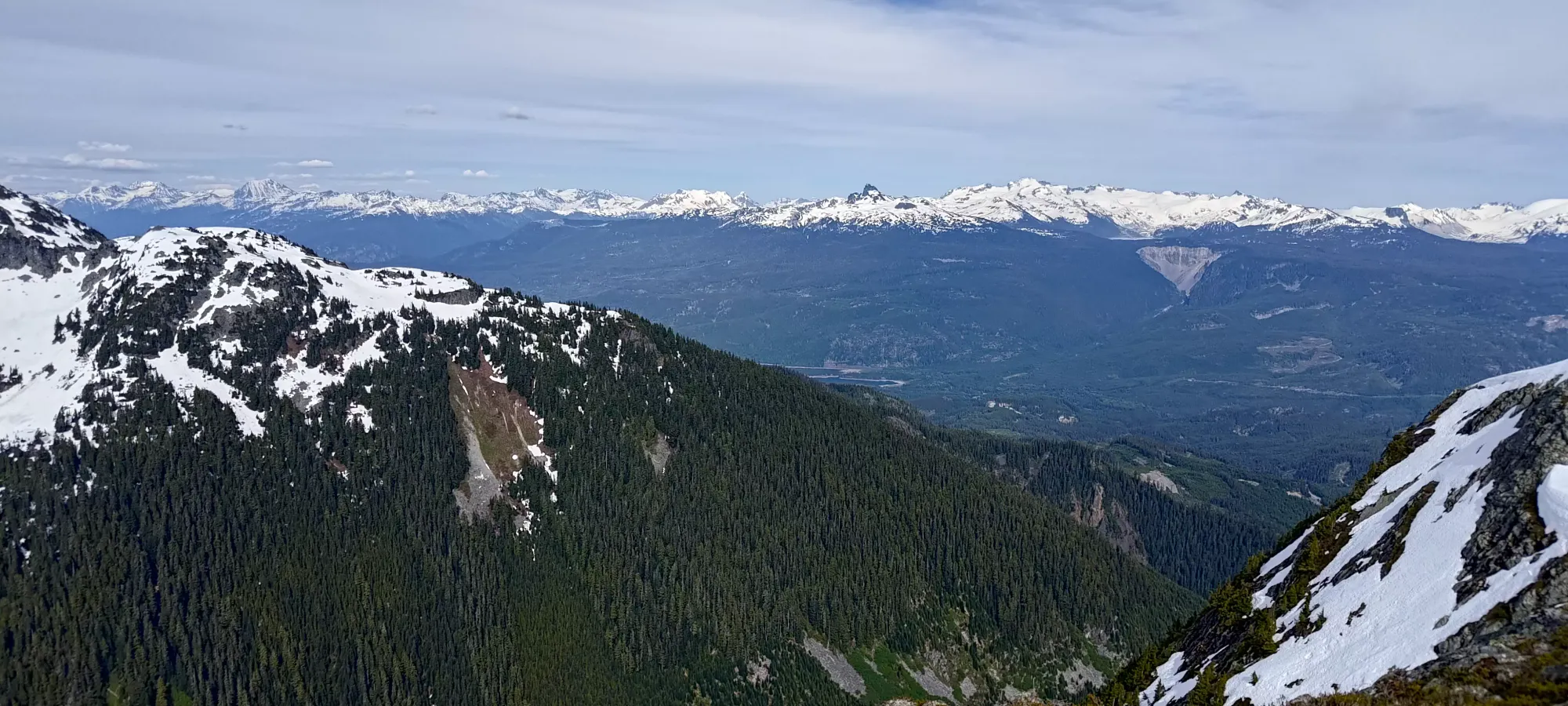
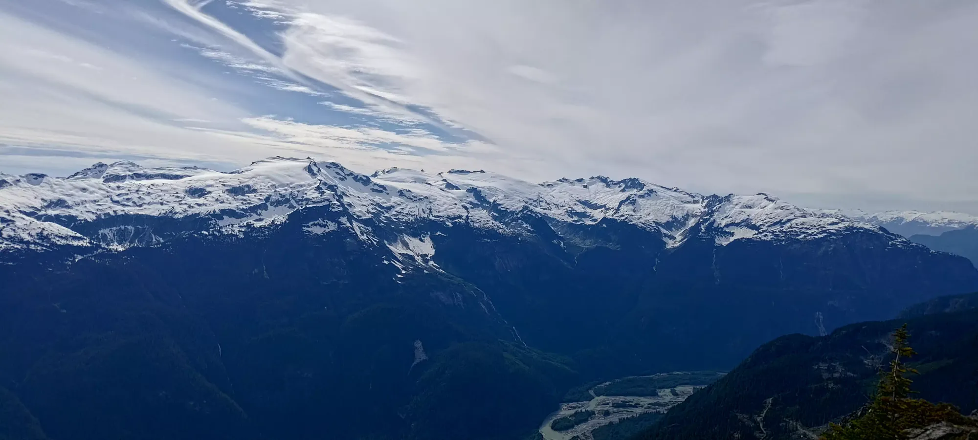
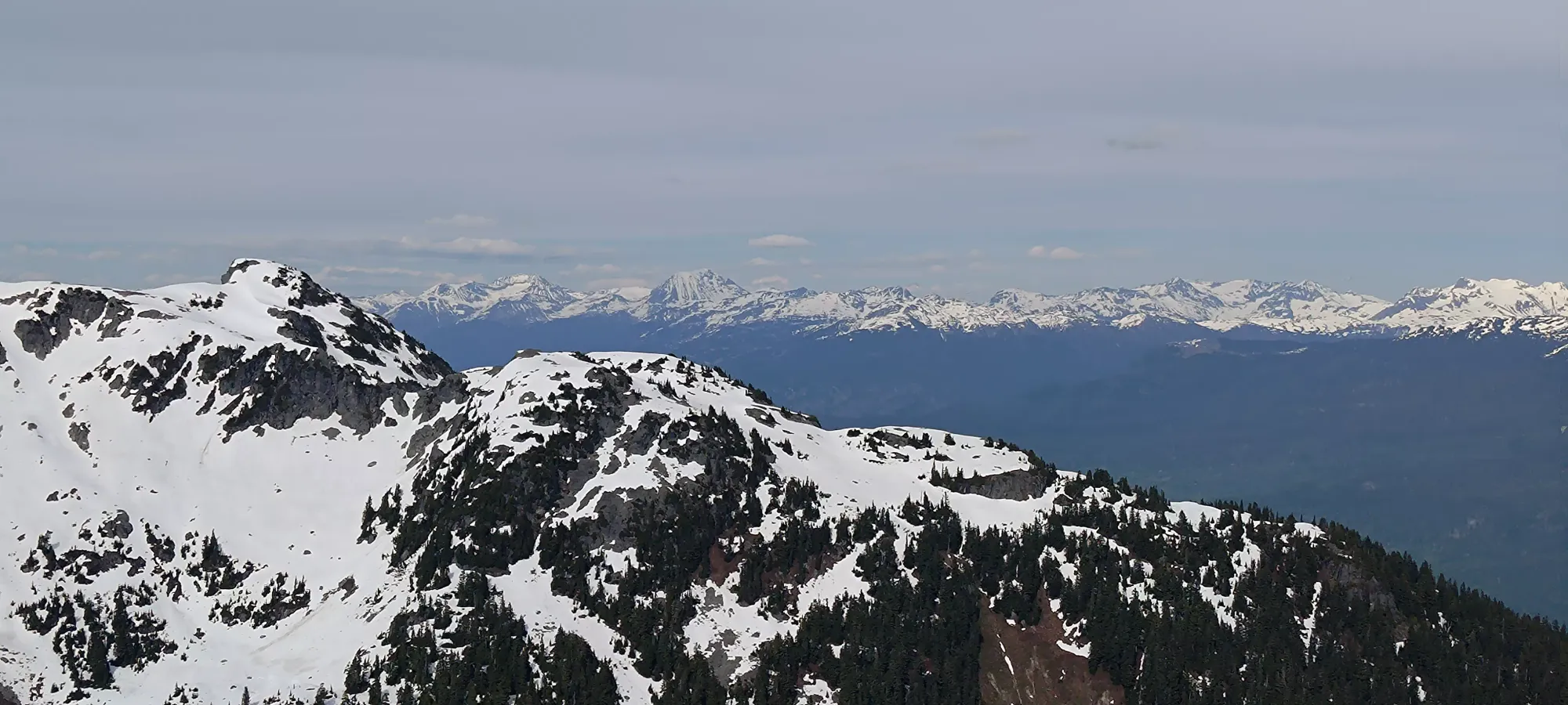
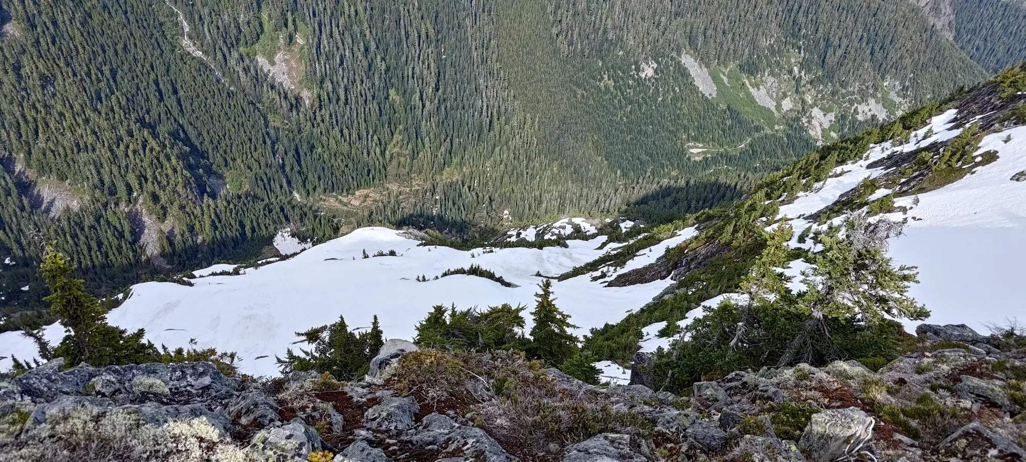
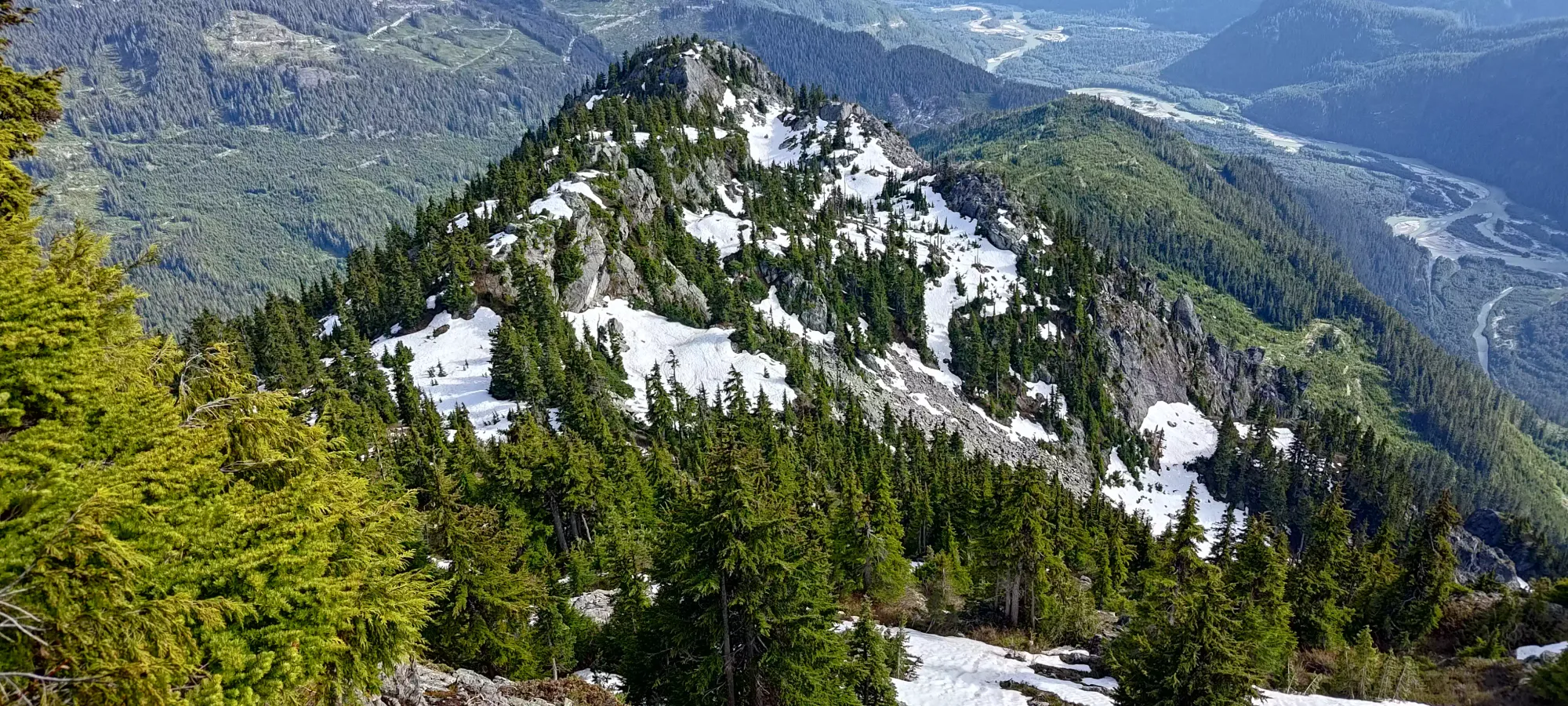
By 2:45pm, I managed to get myself above the forest and bluffs, and up around 1600m, at the southern summit that marks the proper start of the treeline ridge (this was apparently surveyed at 1613m at some point). Here, I could finally see where I was going with respect to the summit, and I also found some snow, though I didn't need to actually step on any of it to reach this southern high point.

To hit that 1613m high point, there was some minor scrambling, with easy moves but larger exposure, as the drop especially off the climber's left (west) side was quite severe. I preferred to stay on top for a better vantage point and to minimize elevation loss, though, so on top I stayed. I'd have loved to stay and enjoy the views, but I barely managed a swig of water before I was sick of being swarmed by bugs, so I continued moving rather hastily.
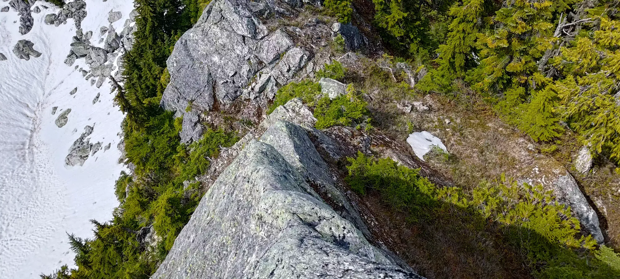
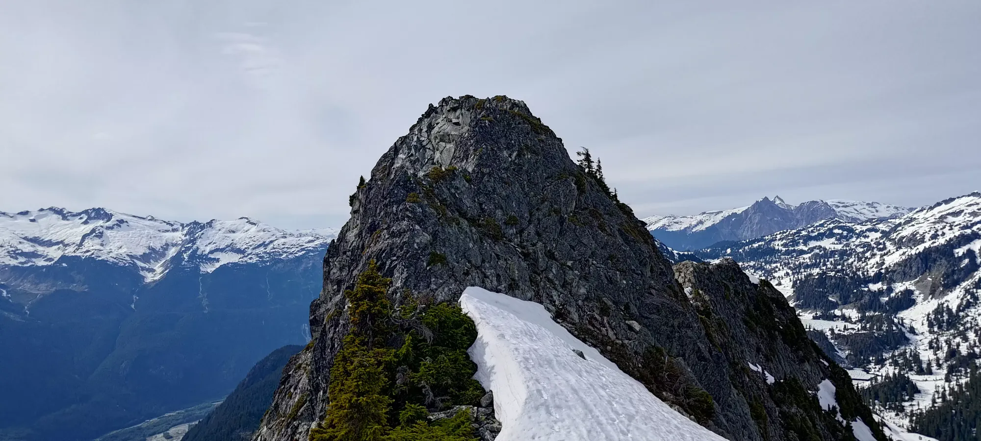
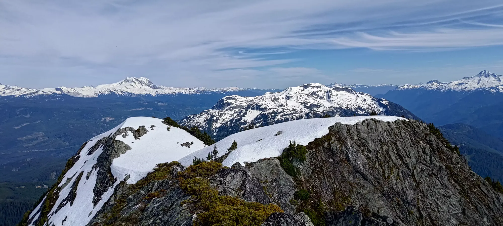
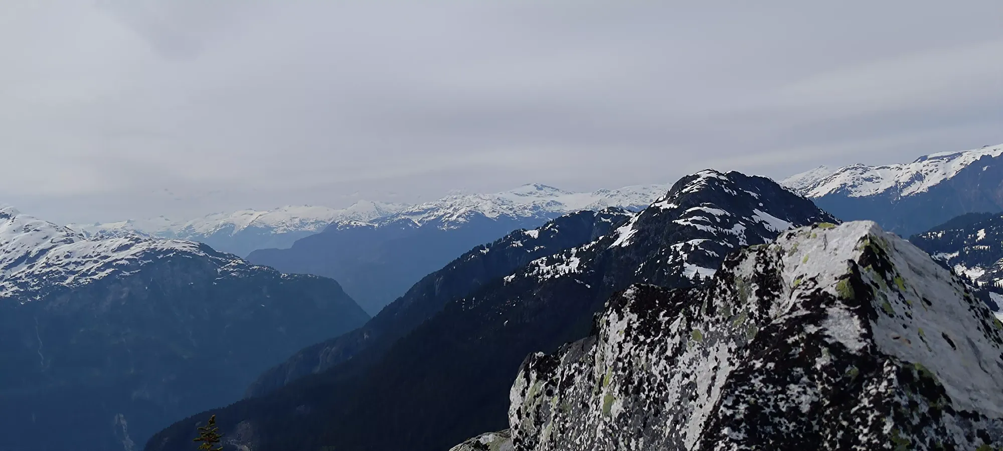
Getting off this small high point required one move where I basically did a negative pull-up to lower myself down to a ledge (to skier's left in the photo above). After that, it was more easy scrambling/walking, until I was on another rocky outcropping which ended rather abruptly heading straight, so I had to descend a steep gully with a tree in it to provide stability on the right/east side of the ridge to get back onto walkable ground. Once I did, though, it was fairly smooth sailing for a while longer.
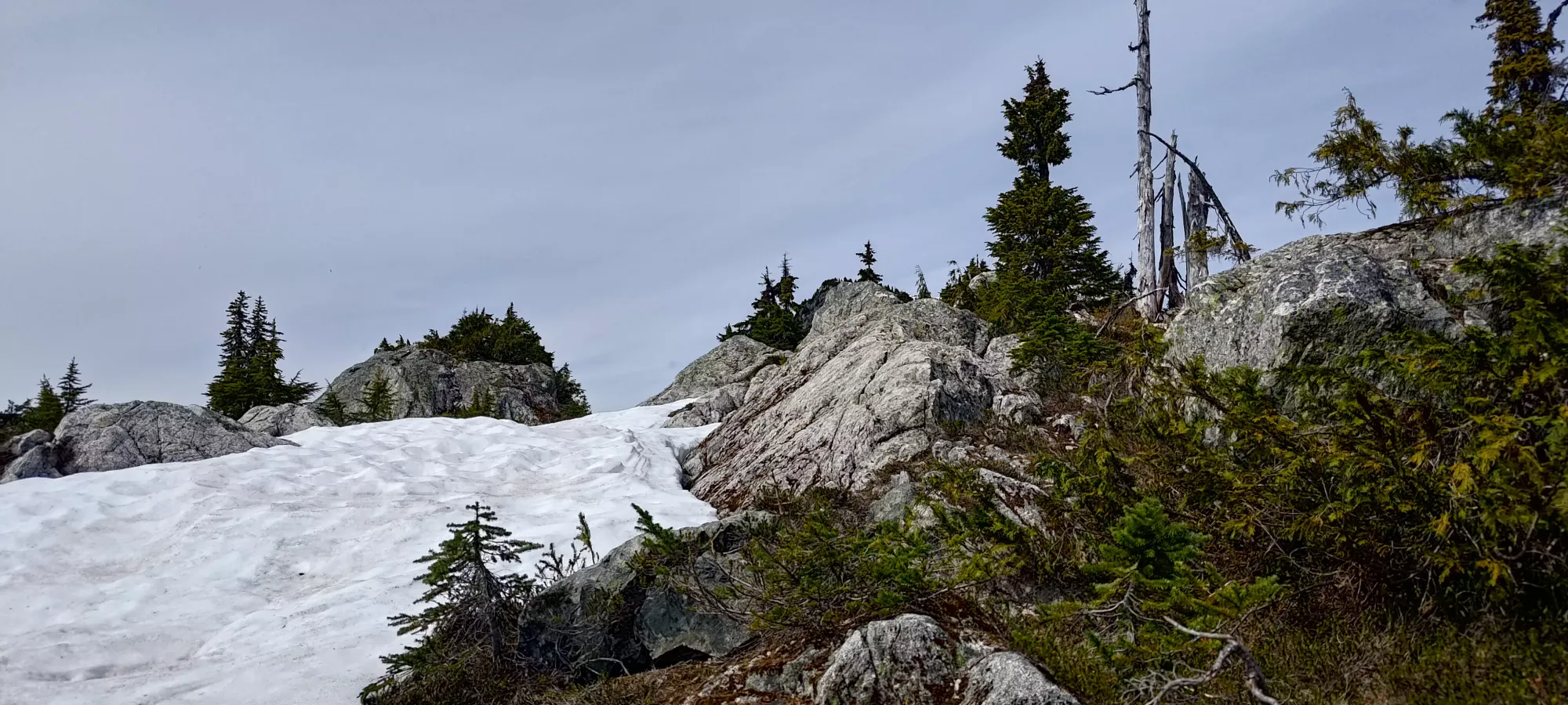
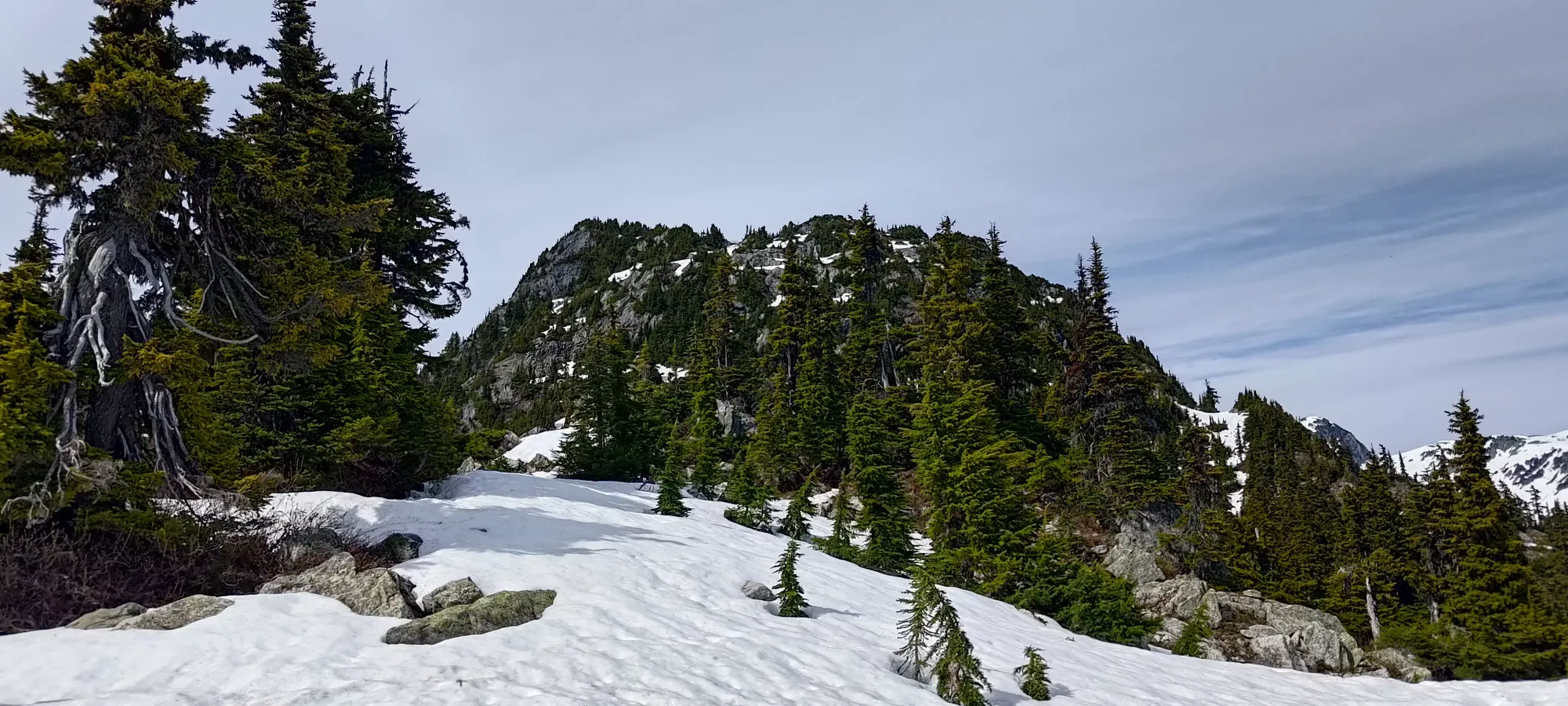
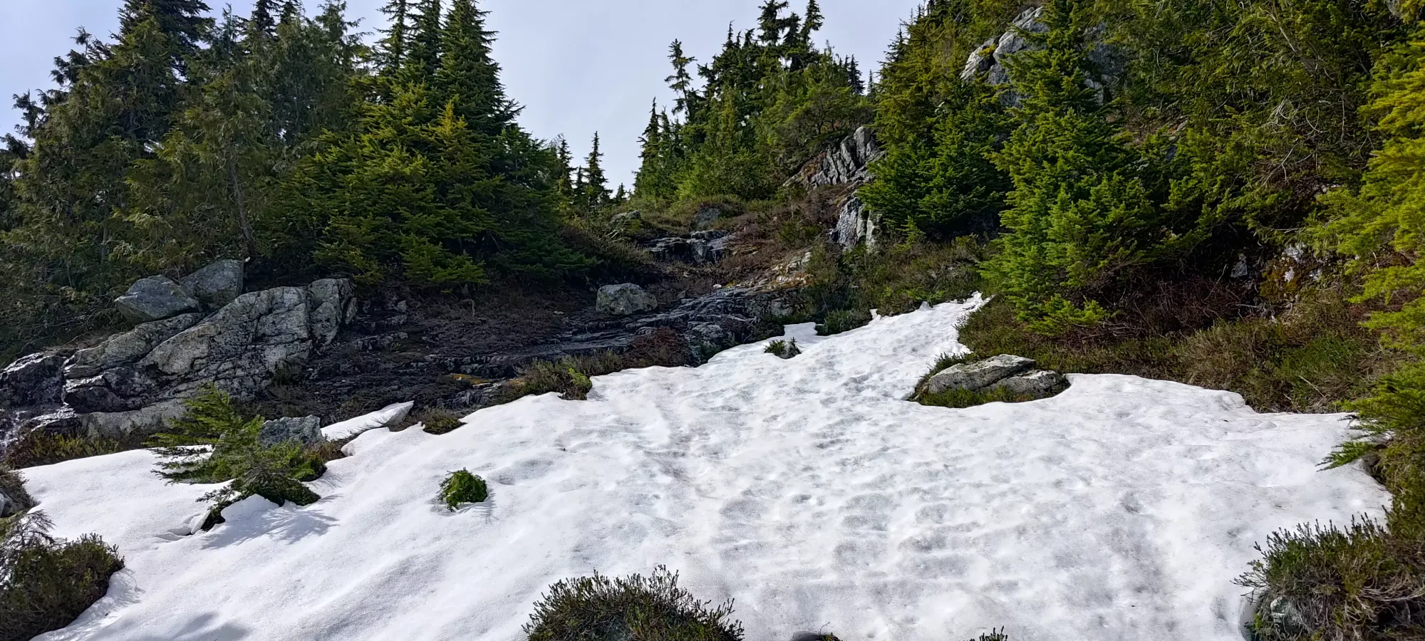
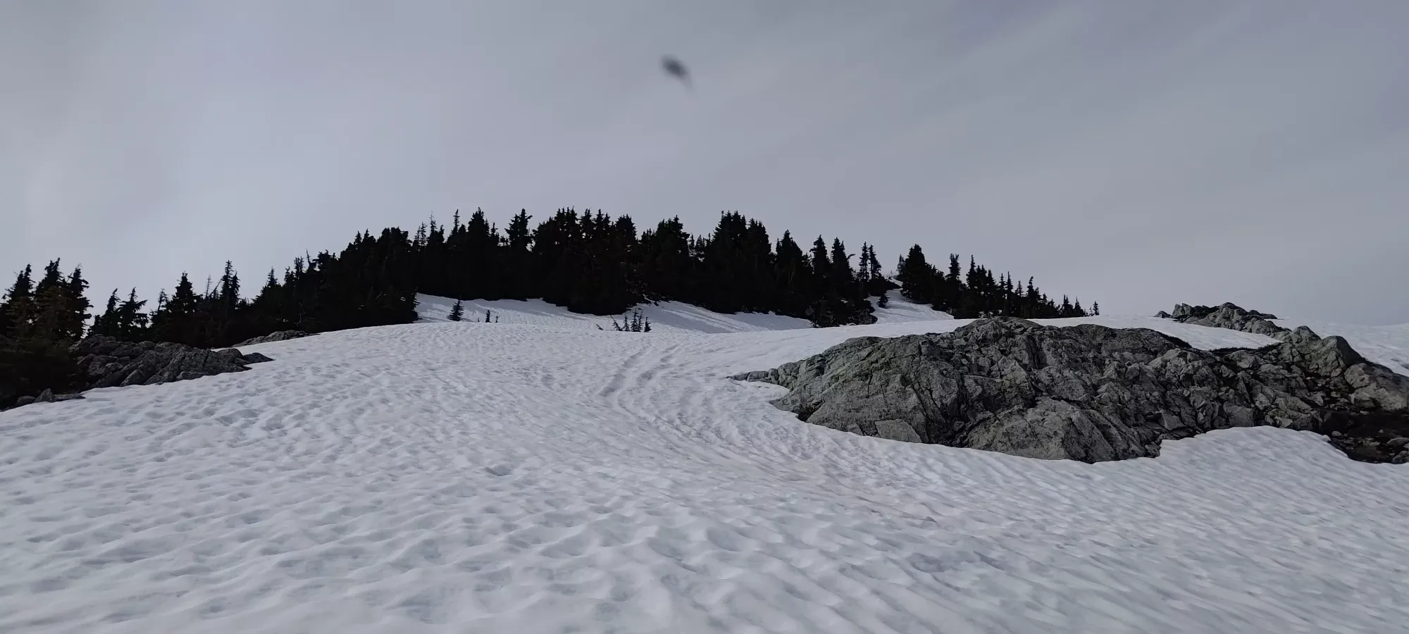
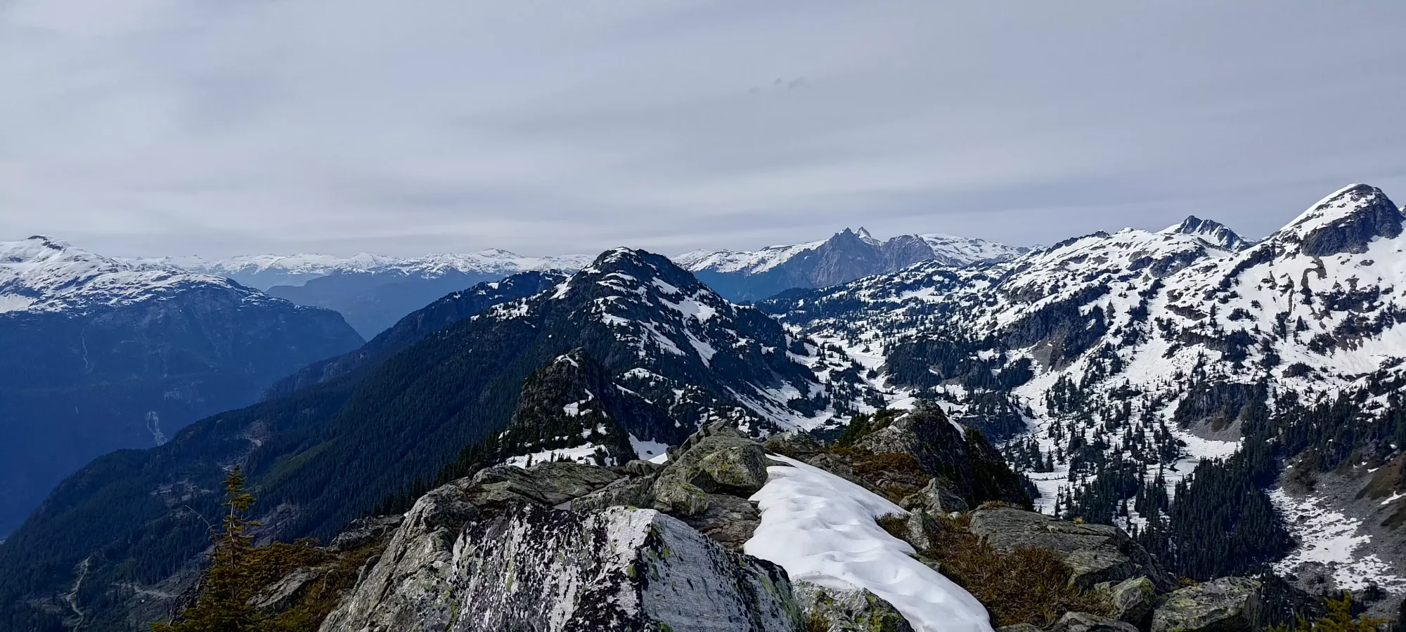
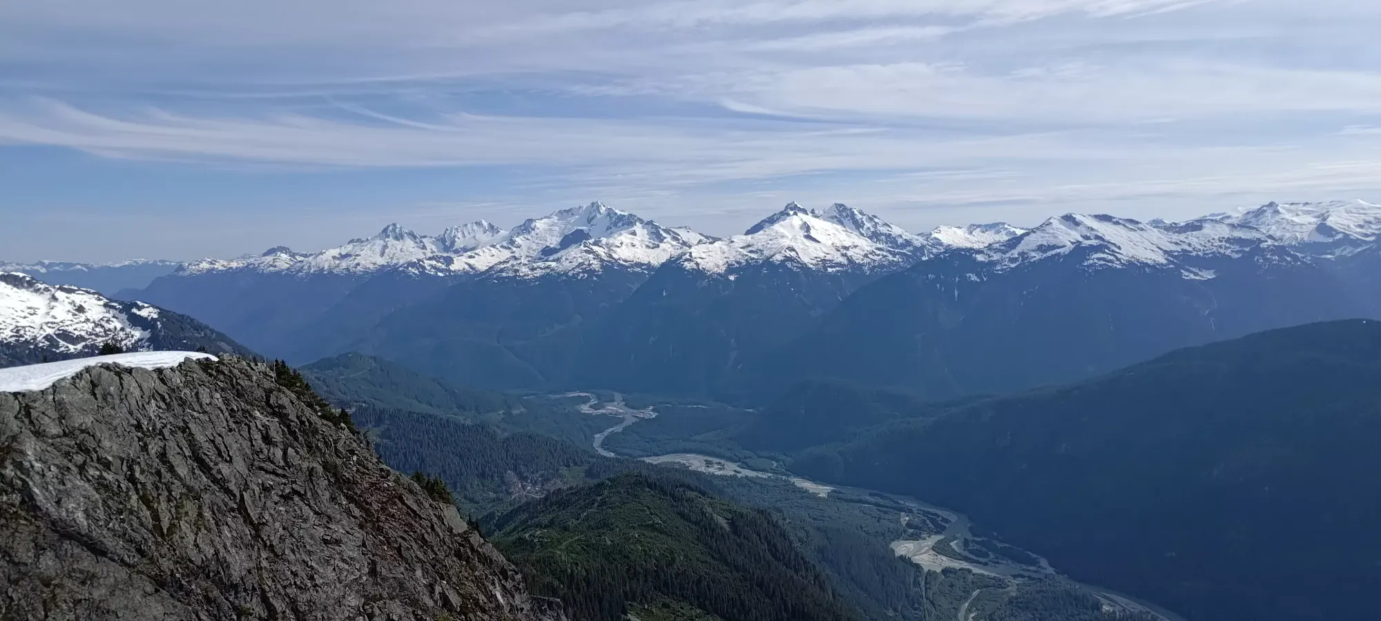
There were a few more metres to descend after the gully, and I probably stayed too close to the ridge proper, as I had some bushwhacking to do which I didn't repeat on the way back. Thankfully that was only a few steps' worth, and it only took a few minutes and a couple small patches of snow-walking to get down to the low-point, where I crossed over the ridge back to the west side, as I found a large snowfield that seemed to continue a decent ways up towards the true summit, which would provide simple travel for me.
At the snowfield, I quickly got my spikes on (again robbed of the chance to take a nice break by the insect onslaught) and started making my way up towards the summit. I gained maybe 50m in the snow (fairly supportive, no postholing) until it had curved up to climber's left, and started thinning out as the terrain got steeper, and the meltwater flowing under it got more intense. Once there was enough exposed terrain to stick to that instead, I took the spikes off and went back onto the rock (the spikes were not necessary, but were handy, and not too burdensome to carry up. My ice axe which stayed in the pack all day was much more useless).
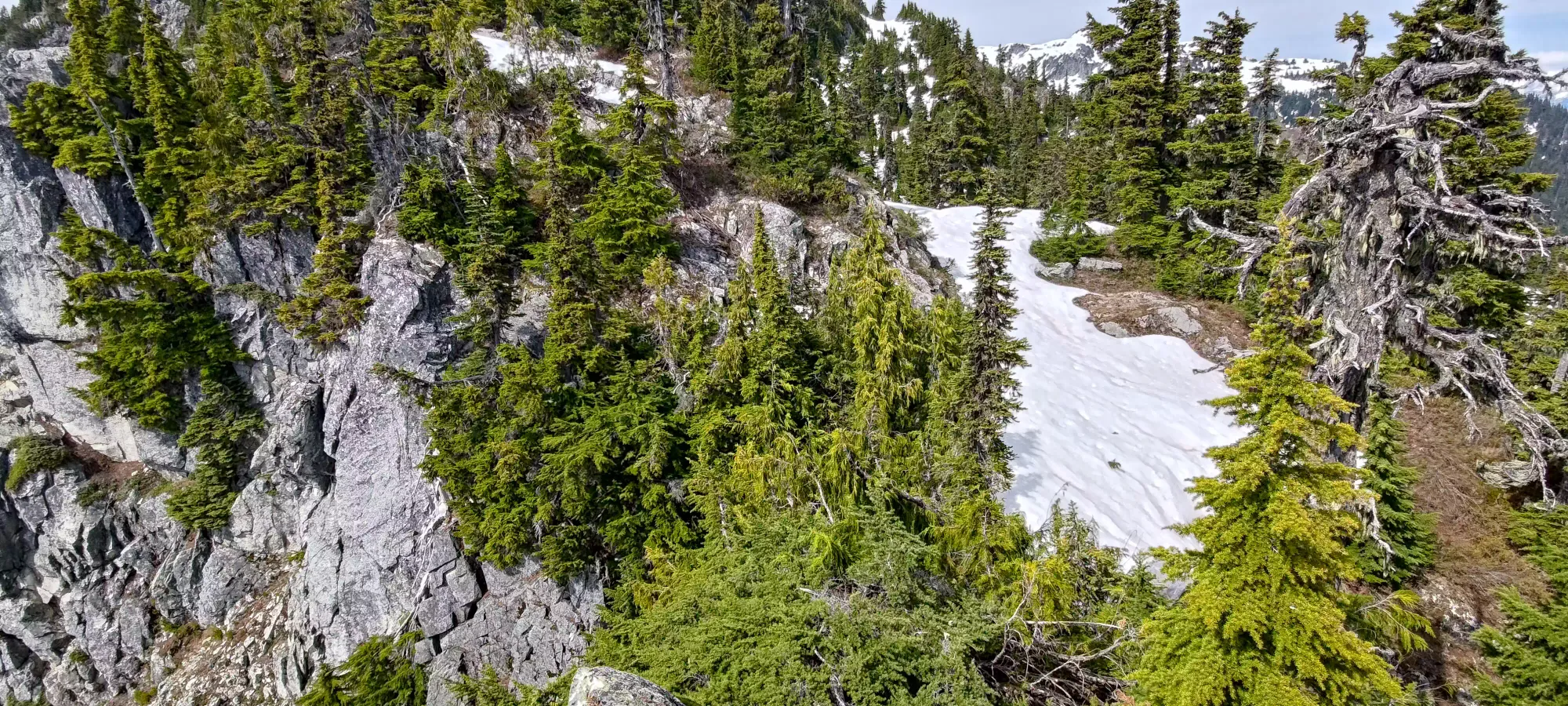
From here, for the next 10 minutes or so, I walked up the bluffy terrain, with small bushwhacking stints to get through to "the next open area" interspersed into my travel. This got me up to a bit above 1700m.
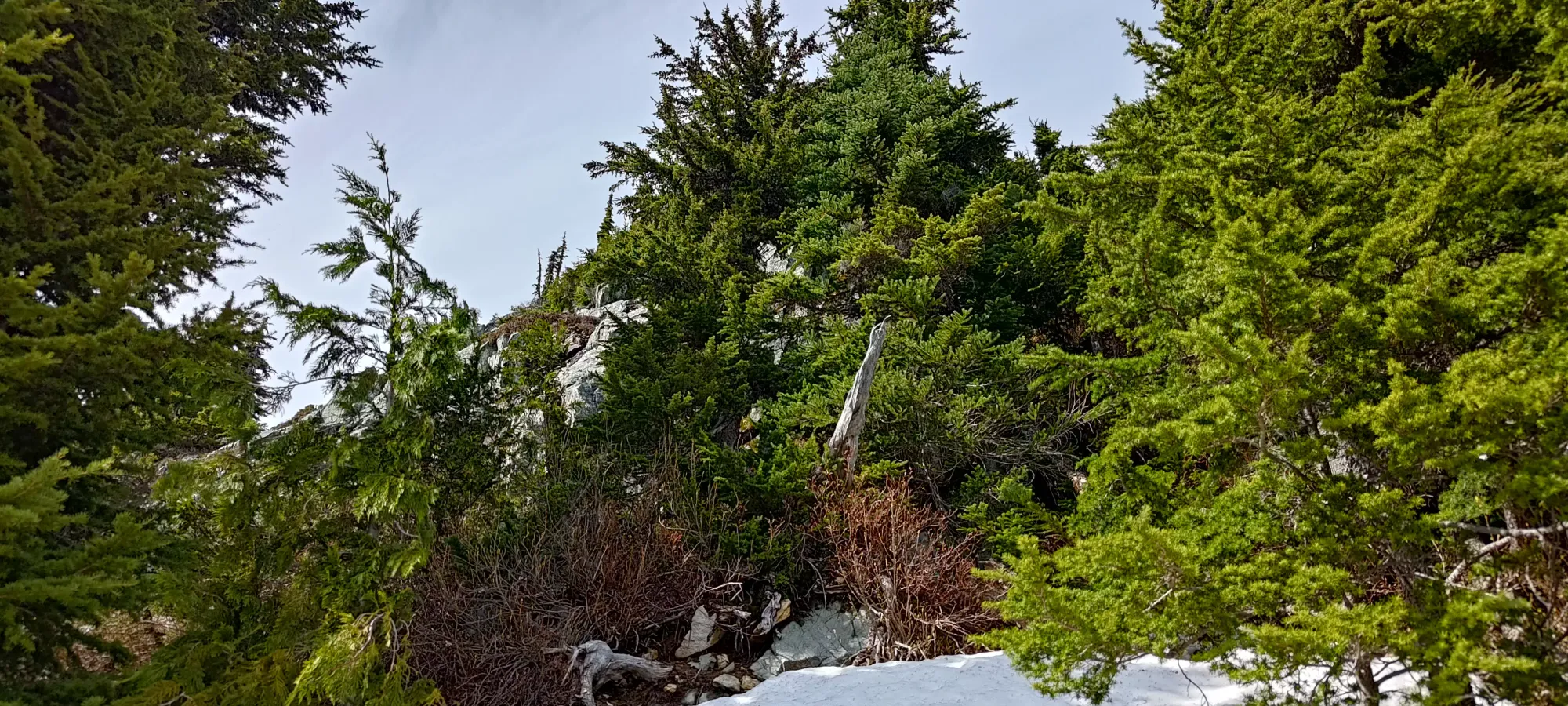
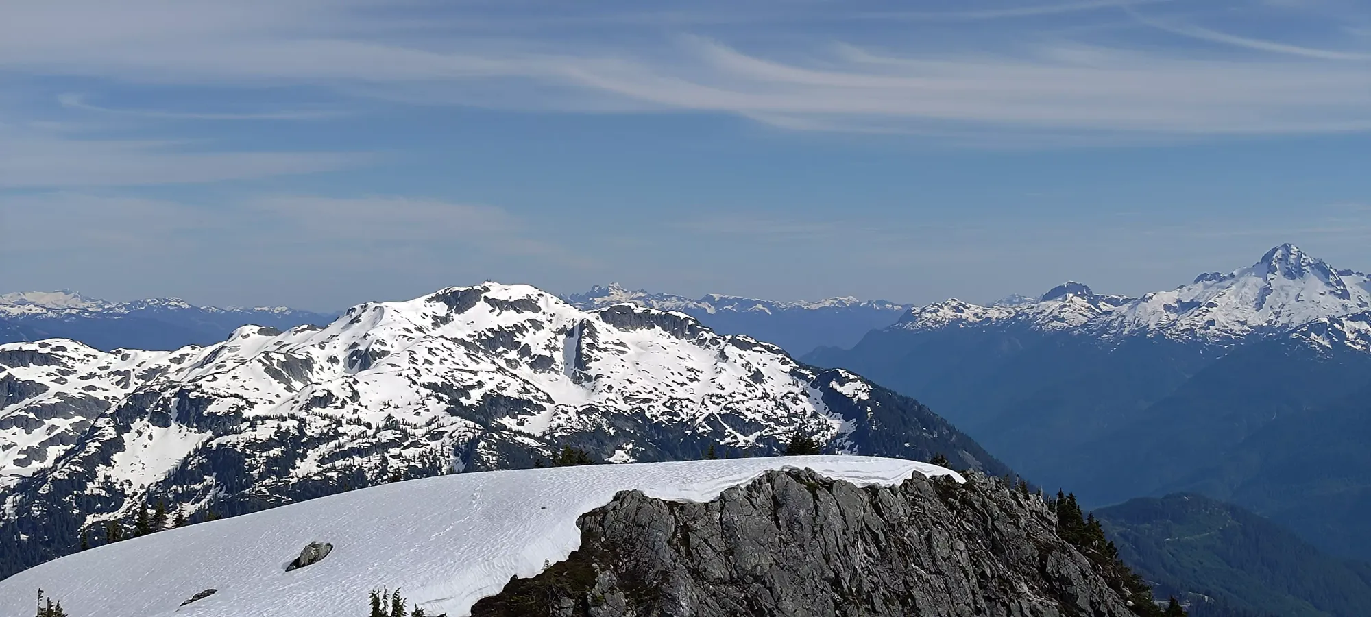
Up to 1800m was a bit more scrambling, including one face I actually had to make some exposed and difficult moves on to get up, exacerbated by the wetness from snow melting higher up. Overall, the rock was slabby, but broken up enough that good holds were generally easy to find. Grippy shoes would definitely help one feel more secure, but my trail runners did me well enough, and I made quick work of the rocky sections, getting up to 1800m where the terrain levelled off a bit, and the snow returned as a result.
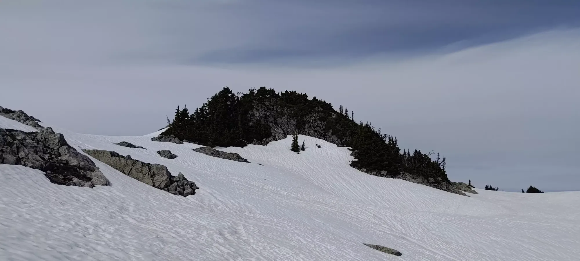
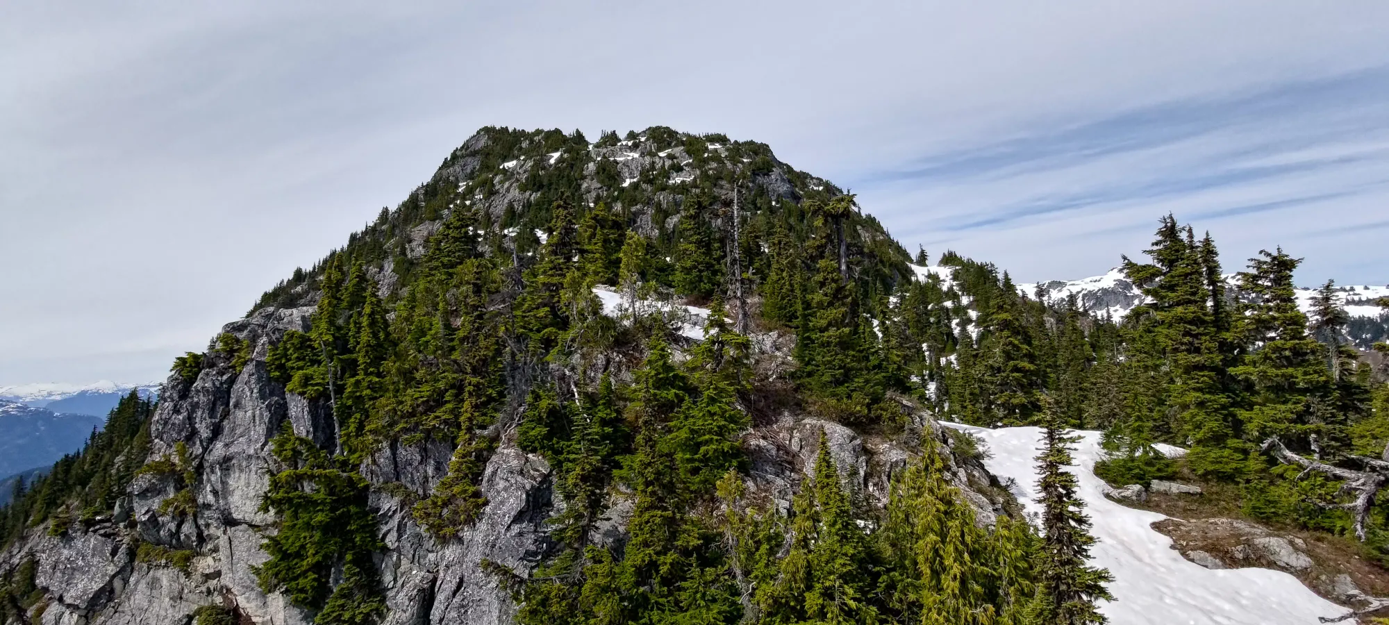
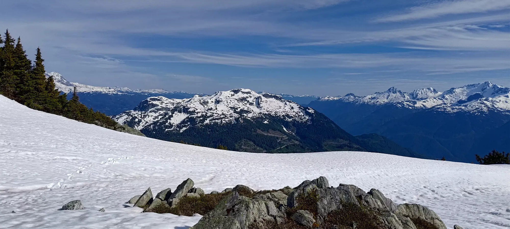
Once on the snowfield, I thought I was on the final stretch. 5 minutes of walking up the snow brought me to what seemed to be the summit until I actually got up there, at which point I realised there was another scramble along a rocky ridge to the true summit, just a bit further north and higher than my location on the top of the snowy false summit.
I took the snow down to the final col, where I left my poles+backpack, and got myself ready to scramble to the true summit. It looked potentially imposing from afar, but up-close, it was actually quite chill. There was some exposure, but you could largely avoid being right on top of the ridge by sticking to climber's right, and the moves were easy. Less than 5 minutes and I was finally on top, a bit after 5pm 🙂
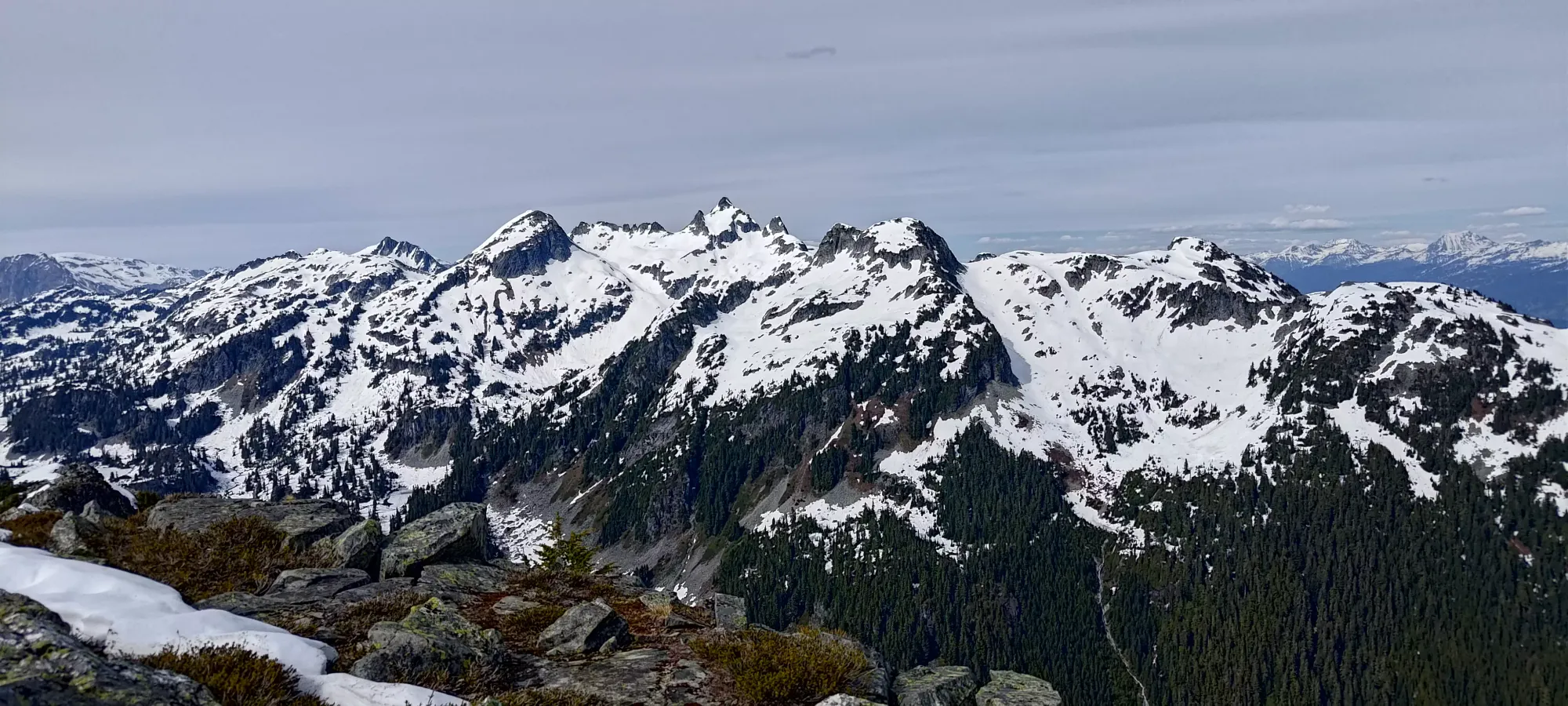
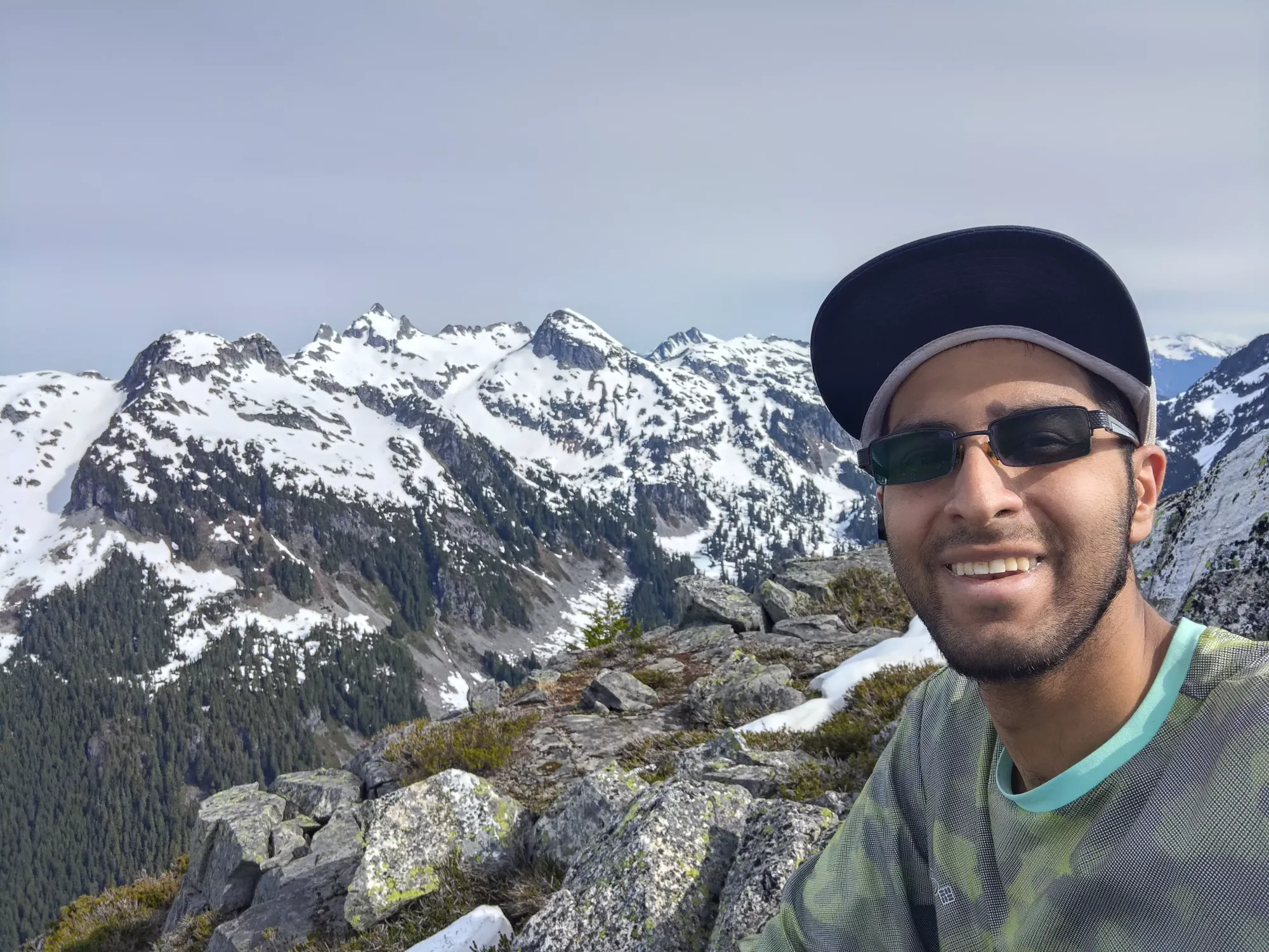
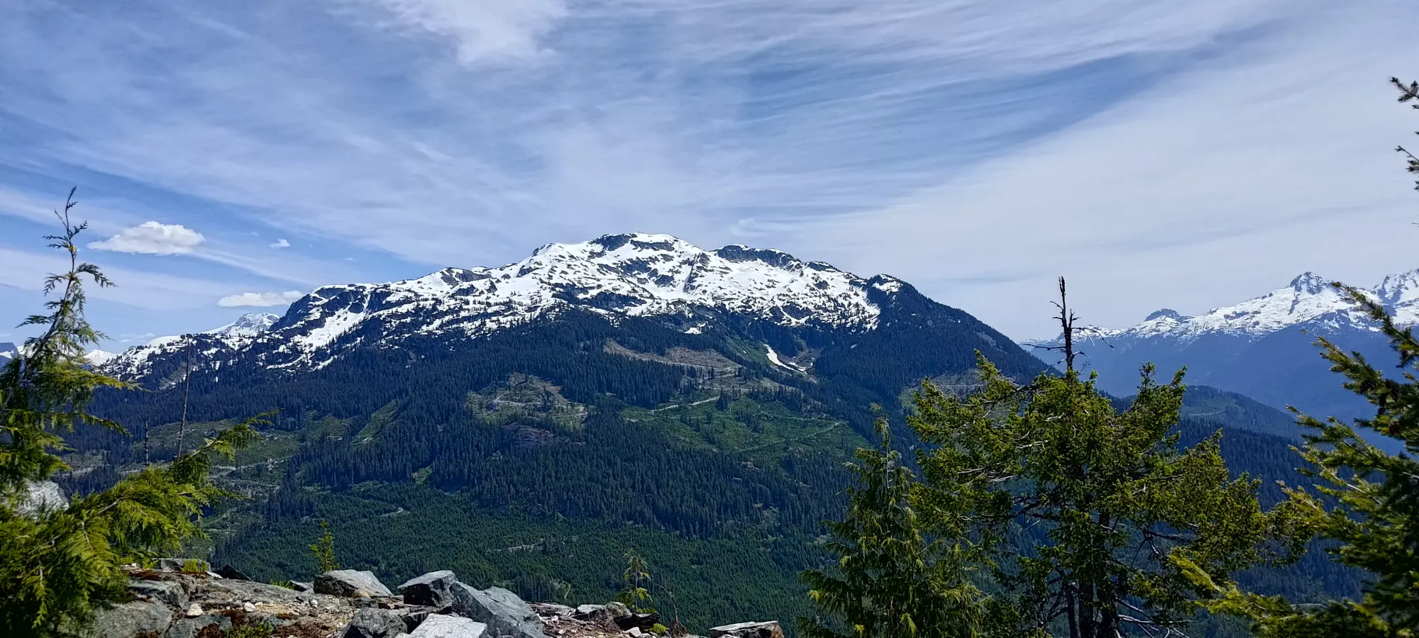
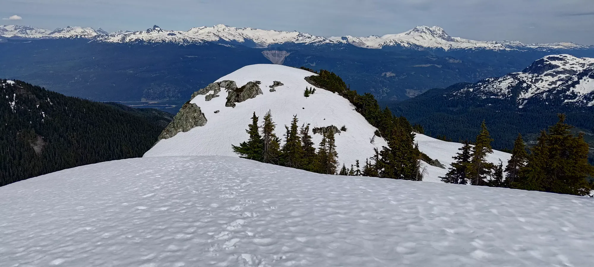
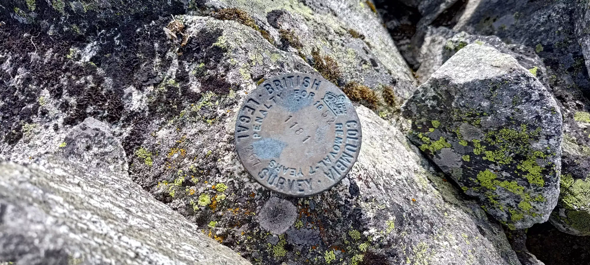
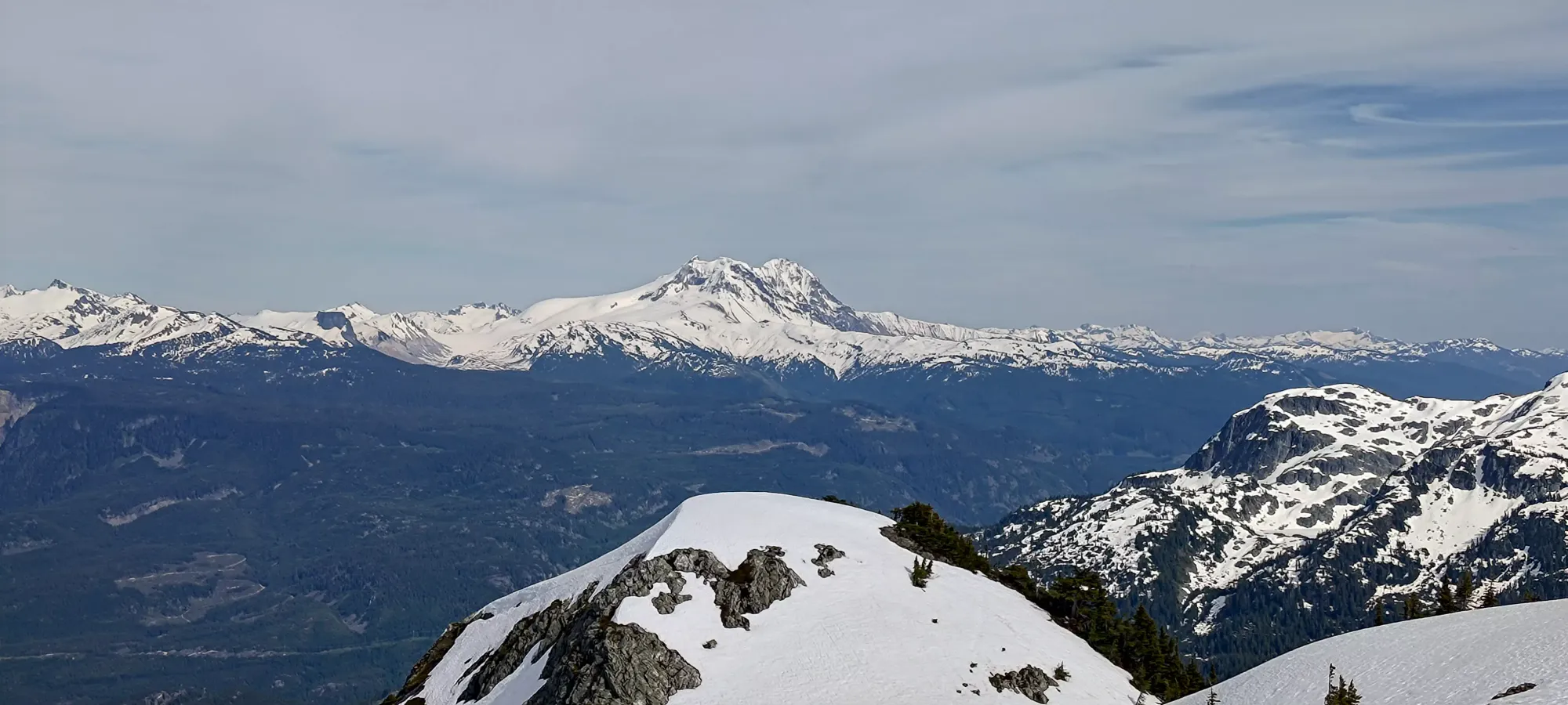
I took lots of summit photos, as the views were excellent and the weather clear. Plus, the bugs finally let up on the final summit ridge. I was a bit disappointed, though not surprised, to find a small summit cairn and BC survey marker at the top. I guess I'll have to settle for first internet ascent only (or I can delude myself into thinking the surveyor made the cairn, and was flown in, which a great but unlikely fantasy).
After getting back to my gear, I took about a 10-minute break to unwind and enjoy not being eaten alive while I caught my breath. Including the long FSR walk, the summit was only about a 3.5 hour trip, so I wasn't expecting the descent to take more than 3 hours, but my digestive health lately had been poor so I hadn't eaten anything (I had snacks, but only had one pack of gummies here), and I wasn't expecting many opportunities to rest given the bugs, so I was expecting to just have to push basically from the summit back to the car. So, after that break, I got moving just before 5:30pm.
The hike down started pretty nice, as I got to stay on the snow for a little while, which was a very easy way to descend, as it was soft enough to plunge step, but firm enough not to posthole. However, I soon ran out of snow, then had a short bit of easy scrambling, and was back into the harder terrain in around 10 minutes. Of course, by that time, the bugs which disappeared right at the summit were back in full force, in fact, actually worse. In the afternoon, it got so bad that not only were there dozens around me at all times, but literally multiple on my skin at all times as well. And I had long sleeves and pants!!!
The downclimb, despite being a different area than the crux on the way up, worked out alright, and I even found a good stream to refill my water bottle in before continuing down. After getting my fill of refreshing snowmelt, I just followed the easy terrain until I realised I was getting too downhill and not enough over to skier's left, so I started cutting across the slope hard until I met up with the big snow patch I'd originally ascended from the bottom of the col.
From there, I plunge-stepped and walked back across my tracks to the bottom of the col, and then started my way back up to the south summit. From the start of the serious downclimb off the top to here was around half an hour. The crux descent off the south summit from the way up was no problem to clamber up on the return, thankfully (usually going down is harder than up in scrambling), and I was soon on my way towards the forest.
From the south summit, I again followed the path of least resistance rather than hard following my uptrack, which seemed to work out fairly well. I think the descent route might've actually been slightly easier, as I didn't really have any exposed or difficult scrambling moves to make, and got down to the top of the boulder field in about half an hour. At this point, the bugs were at peak ridiculousness, and I was solely focused on getting the hell out of there, as it was just miserable, and my hands were actively bleeding in a couple places from the bug bites (I'm sure my face/neck was too, but I wasn't about to stop and pull out a mirror to check).
The boulders felt looser on the way down, so I didn't get through them as fast as I'd hoped, but that's also kinda just how boulder fields go, generally. Once I got through that section, I once again descended a bit too directly and had to cut to skier's left in the mature forest to get back into the cutblock at the end of it, where the road reaches the highest elevation (as that would provide easier travel than the cutblock would, of course). The boulders, lower forest, and cutblock did go by fairly fast overall, though, as it took only 15 minutes for me to arrive back at the road.
Once I was on the road, I'd hoped the bugs would disperse, since they weren't present on my way up, but that hope was quashed thoroughly, as they did not let up whatsoever 😞. So, rather than getting to enjoy some water and relax on my way down, I rushed myself down the 4.5km road in 45 minutes, with one stop for a couple sips of water (which I'm sure probably cost me a couple bug bites just in those 30 seconds). Once I was at the car, I didn't even change my shoes or unpack my bag at all, I just removed the rocks I used as chockstones as a parking brake backup, tossed the gear in the car, and yeeted the heck out of there.
Once I got down to the end of the Squamish River FSR, I stopped to air back up, and since my compressor is a pretty pathetic "on clearance at Canadian Tire" unit, it took quite a while, so I took the time to change into my casual shoes, have some water, etc. while that did its thing. Overall, my time was just under 6:15 for the hike, which I'm happy enough with given the exploratory nature of the trip. I'd definitely recommend giving this peak a try, and it can be a lot shorter with the beta I've hopefully provided, a vehicle that can get to 1250m instead of 850m, and if you bring bug gear or go at a better time, maybe it can even be pleasant too! This counts as my first first internet ascent of a "real" peak (I don't count small trashbags I might've been the first to bother with), so I can't be too disappointed, even if the red spots all over my hands and face might belie other feelings 😅
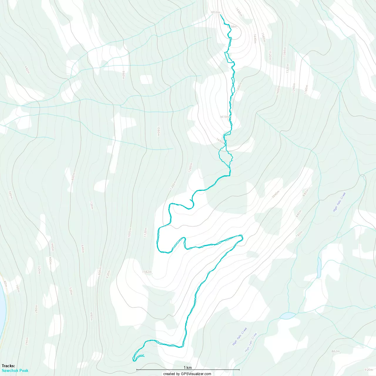
GPX Track + Map