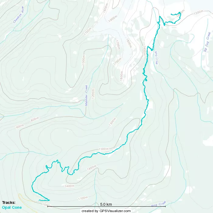
Opal Cone - August 1 2023
A simple but looong hike in Garibaldi Park


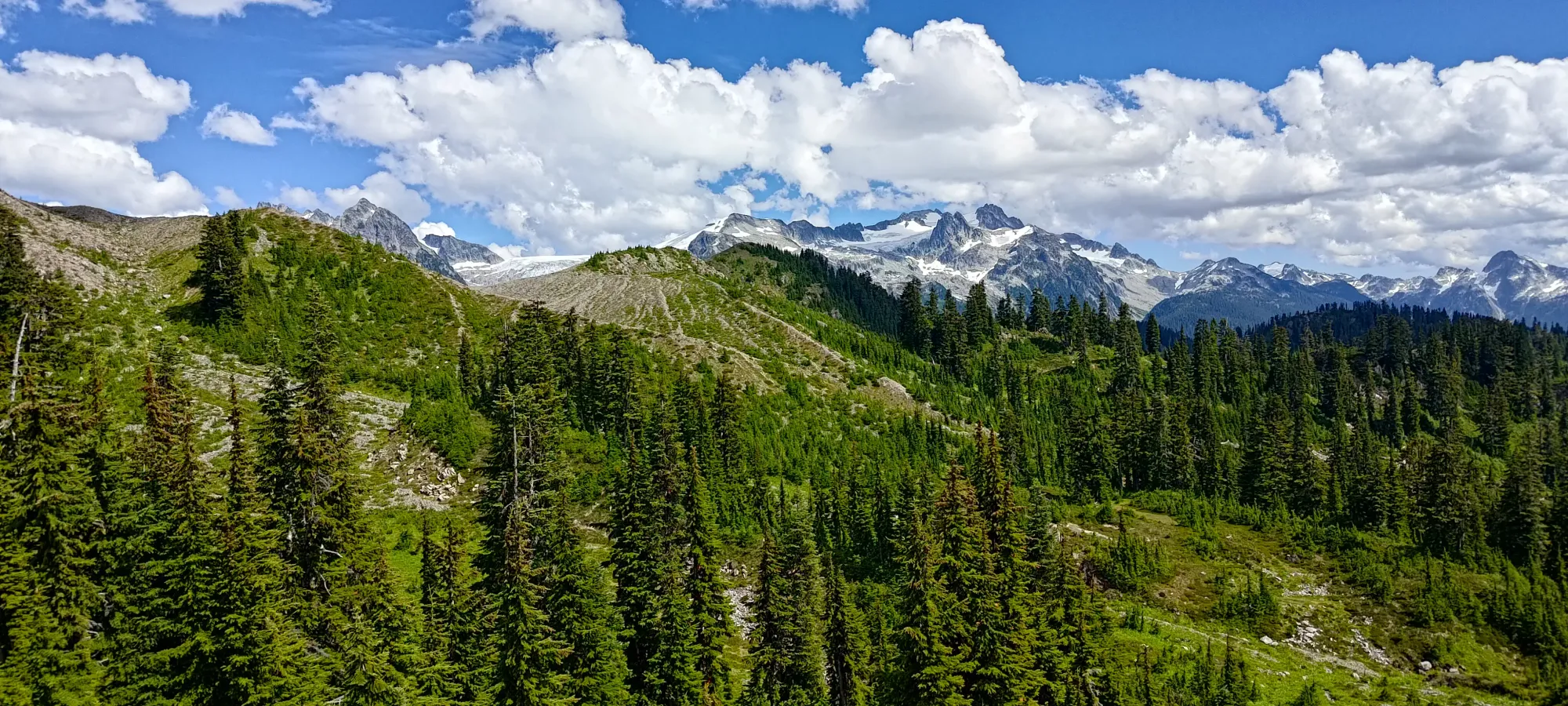
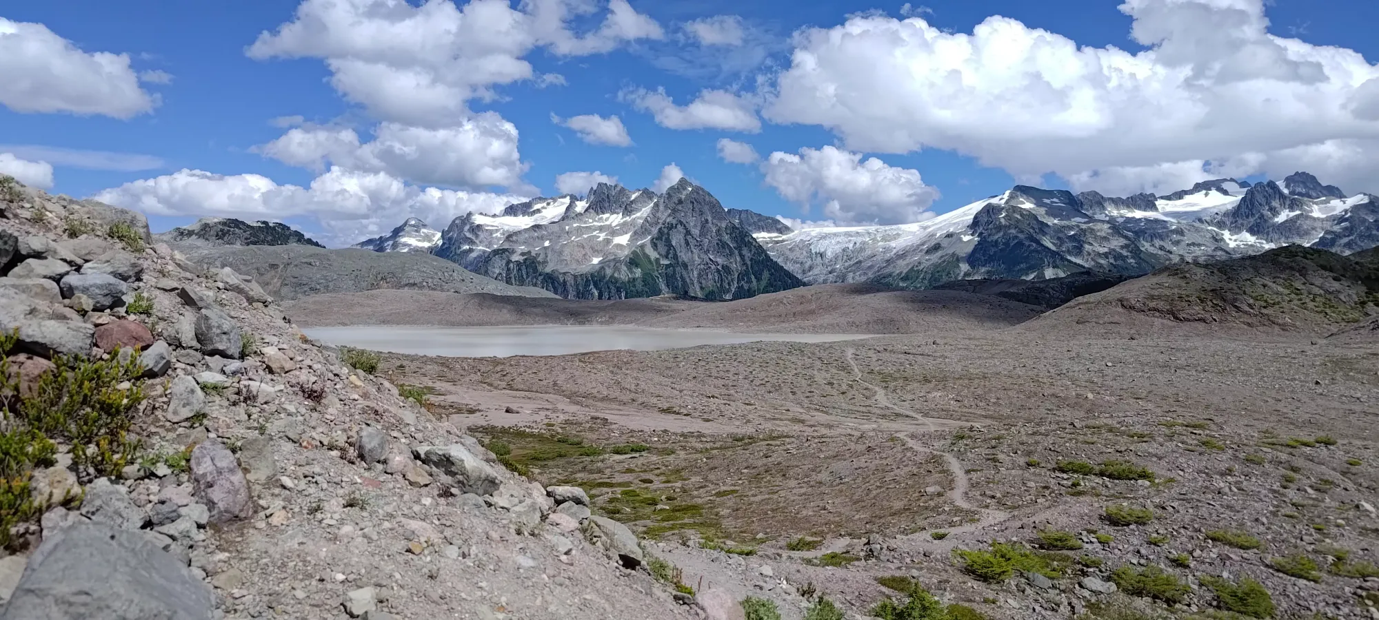
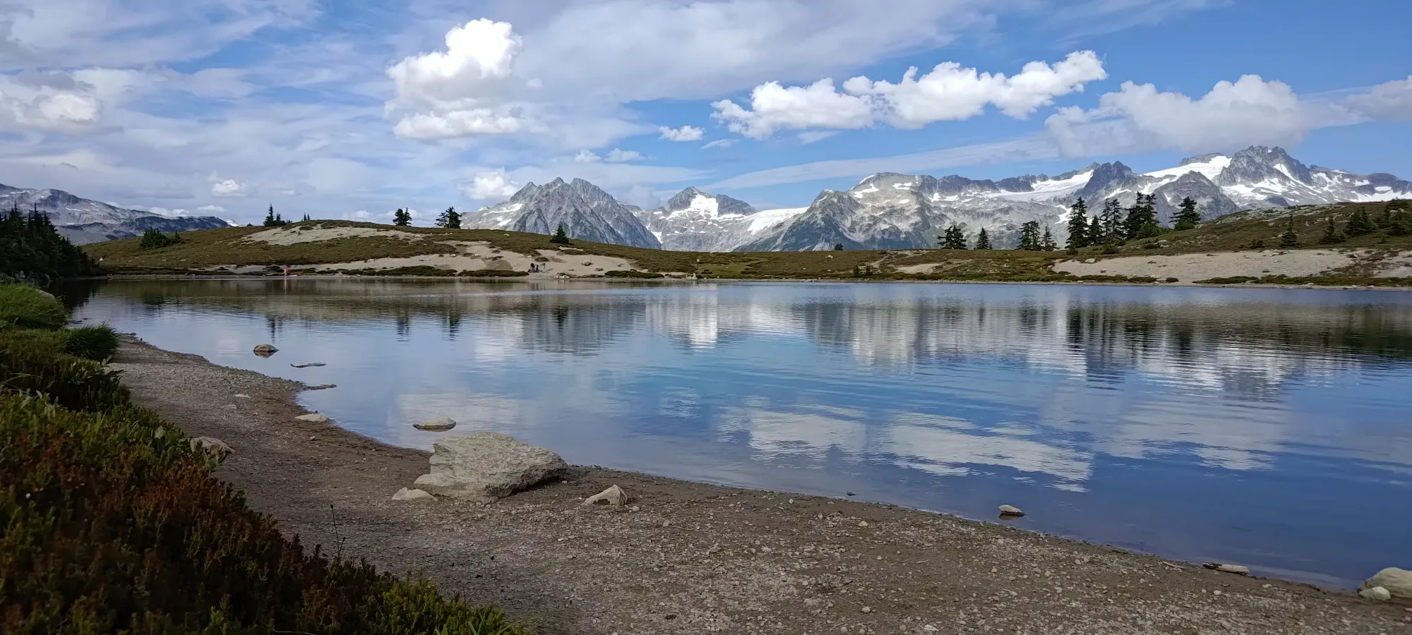
Garibaldi Névé, Squamish, British Columbia
1736m
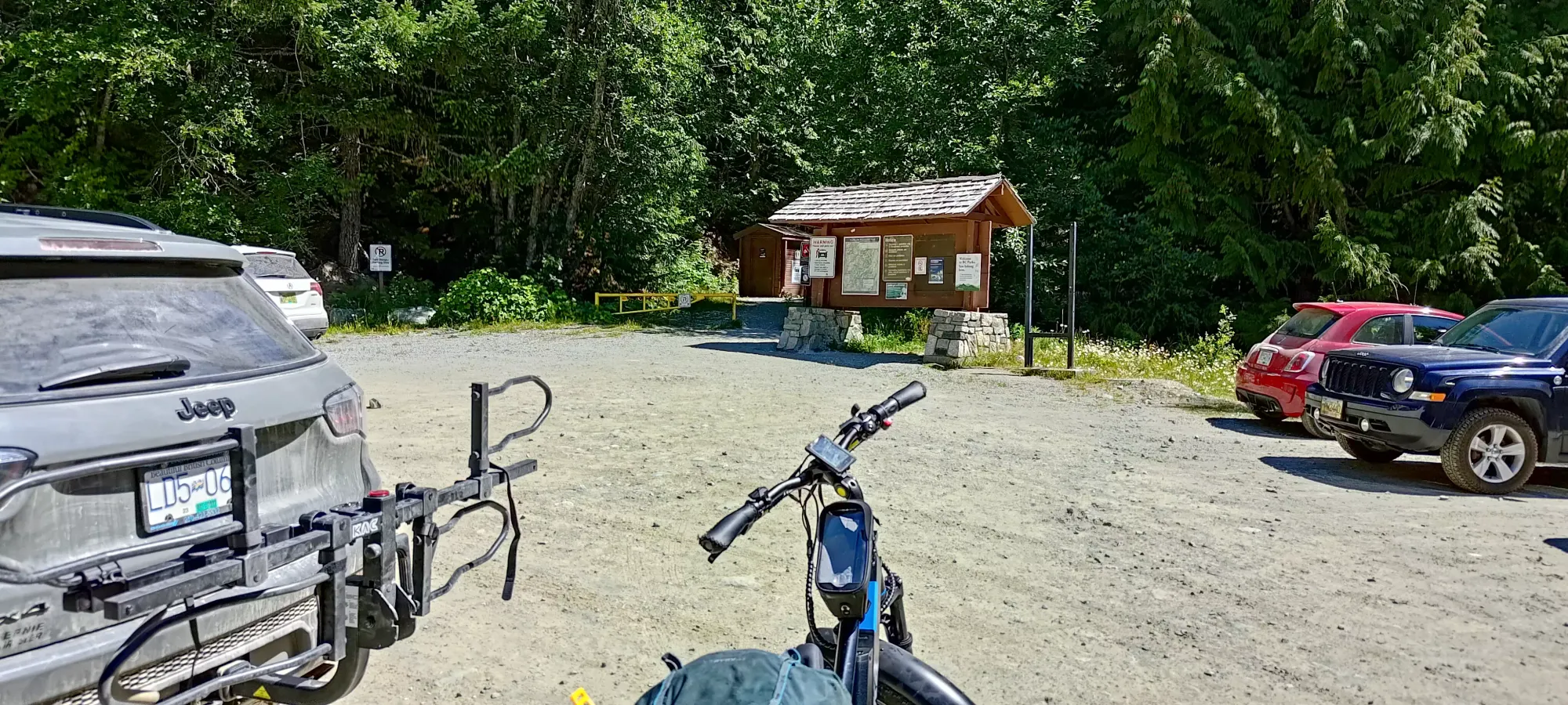
I happened to luck out (depending on your point of view), and have an MRI appointment on this day cancelled rather late, and so had a day with my calendar already blocked for work. I could've just sheepishly announced the cancellation and worked all day, but that wouldn't be very fun, so I decided instead to embrace the fact that someone had booked me early that morning anyways, and work the morning only, taking advantage of that reserved time to bag a peak as I skipped the previous Sunday. I needed something local-ish since I didn't want to spend too much time driving, and more than just a trashbag since I had most of a day. Opal Cone is something I failed last winter due to a thin snowpack, but I knew was in-shape for hiking now. I also knew that the trail up to Elfin Lakes allowed bikes, which could let me shave the 36km day into something more palatable for my injured, not-used-to-long-days feet. And so, after working til nearly noon, I loaded my gear up and set out, getting started just after 12:20pm. Do note that in summer, this trailhead requires a day-use pass, though it was easy to acquire on a weekday (weekends are competitive, better be online at exactly 7am 2 days prior).
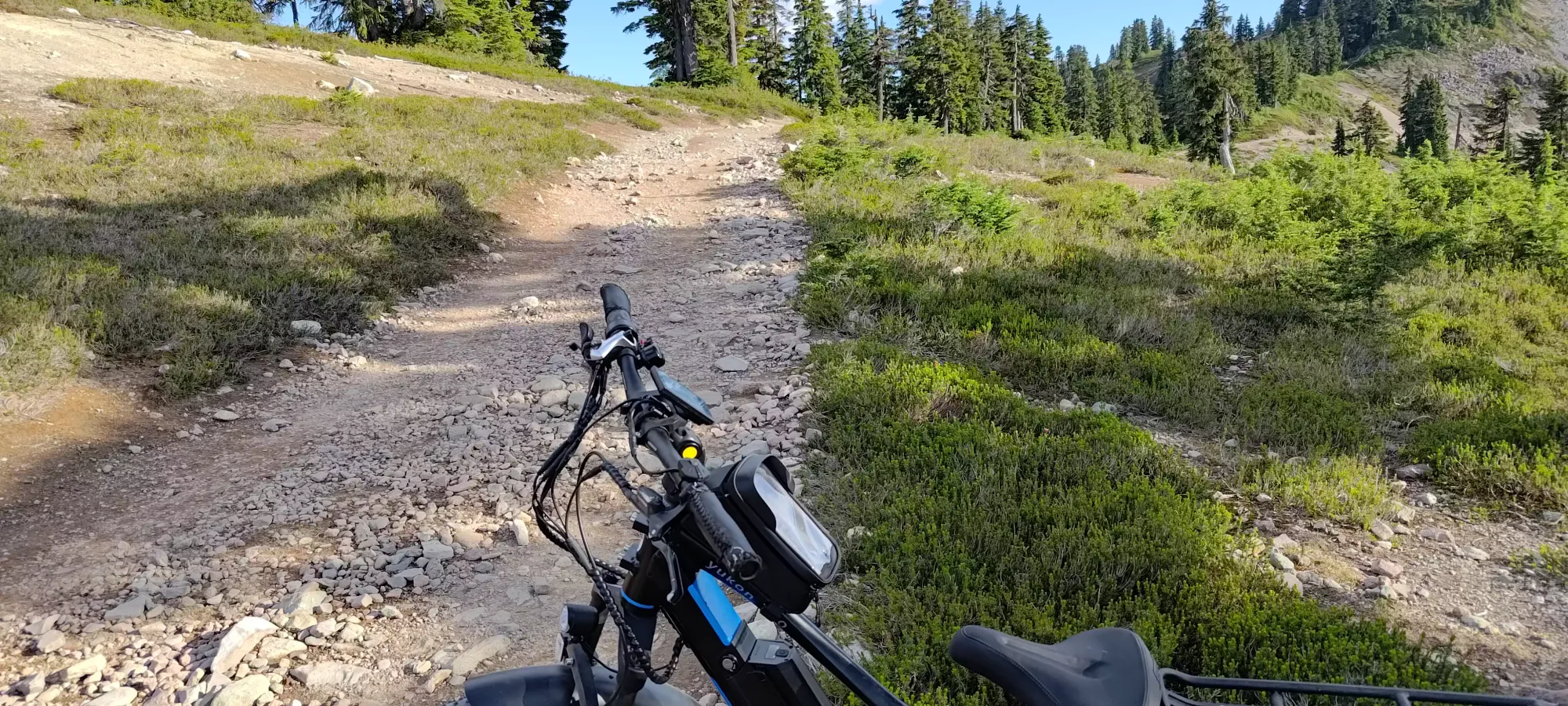
After my last successful bike on the weekend prior, I was pretty confident, as I remember this trail being not super steep, and pretty easy to walk on. The first couple kilometres confirmed this, and I was feeling good coming up to Brandvold Falls. However, past there, things got... spicier. The trail beyond this point, generally increasingly so the further one bikes, gets a lot more difficult. There's quite a few rocks on the trail, some of which are fairly large relative to a bike tire, and many of which are loose. This made things VERY bumpy and kinda scary, and I did not make it up without having to walk a few times, and nearly wiping out once. I got to Red Heather in 25 minutes (at least faster than walking), and considered stashing the bike there, but the trail ahead looked okay, and I knew there was a dedicated bike route for some of Paul Ridge, which I hoped might assuage my concerns.
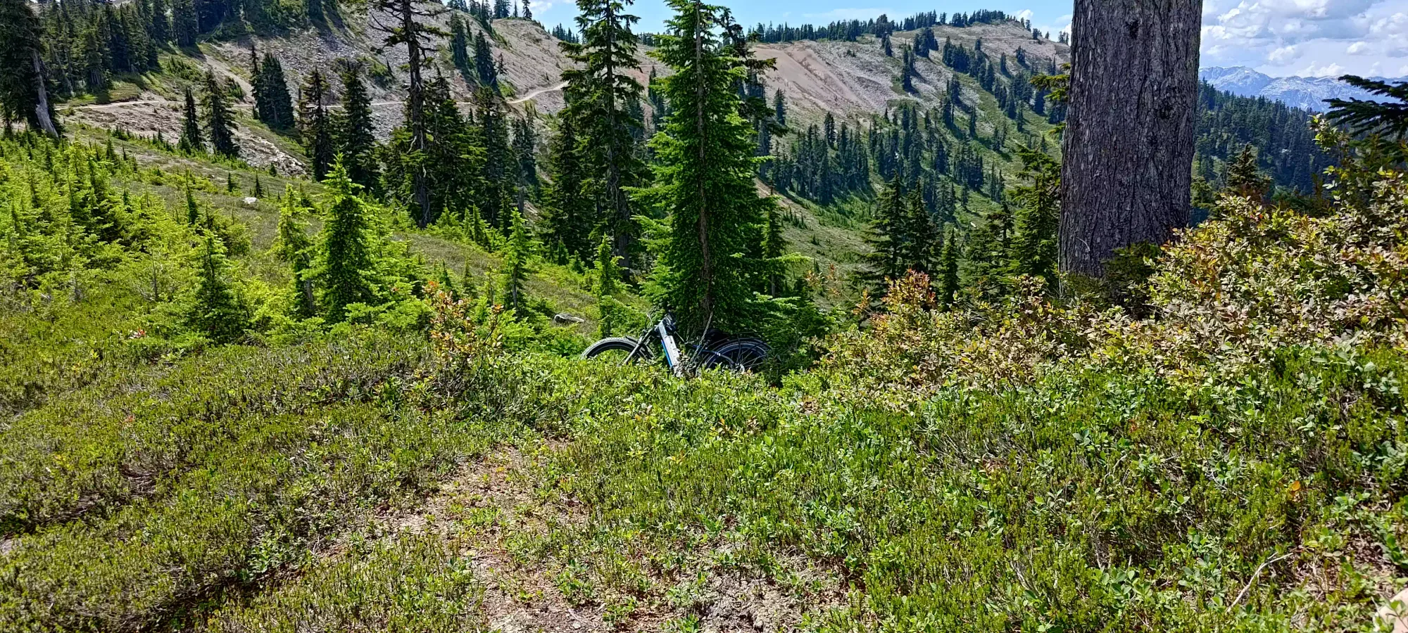
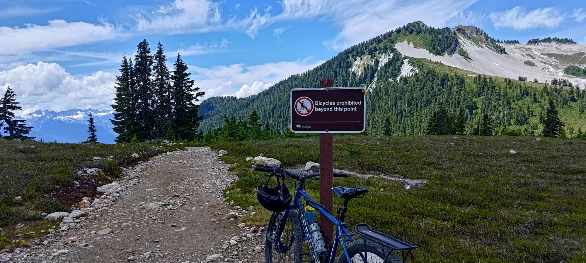
Unfortunately for me, it only got worse, even on the bike trail. I bounced, skidded, and occasionally walked my way up and along the trail until about 8.5km from the trailhead, where after my first big descent, and seeing more rocks and steep slopes ahead, I decided to just call it and stash the bike. I chained it up to a tree, marvelled at how nice it felt to have that out of my pack (it was too bumpy to leash my pack to the bike, it kept falling off even with my good straps), and I continued on by foot. This whole process took an hour and six minutes, which honestly doesn't even account for a ton of time saved (I was about half an hour ahead of my time going for Diamond Head last fall). But it did mean less time on my feet, so while a bit scary, I think it was worth it. I don't recommend a 75lb fat-tire e-bike for this, though. Get a real mountain bike. You might be able to actually enjoy yourself that way. Plus on the steeper or harder parts, I still had to put meaningful pedal work in to get my heavy system up, so the e-part wasn't as amazing as it might seem.
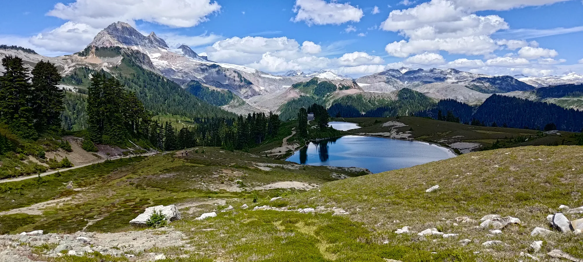
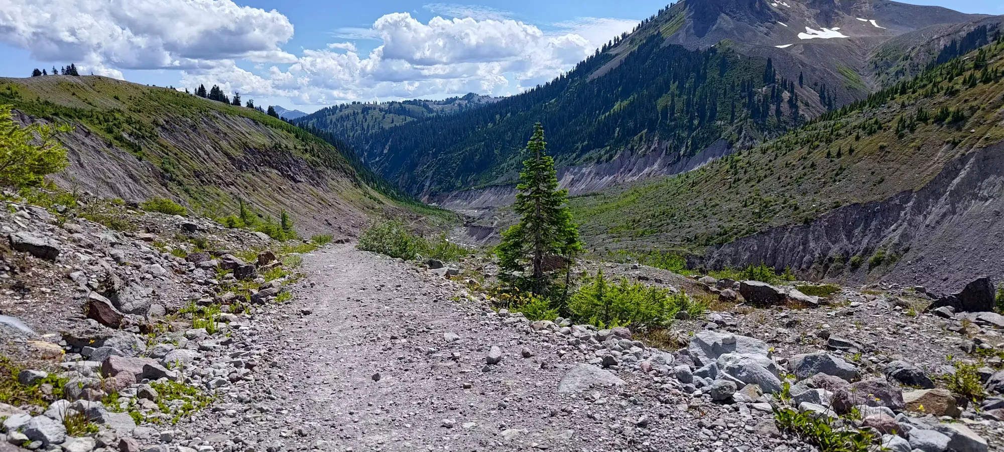
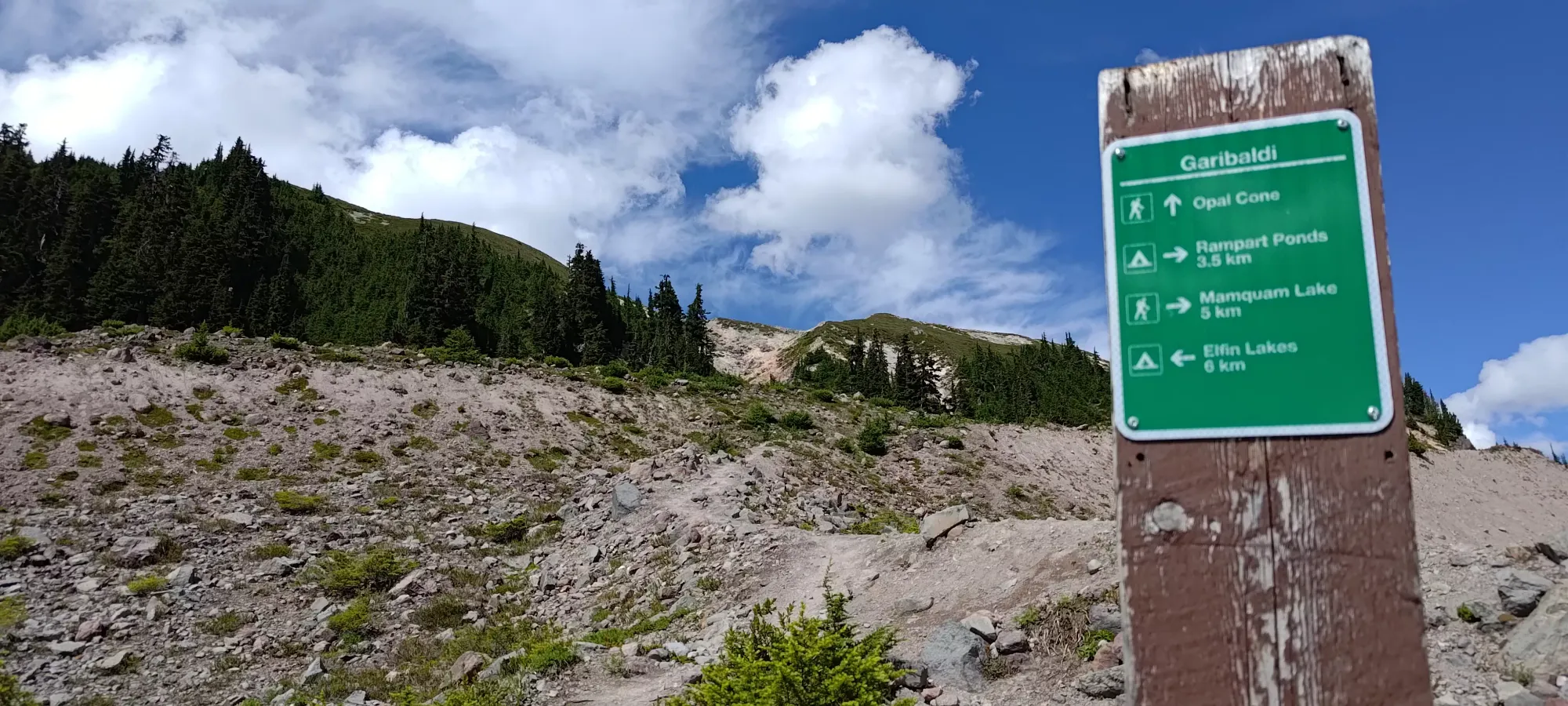
After stashing (and having a few sips of well-earned water), I plodded my way down to the lakes, then right past them, getting to the fork for Diamond Head in about half an hour. I passed a sign indicating that bikes aren't permitted past the lakes on the way to this fork, so at the very least I did remember the length of the road if not the conditions (in my defense, I've been up in this area only once in summer conditions, but many more when everything is snow). I was, at least, still feeling fairly fresh due to the bike-in, so I didn't linger, and just kept pushing. I knew this was a long day, and I didn't fancy biking down in the dark (I didn't fancy biking down period, to be honest), so I wanted to avoid wasting time as much as I could.

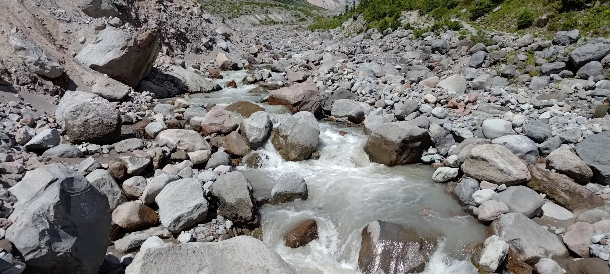
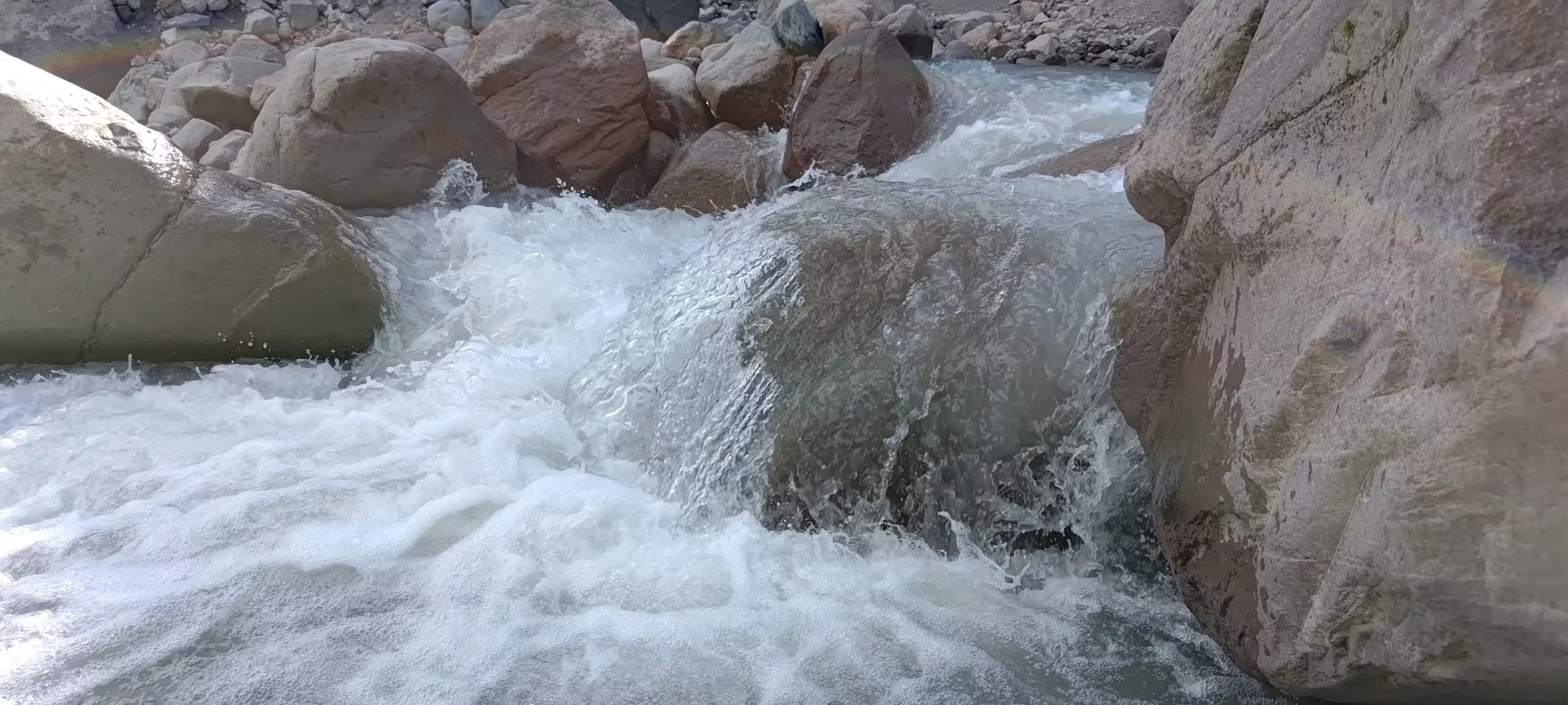
Having to descend from 1550m (where I stashed my bike) all the way down to Ring Creek at 1275m is kind of a drag, but at least on the way in, it goes pretty fast+easy, and I made it from the fork to Diamond Head down to the creek in just under half an hour. This part of the trail is, like basically the entire thing, excellent/easy to walk on, with one short section where one has to step steeply around some debris, and a short set of stairs down to the creek crossing (which is nicely bridged).
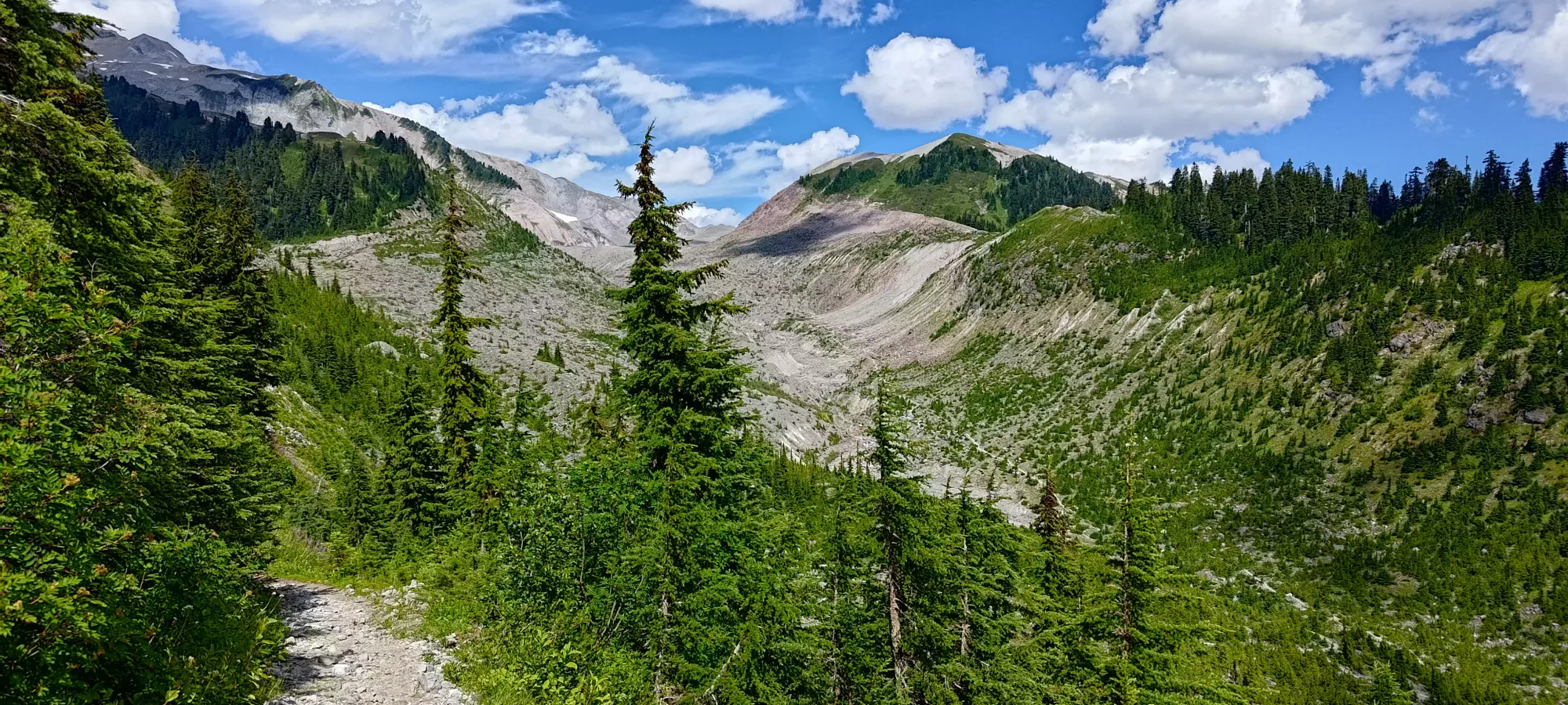
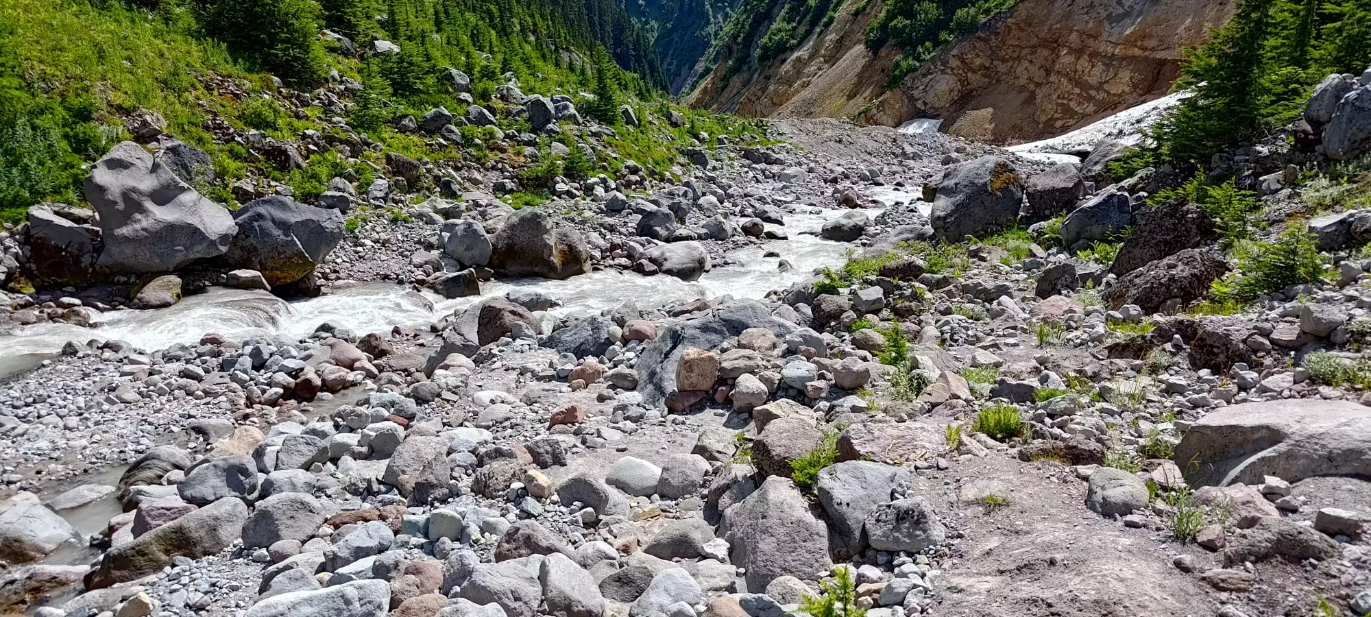
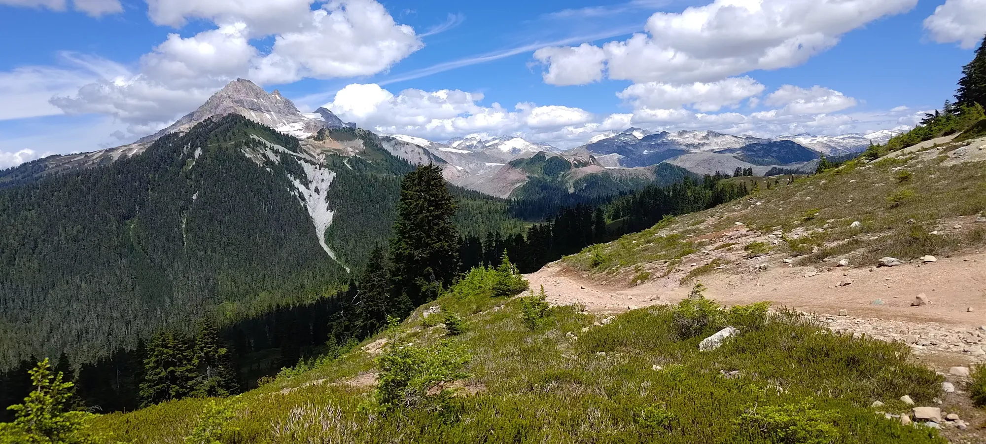
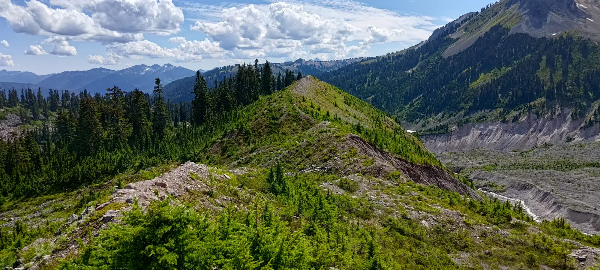
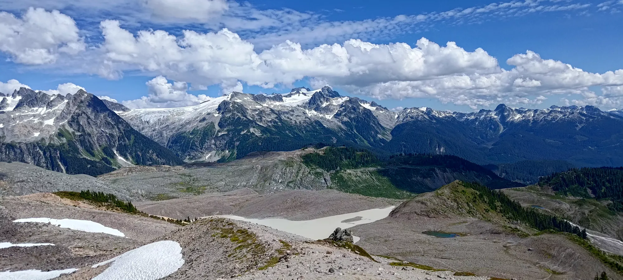
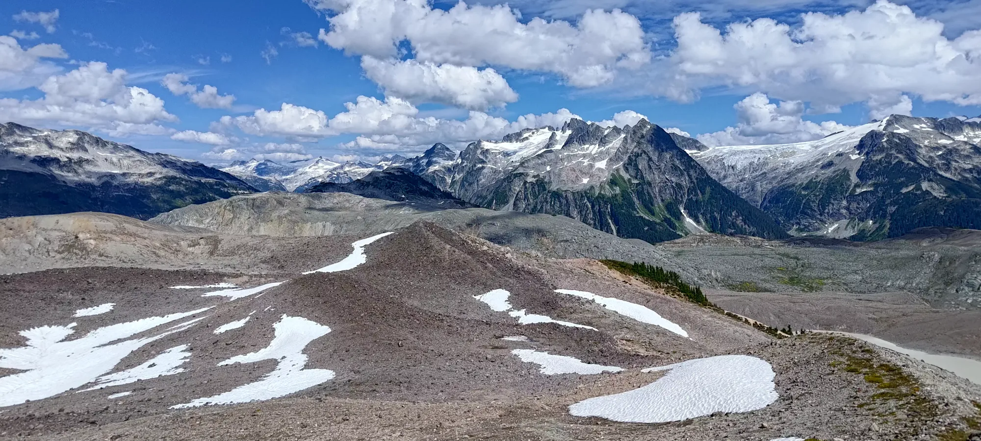
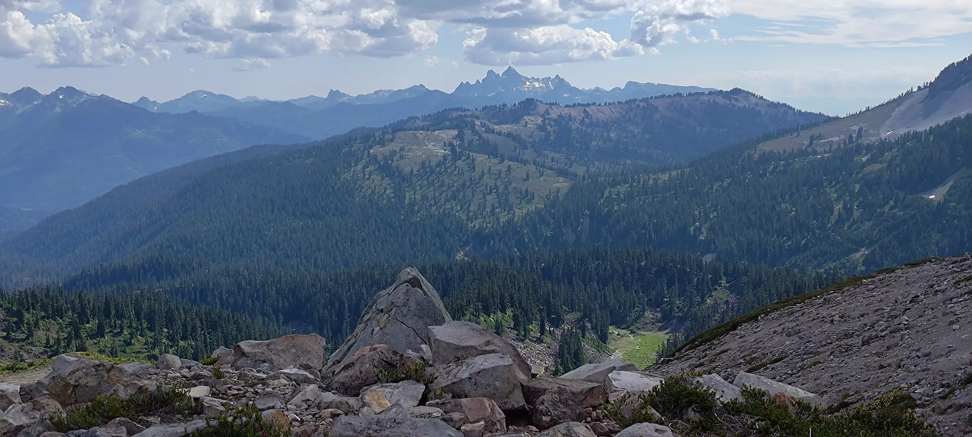
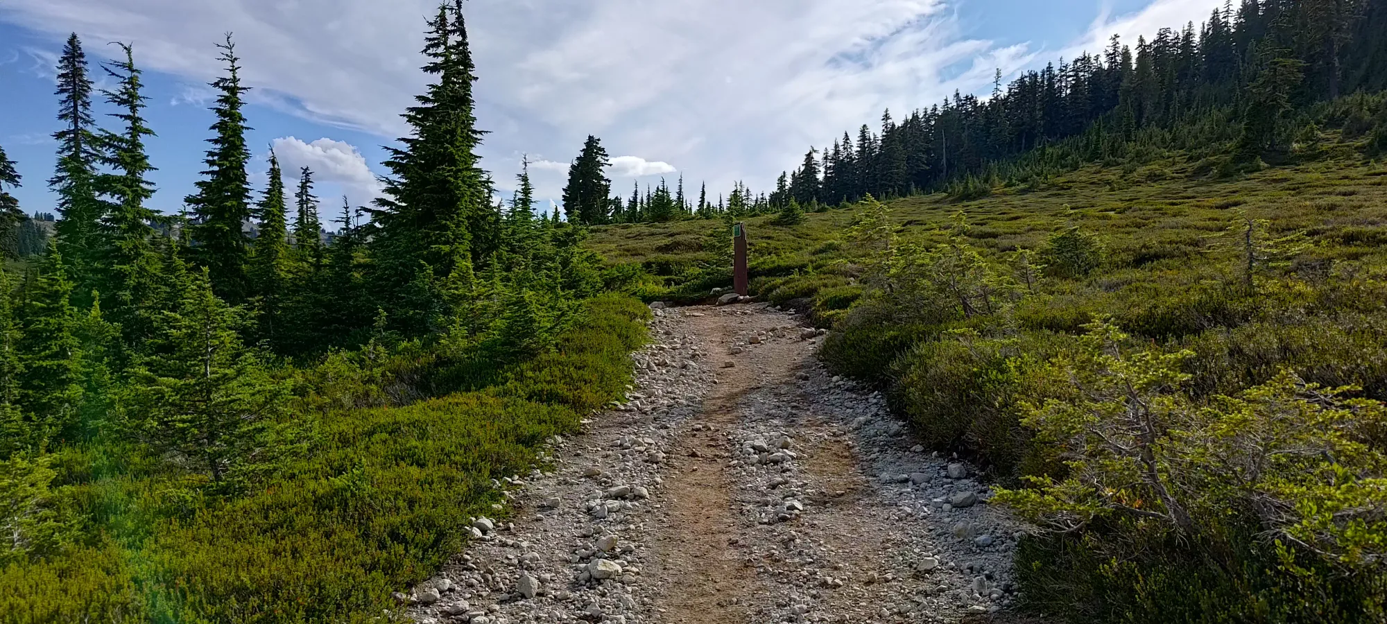
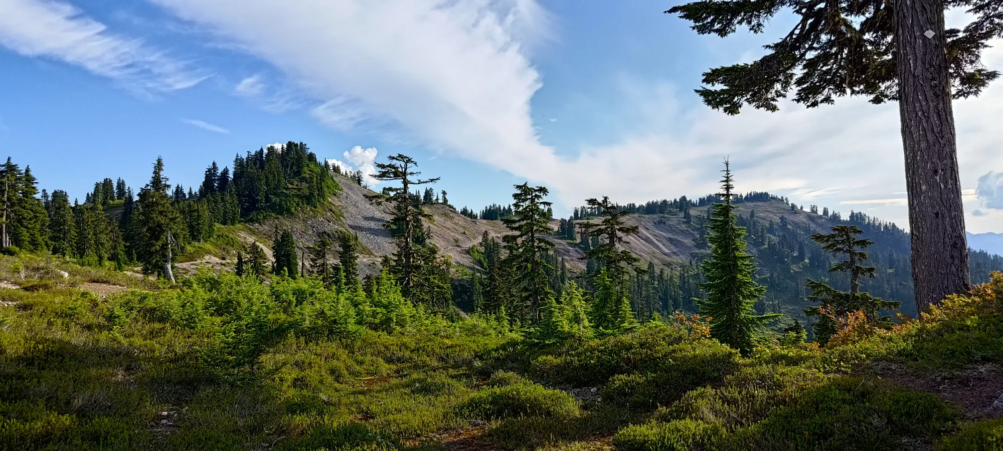
Once you cross the creek, you'll probably stop seeing people (I saw my last other people until I got back to Elfin Lakes here), and you also have to go back into "uphill mode", with about 450m to gain up to the peak. The trail is still quite good, with only a short section of steep debris navigation partway up the flank of Ring Creek. I took about half an hour to gain 200m to the large switchback that turns you south onto the southern ridge of Opal Cone.
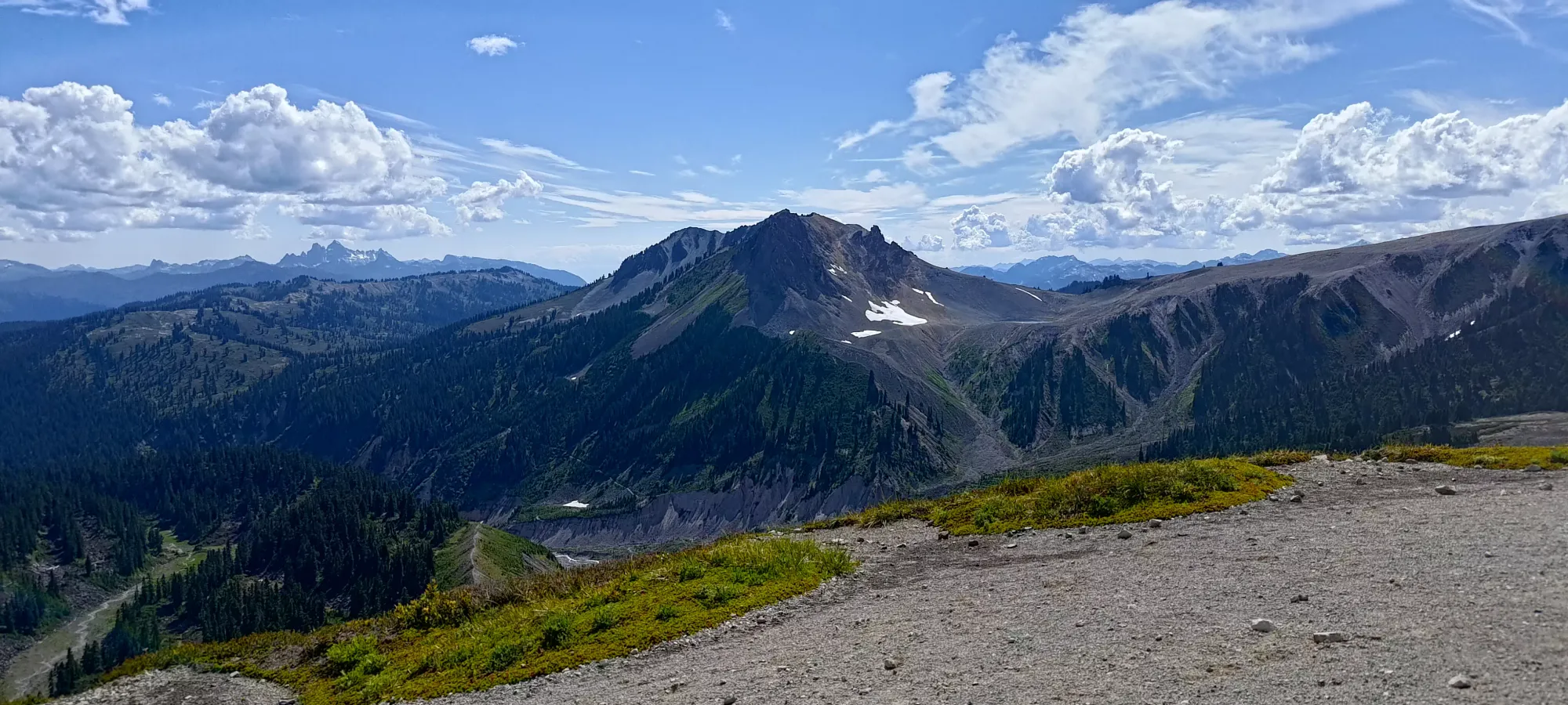
From that point, the trail follows the ridge til it bottoms out before rising again further south, and turns around north before curving east along the trail to Rampart Ponds, one of the campgrounds reservable in the park. I hit the fork where Rampart Ponds' and Opal Cone's trails diverge in about 15 minutes, bringing me to about 1550m of elevation, with less than 200m to go.
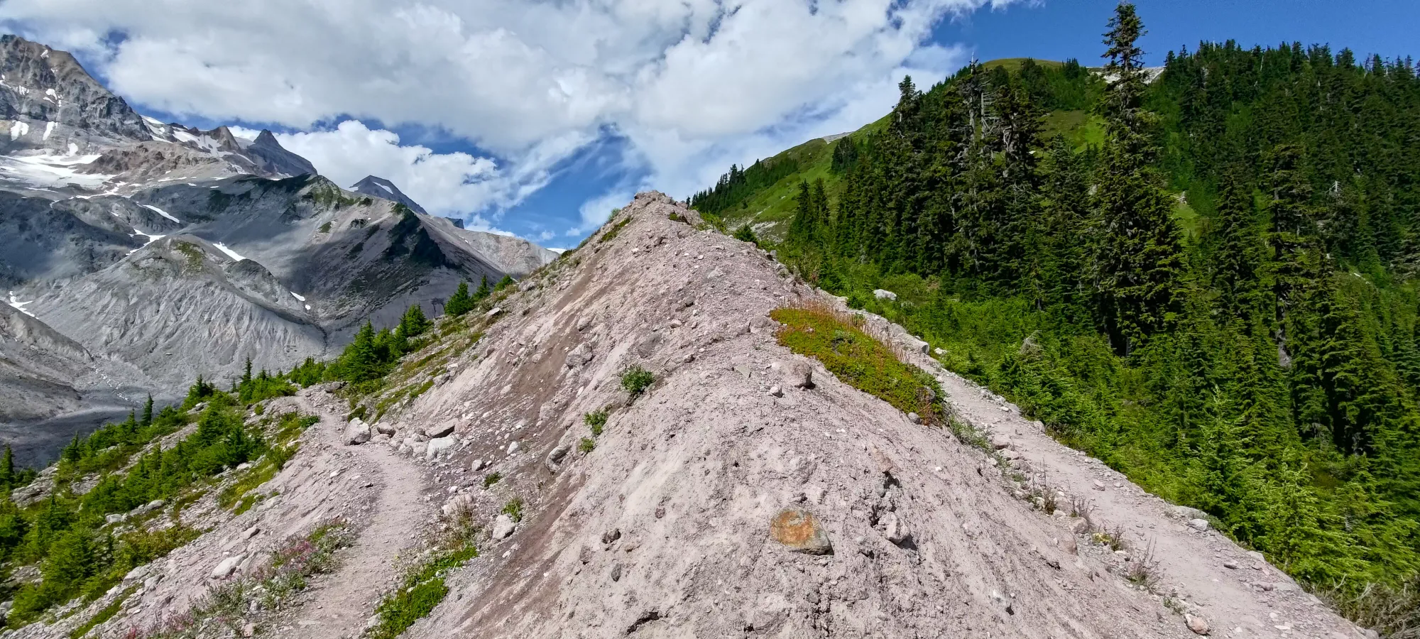
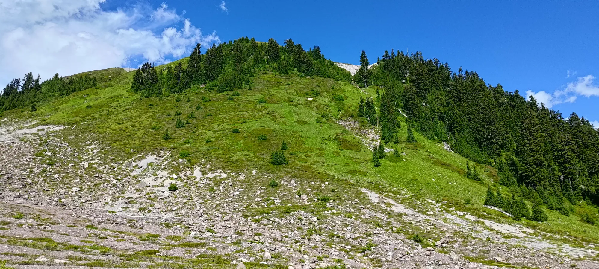
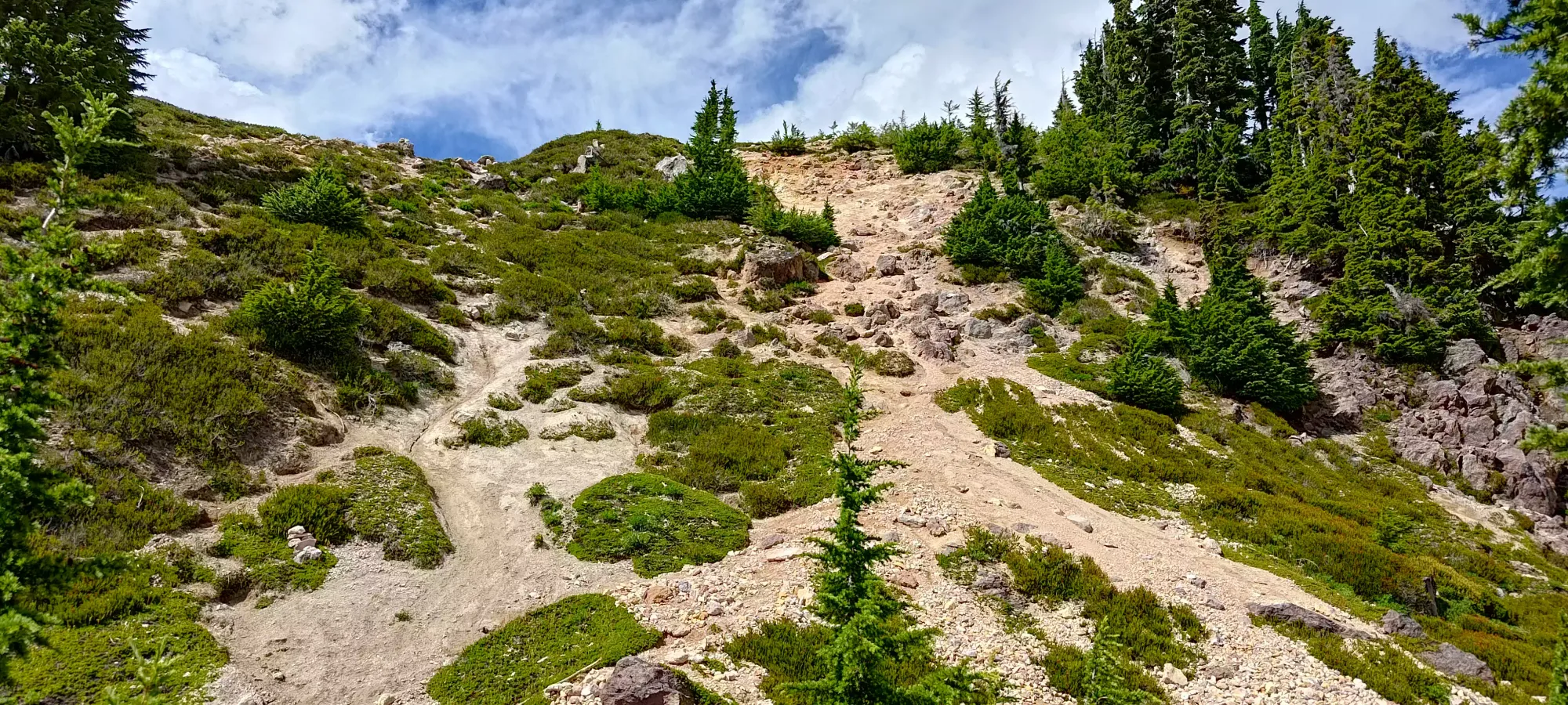
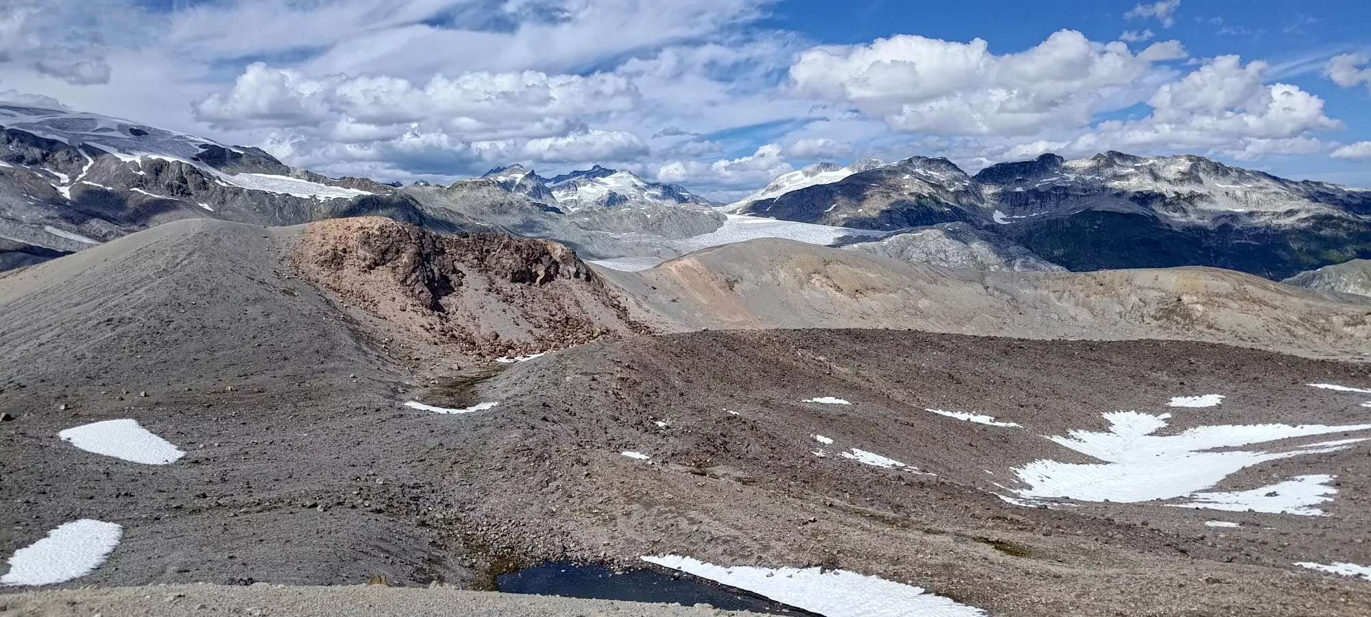
This part of the hike starts off on top of a ridge, walking on a narrow (but nice) trail up a couple dozen metres of elevation, until you hit a steeper, looser dirt section. There are a bunch of ways up here, so just pick whatever terrain tickles your pickle. Once you do, there's a bit more grunting up the side of the cone before you hit the eastern edge of the crater rim, and can figure out your plan for getting to the top.
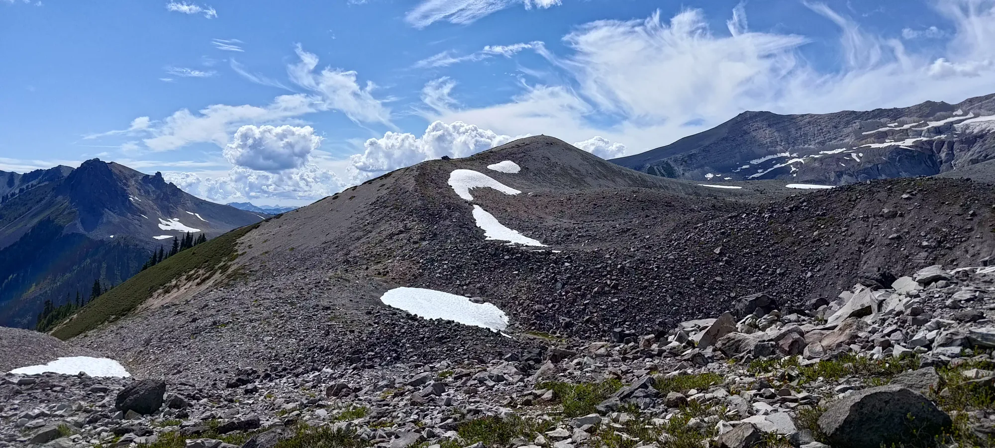
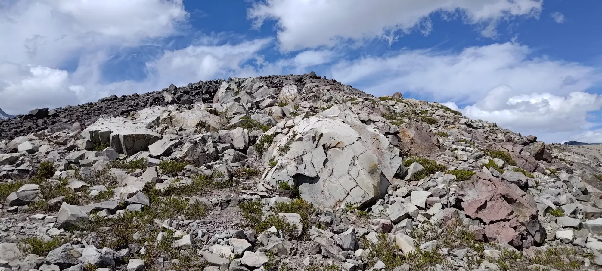
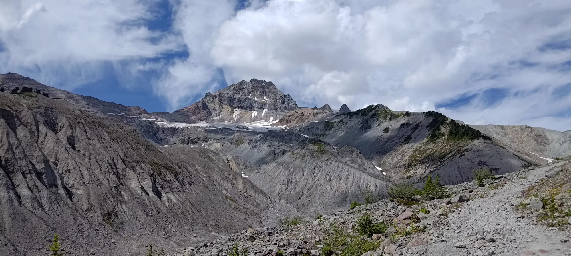
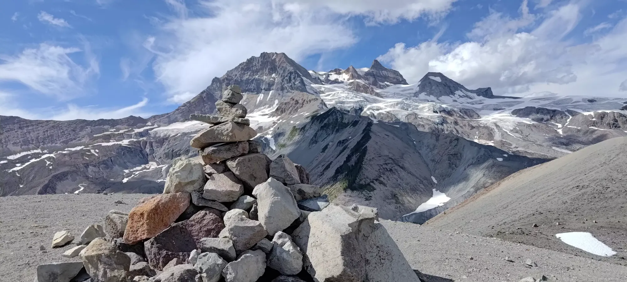
At this point on the rim, you have a decision to make. The highest-looking point, and the point with a cairn on top is on the southwest side of the cone. Most maps indicate the top as being on the northwest. I was confident enough that the SW high point was the real high point, and planned my route to go there. I'm not sure if the area north of this point used to be higher before more erosion (this peak is clearly crumbling over time), or if it's just bad maps (would not be the first time, this sort of issue created some drama in the 8000er community some time ago), or if the cairn builders and just "my eyes" are bad, but I'm confident enough in my selection.
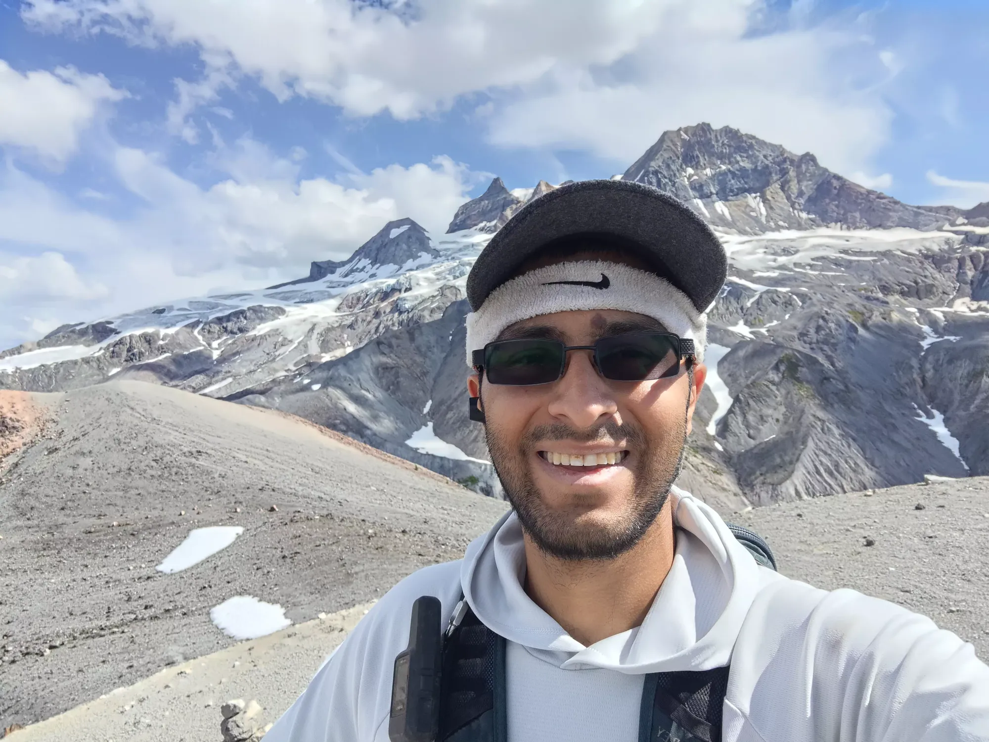
The walk over to the top took about 20 minutes, as I had to choose my route carefully through the boulders to keep my ankle happy, and also had some routefinding decisions through the various ups and downs created by the variable crater rim. I topped out just over 3:20 into the day, and well before my 5:00 turnaround I'd set, so I was quite pleased with that result (even if it was significantly aided by my bike). I didn't stay on top for long, though, as there were a few annoying bugs and was a dearth of shade, so I backtracked a bit back onto the south ridge to get a nicer spot to have a break, which worked out excellently.
I took a short 10-minute break up there for half a sandwich, and resolved to push until Ring Creek before I had my next one, where I'd indulge in some nice, fresh river water and relax a bit more before I had to start my big final ascent of the day. I got down to the creek crossing almost exactly 4.5 hours into the day, and had a longer 15 minute pause there to have some fresh water and scarf down the second half of my sandwich.
The next 55 minutes were just a straight-up grind to the lakes. I took a couple 30-second breaks, but largely just pushed in one go up to the lakes. The terrain is gentle enough that it's just tiring but never exhausting, so I just kept the music playing and ground it out. I took a longer break of a few minutes at the upper lake before the "final pitch" up to my bike, though. It was here where I finally saw signs of other human beings again, as not many people go past the lakes, and especially in the latter half of the day like I did.
The hike up to my bike from the lakes took about 20 minutes, but I was glad to not have to deal with the annoying loose rocks both on the way down or back up while on the bike, so I wasn't even unhappy about it. Honestly, I was thinking about how I probably would prefer the hike out if my bike could teleport back to the car. Unfortunately, life isn't that convenient, so I had to steel myself for the ride back, which was getting scarier and scarier in my head as I remembered all the things that gave me trouble on the way up, but with 75lbs of bike, a heavy pack with my steel chain in it, plus myself, and pictured hurtling downhill on them instead.
The ride out was definitely "an experience". It started out not too bad from a speed perspective, as Paul Ridge is fairly gentle and rolling. I did still have to walk one hill, I think, due to large+loose rocks. Going downhill, I only had to do the same for maybe 2 short sections, but otherwise I somehow managed to stay on the bike. It was more harrowing for the first 5-10 minutes, but I slowly got the hang of things as I traversed the ridge, and by the time I hit the sign indicating the split trail towards Red Heather, I was gaining some confidence. That section is also fairly loose, so I was still getting bumped around like crazy, but my trust in the tires to keep true and handle larger rocks was increasing.
I still needed breaks every so often to just relax and unwind, there isn't much physical exertion to riding a bike downhill, but my body was tense enough to hurt more than it did hiking beforehand. This continued for the first half of the descent past the hut, but somewhere around the waterfall, as on the way up, the trail got calmer, and I was able to worry more about controlling my brake heat than my tire positioning, and started to have some fun coming down instead of just being terrified 😃. I ended up back at the car just short of 6:55 after I set out, or around 7:15pm. The bike-down portion of the trip ended up being 43 minutes to cover about 8.5km, so definitely not the fastest time that trail has ever seen, I'm sure. I'll use the excuse of "there's a lot of people so you shouldn't go fast" to make myself feel better.
All in all, I'd say it was a pretty successful trip. Despite this definitely being the upper limit of what my bike can handle, it DID do it, even if I'd not recommend taking a similar bike up. The hike went pretty smoothly, and I got down with lots of daylight to spare. I did discover the limits of my bike once again, though, and at the same time also discovered my "emergency hiking shoes" I keep in the car (I decided to use them since they have newer tread than my aging standard pair) really should be kept for such occasions, as my feet are definitely a bit red writing this. I can't really say I recommend this hike, as it is really long and uneventful for a minor payoff, and there are other peaks that are more impressive nearby with less effort. If you're into camping, though, it's much less tedious, and there are great campgrounds in the area, so that's a nice way to add it to your portfolio. That, or as part of the Garibaldi Névé traverse, which passes fairly close to the peak's west side.
GPX Track + Map