Mount Seton (Goat Mountain) - September 4 2023
An ultra with easy stats but hard access and a decaying trail

Cayoosh Range, Lillooet, British Columbia
2855m
After a failed attempt to bag this last year (never even got to the trailhead due to a bug with Google Maps on the drive up bringing us to a totally different area before we realised it), this has been on my mind for a while. After a long time not having the right group or conditions, I finally had a day where more technical peaks were out of contention due to rainfall or at least "lingering wetness", other areas were "just raining", and I had people willing to come. So, on Monday morning, Logan met me in Squamish, and we headed up at around 9am. We could've left earlier, but we both wanted to rest properly after a long night the prior Saturday, and were willing to accept the potential of some dark hiking since the trail wasn't super technical to make it happen.
We did have to load our bikes, though, since we heard in 2022 that the officially decommissioned bridge over Cayoosh Creek at the start of Downton FSR was "sketchy", and that around a week prior to our trip someone had moved the concrete blocks blocking the bridge enough for a car to fit, but the person who went was biking, and was unable to confirm the integrity, though they did say the road "seemed fine". With that mixed beta, we brought bikes, and prepared for a potentially long but hopefully not day.
Unfortunately, we didn't make up as much time driving as we had hoped, as Joffre Lakes had opened up for the weekend after being closed for a week or two, and there were many slow vehicles on 1-lane highway preventing any sort of expedient travel. Once we got closer to Duffey Lake, we got a bit more space, but I had to stop to go to the bathroom, so that kinda eliminated any gains. We eventually got to the bridge around 11:40am. There was one car parked before the bridge (not encouraging), a rather tight-looking gap between the rocks, and the bridge itself. We walked across it, and noticed the tire tracks the report we had from the previous week reported. We also noticed the wood was seemingly not rotten, supported by a metal structure beneath, and didn't show any other signs of wear us non-structural-engineers could discern.
So, we decided to go for it, and drive across. Logan spotted me through the blocks, and said I had maybe 6-ish inches on each side of my Jeep Compass, so I'd not recommend trying to bring a full-size pickup or anything here. If you're worried about bridges (which you probably should be), the lighter the better, really. The bridge didn't make any weird sounds or anything, and we got across safely. From there, the FSR was pretty simple, no super steep sections or deep ditches, just a few bumps that'd make me say "medium clearance is a good plan", and a rocky patch that would put people with thin sidewalls and high pressure at risk, but most crossovers or better should be fine. We had a dozen bridges in total, and despite most of the rest having official load rating signs, we agreed to get out and inspect each before proceeding, but never found a convincing reason not to go for it. We got to a spur road just before the trailhead at 12:20pm (~1360m elevation), where we decided to park and gear up, since it was a good parking spot, and close enough not to matter.


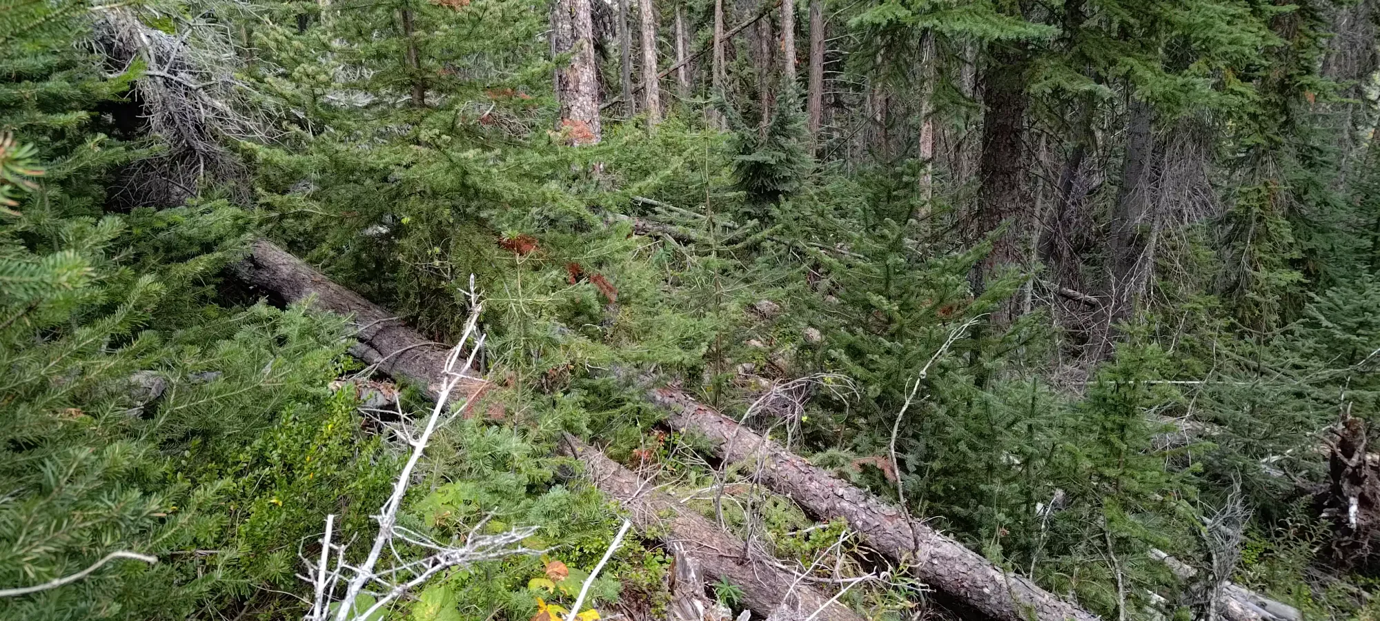
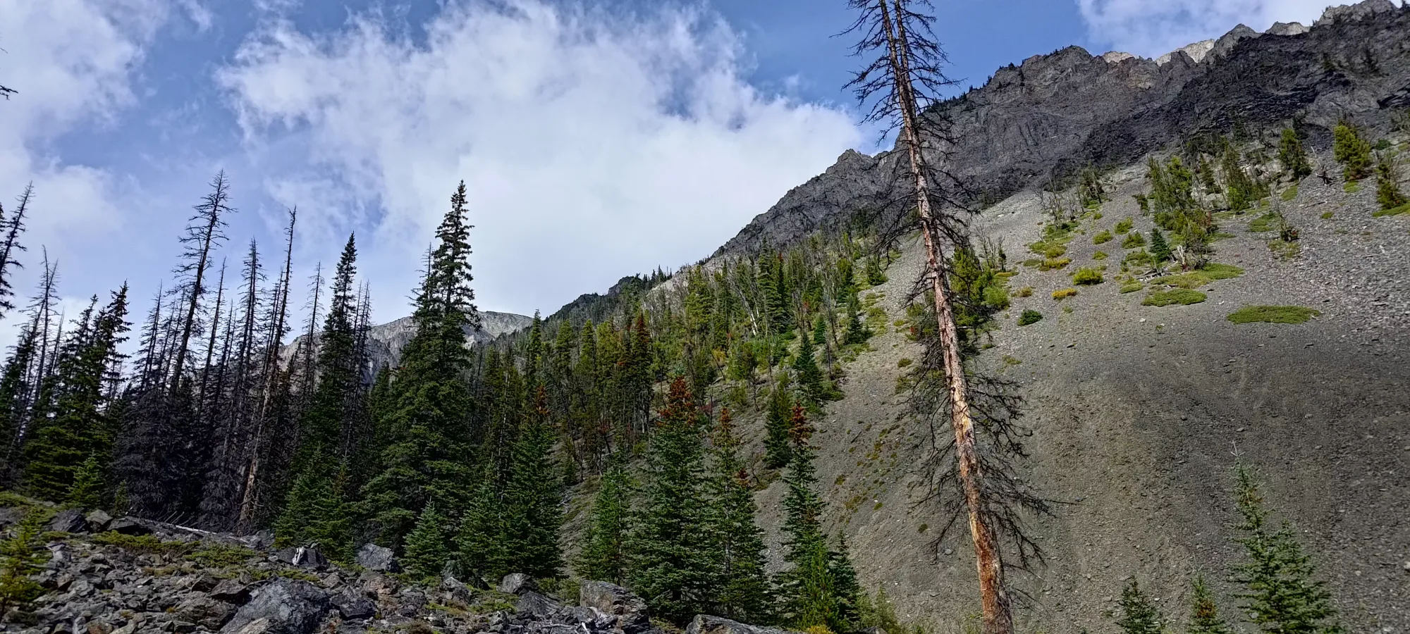
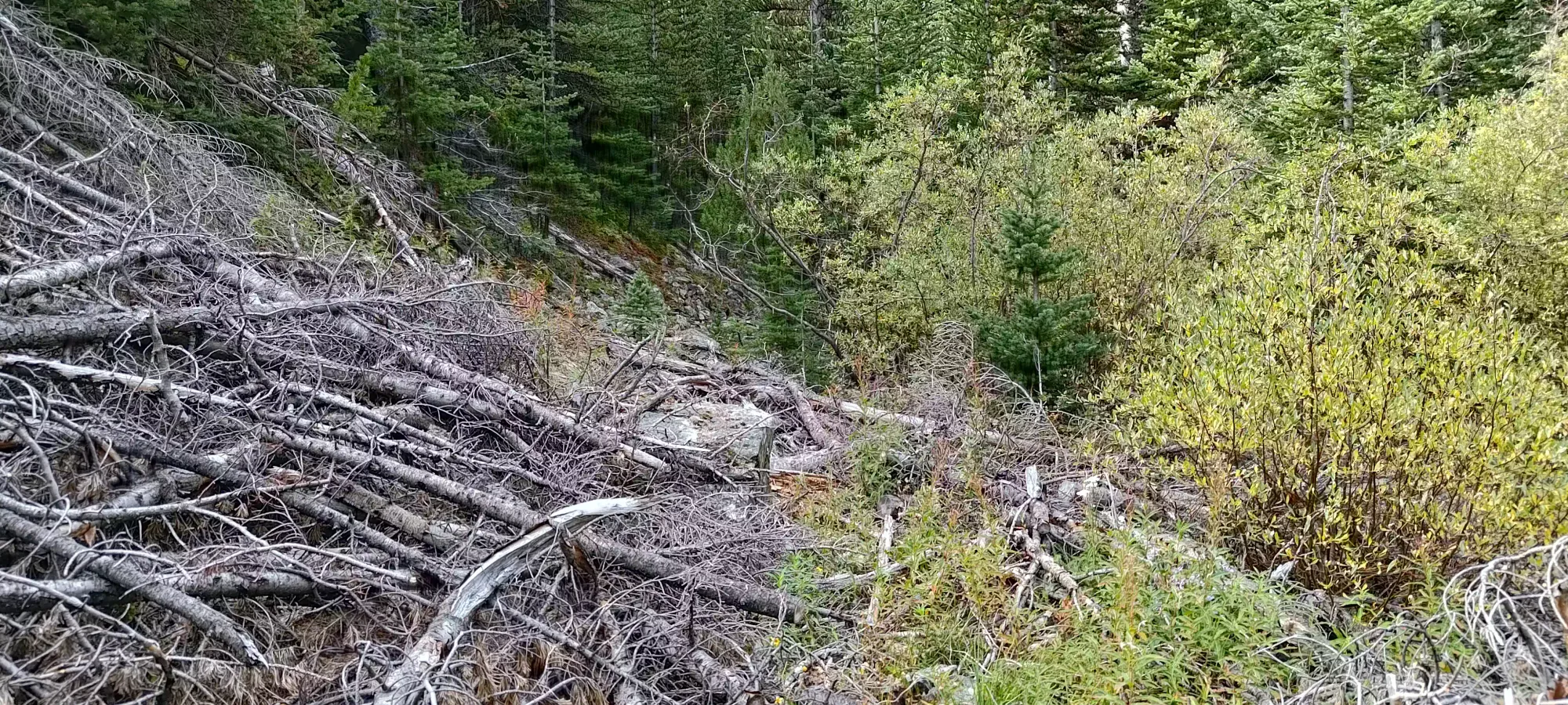
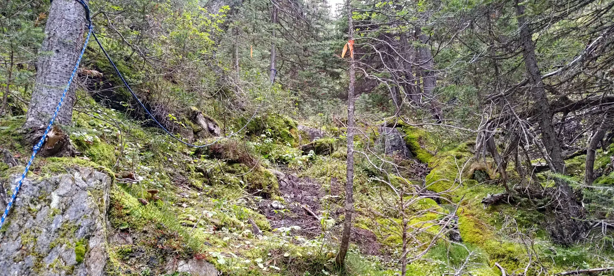
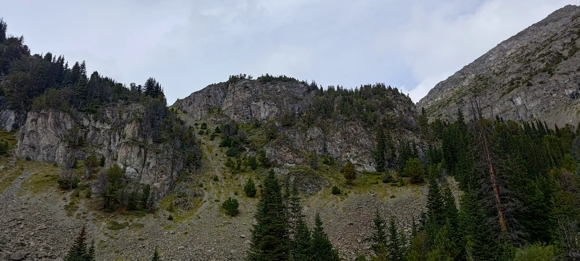
After getting our gear together, and noting the abundance of flow in the creeks draining into Downton Creek (and therefore going down to a litre each of water for weight savings), we headed out at 12:30pm. It only took a minute or two to get to the trailhead, which was really just "a weakness in the trees", which turned into a faint but extant trail fairly quickly. It was one of those trails that's not very popular, so the ground didn't look like dirt as much as "there are no trees, and less vegetation than other places here". But, that was enough, and it quickly got somewhat steep, as we gained about 200m in the first kilometre. However, at around 1550m elevation, the trail, which was easy to follow until that point, started to show further signs of its unmaintained status, and we began to encounter significant deadfall, bushes, and other obstacles either blocking or totally obscuring the trail. There were occasional flags where the trail was in-shape, but one had to figure out the detours, or sections without flags for themselves.
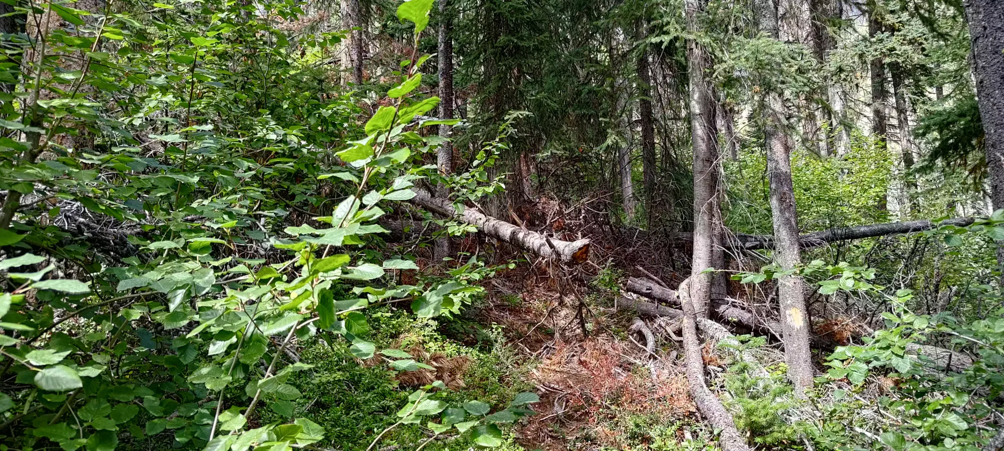
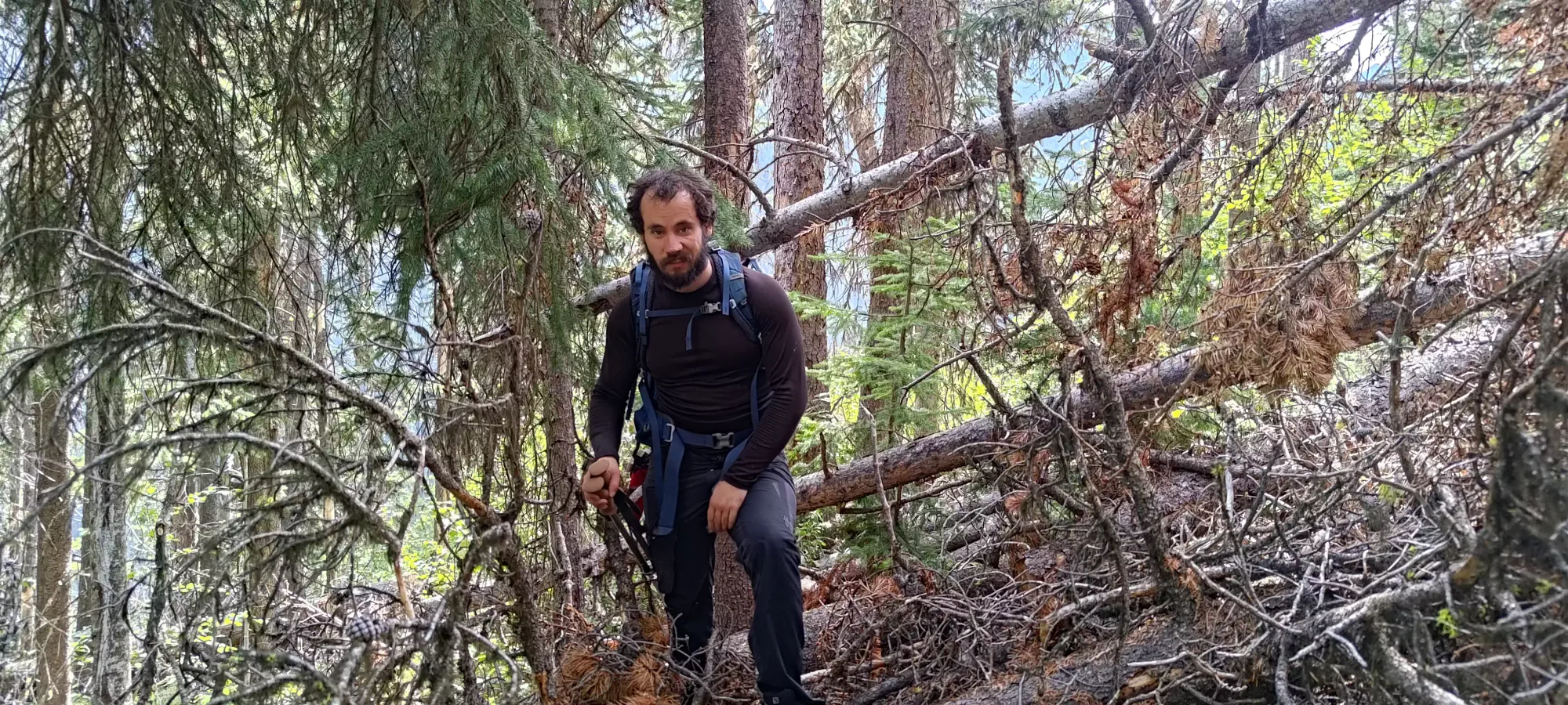
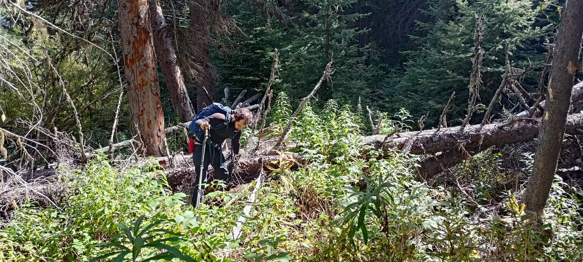
Soon after, we totally lost the trail, and things went a bit awry. We succumbed to a bit of defeatist thinking, and began to think the trail was just totally gone, and that our only hope was to bushwhack down to the creek, hope that it would get clear enough there to allow travel, or we'd just have to go back. We fought down to the creek through some nasty deadfall, devil's club, and other general nonsense, but discovered nothing but raging water, slippery rocks, and more deadfall at the creek.

So, we decided to head back up to the trail, and suffered some more back up to around where we had lost the trail originally. Partway up, as Logan was snacking on some berries (plentiful in this area, it seems), I remarked that I'd like to at least follow the trail back to where we lost it and see if we just randomly both missed it, just in case. I'm glad I did, because fresh eyes, perhaps more adjusted to looking for diamonds in the rough after 40 minutes of bushwhacking, did find us the trail again. We looked at the time and the stats of the hike left, and decided we should be able to summit and get at least partway down before it got dark, so it was still worth going ahead, even if we did feel quite stupid for wasting 40 minutes. Neither of us saw even a hint of the trail on the way up in this spot, though, so "oh well, it is what it is".

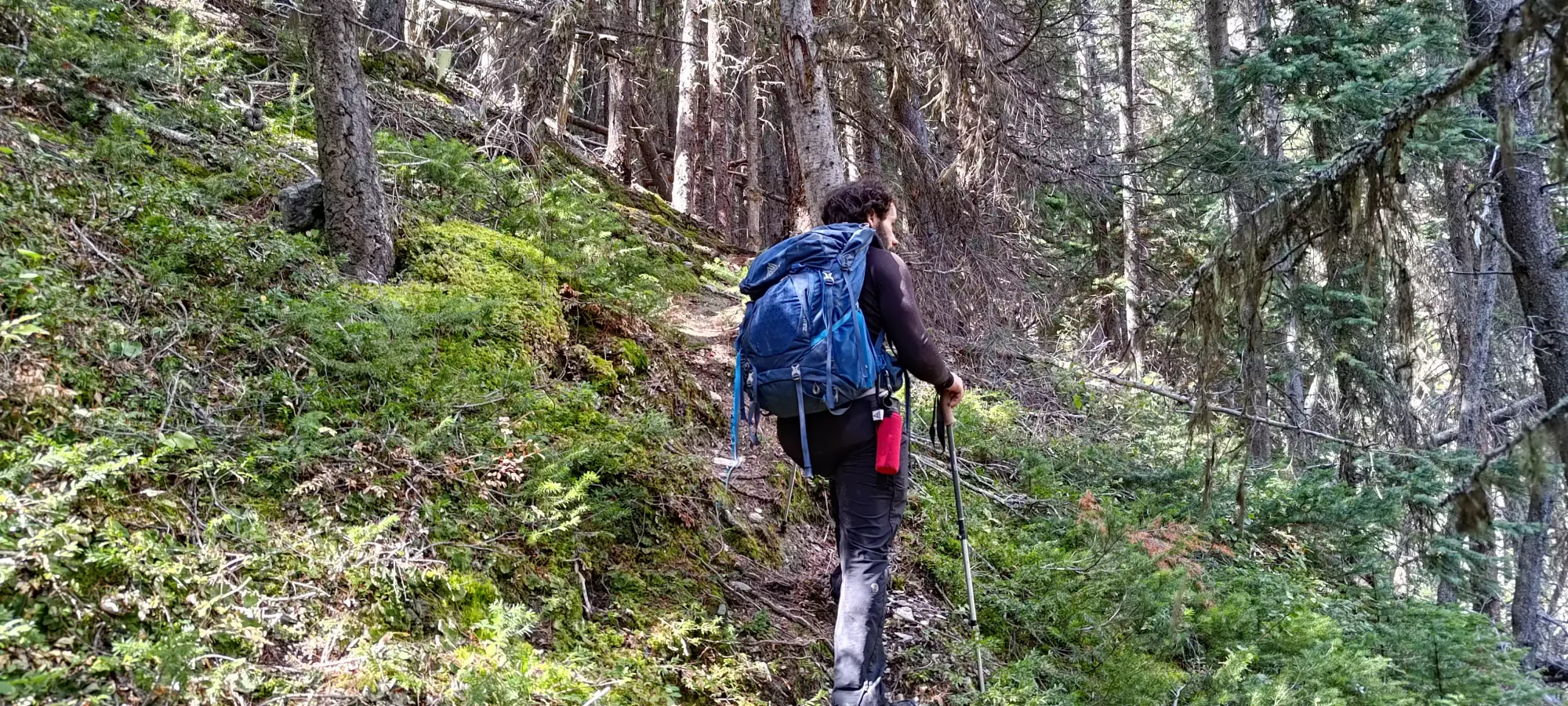
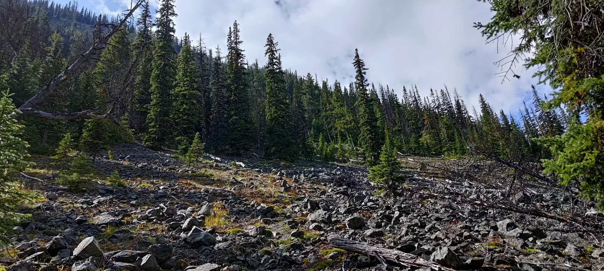
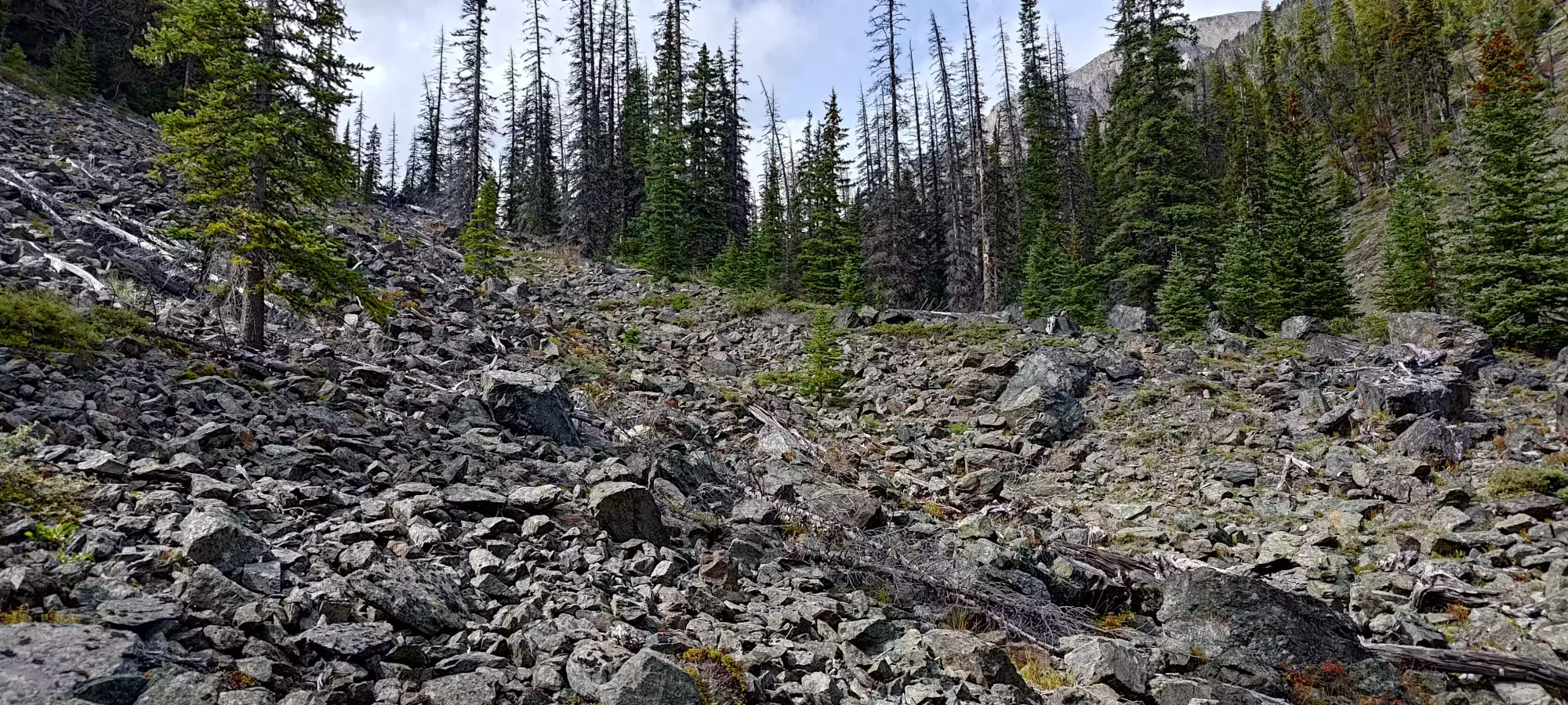
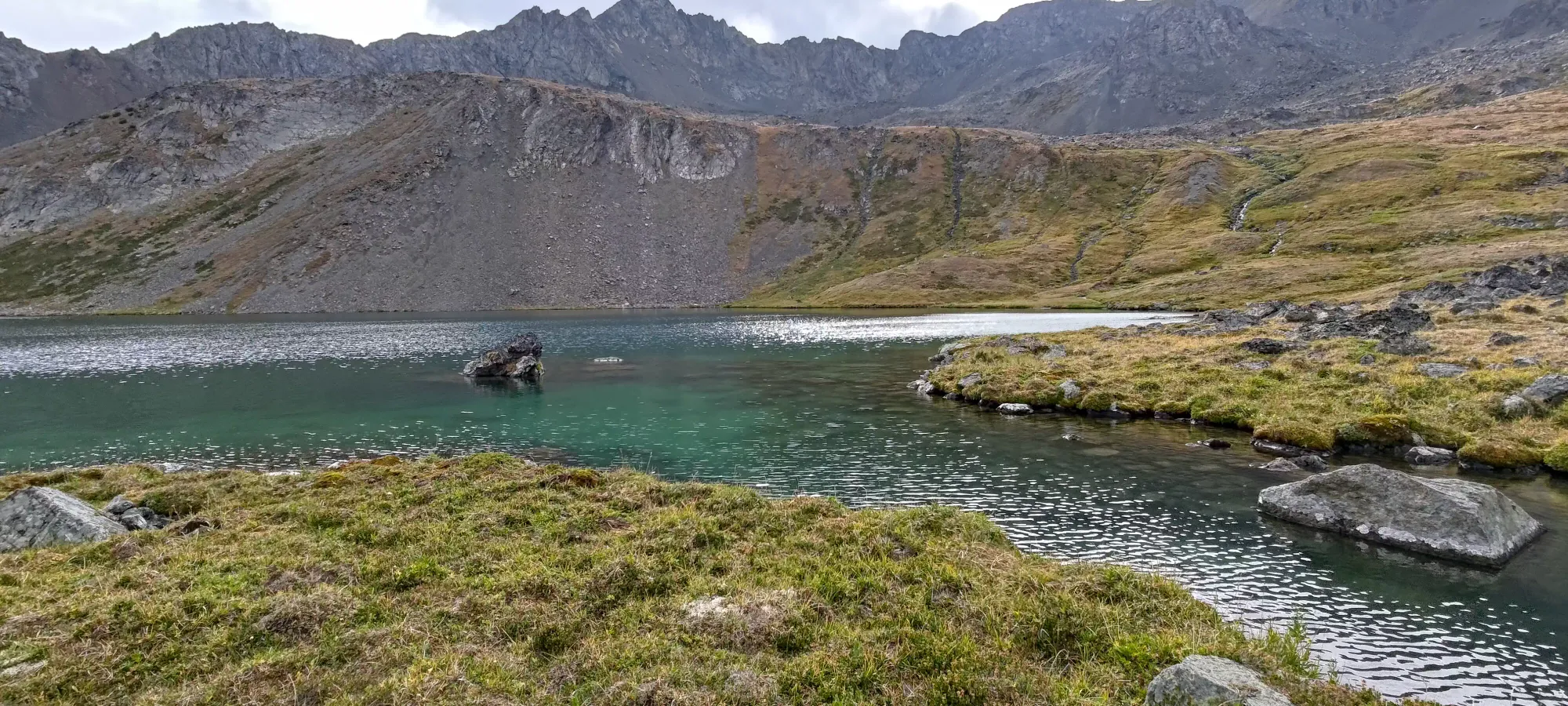
Once we were back on track, we still weren't quite out of the woods yet (both figuratively and literally 😀). There was still a lot of deadfall, detours, and minor bushwhacking to get around spots where the trail was falling apart, though this broadly got better as we gained elevation. We hit 1650m in about 20 minutes, and took a break to refill water (not a huge concern on this trail, it's beside a raging creek basically the whole time you're in the forest, and the time spent away from it above that is brief). After that, the terrain steered a little away from the creek, and opened up to a boulder field on the climber's left side of the creek.
The boulder field was pretty easy to navigate, with occasional cairns and generally decent boulders, as boulder fields go; fairly low ankle-twisting risk. From here, it was a rotation between terrain like this, forest trail, or short grassy clearings. The forest trail was sometimes just dirt, sometimes of course still blocked by deadfall or overgrowth, sometimes rockier, crossing a smaller creek, or any other random feature. The only constant was "you were close to the main creek", which was honestly very reassuring for both navigation and nourishment.
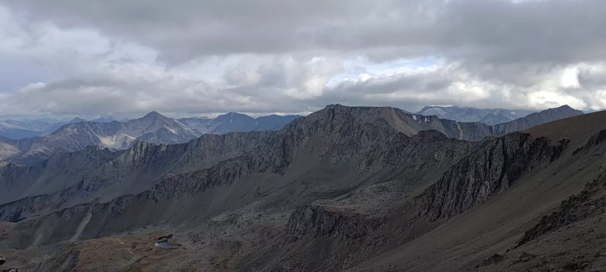
After about 3 hours on trail (keep in mind that includes our rather unnecessary detour), we found ourselves at the bottom of a rather steep and loose-looking gully, after having crossed a short open grassy field to get there. The base of this area was around 2000m, and the top of the gully was probably closer to 2200 than 2100m. While the terrain had been mellow to this point, this would certainly be an avalanche path in the winter, and at least a pain in the summer. Though, as if to prove that we humans are frail, pathetic creatures, we saw a pack of goats prancing up the gully like it was child's play; they even took it a step further and went up the rock face to climber's right of it instead of the gully itself. After revelling at the great luck of finding goats on Goat Mountain, we came up with a plan of attack.

We figured the best approach would be to stick to climber's right and hit the grassy slopes beside the talus field, avoiding that terrain as much as possible. Then, we'd cut across horizontally below the rock face, as it seemed shallow enough to not be slippery, and that would mean we could hopefully go up on grass instead of talus or loose dirt.
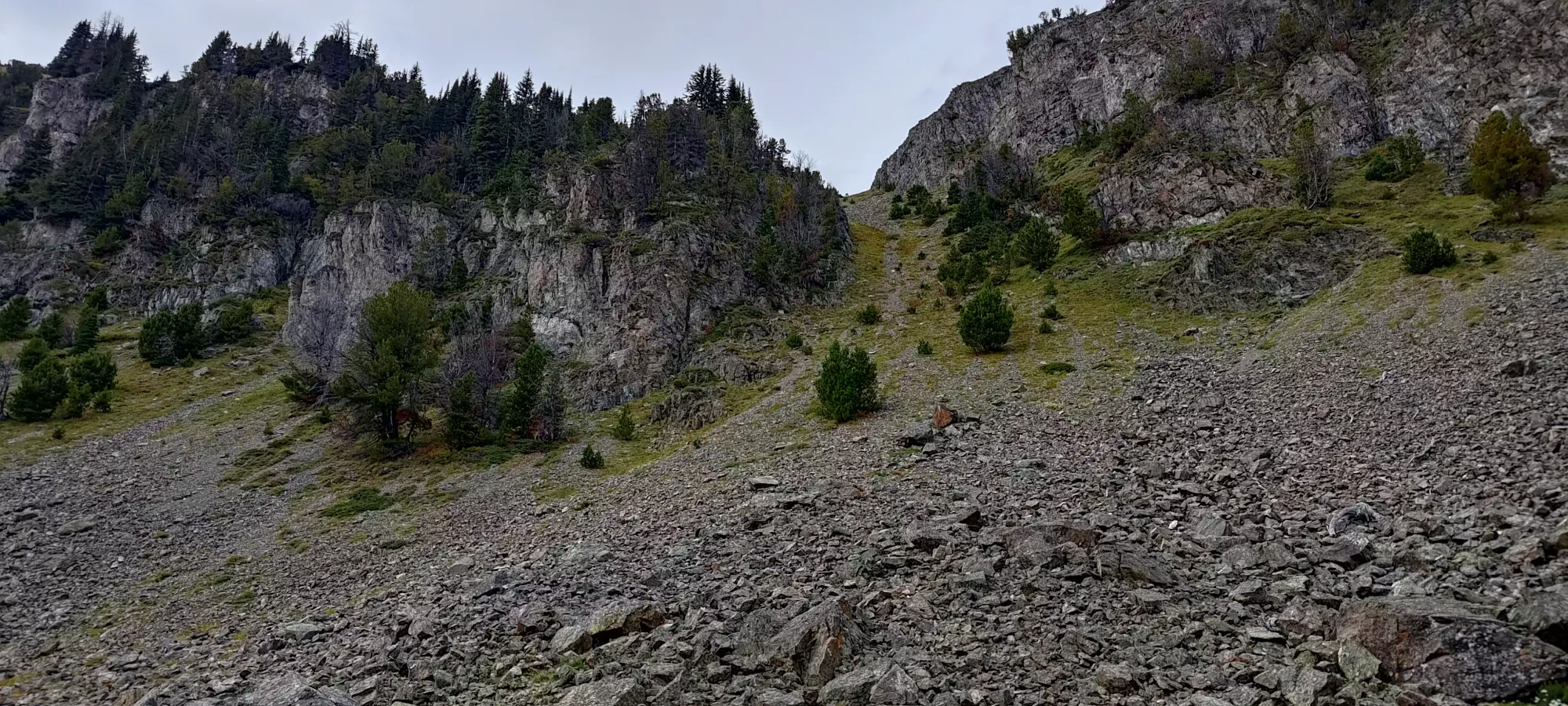
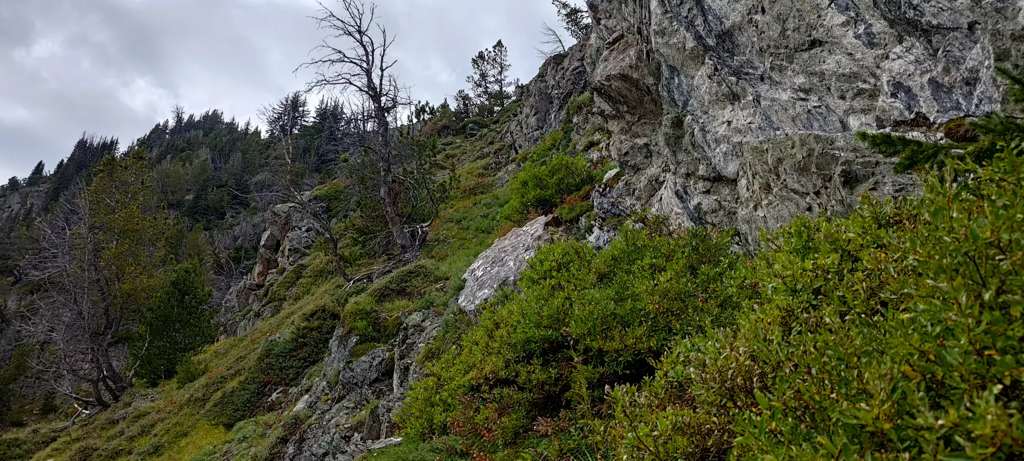
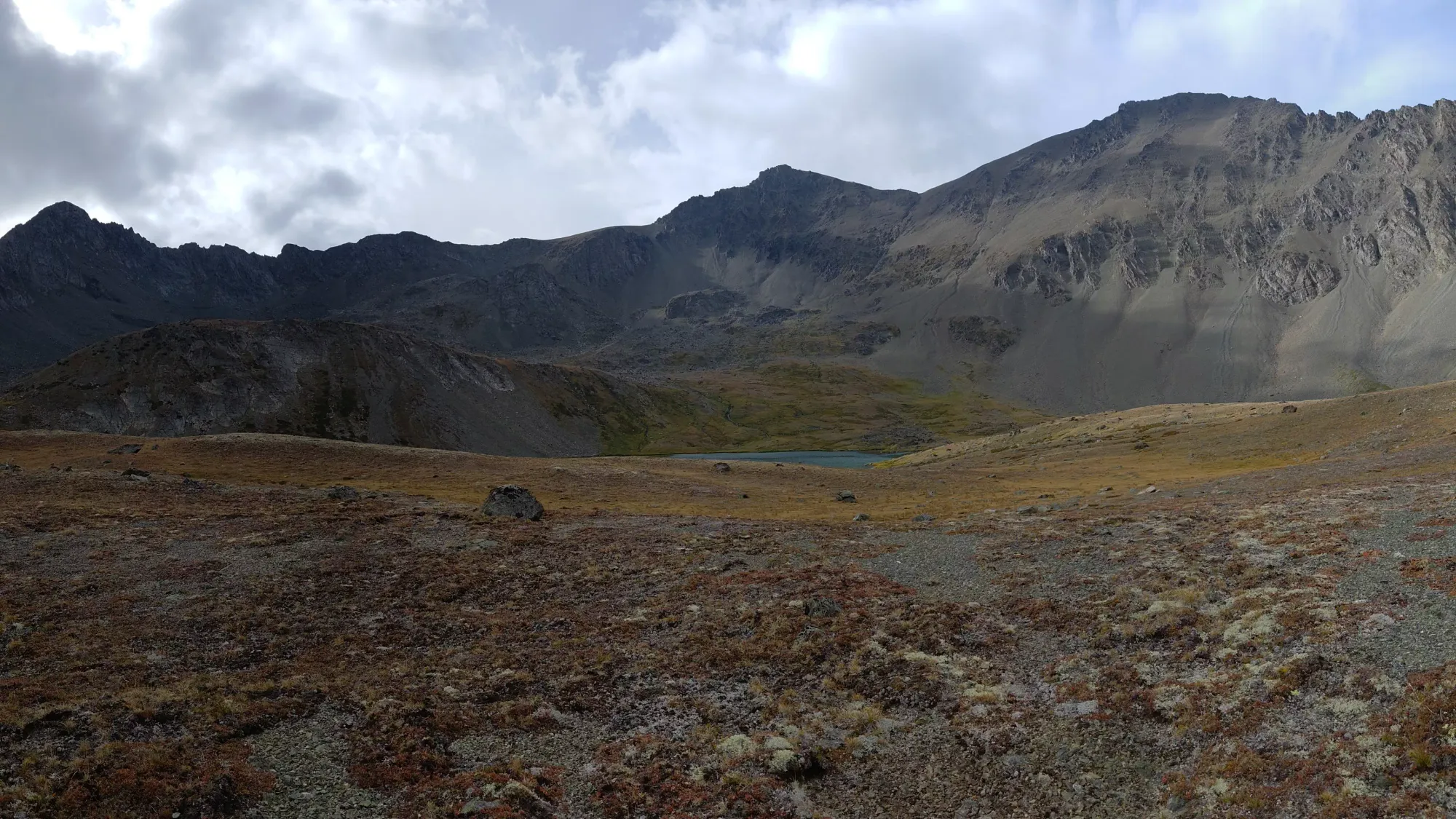
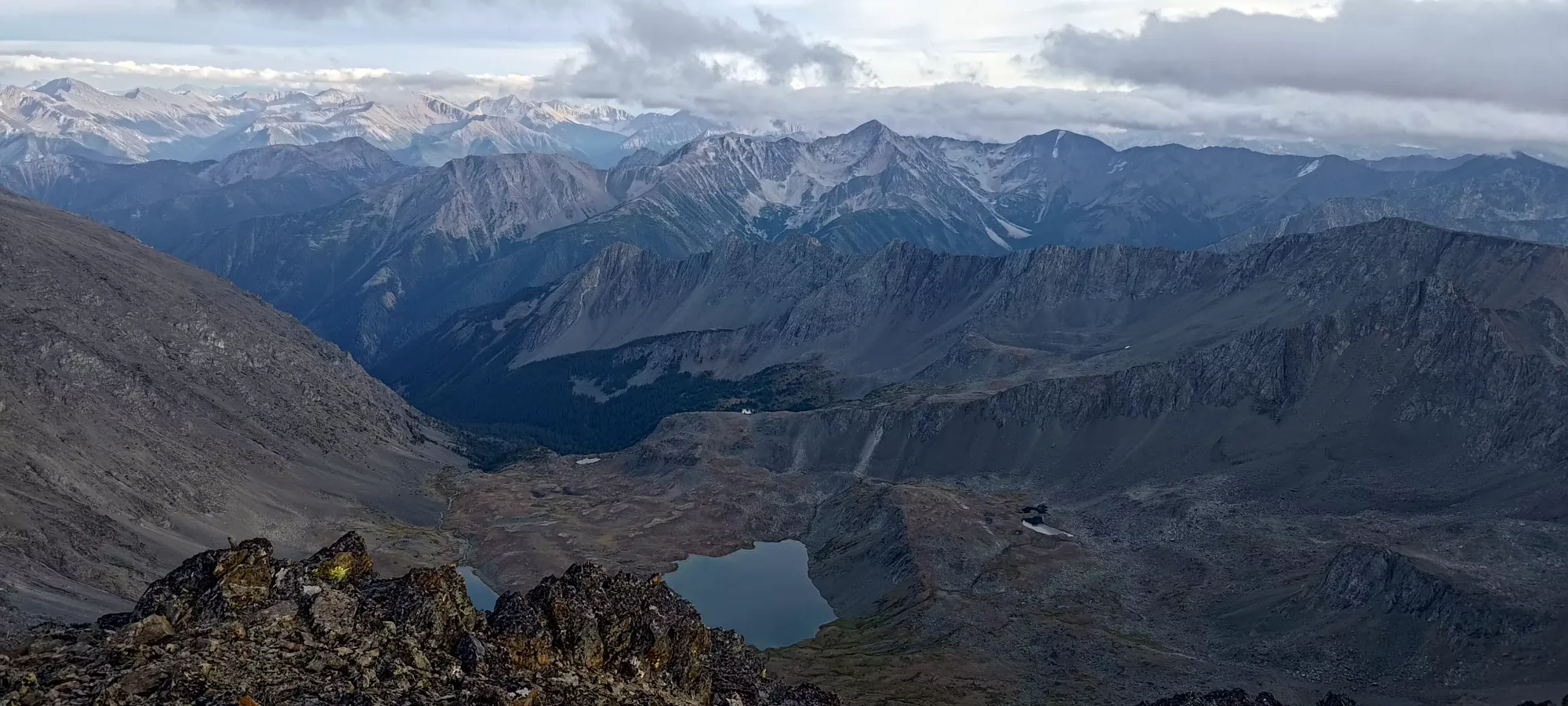
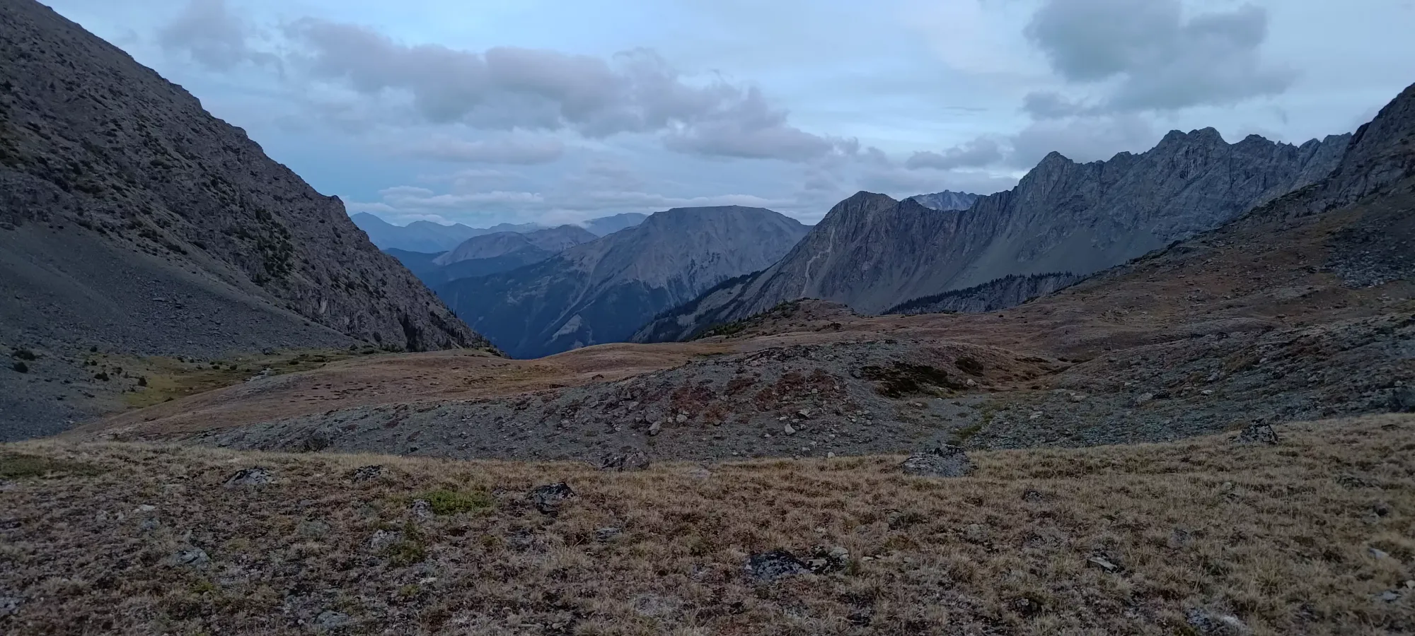
That plan worked great, and once we were under the rock face, it seemed like one could take grassier, bluffier terrain up beside the gully instead of being right in the loose dirt/rocks in the centre of it. We picked our way up this terrain, needing to do plenty of veggie-belaying, and grabbing rocks for stability as we came up a fairly steep route, but at least we weren't treadmilling on scree and steep dirt. We entered the gully proper for the last maybe 30-40m of elevation, though luckily it was mostly clean at this point, and it was just steep grass up to a small lake marking the top of this steep section. That whole section took us about half an hour, and we were pretty excited to have broken into some gorgeous alpine terrain.

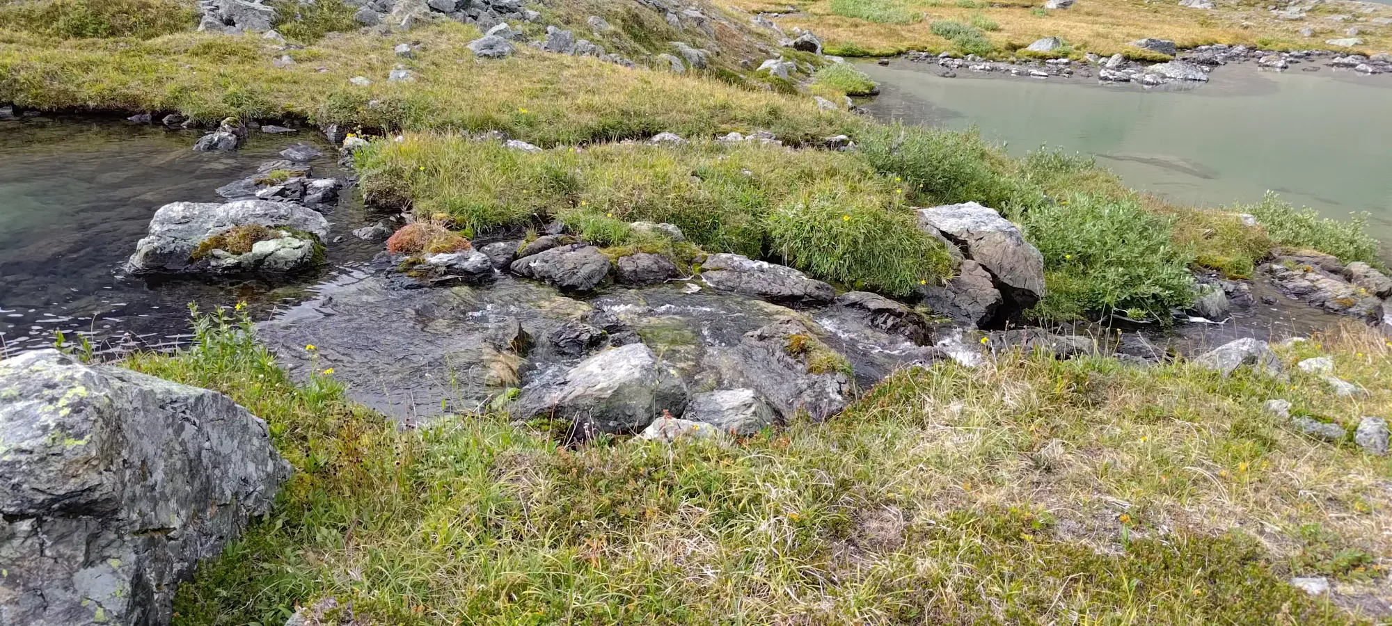
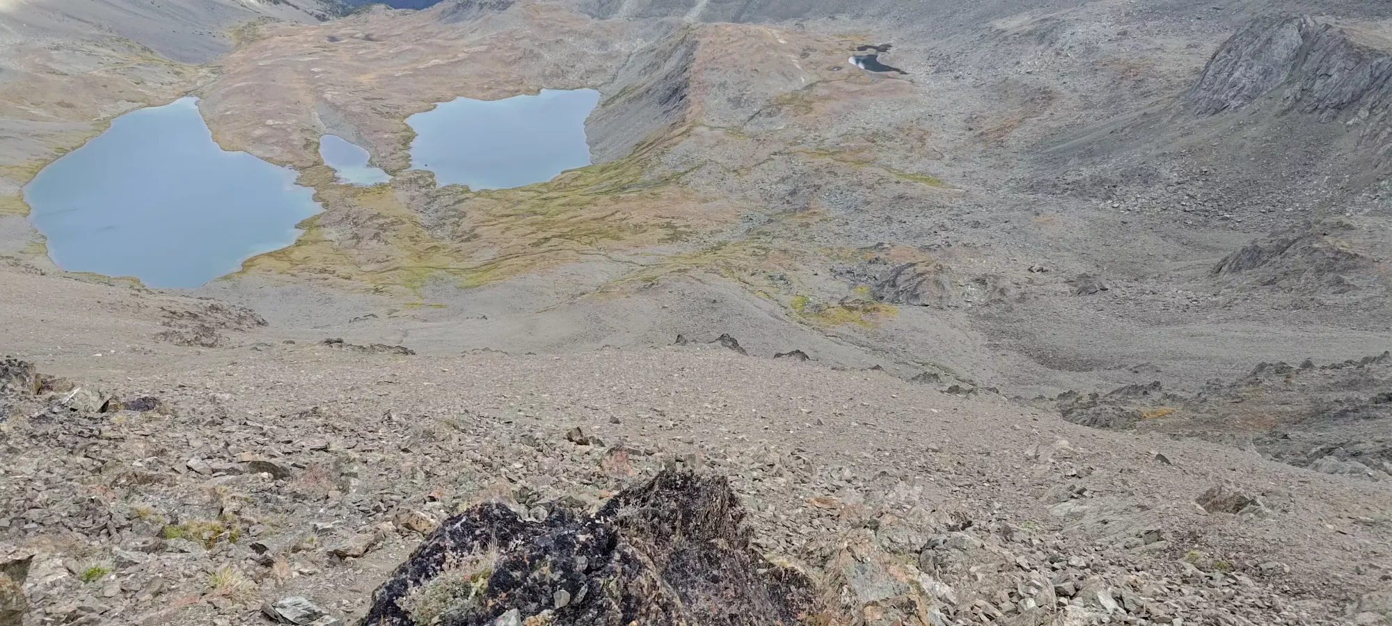
We were pretty ready for a break at this point, but there were only a few rolling hills to get to the larger lakes that would be a much nicer "natural break area", so we pushed ahead for another 15 minutes through gentle hills until we got to a nice spot on top of a hill between the two lakes, where we had some lunch and discussed our options for after the break. Well, technically, I only had a couple oranges and some Ritz Bits, but that felt like enough, so good enough. Peeling more oranges would make my hands rather cold, as it was only 5-7 degrees up there. I was very glad to have brought some liner gloves, and donned them after washing my hands in the lake.


During our half-hour break, we talked about quite a lot of stuff. First, we grabbed a forecast over InReach to see how cold it was going to get, and if there was any chance of rain with an updated forecast. Thankfully, it was going to stay dry, and it was forecasted to get as low as 5 degrees in this bowl by 9pm. Then, we tried to ascertain how long it'd take to get to the top, back down to the lakes, down and out of the gully, and how comfortable we were to be in each section of terrain in the dark. We also talked about "if we had to bivy, where would we be okay to do so, and how much do we really consider that to be worth doing". We also discussed just given how nice of an area this was, how much we could accept just coming back later with more time to be an acceptable solution as there were other peaks here anyways. We had pretty mixed feelings, being pretty confident we could get down below the gully (the last real "hard" terrain of the day) before it got dark and cold, but also knowing it'd be a long night, and still an annoying slog through an imperfect trail in the forest without light. What tipped the scales, though, was the state of the bridges, as we had no idea how long they might stay in a condition we could accept driving on them, and without that, access becomes much harder/longer, and that was a risk that pushed us to accept a little extra suffering. With that, we set off towards the summit at about 4:45pm.
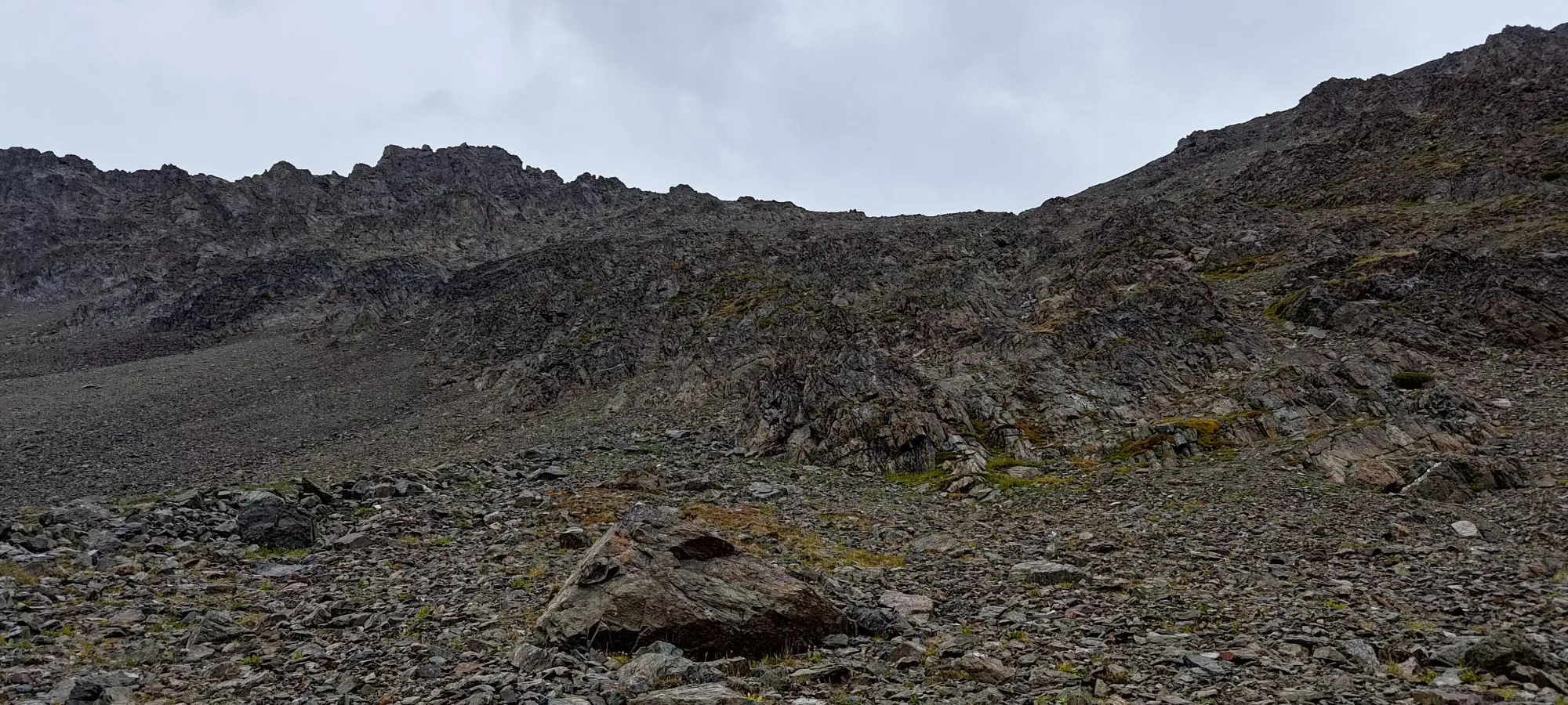
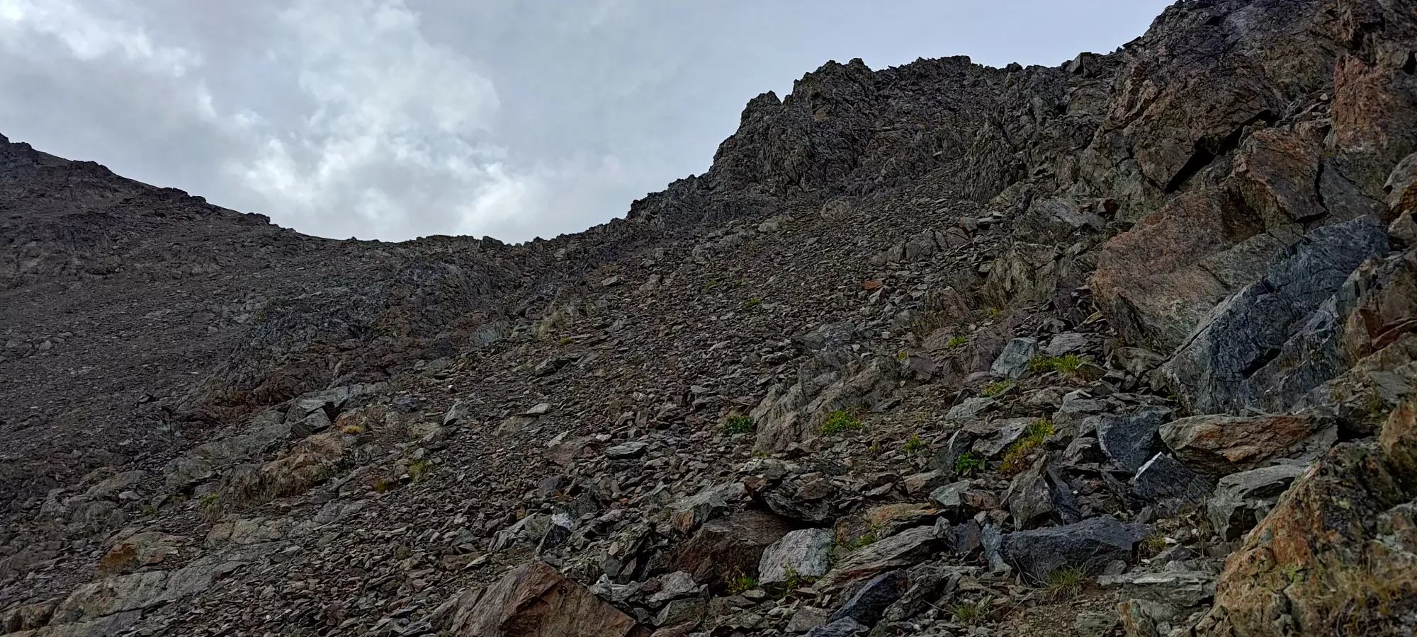
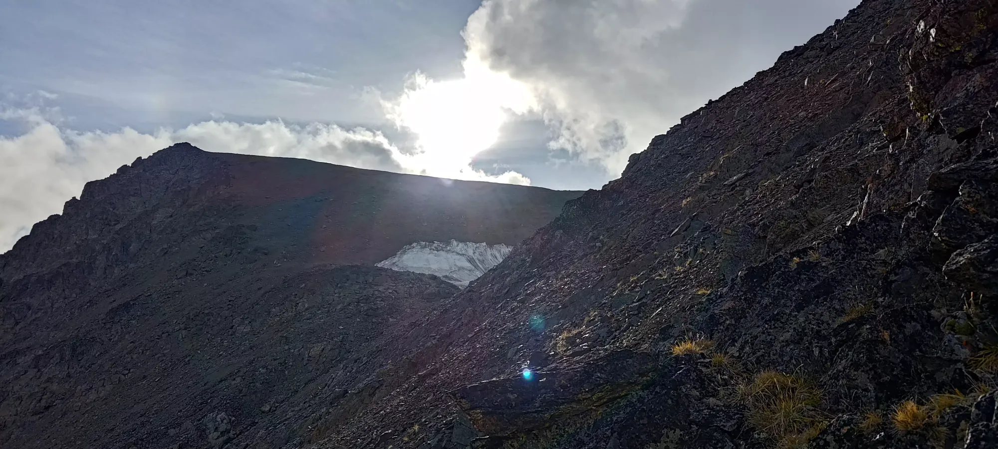
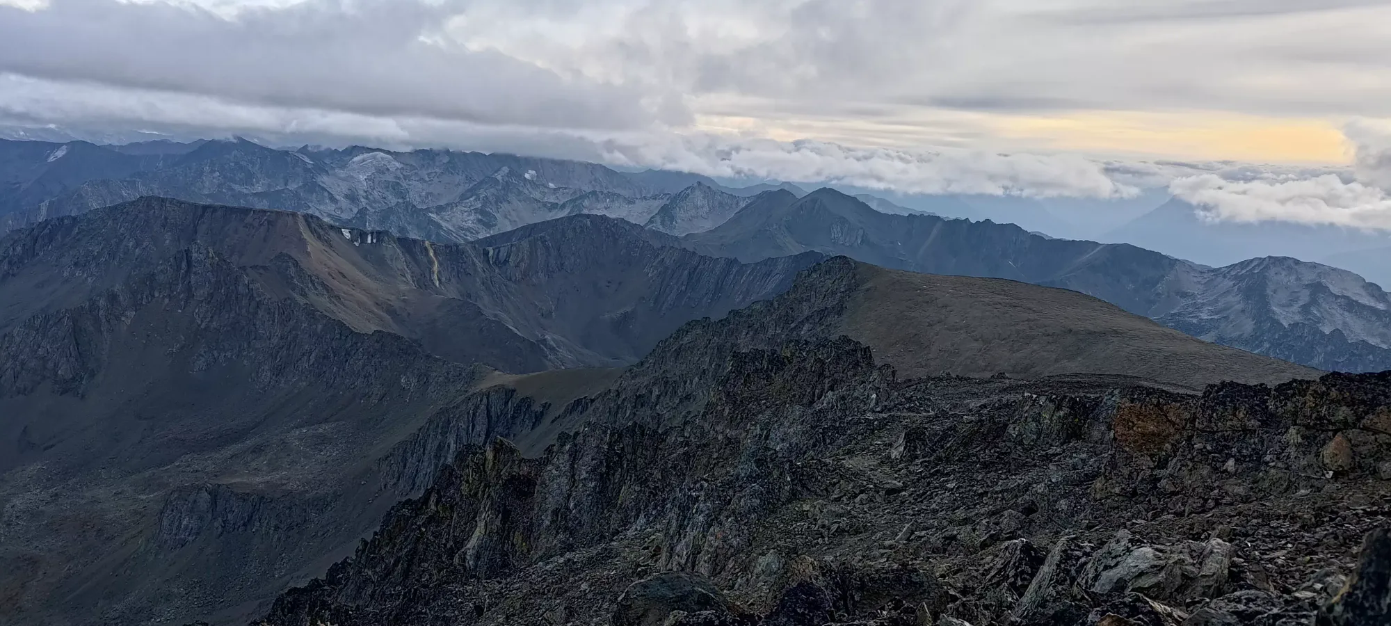
The first bit of the ascent past the lakes is quite pleasant terrain, if a bit steep. It's just grassy slopes, with a couple creek to spice it up. Since it's so open, though, you can just switchback at whatever grade you desire to make it efficient, and it posed little problem for us. Once the grass ran out, though, we were faced with a giant slope of scree, talus, and some rockier outcroppings. The track we had to follow aimed for the pass to climber's left of the summit, where a small snow patch (former glacier, assuredly) was melting out into the creeks below, though we found that sticking a bit more to climber's right allowed for one to stay in more class 2 scramble that steep scree bashing, which we found more pleasant.
This section was a bit more tiring, and we took a couple rest breaks to get through it, and definitely slowed down, especially in the sections with more scree and less stable rock, as treadmilling up steep faces isn't an efficient process. We did stick climber's right of the creek draining from the top, and both felt nourished enough not to need a diversion to refill, though the terrain would allow it if you were to feel differently here.
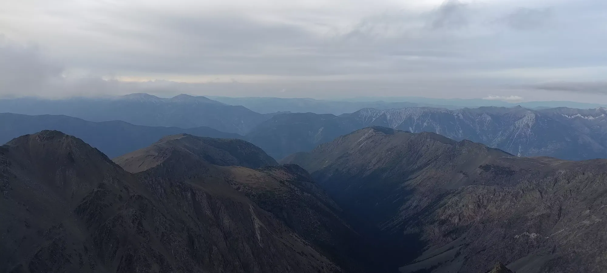
By 6pm, we were getting close to the ridge top, and finally managed to spot some snow on our mountain. We also got high enough to get hit by the sun as it opened up from the clouds, which felt quite nice. Due to our trend to cut right instead of aiming right for the low point of the pass, though, we did spend longer in the shadow of the face than perhaps necessary, though we felt the terrain quality made up for it.
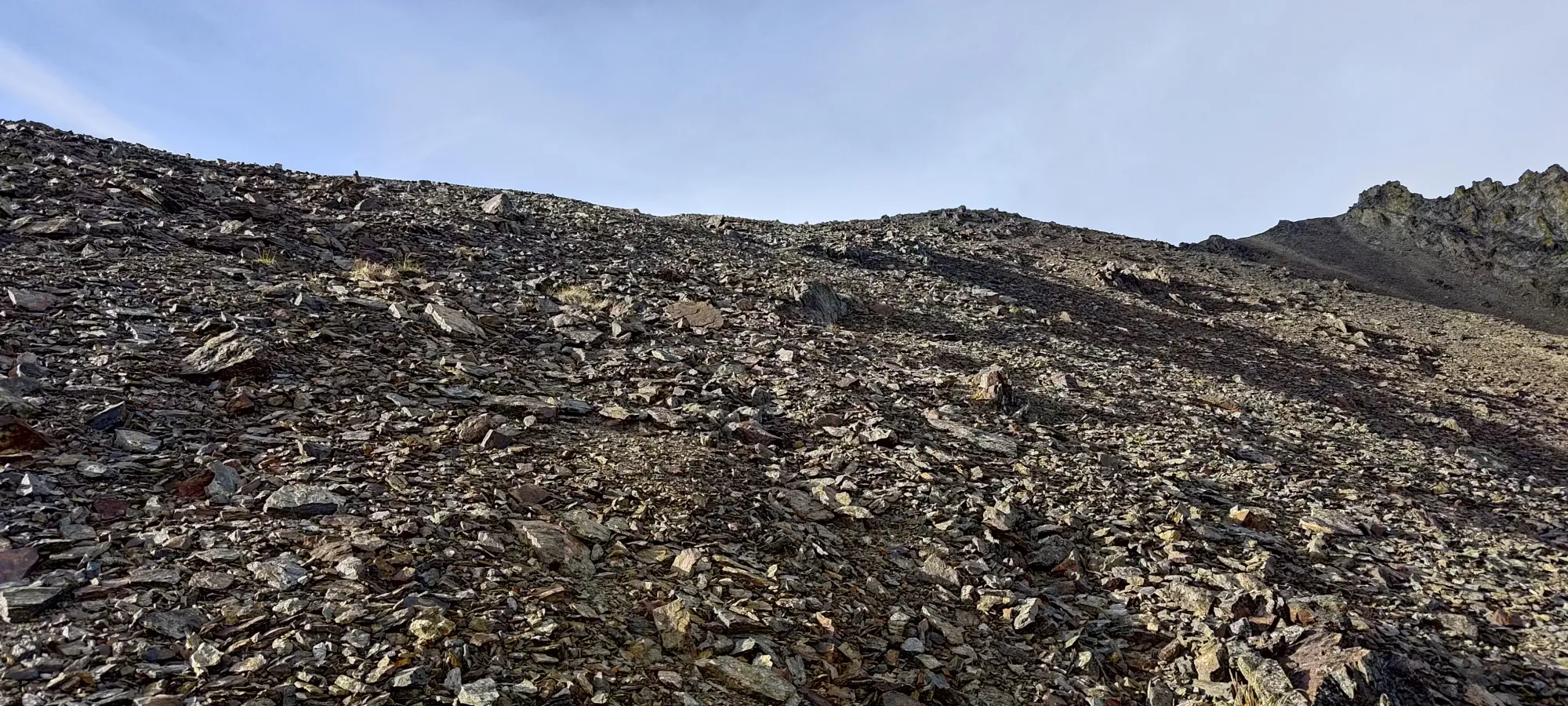
After we hit around the pass elevation, despite cutting the pass off a bit, things mellowed out, and we moved into more "just scree" as we moved closer to actually walking on top of the summit ridge. Thankfully, this scree isn't the thin, slippery stuff you'd find in the Rockies, but more small rocks that actually remain fairly stable, and give you solid enough footing to make consistent progress. Above about 2650-2700m, this becomes mellow enough to become fairly pleasant and the distance goes by pretty quickly.

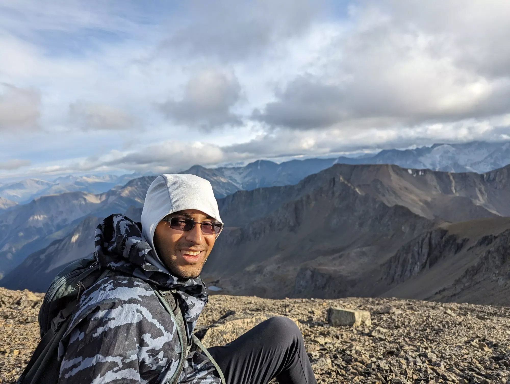
The top was quite easy to get to, the wide ridge goes almost all the way, then just a few steps on jagged rocks (not really scrambling) until the summit! We got there before 6:30, well before our "realistic but conservative" estimate of 7:00pm, which was a great sign for getting below the gully by dark, which was our big goal. We stayed on top for a bit under 10 minutes, checking out the register, taking pictures, and scarfing a quick snack down before we headed out, racing both time and the cool wind that was making us a bit chilly.
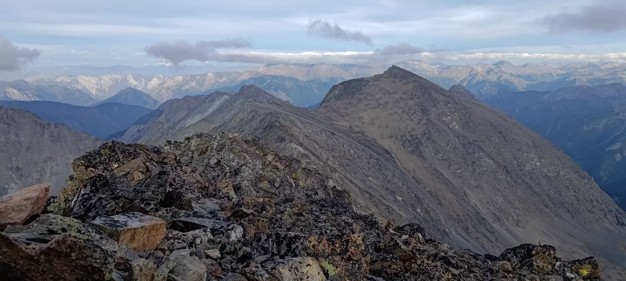
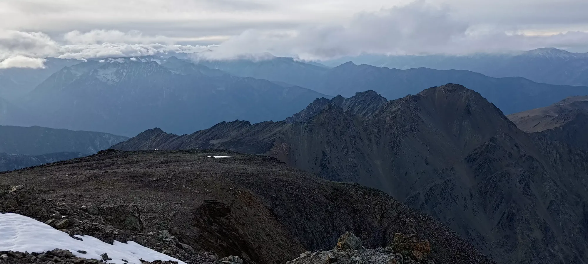

The way down to the lakes was pretty simple, and went faster than expected. The ridge was easy walking, no issues there. I noticed a little antenna or something to skier's right, on the far side of the ridge from the lakes, but didn't have time to investigate. The solid rock and easy angle made walking quite simple.
Once we turned off and started heading down the steeper face, we discovered there were actually a good amount of sections where the scree was small and deep enough to scree-ski, so we plunge-stepped down quite a good portion of the slope. As we got lower, it got a bit harder to find those spots, and we had to do more walking and scrambling down ledges, but largely we travelled pretty efficiently. Once we got to the grassy hills, it was even faster, and we went all the way to the first hill on the far side of the lakes, above the gully. That whole descent took sixty-five minutes, which was quite reassuring. We had a short break (we needed a few for shoe-emptying on the way down, so we weren't too out of breath or anything), then continued to the top of the gully on easy walking terrain (though these hills have more embedded rocks, so you have to watch your step a bit more than the runnable slopes on the peak-side of the lakes).

Getting to the top of the gully was only about 10 more minutes of walking, then we had to figure out a way down there. Thankfully, the first bit was steep but grippy grass. Beyond that, we found some more skiable scree, and got about 80-90% of the way down fairly easily on that. The last bit was just walking in the larger talus field at the bottom, but the whole gully was probably only about 20 minutes down. That meant we made it out of all the technical terrain by dark, which was our big goal. Plus, it was much warmer down there, so even extended breaks didn't cause discomfort. We emptied our shoes, I replaced my blister bandaid (all that skiing messed it up), and we headed out after about a 10 minute break.
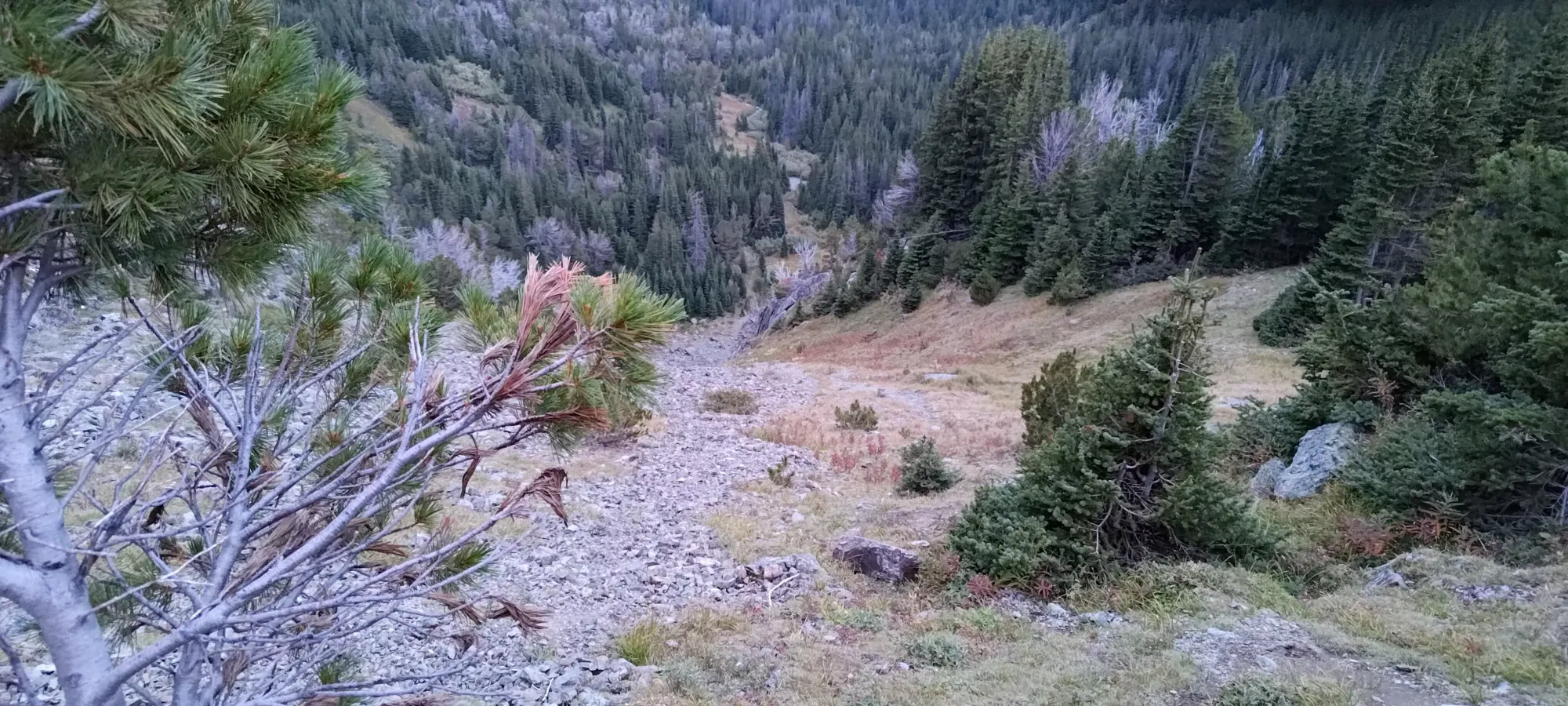

We strapped the headlamps on here, since the forest was substantially darker than the open terrain above. There's not too much else to note for the rest of the way down, it was only about 2.5 hours to the car. The majority of the distance was actually a breeze, and we wasted a lot of time doing small bushwhacks when the terrain became non-obvious in the dark, or trying to find our way around detours that were necessary in the trail. Specifically, I'd say the half-kilometre from just before our big bushwhack detour in the beginning towards the car was the worst, the trail was very hard to follow there in the dark, with a lot of time in the bush.
We got out pretty fast though, all things considered, and the drive back was pretty chill. We stopped in Whistler for some late-night pizza, and with a slight delay due to a rolled-over truck on the 99 just before Creekside, we got back home before either of us got too tired to drive.
I'm definitely glad to have got this peak done when we did, the access and trail are deteriorating, and I'm not sure how long it'll be until this is substantially harder. I'm considering trying to make sled friends, and seeing if this is a skiable trail in the winter, as the bowl near the peak looks sublime, and the lakes would be a great campsite. With snow covering the bush, the approach should be pretty fast too, so it'd be a cool place to camp for a night and just ski a bunch of cool lines, and clean up some peaks before heading out. Plus sleds are lighter than cars if the bridges get worse. But that's a problem for future me. If you're considering Seton and it's still 2023, I'd go for it while things are "still in". A year later, who knows if the bridges will be in, and that's a long bike/run in. Plus the trail won't be getting less bushy.
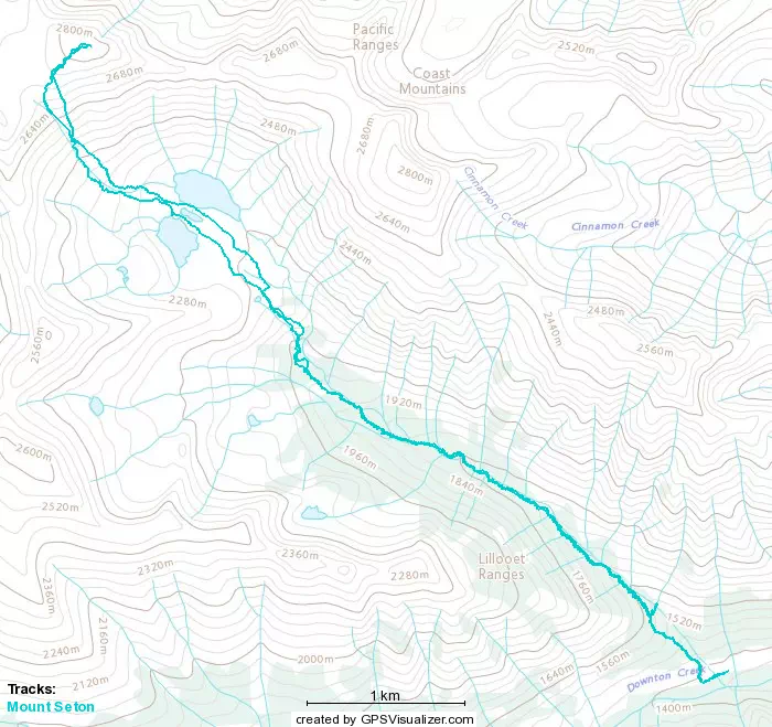
GPX Track + Map