Mount Cline (and Mount Owen) - September 1 2024
A nice, day-trippable 11000er with a fun crux. Long slog, though. Mount Owen is a bonus peak, though honestly I'd not recommend it due to the difficulty of the downclimb, which far exceeds the crux of Cline itself

Cline Range, Saskatchewan River Crossing, Alberta
3374m
For the last weekend of our annual Rockies trip, our (myself + Logan's) eyes were definitely hunting for an 11000er prize. The original objective of Edith Cavell was out due to the Jasper Fire bringing closures to most of the park, that peak included. Cline was one of the peaks on our radar, and had some attractive aspects to it. Namely, it is under 30km/2500m elevation gain round-trip (making it feasible for a day-trip), the route is mainly just hiking except for the notches, which we expected to be well-exposed to the sun to avoid any wetness in the important spots, and it was within a couple hours of our Airbnb in Golden. That sealed the deal for us, so after spending Saturday doing some more touristy stuff (and some last-minute roadside car repair, eating into our sleep/prep time a bit...), we set out a bit before 7am.
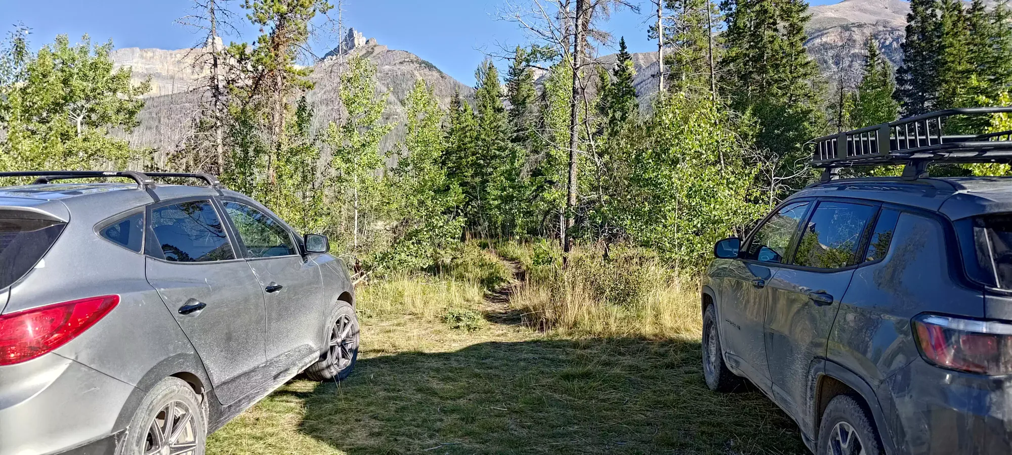
We drove straight to Saskatchewan River Crossing, where we discovered some gas so heavily marked up we couldn't stomach the thought of refueling there, so we accepted returning to Golden fairly low to avoid that (don't plan on fueling up here if possible). I also took way too long for my final bathroom stop thanks to a long queue for the single stall available 🙃 By the time we were parked at the trailhead (just a faint dirt road to a flat area on the north side of Hwy 11, just make sure to slow down when the bridge over Thompson Creek appears, it's immediately after that) and geared up, it was a touch past 9:15am.
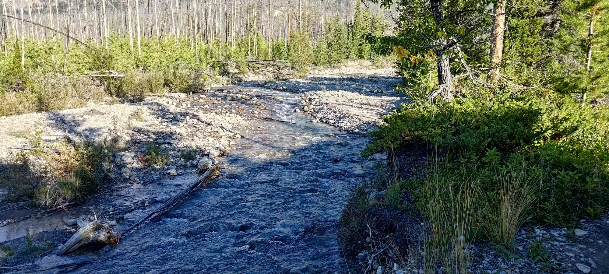
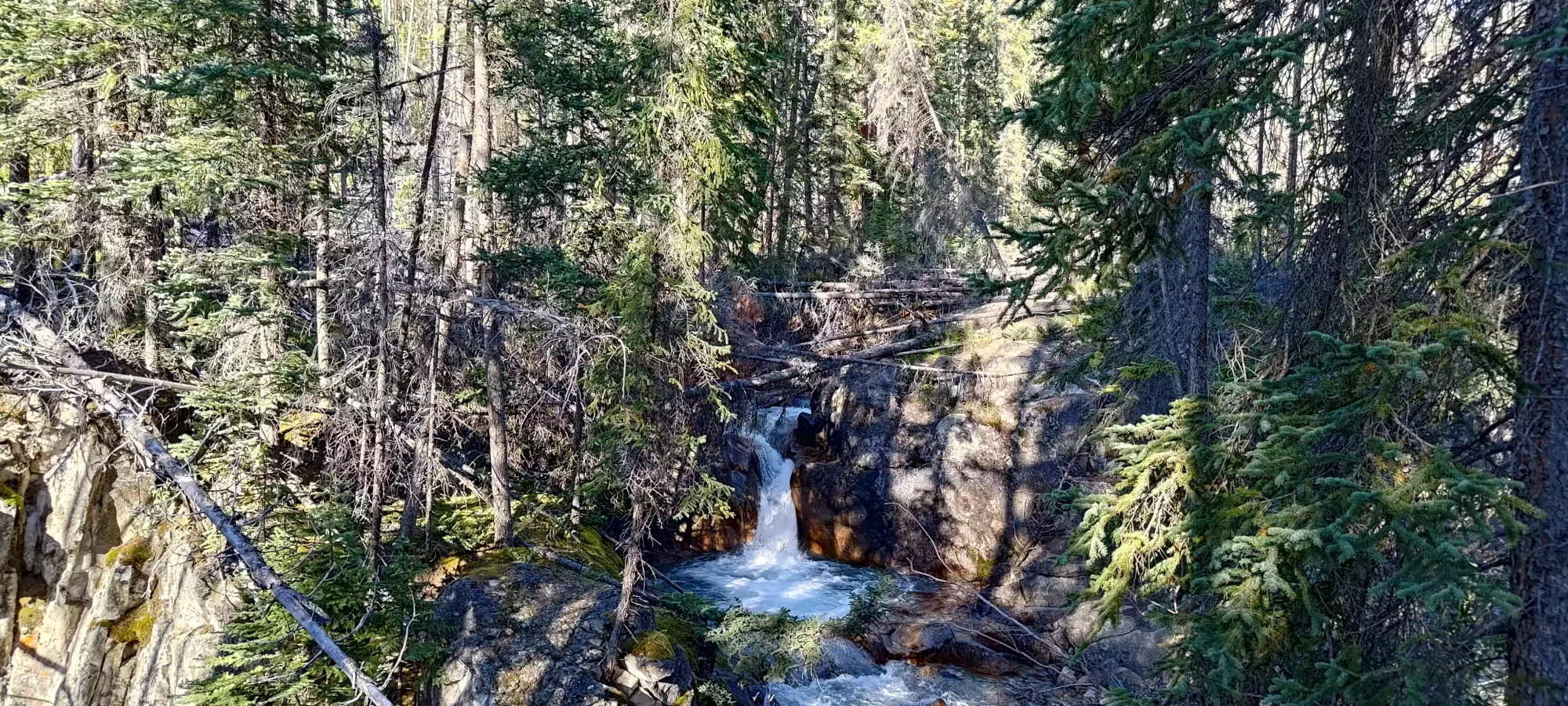
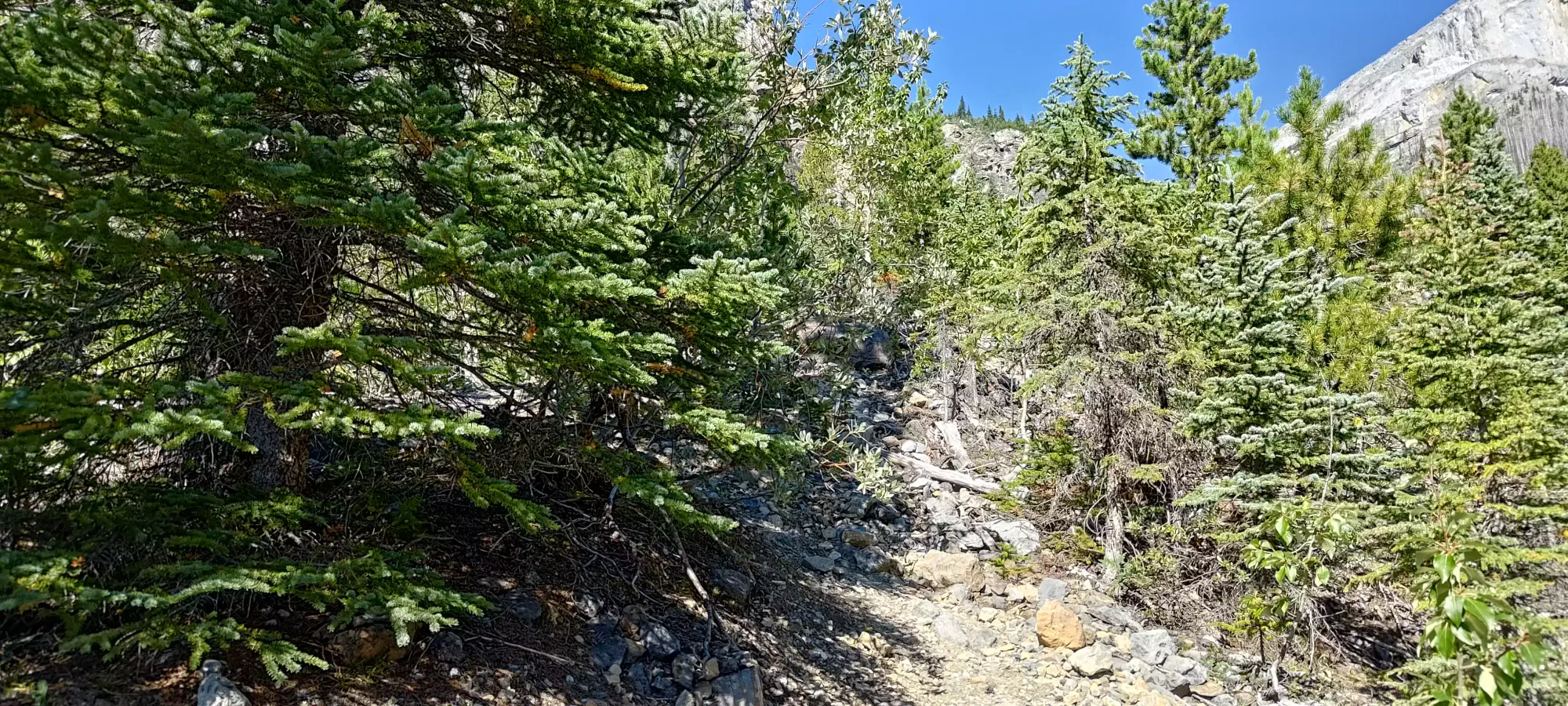
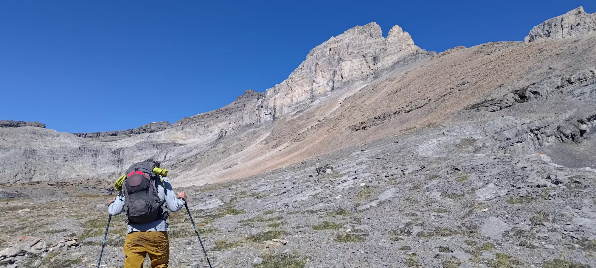
The trail along the east shores of Thompson Creek is excellent, to the point that AllTrails shows the route as bikeable, which I'd believe (though it extends that rating to the entire trail, which certainly is NOT the case). Given the size of the creekbed, it seems the flow can get quite extreme, but when we were there, it was fairly benign, and all crossings were quite simple+straightforward. The first of these was 1km in, where the trail turns to the west side of the creek. One can find an interesting-looking mini-waterfall and pool here, which we both remarked would probably make for an excellent cold dip on a hot day. Sadly, we did not have the luxury of time to waste, and expected a dark return, so we could not confirm this.
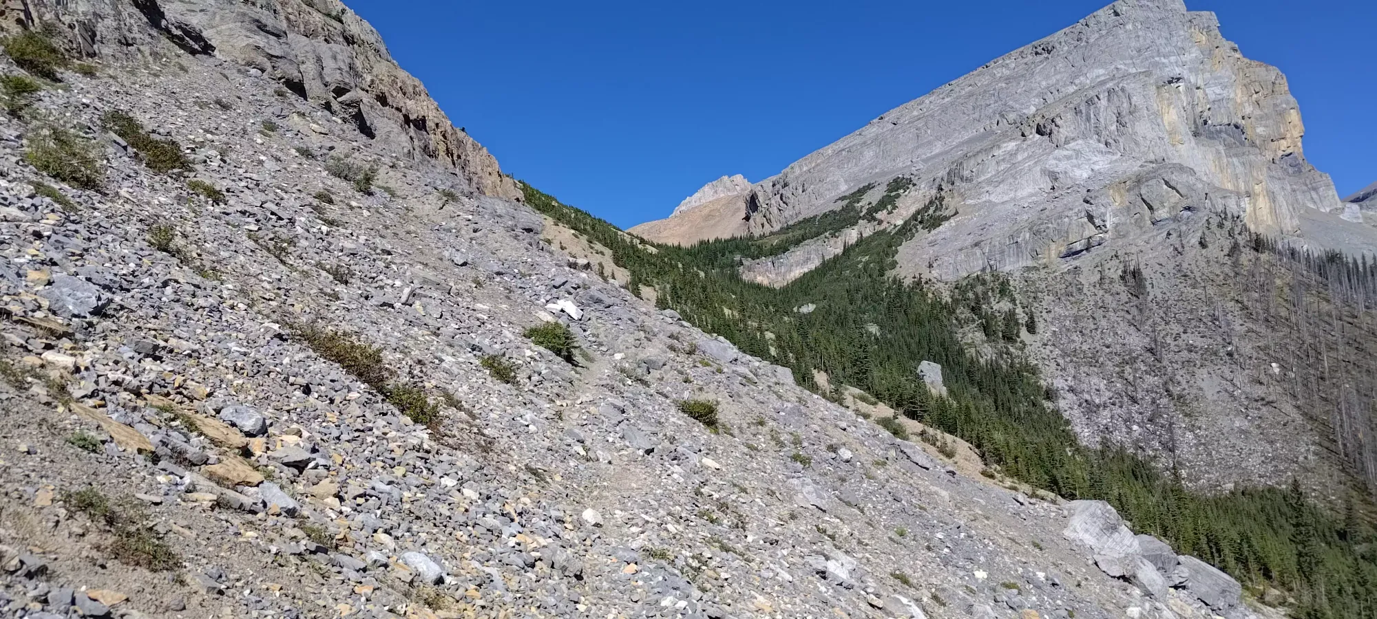
The super-mellow trail continues along the creek for a while, weaving in and out of the sometimes-burnt forest until about 3 clicks, where it finally starts to gain elevation at a meaningful pace. Usually I'm happy to go at a mellow slope angle, but with over 2000m to gain, "wasting kilometres" walking flat just meant more pain later, so I was glad to spread the love amongst as many clicks as we could.
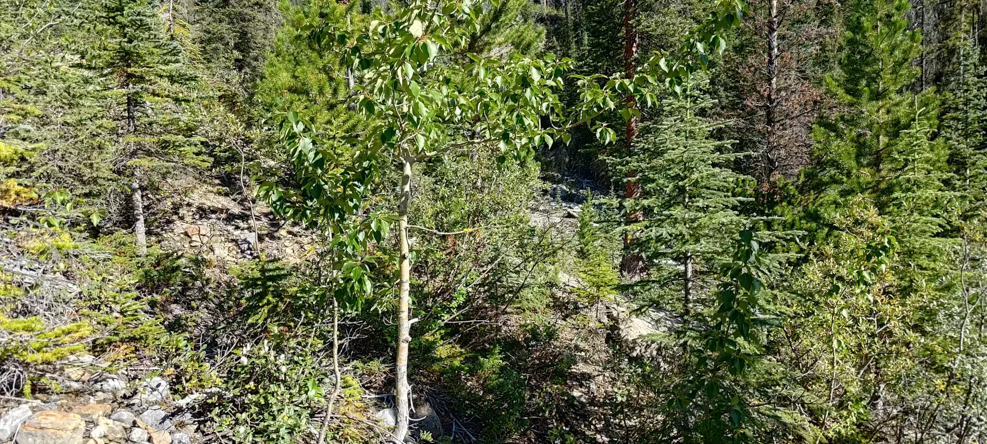
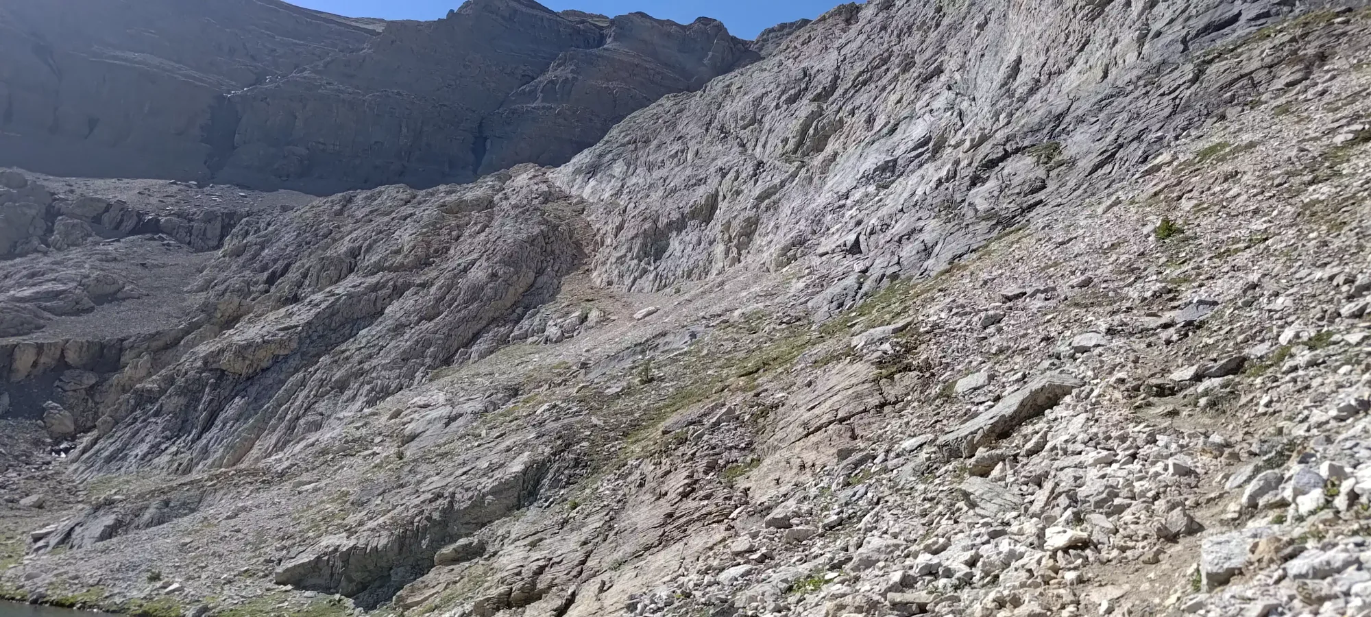
At about 1:15 into the day, we reached a fork, where the trail clearly split sharply uphill to climber's left, or went straight ahead. We had GPX tracks going both ways, and since forward seemed to "continue the trail", and was actually flagged, we decided to follow that direction. This was a mistake, largely. We DID get to see some pretty waterfalls in an open meadow, but we also wasted about half an hour and gained an extra ~75m of elevation to do so. The trail kinda just went towards the waterfall and source cliffs it was pouring from, and our GPX ended up just showing a bushwhack back towards the main trail, so we just turned around to follow a real trail up the steep slope instead. I guess if you have time+energy to kill this could be worthwhile, but with our relatively late start for a big day, it wasn't an ideal use of time.
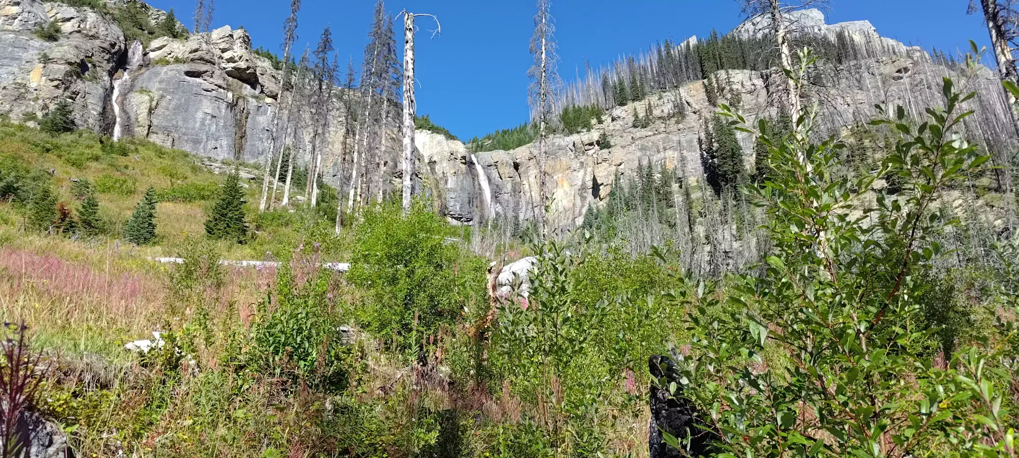
Left is the way up, right is how we ended up at those waterfalls
One we got back on track, we ascended a steep, loose dirt gully (it had a nearly-dry creek in the centre) for about 200m of elevation, near the top of which it cut across and dipped into some trees, which after gaining the final bit of elevation, the trail started to cut across, on the bench we spotted from the valley earlier. I told myself near the start of the climb we'd take a break once we got into the shade of the trees, but I wasn't prepared for 200m of climbing before that 😅, so when we finally got to the top, I was quite happy. Despite my continued colitis-related issues (which I normally "solve" on-trail by refusing to eat+drink until I'm about to conk), I knew this day would be a big slog, so I insisted on regular breaks to drink and even snack, knowing having to go to the bathroom a few times would be worse than being low on calories+water on such a big day, at elevation. Granted, my food for the day was a few granola bars and a pouch of baby food (glorified applesauce), but hey, for me, that's a lot!
After enjoying some shade, we made the traverse (still on a decent trail) along the bench until we reached the first of what would be many talus-filled sidehills of the day. This one, at least, largely had a trail carved in to the talus, so it wasn't too bad, though near the end of it, past the first treed section, the trail kinda disappeared on us, and picking it back up at the next patch of trees was a bit tedious.
In about 45-50 minutes or so, we finally got across this first slope, and crested above the section of trees we'd been staring at, which guarded the "next section" of the hike.
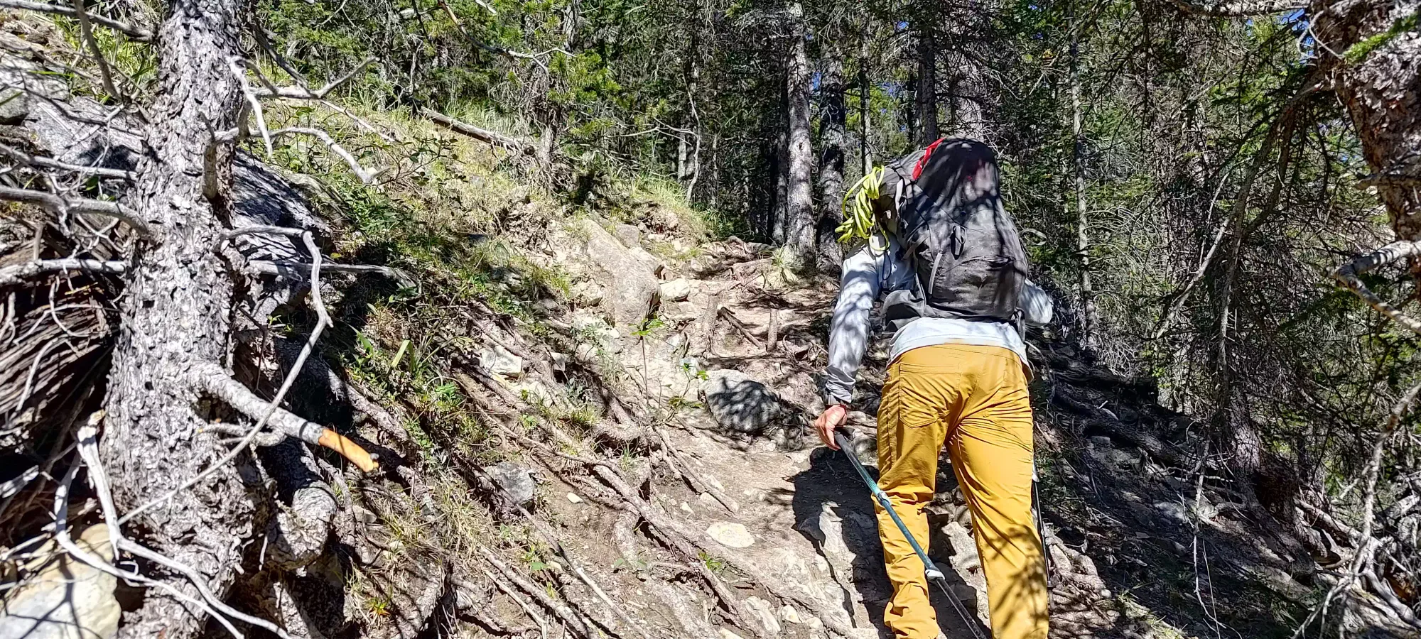
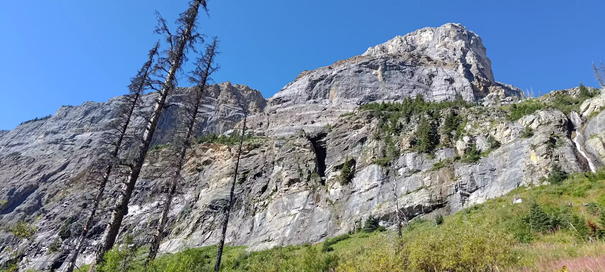
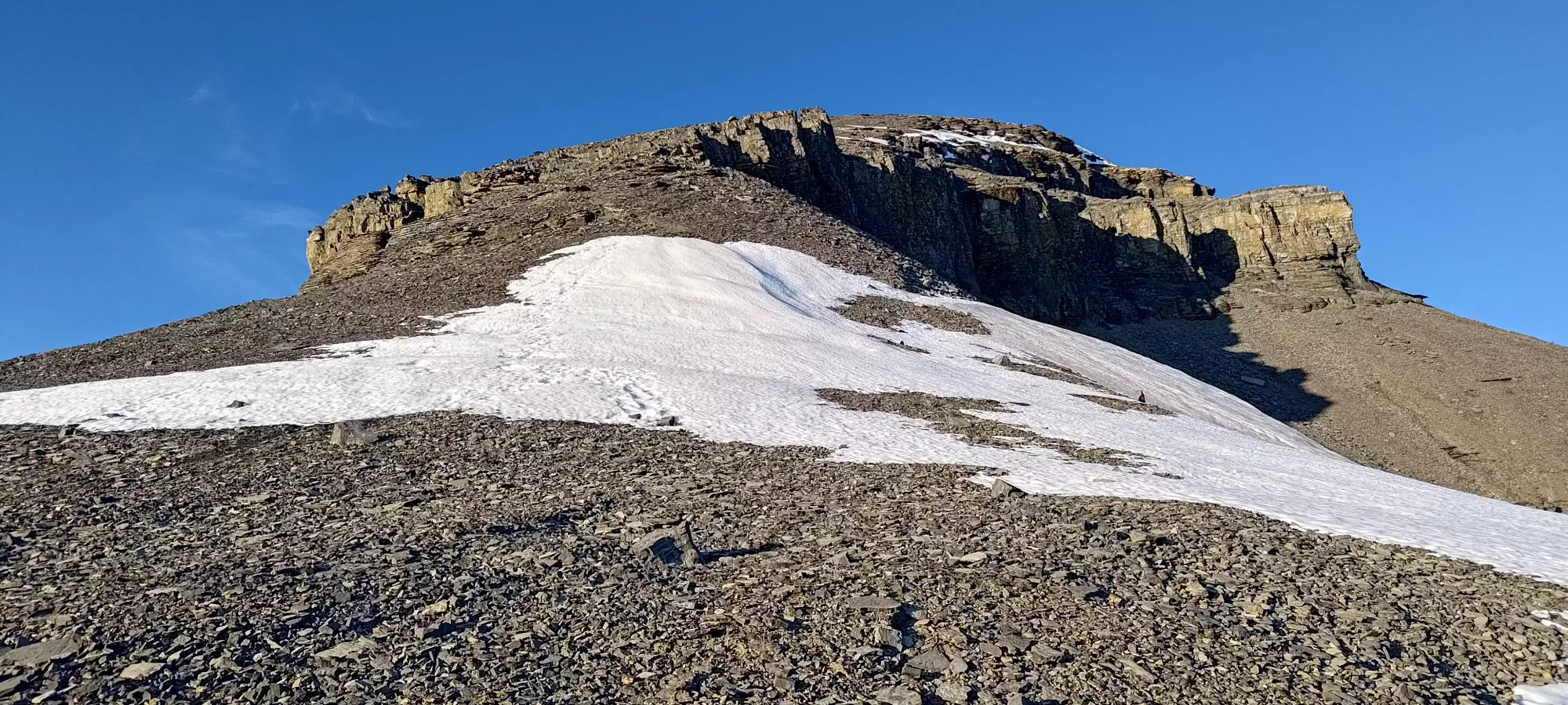
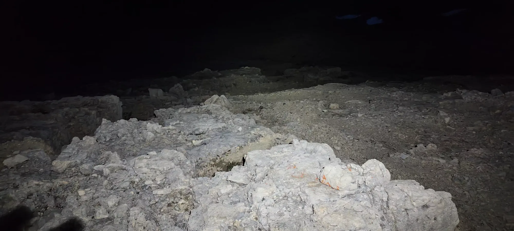
After that, we wandered up random talus for about 25 minutes until we arrived below a small headwall, which presented us with the first scrambling opportunity of the day. From afar, it looked fairly steep and potentially challenging, but up-close, it was much easier, and we found our way up with basic class 2 scrambling, sticking just to climber's right of the obvious gully where water would drain in higher-snowpack months. There was a cairn or two, but one need not stay right on them if you don't want to, just "getting up" in that general area will suffice.
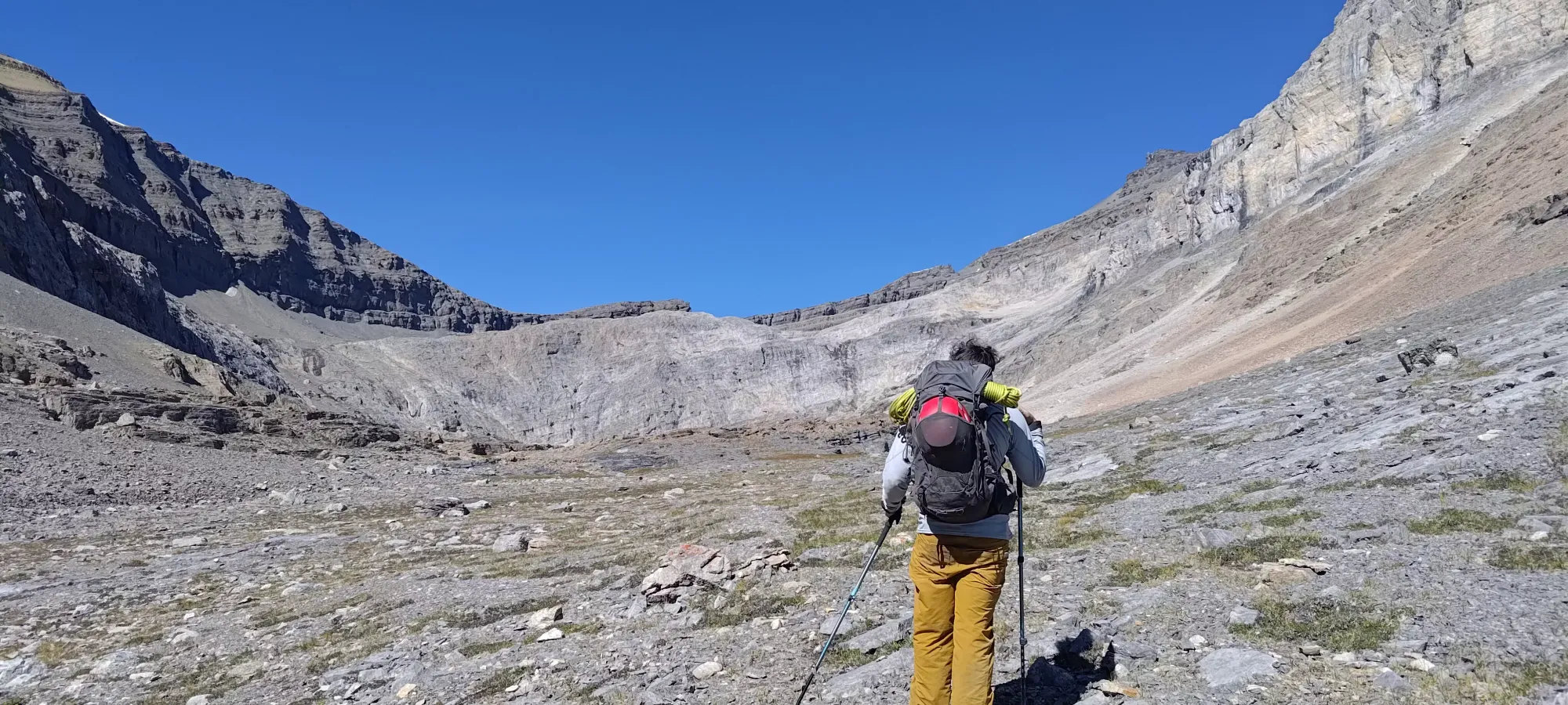
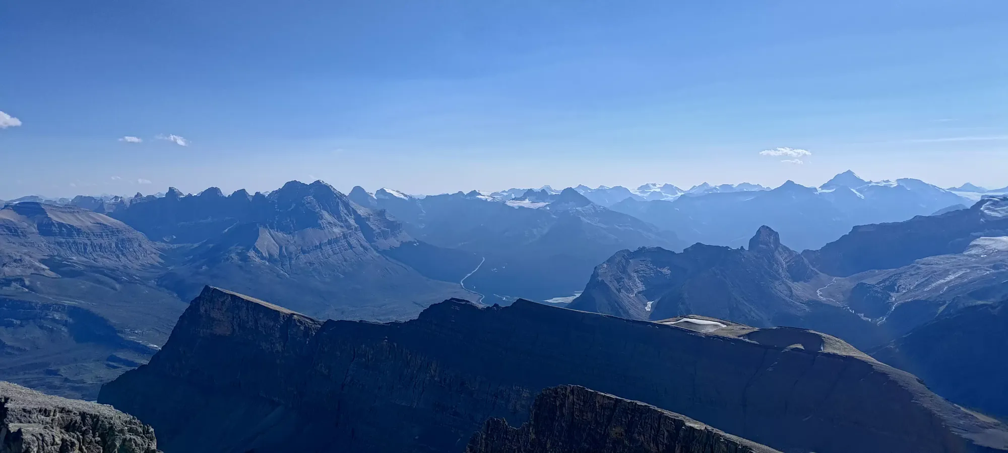
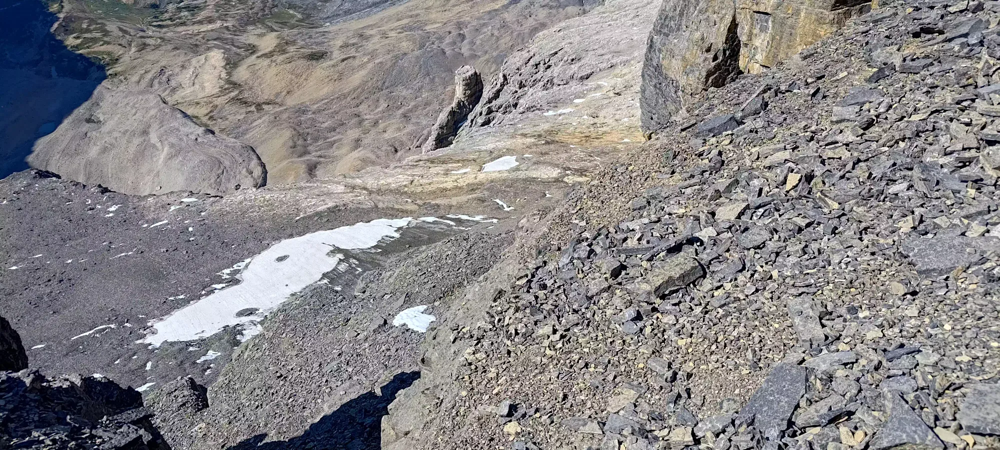
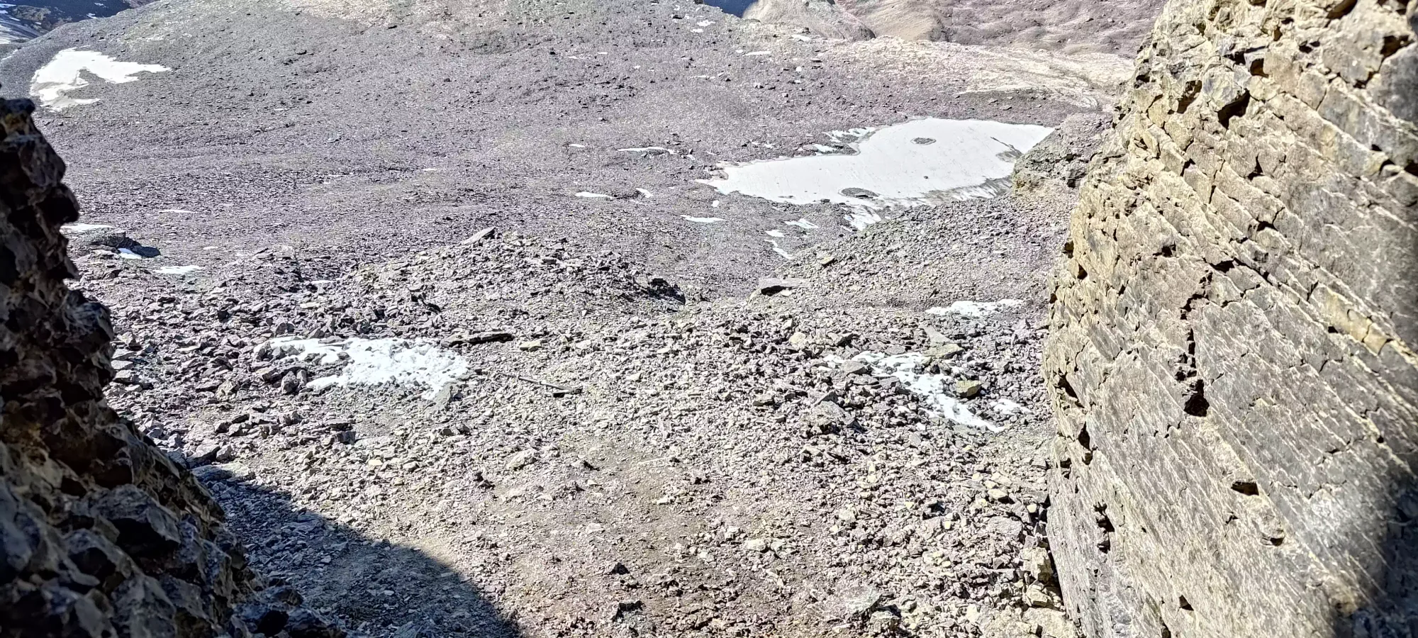
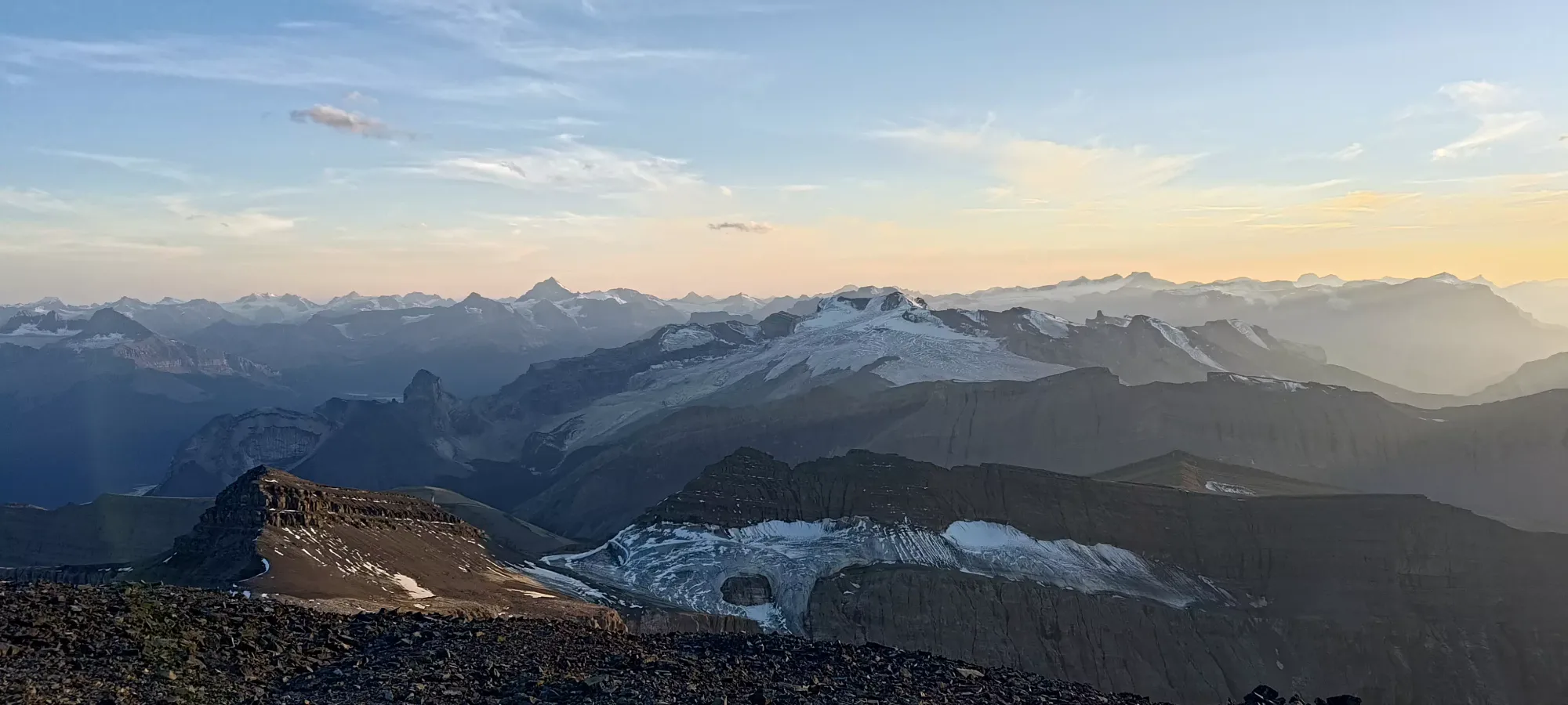
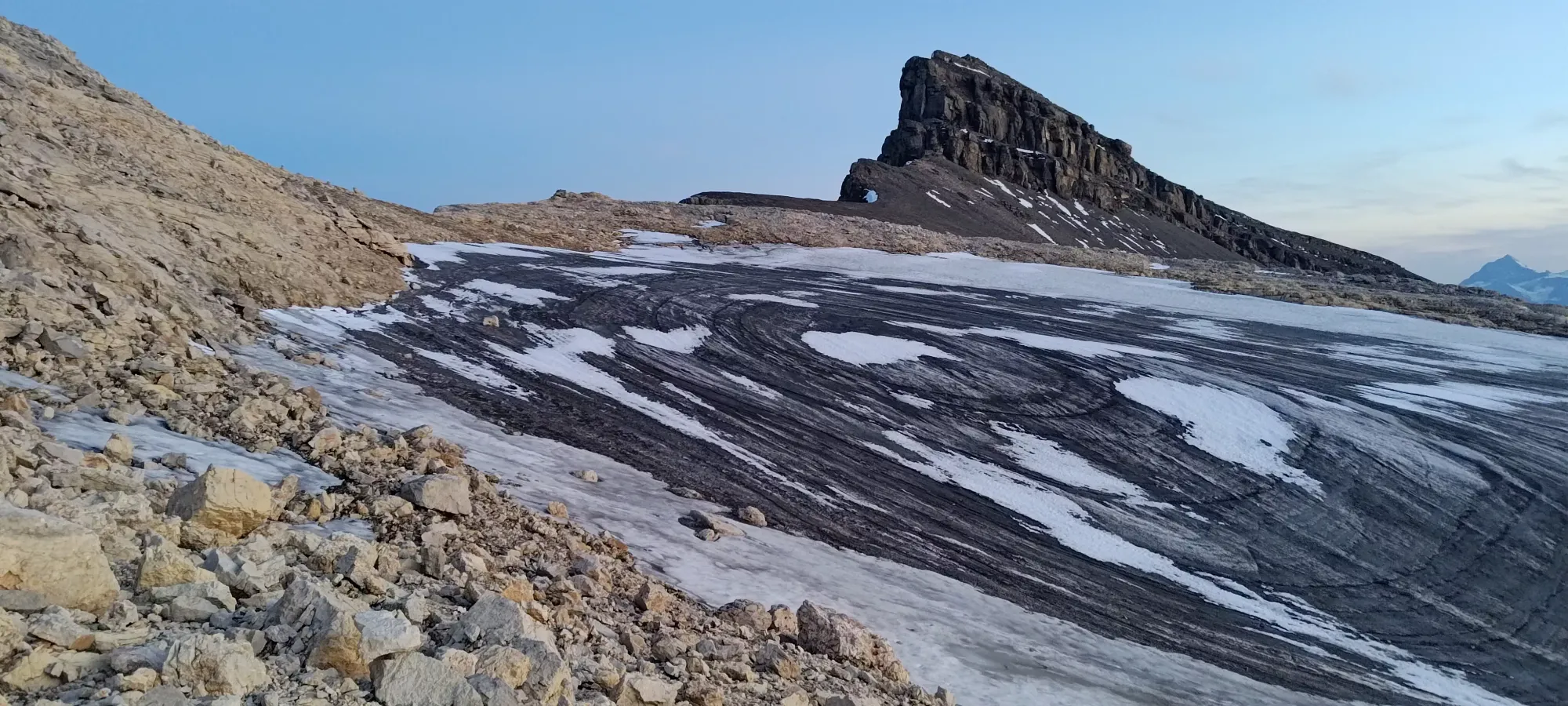
Above the headwall, there wasn't much loose debris, and the walking was basically right on the floor of the small valley carved by the drainage of the alpine lakes marking the halfway point, which are also a common bivy site. We reached the base of them about 4 hours into the day, and got to the far side about 15 minutes later by skirting around the right side, doing our best to stay low/minimize undulation while avoiding getting sucked into wet/muddy spots.
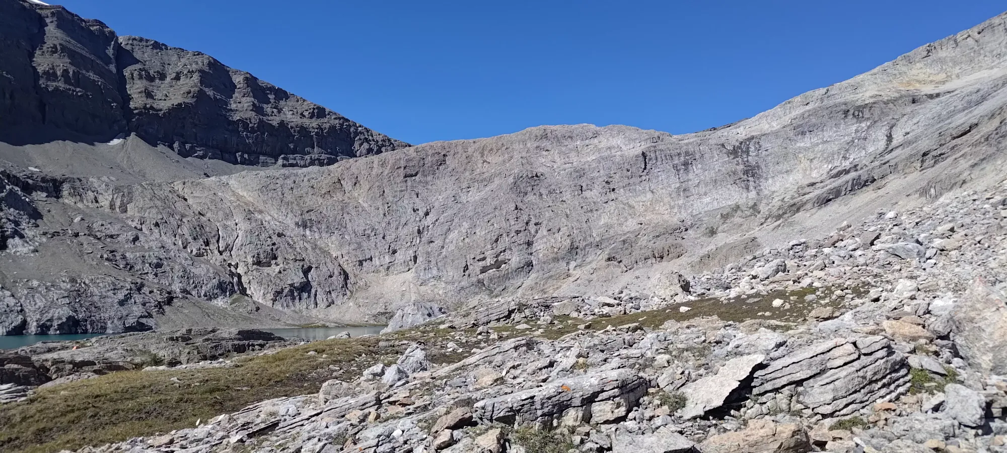
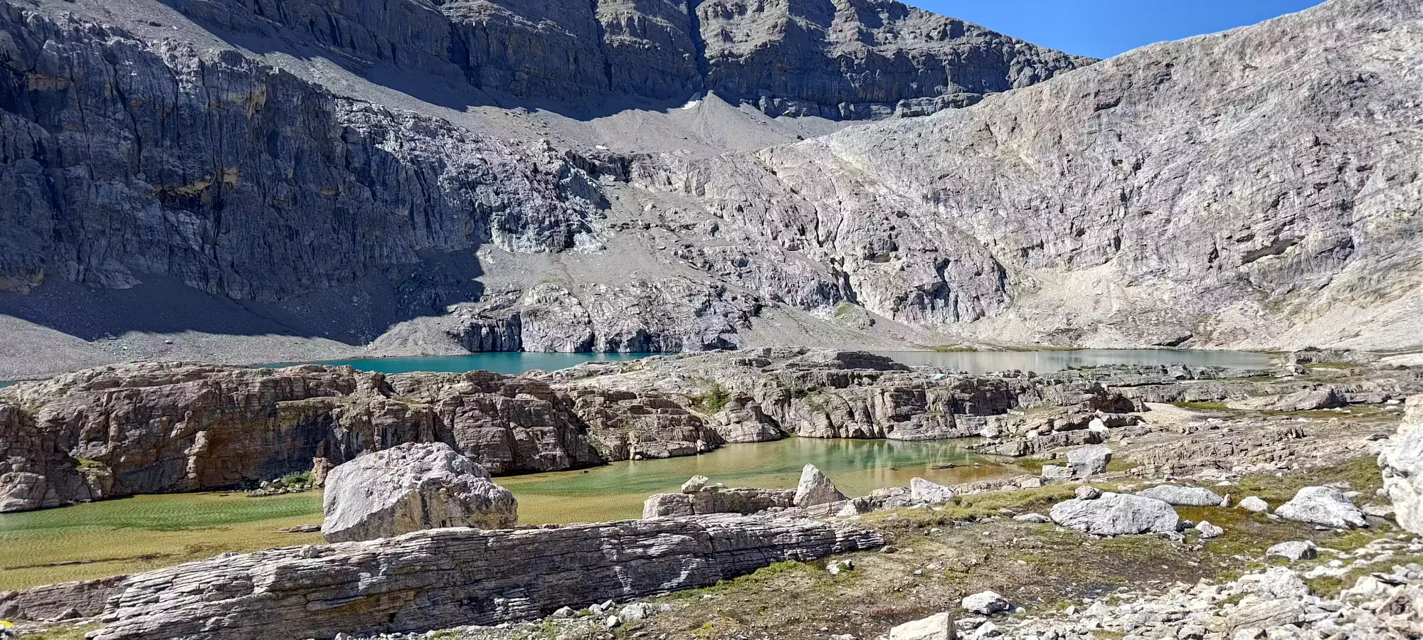
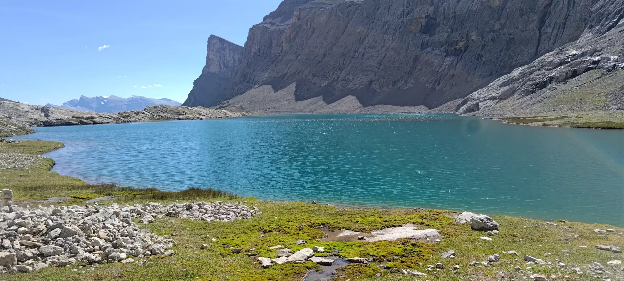
We rested for a few extra minutes before starting up past the lakes. Our hope was to keep a pace of about 250m of vert/hour, at least until the crux, and we were fairly close to that pace. We were happy and expecting to hike out in the dark, so with the terrain thus far being quite simple, we were fine if things were a bit slower, and it was a relief to know even halfway up, things were still all chill terrain. Especially with a disproportionate amount of distance covered in that first half, we expected to get a bit more efficient in the second half with respect to elevation, so we weren't panicking. That was clearly not the orthodox approach, though, as we noted a couple people hanging around their tents at the same time, presumably already having summited and packing up camp. Oh well, at least we got to sleep in real beds!
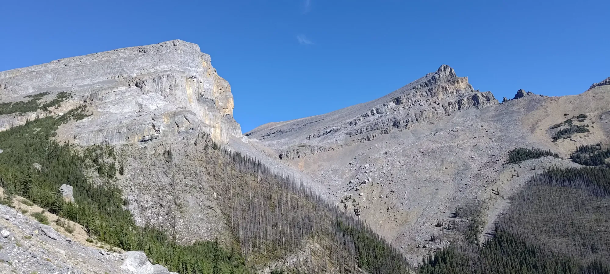
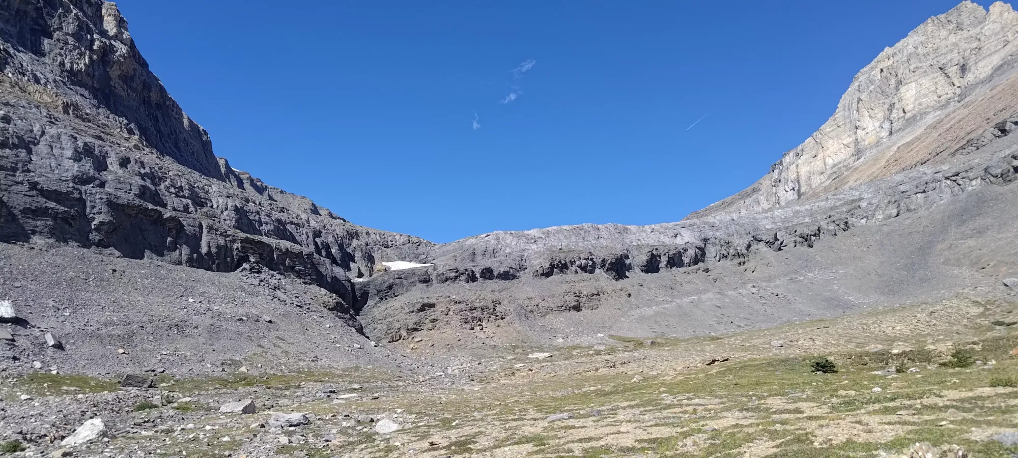
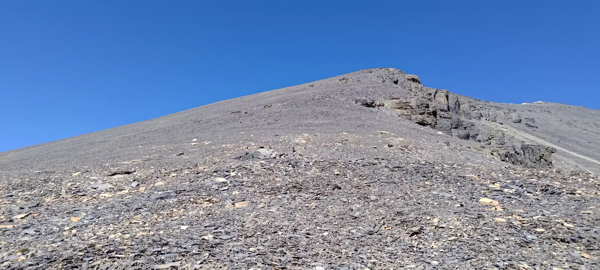
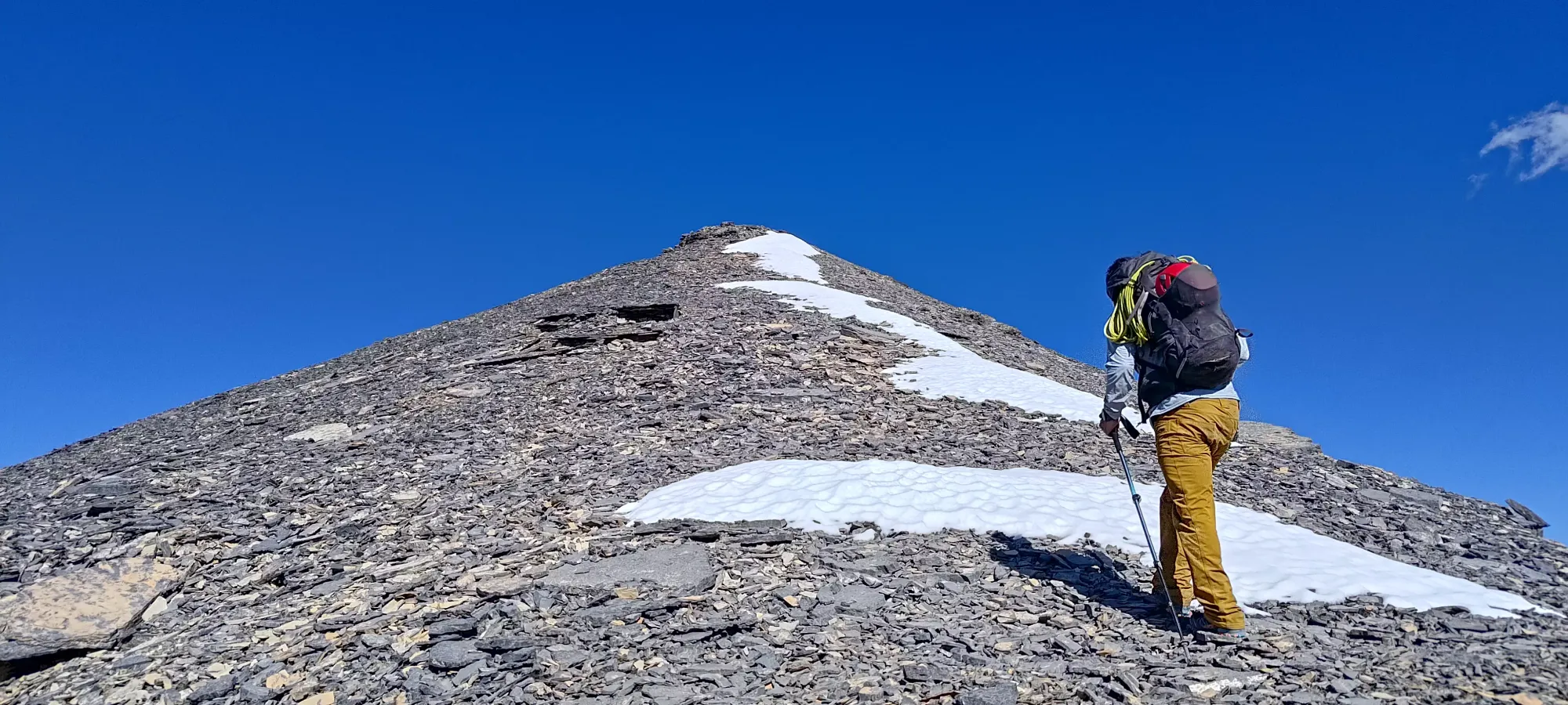
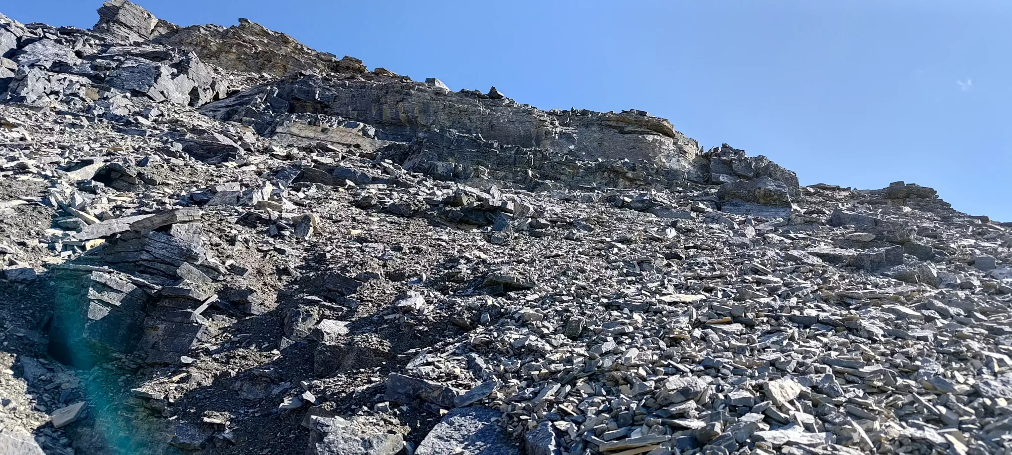
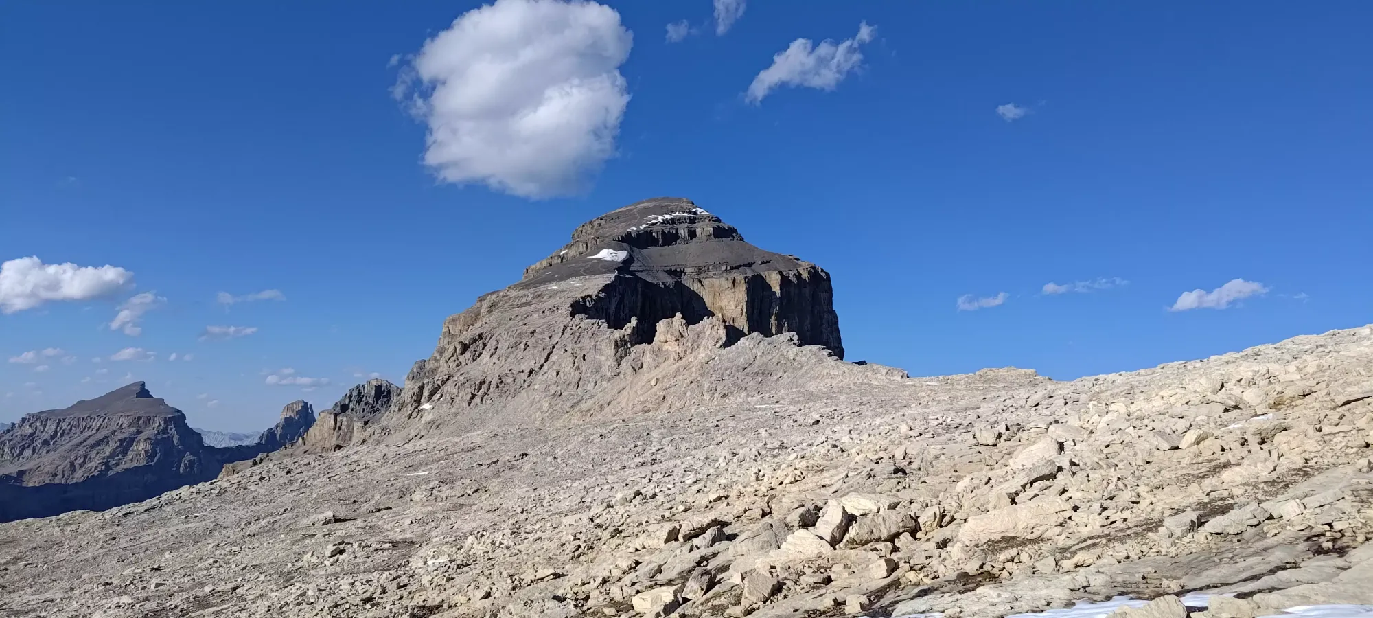
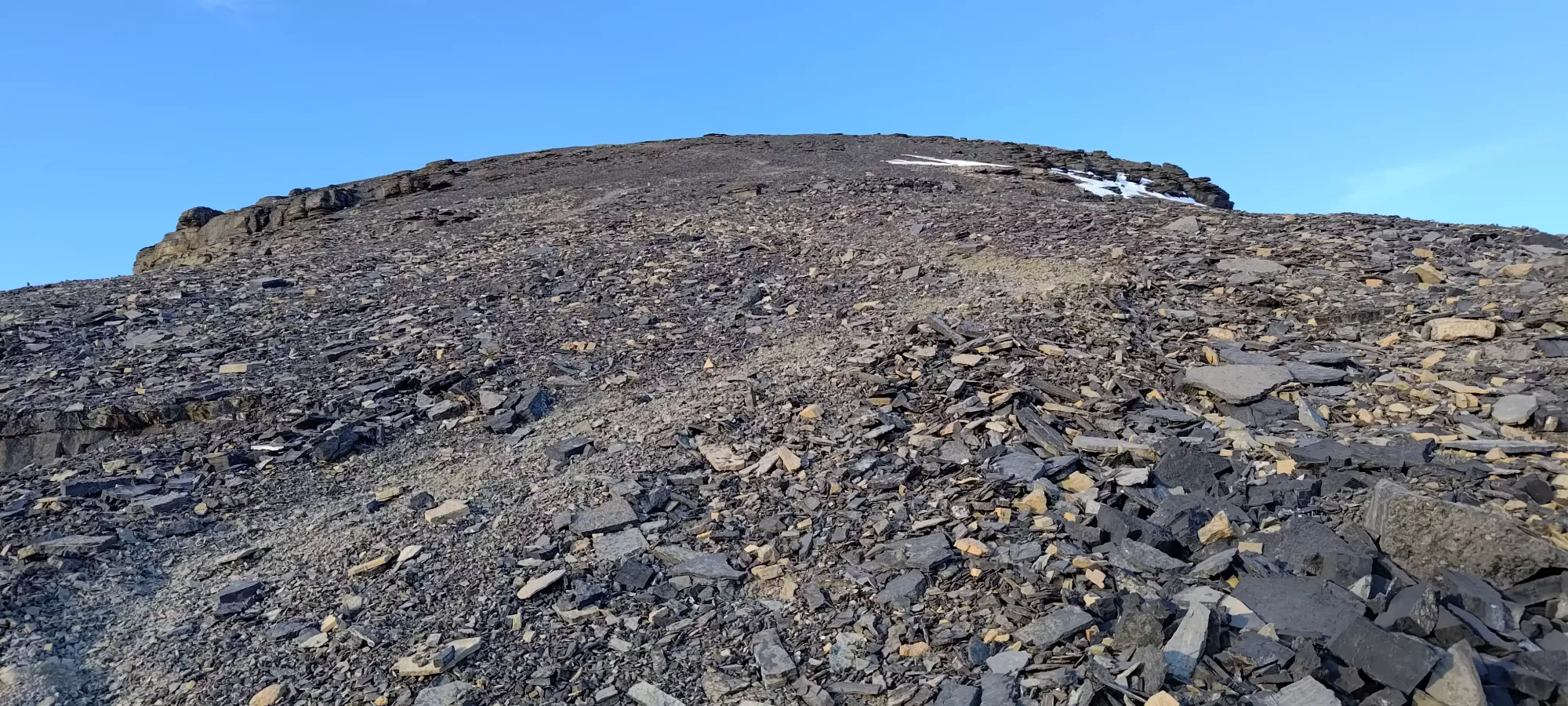
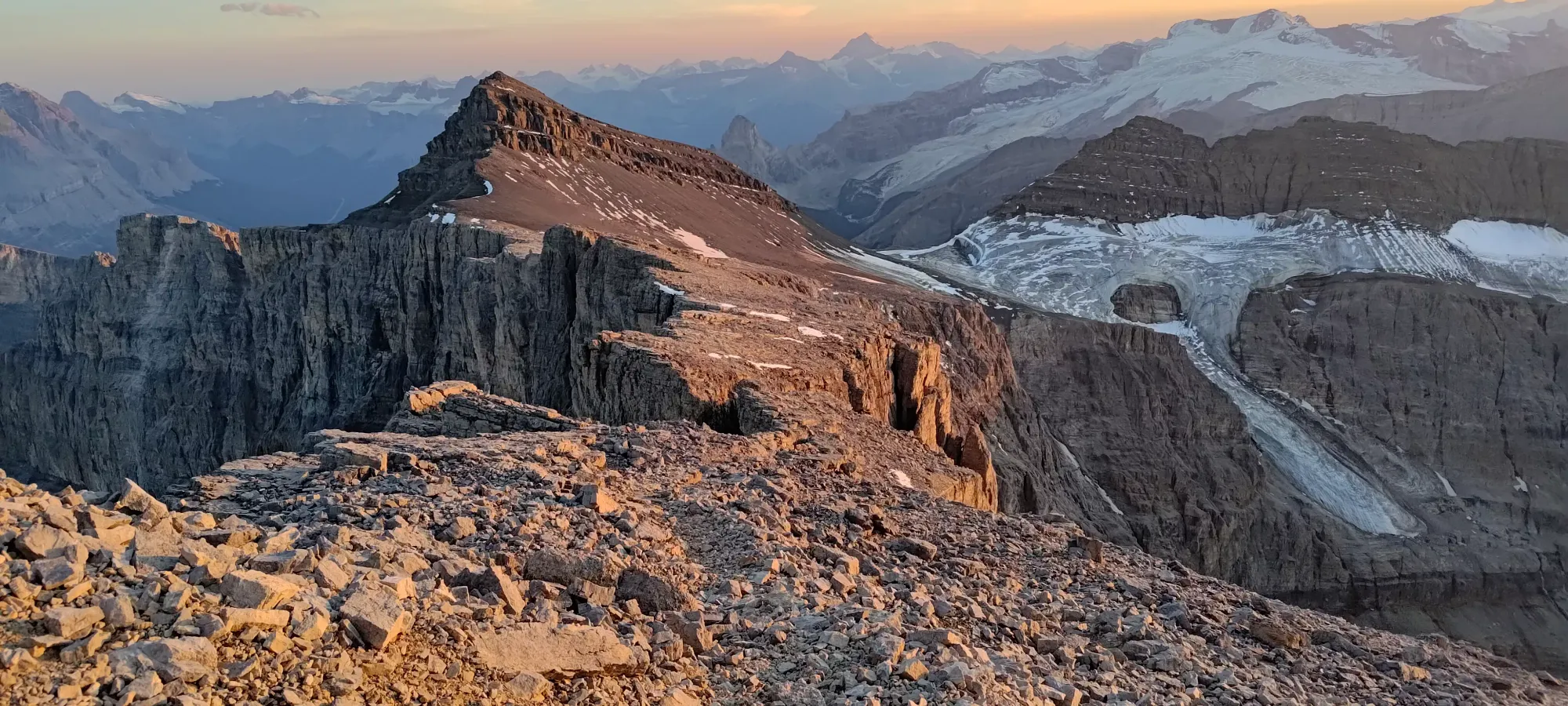
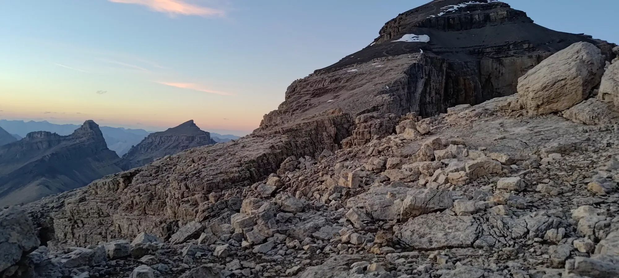
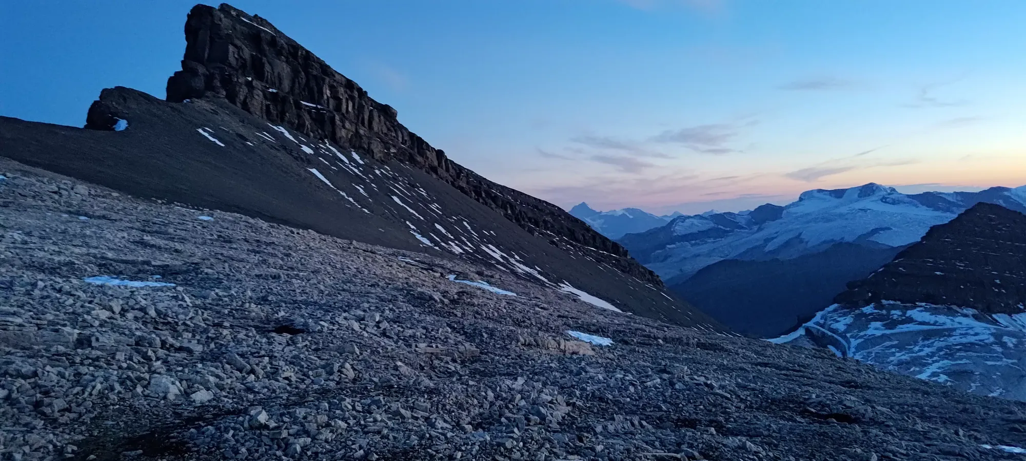
The next 100m+ of gain took us about 20 minutes of slogging up the loose ramp running climber's left across the headwall guarding the upper half of the mountain. It was, at least, just a hike, and unlike the rest of the imposing headwall, a fairly benign route, so I was glad that little weakness existed. Once we topped it out and turned right towards the peak, all semblance of a trail seemed to disappear, and we just had a long slog up an open alpine slope to get to our next benchmark.
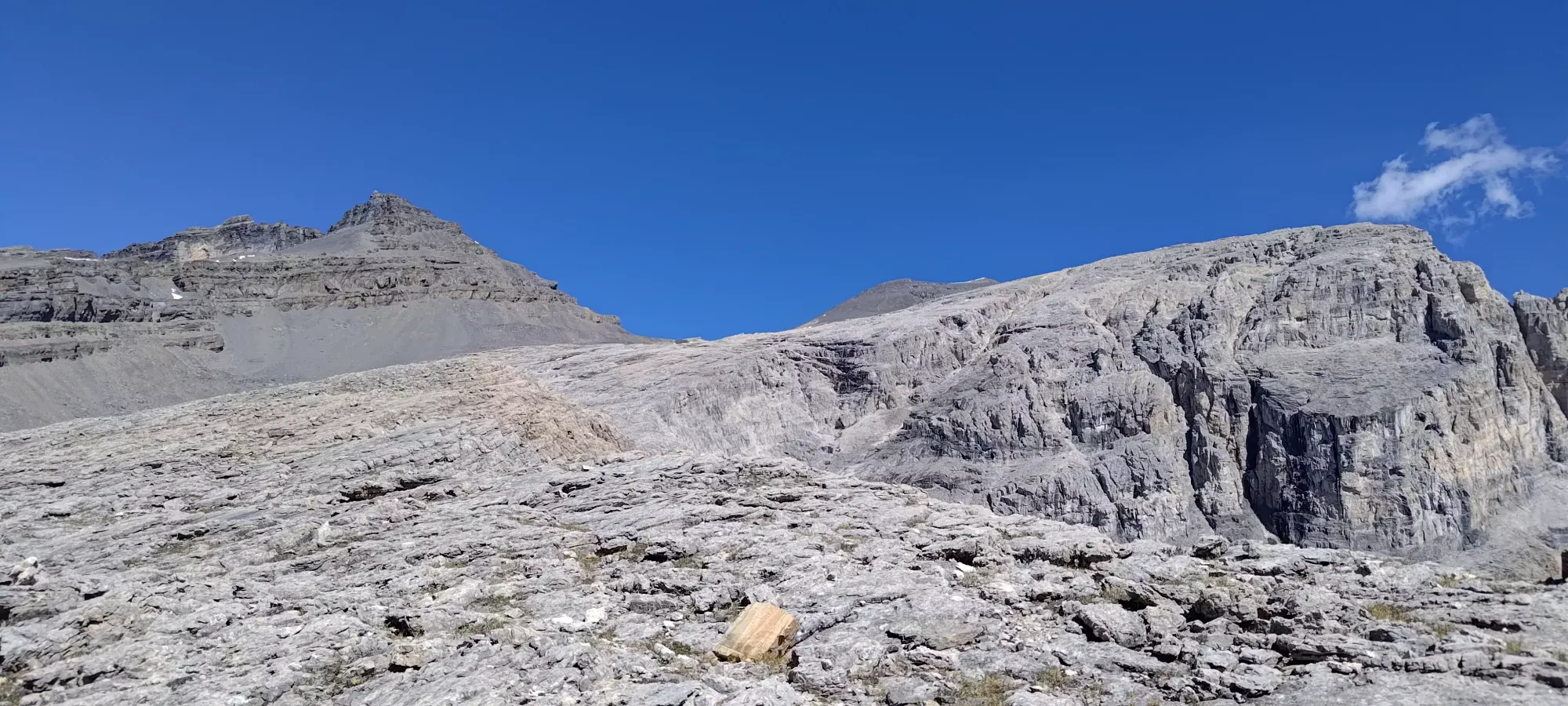
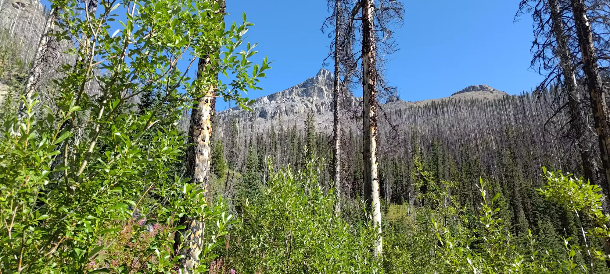
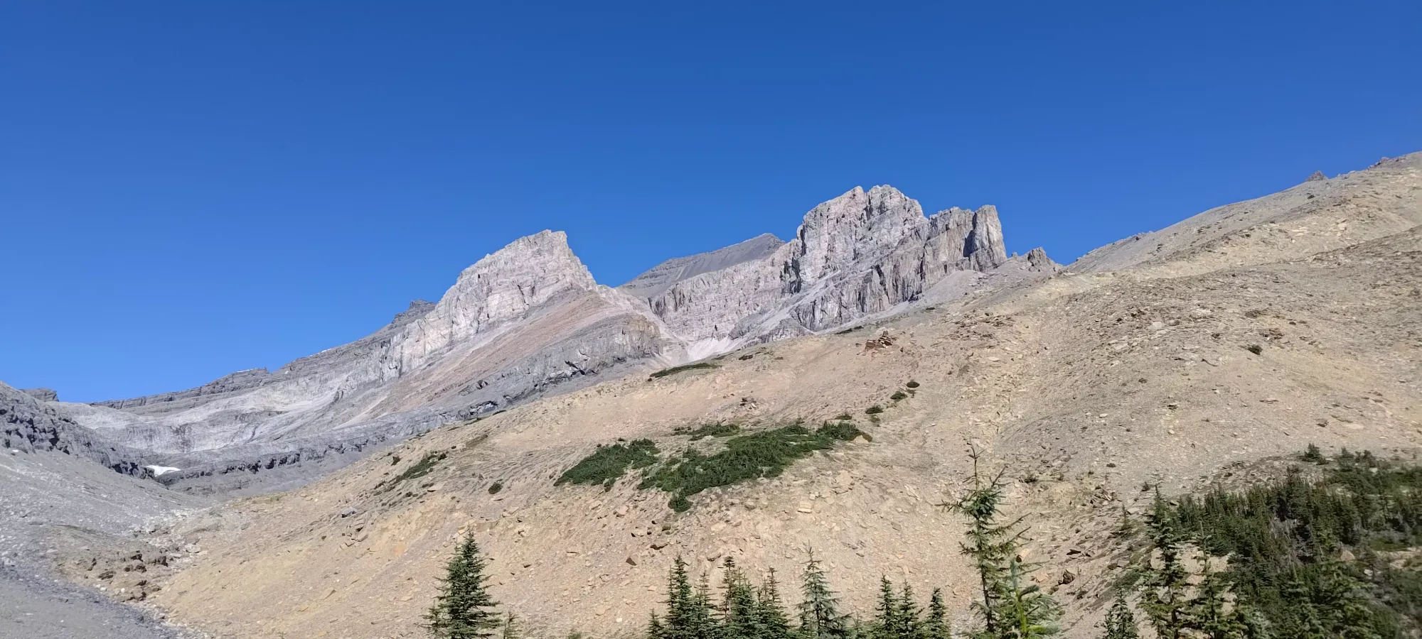
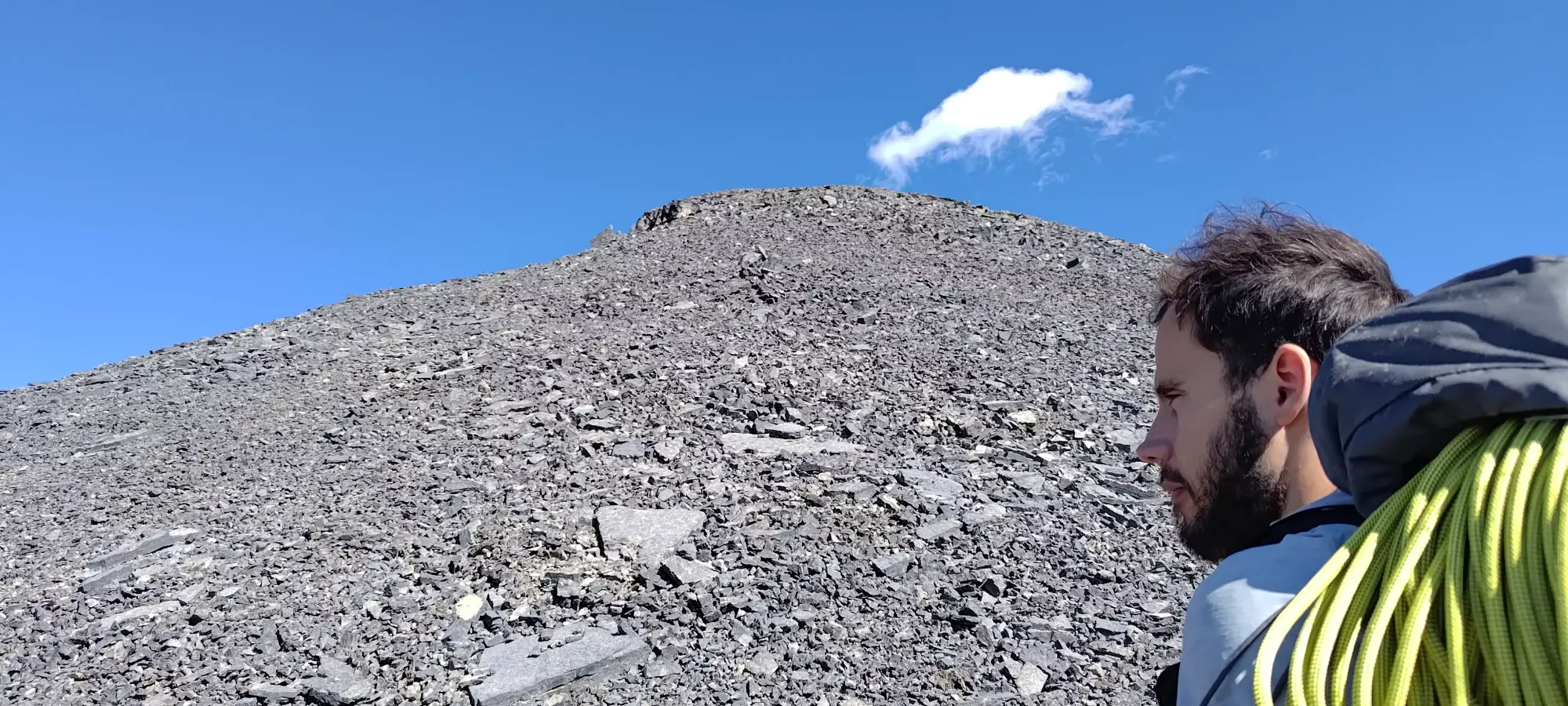
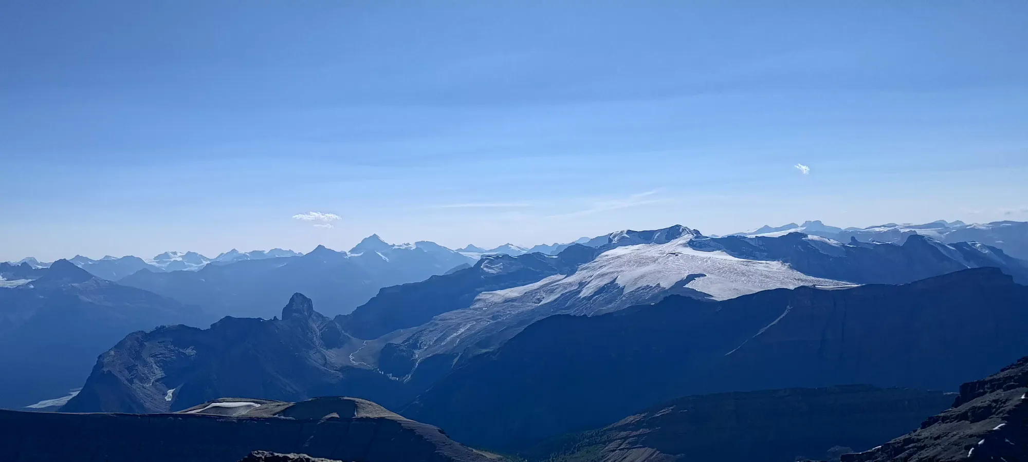
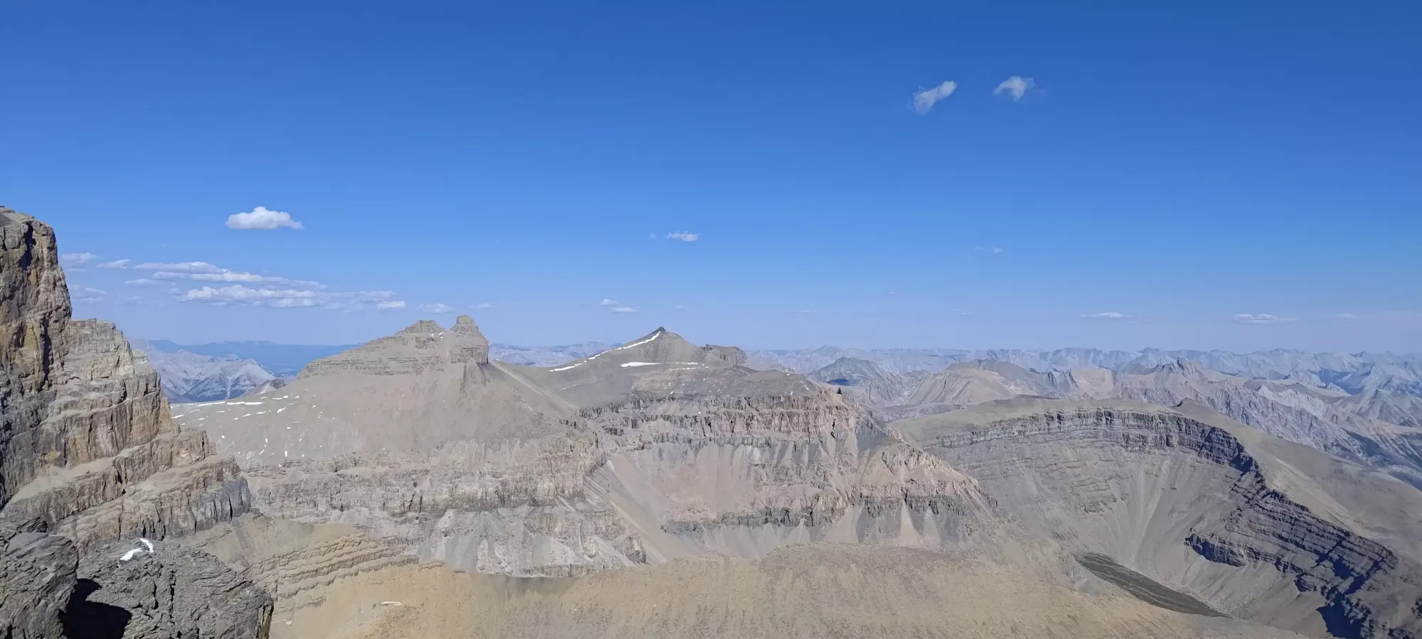
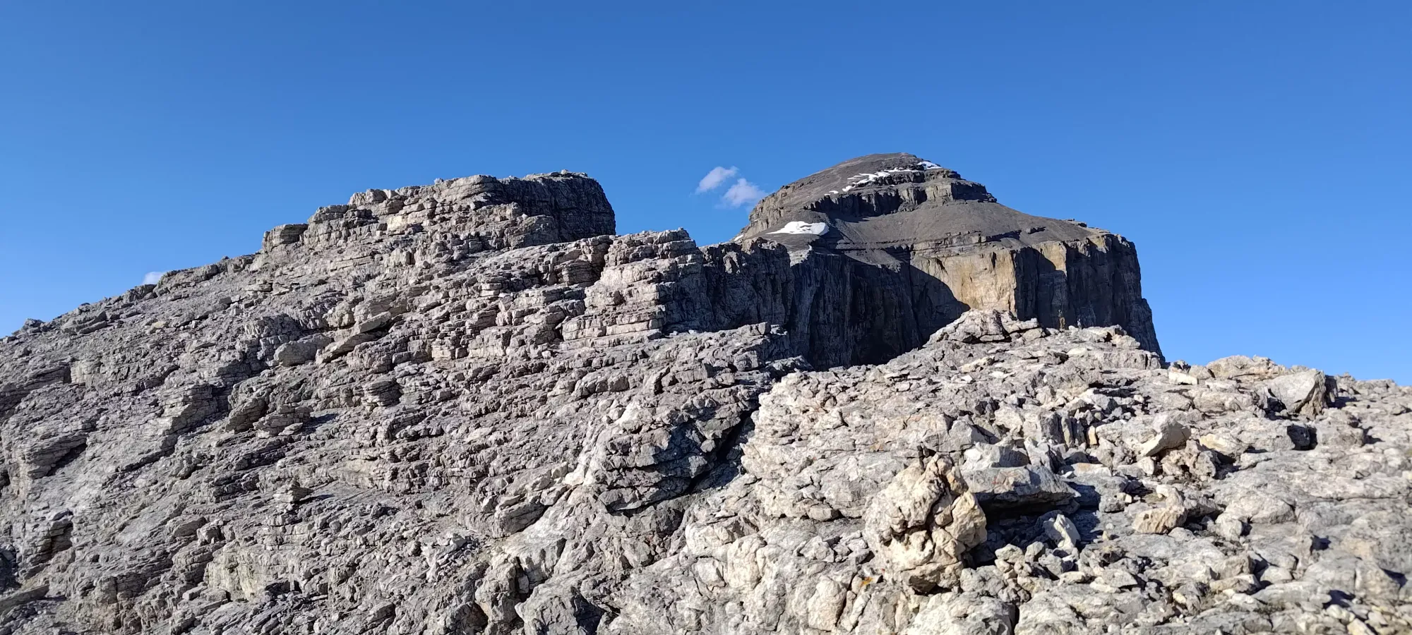
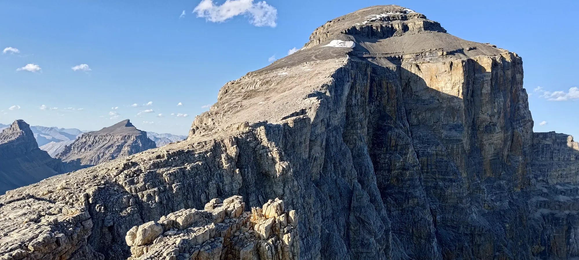
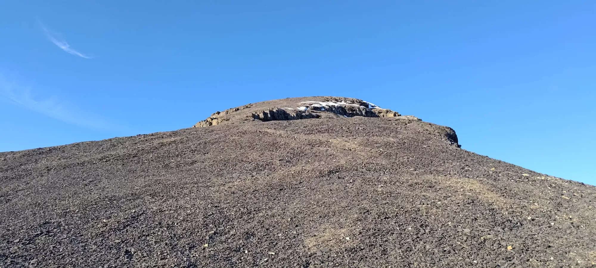
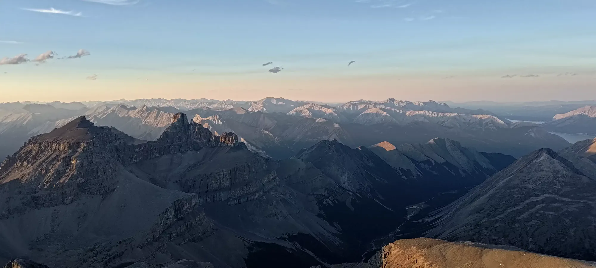
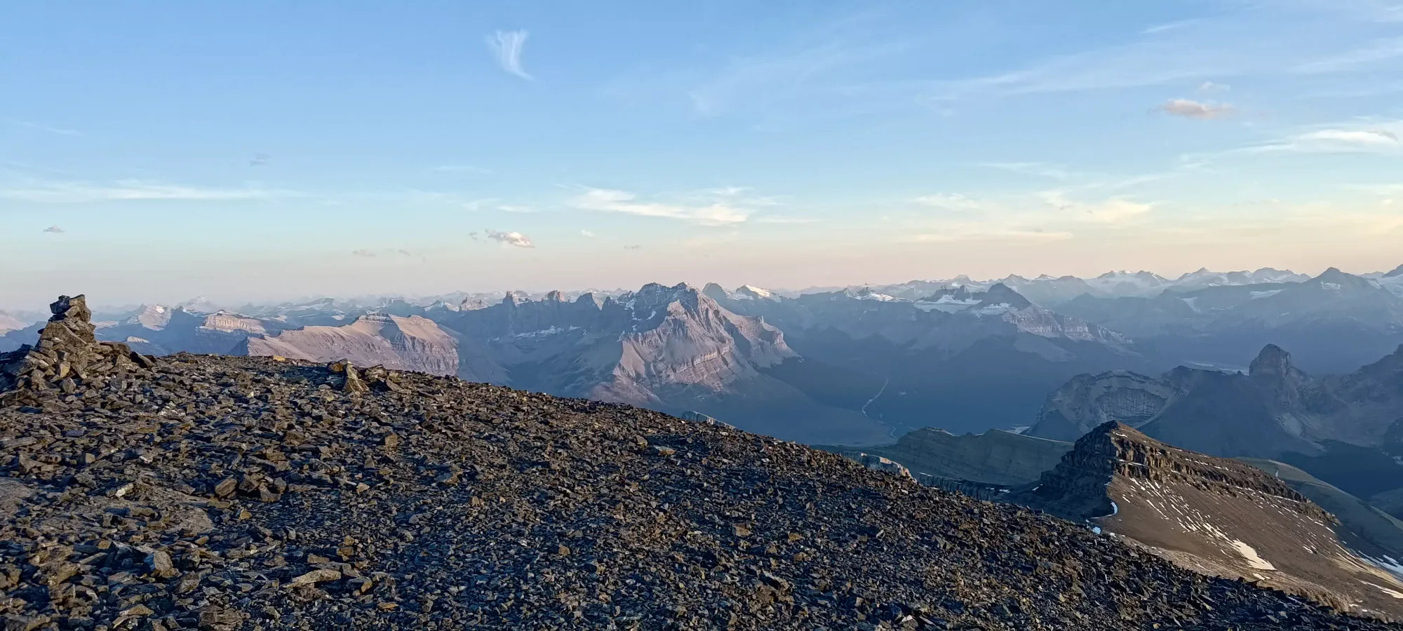
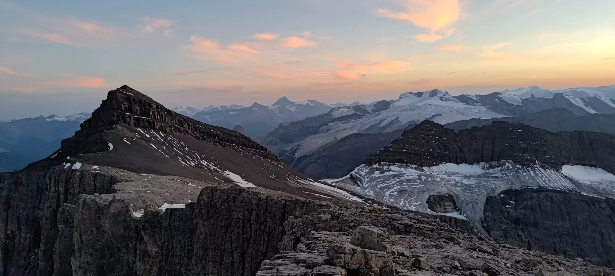
For the next 80 minutes, we just trudged up the open SW slopes of Mount Owen until about 2900m, gaining ~500m in the process. There isn't much to say about this part of the hike, really, you can just walk more or less anywhere as long as you're heading up, and the terrain is basically all just "old glacier bed", with patches of drainage channels (largely dry), bare rock scraped by old ice, and largely-stable rocks embedded into the ground. I just tossed my earphones in and we ground it out, taking breaks every 100m of elevation or so to do things in bite-sized chunks.
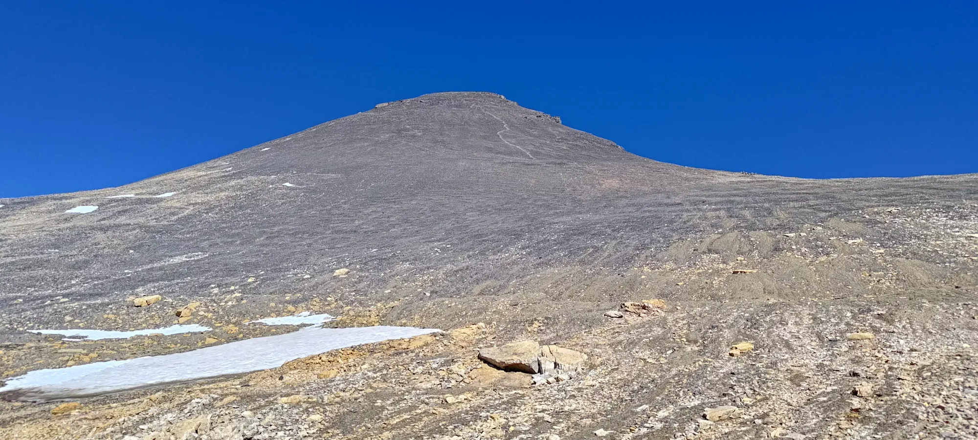
At that point, we made a bit of a navigational oversight by just following the obvious trails in the scree, and basically just followed the ridge up Owen, not realising that we were heading up and over Owen instead of getting on the glacier (or at least former glacier) that heads towards Cline. By the time we realised this, we were most of the way up Owen already, so we figured we'd just summit it, and try to traverse over, as retracing our steps would take precious time, which was not exactly abundant.
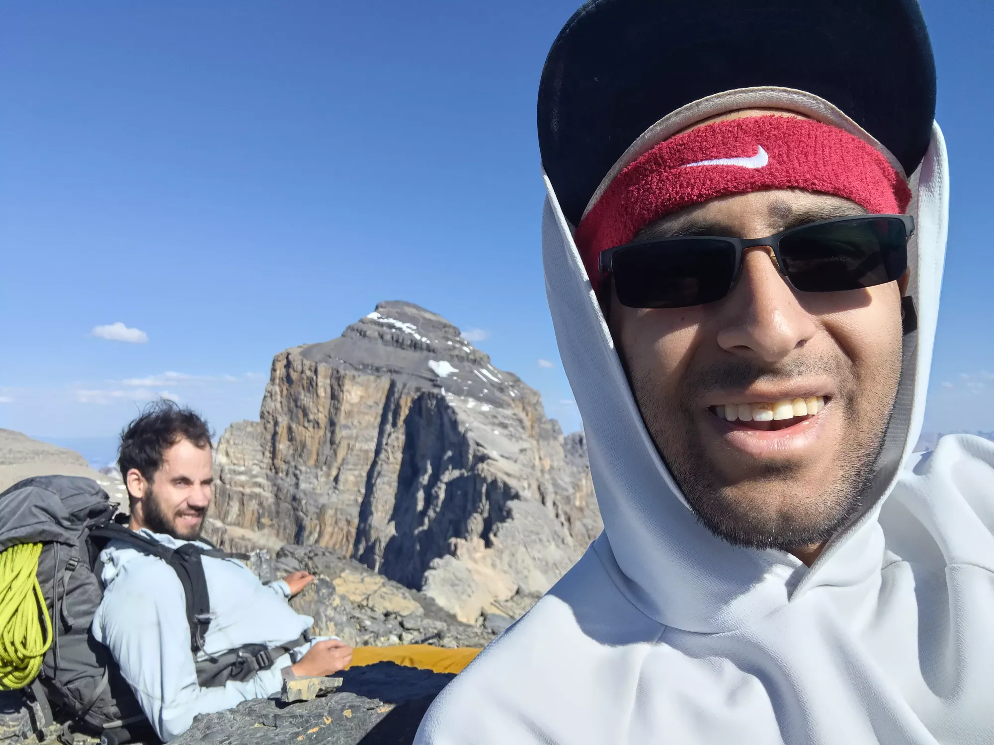
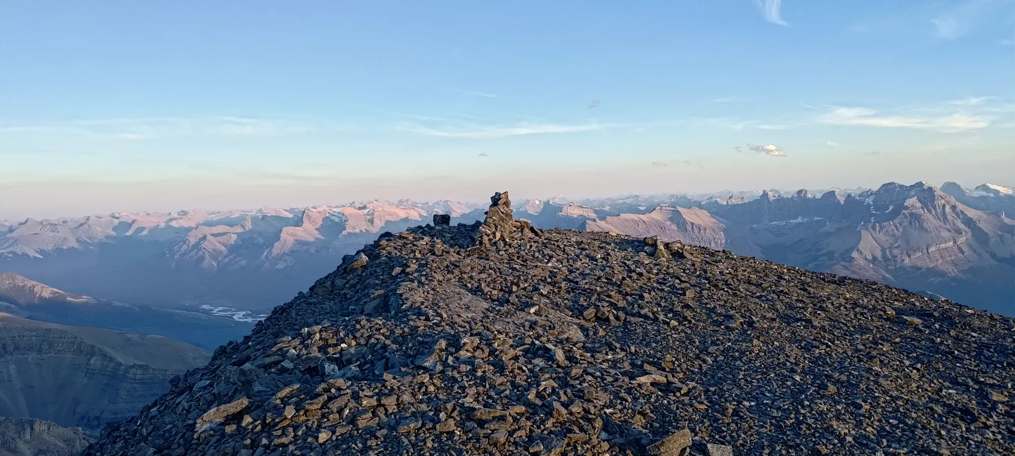
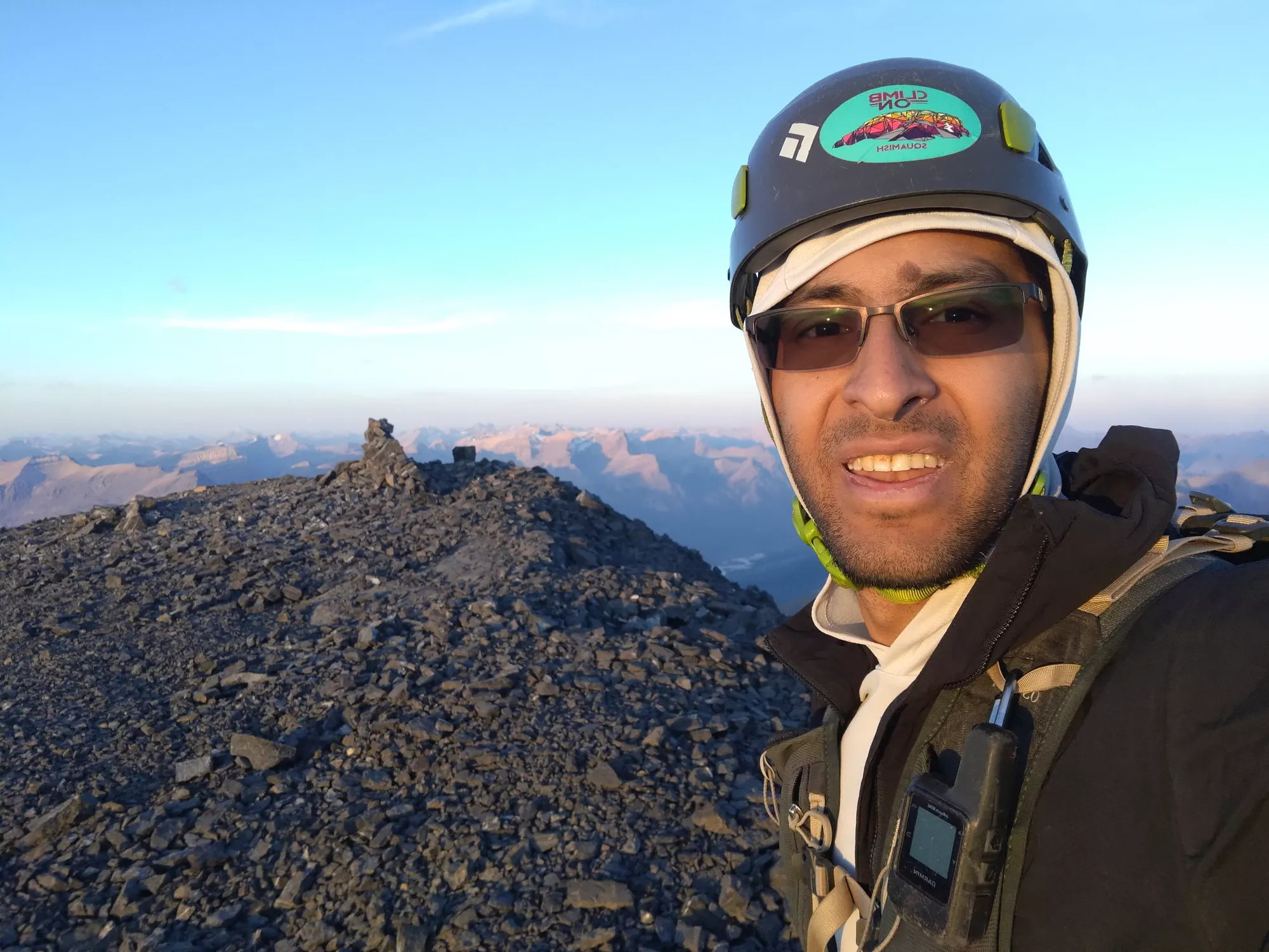
I dropped a small amount of gear (bear spray, an empty bottle, and my water filter) at the last big cairn on the ridge, which ended up being a relevant factor later on in the day, then we continued the trudge up. We definitely slowed down near the top, even Logan, who'd to that point been going strong even with the rope (albeit a thin 30m, but still, something) in his pack. It took us about an hour to get to the ~3100m summit of Mount Owen, which we reached just before 4:30pm. We did encounter the snow we saw from below, but it was neither problematic, nor necessary, to even step on.
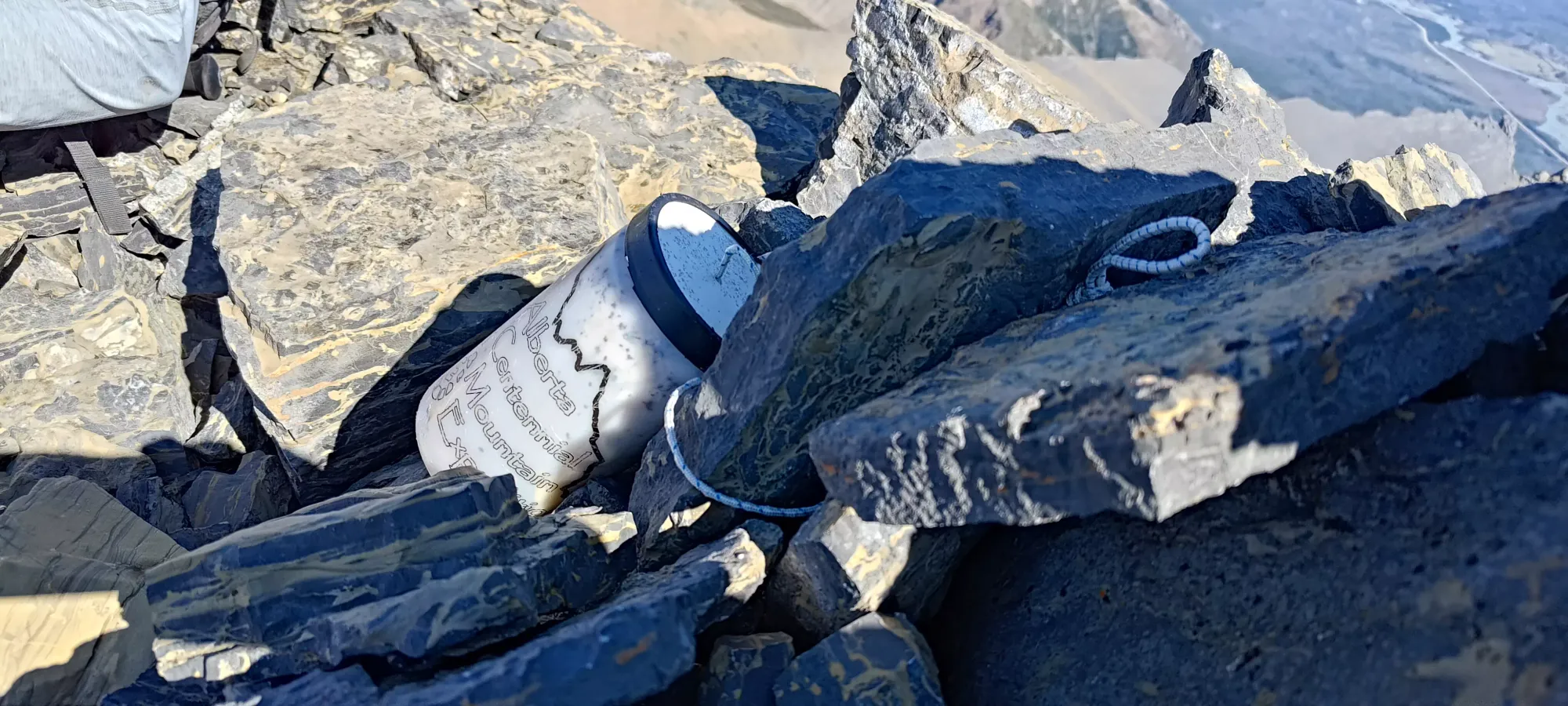
We saw a register on the summit, but Logan reported it to be soaked and unusable, making me regret leaving an empty water bottle at my gear stash. Oh well, live and repeat the same habits til you die, I guess 🤷
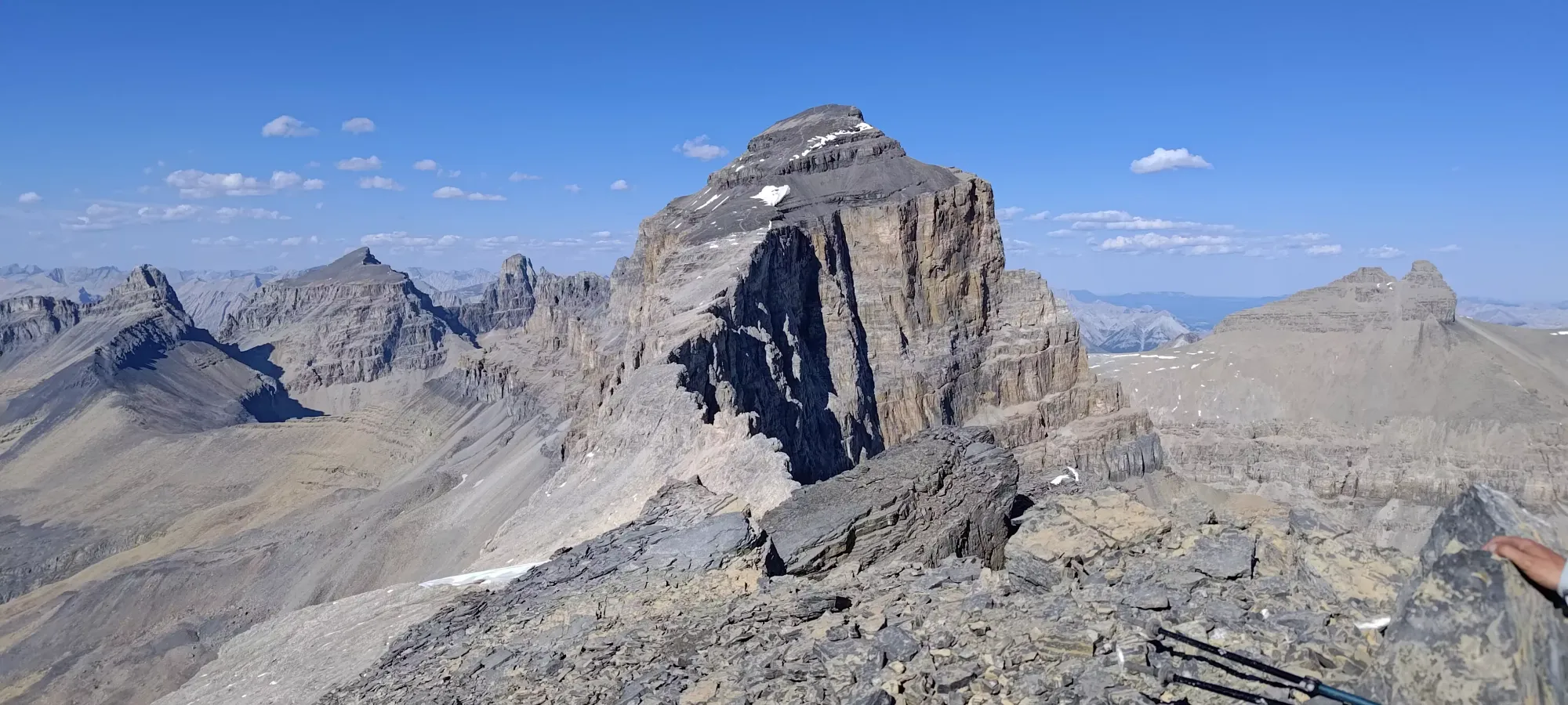
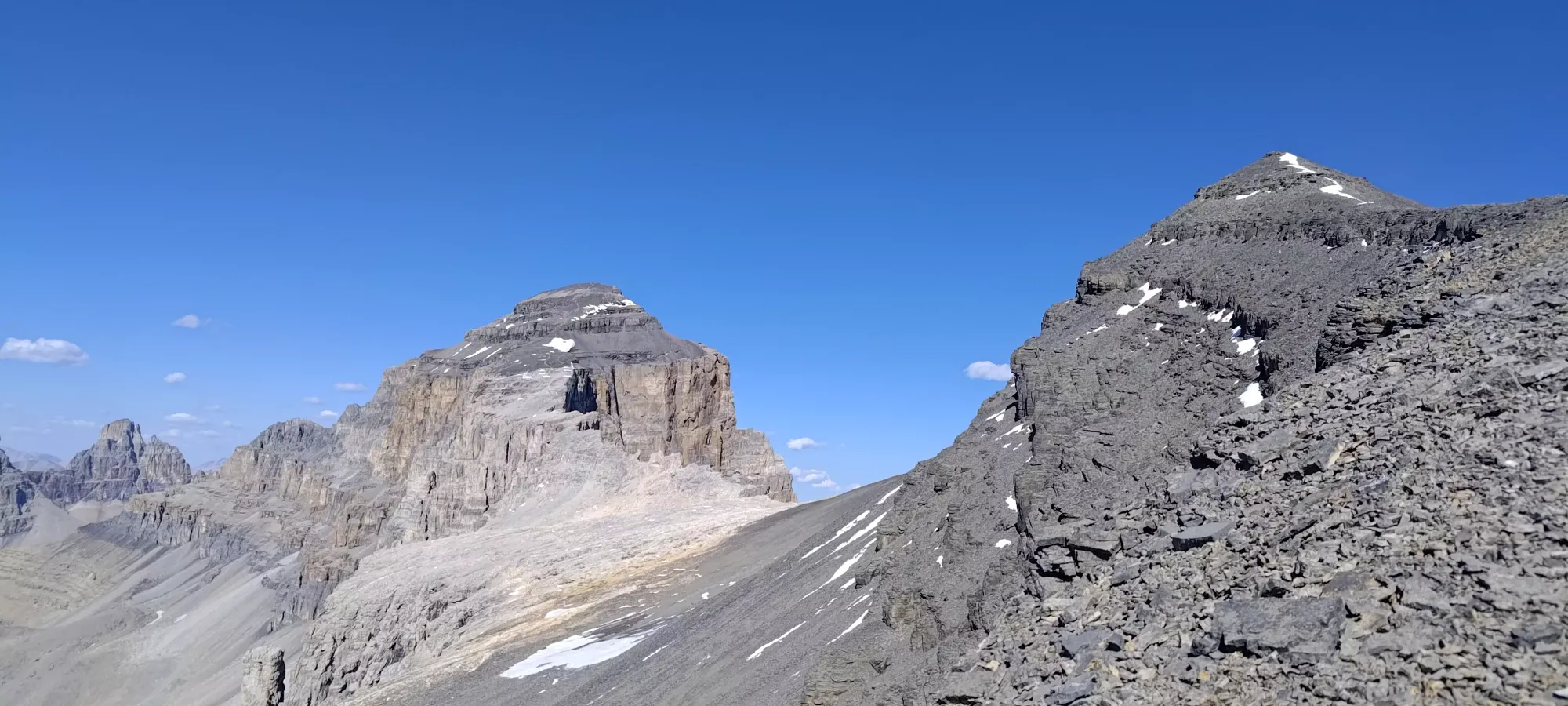
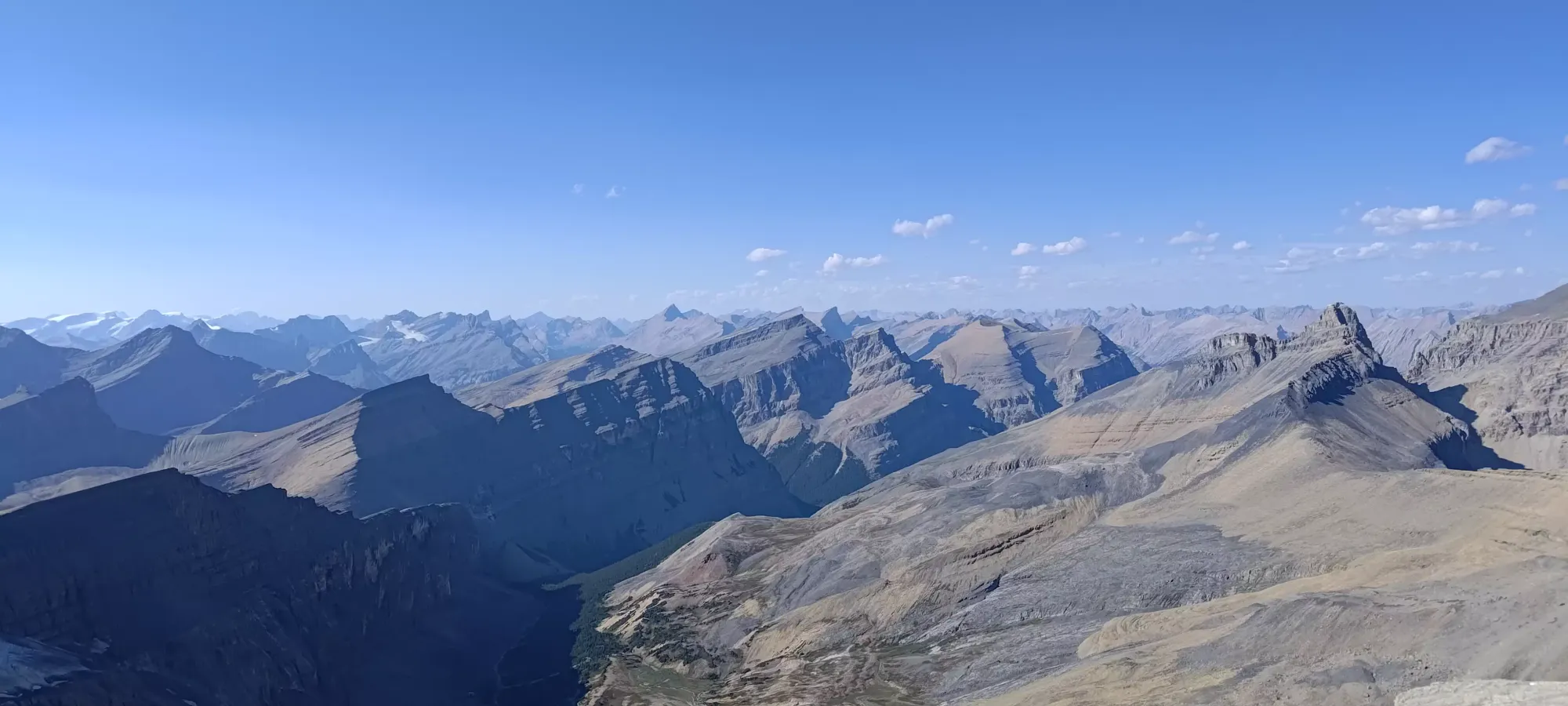
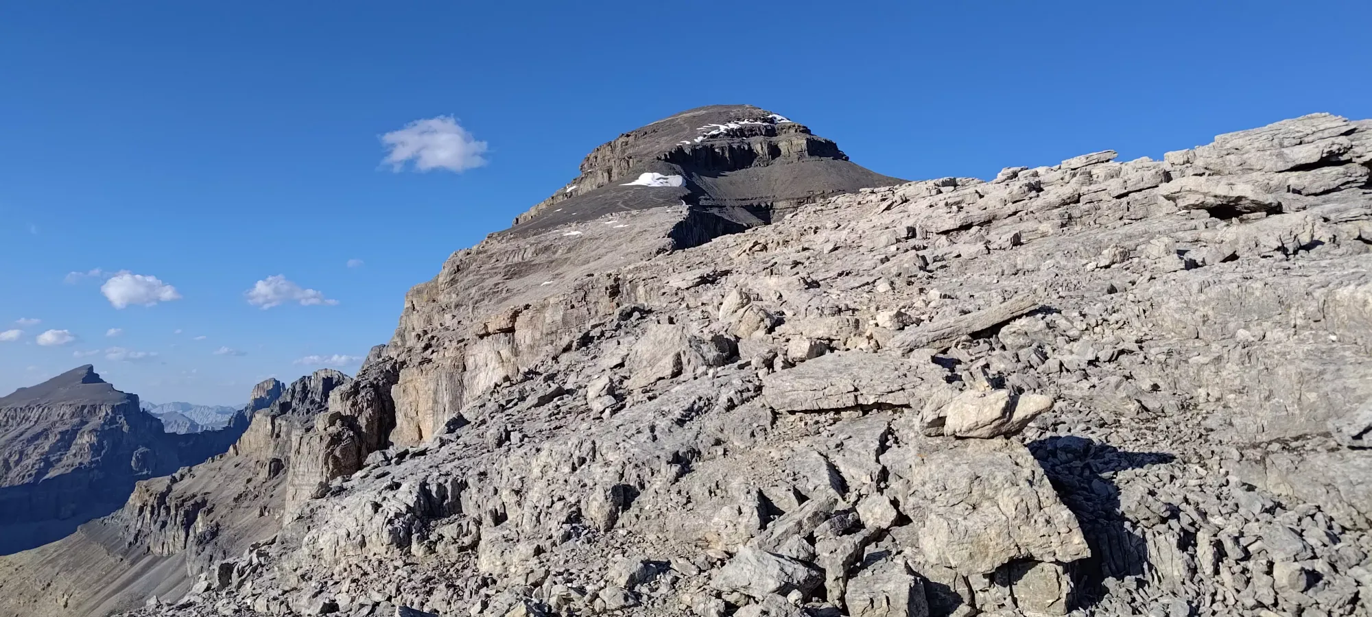
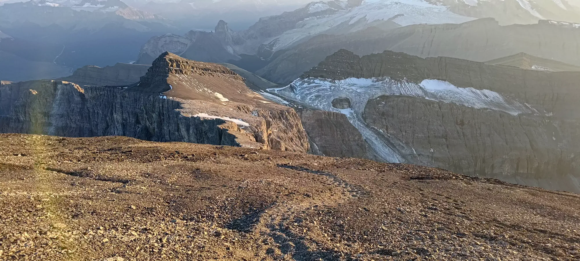
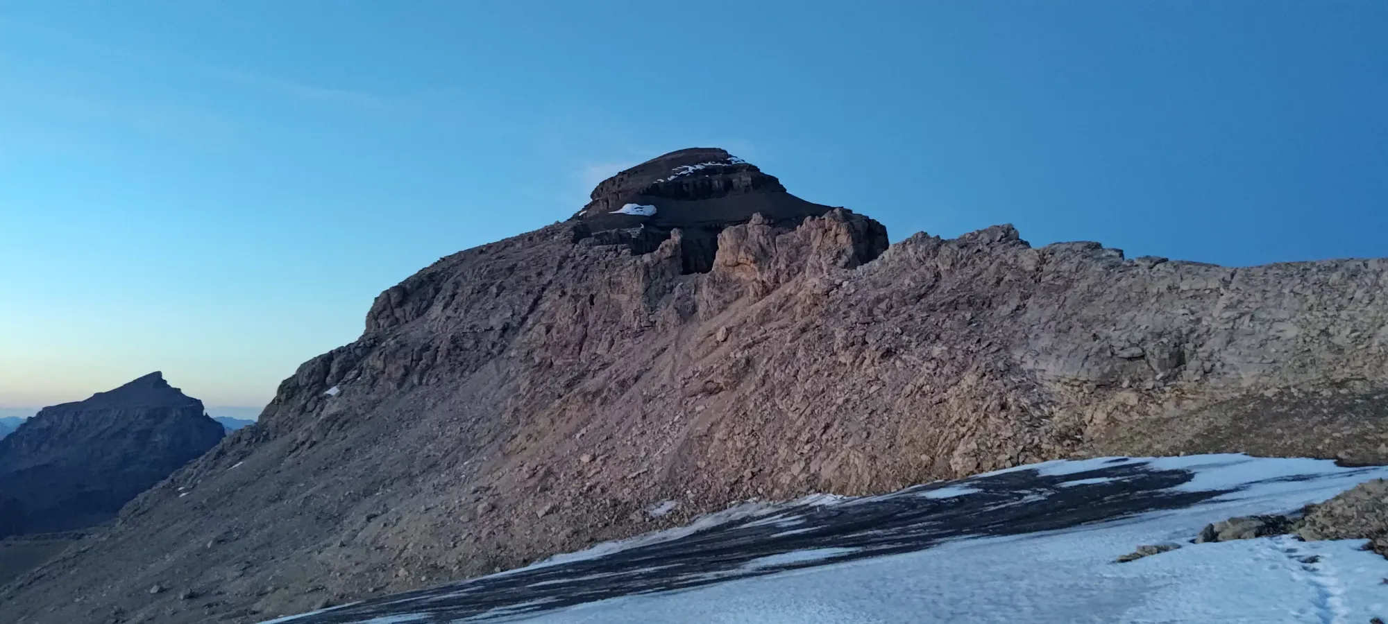
We took some summit pictures, but overall didn't linger long, since the hour wasn't getting earlier, and we had an unknown downclimb of about 100m to the Owen-Cline col, and then another ~350m to ascend before we could summit Cline.

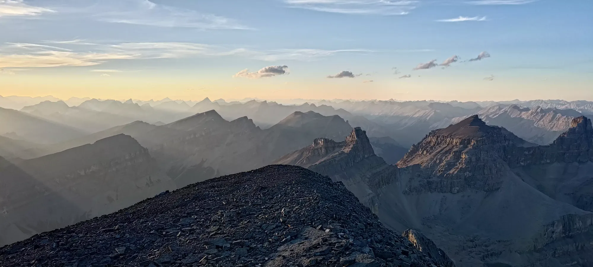
With the photo shoot out of the way, it was time to get moving fairly quickly. The first bit of downclimbing was simple, just walking down along scree-covered slopes with a few ledges to step down, making at most class 2 moves. However, we soon got majorly cliffed out sticking to the direct col route, and had to start moving to skier's left to find gentler slopes down.
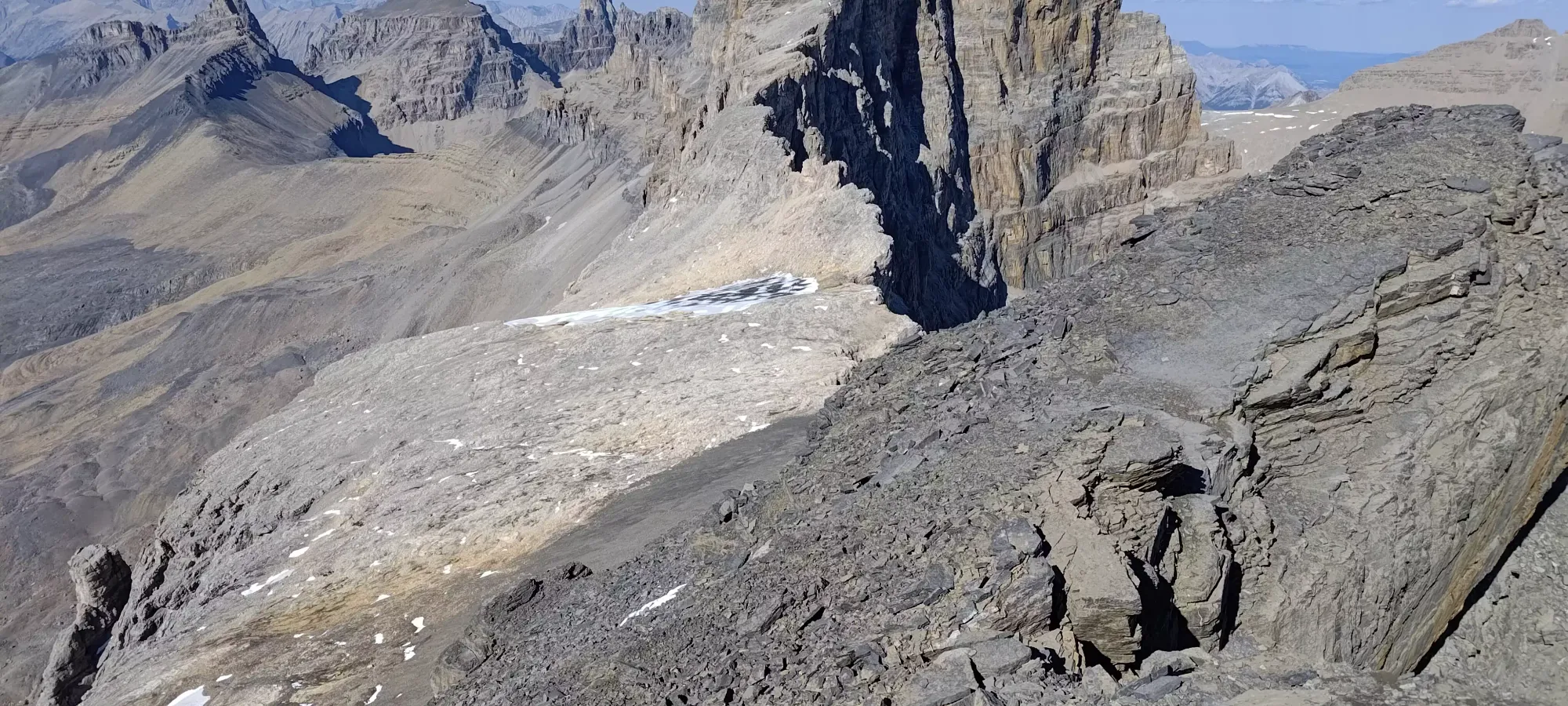
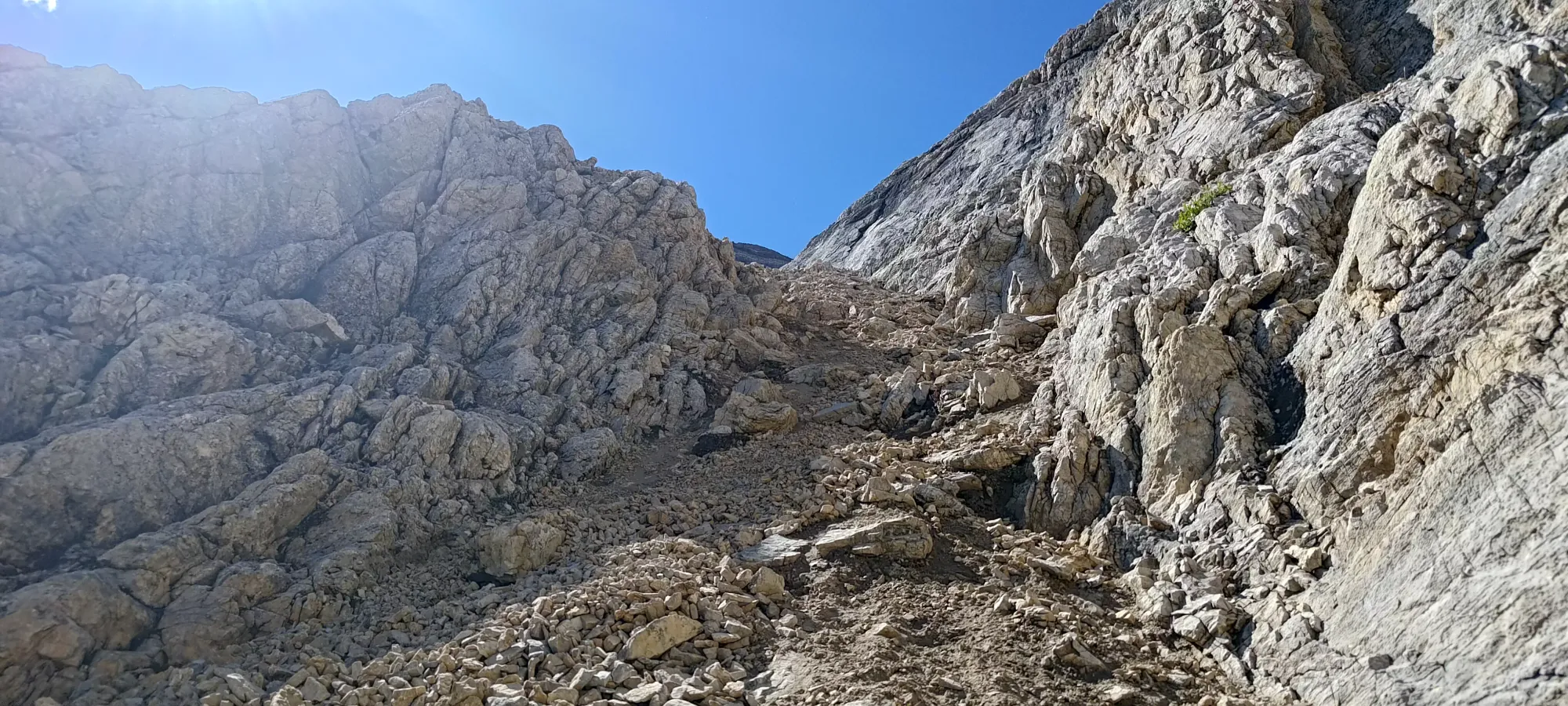
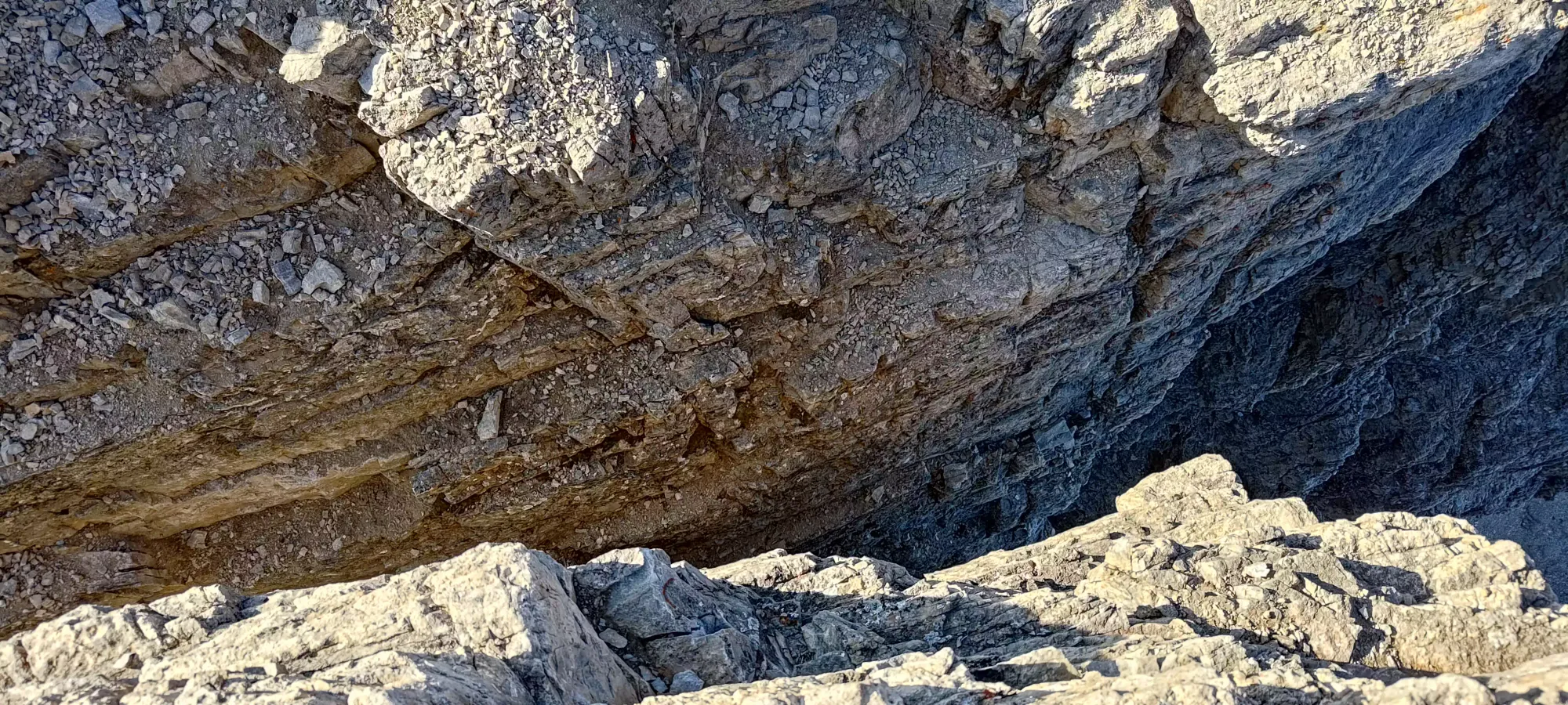
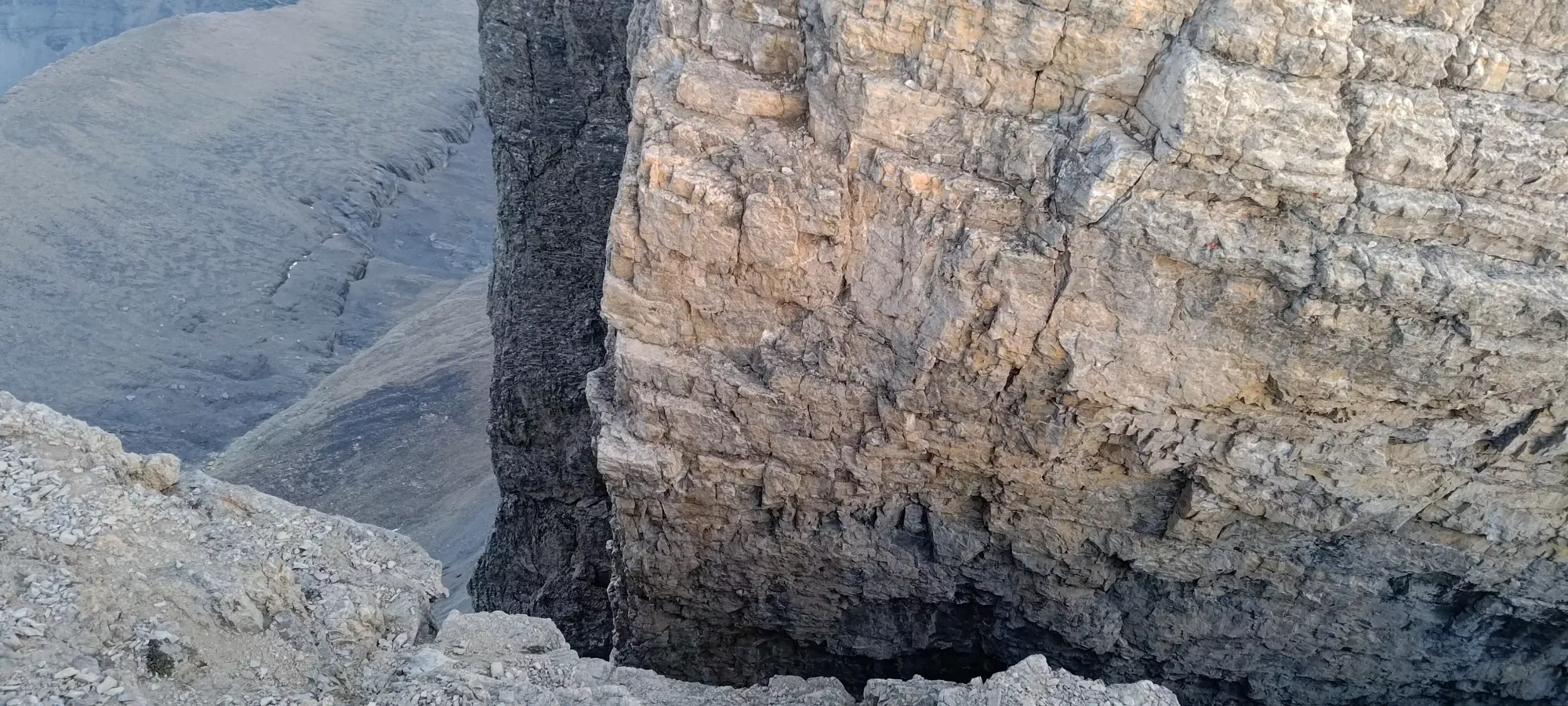
Logan was not as confident in this terrain, seemingly, so we took our time getting down through the ledges, with lots of scouting ahead to find out if we could go ahead or had to skirt more left to get down. Eventually, we hit a spot where going direct was just sheer drops of 10m+, and we "just had to go directly down towards the trail". On the plus side, though, it was just one gully to get down before it was all easy terrain to the glacier, so that was encouraging. I even found a nice, protected, flat ledge above it to rest on while Logan (who's a bit more cavalier when sending rocks down) tried his hand at descending.
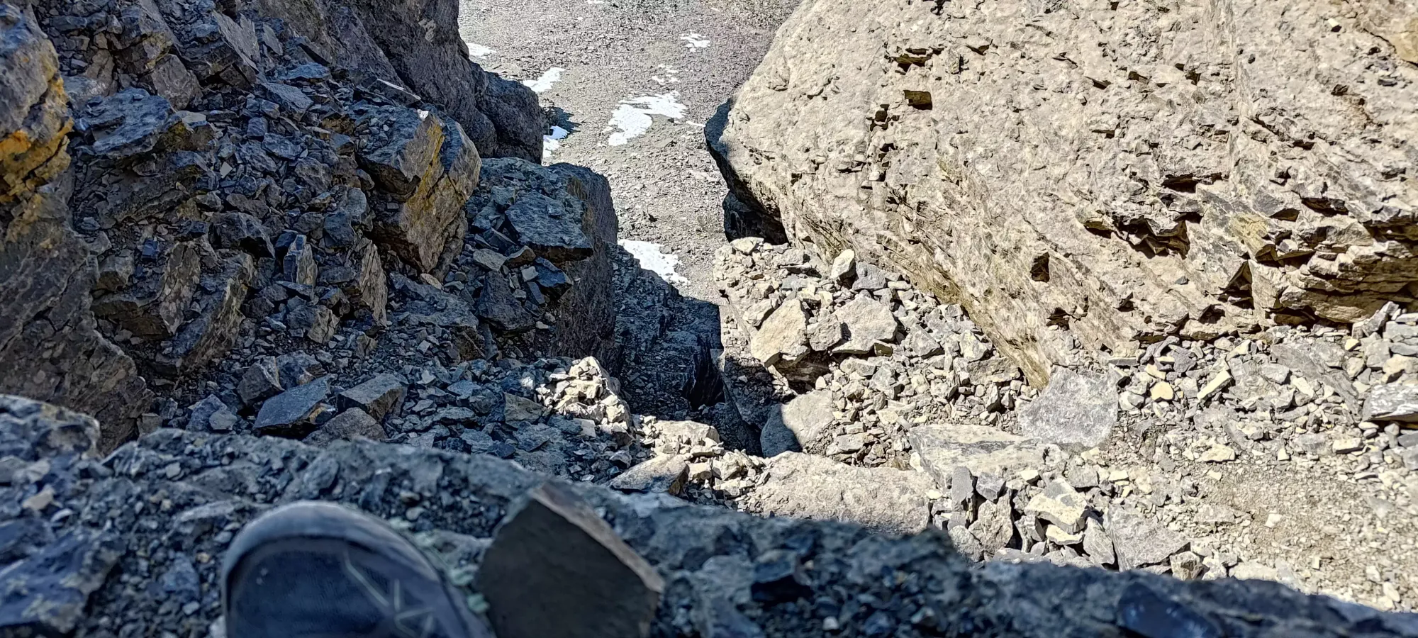
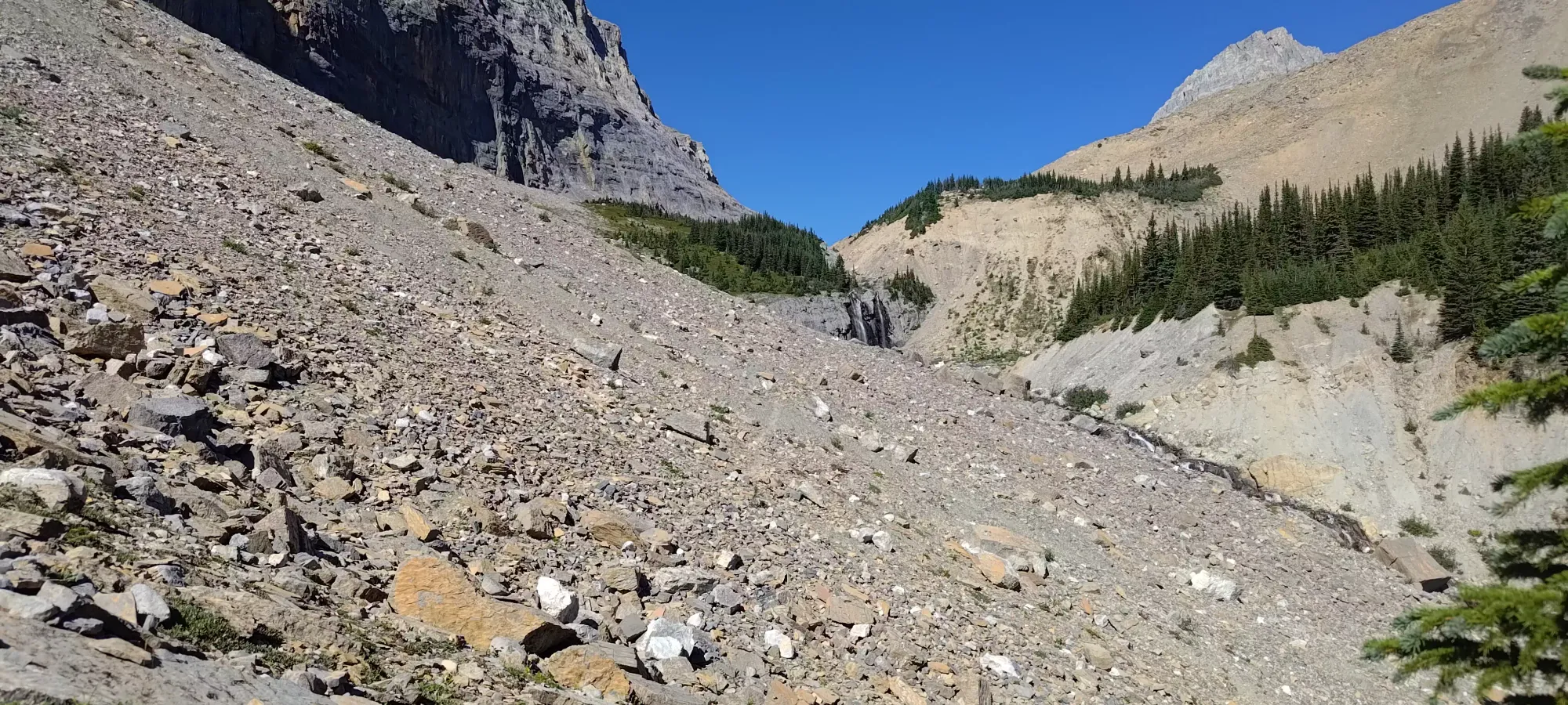
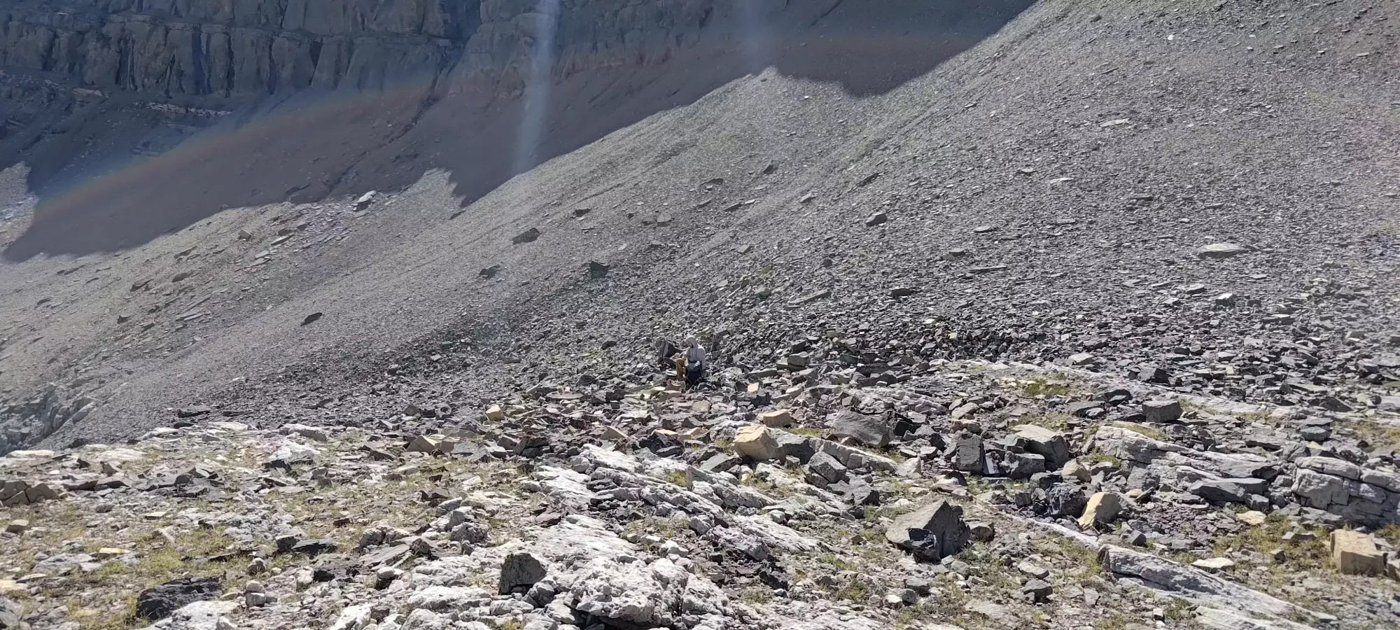
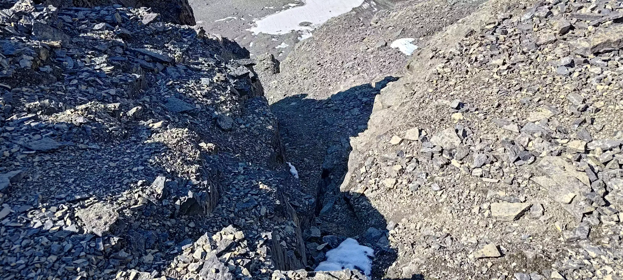
This gully ended up being slightly wet and also quite narrow after the first couple moves, though, to the point that Logan didn't want to descend, and after I tried, I felt the same way. So, we went to the slopes to skier's right in the shot above, and attempted to downclimb from there into the lower part of the gully, past the tight+slippery crux. Logan ended up getting about halfway down to a decent ledge using some very climber-y moves (jams and the like). Perhaps one day I'll gain a greater appreciation for such things, but when I tried to replicate those moves, I couldn't bring myself to trust them over the huge exposure. So, I instead lowered my pack to Logan, clipping it to a pole, then headed back to the gully, hoping that packless, I could squeeze myself in tight enough to stay stable as I got past the wet steps and into the easier terrain.
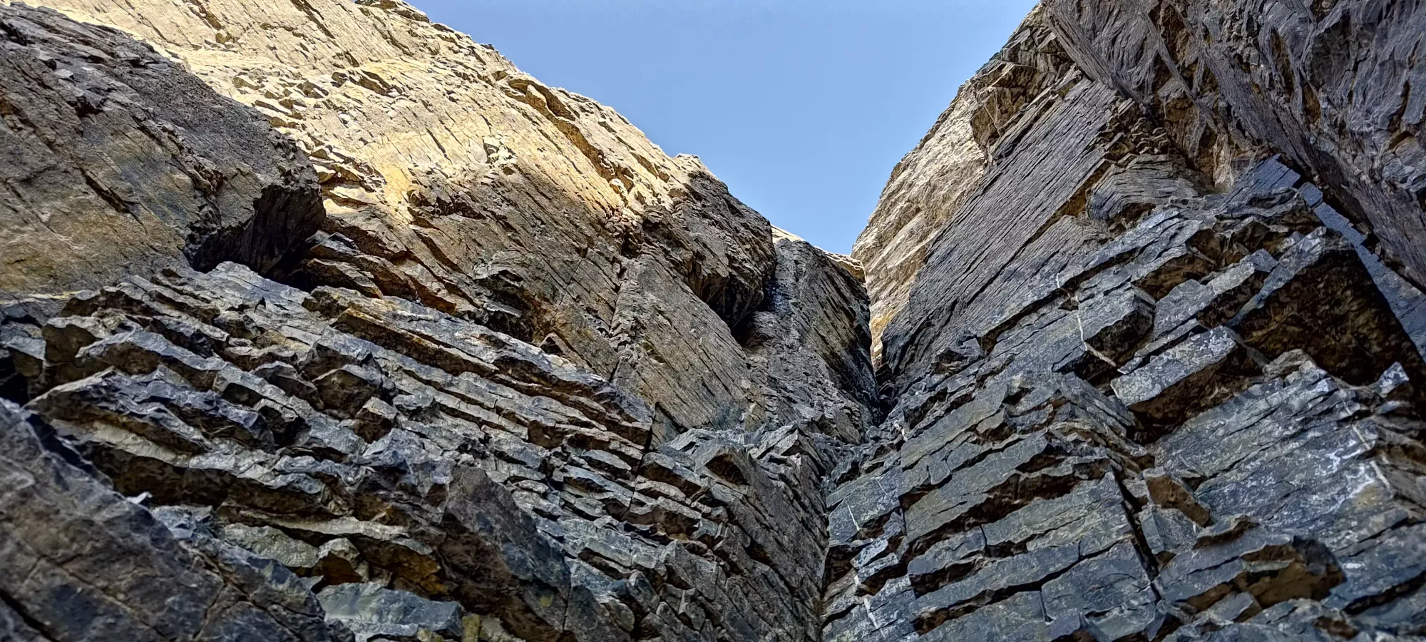
Once I was down at the bottom of the gully, Logan lowered both our packs to me, but before he could get moving, things took a turn for the worse. He ended up hurling pretty thoroughly (thankfully avoiding me, at least), which was definitely not what you want nearly 2000m above your car, still 350m below the summit, and on seemingly the crux downclimb of the day. After a few minutes to calm down, breathe, and sip a bit of water, he managed to lower both our packs to me, and finish his downclimb into the gully. Once we got a bit further down to the pole he'd yeeted below earlier (see if you can spot it in the picture above!), we took a good break for him to collect himself and see how he was doing, and figure out our plan from that point.
By the time we got sorted, it was about 6:20pm, not long before when we'd really wanted to be on the summit, turning around. Logan was feeling a bit better, but not enough to push for the summit (quite a reasonable decision). I was doing fine, a bit worried about time, but otherwise feeling spry. Given how far we were from home, the investment to get to this point, and the non-technical nature of the terrain we'd encountered thus far (the downclimb we'd done from Owen aside, everything else was just hiking, with a couple class 2 moves in easy terrain), I was willing to push for the summit, as long as I could get past the notches and anything else technical before dark. A little extra suffering in the dark while hiking back would be a worthwhile price, given the 10+ hours of driving each way and long hike in I'd need to repeat to come back here, I figured. So, after asking a million times and making sure it'd be okay, I handed Logan the car keys, and we agreed he'd head back ahead of me, and I'd push for the summit. So, after swapping the keys for the rope, we parted ways, and I set my eyes towards Cline.
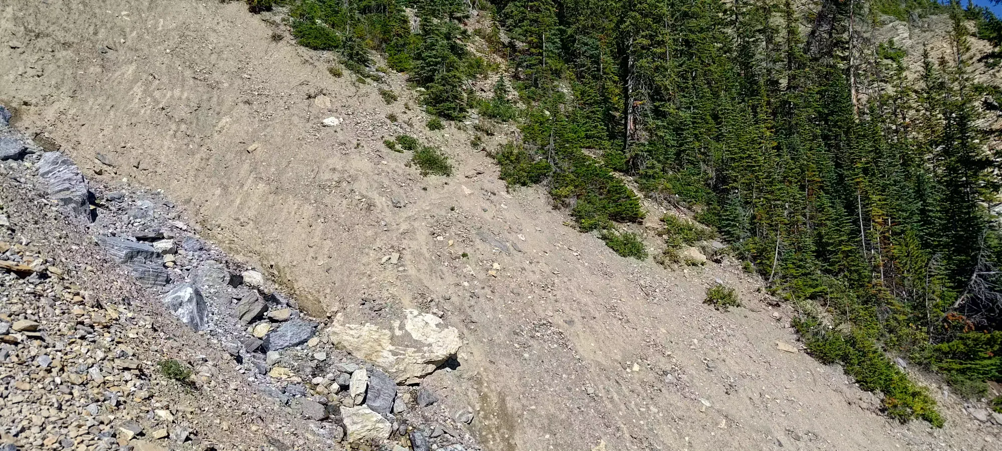
Of course, not a minute after we split up, as I was sidehilling across a horrid moraine to get over to the col, I slipped on a loose section and smacked my right hand up pretty good, necessitating a couple band-aids to get it back into fighting shape 🙃 It turns out I also bruised a rib doing that (even though I just fell down from standing height, guess rocks can be pointy and hard from any height), though I'd not even notice that until the following morning. With that delay, it took about half an hour to get across the moraine and to the Owen-Cline col proper.
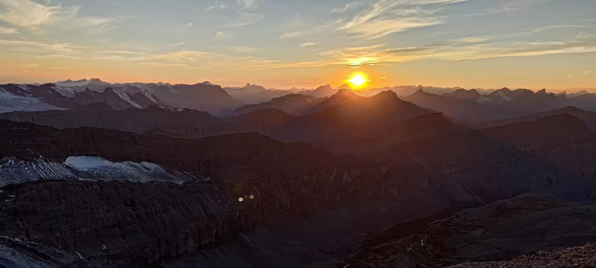
I got to the low point and started making my way up just before 7pm. Given the official sunset was around 8:30pm, with a bit of extra buffer given the nearly 1300m prominence of Cline, that was still fine, if not ideal. Thankfully, the return trip would follow the actual trail, and not be on as steep of a sidehill, making travel a bit easier.
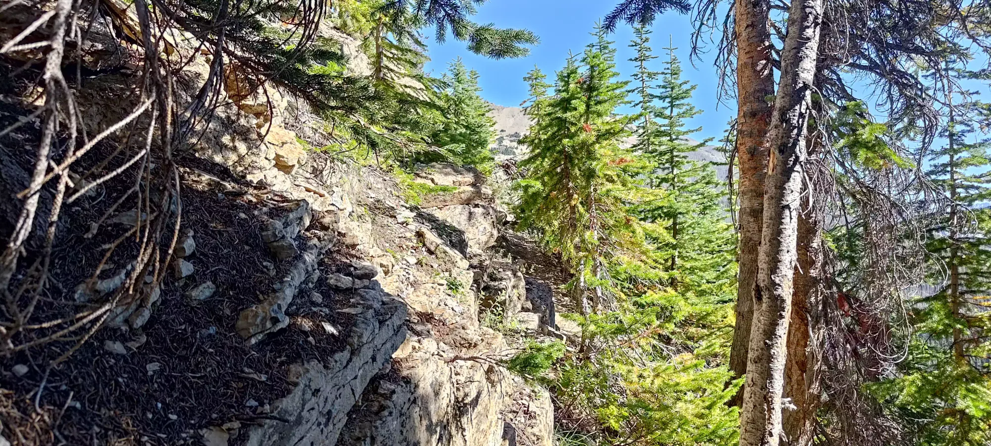
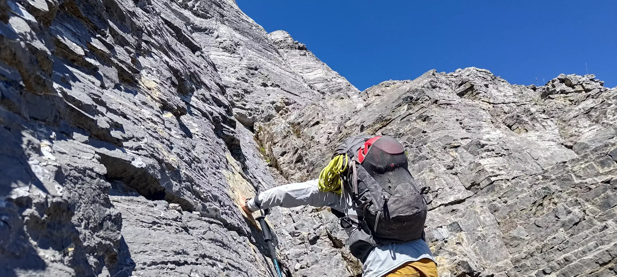
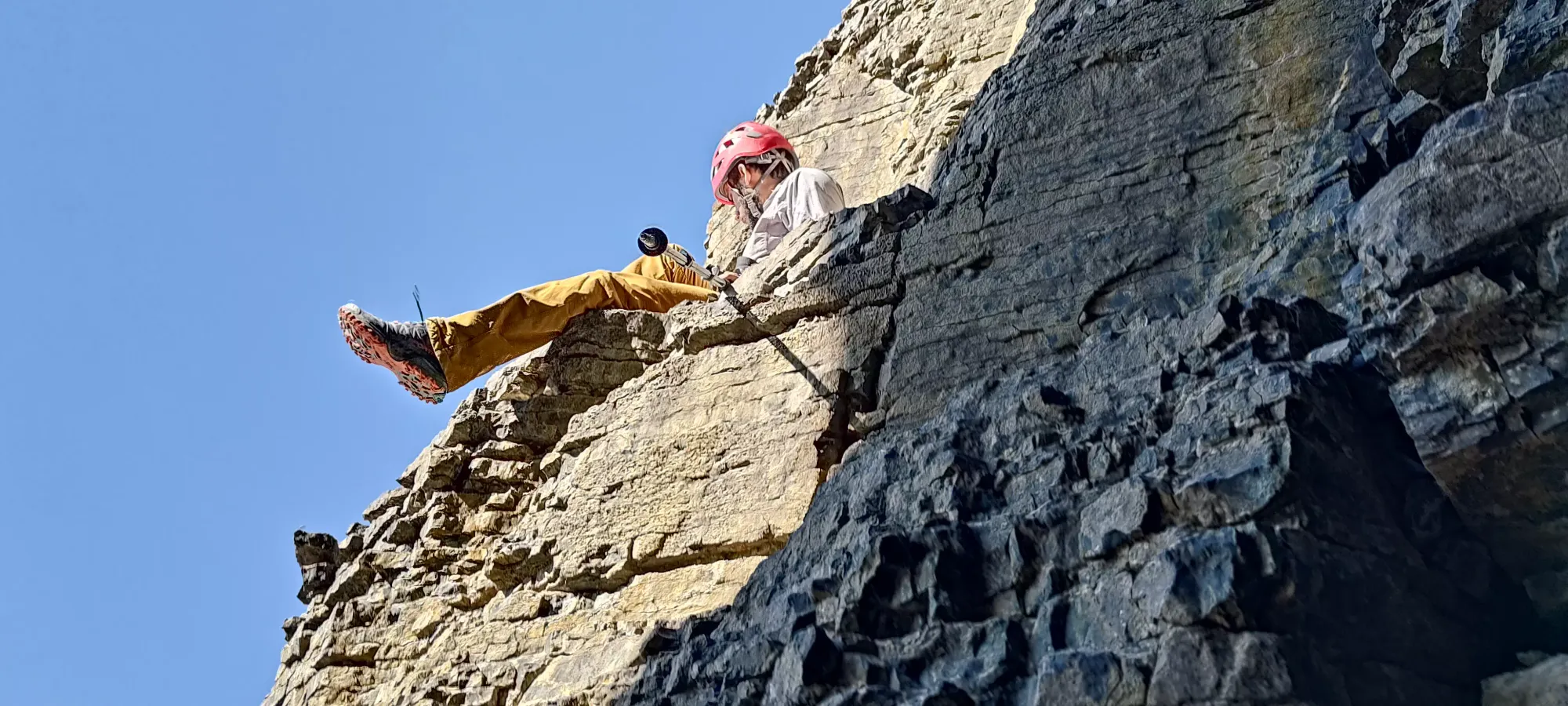
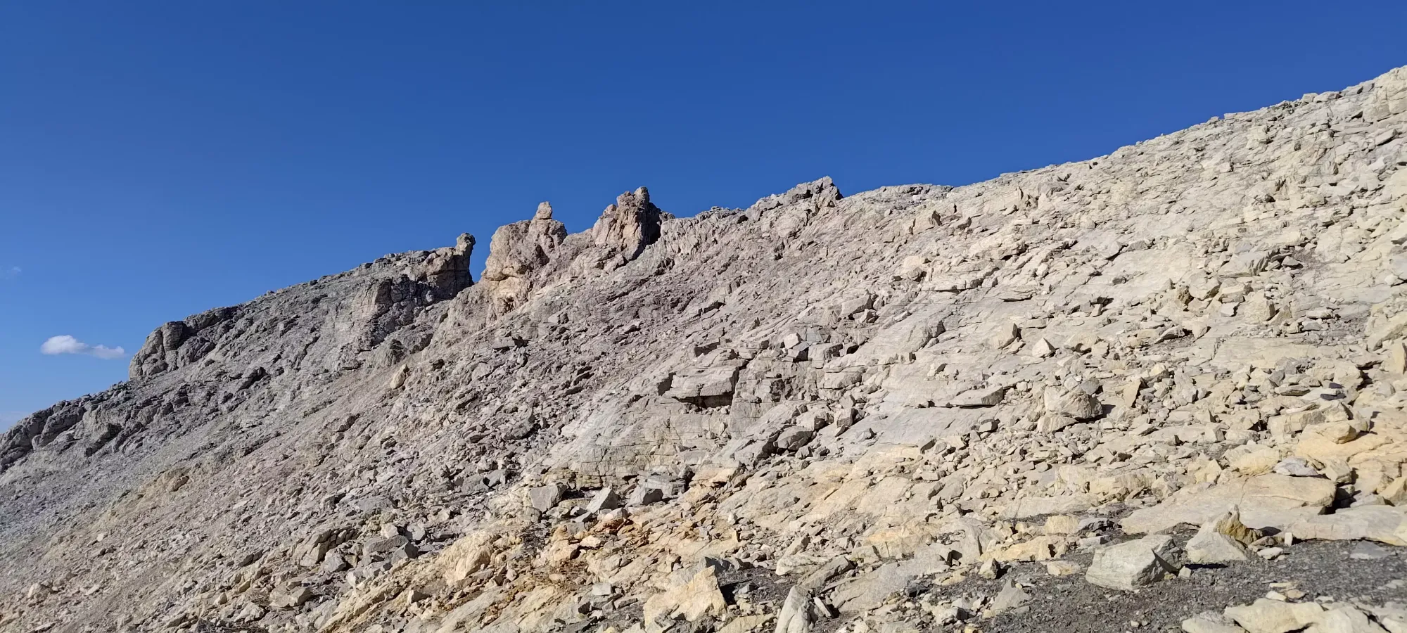
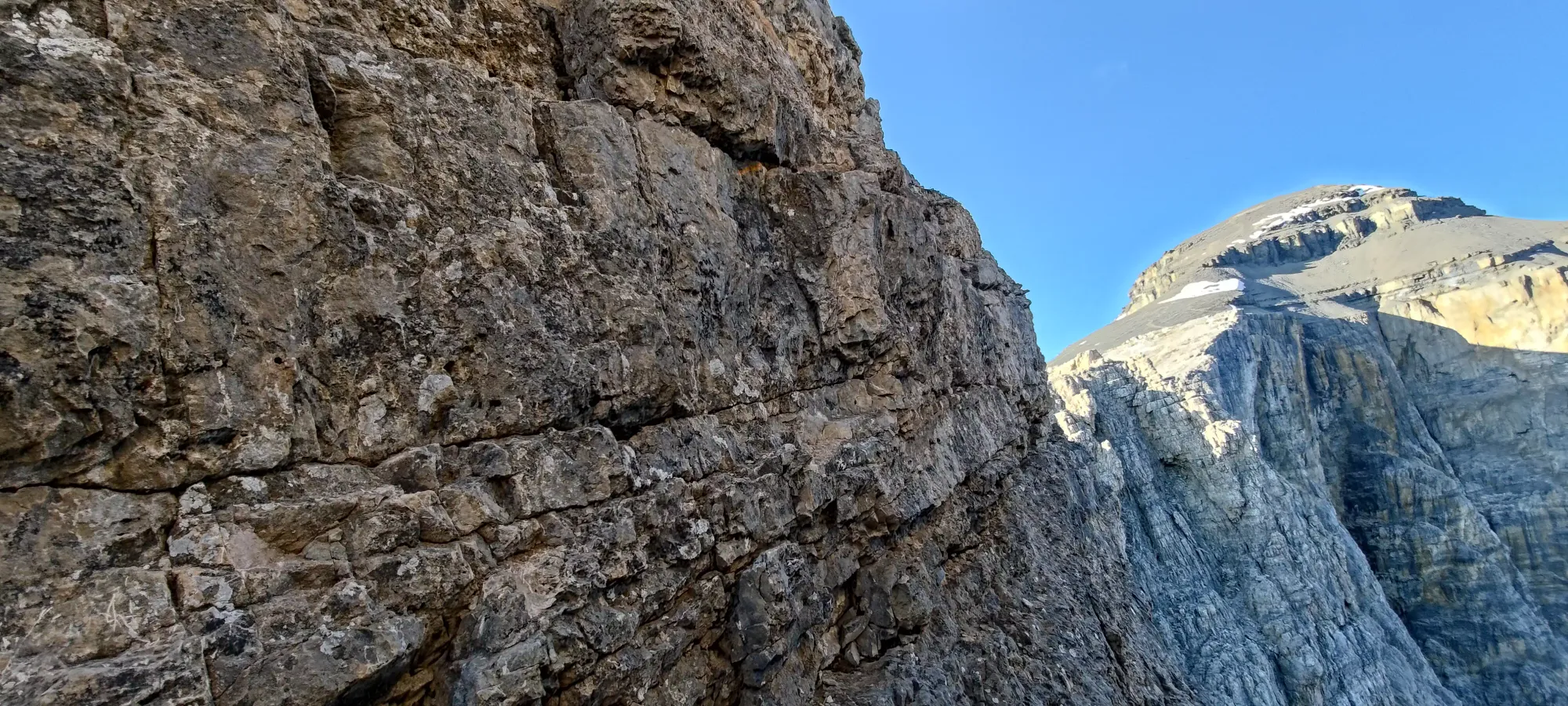
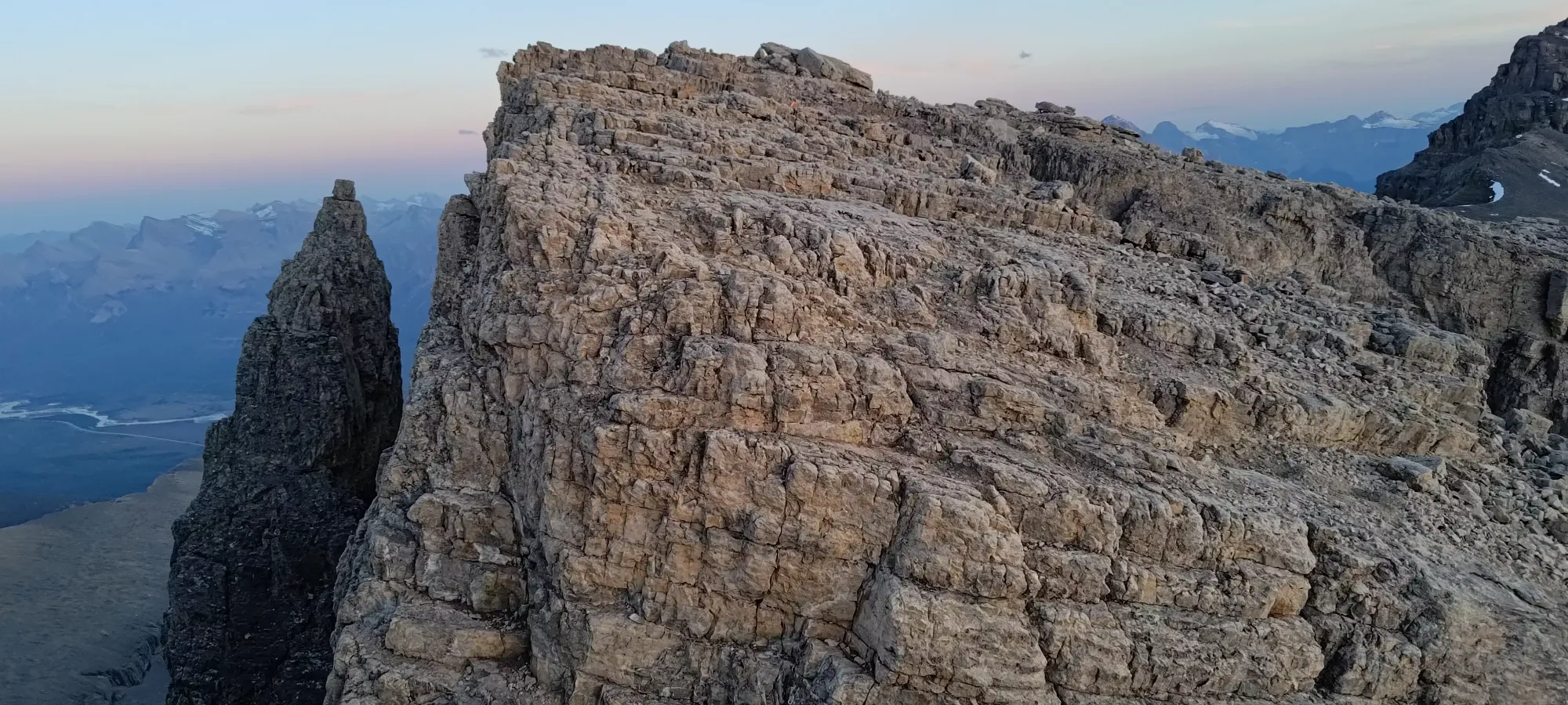
A few minutes later (basically exactly at 7pm, actually), I finally reached the infamous notches, which had actually turned a friend back a few weeks ago. They're rated at anywhere between 5.2 and 5.4 depending on who you ask, so I didn't expect to need the gear we'd hauled, but "you never know", and it'd definitely suck to get all the way there and not have the ability to continue, so it was a good idea to bring, if nothing else, the gear to rap down and belay followers up the far sides.
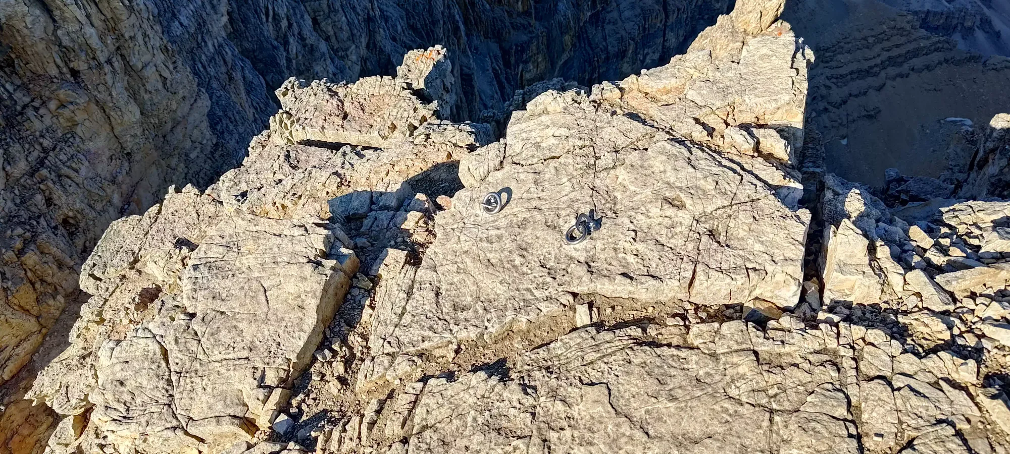
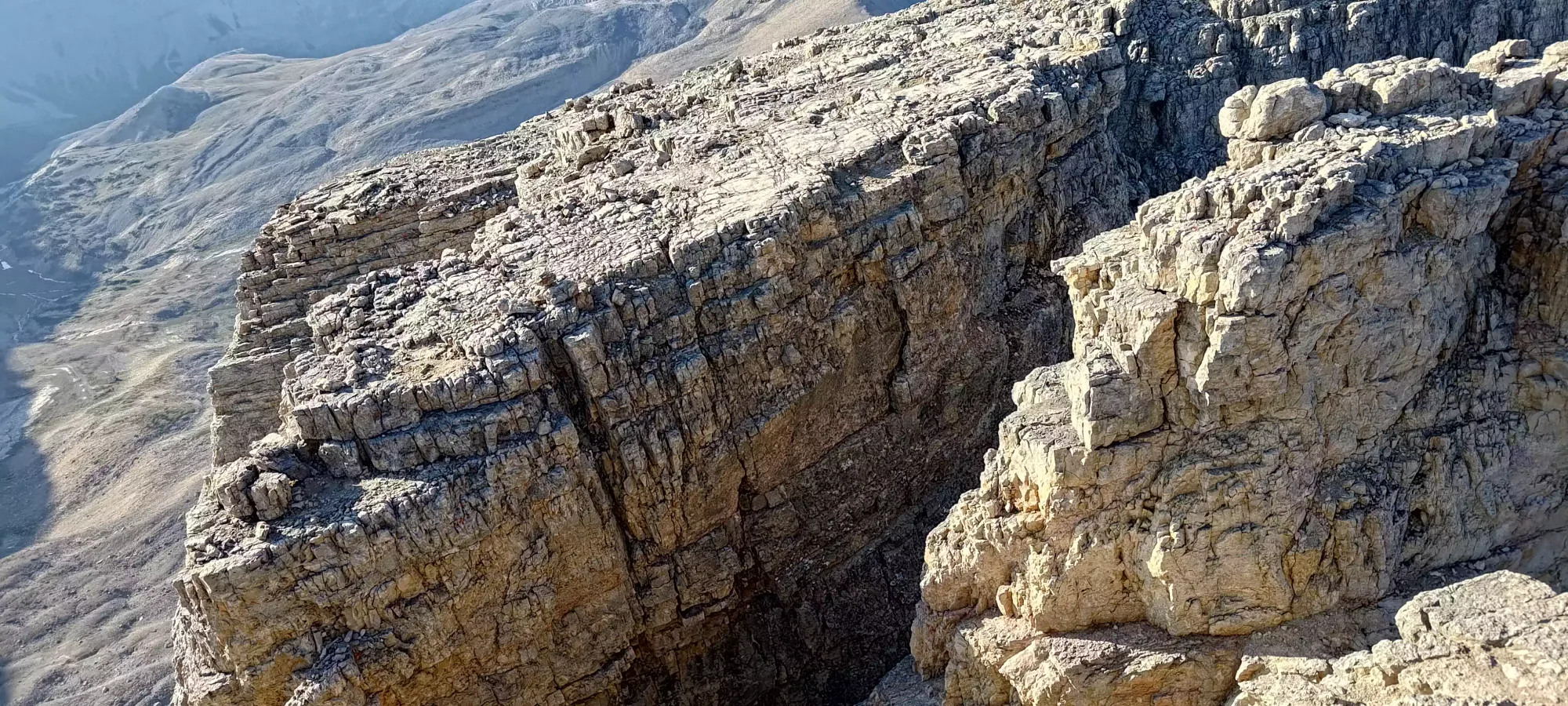
The downclimb on the first notch was trivial, really, and easily led to the little tower (the top of which is visible above) in the middle of the notch. From there, the climb out the other side was steeper and more exposed, but I managed it without too much fuss, and popped out on the useful side fairly quickly. The exposure is definitely real here, though, a fall will kill you, no two ways about it. Thankfully, the rock is quite solid.
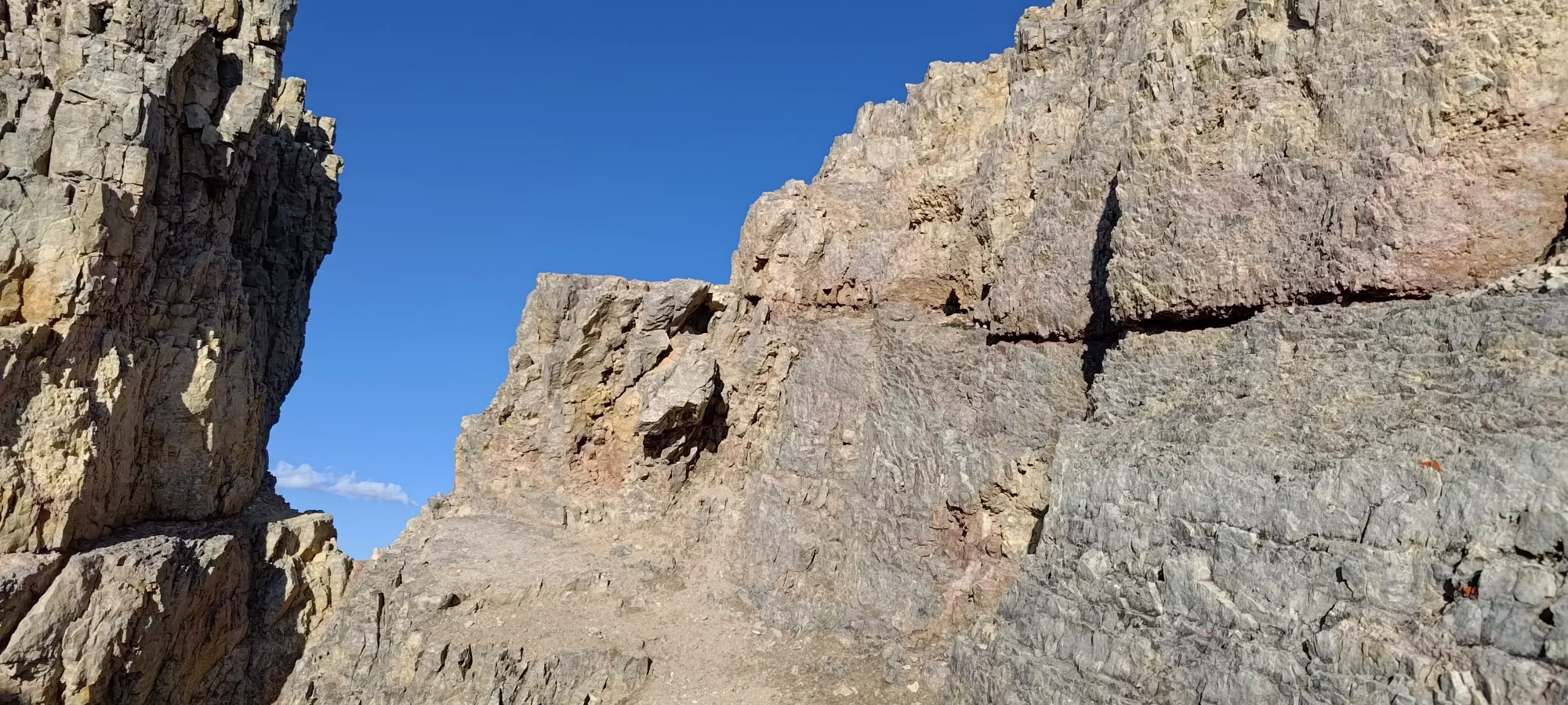
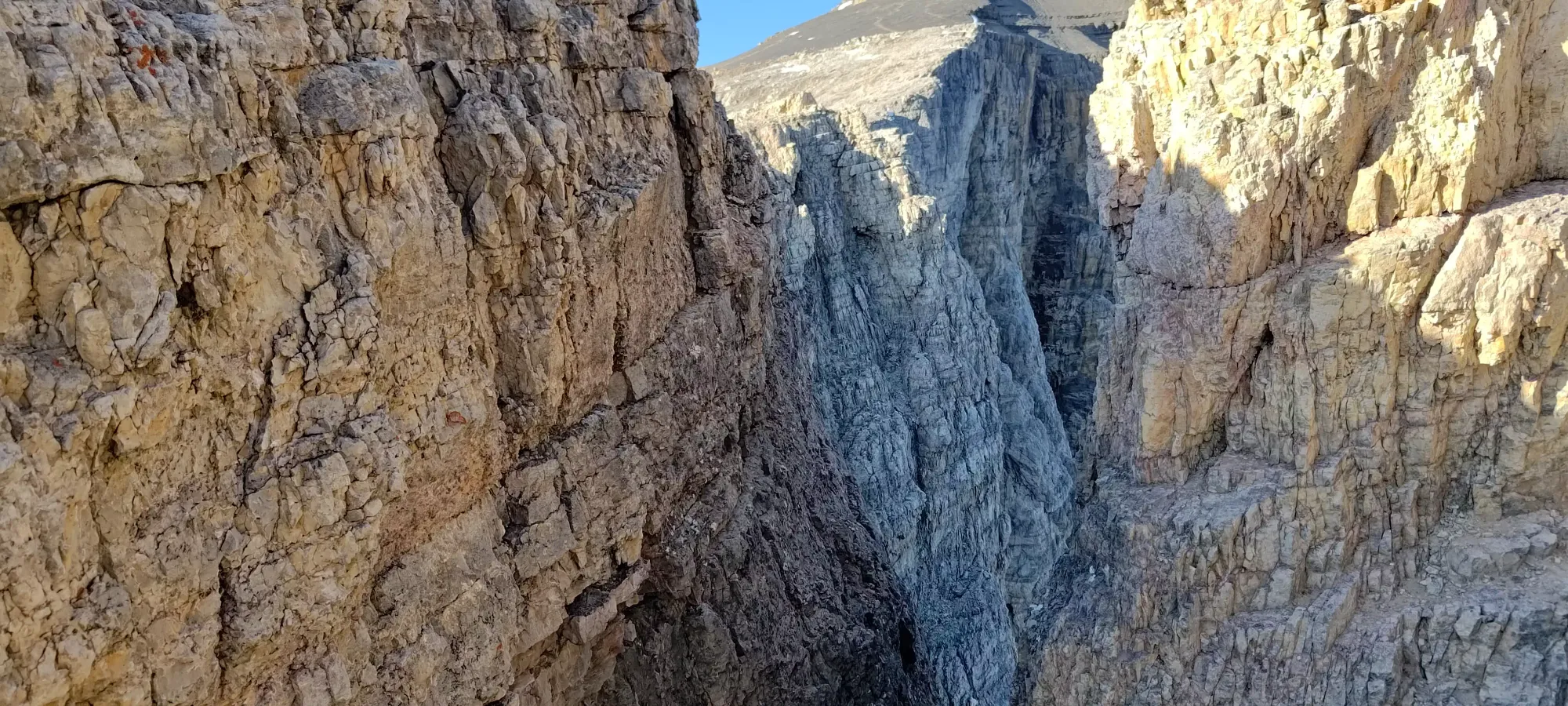
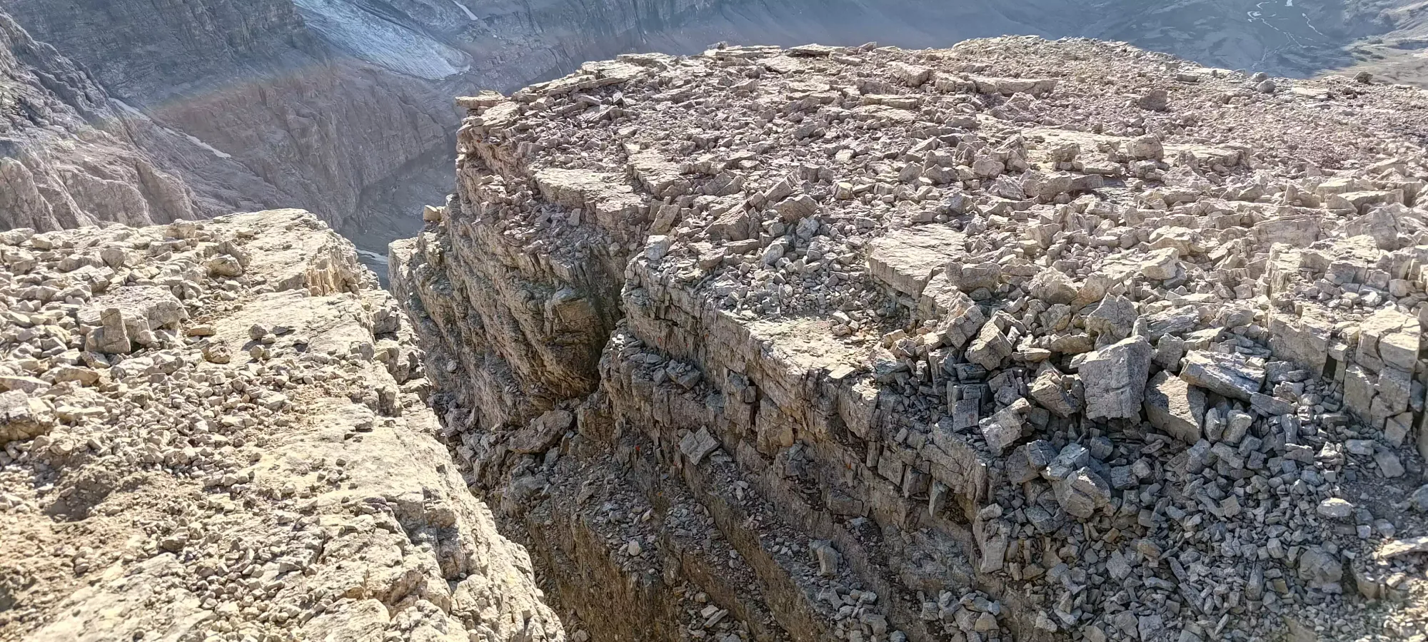
Once I got onto the other side, I hastily decided that the middle tower must define the midpoint of 2 notches, and then reasoned that it would make sense to clip all my climbing gear into the bolts at the top of the notch, so that I wouldn't have to haul it the rest of the way to the summit, since the crux was "over". Of course, that was not the case, and a few seconds after I left my gear, I found the second notch, the one with the infamous "leap" required to get to the other side.
As I recall, on the way across the second notch, it's a bit of a leap down, which means more momentum, but you're also not worrying about "can I make it across" (with the implication of not doing so being falling down the chasm to your death), so that helps balance it out. I could've gone and got my rope, but with the flatness of the ledges, quality holds, and general "inwards" stance you could land with, I felt comfortable making the small leap, so I did. The climb up is a bit harder on this side, with narrower ledges, and more weight over the exposure, so in a multi-person party with less comfortable gap-yeeters, you may want to belay the first person down and back up, so they can set a rope on the far side for people to get up.
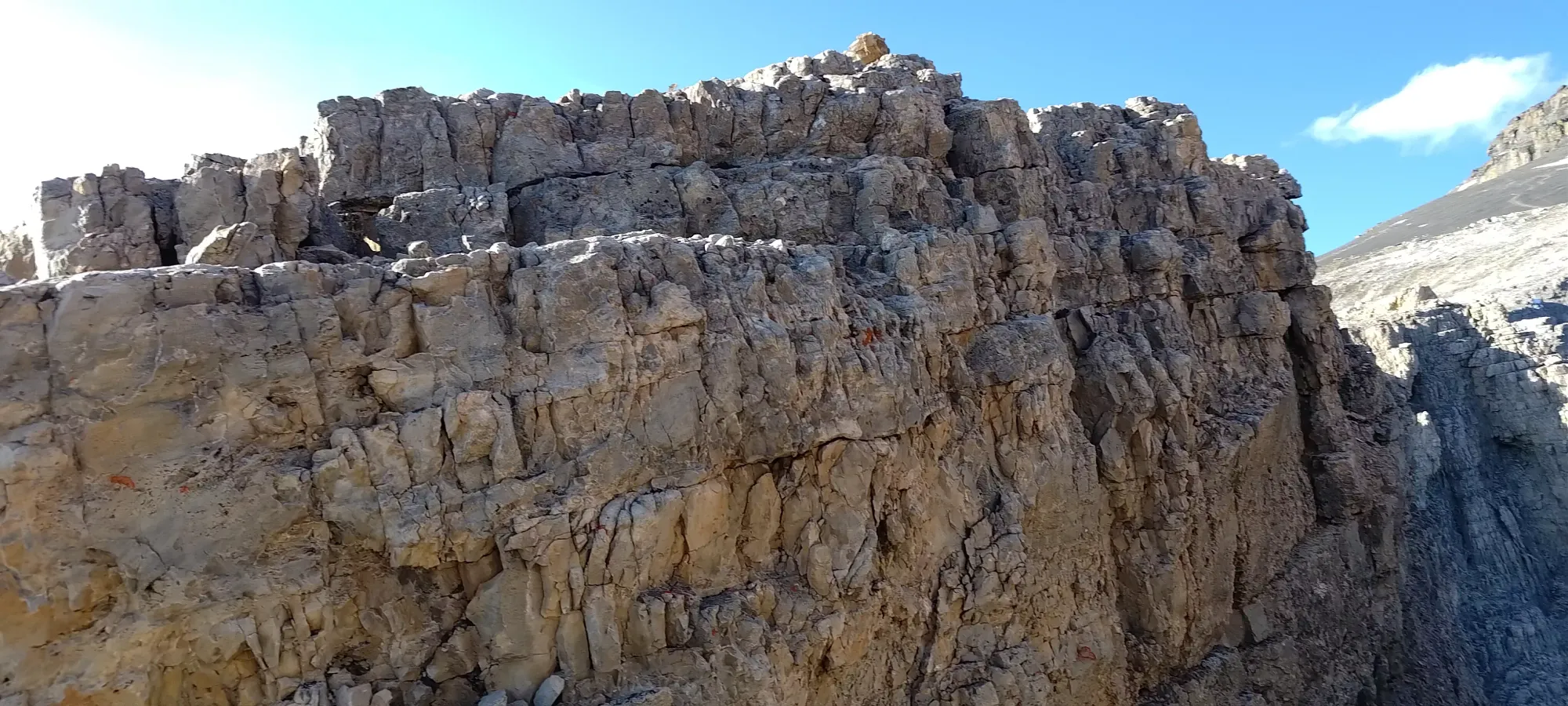
Since I was happy enough getting across under my own power without pro, I just got to restart the slog back up the mountain, with a bit over 300m left to gain (the notches are quite close to the col).
The final push was pretty tiring, and took about 45 minutes. Which, thinking about it, isn't that bad for 300m+ of elevation, but given how tired I was feeling, along with the time crunch, it felt worse than it was. Every time I thought I was close, a bit more mountain would appear 😅
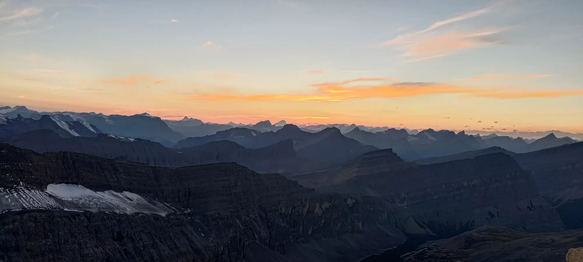
I crawled my way onto the summit basically right at 8pm, and quickly took my photos before making my way down. I briefly looked for a summit register, but wasn't able to find one, and didn't have the time to dig around, so no idea if it needs one or not. I was just happy to get it with enough time to redo the notches in the light. The wind was also fairly strong and quite cool up that high, so I didn't feel like hanging around just because of that (though I did at least have plenty of layers, so I wasn't cold; strong winds are simply annoying all on their own).
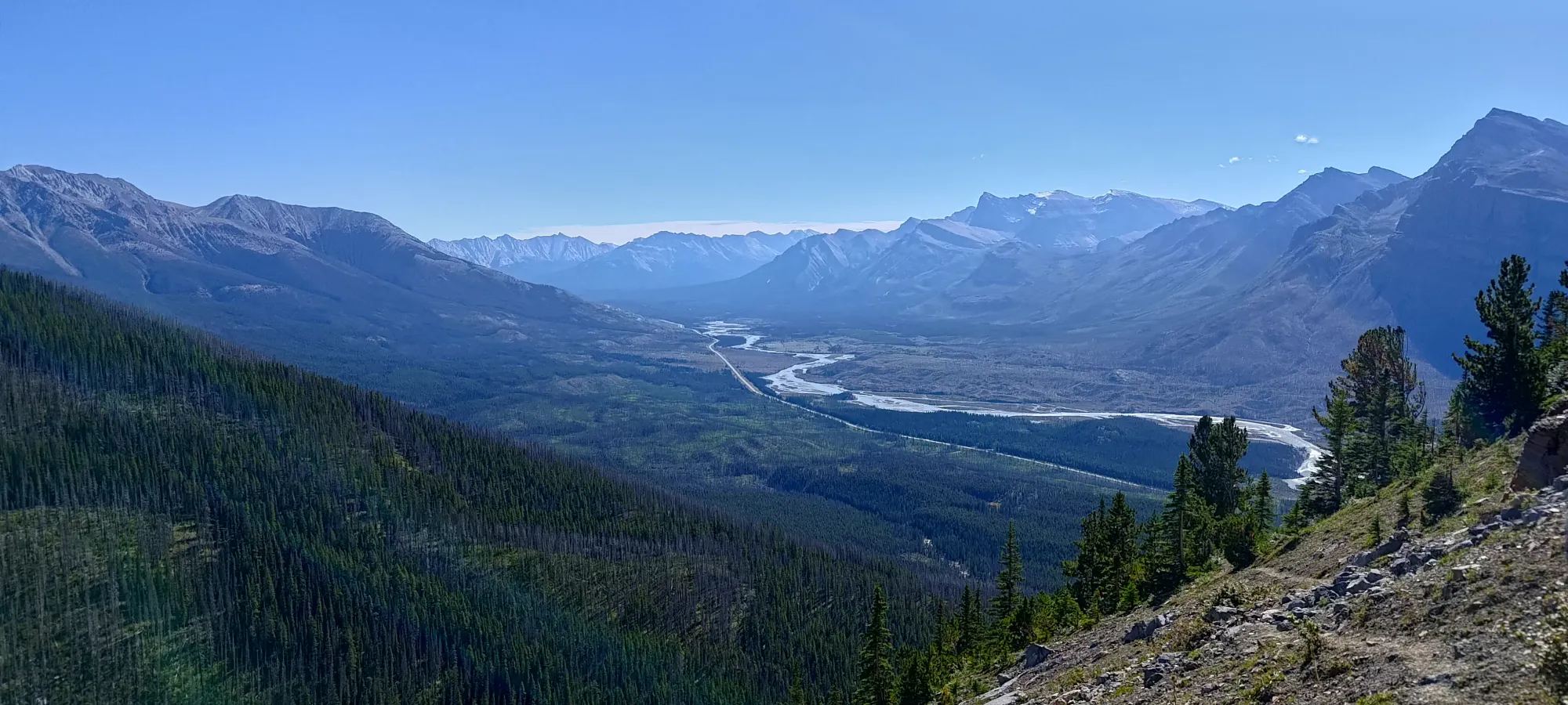
After taking my photos, I didn't waste much time in starting to haul ass downhill, as basically every minute I could spend moving with light would pay significant dividends once it got dark, as there was a lot of vague, rocky terrain between me and the dirt trail by Thompson Creek below.
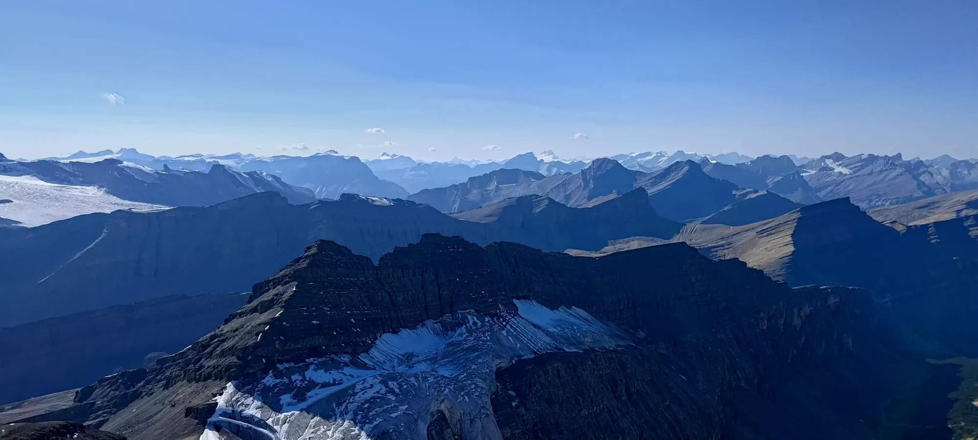
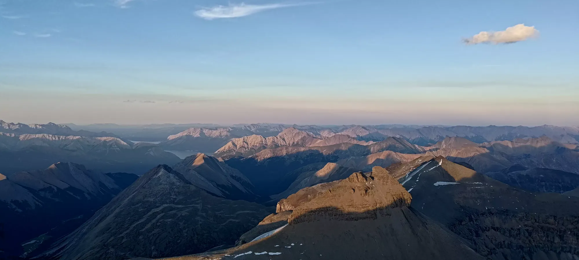
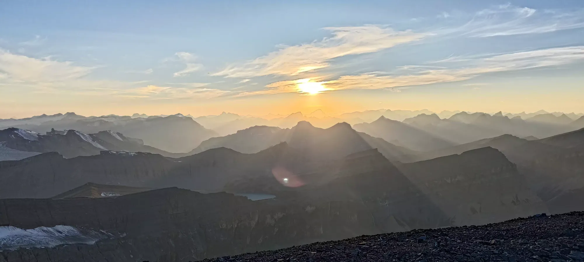
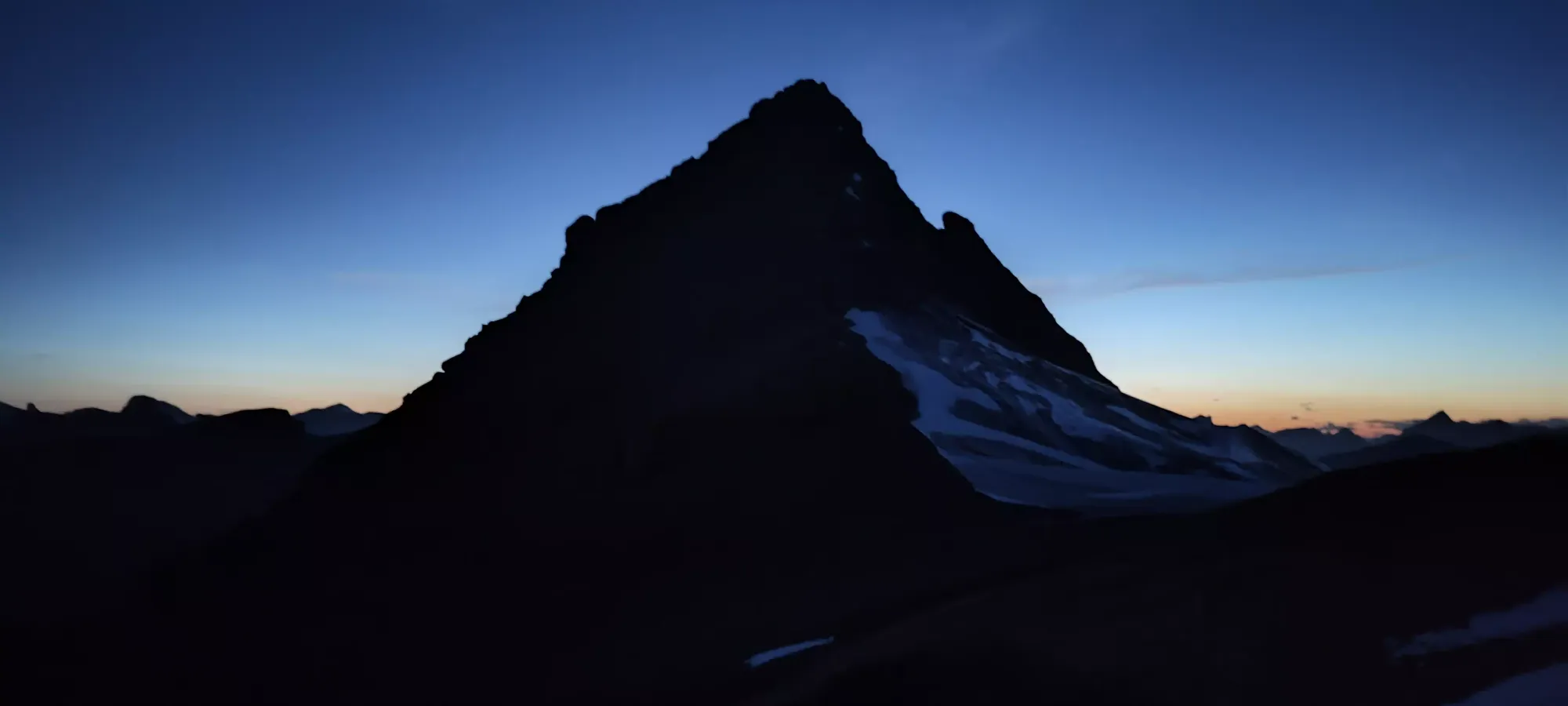
The scree at the top made for fast travel, and I quickly dropped past the snow patch and towards the barer rock more typical near the notches. I did have to stop for a few sunset photos, though, as it was quite beautiful, despite the mental pressure to get moving.
I got back to the notches at about 8:30, and thankfully with some careful downclimbing, the jump back across the first notch (first from the uphill side, at least) was easier than on the way up, despite going up a bit. I could almost just lean a pole over and step across. Climbing up the downhill side was easier than the uphill side from the way up, as well.
10 minutes later, I was done with both notches (the lower of the 2 notches was easier, though my backpack did make my typical facing-out downclimbing a bit more challenging. One can always face in to make that problem go away, though). With the real crux done, I was now just hoping to get as far as I could across the moraine with light, hoping to get to some semblance of trail across it before it got dark, and I'd just have to wander across the loose rocks, which would be an arduous process, to put it mildly.
A couple minutes later, I found myself near the bottom of the col, and followed some footsteps in the dirt that dropped down to the glacier. This technically might've resulted in a bit of extra elevation gain, but walking along the flat glacier would be way faster than the (easy) scrambling to stay right on the ridge, so it was definitely the right choice.
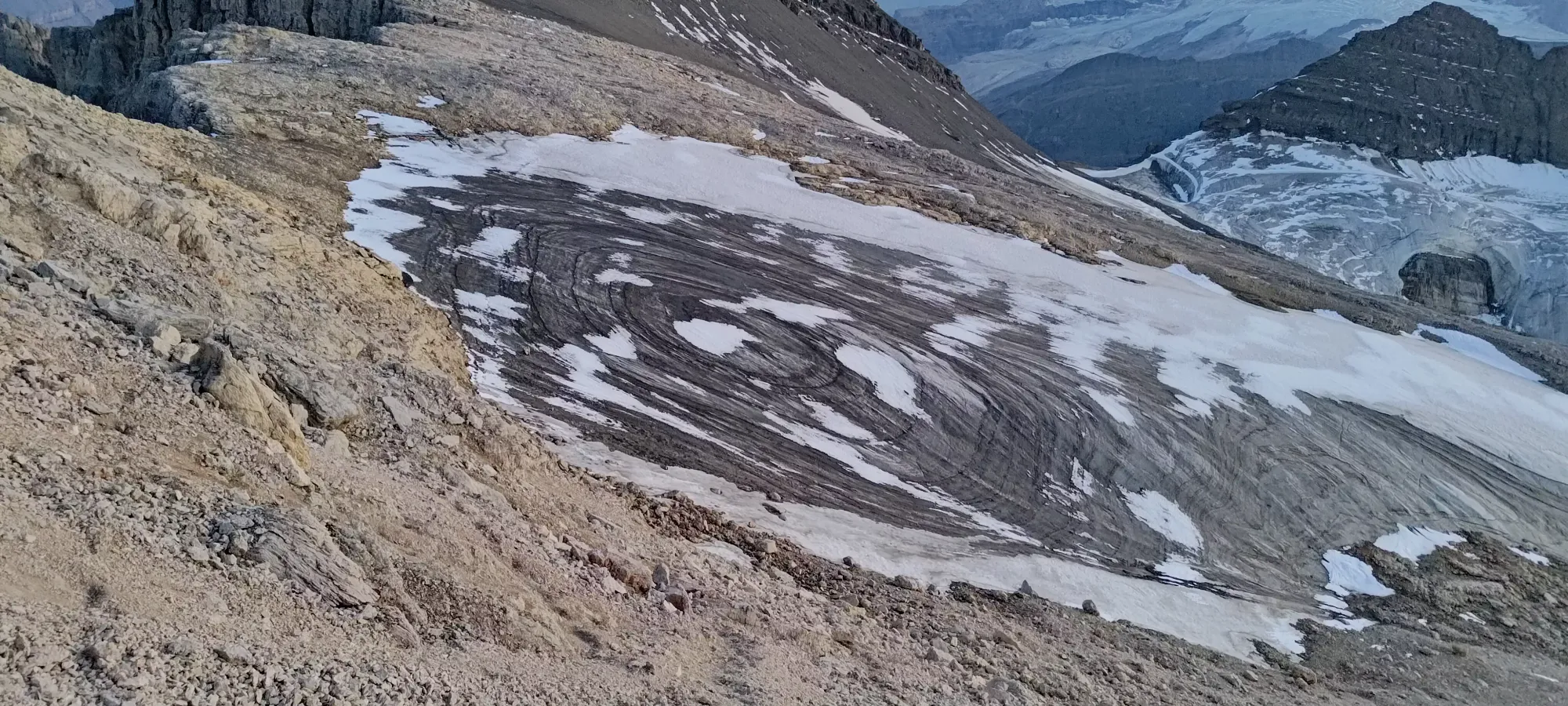
I slapped my spikes on for the brief crossing, but it was rocky enough I could've got away without them. This is definitely a piece of ice on its last legs 🙁 After a few minutes of walking across it, the clock struck 9pm, I ran out of ice, and started wandering through the moraine towards the pass SW of Mount Owen.
The moraine had a few cairns scattered about, but for the life of me, even with light, I couldn't find a good trail through it. I'm sure one exists, but I wasn't going to spend time wandering up and down trying to find it, so I just kept heading in vaguely the right direction, dealing with the somewhat loose ground below me. It wasn't the worse I've experienced, and I actually got through in about 40 minutes, just as my light was truly fading, and the headlamp needed to come out. I briefly considered making the scree slog over towards my gear stash, but given the hour, that thought went away quickly, and I wrote those few items off as a donation to whoever goes up Owen next. Hopefully that bottle turns into a register, at least. The other stuff is just useful enough that I'm sure someone will want to keep 'em just for themselves.
With that section dispatched, it was time to lose the ~500m that would take me around the corner above the lakes. I remembered from our way up that we saw some more scree-like terrain to climber's left, so I aimed a bit that way, and found some looser/smaller rocks at the top, but those quickly ran out. So, most of the descent was spent just tediously walking down the mostly-rock slopes, without much terrain of note, and only a couple class 2 scrambling sections to get down ledges I'd have avoided with daylight. That section took about 70 minutes (and also brought the first bathroom break of the day, which was honestly later than expected, so while still annoying, not too bad for me).
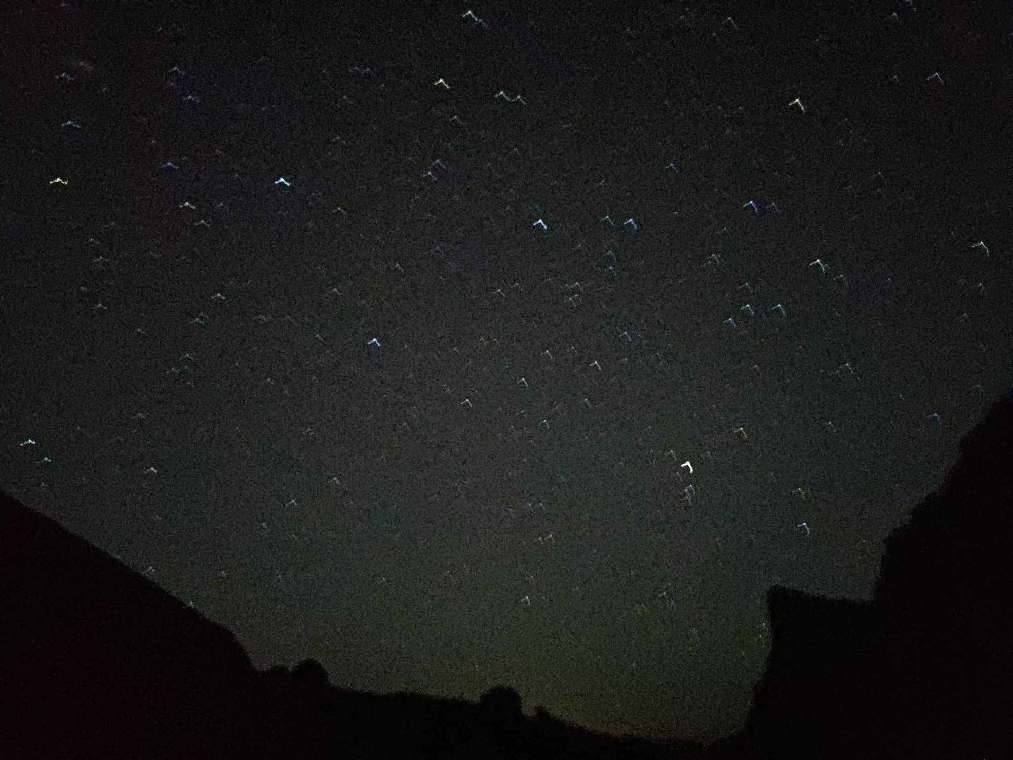
I had a bit of trouble finding the ramp down to the lakes (and also needed a second bathroom break), so that took 25 minutes, despite losing only about 100m of elevation. Once I got to the lakes, though, the travel would be fairly simple, if still vague given the lack of trail for a few kilometres. On the plus side, when I stopped and turned my light off, the stars were very pretty!
In the vague nothingness, it took about 2 hours of wandering to cover the ~3km from the lakes to the treed traverse above the steep gully guarding the "actually good trail" to the trailhead. At times, I picked up a trail in the treed sections, and near the end of the moraine traverse, I did manage to pick up the good path through it, but I also followed some bad cairns that dropped elevation too fast below 2200m, and those ended up wasting some time, I'd bet.
Once I got to that final steep gully, it took about 25 minutes to drop down to the main trail, where I was quite excited to finally be on easy-to-navigate ground! As I was wandering my way down, I noticed a couple of red lights in the distance, which I couldn't figure out if they were hikers alpine starting their way up, Logan heading out slowly, or just car headlights from the parking lot. I swear they seemed to be moving, but I never figured out what they were 🤷
The final 4.5km were much more efficient, taking only 75 minutes to grind out (with one more bathroom break partway through). I was finally comfortable enough to turn on the music and just enjoy the walk out, so I did just that, and arrived at the car at a super-casual 3:15am 😅
It turns out, once I woke Logan up, that our estimation was pretty accurate, it took me around an extra 3 hours to get back after he got there. With daylight, I'm sure the trip could've been many hours less, but with things as they were, it was an 18 hour day for me 😁😬. After I got my gear tossed in the car, we had a very slow drive home, with a couple nap stops required to stay focused on the road. I'm usually quite good in that regard, but given I STARTED the day feeling like I would need to do that, after 18 hours of hiking, it was inevitable.
Once we got home basically just before sunrise, I messaged our (awesome) Airbnb host to see if we could get an extra day, then we conked the hell out, setting alarms to be able to pack ourselves out for checkout if we needed to. Thankfully, we got the extra day, which allowed for some extra sleep and time to refill on calories. I also dropped by the ER to make sure my ribs weren't broken, as they were hurting quite a bit after I woke up (guess it took a long time to let the adrenaline dissipate). No issues there, so armed with some mild painkillers to help me sleep as I healed (mostly good at the time of writing), we were ready for the drive home on Tuesday instead of Monday 🙂
Overall, this was a pretty cool way to end the trip with a bang. Logan getting sick, and our time spent downclimbing Owen definitely made this a bit more of an epic than it needed to be, but I still am happy with the outcome, I think it was worth the extra suffering to get it done. Though I'll be happy to have some more bite-sized trips once I'm back home...
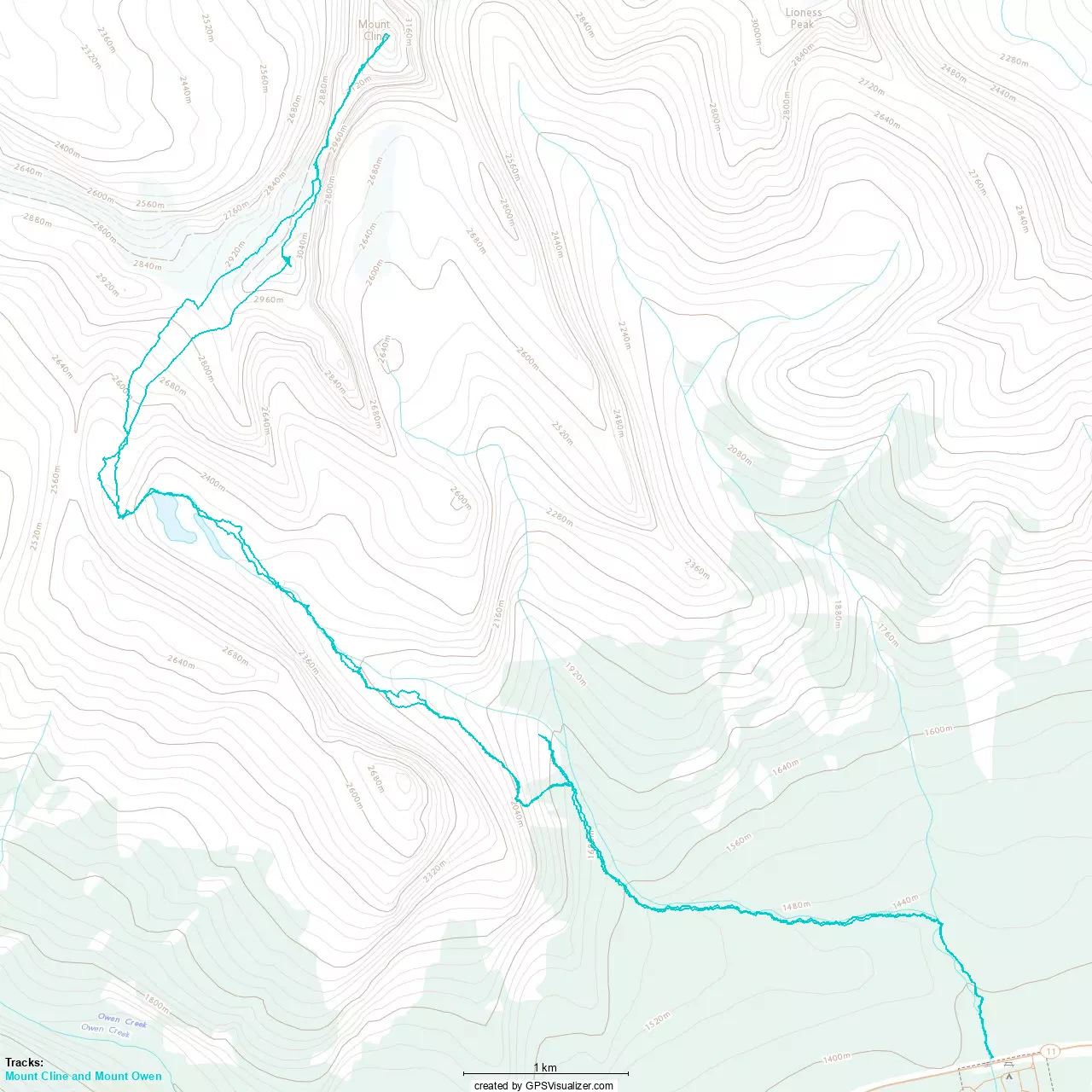
GPX Track + Map