Mount Bachelor - June 30 2024
A nice, fairly prominent Cascade Volcano near Bend, Oregon. The easiest way up is to shell out for a lift ticket during ski season, but coming up for a late June ski tour is a pretty cool option too (and cheaper!)

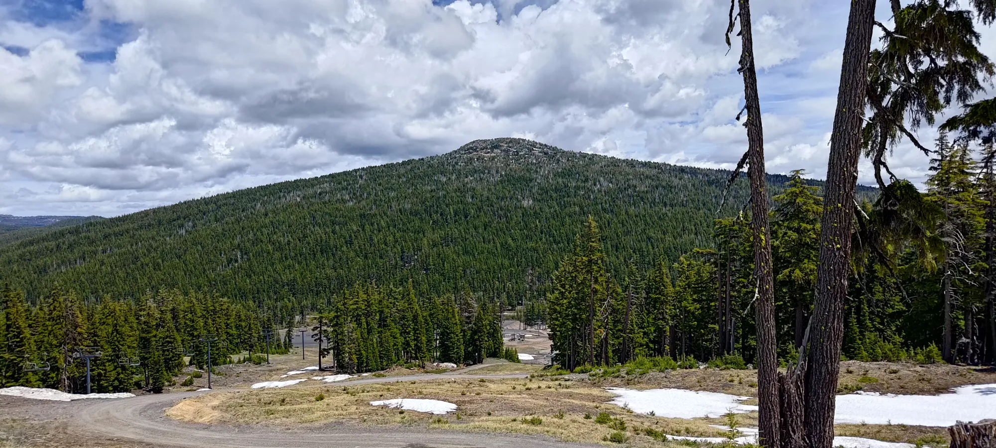
Sisters Area, Bend, Oregon
2763m
Since this weekend ended with Canada Day on the Monday, I was hoping to get some "good work" in, peakbagging-wise. However, the weather near home, which has been a lingering trend this spring/summer was looking fairly poor. I was hard-pressed to find friends wanting to road trip to get to better peaks/weather, but I was able to entice my buddy Nick to come with the dangling fruit of summertime skiing. There has been quite a late snowpack this spring, so that was still very much possible even at the end of June. The plan was to get a couple Cascade Volcanoes, as that is a list I'm hoping to complete, and be able to use skis to accomplish that.
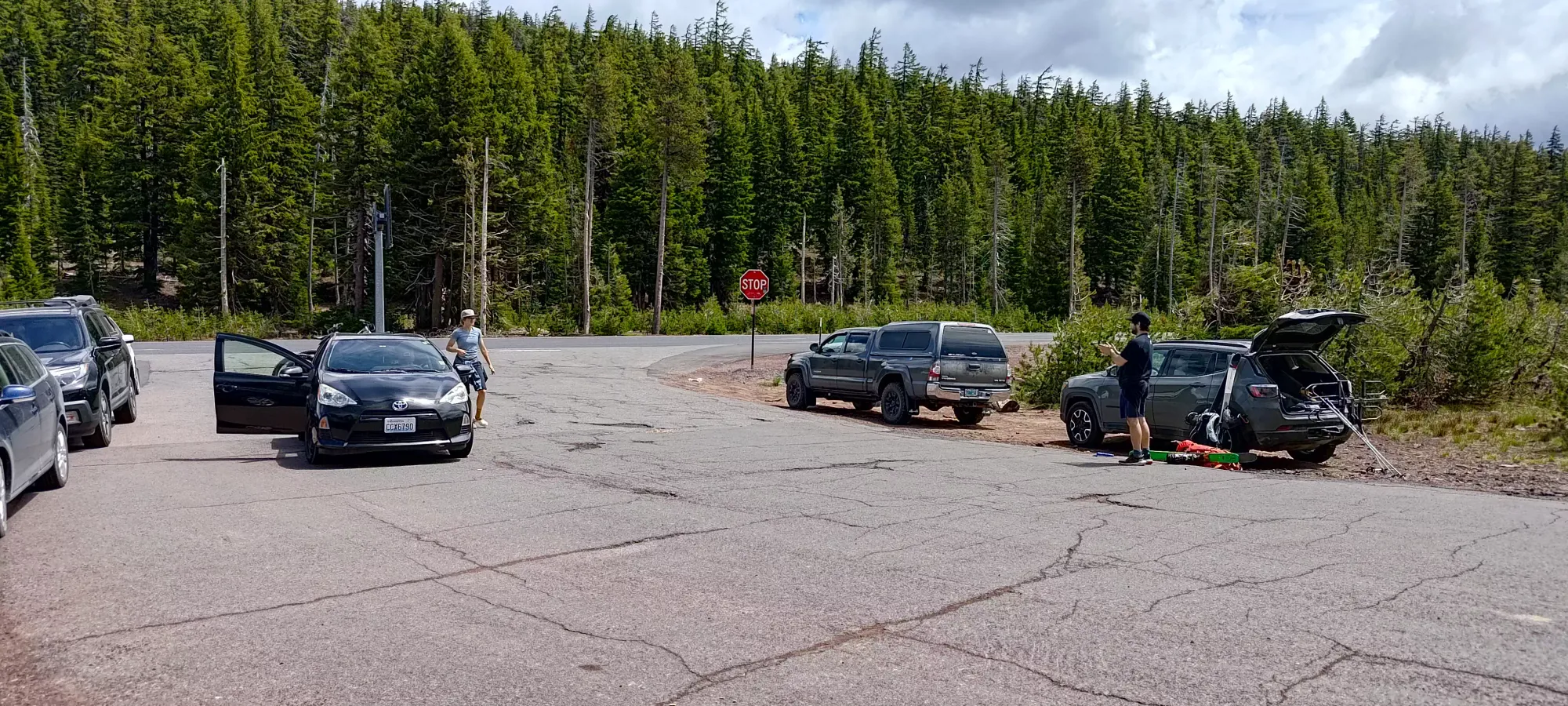
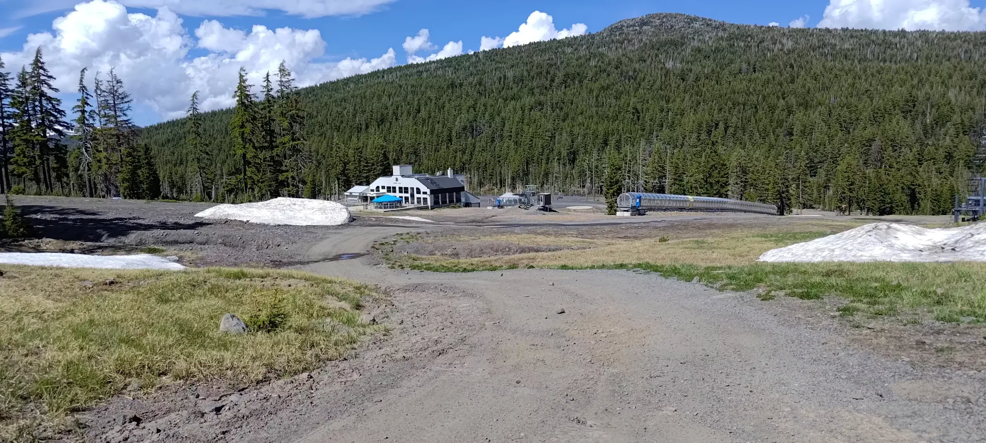
After driving down late Saturday (the plan was very last-second), and discovering that apparently despite the fact that Independence Day was going to be closer to the following weekend, hotels were booked up like crazy, so we actually had to sleep in Portland for the night. That meant we got down to Bend fairly late in the morning, and it was around noon that we arrived at our trailhead. That trailhead was Todd Lake, as we were going to do Broken Top first. However, the road was apparently gated past that point, and Nick as a skier but NOT a peakbagger wouldn't have been interested in booting the road to the snow, so we pivoted to do tomorrow's plan today, and crank out the shorter, simpler, and more easily accessed Bachelor on Sunday. We drove across the road to the also-gated road to the Sunrise Lodge, but thankfully the road doesn't go much past the highway, and there was space to park, so we slid in to a spot and geared up for a 12:30pm start.
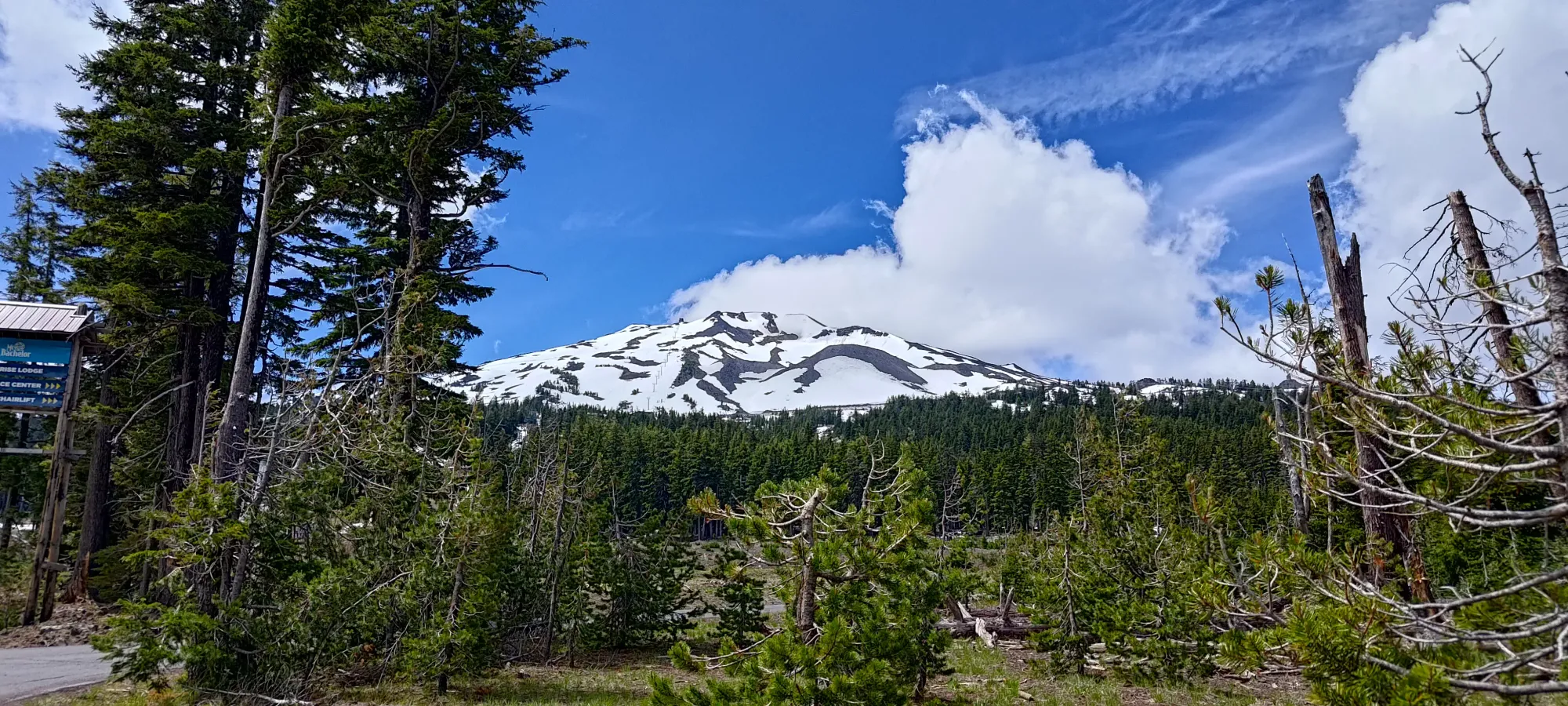
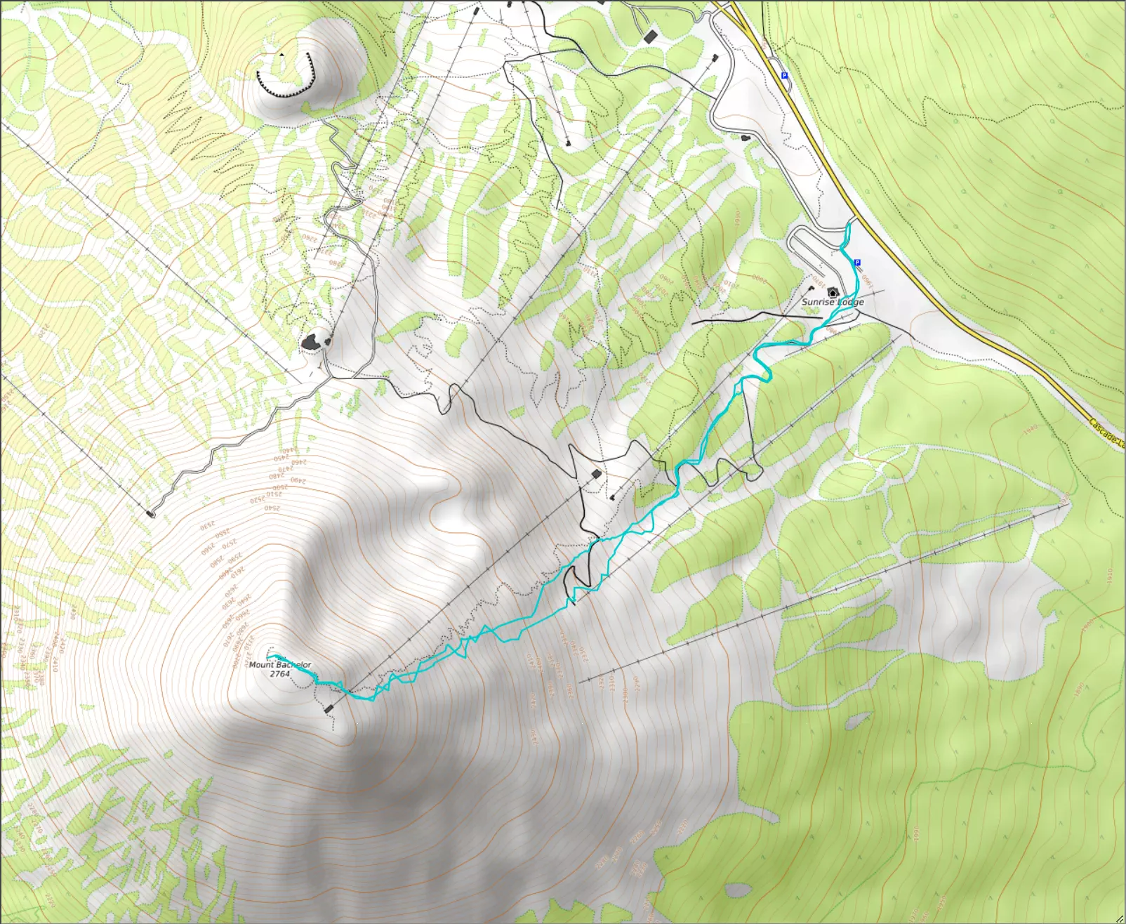
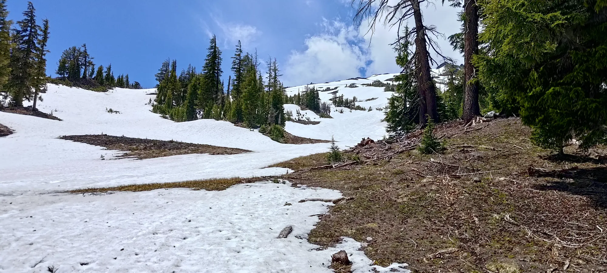
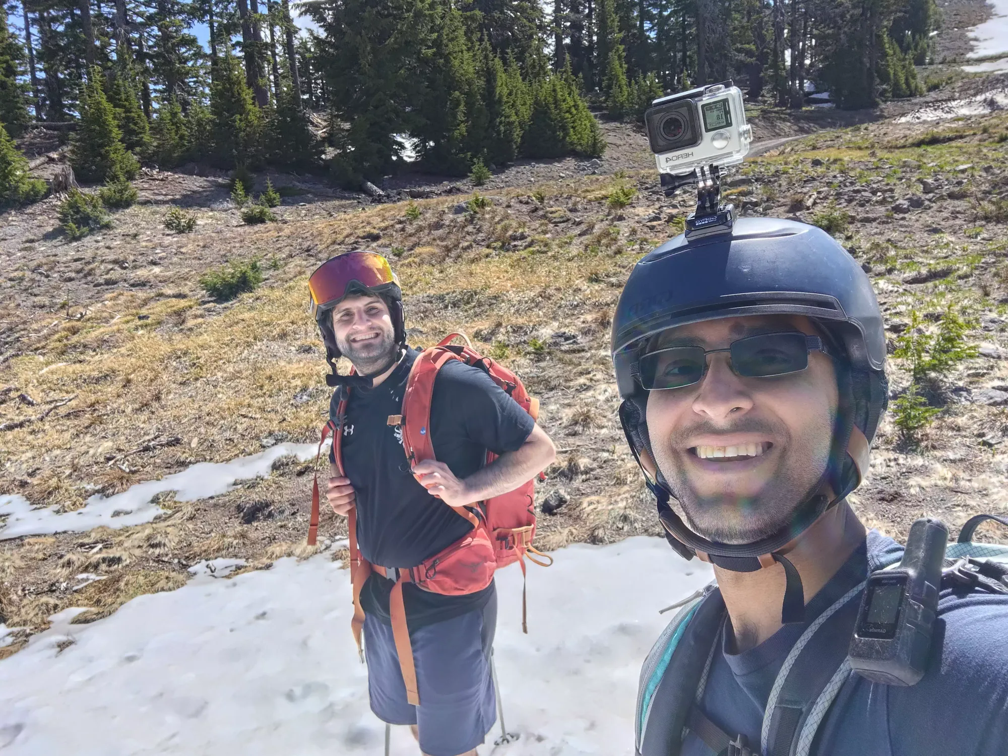
After getting our skis+boots strapped to our backs, we started hiking up a utility road on the climber's left side of the Sunrise Express chair. We gained a bit over 100m for 15 minutes until we were at 2060m, where we found a snow patch long enough to justify getting our skins on and starting that way up. A snowboarder who'd been lapping that area let us know the snow did last for long enough to justify skinning, so we happily took the load off our backs and transitioned. It was a short enough approach that even Nick, who has no love for hiking when he's trying to ski, was okay with it 🤣
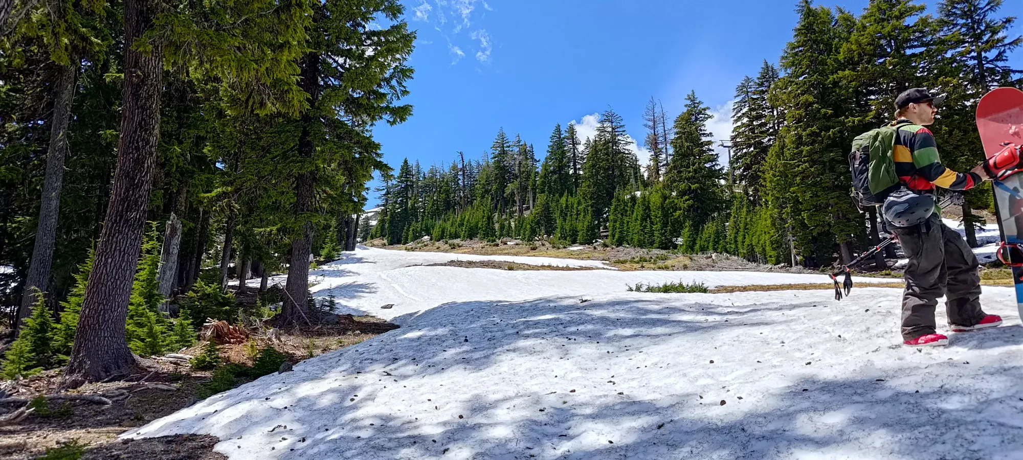
After a casual 10-minute transition into our boots and skis, we got moving uphill the "better" way. We started skinning straight up the mellow Carnival ski run, and were able to do so until around 2125m, where we had to briefly remove our skis to boot across a dry patch of snow, and put them back on at about 2150m. Thankfully the utility road was exposed for most of this, so the walking was trivial, and brief.
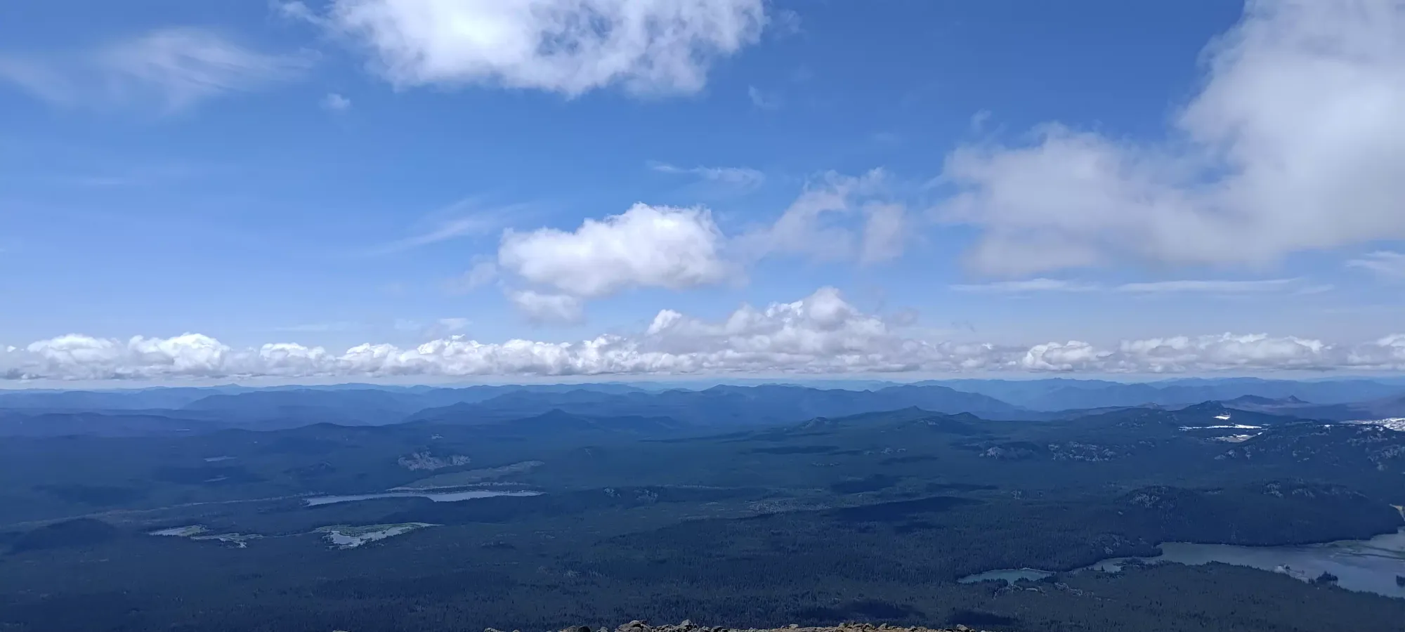
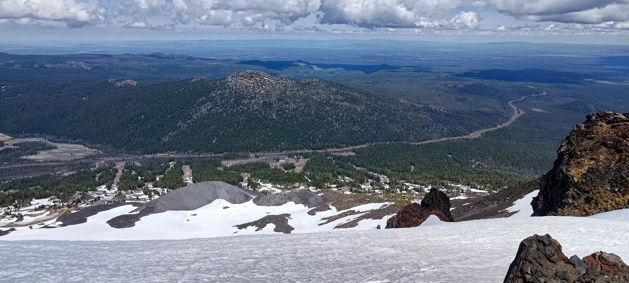
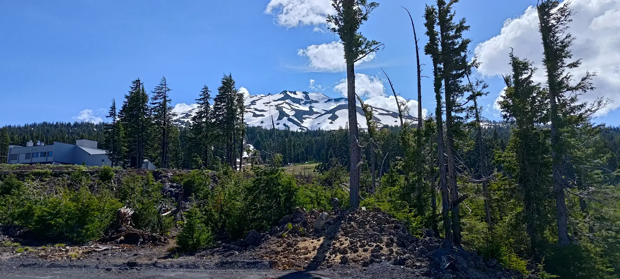
By the hour mark we'd made it up to 2300m or so, which with transitions and our general "let's work but not kill ourselves" pace, wasn't bad at all, I'd say. The views were pretty nice already, and we got plenty of nice pictures along the way. Right around this time, we reached the end of a plowed utility road, and unfortunately did have to briefly remove our skis to get across it, as going around would've been a more lengthy endeavour than just briefly taking the skis off and walking across.
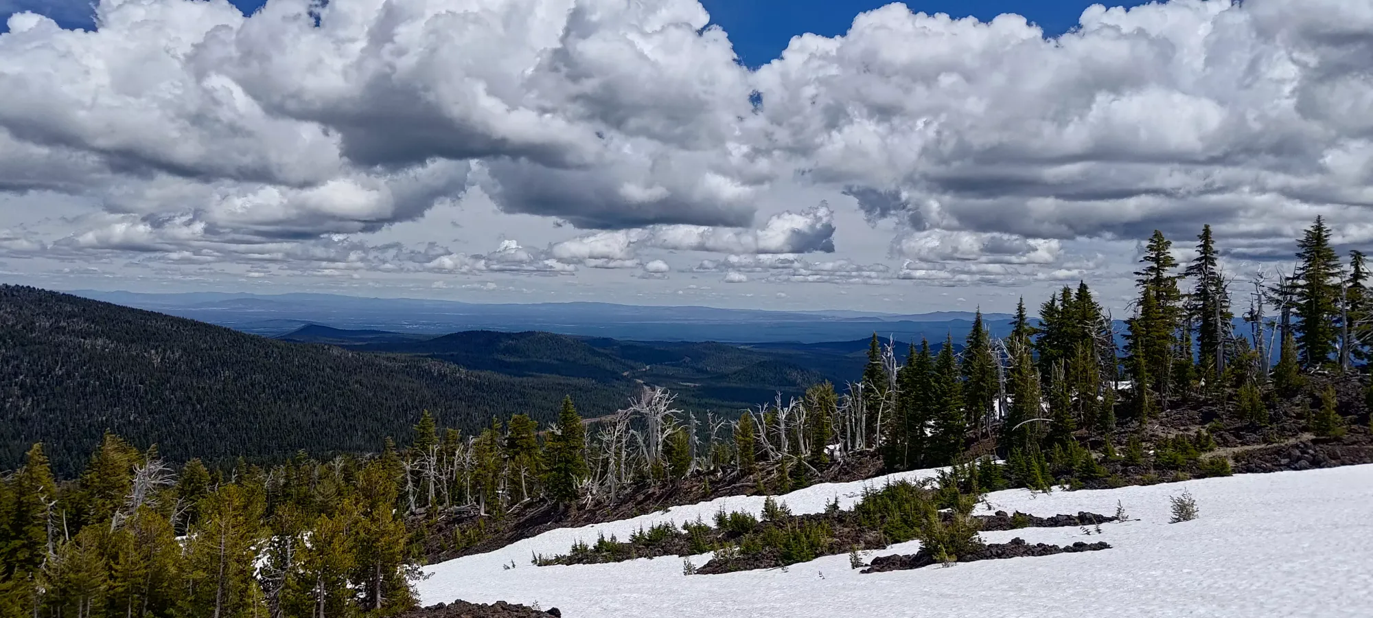
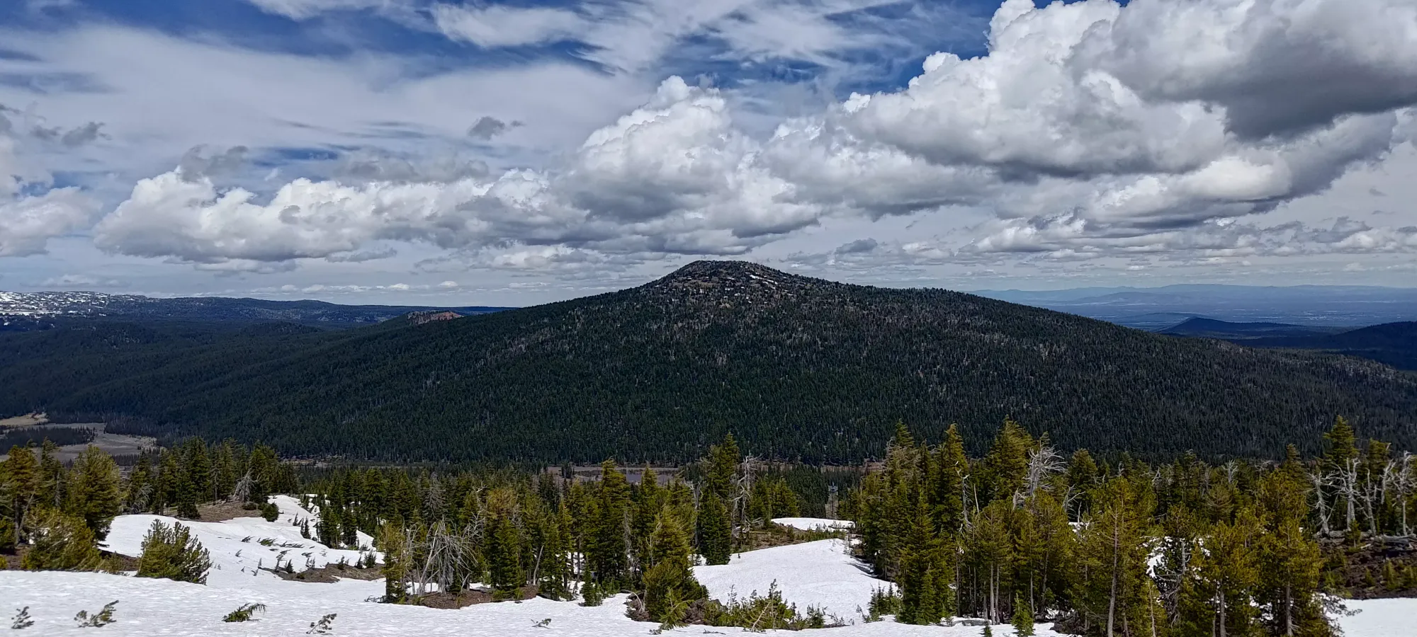
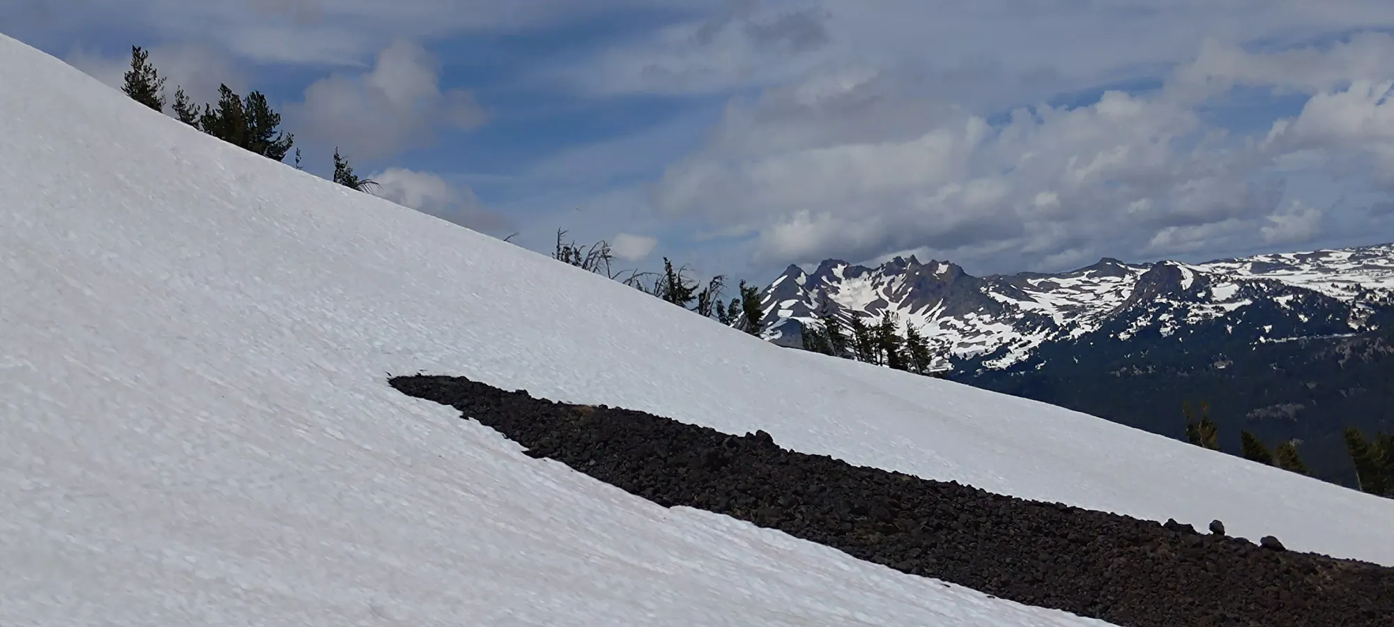
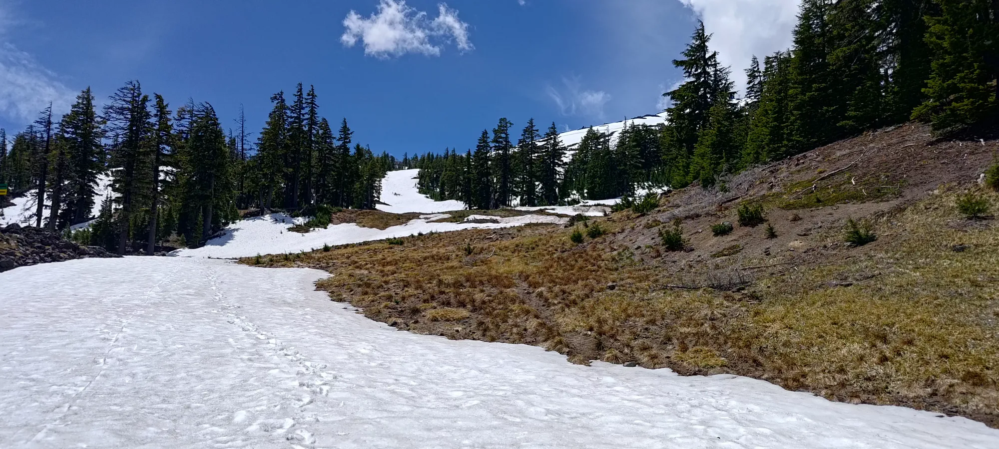
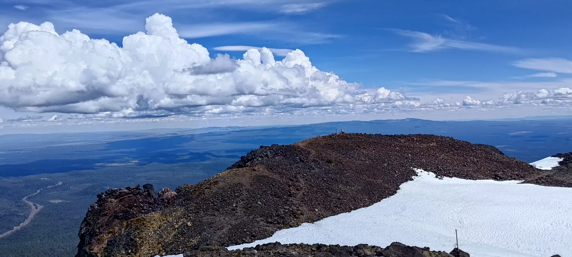
Past that point, as we climbed above the Rainbow Chair towards the top, the runs steepened slightly, and we started to cut more explicit switchbacks to make our way up efficiently. While we didn't get deep ski penetration or anything, the snow was still soft enough to get good traction on our skins without ski crampons, despite the fact that we were not making full contact with the snow. Over the next hour we made good progress, gaining from just over 2300m to nearly 2700m, which put us just below the top of the Summit Chair. Nick was starting to feel it, and took a lot of short breaks on switchbacks, but we were still making great time. I had guesstimated about 2.5 hours at a decent pace, and we were on schedule to meet that 🙂
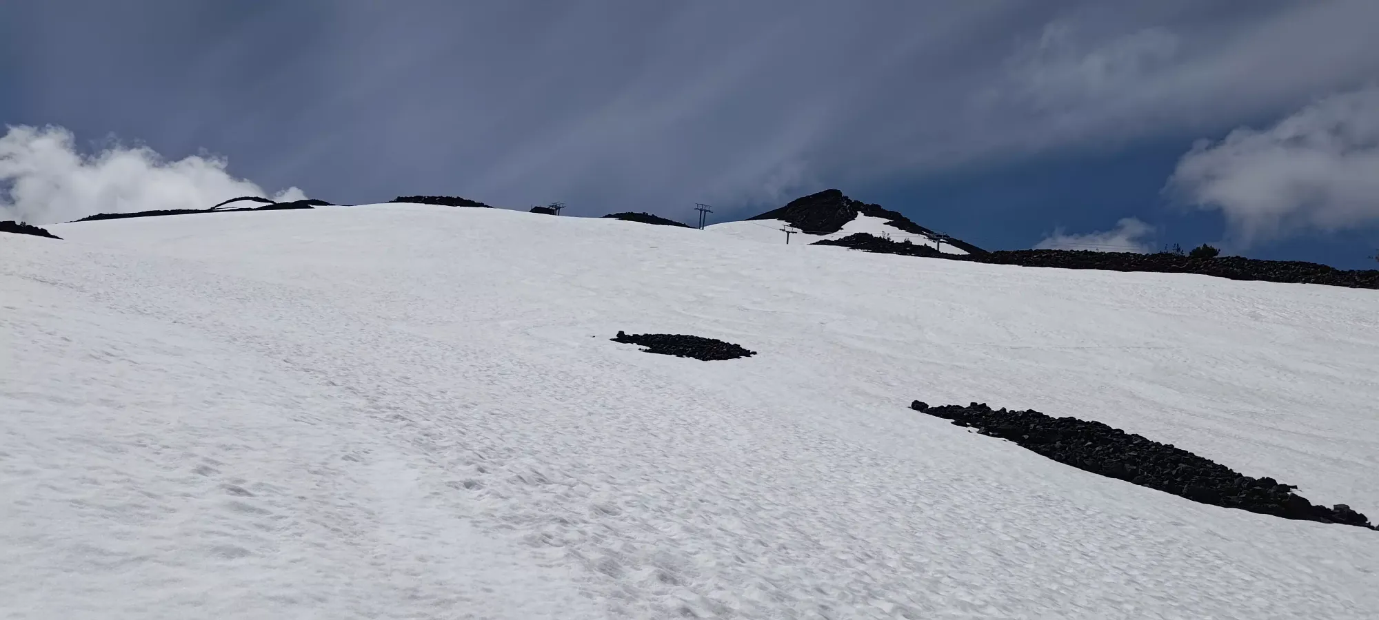
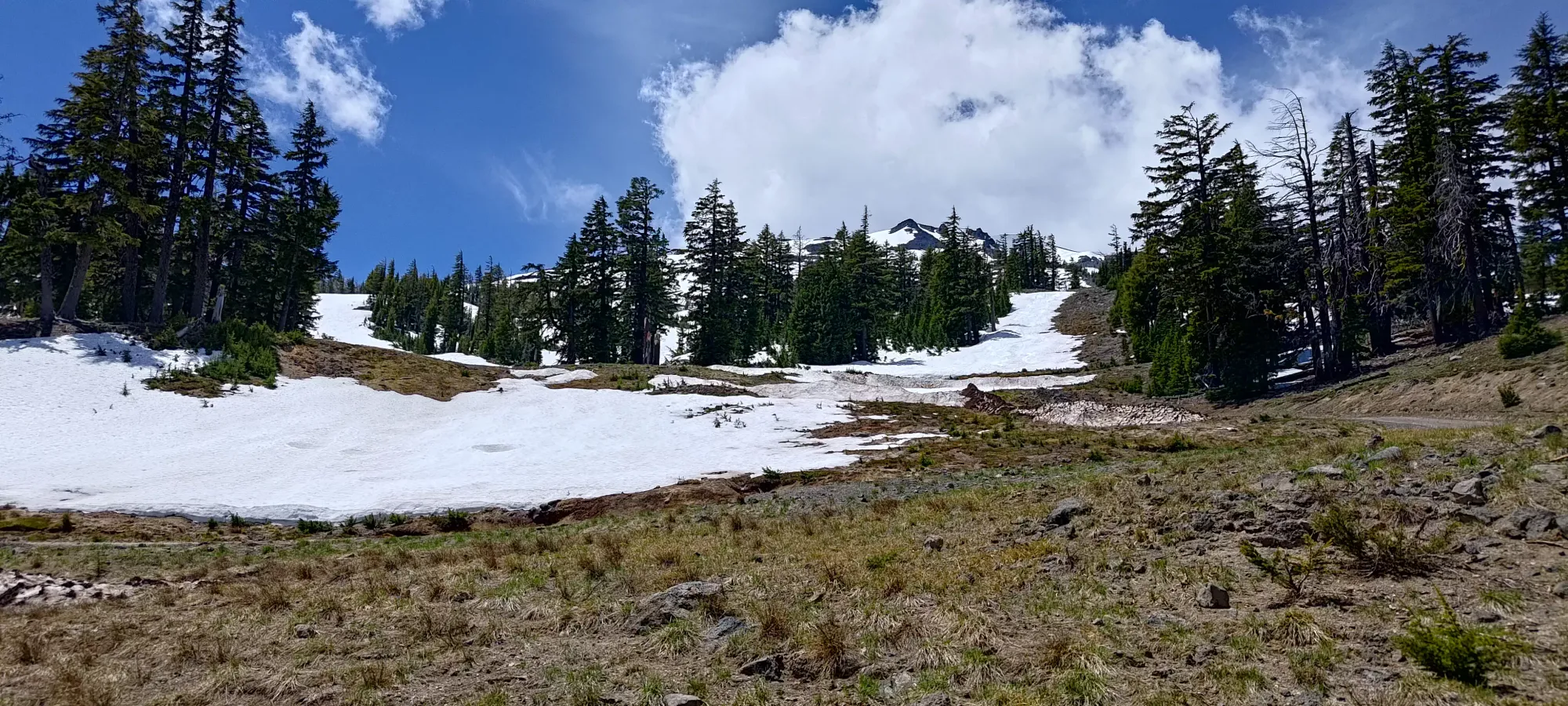
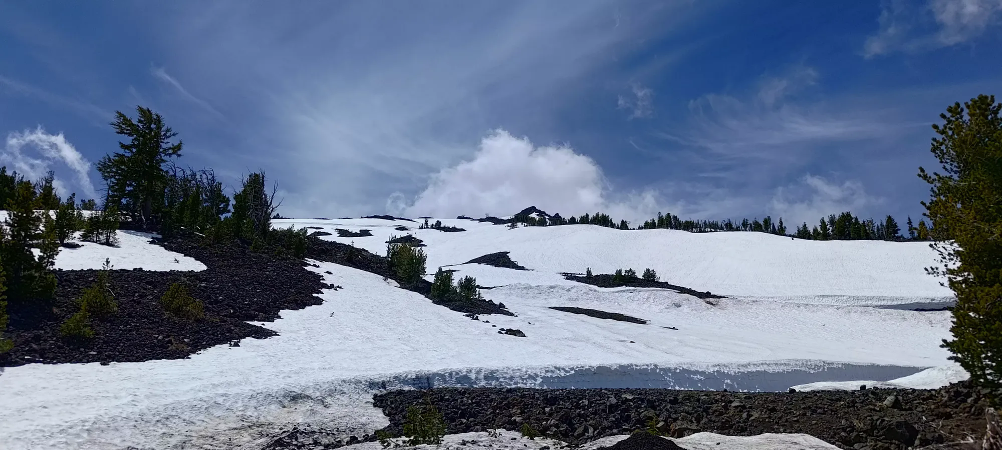
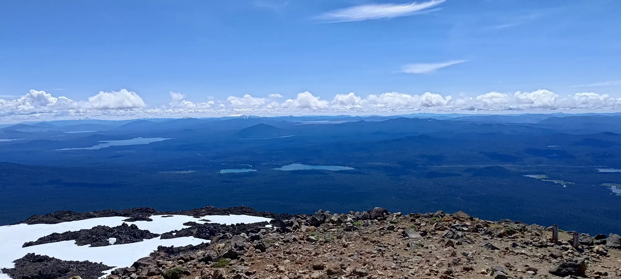
At the 2-hour mark, we could see the snow went a bit higher to climber's right of the Chair's terminus, so I led us under the lift to that area, and we gained about 100m more getting to the end of the snow in 15 minutes or so. This was the top of some fun-looking runs into the Cirque Bowl, which would've been cool to ski, but it had experienced some dirty slides already, and more importantly, didn't deposit us near the car, at least considering the not-necessarily-continuous snow throughout the lower mountain. Nick decided to chill here and have lunch while I continued my journey to the true summit, as he has absolutely 0 craps to give when it comes to bagging peaks.
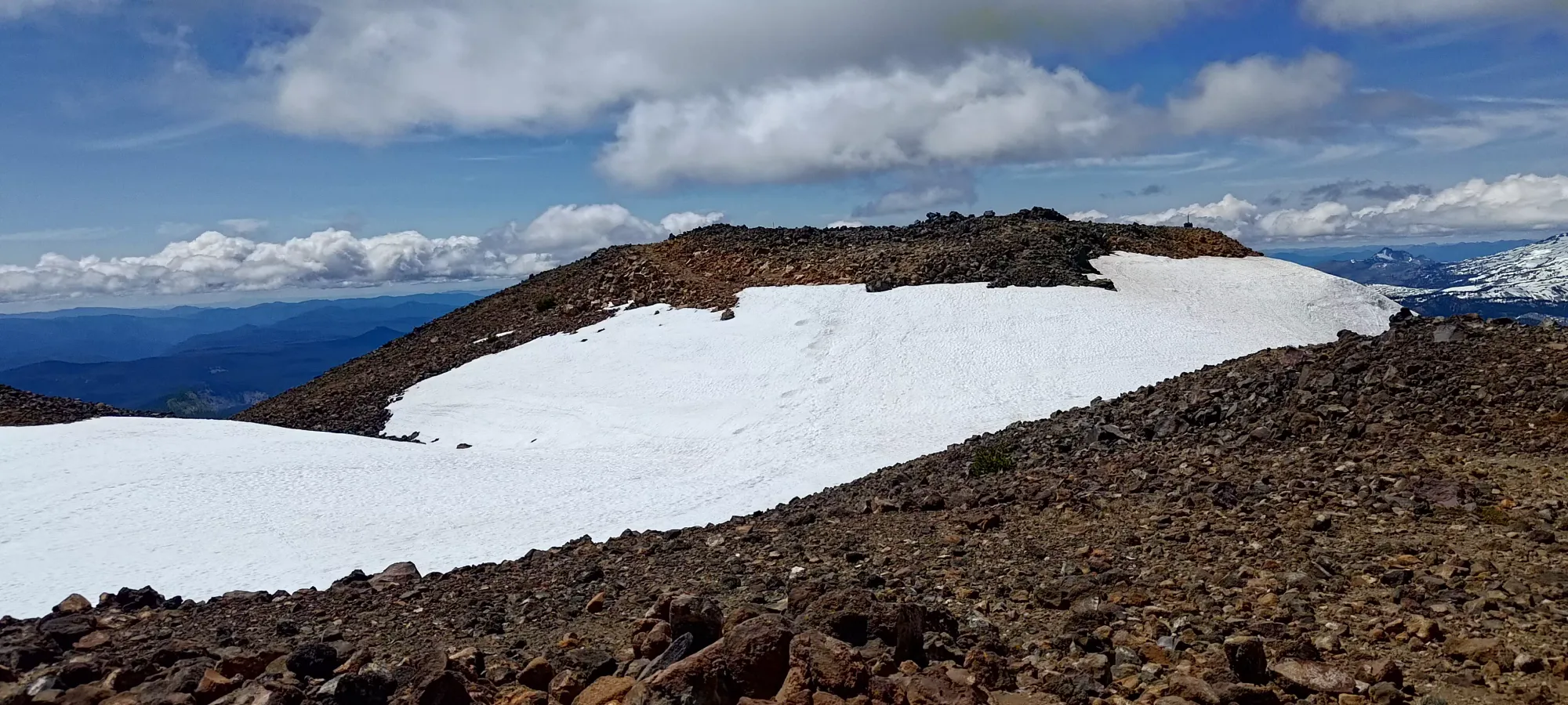
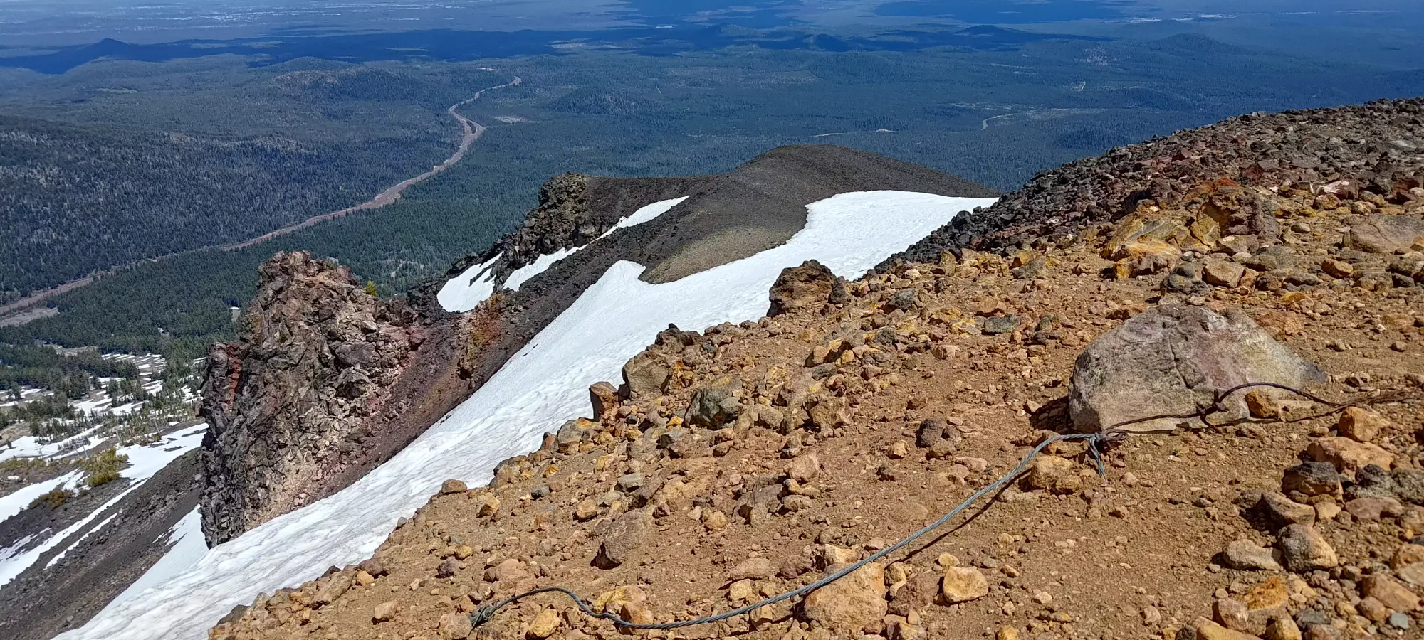
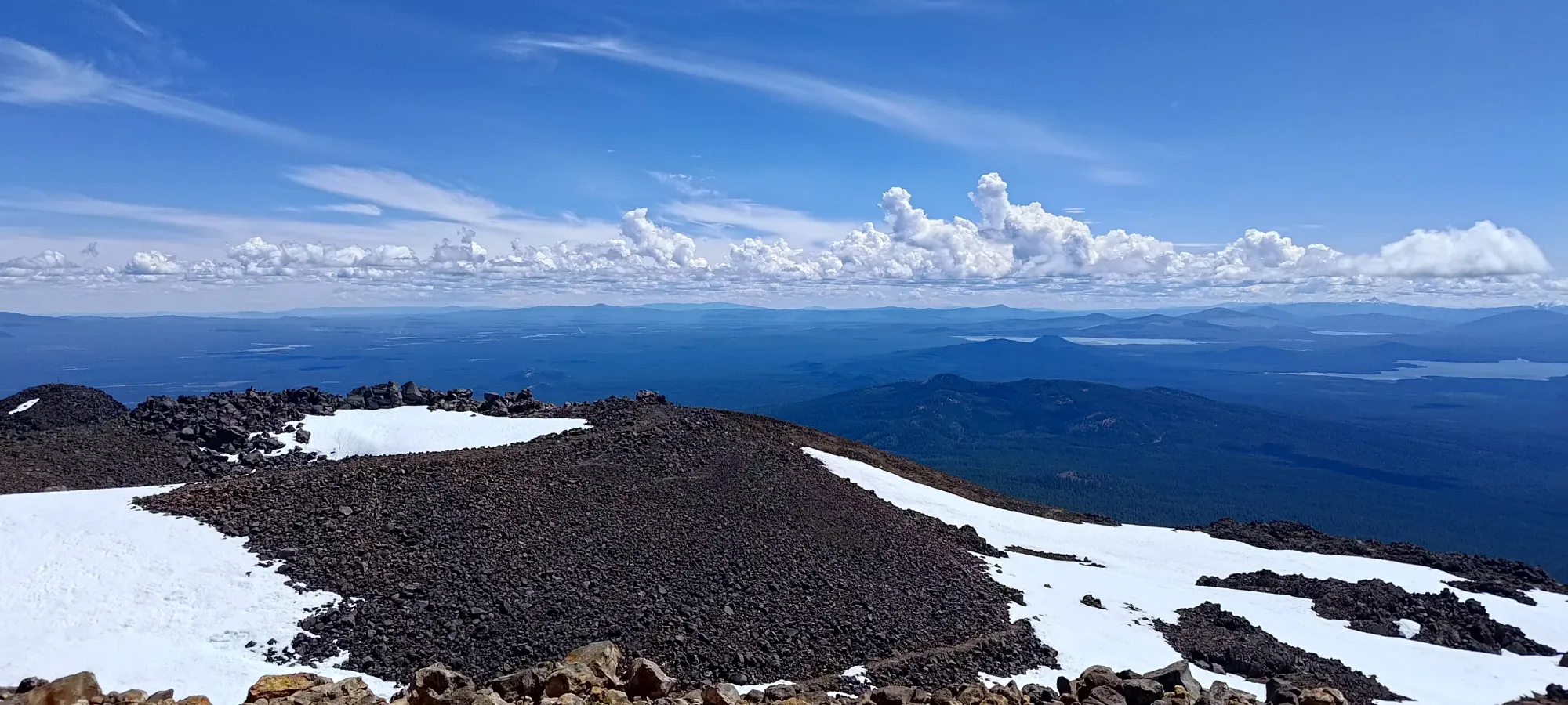
Since we had walked the first few minutes of the ascent, I did have my trusty hiking loafers, but I didn't bother breaking them out since the true summit was so close, and the terrain was firmly in hiking, not scrambling, territory. So, I dropped my pack and waltzed on over. There was a rough trail in the rocks that made the ski-boot-walking fairly easy, and within a couple minutes, I was on top! At least I think so, there were a few same-y looking high point candidates, so I ensured to walk on all of 'em, just to be safe 😄
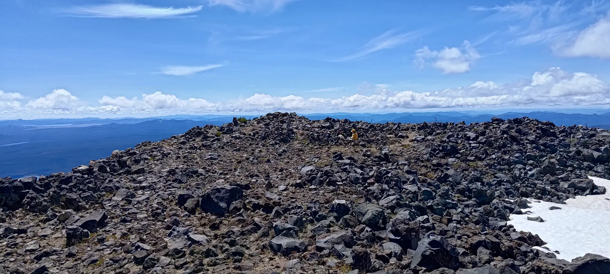
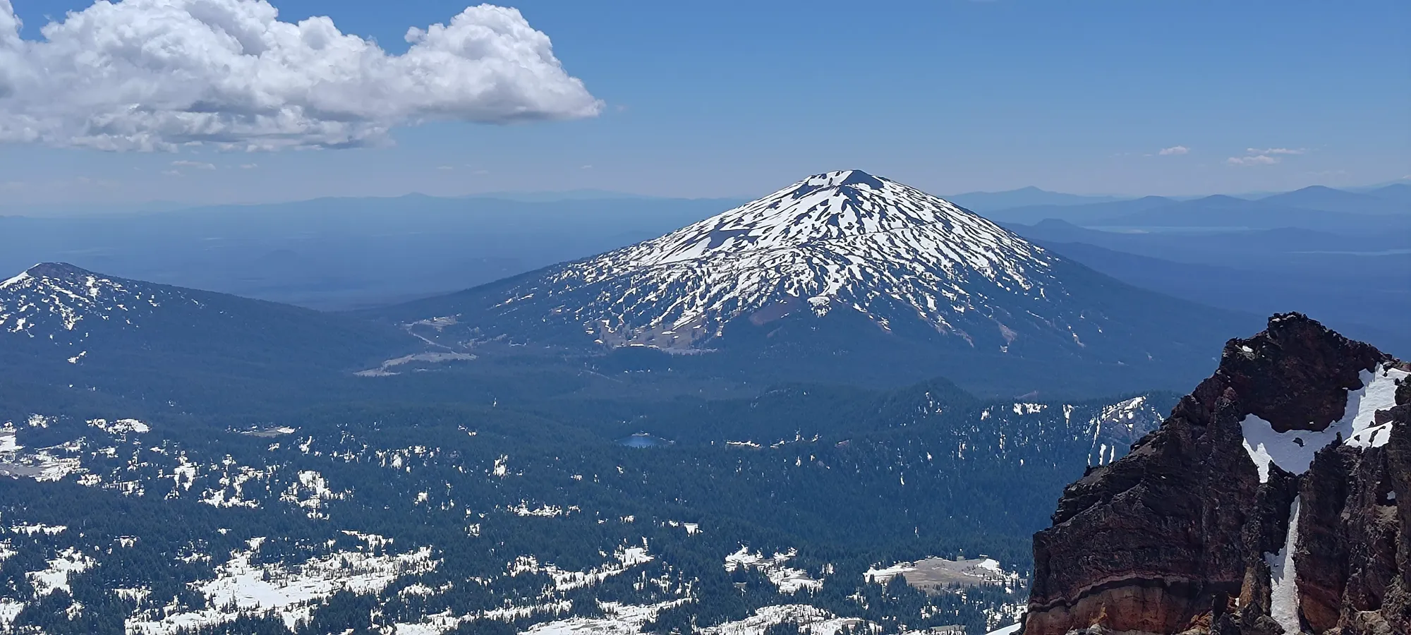
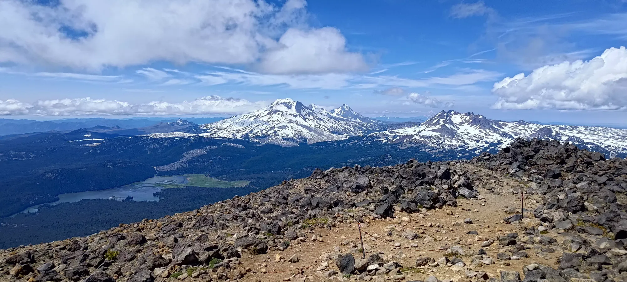
The summit views were quite excellent. I had been surprised all day at how few people were there given the skiable snow, great weather, and general busyness of hotels and parking lots in the area, but even up at the top there was only one other party, who themselves were surprised to see me. If nothing else, that let me enjoy the views uninterrupted by throngs of people, and the snow was less disturbed by others for our skiing pleasure, so no arguments here 🤷
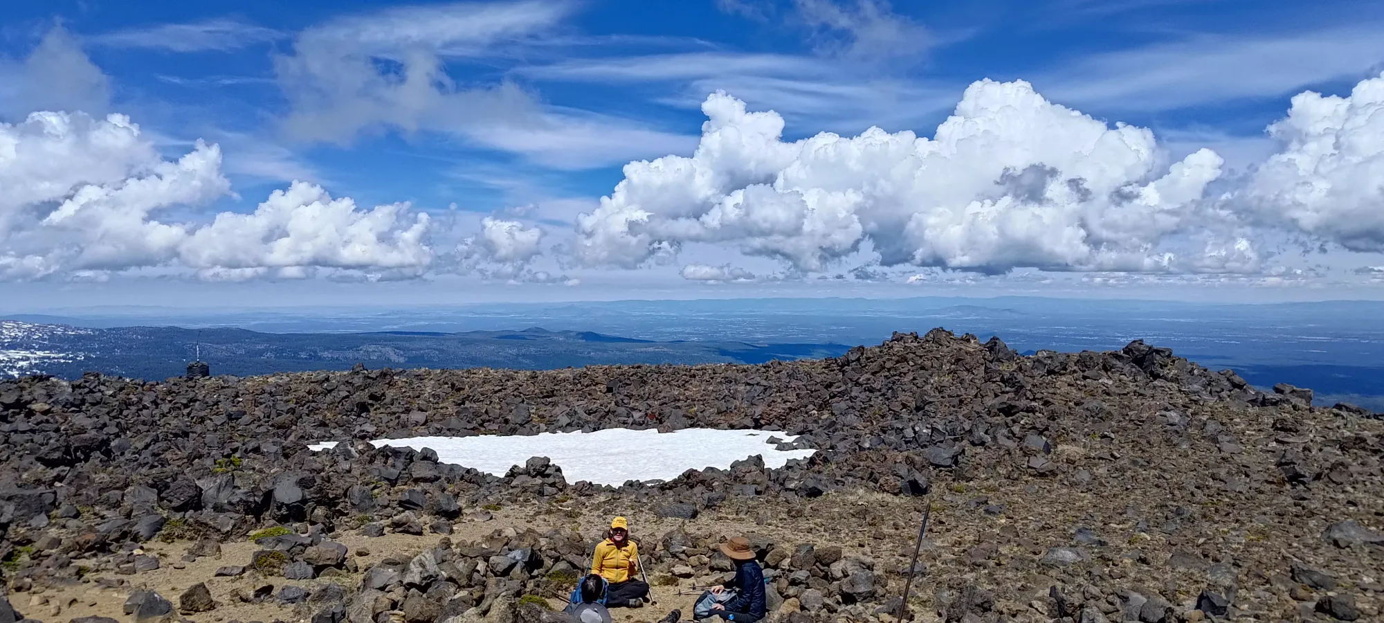
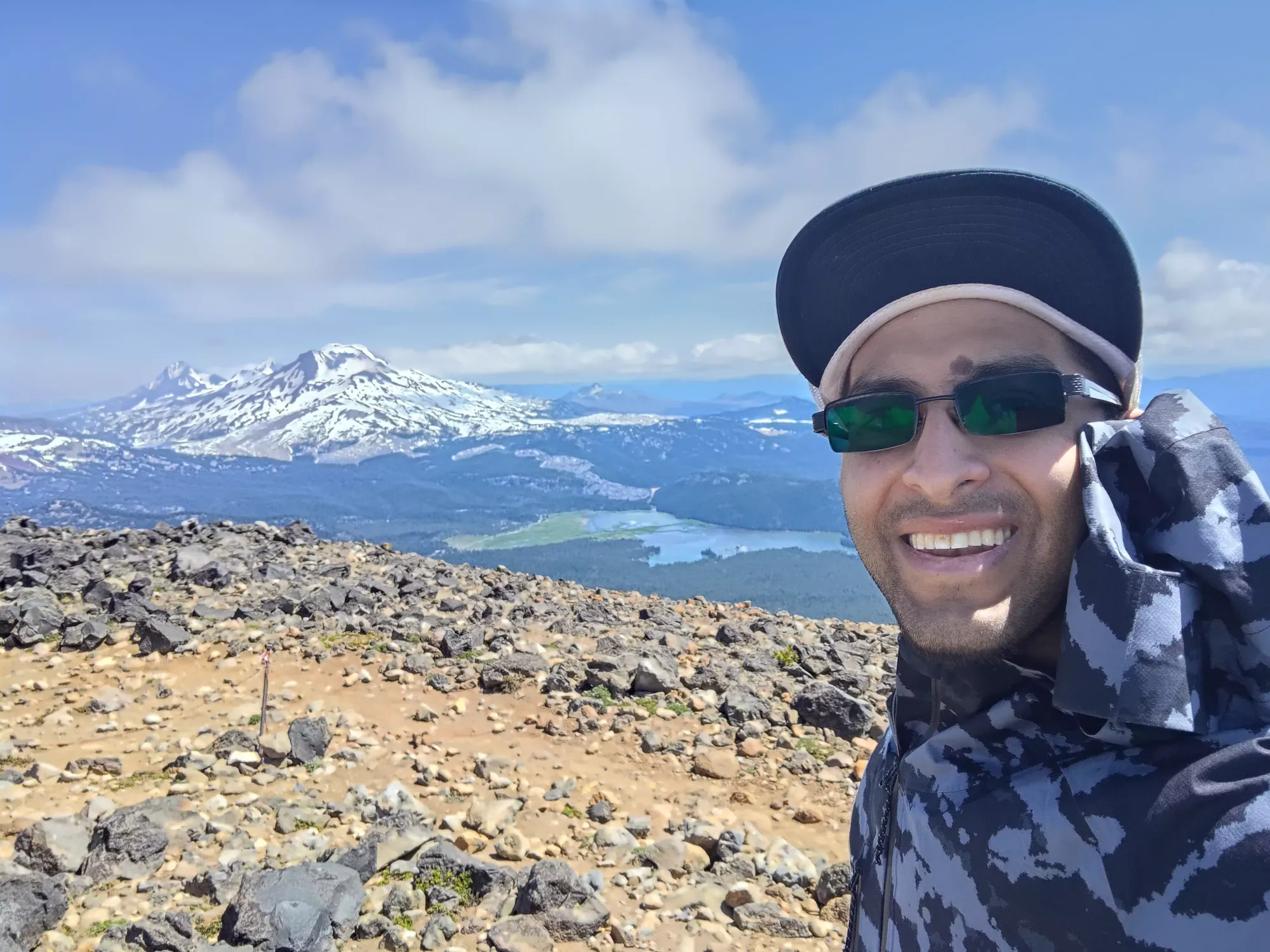
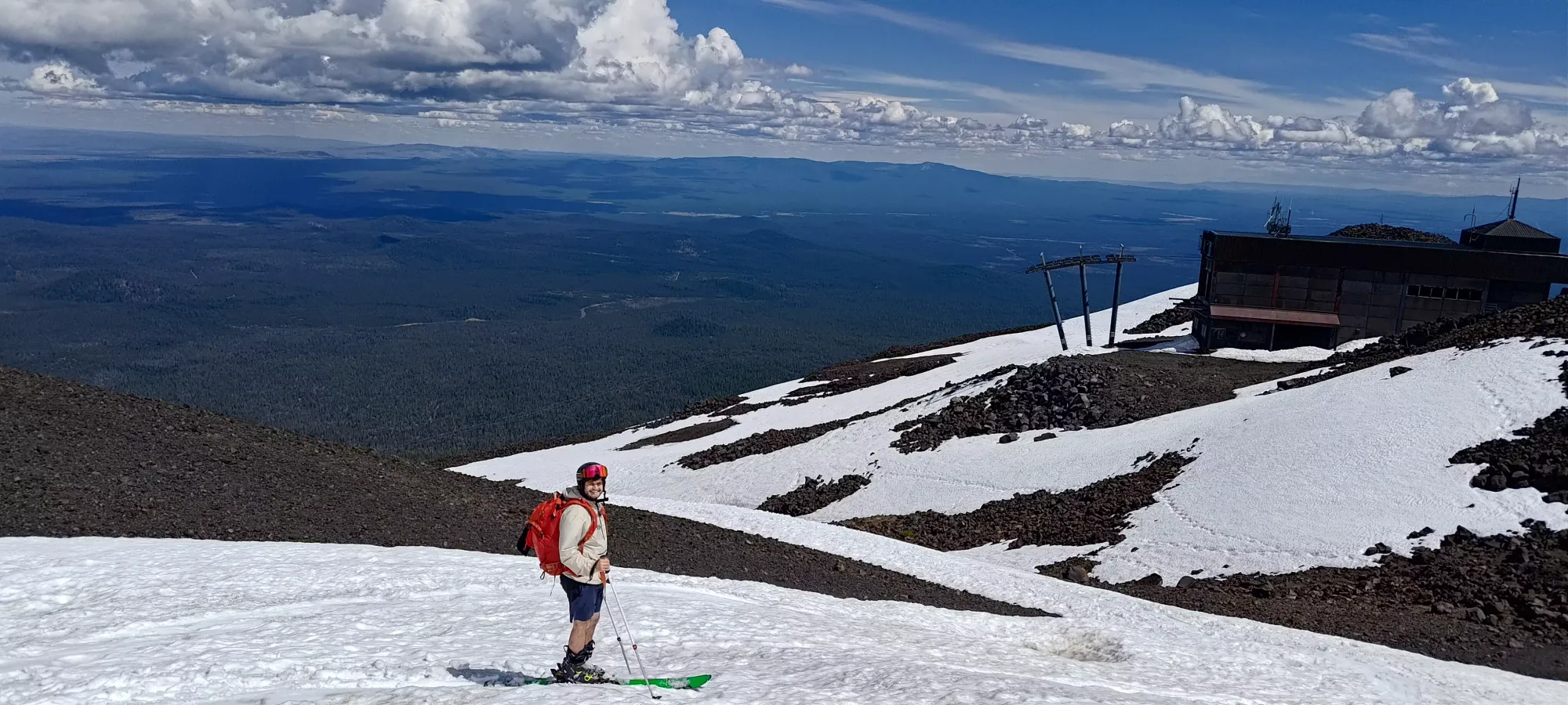
After about 20 minutes walking around the top, taking pictures, and transitioning, we got ourselves into our skis (we also put thin shells on at the top for wind reasons) and started making our way down.
The upper half to two thirds of the mountain were pretty good in terms of snow quality. It was obviously wet, but more so creamy and smooth than sticky or slushy. We had a great time cruising down until probably around the top of the Rainbow Chair. There, we removed our skis to get across the road, and below the snow started to get sun-cupped and a bit rougher. The heat did mitigate how annoying that was, at least, so it was still definitely actively fun.
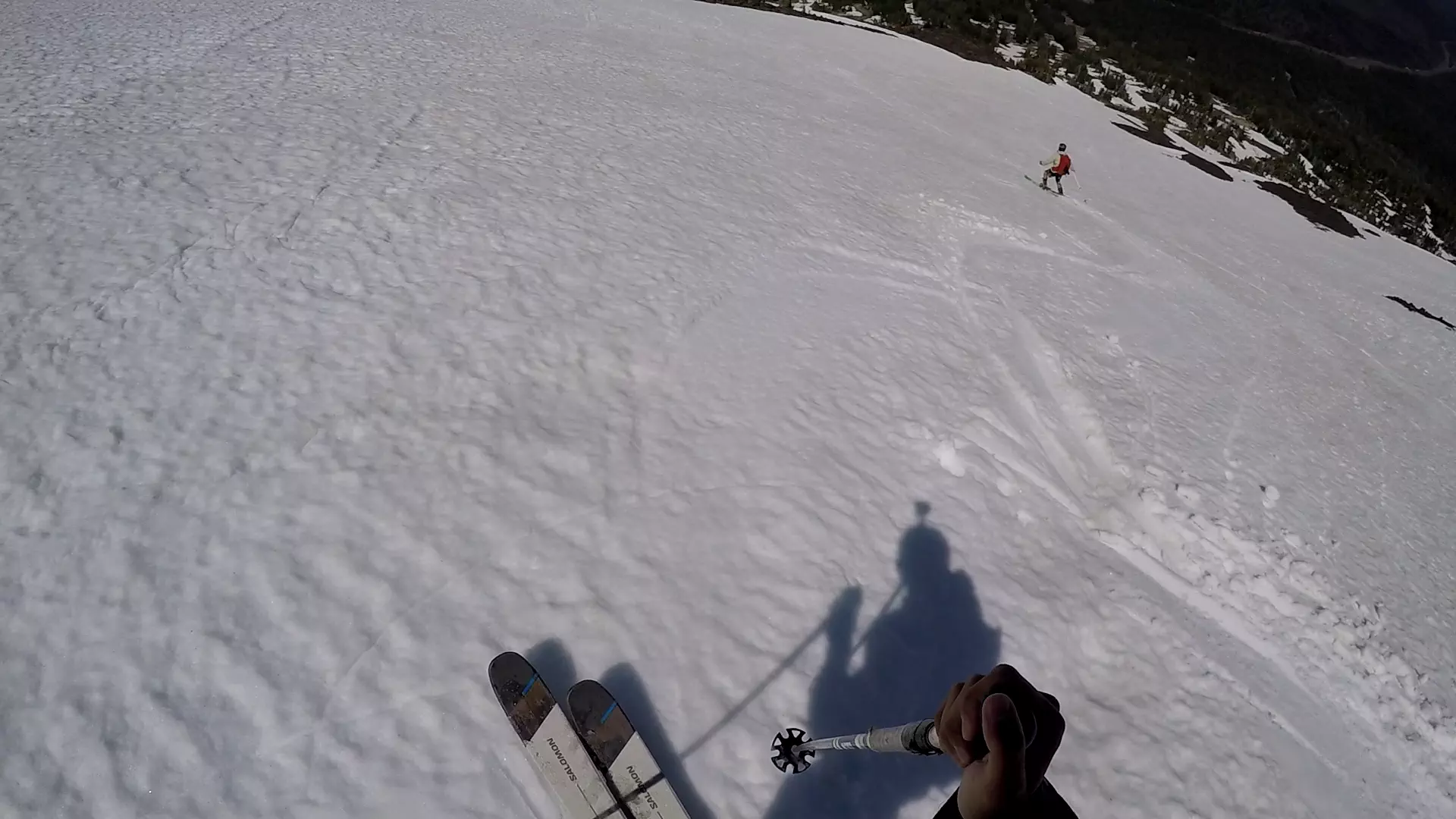
Some cruisy turns down the heart of the mountain
Once we got down to the last section of skiing (below our first dirt patch after we'd started skinning on the way up), we stashed our shells to experience t-shirt skiing properly, had our last run, then packed up for the short walk back to the car. About 20–25 minutes of casual skiing with lots of routefinding to keep on good snow and in the direction got us to this point. In the winter, or in earlier spring, I bet you could get down in like, 5–10 minutes, if that.
We took about 10 minutes packing our skis up and getting our walking shoes back on at the bottom of the continuous snow, then booted out the remaining 15 minutes back down the roads to the car. All-in-all, the trip was just 3.5 hours for a p600 and volcano! Gotta love the efficiency of skiing 🙂. With a successful peakbag and ski trip done, we headed back to town to check in to our place for the night, get some food, and plan out the rest of the trip.
As for "would I recommend this peak", of course, it is a peak 🤣 As for should it be skied and when, it definitely should be skied. If you would go to the resort anyways, maybe save yourself the hassle and just boot up to the top during the resort's operation? For me, not paying for a lift ticket is always a plus, and it did offer skiing pretty well into summer, so I'd say a late spring/early summer ascent on skis is a pretty great way to enjoy yourself, save some dough, and get a nice mountain checked off the list all at the same time.
GPX Track + Map