Mauna Loa - January 12 2024
The 2nd-highest mountain in Hawaii, just shy of Mauna Kea, and a lot more of an involved hike than it. A very satisfying summit, though

Big Island, Hawaii, USA
4169m
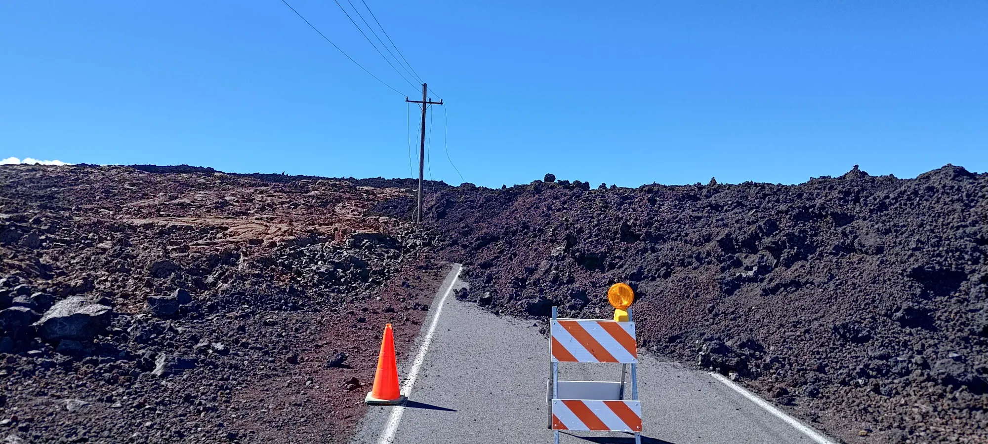
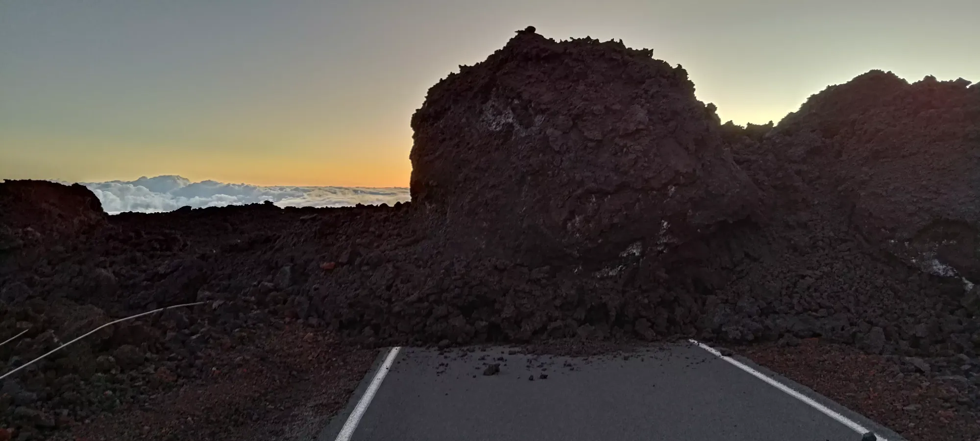
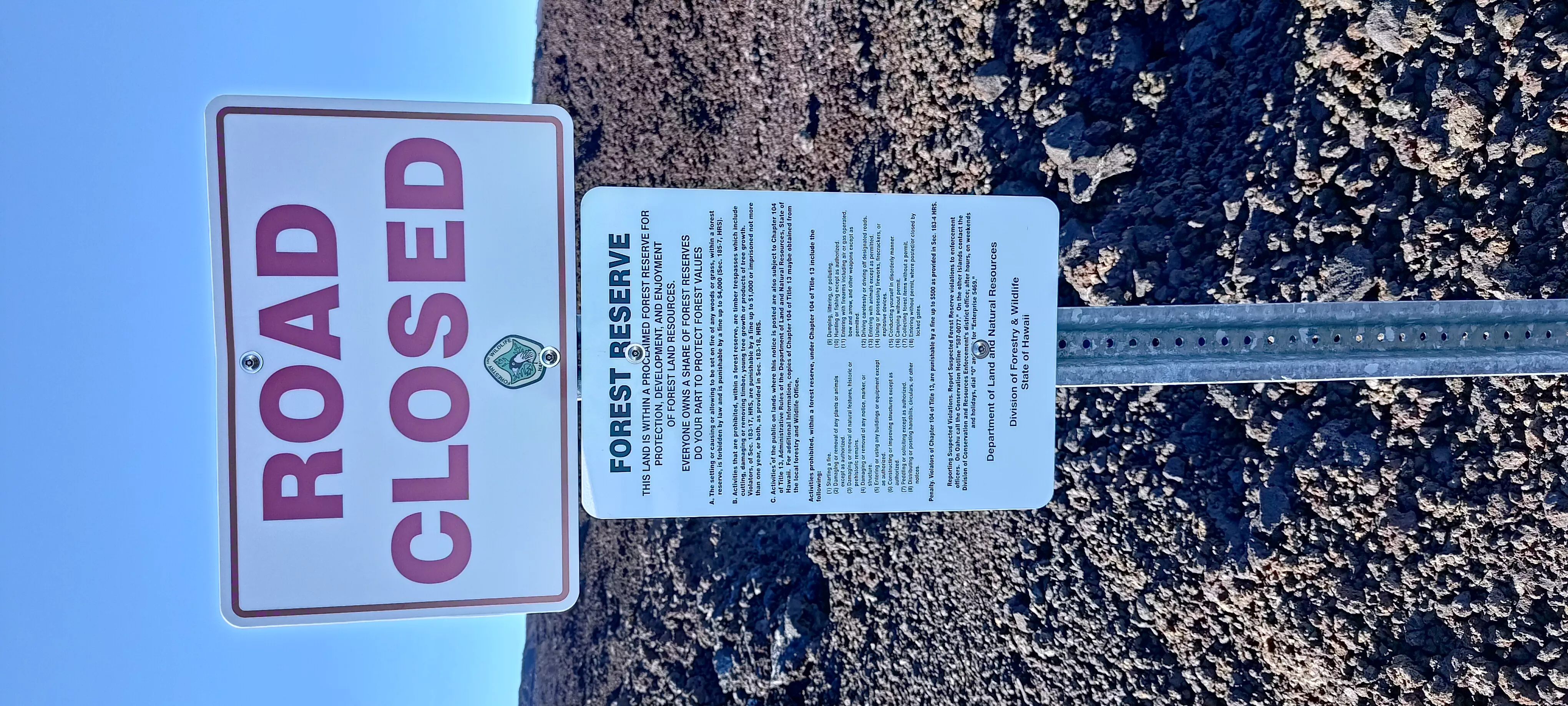
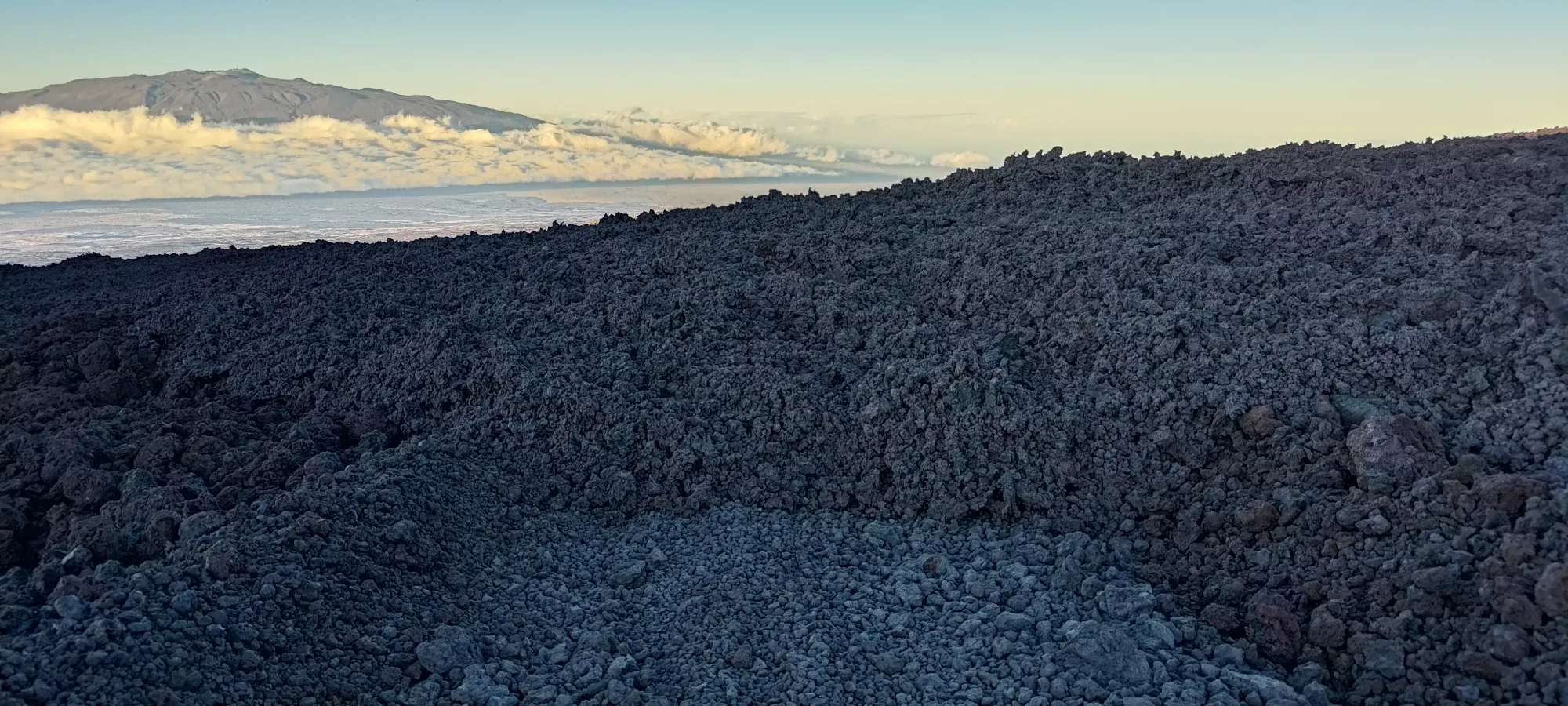
After spending the previous day on this trip going after small cinder cones near the Mauna Kea visitor's centre, we decided to check out the road up to Mauna Loa, since that was something I knew I wanted to bag, but eruptions in late 2022 had somewhat changed the way up. Namely, the road that used to go up to 3400m was kinda buried under lava flows, and I'd heard from the local rangers that it was not meant to be travelled on, but given the other approach had a time-sensitive gate, was over 50km, and nearly 3000m of elevation gain, I wanted to see exactly how bad things were, and where the road was closed. We ended up driving to the end of the paved road at 2700m elevation, where we encountered fully impassable debris covering the road.
After getting home and doing a bunch of research into how fast lava cools (that was something the rangers mentioned), checking out recent satellite photos, looking for the USGS Map of the flow path, mapping out potential routes, and working all that together in my head, I determined that the risk was low enough with respect to the lava being warm and leg-melty, the debris fields were short enough to probably result in a net-faster approach than the longer/steeper approach from Ainapo, and the trails everywhere that wasn't in the path of the 2022 flow should be in good shape, making for an overall long but easy ascent (actually 42km and change, a literal marathon). If I had more time, I could've considered doing the other approach as an overnight, but with our tight schedule, this was "my day to go off peakbagging by myself", so the long, suffering day-trip it was.
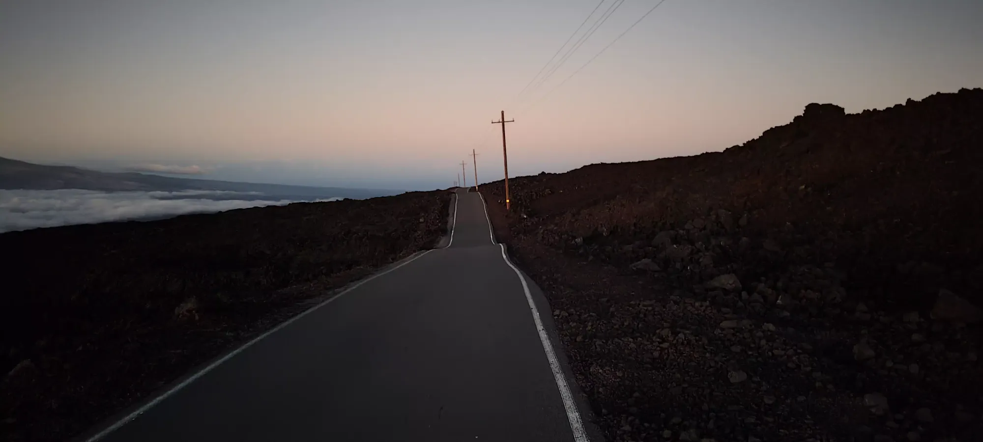
On the day-of, I woke up nice and early, drove out from our place in Hilo, and managed to get myself back up to the trailhead at around 6:30am. I could've woken up earlier, but I'd already been on low sleep for a few days and didn't want to push that further given the anticipated length of my day, especially with altitude being a factor on this hike. I also was kinda hoping to have daylight to help navigate the lava flows, since they're just a bunch of talus that all looks the same, which isn't the easiest to find your way through in the dark. I am not sure if I'm the ONLY person who's walked through these, but on peakbagger.com there haven't been any ascents since the eruption, so I am definitely in a small crowd, meaning there's no trail broken through the rocks whatsoever. So, I waited for the sun to rise just enough to be able to see nicely without my headlamp, and set out at 6:37am. Oh yeah, to add to the suffering, it was also incredibly windy on this day as well, enough that the National Park Service had "closed" the summit for the day. I'm not sure exactly what that entails, but I figured going up on the impassable road route would probably allow me to avoid any rangers encountering me and getting upset, so I just hoped the gusts would stay low enough that I could safely ascend, even if in unpleasant conditions. I had my shell on from the trailhead as a result, though.

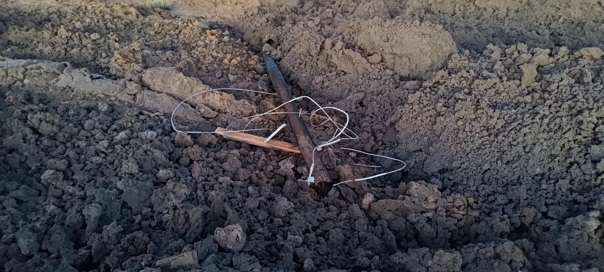
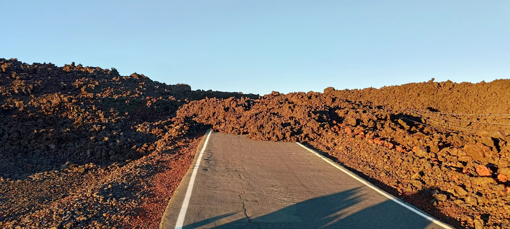
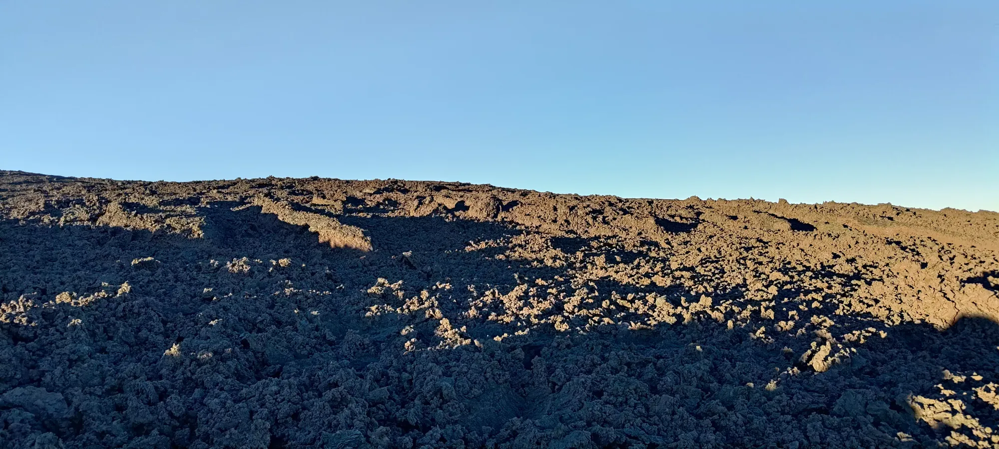
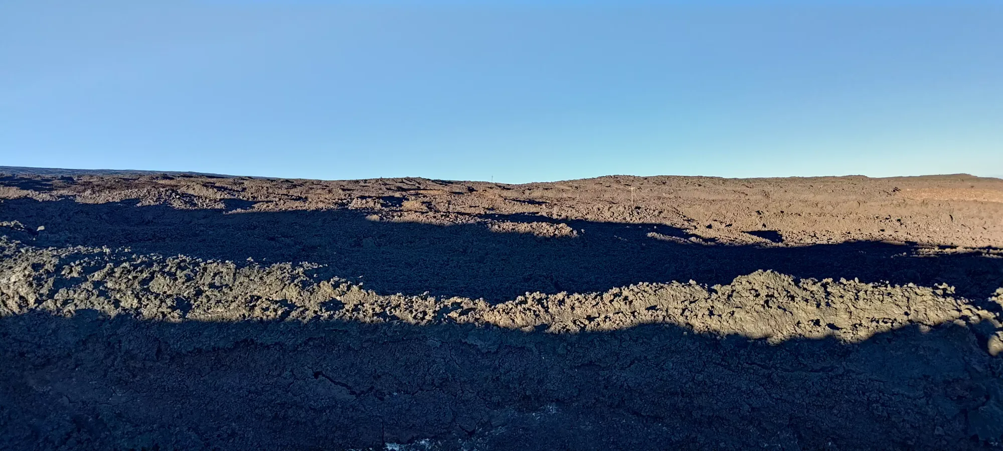
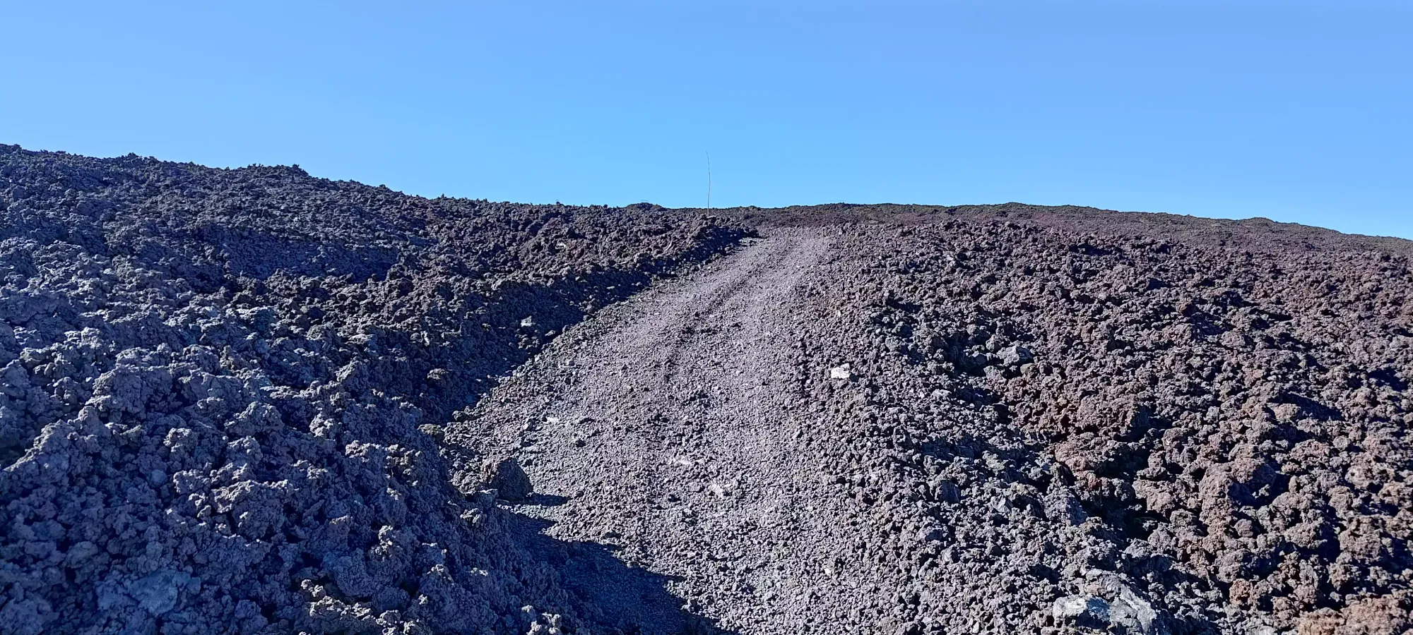
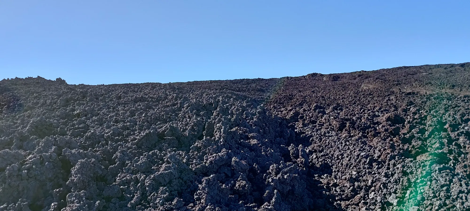
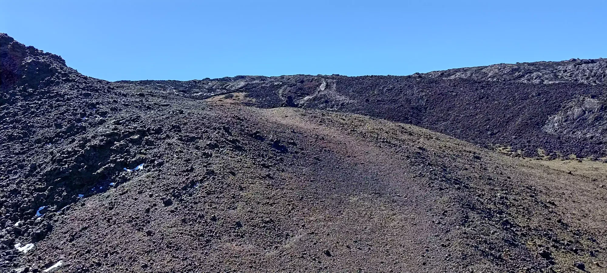
The hike started right where the road ended, so that meant I was in for suffering right from the get-go. I was kinda hoping the rock would be more varied, and ideally more of the pahoehoe type, which is smooth, round, and slabby once I got past the first part I saw the previous day. Sadly, those hopes were in vain, and it was all the much worse a'a lava. This rock is sharp, crumbly, and loose, meaning about 80% of your steps would cause a rock (or rocks) below you to crumble, shift, or both. That made travel very slow and treacherous, and I spent 11 minutes walking the few hundred metres comprising the first debris field. Sometimes, you could see the fallen hydro poles and power lines to keep you roughly on the road, but when you couldn't, GPS and a good sense of direction are essential to avoid getting lost in the endless rocks.

The next 20 minutes were spent back on the paved road, which I cruised along until the 2.1km mark of my trip, or to about 2810m elevation, where the next, larger section of debris was located. This was the one I was dreading the most, as it looked to be about 1.5-2km based on my examination of the maps, which is a lot to just spend wandering about in terrible rocks with 0 information about any sort of "best route" through. But, I had all day and still somewhat high spirits in my soul, so I dove back into the rocks at about 7:08am, with the sunlight now fully on me (not that it was warming me up with the winds as brutal as they were).
The first bit of this section was pretty much "business as usual", just wander about the rocks and try not to destroy my ankles in the process. About 15 minutes in, though, I found a little gully going across the "road" (or the rocks on top of it, at least) which I'd have to find a way either across or around to try and maintain my goal of "roughly stay on top of where the road would be". I decided to scramble down the steep walls into it, which was a bit annoying with the sharp rocks, but doable. Once I got in, though, I realised getting out would be pretty sketchy, so I instead walked uphill (perpendicular to the road) inside the gully until I found a walkable weakness in the walls, and set a waypoint so I'd know where to get in/out on the way back.


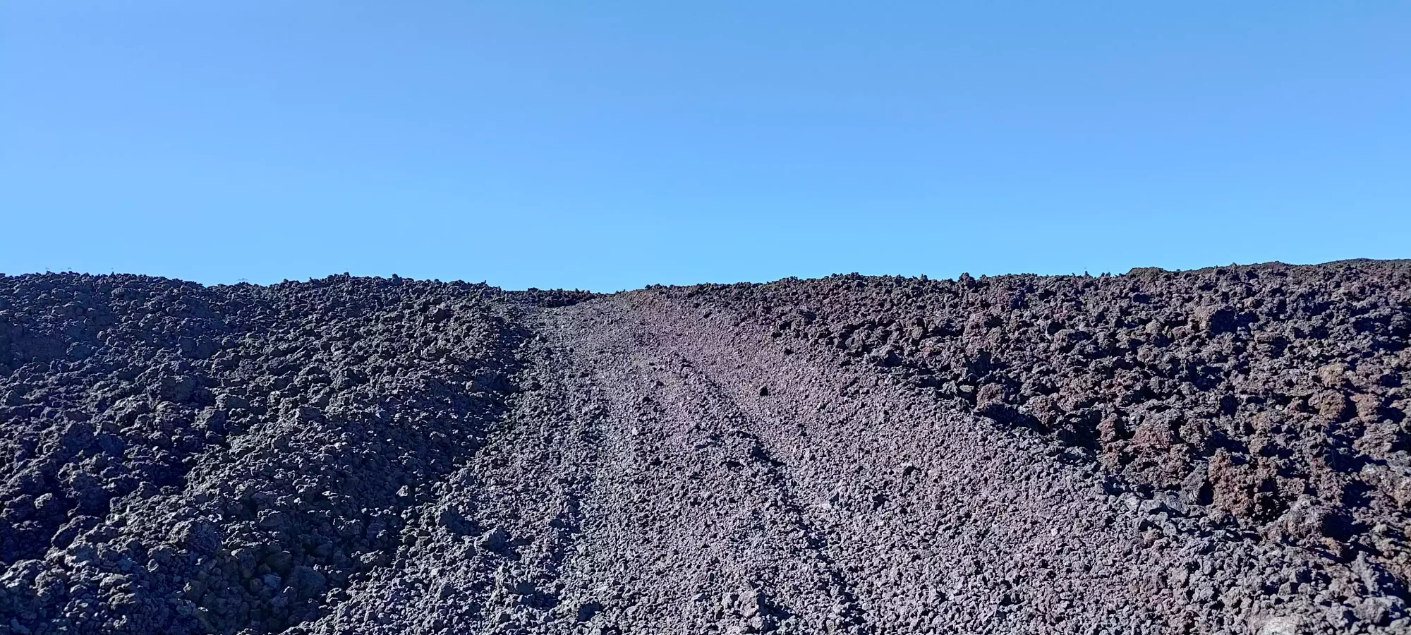
After dealing with that obstacle, I returned to the "usual" wandering through the talus until the 3.2km mark, where I entered a brief section of road which teased me with what "normal walking" feels like, but sadly was short-lived, and it wasn't until the 4.2km mark where I actually returned to the road proper, a whole 100 minutes into the day, and not even 200m higher than where I started. I cannot emphasize enough how terrible this terrain is, you really have to want this mountain, now, and in a day to bother trying with this route.
The next leg of the journey was a quite-uneventful 45 minute walk along the road, covering 3km and gaining a bit over 200m of elevation in the process. I missed having a bike or something even more here, although after the length of the previous debris field, I switched my opinion to "maybe an e-scooter" or something else a bit more packable. If you have time to prepare for this, ANY kind of wheeled transport you can get through the talus would be a huge asset. Since this was going to be such a long day, where I woke up at sea level and was going to climb above 4000m, I didn't push very fast, but with wheels you could save a lot of time without pushing yourself so hard that you induce altitude sickness (especially on the descent).

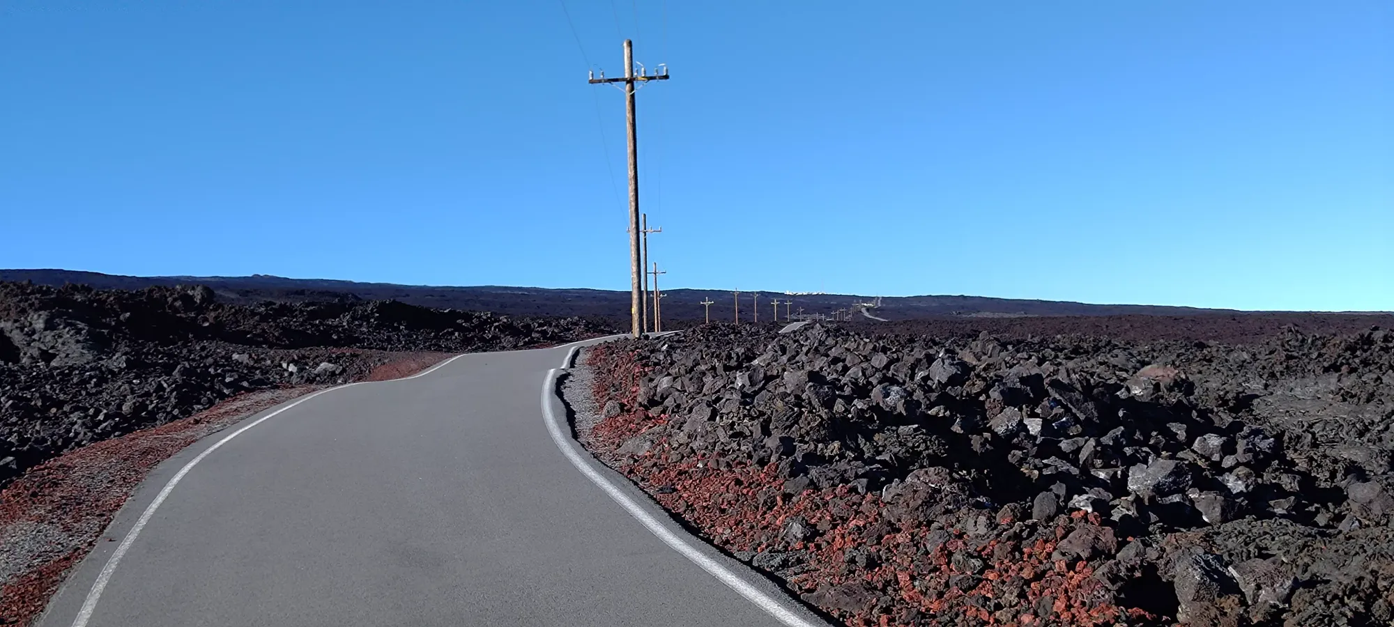
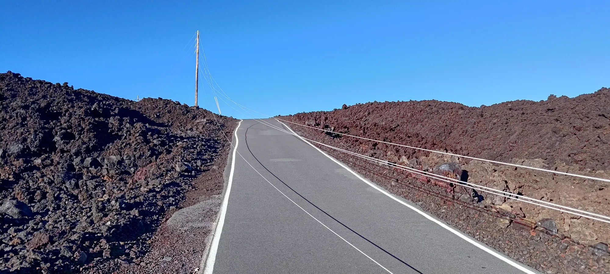
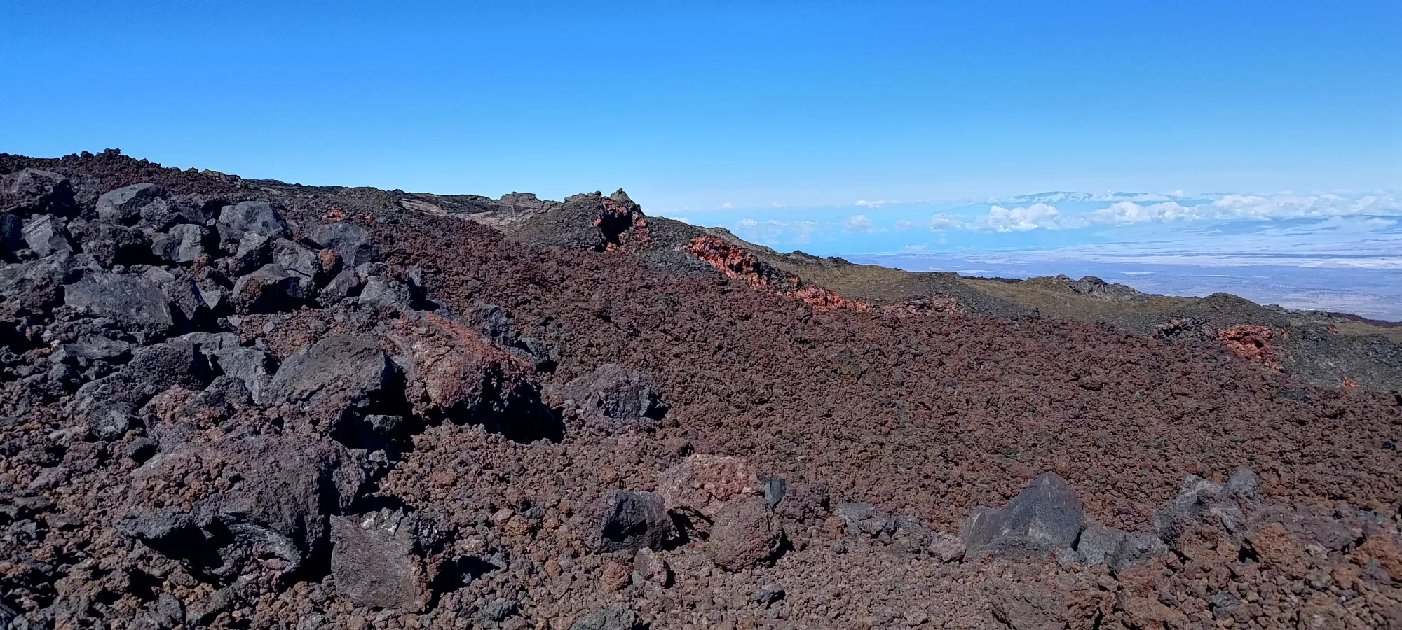
The view from the road a few minutes before I forked off. You can see the observatory at the end in the shot on the right
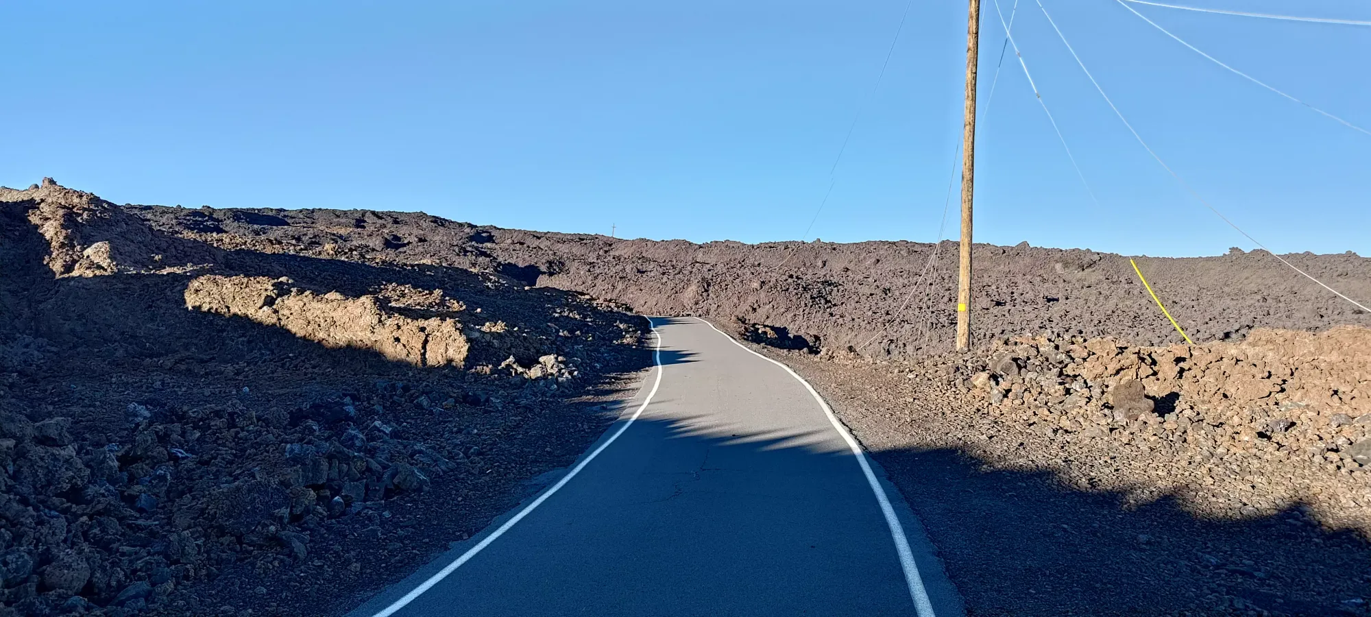
At this point, I was at the fork for the "North Pit Trail", which is a rocky 4x4 road that cuts up a bit more directly than taking the road to the observatory, and more notably, doesn't pass by the one place I suspected there may be people and/or cameras to get annoyed at my presence on the "closed" mountain/trail, so I decided to take this route to avoid any potential red tape issues. The road was in good enough shape to be driveable in a 4x4, so walking was fairly easy, with the rocks being stable enough to provide decent traction. There was one more debris flow area along this trail that would be a bit of a compromise with respect to efficiency, but I decided it was worth it to avoid the risk of upsetting the authorities, so "take that for what you will".


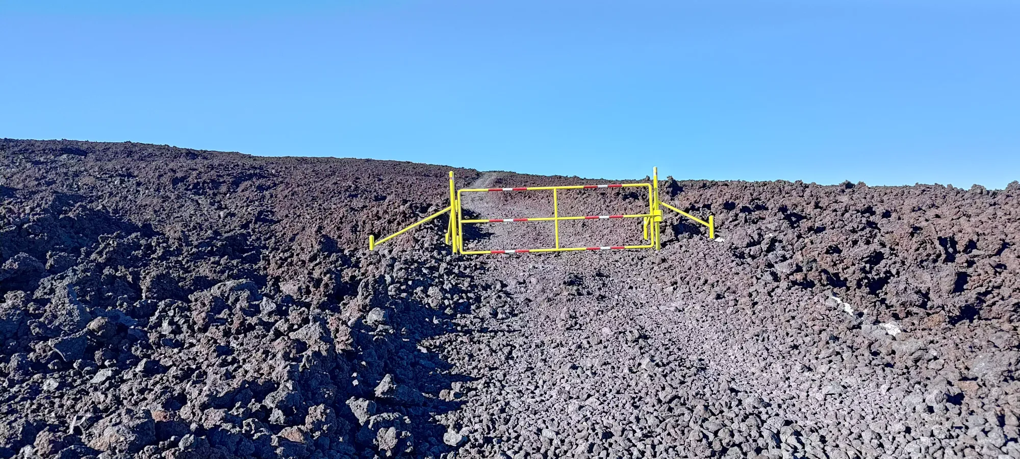
The next 40 minutes on the road took me up past the gate above, and to 3350m (just shy of 11000ft for the Americans out there), covering about 2.2km in the process. I was doing my best to keep a calm, measured pace at this point, since 11000ft is about where I've started to feel elevation impacts before, depending on the day, and given I'd slept at sea level and not been very active before, I wanted to play it safe. At the end of this stretch was the last talus field to cross.

I ambled about for 15 minutes until I got across to a clean section of road, only to be thrown back into the fire 2 minutes later 🙃. I actually got out of the debris just after 10am, and got to continue the slow plod up easy terrain to the top free of worry, a casual 3.5 hours into the hike.
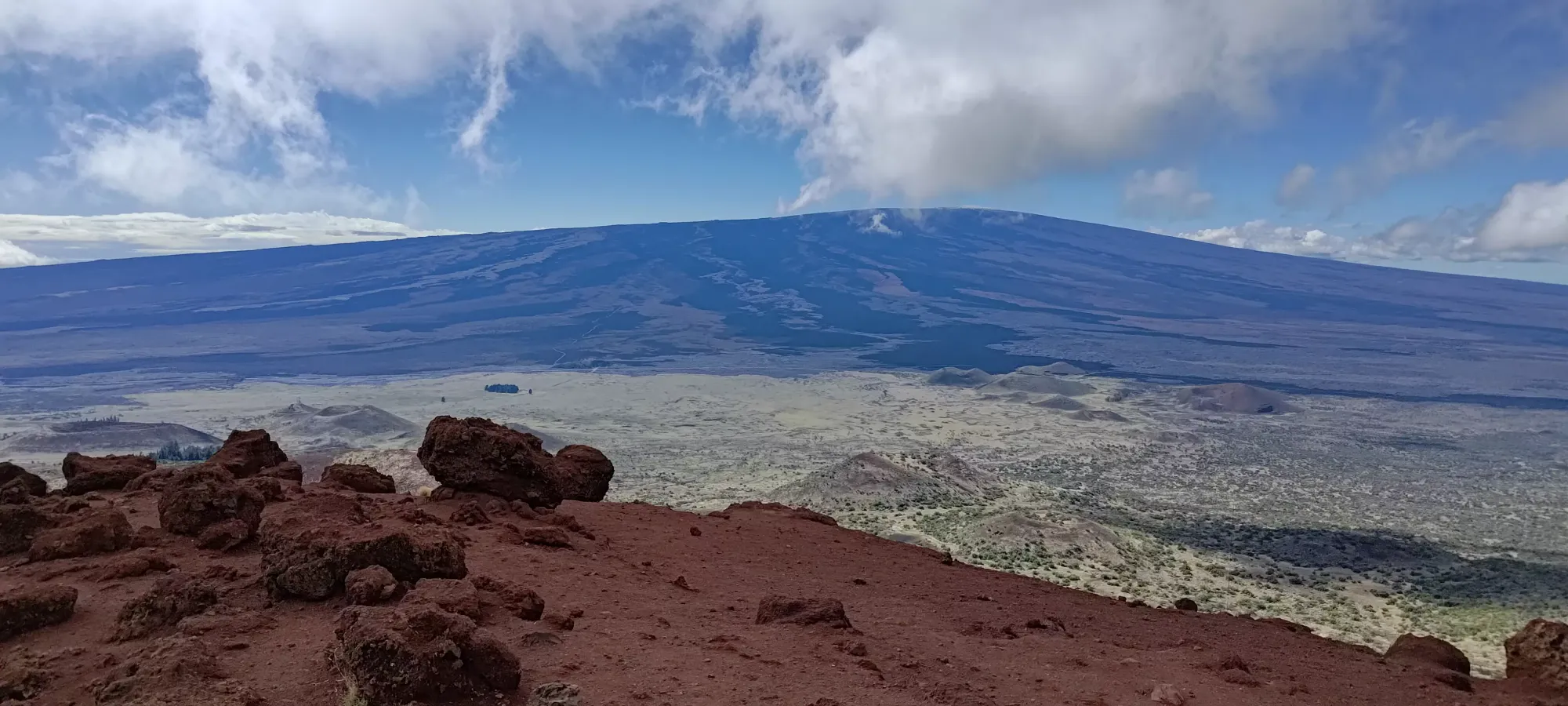
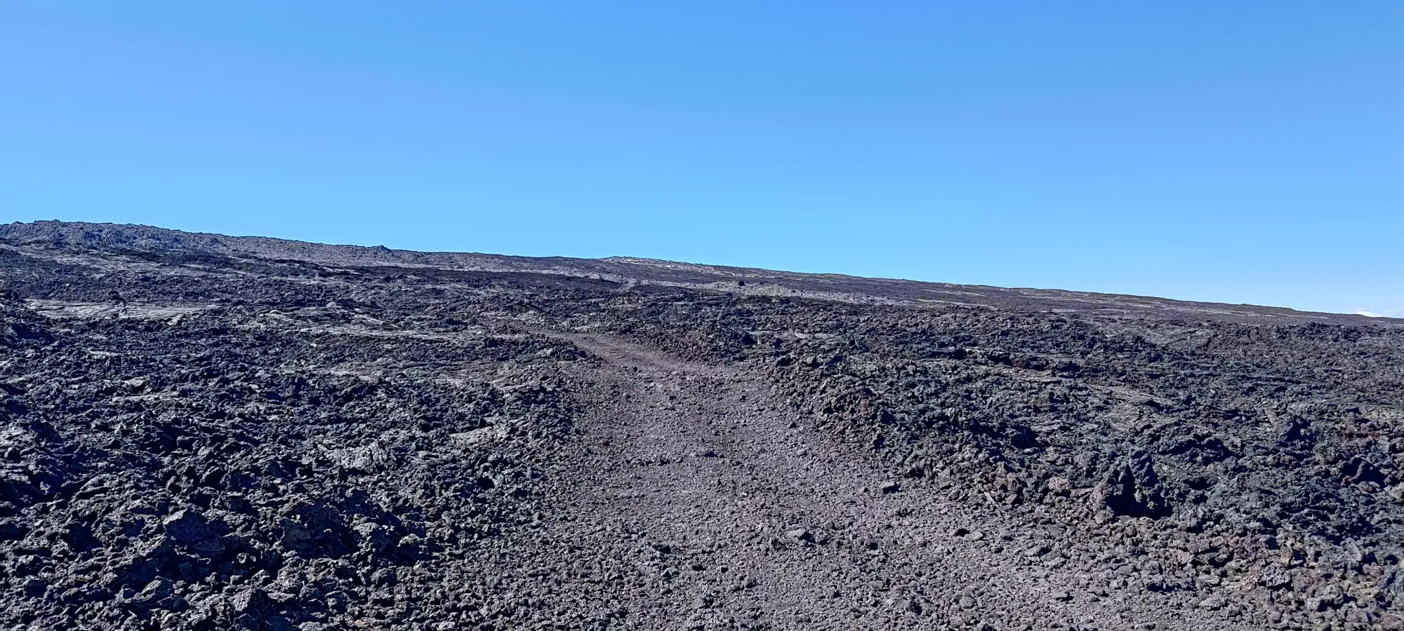
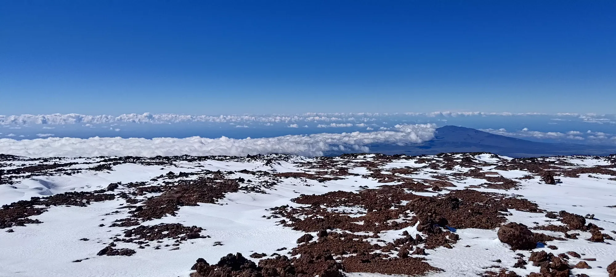
Past this point, there wasn't much to note for a while. There were a few forks in the road which went to "not the summit", but those were naturally of little interest to me, so I just kept going up the North Pit Trail all the way up to 3800m, where the trail forked into a shallower, more circuitous route, and a more direct one. I'd been pretty cautious about gaining too fast thus far, and was feeling good, so I decided to take the more direct route up to 3900m where the two forks rejoined, since the whole mountain was just so shallow to begin with anyways. This section was a very uneventful 2 hours and fifteen minutes of "just walking up the road". I took a few pictures, had a decent amount of water, and a granola bar or two, but otherwise it's just a long mental game of "keep on walking".


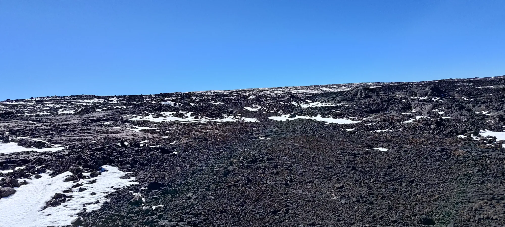
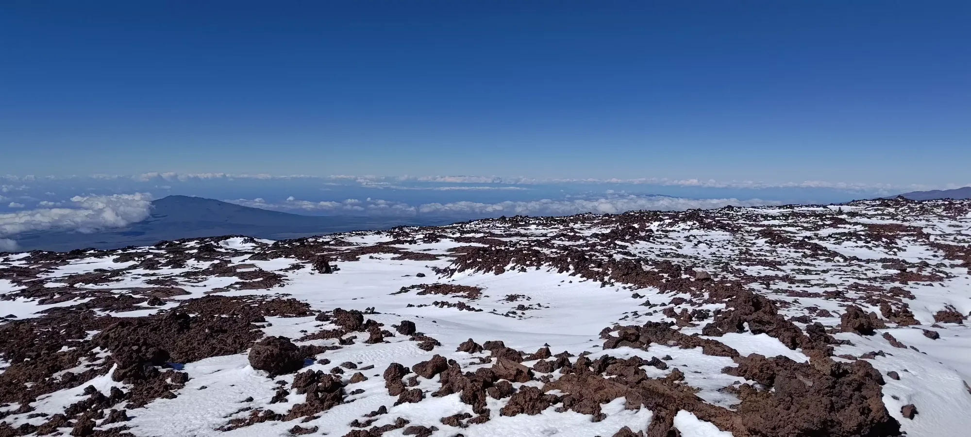
Above 3700m, you can finally start seeing the snowy bits near the top
Once I finally got myself up to 3900m, I hit a fork between the North Pit trail and the "Summit Trail". The latter seemed to exist more for the sake of accessing the cabin on the east side of the crater and being able to walk closer to the rim, but the former was (according to maps) an easy-to-walk road and went more directly towards the summit, so I decided to just take it and walk over to the main trail once it ended if necessary, since the terrain seemed easy enough to DIY at this point. I was definitely noticing the air thinning a bit here, so I didn't really want to waste more time/energy than I had to. It was also getting even windier, to the point that gusts would move my body if I wasn't prepared for them, so reducing the time I spent in that lovely stuff was a priority. It was actually cold enough that I put my midlayer on here, and kept it on for the rest of the day.


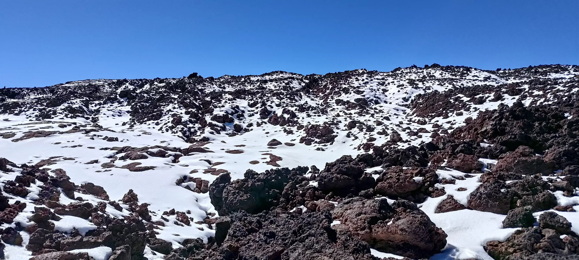
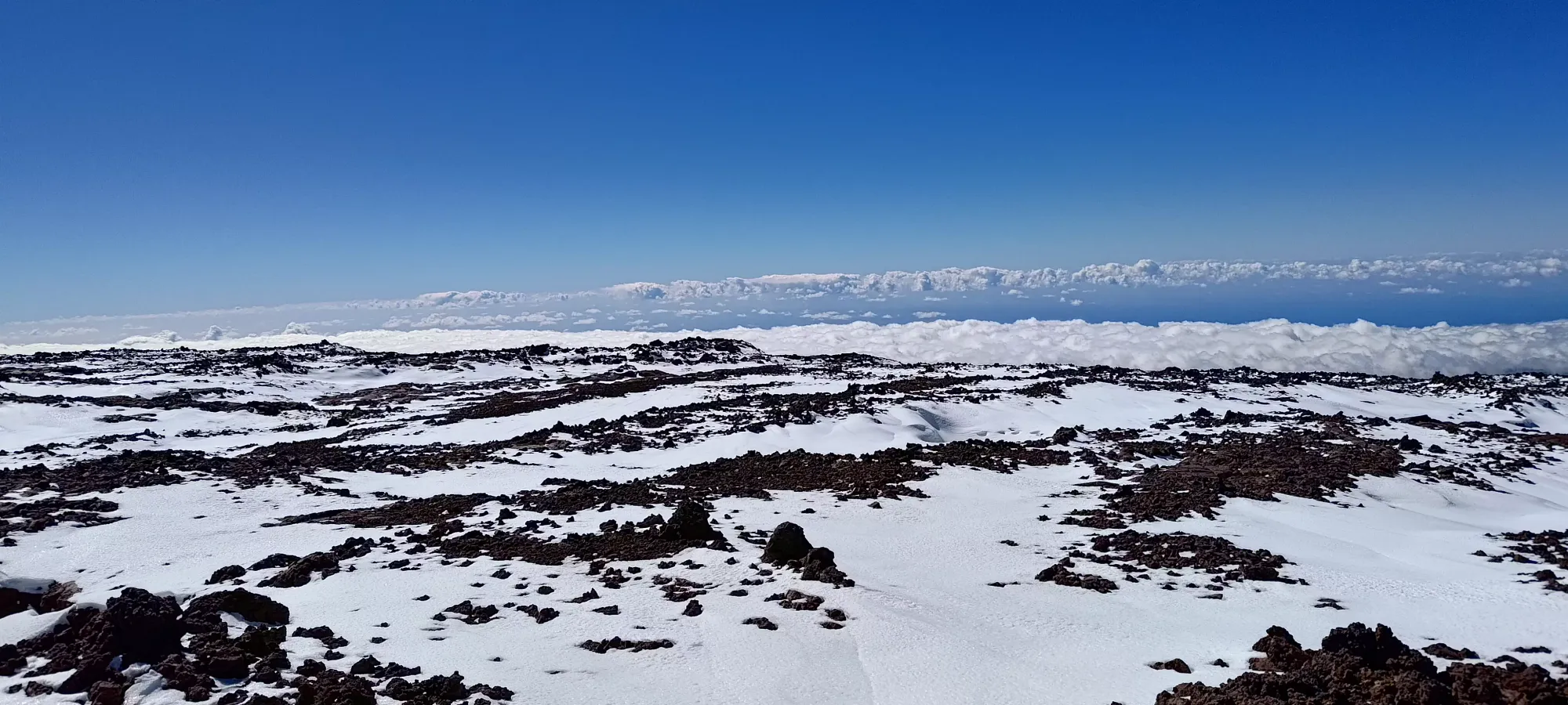
The first bit of this section felt more like trail than road, and a pleasant trail at that, with finely-ground rocks making for soft+even footfalls. I started encountering snow patches right around this elevation as well, which started to increase in frequency quickly as I approached 4000m. After about 15 minutes, the trail started to feel more like a road again, and in another 15, I'd managed to climb up to about 4000m. By this point, the snow patches were large enough to walk on, and I was pleasantly surprised to find that they, while thin, were excellently packed, and offered a very nice surface to walk on, so I started aiming for them when possible.
The next 100m of elevation somehow felt even flatter, taking 1.5km to gain, and taking me about half an hour to push through. The combo of flat terrain "just taking longer to move up in", the winds, and the thinner air did not lend me any favours. I got what I hoped was a view at the summit at the end of this stretch, but sadly was the first of quite a few false summits/bumps that made the final push feel rather long and tedious.
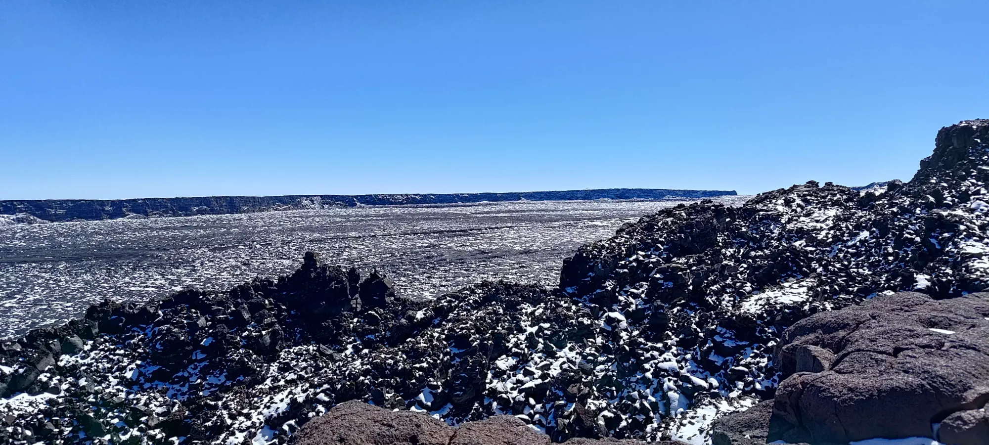

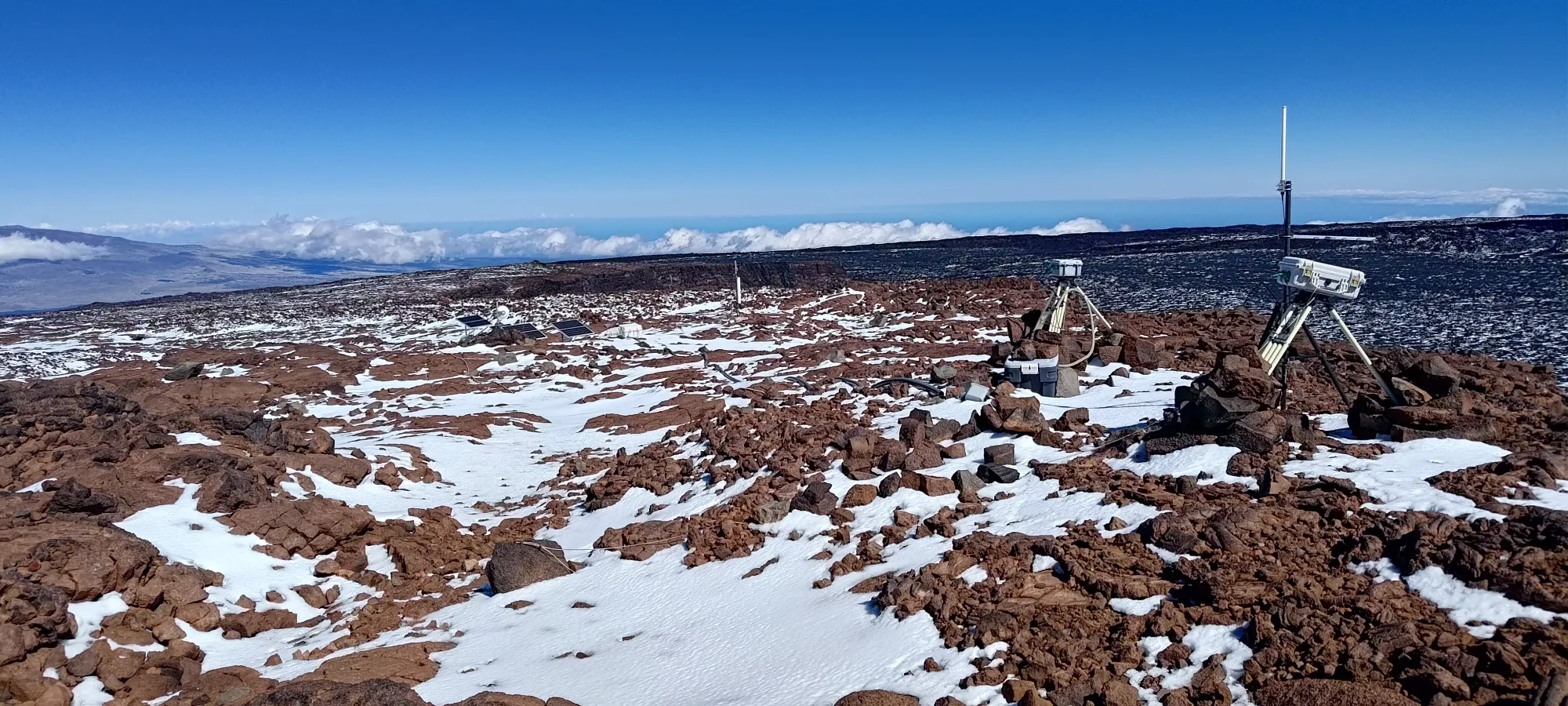
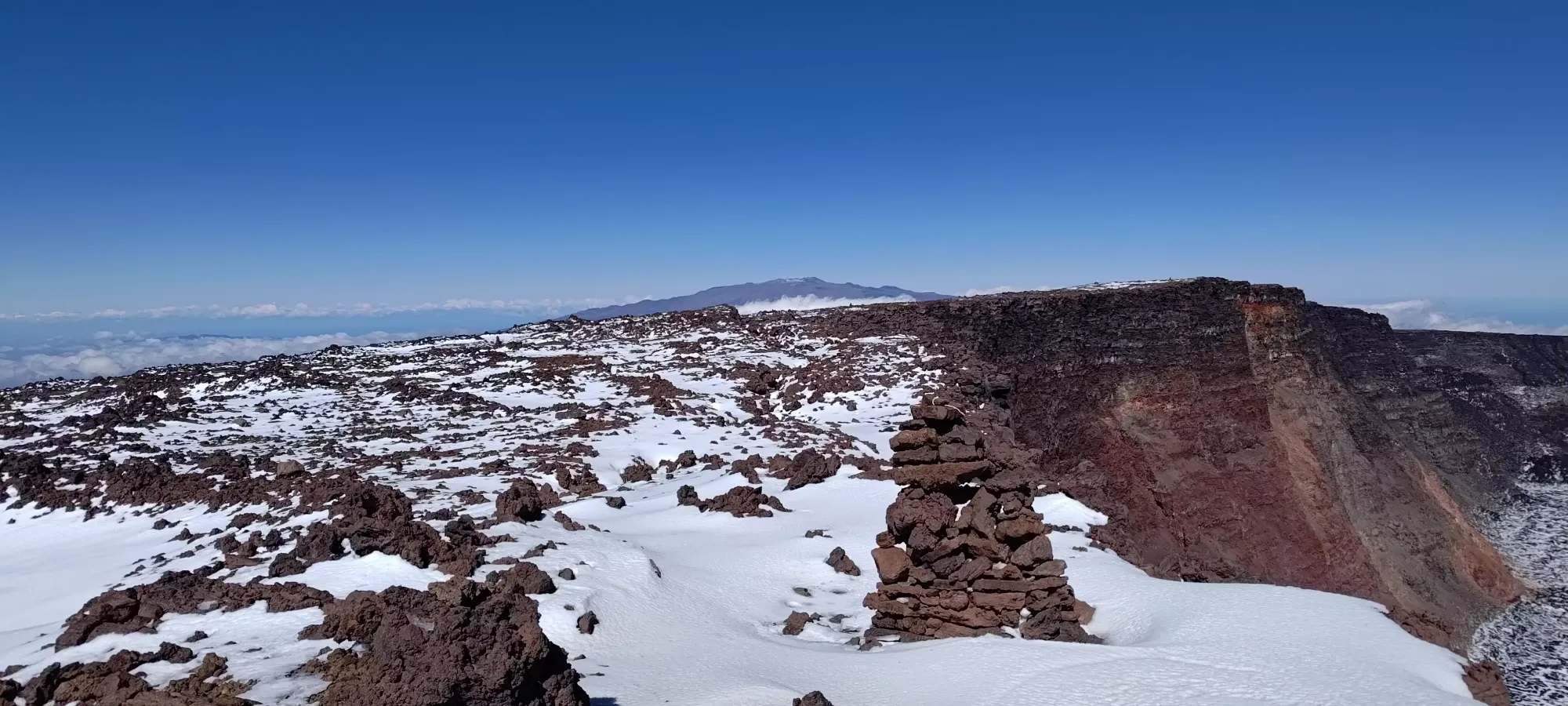
Getting close to the caldera's edge took me "off trail" a little bit, but at this elevation, especially with the amount of snow coverage present, that didn't really matter much, so I just started making my way towards the next thing of note, a collection of instruments/cameras that I thought might indicate the presence of a summit. I walked over there in about 15 minutes, getting up to 4130m, only to be greeted with some higher looking spots further along the crater's edge to walk towards. I took a picture of the things taking pictures (that's probably what those things were, cameras looking into the caldera), and moved along.

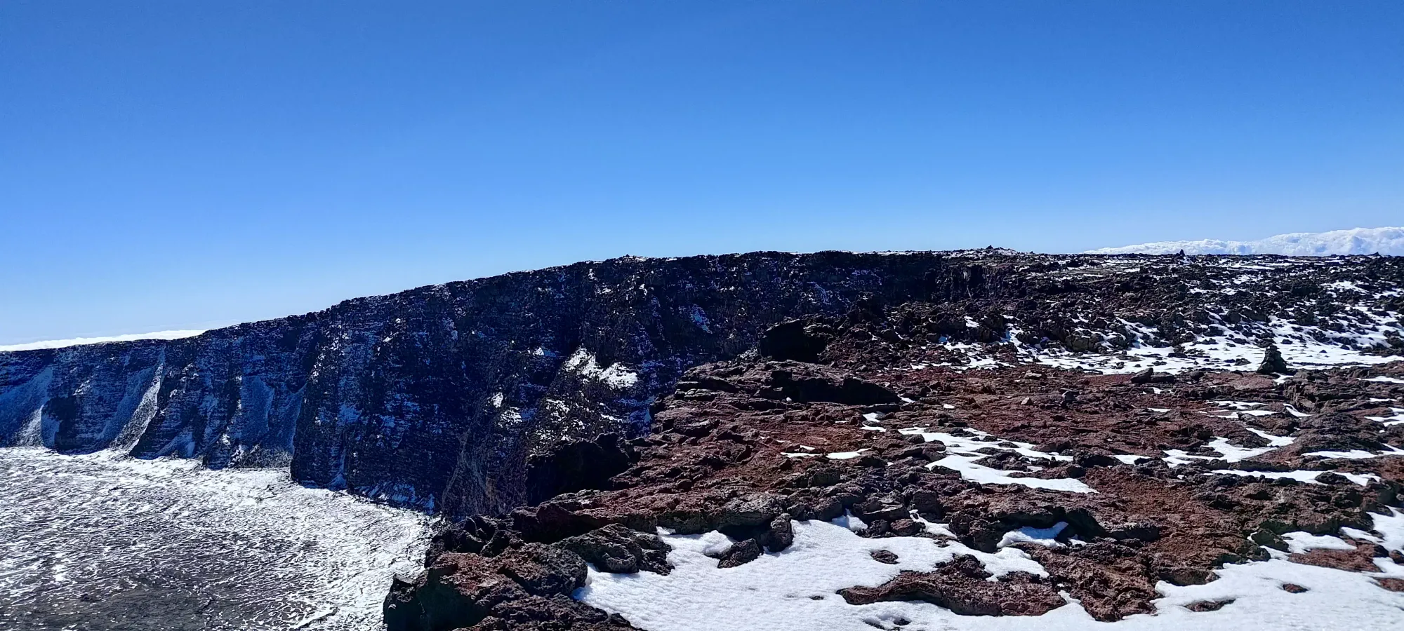
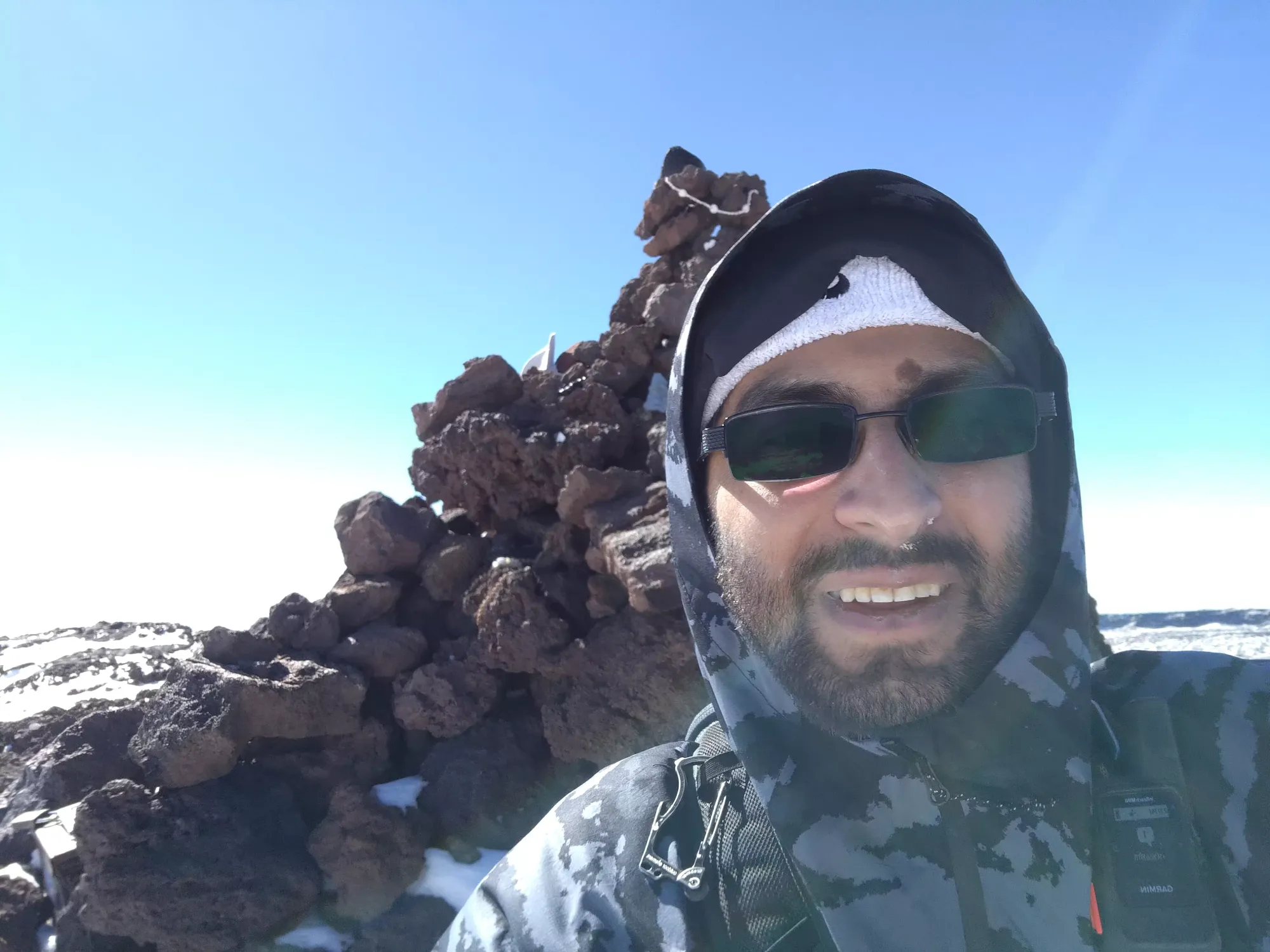
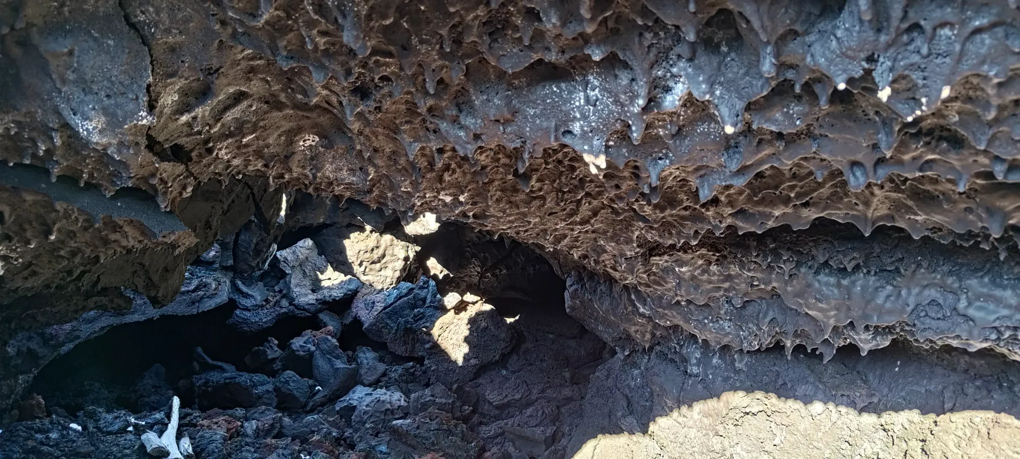
15-20 minutes more walking brought me across a false summit or two, to the summit cairn, and finally to ground which was not higher than anything around me. The caldera is long and tedious, but it was nice to finally be on top, just over 7.5 hours after I started the day, over 20km earlier. I took some pictures and signed the register, but didn't linger for long since the wind was still biting cold, and I was hoping to get down to at least 3900m where I found that little cave to hide from the wind before I had a serious break.


The way down was fairly uneventful, at least in the beginning. I stuck a bit more strictly to the cairns marking the "official trail" until I get back to the road forming the North Pit Trail, then cut over to that, hoping to take advantage of more of those snow patches I had been quite happy with on the ascent. Given the length of the day, and that this was the longest hike I'd have done post-injury, I figured taking easier footing where available was a worthwhile choice. This strategy worked well, and aside from a break or two for water, I more or less kept on moving continuously down to the 3900m cave, which took a bit under 1.5 hours. There, I took shelter from the wind and scarfed down a peanut butter sandwich to help keep my energy up for the long walk back down the mountain. Even with just a couple hundred metres difference, I could start feeling the impacts of the higher oxygen content, which was also quite nice.
Once I left the cave, I started making my way back down the rather uneventful road I'd taken up. I considered splitting off partway to take the "summit trail" which goes by the observatory, which would allow me to avoid that one section of lava debris around 3350m, but I decided against it, since I had enough daylight to navigate it, and I'd rather avoid any hassles in case they had staff present who might get upset at my presence on the mountain. There were no official closure signs for the road or trail, but the park site said the "summit" was closed somewhat nebulously, and I didn't want to get on anyone's bad side. So, I just walked back the way I came up, and a bit under 2 hours later, I found myself back at the top of the highest talus field.
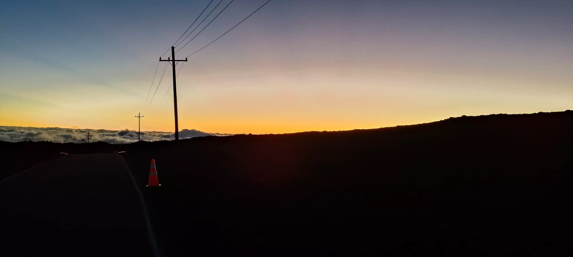
The 25 minutes getting through the debris were, as usual, quite tedious. More so since on the way up, I'd managed to smack my right heel against a rock fairly sharply, and it had been growing in pain quite a bit all day. With the added impact forces of going through unstable rock fields, it was extra unpleasant, though of course still manageable given I was still moving. After that, it was just half an hour to get back onto the road, which I arrived at just about 12 hours into the day, or near 6:30pm, so right when the sun was setting and light was dwindling.

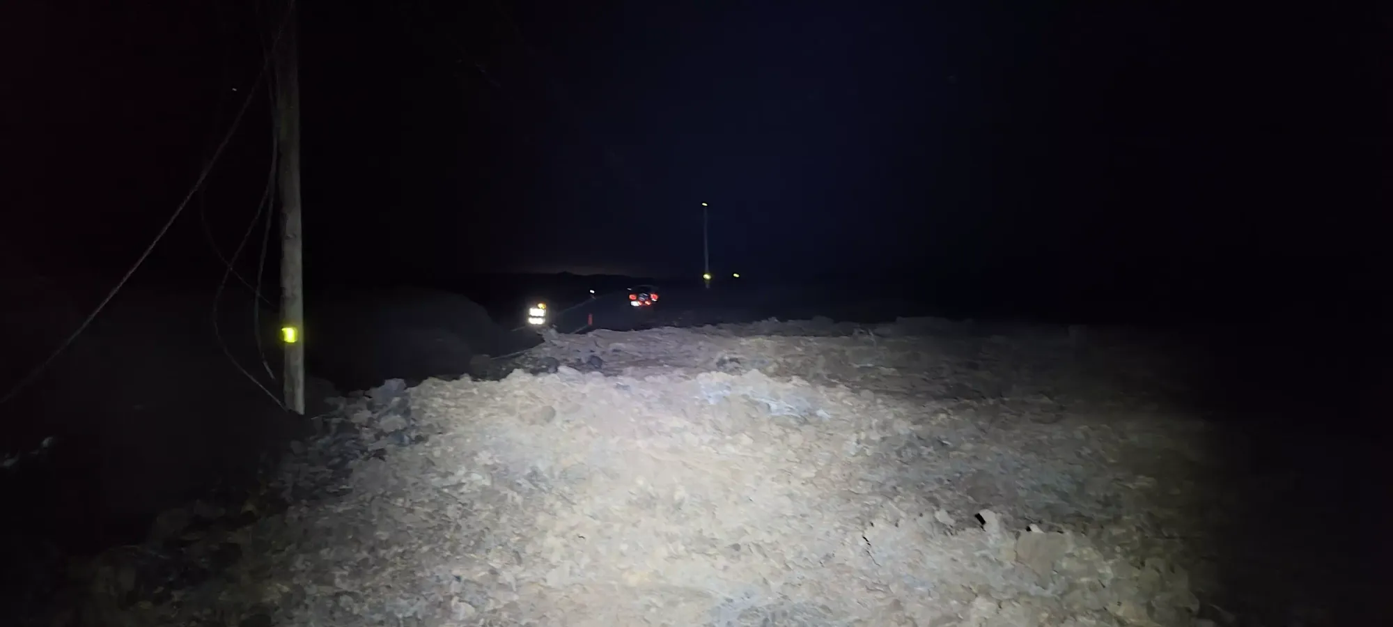
The road section went pretty fast, and I got through the >3km stretch before the big debris field in half an hour. Sadly, that wasn't quite fast enough to get out before night had fallen, so I knew I was in for a really long, tedious final stretch to get past the lava flows before I was homeward-bound. I tracked about 1.5km to get through the first debris field, but it took 2.5 hours to get through in the blackness. The power lines were difficult or impossible to see in the dark (and were often fully buried, so not reliable to begin with). The terrain all looked exactly the same. My new batteries I got for my headlamp which were supposed to be nicer than my old ones were fading quickly, and forced me to use a low-power mode which restricted my forward vision quite a bit, and resulted in a lot of inefficient routefinding and wandering up and over small hills in the debris.
As I was approaching the "crux" (the gully I had to scramble across on the way up), I was getting more and more mentally defeated, and considered just taking a nap instead and handling the rest in the daylight, but I decided it wasn't worth giving up while I could still move, as it wasn't like my bivy would be a comfortable one in the middle of a pile of rocks on a mountain so windy it was closed, so I just kept on slowly picking my way down. Once I got to the crux, I allowed myself to swap batteries to my spares and increase the brightness a bit, which definitely helped. Sadly, I was forced to climb way up past my waypoint I'd set for the ascent to get back up the other side of the gully, since I wasn't comfortable scrambling back up it in that situation.
Past that, while I had a bit more light, my GPS decided to start playing the "let's start tracking erratically when Tareef needs me the most" game, and started teleporting me about and freezing up constantly, which resulted in me deviating from the road a lot more than I had on the way up, which was quite frustrating. I found the power lines once or twice, but they dove back into the rubble far too soon, and I couldn't keep following them, and instead just had to deal with wandering about inefficiently.
I tried to look up at the stars to appreciate the excellent view every so often, which was indeed quite incredible, but I didn't really do much other than think about getting out of the blasted rocks until about 10:30pm when I finally got out of the debris field and got to breathe a huge sigh of relief, knowing the final one was only a few hundred metres wide and wouldn't be nearly as brutal to navigate in the dark.

Once I was on the road, 20 minutes of relieved walking knocked off nearly 2km before I arrived at my final hurdle. This section took me another 20, though to travel less than a fifth of the distance, probably. I again got sidetracked by poor GPS tracking, but since I was checking often enough, not by enough to get lost, just really annoyed at my horrible luck (it never fails when I'm walking an obvious trail in broad daylight...). Once I could flash the lights on my car and see them in the distance, I was quite ecstatic, and when I finally climbed out of the last pile of rocks at 11:20pm, I got to breathe the world's biggest sigh of relief.
This truly was a huge slog, covering a ton of distance (a literal marathon's worth), some really crappy terrain, and getting into elevations that were enough to impact my breathing. But, it got me an ultra, the first ascent (on peakbagger) since the lava flows happened in 2022, and allowed me to say I did at least 1 "real hike" while I was in Hawaii, so overall, definitely worth it. I would recommend, if possible, using the Ainapo route and overnighting in a cabin to save some hassle and terrible terrain, waiting for the road to get repaired, or at least waiting for a little more daylight so you can avoid nighttime navigation of the lava debris, though, since that alone added multiple hours to my overall time, and greatly increased the "suffer factor". At least whenever I come back for Mauna Kea, though, it'll feel trivial in comparison, even if I have to hike up instead of drive 😅.
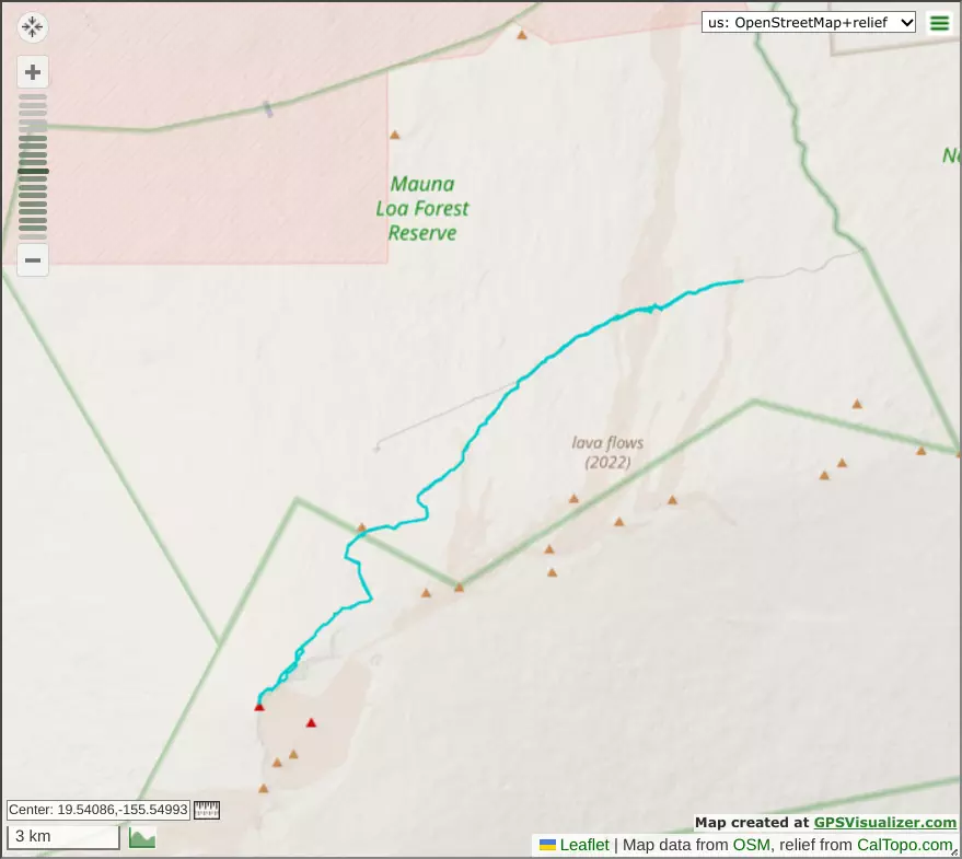
GPX Track + Map