Markhor Peak - July 9 2023
My first real scramble since getting injured, although abridged from the original plan, a fun day indeed


North Hope Mountains, Coquihalla, British Columbia
1994m
After a late night coming home from Demon Peak the previous night, some people might've just taken Sunday off to relax and recuperate. Those people clearly are not peakbaggers. Instead, me, Logan, and Jass (last seen on Mount Saint Benedict) had made plans to make my grand re-entrance to scrambling and attempt the Markhor→Needle Traverse, as there was good beta that it was in good shape. However, due to the late night, we agreed to sleep in a bit, and I left home at around 9am, meaning after picking both Logan and Jass up, we didn't get hiking until 12:15pm. We were still optimistic we could make the traverse, as we didn't mind a dark descent, but the bigger concern was the 1 of many forecast models we looked at, which had thunderstorms in the forecast. We considered Sky Pilot as a backup option if that forecast got worse, but since only one forecast had a single hour of thundershowers in it, we decided to go for it anyway. As for gear, in case my injuries presented issues, we over-prepared with a 60m rope, some cams, and a bunch of slings/cord to allow us to rap or even guide belay if I got into a sticky situation (props to the guys for hauling rope for my broken ass).
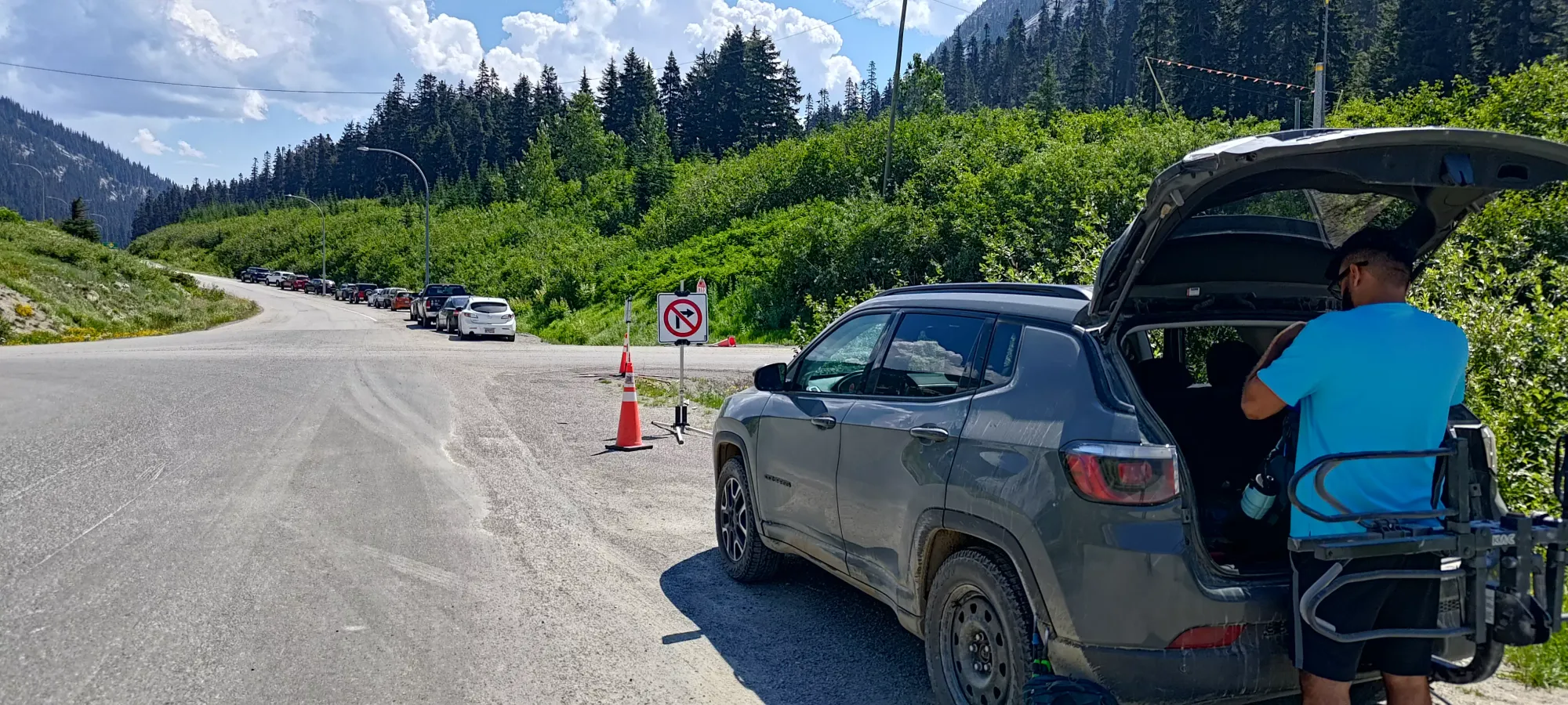

The trailhead didn't seem to be much of, well, a trailhead. We wandered the construction area in a somewhat inefficient manner trying to follow the GPX I had downloaded, and eventually just "entered the forest" where it looked somewhat clear. We did mild bushwhacking for a few minutes until we found some flagging about 15 minutes in, about 50m higher than when we started.
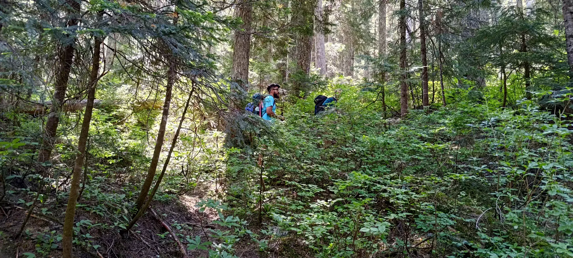
After that, we followed the flags, discovering there were 2 paths, one marked with orange flags, and another with pink. Neither were maintained trails, and had variable amounts of "bush-slapping" (after the first 100m of gain or so it is more slapping or brushing than whacking). They also converged a lot, leading to a day-long debate about there being 2 trails or double-flagging, though the consensus by the end was 2 sometimes-converging routes.
No matter which route one selects, though, what is guaranteed is a fairly sparse forest, a steep slope, fairly soft dirt, and in our case, lots of sweat in the hot weather. We moved fairly casually, gaining about 270m in the first hour. We took lots of breaks and were kinda just chatting+hanging out as we climbed up. This put us at 1470m, since we started at 1200m, notable for being the location where we saw something other than just the forest. Specifically, we saw a random slab of rock.
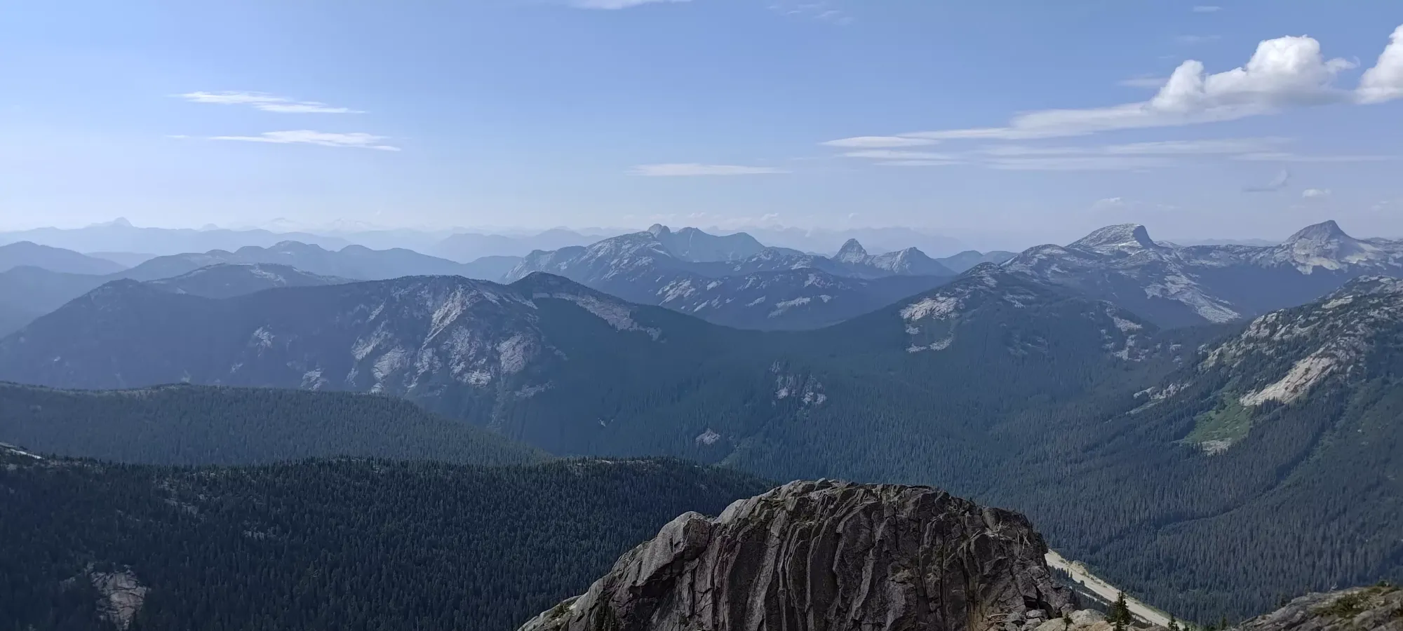
After another 15 minutes of grinding up the forest, we got our first views at a little viewpoint. It was Jass' first time in the Coquihalla Area, even though he lives closer to it than either me or Logan, so he was very impressed with the views. He and Logan (who'd only been up with me in winter, at least in this specific spot, we'd done Coquihalla Mountain previously, but that has different views) were specifically enamoured with Yak Peak, as they're both quite into climbing these days.
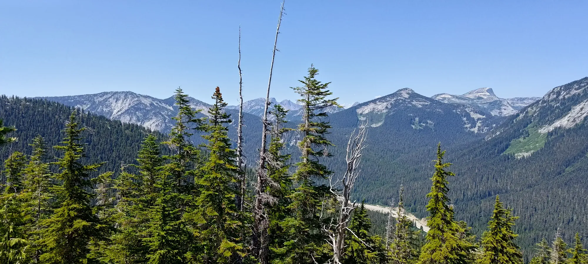

After this point, we started losing our precious tree cover, and getting more directly into the beating sun. The terrain opened up with a lot of slab-walking mixed in with a fairly-beaten trail in the dirt sections. We took our breaks in the few sections we could find decent shade in, just because we knew the ridge was unlikely to provide much for us once we got there.
About 2 hours in, or at about 1650m, we started to do a little bit of scrambling, though only a move or two at a time interspersed with the same terrain as above. It was still pretty fun to get my hands back on the rock for real, though, and it went well. It definitely helped to have started the previous weekend doing a rock climb to test my strength/ability on belay, otherwise I'd not have thought to attempt this yet.

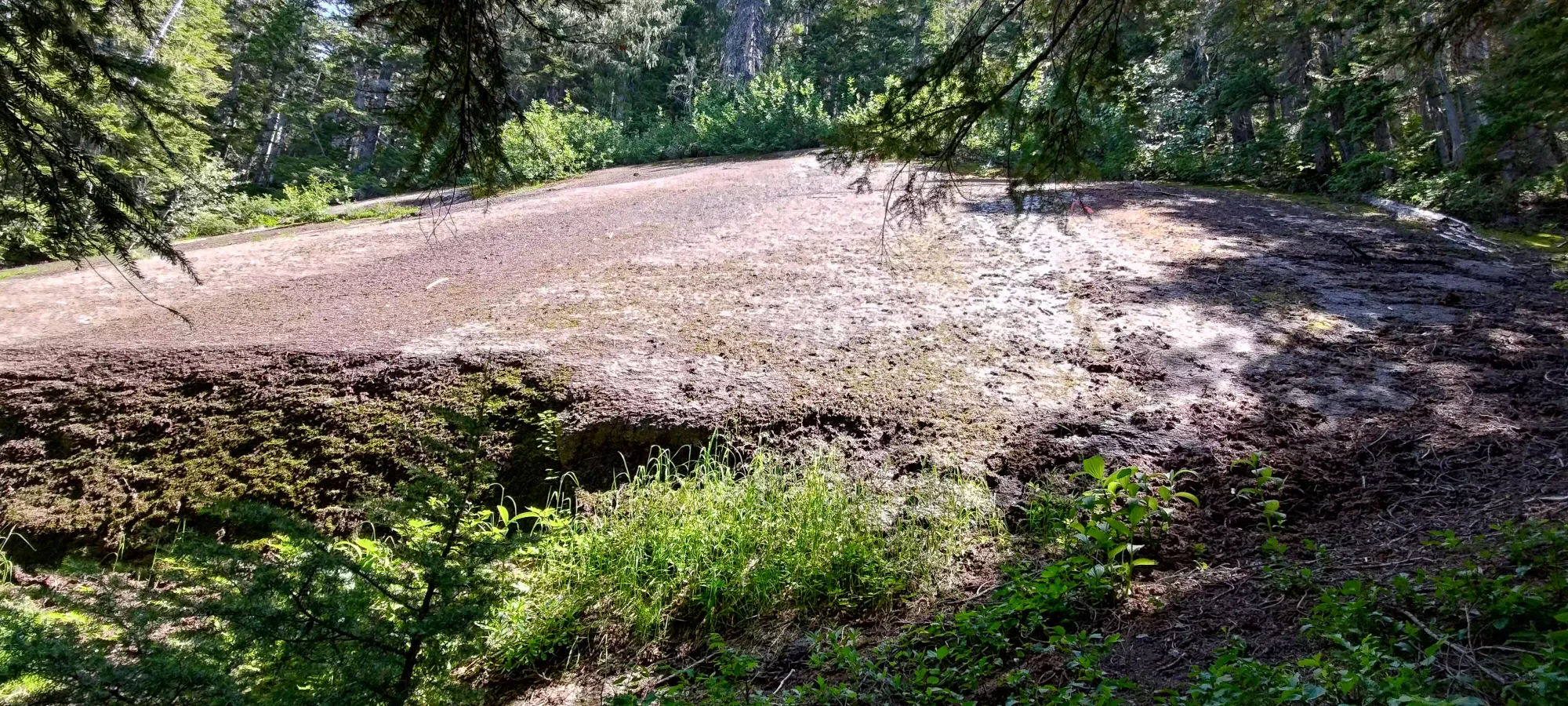
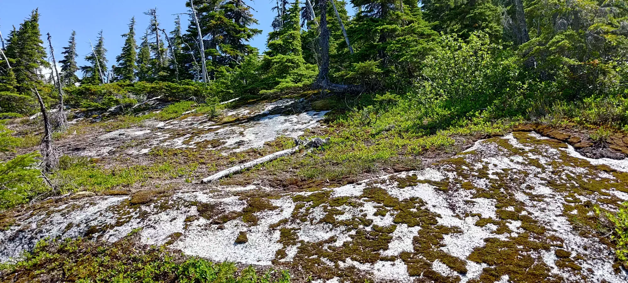
For the next hour, we ground up occasional scrambles up ledges too big to step up, but encountered mostly walking terrain. Somewhere near 1800m we found a snow patch where Jass refilled his water, and we all applied some snow to our bodies for cooling. I was glad to have a hat, since stuffing some under it proved to be quite refreshing.
Past this, the terrain changed as we neared the summit ridge, turning into scree. Although, I have to say, it was quite "nice" scree as scree goes. It didn't cave under your feet terribly, and was more stable due to the rounder nature of the rocks vs, say, Rockies scree.

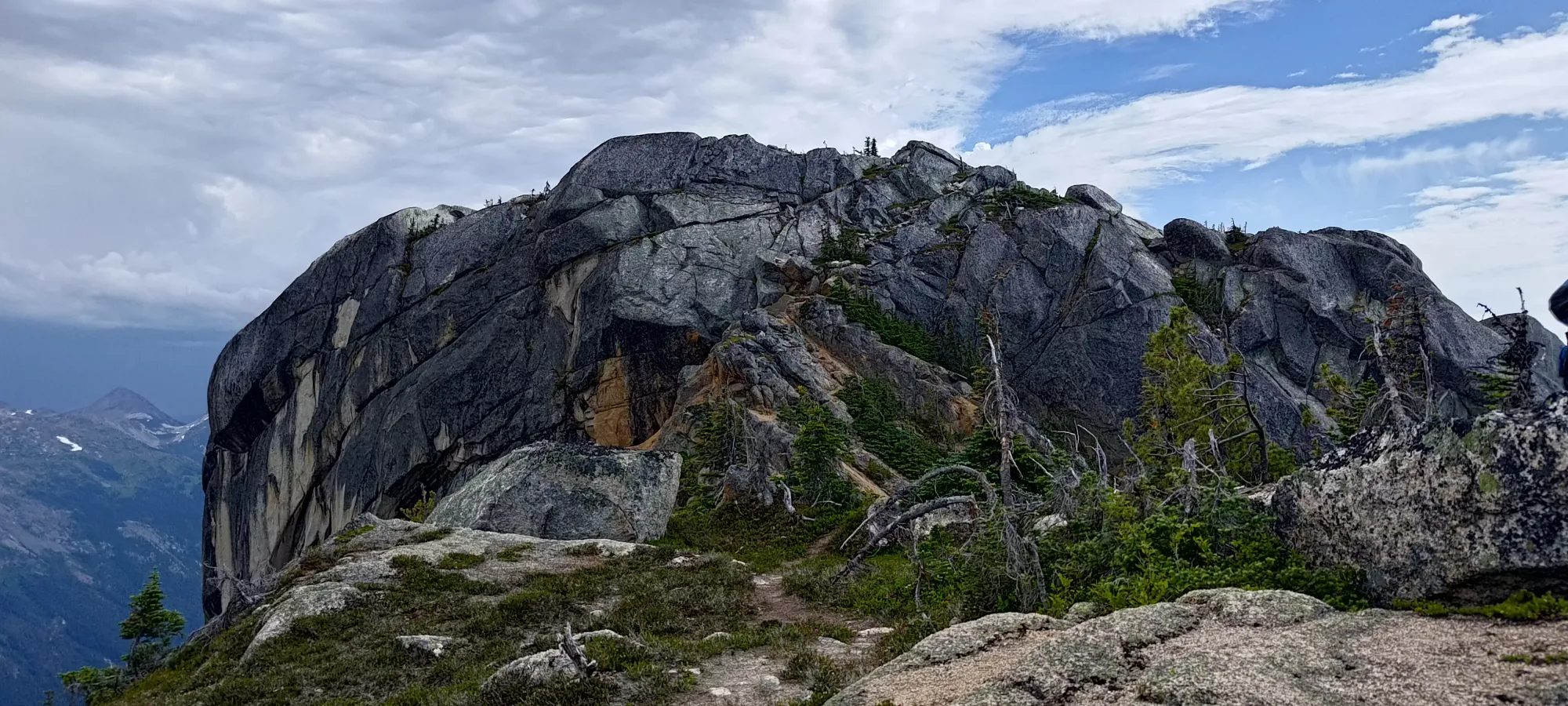
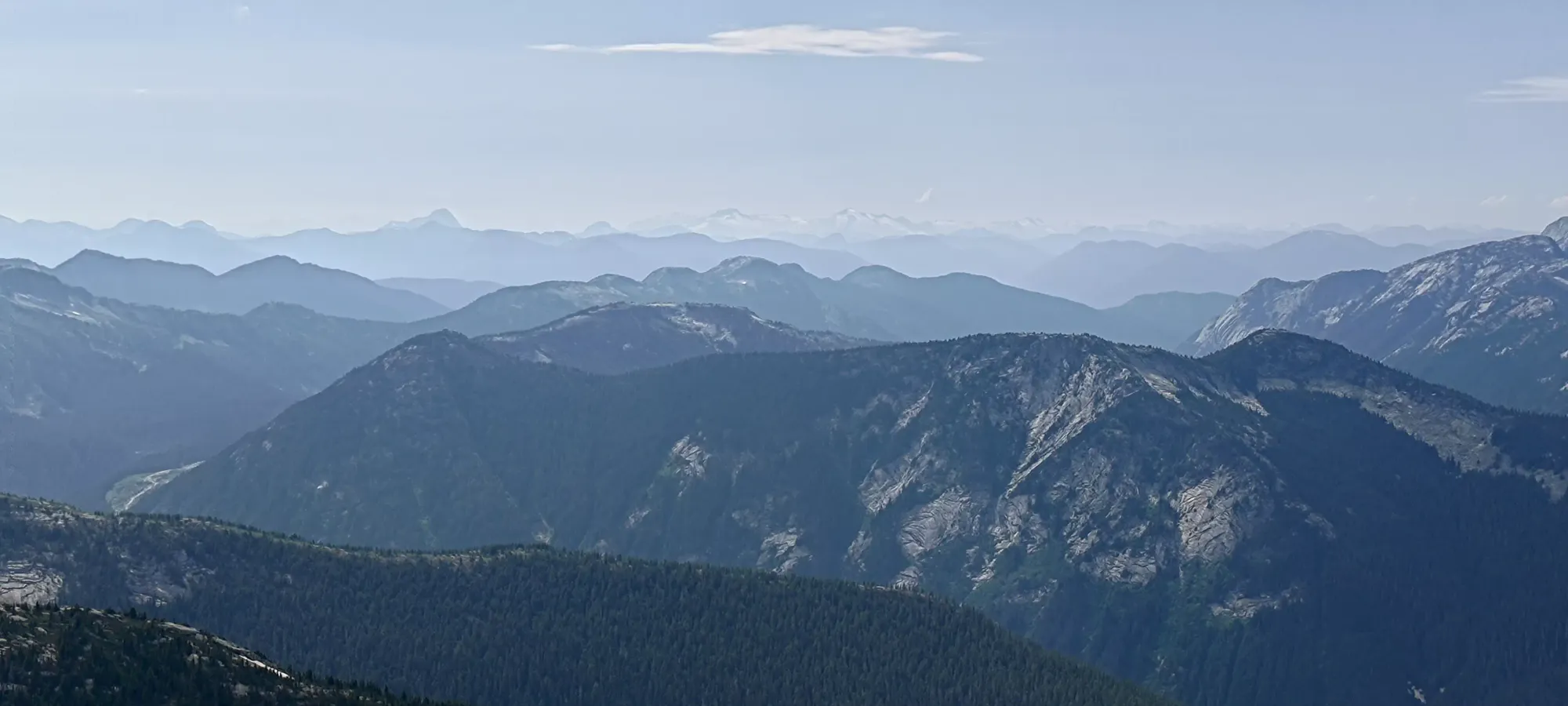
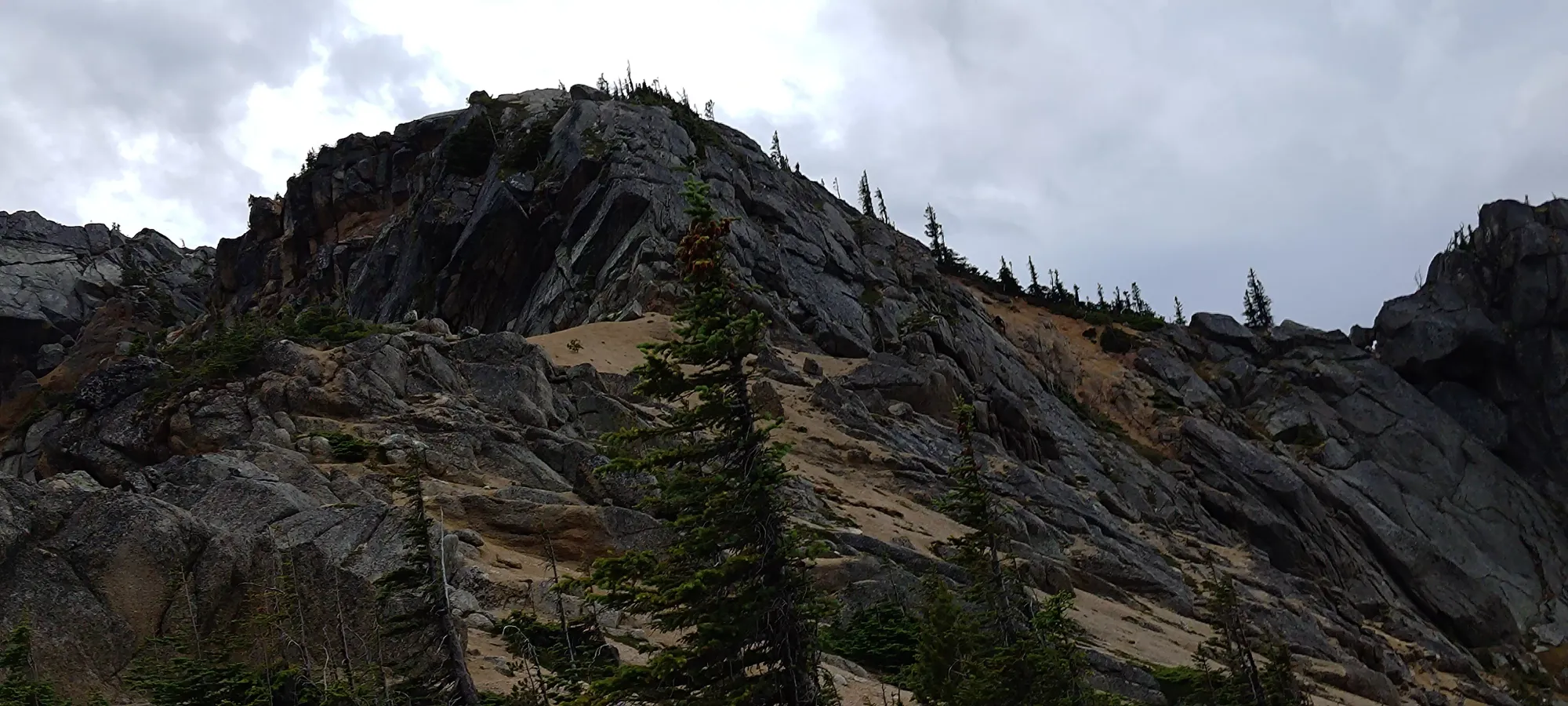
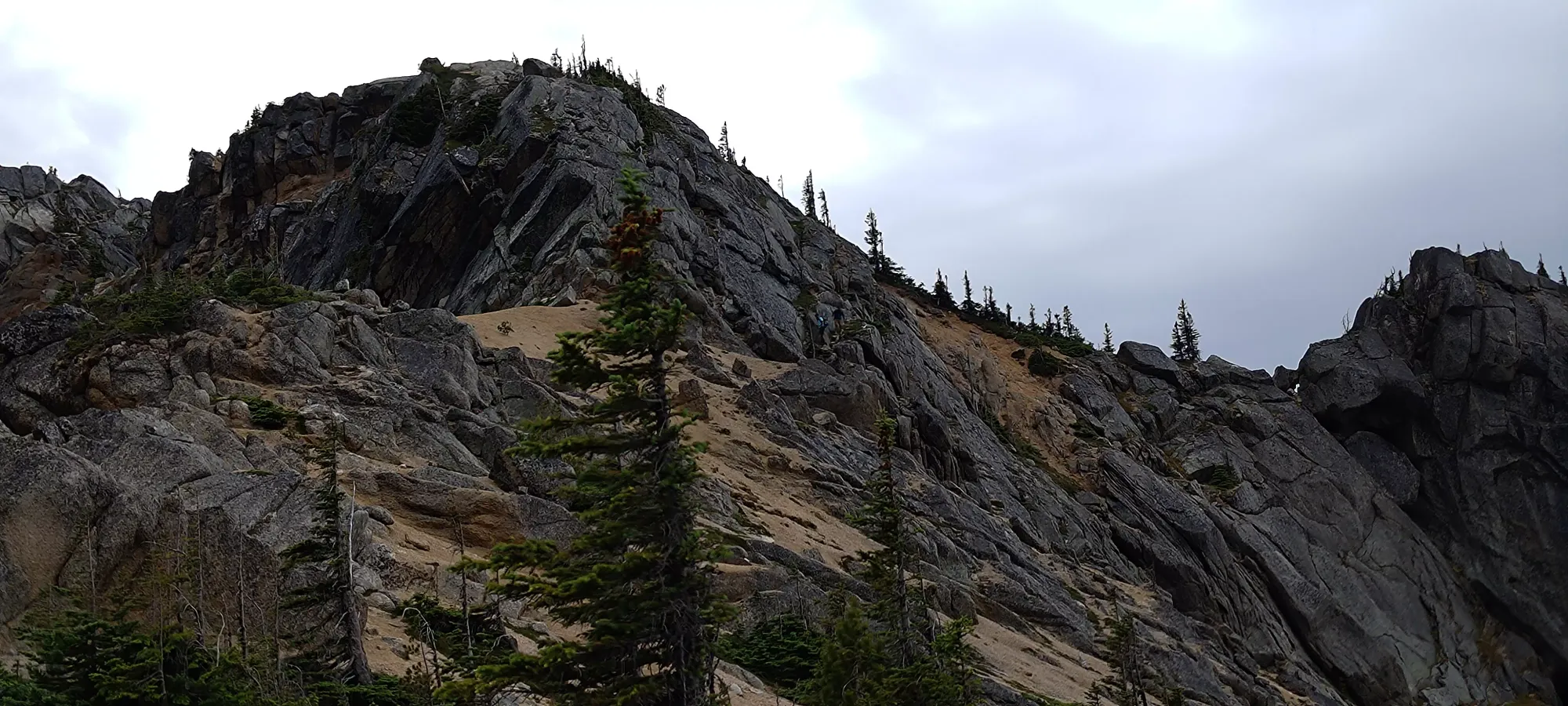
We hit the ridge at about 3:20pm, just over 3 hours into the day. Unfortunately, this also brought a first bad omen, some dark clouds beyond the false summit in the northeast.
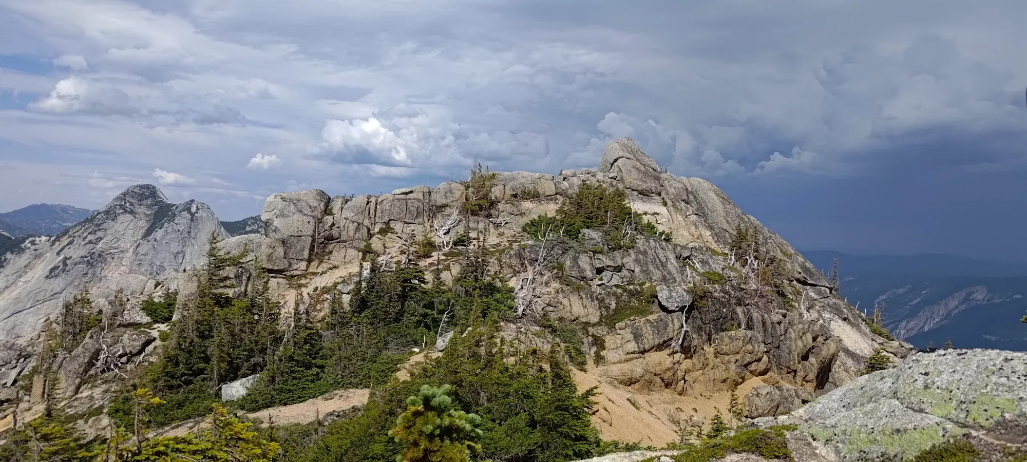

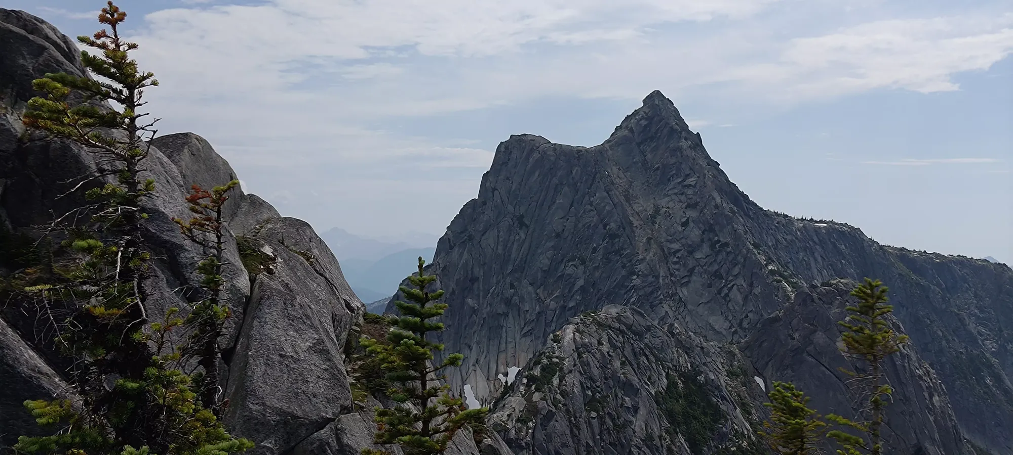
From the point we joined the ridge to the start of the darker rock at the "final" false summit was pretty much just "walking on a wide ridge". It did offer some nice views down the "Markhor East Bowl", a ski route down the east side of the ridge, which looked quite nice, though unfortunately it is unlikely I'll be returning for it since I rarely repeat peaks. We got to the base of the "real" scramble in about 10 minutes, and then the poles went on the wrist and the scrambling began.
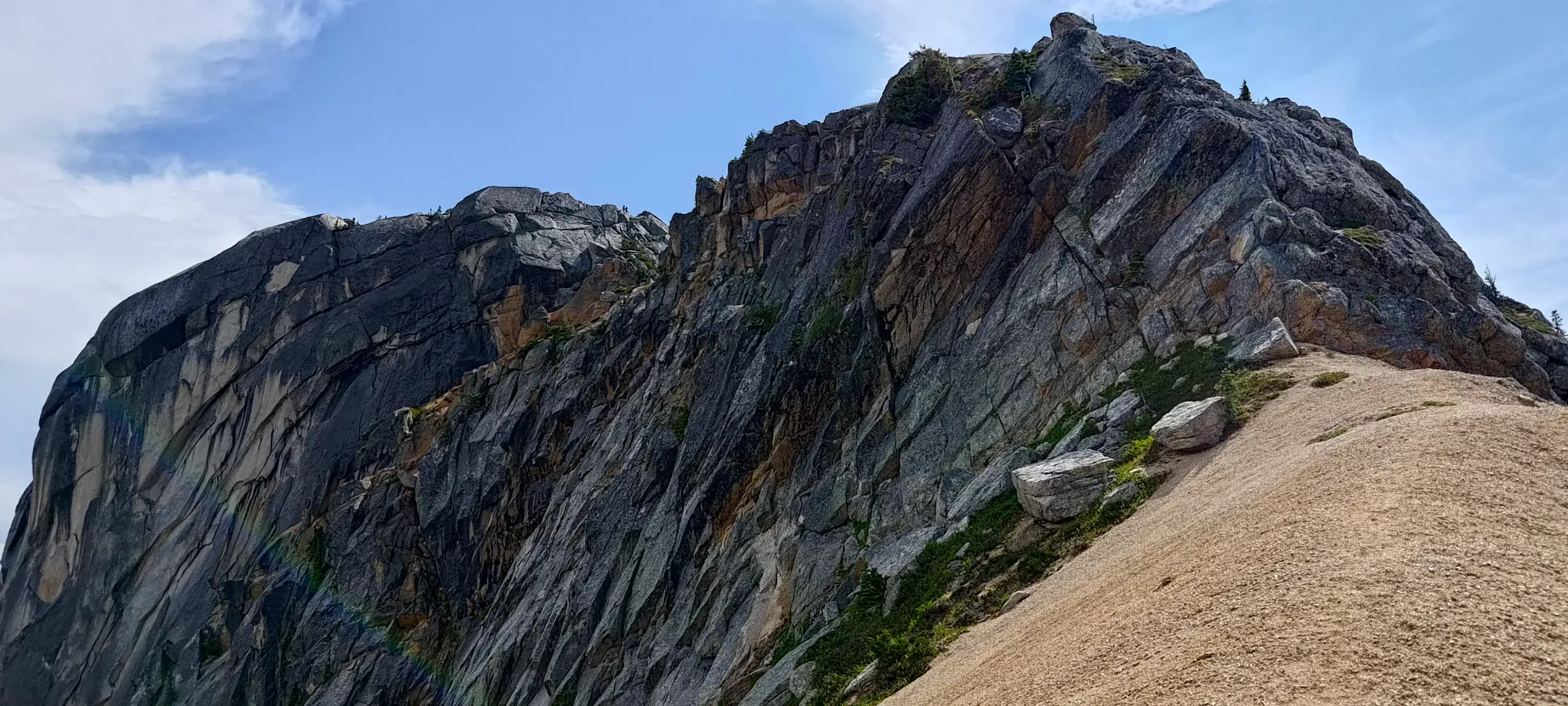
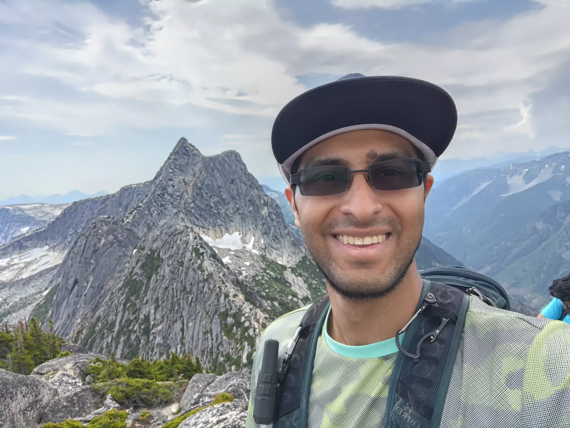
The meta we decided on was having Logan lead up the rock, me in the middle, and Jass behind in case I needed help on either end. Logan scoped out the route straight up the false summit, and said that it went, so that's how we went. The way up was actually pretty good, I was able to put my feet where I wanted to, and while perhaps a bit slower than when healthy, I was able to move with confidence, and was able to plan a descent path I felt I could accomplish as well. We topped the false summit out in about 10 minutes, and from there it was mostly a walk to the real summit, maybe a couple class 2 moves, though I guess with some exposure. I always find it hard to call it a higher class when the moves are so easy that there's really no excuse for falling. The false summit scramble was maybe class 3, I'd say. The moves weren't particularly hard or committing, and the exposure was "unlikely to fall much more than the summit block" for the most part. A good "first scramble back in the game", especially since we had the ability to rap and protect if things got spicy.
On the summit, we hung out for a bit, ate our food (I had the other half of the previous day's sandwich, and lots of grapes), and talked about the plan for the rest of the day.

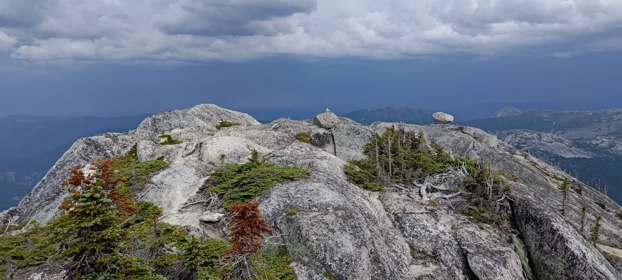
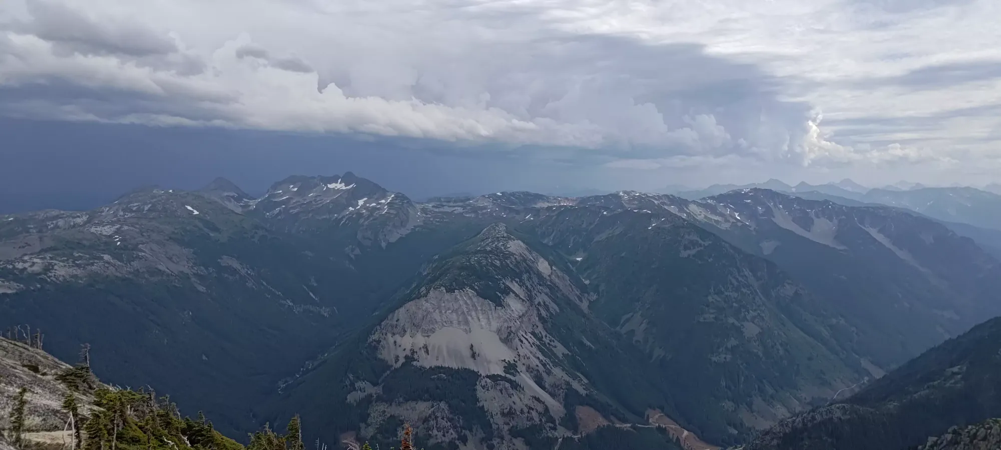


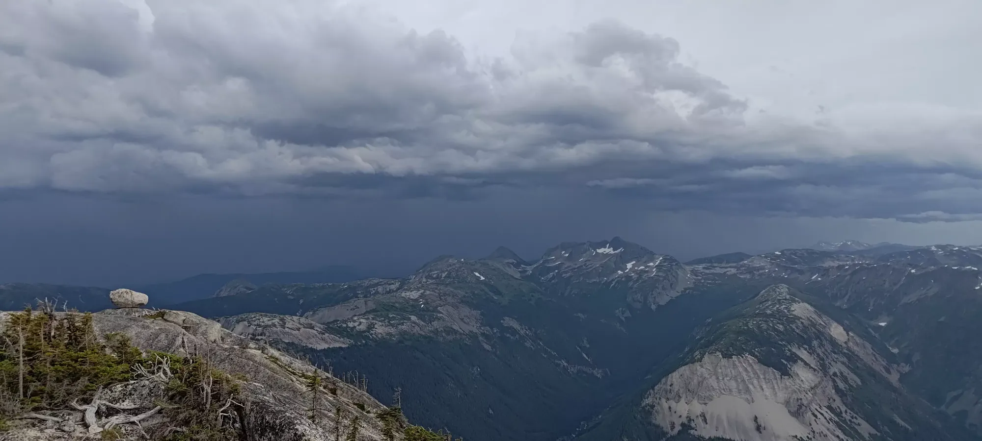
Unfortunately, as we were talking about how we might tackle the ridge, bailout options for the last steep section if it ended up being too difficult, etc. the weather decided to take a turn for the worse, and we started hearing thunderclaps coming from the east. At first, we weren't sure if it was just wind/rockfall playing tricks on us, but after a few minutes it became quite clear, and the air around us was cooling a bit as the clouds coalesced, so we knew we had to turn back. Moving from a high ridge to a p600m peak when thunderclouds are nearby is not a great plan.
I started my way down from the summit a couple minutes before the others, since we all figured I'd be slower anyway, and they were packing up after lunch. I got down the scramble surprisingly easily, and walked along the ridge to a nice resting spot in view from the top of the scramble, waiting for the other two to crest it and get down. A good few minutes passed by and I didn't see anything. I heard a faint sound that sounded like Jass' whistle, so I decided to call them and got my phone out, noticing a message from Logan asking where I was. It seems they thought I might've yeeted myself into oblivion (no faith, honestly, I only did that one time...).
Once we sorted out that I was exactly where I was supposed to be, they came into view shortly, although not exactly on the route we used to get up (or that I used to come down). I called again telling them that they were, in fact, not on the route I descended on, but instead heading towards a false summit further on the ridge. Once that was corrected, they headed towards me, but instead of tracing up to the top and down our original route, they took a spicier route across the face. I can't blame them; I too have a distaste for regaining elevation I plan to lose shortly thereafter.
Thankfully, they made it back without incident, and we started our descent in earnest. One benefit to the new clouds was it was no longer boiling hot, so we were able to go pretty far at a time. The scree descent was especially excellent, I could plunge into it with my heel (much stronger than my toes on my injured side) and just scree-ski down basically effortlessly. Past there, we just charged down, getting from the ridge to the car in 1:45.
Once we got to the bottom, of course, the clouds had cleared and the sun was back out, but we made the right decision with the information we had. I haven't decided if I'll do Needle via the traverse and repeat the peak or if I'll do it the standard way and try to add on Flatiron and Portia+Mercy instead, but I will return to do it in some fashion. While we didn't get to knock out Needle on this trip, we did at least get to do some scrambling (which felt great after so long), we had tons of fun, we got a peak, and me + Logan (Jass had to get home at a reasonable hour) got to go to our favourite restaurant to eat at post-hike when out east, which wouldn't have been open if we pushed for the traverse.
10/10 recommend this peak, while the trail isn't a perfect, maintained trail, the access is easy, the bush is a minor inconvenience, and the scrambling is fun, plus the much greater potential if you have time+conditions to traverse to Needle, which is supposed to be an excellent scramble, much more so than the little bit we did for Markhor itself.
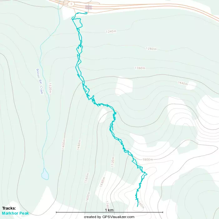
GPX Track + Map