Flat Top Mountain - March 1 2024
A fun, fairly straightforward skiable ultra in the Salt Lake City area, with great views and lots of fall line without being too much to bite off in winter


Oquirrh Mountains, Ophir, Utah
2927m
Having only bagged a couple of small peaks during my stay in Park City, I wanted to get something "good" before I left. For me, that generally means an ultra. However, that is often a bit of a challenge in the winter, as ultras are generally big, complex mountains that make skiing difficult, as weather often sits over them, and they have big slopes which make avalanche conditions challenging before isothermal spring snow takes over. That, combined with the fact that I was with my skiing-forward friend Nick (rather than peakbagging-forward), and the lack of avalanche forecasts in this region, prompted us to get a guide, as even disregarding my own safety, I wasn't ready to lead someone who wasn't as backcountry-experienced into a range I had no experience with and almost no beta on. A bit pricey compared to the usual "just gas", but we got a good deal on our rental for the week prior, so we decided to go for it.
The drive in is pretty simple, drive to Ophir, then just keep going north on the main road until it ends. It gets unpaved just past the majority of the old town drag, but is still fairly even/easy to drive. However, despite being somewhat plowed, the road soon goes past the few homes people still live in, and into the country where that plowing ends. We could've driven probably a third of the remaining distance in the existing vehicle ruts, but since we didn't know if the road would be safe, Nate, our guide, brought a pair of sleds so we could get to the trailhead fresh. For more ardent peakbaggers, this is unnecessary, as it is only 2km at most each way of road, which is a gentle grade. However, to sucker Nick into coming along to a peak, sleds were the way to go 😆. So, we loaded up, and took off.
The ride was a bit tumultuous as ruts made keeping things upright challenging. We tipped over once riding "Canadian Style" (how could we not?), and swapped to the simpler-to0-manage seated positions after that, which got us to the gated start of the route. There was a large water crossing that would be annoying on foot, and the last 2/3 of the route were sled tracks only, so driving would be challenging. After our leisurely start and gearing up, we finally got our skis on and got moving at a casual 9:45am.
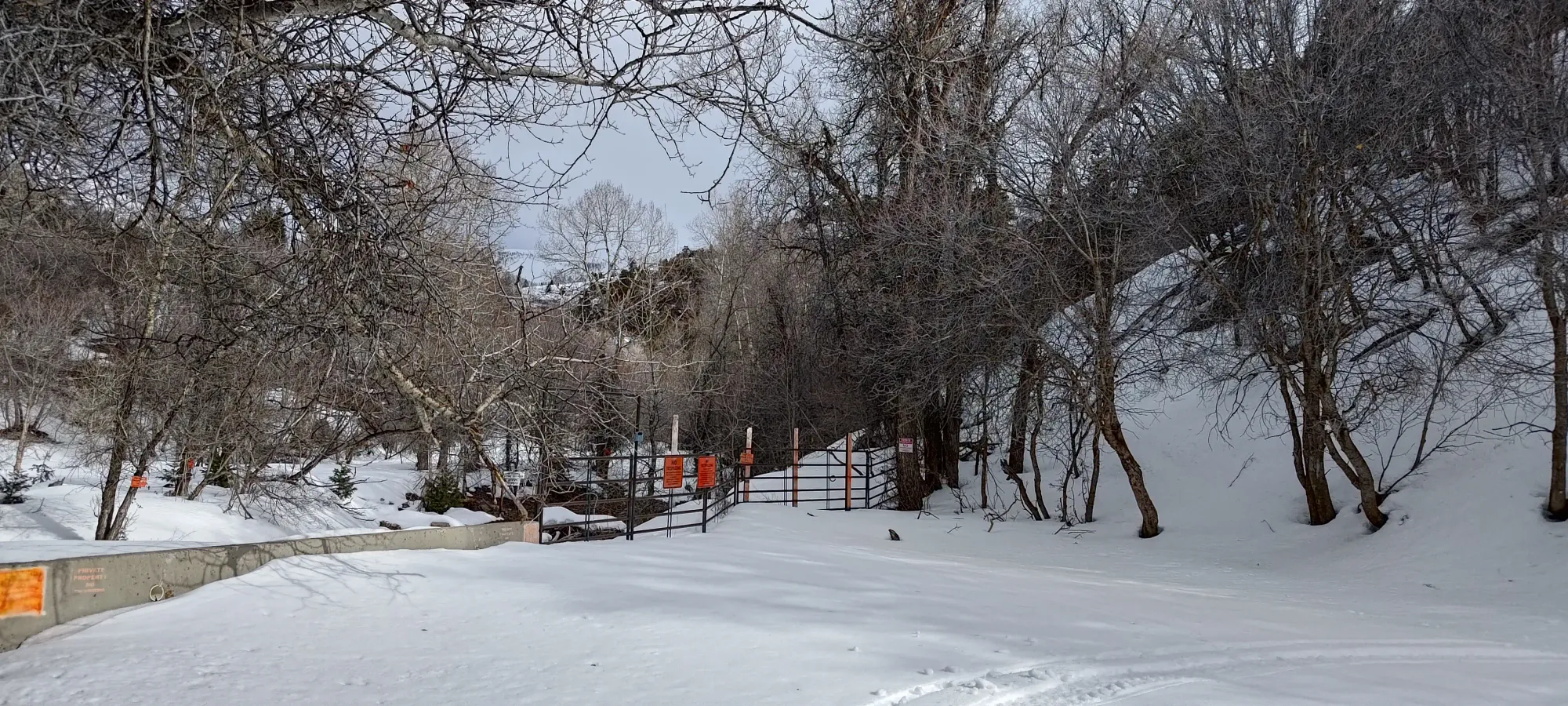
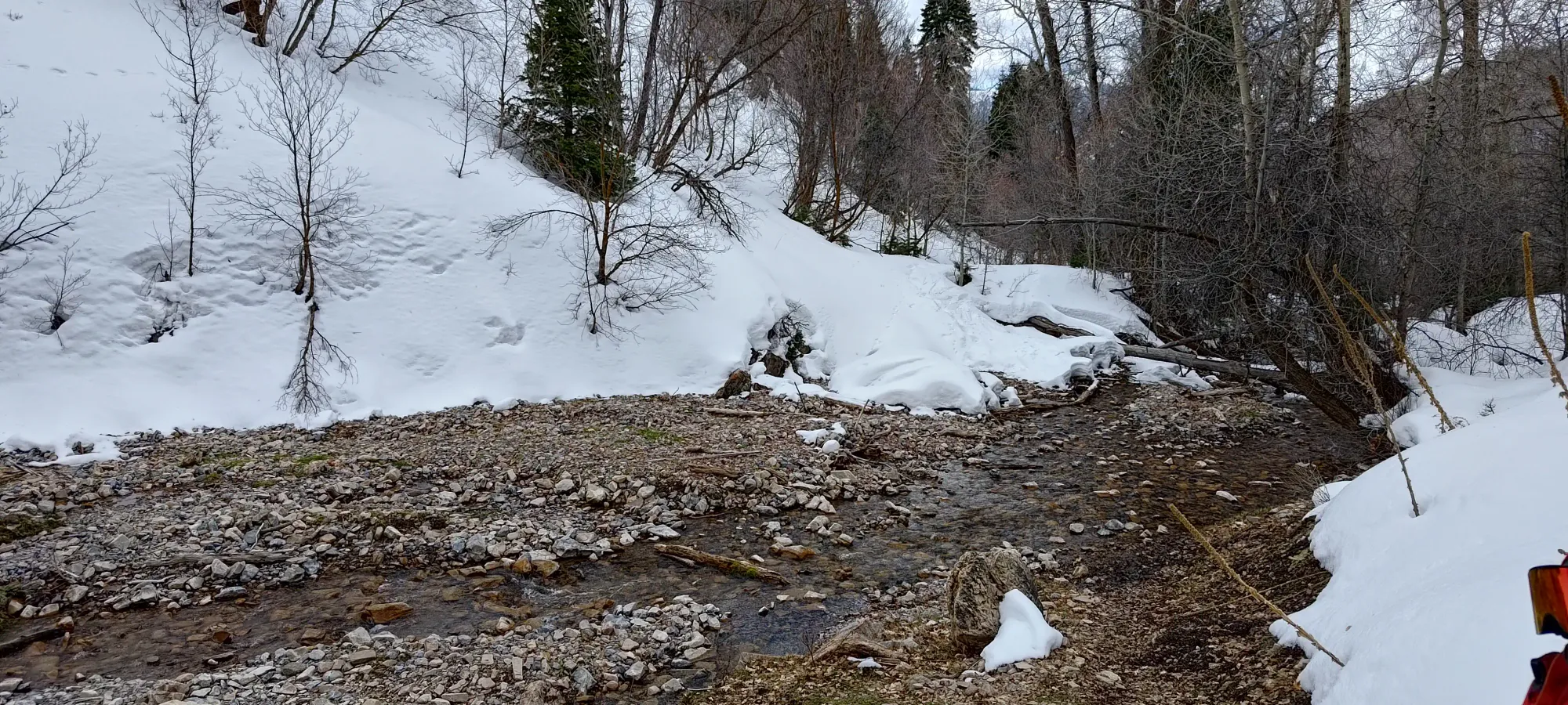
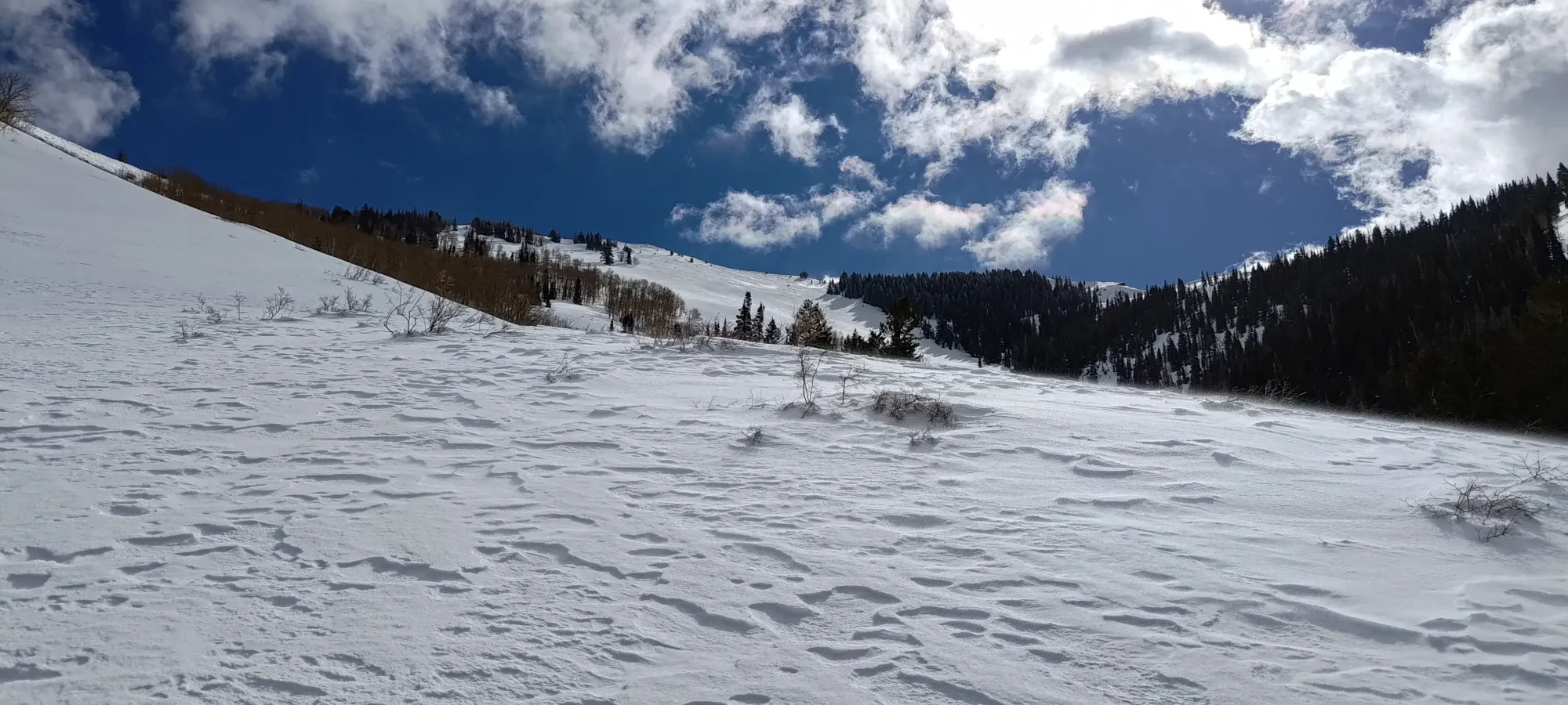
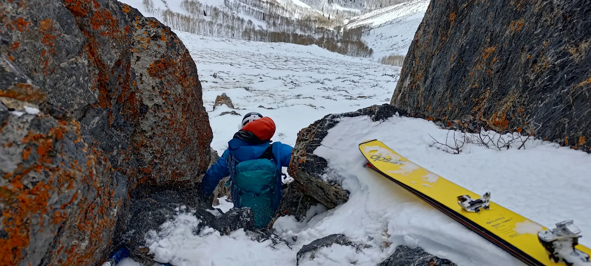
We got a bit eager slapping skins on at the beginning, as not 10m after we started walking, we had a creek to cross. This creek goes the length of Spring Canyon, and we took about half an hour moving that first kilometre, crossing the creek over half a dozen times before turning east into Picnic Canyon. Years with snow lower into the valleys might solve this, but if you go in similar conditions to us, "prepare for some tedium".
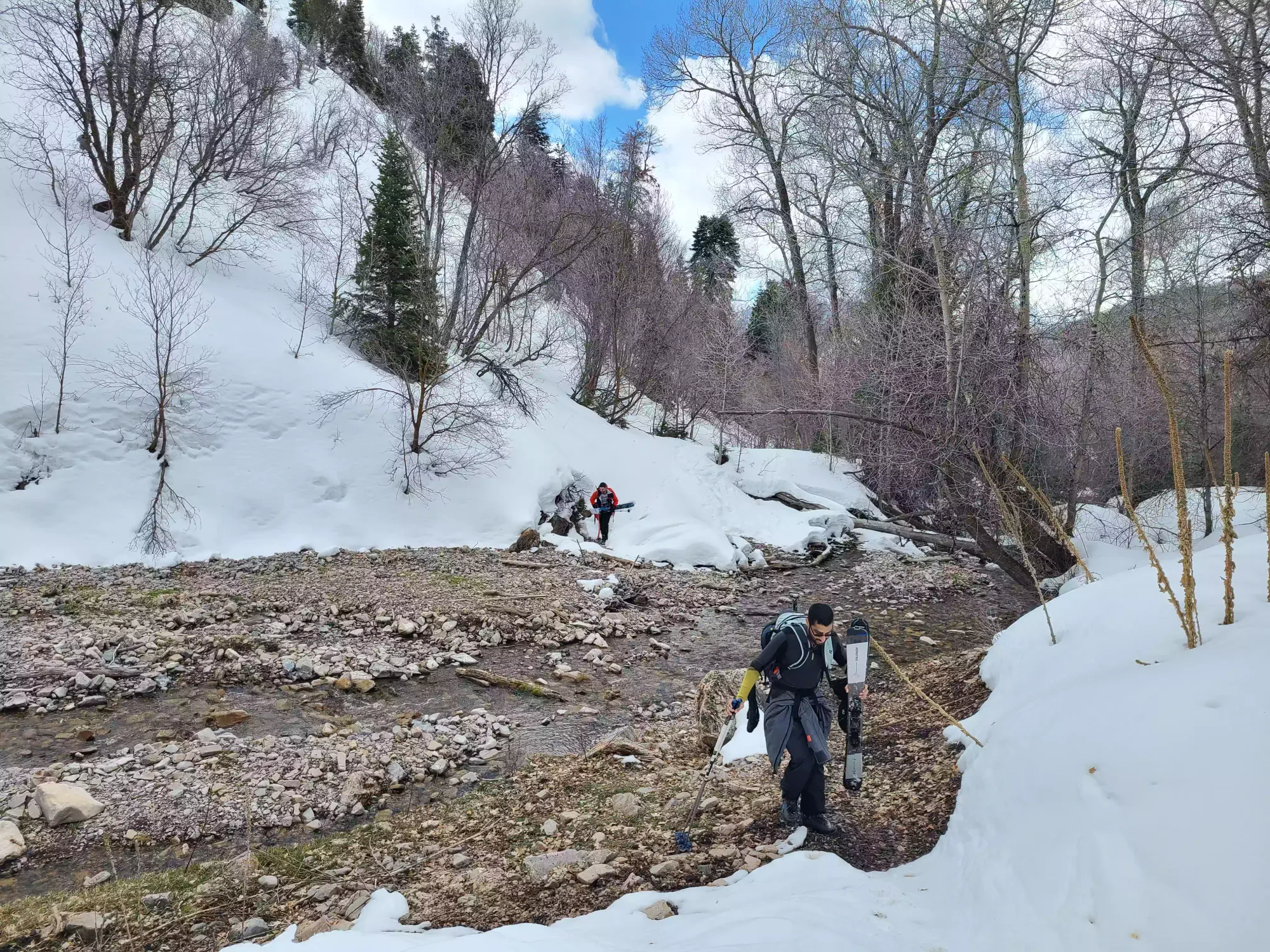
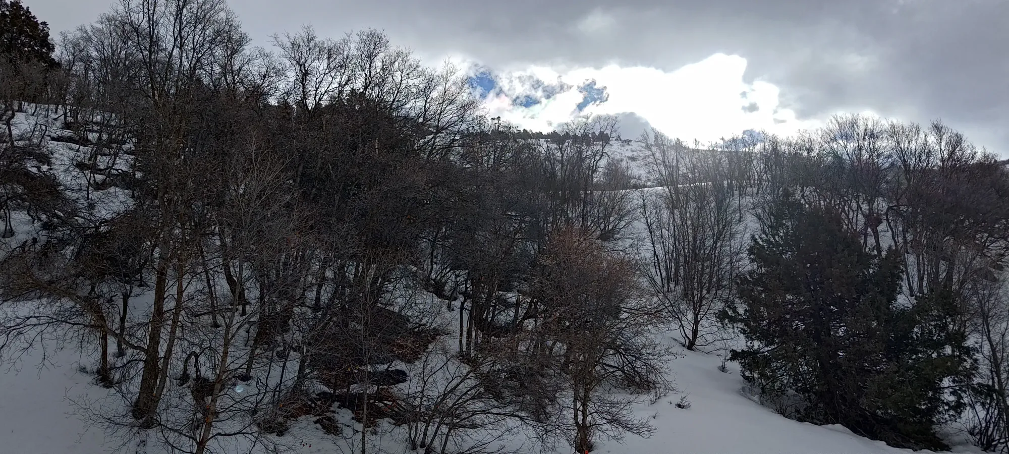
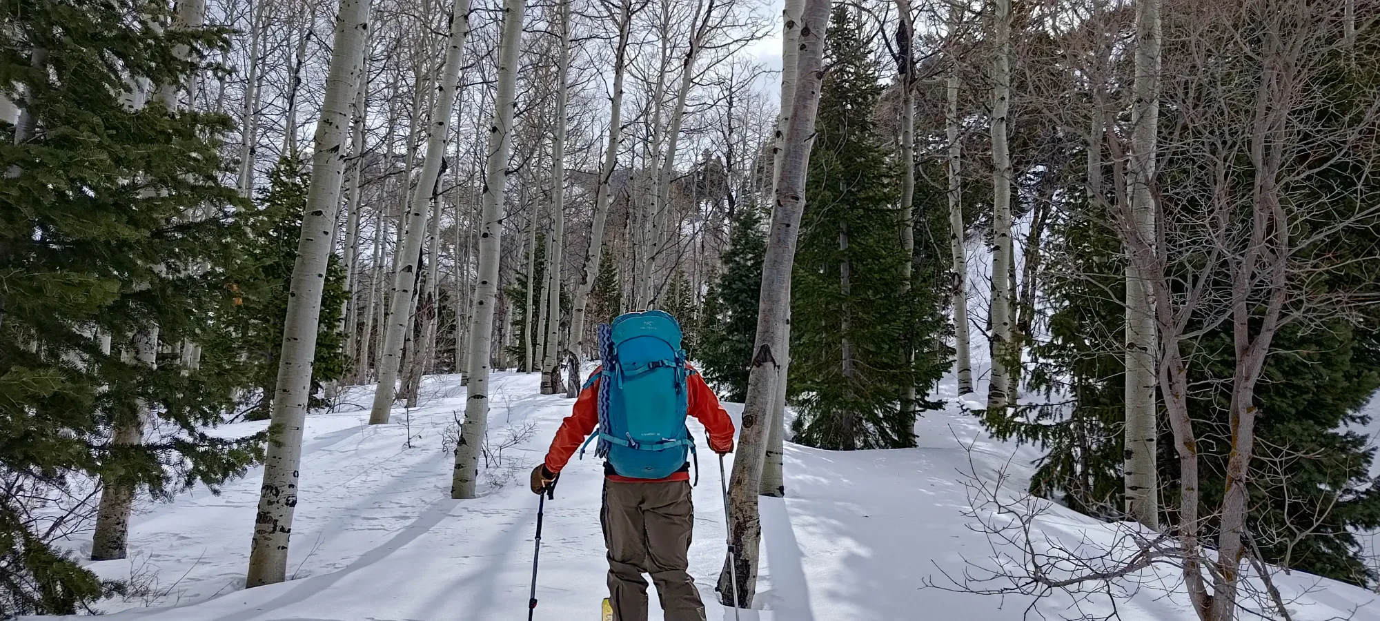
Picnic canyon got better, and we started skinning through a wide, gentle valley filled with aspen trees and good times. Nick was especially pleased to be on his skis continuously and not crossing creeks constantly. We spent about 50 minutes here, gaining up to 2500m (our starting elevation was 2160m), so we definitely were gaining more distance than elevation to this point. We had a short break where Nick and Nate enjoyed some food+water, and I sat there watching (I was having some colitis-related issues at the time due to a failed attempt to try a new medication, so I was on the "nothing in, nothing out" program).
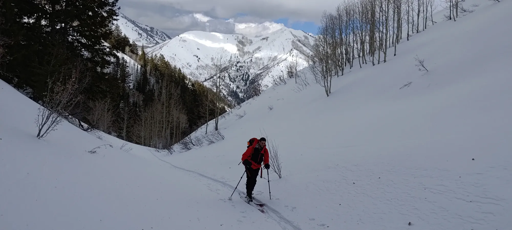
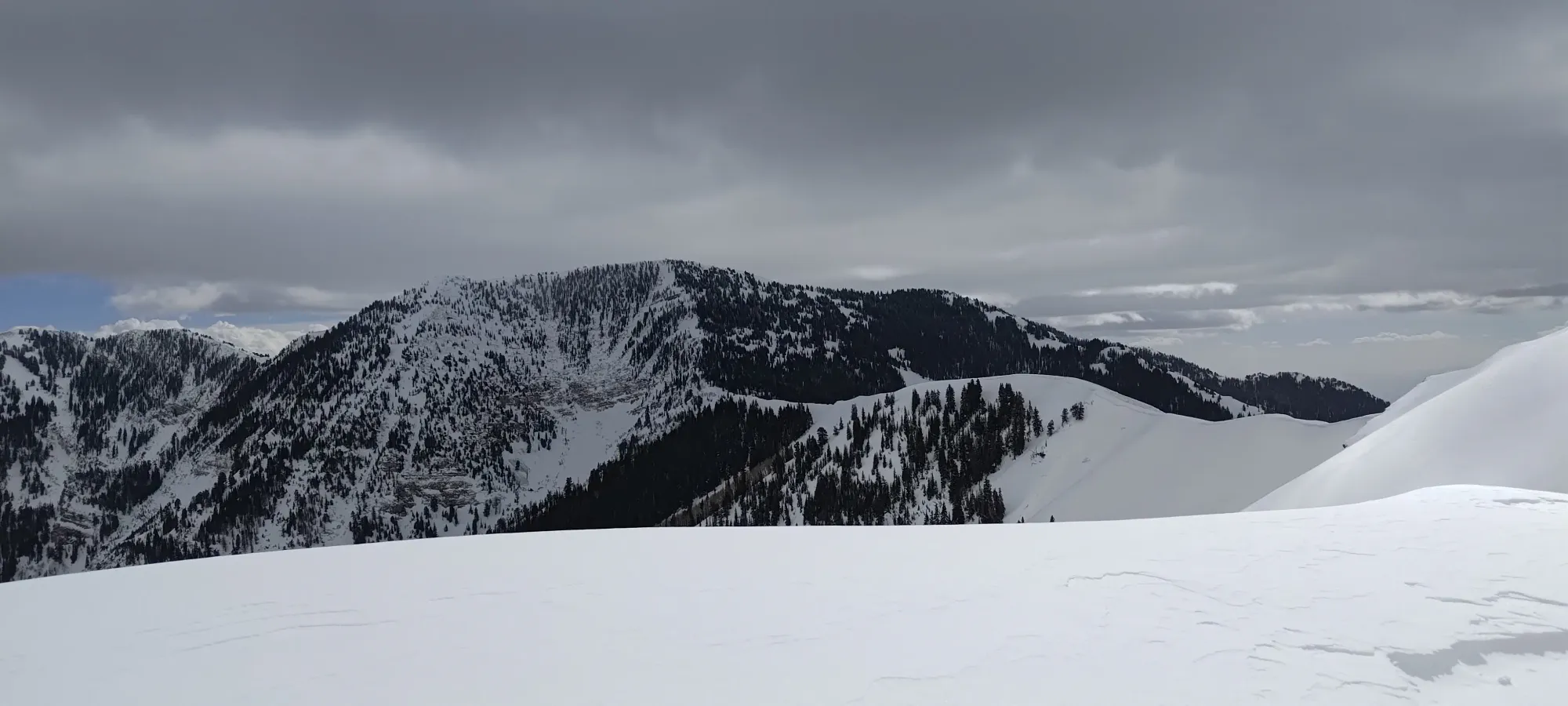
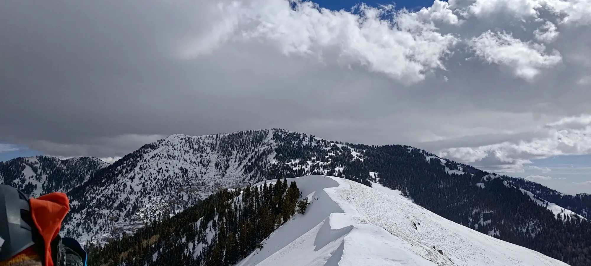
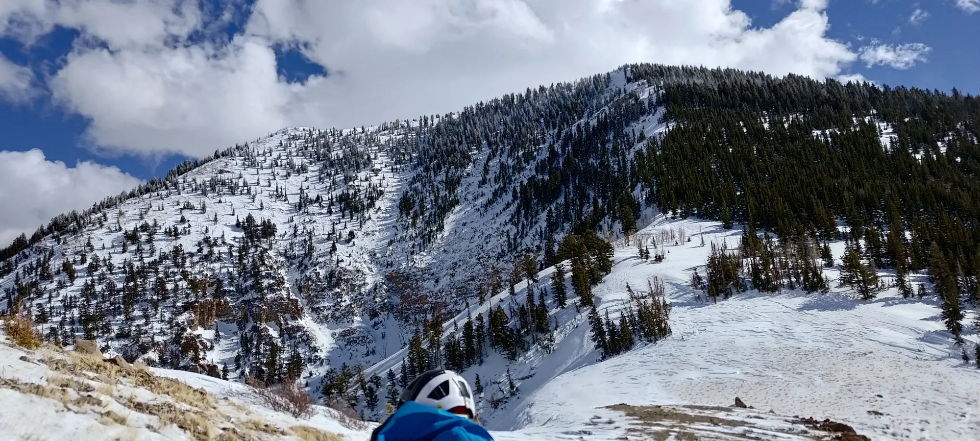
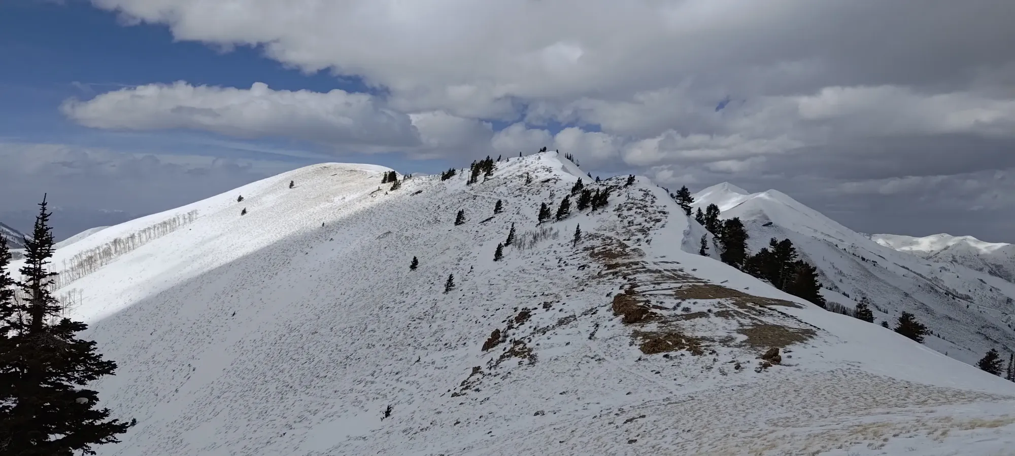
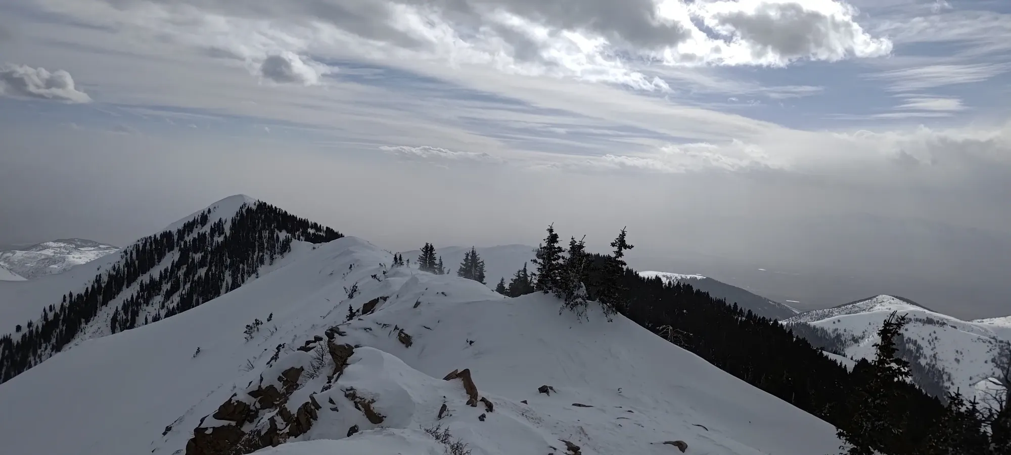
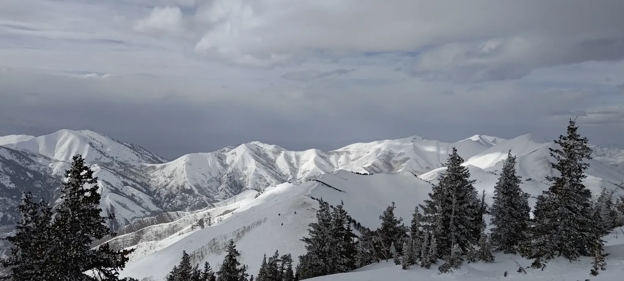
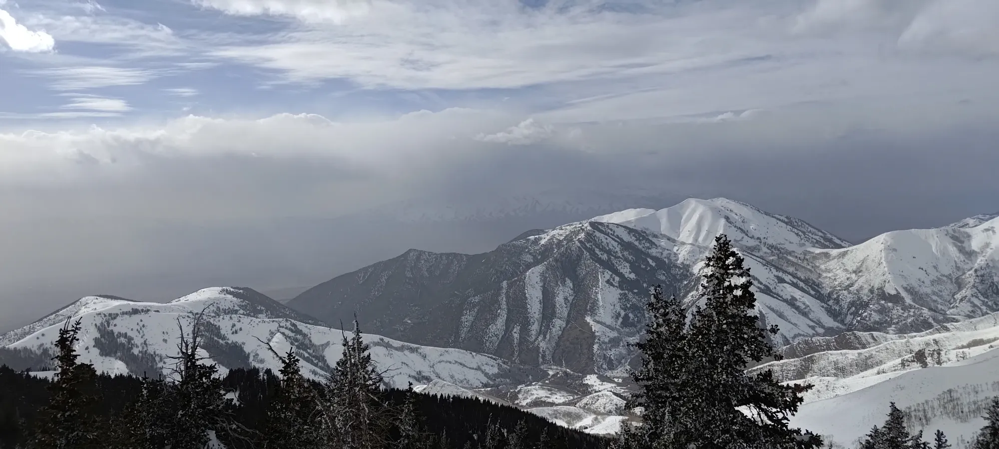
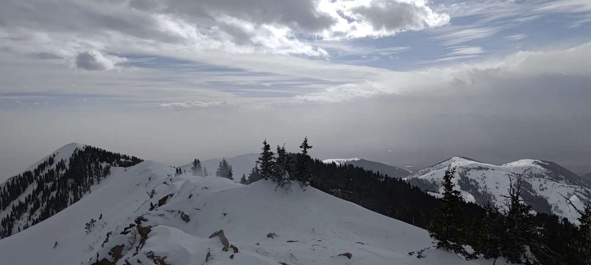
After 10-15 minutes, we got back moving, and we soon found ourselves looking at some larger, open slopes leading up towards the long summit ridge of Flat Top. Thankfully, we found a lot of mellow-enough slopes to walk up safely, and some shallower spots that enabled us to avoid avalanche risk where it got steep, which worked out well. The sun was starting to bake solar slopes, and there was a bit of wind-effect, but overall the conditions were pretty good. We picked a shallow and wide rib to ascend, and switched back up it, weaving into the glades on climber's left a bit near the top, eventually topping out at the point west of The Jumpoff.
This section was pretty straightforward. As we got higher onto the rib, the snow got thinner, and we put ski crampons on pre-emptively to avoid slipping (Nick, especially, who was renting gear since his personal skis' edges were MIA, was on some pretty fat and unfamiliar skis making sidehilling challenging). Since we were just going up for a while, we didn't lose much with glide, and the traction was nice to have. Otherwise, we just walked up for an hour and a half til we were on the ridge at just above 2900m.
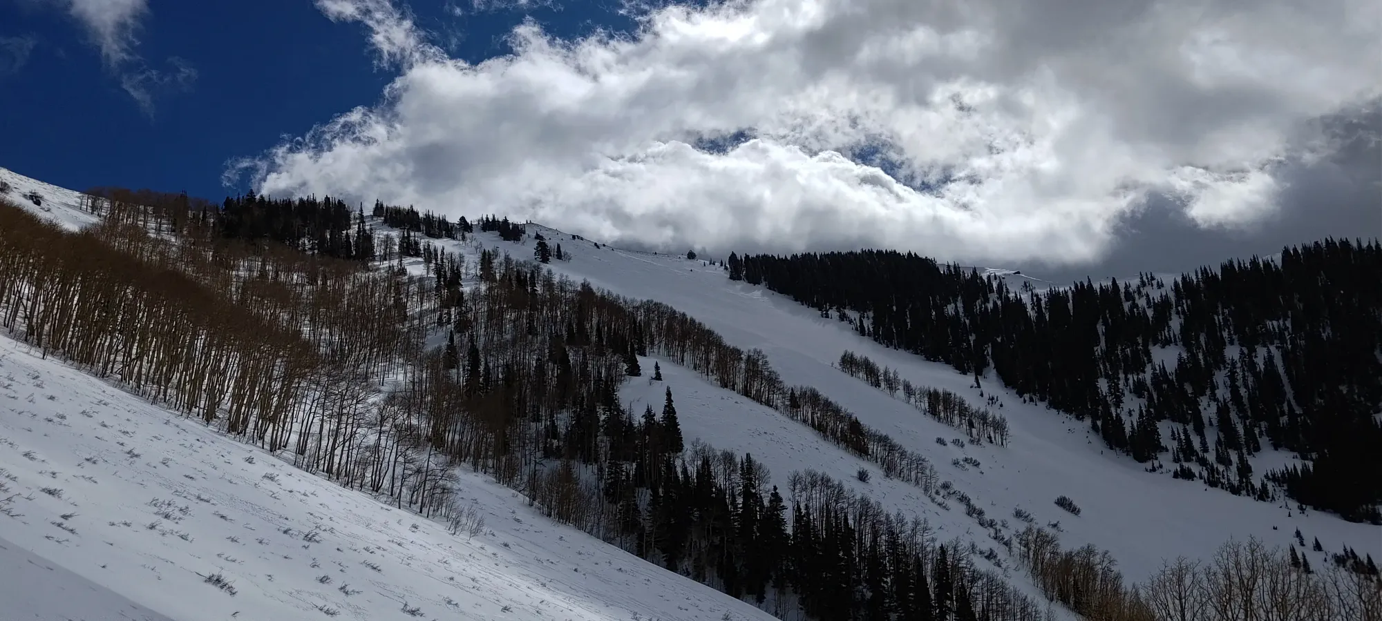
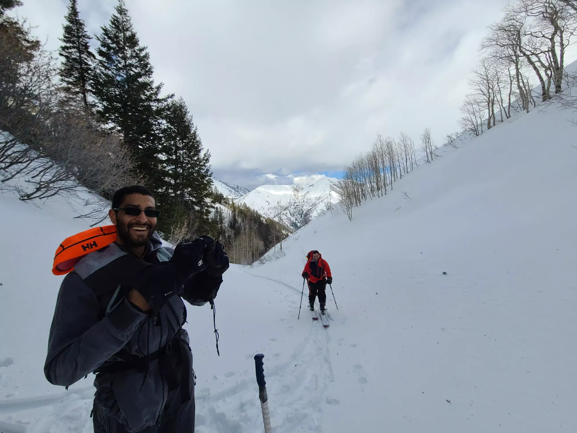
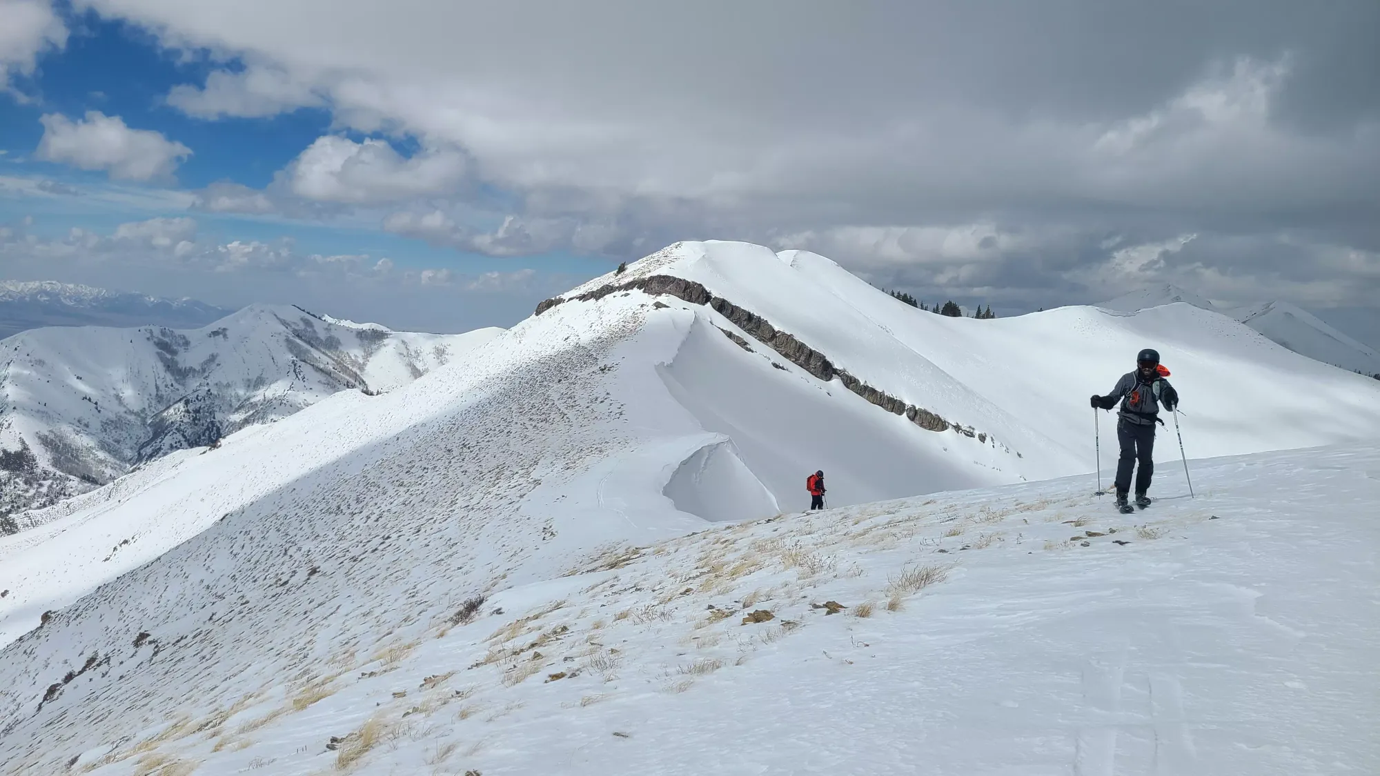
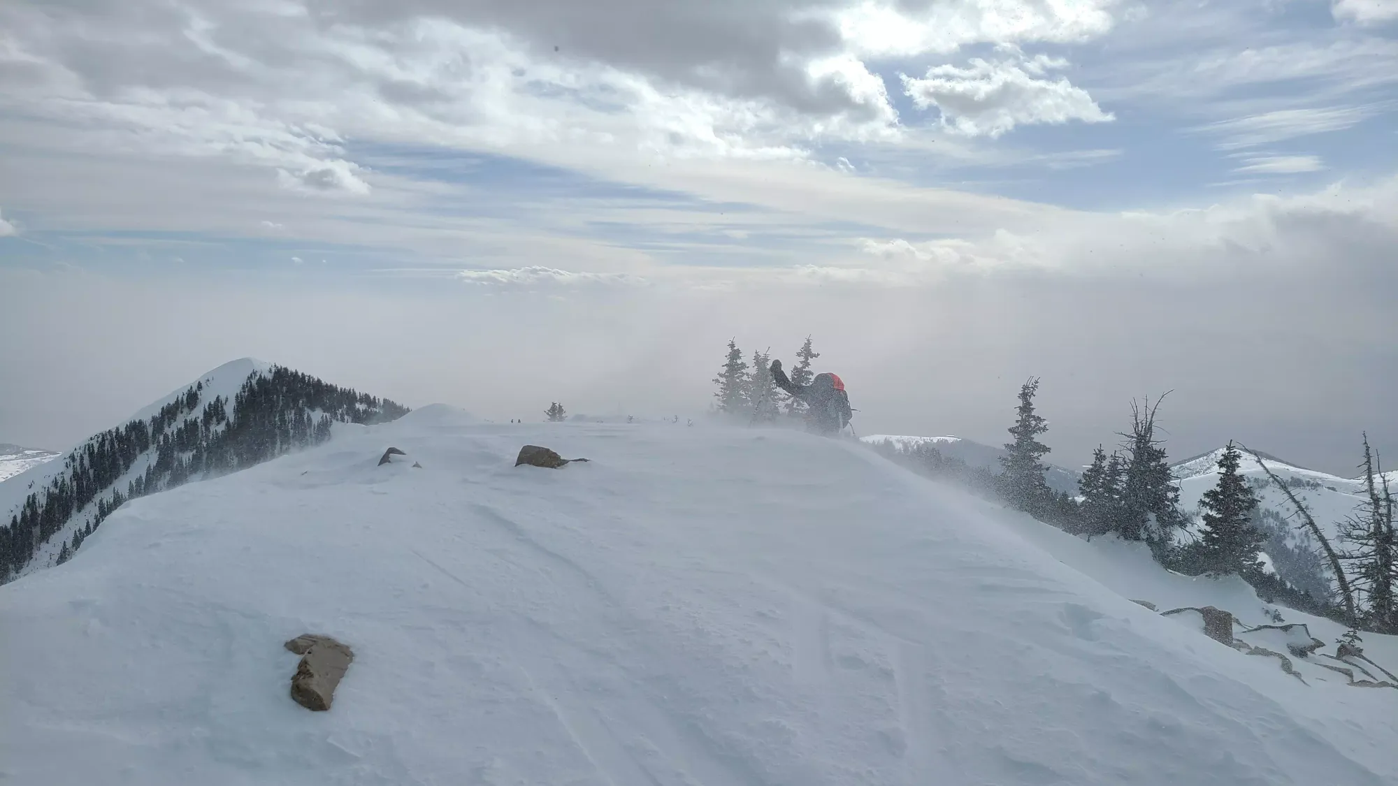
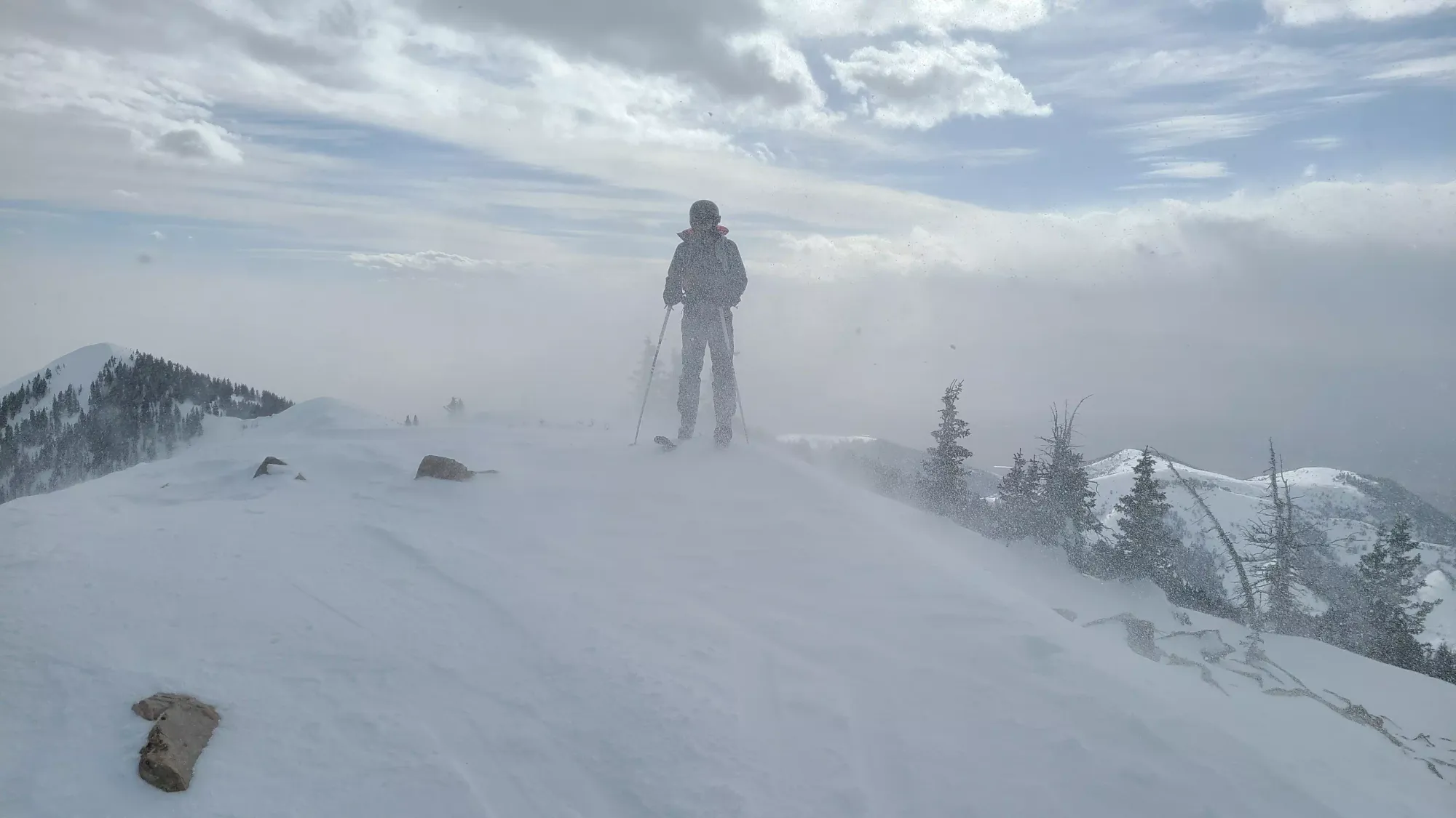
On the ridge, we found more consistent snow, fairly small cornices, and an easy-looking walk to the first false summit of the ridge. We stashed our ski crampons (though we kept them fairly handy, as we were warned they'd be coming in handy again later), and got moving. We'd originally planned to layer up here due to high winds rolling in, but we didn't feel them yet on this aspect, so we held off a bit longer til things got more intense.
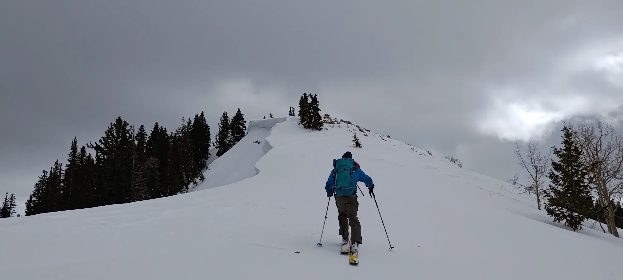
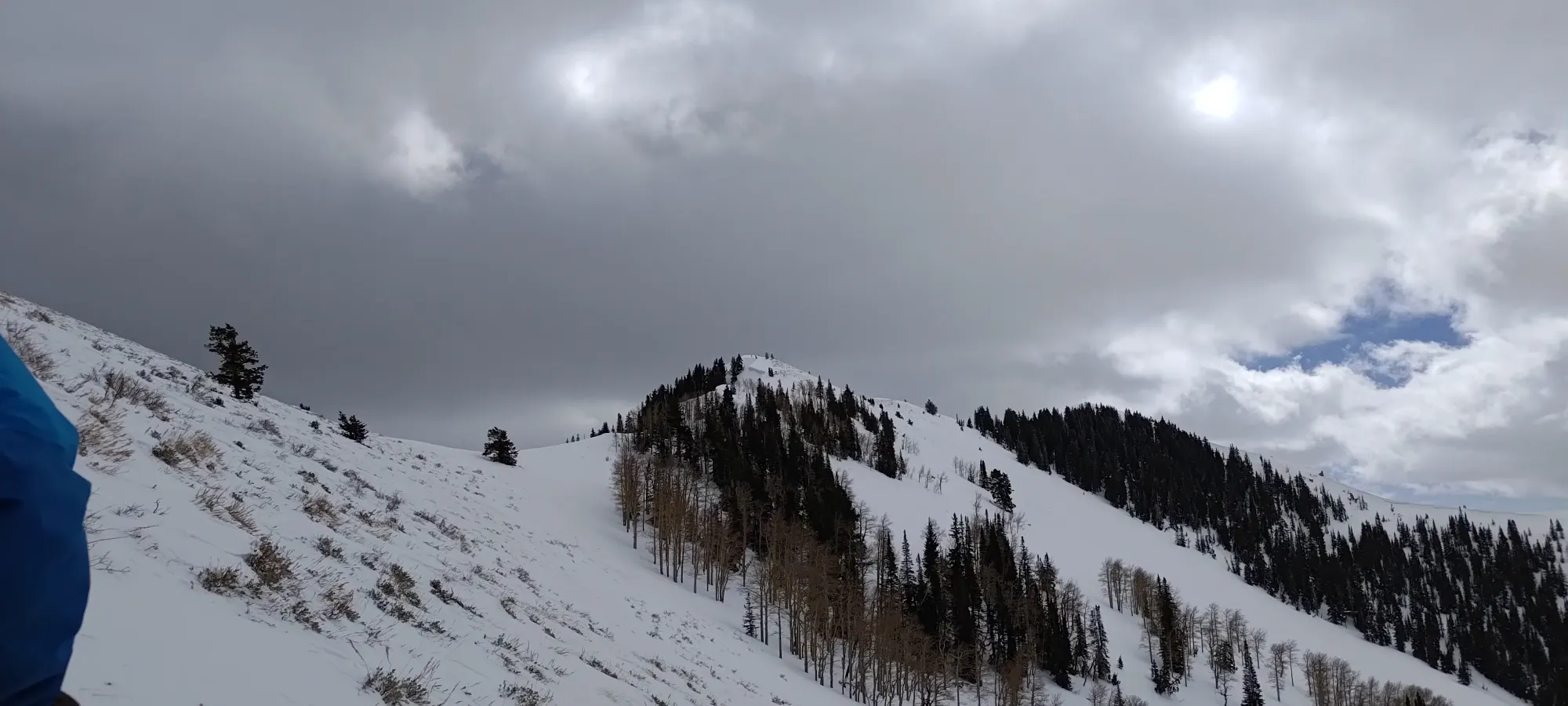
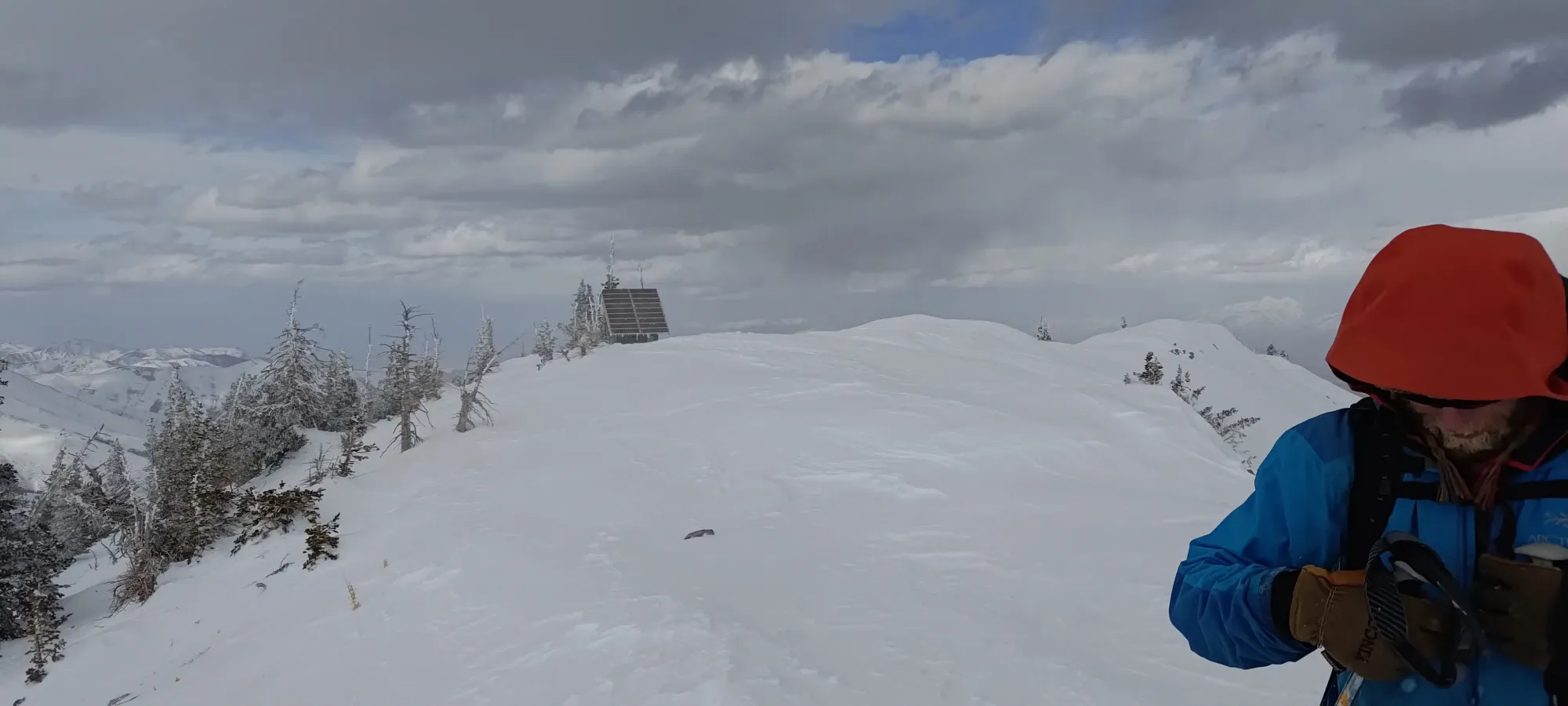
Getting up to the first false summit took us about 20 minutes, and we spent another 15 getting from there back down and up to the "real false summit", which itself has 99m of prominence (so close!). Here, we finally got our eyes on the objective, which was looking encouragingly "not too far away".

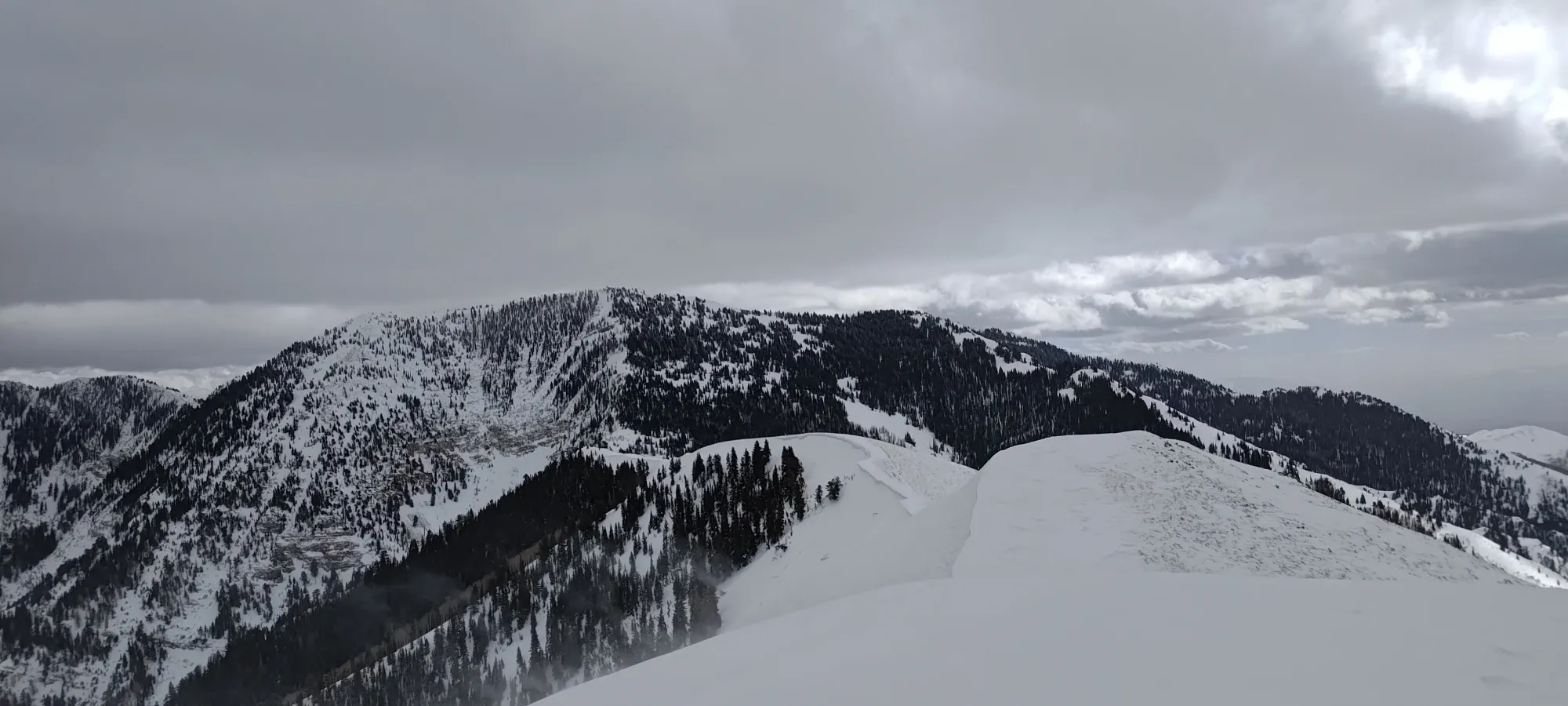
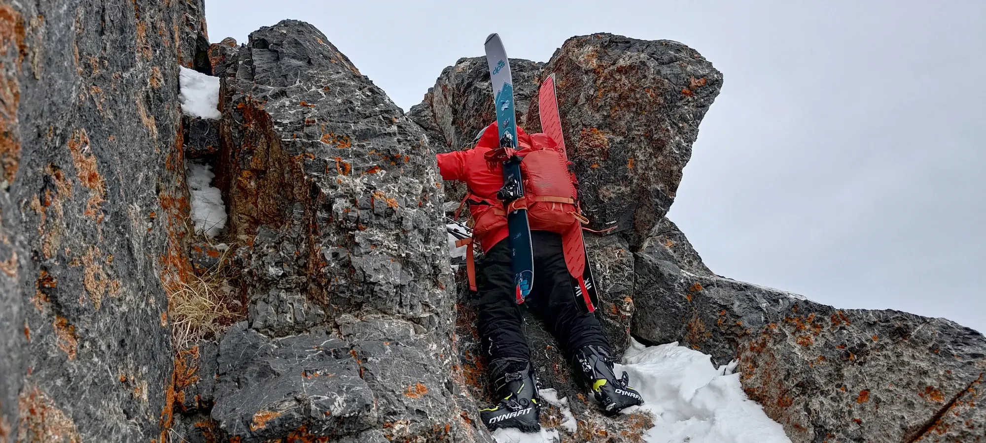
With this first hurdle cleared, we started making our way down the ridge, which drops about 100m to the final col below the true summit. Not long after we started our descent, we encountered a small crux just below 3000m, where we had to downclimb a short gully (maybe 10m of vert, if that) to get down onto the rest of the ridge where we could continue traversing. Thankfully, it was fairly easy to just slip down the ledges a few times on your butt, and we spent less than 10 minutes getting through. Despite that fact that this wasn't skiing, I think Nick even managed to have some fun doing it!
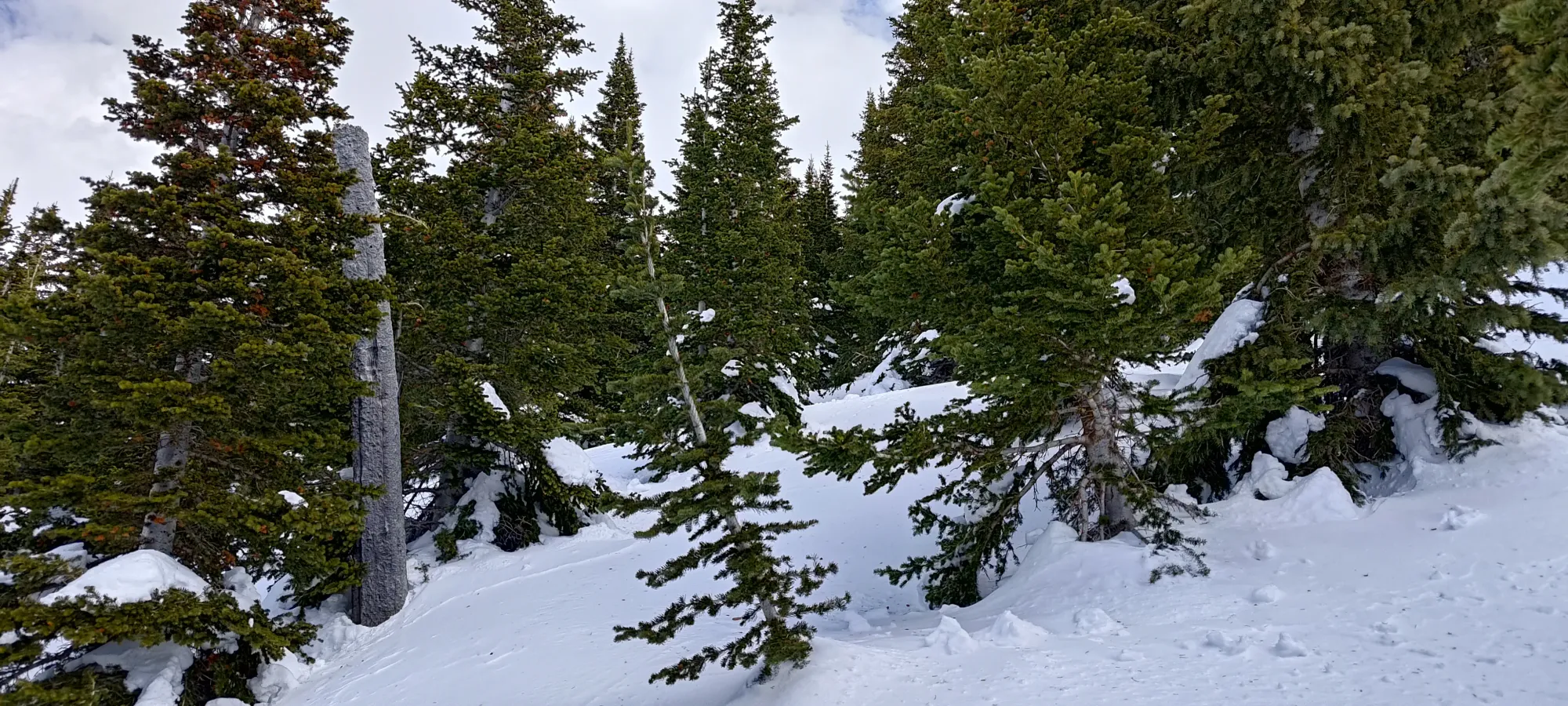
From there, it started to get a lot windier, so we bundled up and started the final descent of the ridge, which took about half an hour, with us mostly avoiding the rocks by staying high on the snow, since the cornices weren't big enough to concern us at that distance. We didn't break right at the col, but slightly further, as that allowed us to get out of the wind, and break in the shelter of the trees on the final face.
I was feeling my lack of nutrients pretty hard at this point, so I called for a break before we made the final 300m summit push. Since my digestion was still highly suspect, I only had some water and about half a sandwich, and we moved on after 10–15 minutes, as the day wasn't getting any younger.
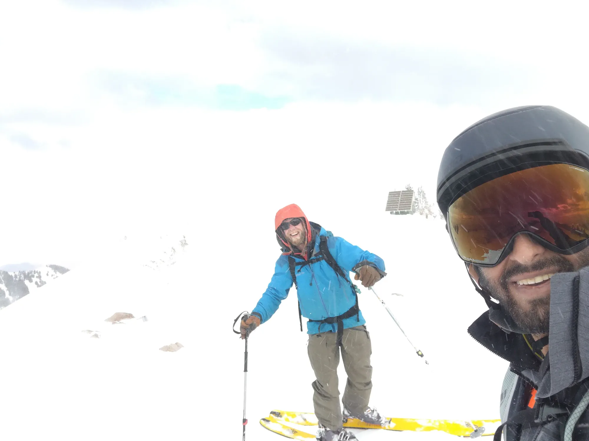
The snow was nicer in this forested area, sheltered from the sun by trees and the NW aspect, and I was getting excited for a nice summit ski down with every step. Sadly, that didn't last too long, as I soon felt the consequences of having that short snack break, and I had to stop to use the bathroom. Nick and Nate went on ahead to get Nick up as much as they could while I was breaking. After a tedious 15 minutes of trying to go to the bathroom on the side of a mountain in the middle of winter (hard to make that anything other than a poor experience), I got myself moving again, and tried to catch myself up. I caught up at around 3025m or so, where Nick was officially at his limit for exertion, so he decided to turn around. He was nice enough to (without my presence or input, even) turn around solo and start the traverse while Nate and I pushed for the top, so massive props to Nick for suffering up that far, and for being nice enough to let us continue up. Since it was close to 4pm, we had to do our best to push and get up+down to minimize travel in the dark, and more notably, to reduce the exposure to the ever-worsening winds coming from the west.
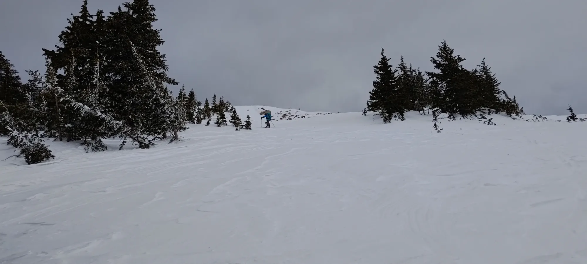
Those last couple hundred metres were a slog, though, and I was feeling the lack of nutrition, sleep, and elevation all at once. After my break below 3000m, it took nearly an hour to top out. We took a couple photos, but didn't linger up high due to the unpleasant winds. We took our skins off in the shelter of some trees just below the top, and started making our way down just after 4pm.
The ski down started out with a bit of a jump scare, as Nate had his ski catch some hard snow and release, and without brakes or a leash, it rocketed down for a good few seconds before thankfully stopping in a small cluster of trees 😅. After that small bit of spice, we enjoyed some excellent open glade skiing down to the col, getting down 300m in about 7 minutes. Man, I love being able to go down on skis!
Once we were done skiing, though, we had the worst part of the day. I saw Nick's tracks on my way down, so we were confident he was ahead on the traverse, but weren't sure exactly where, since we couldn't see him. What we did know, though, was that we were going to have a hell of a time catching up. Not only was I feeling pretty pooped, but the winds had increased substantially, and transitioning was a legitimate challenge, as pointing our skis up slightly caused them to catch the wind like sails, and we both got knocked over twice as we got skins+crampons on and started walking.
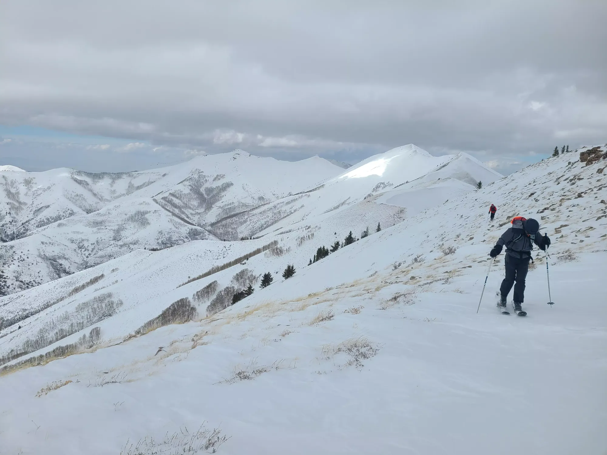
The ridge walk was pretty taxing. I had to move fast despite my tiredness, knowing the winds were going to get worse, and that getting off the ridge was the highest priority. We stayed lower on the ridge to avoid getting blown off, but being constantly dialed to keep low, planted, and moving was taxing to both mind and body. We gained up to some trees below the crux in about 20–25 minutes, where we reunited with Nick, and got moving after I caught my breath a bit.
We were pretty close to the crux, so we arrived there quickly, after which we realised it might be a bit of a challenge to get back up. I was happy to just catch my breath a bit more, so Nick went to inspect, and spent a few good minutes trying to figure out his approach to get up. Nate and I checked out the possibility of wrapping around, but it seemed no better, so with a bit of spotting from Nate and a hand-boost to supplement the footholds, Nick made it up. I followed up with a bit more ease, thankful to hold on to my title as the better scrambler of the two of us (Nick is by far the better climber, so I need to take my wins where I can in the rocks). Nate followed up without issue, and 25–30 minutes later, we were on our way to the ridge's high point, after which we expected the winds to finally calm down a bit with the aspect change.
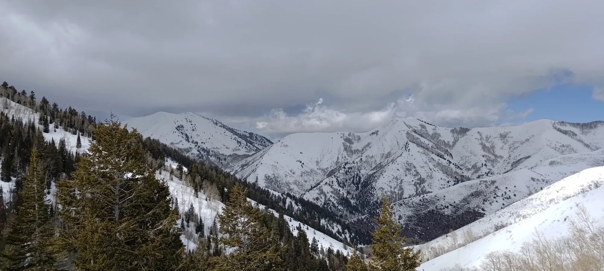
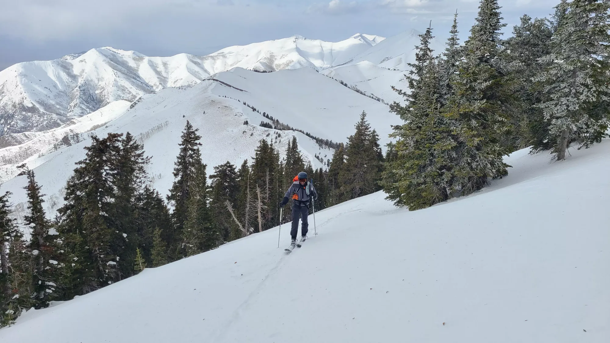
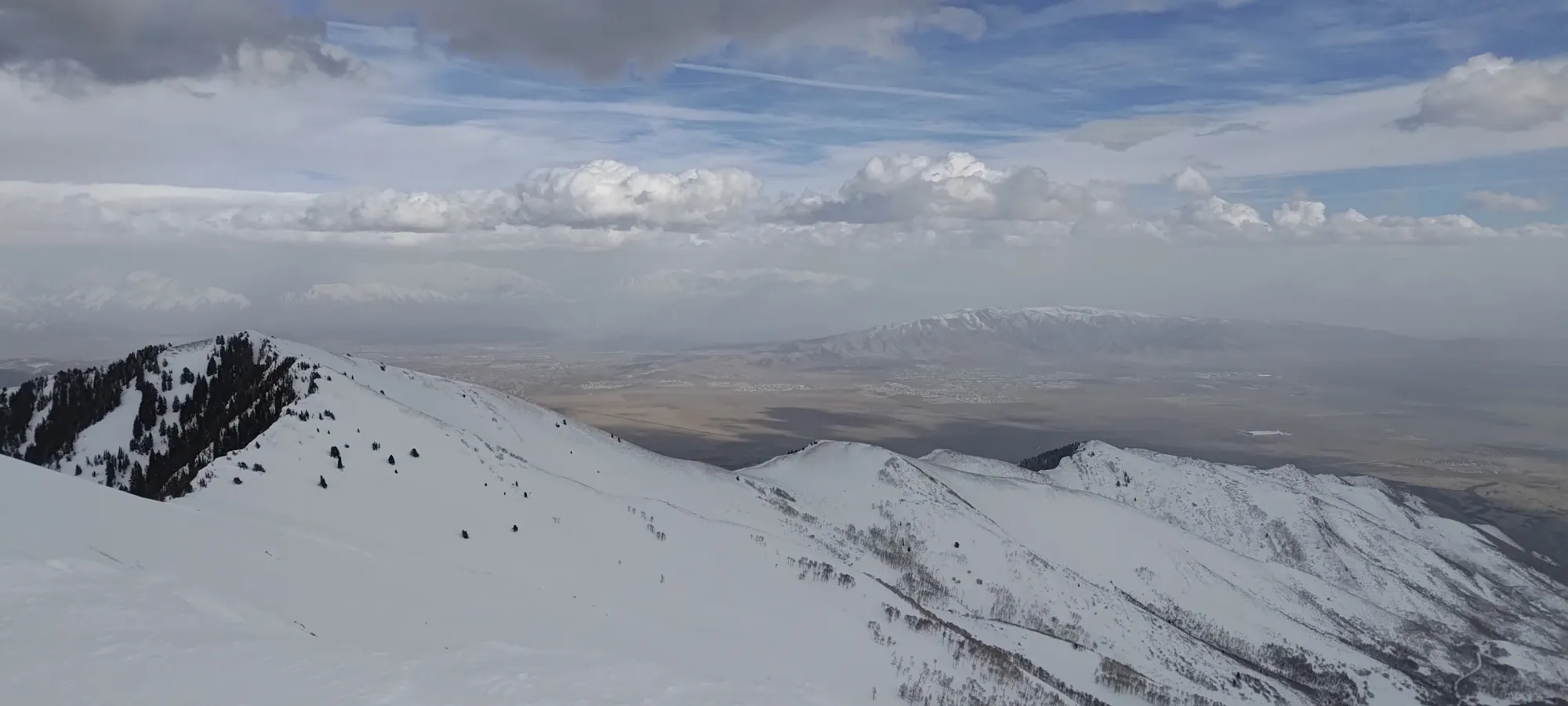
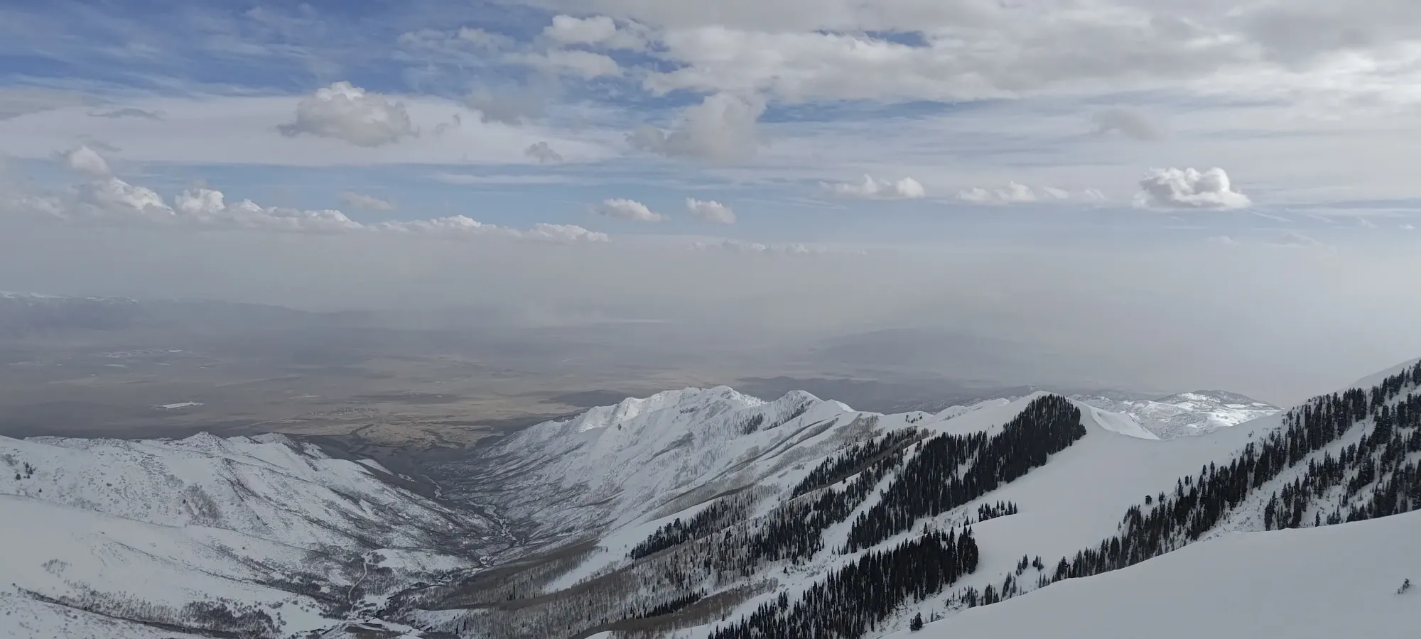
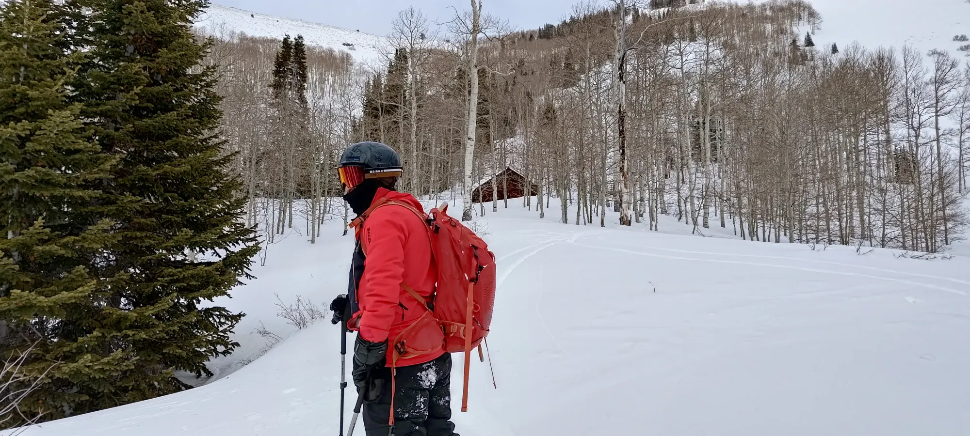
Once we got over the ridge summit, we skinned down to the bottom of the col between it and the first bump we ascended in the morning, and transitioned in the calm of the more sheltered NW aspect. From there, we enjoyed some excellent powder skiing down to about 2600m, where the snow started getting a bit more variable, with the sun making a sticky surface if you got too far from the trees. Still, some excellent turns were had, and if you played the aspect card ridge and stuck to shadier slopes, you could still have very nice turns for a while longer.
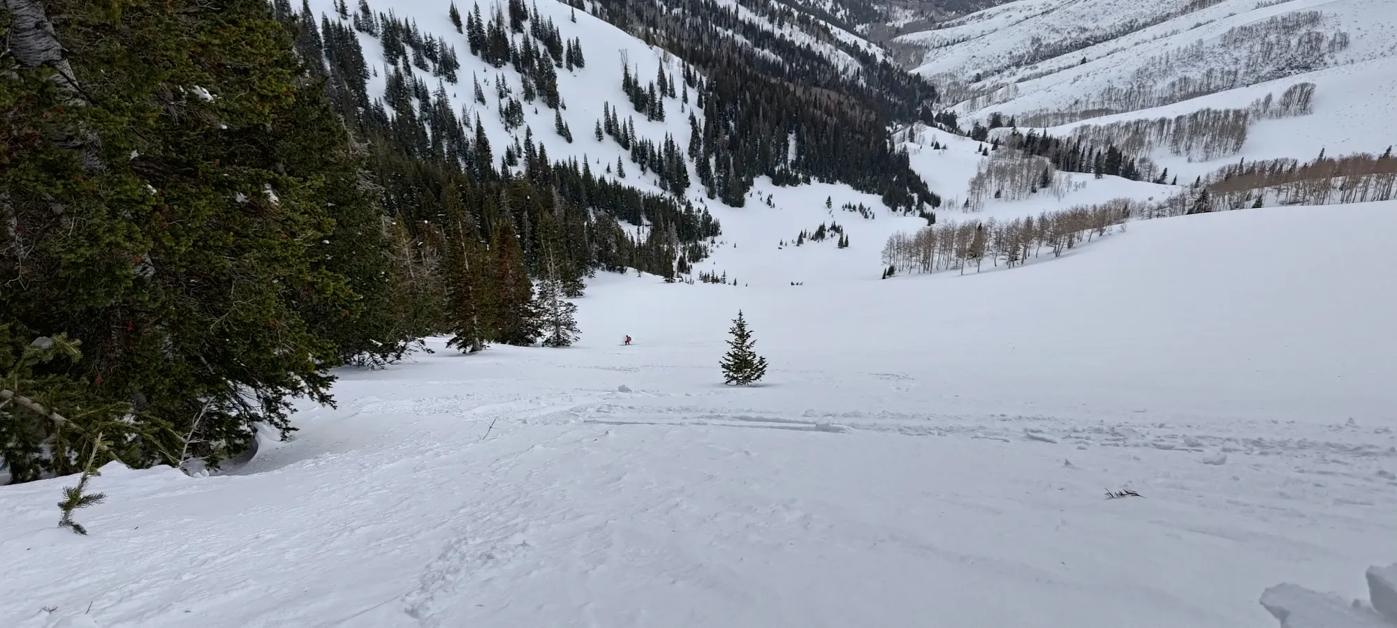
As we got lower into the valley and the aspens, we had a harder and harder time finding soft snow, and by 2450m or so, it was mostly just the sticky stuff. We found some cabin in the aspens in the valley, which looked like quite the cozy setup. We did not have that luxury, though, so we continued skiing down to the creek, where we had to take our skis off and start the tedious ski, cross creek, repeat process to get ourselves fully off the mountain.
The way back took around 45 minutes from this point, partially because transitioning all the time is slow, but mostly because Nick sadly had a bit of a mishap on one of the pitches of skiing between creek crossings, where he had his goggles up but skied past some branches that clipped his eye. We spent a little while doing some basic first-aid (sadly not much to do other than try to blink out any debris, though) and letting the immediate pain subside, but sadly he was in quite a bit of discomfort+pain for the rest of the ski out. We got to the sleds without headlamps necessary, then rode back, loaded up, and started the drive out after sundown.
We split up at that point, and I drove us to Salt Lake City for me to get some food, then we drove as far as was reasonable given the hour, blizzard conditions that were forming, and my tiredness, which ended up being Burley, Idaho. We crashed there for the night, then I drove us home the next day, where I dropped Nick off at the ER. They thankfully reported that he should heal in a couple days with some antibiotics, and as of the time of writing, is already doing much better than he was on the drive home. Props to him for sticking that out despite the pain, and thanks to Nate for the awesome trip.
For those wondering "should I ski Flat Top Mountain", I would avoid the ridiculous winds and eye-poking elements, but otherwise heck yeah! It is a straightforward, 99% skinning trip, had some great skiing away from the sun, and it's an ultra, so therefore it is important 😜.
GPX Track + Map