Enchantment Peak - August 12 2023
A long slog to an often-overlooked peak, but a worthwhile trip if you're already in the area

North Vancouver Area, Lion's Bay, BC
1444m
This is a peak that's seldom climbed, and is kinda out-of-the-way, requiring a lot of work for a non-prominent, not-very-technical summit. I got close to it when I did an abridged Howe Sound Crest Trail traverse last year, but didn't have the time to make such a big detour. I knew I'd need to return to clean this up at some point, but it never felt "worth" the hassle. However, Logan+Jass had started talking about wanting to get East Lion recently. Since I already got that last year, I figured it'd be a good opportunity to hang out and share the approach, then just split up at Thomas Peak for our respective summits, then head out together.
When planning, I realised just how much elevation gain it was gonna be (~1900m) with my rough estimation from throwing a GPX track together. I've maxed out around 1500m in a day since my injury, and my goal was 1750 this month. 1900 was substantially more, but I was feeling optimistic, so we decided to meet at my dad's place in Horseshoe Bay to carpool (I'd be coming from the north, and them from the east), and then go together to try and snag one of the precious free parking spots in Lion's Bay.
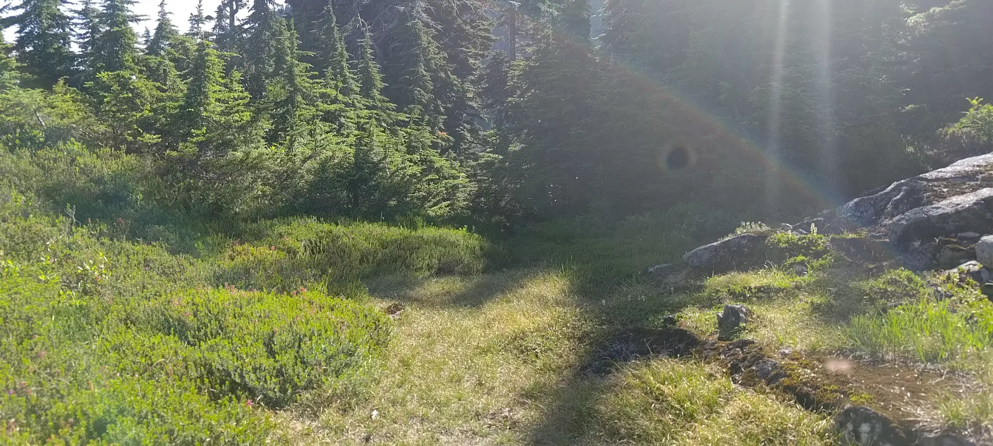
We managed to do that, just barely, although we paid the price not in dollars, but instead in about 130m of extra elevation to gain on the road in. On the way in, at least, this was no big deal, barely 10 minutes of extra effort. We decided not to take the usual Lions-Binkert old FSR from the Sunset Trailhead, but take the shorter+steeper Trudi's Trail + Sleepless Nights trail instead.


Our choice seemed to pay off. First and most important, I had a song to match our trail's name, which always makes me happy. Aside from pointless jokes, though, it was nice empty, which I'm sure was not the case on the main trail. Plus, we made nice, efficient progress, and burned up from the car at 115m (Lion's Bay Elementary, the only free parking in the entire town) to 700m (Alberta Creek) in under 1.5 hours, at a pace that left us feeling pretty close to fresh still. It was more rooty/steppy than the FSR, though, so we decided not to use it for the downhill. Jass filled up some water at the creek, then we continued on. The FSR didn't last long after we joined, though, and quickly became singletrack and rocky to the point that biking would be difficult, for those considering that.


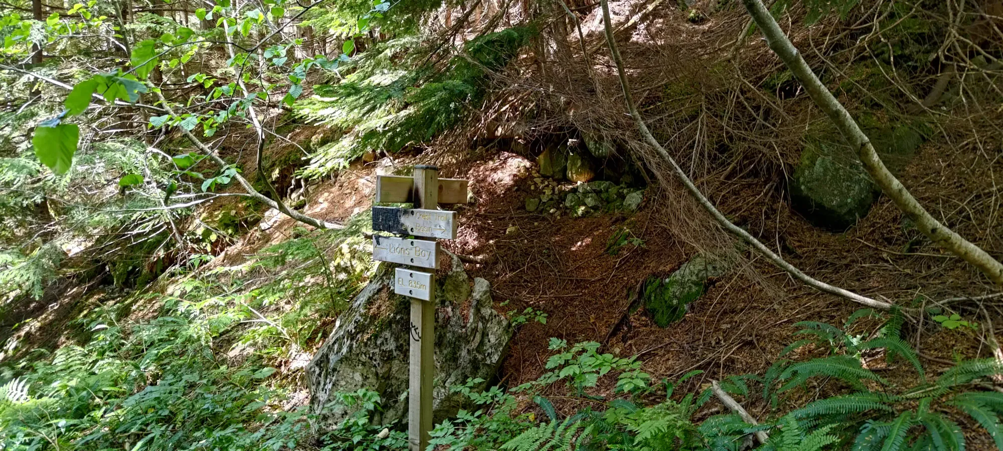
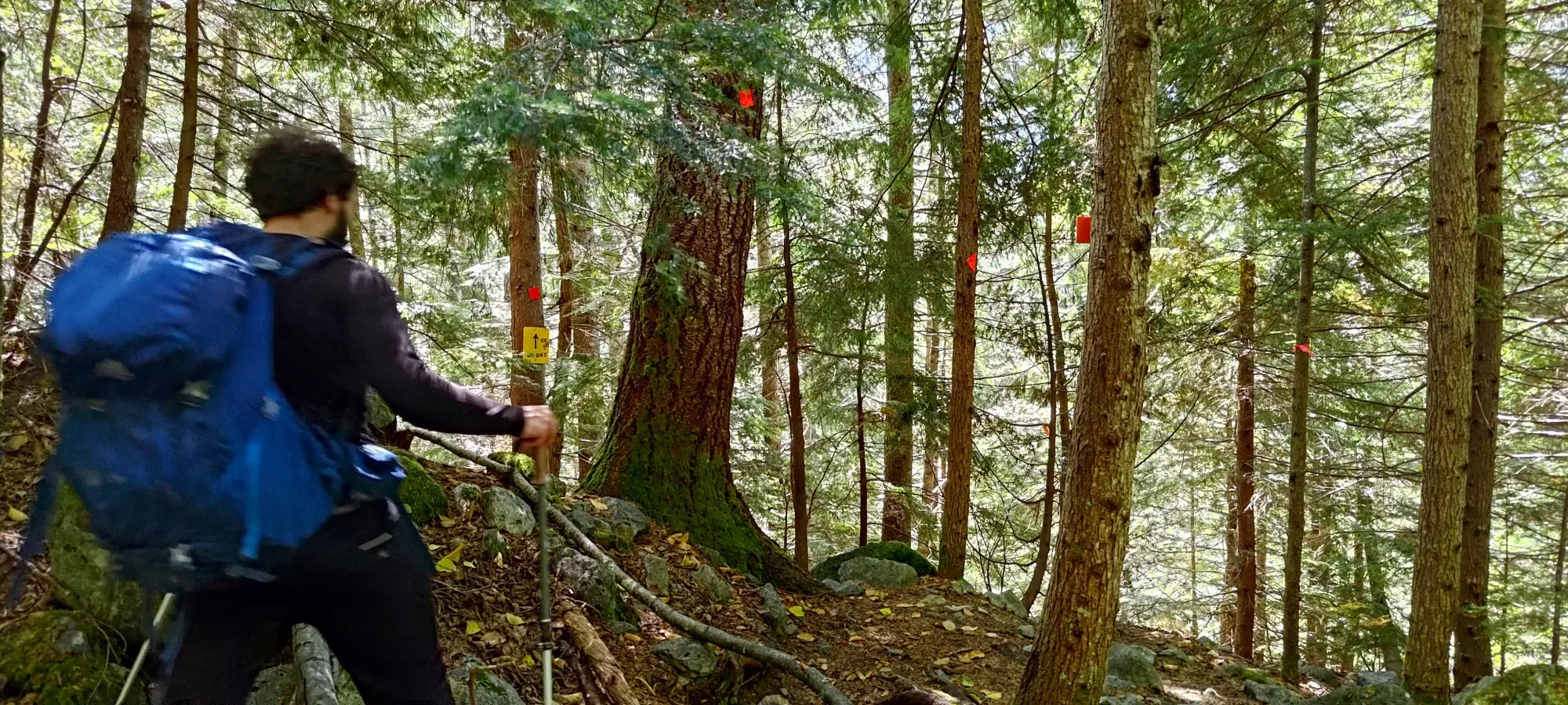
From that point to the Harvey Creek junction took around another half hour, an unfortunately flat section of the trail. This seemed to have put all 3 of us into a deep Sigma Male Grindset, and we just didn't notice the sign or many markers showing the way to the Binkert trail, and instead just continued bashing up the trail continuing from the road, which actually leads to the pass between Mount Harvey and David Peak. We did this blindly for about 35 minutes (including a snack break) before realising that we'd ascended about 170m up the wrong trail when it narrowed to be bushier than any of us remembered the Binkert trail as being. So we turned back around, and after wasting almost an hour with that excursion, got back on the intended route. We did briefly consider just committing and going up and over David/James, but figured that'd result in overall more gain, so we just turned back instead. Our best guess was that the fork is off to the side and also downhill, but in reality we were just all focused on "grind uphill" and were following the easy path that went up.
We slowed down after this point, and our next stop was only about 200m higher, at a small viewpoint around 1030m, 3:40 into the day, or just after 1:00pm. After this point, the trail got steeper and more variable, with bigger steps up big root systems, rocks to navigate around, and other "generally tedious" obstacles slowing the approach down. We hit the viewpoint at 1250m 35 minutes later, and took a long break. I guess the 3 of us just have too much fun sitting around and talking because we've got into a bit of a habit of "longer-than-needed" breaks on our ascents together, but none of us seem to be wanting to stop doing so enough to tell everyone to shut up and start hiking again earlier, so 🤷.

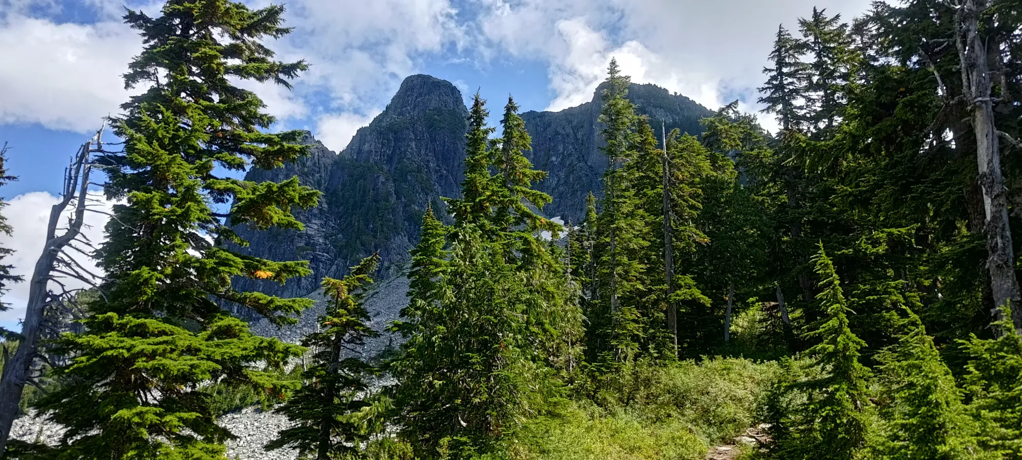
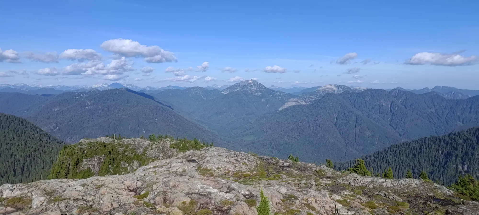
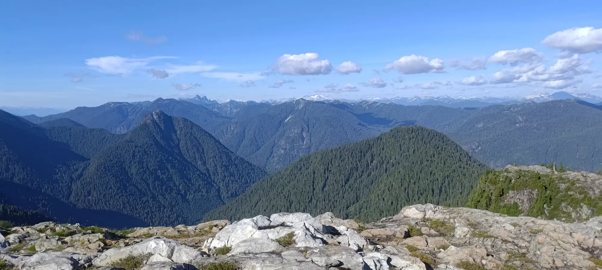
After a nice break, we spent 45 minutes slogging up the boulders to 1465m, where the trail joins the HSCT proper. There's some nice views in this section, but also not much shade on hot days, and the terrain is just generally slow due to the bouldery terrain (though they're at least fairly stable/solid). We were quite happy to get onto the ridge, though, as from there we knew it wasn't too much longer until we hit our checkpoint to split off for our peaks (Thomas Peak).
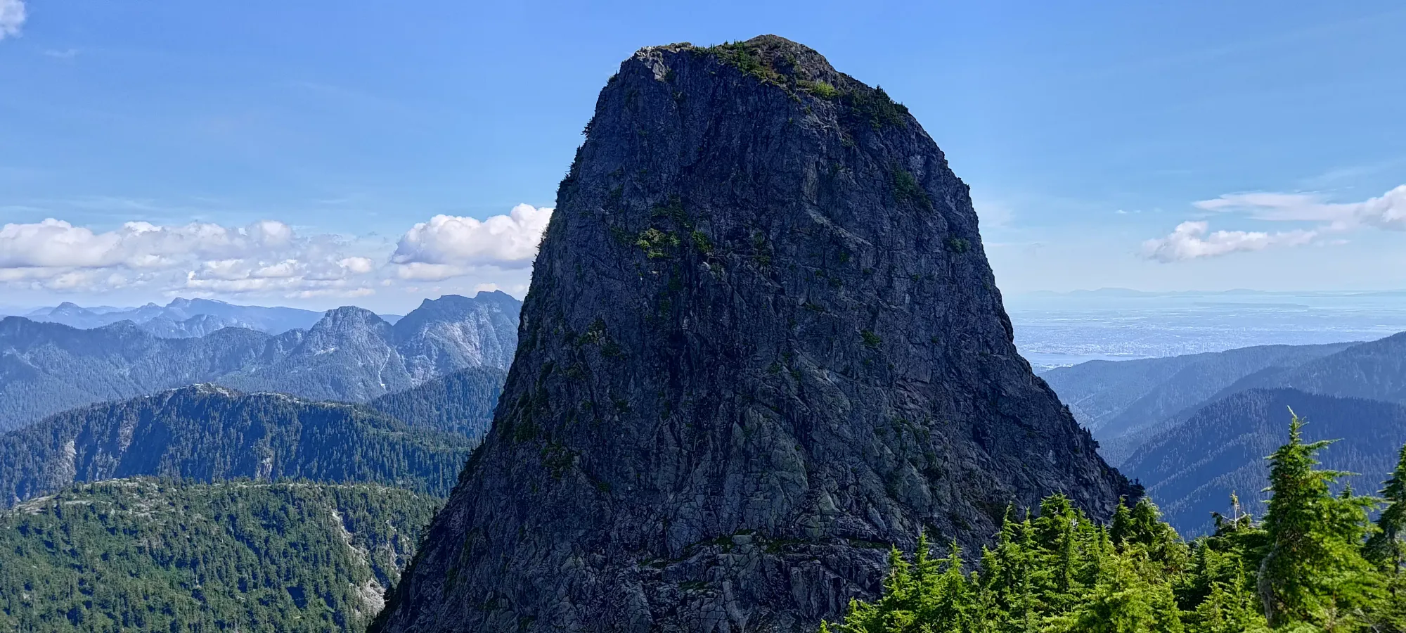
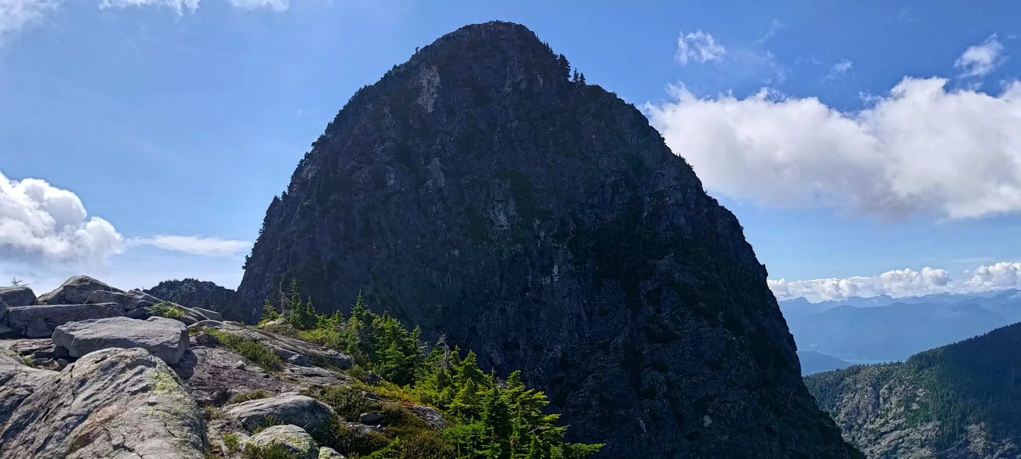
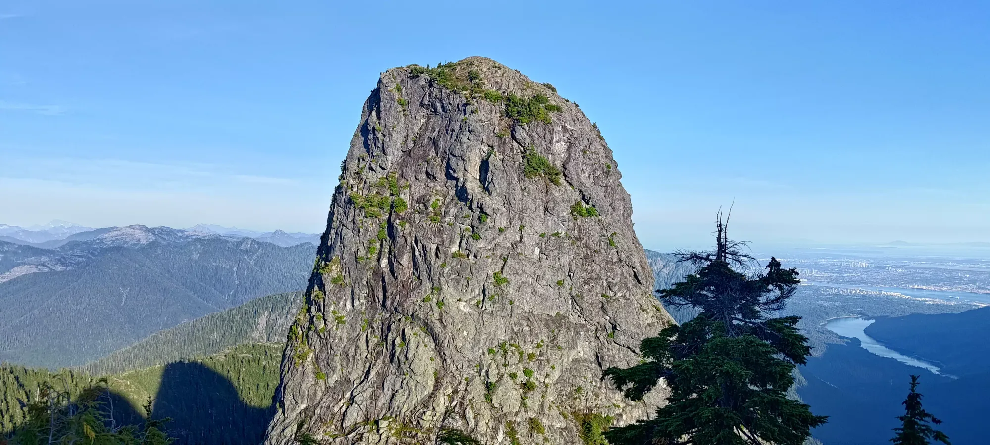
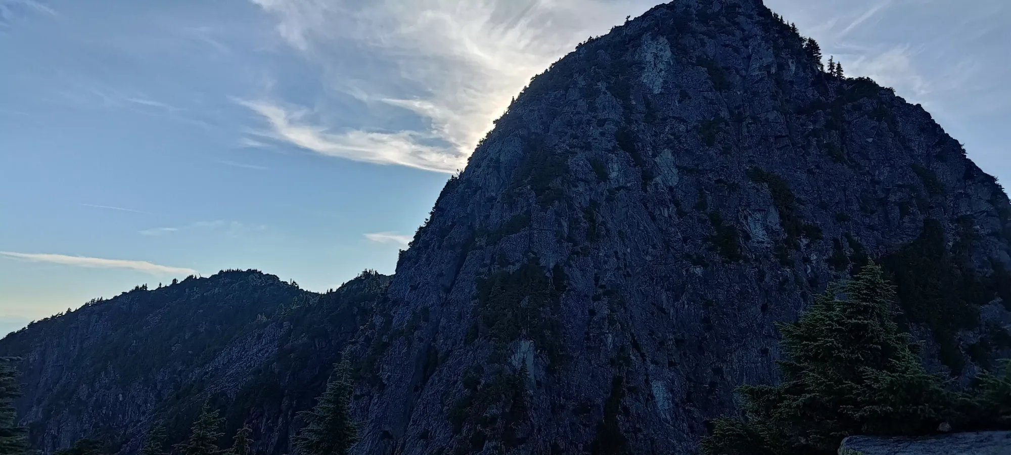
The ridge ramble up to the viewpoint below West Lion, down to the col between West Lion and Thomas Peak, then up Thomas took us about 50 minutes, with a short break in the middle. The ridge was similar in terrain to the boulders below, and the traverse over to Thomas was more exposed than I remember, with some finger-sized holds needed to hold you onto a thin ledge while traversing a bowl between the two peaks in a few spots. I'm honestly surprised so many casual hikers do this, and that I didn't even remember this terrain being of that nature.


We spent half an hour on the top of Thomas eating lunch while Logan+Jass planned out their route (since East Lion is substantially more technical than Enchantment). After that long, though, it was getting past 4pm and I wanted to move things along, so I decided to start heading down, figuring that I'd be slower anyways as the cripple of the group, especially since they were planning to descend only to 1400m whereas I had to go down below 1300m, and had much more distance to cover.
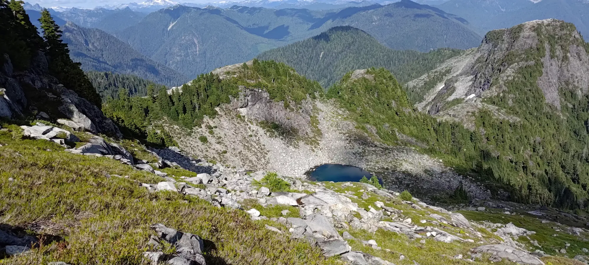
The descent to the small tarn north of Thomas was pretty simple, just walking down a grassy hill. There's a lot of buried rocks and 1-foot drops so you do have to pay attention, but generally just "wandering down the correct direction" will get you there. Once I got there, I enjoyed the view for a bit, then spent a little bit of time exploring to see if I could find a more direct route than the route graciously shared by Matt Juhasz with me. Unsurprisingly, he did his homework and it was the best option, but hey, nothing ventured, nothing gained.
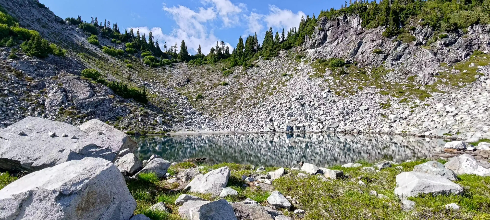
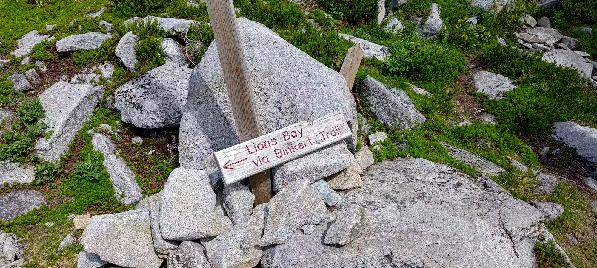
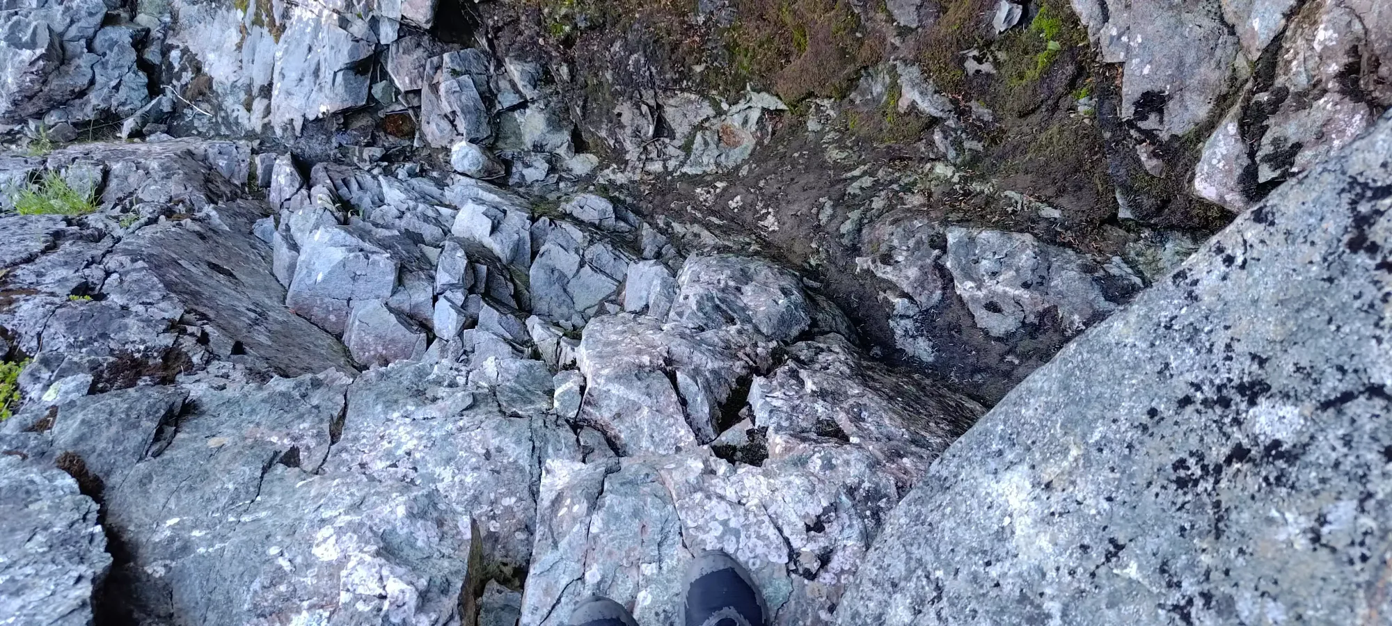
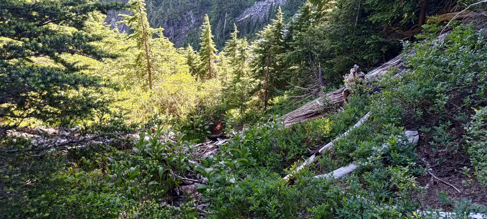
Around the point where my uphill+downhill tracks in this area meet, there's some pink flagging that denotes the "trail" to Enchantment Peak, which was quite nice to have. You basically just walk down the creek (low flow), then hit a few tributaries, with more grassy terrain in-between, then you hit the low point (around 1270m), and start picking up elevation again on some boulder fields. The creek has a couple small class 3 moves, one large ledge with wet, sloping rocks below, and one thin ledge traverse with finger holds to get out of the creekbed. Nothing crazy, though, and they'll assuredly change with conditions and erosion quickly.
Once you cross the boulders, there's one more stream to cross, and a steeper ascent through a short treed area with some steep dirt, and you can gain onto the ridge between the HSCT and Enchantment. That whole adventure (from the tarn to the ridge) took under half an hour, thanks to the great flagging and "semi-visible" path in the grass, which ranged from "the grass seems slightly more brown" to "this could be a game trail" levels of visible. Getting slightly off won't be the end of the world, though, the terrain isn't that big or difficult.
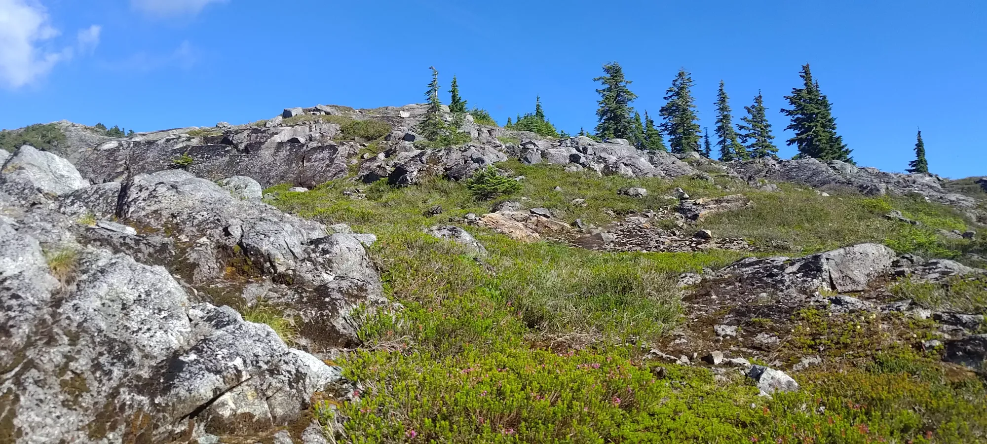

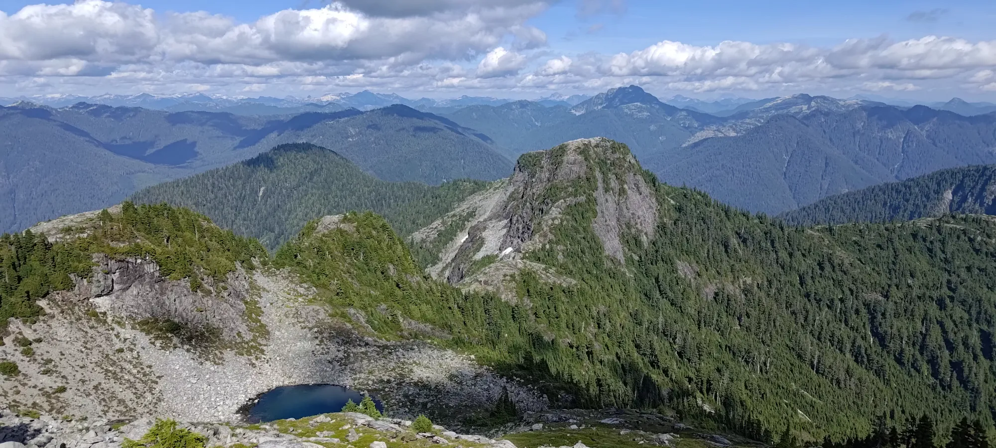
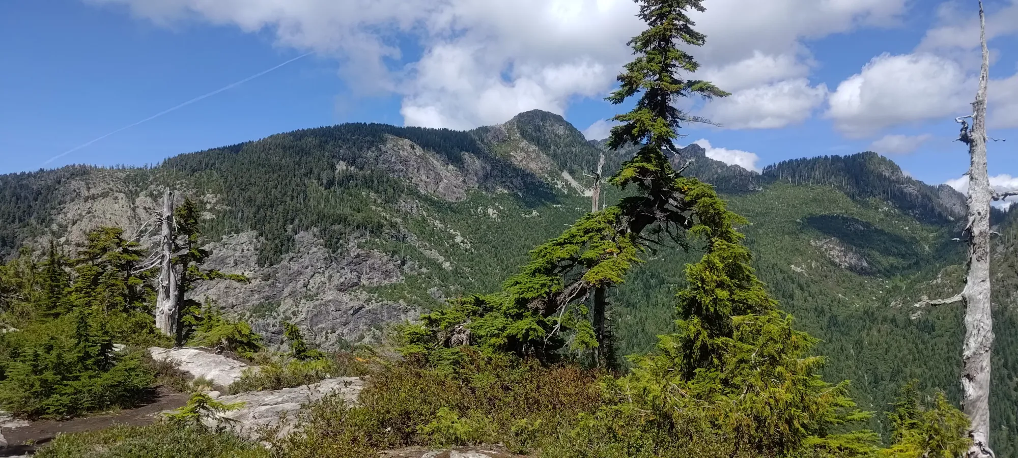
From the ridge to the peak was about 25 minutes of hiking and class 2 scrambling, but mostly hiking. The flagging persists here as well, but you can basically just "go up the ridge" and generally be okay, so just picking the terrain you prefer is a pretty viable strategy. When I got to the top, I was greeted by a rather loud crow (though it thankfully quieted down after I topped out), and I soaked in the views for 5-10 minutes before heading back down. While the terrain isn't terribly difficult and the mountain isn't very prominent or distinctive, it does offer excellent views.


Now nearly 8 hours into the day, it was time to get back. I was radioing the others on my way up, but after the boulders I couldn't get in touch, I figured they were busy climbing and didn't have free hands, and just kept checking in every so often so they could at least know what was going on from my side. I didn't take any extended breaks, as I expected them to summit not long after me if they hadn't already, and thought I had to hustle to meet back at Thomas before they got there. I did stop to refill some water on the way back, though, as I'd given Logan my extra water before we split up. Thankfully the creeks were flowing well for that purpose, a welcome benefit to this objective vs staying on the infamously dry HSCT.

I finally heard from Logan+Jass shortly after the boulders, before I got into the main creekbed. They had just summited, and were just enjoying the top for a bit, and were going to rappel down to save time. I was close to 1300m at the time, so I figured we'd probably arrive at a similar time, since they confirmed they only went down to 1400m, so if they rapped efficiently, they might beat me (I wasn't moving very fast). In about an hour from my summit departure, I made it back to the tarn. I met a couple of backpackers there on vacation from the East Coast, and we chatted for a while. They said they wanted to explore up past Brunswick, but were unsure if they could make it since they had to get back to their single car at Cypress. I asked how many days they were planning on staying, and it turns out their exit day was one where I'm light on meetings, so I offered to pick them up at Deeks so they could do the traverse, which made their day. Hopefully they enjoy their thru-hike. I also gave them some beta on West Lion, since they were interested in it, but weren't aware of an established route.
After that 10-minute side-quest, I rambled up the grass and bluffs for another 25 minutes until I got up to Thomas Peak. I wasn't hearing back from Logan+Jass, so I just chilled on the summit. They bugs were kinda annoying, but they were mostly non-biting flies (some mosquitoes, but not too many), so it was manageable. I gave my dad a call and we just chatted for a bit, but once it got past 7:00 I was getting a bit antsy. Around 10 after I got some texts from Logan that they were rapping slower than expected, and we agreed since I'm generally slow right now that I should just start descending, and that they'd catch up on the way down, so I set out around 7:20pm.

The way back to West Lion was not very eventful. I did meet a couple when I got up to the viewpoint who were hanging around the entrance to the scramble route, so I asked what they were up to, and they seemed to want to do the scramble, but wanted some more beta, so I gave them some. I considered just going up with them, but I figured that'd be too long, and then Logan+Jass would be waiting for me. Plus, by this point, I'd already gained over 2000m, way more than anything else I'd done since leaving the hospital, so I wasn't sure if I'd "last" the whole descent if I tacked on even more gain. They were making good progress by the time I went over the ridge, though, so hopefully they did okay.
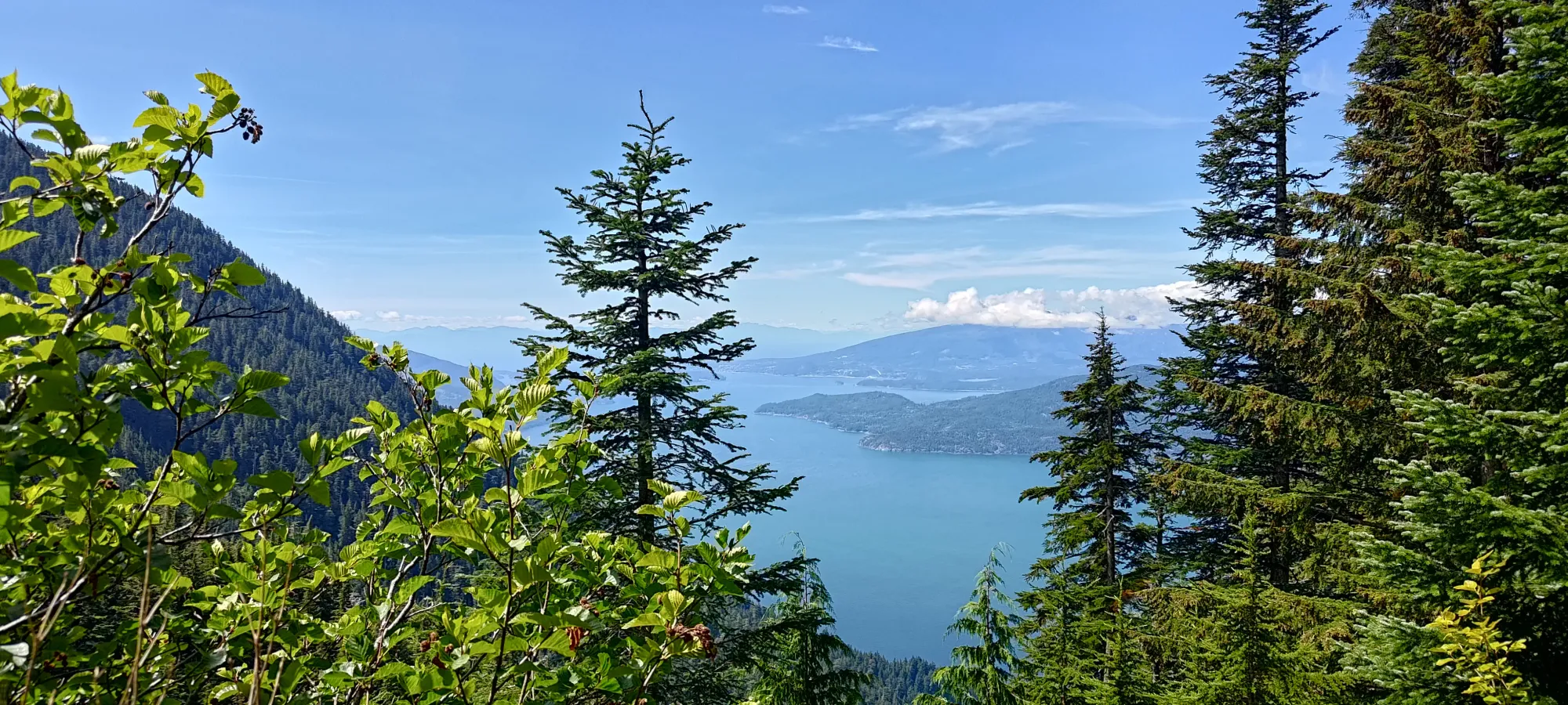
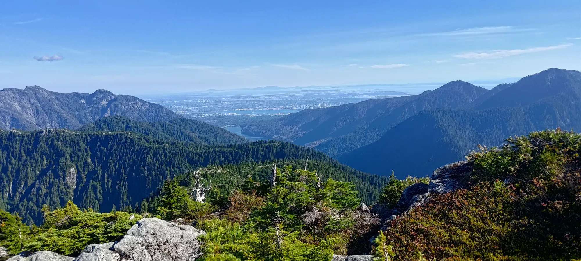
The terrain down to the fork off of the HSCT to the Binkert trail was rather annoying to descend, and took 30 minutes from the West Lion viewpoint. It did offer a nice view of the sound, though, so I did snap a rare descent picture before I started making my way down the boulders.
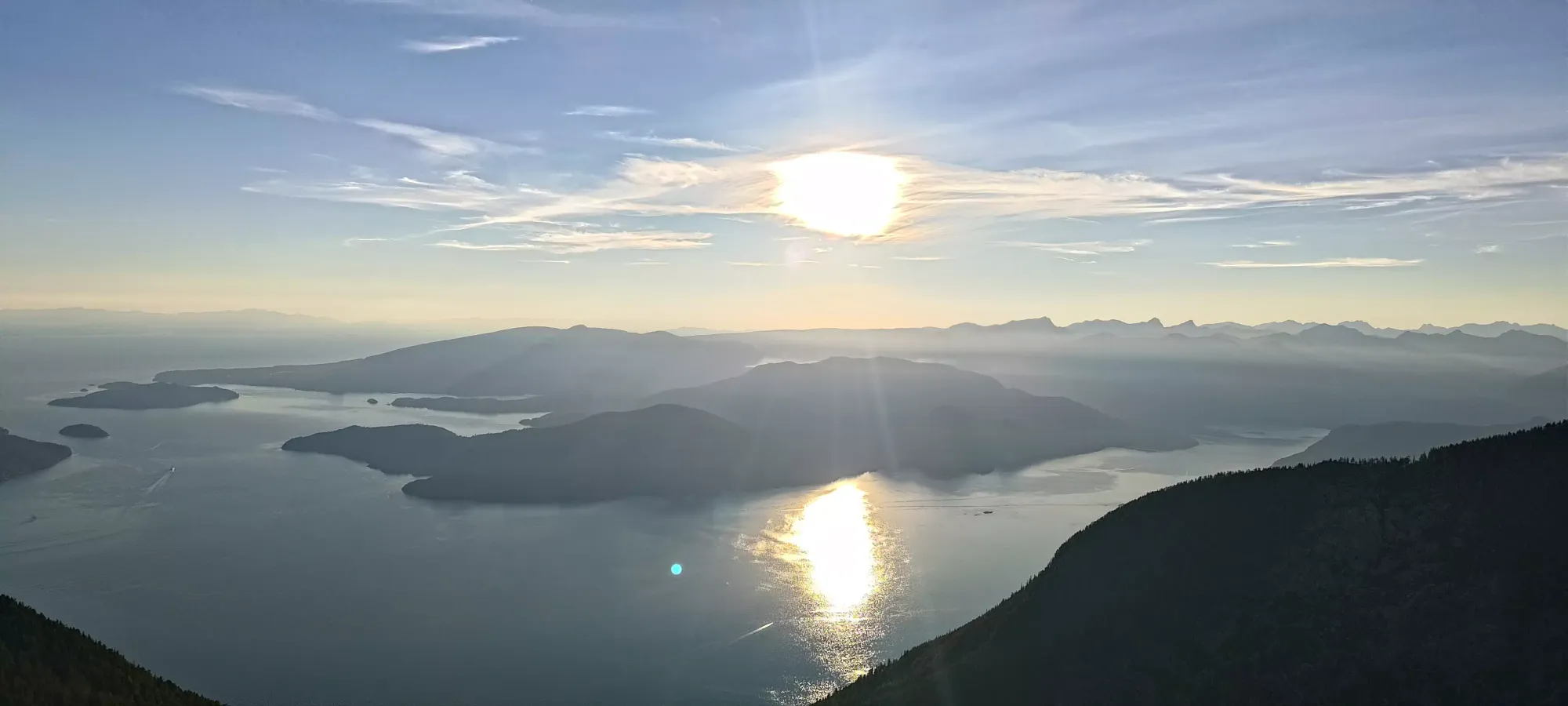
The boulders felt like they went forever, and I made it down to the viewpoint at the top of the forest in about 35-40 minutes. In this time window, the sun had set considerably, so I did snap one picture of the reddening light before I dipped into the trees.

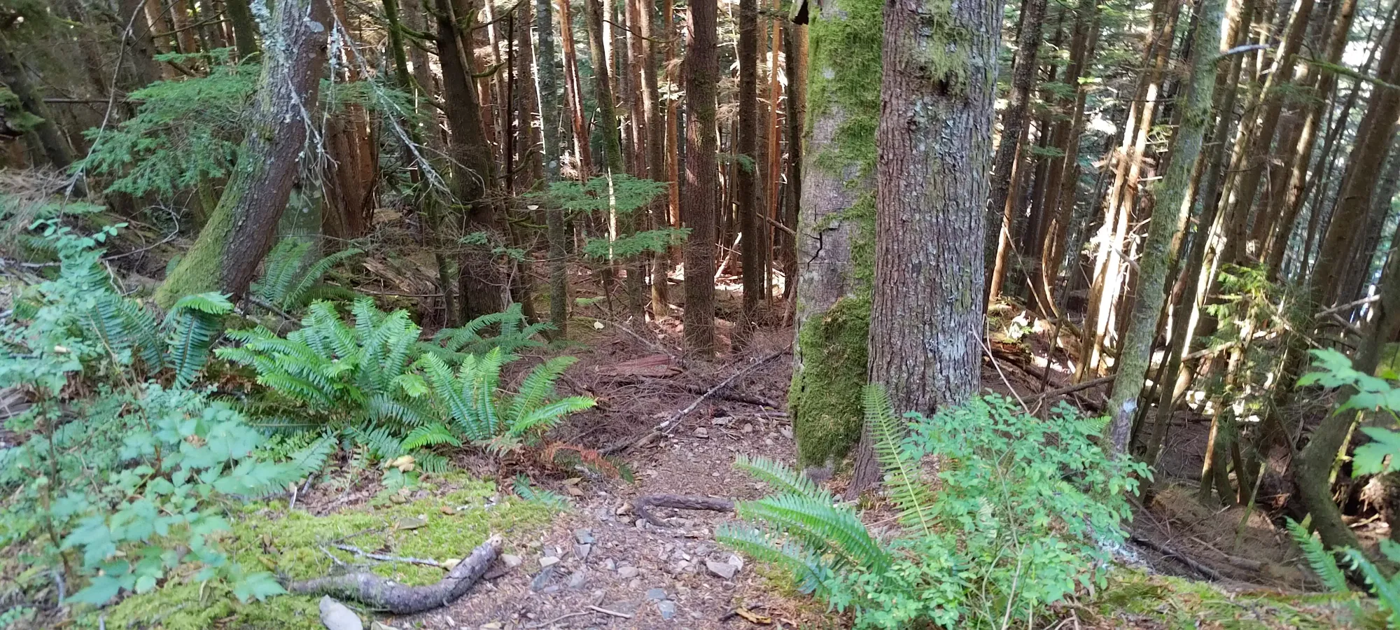
Coming down the upper forest was equally annoying, as the steep roots made quick progress impossible, although my new trail runners were at least happier here than stepper slabs, which they didn't do too hot on (I think there's too much space between lugs for excellent grip there, will need to bring them on easier terrain or augment them with approach shoes, I guess). They were, at least, comfortable, and didn't cause any blistering, so that's a win; kinda. I strapped my headlamp on around 9pm, and around 9:30pm I got below 1000m where the terrain started improving.
I hit the junction where we'd gone too far in the morning at 9:50. Logan had messaged saying they hit the top of the boulders about 25 minutes prior, so I was getting less sure they'd catch up, but since they said they'd run the FSR (which I am still physically incapable of doing with my gait), there was still a chance. At the very least, I felt I probably shouldn't dawdle, and did my best to keep going and take minimal breaks.
With about half an hour of effort, I got myself to Alberta Creek, where I did one last refill of water to be safe, and continued on down. From there, it was about an hour's worth of effort, to get down to the car. I got to the 2km marker on the FSR surprisingly quickly, though that 2km seemed to last for quite a while, as did the road back to the car. I found myself pondering if the free parking was worth the extra effort at the end of the day, but I did survive, so it was "fine". I got to the car at 11:15, unpacked, and drove up to the trailhead to pick the guys up. I'd been unable to get a reply on the radio for a while, so I just went up to wait.
At 11:33, I got a message saying they were at the junction where we overshot the trail in the morning (825m), so that meant they would be a little while still. So, I told Logan to give me a text when they hit the 2km FSR sign (we have the same cell network, and I knew there was signal), and I decided to drive to my dad's to drop some stuff off and hopefully raid the fridge while I waited. I stayed there until about 10 after midnight, when I ran out of stuff to take that was quiet to prepare (a banana and a couple squares of chocolate), and was generally getting worried about the lack of comms, so I headed back in case they ran out of battery or something but were waiting for me.
I drove back up, and talked to some trail runners who were starting their day late, doing a traverse down to Cypress hoping to see some of the meteor shower I had no idea was happening, but apparently was the reason for a lot of crowds that night. I talked to some others who came down a bit later from Brunswick who didn't see Logan or Jass, indicating that they were still a ways up, much further than expected, since I descended from their point at 11:33 in under 1.5 hours, and they were supposed to be running.
I eventually got a hold of Logan at 12:52am and they were a few minutes from the trailhead, apparently he forgot about the 2km check-in. I was happy that they were at least close and not >2km above still. They eventually broke out of the forest just before 1:00, and we headed on out after a very long day. Apparently Jass had some shoe trouble that was bothering him, and they were running low on water until Harvey Creek, so that delayed them more than they anticipated. We went for some dinner at the 24/7 Denny's in North Van, then split up at 3:20, getting me home just before 4am. We were supposed to do another peak Sunday, but that wasn't going to happen anymore with that late of a night. I did consider something if I got up and ready in time solo, but instead I just watched anime and wrote this TR 😅. I might have to do some trashbagging during the week to compensate, I'm falling further from the 100 peaks/year goal at this rate.
I was very happy to do so much elevation gain without issue, though, I think I can finally stop worrying about that aspect of trips when planning again, which feels like some solid progress in my injury recovery. As for the peak itself, I'm happy to get it done. I can't say I recommend going for it by itself like I did, but if you're doing the HSCT and camping nearby, then it can be worthwhile.
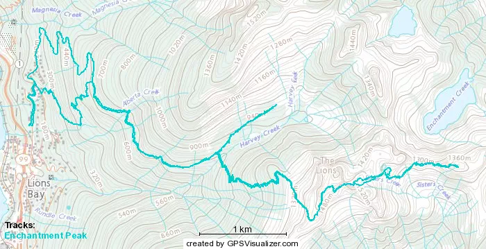
GPX Track + Map