Canadian Border Peak - July 7 2024
A fun, challenging scramble on the northern of the two Border Peaks, which straddle the US-Canada border near Chilliwack, BC and Glacier, WA


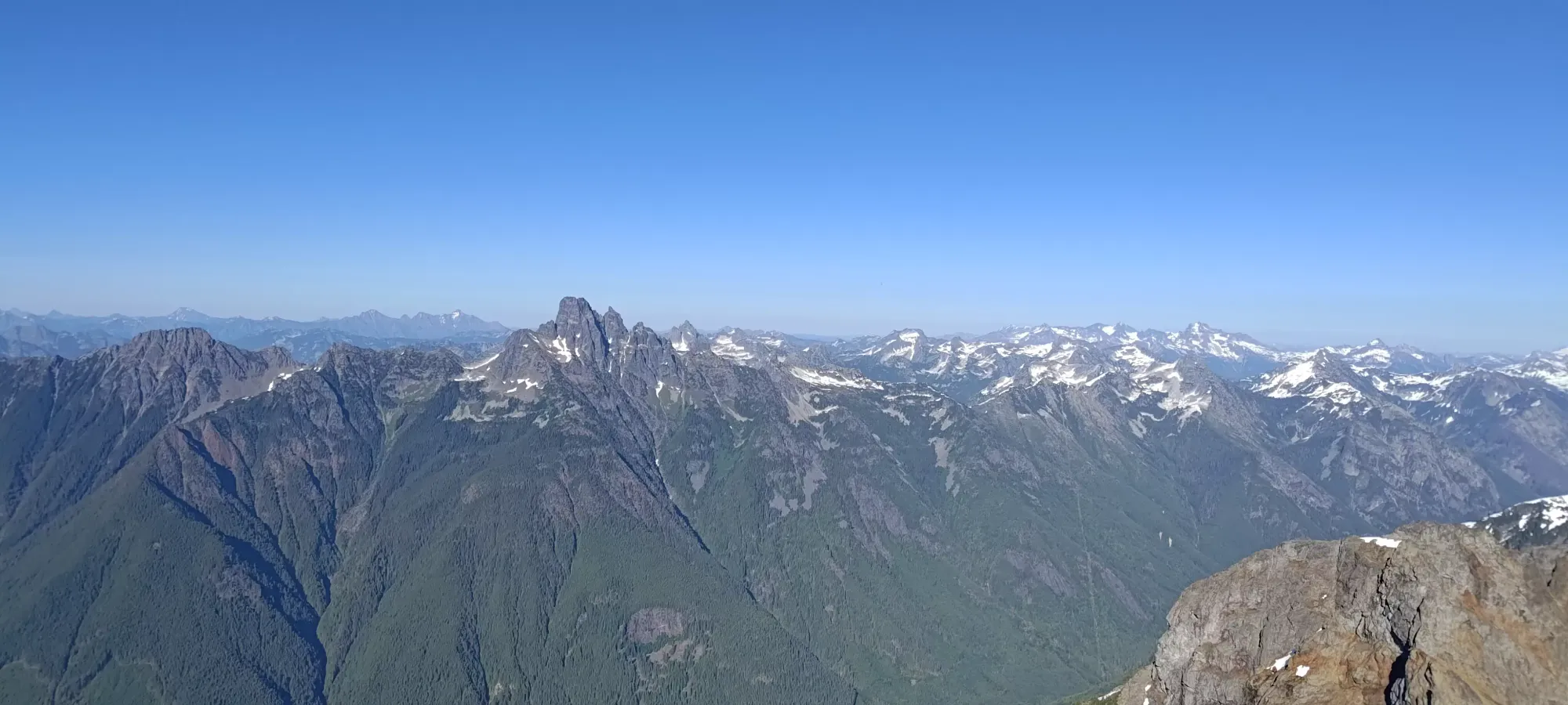
Border Ranges, Chilliwack, British Columbia
2277m
Ah, CBP. Not to be confused with the similarly-acronymed Customs and Border Protection (who might be coming after you if you stray too far off-route, though 🤣), Canadian Border Peak is a bit of a statement piece in SWBC in terms of being one of the harder scrambles around (some have rated it more as a climb of 5.4-5.6, depending on who you ask), and being visible from many areas nearby with a striking profile, along with its American counterpart. The last time we knew someone was on the mountain was, sadly, when a member of the local peakbagging community met their end in 2023 (it was never discovered if she summited or not). Hoping to start the trend back in a more positive direction, Logan and I set out on this scorching Sunday armed with lots of beta, rock gear, and a resolve to go slow and steady to get things done.
The drive was made much shorter courtesy of our good friend Michael who let us crash in Abbotsford after doing Church Mountain together the previous day. We took Tamihi Creek FSR more or less to the end. The road has some horrible potholes which slow travel, but won't stop a medium clearance crossover. I can't remember exactly when, but at some point on the eastern stretch (where it goes east-west almost exactly instead of southeast like at the start) there is a large cross-ditch which I would say probably requires a crossover with good angles, or a 4x4 which does the same. Then, near the TA8 spur, the road worsens, and this is actually where another party in the area driving a Wrangler parked. The road gets steep and rockier, but my Jeep Compass was still able to handle it fine even with full tire pressure. There is another washed-out water bar marked as an impasse on Francis' Site, but we got through it with some choice line selection.
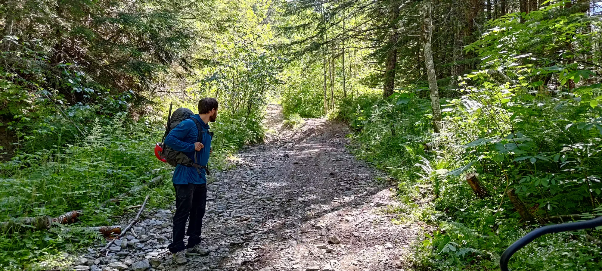
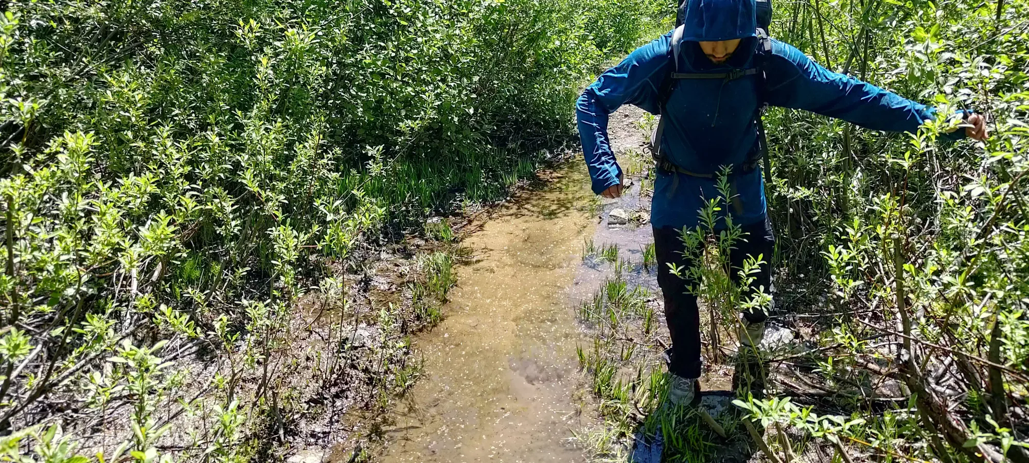
Me going through the first deep water bar on Tamihi Creek FSR. Video creds: Logan
After that, the climber's left side of the road was heavily washed out, but the right side was just wide enough to fit a vehicle. We were about to slowly crawl up this side when another party notified us that the road ended only about 100m further up. Since this section would be difficult with high consequences if I messed up, I decided to turn around and park at the spot we were in, since there was space to the side enough for 1 car. As it turns out, this was a bit conservative, as there was about 300m or so left to walk, and I would've been able to drive until that point, but oh well, at least my car was in one piece. We geared up in the heat (but with surprisingly few bugs), then set out at 11:20am.
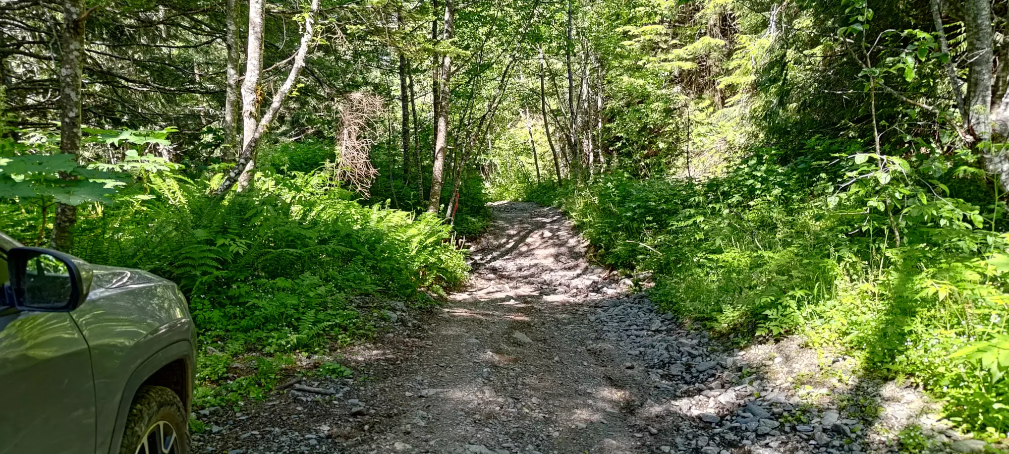
In about 5 minutes, the road stopped going east and turned north, where it also narrowed to the point that most vehicles that aren't dirtbikes, or pretty decent SxS or ATVs would not be able to continue. That means the highest any highway-safe vehicle can start is between 950m and 1000m. I know I wouldn't be able to bike up or down this road, but perhaps some good MTBers with good bikes could? I think the width and weight of a real dirtbike is the best and perhaps only solution to this road (other than good ol' walking and suffering I guess), and we did see one party do exactly that (though they were just there to drive, not bag any peaks).
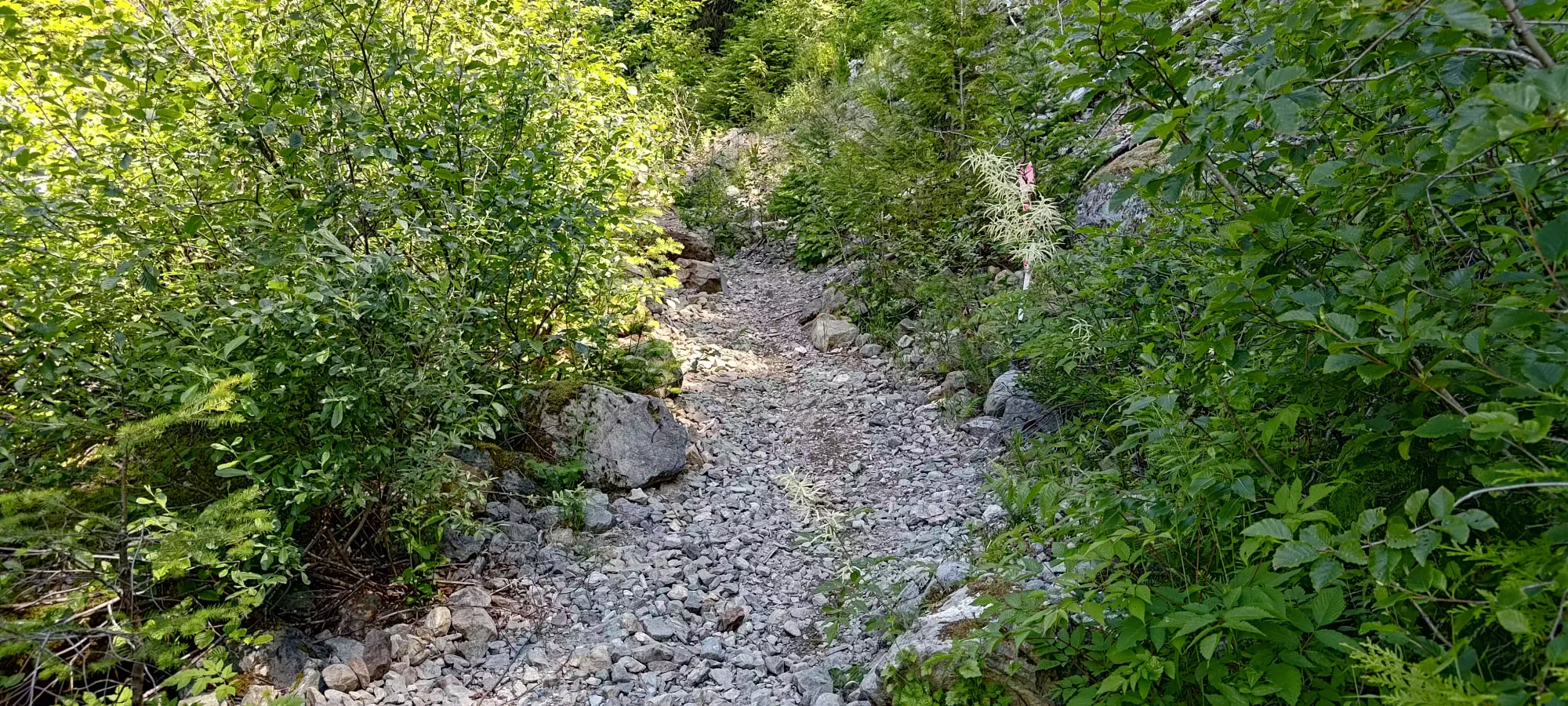
By around 1km, the road narrowed to a fairly definite singletrack. I'm not entirely convinced that a small UTV/ATV couldn't bash its way through, as the road didn't drop off on the sides, it was just overgrown. I also wouldn't be willing to say "it'll definitely work", though. One thing Andrew from the descending party pointed out was that the road was ripe with flags indicating a pending logging project which would result in the road being cleaned up a good few kilometres past where we stopped, so perhaps waiting for that project is the right call, as you'd be able to drive in a regular vehicle much higher? Or maybe they'll build a gate and leave it locked, who knows 🤷
I did my best to set us a calm, measured pace up the road (and for the rest of the day, but it's hardest to keep that discipline on easy terrain like a road), and I think I succeeded in that. By 1 hour, we had gained a bit over 300m in about 2.4km, nice and slow. The road was fairly exposed to the sun, more so as we got higher, so not sweating all our water out was of the utmost importance in the record-breaking heat.
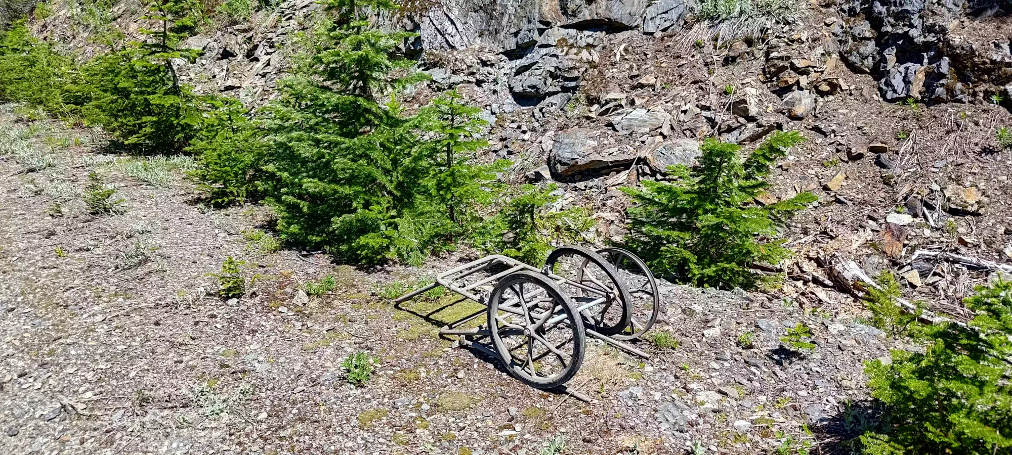
A bit above 1400m, we encountered a small bit of water that was flowing onto the trail, which formed a puddle which would overtop our trail runners. Thankfully, there were just enough rocks that allowed us to gingerly walk across without getting wet, though to be honest, we'd have dried very quickly given the sun+heat. Not too long after, just before the switchback where the 150 branch splits off, we found some old cart-looking thing which I half-joked that Logan should use to tow me down the mountain later. We did confirm it does roll, so feel free to try it (we were not bold enough, it turns out).
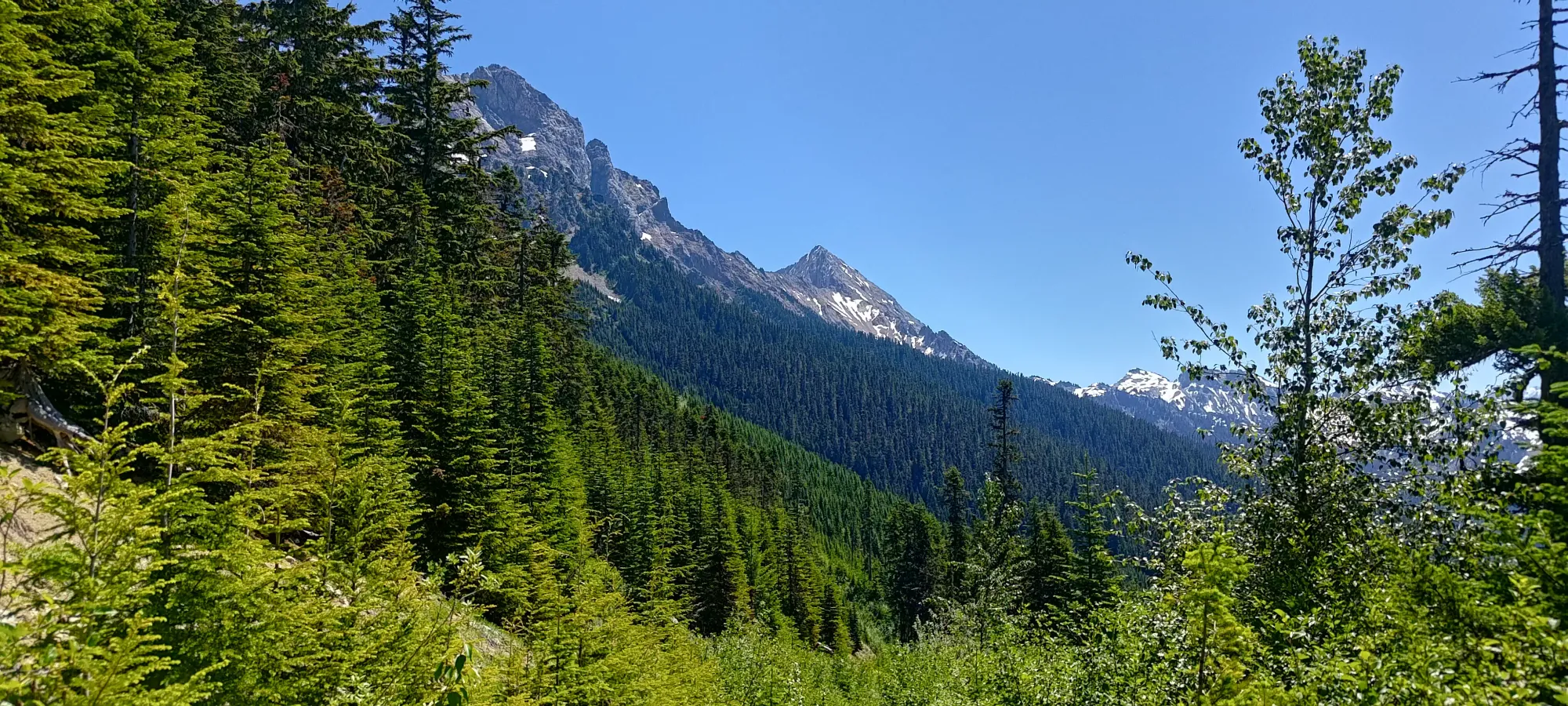
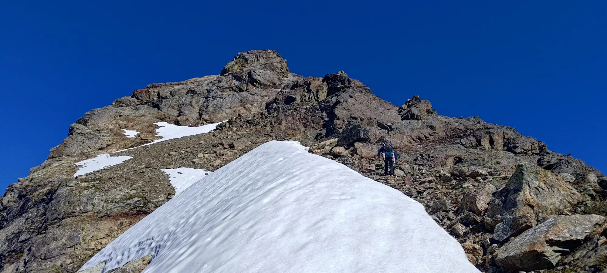
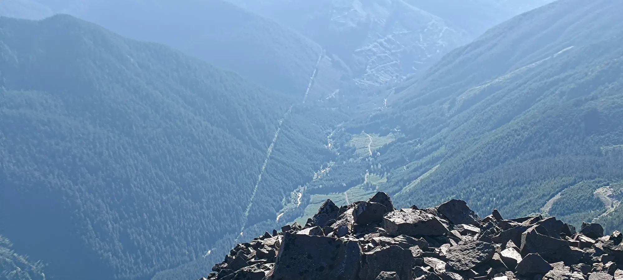
At about the 2-hour and 10-minute mark, we finally hit the end of the road, where we soaked the views in, took another of our many water breaks, then started to find out way up through the short forest that cut up from 1600m (the end of the road) to 1750m, where we'd pick up the western ridge of the peak.

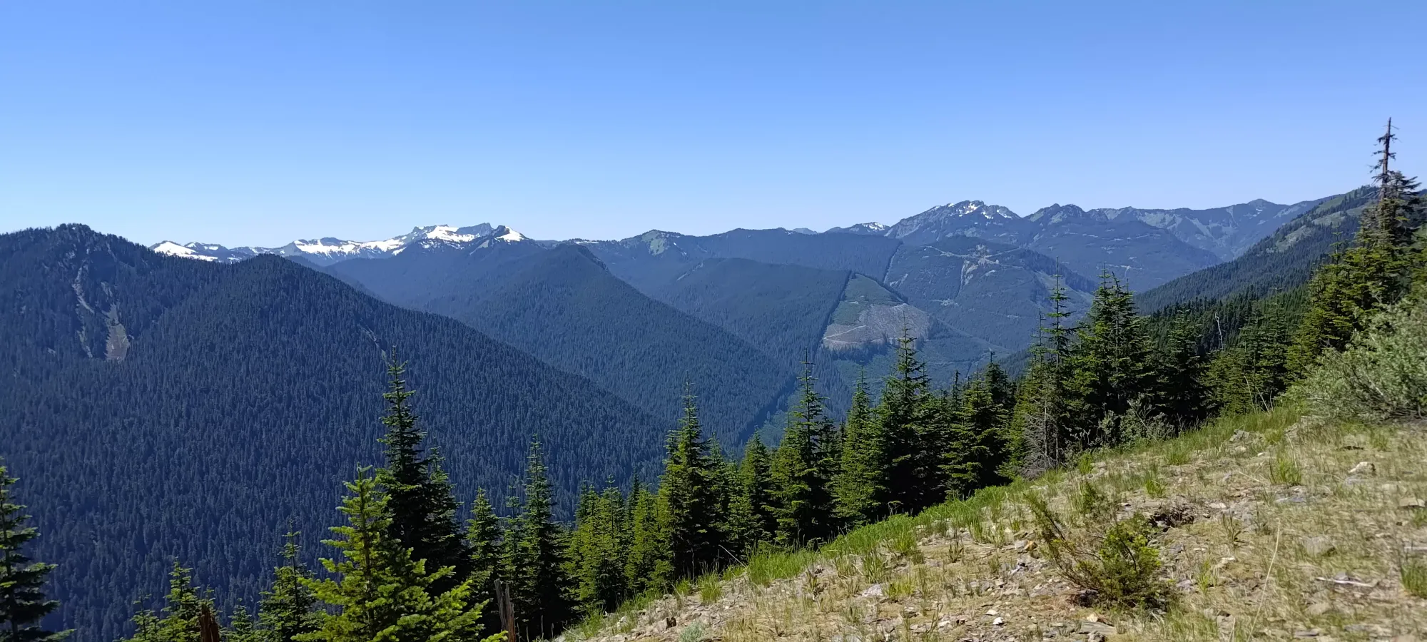
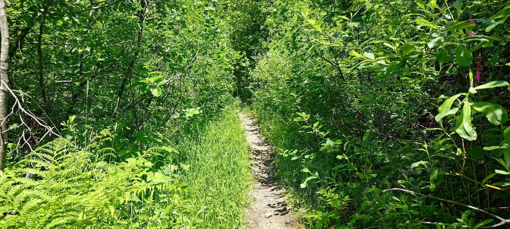
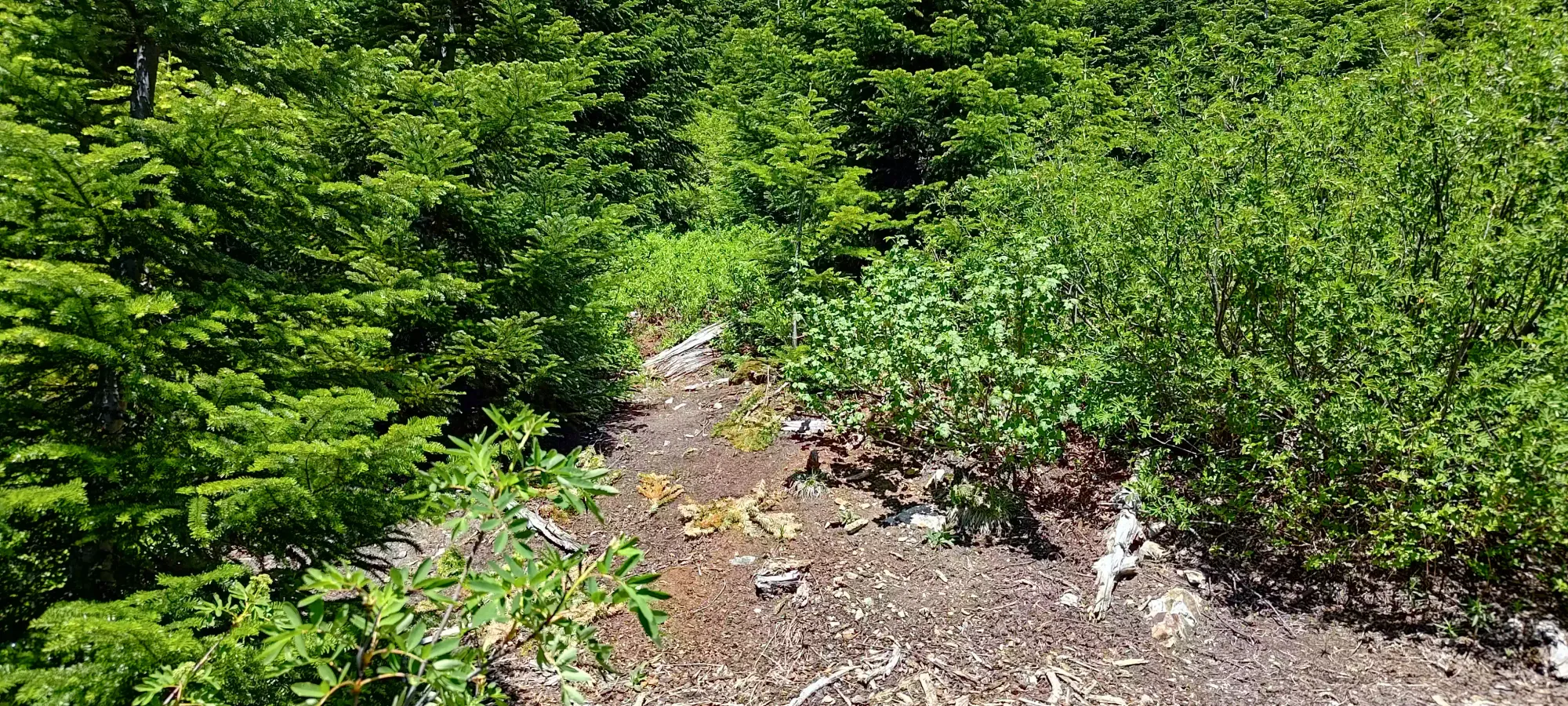
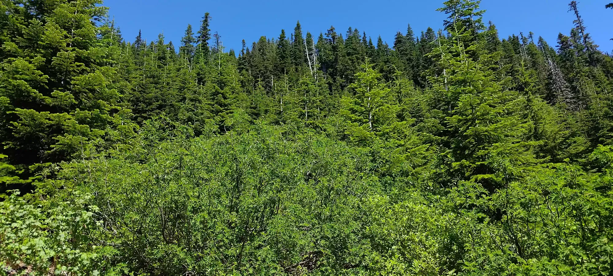
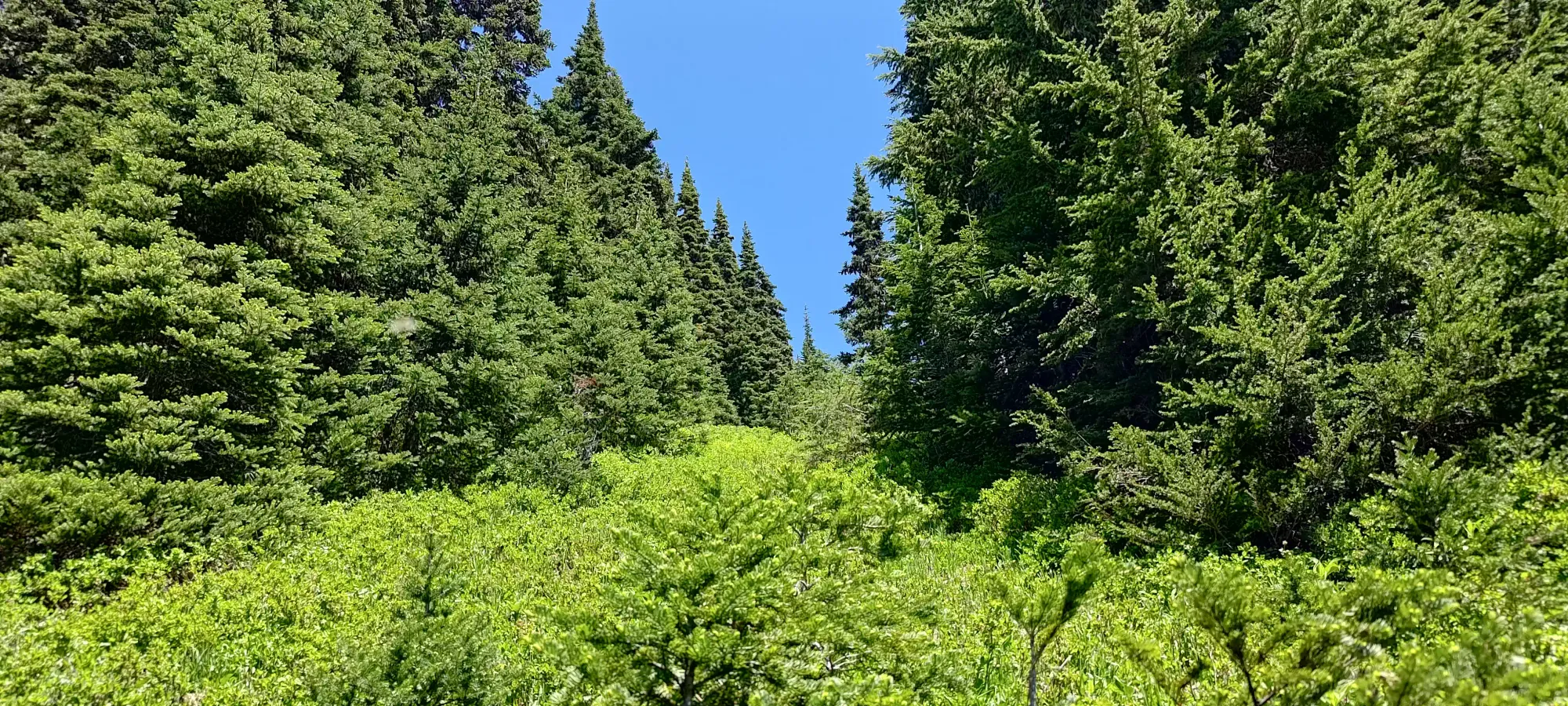
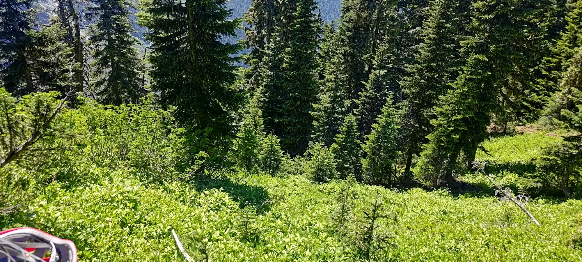
We had a few different GPX tracks to follow through the forest, but fairly quickly decided that nothing really seemed to be better than anything else, and then just went up wherever offered the least resistance. In the lower third or so, this meant largely open clearings where deadfall or just happenstance resulted in a lack of forest cover on the ground. Higher up, we just found open parts of the forest, or small meadowy clearings where trees were not growing, and small bushes which didn't serve as impediments to travel were growing instead. This worked quite well, and in 25 minutes we'd gained that 150m up to the ridge, with the only bushwhacking being intentional to get into the shade 😅
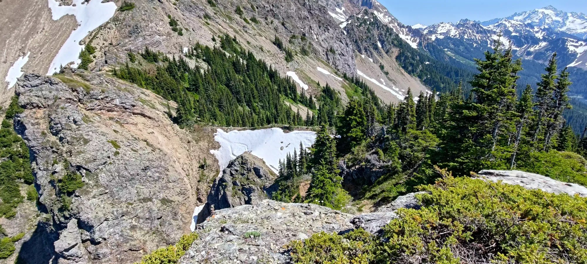
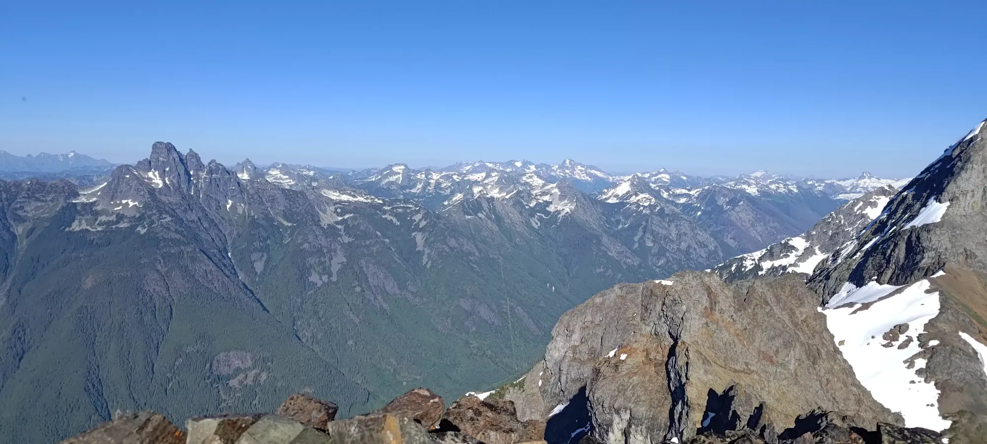
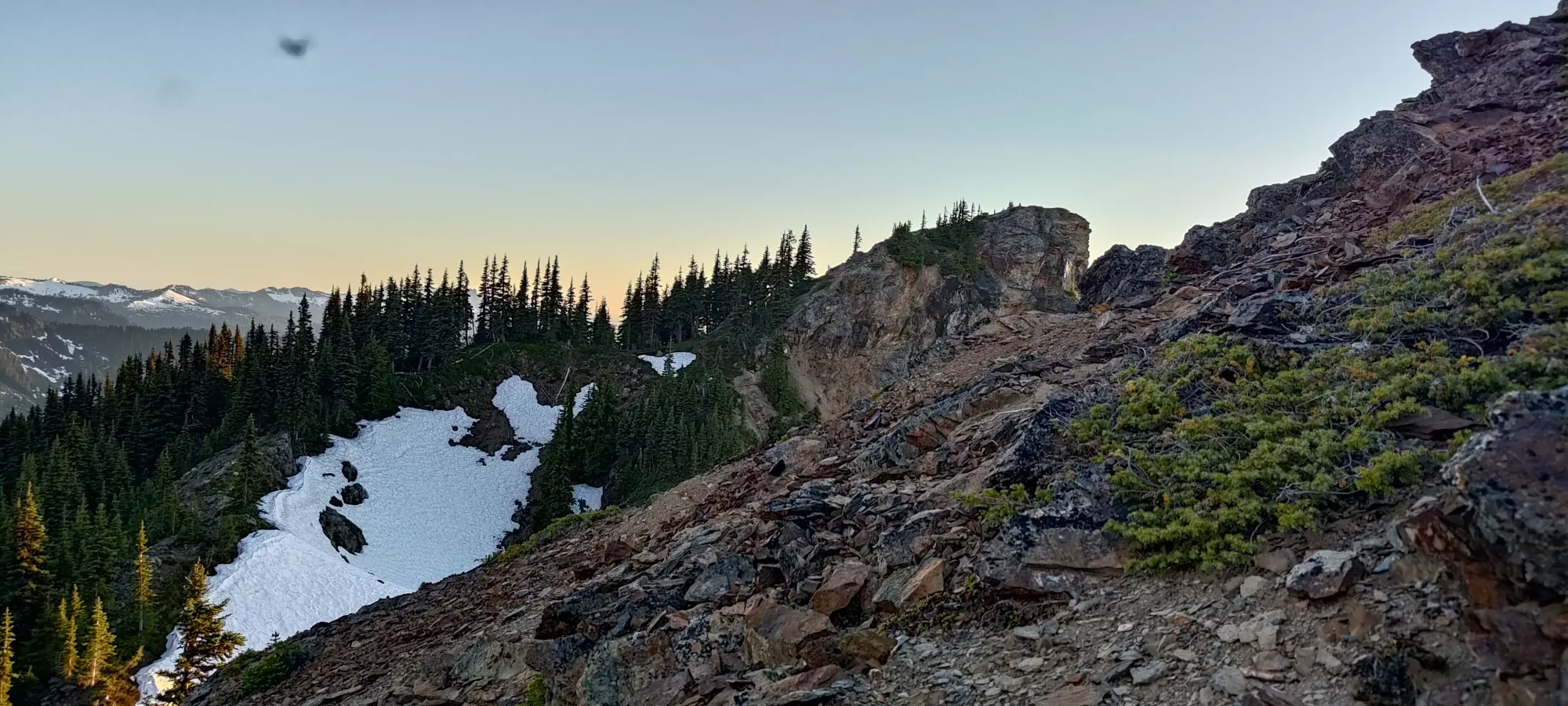
Once we got onto the ridge, we noticed snow patches on the north side of it. We largely stuck to the south side when possible, partially to avoid slippery snow, but also because more trees grew on that side, and it offered more shade as a result. There wasn't any sort of trail we could find in the forest, but once on this ridge, a scrambler's trail was visible for most of the way (although sometimes buried in snow).
The ridge walking was pretty easy, with minimal undulation and straightforward navigation. There's a small ~1870m bump with maybe 20m of prominence that marks "mostly the end" of the forested part of the ridge, which we curled to climber's right to ascend, which brought us into some steep bush scrambling, though on the way down, we managed to avoid that somehow. It was brief, at least, so it wasn't much of an impediment.
On the traverse over, Logan refilled some water by scooping snow into a transparent bottle and letting it melt (no flowing water was encountered to this point). I was going through mine a bit slower, so I didn't. You'll want to bring plenty or go in similar or deeper snow conditions to us to have water accessible en-route. About 10-15 minutes later, we had finished the descent and walked over to the base of the peak.
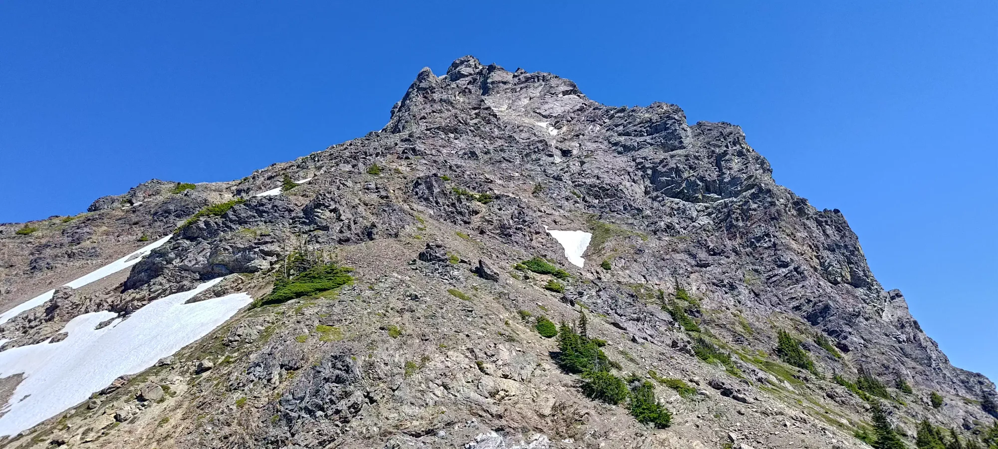
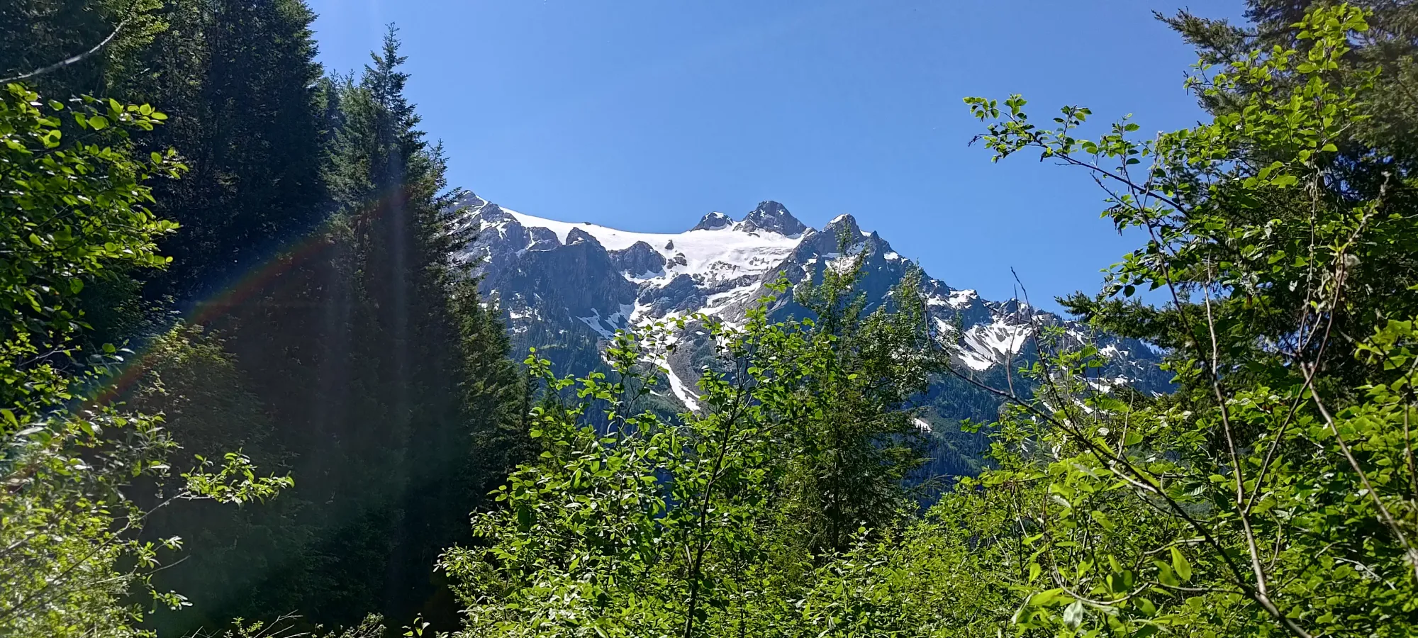
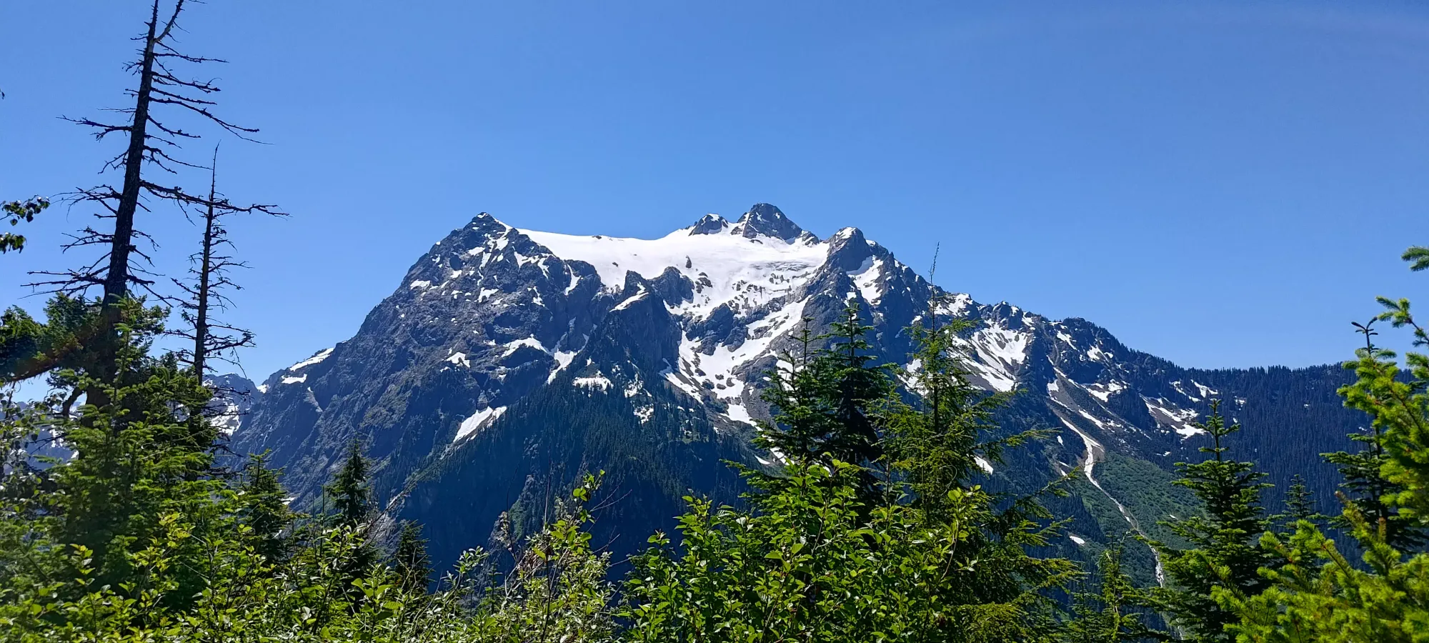
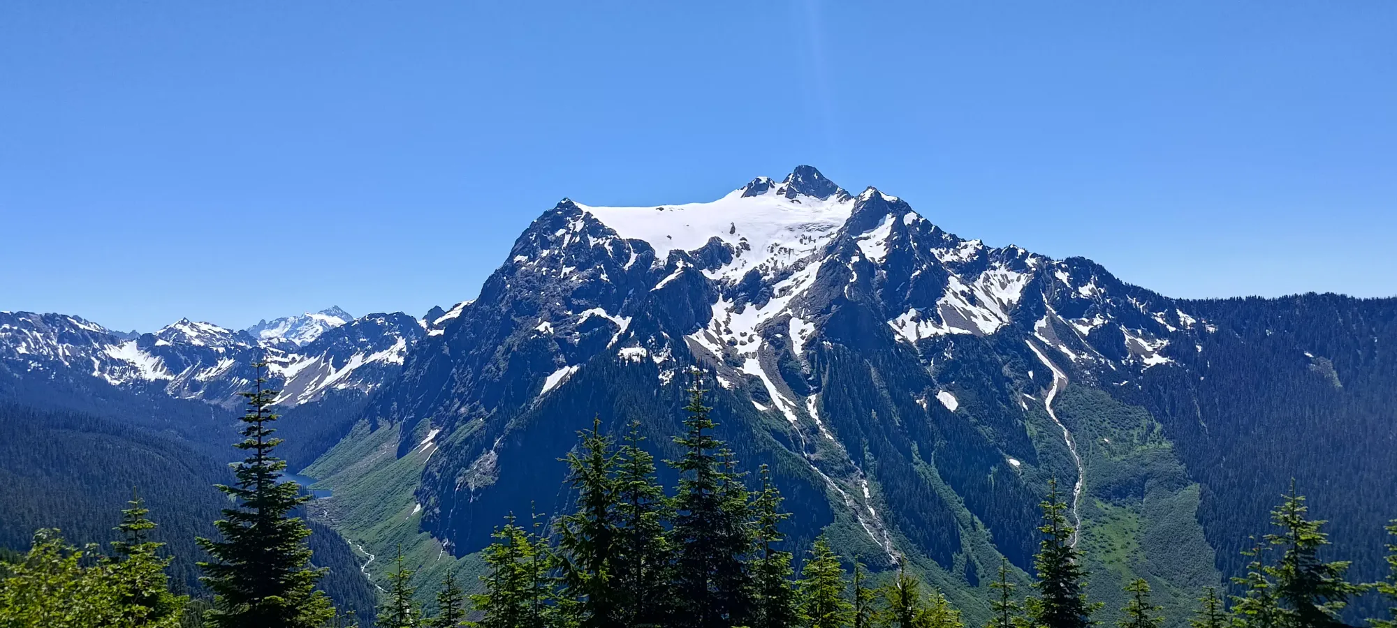
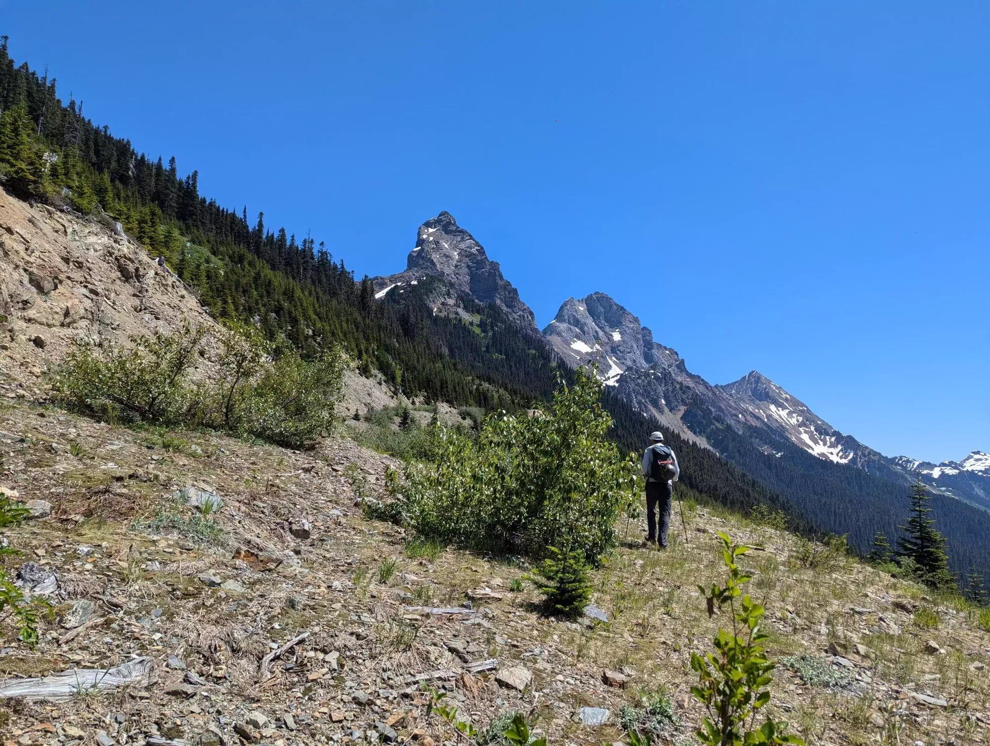
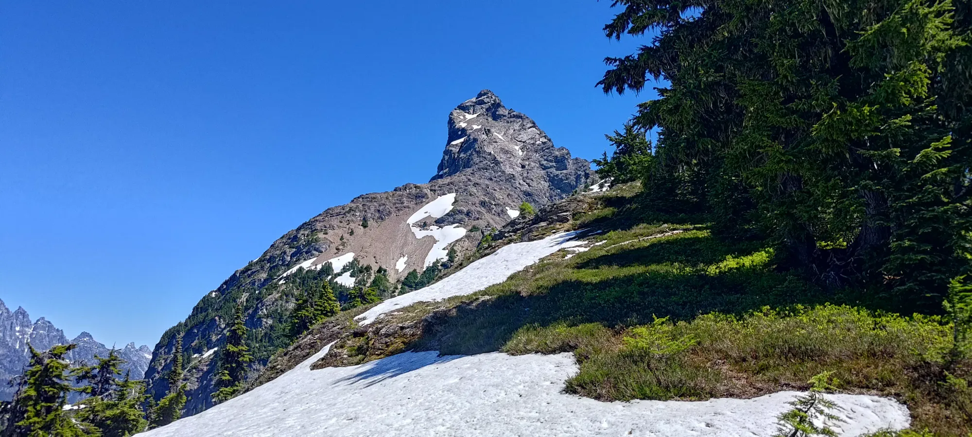
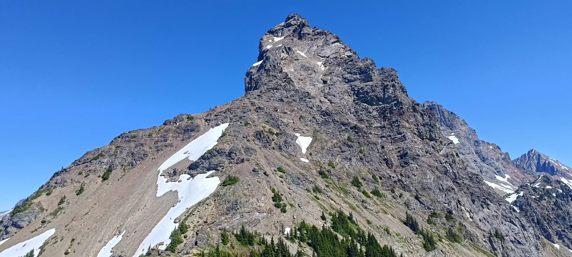
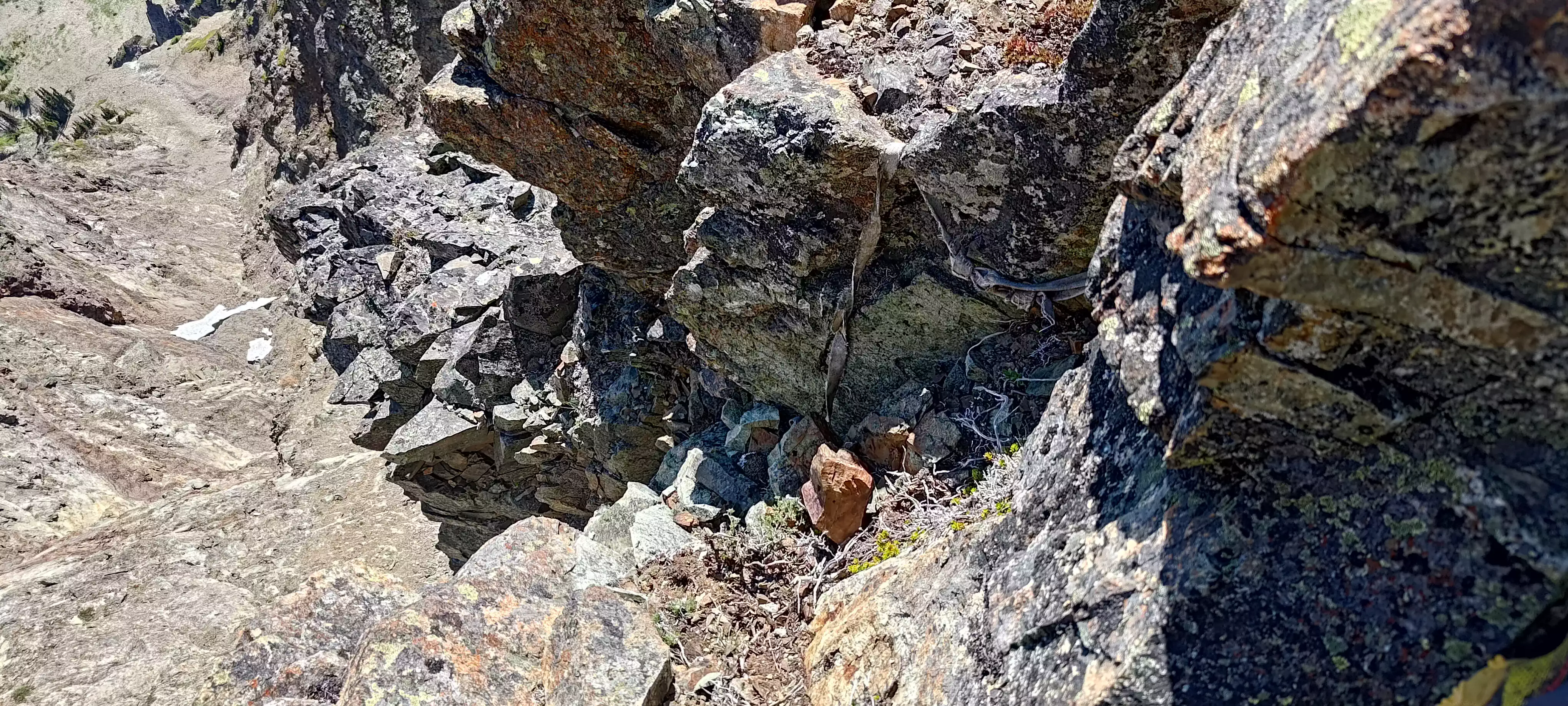
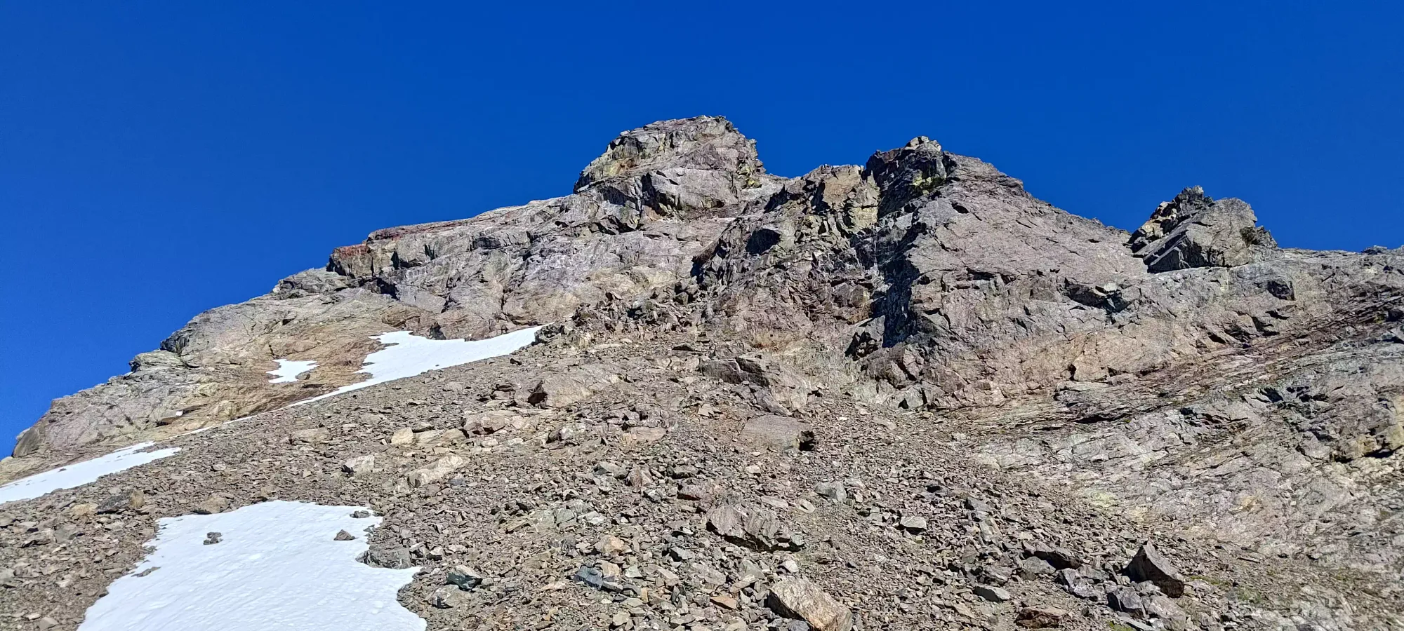
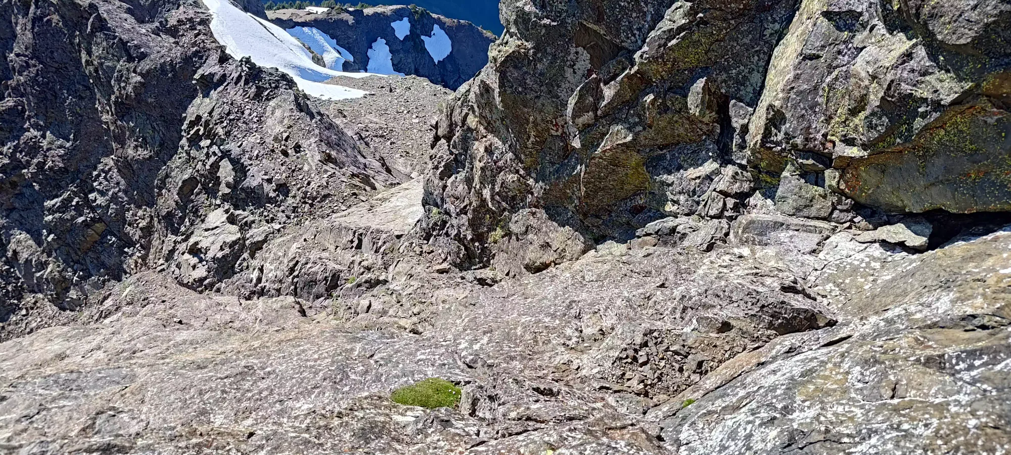
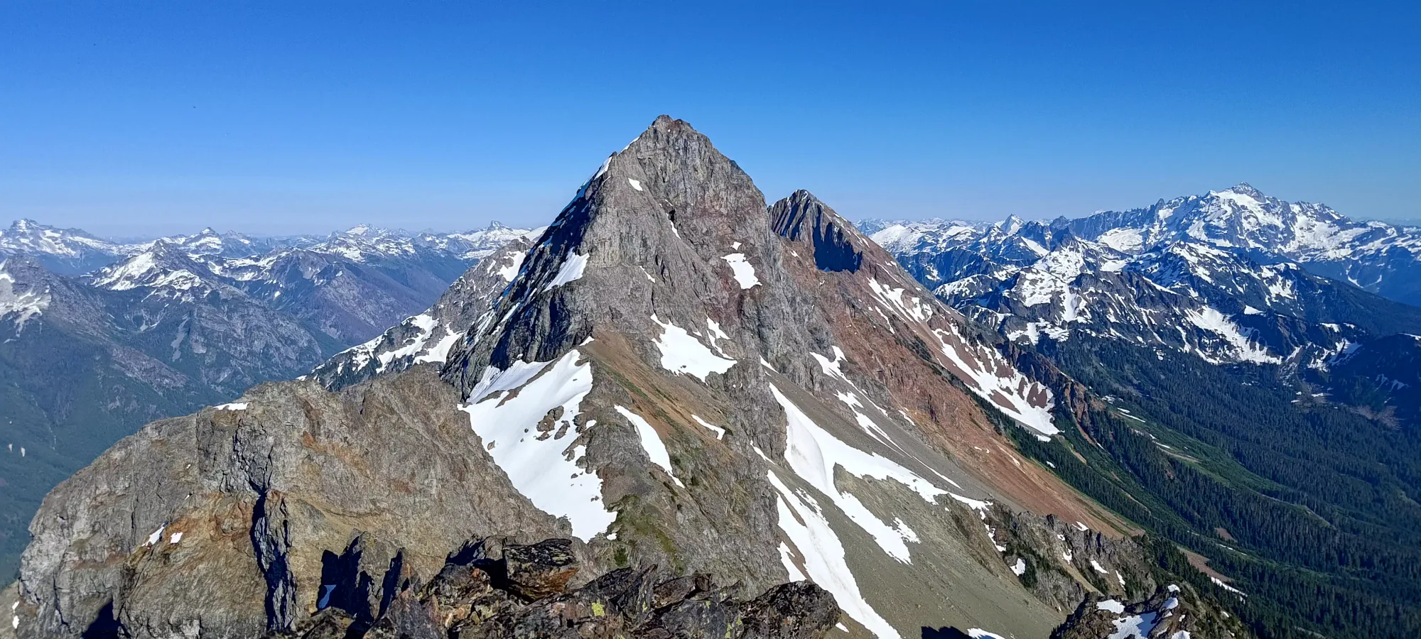
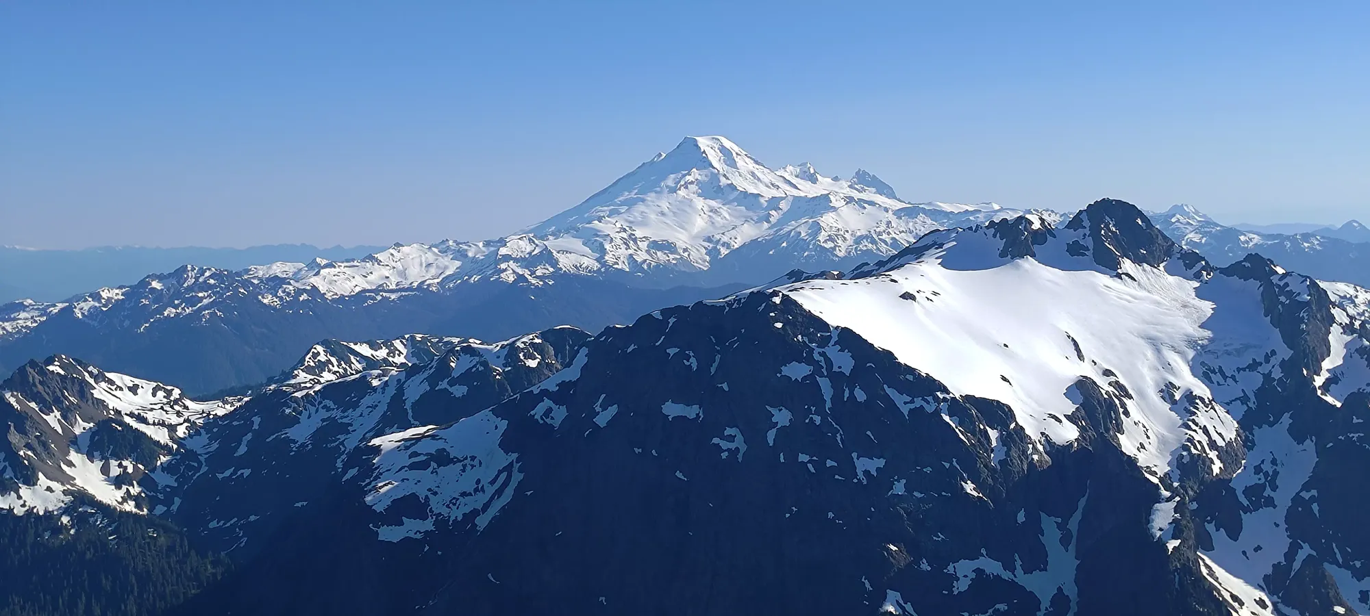
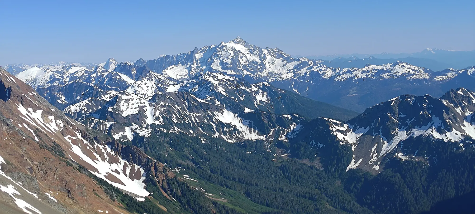
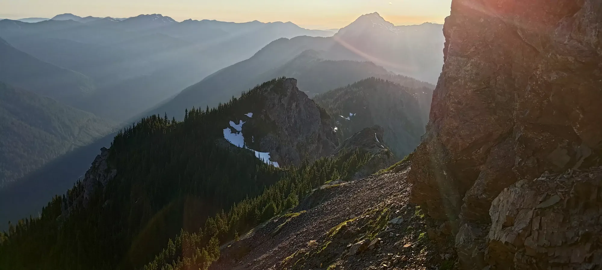
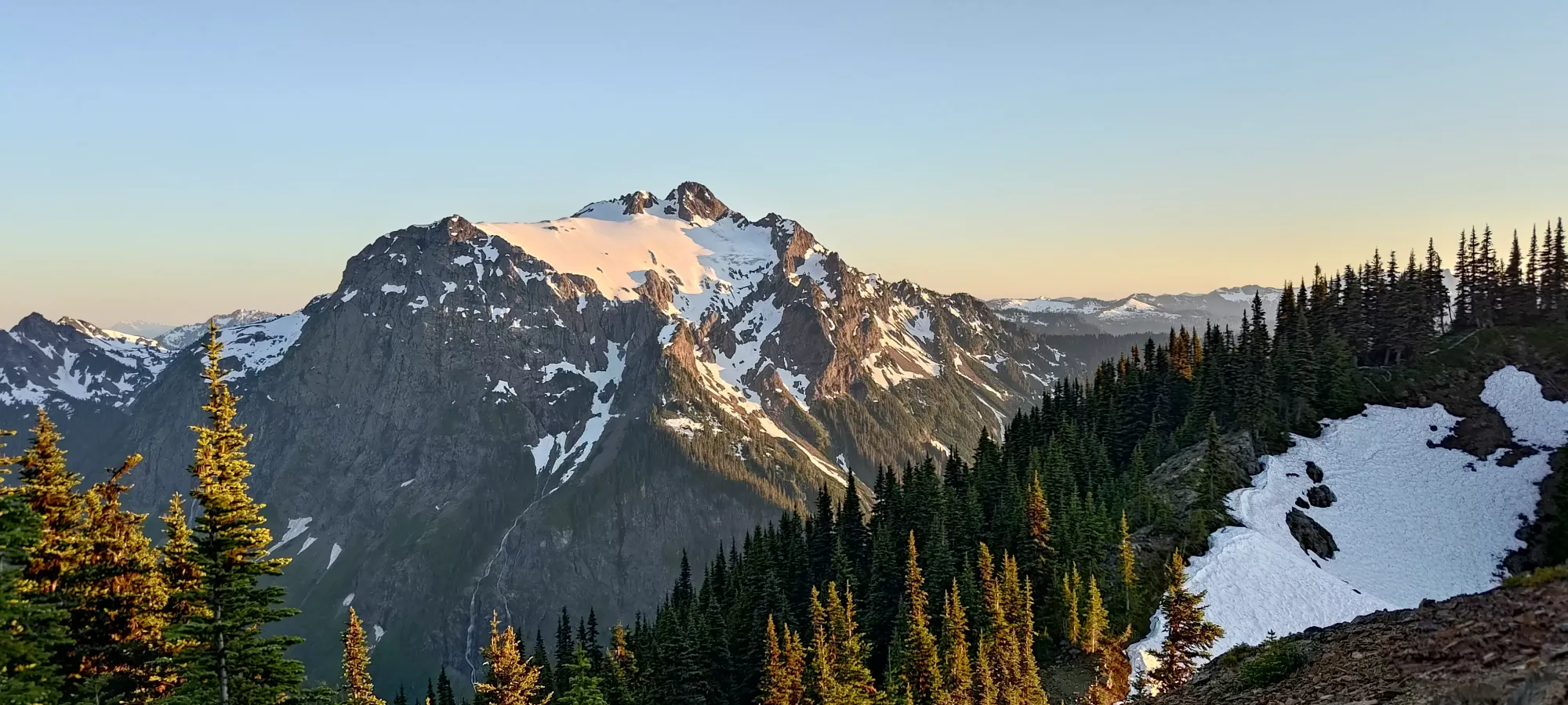
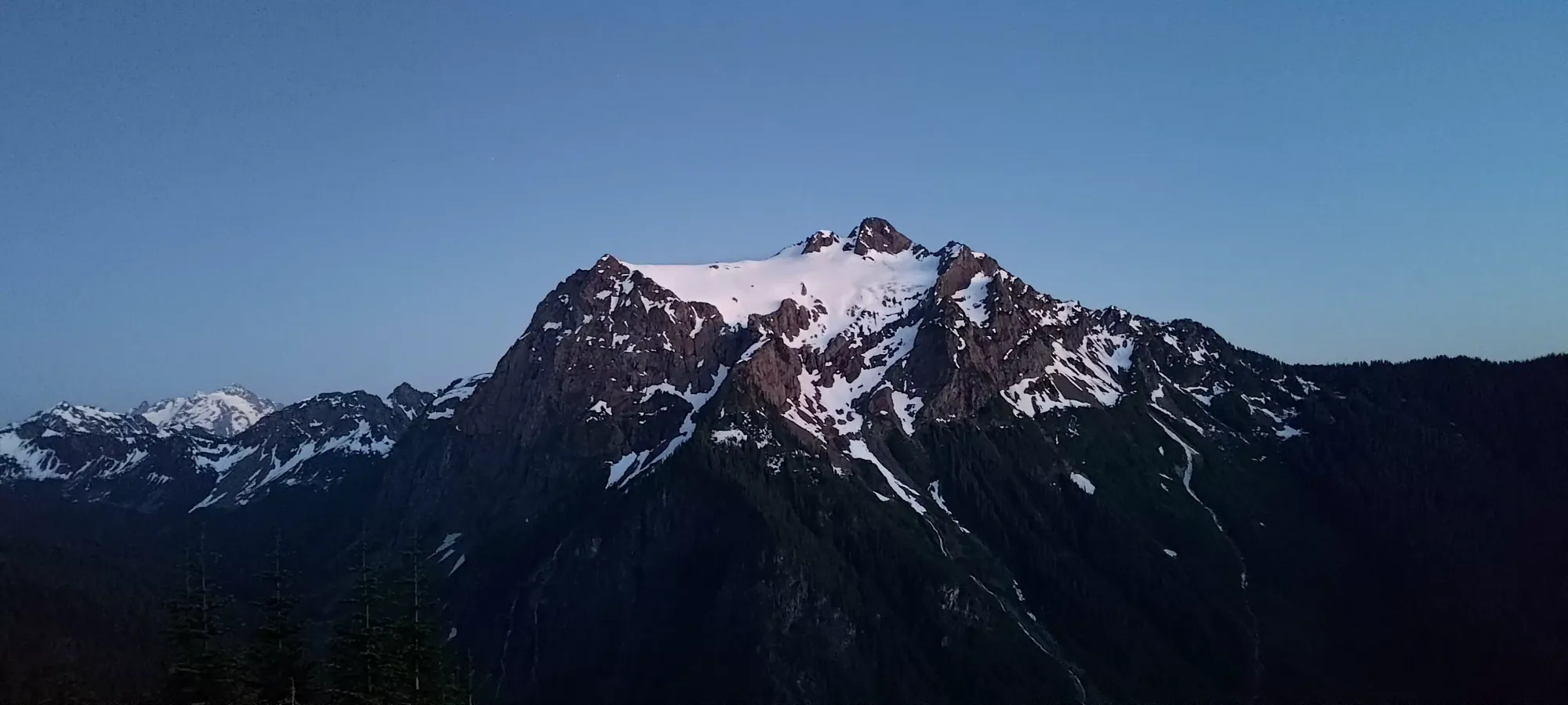
Once at the base, the first order of business was to slog up the loose dirt/scree/talus up the base of the horn-like feature on the left of the summit massif as seen above. The plan was, from there, to assess our options, and likely skirt around it to the right. Slogging up there was straightforward, if tedious. At around 2000m, though, we realised it was going to be too difficult/exposed to cross higher up, so we decided to traverse hard to climber's right a bit early, and get around the flanks of it while it was still walking and not exposed climbing to get to the other side.
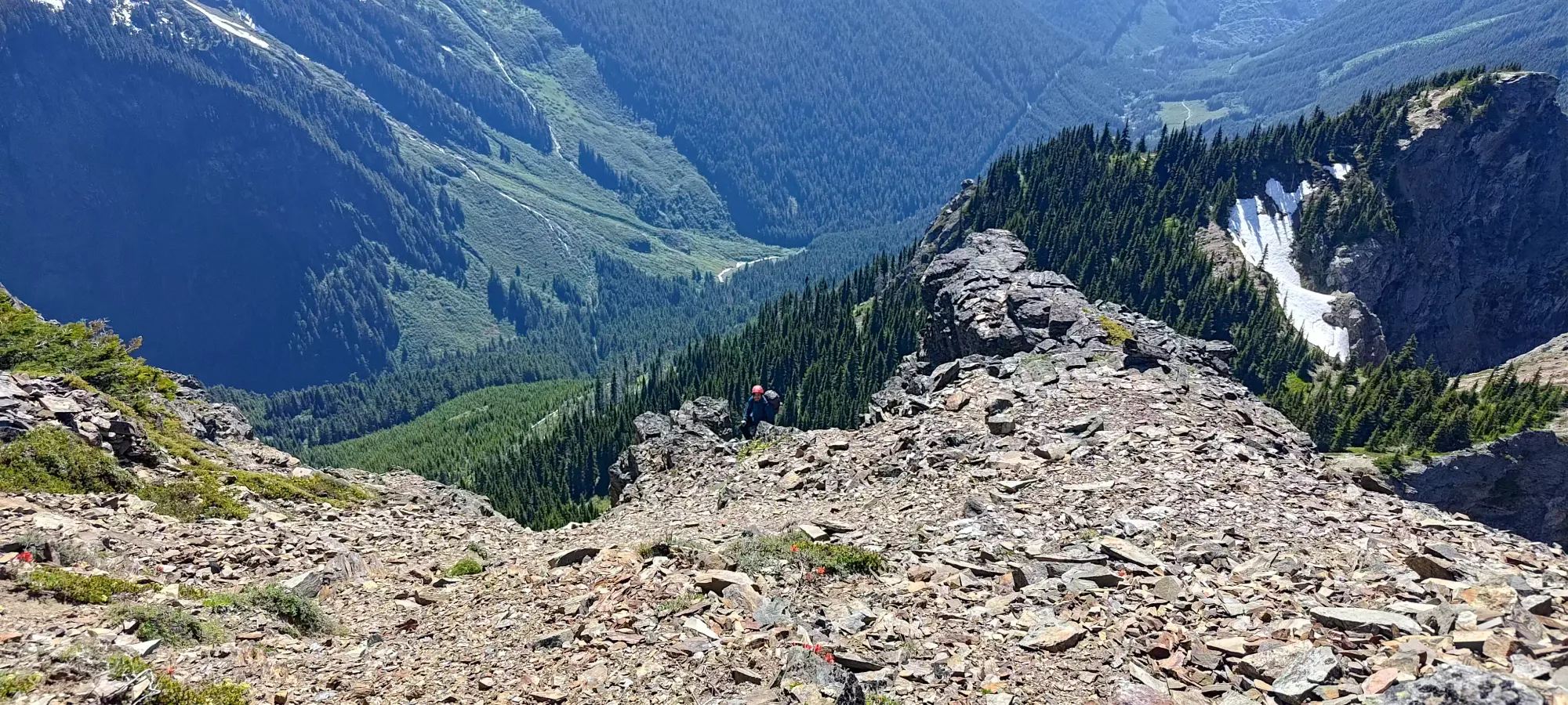
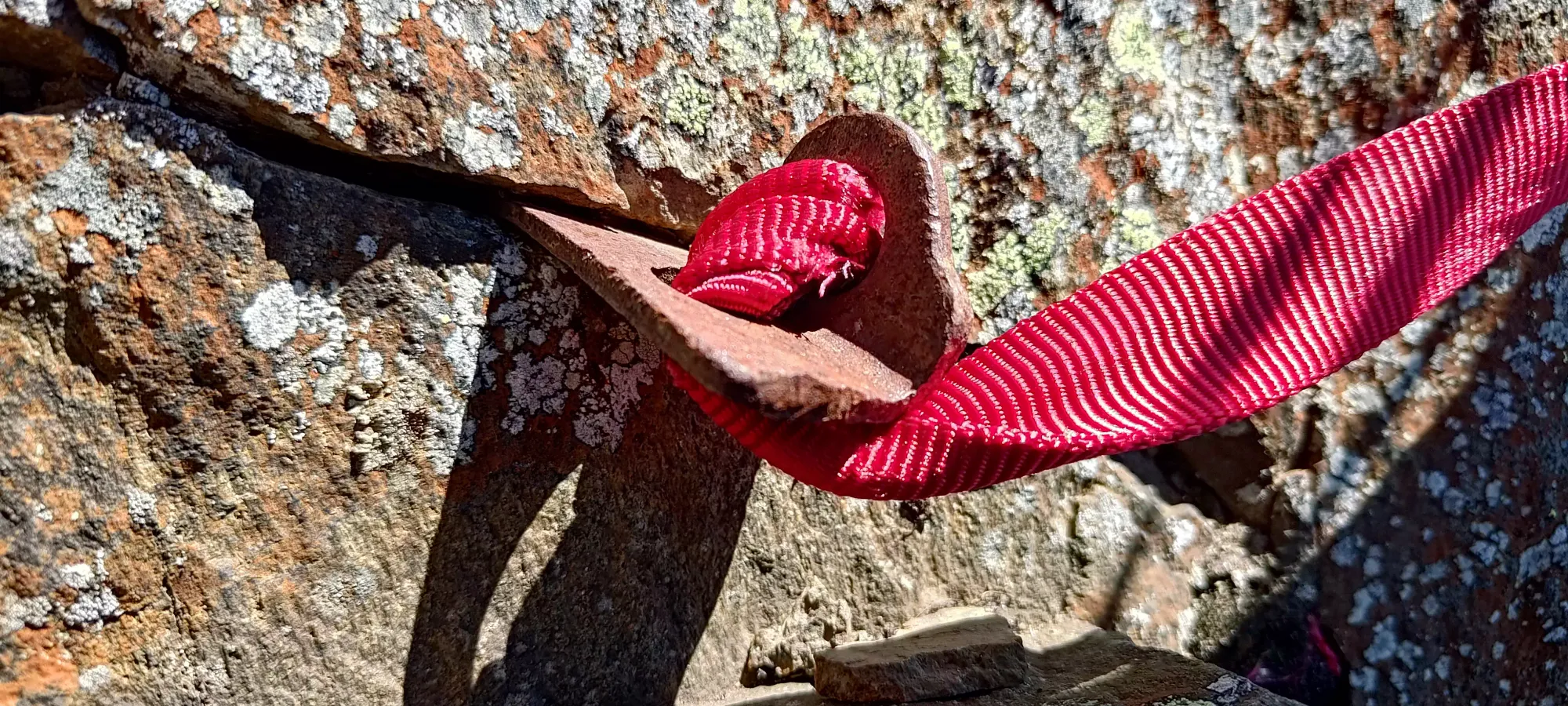
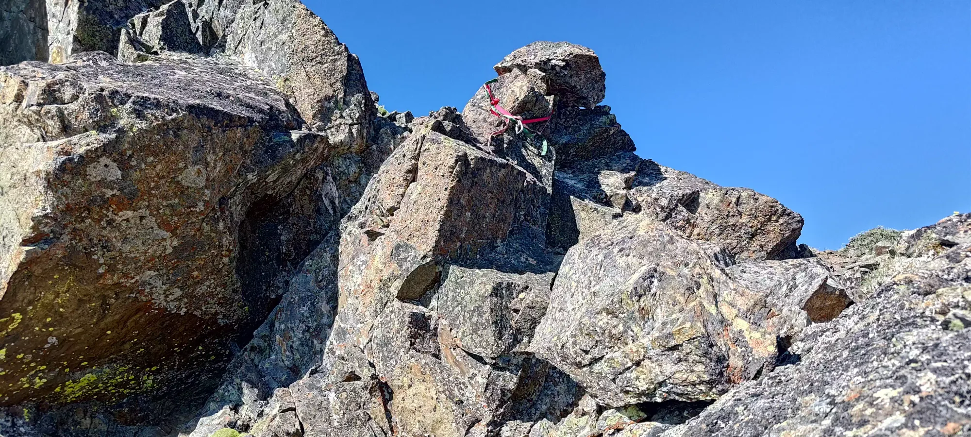
As we got all the way over, we found some fresh-looking tat slung around some rock, and got to feel happy about our decision to come over when we did. Given the route we'd taken was largely traversing on foot with hands just for support, we figure people must've come more directly up than us, but we were happy with our route, not finding any terrain we'd need to rappel to that point.
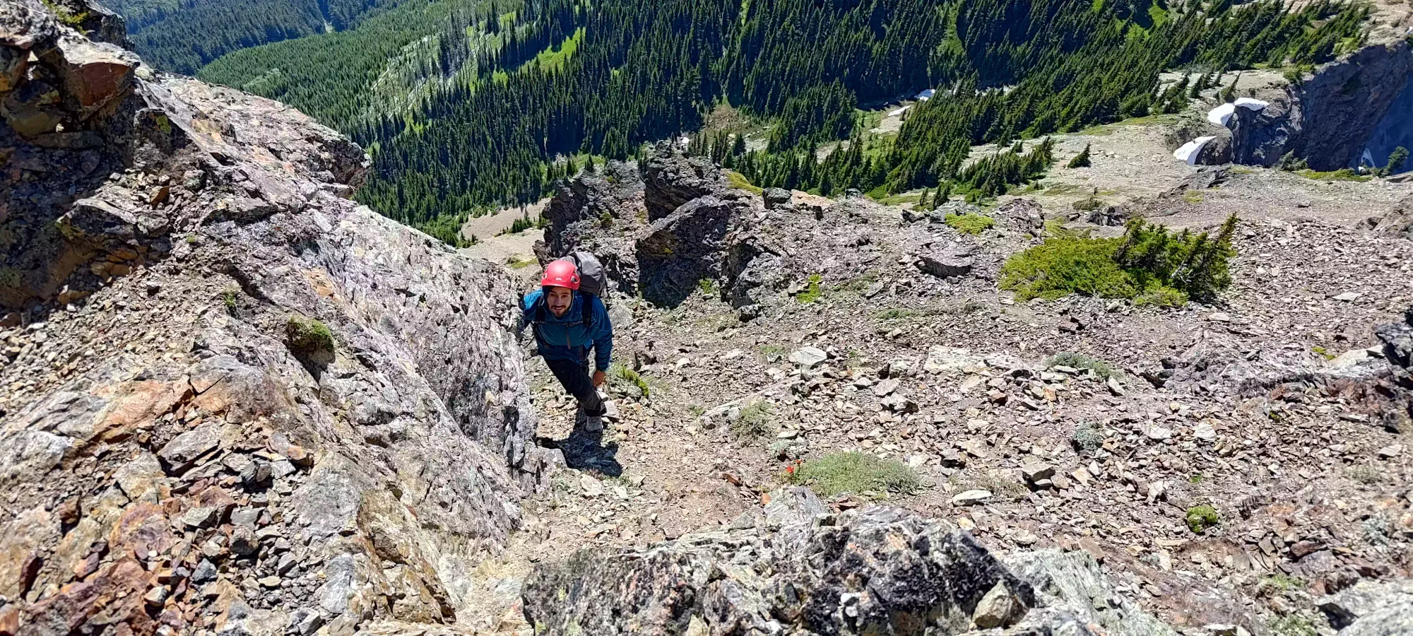
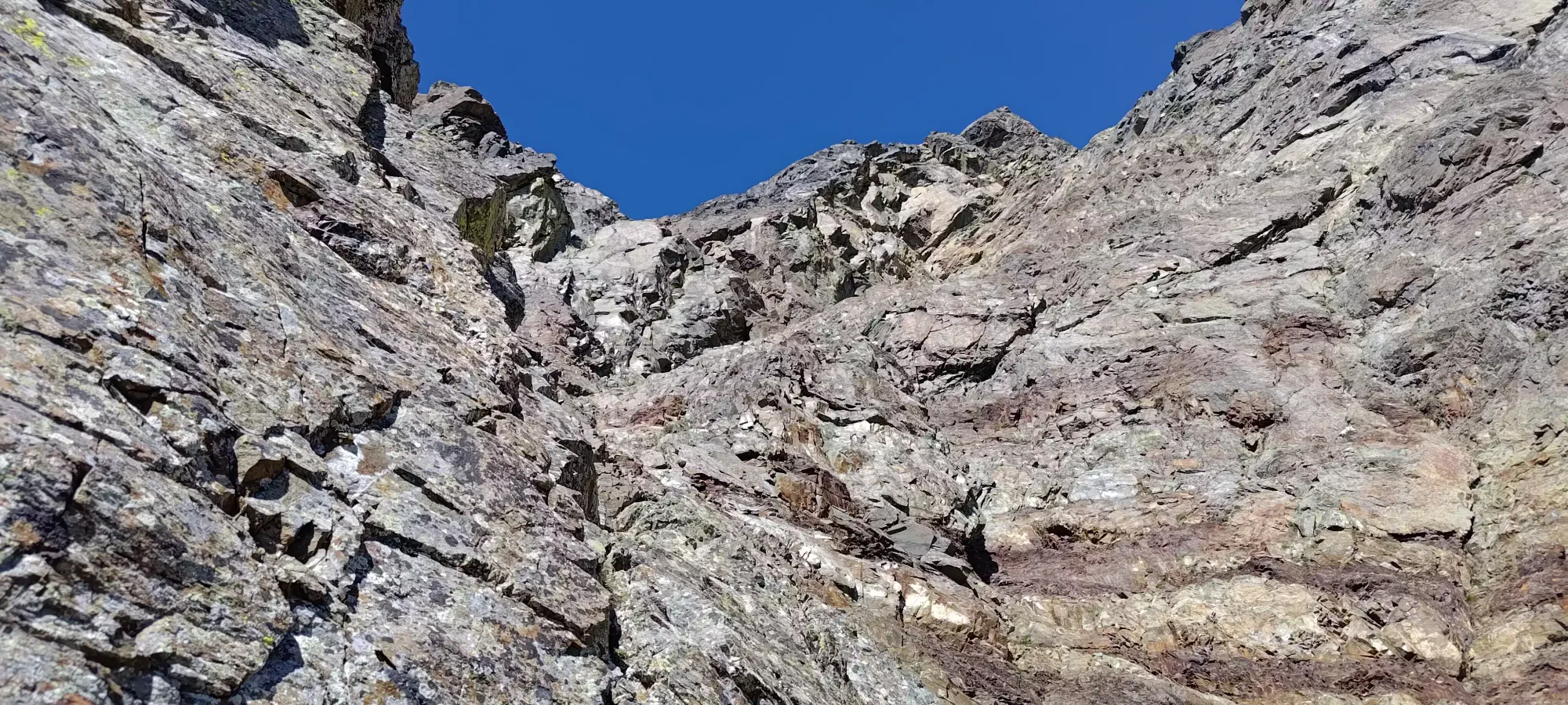
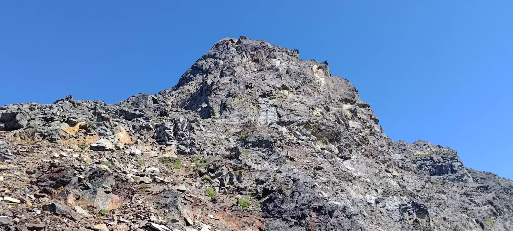
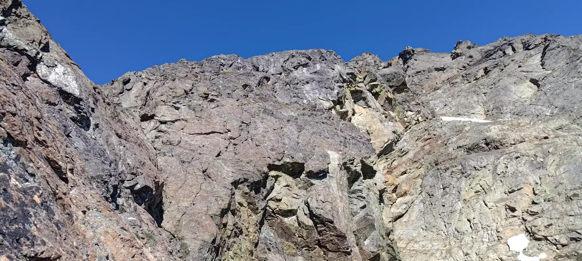
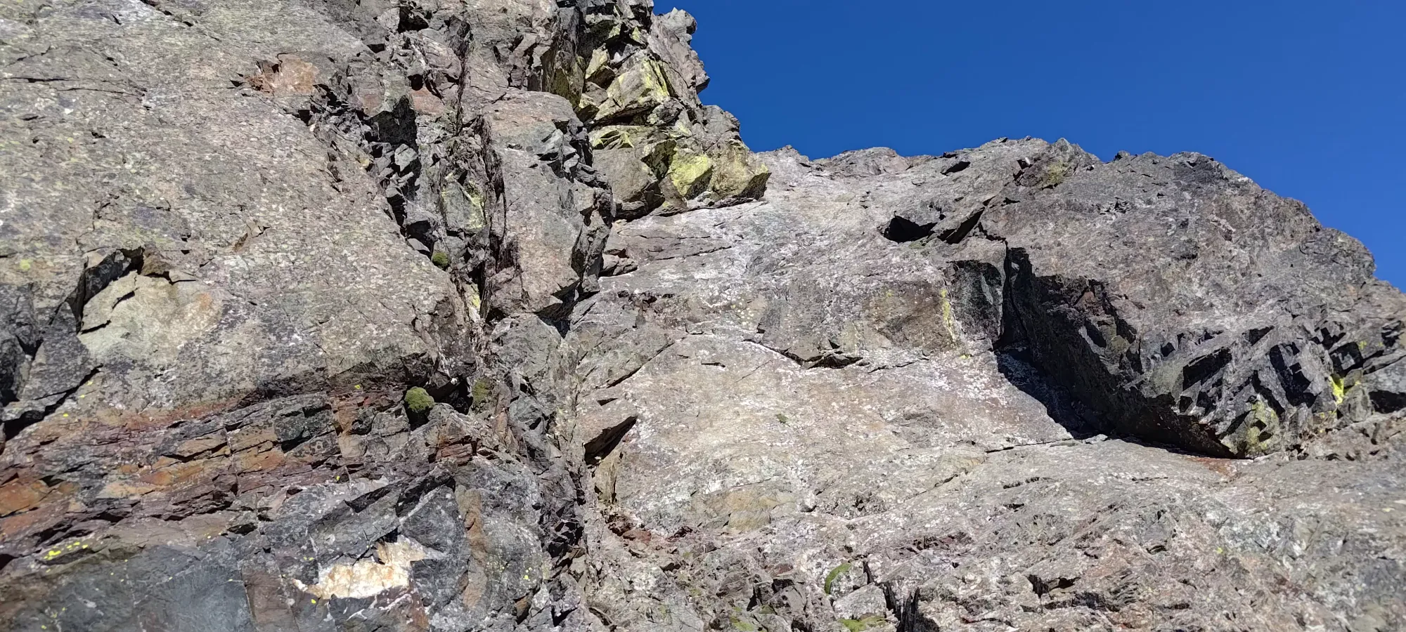
From there, it was more class 3+ scrambling up fairly easy, ledgy terrain, following natural gullies towards the summit area, trending more to climber's left overall. This continued until about 2050m (probably, GPX tracking in alpine rock is rather iffy), where we found ourselves in a tight gully which went up to the top of the NW ridge. That didn't look like the best option for us, though, as that ridge didn't seem like it would easily go to the top, we instead intended to get over to the SW ridge before the end and top out that way. So, we found a nice-looking diagonal crack that led out of our gully and up to climber's right around the next protrusion from the ridge. Logan was scoping out a steep route up the larger bowl/gully system below me, but I figured this route would go, and he'd enjoy the crack climbing, so we decided to try this route to access the next section.
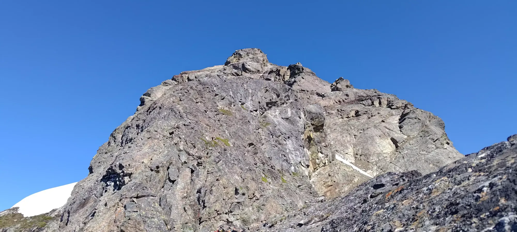
The left side of the crack was quite excellent for "reverse jugs" (Logan informed me normal people call these underclings), and even my not-really-a-climber self had a fun and safe time getting up. The crack topped out on an uphill ledge system that allowed us to basically walk around the overhanging rock protrusion seen above, which gave us access to the "next zone" of the scramble.
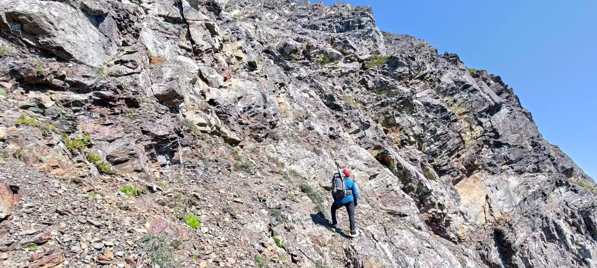
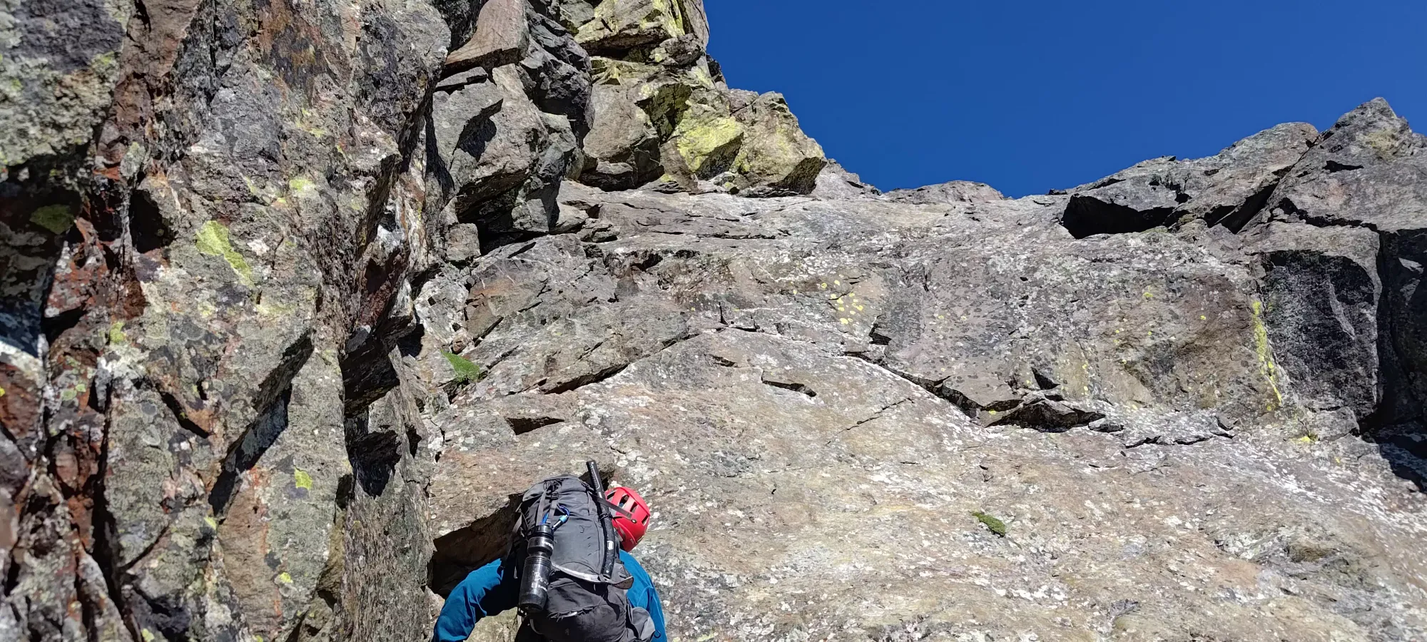
From this point, we turned up towards climber's left again, aiming to hit the NW ridge for at least a little bit, as it seemed like the least steep way to access the summit block. The way there was, of course, still scrambling, and at least class 3, but wasn't notably difficult or anything. When we topped the ridge out a couple minutes later, we stopped to get our better shoes on and get our harnesses out, as we weren't sure when another opportunity to do so would come, and it's always better to have stuff on before you get into sketchy, exposed spots. Logan had rock shoes, but I just had approach shoes since I hate wearing rock shoes 😅. I'd say they weren't necessary, though, and I just used 'em since we were stopping regardless.
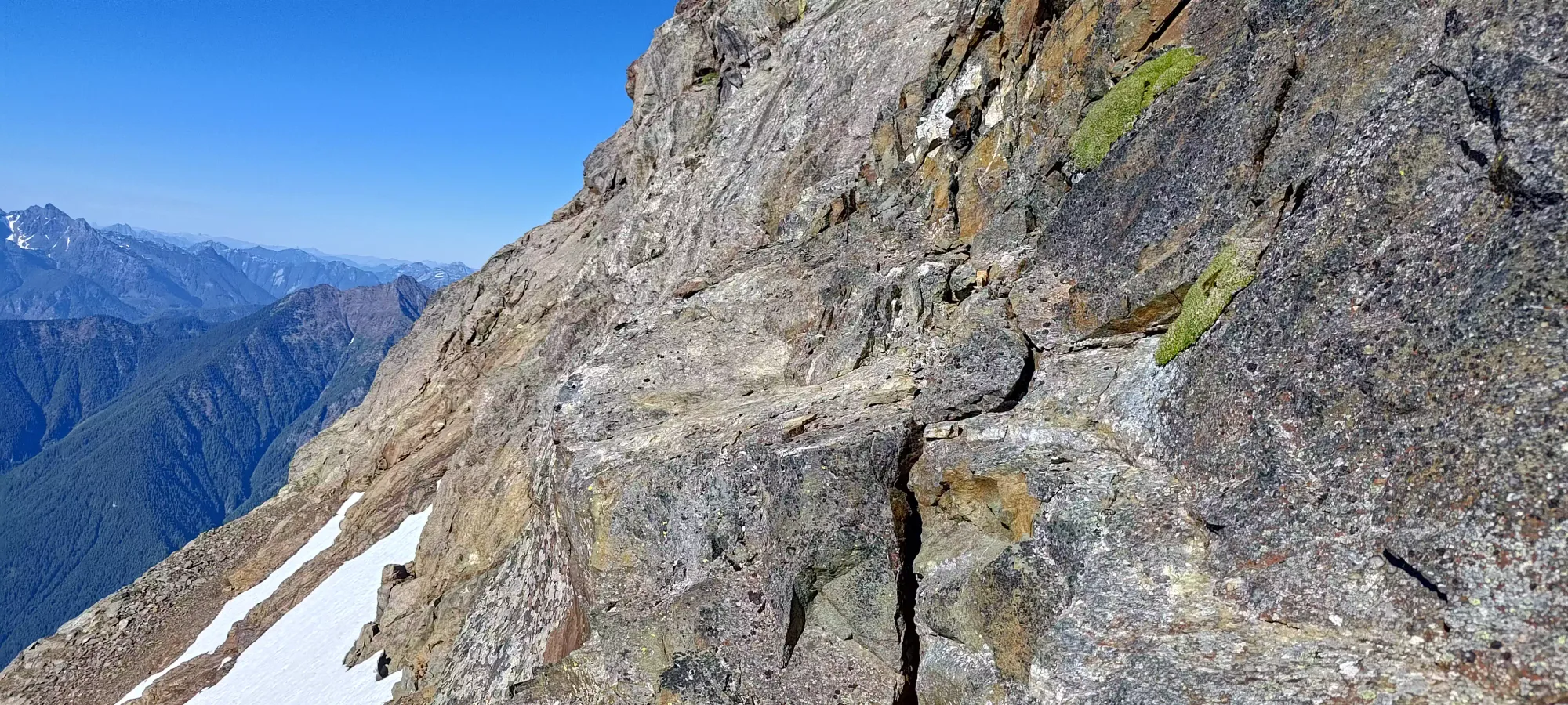
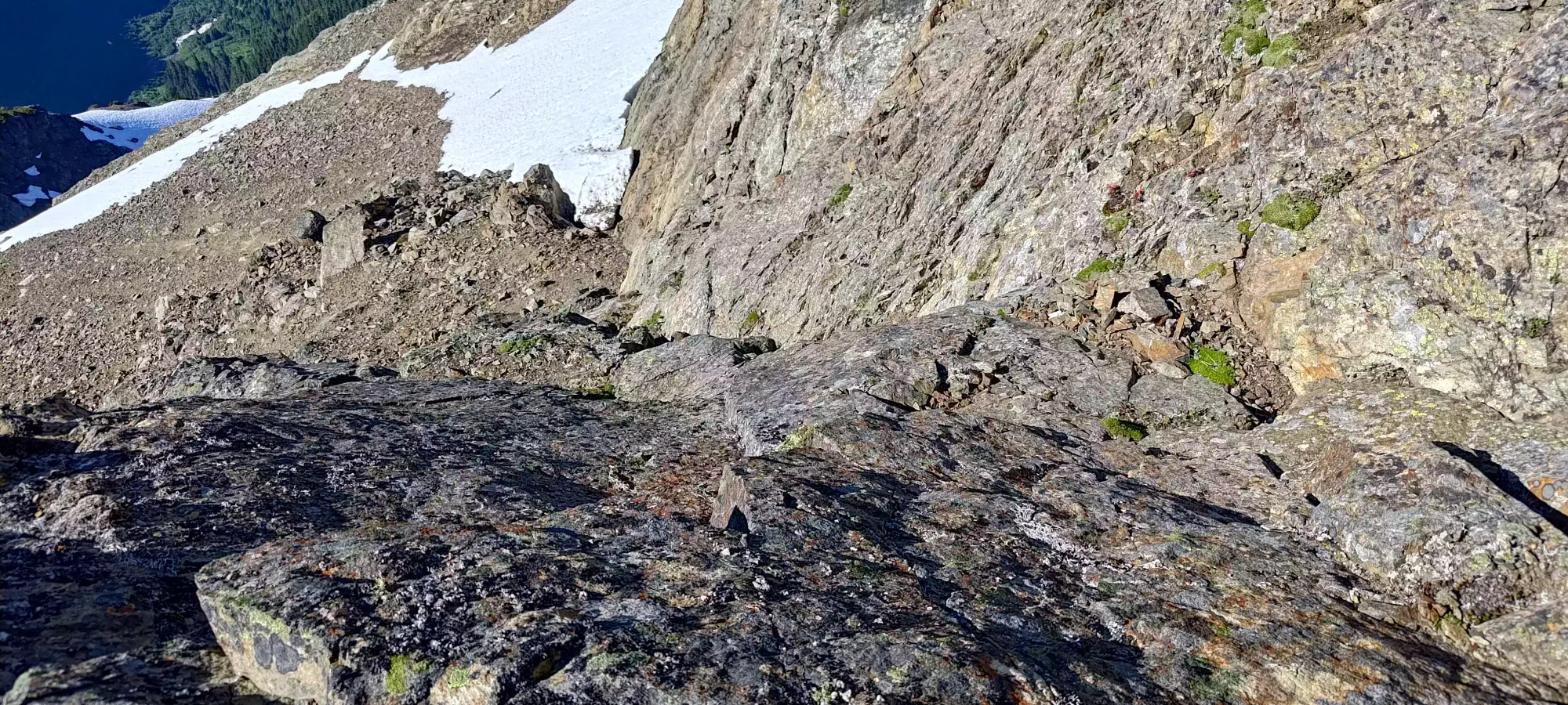
The next bit of scrambling was a bit more challenging, as the terrain was more exposed, the rock slabbier (not actually slab climbing, but just smaller holds, not ledgy as much as just contoured rock, etc), and room for error lower. I remember remarking on this section that the downclimbing would be a bit challenging, and that would prove to be true some time later. Nevertheless, we got through it fine, and eventually emerged much higher up (maybe around 2100m?), finally close enough to figure out our plans for the rest of the summit. We also found ourselves near a couple snow patches for emergency refilling, though we were doing okay in that sense. The routefinding and technical scrambling kept us moving slow enough to stay regulated.
From that point, after walking up the loose-but-walkable section, we had a few options to consider. The most direction option (literally straight to the summit) was impractical, as a couple vertical walls would prevent that. The most obvious choice appeared to be contouring right below the first wall and joining the ridge to climber's right, but there was a tall, overhanging step to exit the rightward traverse before we could get up to the ridge, so that was voted out. One option I left on the table, though wasn't super enthused about, was traversing the steep snow patch on climber's left, then taking the ramp above that first wall to hit the climber's right ridge. That would probably work, but asked us to traverse steep snow (doable, but annoying), then do some exposed slab traversing before getting to the ramp, which would be a bit sketchy. A third option was to hit the low, slightly red band of rocks on the right and hit the ridge early. That traverse looked doable, but the couple protrusions lower on the ridge we'd have to go over (or find another way around) didn't seem promising. So, the last option of "take the blocky scrambling to the right of the wall until we could get past the overhang, then head climber's right towards the ridge, above the protrusions" was chosen.
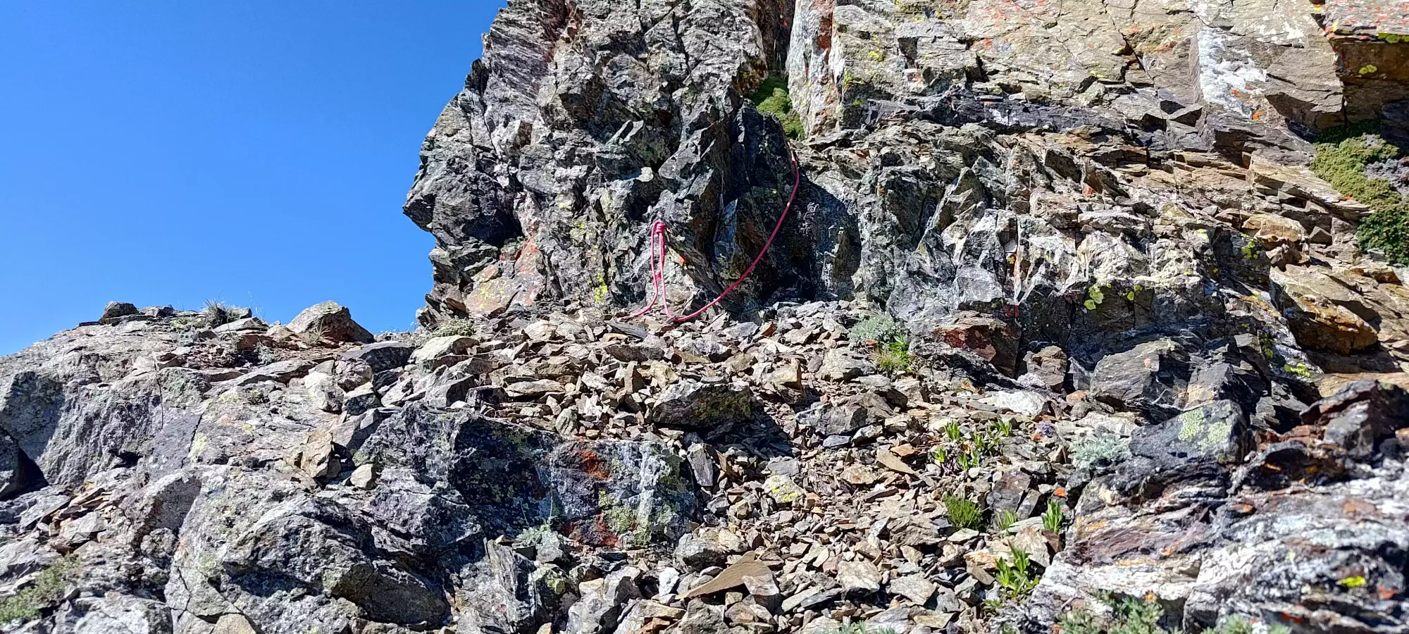
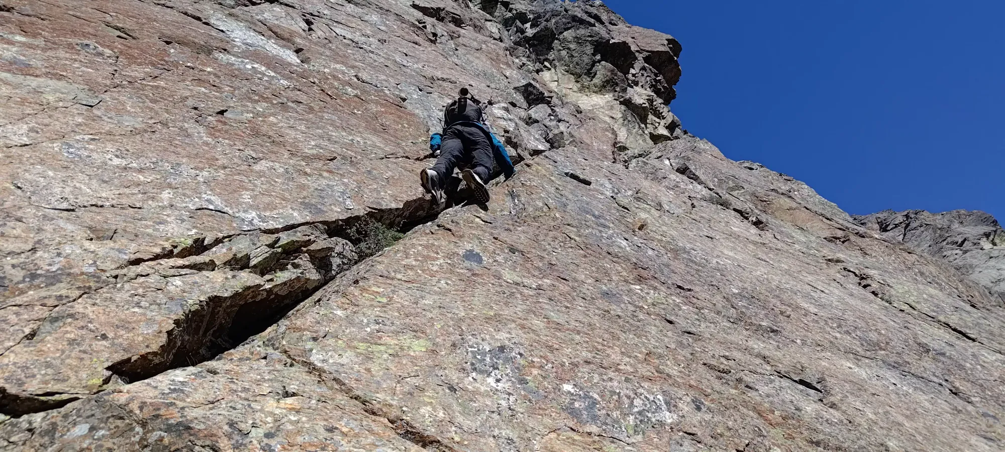
This worked out well for us. The blocky section had some difficult moves, but the ledgy rock made us feel quite secure, and the couple traverses we made to climber's left to get back towards the ramp above the overhang on the first route were made on fairly gently-sloping ledges (though they were still downsloping). Once we did that, we found some more tat above the overhanging gully, which we guessed was where other parties had found the crux that merited roping up.

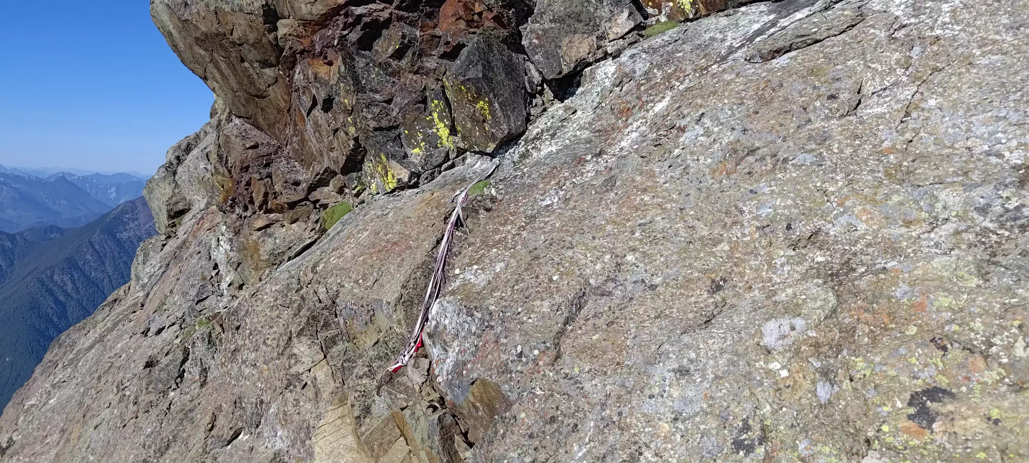
From there, we stayed in a wide crack/chimney system that led up towards the SW ridge, doing more scrambling that would fall on the difficult end of the spectrum. There were more tat stations (one could probably bring a 40m rope, even, as they were quite tightly spaced, and more anchors could be built in most of the difficult spots) throughout this area to support that claim. We are both confident scramblers, though, so we got through this section, like the others, without issue. I specifically like chimneys, so this was right up my alley.
After that pitch, things opened up a bit, and we had a bit more ledgy terrain (though not quite as flat, requiring more use of friction and textured holds) to get up to the next station, which was basically on the ridge. Again, no issues for us.
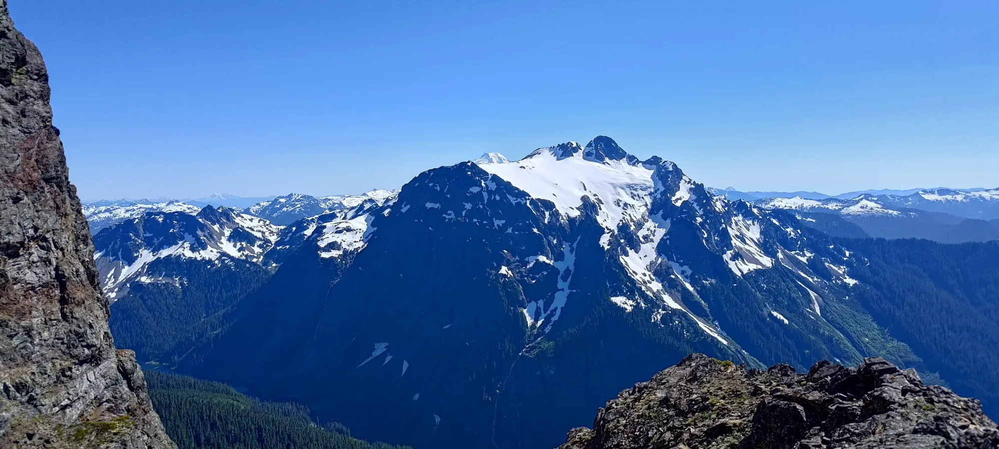
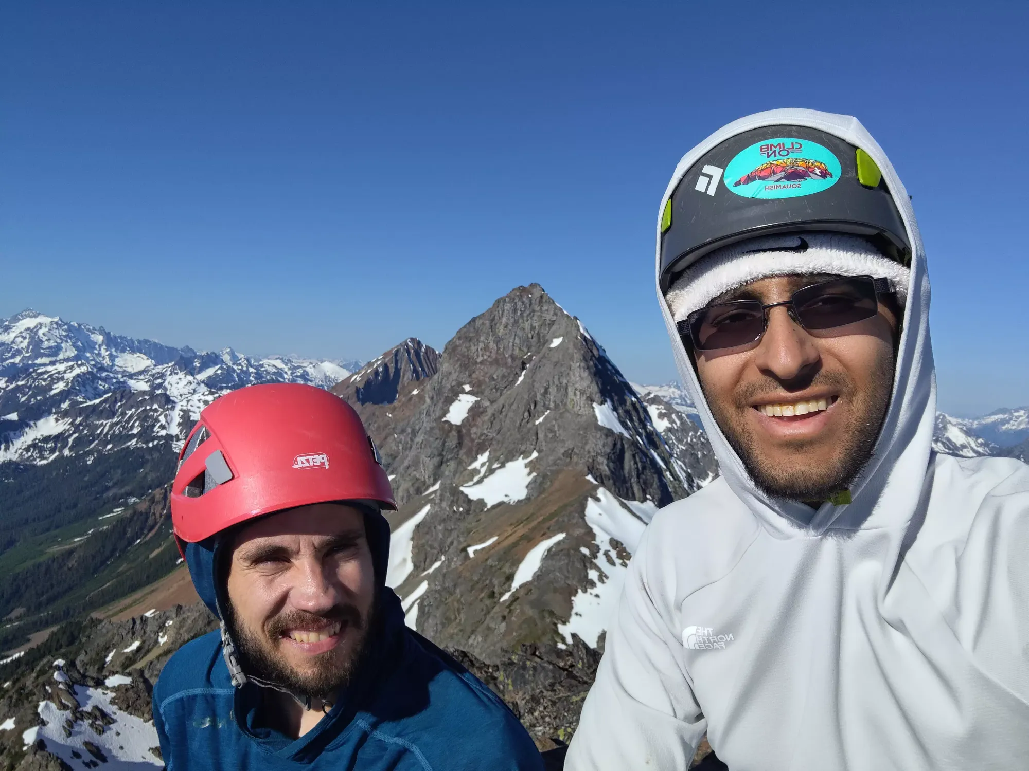
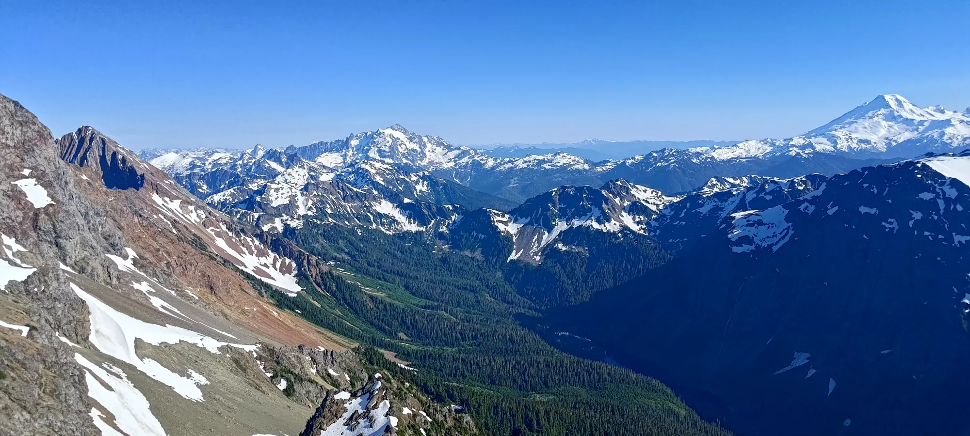
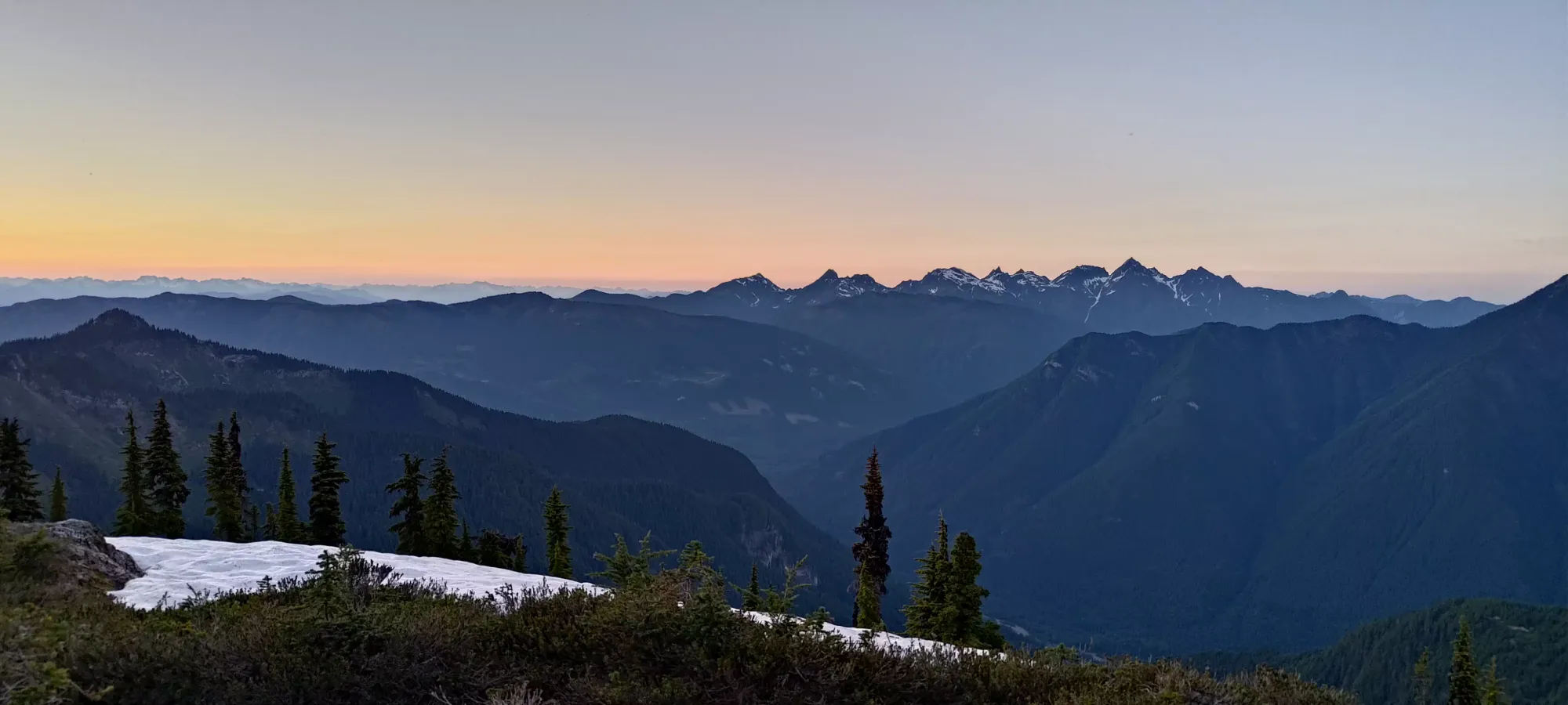
Past that station, we turned left onto the ridge, and just had a couple minutes of walking on semi-loose, larger rocks to the summit. The summit itself was roomy enough for a large party of people, though unsurprisingly, nobody else was there to greet us 🤣. There, we had a nice long break, enjoyed the views, sent a couple messages (one of the few spots with signal, and the only which really let me send anything out), and found a summit register cap but no corresponding tube 🤷. This was at about 6:10pm, so we definitely took our time getting up. Given how much our friends had talked up the seriousness of the ascent, though, plus the heat, we were happy to take our time. We were both comfortable with hiking out in the dark, as long as we were on the gentler west ridge by dark, which we'd still have plenty of time to make happen.
On the downclimb, we didn't take many pictures, as our concern was just getting down safely, and also, we largely just stayed on our uptrack. Getting to the first rap station was just walking, so no problems there. From there to the next one was mostly ledges, if a bit downsloping or requiring more careful holds in places, but still fairly comfortable for us. After that, we got back into the chimneys above the supposed crux, which had a few challenging moves, but the walls offered enough safety that we were happy to keep going down un-roped.
From the crux rap station, we retraced our steps along the ledge traverse (this was a bit sketchier on the way down, and we took our time using all the friction available to us to do this safely), then down the blocky section back into the scree above the NW ridge. From there, we downclimbed the difficult ridge section, and actually followed our GPSes a bit too far down the ridge. We both quickly ascertained something was amiss, as none of the terrain felt familiar, and the terrain got too sketchy to downclimb quickly. We found 2 pitons which we could've used to get off (though we were unsure if they'd go all the way to safe ground or not with our 60m rope) as a backup option, but I knew we couldn't be far off where we were on the way up, so we went back up maybe half a dozen moves, and sure enough, we found the spot that we'd previously transitioned into rock/approach shoes on the way up, and all was well.
From there, the downclimbing was a bit easier, with more ledgy terrain, and slightly less precipitous exposure. That got us down to where we would start wrapping around ribs coming off of the ridge until we rejoined it below the big horn, where the west ridge gets initially steep.
At some point after we passed the last of the rap stations, I cut down the slope a bit too aggressively, and found myself in some harder downclimbing to get back down on the scree slopes. To help on one particular move, I decided to toss my poles and pack down onto the scree bench. However, I made a bit of a stupid and didn't think "I could just hand these to Logan, who was in a safe spot behind me", and so yeeted my stuff down when I had a safer option. The poles were fine, but my pack took an unlucky bounce, and actually went a ways down the slope until it came to rest, out-of-view, in a snowpatch, thankfully not so far that we'd have to regain anything to retrieve it. Once I got down to the spot I tossed it to, I realised my perspective skewed my perception of the slope angle, and it was fairly downsloping. A potentially quite-troublesome mistake, but thankfully no harm was done.
We were able to retrieve the pack relatively unscathed (a small tear and partially broken but still functional buckle notwithstanding), and all it cost us was me getting swarmed by bugs near the meltwater from the snowpatch the bag was resting in as I navigated Logan to it from below (I was the scout, he was the retrieval man, in this case). They hadn't bothered us all day until this point, but from this point, small flies were incessant until the forest, and from the forest and below, mosquitoes started to swarm around us.
Once we got my pack back, we traversed back along the scree to skier's right to rejoin our uptrack on the ridge, then it was a simple retracing of our steps along the western ridge back towards the forest. The ridge, despite needing us to gain about 20m to hit the minor high point on it, was quite smooth, and I think using some snow patches on the way down helped us avoid the bushwhack coming off of the other side of it, which was nice.
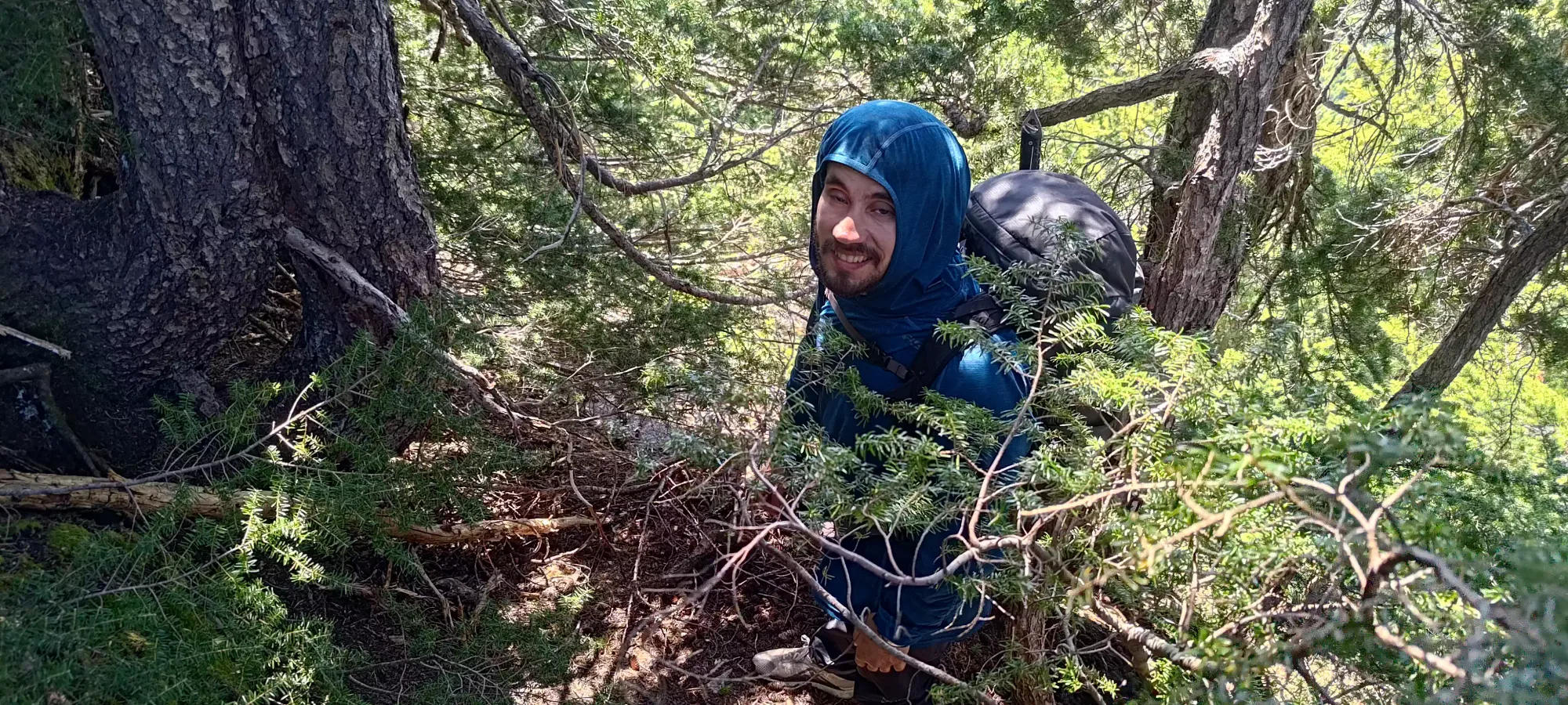
On the ridge, I had a couple signs of digestive issues creeping up, but managed to avoid needing to go, which was good given the amount of bugs swarming around us. In the forest, we made the poor decision to follow the tracks of some previous parties, as there appeared to be a continuation of the beaten ridge trail going into the forest where they led, but that died quite quickly, and the terrain ended up being worse than we experienced on our DIY route for the way up. I'd recommend following our uptrack in this section. I also did end up needing a short bathroom break here, but managed to avoid any insect bites in it, at least 😅
The descent back to the road took us 30 minutes (with maybe 5 lost to that break), so about the same as the way up. Considering this was downhill vs uphill, definitely not amazing. We were quite happy to see the road, though. There, we took a short break, emptied our shoes for the last time, and got our headlamps out for the road-walk out to the car.
The road was a tedious, annoying descent, as after the first couple switchbacks, it quickly gets just-rocky-enough that you can't just smoothly walk down, and actually have to watch your footing carefully, making things just that much more annoying. We stopped for water a couple times, but otherwise just turned some music on and ground it out, taking just under 75 minutes to descend 650m and 4.5km. It felt longer, though 😅
Once we finally got into the car, 12 hours after we left it, we made the loooong drive out (the potholes made it so much slower than it otherwise could've been), stopped at a diner on the way back for some late-night grub, and then I drove us home. I actually had to pull over once just to let me eyes rest for 5 minutes before getting myself all the way home, which is a rare thing for me, but it being almost 4am can do that sometimes 😅. We got it done, though, so I'm pretty happy with the result. It was a super fun peak, and I'd recommend it to any scrambler wanting to push things a bit in SWBC. While a lot of people here like to complain about the rock quality, I would say it is worse than the average in SWBC, but compared to many of the Rockies peaks I've done, it's really not so bad. The holds were great in the places that mattered, the vast majority of bad/loose rock was just in the steep walking areas. Don't let that get you down, and go for it! I would recommend bringing a rope unless you've been out with me often enough to compare our scrambling abilities, and know 10000% that you can do anything I can. The consequences of a fall here are not good. Heck, I'd really say "just bring one regardless", the stats aren't that bad, the insurance is worth the pack weight. A confident scrambler can maybe save the weight/space by omitting trad gear and just bringing rappelling stuff (though make sure to have lots of tat, as it doesn't get replaced very often).
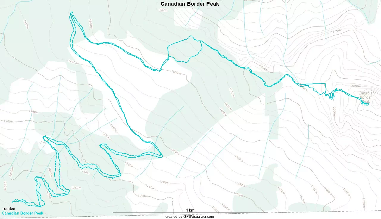
GPX Track + Map