Camelshoof Peak - September 15 2024
A short+steep hike up to a decently prominent peak looking over Lillooet and the Fountain Valley, with some fun driving to get there too!

Camelsfoot Range, Lillooet, BC
1555m
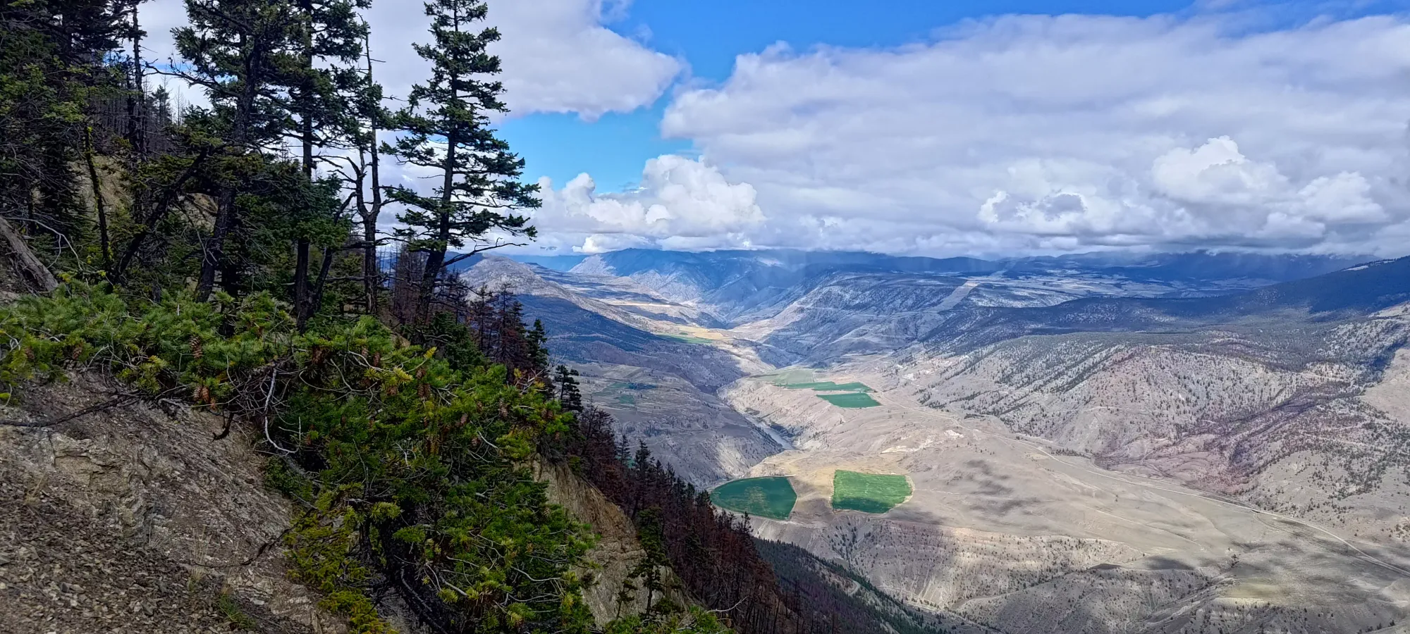
After a late night the Saturday prior, I needed a peak small enough that I could sleep in a little before tackling it. At the same time, I still wanted to get something meaningful, so I pulled a p500 out of my bag that I'd been saving for just such an occasion, Camelshoof Peak. This is the first peak (from the south) in the Camelsfoot Range, and is the big peak that you see towering over the small First Nations town of Pavilion, just outside of Lillooet. I got Kelly to agree to join me on this adventure, so I picked him up on the way up, and we got into town right around noon.
From there, it was an easy drive up the West Pavilion FSR, which was well-graded and driveable by most anything. We saw a couple cars parked there, but the spur road was reported to be driveable for some distance still, so we continued on up it. If you park at the bottom, it would add about 300m of elevation gain and 6km round-trip, fwiw.
The road was fairly well-graded, but had very large/steep berms going across the road (like cross-ditches, but a raised bump instead of a dug ditch) for drainage on the cheap, I guess. They were enough that my Jeep Compass ended up touching a couple times due to breakover/clearance running out, but nothing problematic. Once we got to 1090m, there was a small pull-off that I probably should have taken, as the road got super steep, loose, and tight beyond that point. Kelly and I kinda looked at each other and thought (or perhaps just said) "maybe we should've taken his FJ after all 😅".
I did my best to get us up, and made it maybe 70% of the way, but I couldn't make it up the final steep hill before the road levelled off, so I had to very carefully back myself down the road until the flat-ish spot seen above, where I could turn around, then drive back down to the pull-off, where we parked to start our hike. If you want to try that final bit of driving, I'd say a low-range is basically necessary, but if you have that, along with decent tires, you should be alright. I will note that the process of backing down is not easy, though, so only attempt it if you're a confident driver (honestly, I'd not sit in most people's cars as they attempt to do so, for some context). The payoff for making it up that hill is being able to knock off about 1.4km round-trip and ~100m of elevation gain, for reference.
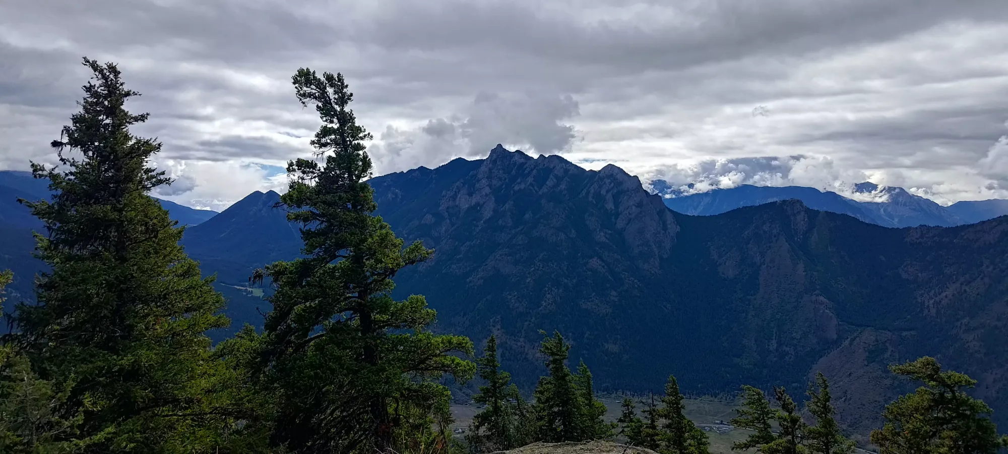
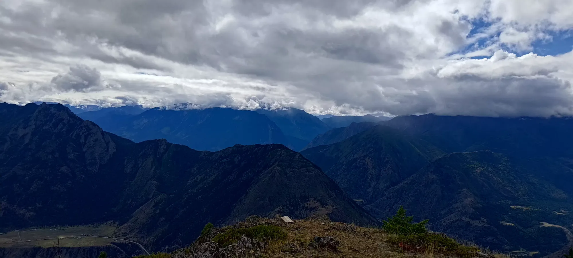
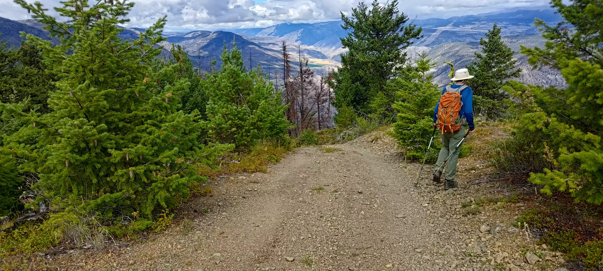
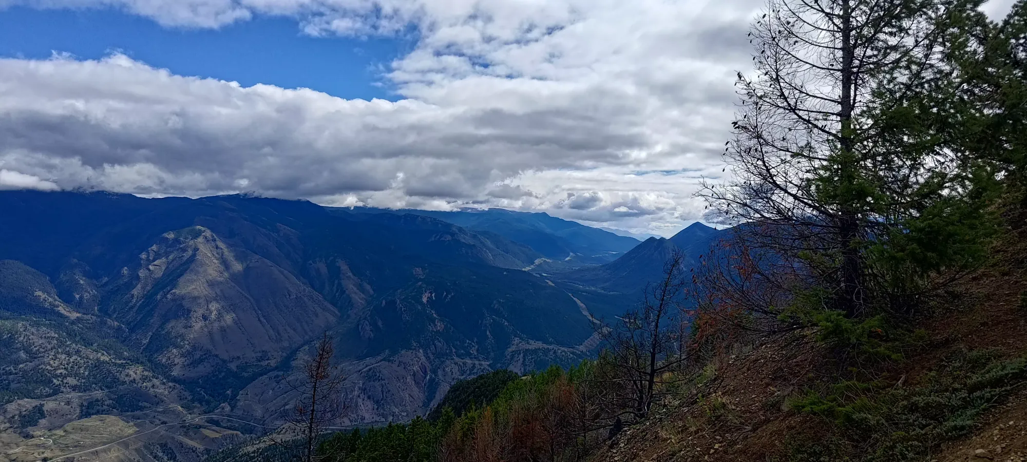
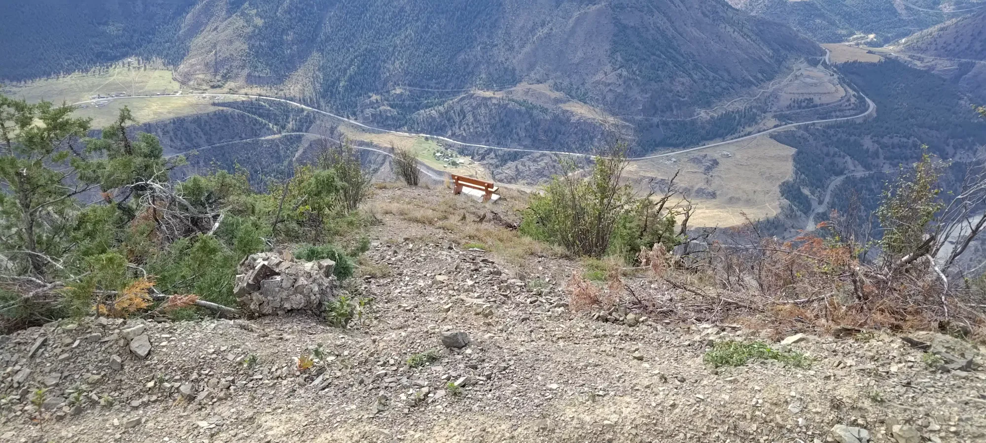
After getting parked and geared up, we got walking at a casual 12:55pm. Once we climbed that steep hill that defeated my car, we found ourselves at a small viewpoint on a local high-point of the ridge leading up towards Camelshoof, which had a small bench looking over the town, and a nice view of our objective.
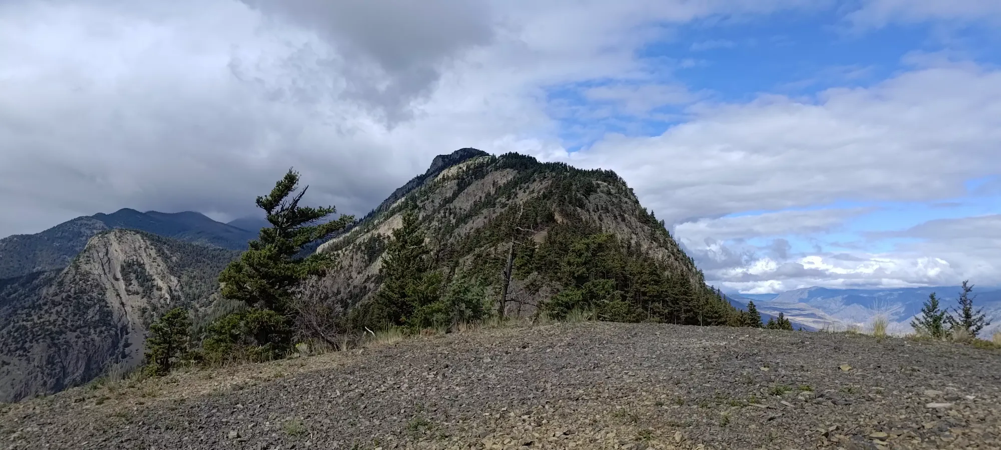
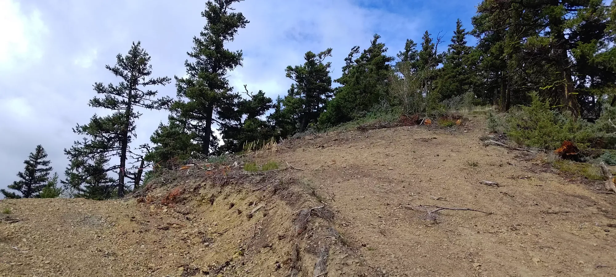
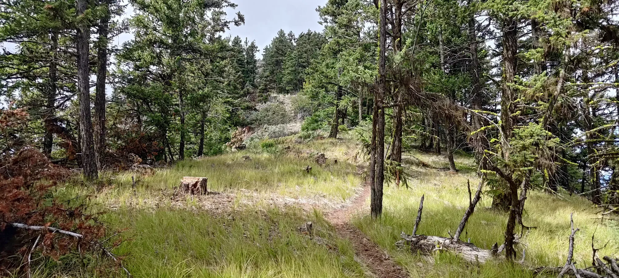
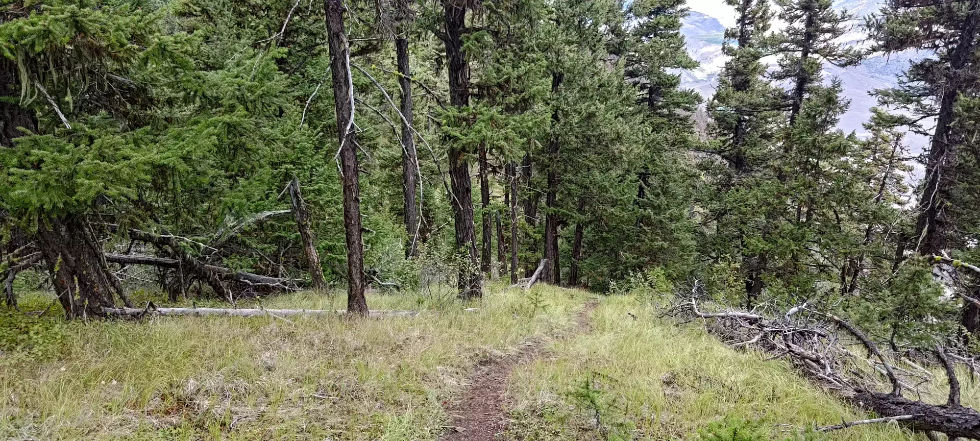
From there, we turned the gas up, and started hiking at a pretty decent clip. We made the end of the road in about 10 minutes, which made me feel a bit better about taking my less-capable vehicle, as I could confidently say my on-road performance would be able to make up 20 minutes lost on the hike. From that point, the road transitioned into a singletrack hiking trail that climbed the steep south ridge right up towards the peak.
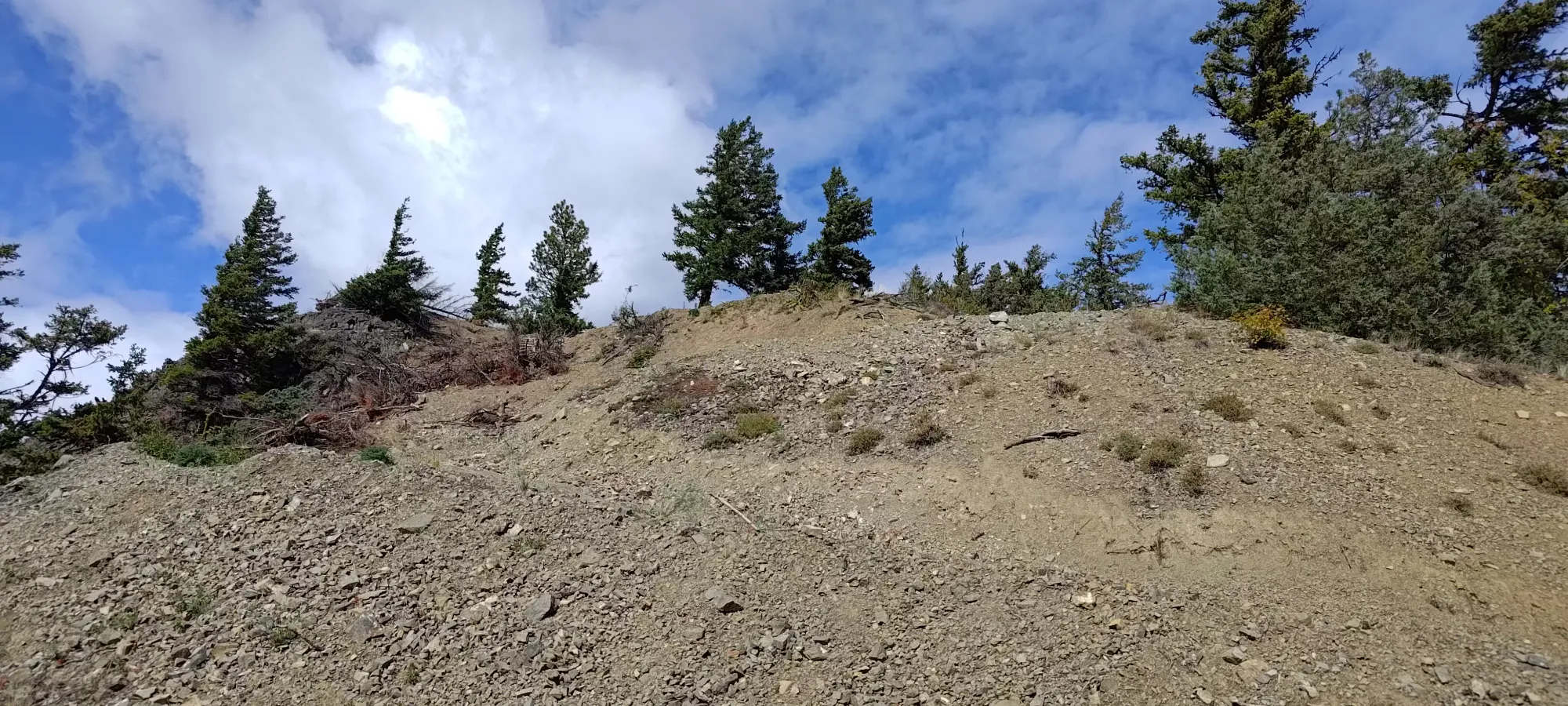
A bit before the half-hour mark, we hit the surprise false summit at ~1350m, where you have to descend almost 50m before you can start getting back up to the summit proper. That was a bit annoying, but provided a nice first test of my new trail runners, which garnered a result of "decent grip, but need some tightening of the lower laces". Not wanting to stop and interrupt our solid effort to knock the summit out in one shot, though, I ignored that fact and pushed on. Kelly is much more fit than myself, so it's nice to try and keep up with his pace for as long as I can to get my heart moving.
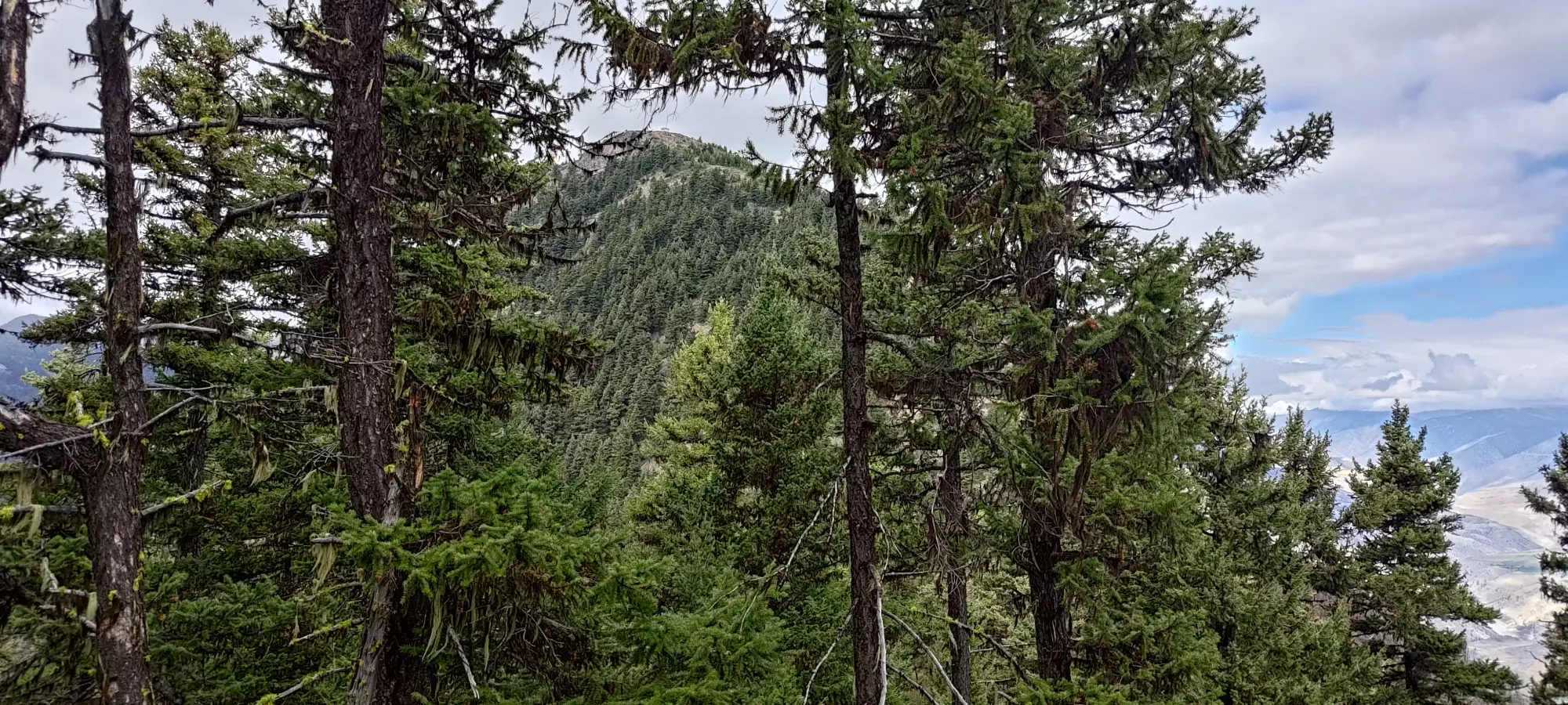
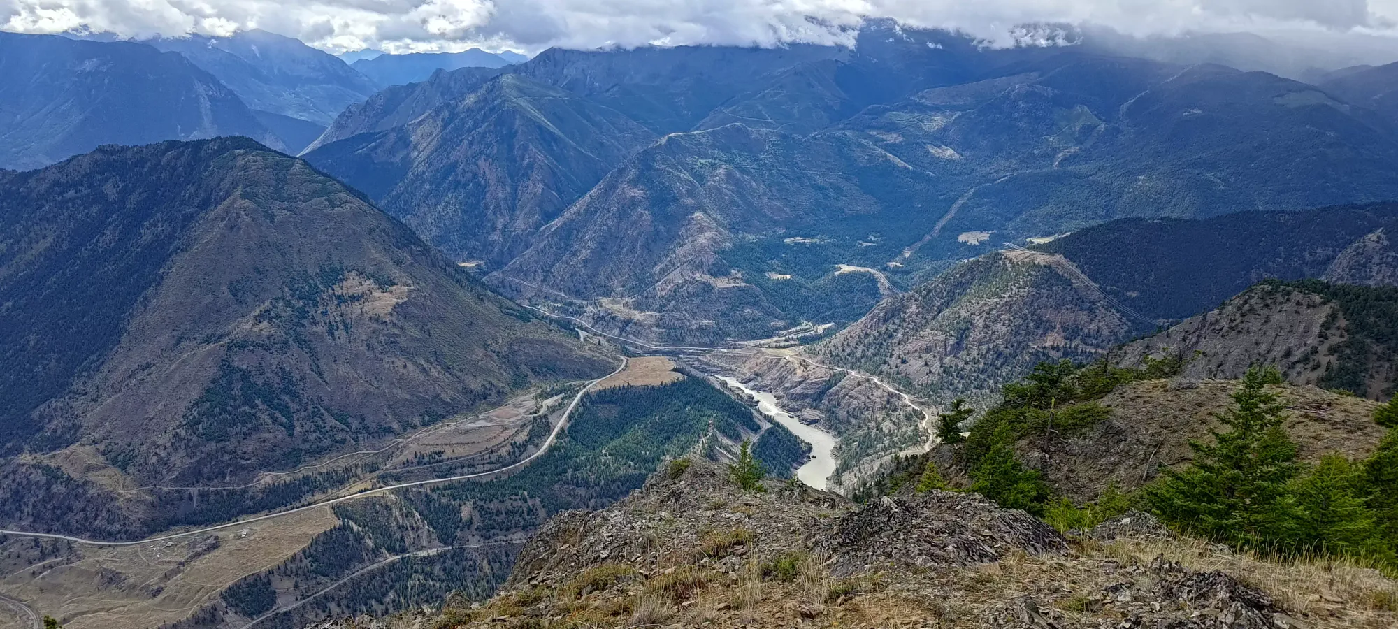
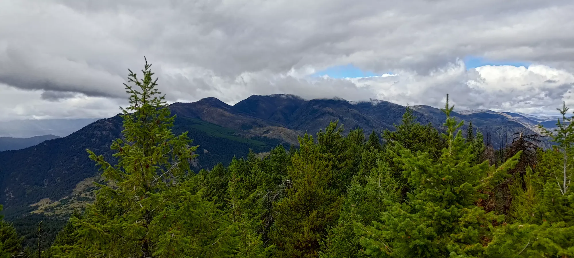
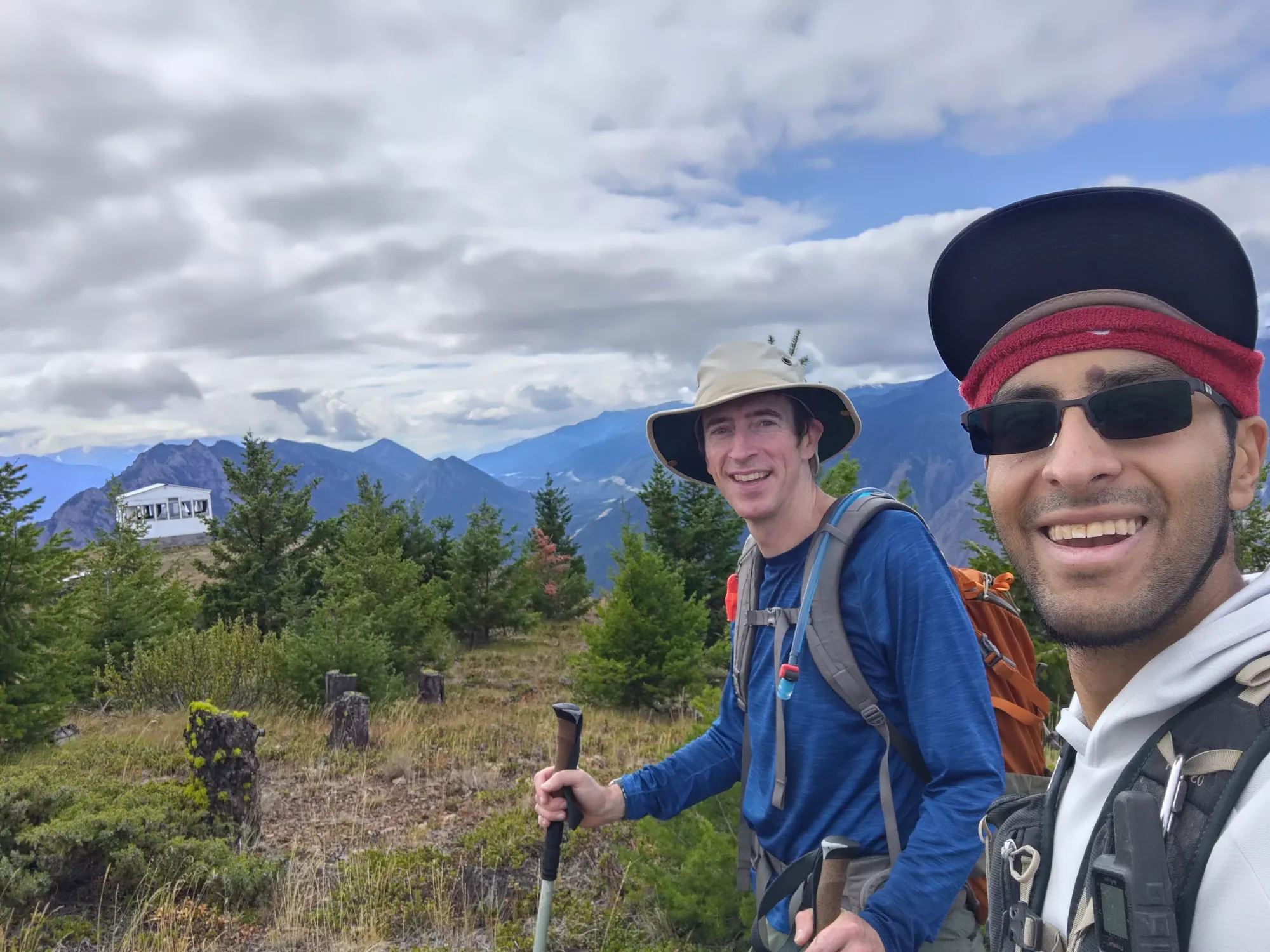
After taking a couple minutes to drop down to that low point, we ground through the final ~250m in 20 minutes, bringing us to a total of 50 minutes from parking to summit! Not bad, I'd say, for about 2.5km and about 500m of elevation. It definitely got the heart pumping, though, I was averaging a bit over 180 for that time 😅 Our reward for that effort was a pretty decent view, an old lookout hut, and a view of the rumoured road that comes in from the north side, and makes the peak potentially driveable for those willing to take a more circuitous route.
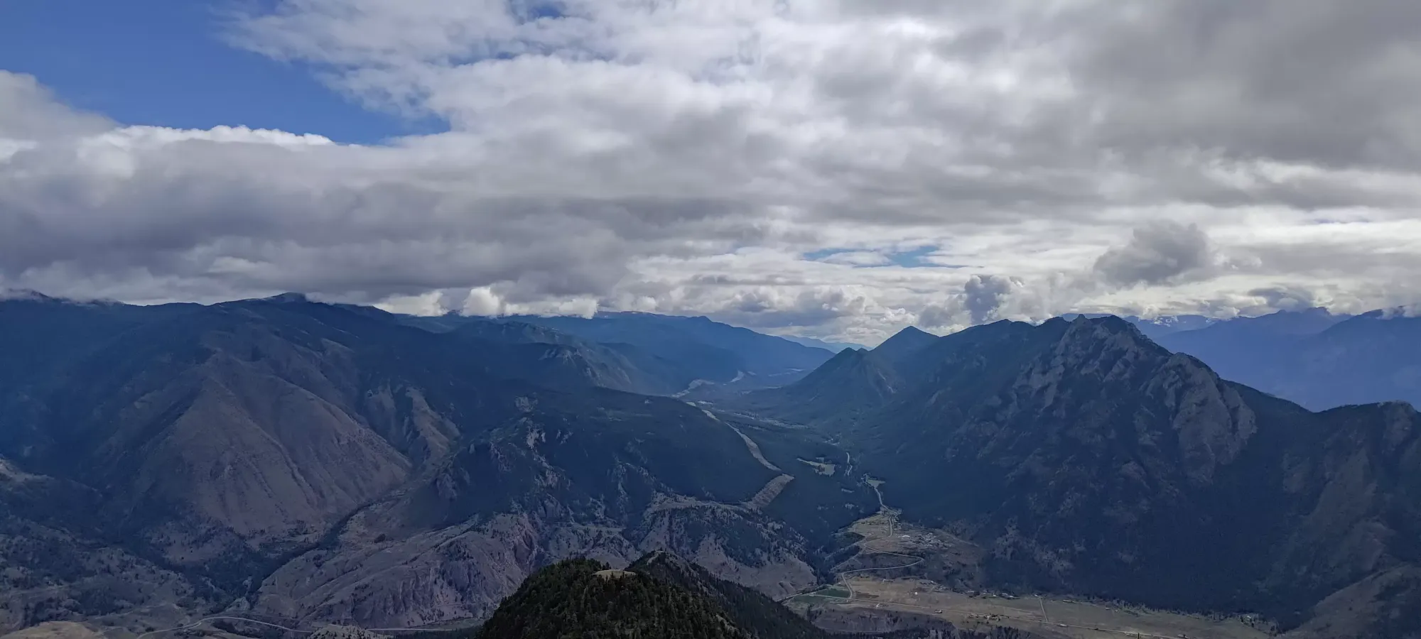
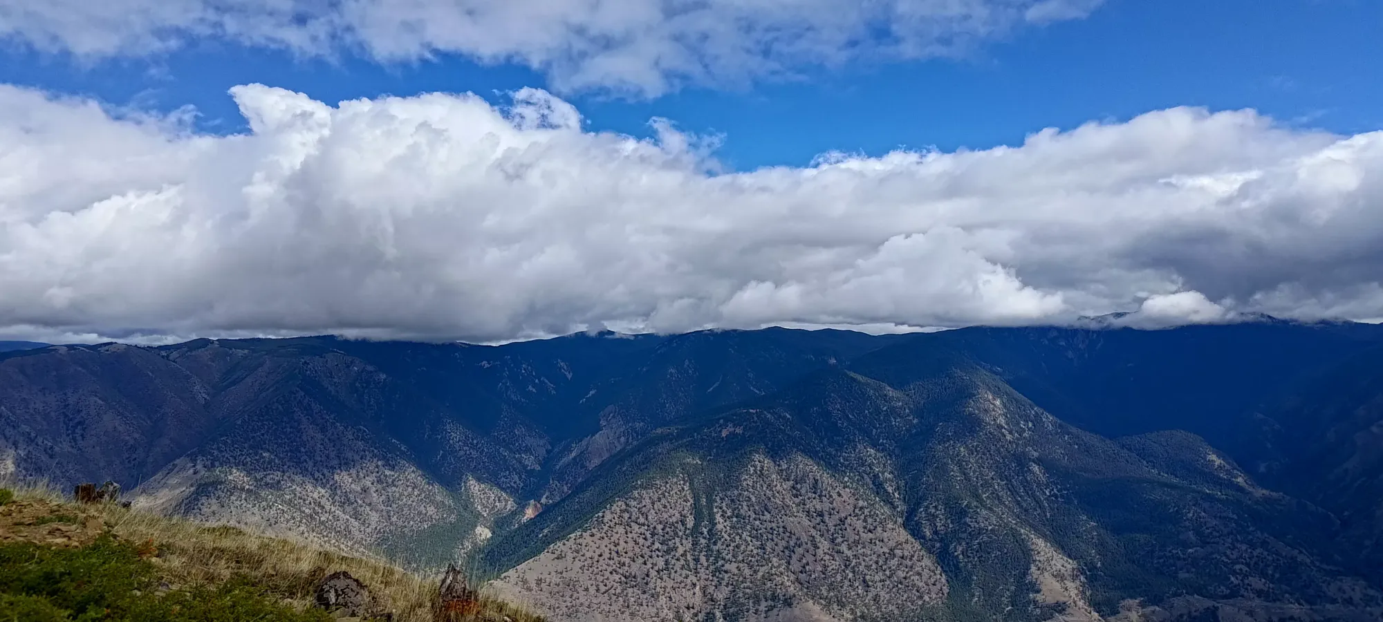
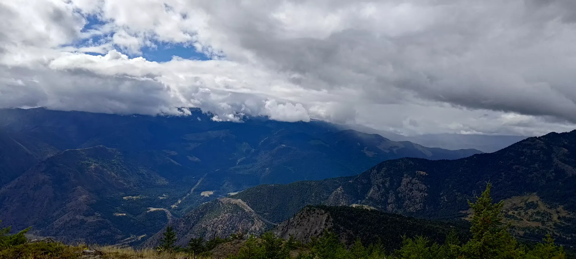
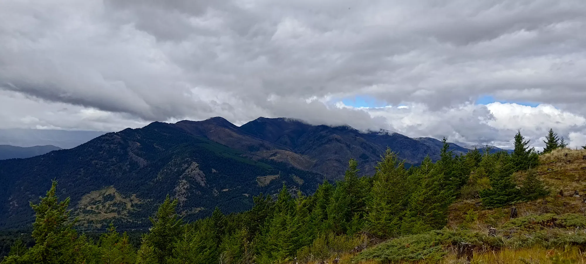
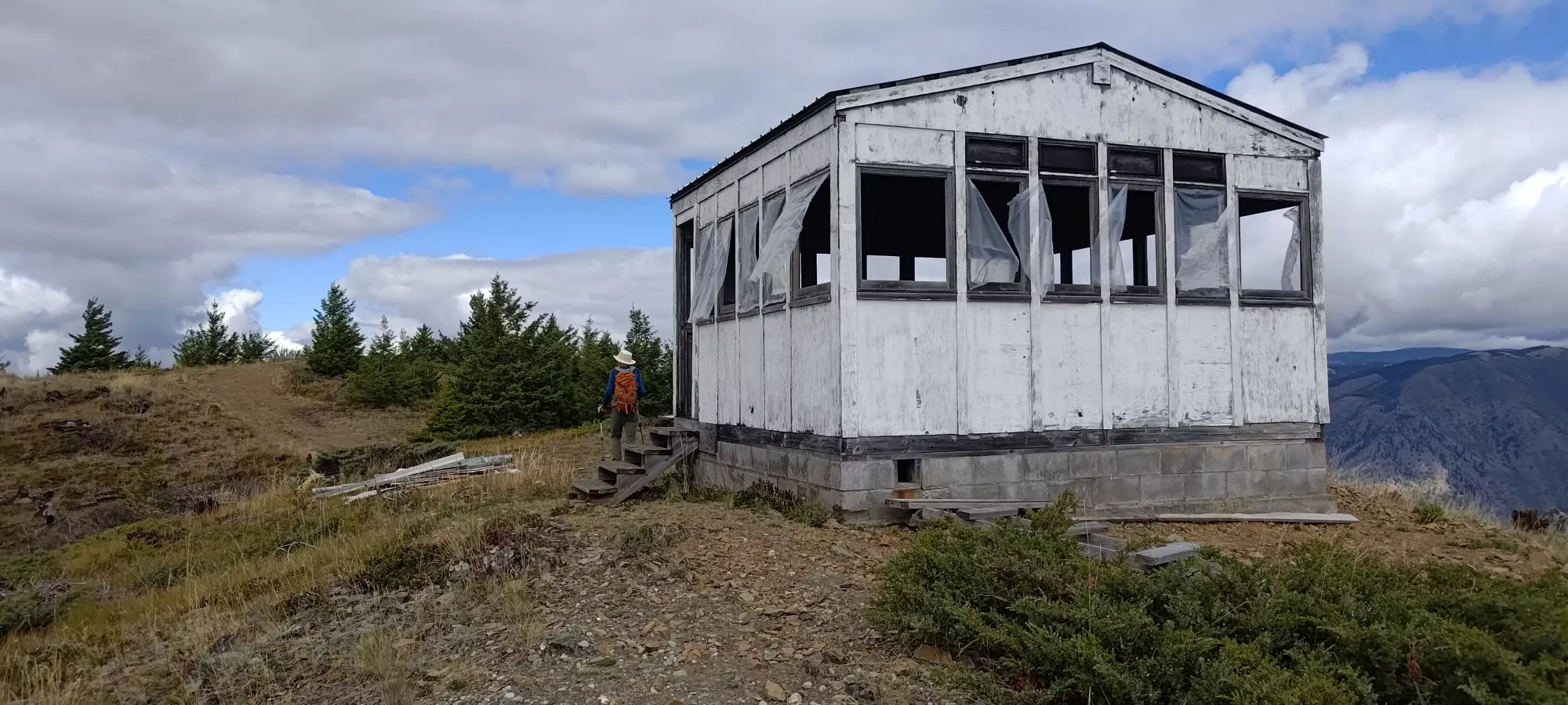
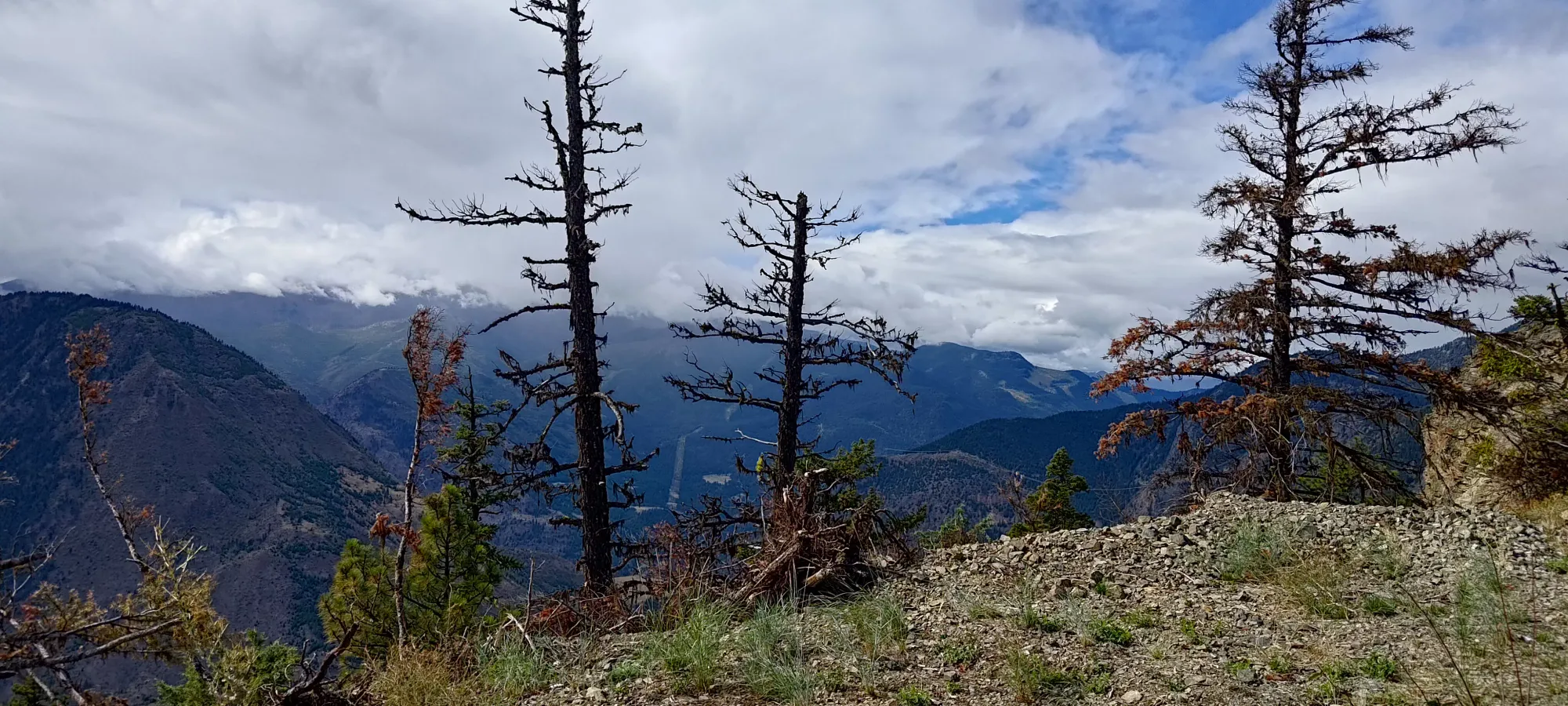
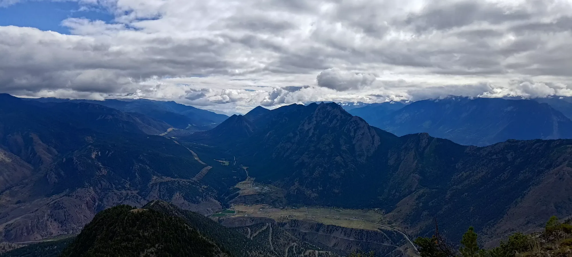
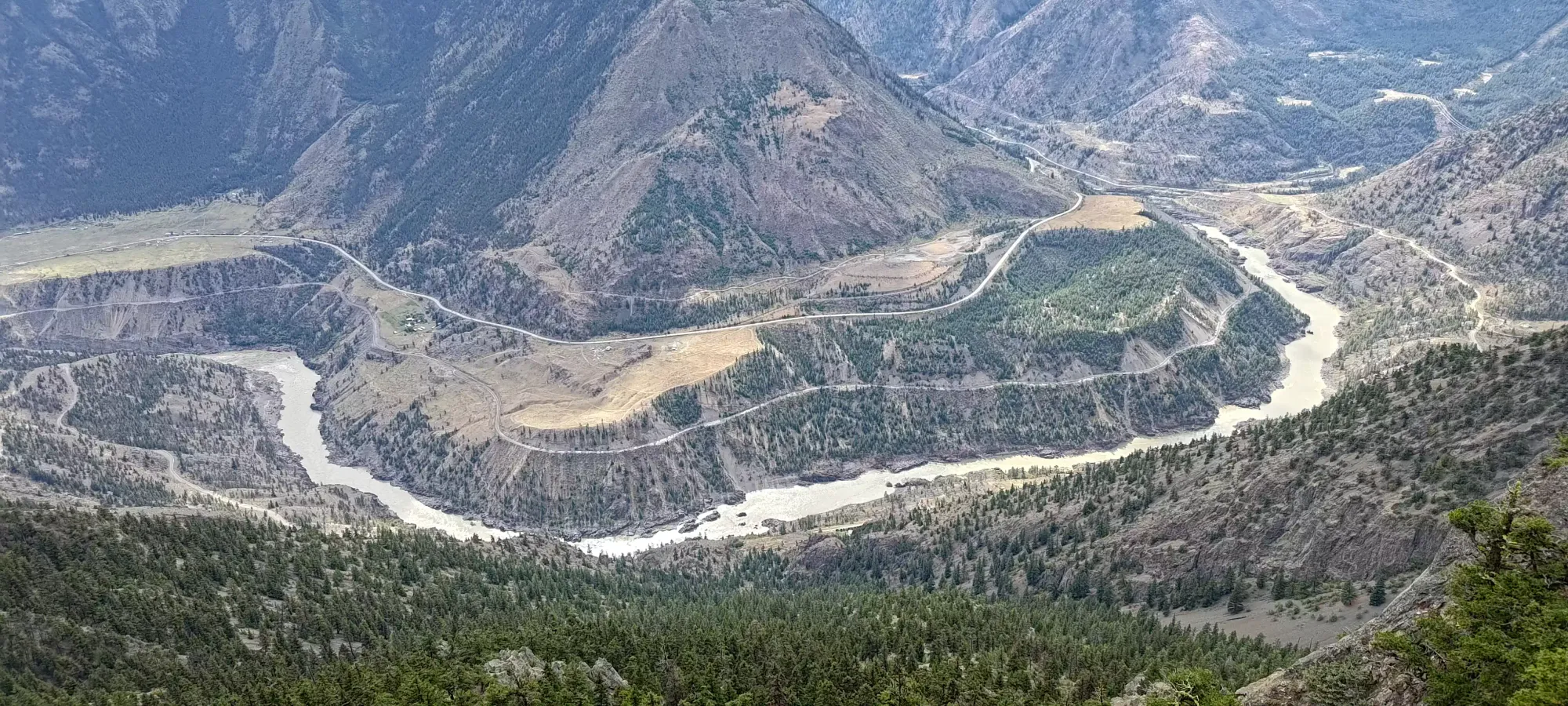
The lookout building itself wasn't that inspiring, so we ventured over to the true high point on the side of the northern road, then walked down the east side of the peak a bit to try and get some better views of the Fraser.
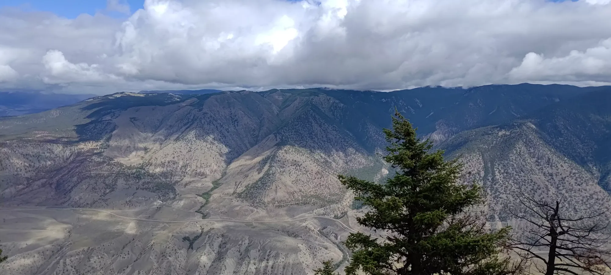
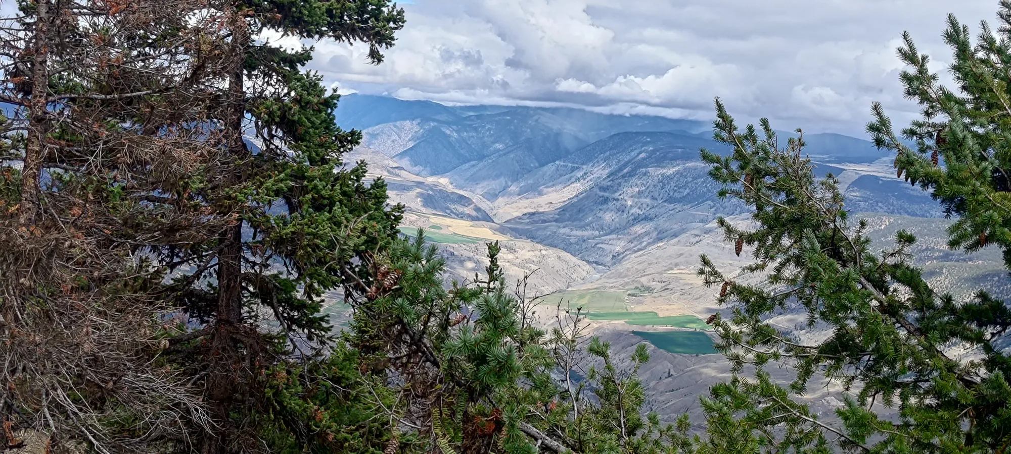
After that, we did a little more rambling around looking for better views of the town (and for Kelly, a little snacking) before we started heading back to the car at about 2pm.

The return hike to the car took us about 40 minutes going at a more casual pace. We stopped for a couple more photos, but otherwise just took it in one shot, with a slight annoyance at the extra 50m of gain the hill in the middle added onto things.

After that, we explored some backroads to see what else was around, but didn't end up summiting anything, and so just retreated to Lillooet for some dinner before driving home. This was definitely a nice, bite-sized outing, but still enough to say that you exercised and earned a peak for the day. 10/10 would recommend.
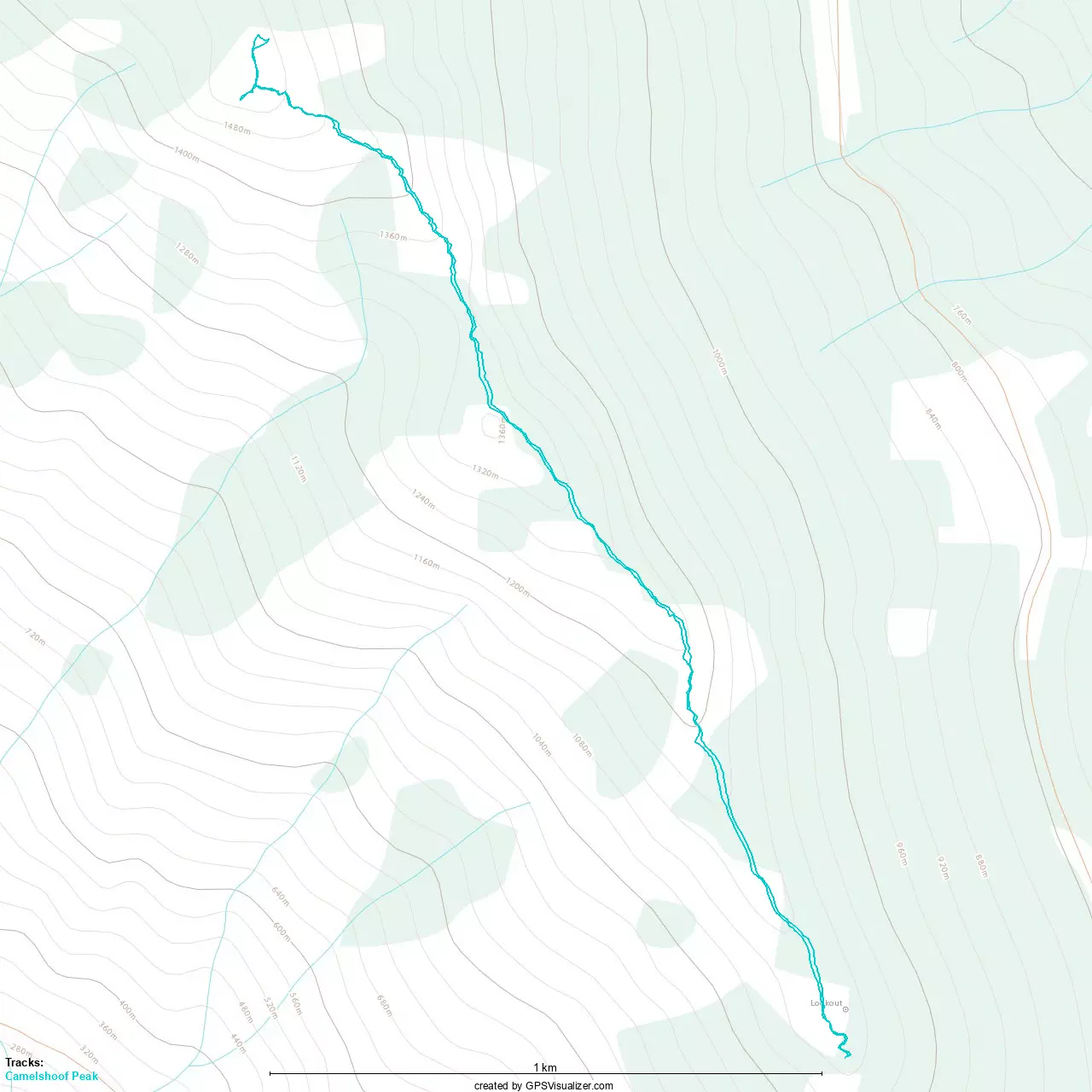
GPX Track + Map