Broken Top - July 1 2024
A fun scramble peak, though with a bit of a long approach. Doing it in spring on skis can make that approach fun instead of tedious, though we were a bit too late for that


Sisters Area, Bend, Oregon
2797m
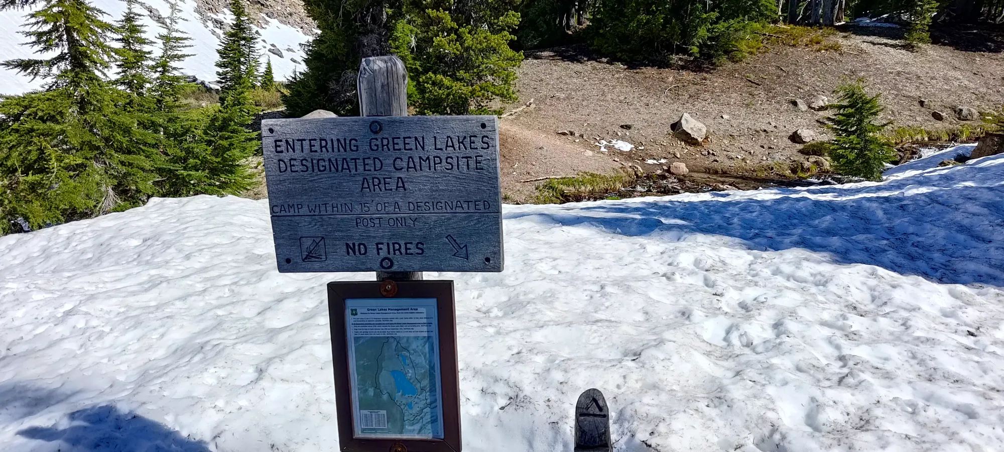
After arriving in Bend the previous day and finding the road past Todd Lake blocked, forcing us to abandon our plans to drive to the snowline and ski up the SE bowl, and instead go for the simpler Mount Bachelor, I had to formulate some different plans. I got some recent beta courtesy of Steven Song, along with the views we could see from Bachelor, which made Nick not want to try hiking the road to do the ski route on the SE side. So, instead, we pivoted to do the hike and scramble route on the NW ridge, as the scramble was reported as now dry. My lack of a summer pack, hiking poles, and a few other goodies made it a bit improvised, as did our lack of permits, but we figured we'd find a way to make it work. After waking up, eating, and checking out, we arrived shortly after 8am, where we found some volunteers talking to those arriving at the trailhead, along with signs indicating a dearth of available permits (insert Homer Simpson disappearing into the bushes here).
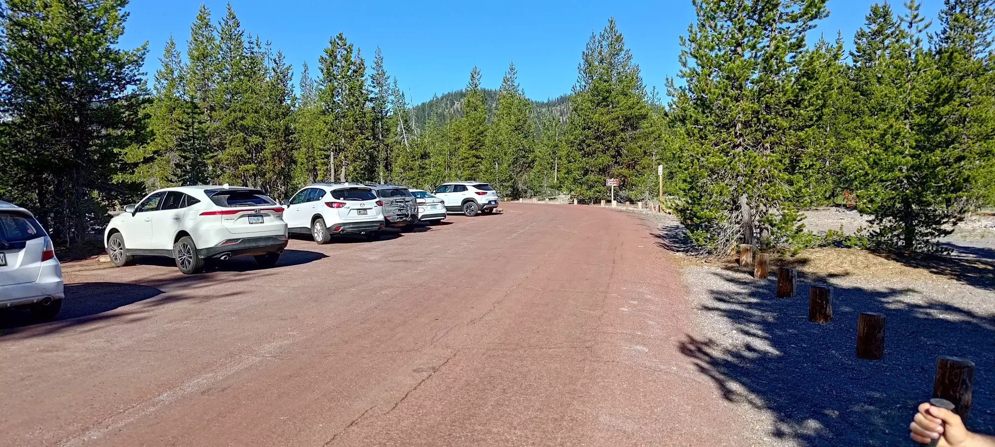
I had to use the bathroom (health still not really on point), so I found the pit toilets, and while I was there, I managed to get a cancelled permit, which was a huge source of relief for us, given the active presence of volunteers (even if not park rangers, they probably had ways to tell them about our presence). So, after I returned to the car, we got geared up (my spare hiking pole in the car refused to extend, so I made do with my ski poles) and headed out just after 8:30.
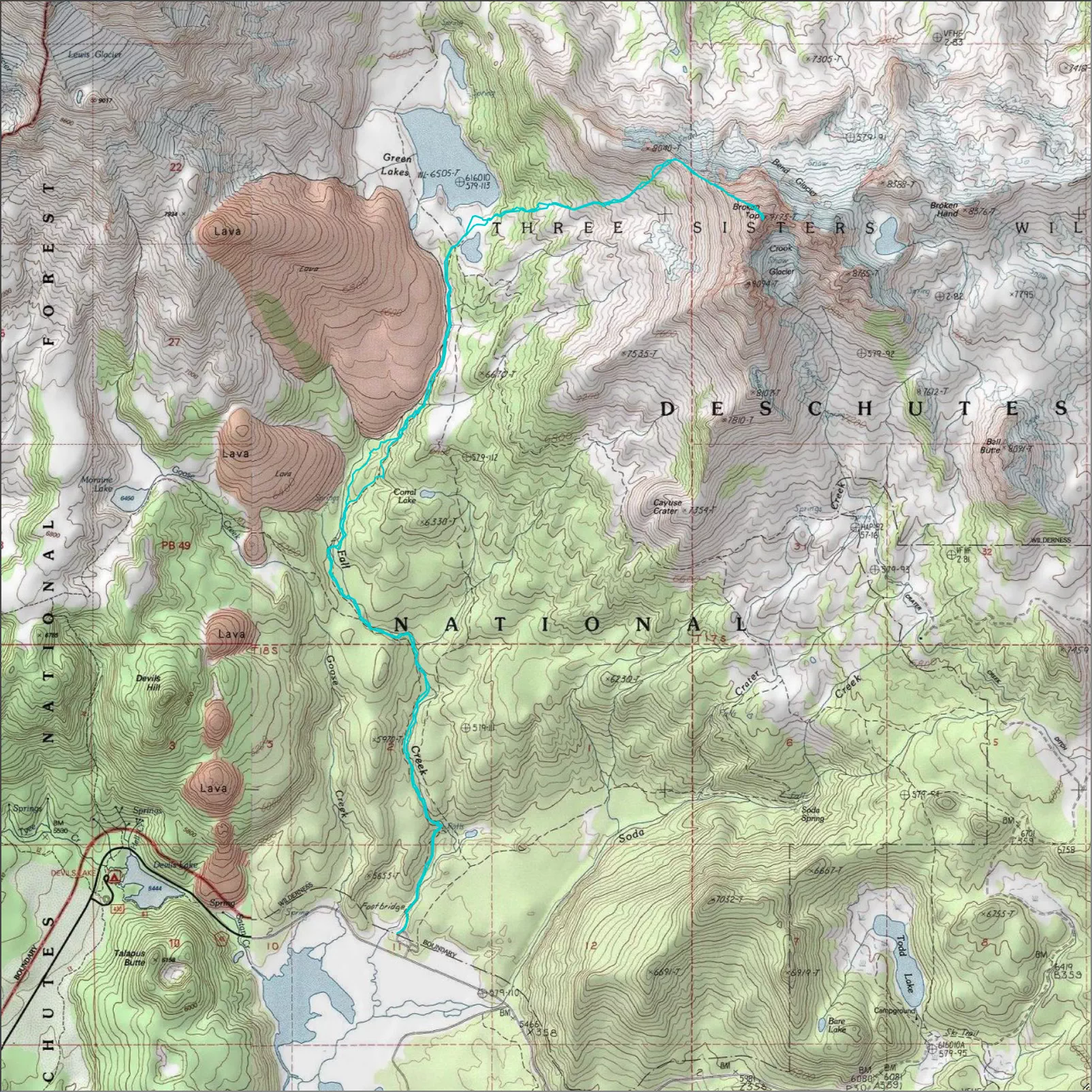
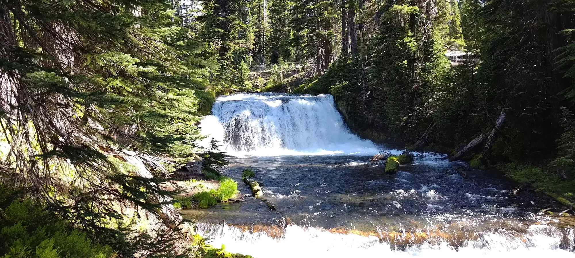
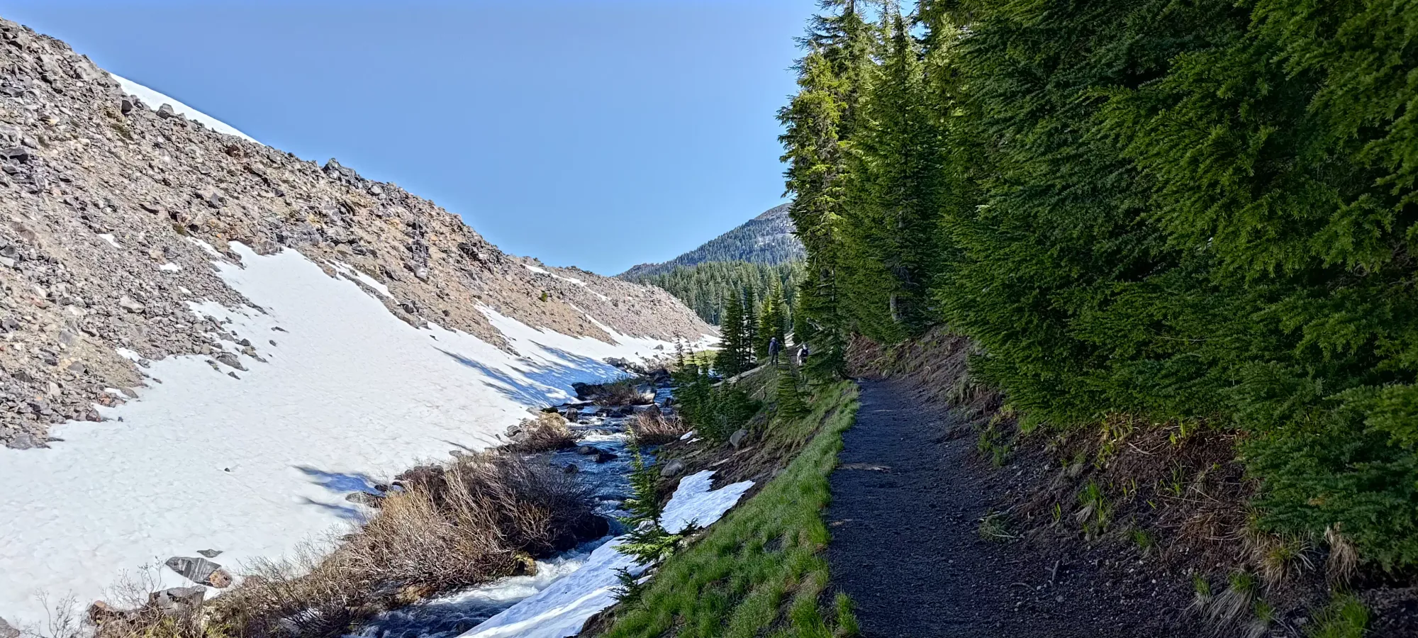
The trail goes for a minute or so before it reaches a log bridge over Fall Creek, which it then follows for basically 7km until you hit its source, Green Lakes. It was, at least, quite pretty, made for a convenient water source, and probably serves as a good navigation tool for those who might get lost.
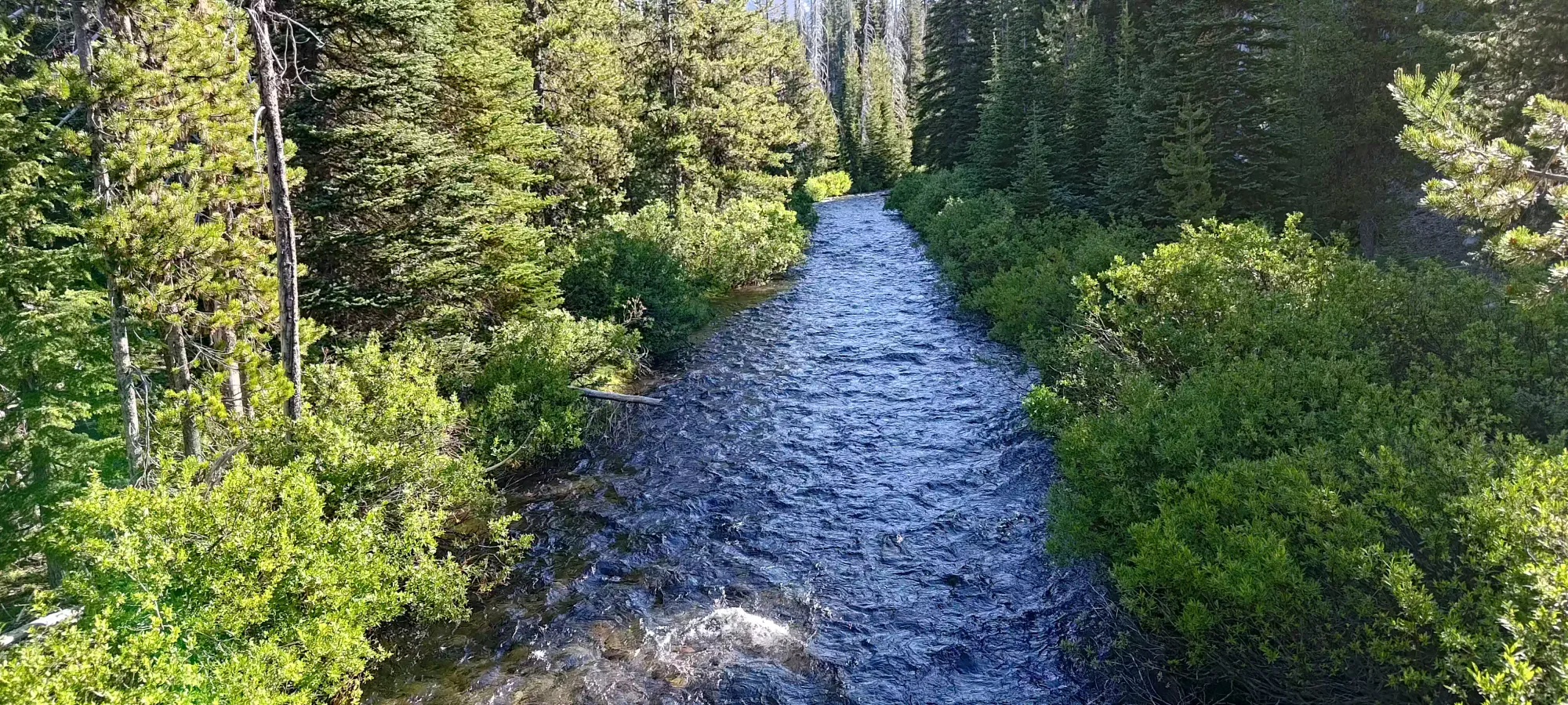
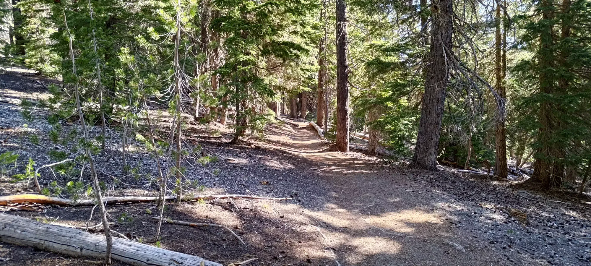
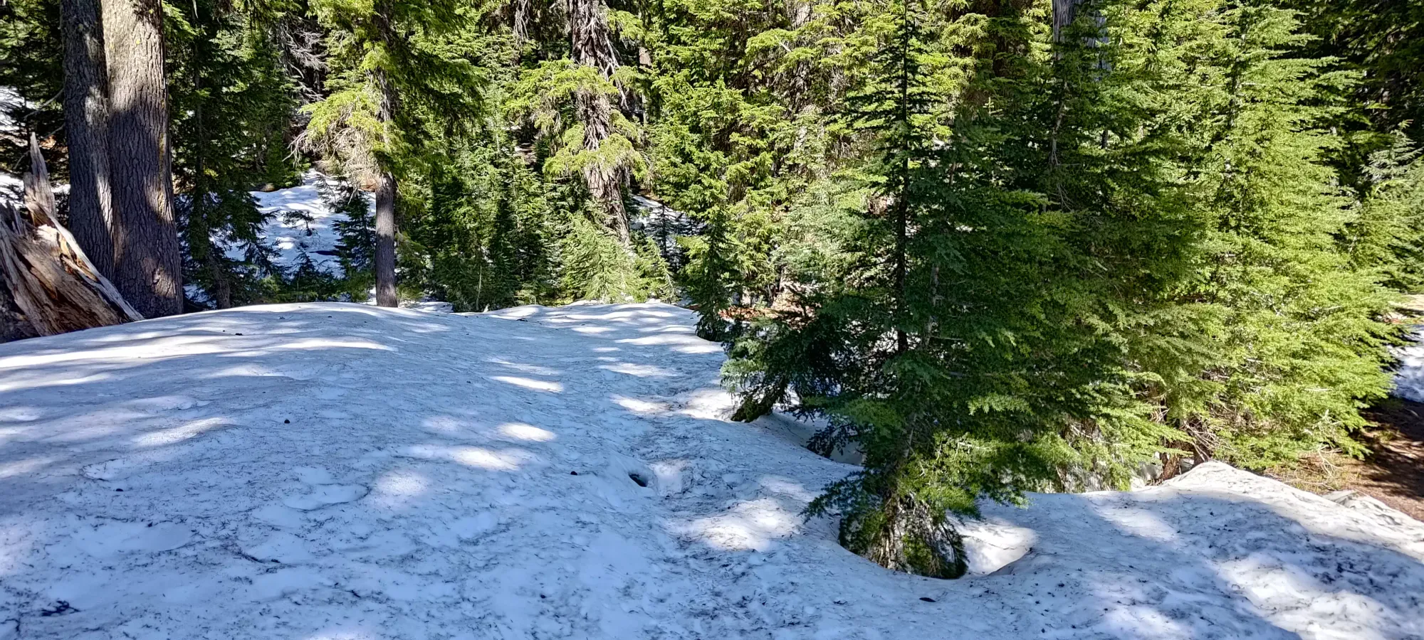
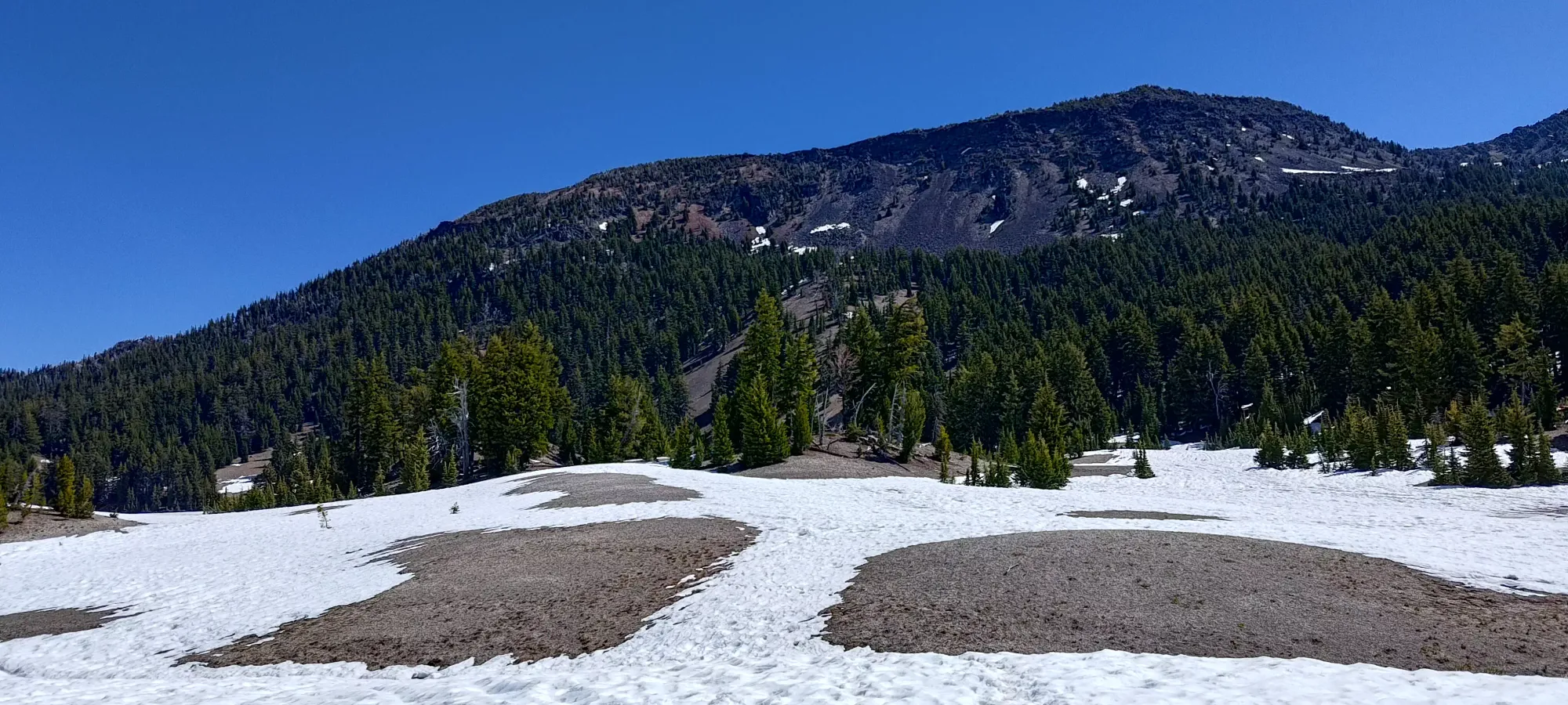
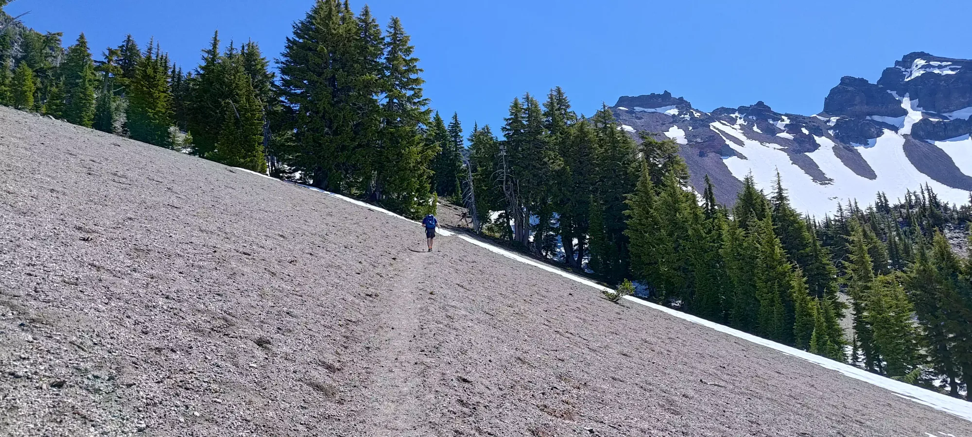
The first couple kilometres of the trail were dry, and made for easy hiking. We enjoyed the rapids and waterfalls of the creek as we walked along, but otherwise it was a very straightforward hike on a well-made, if perhaps too-shallow trail. As we past that point, we started to encounter snow patches, but they were inconsistent and very well-trodden, so they didn't pose much of a concern, and I didn't bother to take my usual "this is where the snow really starts" picture until about the 3.5km mark. Even at this point, the snow wasn't consistent, the patches just got a bit more frequent and larger.
It is around this point, where the trail has a left fork towards Moraine Lake, that it gets close to and actually crosses the creek, once on a tributary, and once on the main creek. Each crossing has a very solid and well-made log bridge, so there's nothing to worry about other than avoiding the marshy ground in-between, which with the snow presence we had, took some care.
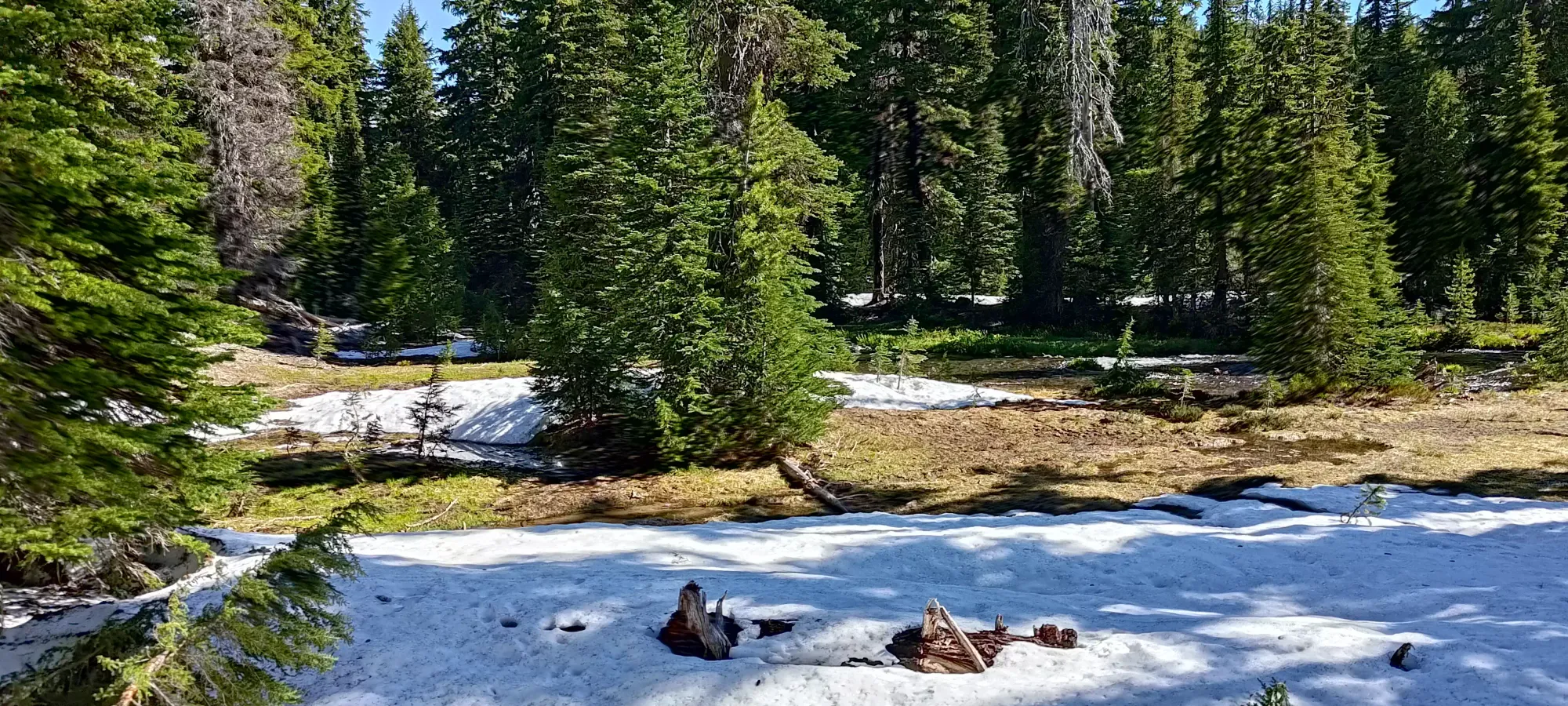
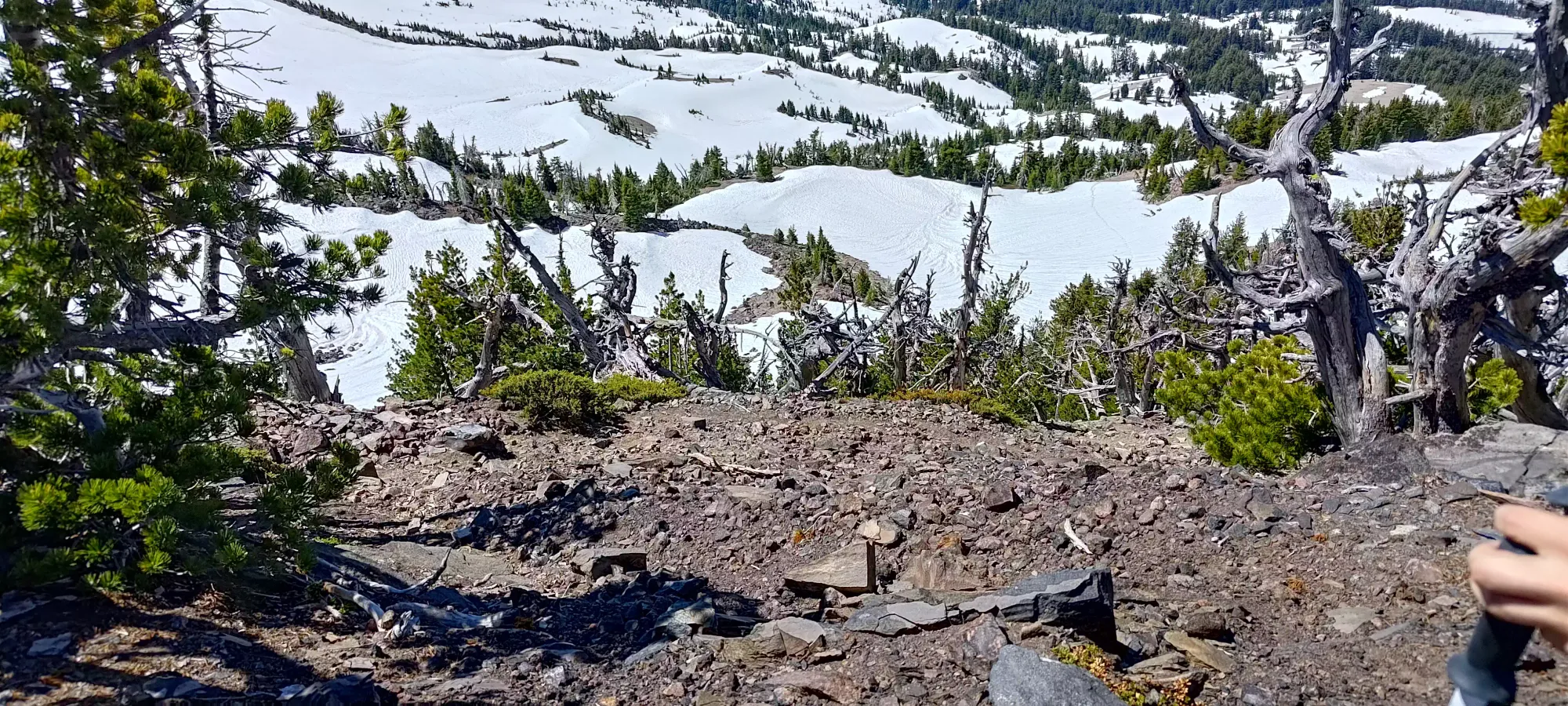
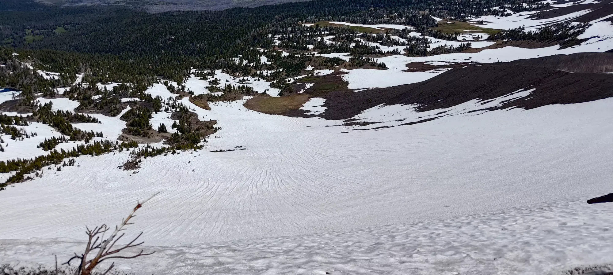
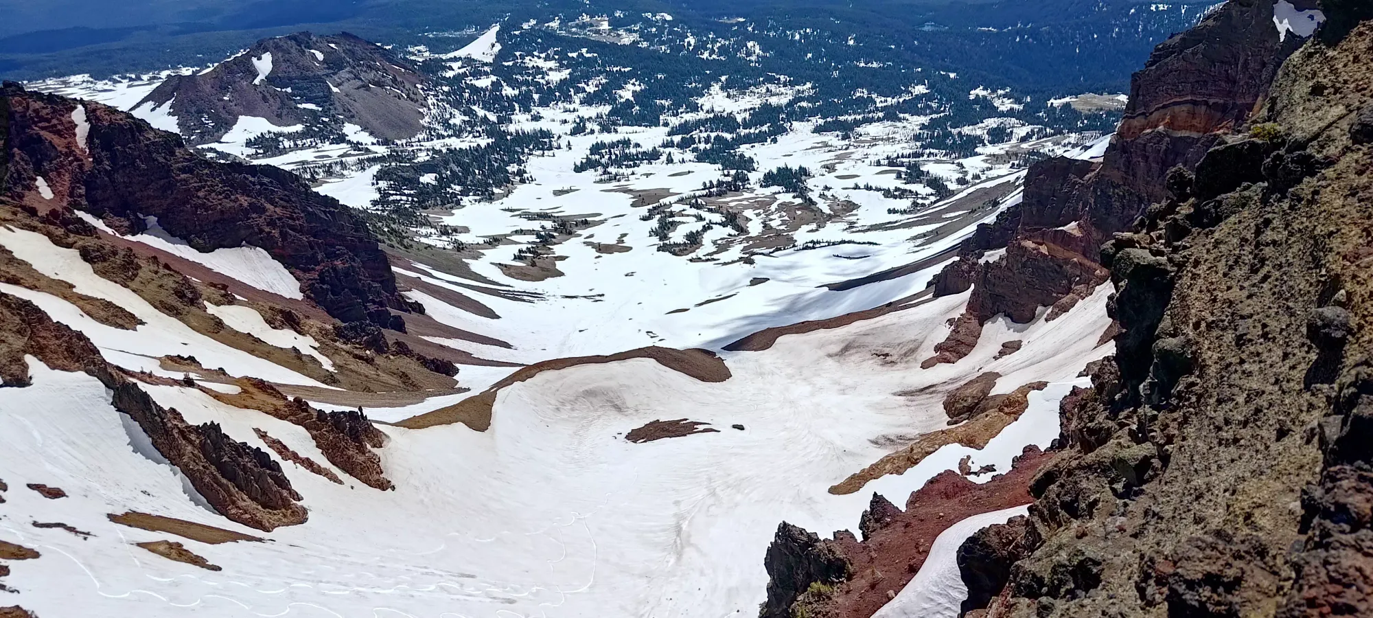
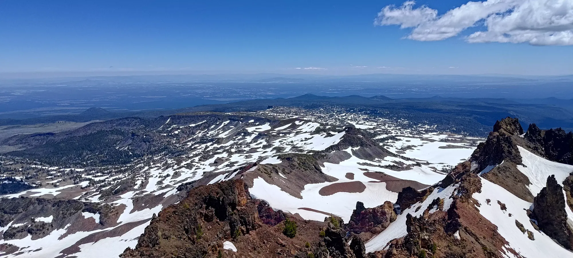
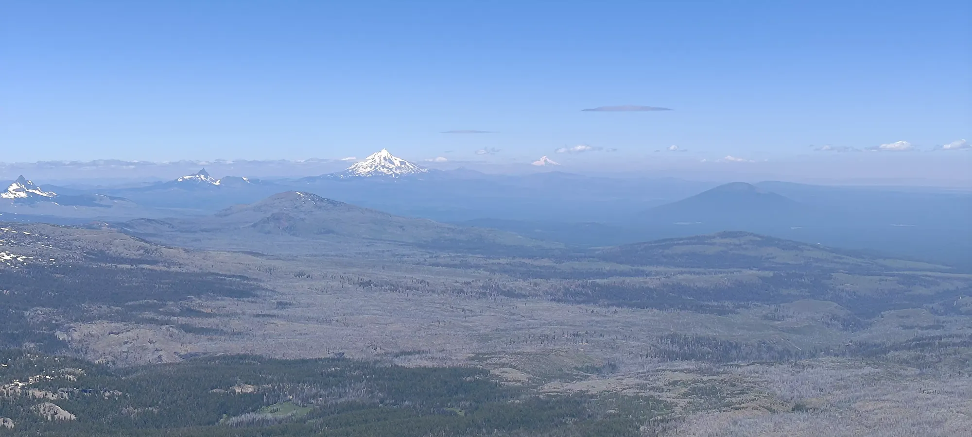
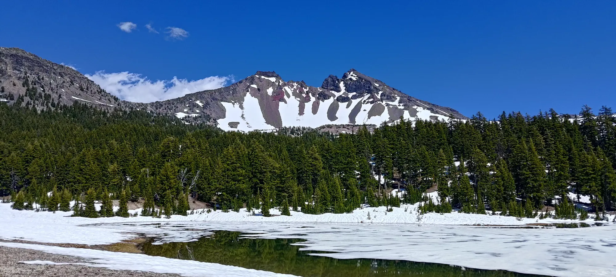
The hike continued in the same patchy manner until the 6km mark, where we found ourselves in a mini-valley, with the creek at the bottom, the trail on the climber's right side, and the extended slopes of South Sister and Broken Top forming the walls. Here, we had a decent initial dry section, then largely snow to walk along the creek for the final kilometre to the lakes. There were some mini-creek-crossings as water drained into the main creek, but they were all rock-hoppable. The biggest hazard was unsupported snow on the sides for a couple of them, but we managed to cross without incident.
All-in-all, we took about 110 minutes to get from the trailhead to the lakes, where we finally took a short rest to take in the views and orient ourselves. We'd spent 7km gaining a whole 350m, and the rest of the trail compensated for that in kind, leaving us 800m to gain in just 3km. Not the most balanced slope, but manageable nonetheless (though we definitely wished for a shorter approach trail, especially on the way out later).
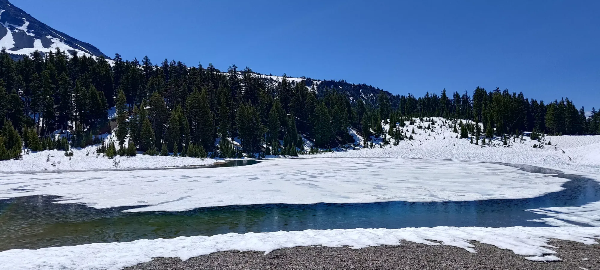
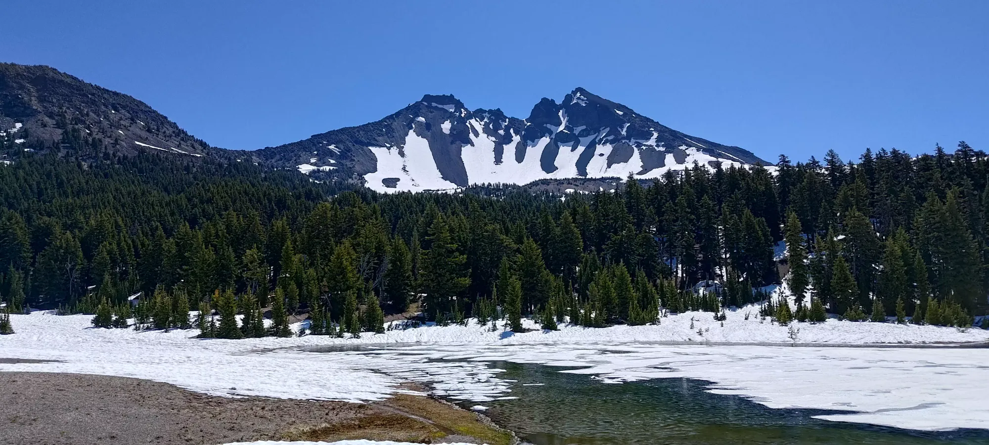
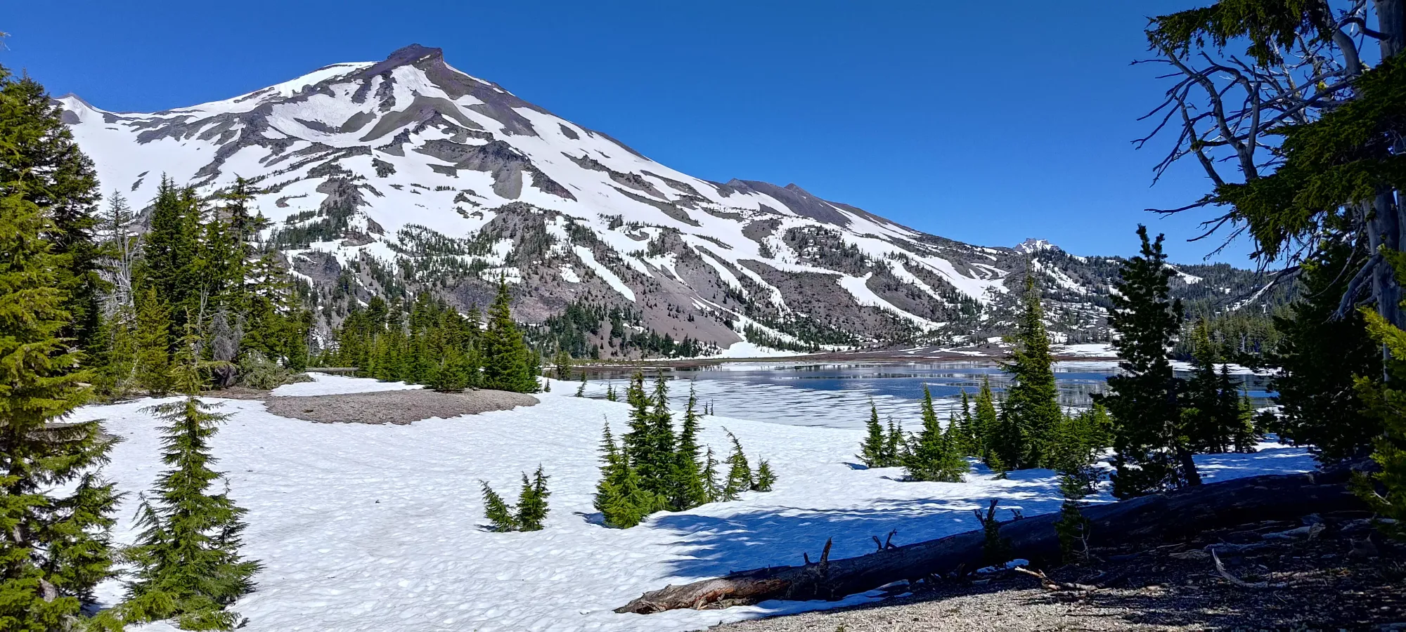
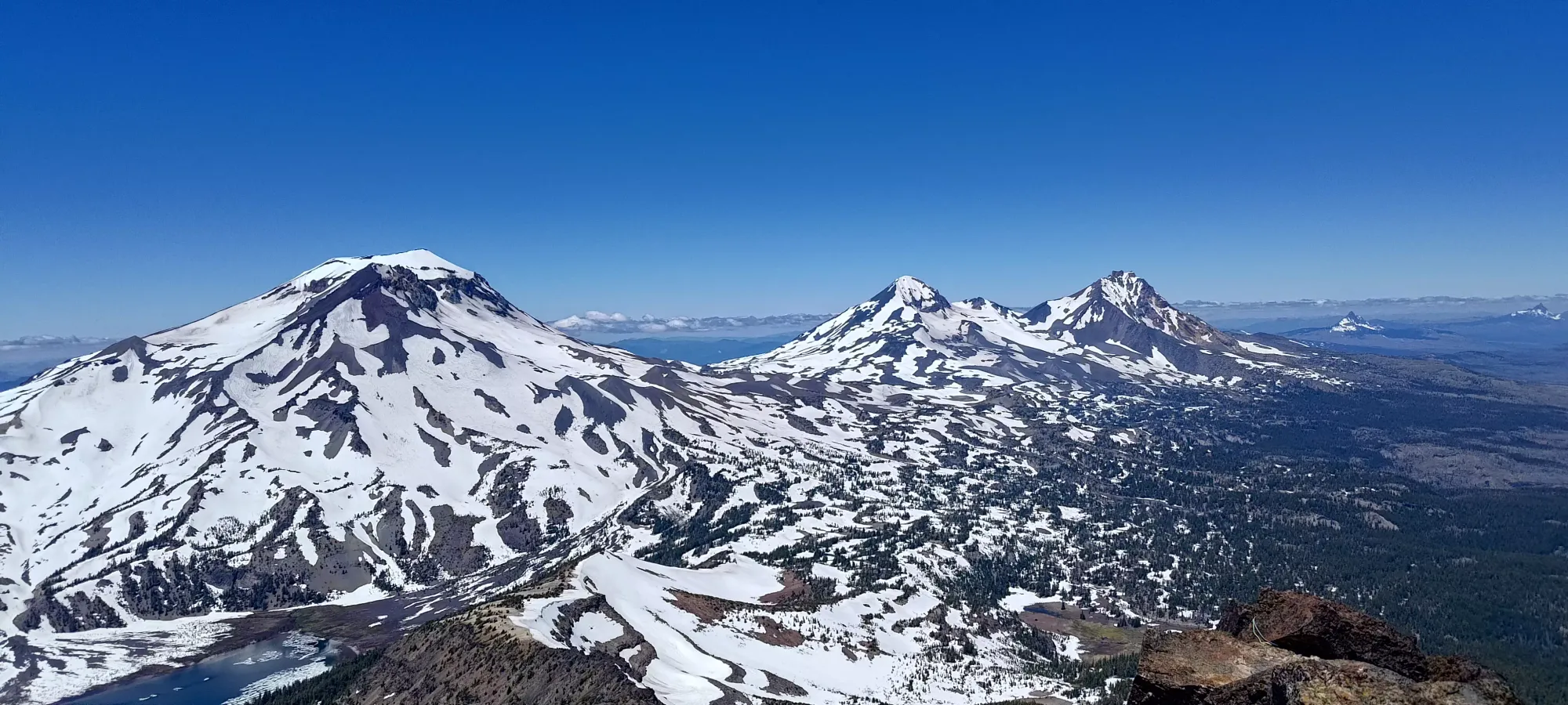
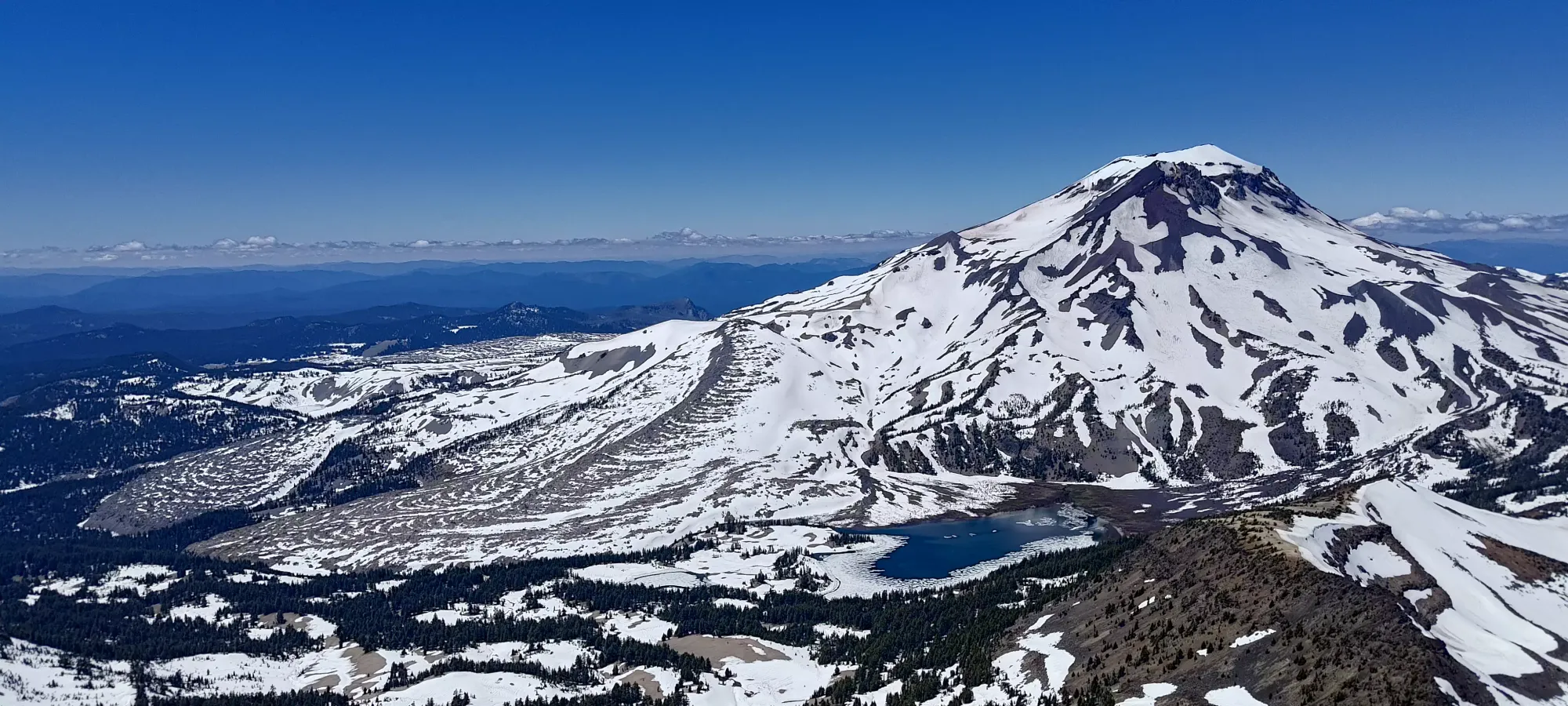
We detoured off the official trail (not that it meant much with the snow cover) to take a look at the larger lake and South Sister, then traced our way back towards the trail quickly, following some old boot tracks up the snow.
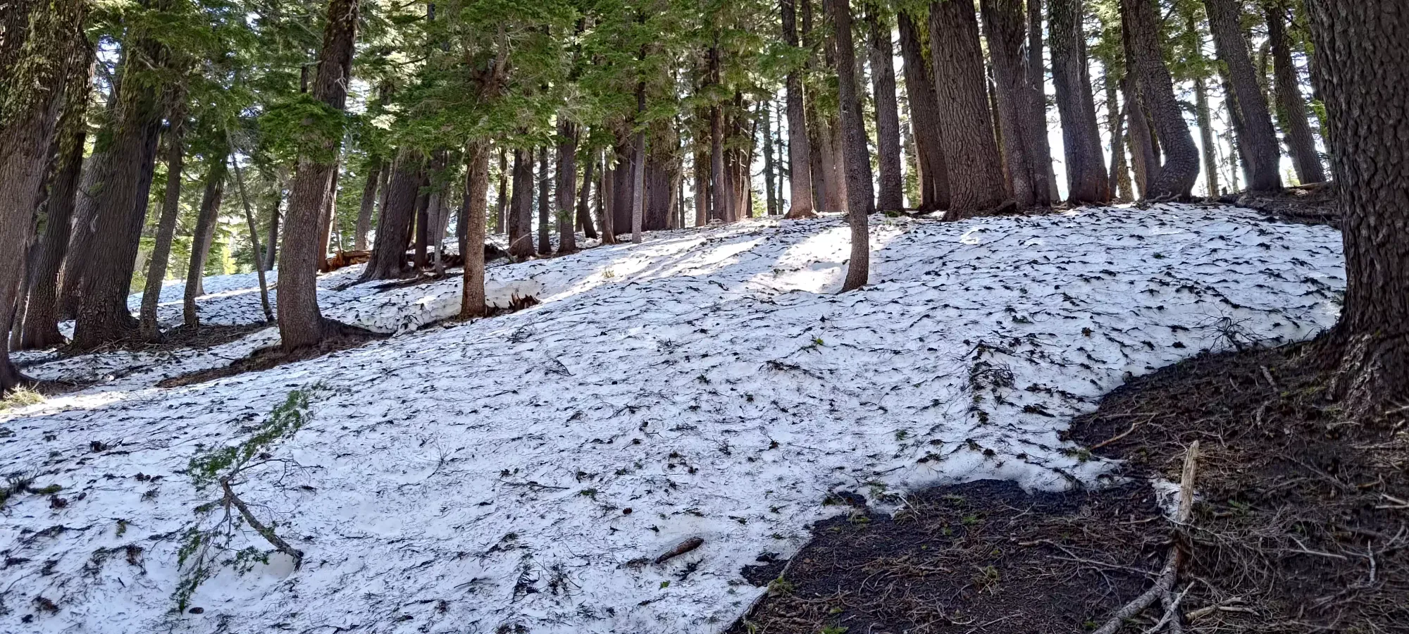
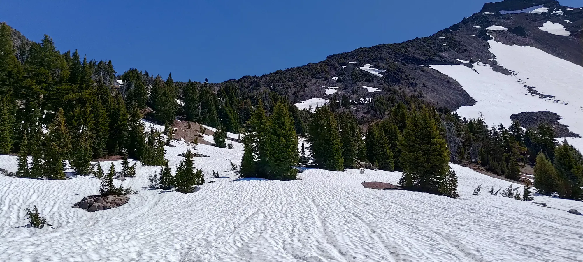
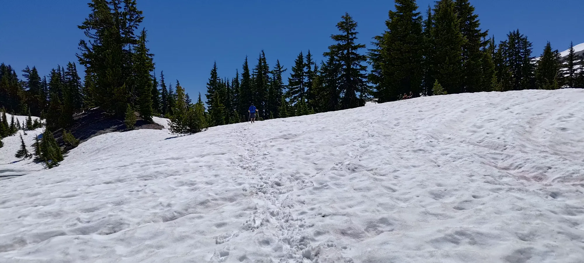
The snow walking lasted for a bit in the open plains, but as we started gaining again, we hit a short forested section above 2030m. Here, we deviated from the official trail, which was snowy and a bit steep, and instead just walked up the open dry forest a bit to climber's right, until we rejoined the main trail (and boot tracks) at around 2100m when things opened up again.
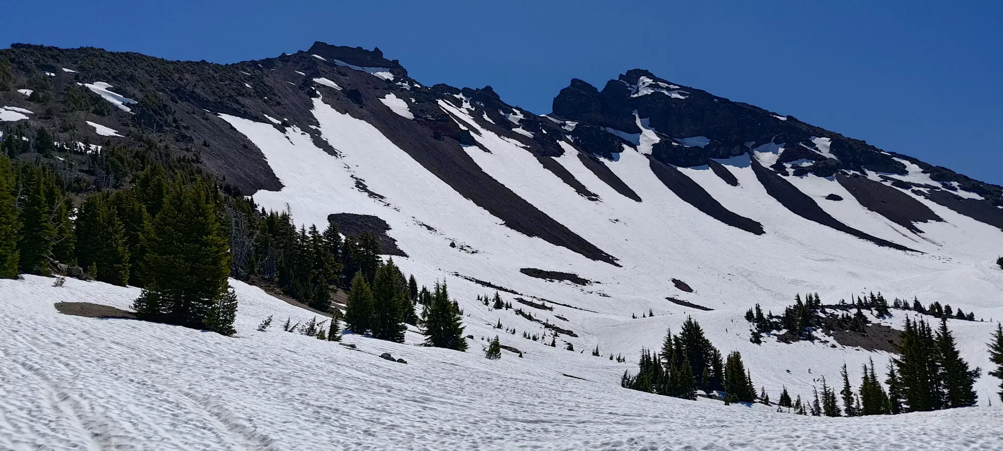
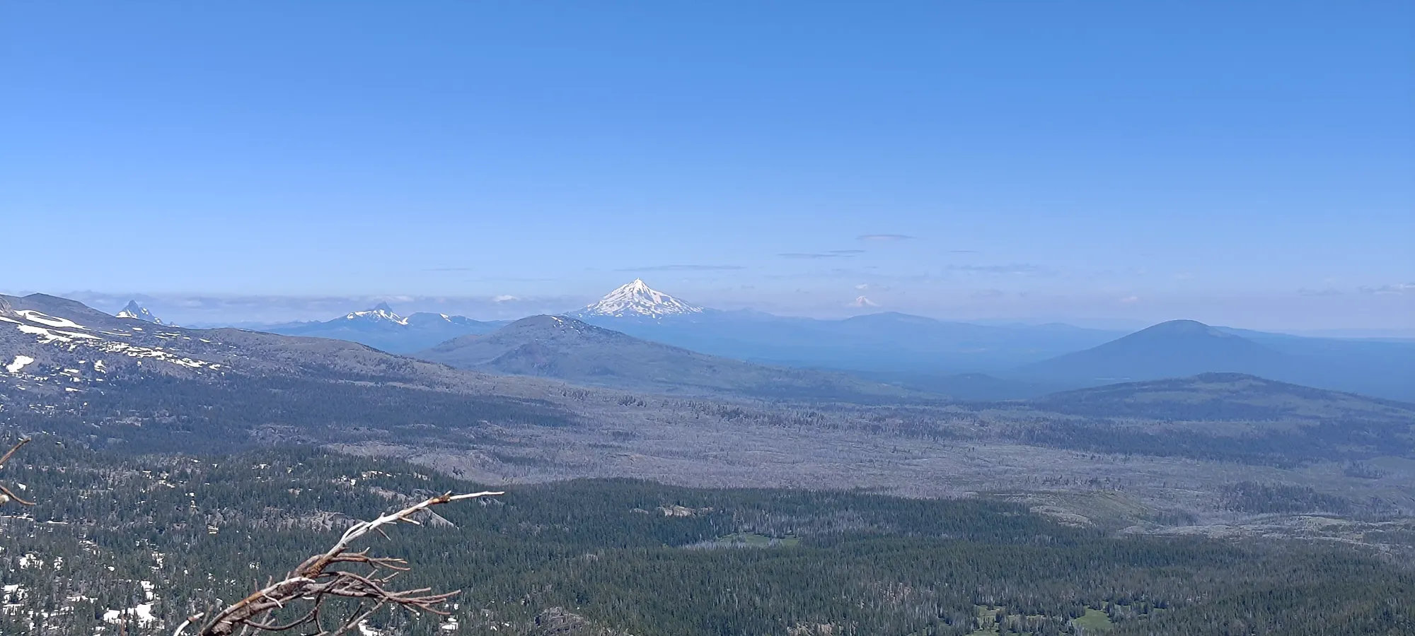
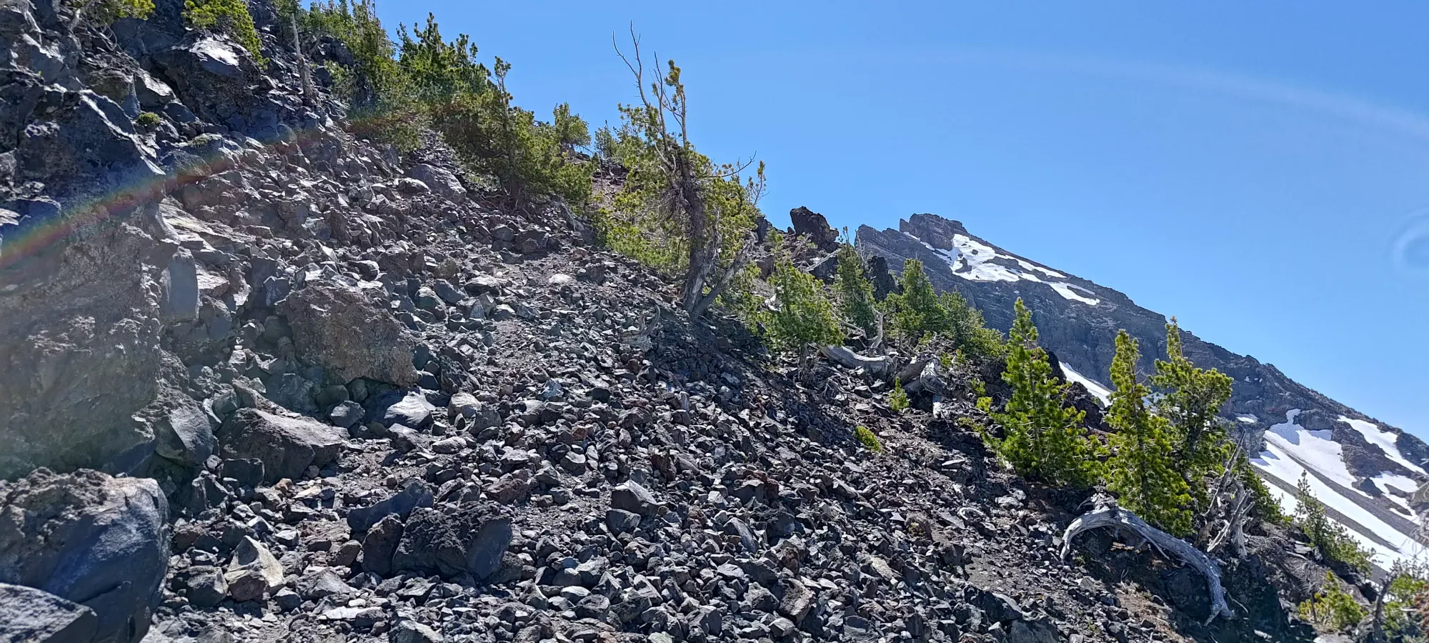
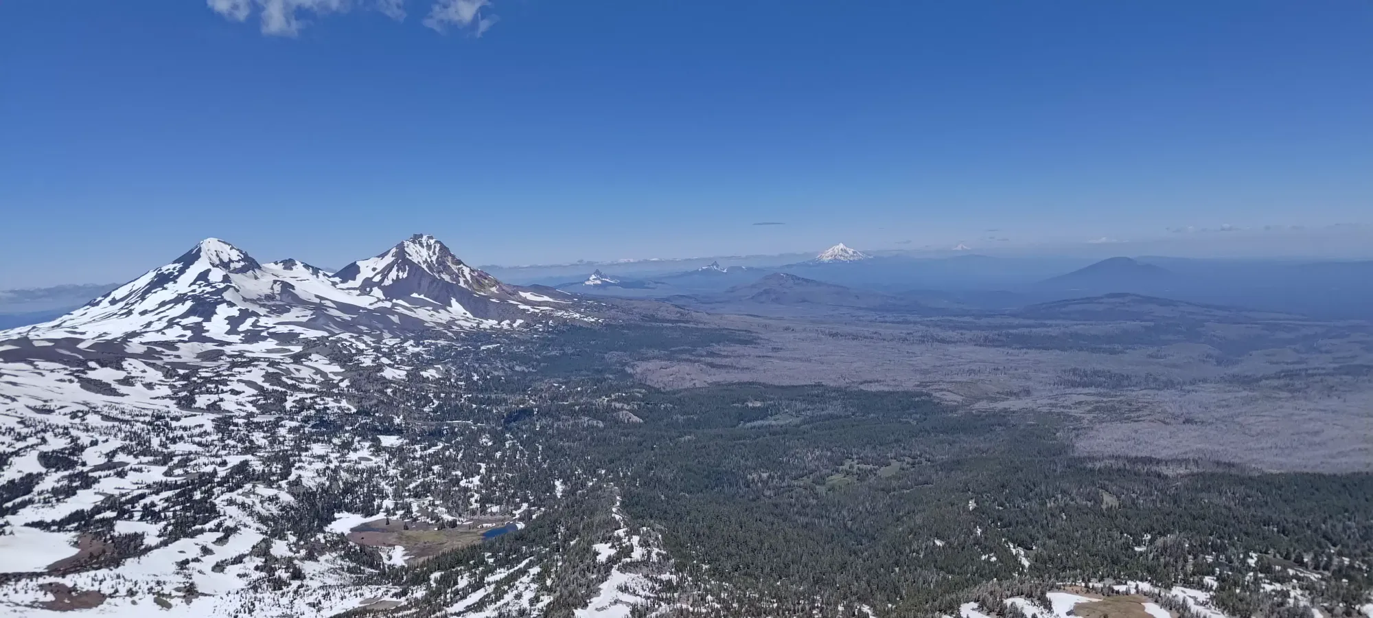
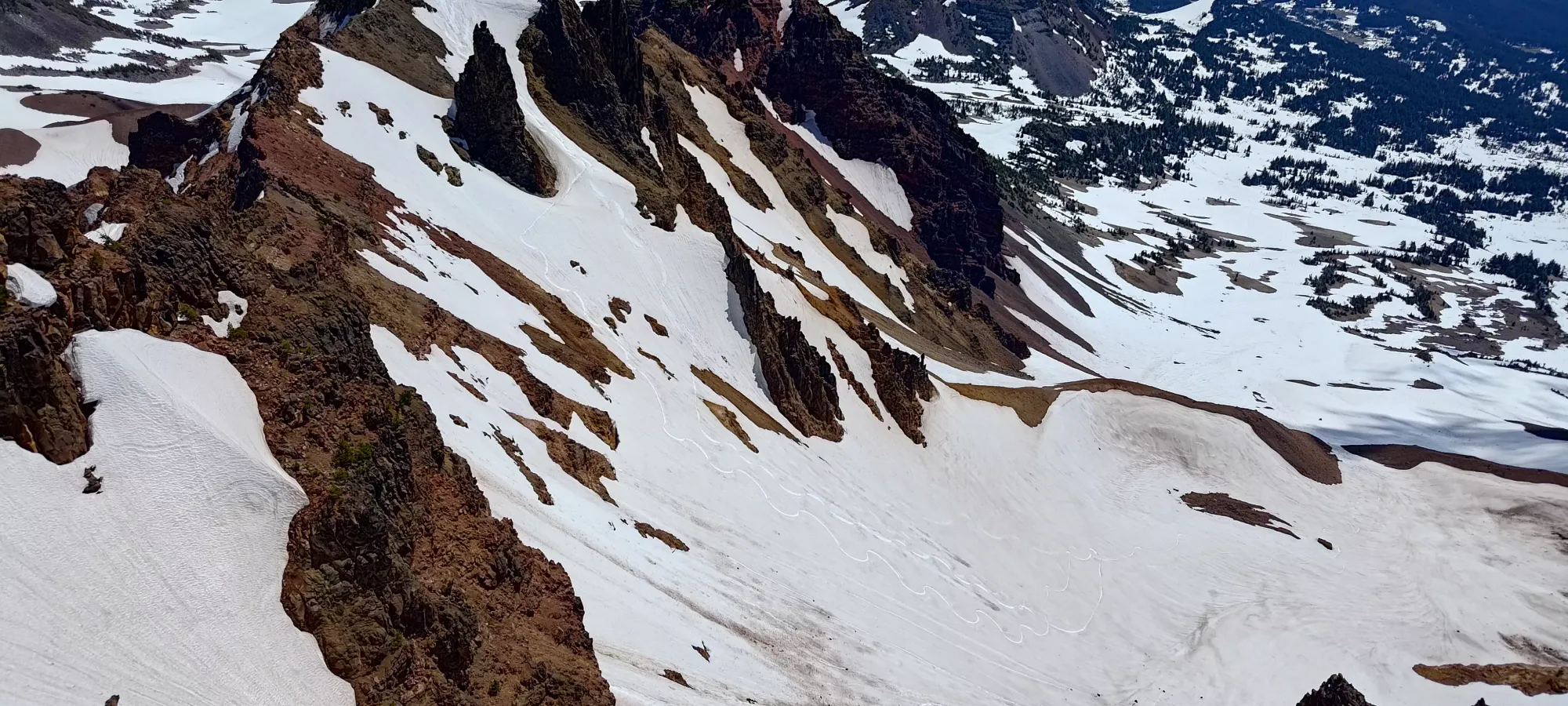
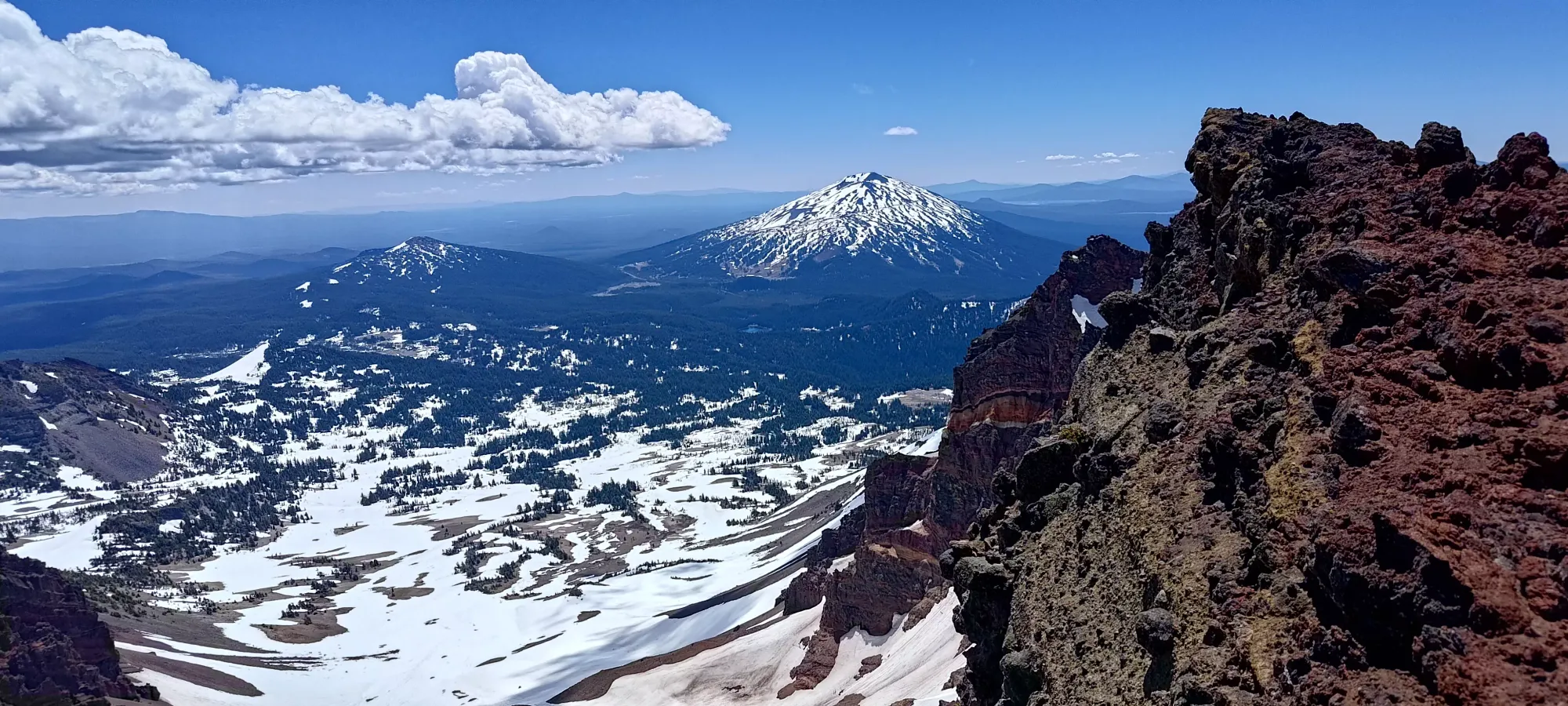
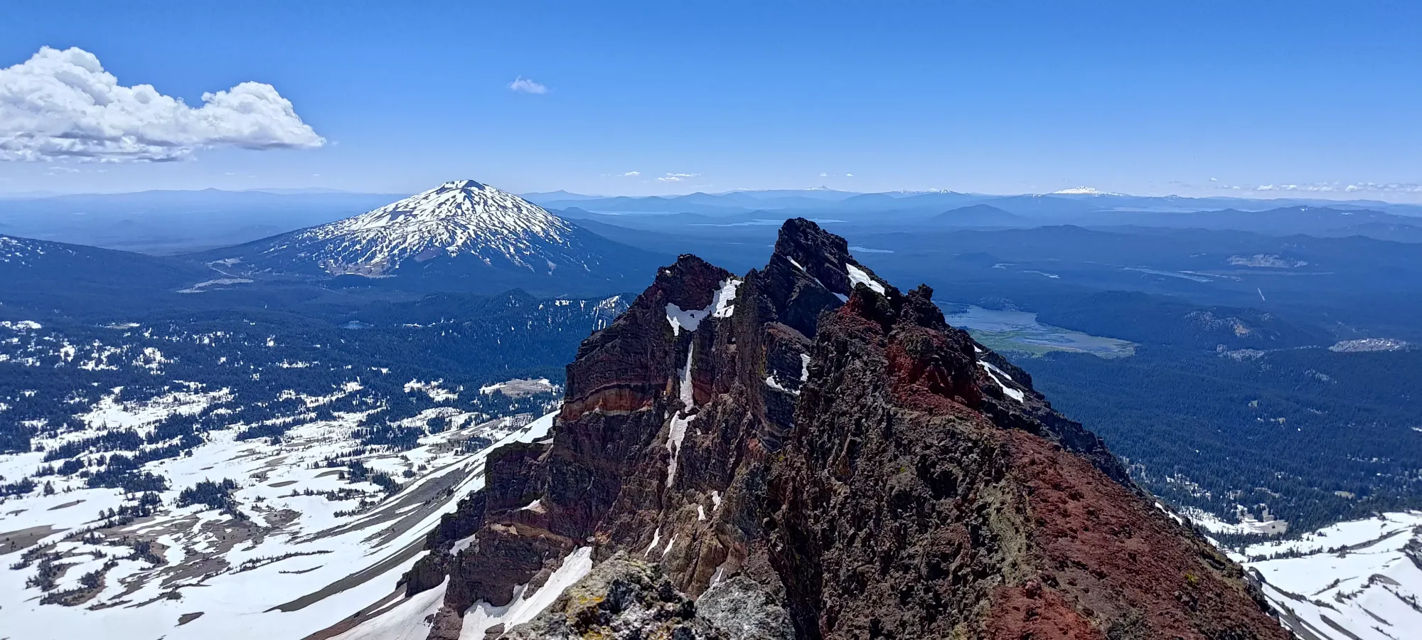
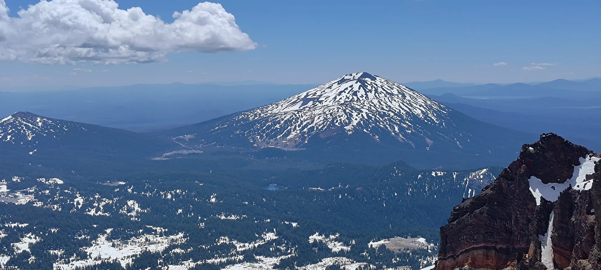
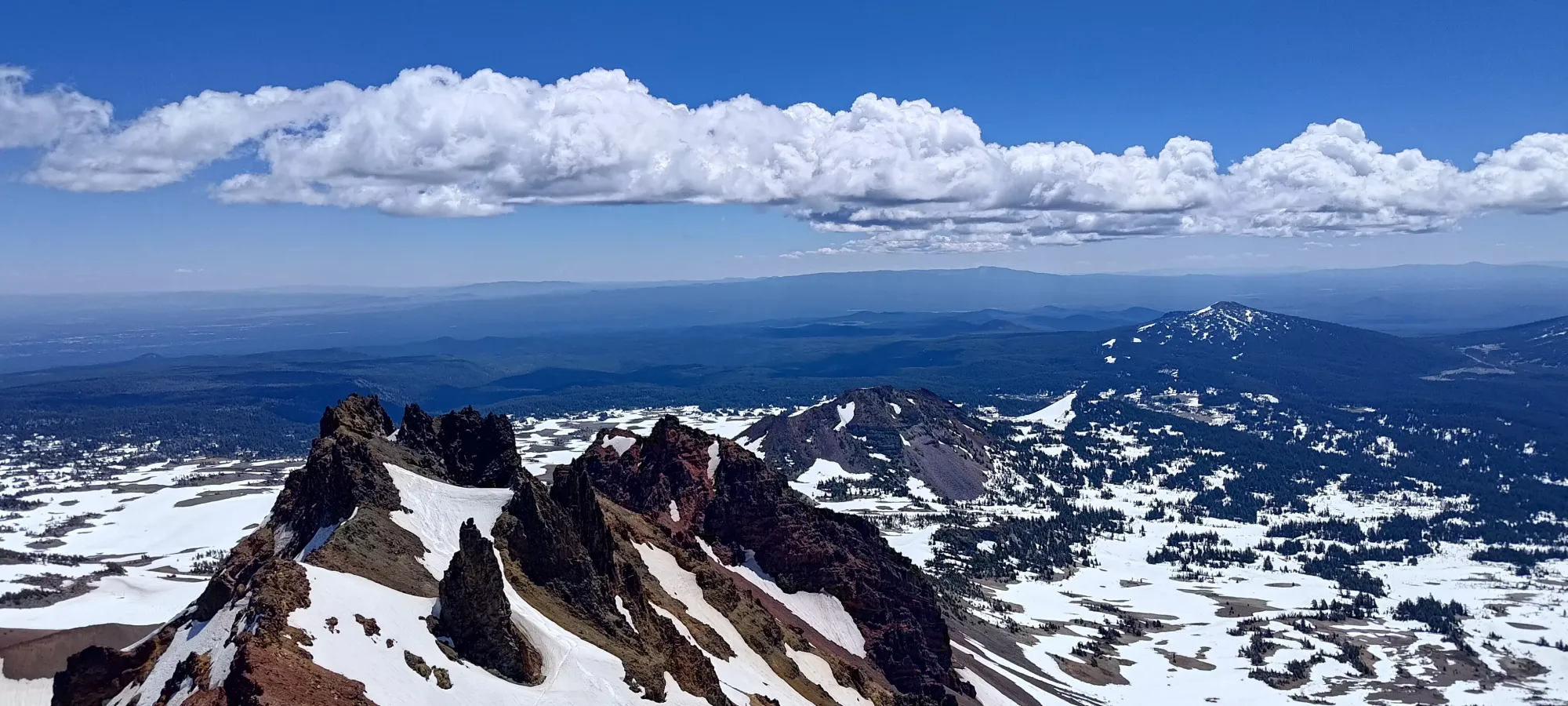
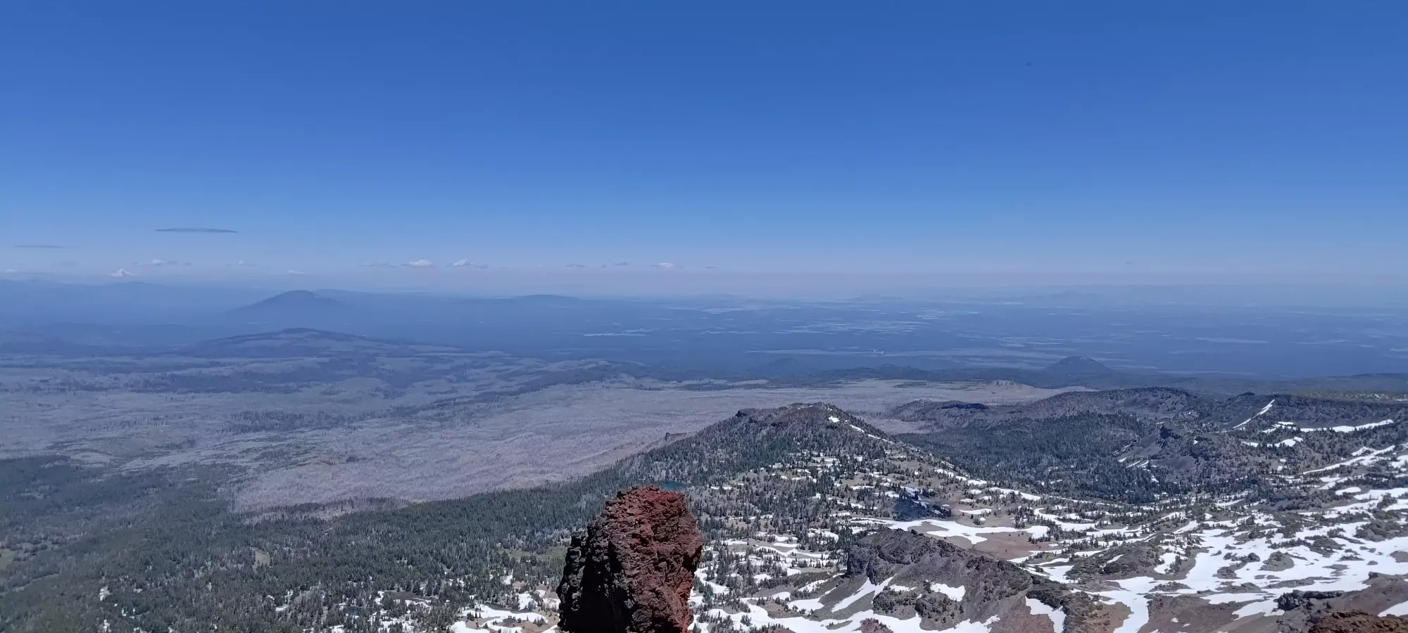
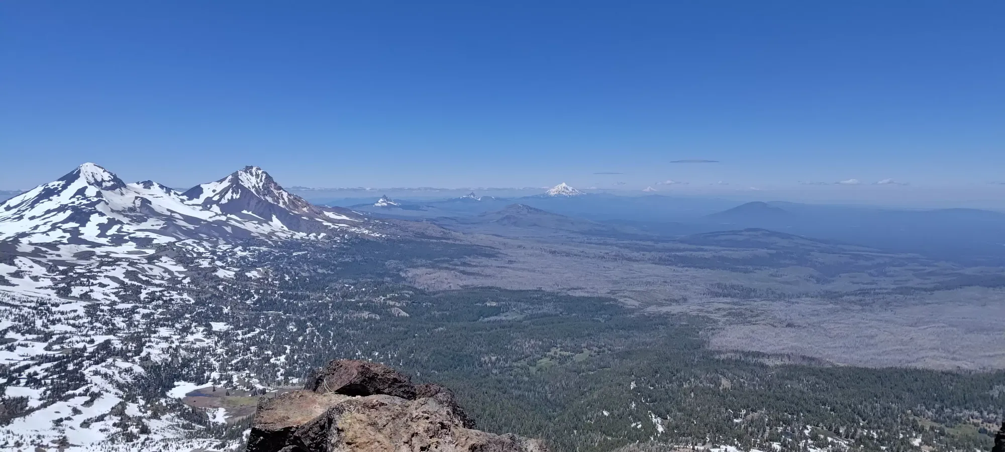
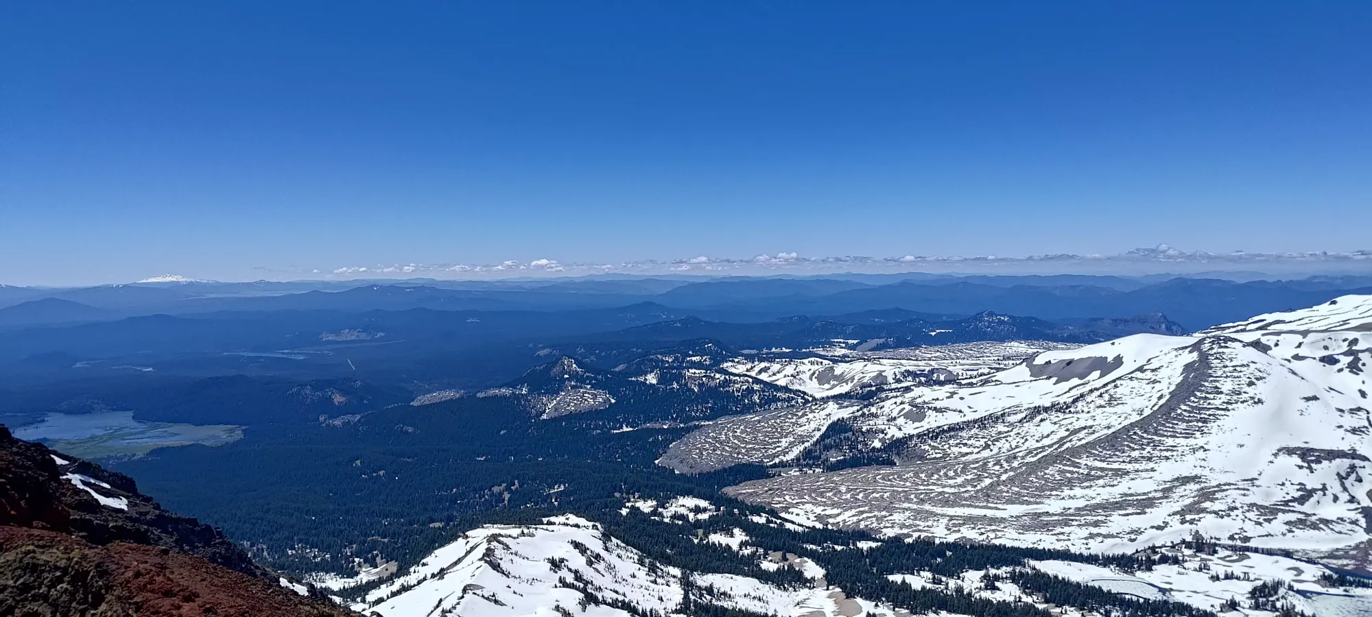
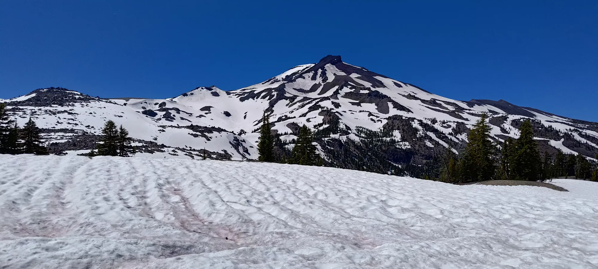
By 2150m, we were high enough that the terrain was basically fully open, and we could get a great view of the western bowl of Broken Top. We rued our lack of skis a bit here (but still agreed it'd not have been efficient just for the skiing from the top), then continued following the trail, once again intermittent between snow patch and dry dirt. The trail here wasn't as wide and well-maintained as the one to Green Lakes, but without snow it was still quite easy to discern from the surrounding dirt.
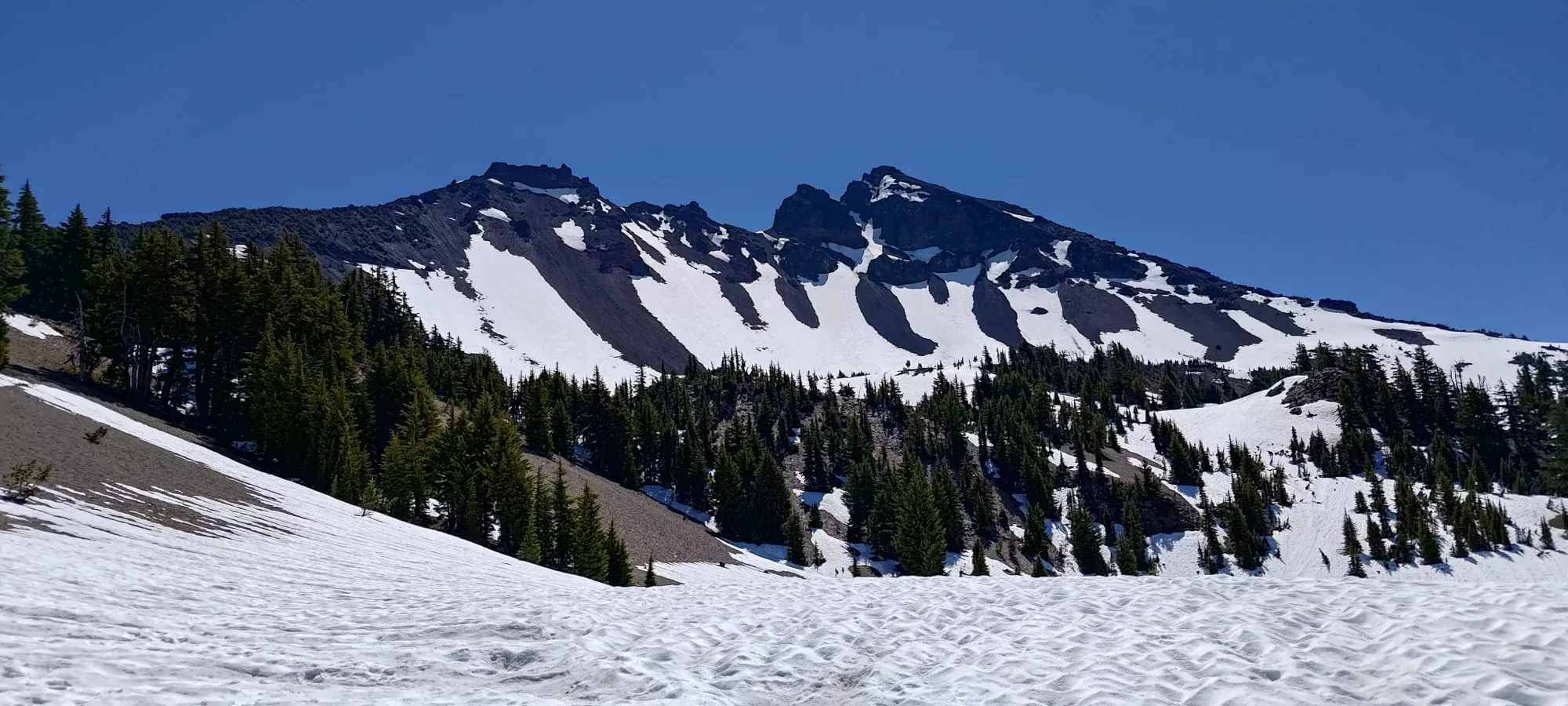
At around the 2.5 hour mark, we'd made it above 2200m to one of the scant downhill sections of the trail. It was quite brief, though, just crossing a short depression in the snow along the way to the ridge before continuing on towards the steeper, drier trail that went up to the ridge itself.
The next 20 minutes got us up to the ridge proper. After the snow ended, there was some loose, soft dirt to contend with, and a bit of scree, but we avoided a lot of both by cutting up a bit to climber's right of the trail in some dead trees, which got us to the ridge mostly on decent soil. Here, we took a decent break, and Nick contemplated if he was going to continue, as he was getting fairly tired (he's less used to suffering multiple days in a row than I). After contemplating for a good few minutes, though, he decided to press on with me for a while longer 🙂
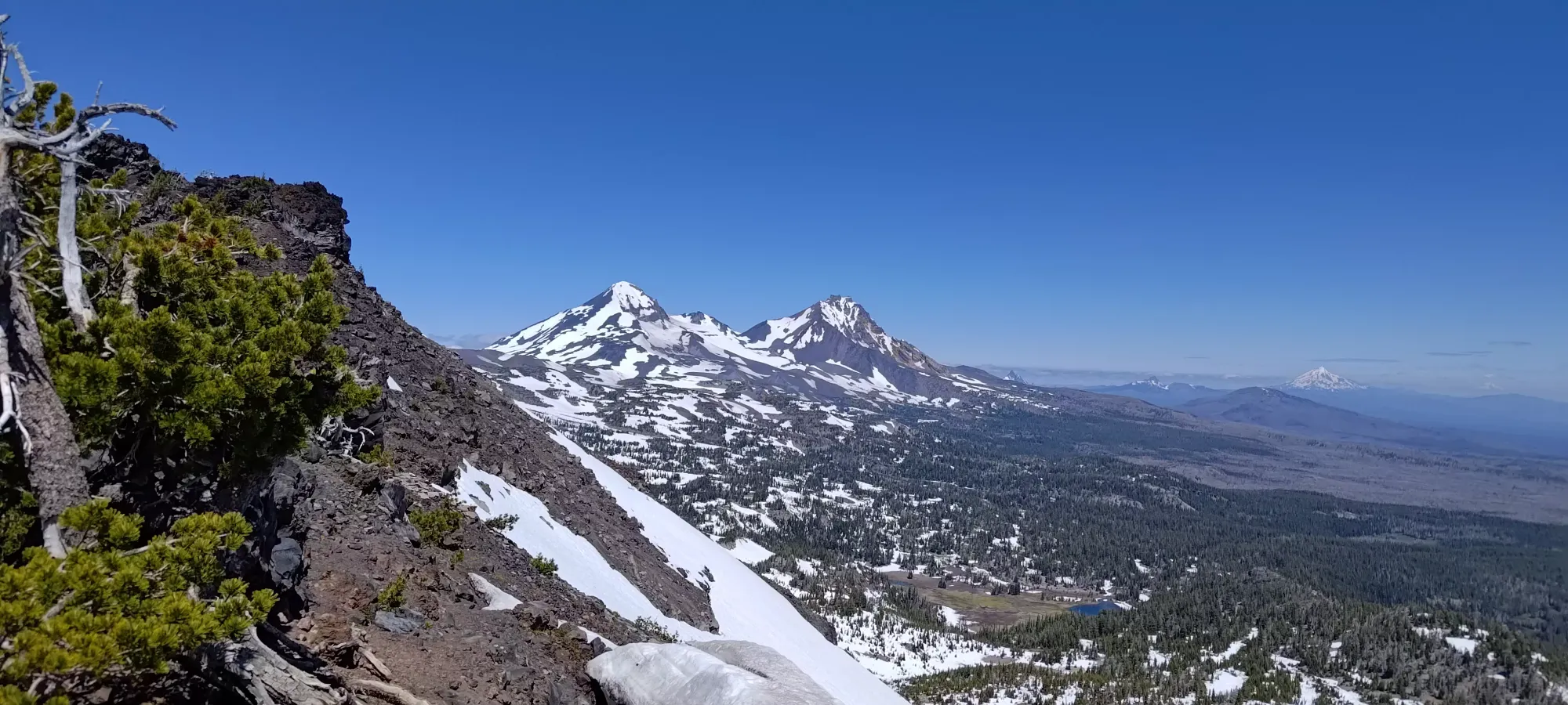
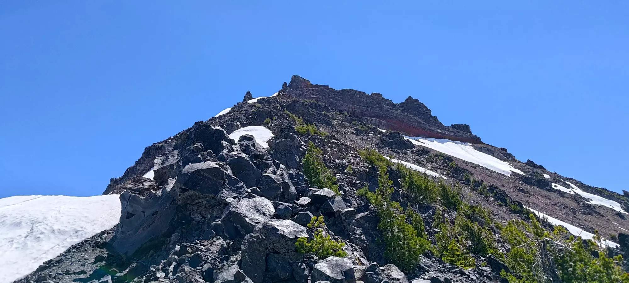
The ridge was steep, but still definitely a hike for the vast majority of the route, with only a couple class 2 moves along the way. Nick continued until around 2500m, but decided to wait things out there, as he didn't want to get too tired and delay the return, since we had to drive from there back home to Canada without another night of sleep 😅. Thankfully the weather was great and the bugs we encountered in the forest weren't present up there, so he was happy to wait for me to bag the peak and return. So, I dumped the rope and climbing gear I had brought in case he needed them (while he's a better climber than me, he's not into exposed scrambling, so we brought gear should he want it), and continued on.
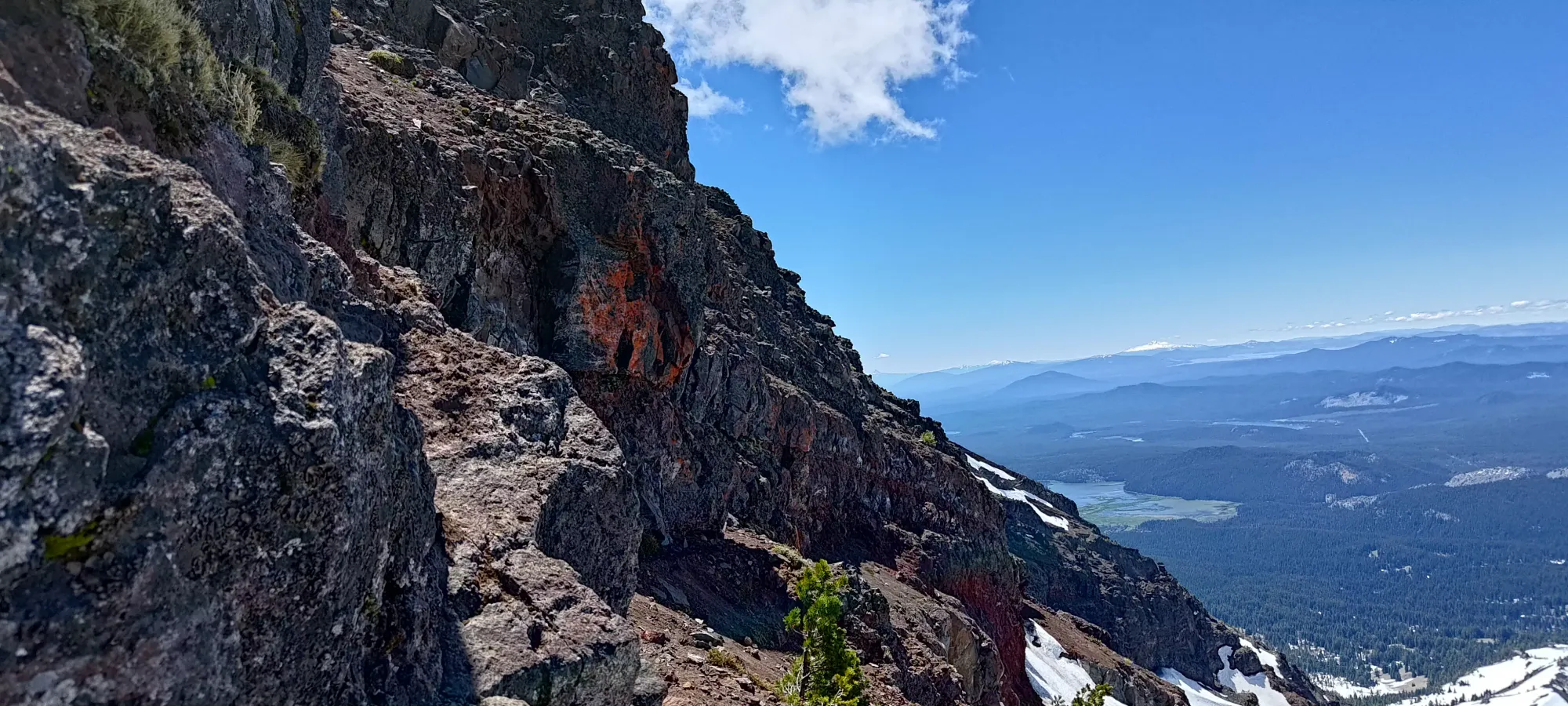
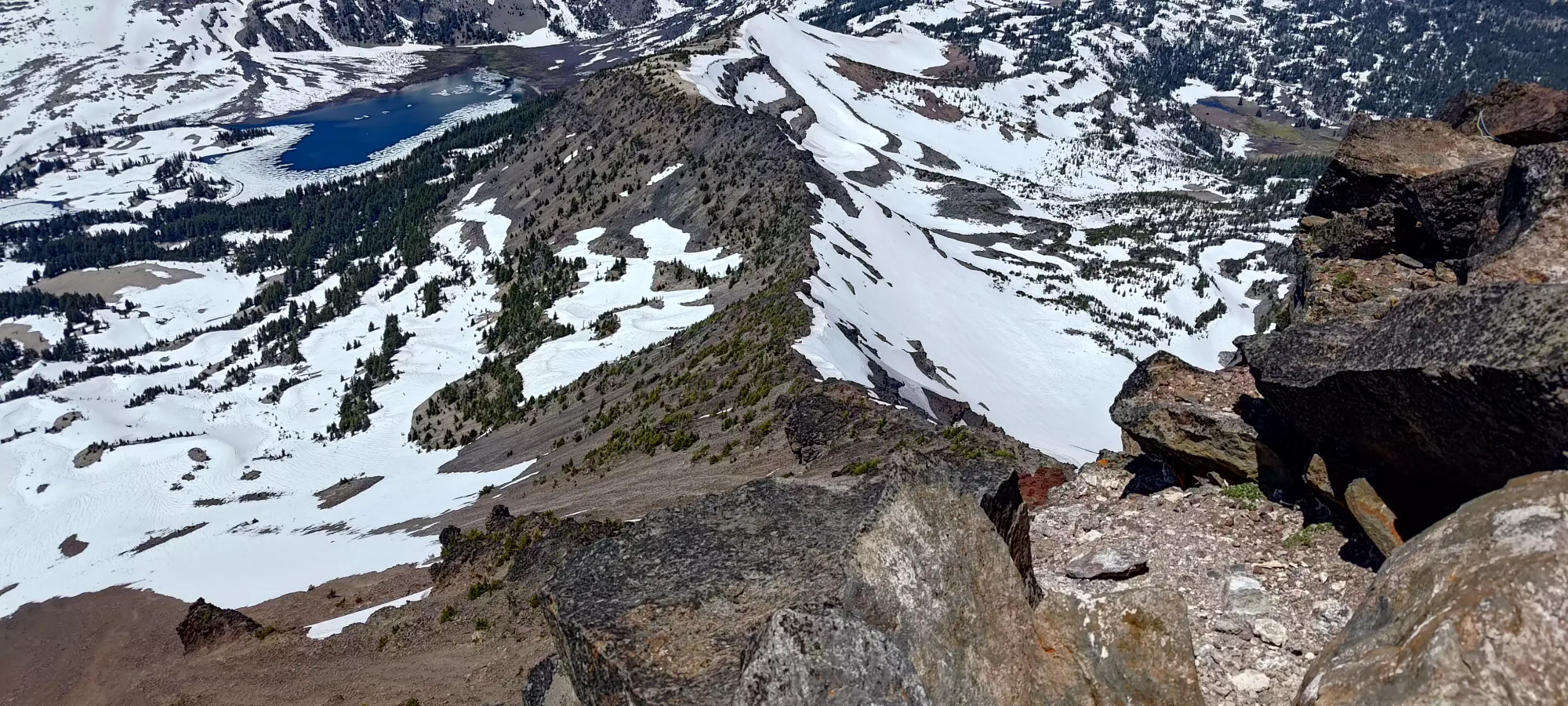
Up to that point, we'd exclusively been on the climber's right (south) side of the ridge, but afterwards, I actually crossed over to the north side, and was there for most of the way up/down above where we separated. The first 100m was gained in about 15 minutes without much fuss.
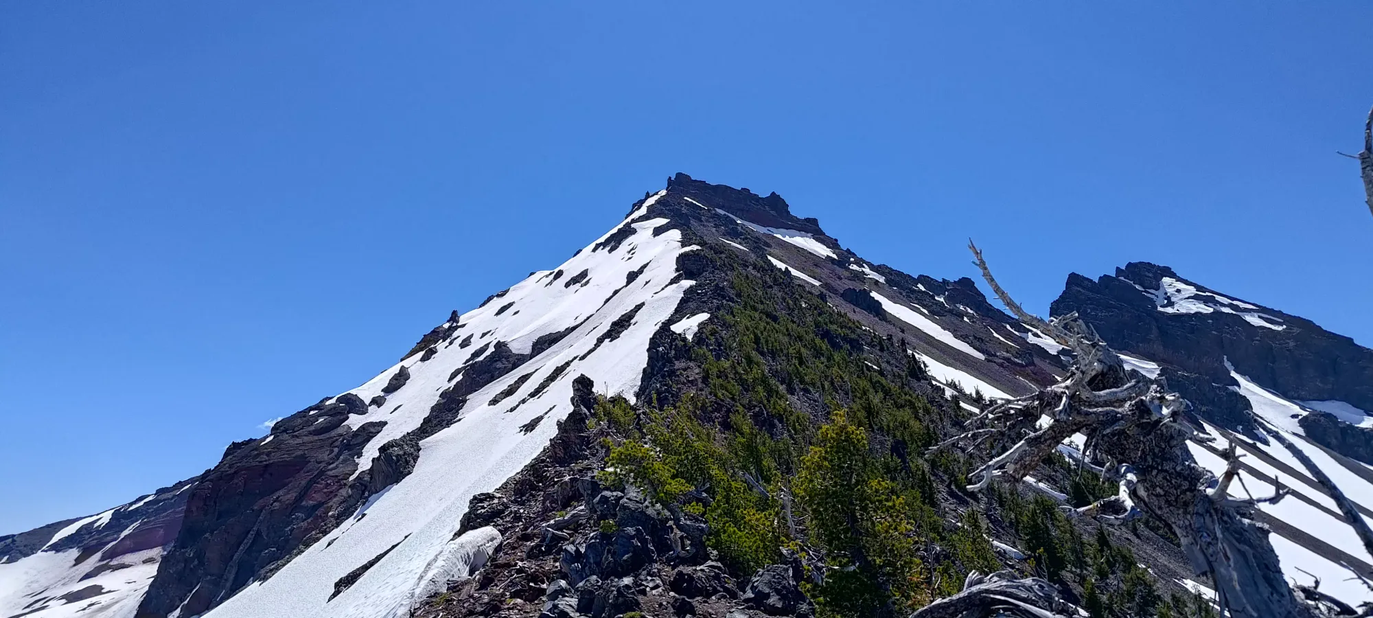
My watch did a little teleporting above this point, so I'm not sure exactly what the timing was like in-between, but I reached 2750m, or "the base of the scramble" at 12:40pm, a bit under 40 minutes after I left Nick (which was just after noon). Here, I noticed a ledge that traversed to climber's right which seemed to have heavy foot traffic, so I followed it to its end.
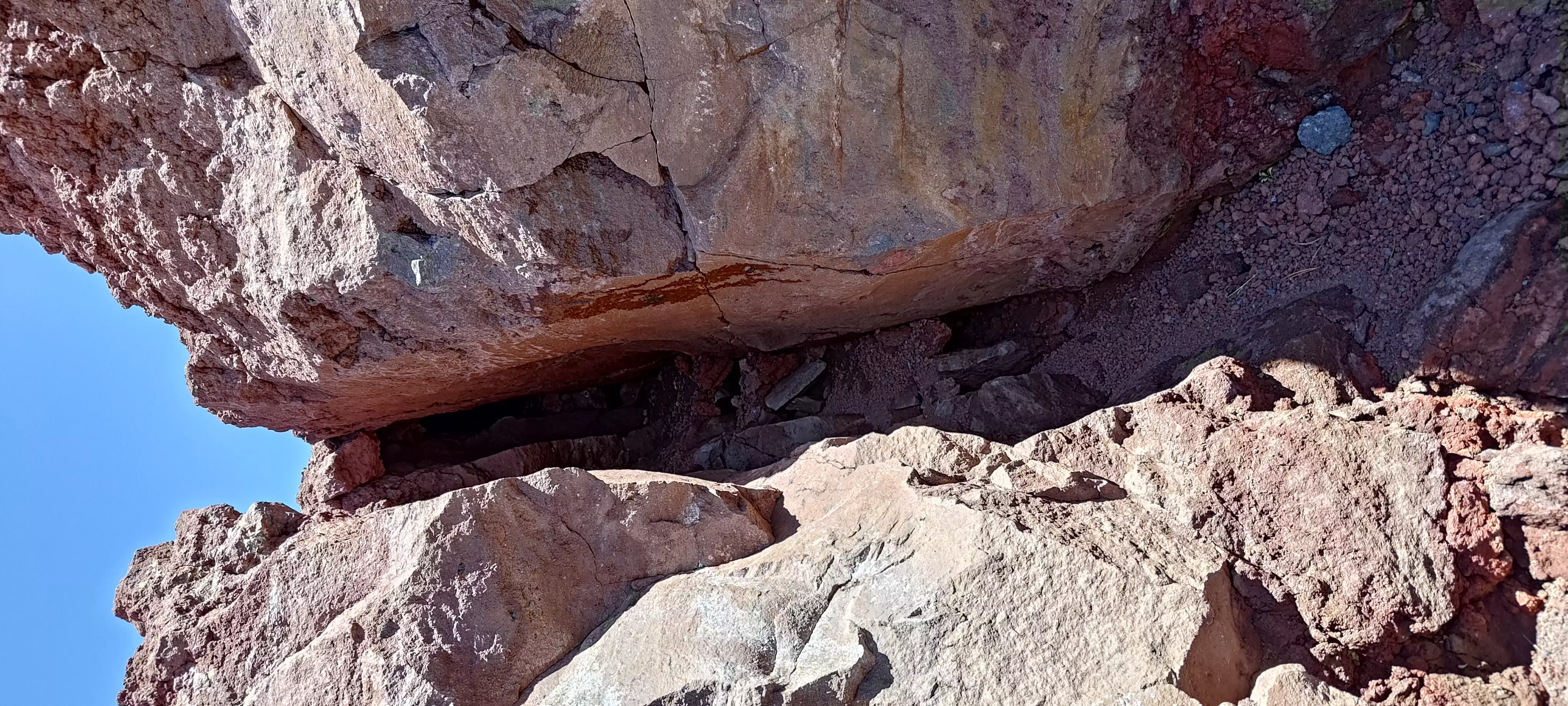
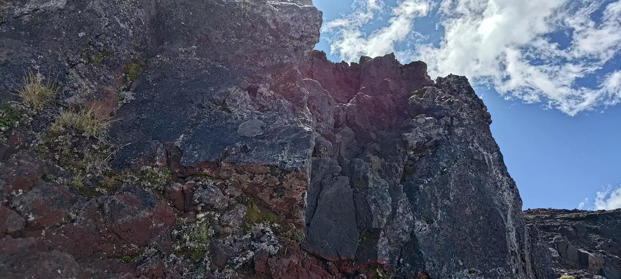
At the end of the ledge traverse, I saw a fairly difficult, committing line up, in 2 small "pitches". I vaguely recalled a mention of a ledge traverse, and the fact that this was rated as low fifth class, so I tried my hand at it, figuring it could very well be the route. The first half was fairly easy, though still fourth class with huge exposure. Once on the ledge between the two halves, though, I got a closer look at how committing the second half would be, and figured there was no way it was the route that many people had reported as scrambleable online. I am generally in the minority in the sense that I'm willing to scramble more than most, and this would be right at the edge of what I'd be able to convince myself to do, and I knew that was too difficult if so many people had also soloed the route. So, I turned back and reversed my course along the ledge traverse back to where I started.
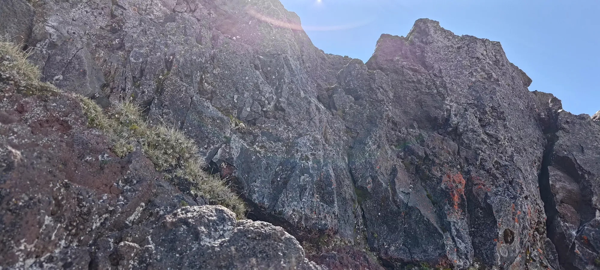
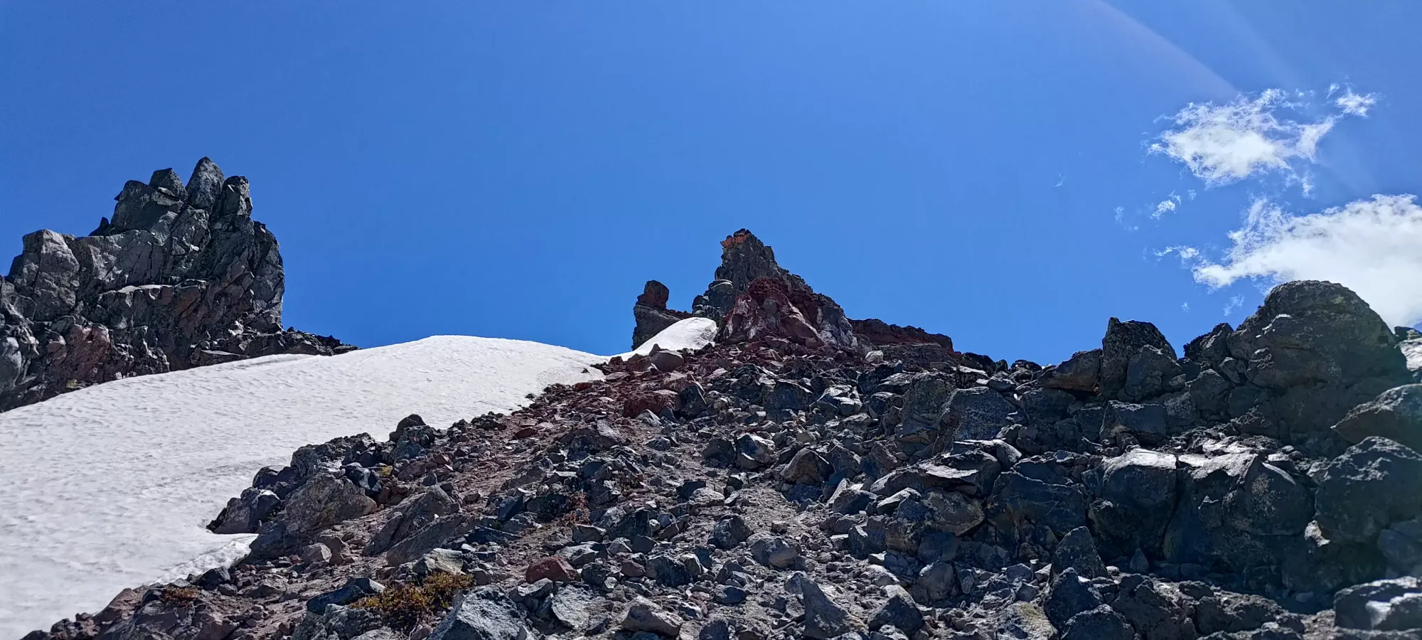
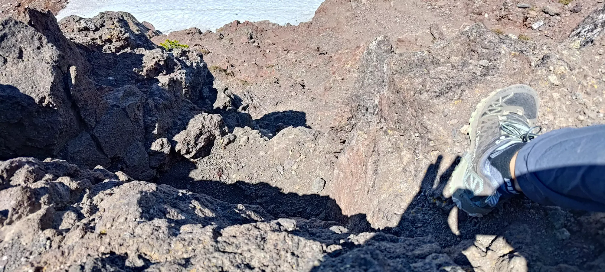
A bit before I got "literally back on the NW ridge", I found what looked like a much more doable scramble up this 5-10 metre section that had been posing a challenge thus far. So, I took some pictures for reference, and scrambled up. There were one or two challenging moves, but nothing really crazy, and it was class 3 or 4 depending on your definition, and I would lean towards 3. The moves weren't super hard, and the likelihood you'd fall all the way down the mountain if you screwed up wasn't too high. Still don't recommend falling, though, of course.
A couple minutes later, I found myself above that ledge, and a few steps after mantling up, I found myself at a rap station! I never even saw/considered the route the station protected, so I can't comment on it, but "apparently that exists". Unless it is particularly fun or something, I'd not bother, my route was quite doable, IMO fun, and doesn't require any gear. This was also the only rap station I found, despite hearing about 2 in previous reports.
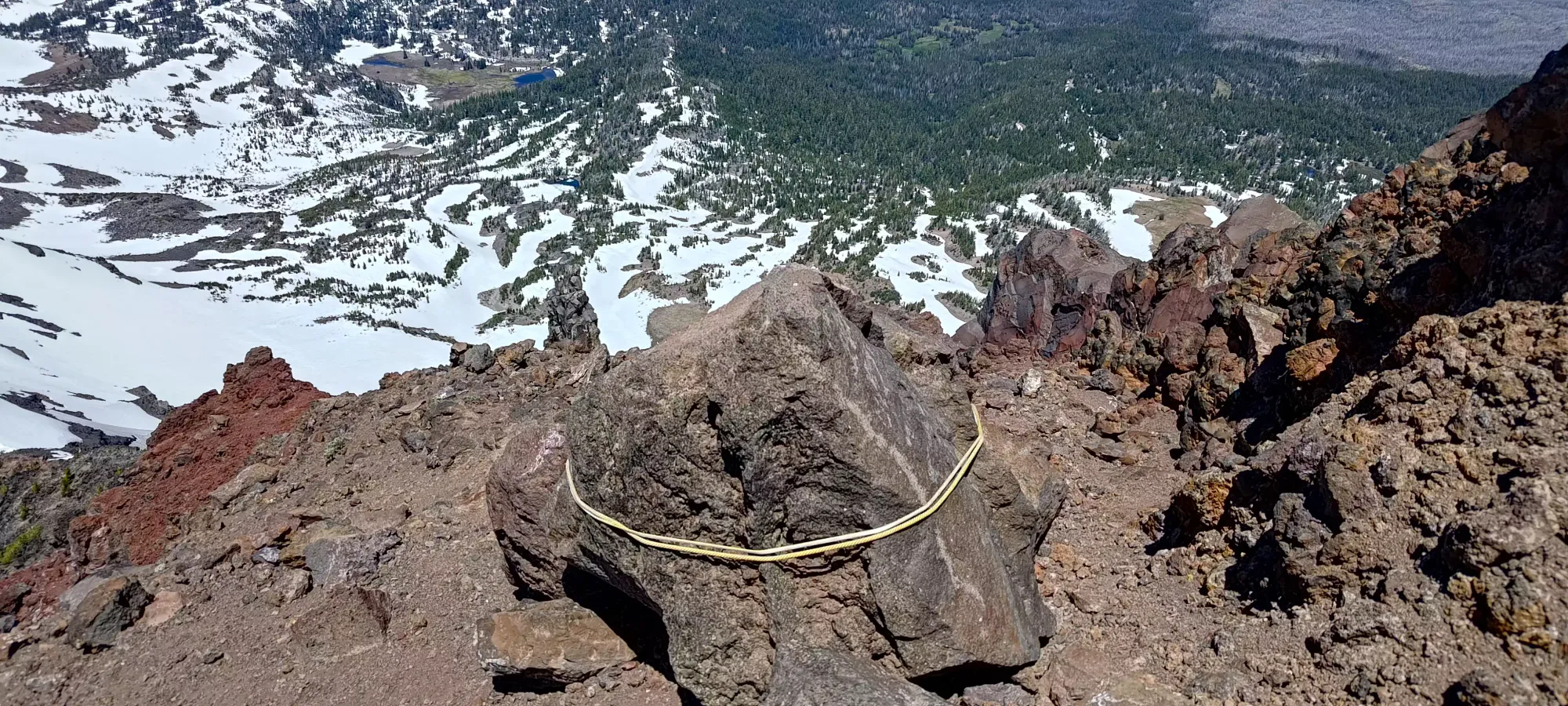
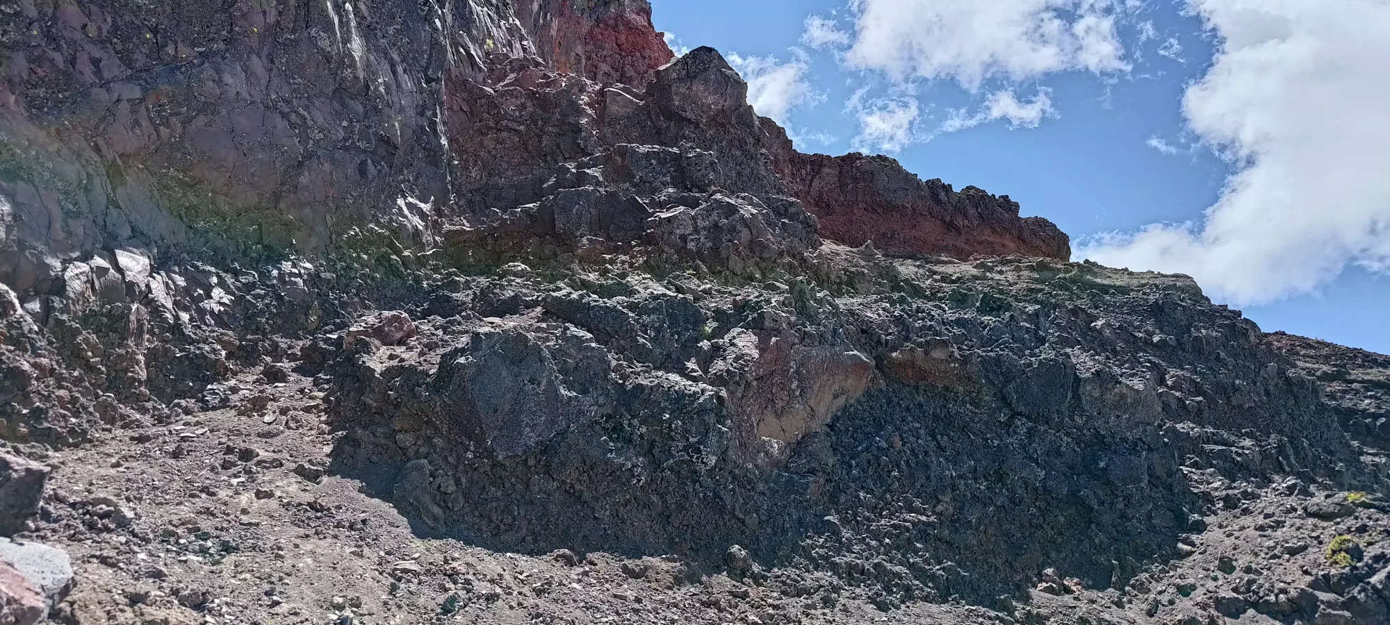
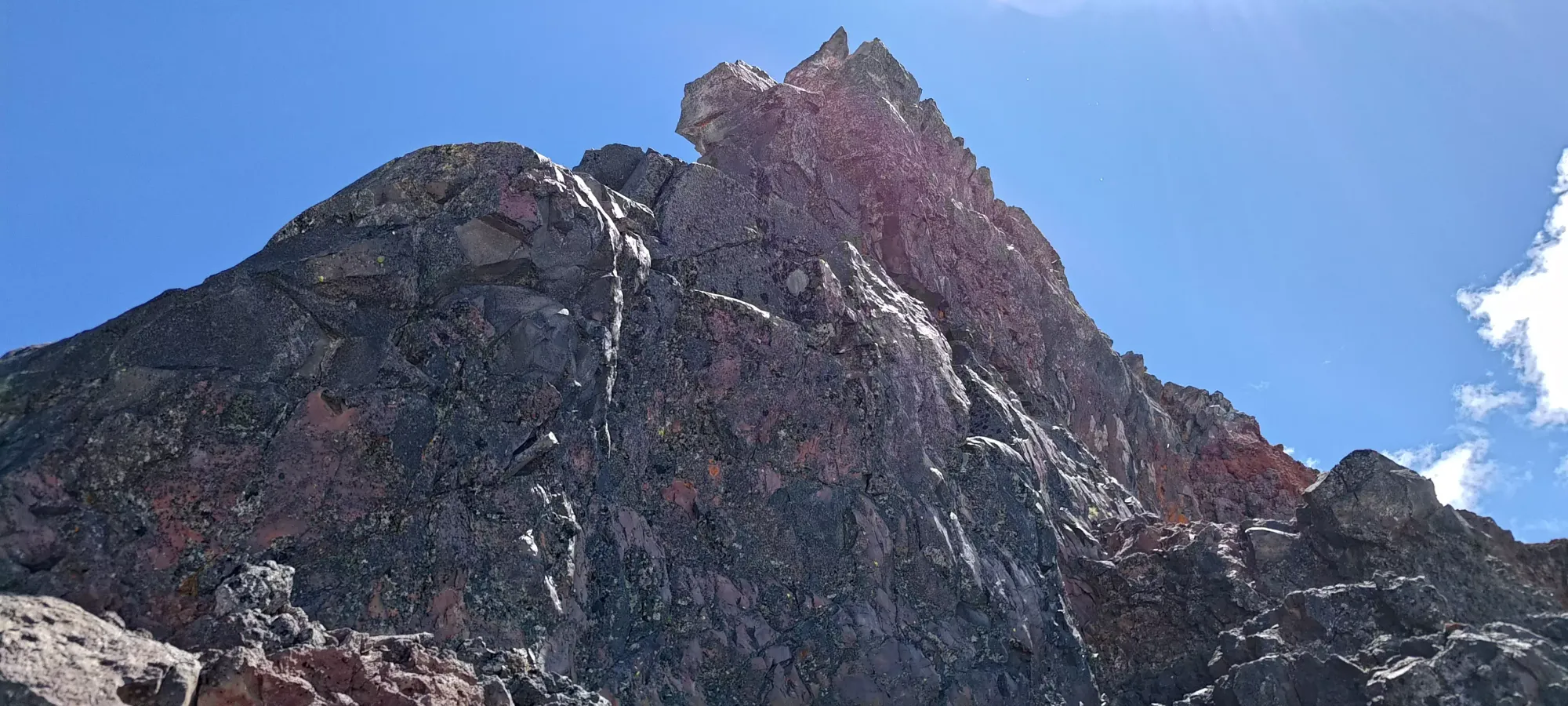
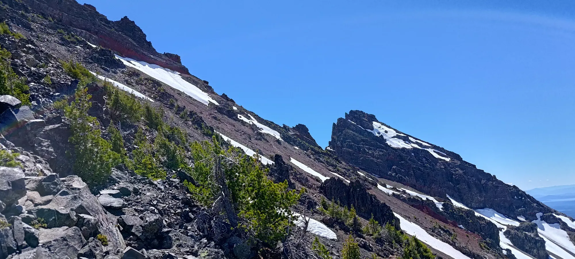
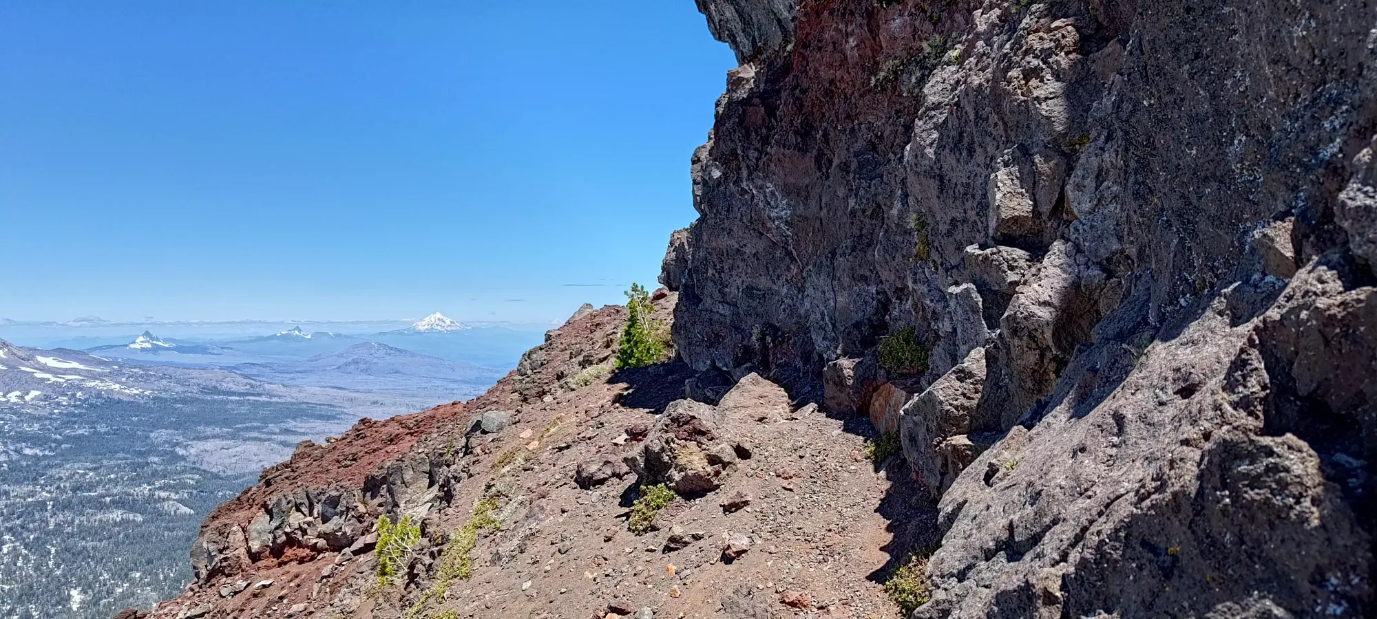
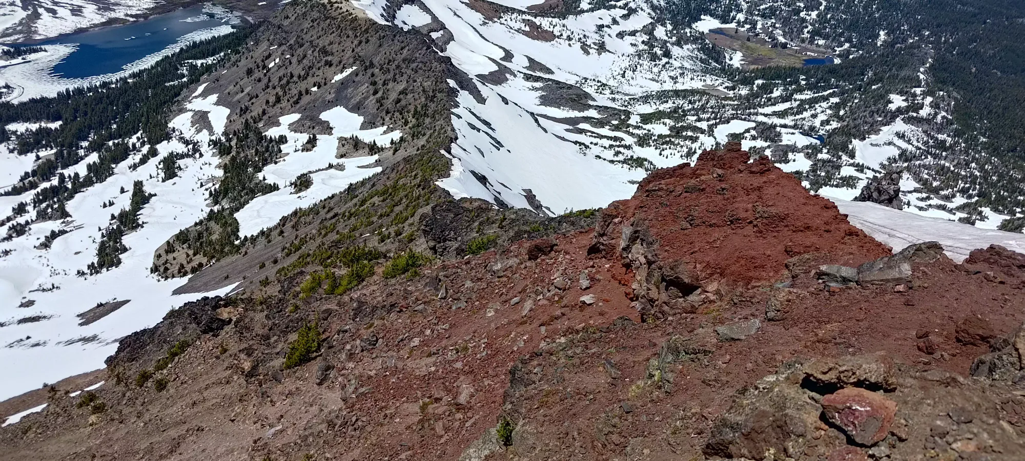
After this crux, it was an easy scramble (see above), followed by some walking under the red band seen above. From the end of the band, you loop back to the east side of it (this is now the south ridge of the peak), and make your way towards the true summit.
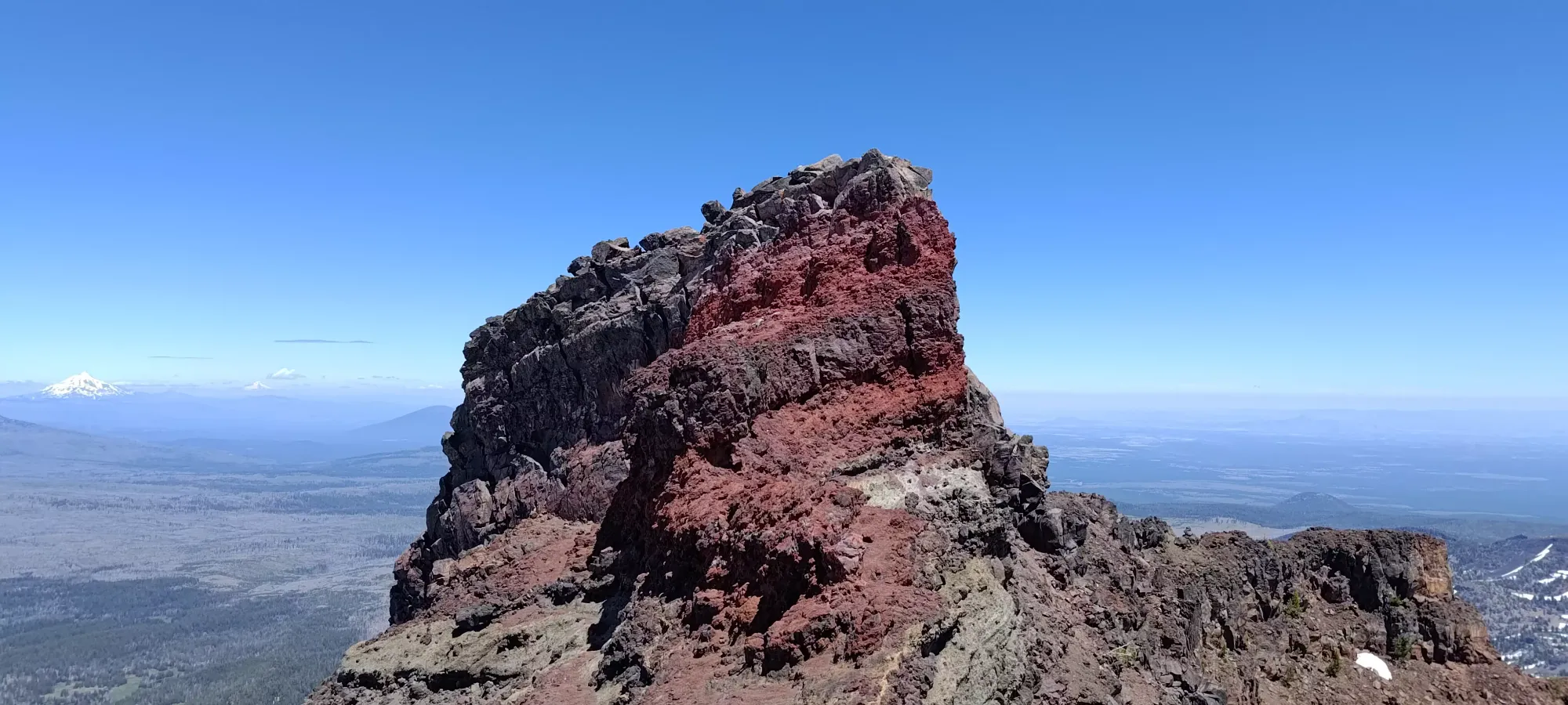
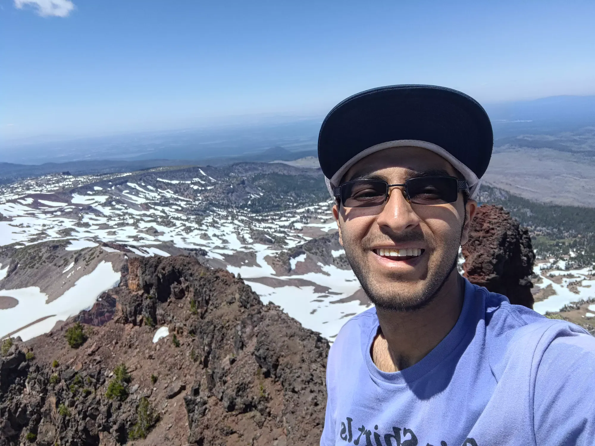
From there, it's an easy walk to and scramble up onto the true summit. There, I took plenty of photos, had some water, then headed down after a couple minutes, since I had Nick waiting for me back on the ridge.
The downclimb was fairly simple, with the one snag I encountered being "not really mentally noting where I came up the crux ledge from". I traversed too far to skier's left originally, and had to descend+re-gain some fairly loose and steep scree+dirt to get back from where I incorrectly guessed my spot was. After that, though, I remembered just how close I came up to the rap station, and from there, it was more obvious where I was to descend. I was able to do the downclimb facing-out, so it wasn't that difficult, really.
The descent down to Nick took about half an hour, where I spent a few minutes repacking my bag and drinking some water before we started to head back down the mountain. From there, it was another 10 to get to the turnoff point from the ridge (so quite consistently about 10 minutes per 100m of descent), then we got to the easier terrain of dirt/trail and snow to get back to the lakes. That section took us about 45 minutes, with the snow being a bit too soft to boot-ski, but thankfully largely supportive enough thanks to summer conditions that we didn't posthole much. There, I tried to refill my water using my filter at the lake's outflow, but I think it was clogged, as the process was excruciatingly slow. So, after nearly 10 minutes, I called it "good enough" with a couple hundred mL (I only had about 600 or so at the start of the day, as I just reused what was left from Bachelor) replenished, and vowed to refill at more vigorously flowing water I could trust without the filter.
From there, Nick largely led us out, as I was starting to feel my lack of calories from my second day of "well I'm not doing great digestively so let's just hike without eating all day". We stopped not-too-long after getting into the short valley that lead to the lakes, as I could refill at one of the creeks flowing into Fall Creek there. After that, we just started grinding out kilometres. The total way out took us 2 hours, largely thanks to my needing 2 bathroom breaks in the forest on the way out. I did my best but my body, for whatever reason, decided I hadn't suffered enough, so I had to not just go to the bathroom in the middle of the forest with basically 0 warning (not pleasant in its own right), but of course it was exactly where the bugs were all concentrated! I got probably over a dozen bites just from these two stops alone 🙃
Aside from that, though, the descent was tedious and long, but not difficult, and we got to the car in a bit over 8 hours round-trip. From there, we quickly got ourselves loaded up and headed out for the long way home. We stopped in Bend for some food, and with that, a few horrible construction delays, the world's longest McDonald's lineup, and a bathroom break or two, I didn't get home til 4am 😅
So while the trip was a success, and I do recommend this peak as an excellent scramble, and probably a great ski as well, I would probably arrange things so that you don't have quite as much of a sufferfest on the drive home 😄
GPX Track + Map